
Interstate 70 East - Indianapolis

 east
east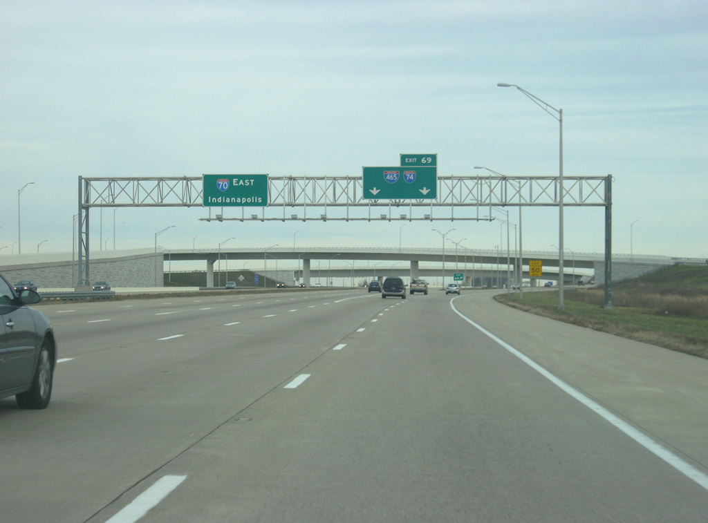
The entrance ramp from Ameriplex Parkway at Exit 68 forms the c/d roadway extending 3.8 miles east to the Indianapolis Beltway. I-74/465 combine for 20.60 miles north to Speedway on the west side of Indianapolis and east to Five Points.
12/22/11
Flyovers link I-70 with Colonel H. Weir Cook Memorial Drive to Indianapolis International Airport (IND). A new terminal for IND Airport opened on November 11, 2008 to replace the original terminal at the end of Sam Jones Expressway.
11/05/09
Mid 2000s construction included realigning I-70 southward to accommodate expansion of IND Airport expansion between what was Six Points Road at Exit 68 and the Beltway. Beyond Exit 69, the I-70 mainline continues with no exits to Sam Jones Expressway.
12/22/11
The I-70 mainline is six lanes wide while four lane c/d roadways run along both directions. During road work in 2004, westbound I-70 traffic temporarily used the eastbound roadway during work to accommodate runway expansion to the north. Perimeter Road today runs along the former right of way.
11/05/09
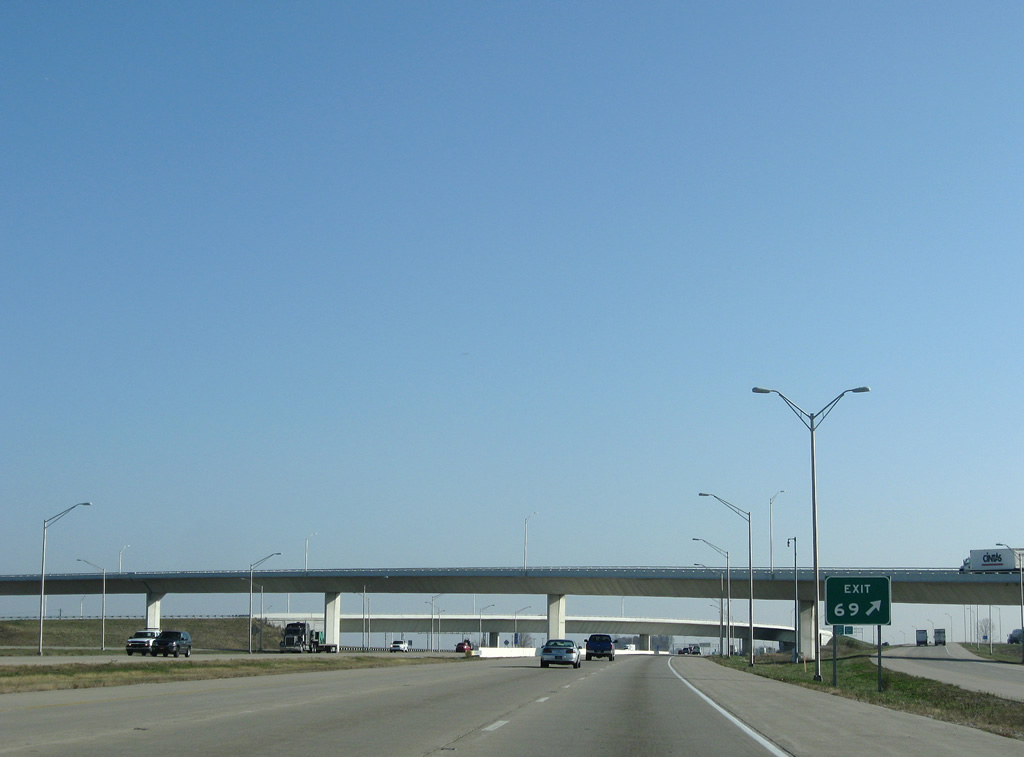
A two lane slip ramp provides access to Interstate 70 east ahead of the Beltway for motorists that joined the freeway from Ameriplex or Ronald Reagan Parkways.
12/22/11
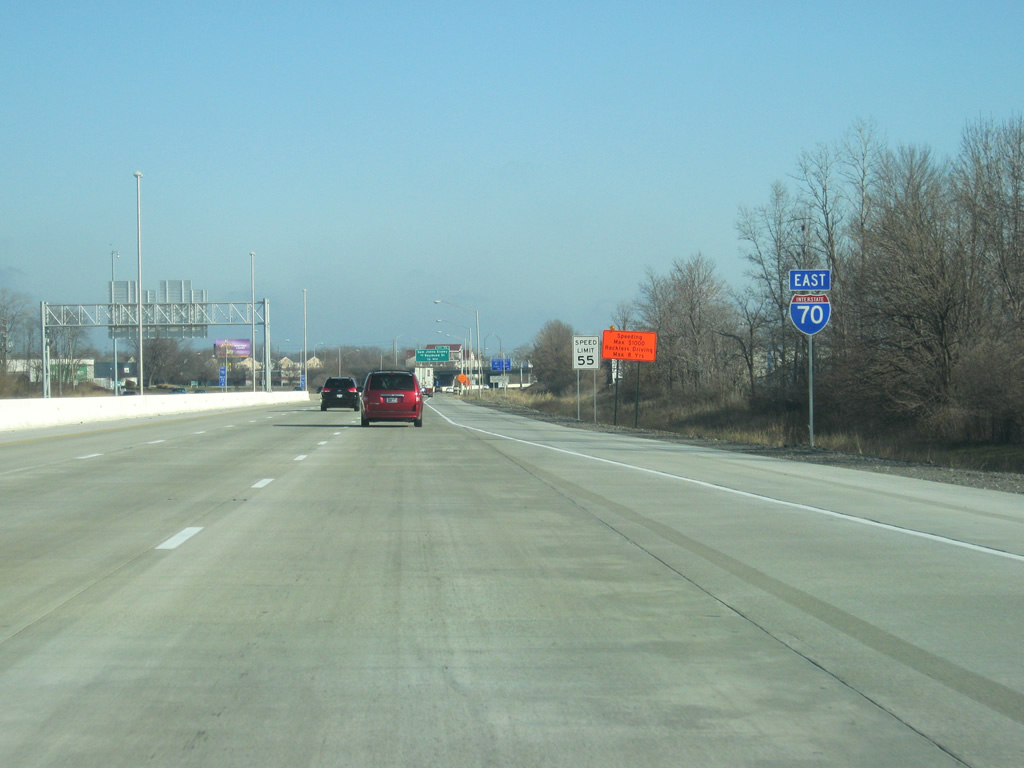
Interstate 74 travels 417 miles overall from I-80 in the Quad Cities southeast to I-75 in Cincinnati, Ohio.
12/22/11
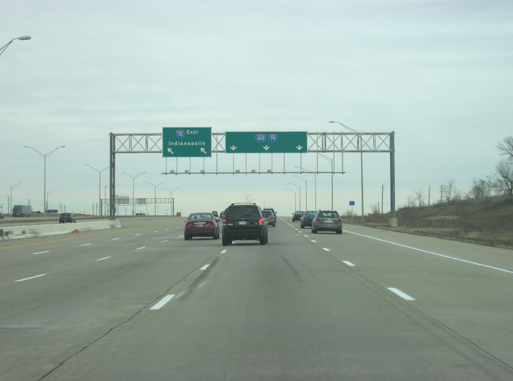
The Indianapolis skyline appears in the distance where I-70 curves east ahead of High School Road and the cloverstack interchange with I-465/74.
12/22/11
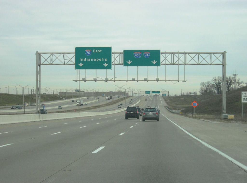
Prior to the Accelerate 465 project, a low-speed directional cloverleaf interchange joined I-70 with I-74/465 at what was Exit 73. Redesign of the exchange replaced the loop ramp for the beltway north with a higher speed directional ramp.
12/22/11
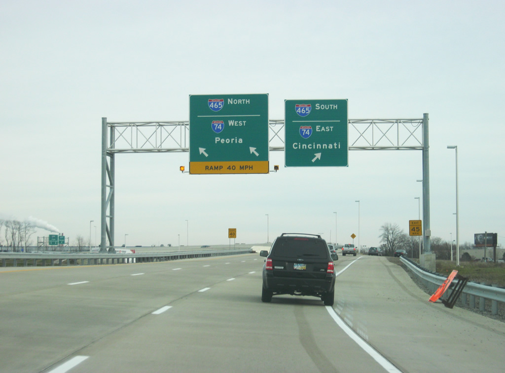
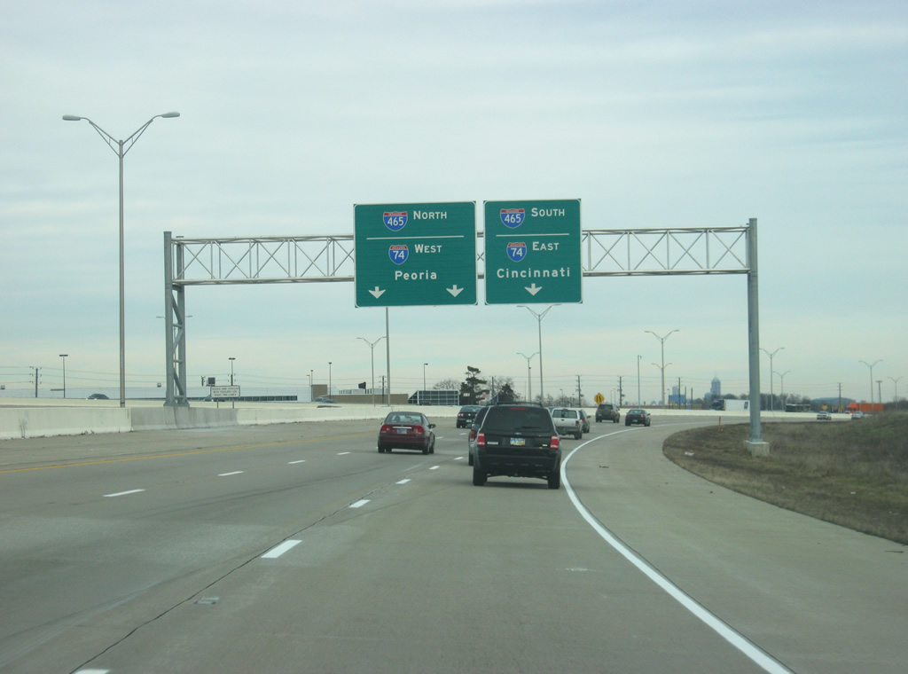
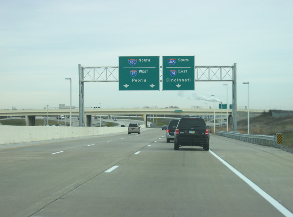
Two lanes separate for I-74/465 north along the west side of Indianapolis to Speedway while a single lane joins I-74/465 east across the south side of the capital city to Beech Grove. I-74/465 connect with I-69 south to Bloomington in four miles.
12/22/11
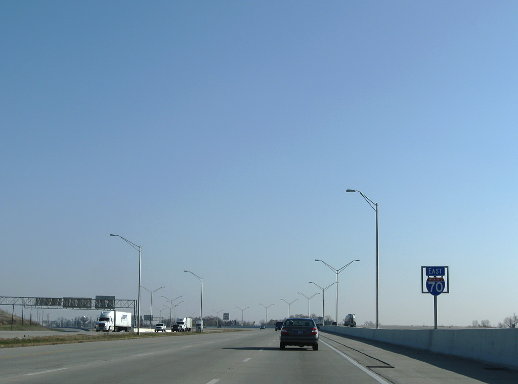
Interstate 70 angles northeast from the beltway and Davis Creek.
12/17/11
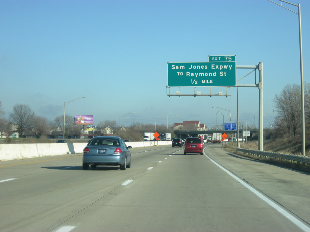
Sam Jones Expressway leads 1.2 miles east from I-74/465 to I-70 at Exit 75. The controlled access road was Airport Expressway before being renamed for Sam Jones, a local civic leader in 2007. The change was made after the new terminal for Indianapolis International Airport (IND) opened north of Exit 68.
12/17/11
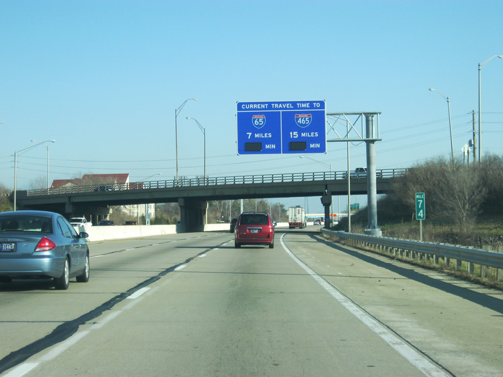
Alerting motorists of the distance and estimated time to reach I-65 and I-465, a travel time sign preceding the Lynhurst Drive overpass was erected in 2011. As of late 2011, these signs were not yet operational.
12/17/11
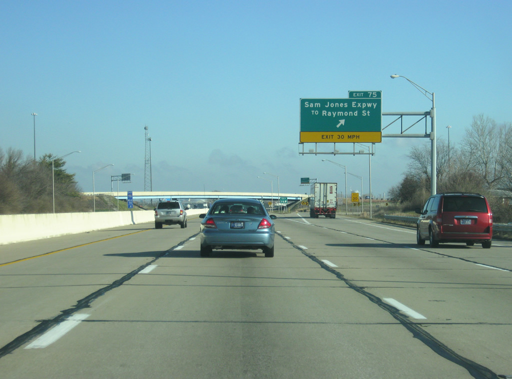
East from the parclo A2 interchange at Exit 75, Sam Jones Expressway transitions into an at-grade arterial to Tibbs Avenue where it becomes Raymond Street. Raymond Street is a well-traveled four to six lane arterial across the Near Southside of Indianapolis, connecting with Southeastern Avenue leading east to I-74 at I-465.
12/17/11
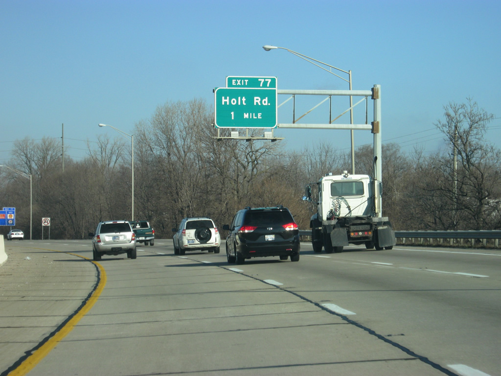
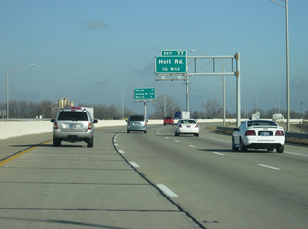
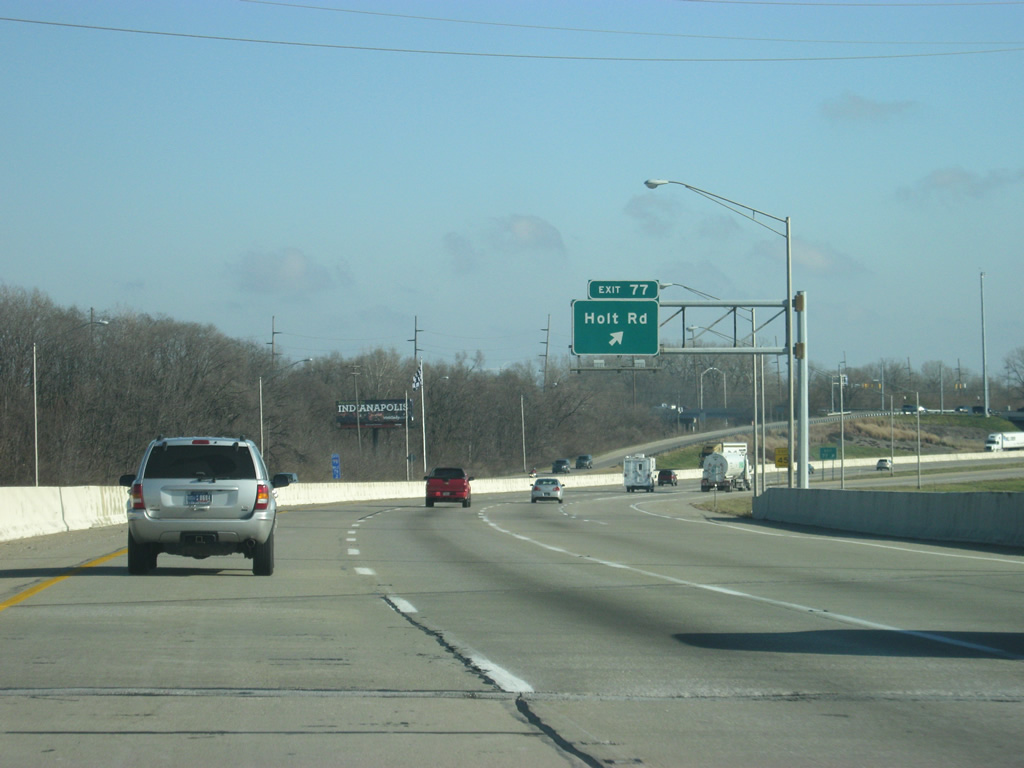
Interstate 70 continues northward from Sam Jones Expressway by the former Stout Field and Drexel Gardens to a diamond interchange (Exit 77) with Holt Road.
12/17/11
Holt Road heads south from Interstate 70 to the Stout Field area, Maywood and Kentucky Avenue (former SR 67) at Mars Hill. Abandoned plans for the road southward focused on a southeasterly course across the White River and south to I-465 and Southport Road near where it intersects Tibbs Avenue.
12/17/11
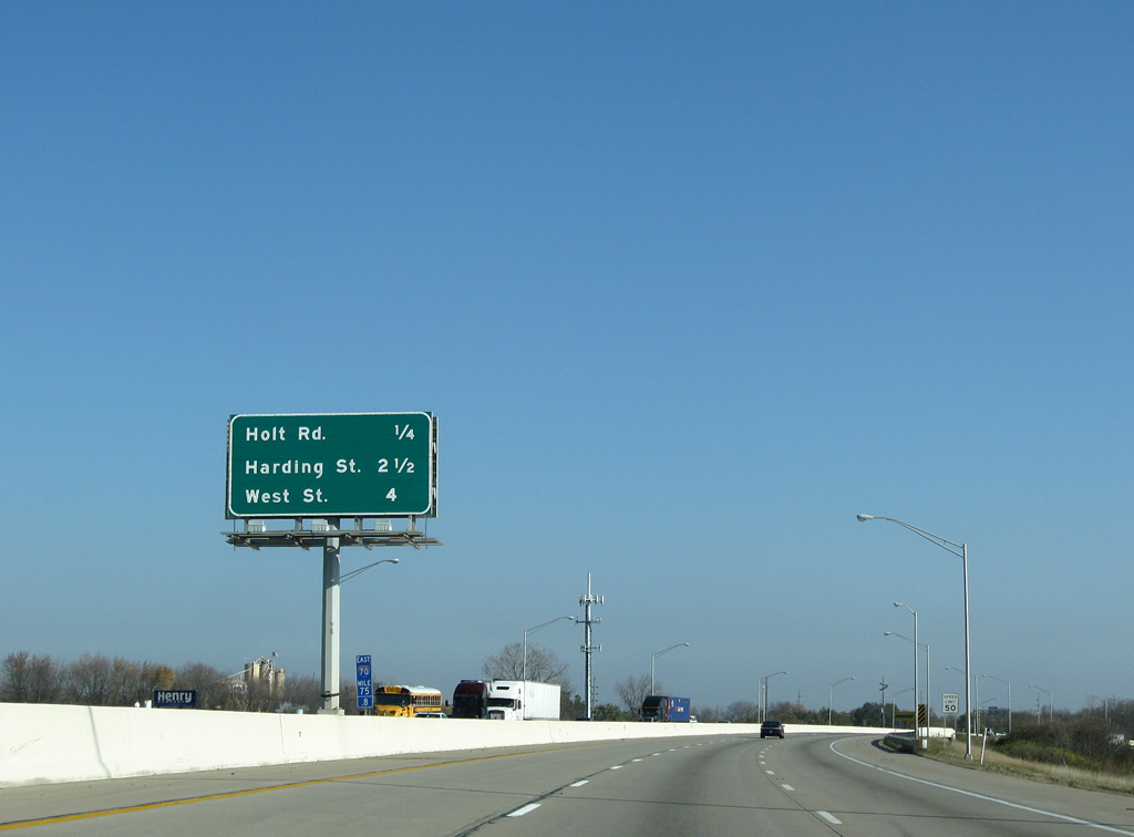
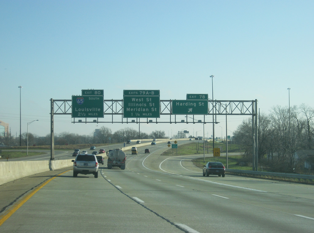
Button copy interchange sequence sign referencing Exit 77 to Holt Road, Exit 78 to Harding Streetand Exit 79 A to West Street and Downtown Indianapolis.
11/05/09
Holt Road continues north from Exit 77 to W 10th Street and a stub end by a CSX Railroad line at W 11th Street in Speedway. Holt Road was intended to continue north to 30th Street and northeasterly to Lafayette Road (old U.S. 52). Plans later called for an extension north to a new roundabout intersection with 16th Street. This would create a new access road from the south to the Indianapolis Motor Speedway.
12/17/11
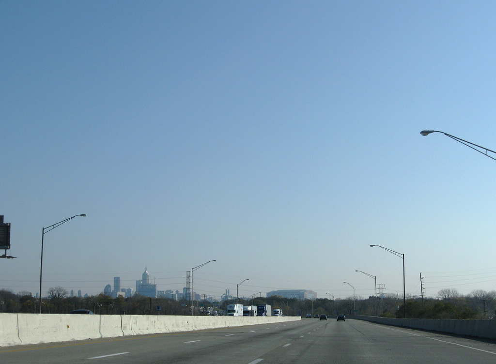
The Indianapolis skyline comes into view from the I-70 viaduct over CSX Railroad lines between Holt Road and Tibbs Avenue. Home to 839,489 as of the 2010 census and 887,642 in 2020, the capital city of Indiana was founded in 1820 and named by combining Indiana and the Greek word Polis, which means city. The city and County of Marion merged to form a single government entity in 1970.
11/05/09
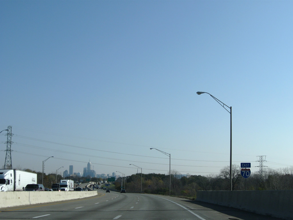
A transmission corridor passes over Interstate 70 near the crossing of Eagle Creek.
11/05/09
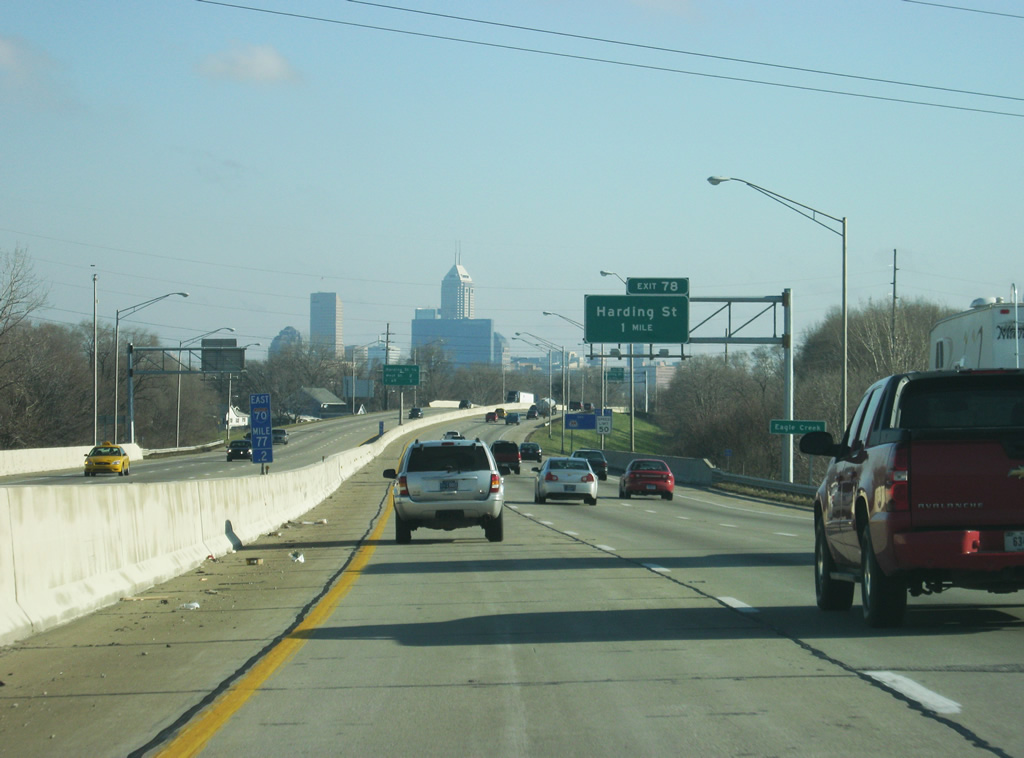
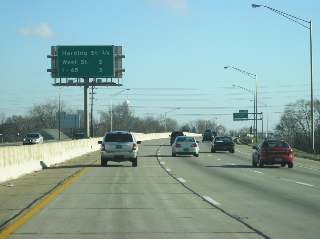
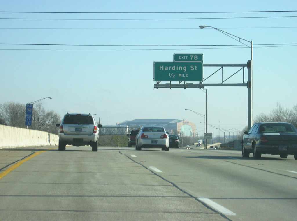
A folded diamond interchange connects Interstate 70 east with Harding Street at Exit 78 in one mile.
12/17/11
I-70 converges with Interstate 65 in three miles outside Downtown Indianapolis. The two routes combine for 1.2 miles north.
12/17/11
Harding Street ties into adjacent Oliver Avenue to the north of Exit 78 and leads southward to the Lilly Industrial Center and I-74/465 at SR 37 south.
12/17/11
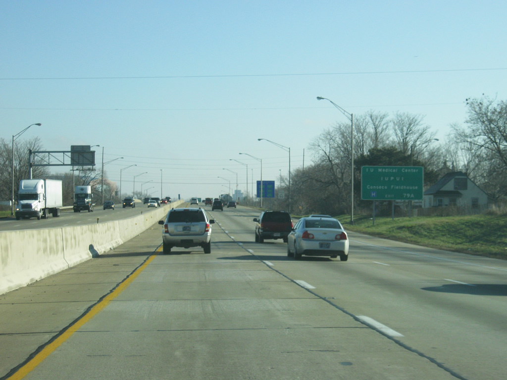
A guide sign directs traffic heading for the IU Medical Center, the Indiana University-Purdue University Indianapolis campus, and Bankers Life Fieldhouse (formerly Conseco Fieldhouse) to use Exit 79A (West Street).
12/17/11
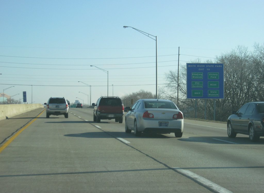
A collection of points of interest are featured on this services sign posted ahead of the Exit 79A and 79B off-ramps to downtown Indianapolis. The sign in this case refers to the various attractions at White River State Park, which is touted as the only urban state park in Indiana. The Indianapolis Zoo, Indiana State Museum and IMAX theatre, Eiteljorg Museum, NCAA Hall of Champions Museum, and Victory Field, the home of the AAA Indianapolis Indians, all call White River State Park home.
12/17/11
Harding Street was envisioned as the Harding Freeway in the 1968 Transportation Plan for Indianapolis. The freeway would have begun at the Beltway interchange with SR 37 and lead north along the street to I-70. Paralleling the CSX Railroad from Oliver Avenue north, the Harding Freeway would have interchanges at Washington Street (old U.S. 40) and New York Street before branching west from the railroad corridor to an interchange with the unbuilt North Leg Extension and 10th Street Expressway before concluding at I-65 near the Kessler Boulevard exit.1
12/17/11
Traveling a viaduct from River Avenue to the White River, Interstate 70 advances a half mile to Exit 79 A for Missouri and West Streets. SR 37 formerly used the one way couplet northward to Washington and Maryland Streets (former U.S. 40).
12/17/11
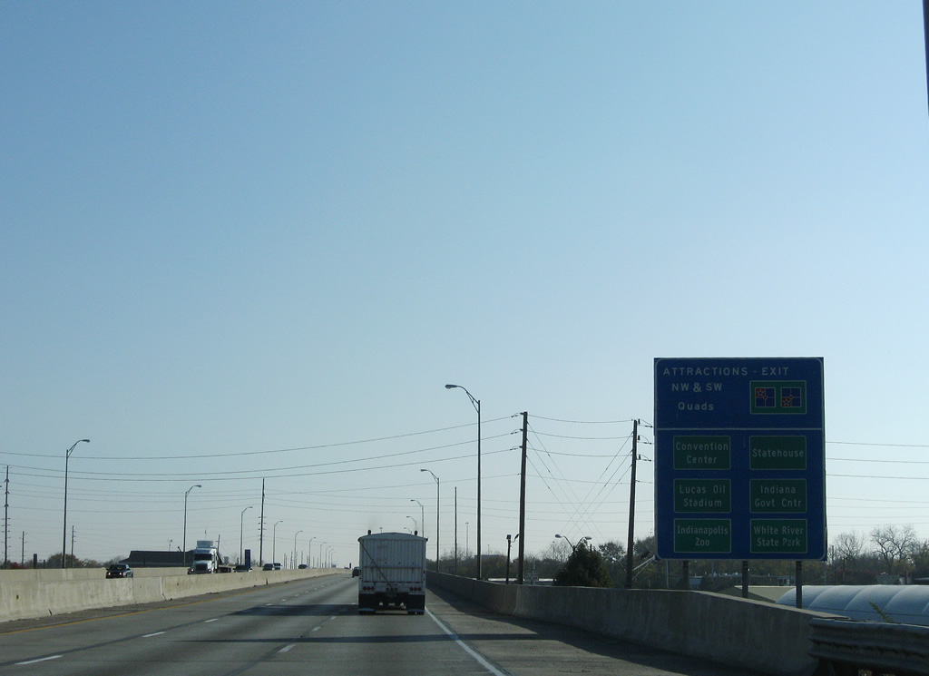
Downtown Indianapolis points of interest for Exits 79 A and 79 B include the Indianapolis Zoo, White River State Park, Indiana Statehouse and Government Center and Indiana Convention Center. Missouri Street north serves Lucas Oil Stadium and Victory Field, home of the Indianapolis Indians AAA Baseball club.
11/05/09
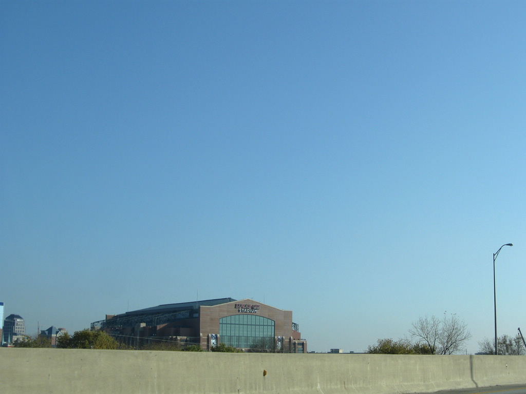
Lucas Oil Stadium, home of Super Bowl XLVI in 2012, replaced the RCA Dome as the home of the NFL Indianapolis Colts. Later the Hoosier Dome, the original Colts stadium opened in 1983 and was demolished by December 2008 to make way for an expanded Indiana Convention Center.2
11/05/09
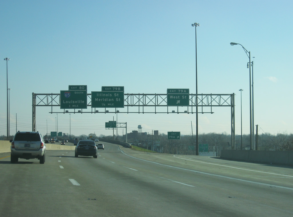
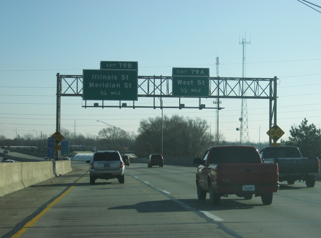
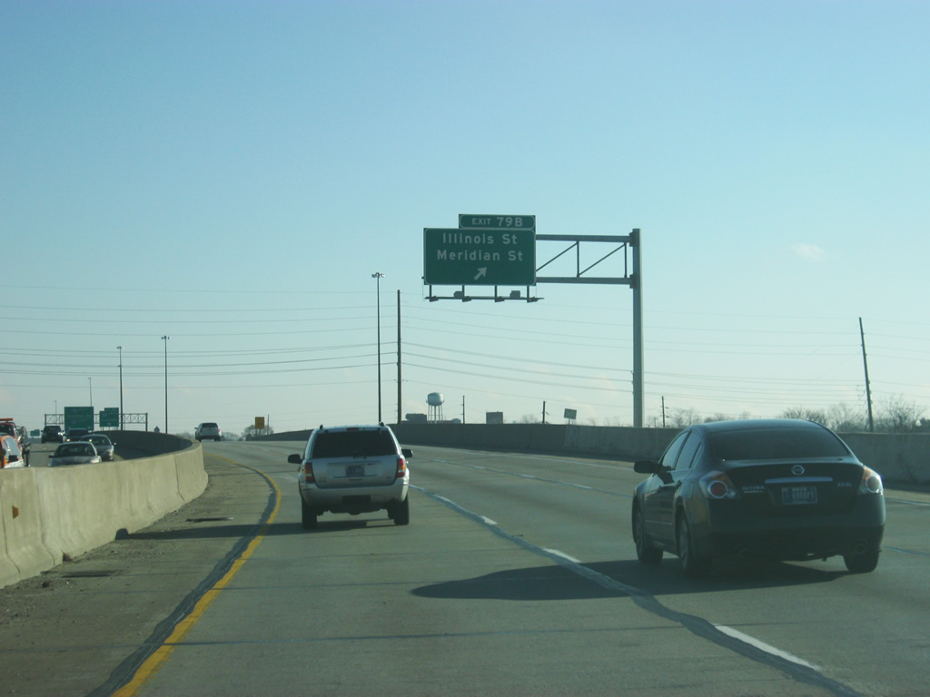
A trumpet interchange follows for Madison Avenue north into Downtown Indianapolis. Signage for Exit 79 B originally referenced Illinois and McCarty Streets. McCarty Street was changed to Meridian Street.
12/17/11
Exit 79 A lowers from the eastbound viaduct to West Street south and Missouri Street north. Northward, the couplet of West and Missouri Streets form a six lane arterial known as West Street, which forms the western leg of the Downtown beltway. Original plans called for this corridor to be converted into a freeway to form an Inner belt, similar to the system in Columbus, Ohio.
11/05/09
Exit 79 B partitions with a ramp onto Illinois Street at McCarty Street, one block west of Meridian Street. The second ramp other leads onto Madison Avenue, which runs directly onto Meridian Street at South Street. This section of Madison Avenue is a remnant from the longer Madison Avenue to the south of I-70.
12/17/11
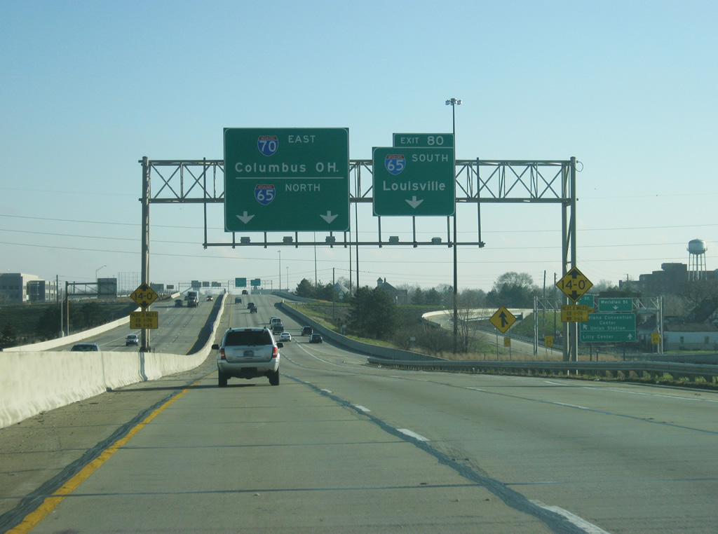
I-70 advances east to the South Split interchange (Exit 80) with Interstate 65. Two lanes separate for I-65 south to Near Southeast and the overlap with I-65 north by Downtown.
12/17/11
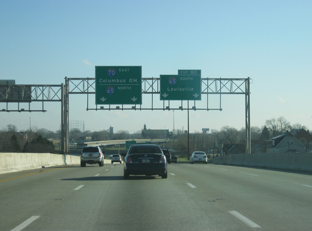
The directional T interchange (Exit 80) at I-65 is known locally as the South Split. Interstate 65 travels 887.30 miles overall and 261.27 miles within the Hoosier State. Completion of the last section of I-65 in Indiana, the segment at Downtown Indianapolis, occurred in 1976.
12/17/11
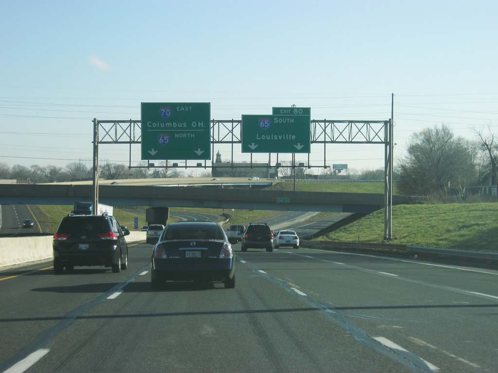
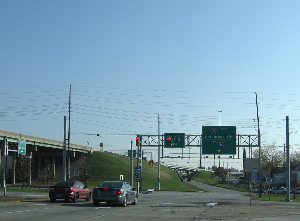
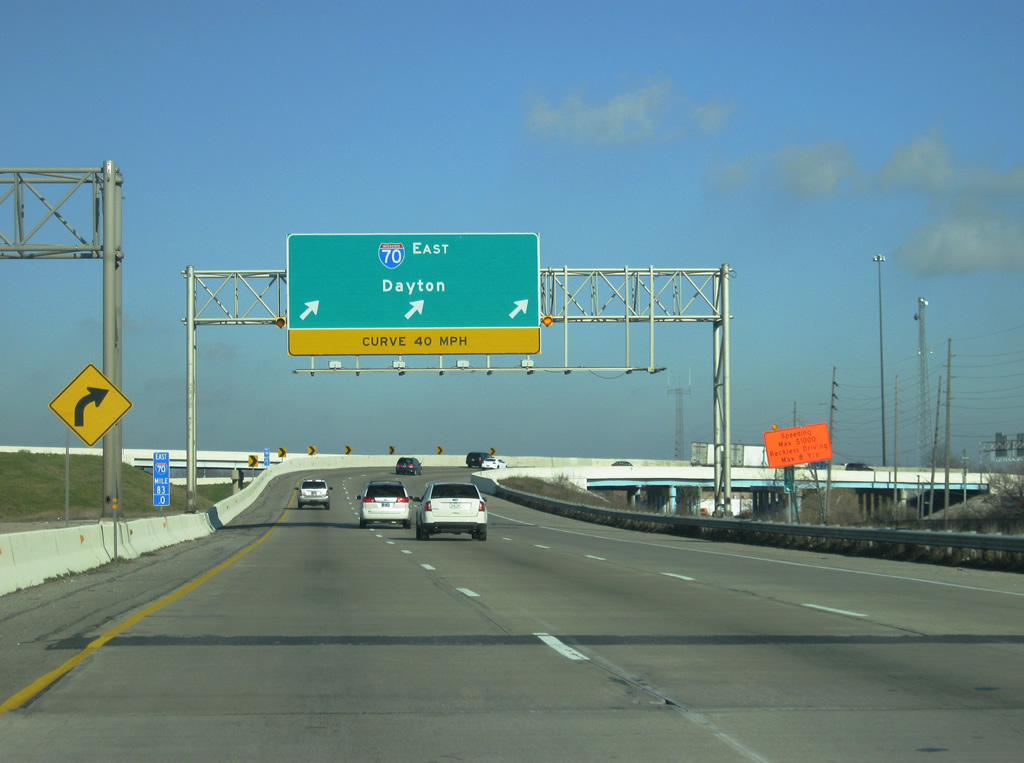
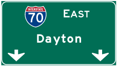
Interstate 65 heads south toward Beach Grove and Louisville, Kentucky. Ultimately the highway heads through Nashville, Birmingham, Montgomery and Mobile, Alabama. Older guide signs for I-70 east referenced Columbus in place of Dayton, Ohio.
12/17/11
 North East
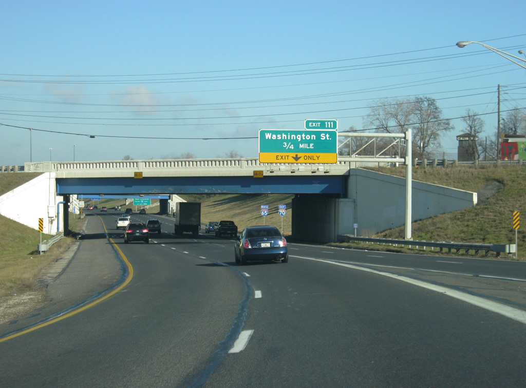
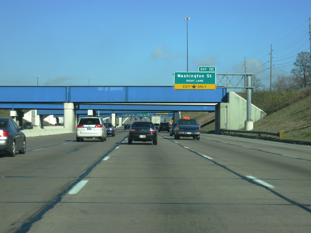
Interstate 70 east joins Interstate 65 north south of the Virginia Avenue overpass at the 3/4 mile approach to Exit 111 for Washington Street (former U.S. 40 and U.S. 421). The multiplex between I-65/70 use Interstate 65's mile markers for exits and remain depressed for the southern half to Washington Street.
12/17/11
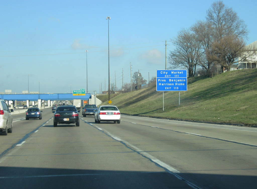
The City Market can be reached by using Exit 111 to Market Street. Until the ramp was redesigned in 2008, the Exit 111 ramp ran straight to Market Street. The rebuilt interchange shifted the ramp to reach Washington Street, one block south of Market. Market Street can be reached by going north for one block from the ramp along Pine Street. The home of President Benjamin Harrison, located in the Old Northside neighborhood can be reached via Exit 113 (Meridian Street) further north.
12/17/11
An entrance ramp from Calvary Street to the left becomes the fifth lane going northbound Interstate 65 and eastbound Interstate 70 underneath a series of overpasses. The far right lane continues on its course toward Exit 111 and Washington Street. Washington Street, originally the National Road and later on U.S. 40, is the main west-east road across Indianapolis, connecting Downtown with the Holy Cross, Willard Park, Irish Hill, and Irvington neighborhoods. U.S. 421 also ran down Washington Street to the Southeastern Avenue intersection, just east of Exit 111. Southeastern Avenue carried U.S. 421 southeast toward Cincinnati.
12/17/11

The far right lane now exits for Exit 111 to Washington Street. As previously mentioned, Market Street can be reached from this ramp one block north of Washington Street. Market Street leads to Monument Circle, the heart of Indianapolis, and the Indiana Statehouse. As the interstate multiplex ascends from its depression, the right two lanes become dedicated to Interstate 70 eastbound traffic while the left two lanes carry the Interstate 65 northbound traffic.
12/17/11
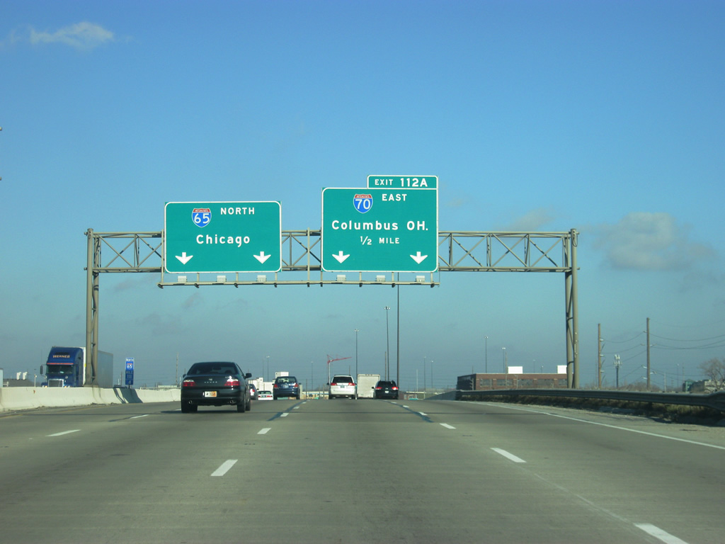
Now passing over Washington and Market Streets, the Interstate 65/70 multiplex takes on a different character for its northern half as an elevated highway. Interstate 70 east exits off the multiplex in one half mile via Exit 112A. The multiplex from the South Split to the North Split was rebuilt in the early 2000s as part of a two-month project known as Hyperfix. The project rebuilt many of the bridges and the concrete sections of the multiplex.
12/17/11
Along with the entrance ramp from Pine Street, the exit ramp onto Interstate 70 eastbound is three lanes wide. The Hyperfix project expanded this ramp and is the reason that the signage now reads a control city of Dayton instead of Columbus. As the ramp turns toward the northeast, it picks up two exit ramps from Interstate 65 southbound.
12/17/11
East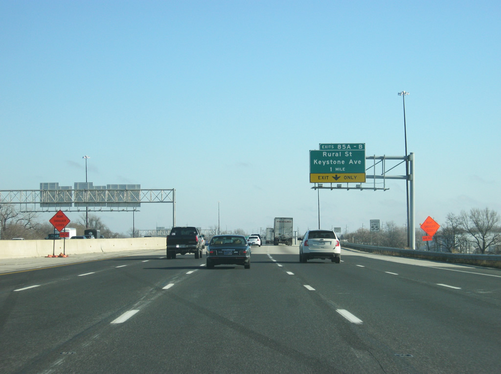
Now east of the North Split (Exit 112A), Interstate 70 east swells to five lanes. The failure to build the Northeast freeway brought more traffic from suburban Hamilton County and northern Marion County to use Interstate 465 to Interstate 70 on the Eastside. Because of that, the stretch of Interstate 70 from the North Split to Interstate 465 is the busiest highway in the city and among the busiest in the state. The far right lane will become an exit ramp for Exit 85 A-B (Rural Street/Keystone Avenue) in one mile.
12/17/11
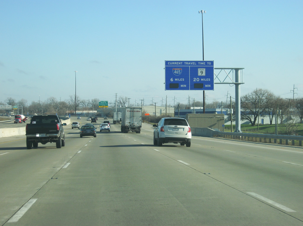
Approaching Exit 85 A-B (Rural Street/Keystone Avenue) a new Travel Time Sign alerts motorists of the distance and estimated time to reach Interstate 465 and SR 9. As of late 2011, the signs were not yet operational.
12/17/11
Construction in 2007-08 rebuilt a six mile stretch of I-70 from between the merge with I-65 and I-465. The "Super 70" project widened the road in portions and added a bridge over the CSX Railroad and Sherman Drive in place of a lowered stretch of freeway to improve visibility and drainage. Low-mast lighting was also removed along the stretch.
12/17/11
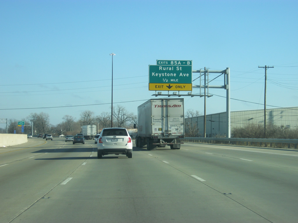
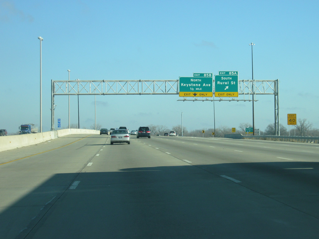
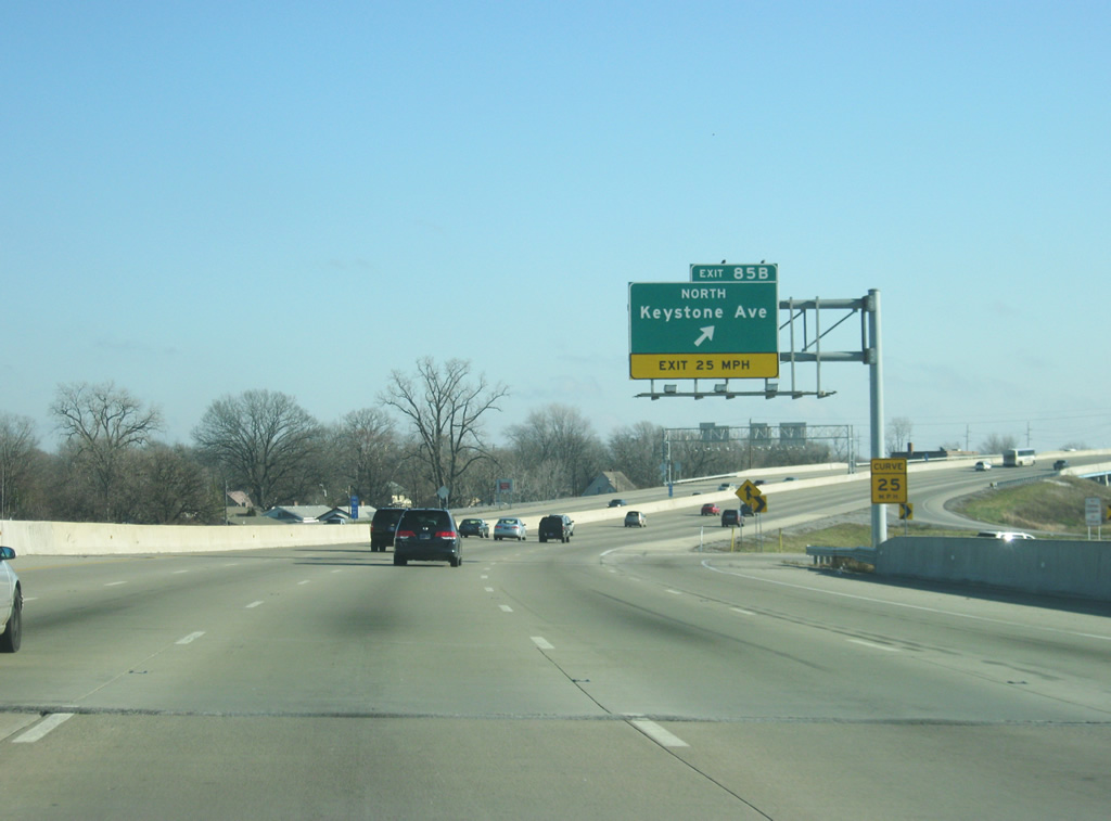
A six-ramp parclo interchange joins I-70 with Keystone Avenue north and Rural Street south at Exit 85. Keystone Avenue north to 38th Street links I-70 with the Indiana State Fairgrounds.
12/17/11
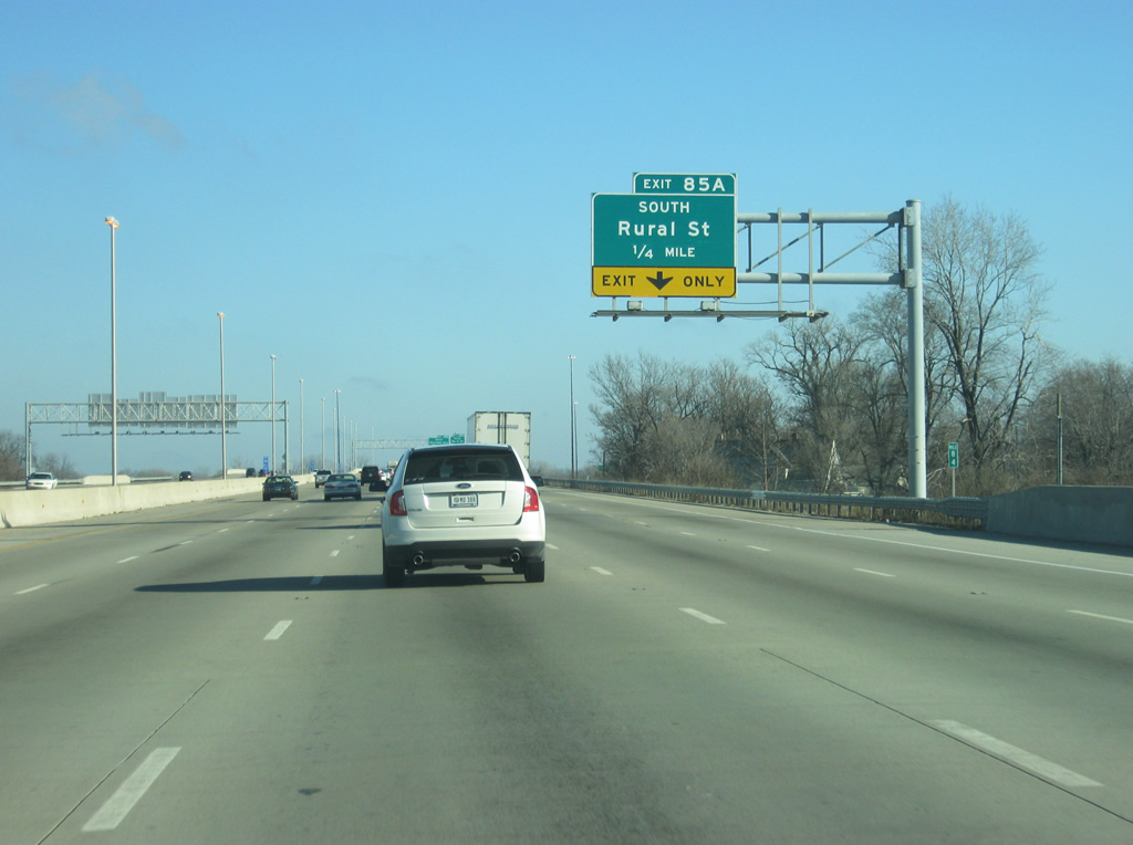
At Exit 85A Rural Street heads south from Interstate 70 through Woodruff Place to the five-point intersection with English Avenue (former U.S. 52) and Southeastern Avenue (former U.S. 421). Using Rural Street and English Avenue take travelers back to Keystone Avenue, which continues south to Interstate 65 before ending at Edgewood Avenue.
12/17/11
The far right lane exits off at Exit 85B, a loop ramp onto northbound Keystone Avenue. Keystone Avenue meanders north to Fall Creek Parkway / Binford Boulevard (former SR 37) where the street used to become SR 431 north. Keystone Avenue remains a busy four lane arterial all the way to the county line where it becomes Keystone Parkway through Carmel.
12/17/11
Now on top of the new bridge for Interstate 70 over the CSX Railroad and Sherman Drive. A CSX Railroad line and Sherman Drive used to pass over Interstate 70 west on the half mile approach to Exit 85 and the divided Keystone Way. "Super 70" construction elevated the freeway above both the railroad line and adjacent street in 2007. Exit 87 for Emerson Avenue is one mile away.
12/17/11

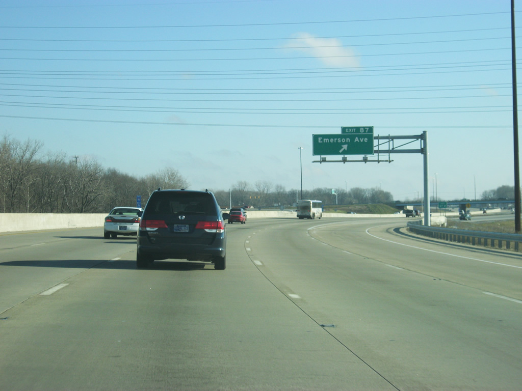
Interstate 70 passes the Pogues Run Park to the right as it is now a half mile from the parclo interchange with Emerson Avenue (Exit 87). Emerson Avenue leads through residential areas south of Interstate 70 to Sunnyview, Irvington and Beech Grove.
12/17/11
Exit 87 departs Interstate 70 west for Emerson Avenue. Emerson Avenue continues north through residential neighborhoods to Millersville and East 56th Street.
12/17/11
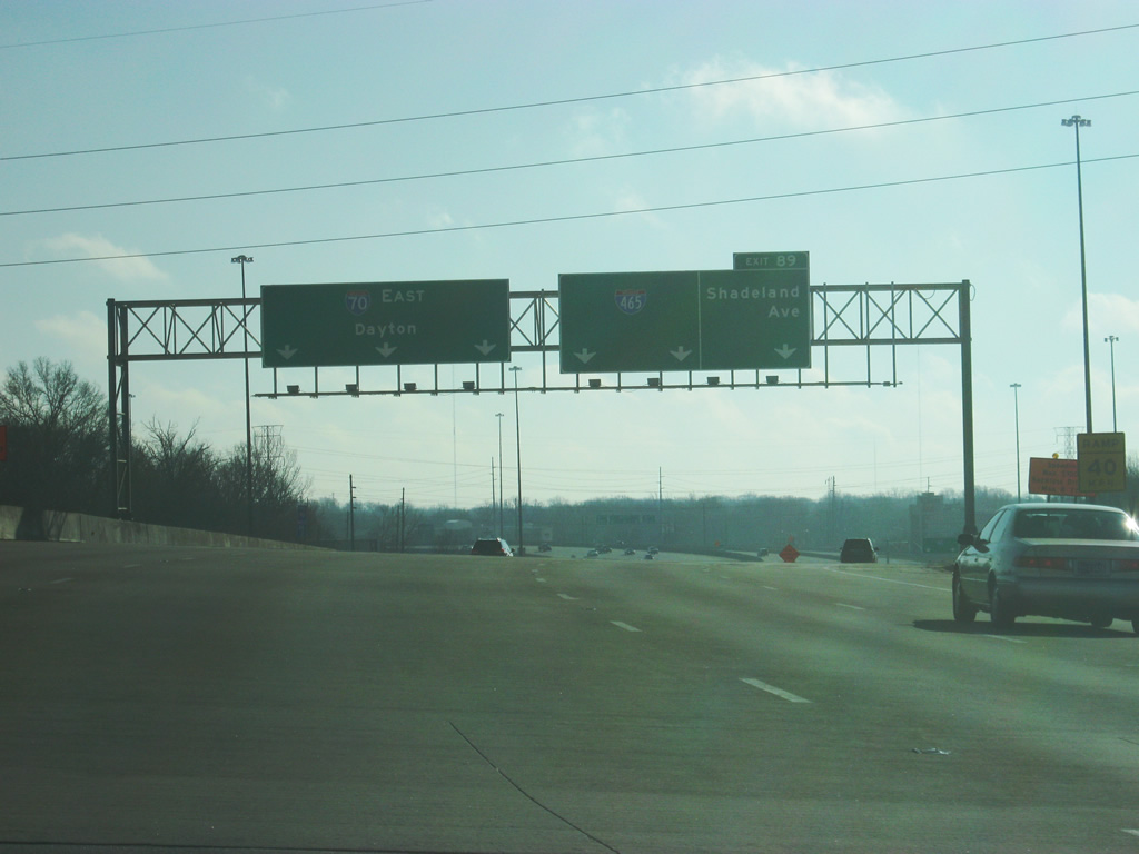
East of Exit 87 (Emerson Avenue), Interstate 70 widens to five lanes in preparation for its split with Interstate 465 traffic. Traffic for both Interstate 465 and Shadeland Avenue will exit in the right three lanes in one mile. A diagrammatic sign explains how the lanes will be exiting off at the exit.
12/17/11
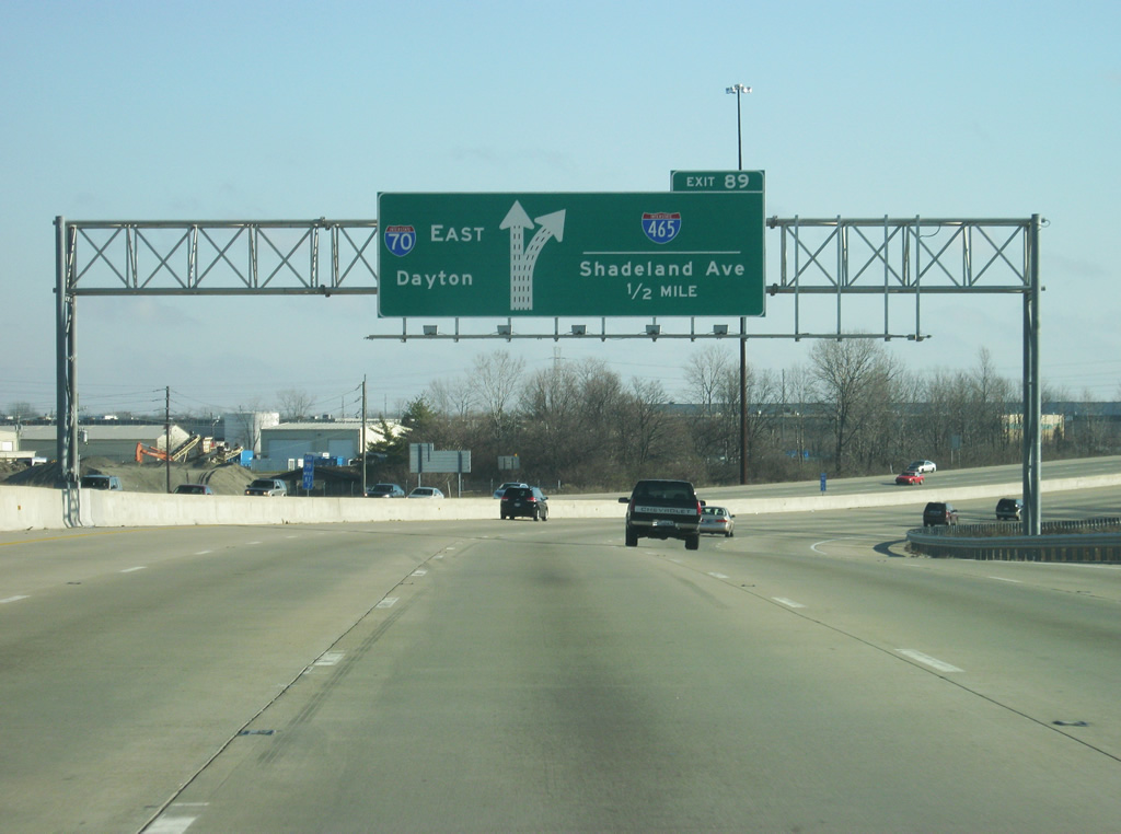
Crossing over Arlington Avenue, Interstate 70 is now a half mile from the exit for both Interstate 465 and Shadeland Avenue. Interstate 465 carries a myriad of other routes along its encircling of the city. U.S. 31, 36, 52, and 421 follow the east side of the beltway along with SR 37 and 67, but none of those are acknowledged here.
12/17/11
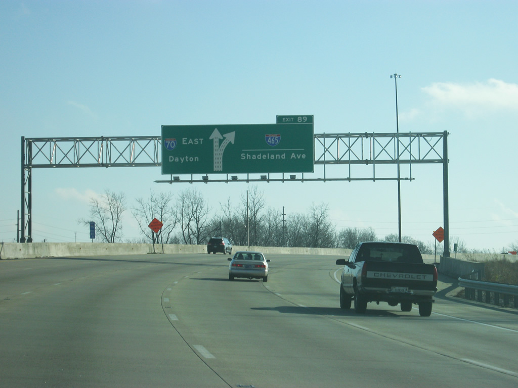
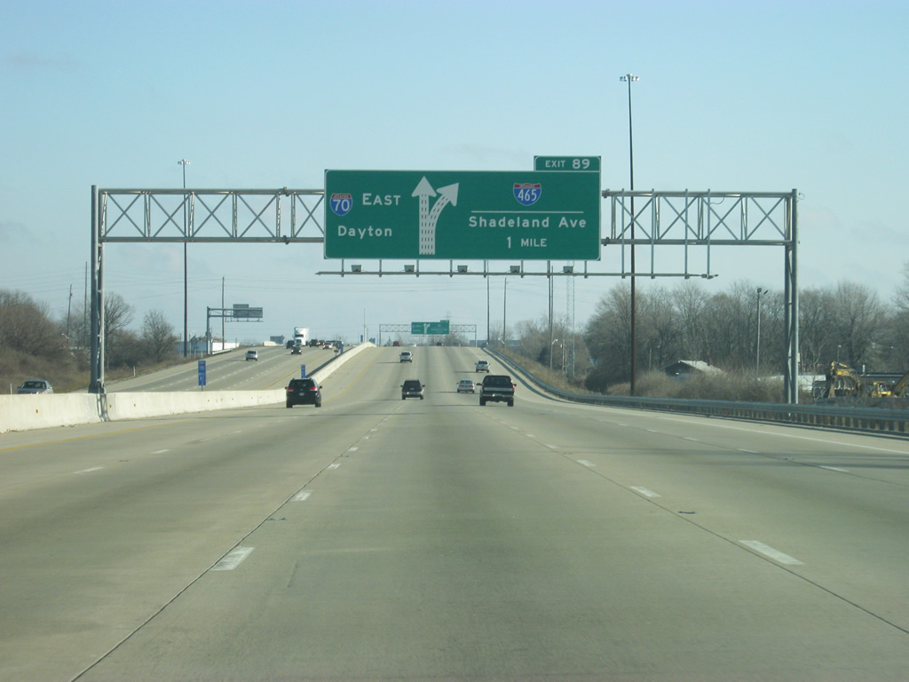
Nearing Exit 89, the left three lanes will continue on Interstate 70 east while the right three lanes will exit off onto Interstate 465 and Shadeland Avenue. Shadeland Avenue meets the freeway at the adjacent folded diamond interchange and represents the predecessor to the beltway (old SR 100). Interstate 465 was built between 1959 and 1970 and replaced SR 100 along the stretch between Exits 20 and 25.
12/17/11
Now at Exit 89, Interstate 465 north heads toward Lawrence with connections to U.S. 36/SR 67 (Pendleton Pike) east, I-69/SR 37 north to Fort Wayne, U.S. 31 north to Kokomo, and U.S. 421 north to Michigan City among others. To the south, it links with Interstate 74 to Cincinnati, and Interstate 65 to Louisville. Among the three lanes that exit off at Exit 89, the left two lanes continue toward Interstate 465 north, carrying the bulk of the commuter traffic to Hamilton County. The far right lane continues toward the folded diamond interchange with Shadeland Avenue.
12/17/11
In between Shadeland Avenue and Interstate 465, a slip ramp from the collector distributor ramp that carries traffic onto Interstate 465 north and south, heads onto Interstate 70 east for those entering from Shadeland Avenue. The larger Exit 89 complex was rebuilt as part of a reconstruction of Interstate 465 on the east side in the early 2000s.
12/17/11
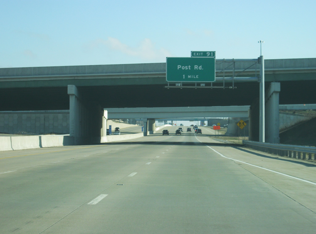
Now passing underneath Interstate 465, the parclo interchange with Post Road (Exit 91), is now one mile away.
12/17/11
East of Exit 89 (Interstate 465/Shadeland Avenue), Interstate 70 east is four lanes wide with the far right lane becoming an auxiliary lane for Post Road via Exit 91). Post Road consists of an arterial leading south to U.S. 40 (Washington Street) and the Wanamaker area near Interstate 74 and north to U.S. 36/SR 67 (Pendleton Pike) at Lawrence.
12/17/11
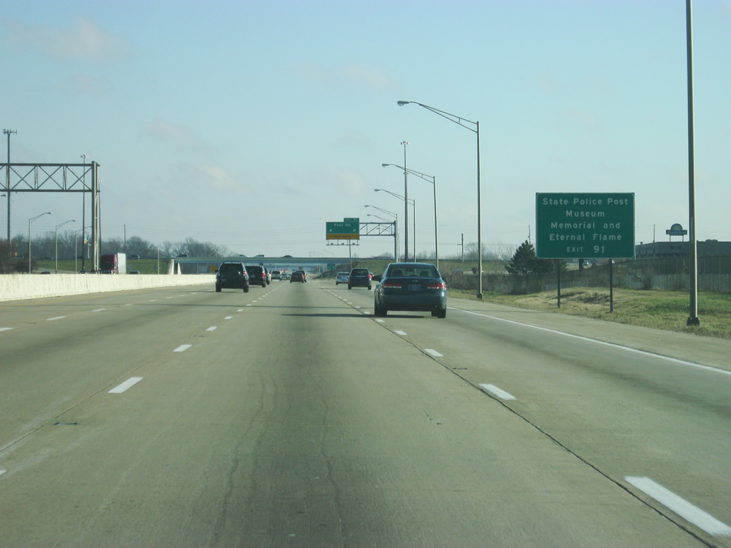
The Indiana State Police Museum, Memorial and Eternal Flame are reached by taking Post Road south of Exit 91 to 21st Street.
12/17/11
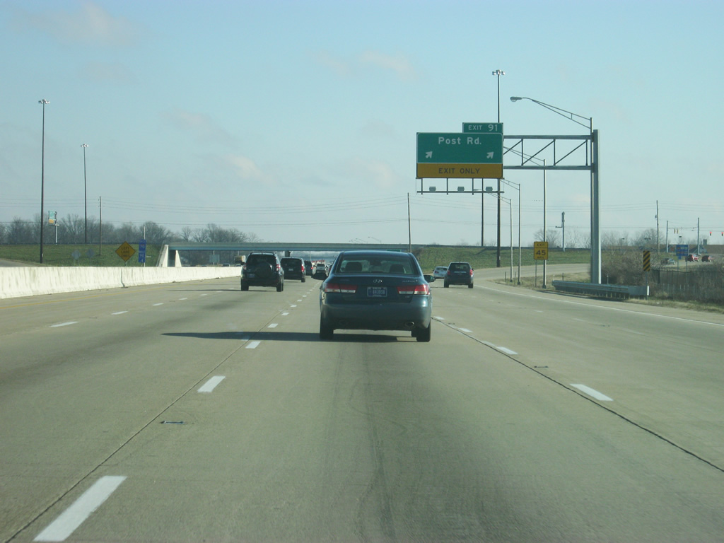
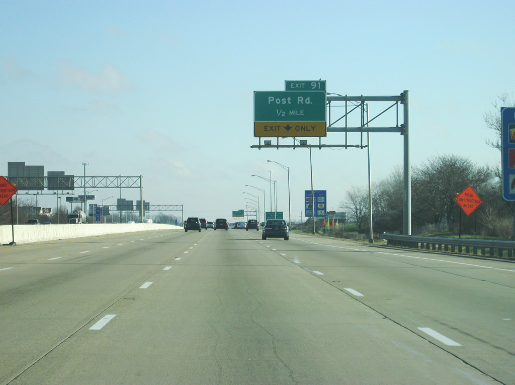
Two exit lanes exit off at Exit 91 (Post Road). The road was originally named for Fort Benjamin Harrison which was previously located in Lawrence at the spot where Post Road ended to the north. Today, it is Fort Harrison State Park. Post Road remains the most important north-south road across the Warren Township suburbs of Indianapolis.
12/17/11

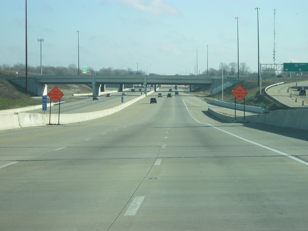
East of Exit 91 (Post Road), Interstate 70 is reduced to four lanes as it begins to leave the Indianapolis urbanized area. By 2012 however, the stretch of Interstate 70 from Exit 91 to Exit 96 (Mount Comfort Road) will be widened to six lanes. Mount Comfort is 5 miles away while the Hancock County seat of Greenfield is 14 miles away. Dayton, Ohio is 107 miles away.
12/17/11
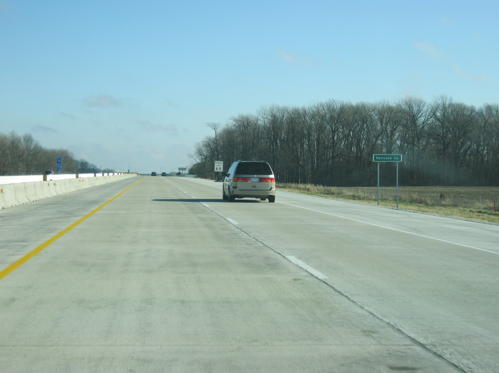
Interstate 70 enters Hancock County just over a mile west of Exit 96 (Mount Comfort Road).
12/17/11
References:
Photo Credits:
- Thomas Decker: 12/17/11, 12/22/11
- ABRoads: 11/05/09
Connect with:
Page Updated Friday January 13, 2012.