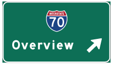
Interstate 70 West - Oakley to Colby


 West
West
K-212 was a 0.653 mile long route linking I-70/U.S. 40 at Exit 107 with Main Street in the city of Quinter. It was withdrawn from the state highway system on April 1, 2014.1
10/17/04
10/17/04

Castle Rock Road extends south from Exit 107 to ranch land and north as Castle Rock Street into Quinter.
10/17/04
10/17/04

I-70/U.S. 40 turn due west at mile marker 102 and next meet K-211 north to the city of Park.
10/17/04
10/17/04

Exit 95 joins I-70/U.S. 40 with K-23 Spur, a 0.35 mile long cut off for K-23 north to the Sheridan County seat of Hoxie.
10/17/04
10/17/04

K-23 parallels a Union Pacific Railroad along old U.S. 40 west from K-23 Spur to K-23 Alternate (Main Street) in the city of Grainfield.
10/17/04
10/17/04

K-23 turns south from Old Highway 40 into a diamond interchange with I-70/U.S. 40 at Exit 93.
10/17/04
10/17/04

K-23 travels south from Exit 93 to the Gove County seat of Gove City, Dighton and Cimarron.
10/17/04
10/17/04

A 0.58 mile long route north onto Old Highway 40, K-216 connects I-70/U.S. 40 with the city of Grinnell.
10/17/04
10/17/04

U.S. 40 branches southwest from the I-70 corridor to the Wallace County seat of Sharon Springs and Cheyenne Wells, Colorado. U.S. 40 west and Freeman Avenue north to Downtown Oakley was formerly Business Loop I-70.
10/17/04
10/17/04
 West
West
Interstate 70 travels independent of a U.S. Highway for the first time westbound in Kansas beyond Exit 76.
10/17/04
10/17/04

U.S. 83 converges with Interstate 70 at Exit 70, 4.85 miles north from U.S. 40 along the west side of Oakley.
10/17/04
10/17/04

U.S. 83 continues 14.14 miles north from the diamond interchange at Exit 70 to U.S. 24 and 24 miles to the city of Rexford.
10/17/04
10/17/04

The first of two exits for Interstate 70 to the Thomas County seat of Colby is with Country Club Drive.
10/17/04
10/17/04

Country Club Drive north from Exit 54 to U.S. 24 (E 4th Street) was formerly part of Business Loop I-70 to Downtown Colby.
10/17/04
10/17/04

Turning back to the west, I-70 advances three quarters of a mile from Country Club Drive to the diamond interchange (Exit 53) with K-25 (Range Avenue) to Colby Community College.
10/17/04
10/17/04

K-25 travels south to K-96 and the Wichita County seat of Leoti and north to U.S. 36 at the Rawlins County seat of Atwood.
10/17/04
10/17/04
References:
- Kansas Highways: Numbers 201-219. route56.com (Richie Kennedy).
Photo Credits:
- AARoads: 10/17/04
Connect with:
Page Updated Monday November 08, 2021.


