
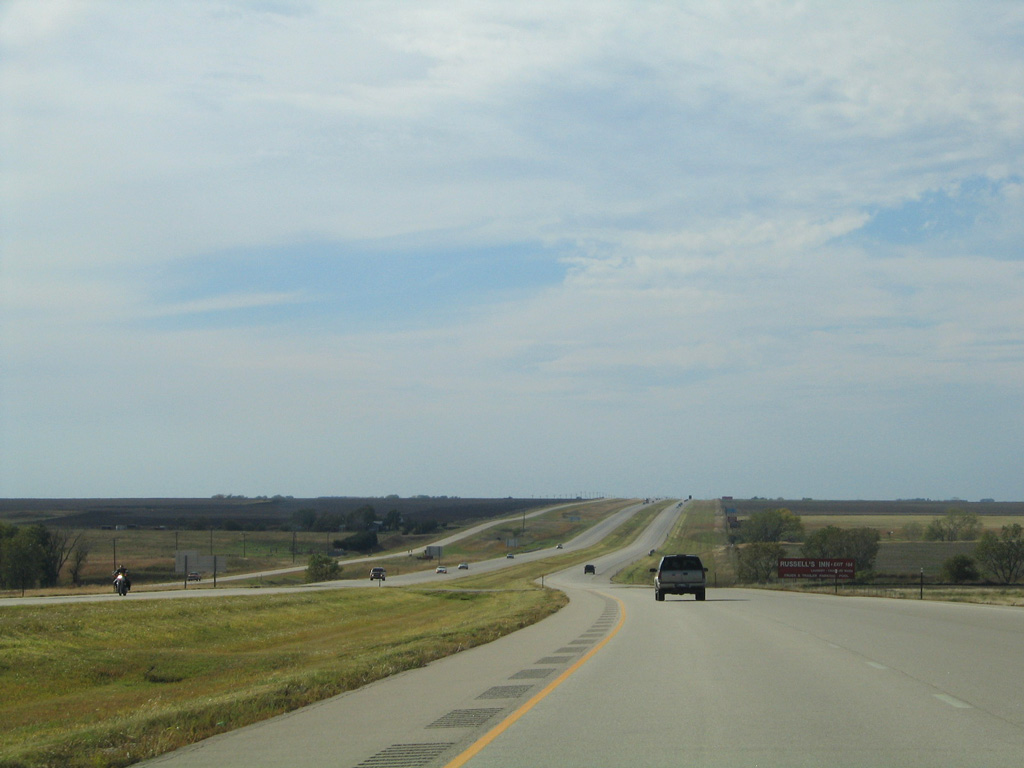
Interstate 70 West - Ellsworth to Russell


 West
West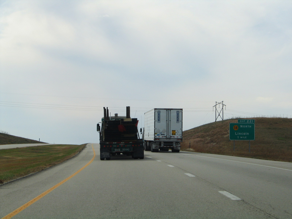
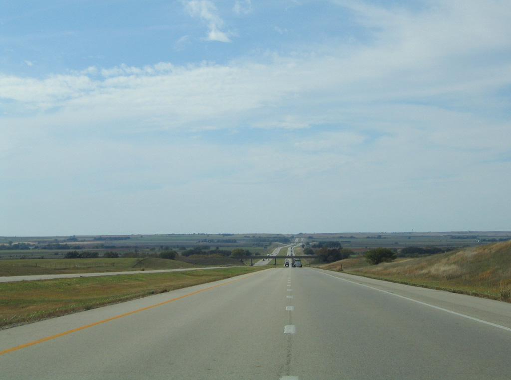
K-14 converges with I-70/U.S. 40 west at Exit 221 from Lincoln, 13.5 miles to the north.
10/17/04
10/17/04
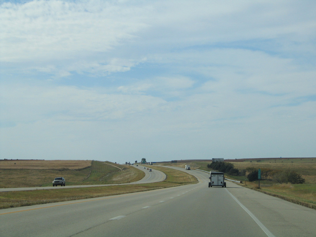
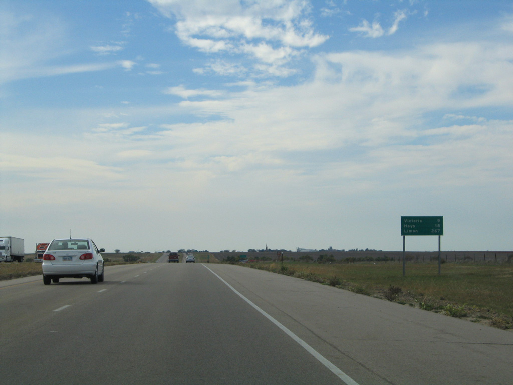
The Ellsworth Rest Area along westbound I-70/U.S. 40 precedes this S-curve between mile marker 224 and 223.
10/17/04
10/17/04

A 219.28 mile long highway in Kansas, K-14 forms a multi state route with N-14 to Superior and the South Dakota state line along the Missouri River near Niobrara.
10/17/04
10/17/04
West 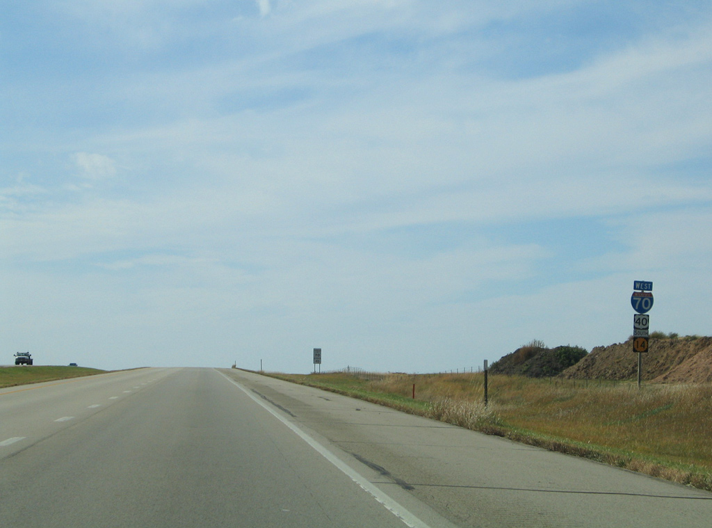
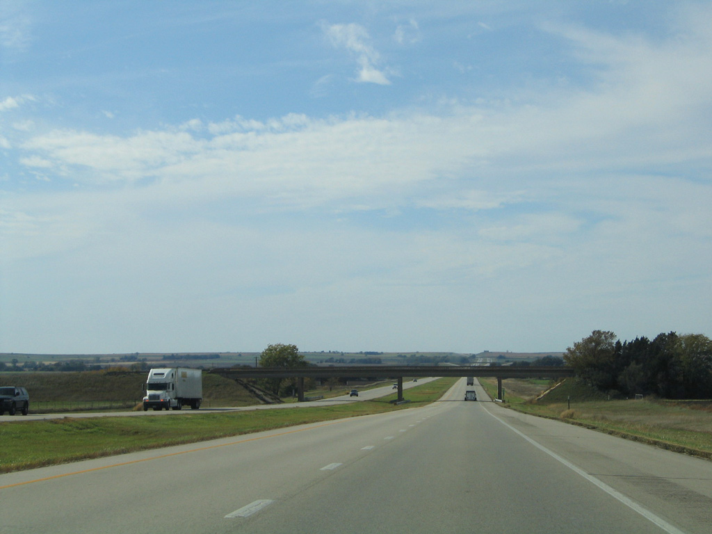
K-14 combines with I-70/U.S. 40 west for 2.92 miles.
10/17/04
10/17/04
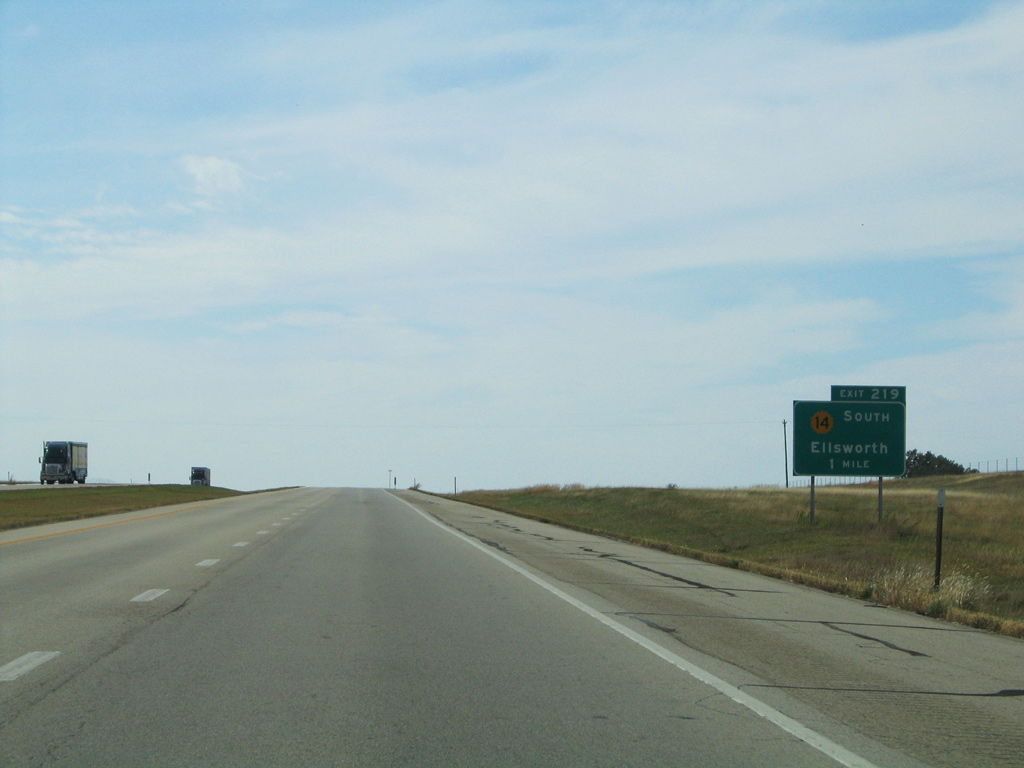
K-14 resumes a southerly course from the diamond interchange at Exit 219, 6.95 miles to Ellsworth.
10/17/04
10/17/04
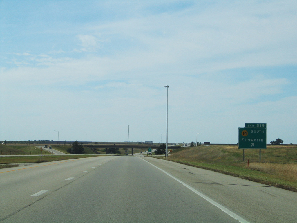
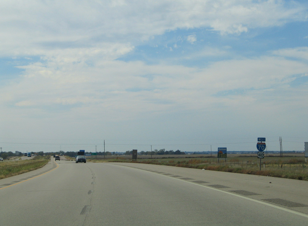
K-14 continues from Ellsworth to Lyons, Hutchinson, Kingman and U.S. 160 at Harper.
10/17/04
10/17/04
West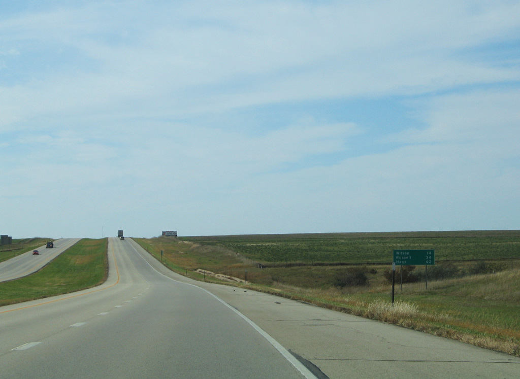
10/17/04
10/17/04
10/17/04
10/17/04
10/17/04
10/17/04
10/17/04
10/17/04
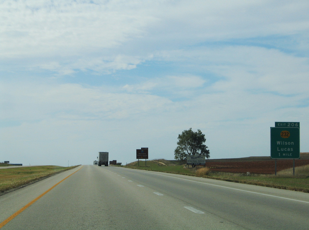
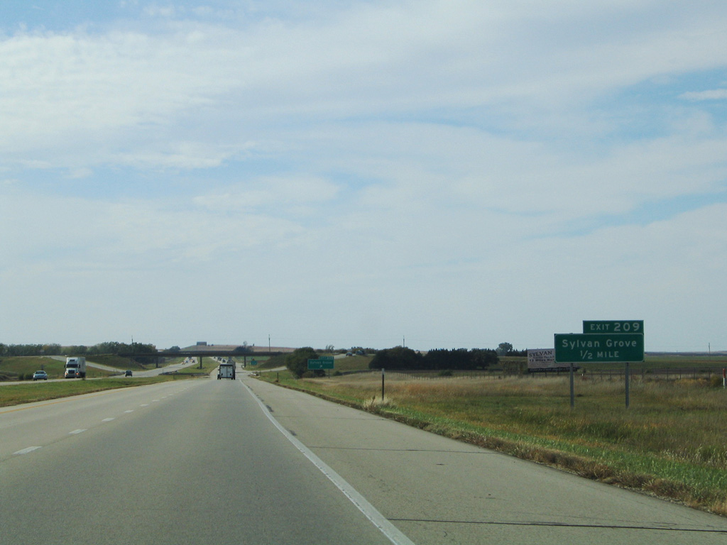
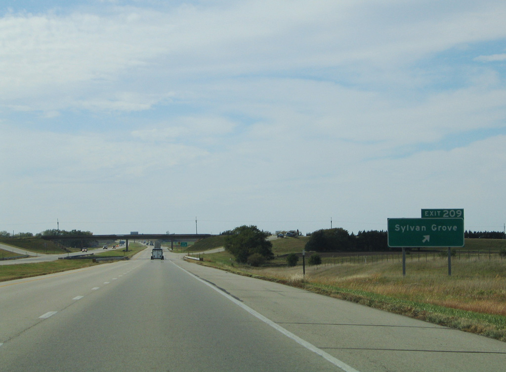
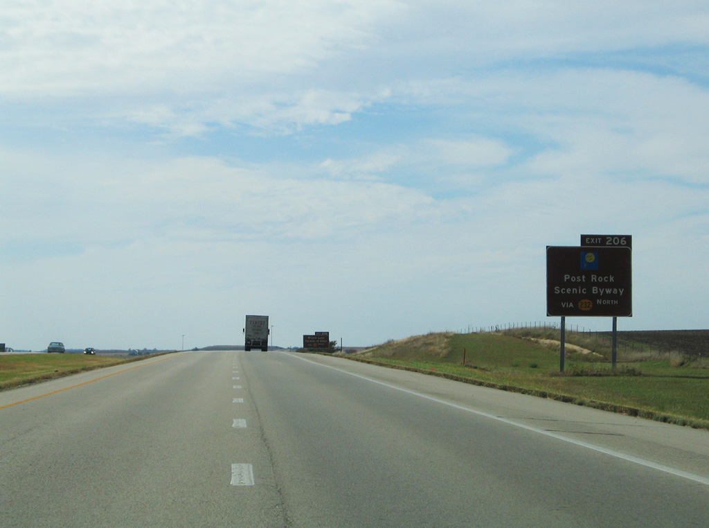
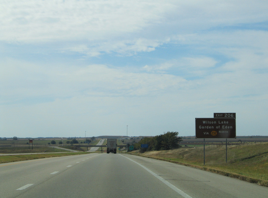
The succeeding exit westbound is for K-232, a 17.26 mile long highway from Wilson north to K-18 at Lucas.
10/17/04
10/17/04
10/17/04
10/17/04
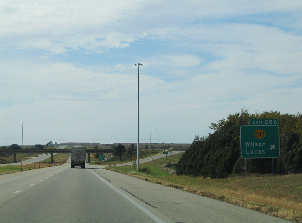
K-232 spurs 1.75 miles south from the diamond interchange at Exit 206 to 27th Street / Old US Highway 40 along Avenue A at Wilson.
10/17/04
10/17/04
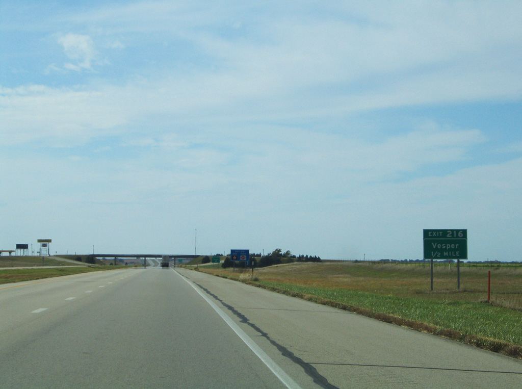
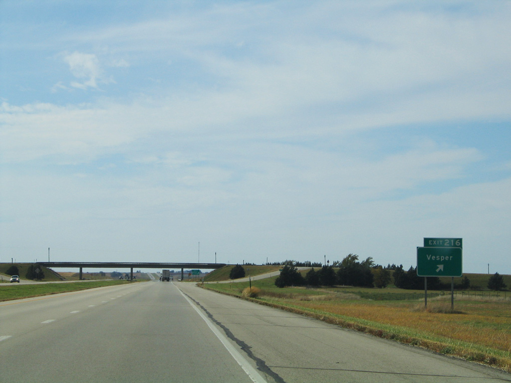
I-70/U.S. 40 enter Russell County by mile marker 205.
10/17/04
10/17/04

Decommissioned on August 24, 2006,1 K-231 was a short spur south along Dorrance Lucas Road to the city of Dorrance.
10/17/04
10/17/04

Entering the parclo interchange with Dorrance Lucas Road (old K-231) south and 200th Boulevard north on I-70/U.S. 40 west at Exit 199.
10/17/04
10/17/04
Old U.S. Highway 40 converges with the south side of Interstate 70 west of mile marker 198.
10/17/04
10/17/04
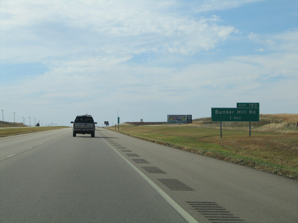
A modified diamond interchange where the eastbound ramps link with adjacent Old U.S. Highway 40 joins Interstate 70 with 193rd Street / Bunker Hill Luray Road at Exit 193.
10/17/04
10/17/04
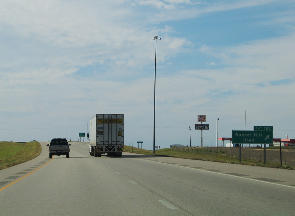
The rural city of Bunker Hill lies 0.7 miles north of Exit 193.
10/17/04
10/17/04
10/17/04
10/17/04
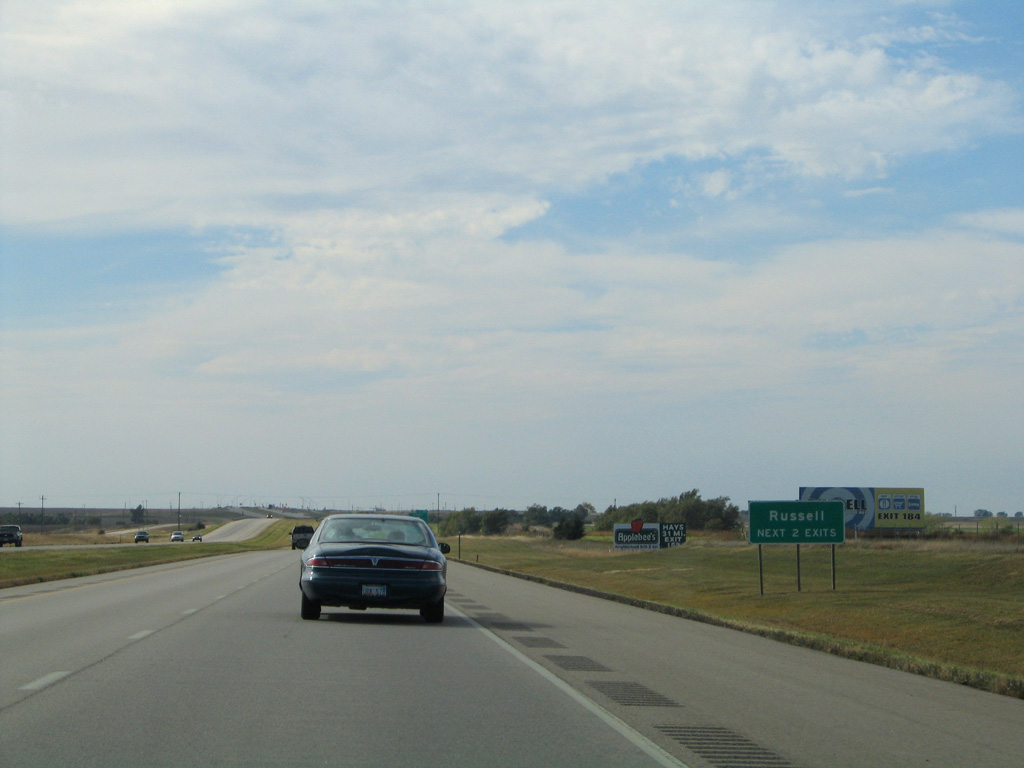
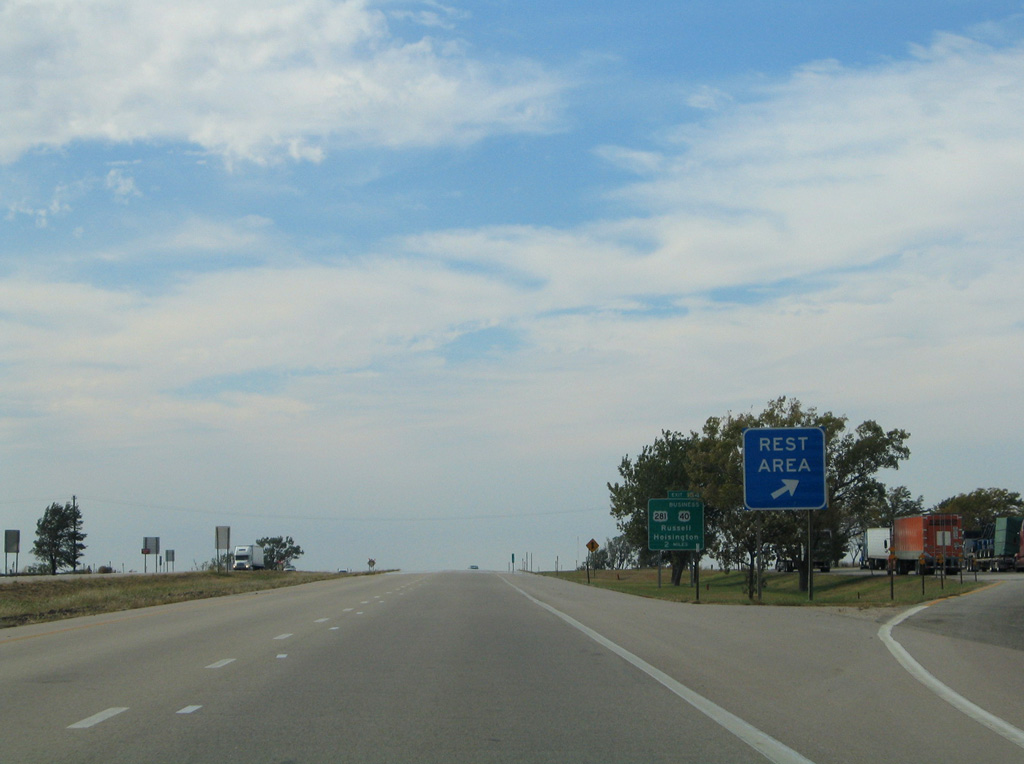
U.S. 40 Business was a 6.09 mile long loop2 from Exit 189 northwest onto Wichita Avenue in Russell and south alongside U.S. 281 to Exit 184.
10/17/04
10/17/04
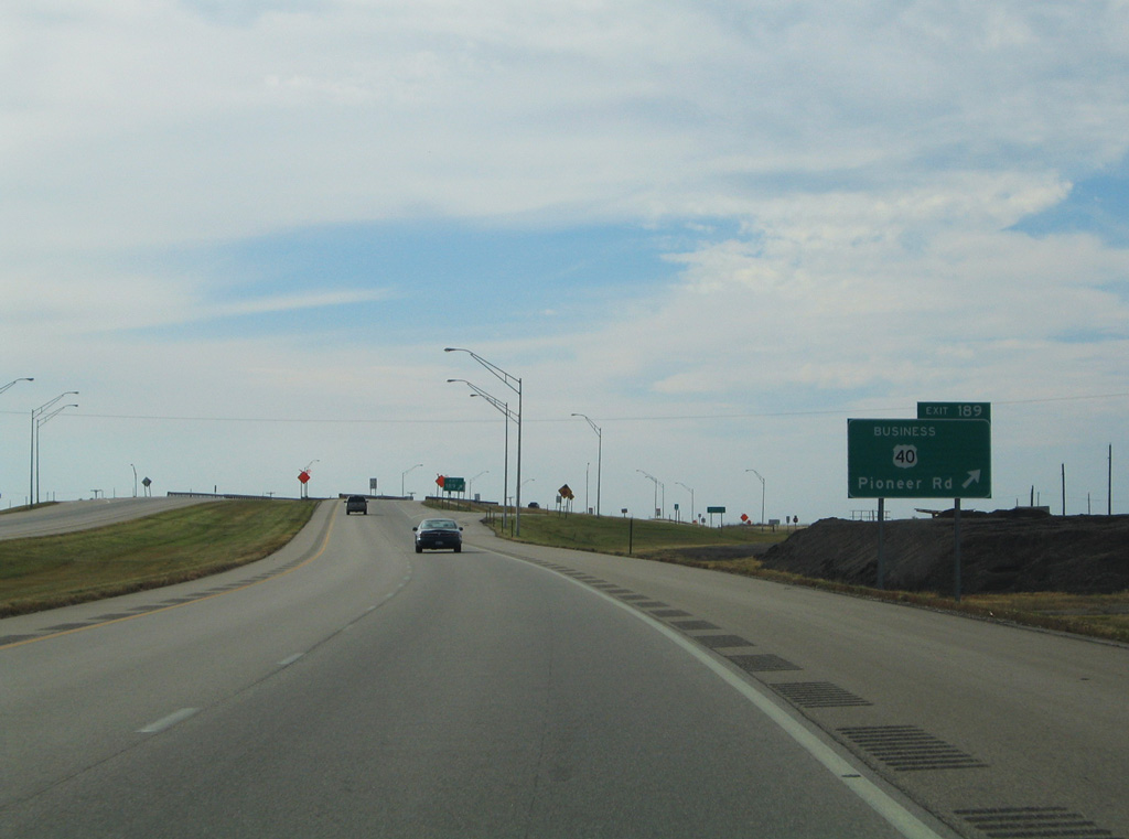
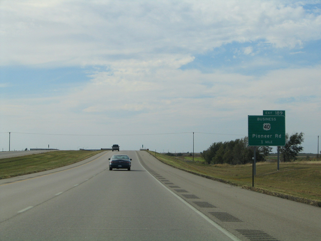
U.S. 40 Business was decommissioned when the route was turned back to the City of Russell and Russell County in 2013.2 Pioneer Road / 189th Street ties into the diamond interchange at Exit 189 from the south.
10/17/04
10/17/04
10/17/04
10/17/04
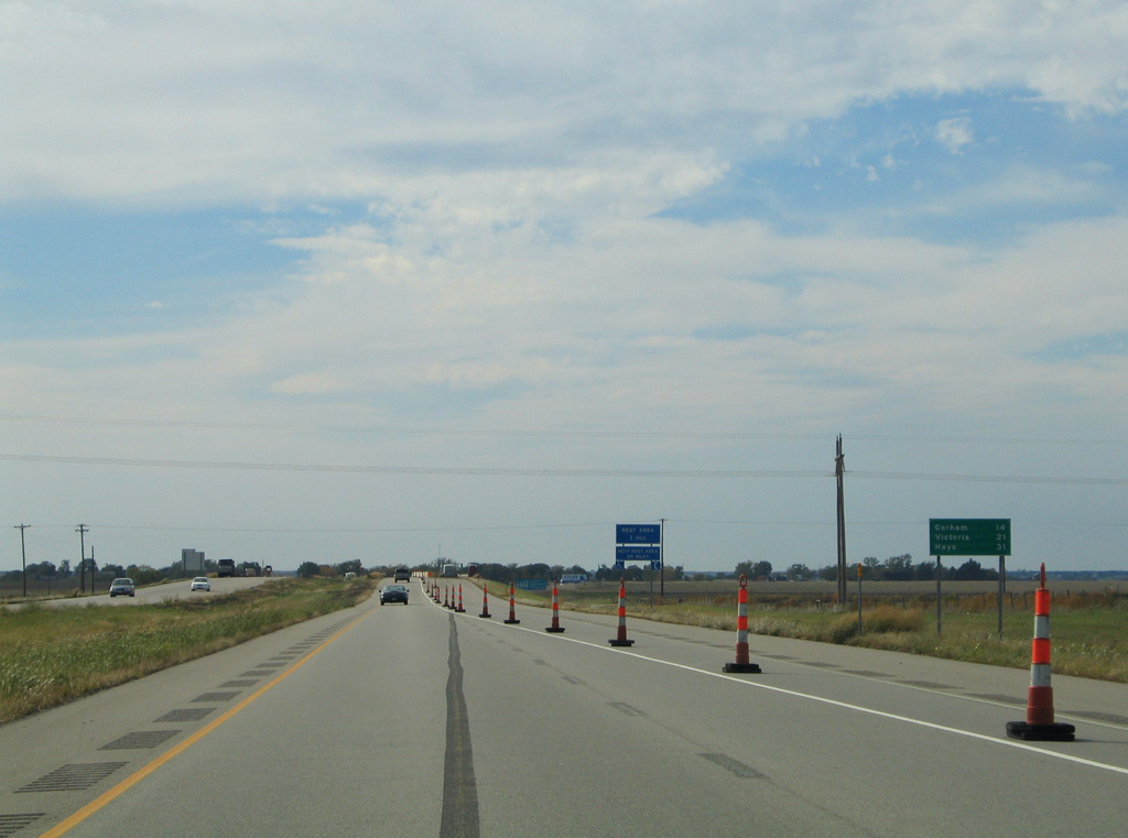
The rest areas near mile marker 187 and Russell were closed on the week of March 3, 2014 for the removal of bathroom and water facilities. They reopened as parking areas.3
10/17/04
10/17/04
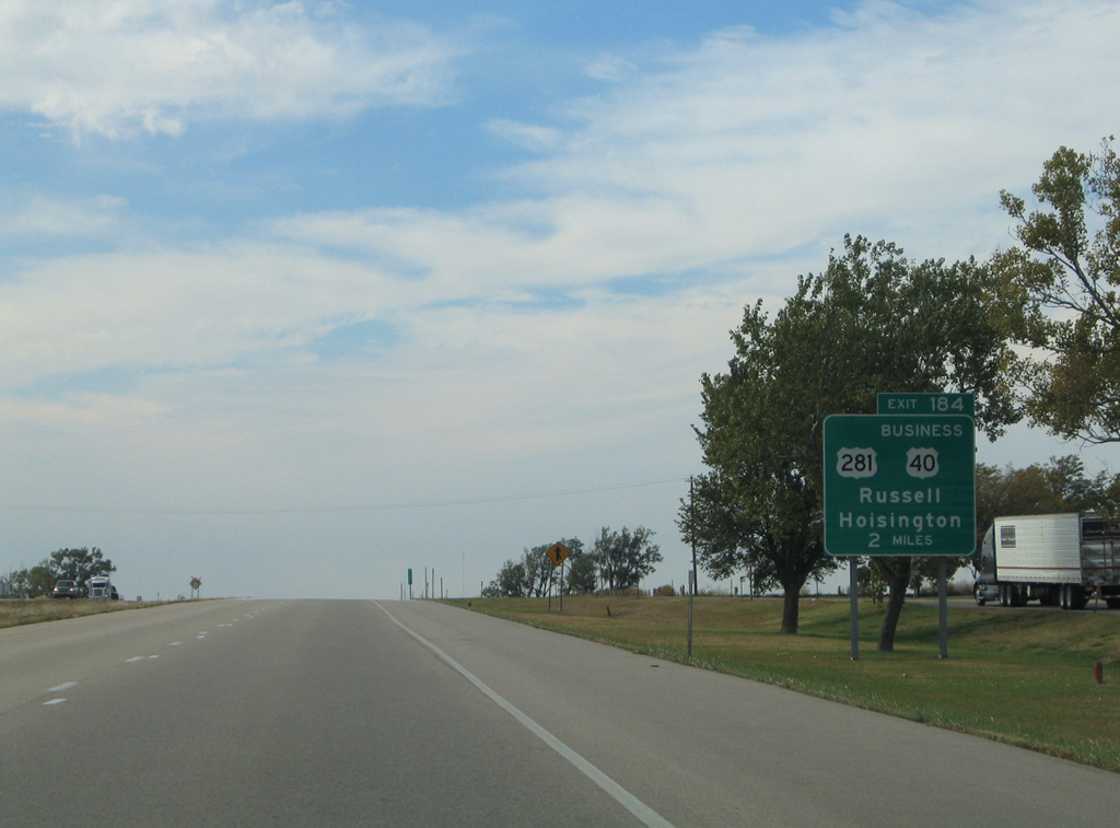
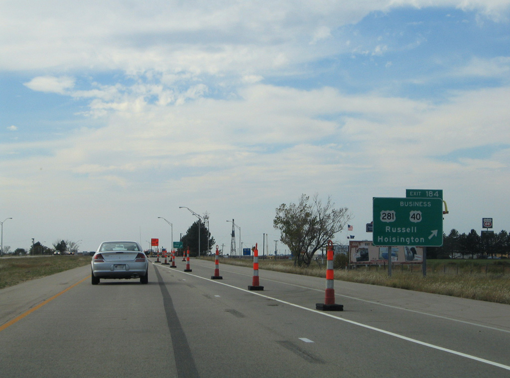
Passing east of Downtown Russell, U.S. 281 (Fossill Street) travels the height of the city from Exit 184 to 18th Street.
10/17/04
10/17/04
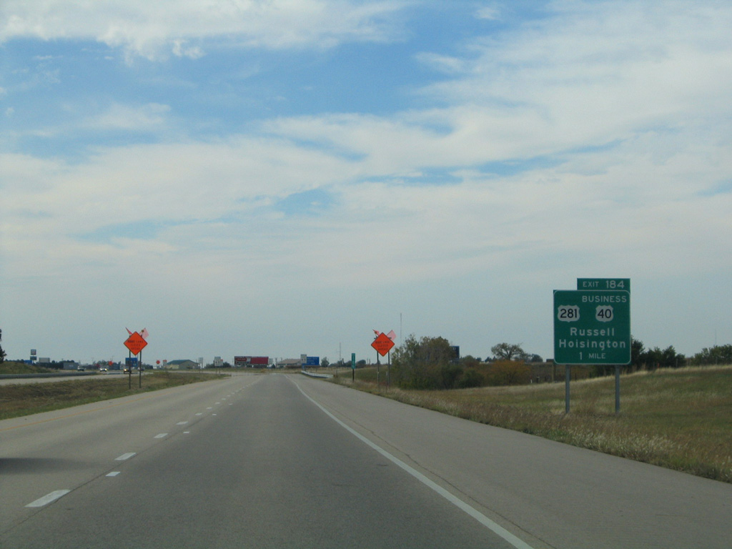
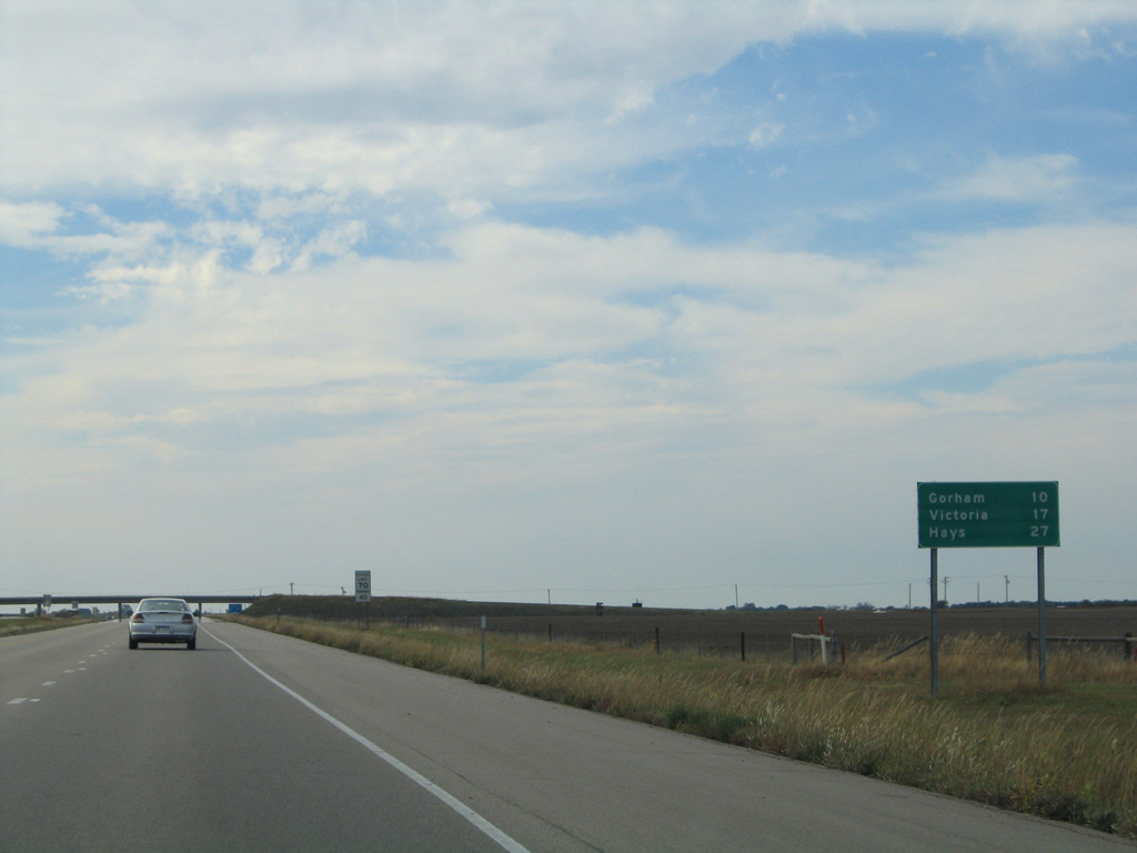
U.S. 281 joins Russell with the Barton County seat of Hoisington, 26.8 miles south of I-70/U.S. 40 at Exit 184.
10/17/04
10/17/04
10/17/04
10/17/04
10/17/04
10/17/04

10/17/04
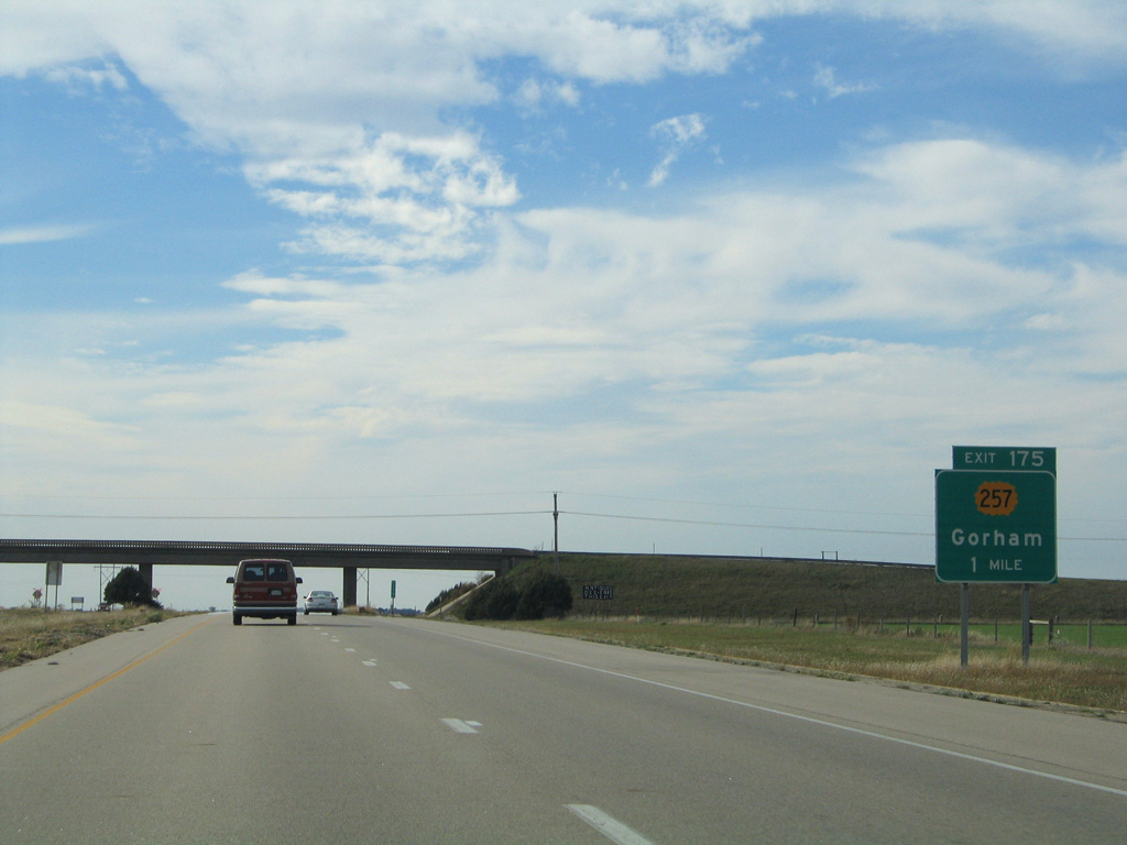
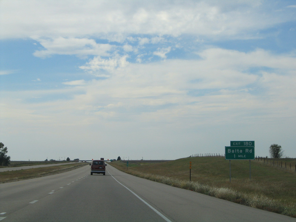
A diamond interchange links I-70/U.S. 40 west with Gorham Galatia Road / 176th Street (former K-257) at Exit 175.
10/17/04
10/17/04
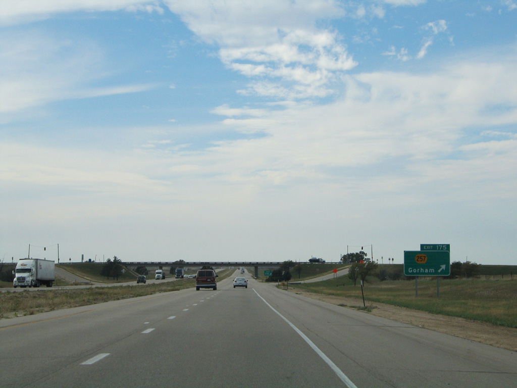
K-257 was a 0.932 mile long spur north from Interstate 70 to the city of Gorham. It was withdrawn from the state highway system on August 24, 2006.4
10/17/04
10/17/04
10/17/04
References:
- Kansas Highways: Numbers 220-239. route56.com (Richie Kennedy).
- Kansas Highways: Numbers 40-59. route56.com (Richie Kennedy).
- "KDOT Says Rest I-70 Rest Area Facilities Will Go, Parking Will Remain Open." CDL Life, January 23, 2014.
- Kansas Highways: Numbers 241-259. route56.com (Richie Kennedy).
Photo Credits:
- AARoads: 10/17/04
Page Updated Monday November 08, 2021.