
Interstate 74 East - Southeast Marion & Shelby Counties
 East
East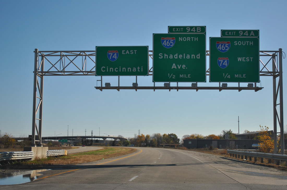
Eastbound on the Southeastern Avenue spur that leads into I-74 at I-465 (Exit 89). The spur originates an original plan to route I-74 through the city following Southeastern Avenue.
11/04/11
The spur also has mile markers for Interstate 74 even though it is not considered a part of the interstate.
11/04/11
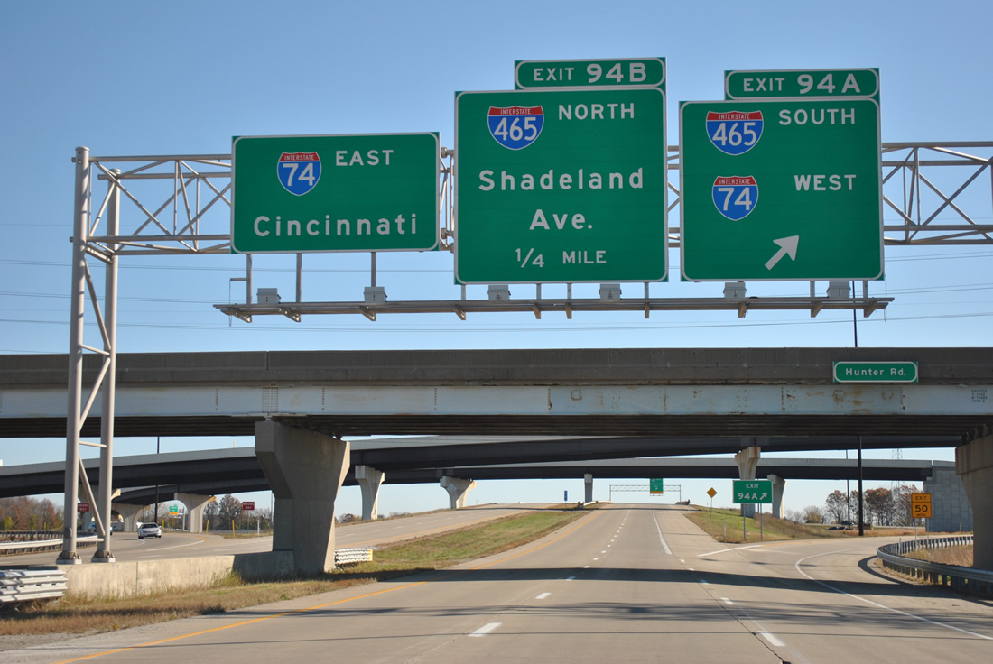
The first ramp to the right carries traffic onto Interstate 74 west and Interstate 465 south to Beech Grove.
11/04/11
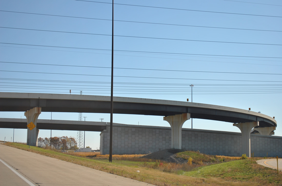
Originally a cloverleaf interchange, upgrades to the Interstates 74-465 interchange replaced loop ramps on the west side of the beltway with flyover ramps.
11/04/11
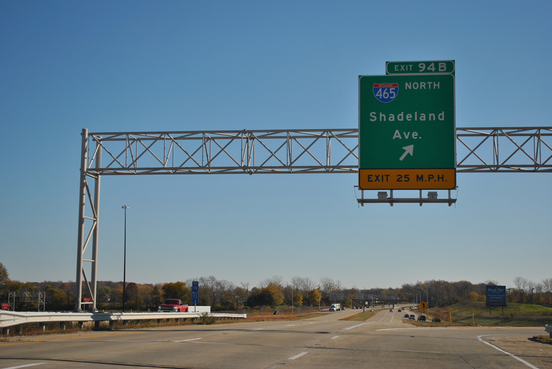
A loop ramp takes traffic onto Interstate 465 north to Lawrence and Shadeland Avenue (former SR 100) north to Warren Park.
11/04/11
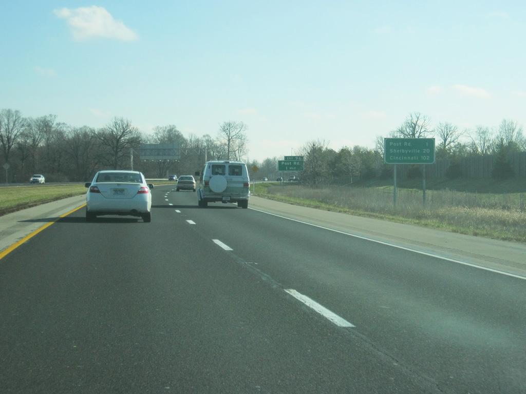
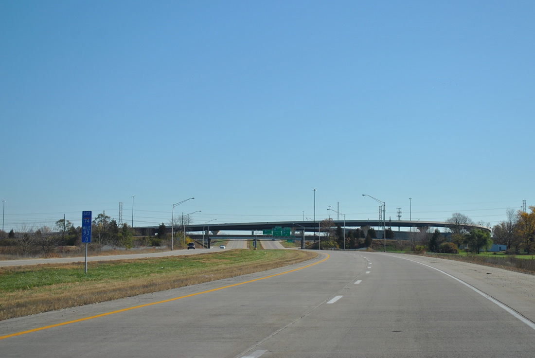
East of Exit 94, Interstate 74/U.S. 421 becomes a four lane interstate highway through the Five Points area. The first exit, the diamond interchange at Post Road (Exit 96), is one mile ahead. The Shelby County seat of Shelbyville is 20 miles ahead and the control city of Cincinnati is 102 miles away.
12/24/11
Post Road consists of an arterial leading north to U.S. 40 (Washington Street) and to U.S. 36/SR 67 (Pendleton Pike) at Lawrence, ending at the former Fort Benjamin Harrison, hence the name of the road. Post Road ends less than a mile to the south at Southeastern Avenue, which continues in a straight path toward the southeast through the Wanamaker community.
12/24/11
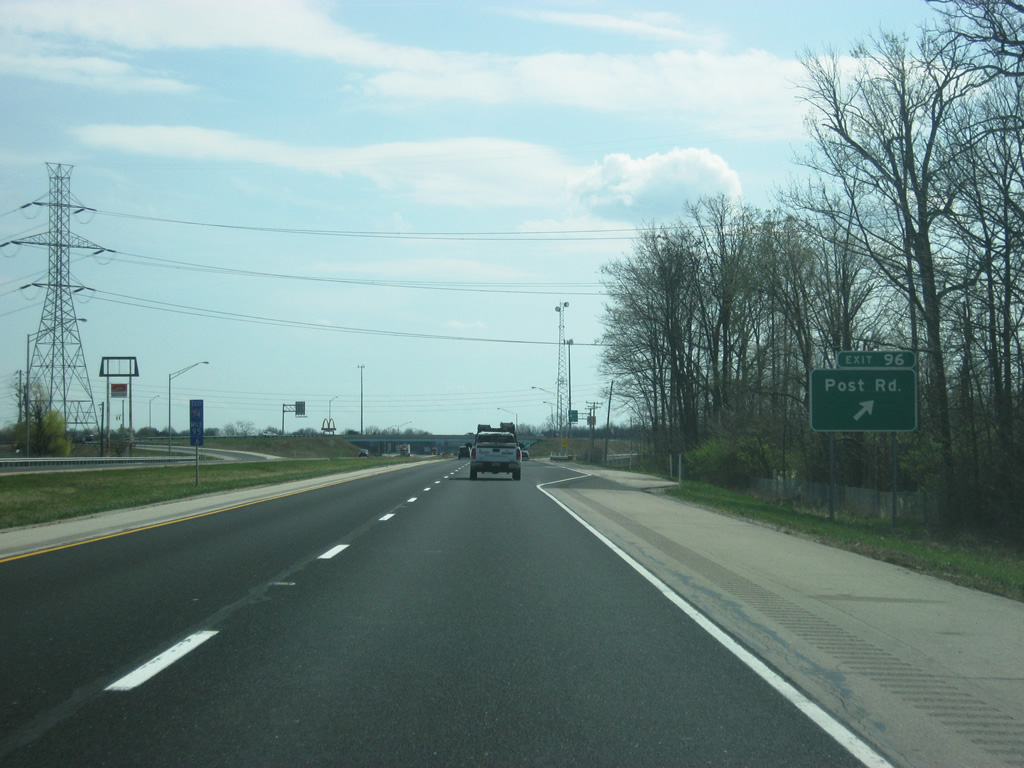
Now at the diamond Interchange (Exit 96) with Post Road. Post Road is among the most important roads across the Far East Side of Indianapolis.
03/19/12
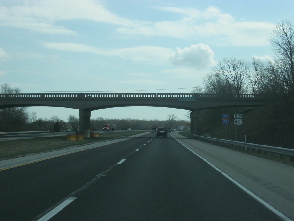
East of Exit 96 are two reassurance shields for Interstate 74 and U.S. 421. U.S. 421 follows Interstate 74 for 38 miles from Exit 94 (Interstate 465) to its split at Exit 132 in Greensburg.
03/19/12
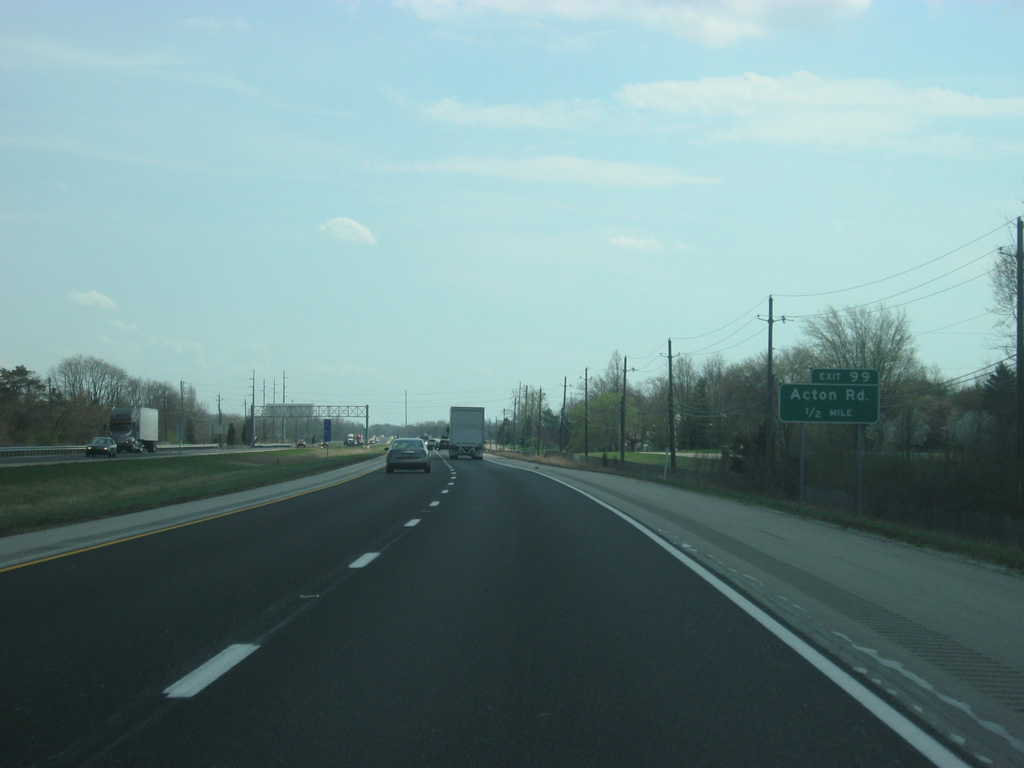
Now coming up to the next interchange, Exit 99 for Acton Road. Acton Road starts at Frontage Road just north of I-74/U.S. 421 and continues south into Johnson County.
03/19/12
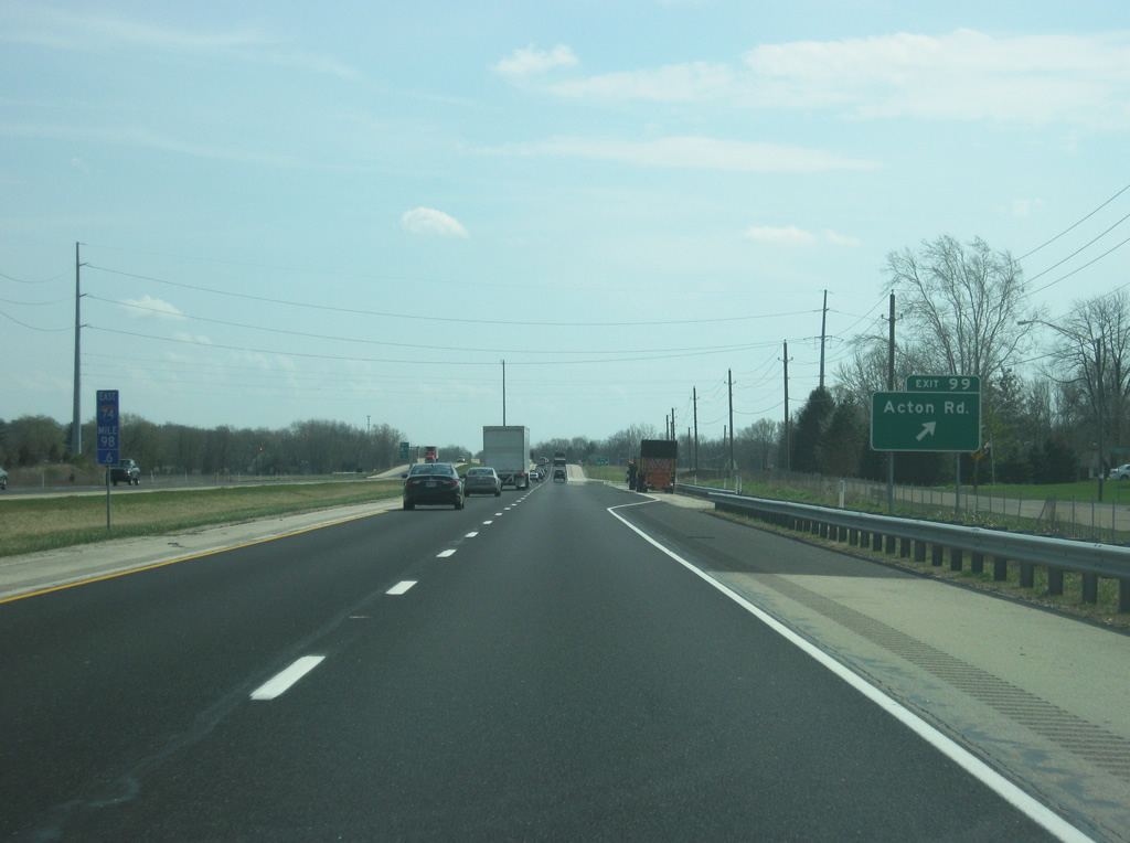
I-74/U.S. 421 at the diamond interchange with Acton Road (Exit 99). As the name suggests, the road goes by the small town of Acton a couple of miles to the south. Acton however is still a part of Indianapolis, since the city covers all of Marion County.
03/19/12
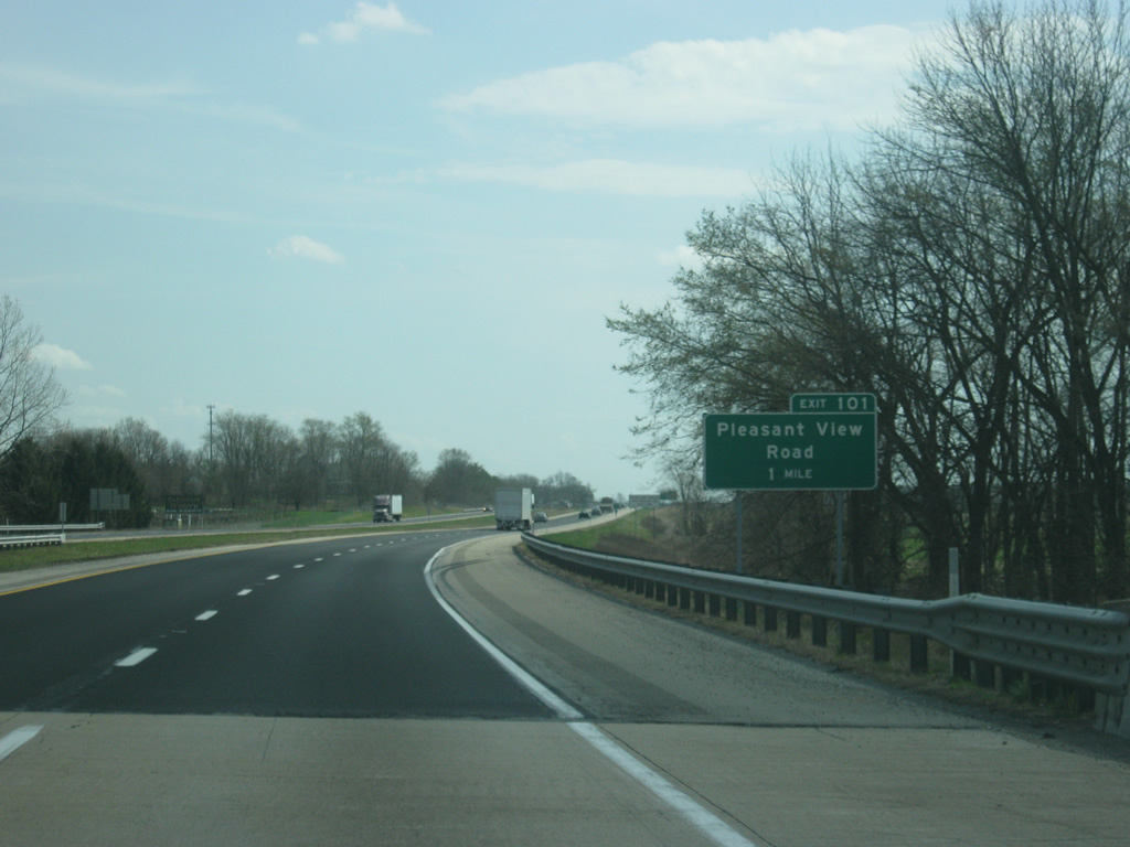
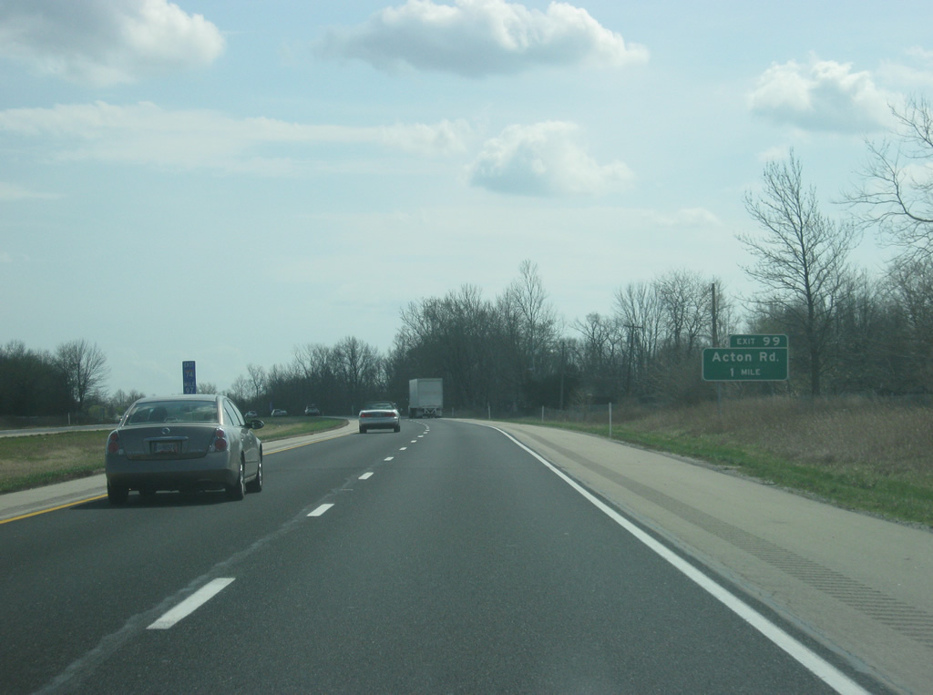
East of Exit 99 (Acton Road), a guide sign announces the one mile approach to Pleasant View Road (Exit 101).
03/19/12
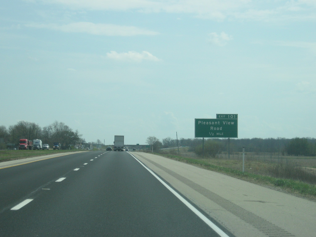
Now a half mile away from Pleasant View Road (Exit 101). Pleasant View Road is a short road that leads into the small community of Pleasant View in far northwestern Shelby County.
03/19/12
I-74/U.S. 421 enters Shelby County less than a half mile from Exit 101 (Pleasant View Road).
03/19/12
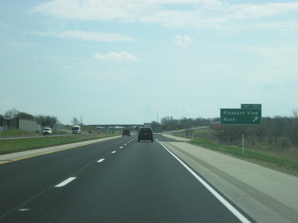
Now at the diamond interchange with Pleasant Run Road (Exit 101). The community of Pleasant View is located just north of the interchange along Southeastern Avenue (the old alignment of U.S. 421).
03/19/12
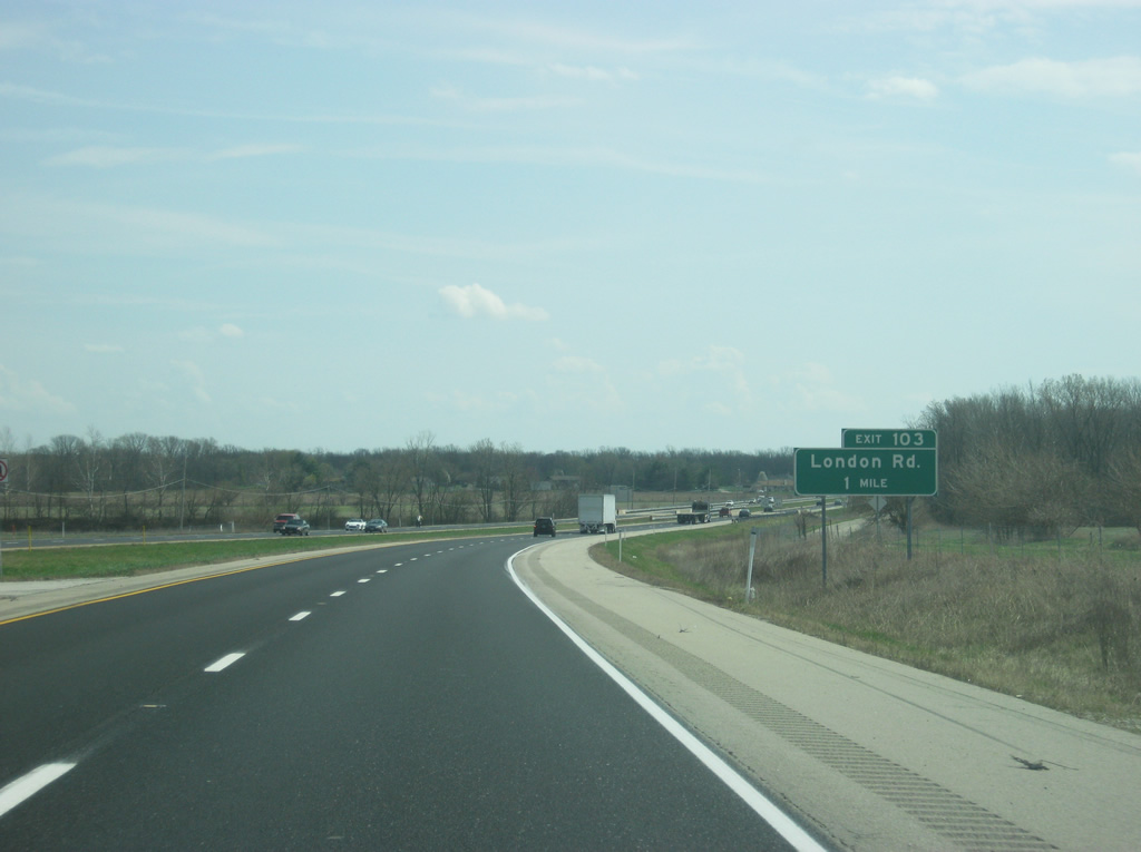
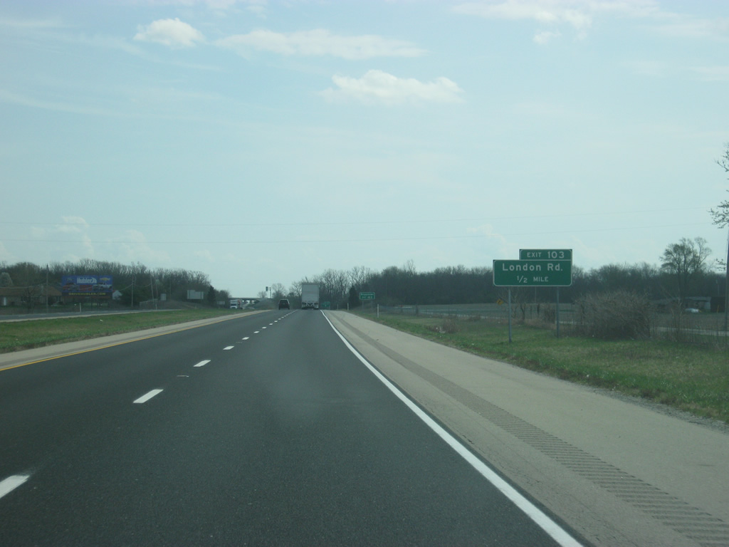
Up ahead is Exit 103 for London Road. Both Exits 101 and 103 are meant to serve the small communities of northwestern Shelby County that had their access taken away from the construction of Interstate 74 on top of U.S. 421.
03/19/12
London Road begins to the north of the interchange with I-74/U.S. 421 at County Road 900 North and continues south to the town of Boggstown, about five miles from the exit.
03/19/12
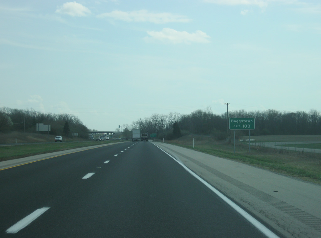
The small community of Boggstown can be reached by taking London Road to the south. Boggstown is located at the junction of a system of county roads that once connected Indianapolis with Shelbyville before U.S. 421.
03/19/12
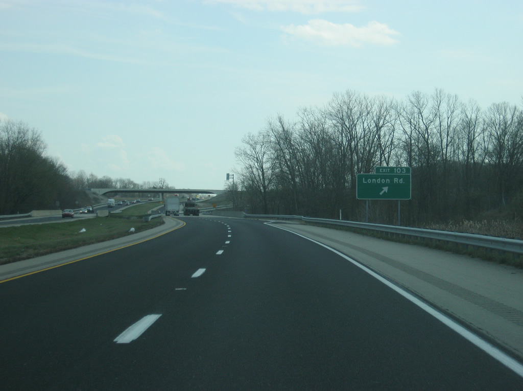
Now at Exit 103 for London Road.
03/19/12
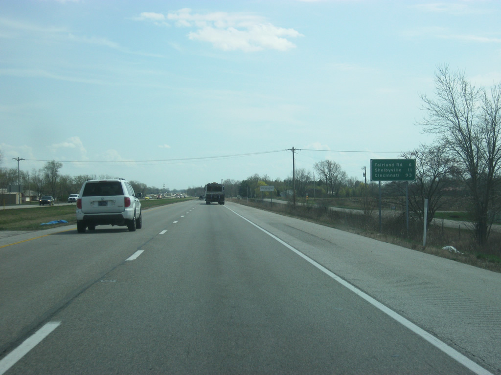
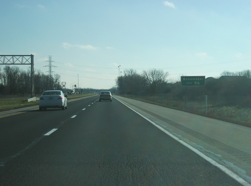
The next exit, for Fairland Road, is six miles away with Shelbyville at 11 miles. Cincinnati is now 93 miles down the road.
03/19/12
Through northwestern Shelby County, Michigan Road and Frontage Road follow the interstate on the north and south sides respectively to serve the houses and businesses that were once on U.S. 421.
03/19/12
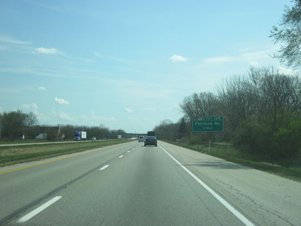
Now coming up to the diamond interchange at Fairland Road (Exit 109). Fairland Road starts at Michigan Road to the east and heads west to eastern Johnson County.
03/19/12
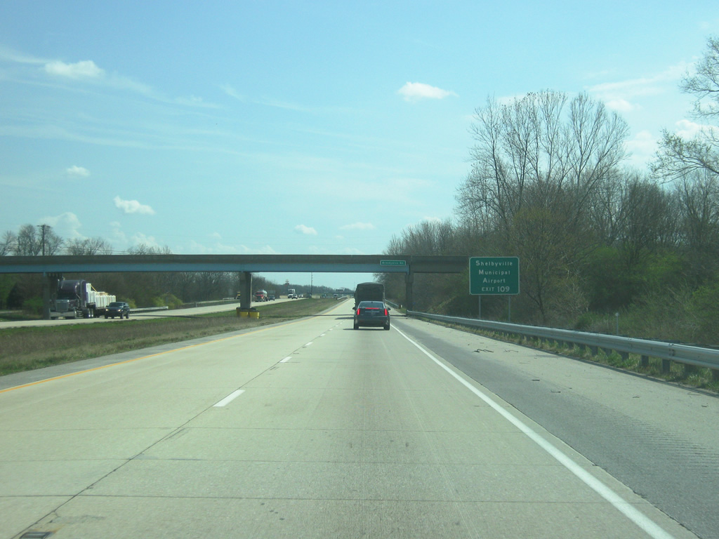
The Shelbyville Municipal Airport can be reached by taking Fairland Road east to Michigan Road. Exit 109 is the first of three exits that serve the Shelby County seat of Shelbyville.
03/19/12
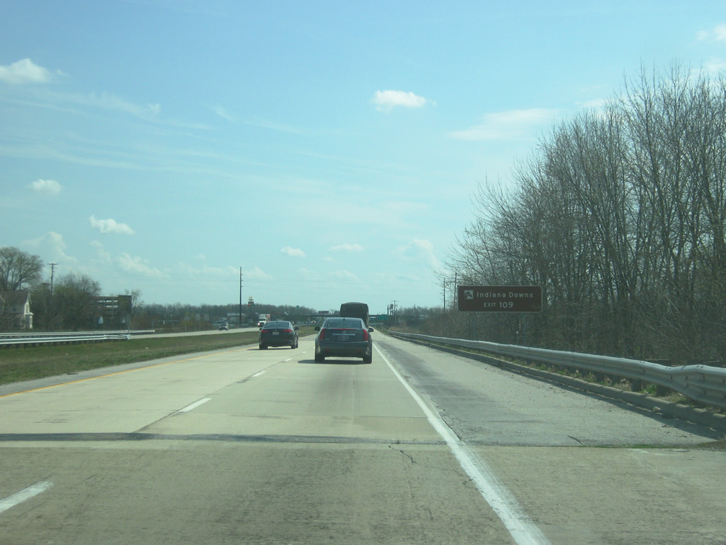
What Exit 109 is best known for is the Indiana Downs Horse racing track and the Indiana Live Casino. The Casino is the closest gambling establishment to Indianapolis and has brought many from the metro area down I-74/U.S. 421 to the Fairland Road exit.
03/19/12
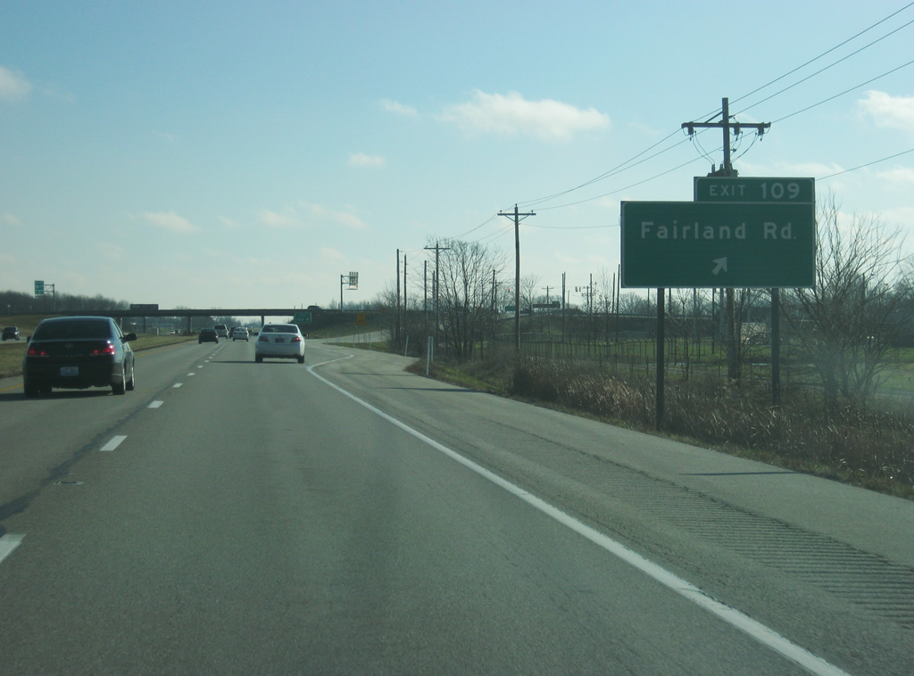
Now at the Fairland Road interchange (Exit 109). The Indiana Downs horse racing track and Indiana Live Casino can be reached just to the east of the interchange. The town of Fairland can be accessed by taking Fairland Road to the west for a couple of miles.
12/24/11
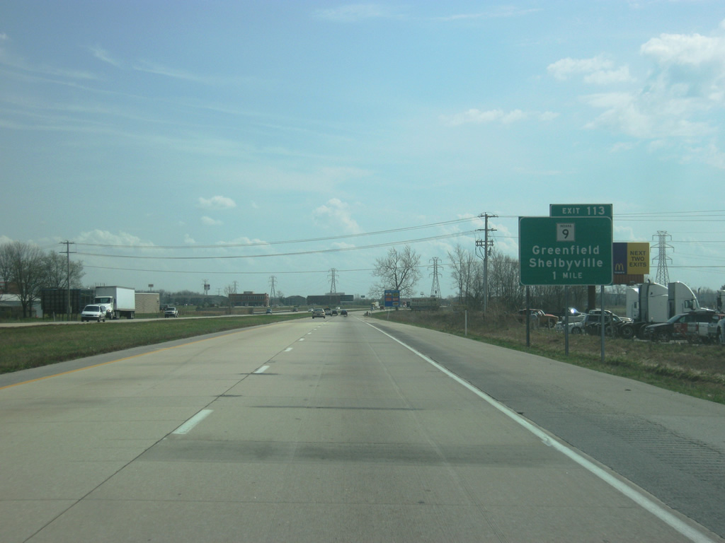
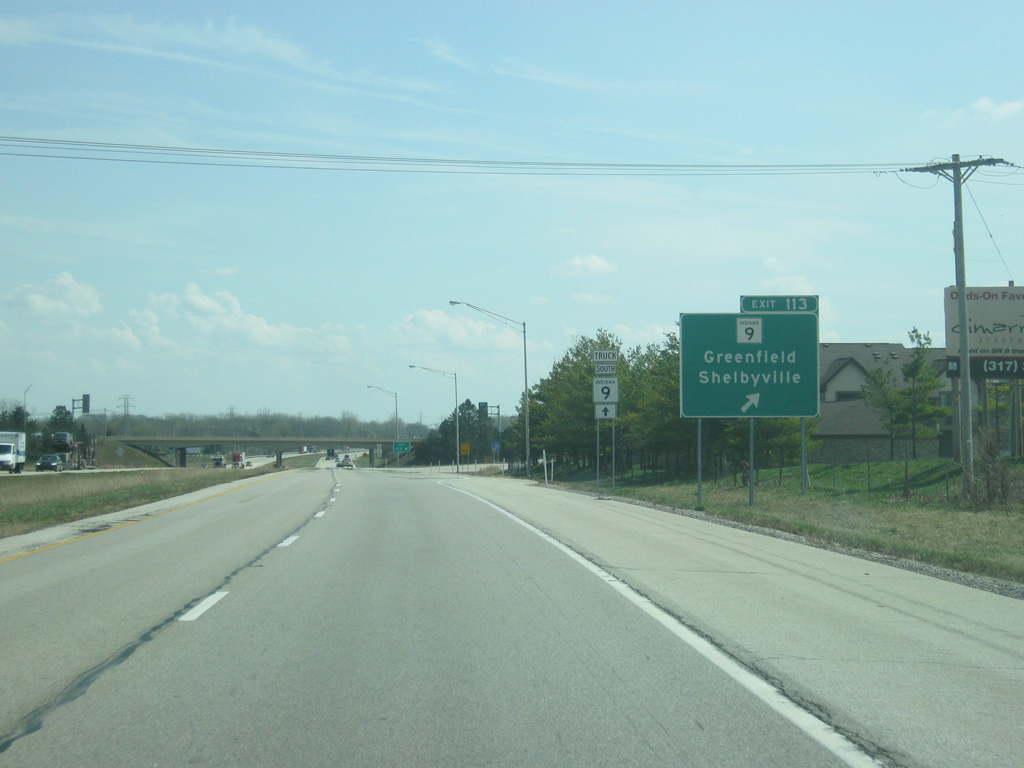
Continuing to the southeast, I-74/U.S. 421 approach the next interchange, with SR 9 at Exit 113. The state road constitutes a 196 mile route between the Michigan line and SR 46 east of Columbus.
03/19/12

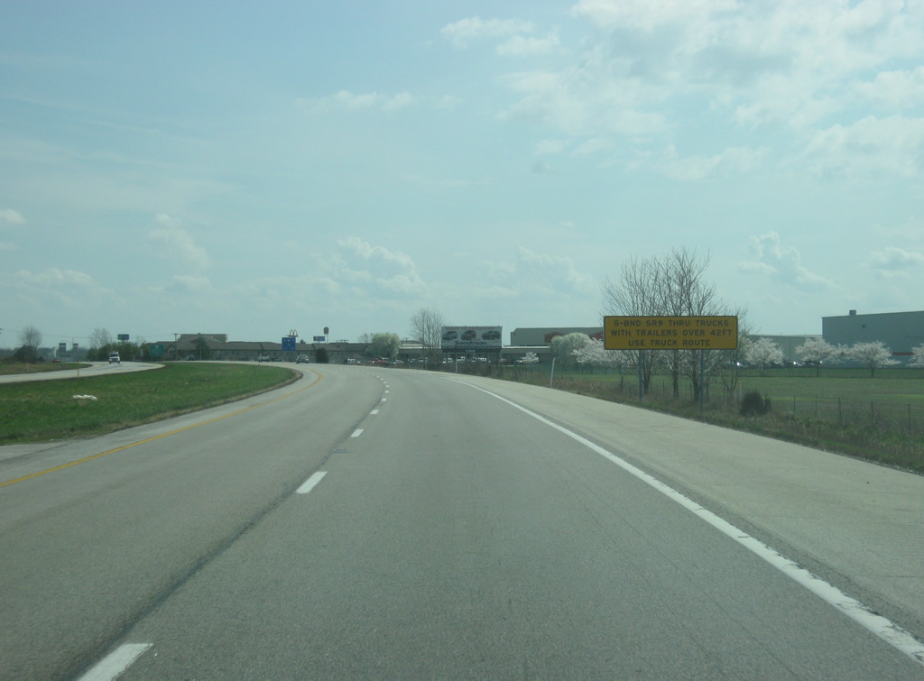
Past the half mile approach to Exit 113, Truckers heading south on SR 9 are advised to use the truck route, which consists of staying on the interstate to Exit 116 (SR 44), and then following a bypass road known as Progress Parkway off of SR 44 to meet back up with SR 9 south of the city. The truck route is in place because of the Public Square traffic circle along SR 9 (Harrison Street) in Downtown Shelbyville.
12/24/11
03/19/12
SR 9 is known as Riley Highway from Exit 113 south into Shelbyville, where it is a four lane highway leading into the city. In town, it is known as Harrison Street before it leaves Shelbyville en route to Hope and Columbus at its southern terminus at SR 46. Greenfield, U.S. 40 and I-70 lie 19 miles to the north.
03/19/12
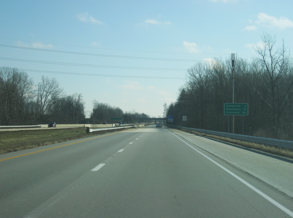
Interstate 74/U.S. 421 now bypasses Shelbyville to the northeast, while the original U.S. 421 follows Michigan Road into town. Still, the distance to Shelbyville (3 miles) is given. Greensburg, the point where U.S. 421 breaks off to the southeast, is 21 miles down the road and Cincinnati is 82 miles.
12/24/11
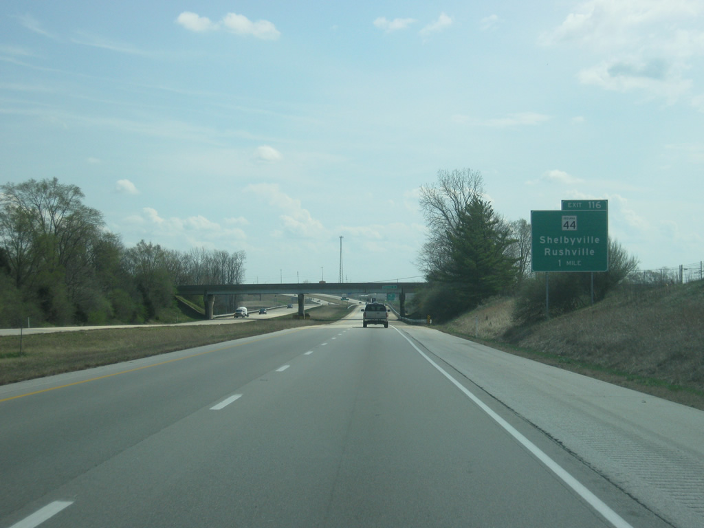
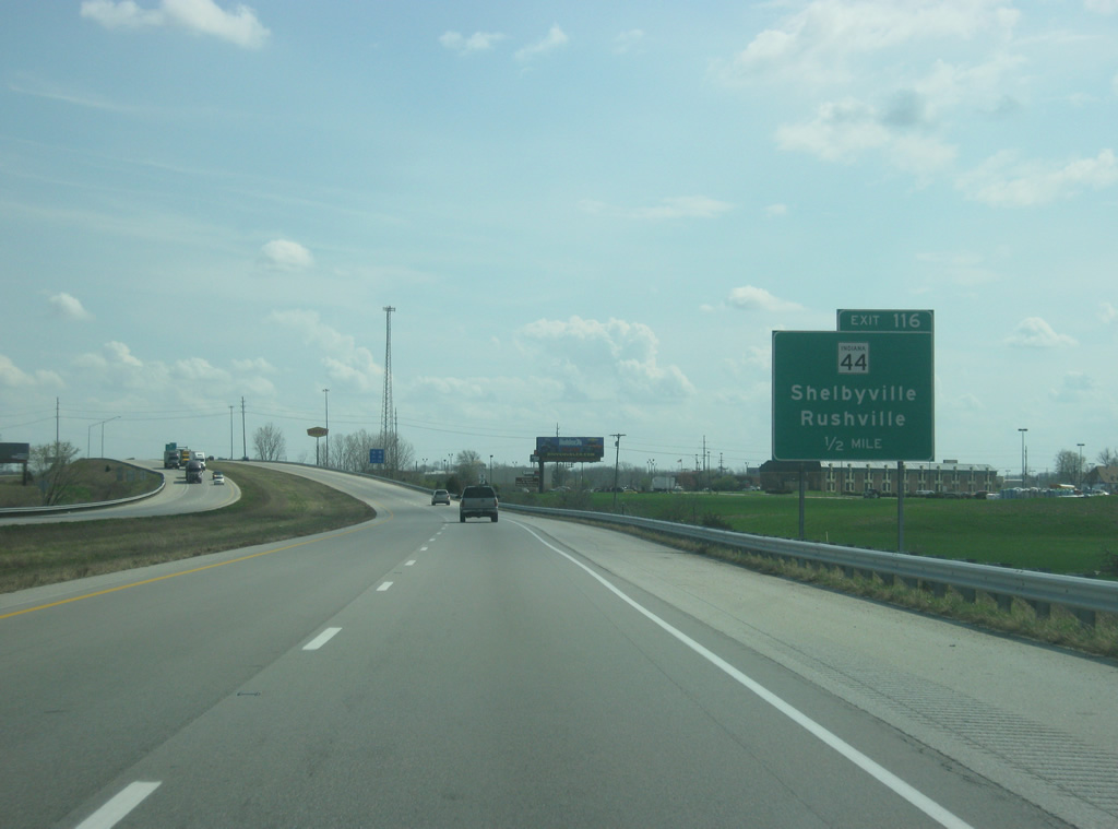
Now coming up with the folded diamond interchange with SR 44 on the east side of Shelbyville. SR 44 is a 90 mile highway that stretches from Martinsville at SR 37 to the west to the Ohio border east of Liberty, connecting Franklin, Shelbyville, Rushville, and Connersville along the way.
03/19/12
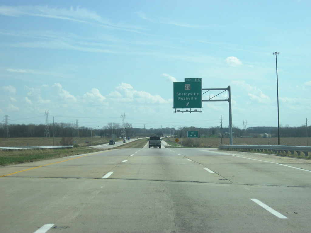
Now at Exit 116 for SR 44. To the west, it becomes Broadway Street as it connects with Downtown Shelbyville. To the east, it travels for 16 miles to Rushville and the intersection with U.S. 52 and SR 3.
03/19/12
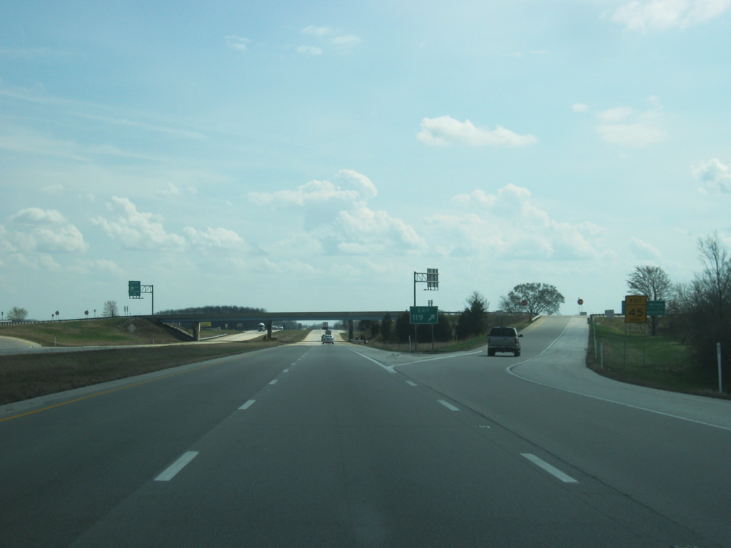
Reassurance shields for I-74/U.S. 421 south greet motorists past Exit 116 (SR 44). SR 244 (at Exit 119) is up next in two miles. The Decatur County seat of Greensburg follows at 18 miles with Cincinnati at 79 miles.
03/19/12
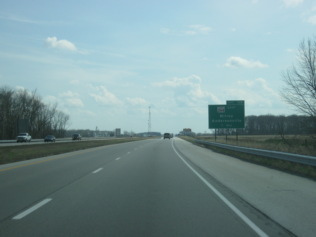
The only guide sign posted for Exit 119 at the time of these photos was situated one mile out from the diamond interchange with SR 244's western terminus.
03/19/12
Exit 119 departs the eastbound freeway for SR 244 and County Road 250 South west to Michigan Road. SR 244 bee lines east 19.5 miles to Milroy and U.S. 52 near Andersonville.
03/19/12
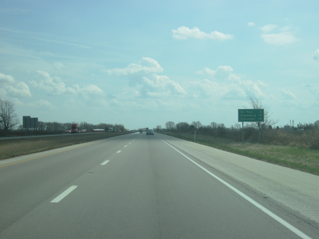
The Shelby County town of St. Paul is next at six miles. Greensburg and Cincinnati are 15 and 76 miles away respectively.
03/19/12
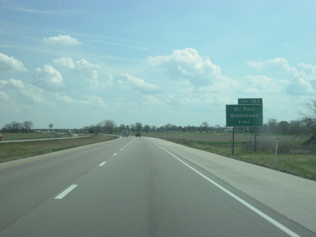
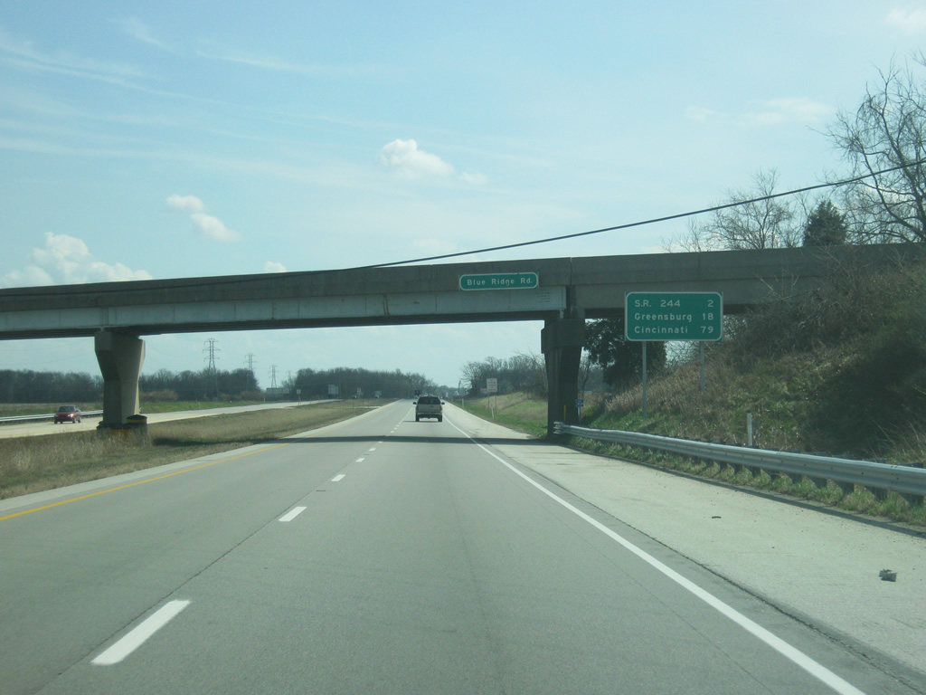
Michigan Avenue (Old U.S. 421) travels through St. Omer to interact with I-74/U.S. 421 again at the Exit 123 folded-cloverleaf interchange with Mohrwood Road. Ramps along the eastbound roadway directly connect with the former US Highway. County Road 800 leads south from Exit 123 along the Decatur / Shelby County line to the town of Saint Paul. Northward County Road 800 Road (Mohrwood Road) continues to SR 244 and Blue Ridge.
03/19/12
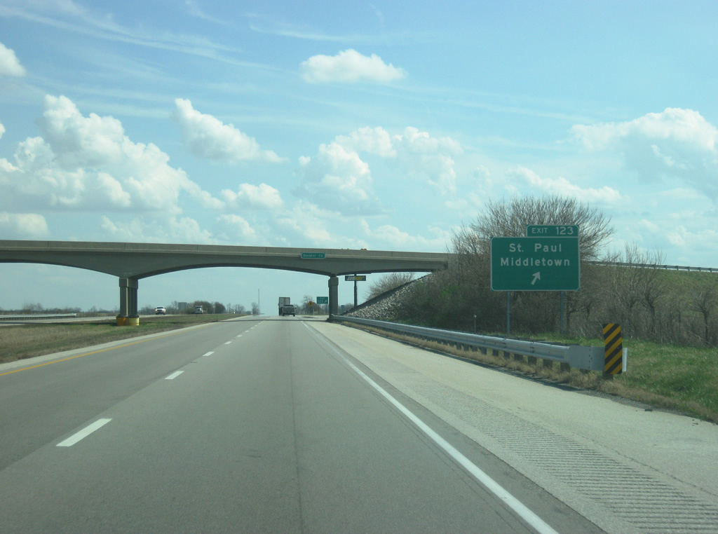
Exit 123 loops onto County Road 800 Road (Mohrwood Road) from II-74/U.S. 421 north. Travelers destined for Middletown or Waldron should follow Michigan Avenue west as old U.S. 421 parallels the freeway back toward the northwest. The corner of Decatur, Rush and Shelby Counties lies directly at the Mohrwood Road overpass. I-74/U.S. 421 officially enter Decatur County only.
03/19/12

Photo Credits:
- ABRoads: 11/04/11
- Thomas Decker: 12/24/11, 03/19/12
Page Updated Tuesday August 07, 2012.