
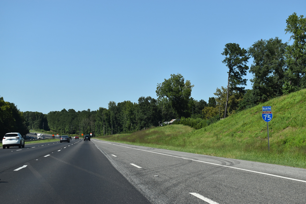
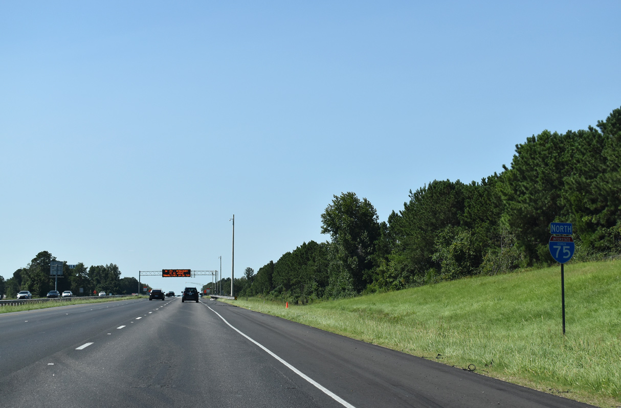
Interstate 75 North - Forsyth to Locust Grove

 North
North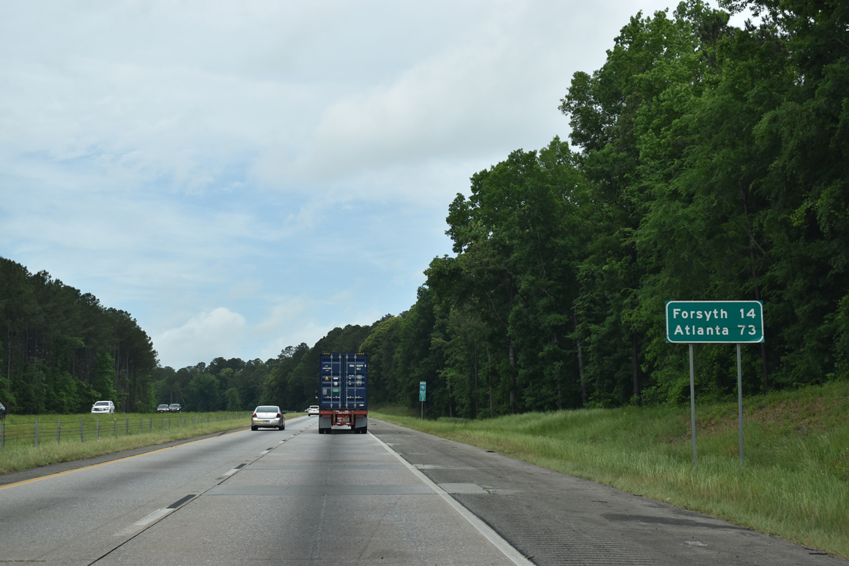
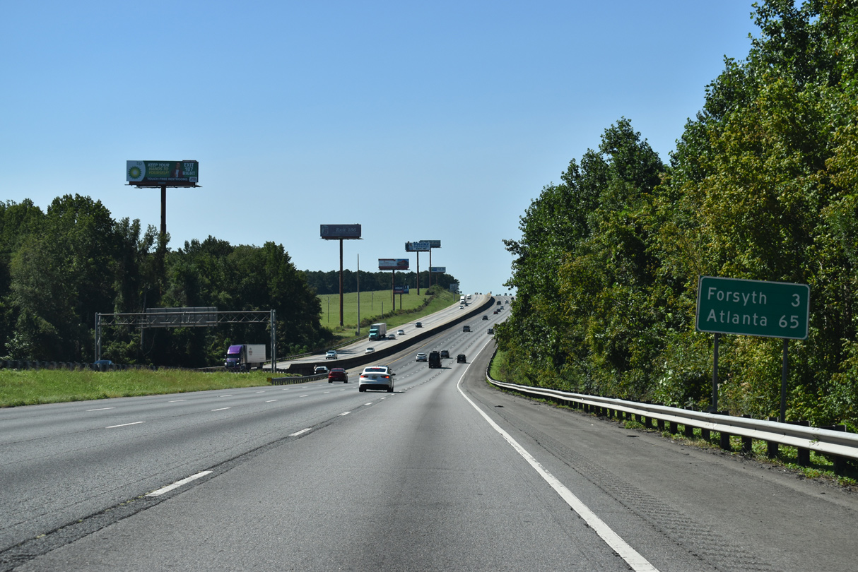
The Monroe County seat of Forsyth is the next destination of I-75 beyond Macon in 14 miles. Atlanta is a 73 mile drive to the northwest.
05/06/22
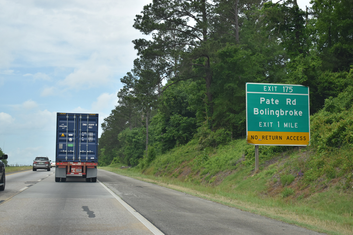
New Forsyth Road parallels I-75 west to the half diamond interchange (Exit 175) with Pate Road.
05/06/22
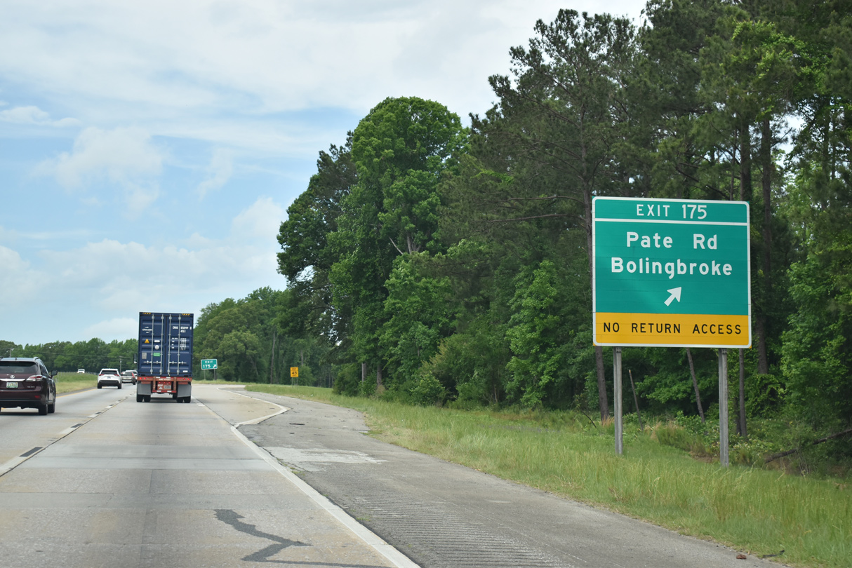
Pate Road links I-75 with U.S. 41/SR 19 (Dixie Highway) at the unincorporated community of Bolingbroke 0.58 miles to the west. Pate Road and New Forsyth Road east 4.12 miles to U.S. 23/SR 87 at Arkwright were formally apart of SR 19 Spur.
05/06/22
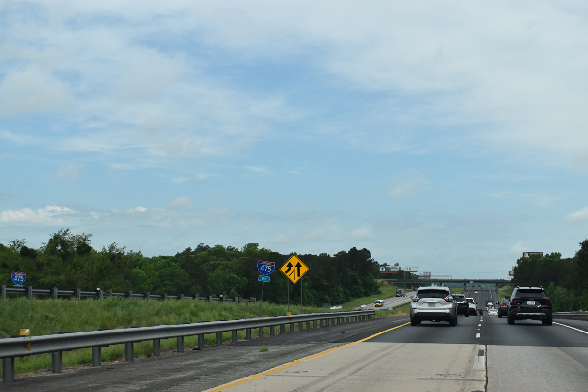
I-75 converges with the north end of Interstate 475 at a wye interchange near Bolingbroke. I-475 carries the bulk of through traffic to the west of Macon between South Georgia and Atlanta.
05/06/22
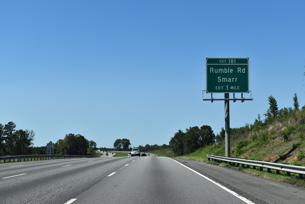
Interstate 75 expands to eight overall lanes with the advent of traffic from I-475. Advancing north across Little Deer Creek, I-75 meets Rumble Road at a diamond interchange (Exit 181).
09/06/20
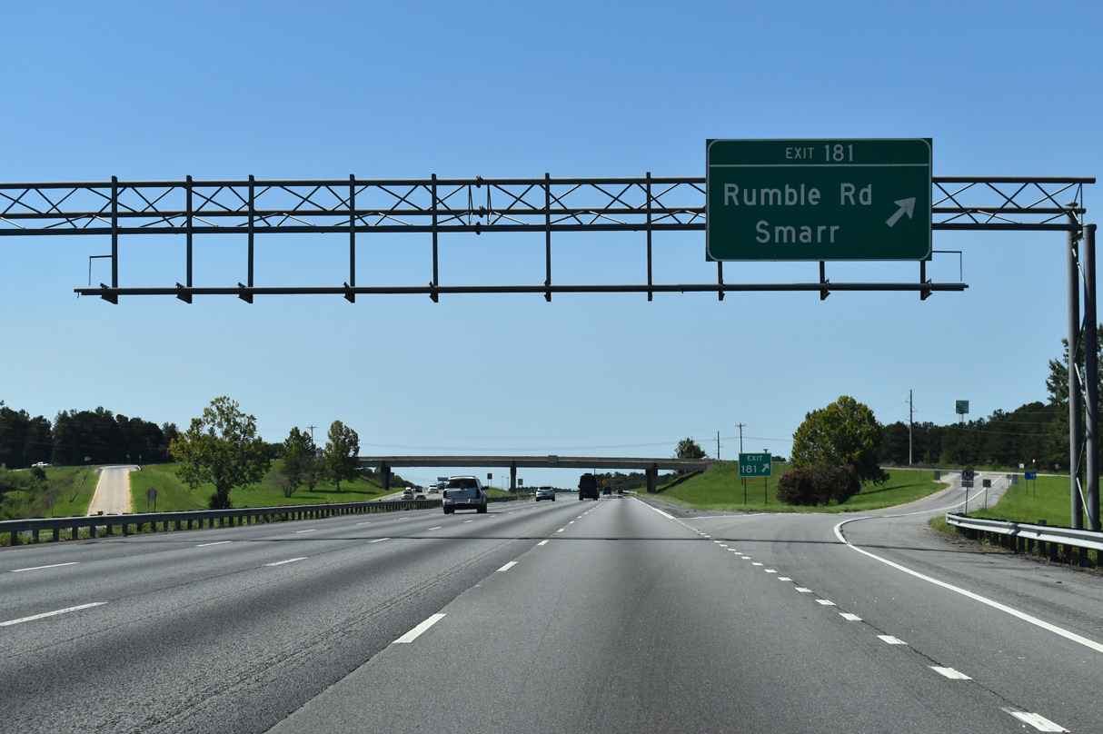
Rumble Road is a 6.13 mile long minor collector west to U.S. 41/SR 19 near Smarr and east through rural Monroe County to Pea Ridge Road.
09/06/20
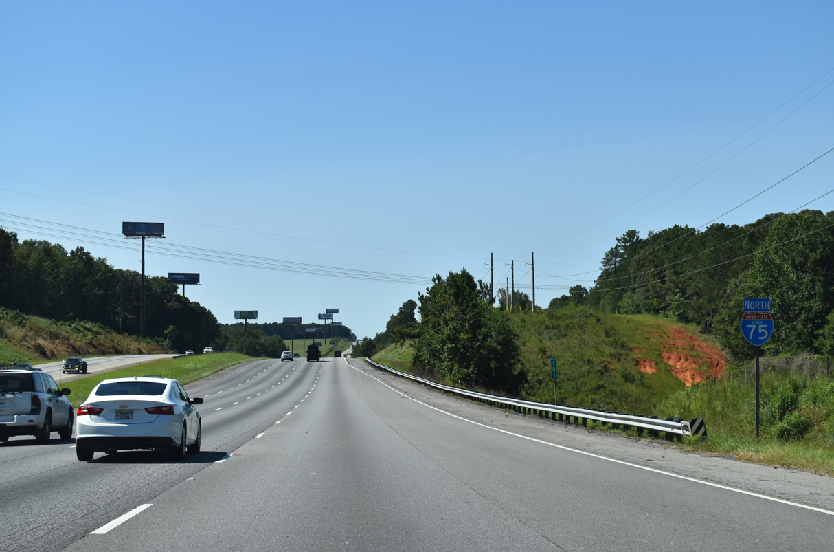
A transmission corridor crosses Interstate 75 north of the exchange with Rumble Road. The freeway undulates across timberland northwest to Forsyth.
09/06/20
Downtown Atlanta lies 62 miles north of Forsyth off I-75/85 (Downtown Connector).
09/06/20
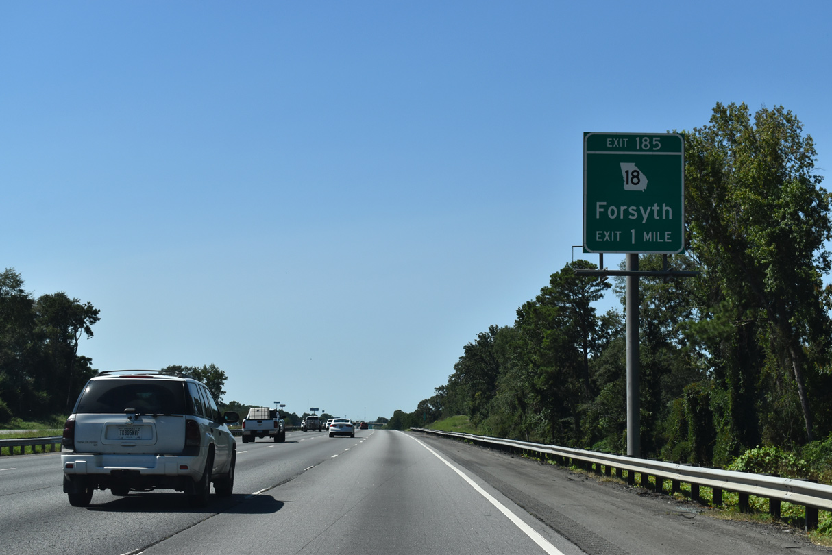
SR 18 (Dames Ferry Road), a 147.41 mile long route from U.S. 29 in West Point and U.S. 80 in Jeffersonville, meets I-75 on the outskirts of Forsyth.
09/06/20
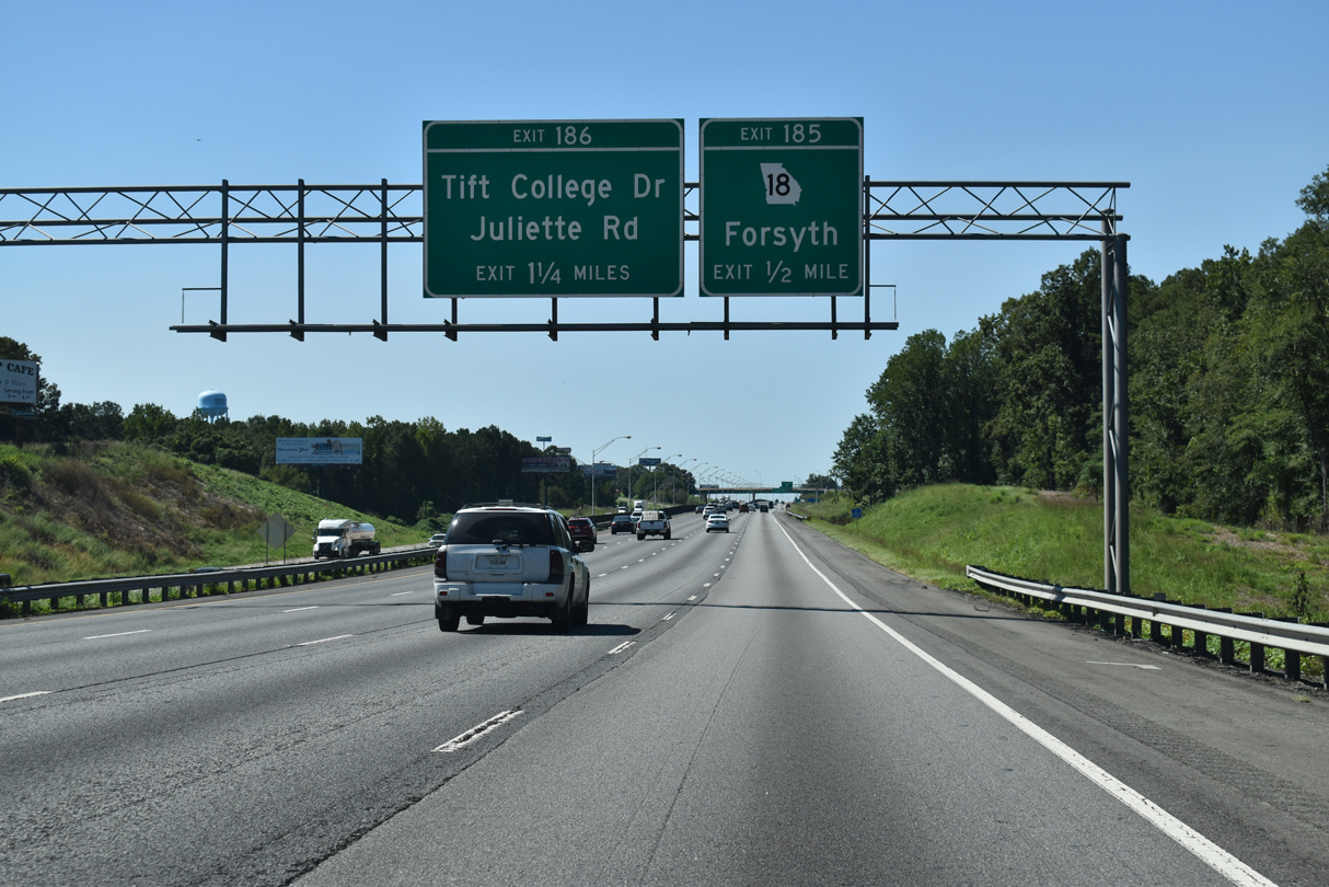
SR 18 (Dames Ferry Road) converges with Interstate 75 at a diamond interchange (Exit 185) in a half mile. Tift College Drive east and Juliette Road west come together at the ensuing exit.
09/06/20
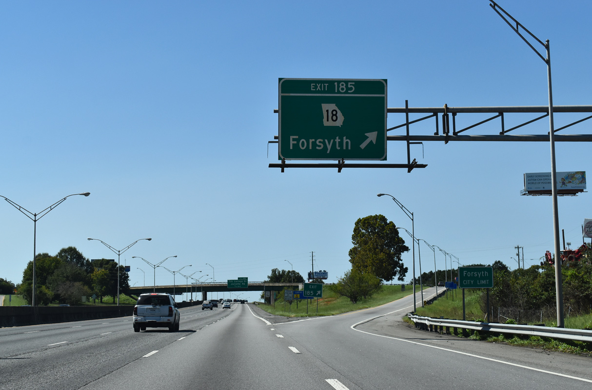
SR 18 (Dames Ferry Road) west combines with U.S. 41/SR 19 (Brooklyn Avenue) north into Downtown Forsyth. SR 18 overlaps with U.S. 41, 16.6 miles to Barnesville before leaving for Zebulon. SR 18 (Harold G. Clarke Parkway) east travels to Lake Juliette, Dames Ferry and U.S. 129 at Gray.
09/06/20
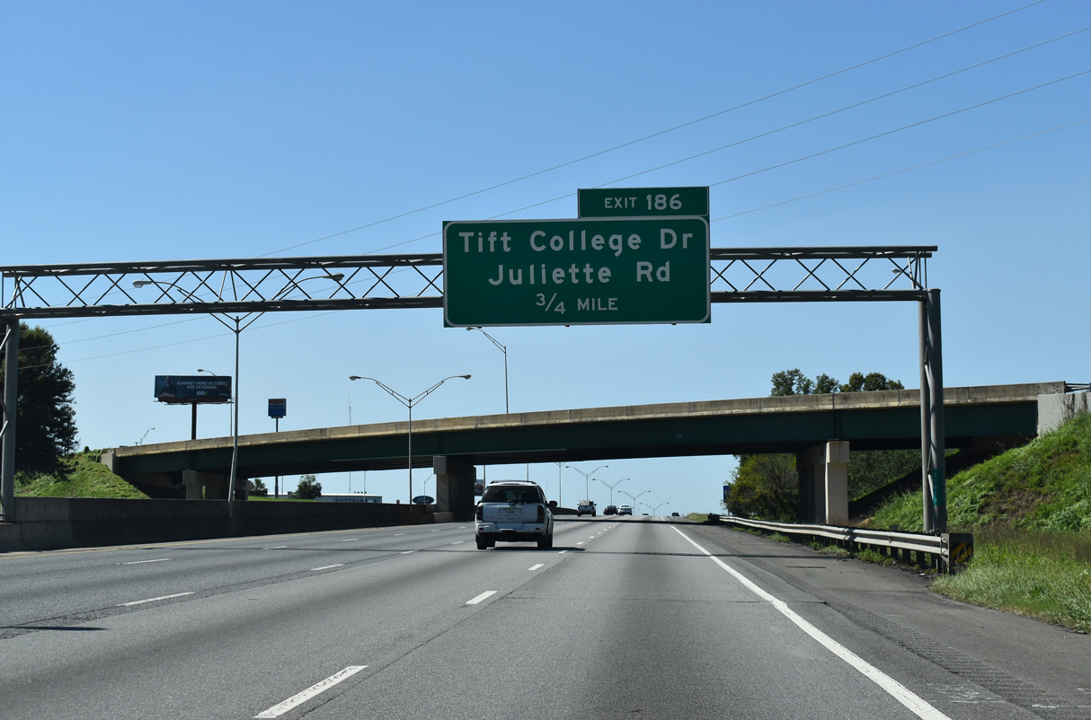
Tift College Drive leads west from Exit 186 to Tift College, becoming Johnston Street at Railroad Avenue en route to Downtown Forsyth.
09/06/20
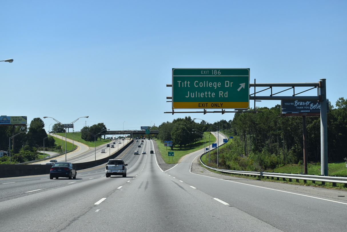
Juliette Road continues 9.2 miles northeast from I-75 into rural Monroe County and the community of Juliette. The diamond interchange at Exit 186 was originally a parclo with a loop ramp from I-75 northbound.
09/06/20
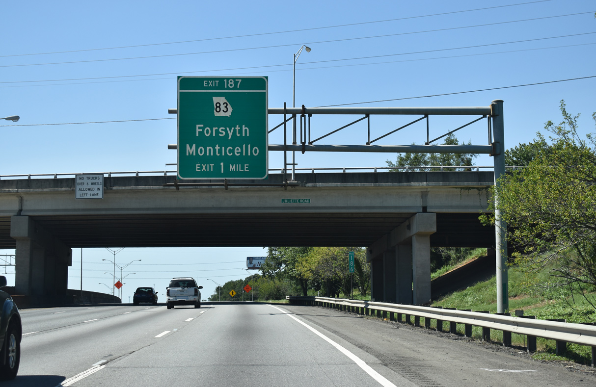
Meeting I-75 north next is SR 83, a 86.44 mile long route between U.S. 341 and U.S. 78 through Forsyth, Monticello and Madison.
09/06/20
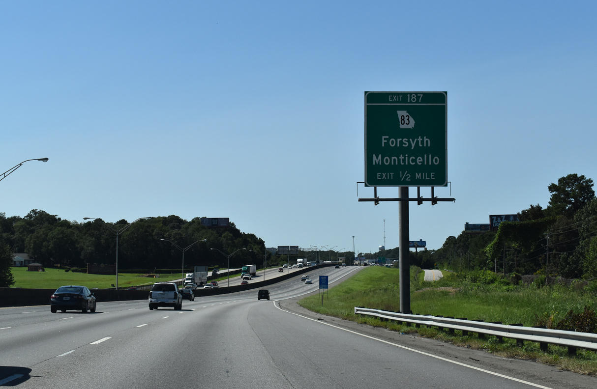
Frontage roads accompany both sides of Interstate 75 north to the diamond interchange (Exit 187) with SR 83 (Cabaniss Road).
09/06/20
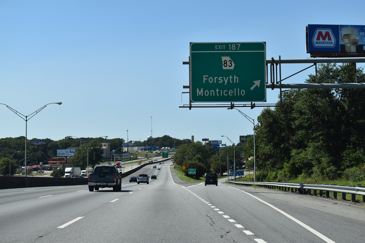
SR 83 (Cabaniss Road) heads south onto Lee Street, joining SR 42 for 0.40 miles to U.S. 41/SR 18 in Downtown Forsyth. Northeast from Exit 187, SR 18 travels 25.3 miles to the Jasper County seat of Monticello.
09/06/20
SR 42 (Lee Street) branches northwest from SR 83 (Cabaniss Road) and runs alongside I-75 to Exit 188.
09/06/20
The Forsyth city limits spread northward along Interstate 75 to Exit 188.
09/06/20
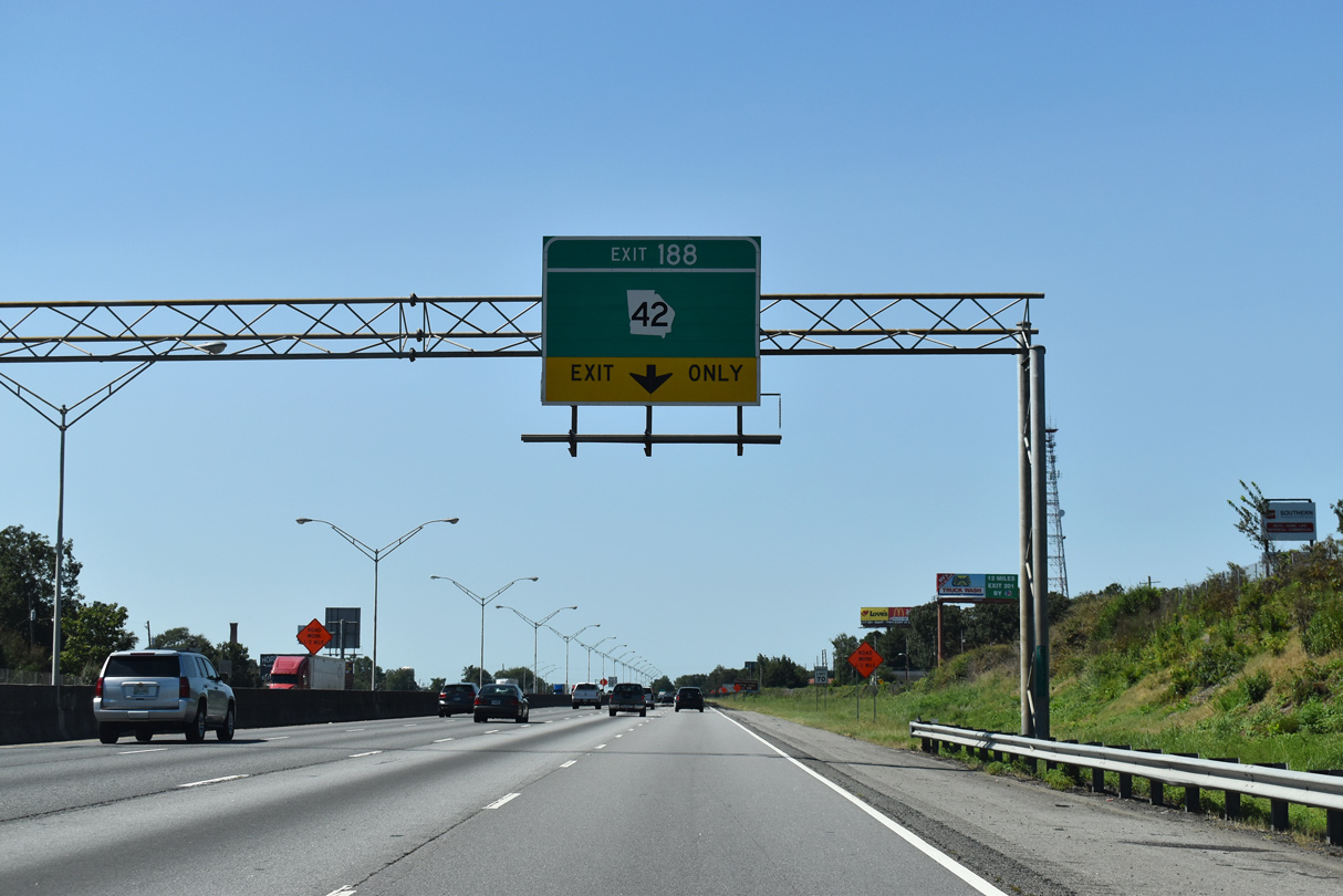
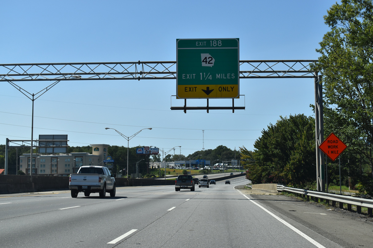
SR 42 turns north from Lee Street and Collier Road through a parclo interchange (Exit 188) with Interstate 75.
09/06/20
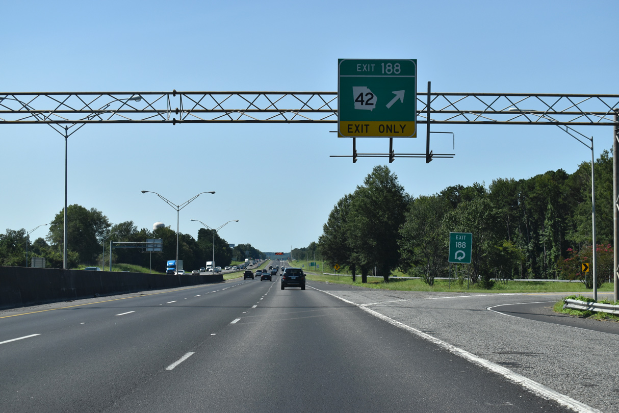
A lane drop at Exit 188 reduces I-75 to six overall lanes. SR 42 runs 16.1 miles north to U.S. 23 via Indian Springs. SR 42 overlaps with U.S. 23 northward to Jackson and Locust Grove, concluding a 115.06 mile route that started in Byron at SR 13.
09/06/20
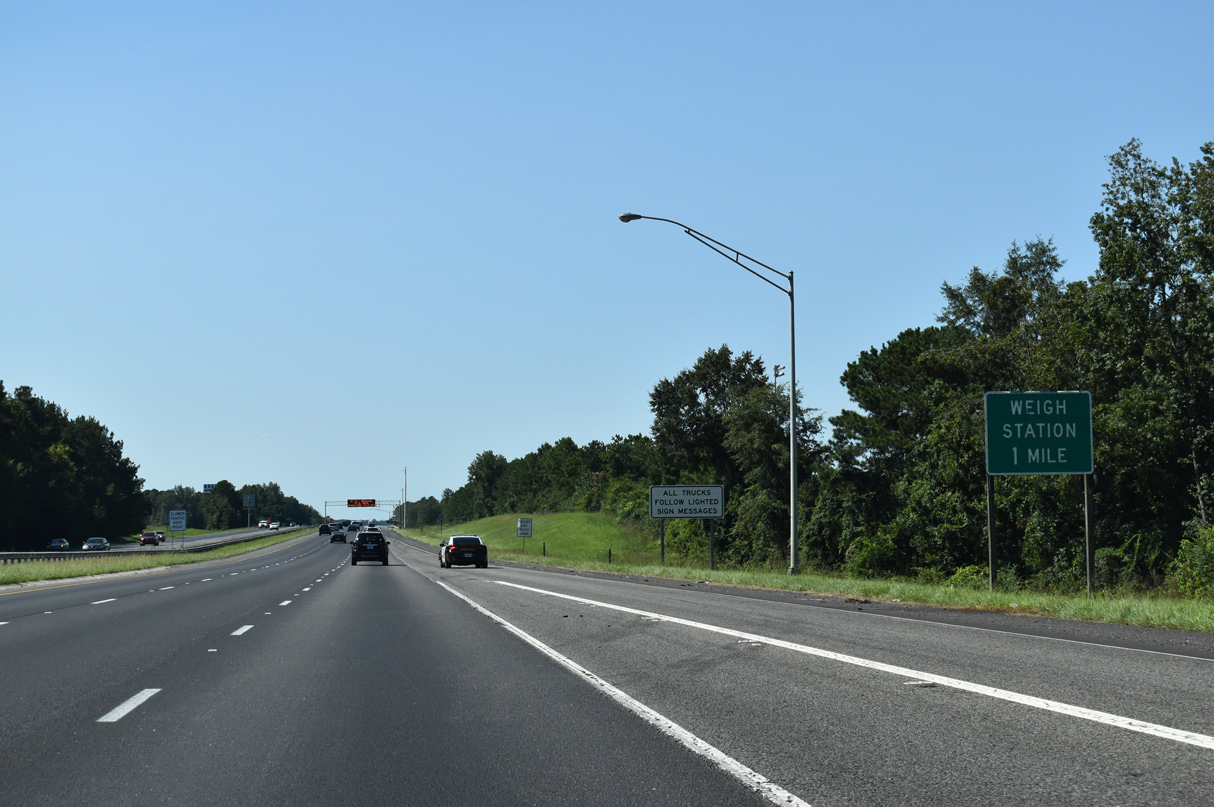
Interstate 75 passes by the Georgia Public Safety Training Center campus ahead of a weigh station for commercial trucks.
09/06/20
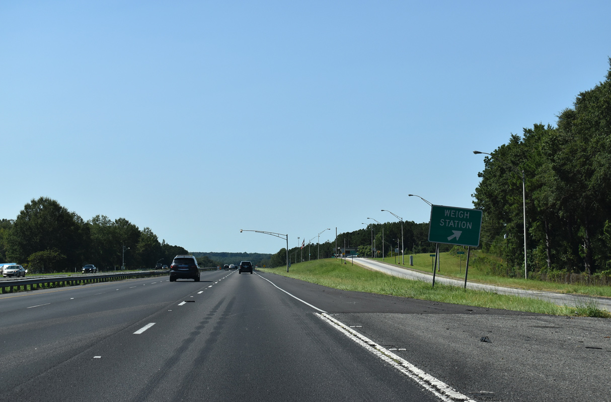
Weigh stations operate in both directions of I-75 north of the Forsyth city line.
09/06/20
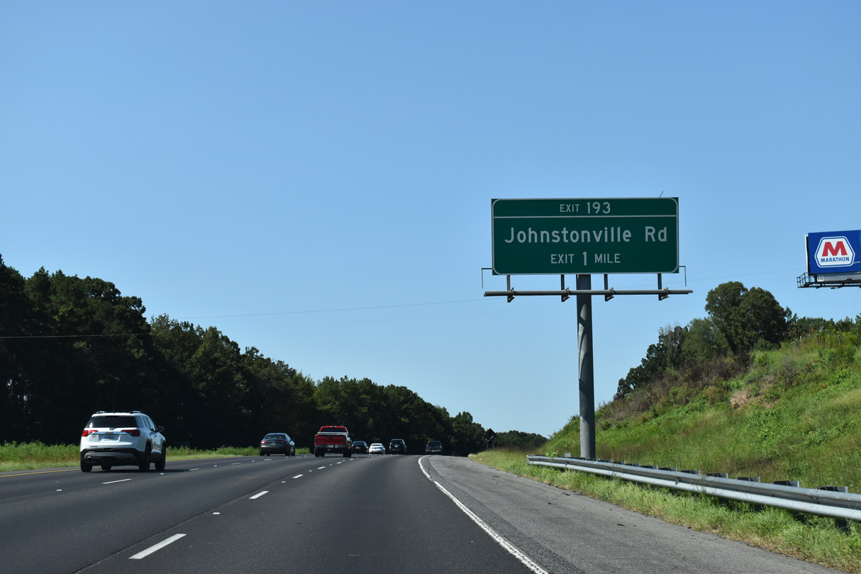
The roadways of Interstate 75 separate at Red Creek, one mile from the diamond interchange (Exit 193) with Johnstonville Road.
09/06/20
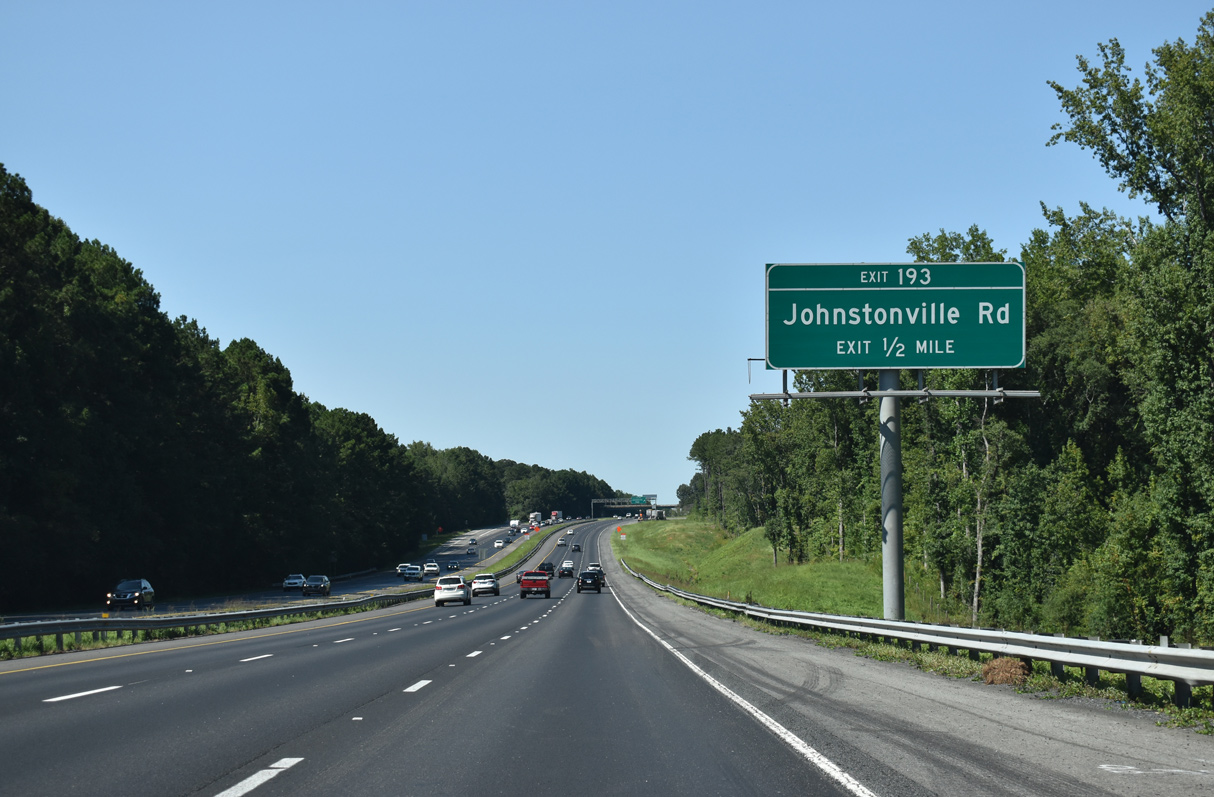
Johnstonville Road leads 3.5 miles east from Exit 193 to the River Forest golf course community and SR 42.
09/06/20
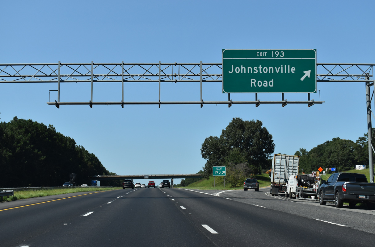
West from I-75, Johnstonville Road continues 9.3 miles to the Lamar County city of Barnesville.
09/06/20
Interstate 75 shifts westward on the ensuing stretch across the Little Towaliga River.
09/06/20
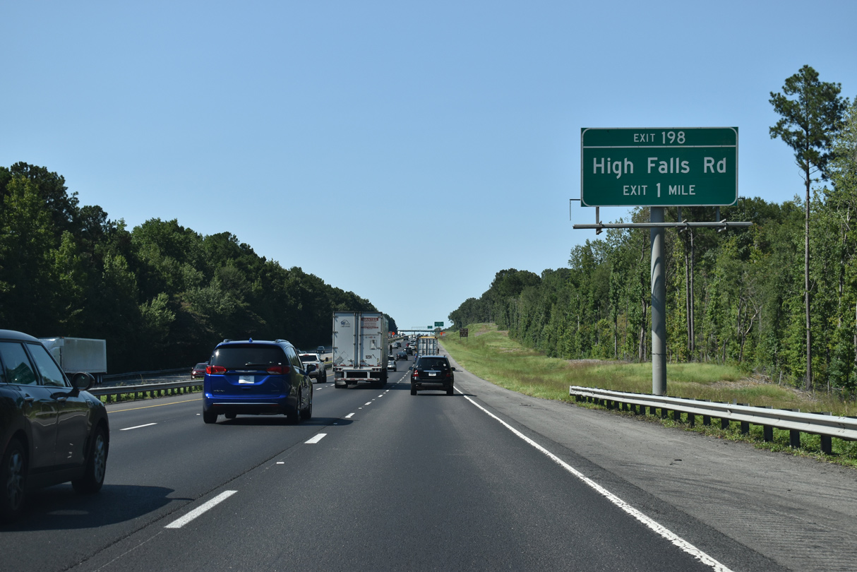
High Falls Road arcs 10.64 miles northeast from the Lamar County state line at Exit 198 to High Falls State Park, High Falls Lake and SR 36 in Butts County.
09/06/20
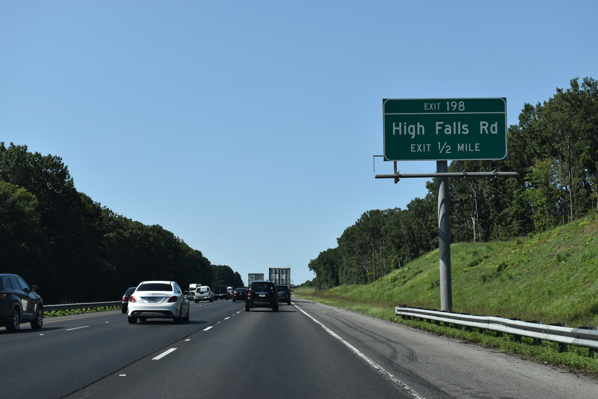
West into Lamar County, Highfalls Park Road continues High Falls Road west 4.49 miles to Unionville and SR 36 near Liberty Hill.
09/06/20
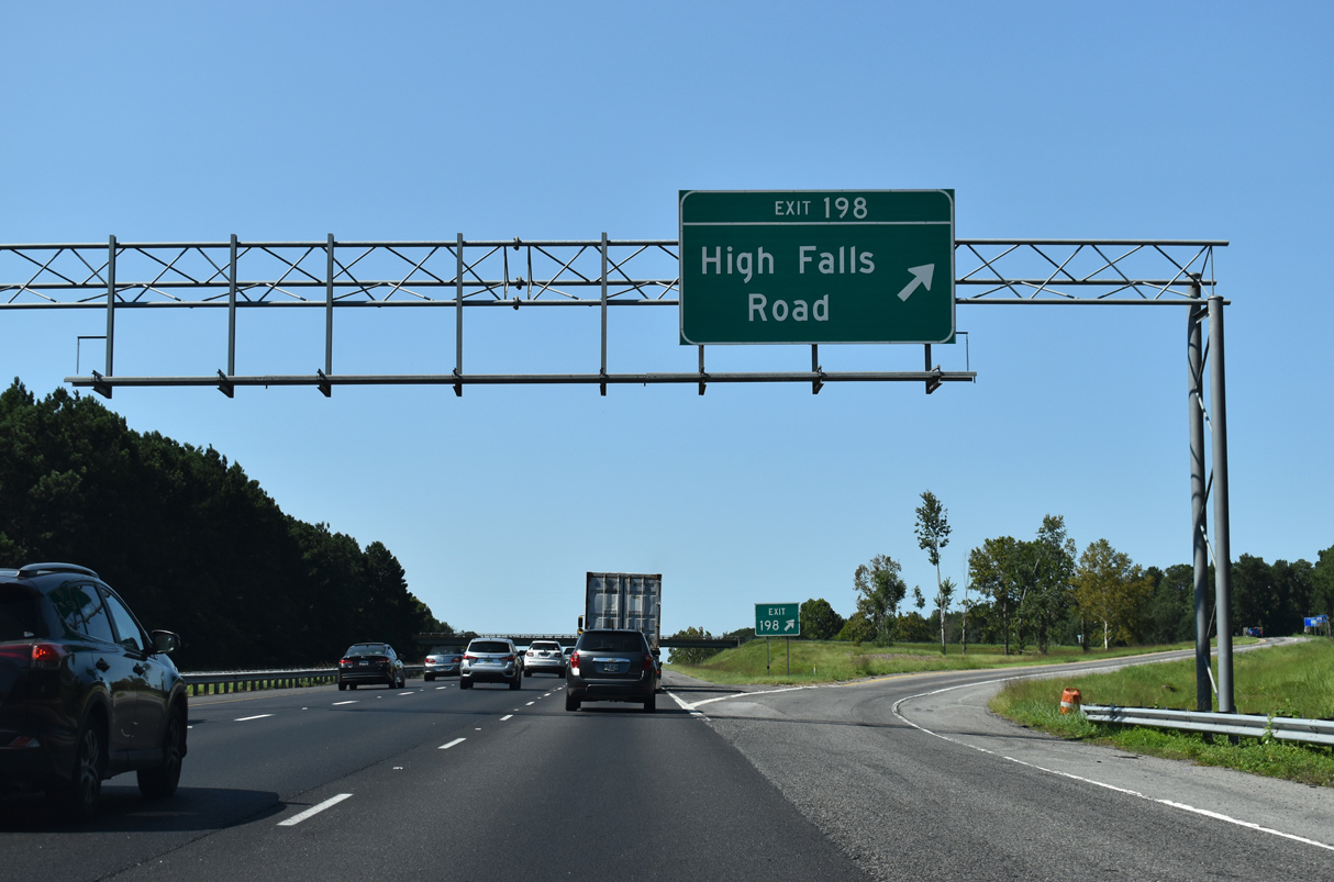
Entering the diamond interchange (Exit 198) with High Falls Road along Interstate 75 north.
09/06/20
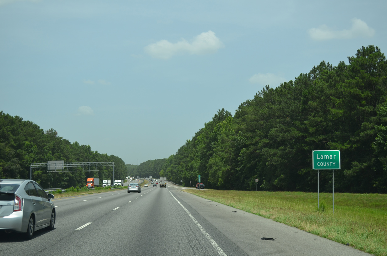
I-75 crosses the northeastern corner of Lamar County between Exits 198 and 201.
07/02/14
Interstate 75 straddles western reaches of High Falls Lake and Buck Creek through Lamar County.
06/30/17
07/02/14

SR 36 crosses paths with Interstate 75 at Exit 201, 12.34 miles northeast from U.S. 41 outside Barnesville.
09/06/20
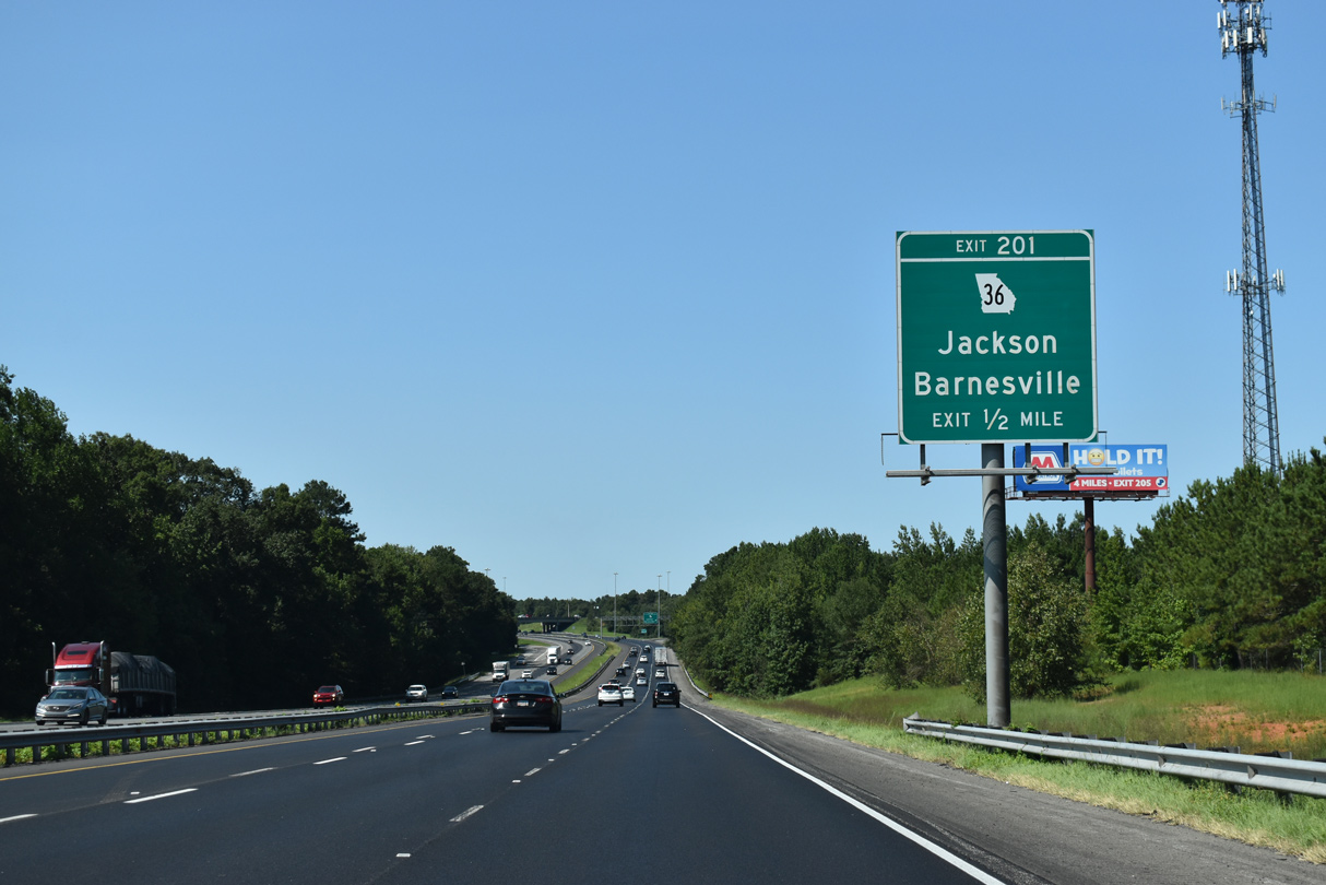
SR 36 constitutes a 95.13 mile long highway northeast from SR 208 near Waverly Hall to U.S. 278 in Covington.
09/06/20
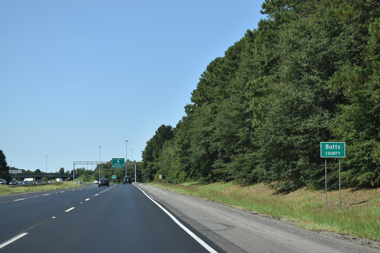
The diamond interchange (Exit 201) with SR 36 lies just north of the Butts County line.
09/06/20
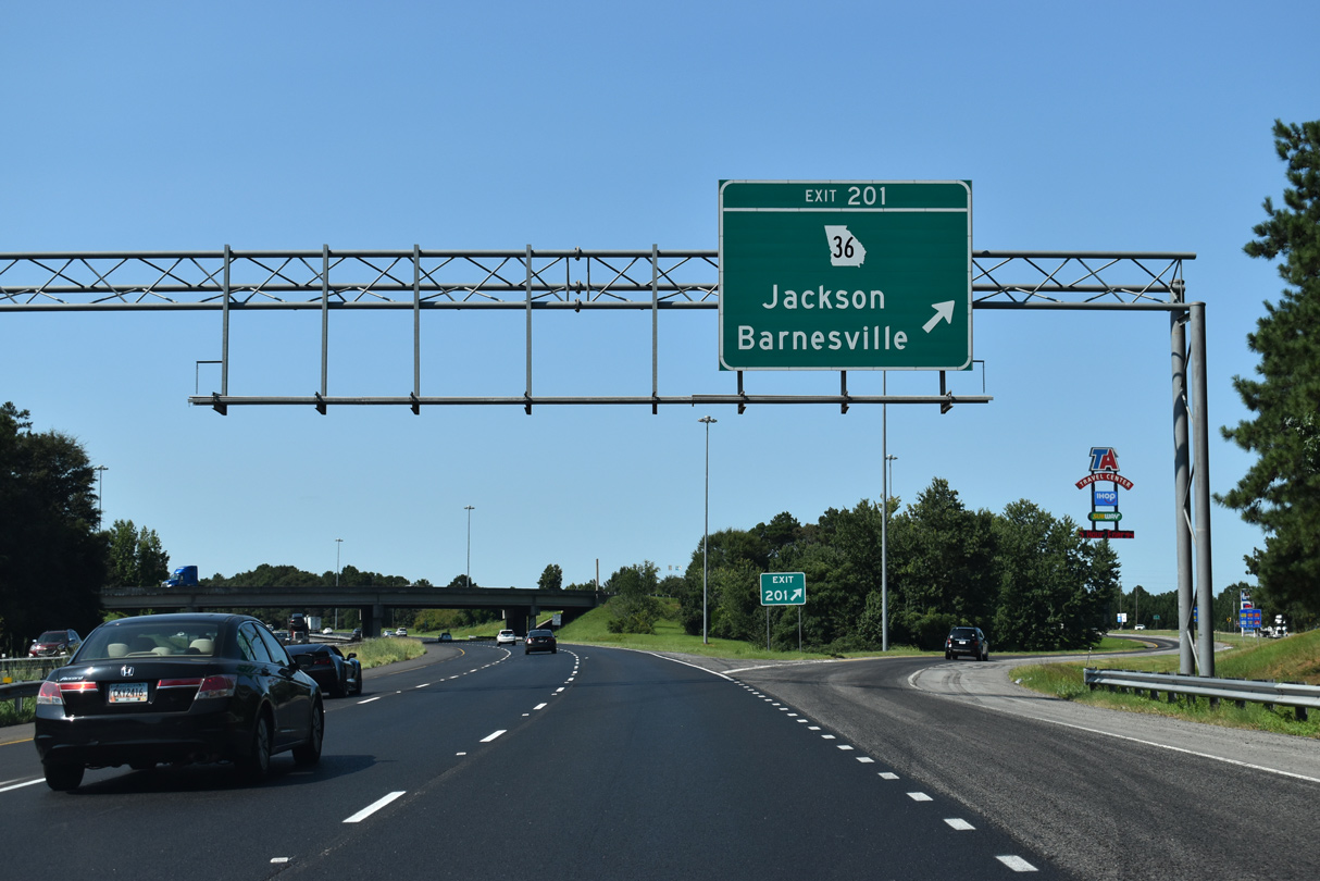
SR 36 expands to a four lane highway within the vicinity of Exit 201 by three truck travel centers. SR 36 continues 8.3 miles northeast to U.S. 23 in the Butts County seat of Jackson.
09/06/20
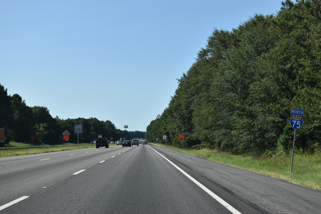
74,700 vehicles per day (vpd) were recorded on the stretch of Interstate 75 between Exits 201 and 205 in 2014.
09/06/20
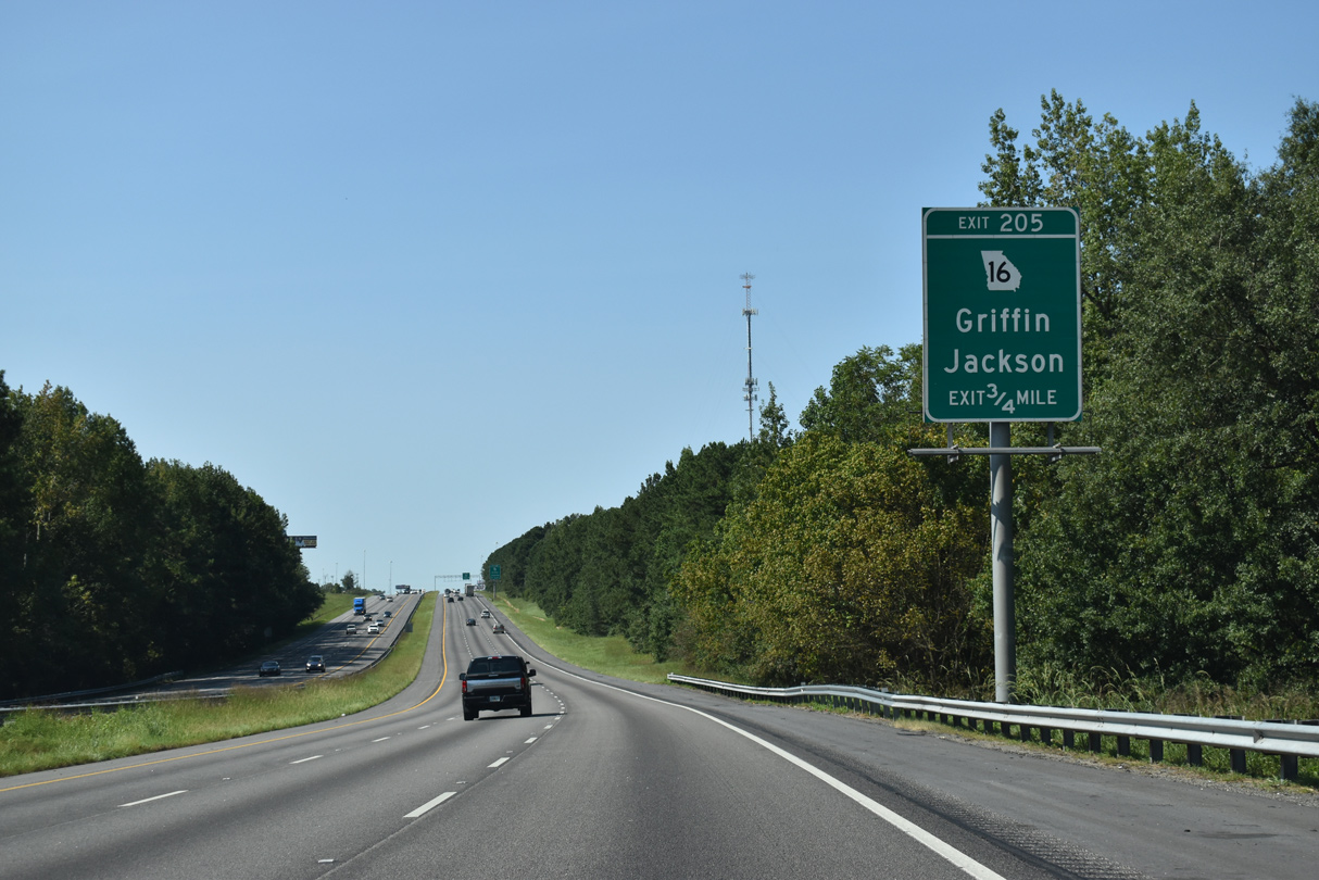
SR 16 (Arthur K. Bolton Parkway) represents the main route between Interstate 75 and the city of Griffin, 10.76 miles to the west. Arthur K. Bolton Parkway replaced a winding two lane alignment along Jackson Road between Broadway Street (SR 155) in Griffin and I-75.
09/06/20
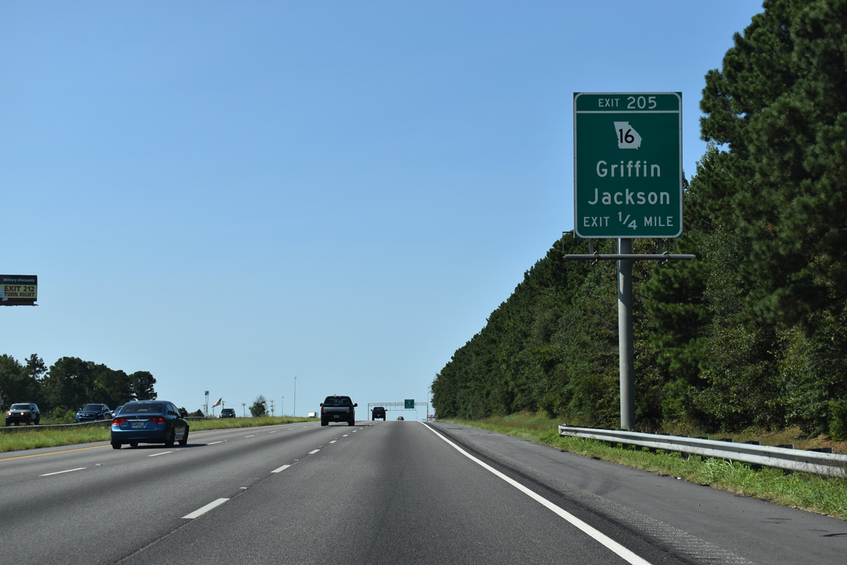
East from Exit 205, SR 16 progresses 8.3 miles to Downtown Jackson, where it combines with U.S. 23/SR 42 along 3rd Street.
09/06/20
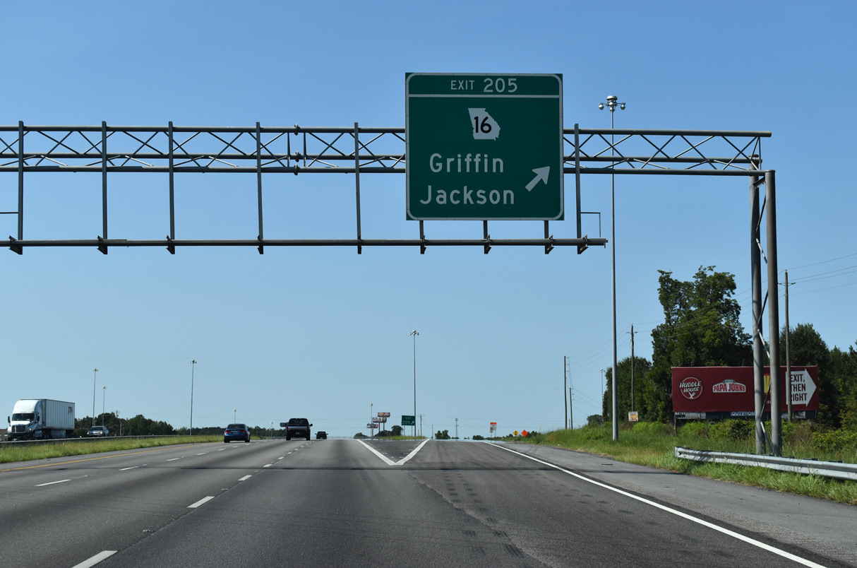
Interstate 75 north reaches the rural diamond interchange (Exit 205) with SR 16. Totaling 178.53 miles across north central Georgia, SR 16 originates from SR 100 near Mount Zion and concludes east at U.S. 278 in Warrenton.
09/06/20
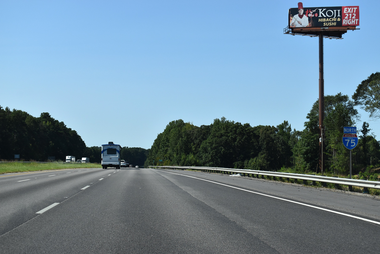
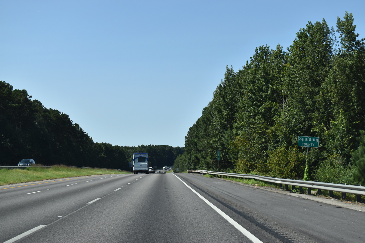
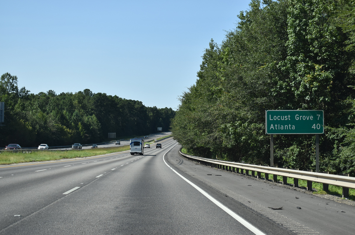
Interstate 75 passes through the eastern wedge of Spalding County on the seven mile drive to Locust Grove.
09/06/20
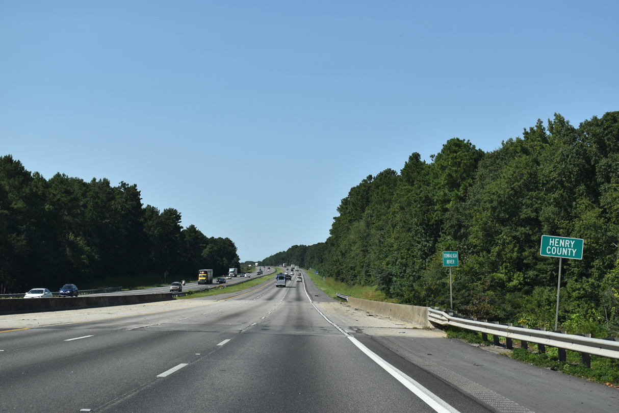
The Towaliga River represents the Henry / Spalding County line across I-75 as it flows southward to High Falls Lake.
09/06/20
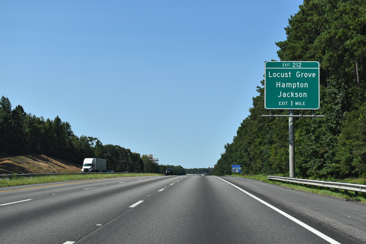
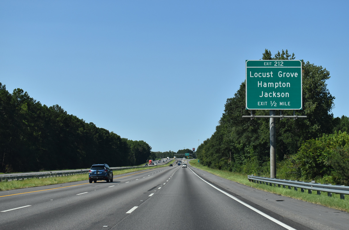
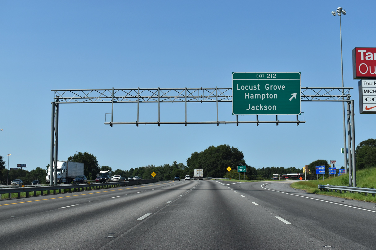
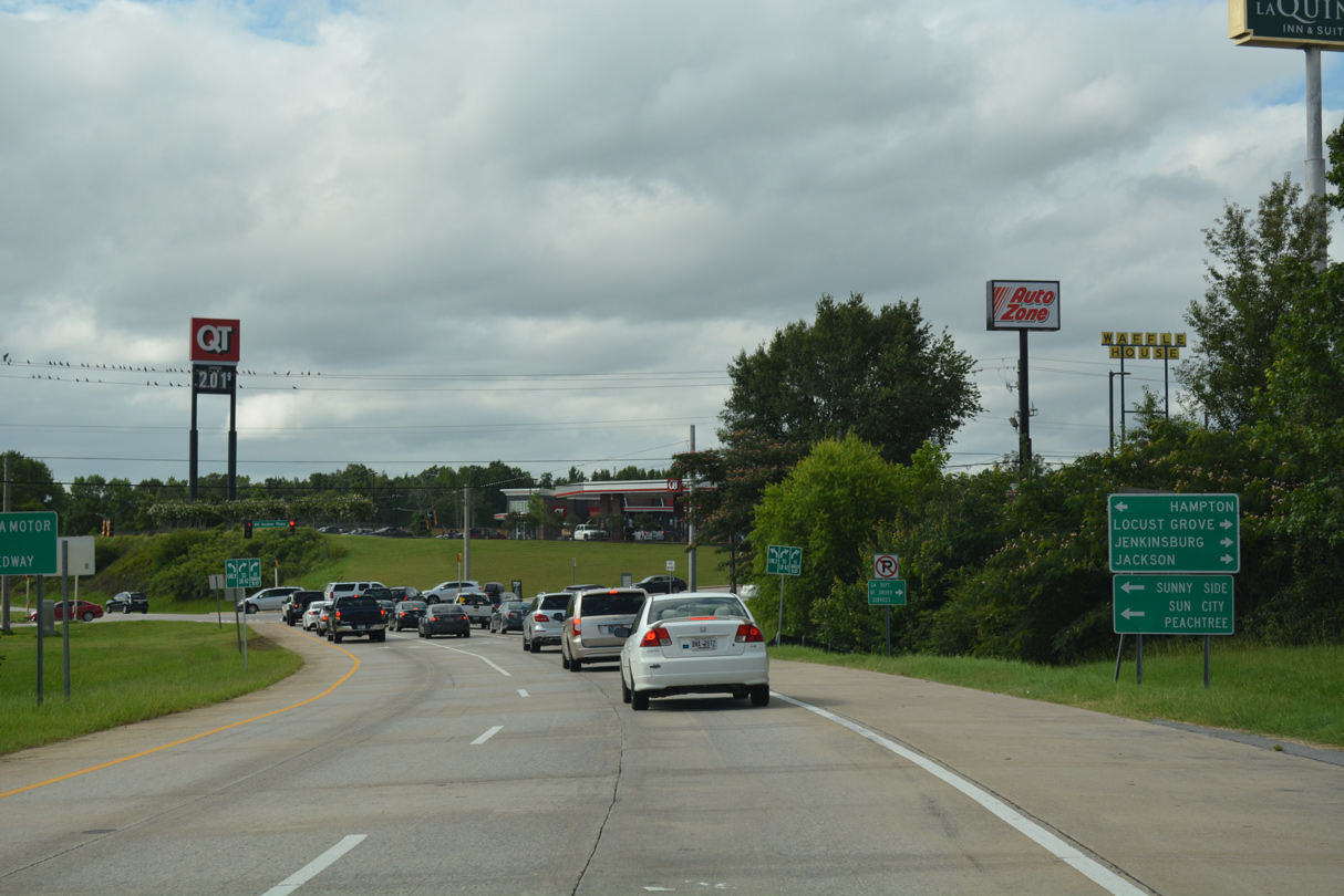
A diamond interchange (Exit 212) connects Interstate 75 with Bill Gardner Parkway in the city of Locust Grove. The bedroom community doubled in population between 2000 and 2015.
09/06/20
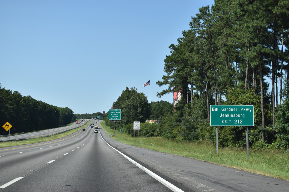
Bill Gardner Parkway links Interstate 75 with U.S. 23/SR 42 southeast to Jenkinsburg.
09/06/20
Bill Gardner Parkway along with Hampton Locust Grove Road lead 9.2 miles west to the city of Hampton. The parkway comprises a commercial arterial 0.6 miles east to U.S. 23/SR 42.
09/06/20
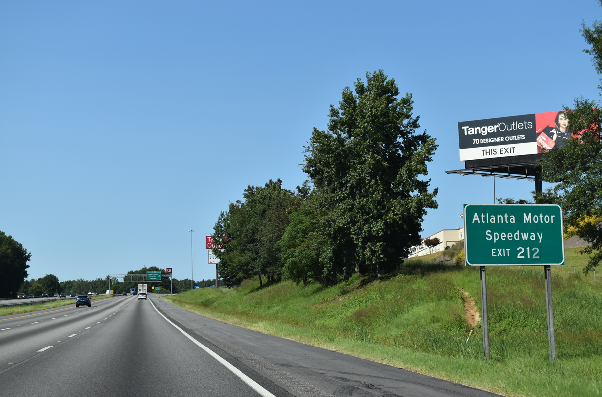
Bill Gardner Parkway west provides part of a route to Atlanta Motor Speedway. Hosting NASCAR Cup Series races annually, the track is located beyond the south end of SR 20 outside Hampton.
09/06/20
Exit 212 departs for Bill Gardner Parkway to U.S. 23. U.S. 23 leads south from Locust Grove back to Jackson and north paralleling I-75 toward McDonough.
09/06/20
06/30/17
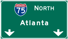

Photo Credits:
- ABRoads: 09/06/20, 05/06/22
- Brent Ivy: 07/02/14
- Alex Nitzman: 06/30/17
Page Updated Saturday September 17, 2022.