
Interstate 78 West - Bedminster Township to Phillipsburg

The entrance ramp from I-287 north adds a fourth lane on the left side of Interstate 78 westbound. A lane drop follows on the right.
07/26/24

Interstate 78 becomes vastly more rural west of I-287 through Bedminster Township.
07/26/24

The final Somerset County exit joins I-78 west with CR 665 (Rattlesnake Bridge Road) in one mile. Signs for Exit 26 reference CR 523 Spur, the former designation of CR 665.
07/26/24

CR 665 (Rattlesnake Bridge Road) constitutes a rural route north from Exit 26 to CR 523 at Lamington.
07/26/24
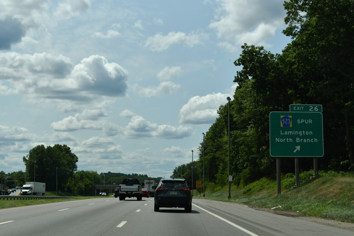
The 4.15 mile long route of CR 665 concludes south of Exit 26 at CR 614 in Branchburg Township, just west of North Branch.
07/26/24

Interstate 78 crosses the Lamington River into both Readington Township and Hunterdon County.
07/26/24
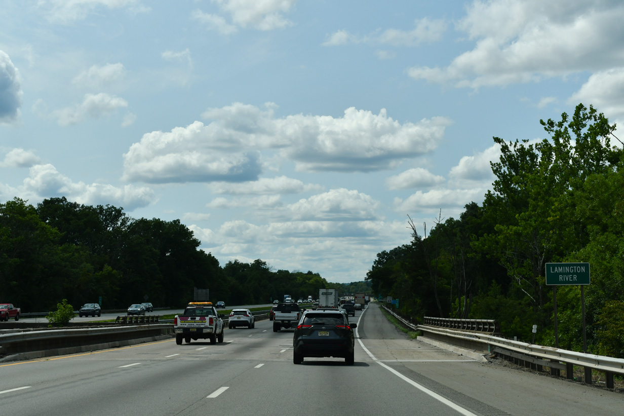
Interstate 78 crosses the Lamington River into both Readington Township and Hunterdon County.
07/26/24

One mile east of the diamond interchange (Exit 24) with County Route 523 (Oldwick Road) on Interstate 78 west.
07/26/24
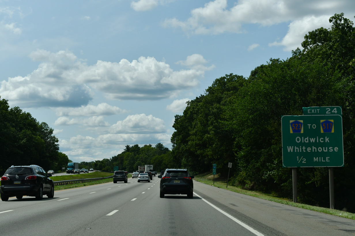
Westbound I-78 enters southern Tewksbury Township ahead of Exit 24 to CR 523 (Oldwick Road). CR 523 takes Oldwick Road north to Lamington Road east. There CR 517 commences north to Oldwick.
07/26/24
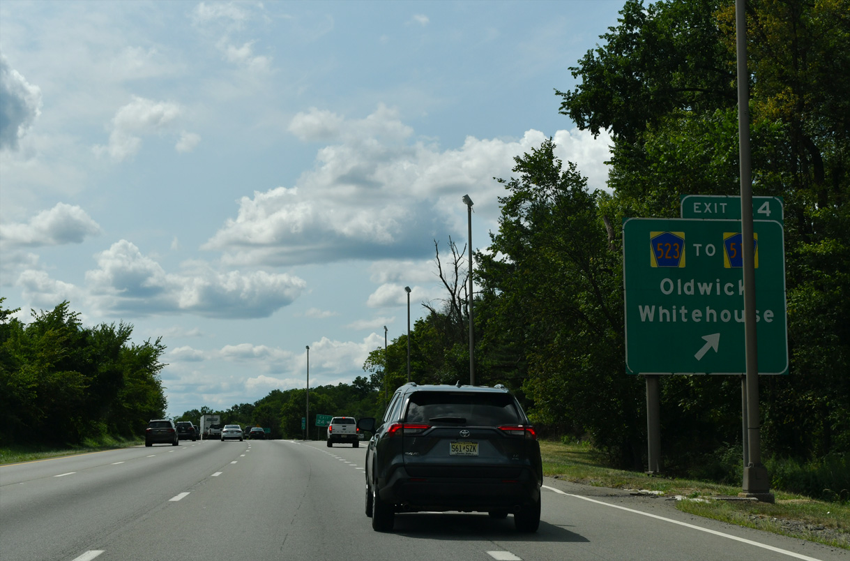
CR 523 (Oldwick Road) extends two miles south from Exit 24 by the UNICOM Science and Technology Park to U.S. 22 at Whitehouse.
07/26/24
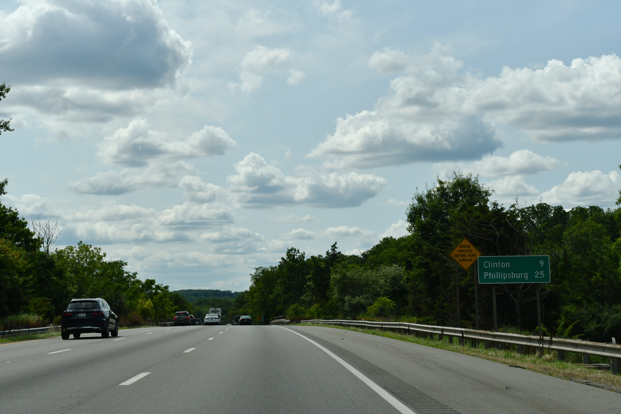
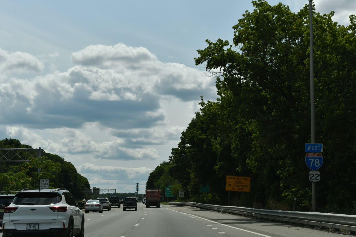
The town of Clinton is eight miles to the west, followed by Phillipsburg in 25 miles.
07/26/24

Interstate 78 winds west into Clinton Township, next meeting CR 639 at Exit 20 in the borough of Lebanon.
07/26/24
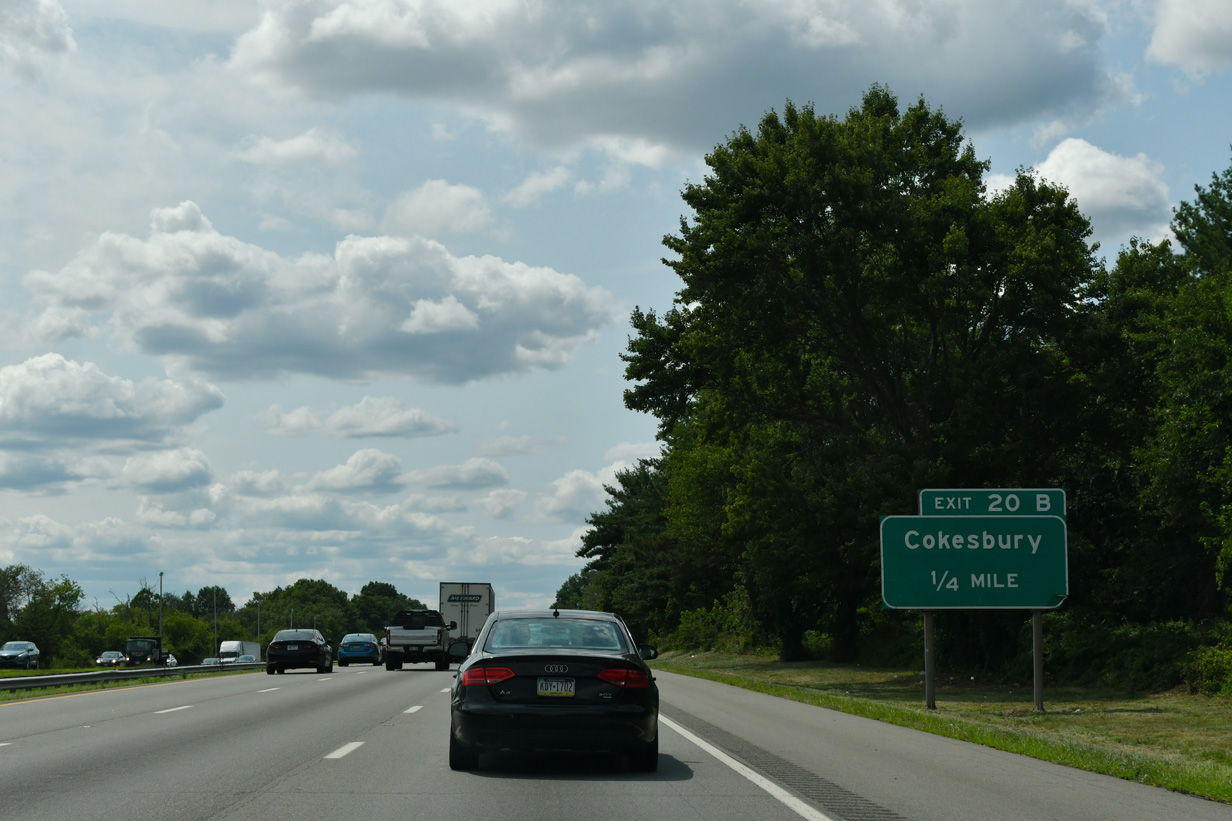
A partial interchange includes two ramps for CR 639 (Cokesbury Road) from I-78 west. Exit 20 B serves CR 639 north to Cokesbury.
07/26/24
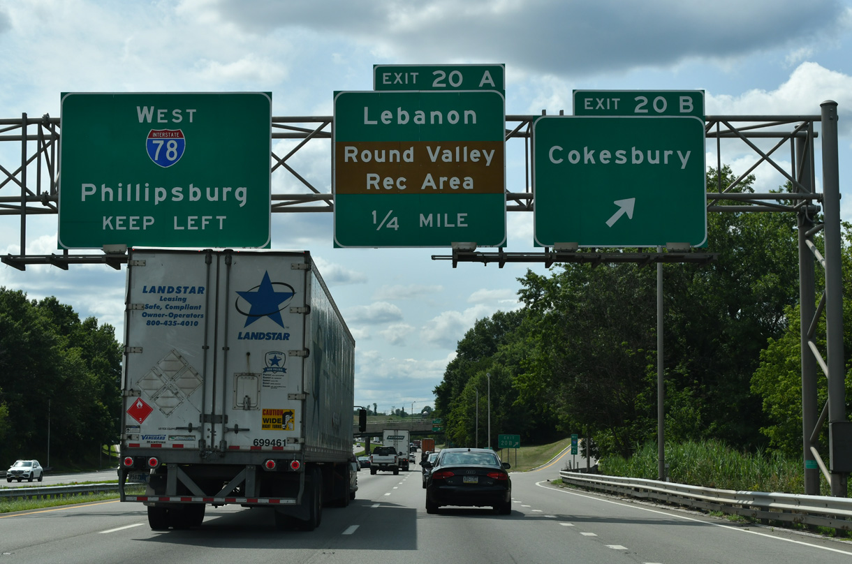
Exit 20 B departs I-78 west for CR 639 (Cokesbury Road) north. CR 639 runs 5.73 miles north to Cokesbury and west to High Bridge from U.S. 22 in Lebanon.
07/26/24

U.S. 22 parallels I-78 just to the south through Lebanon. CR 639 connects the two routes east of CR 751 south to Round Valley Recreation Area. Round Valley Reservoir, contained by Cushetunk Mountain, lies to the south of Lebanon. The 2,000 acre lake is approximately 180 feet deep, representing the deepest in the state (NJDEP, 2015).
07/26/24
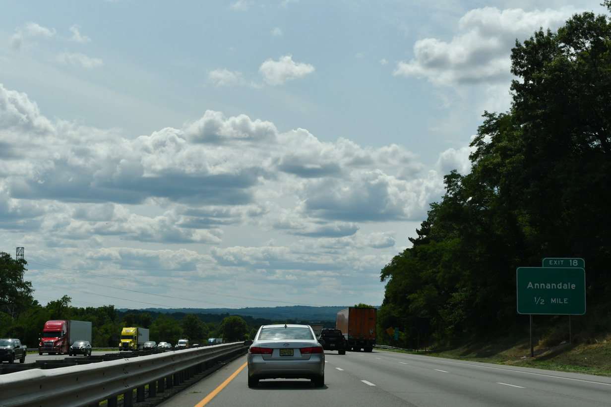
U.S. 22 and Interstate 78 proceed west from Lebanon to come together at a wye interchange (Exit 18) at Annandale.
07/26/24
Interstate 78 drops from around 450 above sea level to around 200 feet in the Town of Clinton over the next two miles.
10/01/05

Exit 18 joins Beaver Avenue (CR 626), the former alignment of U.S. 22, west through Annandale to Route 173 and Route 31 outside Clinton.
07/26/24
Traffic taking Exit 18 joins U.S. 22 west briefly before combines with Interstate 78 through Clinton.
07/26/24

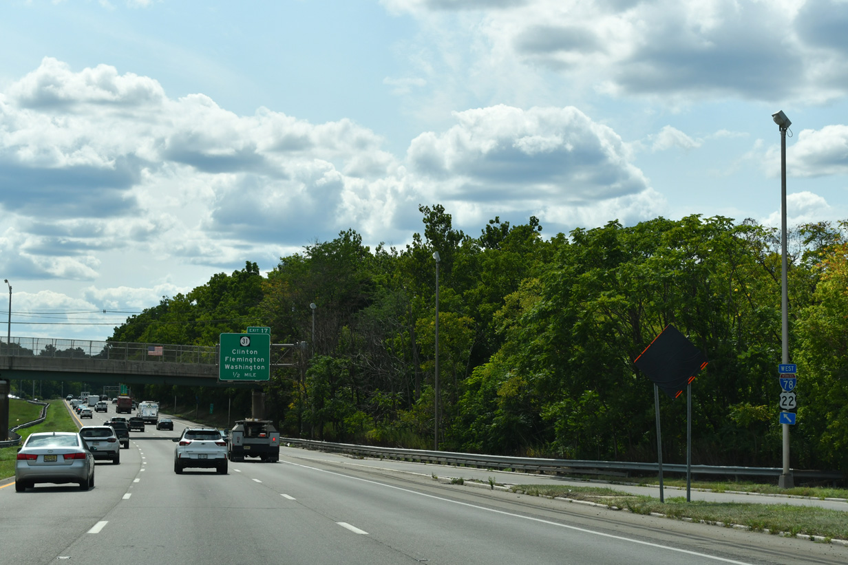
The lane gained from U.S. 22 west defaults onto Exit 17 for Route 31 north to High Bridge, Glen Gardner and Hampton.
07/26/24
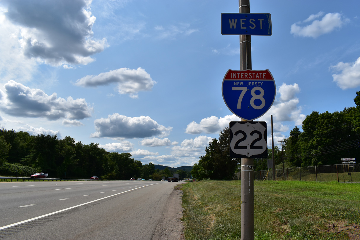
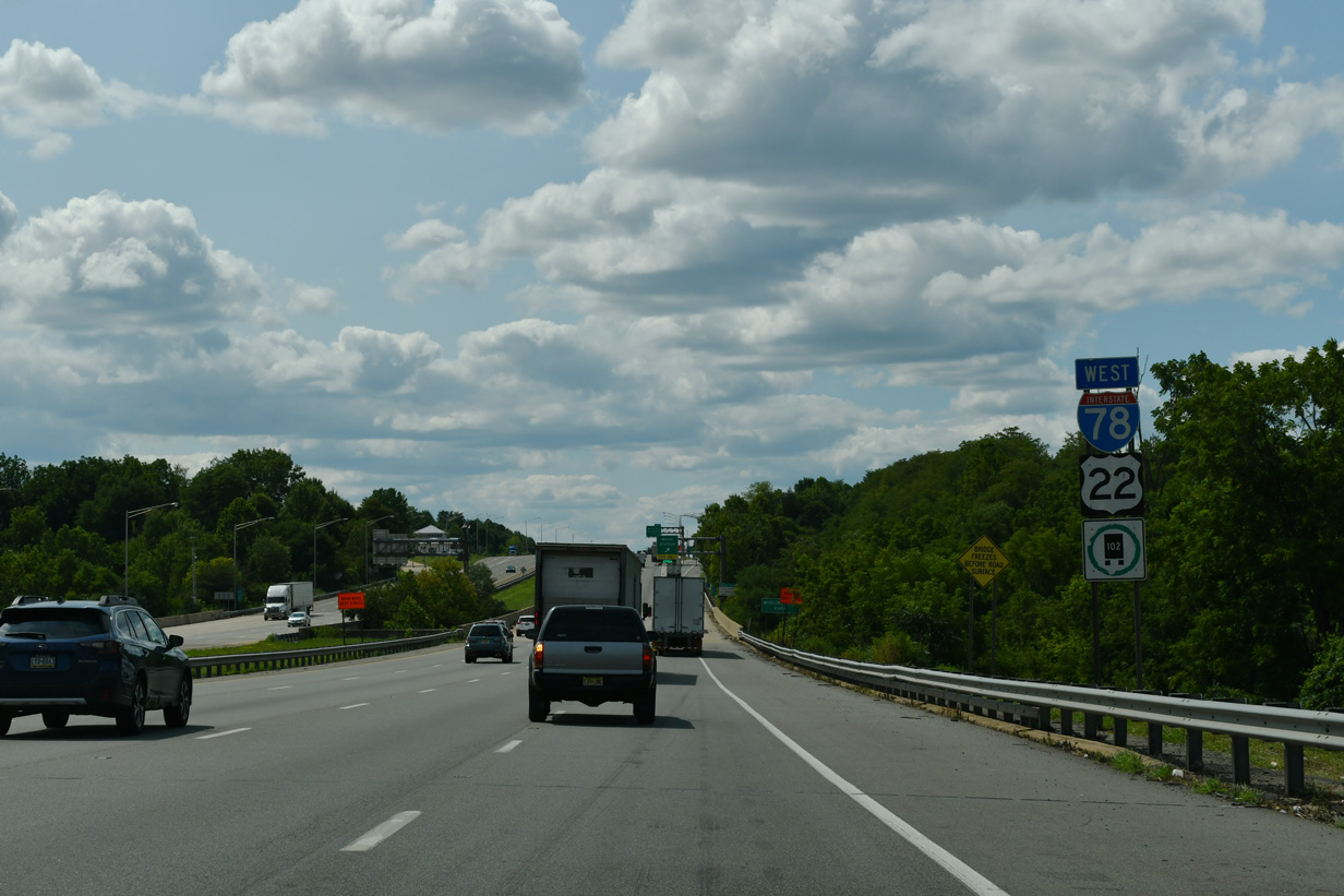
I-78/U.S. 22 overlap 14.3 miles west to Greenwich Township.
07/26/24

Route 31 travels 48.93 miles from Trenton north to U.S. 46 at Buttzville. The state route combines with U.S. 202 at Flemington to the south while traveling ten miles to the borough of Washington to the north.
07/26/24

Exit 17 joins Route 31 north ahead of an interchange with Route 173 and CR 626 (Beaver Street). Motorists bound for Route 31 south are directed to U-turn at Route 173 for Flemington.
07/26/24
I-78/U.S. 22 confirming markers posted between the wye interchange (Exit 16) with adjacent Route 173 and Beaver Brook.
07/26/24
Beginning at the exchange joining Route 31 and CR 626, Route 173 leads west along former U.S. 22 through Clinton. An entrance ramp beyond Village Road connects the state route with I-78/U.S. 22 west ahead of the town line.
07/26/24

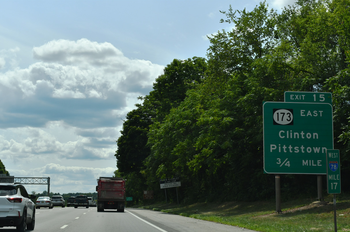
Route 173 (Main Street) ties into I-78/U.S. 22 at a parclo interchange (Exit 15) with County Route 513 (Pittstown Road) just west of the Raritan River South Branch.
07/26/24

Hunterdon County Route 513 overlaps with Route 173 (Main Street) through Clinton. Emerging at Exit 15, CR 513 heads south along the Franklin / Union Township line to Pittstown.
07/26/24
Route 173 briefly joins I-78/U.S. 22 west where the freeway overtakes the original U.S. 22 alignment.
07/26/24

Easton, Pennsylvania debuts on westbound distance signs at 16 miles out.
07/26/24
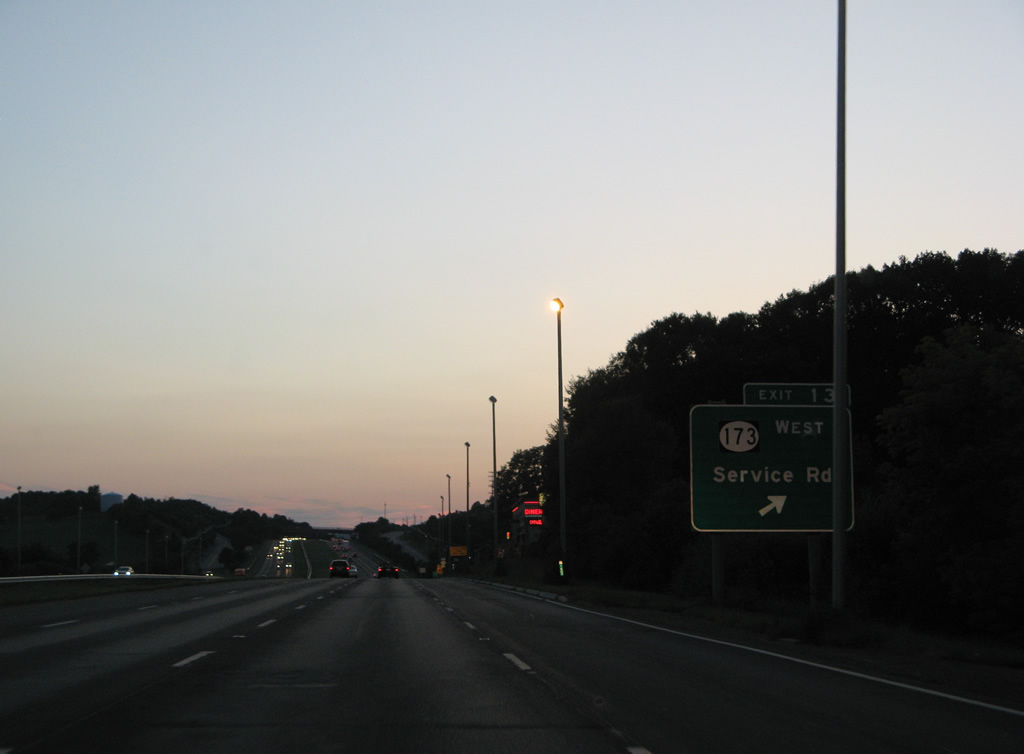
This guide sign for Route 173 in Union Township has been missing since 2019.
08/04/07
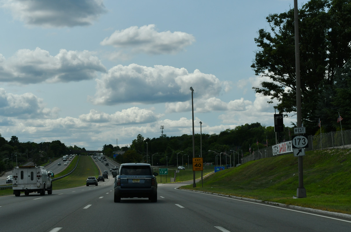
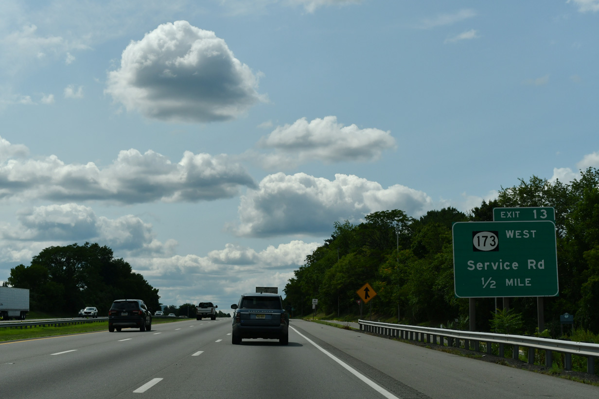
Route 173 separates from I-78/U.S. 22 west at a half diamond interchange (Exit 13) and follows the north service road to Perryville.
07/26/24
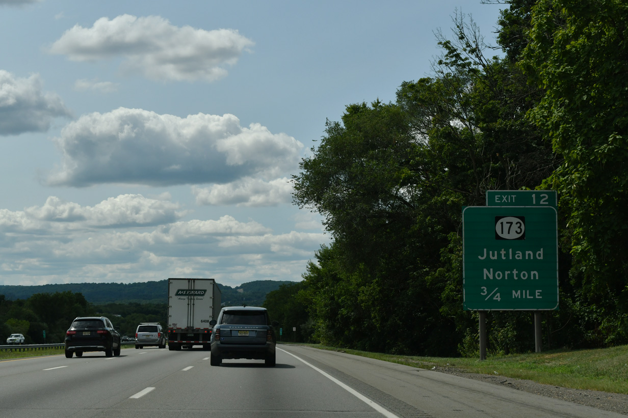
A modified diamond interchange (Exit 12) connects Route 173 and the south Frontage Road with I-78/U.S. 22 at Perryville.
07/26/24

CR 625 south and CR 635 north meet at Route 173 in Perryville. CR 635 arcs northeast 6.31 miles to Norton, Charlestown and the borough of Hampton.
07/26/24
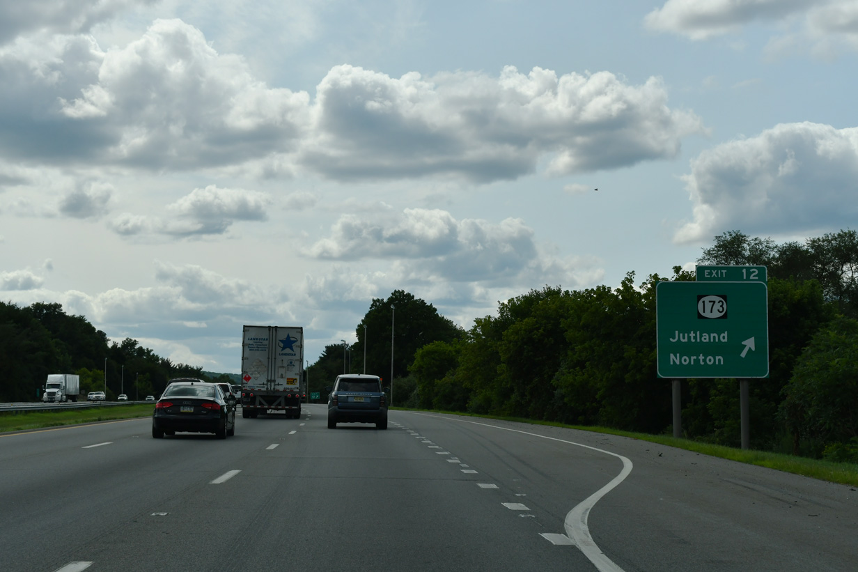
Exit 13 departs for adjacent Route 173 west ahead of CR 625 south to CR 579 at Mechlin Corner. Perryville Road branches southeast from CR 625 nearby to the settlement of Jutland.
07/26/24
I-78/U.S. 22 turn more northerly toward Musconetcong Mountain.
07/26/24

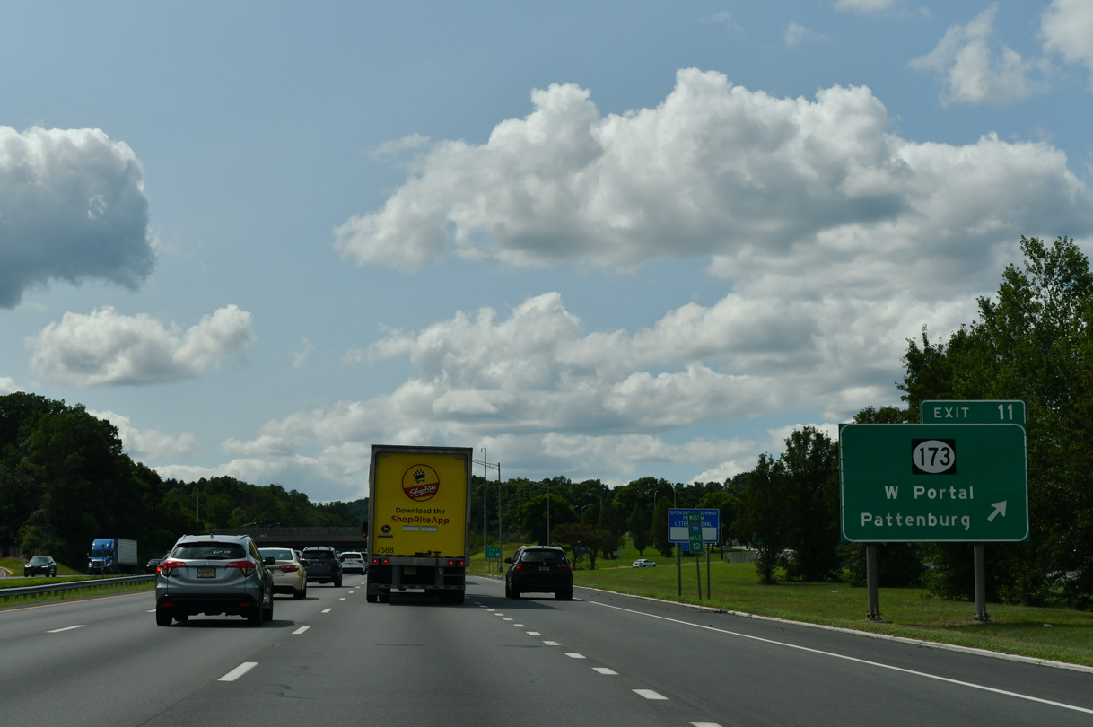
Route 173 remains alongside I-78/U.S. 22 west to a modified diamond interchange (Exit 11) at CR 614 (Pattenburg Road)
07/26/24

Westbound I-78 spans Mulhockaway Creek on the half mile preceding Exit 11 with Route 173. CR 614 stems southwest 7.70 miles from a traffic circle with Route 173 to Pattenburg, Little York and CR 519 at Spring Mills.
07/26/24
Route 173 branches away from the freeway between Exit 11 and West Portal across Musconetcong Mountain.
07/26/24

Reaching a summit of over 800 feet above sea level, I-78/U.S. 22 navigate through a series of S-curves across Musconetcong Mountain.
07/26/24

A set of rest areas line both sides of the freeway on the north slope of Musconetcong Mountain.
07/26/24

Route 173 returns alongside I-78/U.S. 22 from West Portal to meet the freeway at Exit 7 just beyond the rest area.
07/26/24

I-78/U.S. 22 lower into the borough of Bloomsbury and Musconetcong Valley at Exit 7 with Route 173 (Clinton street).
07/26/24
Route 173 acts as a business loop for I-78 through Bloomsbury, returning to the freeway at Exit 3.
07/26/24
I-78/U.S. 22 cross the Musconetcong River and Warren County line ahead of a half diamond interchange (Exit 6) with Bloomsbury Road (CR 632).
07/26/24

Westbound I-78 nips the southern corner of Franklin Township ahead of the weigh station and Greenwich Township line.
07/26/24
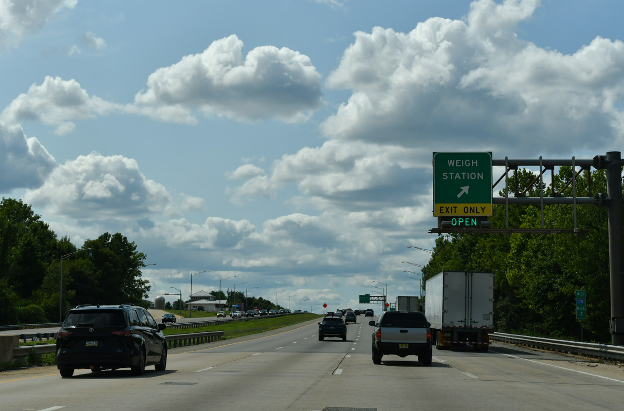
The weigh stations west of the Musconetcong River were constructed in 2004/05.
07/26/24
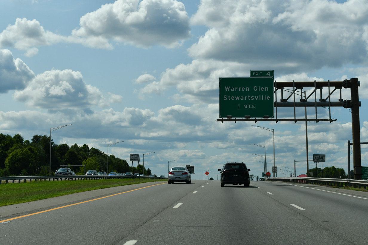
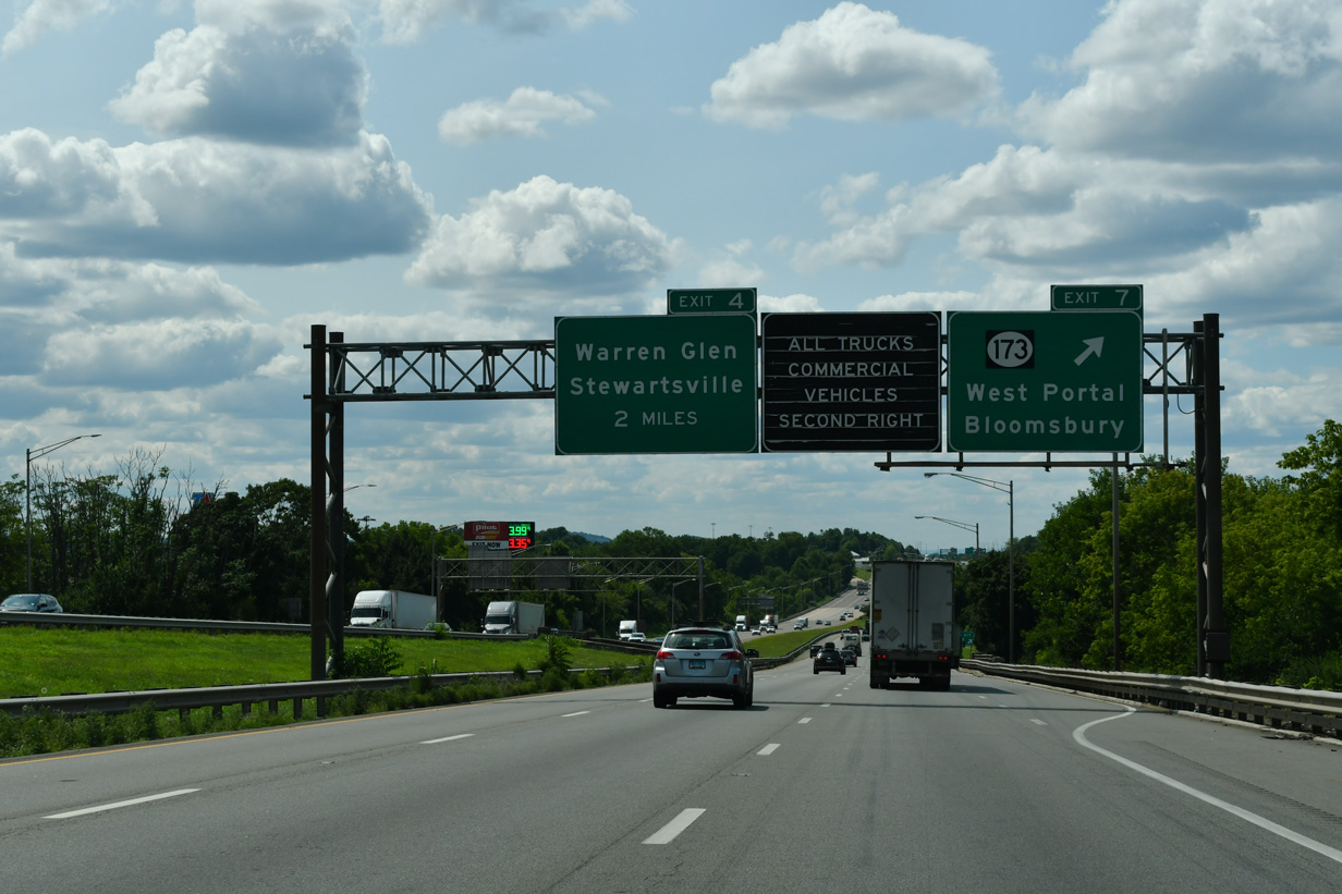
CR 637 meanders northward from CR 639 (Warren Glen Road) to meet I-78/U.S. 22 at a half diamond interchange (Exit 4) in one mile.
07/26/24

U.S. 22 leaves Interstate 78 in two miles for Phillipsburg. The two routes reconvene west of Allentown, Pennsylvania. CR 637 continues north from Exit 4 to Stewartsville, Route 57 and CR 519 in Lopatcong Township.
07/26/24
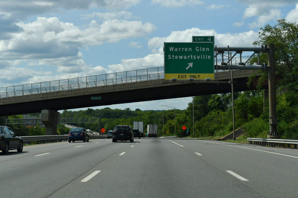
New Village Road spans I-78/U.S. 22 west at Exit 4 to CR 637 (Main Street). Warren Glen lies southwest of Silver Hill via CR 639 west.
07/26/24
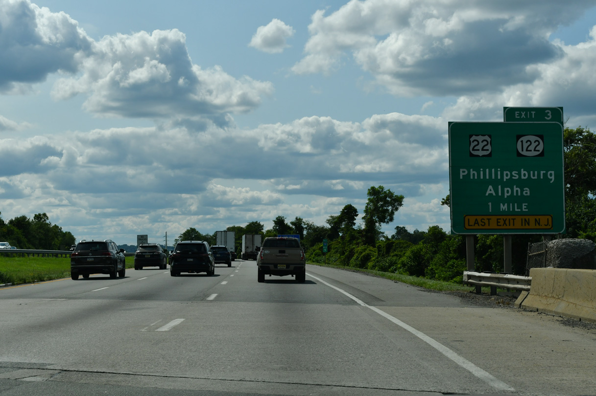
One mile east of the directional cloverleaf interchange (Exit 3) with U.S. 22 west to Phillipsburg and Route 122 west to the borough of Alpha. Route 173 ties into Exit 3 from the south.
07/26/24
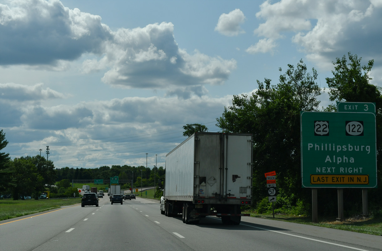
U.S. 22 angles northwest from Exit 3 along a busy commercial arterial to Phillipsburg Mall and Memorial Parkway outside the Phillipsburg town limits. Route 122 spurs west 2.42 miles west from nearby to Alpha and S Main Street into Phillipsburg. The state route was formerly signed as U.S. 22 Alternate.
07/26/24
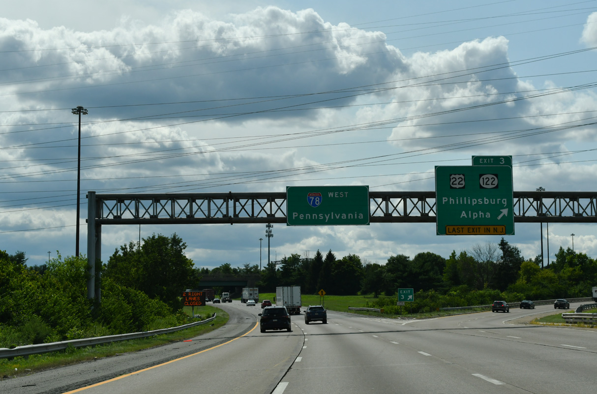
Interstate 78 and U.S. 22 partition at Still Valley and Exit 3. U.S. 22 travels another 5.07 miles to the state line into Easton, Pennsylvania. There the route upgrades to the Lehigh Valley Thruway, the former route of I-78, to Bethlehem and Allentown.
07/26/24

Interstate 78 encircles Alpha on the final three miles to the Delaware River. This portion of freeway opened to traffic on November 21, 1989 (Delaware River Joint Toll Bridge Commission, 2014).
07/26/24
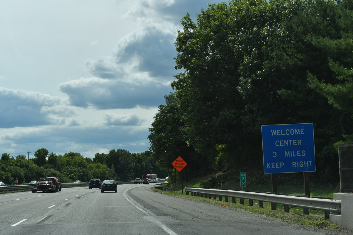
The Pennsylvania Welcome Center is the next rest area along Interstate 78 west.
07/26/24
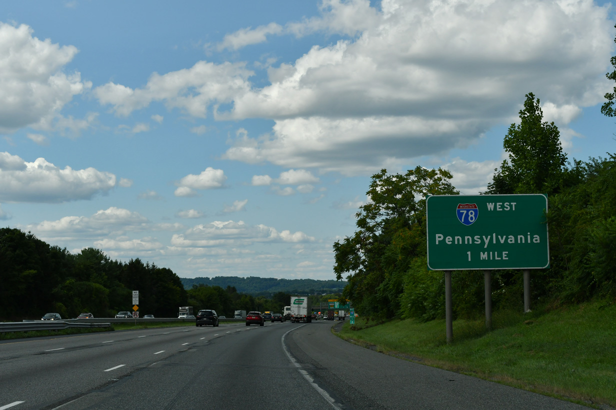
Curving northward through Pohatcong Township, Interstate 78 reaches the final mile in the Garden State.
07/26/24

The bridge across the Delaware River is tolled in the westbound direction. The toll collection point lies two miles ahead at South Easton.
07/26/24
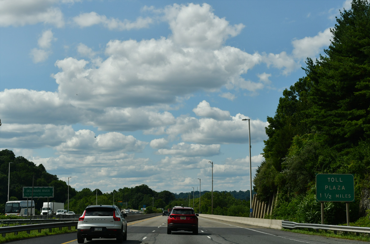
Interstate 78 spans the Delaware River along a twin four-girder, seven-span continuous structure measuring 1,222 feet in length (Delaware River Joint Toll Bridge Commission, 2014).
07/26/24

Midway across the Delaware River, I-78 enters both Williams Township and Northampton County, Pennsylvania.
10/01/05
References:
New Jersey Department of Environmental Protection (NJDEP). (2015, September 22). Round Valley Recreation Area. http://www.state.nj.us/dep/parksandforests/parks/round.html
Delaware River Joint Toll Bridge Commission. (2014). Interstate 78 Toll Bridge. http://www.drjtbc.org/default.aspx?pageid=85
Photo Credits:
- Brent Ivy: 07/26/24
- Justin Cozart: 10/01/05
- AARoads: 08/04/07
Page Updated Thursday May 07, 2026.