
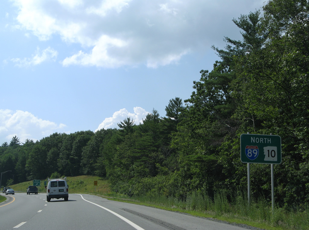
Interstate 89 North - Sunapee to Vermont

 North
North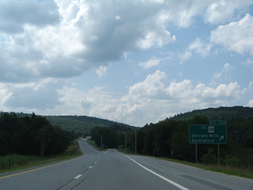
Exit 12A departs I-89 north for Springfield Road south to Georges Mills and north to NH 114 (Main Street) toward the Springfield town center by Kolelemook Lake.
07/30/07
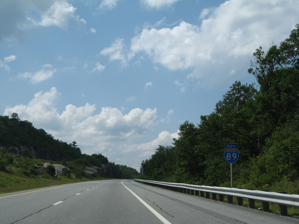
Interstate 89 formally enters the town of Springfield just beyond the Stoney Brook Road underpass ahead of Baptist Pond.
07/30/07
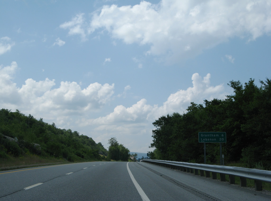
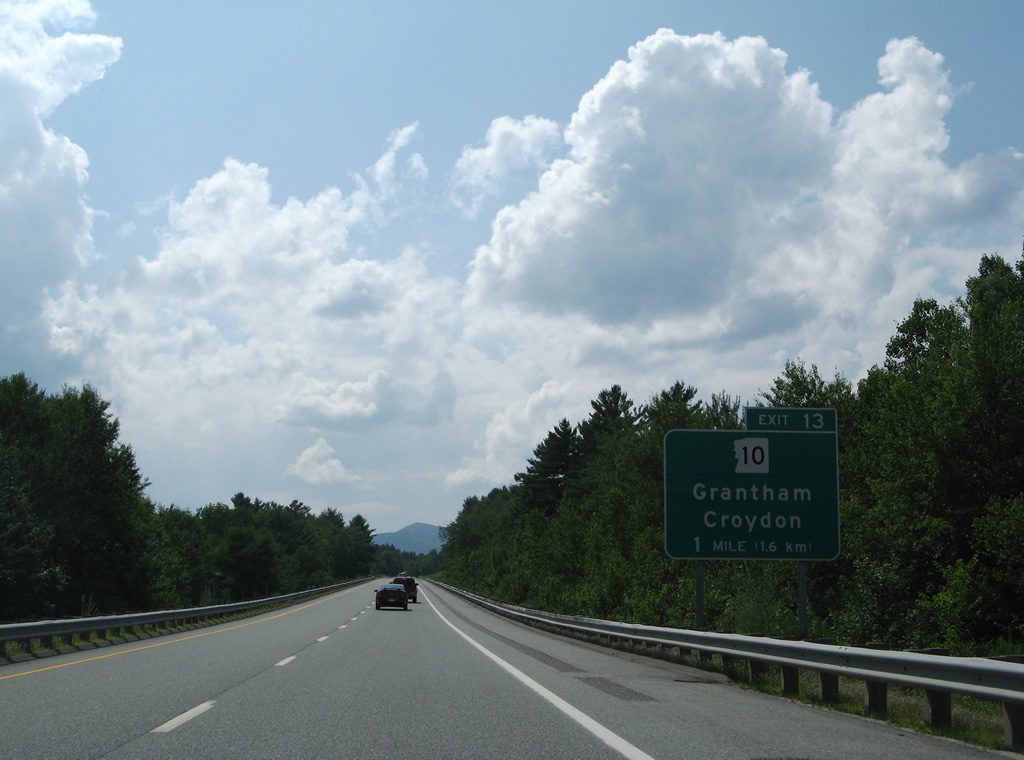
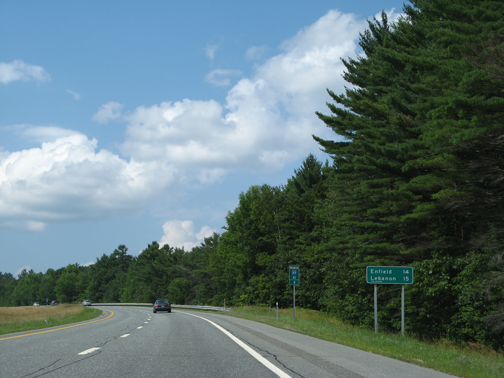
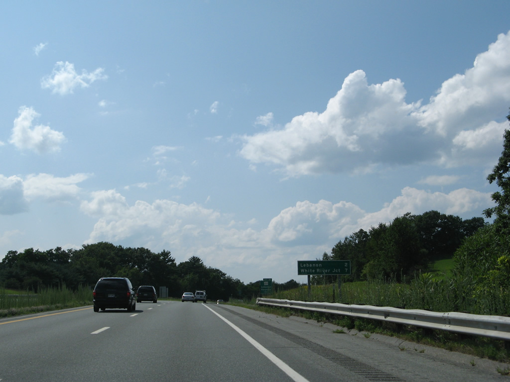
The Grantham town line is a six mile drive to the northwest via Exit 13. Lebanon is 20 miles away.
07/30/07
Stoney Brook Road passes under I-89 again, one mile south of the first northbound rest area for Interstate 89.
07/30/07
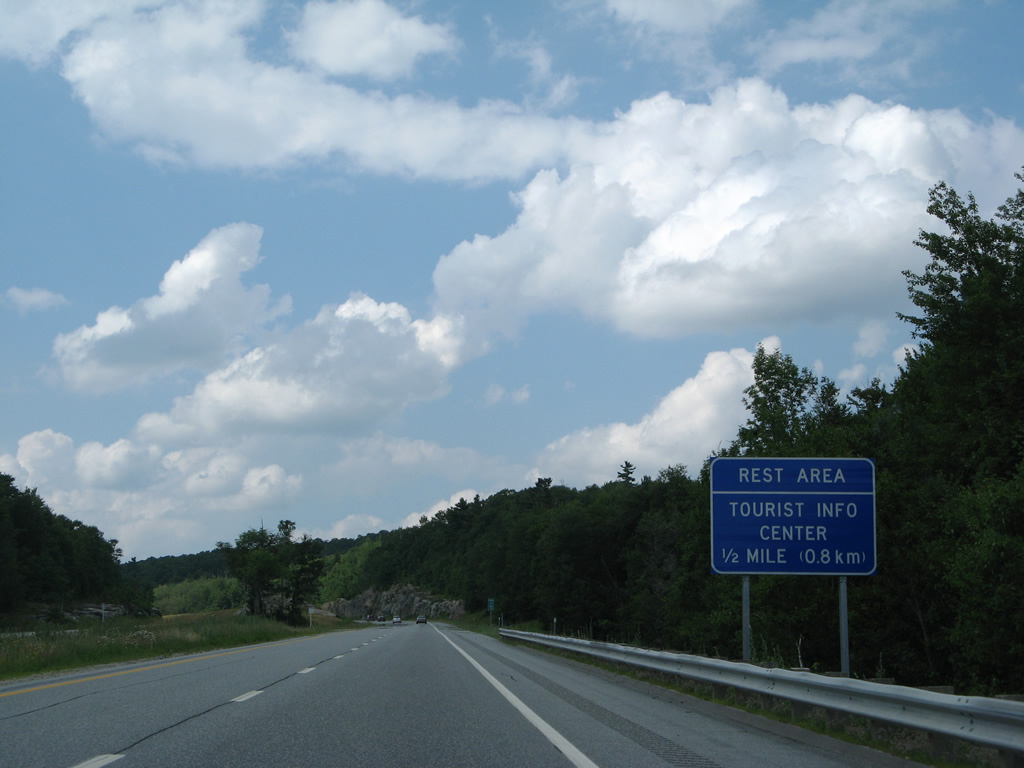
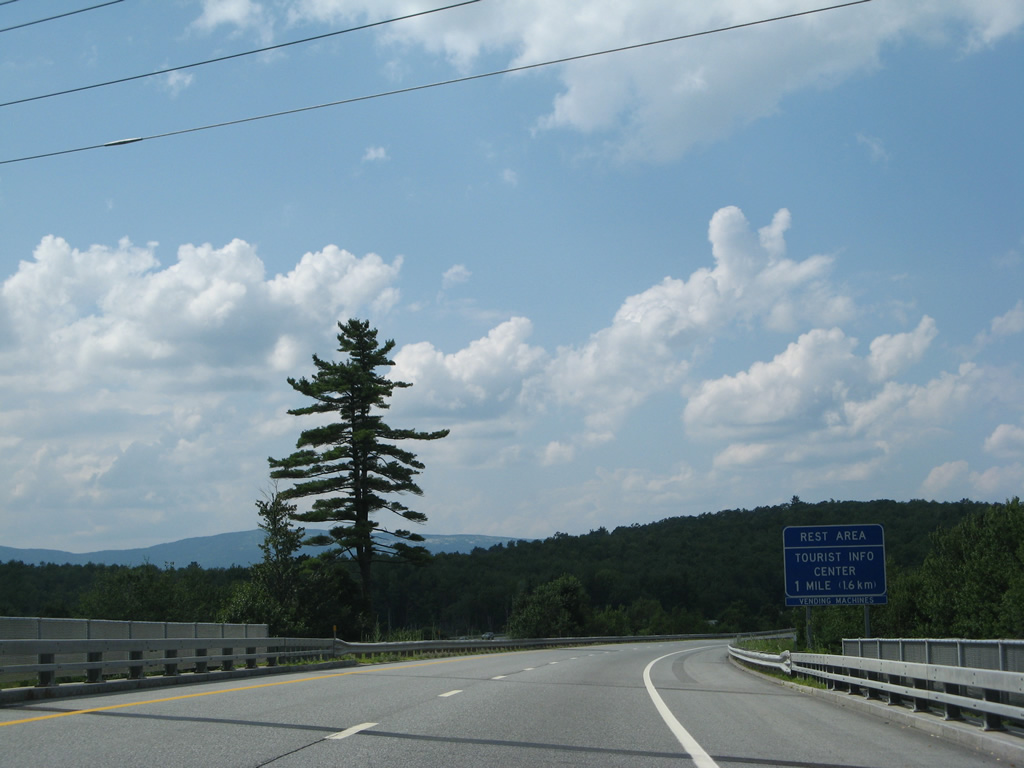
The Springfield rest area at Leavitt Hill includes a tourist information center.
07/30/07
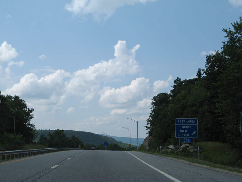
Interstate 89 north reaches the rest area beyond milepost 39.
07/30/07
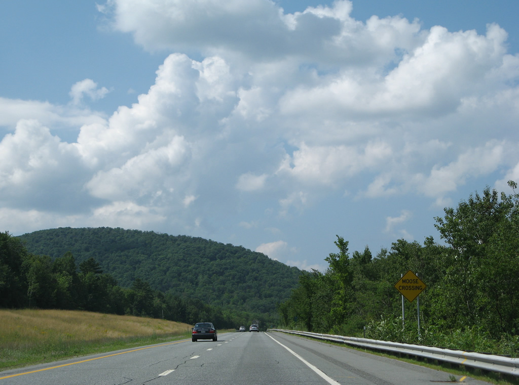
Grantham Mountain (elevation 2,625 feet) of the Croydon Mountain chain rises to the west in this scene by the Springfield rest area.
07/30/07
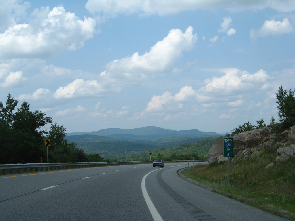
Lowering toward Stocker Pond, just north of the Grantham town line at milepost 41, on I-89 north.
07/30/07
Interstate 89 makes an S-curve by East Grantham ahead of Exit 13 with NH 10 (Dart College Highway) south.
07/30/07
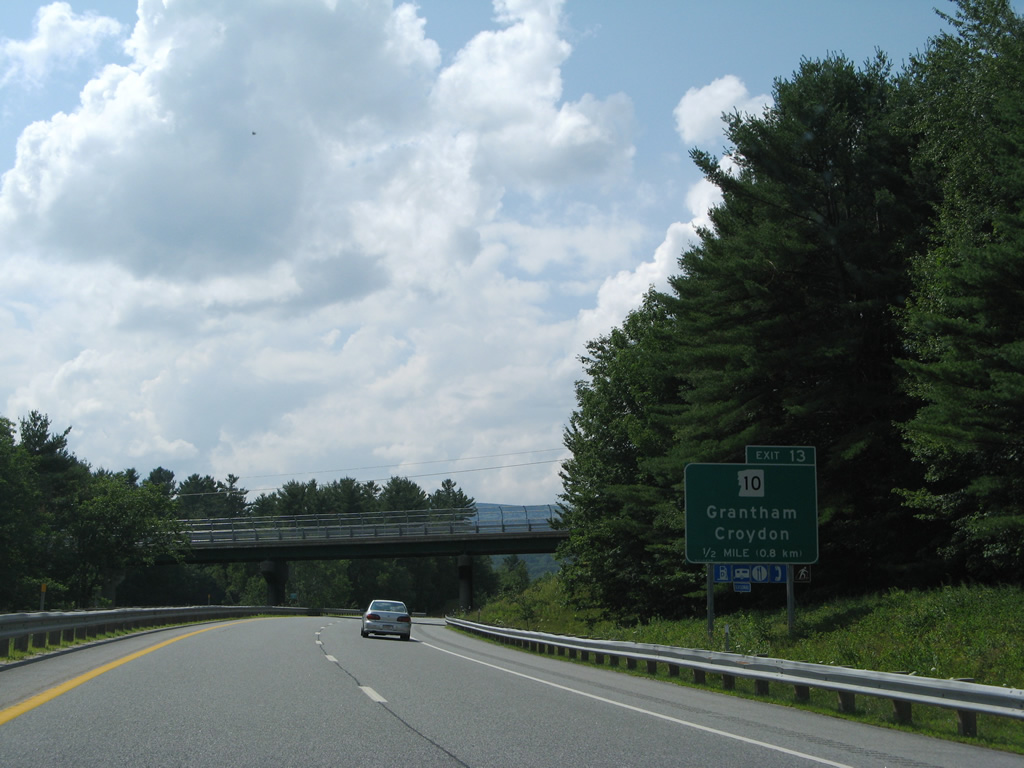
NH 10 (Dart College Highway) continues from Exit 13 to the Grantham town center and Croydon as part of a multi state route south to Greenfield, Massachusetts and New Haven, Connecticut.
07/30/07
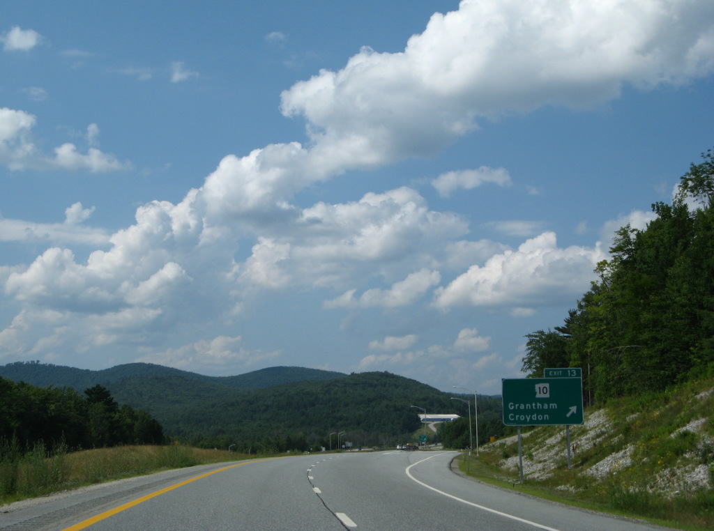
Entering the diamond interchange (Exit 13) with Dart College Highway on I-89 north. Dart College Highway extends north from NH 10 to Eastman Road east to Eastman and North Grantham.
07/30/07
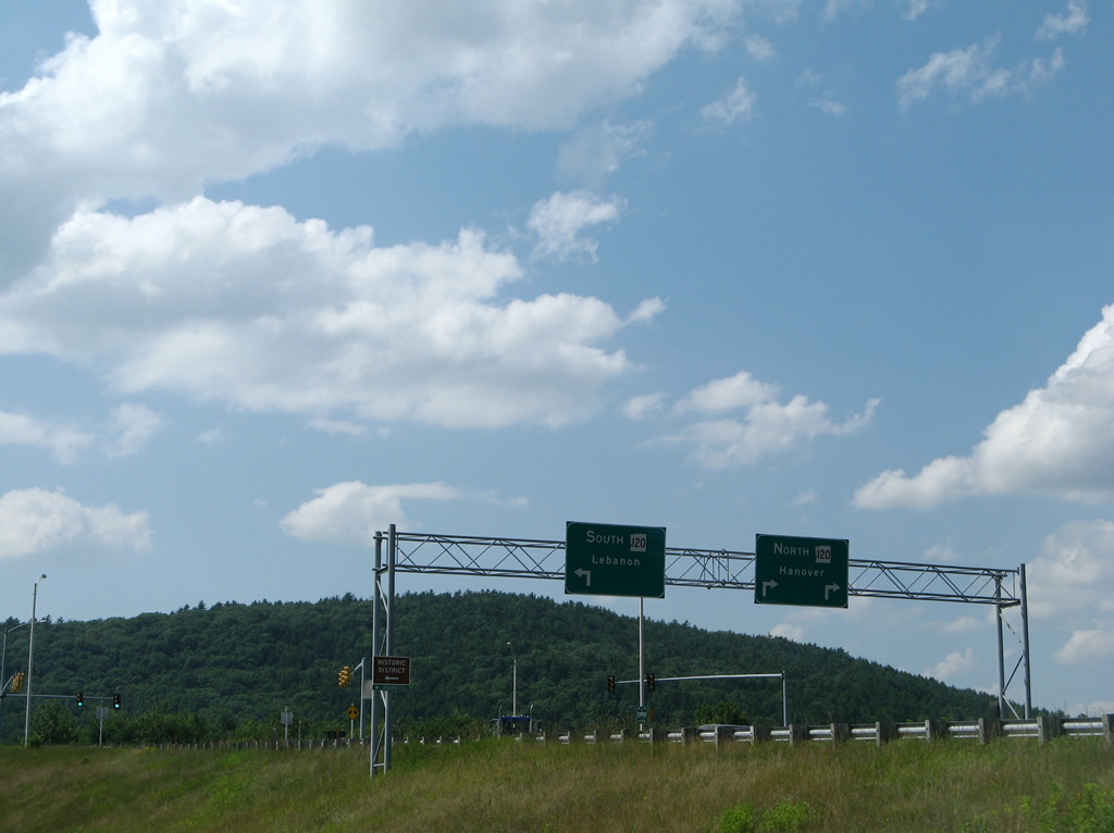
/ NH 10 North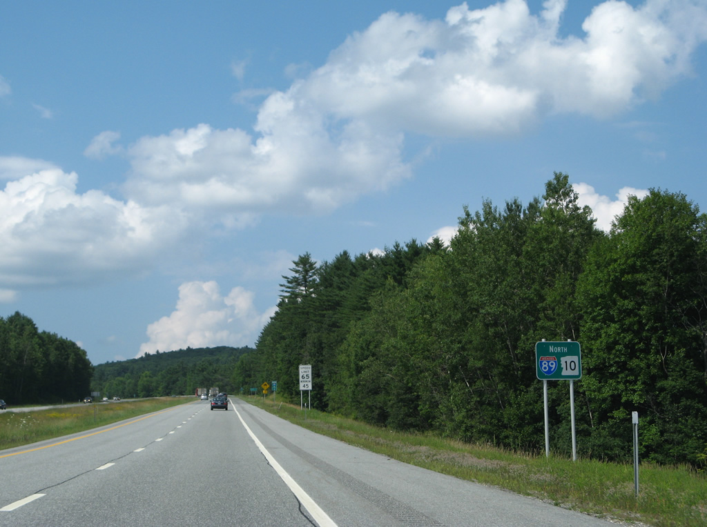
NH 10 overlaps with Interstate 89 for 24.3 miles to Exit 19.
07/30/07
Enfield is a 14 mile drive via I-89 north and U.S. 4 east. Lebanon is one mile further via I-89 north and U.S. 4 west.
07/30/07
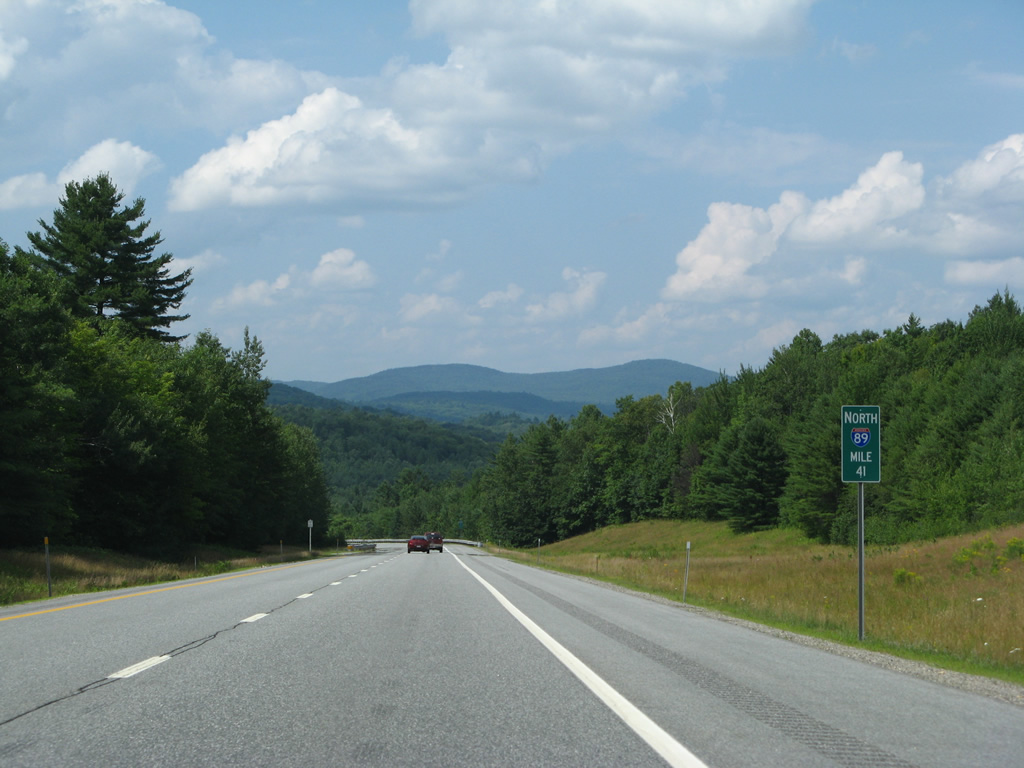
Interstate 89 shifts eastward by Sargent Hill and North Grantham.
07/30/07
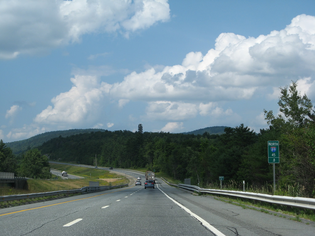
Dart College Highway (former NH 10) passes under I-89/NH 10 at milepost 45.8. The rural road remains close by to the west to the Enfield town line.
07/30/07
I-89/NH 10 overtake the original alignment of NH 10 at a half diamond interchange (Exit 14 on southbound) on the Enfield town / Grafton County line.
07/30/07
The freeway winds north through a valley between Snow Mountain and Prospect Hill through west Enfield.
07/30/07
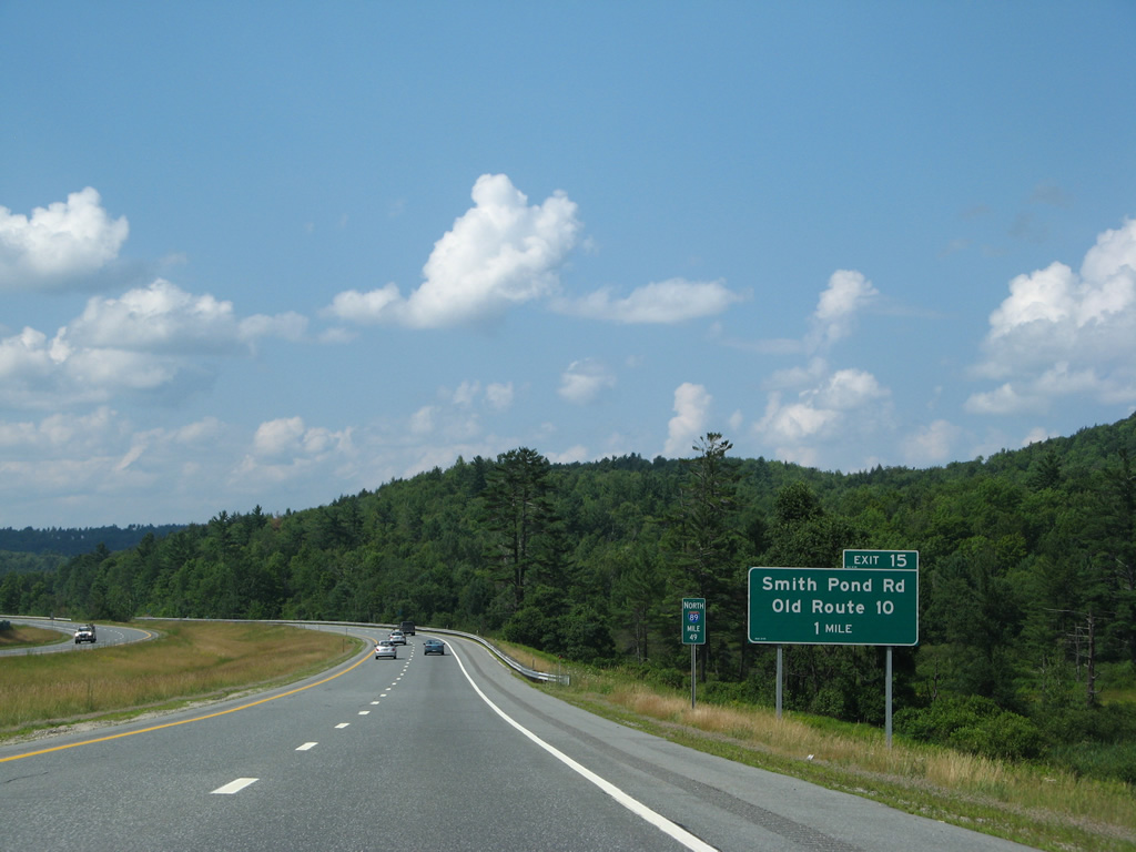
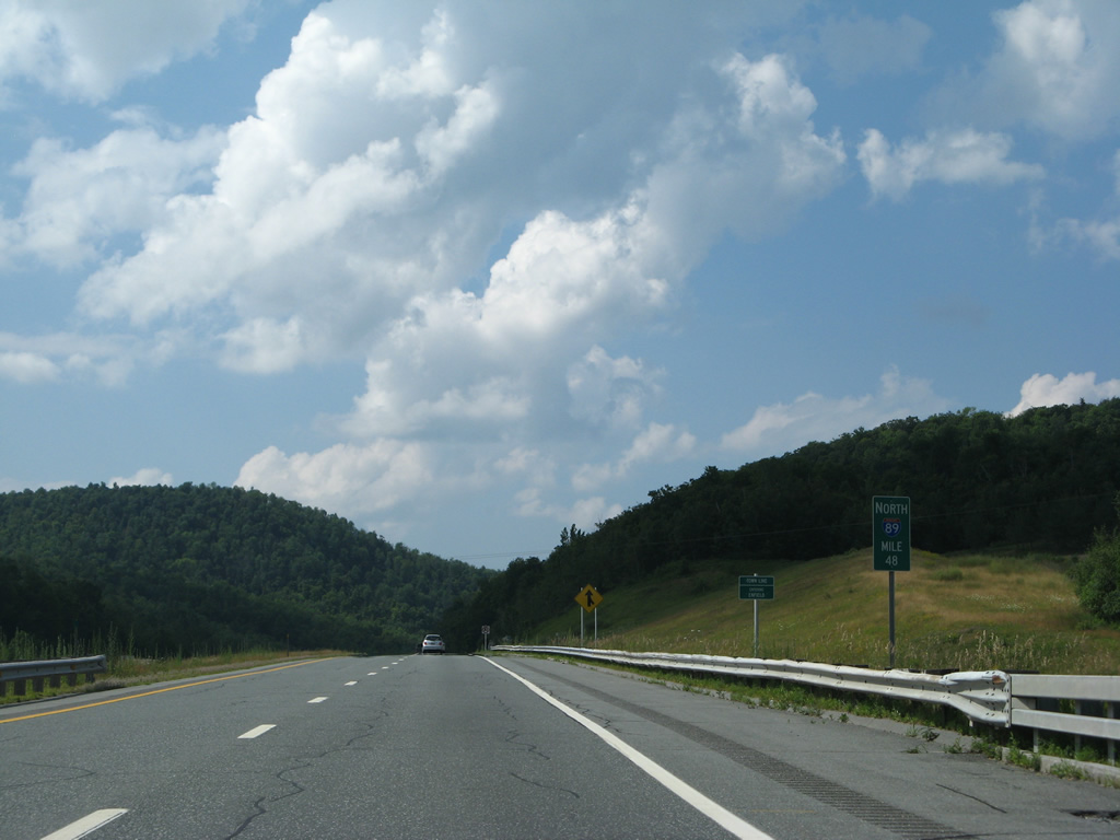
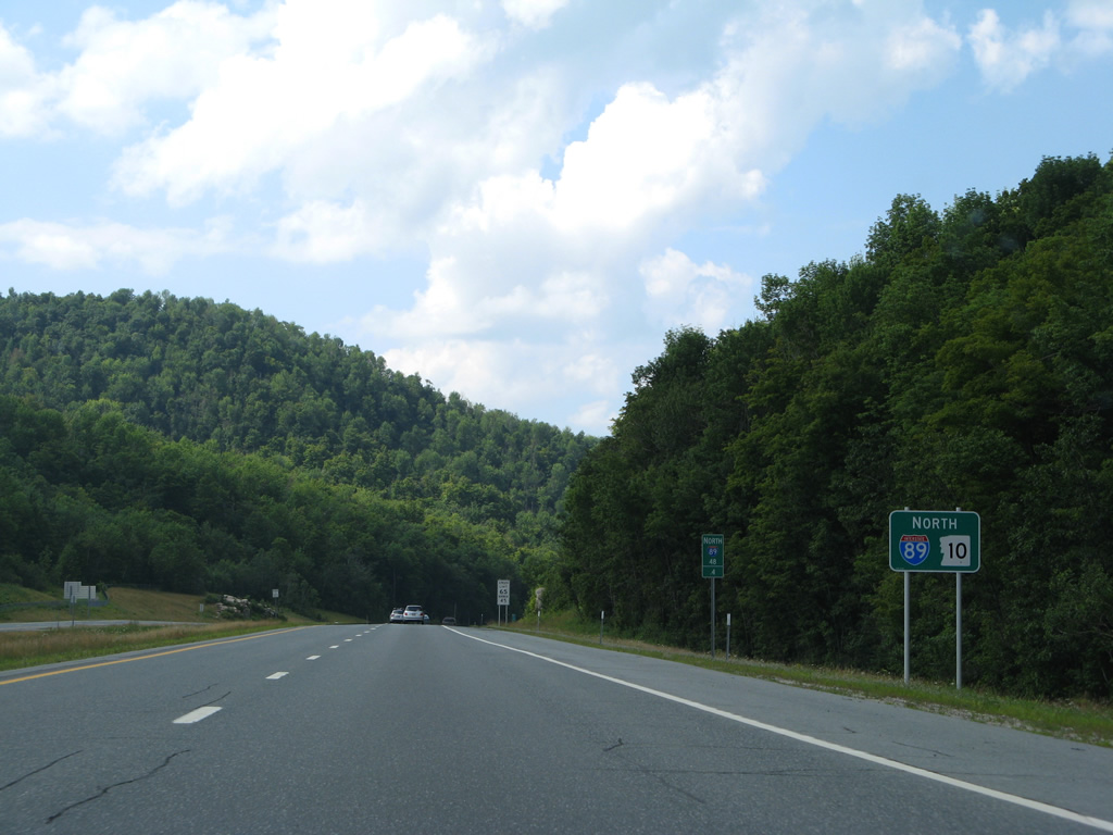
Exit 15 serves an isolated area of Enfield in one mile at milepost 50.
07/30/07
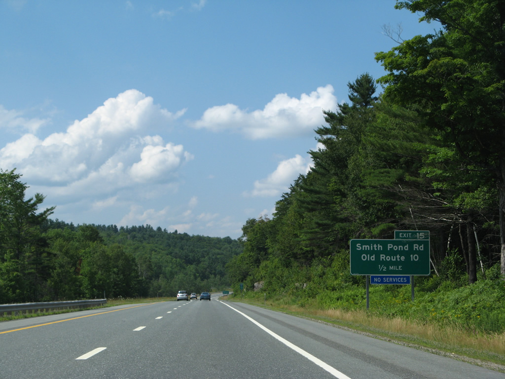
Old Route 10 spurs north and south along the west side of Interstate 89 at the settlement of Montcalm.
07/30/07
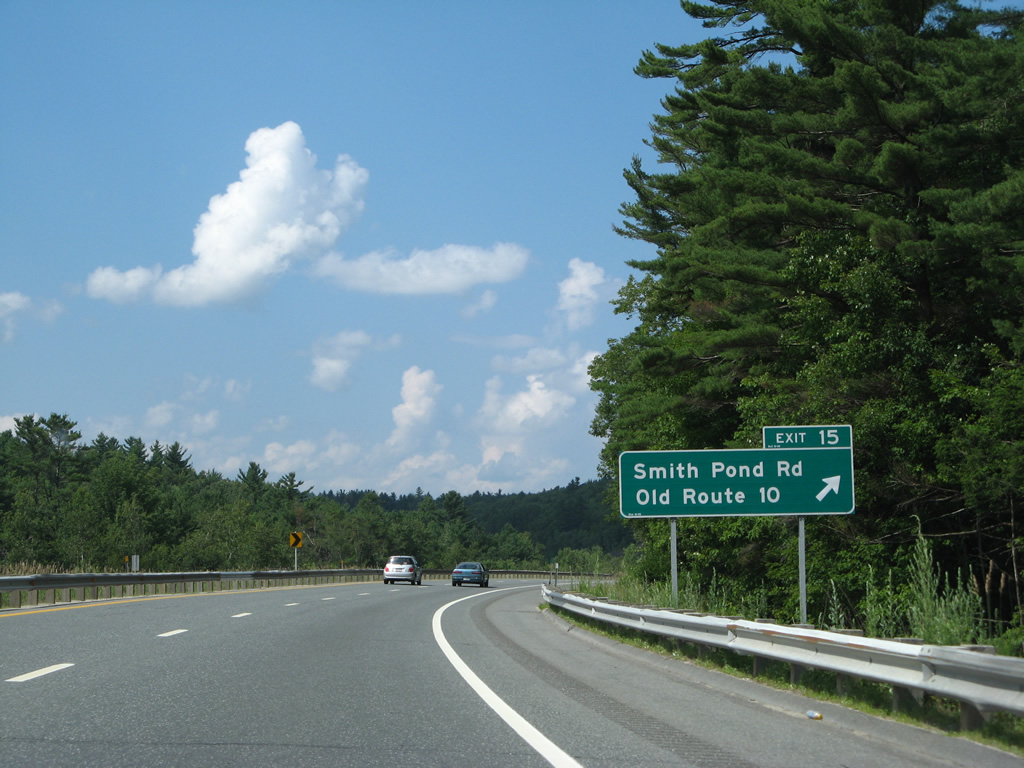
Smith Pond Road stems east from the diamond interchange (Exit 15) with I-89/NH 10 to Smith Pond.
07/30/07
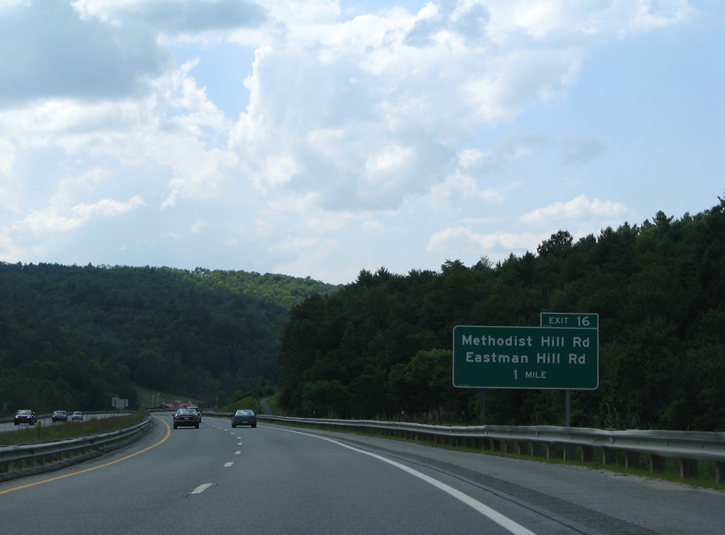
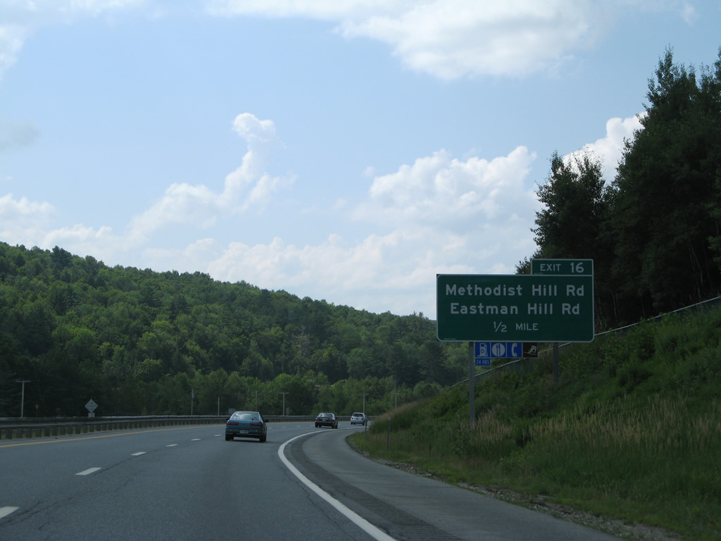
Methodist Hill Road north and Eastman Hill Road south come together at a diamond interchange (Exit 16) with I-89/NH 10 north in one mile.
07/30/07
Eastman Hill Road traverses the north side of Shaker Mountain from Exit 16 and Purmort northward to U.S. 4 near Mascoma.
07/30/07
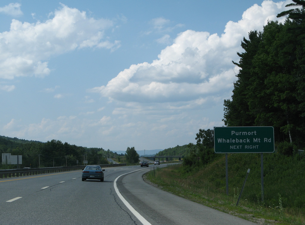
Whaleback Mount Road spurs south from Methodist Hill and Eastman Hill Roads to Whaleback Mountain ski resort on Methodist Hill.
07/30/07

Exit 16 parts ways with I-89/NH 10 north by milepost 52. Methodist Hill Road south leads to NH 120 near East Plainfield.
07/30/07
I-89/NH 10 north enter the city limit of Lebanon just beyond Exit 16. Four interchanges serve the city of over 13,000.
07/30/07

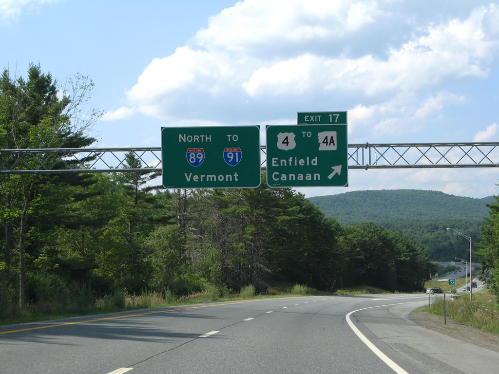
U.S. 4 meanders west from Canaan to Enfield and Mascoma along the northern periphery of Mascoma Lake to meet I-89/NH 10 at Exit 17.
07/30/07
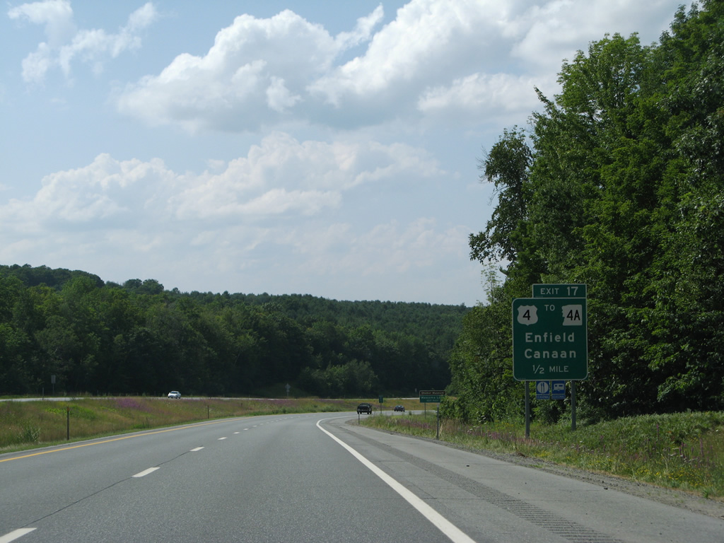
I-89/NH 10 descend toward the parclo interchange (Exit 17) with U.S. 4 (Dartmouth College Highway). U.S. 4 provides a local route west to Downtown Lebanon via Bank Street.
07/30/07
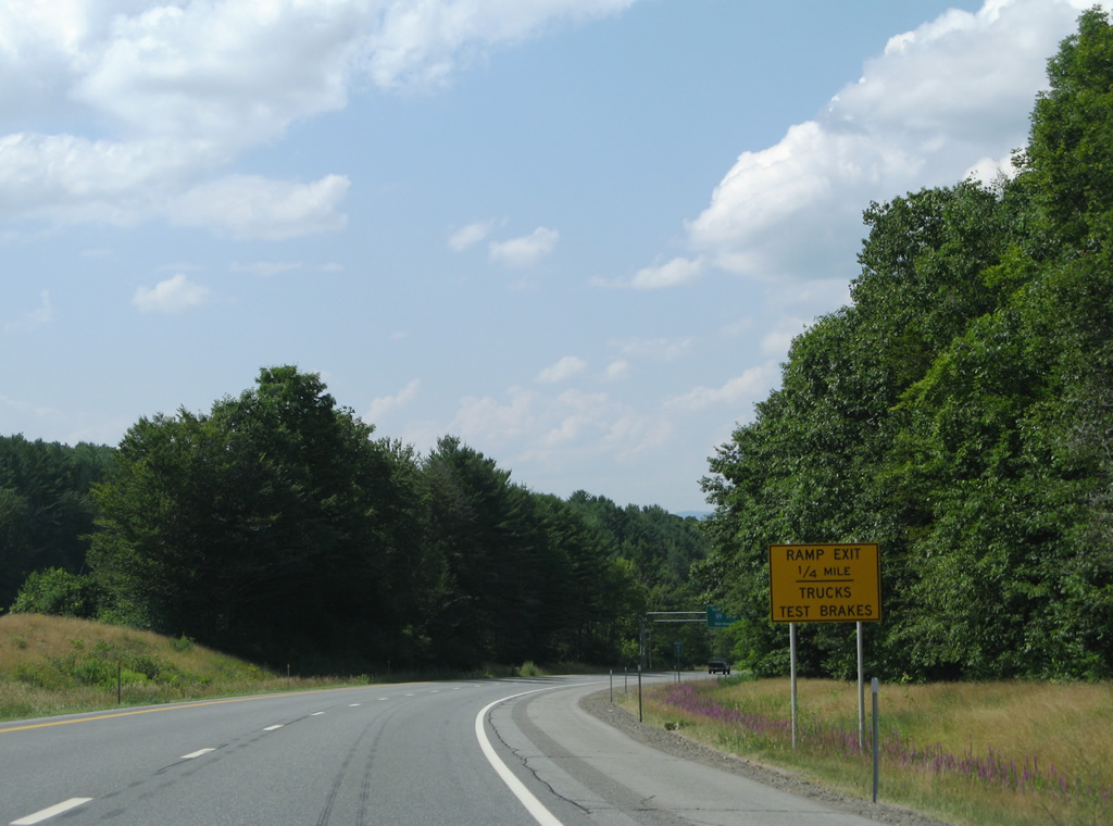
The steep grade of I-89 north into Lebanon prompts an advisory sign warning truckers to test brakes ahead of the off-ramp to U.S. 4. The freeway drops over 120 feet in elevation from Purmort.
07/30/07
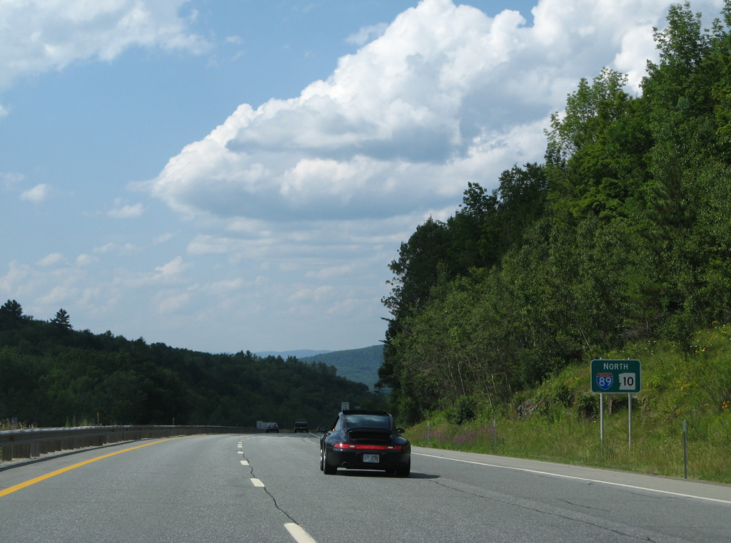
U.S. 4 east splits with NH 4A on the north side of Shaker Mountain. The state route straddles the west side of Mascoma Lake south to Lower and Upper Shaker Villages to Enfield Center.
Interstate 89 meanwhile turns west for the final push to White River Junction, Vermont.
07/30/07
I-89/NH 10 cross the Mascoma River and turn west on the south side of Signal Hill.
07/30/07
Downtown Lebanon is the next exit in two miles. White River Junction, Vermont follows in seven miles.
07/30/07
A diamond interchange joins I-89/NH 10 with NH 120 north of Downtown Lebanon and Lebanon College in one mile.
07/30/07
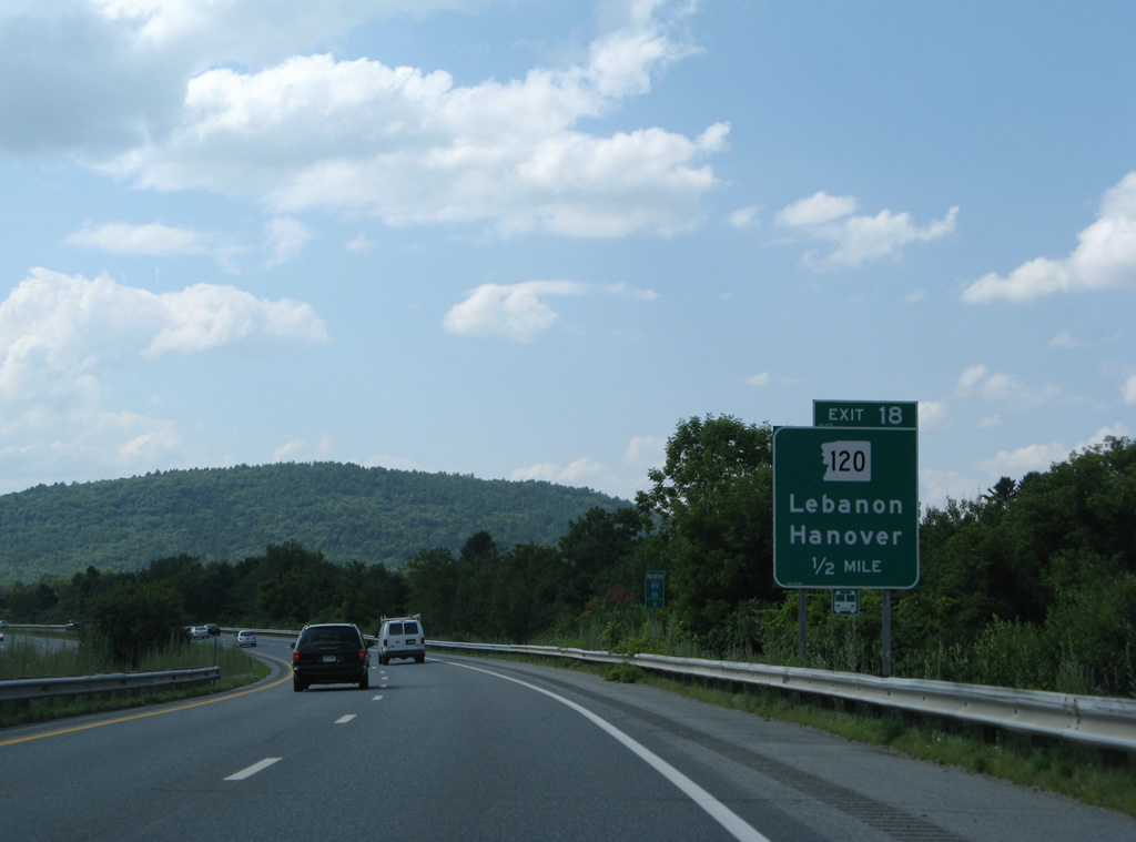
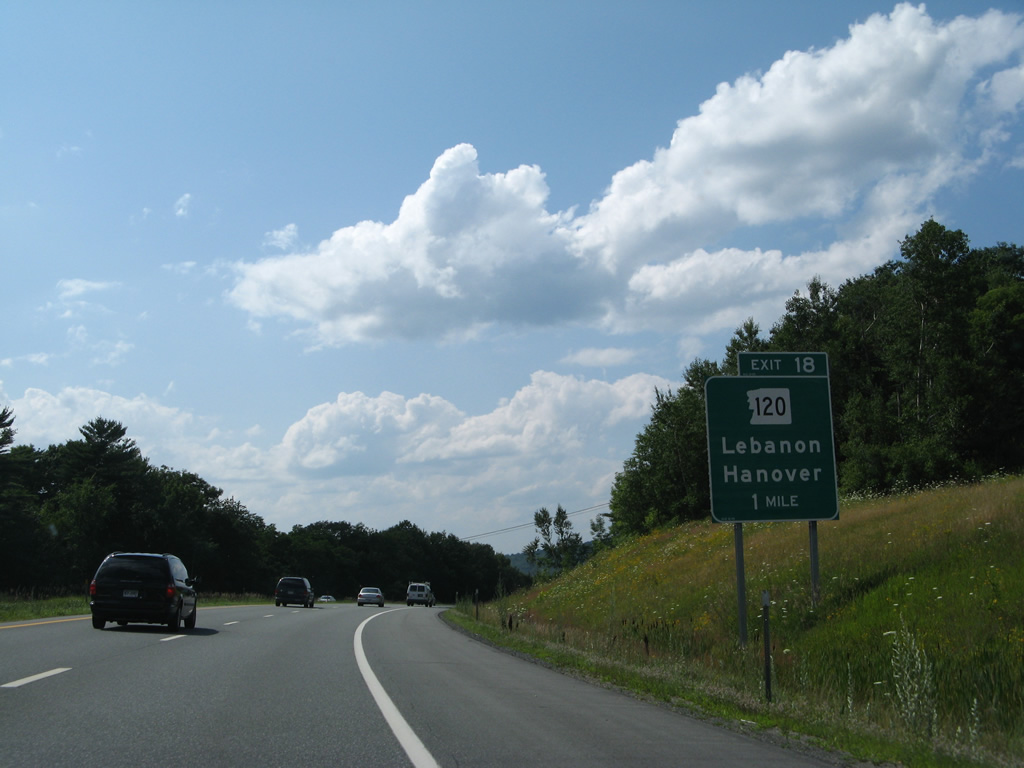
One half mile ahead of Exit 18 for NH 120 on I-89 north. NH 120 travels 26.9 miles from NH 11/103 in Claremont north to NH 10 in Hanover.
07/30/07
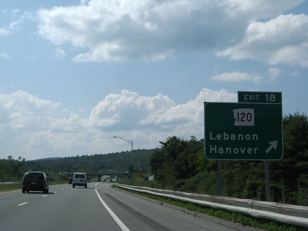
NH 120 angles northwest from Exit 18 in Lebanon to Dartmouth-Hitchcock Medical Center and Dartmouth College in Hanover.
07/30/07
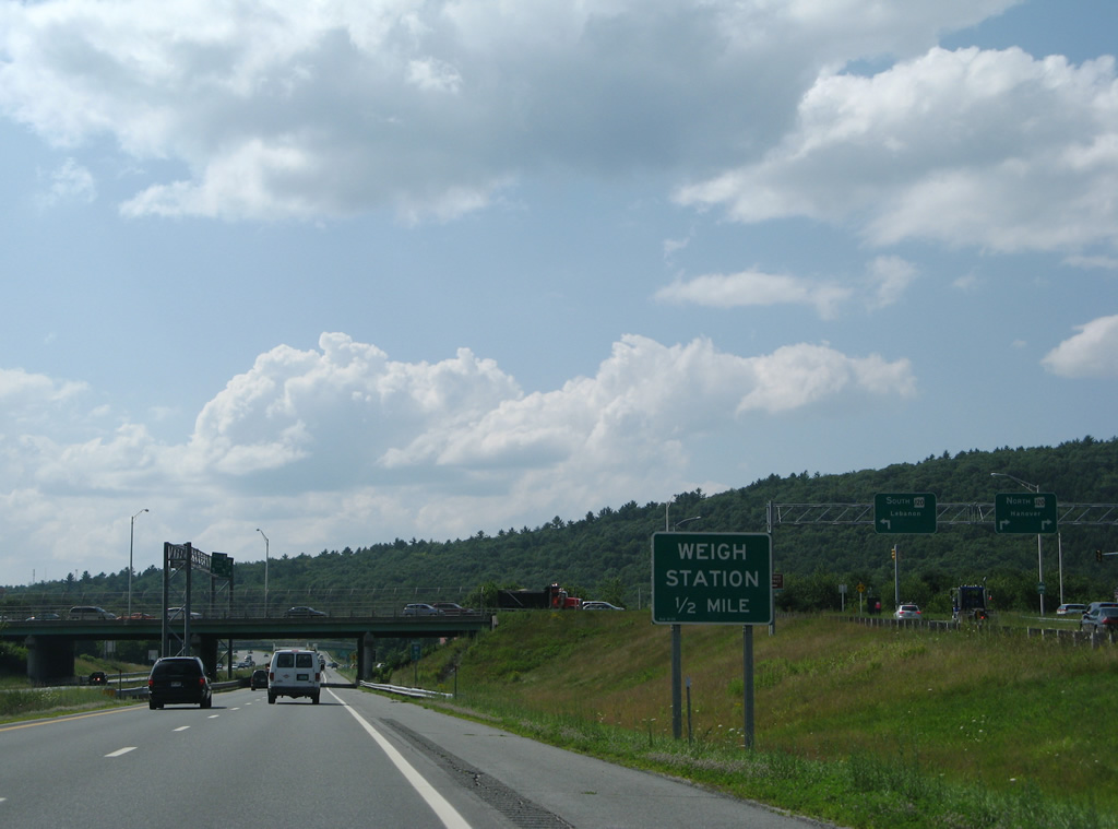
Weigh stations operate in both directions of Interstate 89 on the south side of Quarry Hill.
07/30/07
NH 120 turns south onto Hanover Street just west of Exit 18 to Downtown Lebanon and a brief overlap with U.S. 4 on Park Street.
07/30/07
I-89/NH 10 encircle the north side of Lebanon from the weigh station westward.
07/30/07
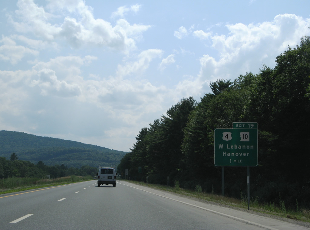
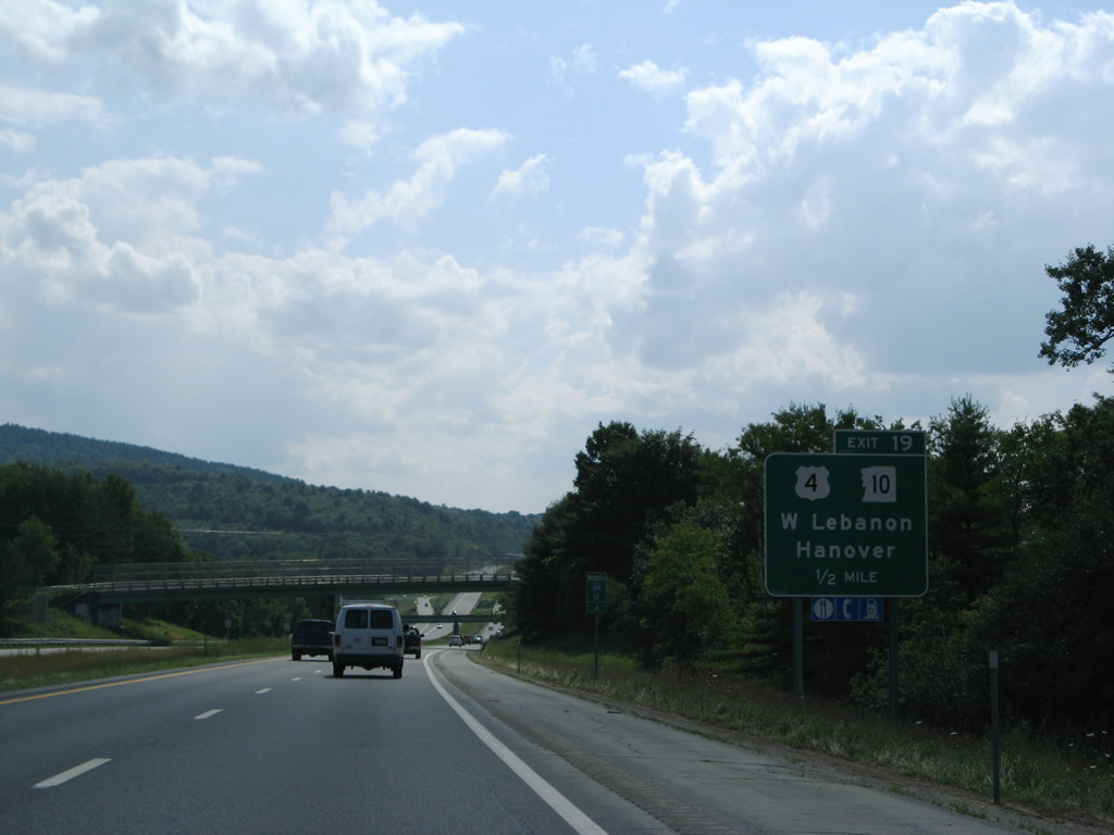
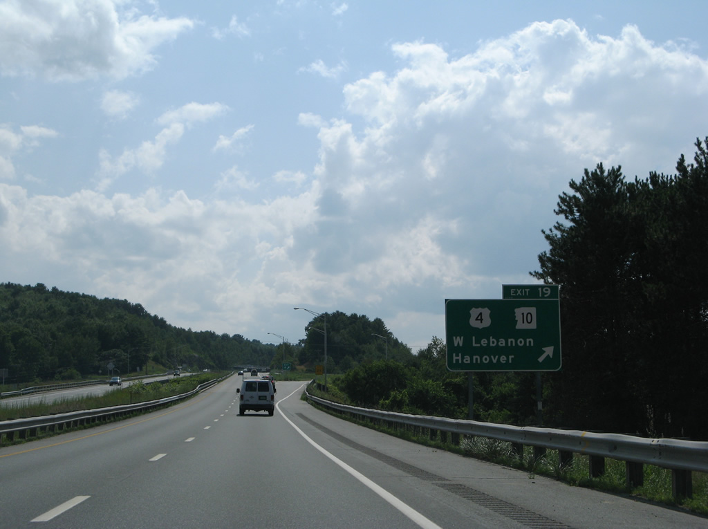
NH 10 splits with Interstate 89 north to overlap with U.S. 4 to West Lebanon at Exit 19 in one mile.
07/30/07
U.S. 4 follows Mechanic Street west from Downtown Lebanon to a parclo interchange with I-89/NH 10 at the Mascoma River. The route of U.S. 4 through Lebanon was historically a business loop for I-89. The last sign for the route was taken down by 2007.
07/30/07
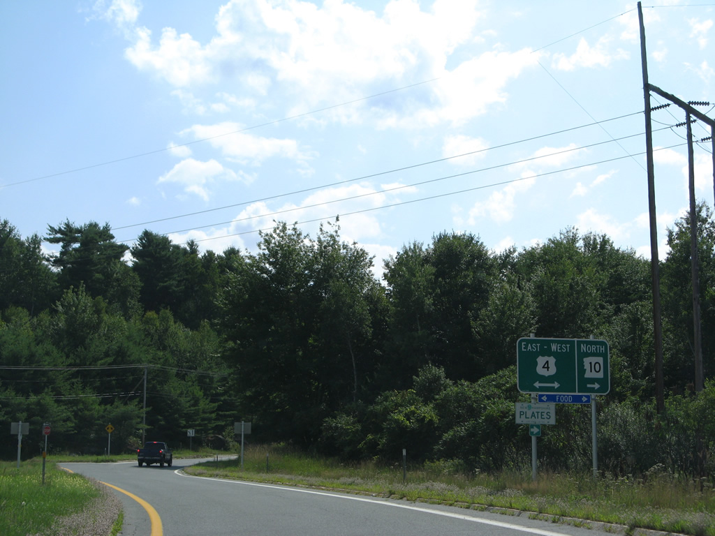
U.S. 4/NH 10 head 3.3 miles northwest to Main Street in West Lebanon. U.S. 4 turns west to cross the Connecticut River into Vermont from there while NH 10 remains north to Hanover.
07/30/07
Downtown Lebanon is a two mile drive east along U.S. 4. Hanover lies six miles to the north. U.S. 4 interacts with Interstate 89 again at Centertown, Vermont.
07/30/07
North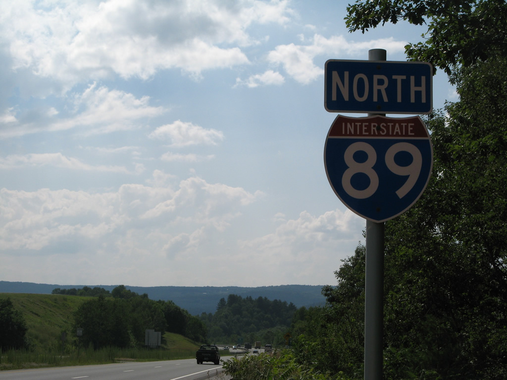
Interstate 89 straddles the north side of Farnum Hill and Lebanon Municipal Airport (LEB) by the last reassurance marker in New Hampshire.
07/30/07
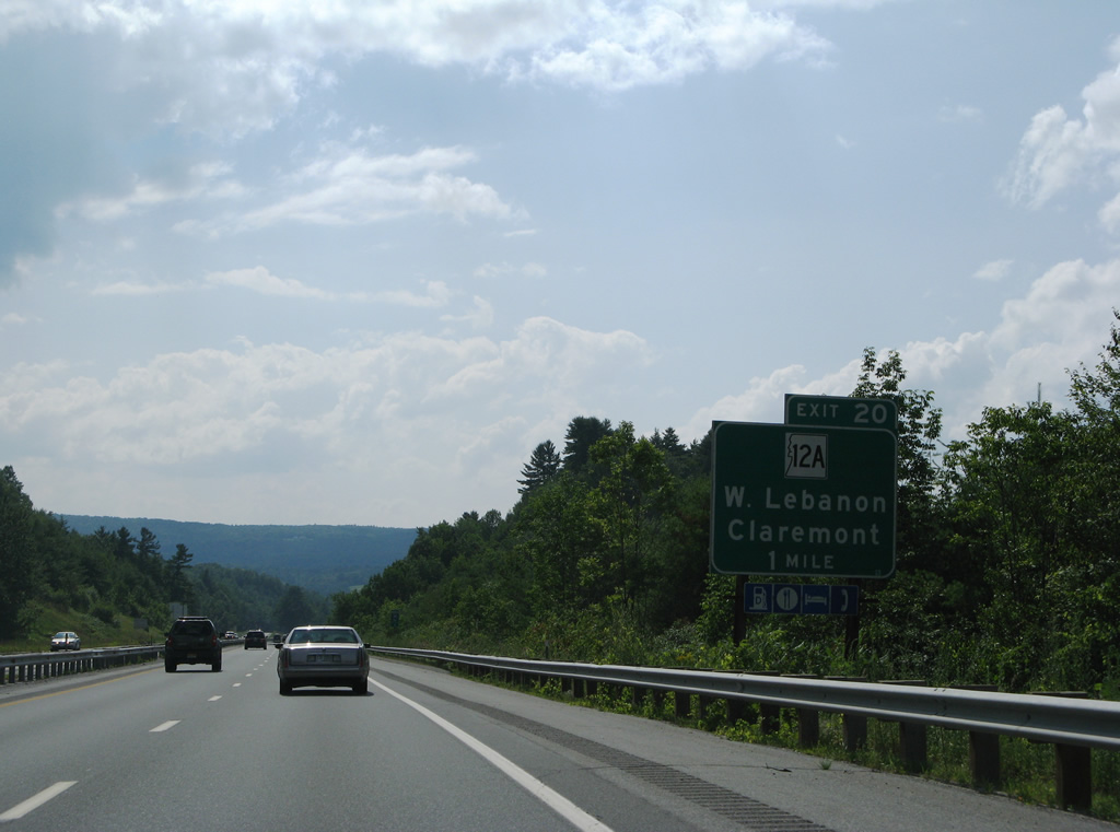
NH 12A (South Main Street) branches southwest from U.S. 4/NH 10 in West Lebanon to cross paths with Interstate 89 at a commercialized diamond interchange (Exit 20) in one mile.
07/30/07
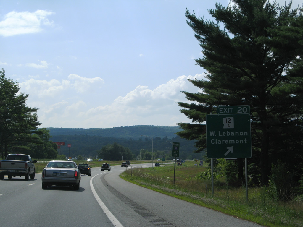
NH 12A runs south 26.9 miles from West Lebanon to Charlestown by way of Plainfield, Cornish and Clairemont.
07/30/07
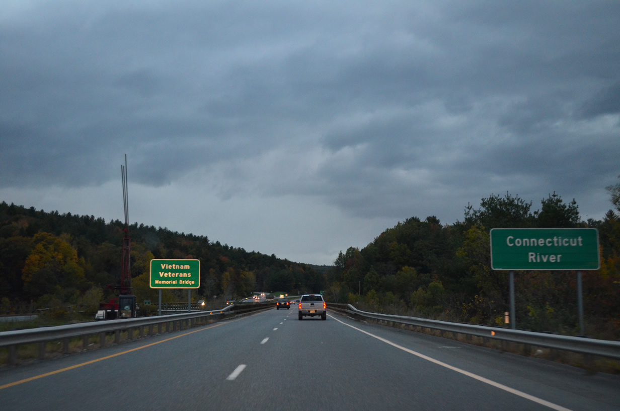
The Vietnam Veterans Memorial Bridge spans the Connecticut River from West Lebanon to White River Junction, Vermont.
10/08/14
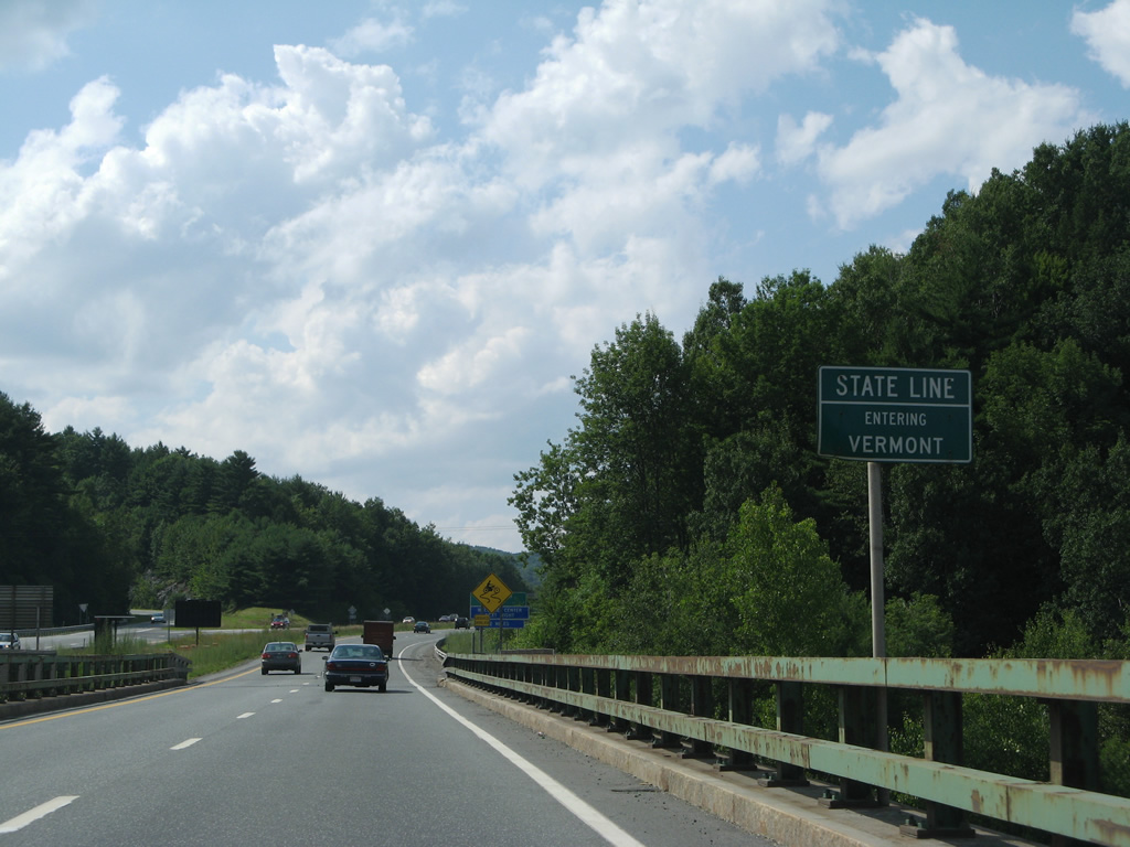
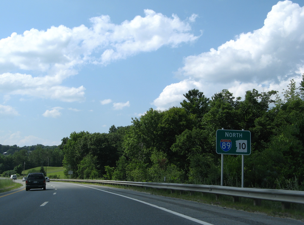
Interstate 89 crosses into Windsor County, Vermont at the west banks of the Connecticut River. Ramps to Interstate 91 depart within one half mile.
07/30/07
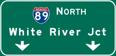

Photo Credits:
- AARoads: 07/30/07
- Brent Ivy: 10/08/14
Page Updated Thursday February 12, 2015.