
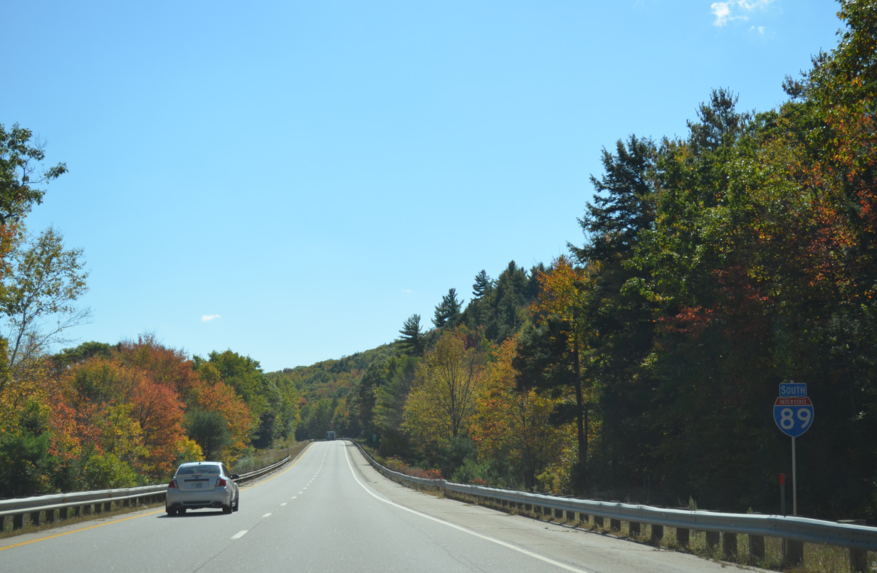
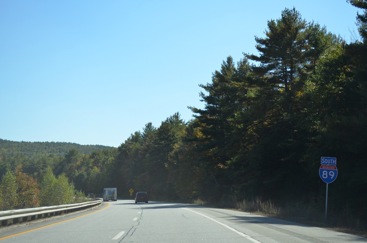
Interstate 89 South - Sunapee to Concord

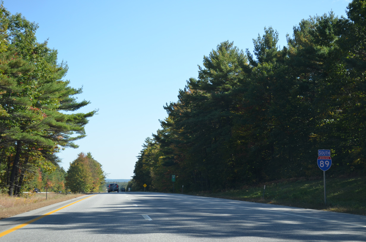
 South
South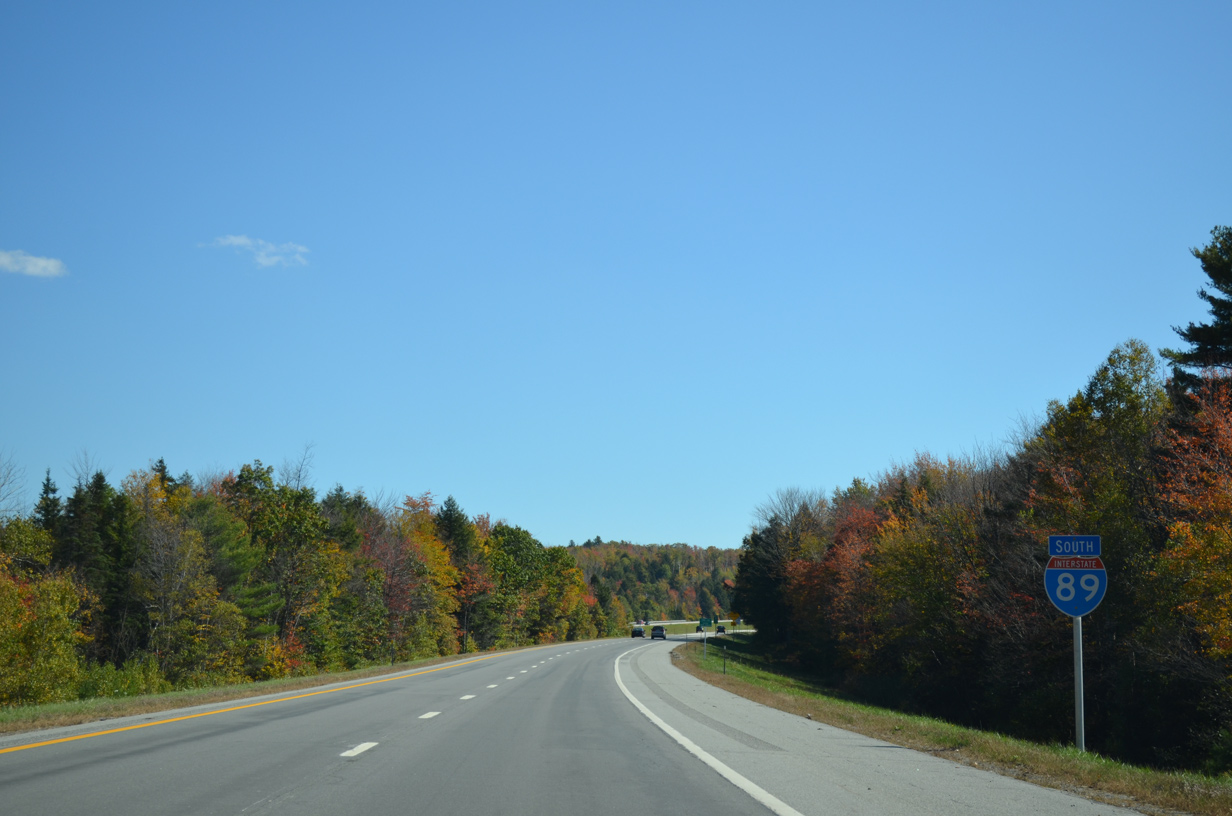
Interstate 89 arcs southeast between Otter Pond and Little Sunapee Lake through northwestern reaches of New London.
10/06/14
NH 11 turns east from Georges Mills to combine with Interstate 89 south at forthcoming Exit 12.
10/06/14
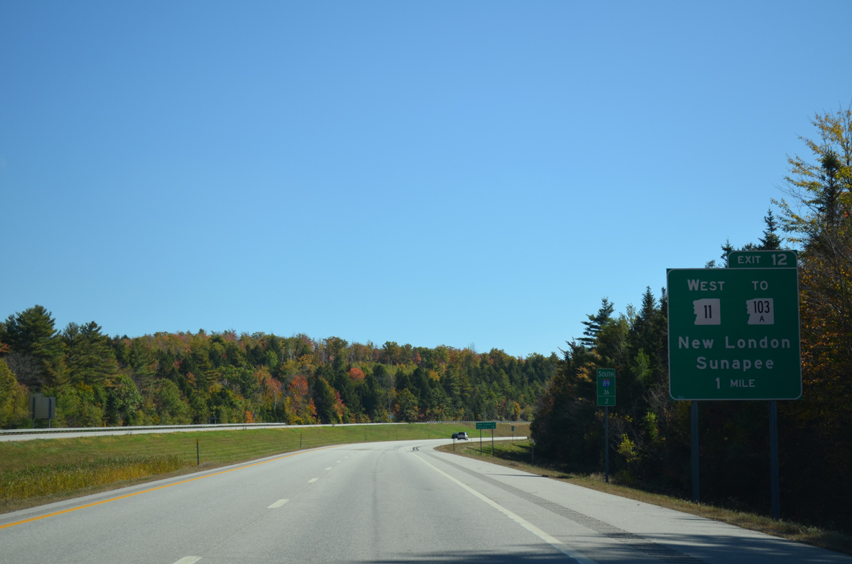
Newport Road continues east from NH 11 and I-89 at Exit 12 to the New London town center and Colby-Sawyer College in three miles. Concord remains 38 miles to the southeast.
10/06/14
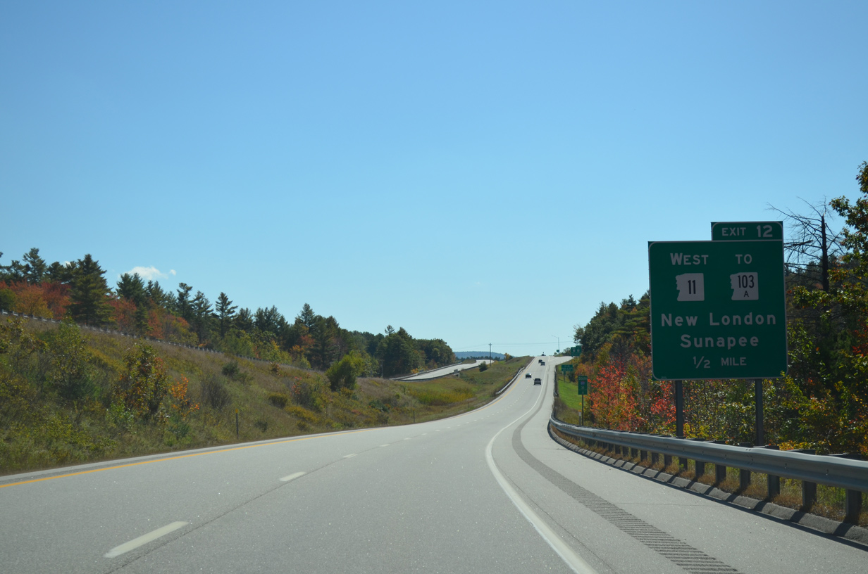
Exit 12 links Interstate 89 with adjacent NH 103A (Lakeside Road) south to Lakeside, Hastings and Newbury on the eastern periphery of Sunapee Lake.
10/06/14
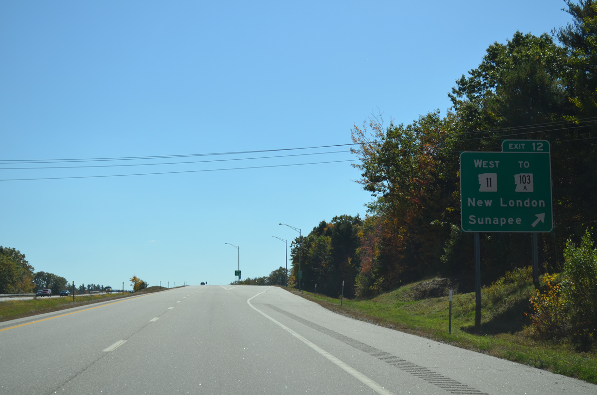
Entering the diamond interchange (Exit 12) with NH 11 west and Newport Road east on I-89 south. NH 11 constitutes a cross state route 108.2 miles from Springfield, Vermont to Rochester and Lebanon, Maine.
10/06/14
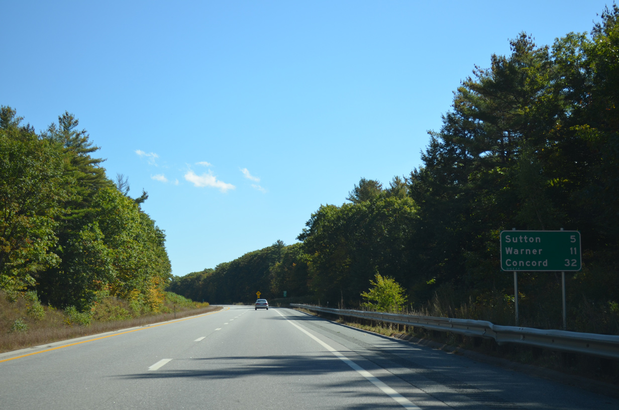
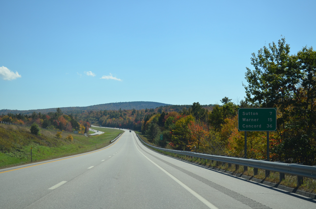
South / NH 11 East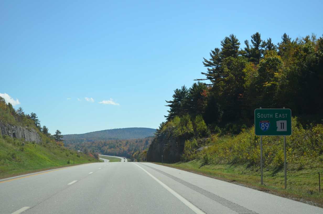
A 5.7 mile overlap with NH 11 east ensues along Interstate 89 south to Sutton. Warner follows Sutton in 15 miles.
10/06/14
County Road crosses under I-89 north and over I-89 south near the area of Messer Pond.
10/06/14
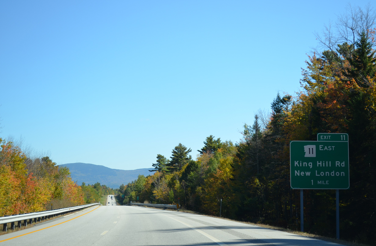
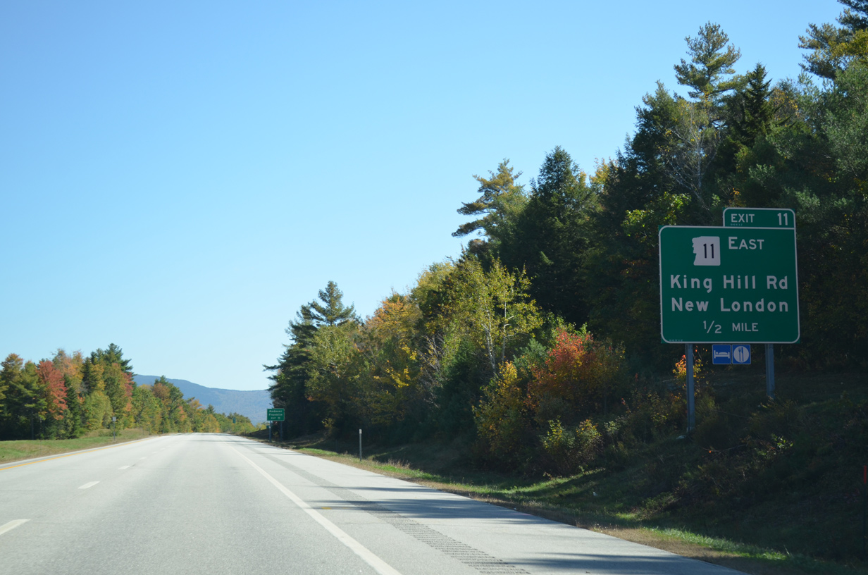
King Hill Road east from NH 103A (Lakeside Road) becomes NH 11 east beyond upcoming Exit 11.
10/06/14
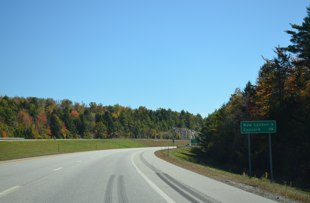
NH 11 departs I-89 south to intersect NH 104 (Main Street) at Crockett Corner. NH 104 north provides return access to the New London town center.
10/06/14
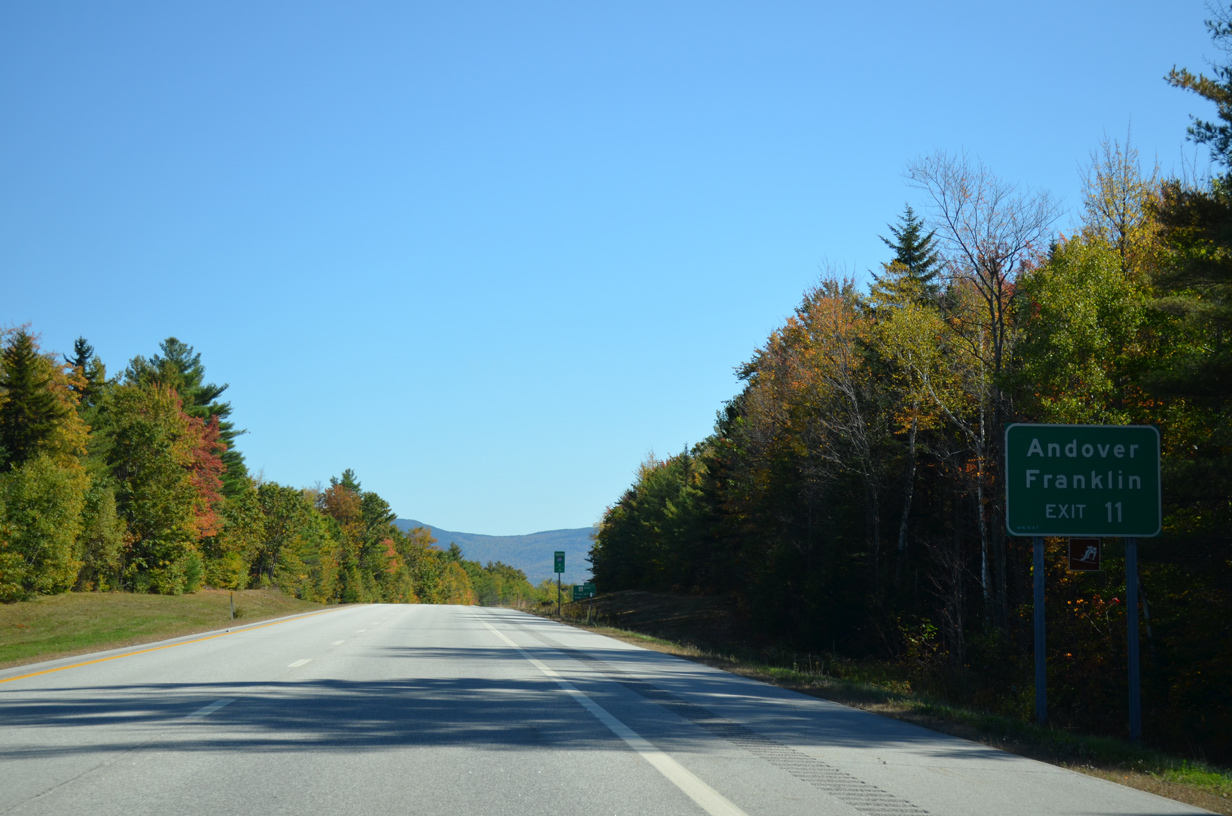
East from New London, NH 11 advances to Andover and Franklin, where it combines with U.S. 3 north to Tilton, Laconia and the Lake Winnipesaukee Region.
10/06/14
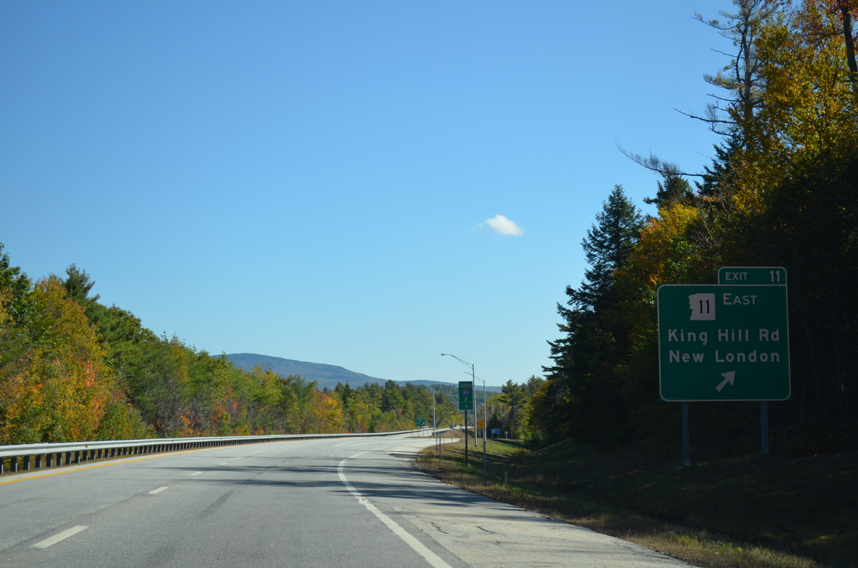
A diamond interchange connects I-89 to King Hill Road west to Sunapee Lake and NH 11 (Old King Hill Road) east to New London. NH 11 east transitions to Maine Route 11, a 401 mile long highway extending all the way to Fort Kent.
10/06/14
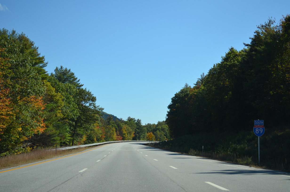
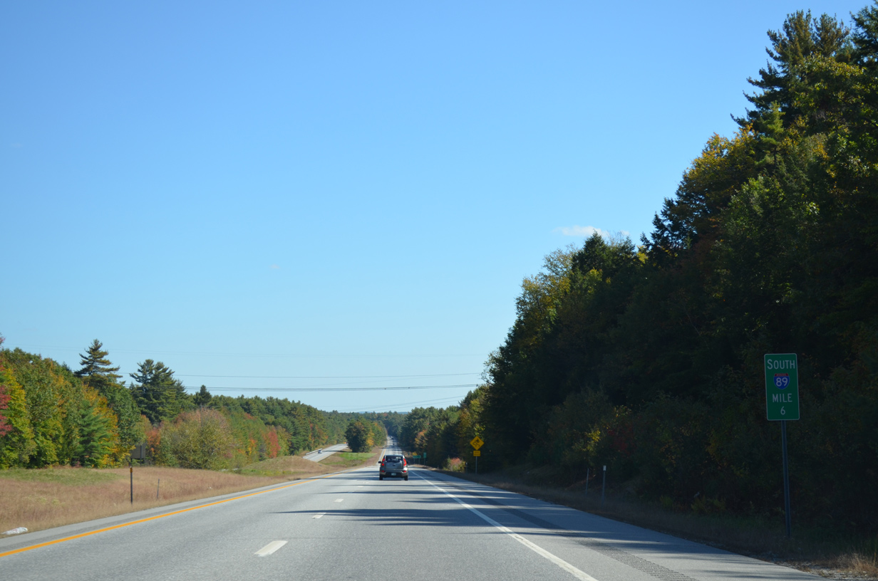
South
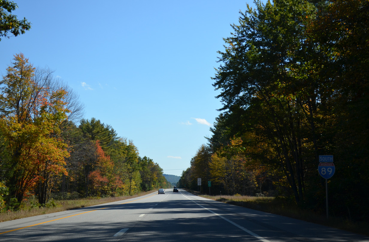
Interstate 89 travels solo for the remaining 31 miles to Bow.
10/06/14
Interstate 89 crosses the Sutton town line just south of Exit 10. The town center is a seven mile drive via Exit 10 and NH 114 south. Downtown Concord is 32 miles away.
10/06/14
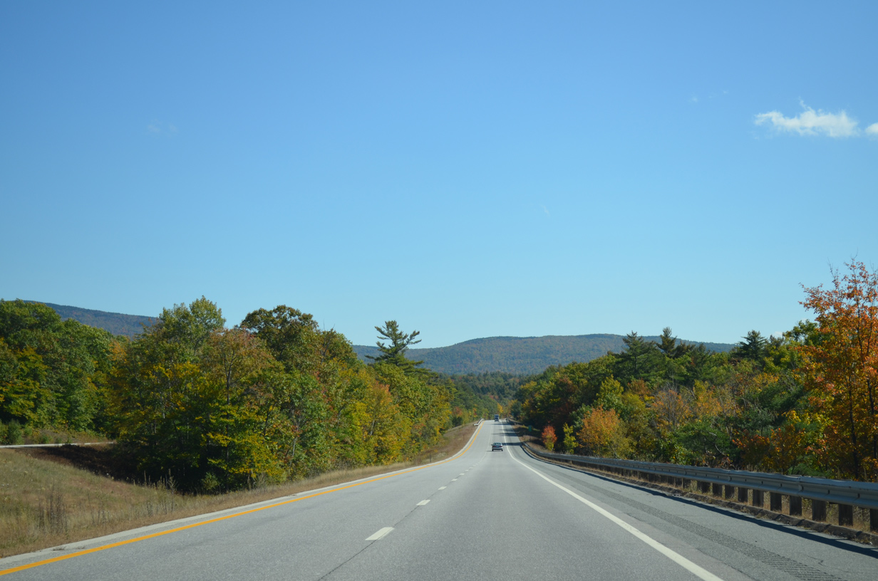
Mount Kearsarge appears to the east as I-89 generally travels southward through Sutton.
10/06/14
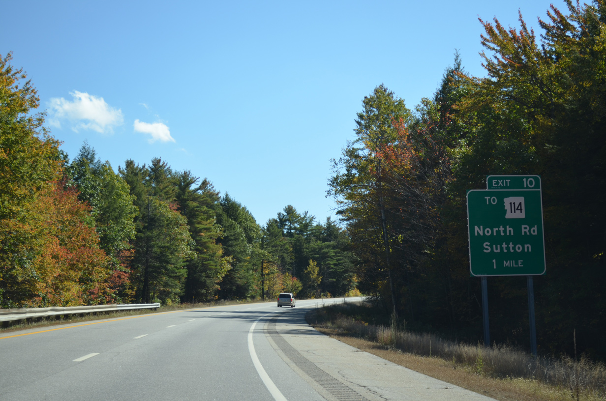
NH 114 (Sutton Road) passes under I-89 en route to North Sutton and Kezar Lake. North Road and Gile Pond Road connect the state route with Interstate 89 at Exit 10.
10/06/14
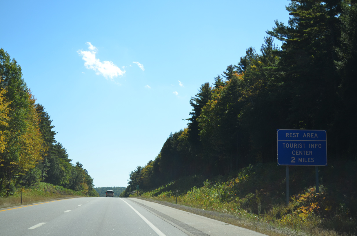
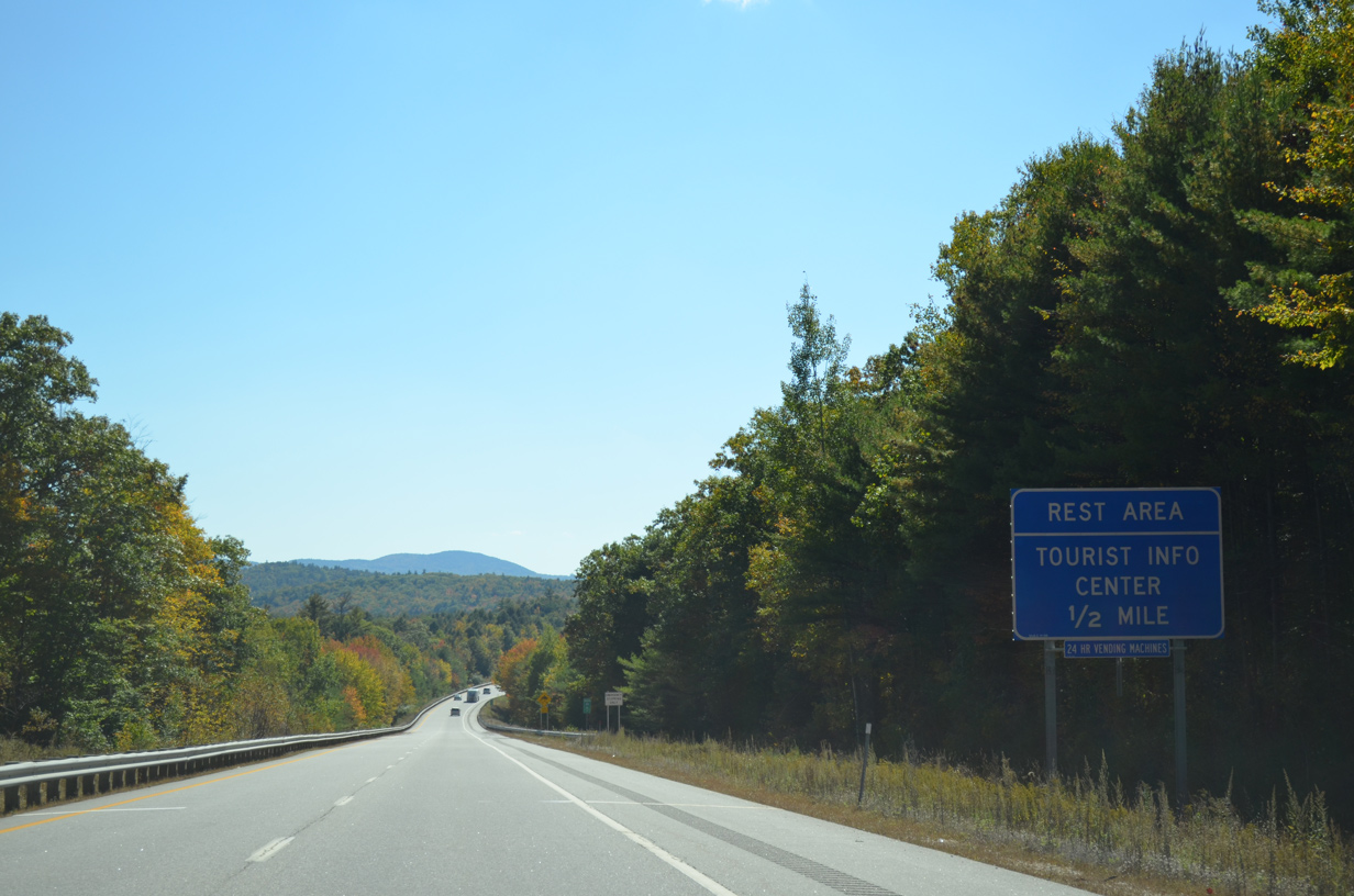
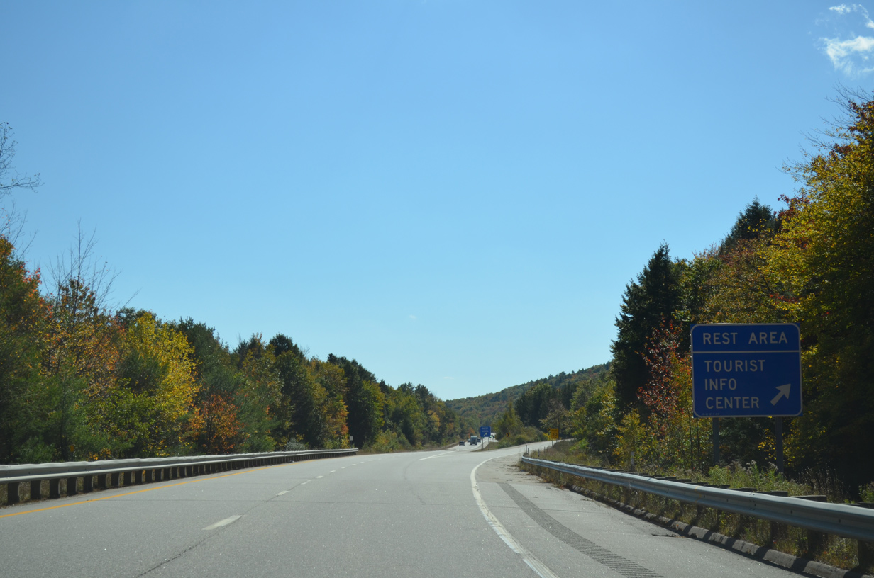
The final rest area for Interstate 89 follows Exit 10 near the Dresser Hills.
10/06/14
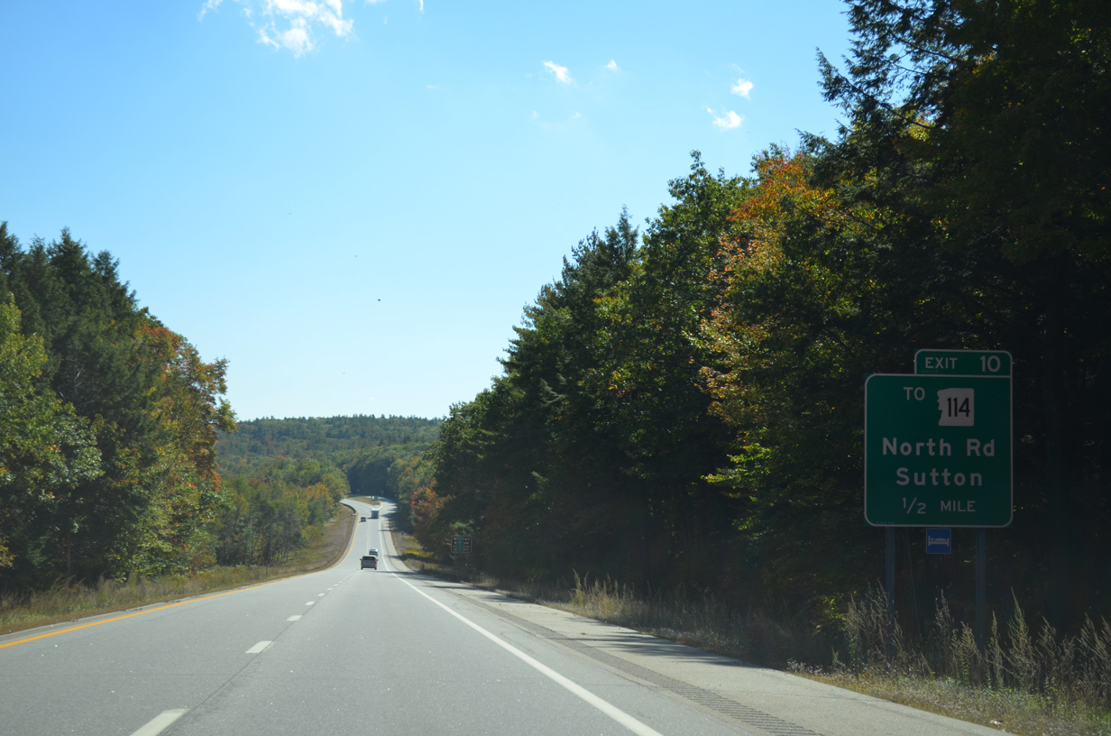
One half mile ahead of the diamond interchange (Exit 10) with North Road to NH 114. NH 114 south leaves the I-89 corridor by way of the Sutton town center and South Sutton into Bradford.
10/06/14
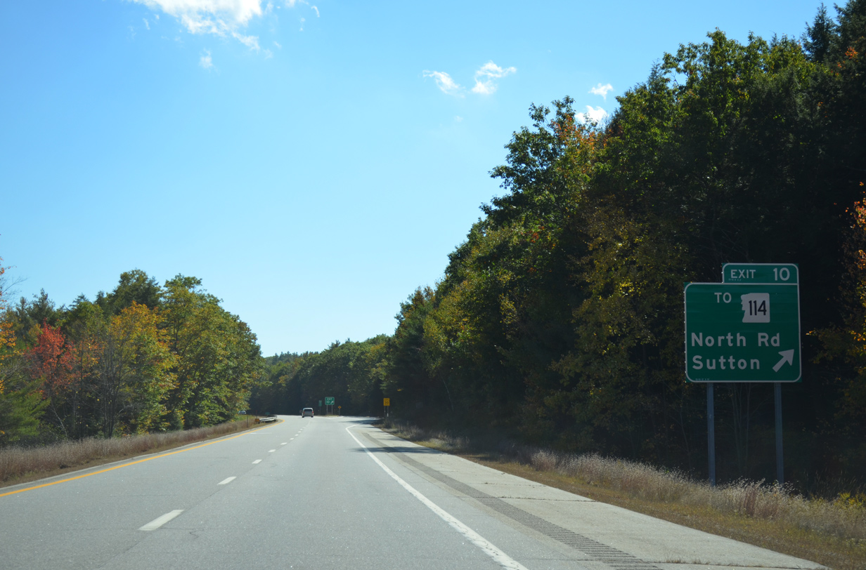
North Road connects Exit 10 with Kearsarge Valley Road north to NH 11 in Wilmot and Winslow State Park on Mount Kearsarge.
10/06/14
Interstate 89 continues south through a valley between Dressler Hills and Mount Kearsarge with a series of wide forested medians.
10/06/14
The aforementioned rest area for Interstate 89 southbound in Sutton.
10/06/14
Winding eastward alongside Stevens Brook, Interstate 89 continues to the Warner town line.
10/06/14
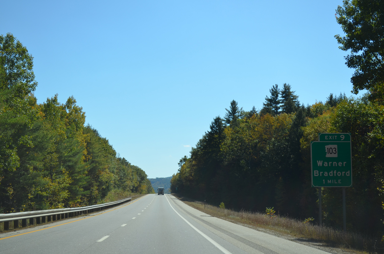
NH 103 follows Warner Road east from Bradford to the first of three interchanges with Interstate 89 at Exit 9.
10/06/14
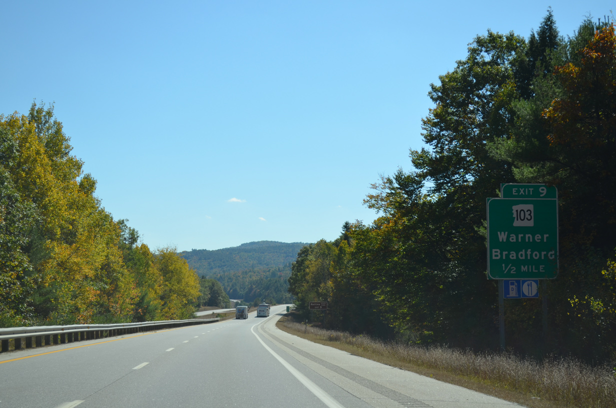
A 48.4 mile route, NH 103 originates in Claremont from NH 12/12A and ends at U.S. 202/NH 9 in Hopkinton.
10/06/14

NH 103 loops east through the Warner town center from the parclo interchange (Exit 9) with I-89 to Lower Village.
10/06/14
Reassurance marker for Interstate 89 south posted beyond the first crossing over the Warner River.
10/06/14
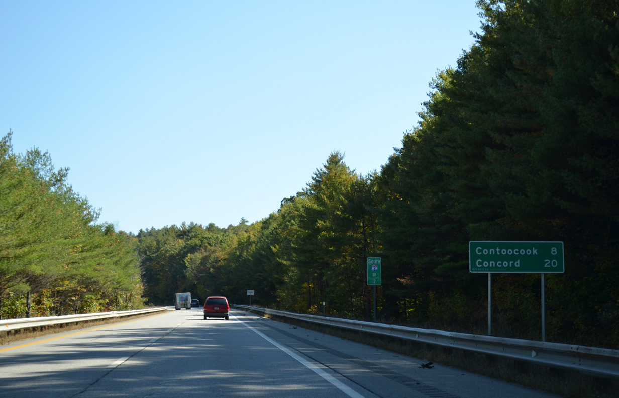
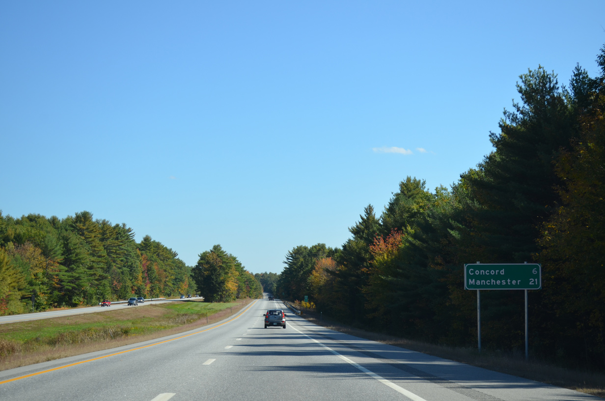
Contoocook, a community in north Hopkinton, is referenced next on distance signs for I-89 south at eight miles out. Comcord is a 20 minute drive away.
10/06/14
West Joppa Road passes underneath I-89 in this scene from a covered bridge across the Warner River.
10/06/14

A half diamond interchange (Exit 8 from northbound) adds traffic to I-89 south from NH 103 near Bagley.
10/06/14
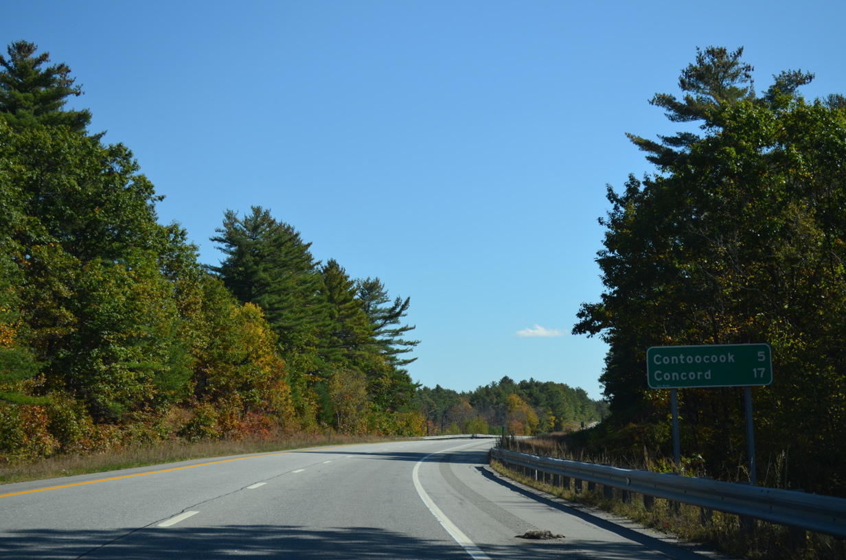
Contoocook is five miles to the southeast along Interstate 89 and NH 103 south.
10/06/14
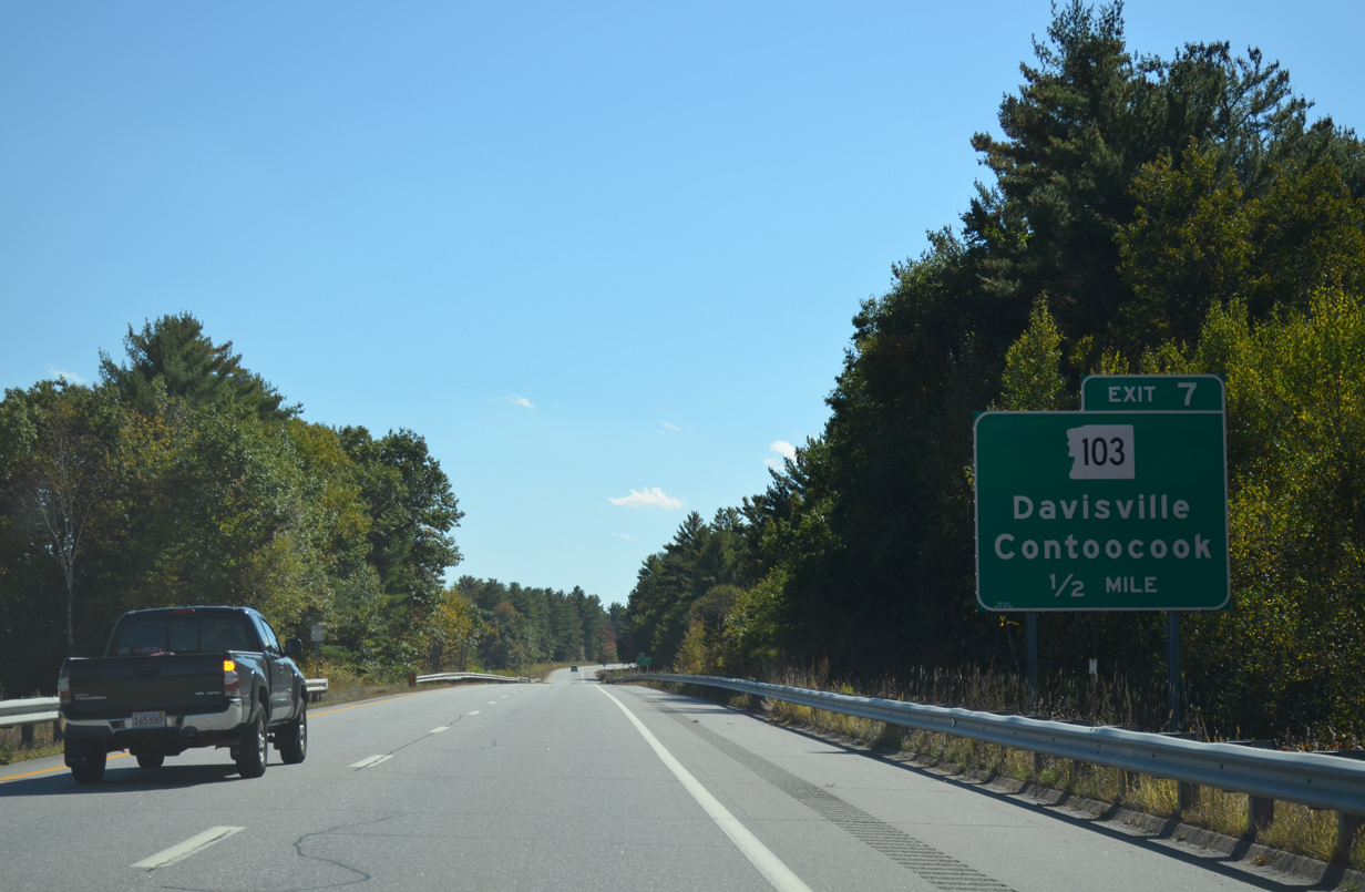
South from Bagley, NH 103 reaches Diamond and an eastern turn to cross paths with I-89 again.
10/06/14
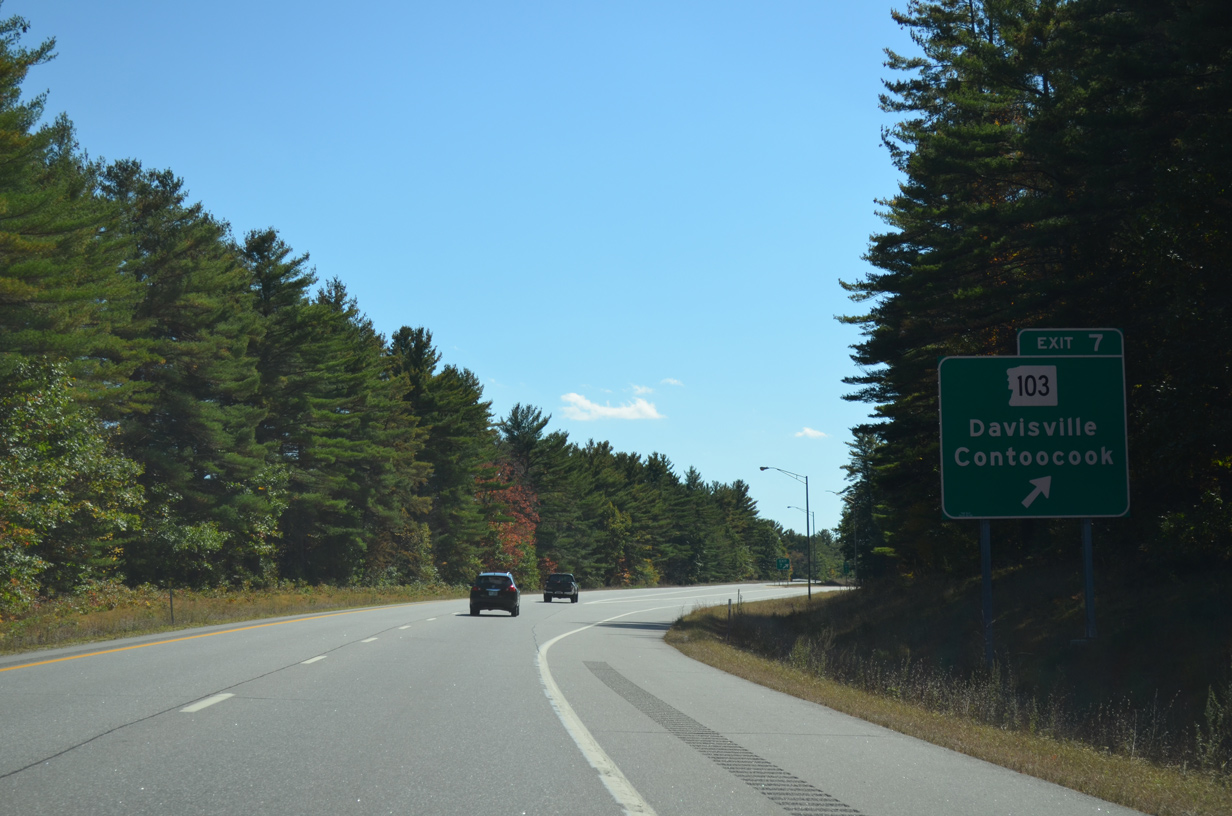
East from the modified diamond interchange (Exit 7) with I-89, NH 103 arcs southward to Contoocook. NH 127 overlaps with NH 103 south for 2.1 miles from Davisville to Main Street in Contoocook.
10/06/14
Interstate 89 passes into the town of Hopkinton ahead of a long straight away west of Contoocook.
10/06/14
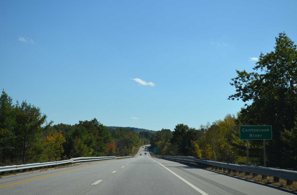
Spanning the Contoocook River along Interstate 89 south. The southbound bridge was built in 1959; the northbound crossing was in 1967. Both were rebuilt in 1991.
10/06/14
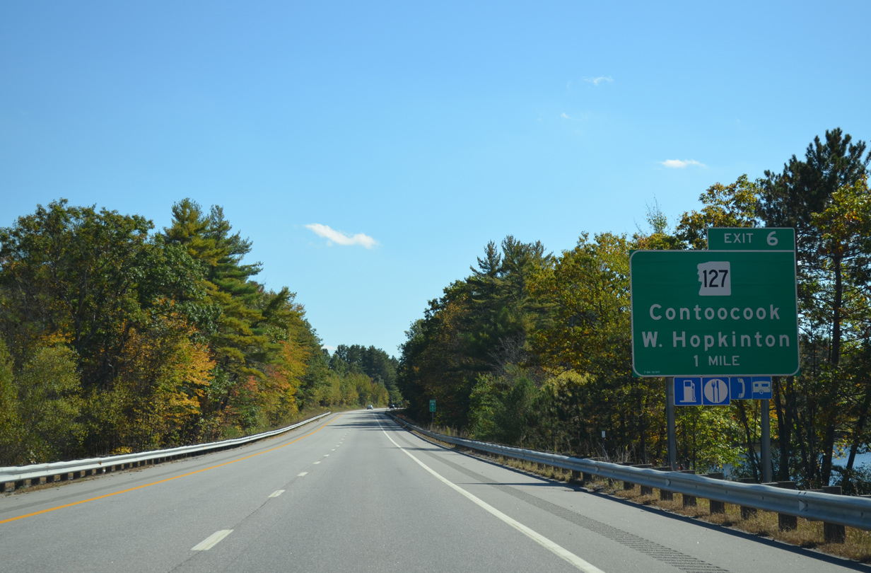
NH 127 (Maple Street) branches south from NH 103 (Main Street) at Contoocook to converge with Interstate 89 in one mile.
10/06/14
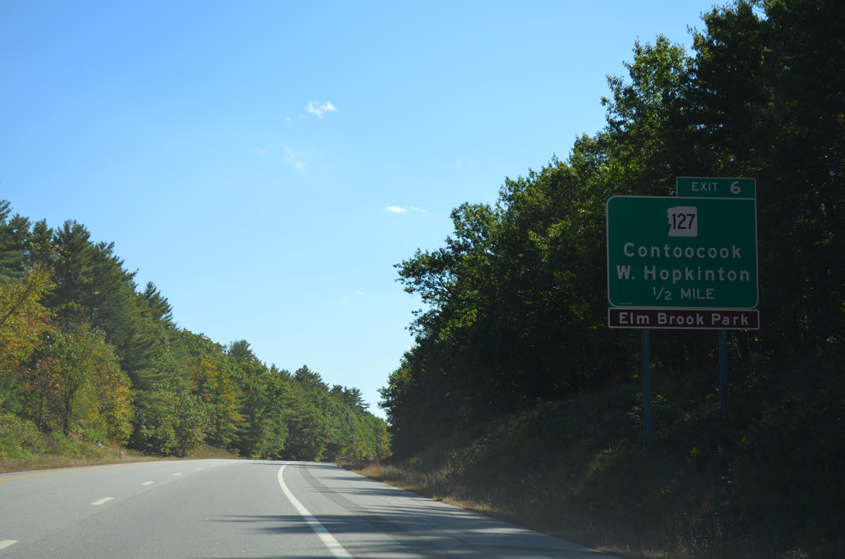
NH 127 weaves west by Hopkinton-Everett Reservoir and Elm Brook Park to West Hopkinton and U.S. 202/NH 9 near Hatfield Corner.
10/06/14
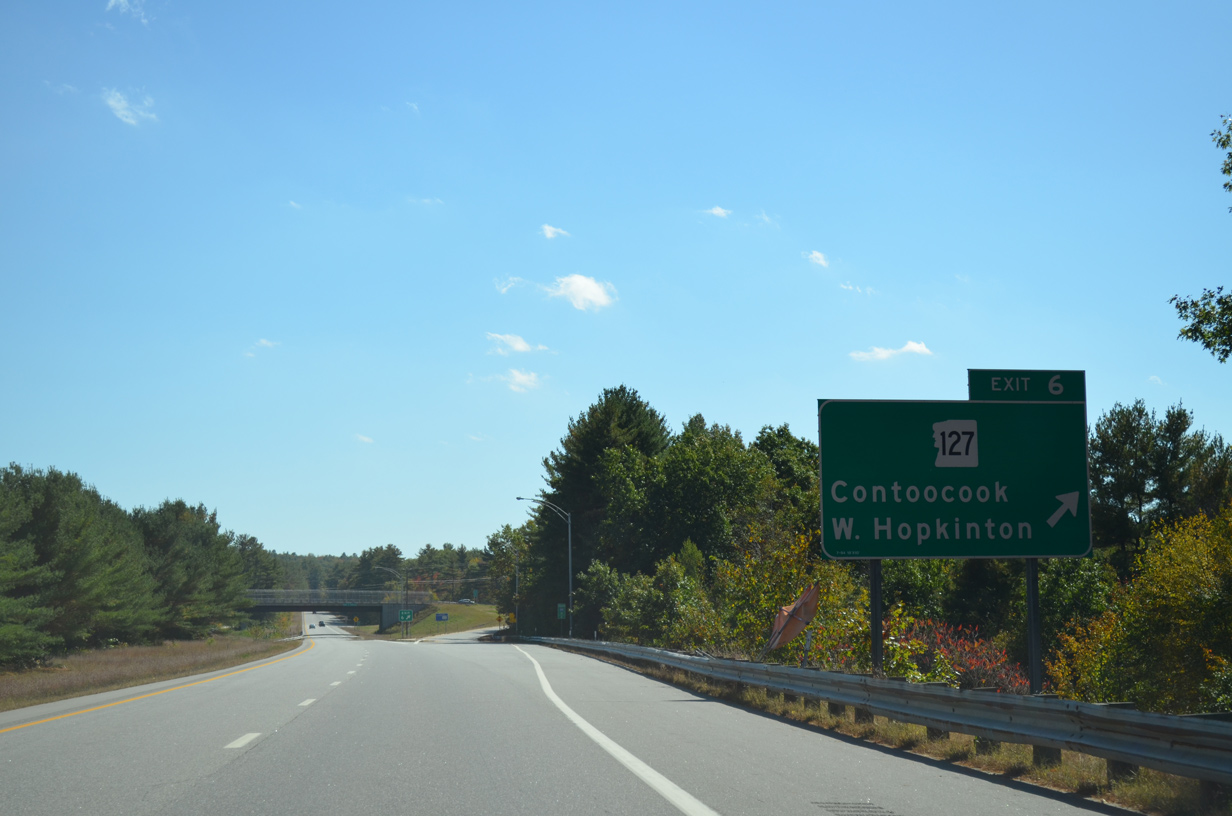
A diamond interchange joins Interstate 89 with NH 127 (Maple Street) at Exit 6. The state route is 31.6 miles long, running north from Hopkinton to Sanbornton.
10/06/14

Interstate 89 turns eastward between Hopkinton-Everett Reservoir and Putney Hill.
10/06/14
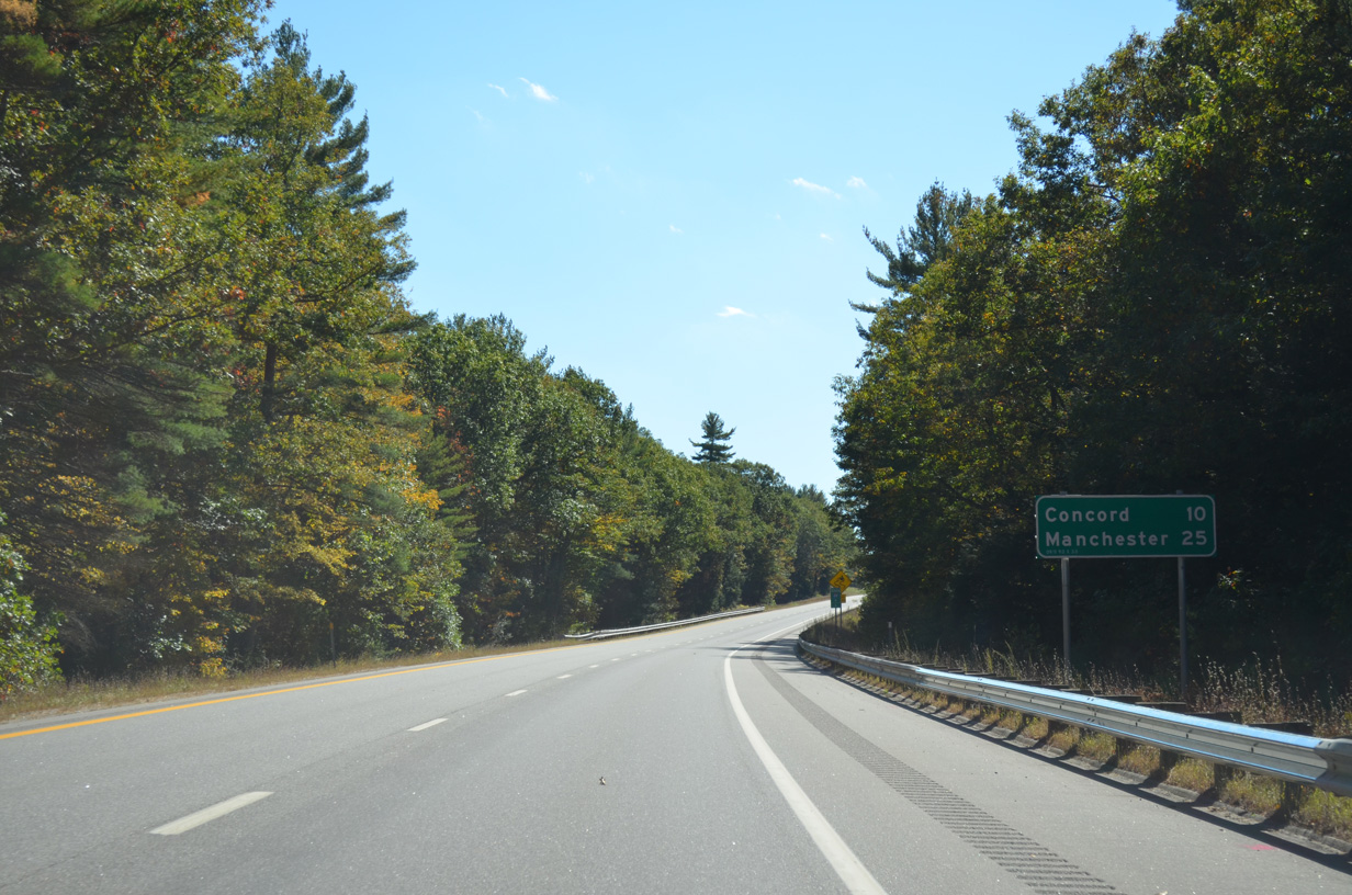
Ten miles west of Downtown Concord, Manchester via the F.E. Everett Turnpike south, appears on this distance sign.
10/06/14
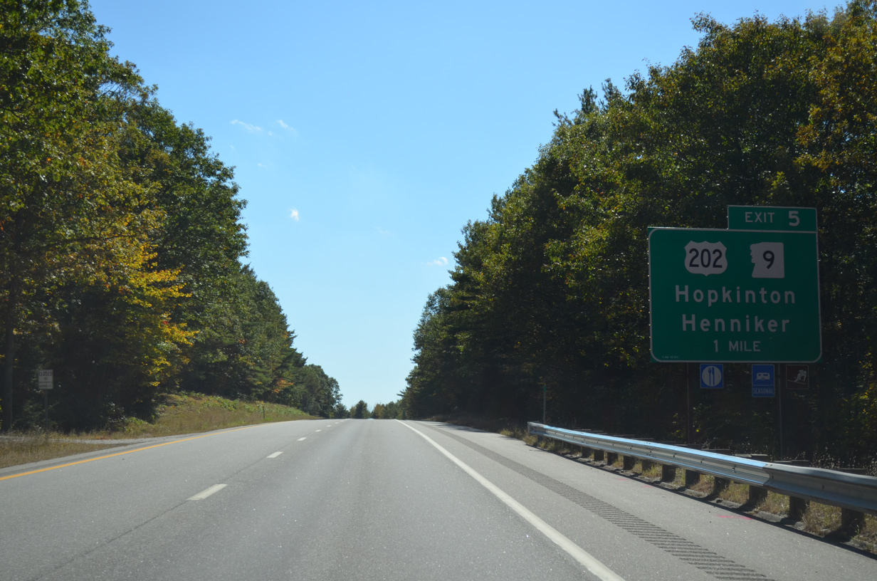
U.S. 202/NH 9 combine in Hillsborough and take a two lane expressway eastward through Henniker to Exit 5 with Interstate 89.
10/06/14
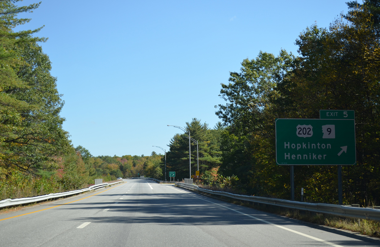
A loop ramp departs I-89 south for U.S. 202/NH 9 east to the Hopkinton town center. The pair take Hopkinton Road east to Pleasant Street and Downtown Concord.
10/06/14

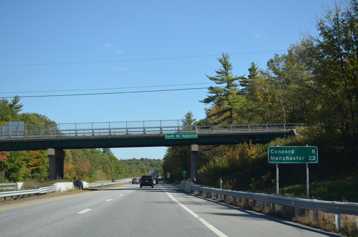
A wye interchange brings traffic from the U.S. 202/NH 9 expressway onto I-89 south at this shield assembly and the South Road overpass. U.S. 202/NH 9 both extend well into Maine, with MSR 9 ending at the Canadian border at St. Stephen, New Brunswick.
10/06/14
Downtown Concord is an eight mile drive via I-89 south to I-93 north. Travelers taking I-93 south from Bow reach Downtown Manchester in 23 miles.
10/06/14
A second wye interchange (Exit 4 on northbound) provides access to Interstate 89 south from U.S. 202/NH 9 east from Hopkinton. This shield assembly follows the on-ramp.
10/06/14
Interstate 89 continues east from Hopkinton into the Concord city limits. A third wye interchange (Exit 3 on northbound) with Stickney Hill Road lies 2.75 miles ahead.
10/06/14
Interstate 89 stays through the rural outskirts of Concord southeast to Bow. Manchester is a 15 mile drive south from the freeway end.
10/06/14
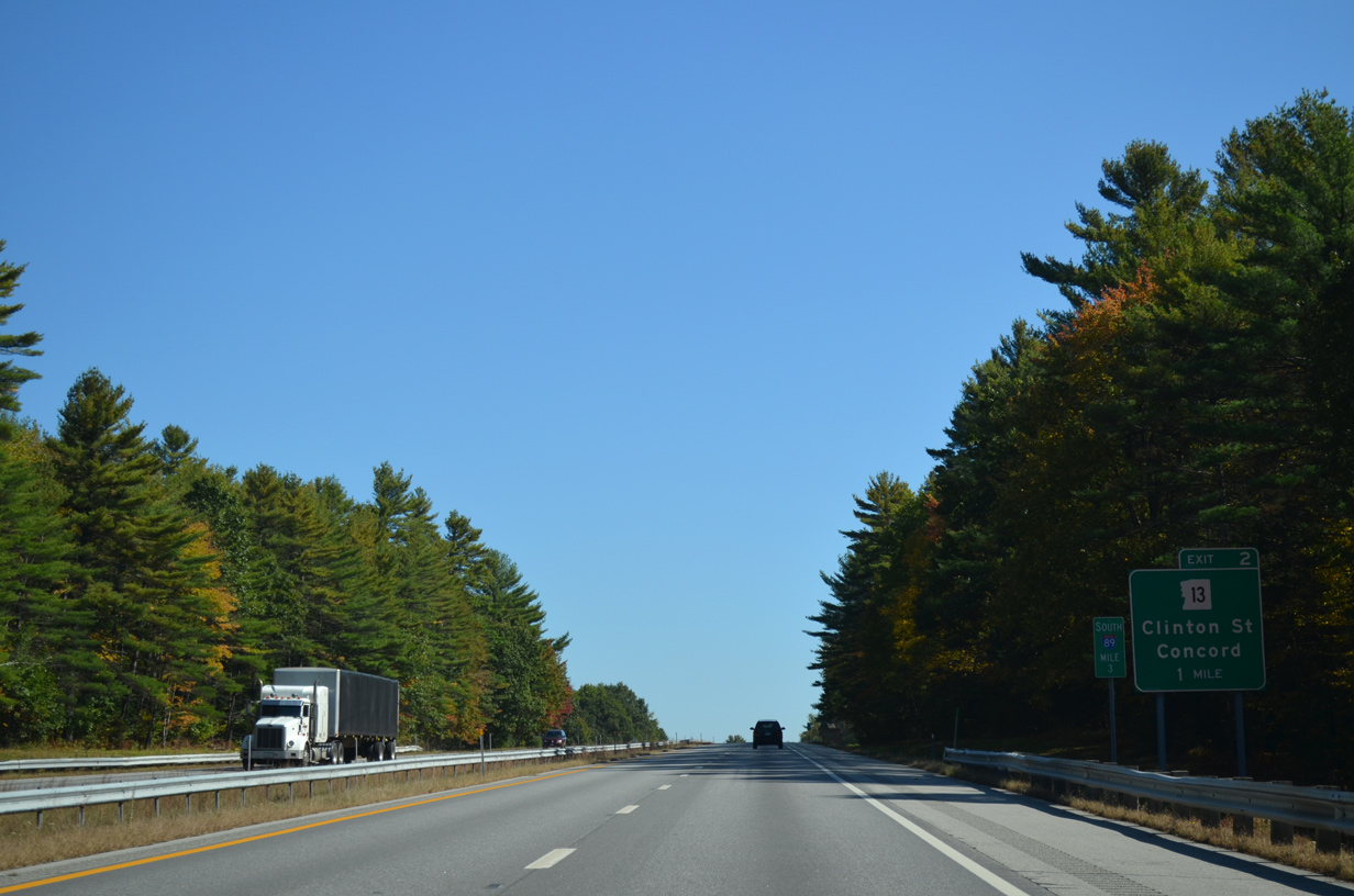
NH 13 and Interstate 89 come together at a parclo interchange (Exit 2) in one mile on Silver Hill.
10/06/14
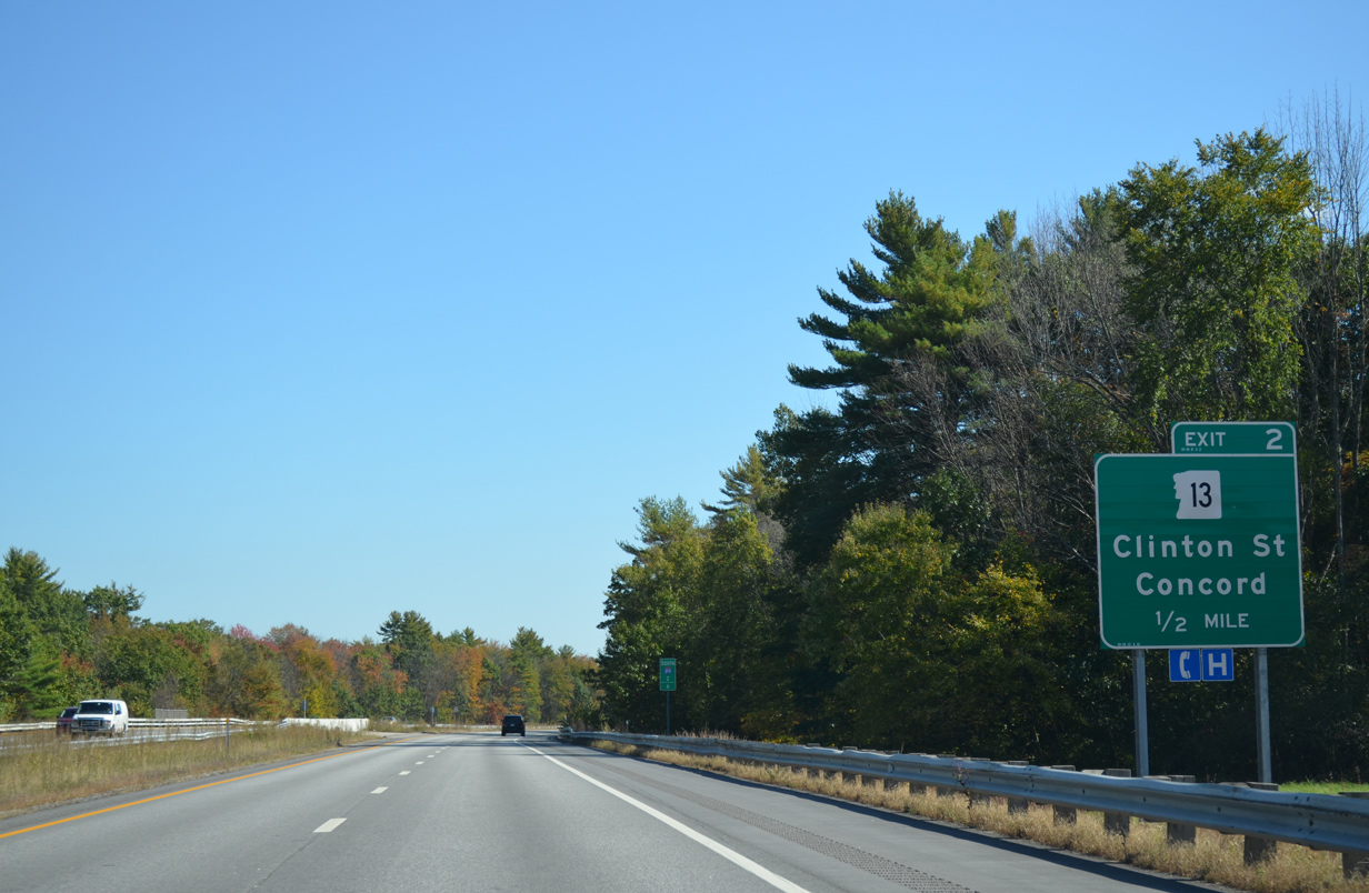
East from Exit 2, NH 13 follows Clinton Street to South Street and U.S. 202/NH 9 (Pleasant Street) in Downtown Concord.
10/06/14
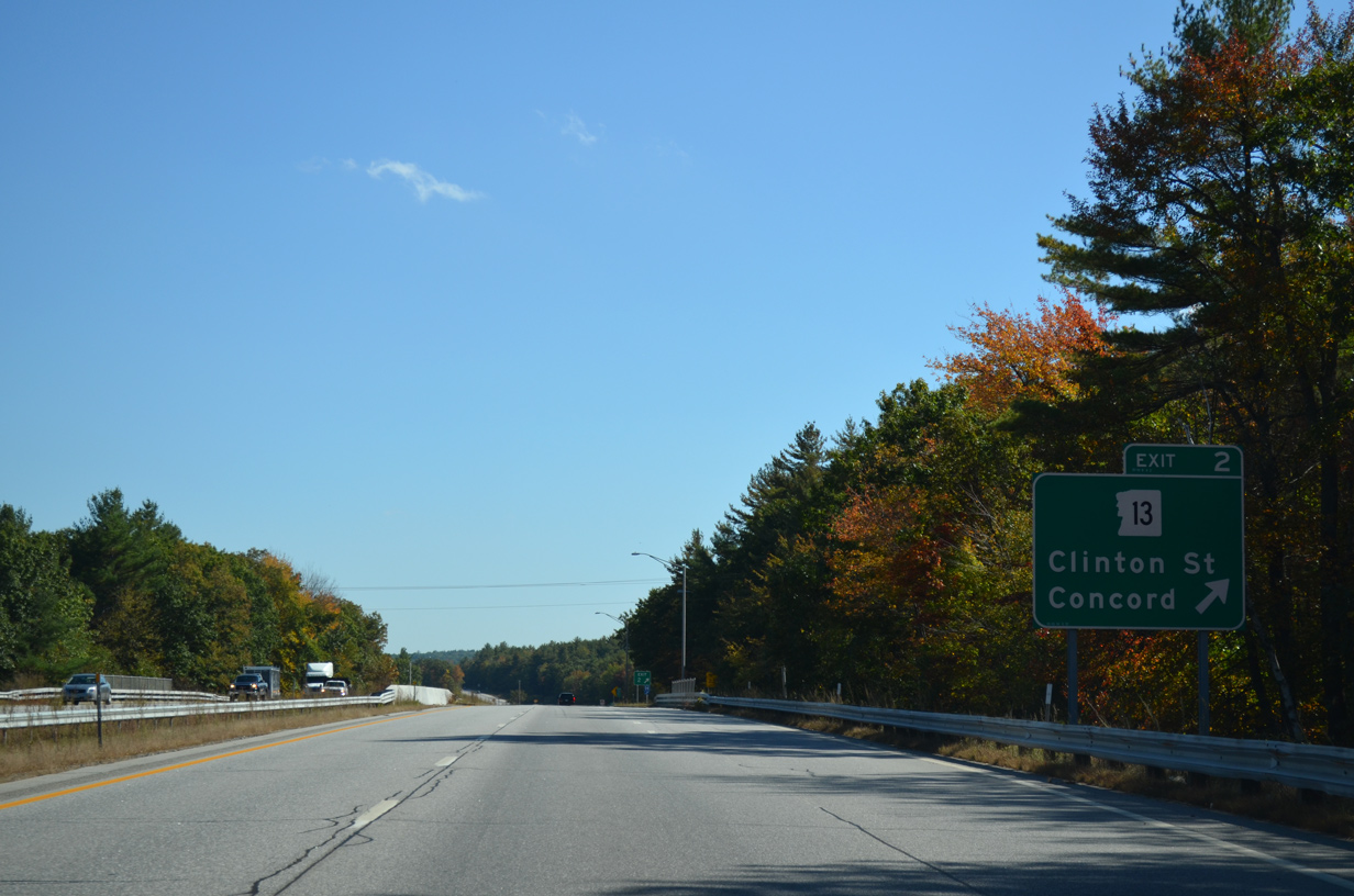
Southbound at the loop ramp (Exit 2) for NH 13 (Clinton Street) on I-93. NH 13 comprises part of a 57.5 mile long multi-state route south from Concord to Leominster, Massachusetts.
10/06/14
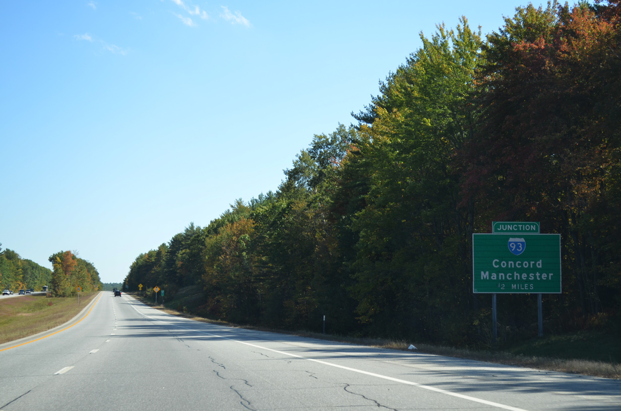
I-89 runs southeast along Silver Hill on the two miles leading to Interstate 93. The interchange between the two freeways is unnumbered in any direction.
10/06/14
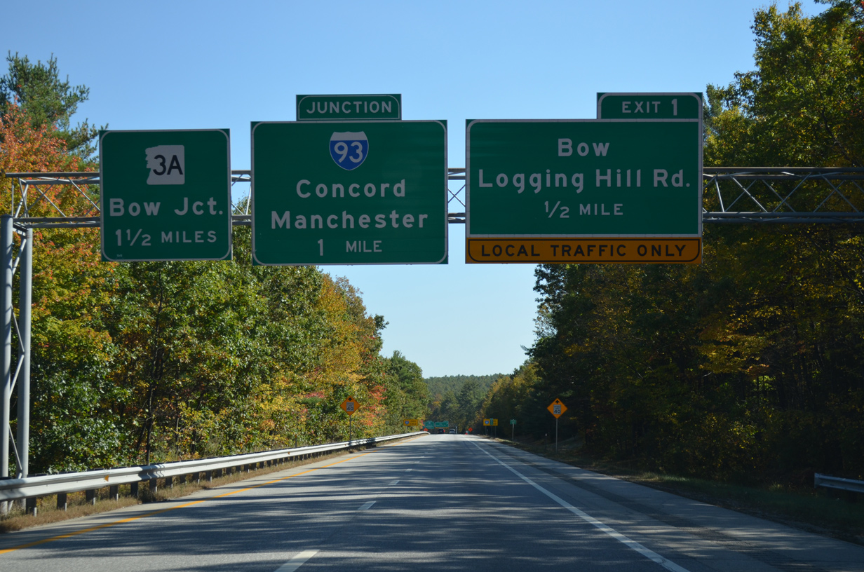
A sequence of three ramps depart Interstate 89 south in quick succession before the freeway concludes at an at-grade intersection with NH 3A and Hall Street. A folded diamond interchange (Exit 1) lies one half mile ahead with Logging Hill Road south and South Street north.
10/06/14

A pair of end signs stand along the freeway as I-89 enters northern reaches of Bow at Bow Mills.
10/06/14
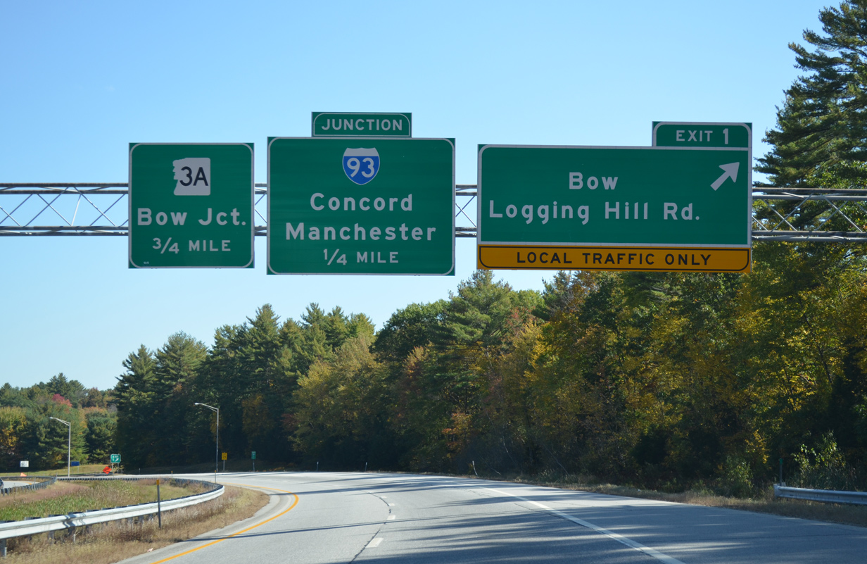
Logging Hill Road heads south from Exit 1 through suburban areas toward Bow Center. South Street extends the road northward to NH 13.
A half cloverleaf interchange follows in one half mile with Interstate 93.
10/06/14
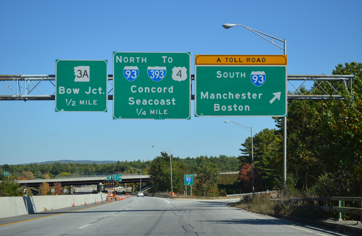
Traffic bound for Manchester and Boston partitions with the ending I-89 south. Interstate 93 transitions into the tolled F.E. Everett Turnpike south from Bow to I-293 at Hooksett.
10/06/14
I-93 travels 189.95 miles overall from St. Johnsbury, Vermont to Canton, Massachusetts. The freeway bypasses Manchester to the east en route to Salem and Lawrence, Massachusetts while the Turnpike remains southward to Merrimack and Nashua.
10/06/14
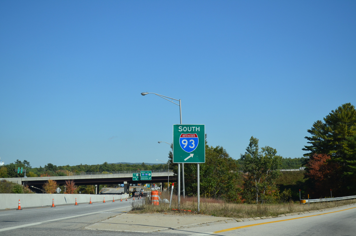
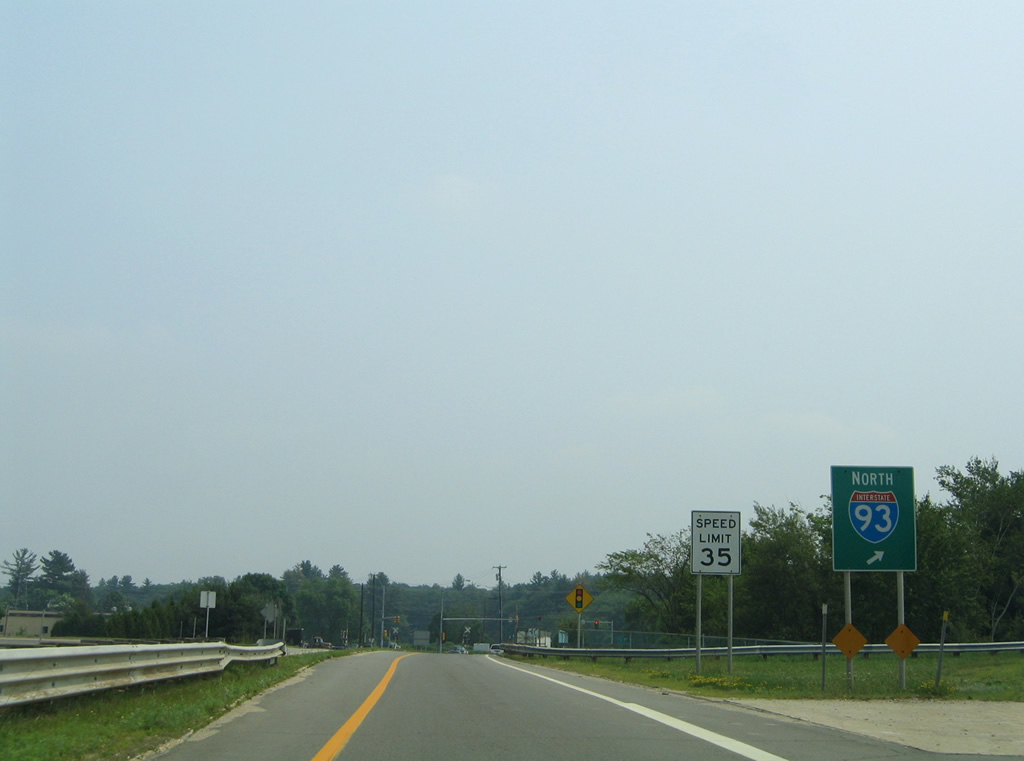
Interstate 89 separates into a loop ramp for Interstate 93 north to Downtown Concord and NH 3A at Bow Junction.
06/27/05
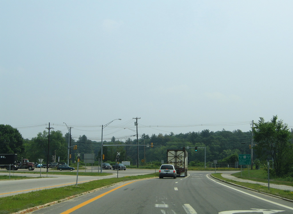
I-93 travels north to I-393 east for Loudon and the Seacoast (via U.S. 4). The freeway leaves Concord for Plymouth, Lincoln and the White Mountains region.
06/27/05
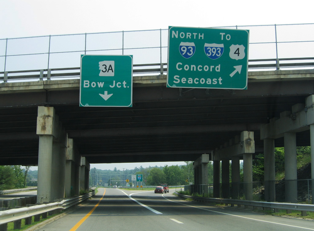
A signalized intersection concludes Interstate 89 opposite Hall Street north along the industrial waterfront of the Merrimack River.
06/27/05
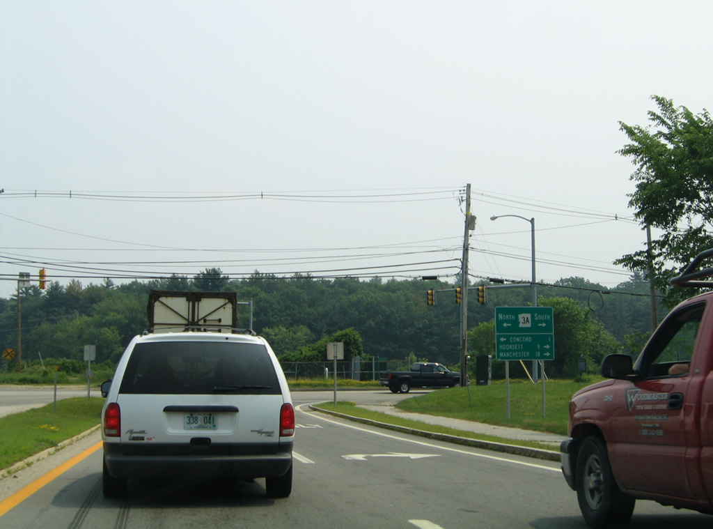
NH 3A constitutes a rural route paralleling the Merrimack River south from Bow Junction to Hooksett and Manchester. The state route ends at U.S. 3 (Water Street), 1.8 miles to the north.
06/27/05

Photo Credits:
- ABRoads: 10/06/14
- Alex Nitzman, Carter Buchanan: 06/27/05
Connect with:
Page Updated Thursday February 12, 2015.