
Interstate 93 South - Plymouth to Concord
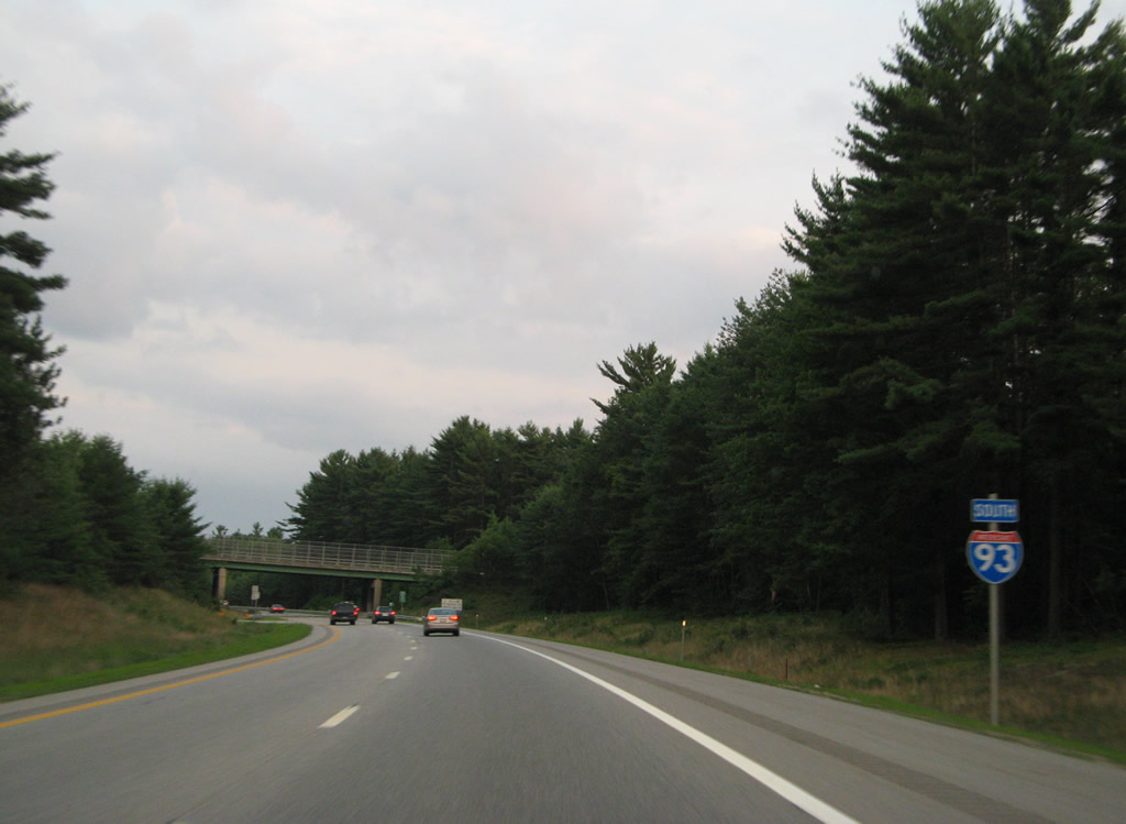
 South
South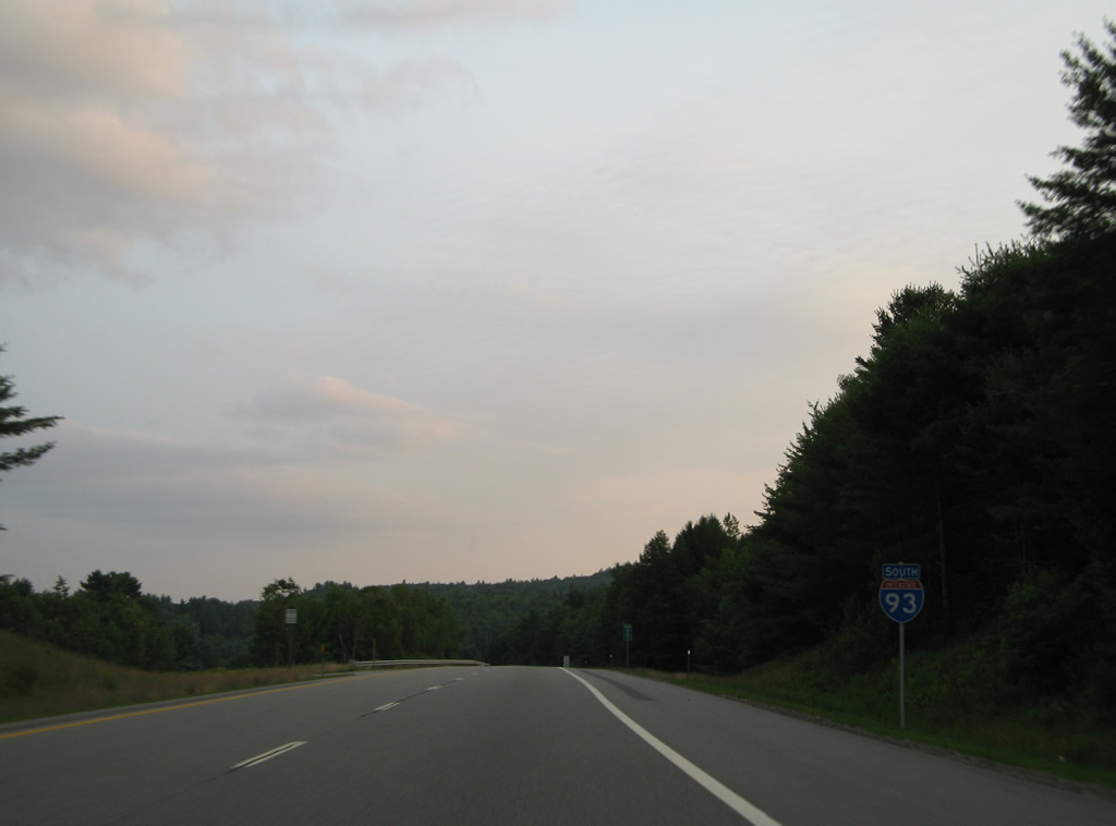
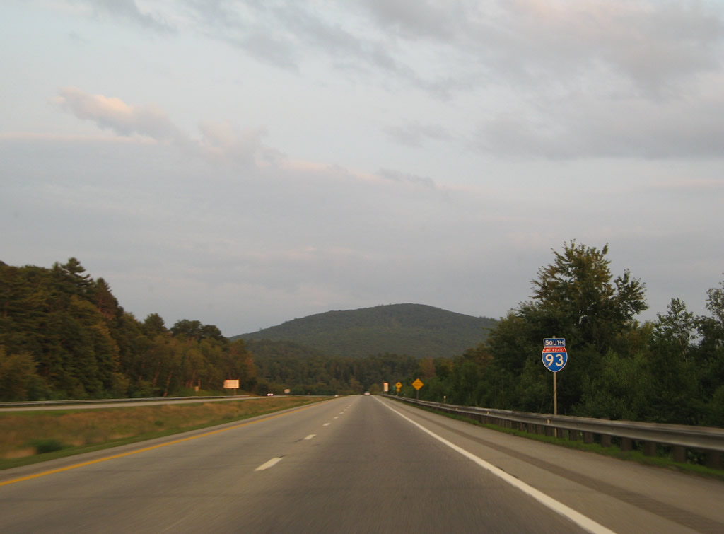
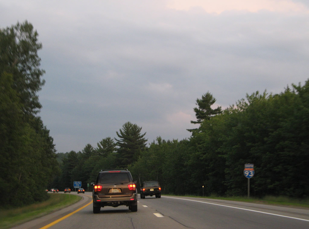
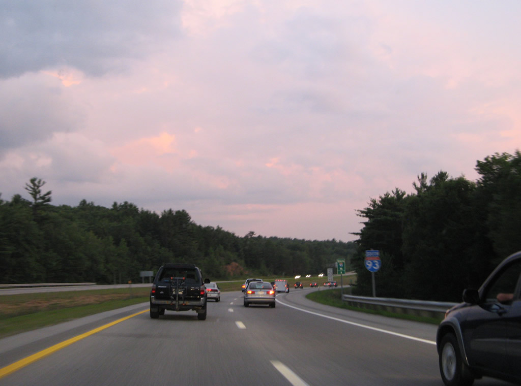
Reassurance marker posted south of Blair as Interstate 93 travels by the eastern slopes of Mt. Pero (elevation 1,421 feet).
07/29/07
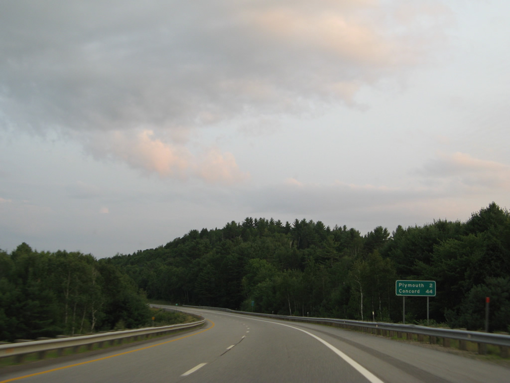
Interstate 93 crosses the Plymouth town line within the next two miles. The capital city of Concord is 44 miles to the south.
07/29/07
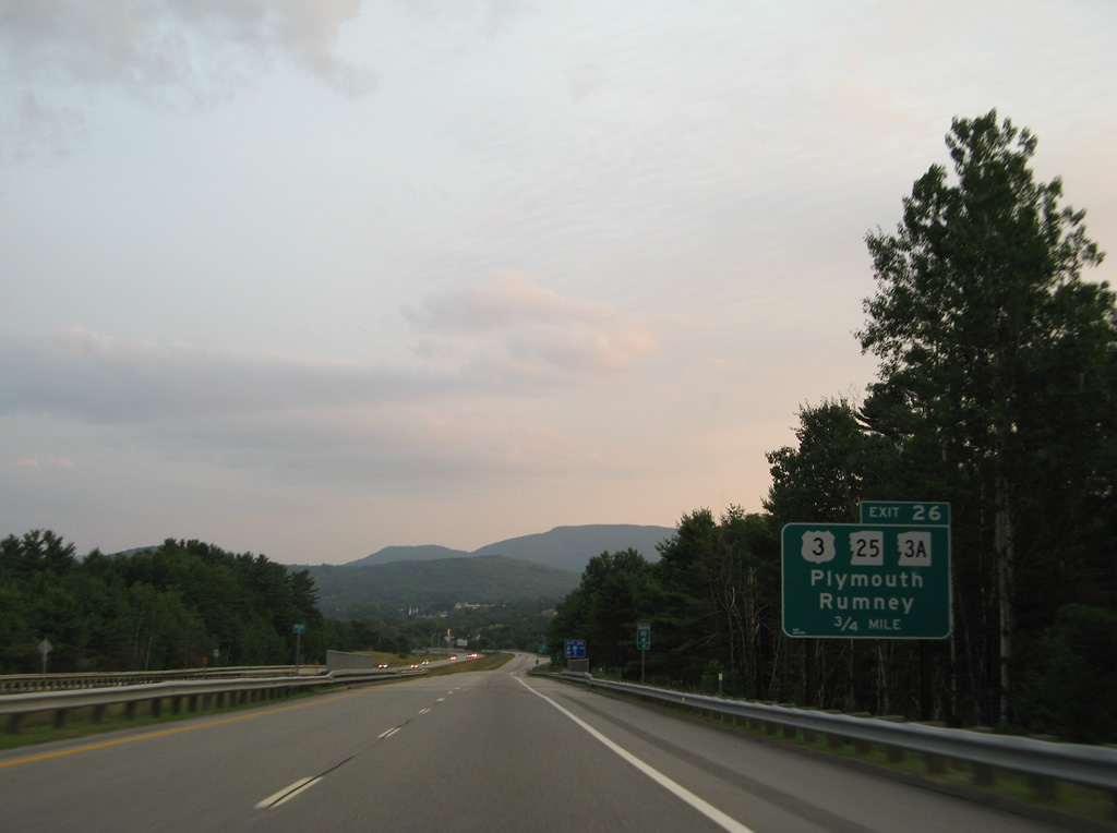
A trumpet interchange (Exit 26) joins Interstate 93 with the north side of Plymouth at NH 3A (Tenney Mountain Highway) south. NH 3A combines with NH 25 north from adjacent U.S. 3 to West Plymouth. NH 25 winds northwest to Rumney through the Baker River Valley.
07/29/07
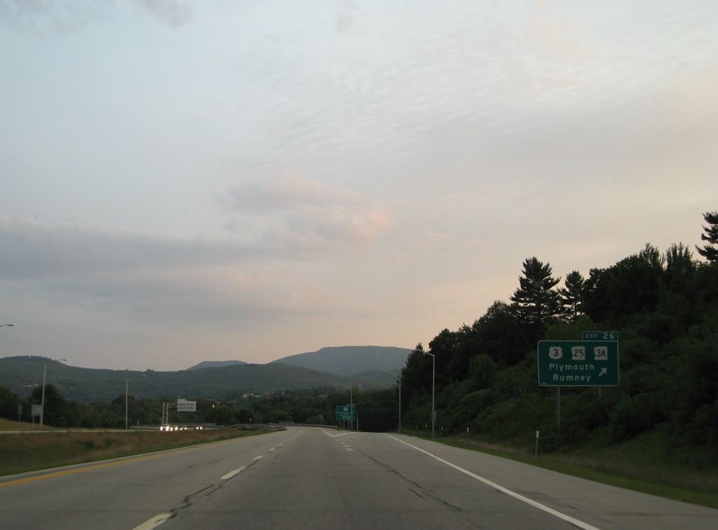
Exit 26 leaves I-93 south for NH 3A (Tenney Mountain Highway) south. A folded diamond interchange connects the state route with U.S. 3 & NH 25 (Main Street) south to Downtown Plymouth and Plymouth State University.
07/29/07
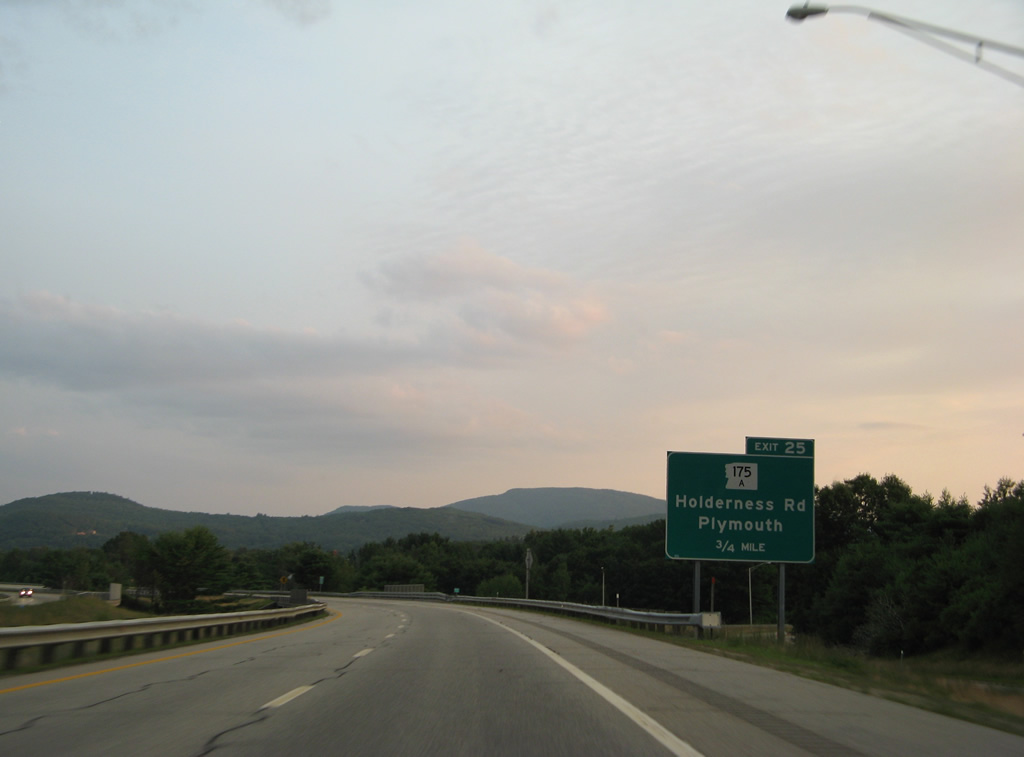
NH 175A follows Bridge Street east from a roundabout with U.S. 3 & NH 25 (Main Street) and High Street to a diamond interchange (Exit 25) with I-93 in 0.75 miles.
07/29/07
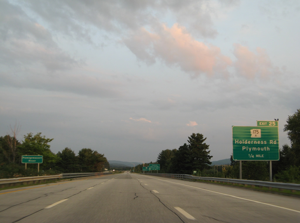
Travelers span the Pemigewasset River ahead of the off-ramp (Exit 25) for NH 175A (Bridge Street). NH 175A ends just east of I-93 at NH 175 (East Side River Road north / North Holderness Road south).
07/29/07
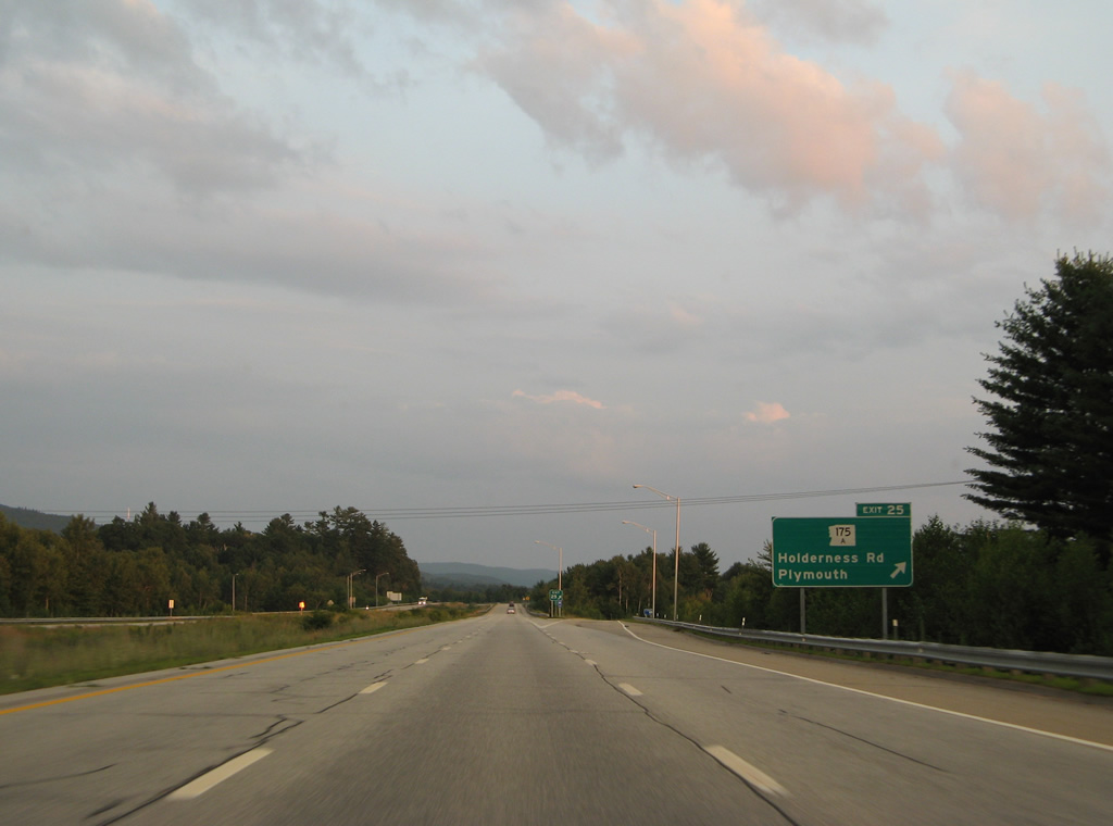
Adjacent NH 175 parallels Interstate 93 and the Pemigewasset River south from North Woodstock to Holderness, where the route turns southeast to its end at U.S. 3 & NH 25 by Little Squam Lake.
07/29/07
Hicks Hill (elevation 1,385 feet) rises to the southeast of Interstate 93 as the freeway approaches the Ashland town line.
07/29/07
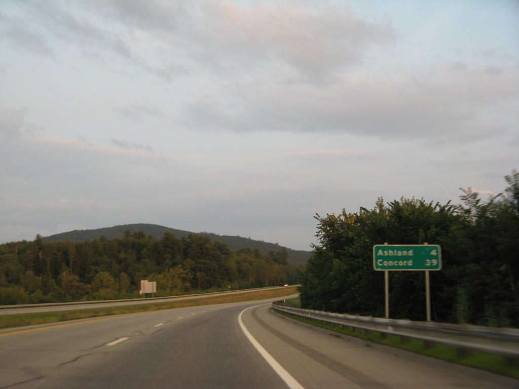
Exit 24 departs in four miles for the Ashland town center. Concord is now 39 miles away.
07/29/07
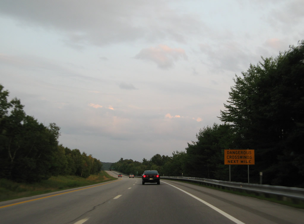
High crosswinds are possible in the Pemigewasset River valley between Bridgewater Mountain (elevation 1,654 feet) and Hicks Hill.
07/29/07
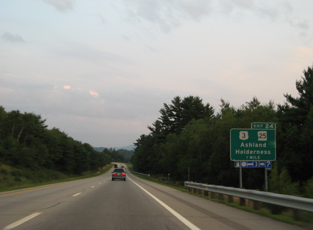
U.S. 3 & NH 25 cross the Pemigewasset River onto Main Street just west of I-93. The pair meet the freeway at a parclo interchange (Exit 24) in one mile.
07/29/07
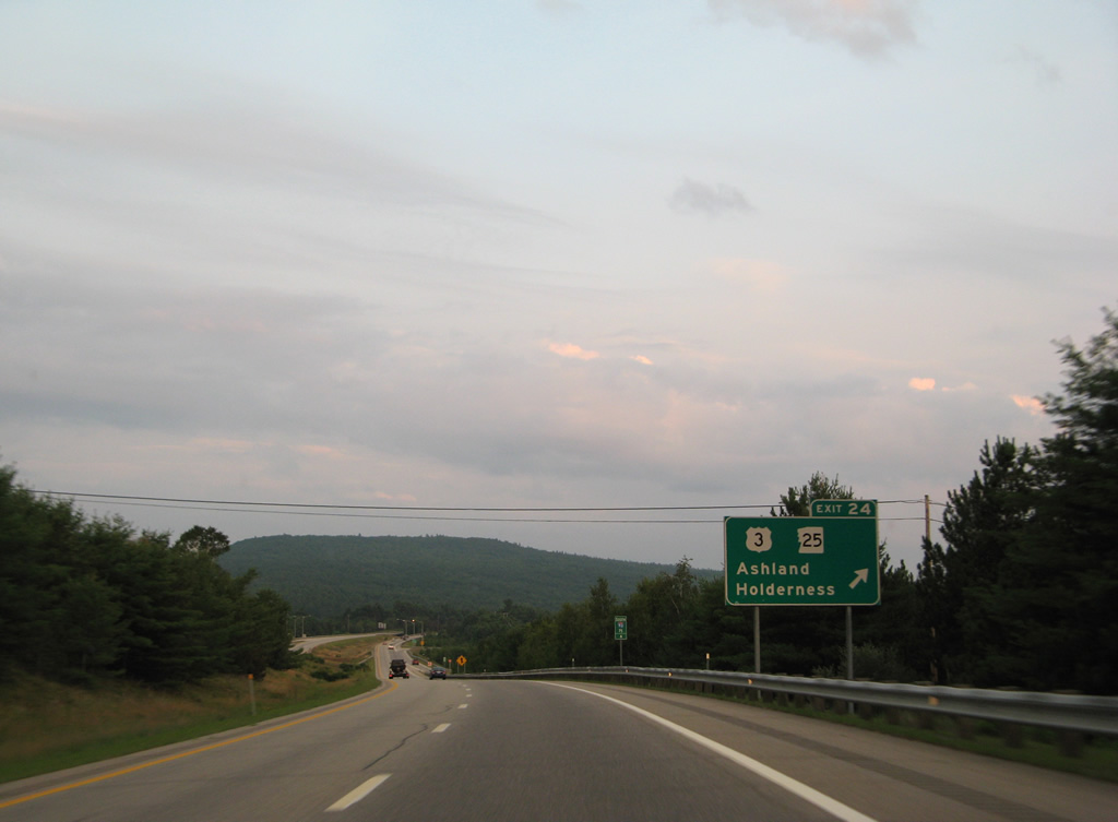
Exit 24 leaves Interstate 93 south for U.S. 3 & NH 25 (Main Street) in Ashland. The tandem turn northward along Riverside Drive to Holderness and the Squam Lakes Region.
U.S. 3 loops away from I-93 overall to Meredith, Lake Winnipesaukee and Laconia before returning to the freeway at Tilton (Exit 20).
07/29/07
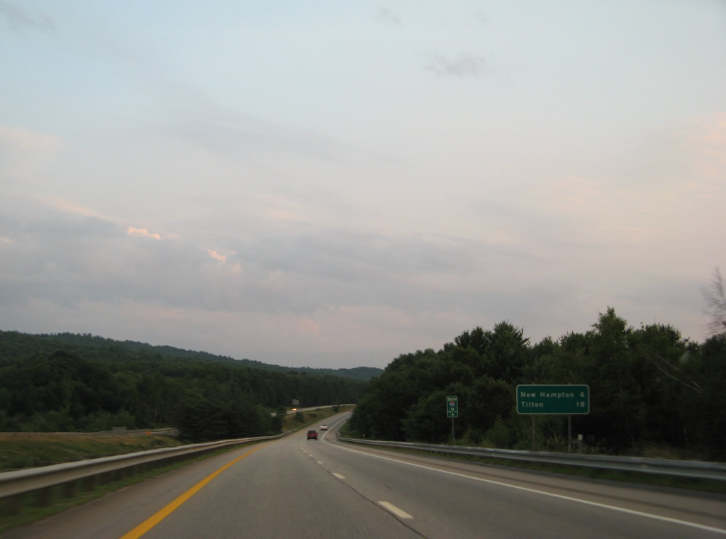
Interstate 93 continues south along the Pemigewasset River to enter Belknap County on the six mile drive to New Hampton. Tilton appears in place of Concord here at 18 miles out.
07/29/07
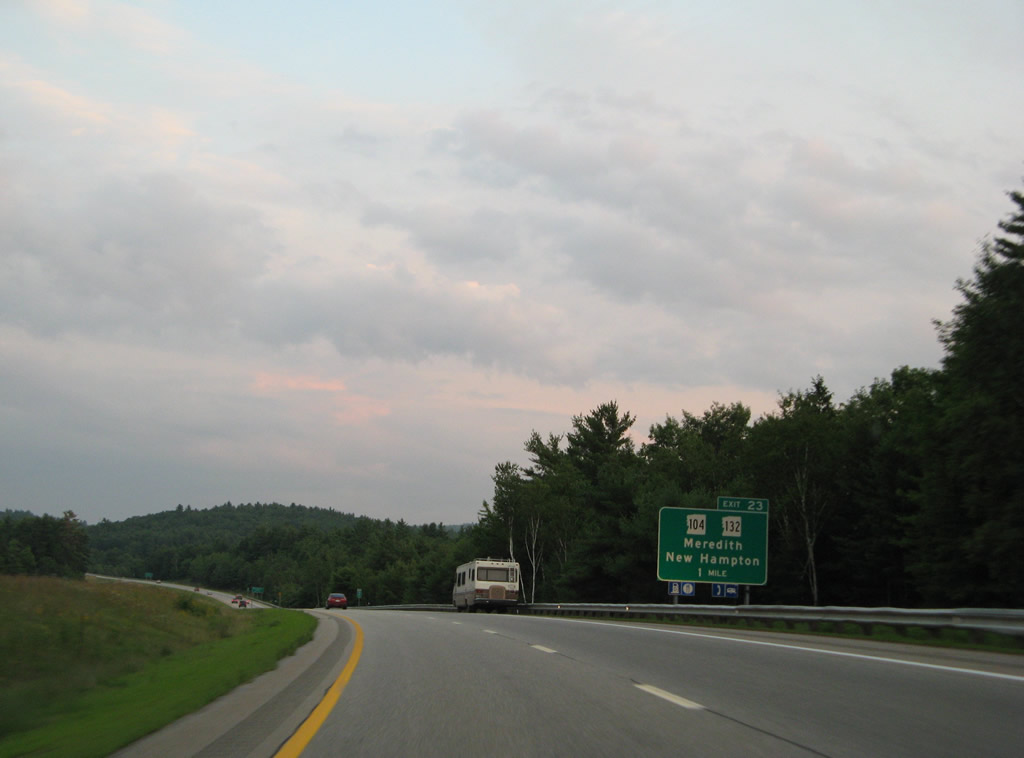
NH 132 commences a 40 mile route south in Ashland. The state route winds south parallel to I-93 to combine with NH 104 ahead of a diamond interchange (Exit 23) with the freeway in New Hampton.
07/29/07
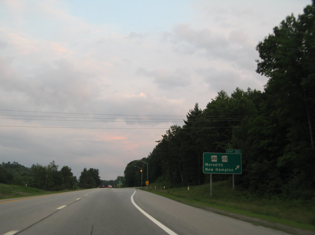
West from Exit 23, NH 104 and 132 part ways at the New Hampton town center on respective paths to Bristol and Spectacle Pond in Meredith. NH 140 totals 23 miles overall from U.S. 4 in Danbury to U.S. 3 in Meredith. Connections of NH 104 with NH 3A north lead motorists to Newfound Lake.
07/29/07
Pinnacle Hill Road crosses over Interstate 93 beyond this southbound reassurance marker. The freeway winds through western reaches of the Meredith town limits by Spectacle Pond ahead.
07/29/07
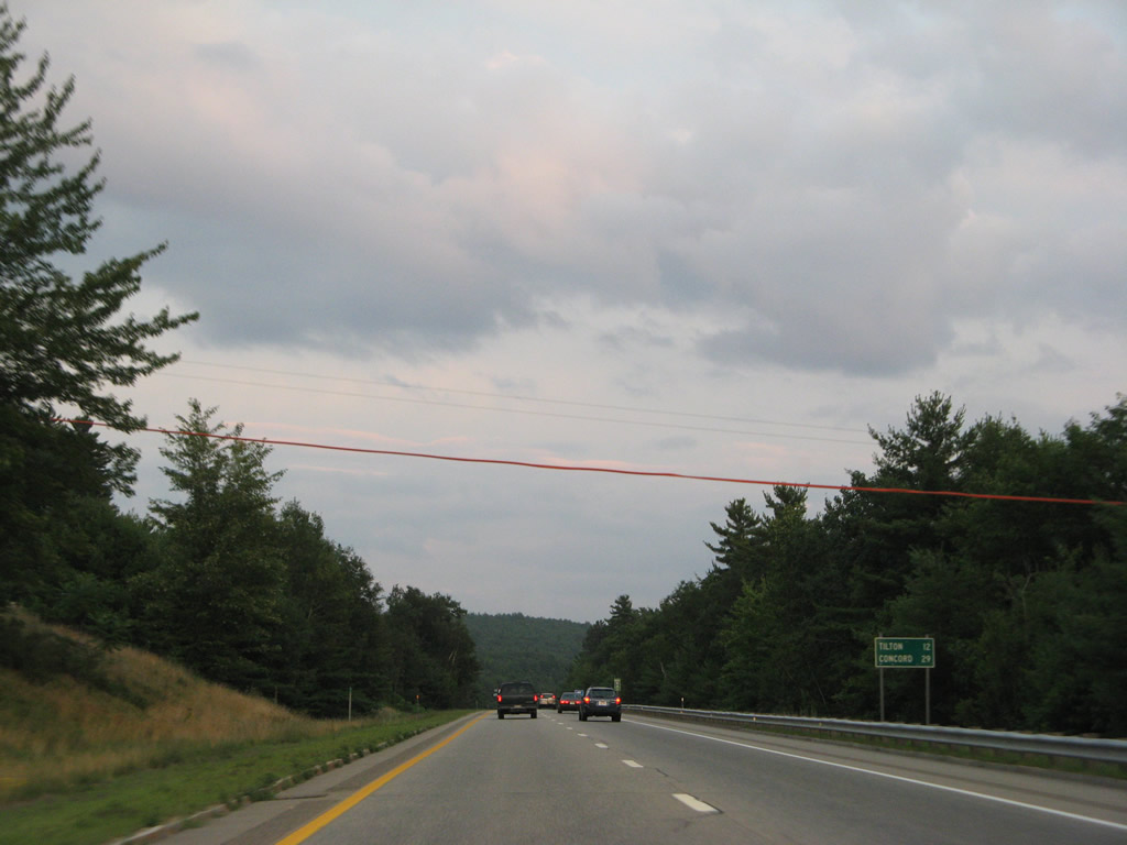
Concord reappears at 29 miles away on this southbound distance sign posted 12 miles from Tilton.
07/29/07
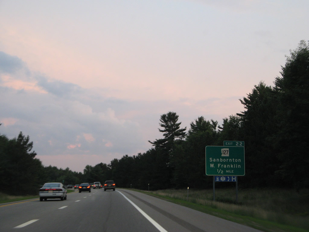
NH 127 originates from NH 132 (Stage Road) at Gaza in Sanbornton to the east of forthcoming Exit 22.
07/29/07
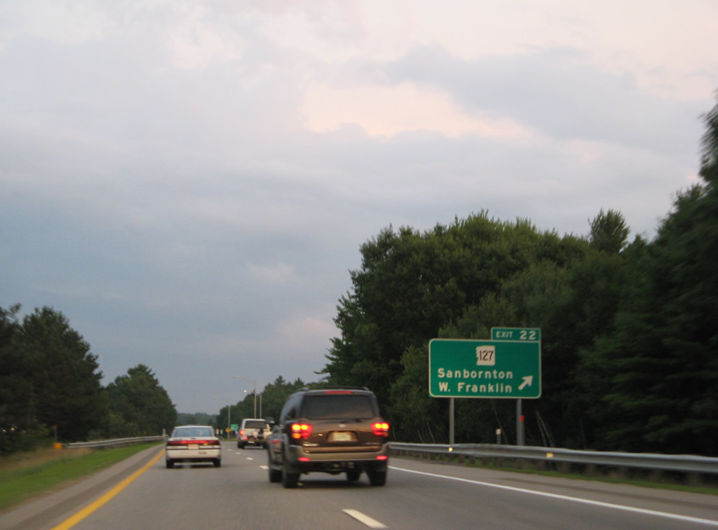
Entering the half cloverleaf interchange (Exit 22) with NH 127 (New Hampton Road) on Interstate 93 south. NH 127 ventures southwest from Sanbornton to Franklin as part of a 31.6 mile route to Hopkinton.
07/29/07
Interstate 93 angles southeast from Sanbornton to Tilton.
07/29/07
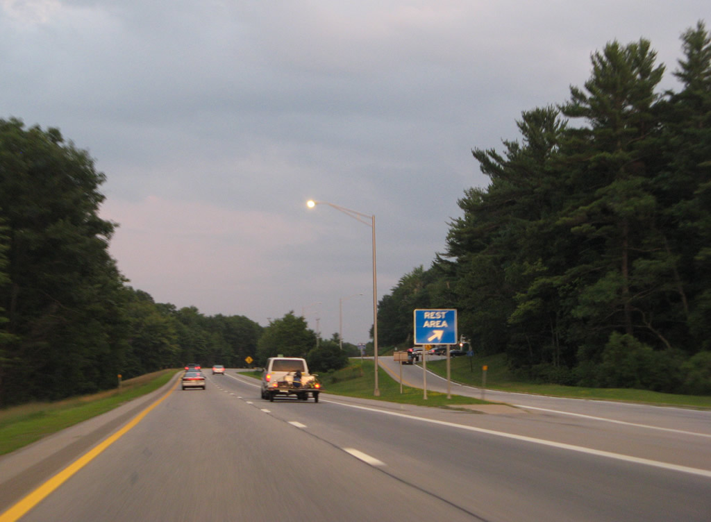
A rest area and tourist information center lines Interstate 93 southbound to the west of the Sanbornton town center. A northbound facility lies to the south at Northfield.
07/29/07
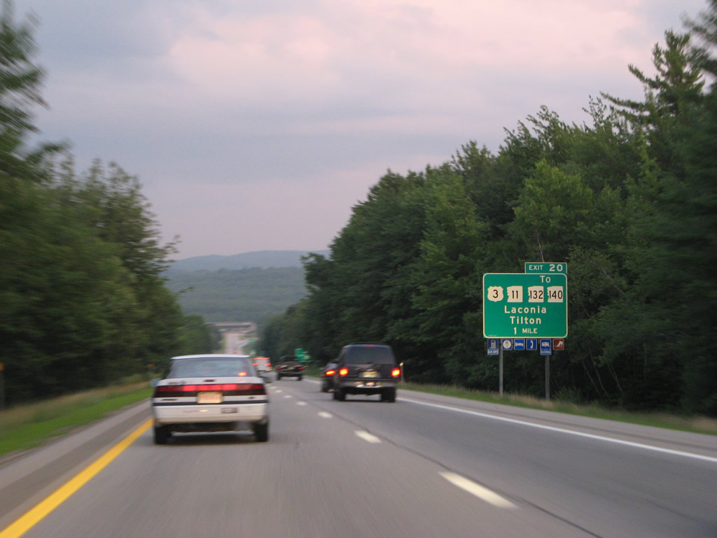
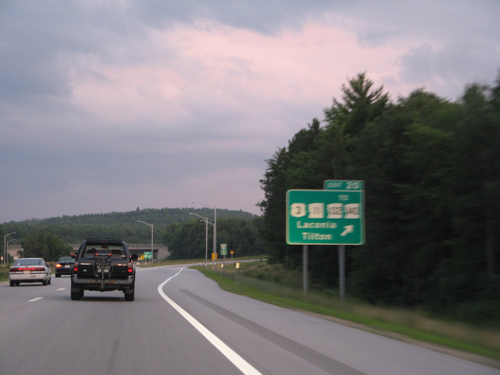
U.S. 3 combines with NH 11 south from the Laconia bypass to run west by Winnisquam Lake to Tilton and a folded diamond interchange (Exit 20) with Interstate 93. The pair continue west along the Winnipesaukee River to Franklin.
07/29/07
NH 132 ties into U.S. 3 & NH 11 across I-93 from just east of Exit 20 to Park Street south into Northfield. NH 140 begins a 21 mile route to Alton on the east side of Exit 20.
07/29/07
Interstate 93 south spans the Winnipesaukee River into the town of Northfield and Merrimack County.
07/29/07
A half diamond interchange adds traffic to Interstate 93 south from NH 12 (Park Street) on the south side of Northfield. The freeway continues by this reassurance marker and Mount Tug.
07/29/07
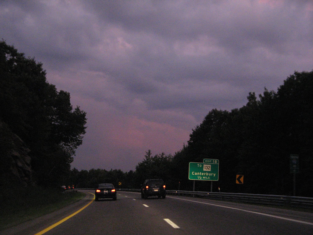
Interstate 93 south enters the town of Canterbury by Northfield Station. Meeting the freeway next is West Road at Exit 18.
07/29/07
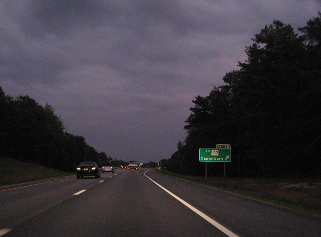
A folded diamond interchange joins I-93 with West Road at Canterbury Station. West Road dead ends at an agricultural area on the Merrimack River. An abandoned truss bridge used to connect with Depot Street in Boscawen.
East from Exit 18, West Road ties into parallel NH 132 (Northwest Road). Connections with Center Road lead motorists to the Canterbury town center.
07/29/07
The roadways of Interstate 93 separate with a wide forested median concealing waters of Cold Brook.
07/29/07
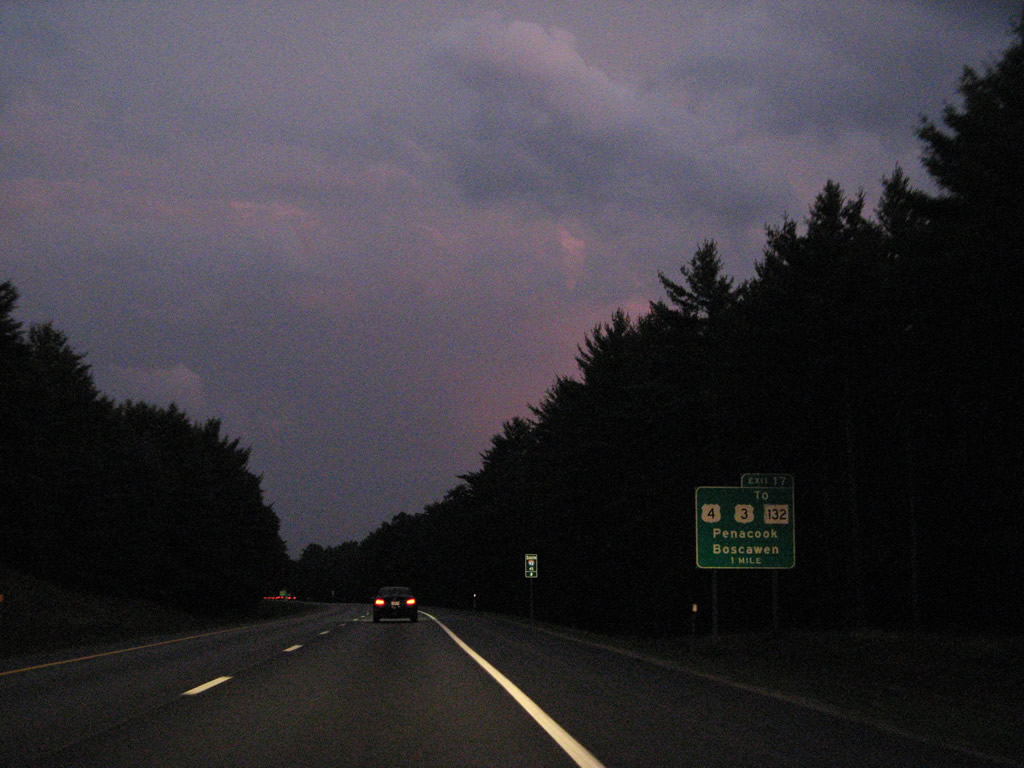
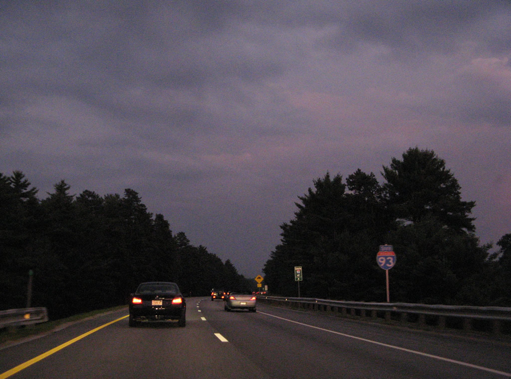
U.S. 4 east splits with U.S. 3 in the town of Boscawen to bypass Penacook to a parclo interchange (Exit 17) with Interstate 93.
07/29/07
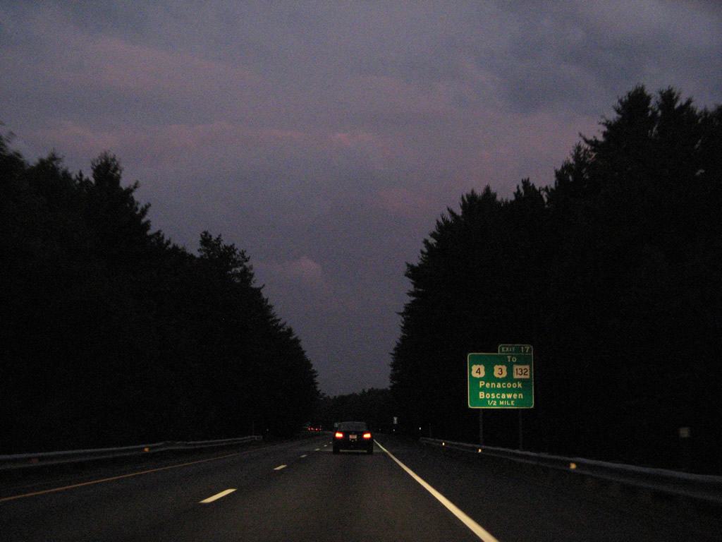
U.S. 4 east merges with I-93 south to Concord as U.S. 3 remains to the west of the Merrimack River through Penacook and West Concord.
07/29/07
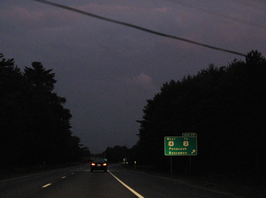
Exit 17 departs Interstate 93 south for U.S. 4 west to Penacook and U.S. 3. U.S. 4 overlaps with U.S. 3 through Boscawen from Andover to the northwest.
07/29/07
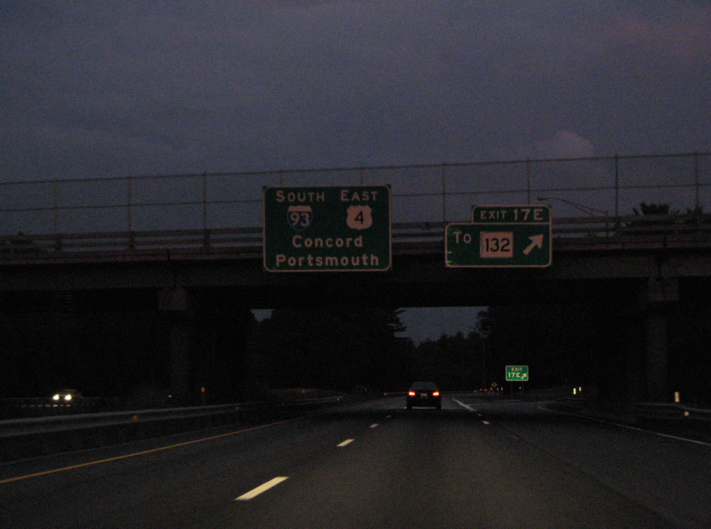
Exit 17E consists of a loop ramp for Hoit Road east to NH 132 (Mountain Road) and Loudon.
07/29/07
South  East
East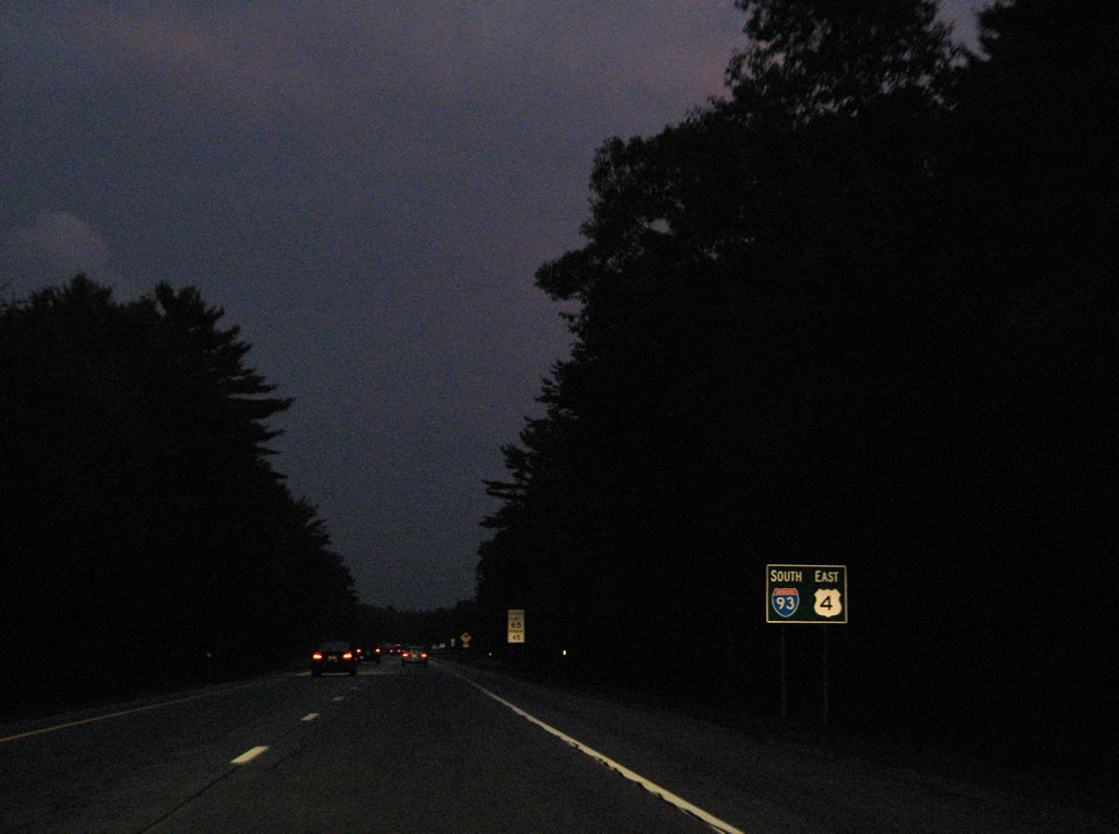
U.S. 4 combines with Interstate 93 south from north Concord to Exit 15E and Interstate 393 east.
07/29/07
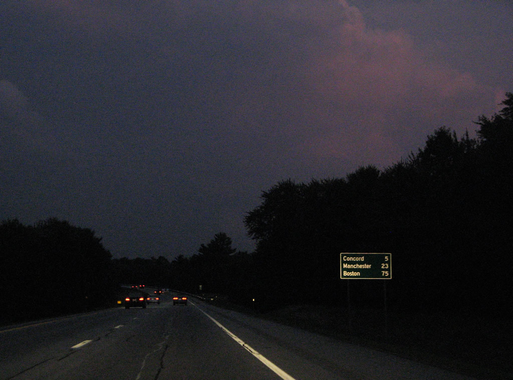
Downtown Concord lies five miles ahead, followed by Manchester in 23 miles. Boston is still 75 miles out.
07/29/07
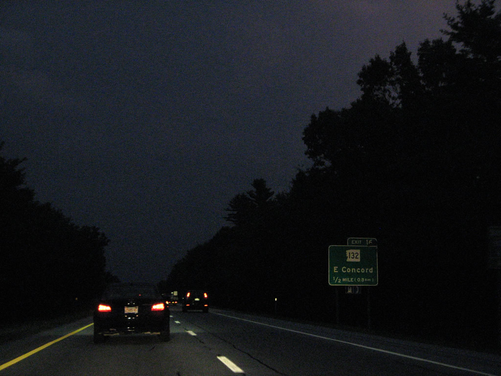
A parclo interchange connects Interstate 93 & U.S. 4 with adjacent NH 132 (East Side Drive) via Portsmouth Road. NH 132 angles southeast from East Concord to Exit 2 of I-393 and its south end at NH 9 (Loudon Road).
07/29/07
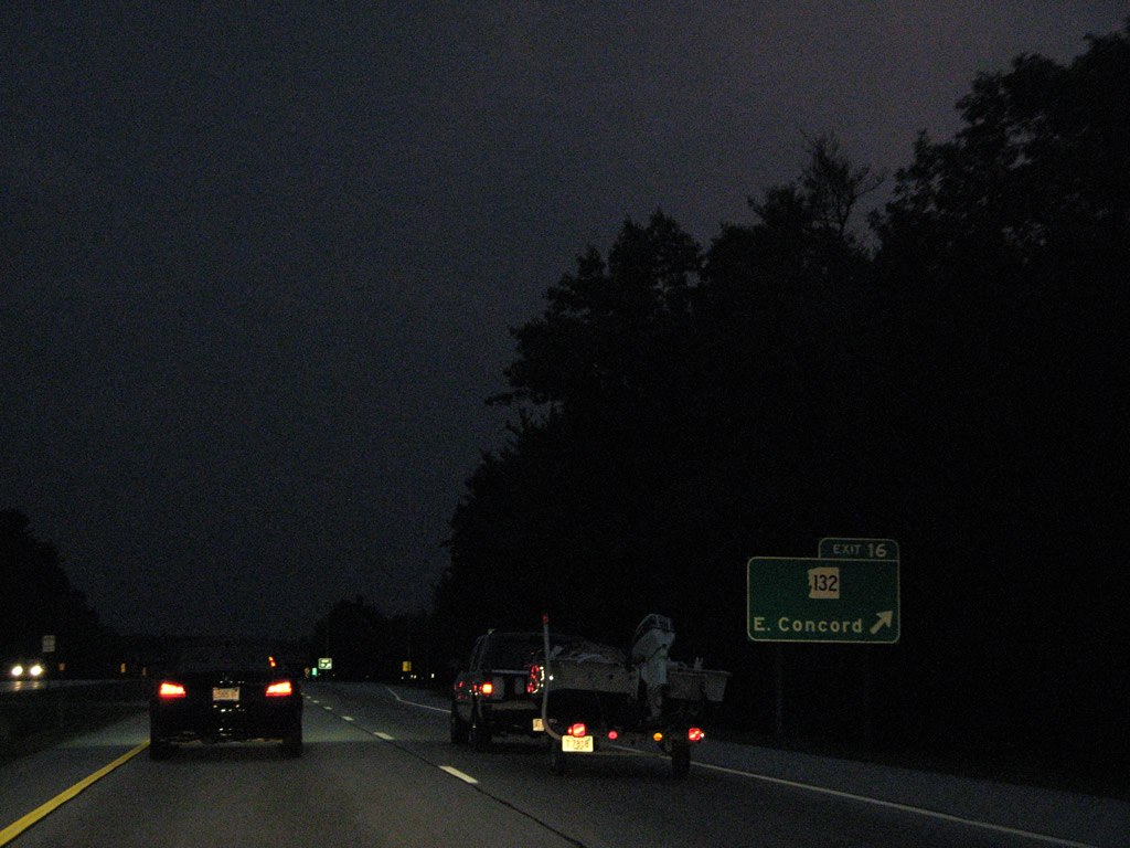
Southbound at the off-ramp (Exit 16) to Portsmouth Road on I-93 south & U.S. 4 east. NH 132 totals 40 miles overall from Ashland to Concord.
07/29/07
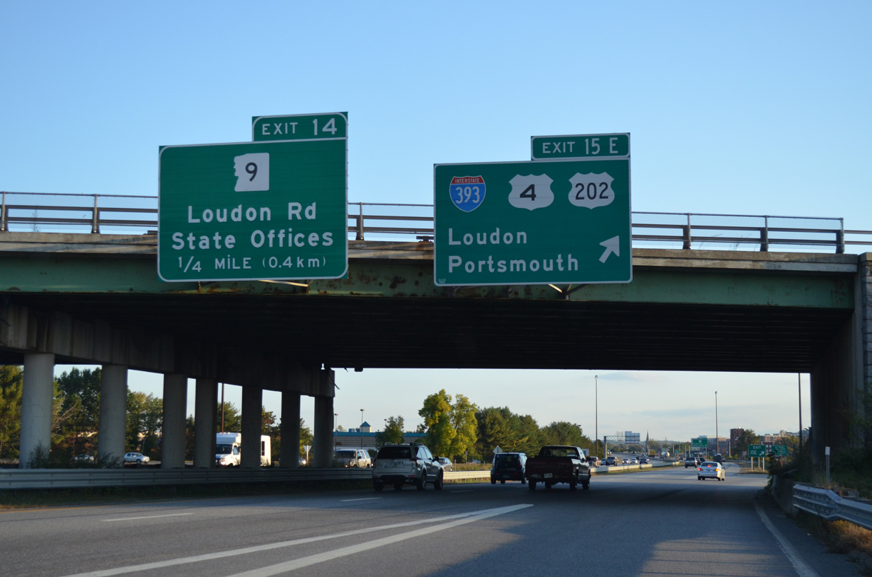
The first of four exits for the capital city of Concord joins Interstate 93 south with I-393/U.S. 202 at Exits 15W/E.
06/27/05
Delta Drive spans Interstate 93 & U.S. 4 south by NHTI - Concord's Community College just north of the cloverleaf interchange (Exit 15) with Interstate 393 and U.S. 202. U.S. 4 parts ways with I-93 south via Exit 15E in one half mile.
06/27/05
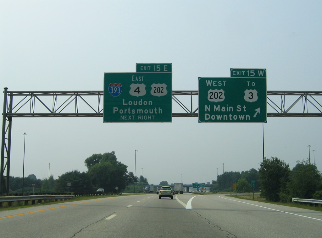
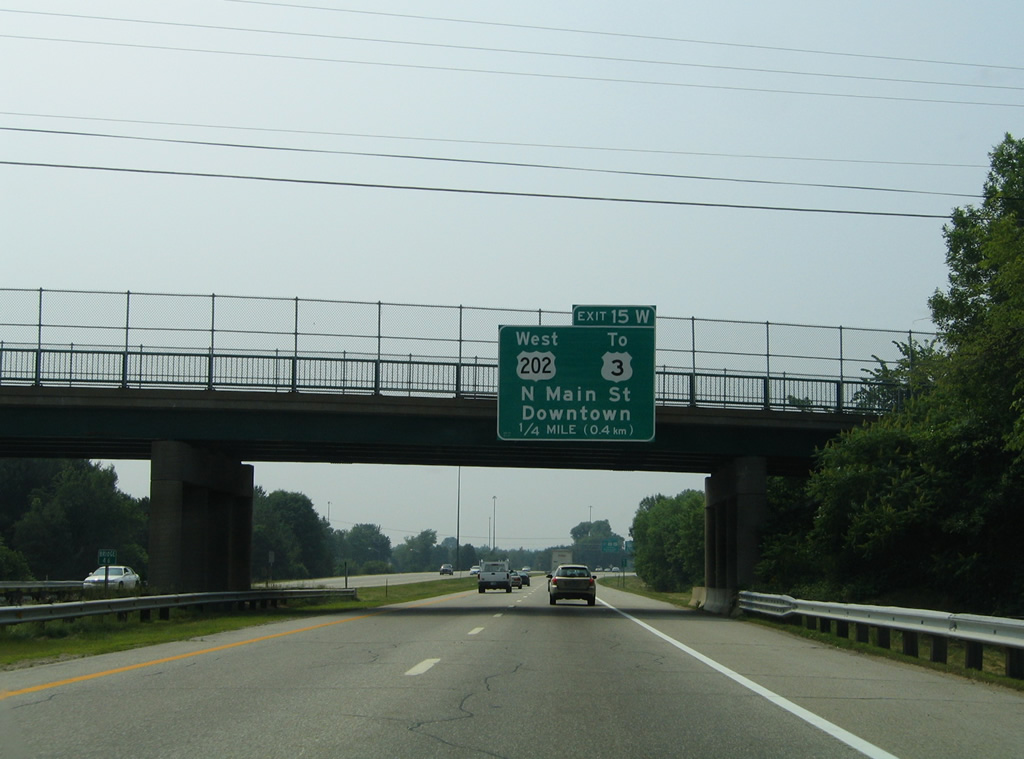
Exit 15W leaves I-93 south & U.S. 4 west for U.S. 202 west and the I-393 freeway end. U.S. 202 turns south alongside U.S. 3 (North Main Street) to Downtown.
This sign bridge was taken down by 2012 and replaced with a side mounted overhead for just Exit 15W.
06/27/05
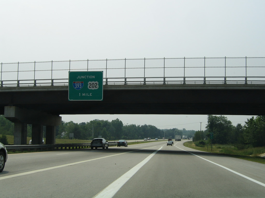
Interstate 393 travels 4.60 miles overall, linking U.S. 3 and 202 (North Main Street) in Concord with NH 106 (Sheep Davis Road) north to Loudon. The freeway provides a bypass of the commercialized stretch of NH 9 (Loudon Road) for U.S. 4 east to Durham and Portsmouth and U.S. 202 to Rochester.
10/06/14
South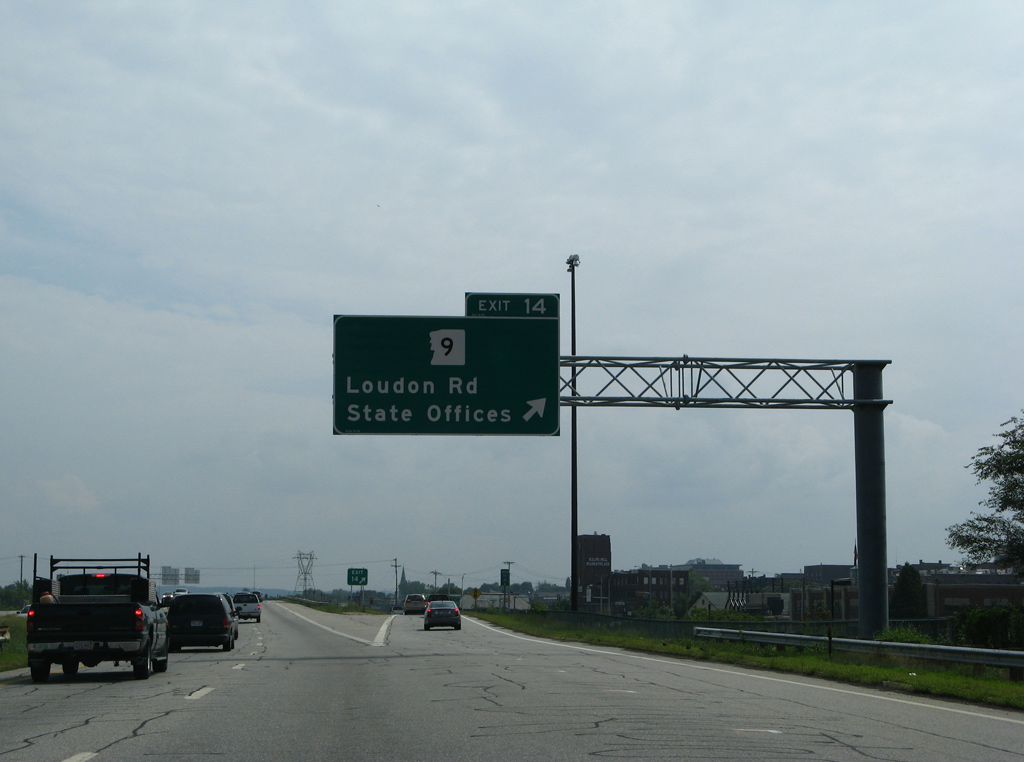
Commercialized frontage abuts Interstate 93 southward from I-393 to the modified diamond interchange (Exit 14) with NH 9 (Loudon Road). NH 9 west merges with U.S. 3 & 202 (North Main Street) just west of Exit 14 by the New Hampshire State House. NH 9 east spans the Merrimack River to Concord Municipal Airport (CON) and Steeplegate Mall.
07/30/07
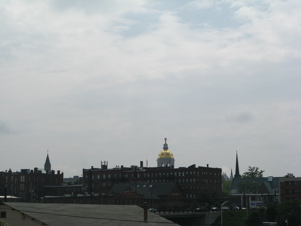
The New Hampshire State House dome appears just west of Interstate 93 as the freeway passes over NH 9 (Loudon Road).
07/30/07
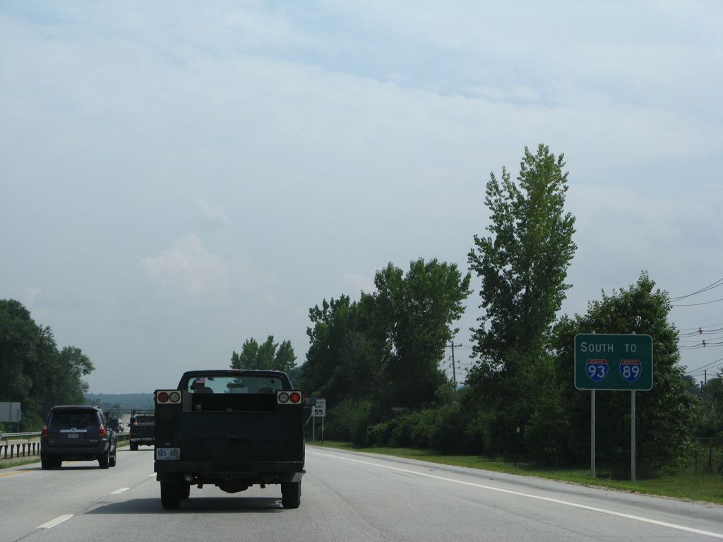
Trailblazers for Interstate 89 accompany reassurance signs for I-93 leading south from I-393 through Concord.
07/30/07
Parallel U.S. 3 partitions with U.S. 202 west at Pleasant Street and NH 3A (Main Street) south for Water Street to cross paths with Interstate 93 again at Exit 13.
07/30/07
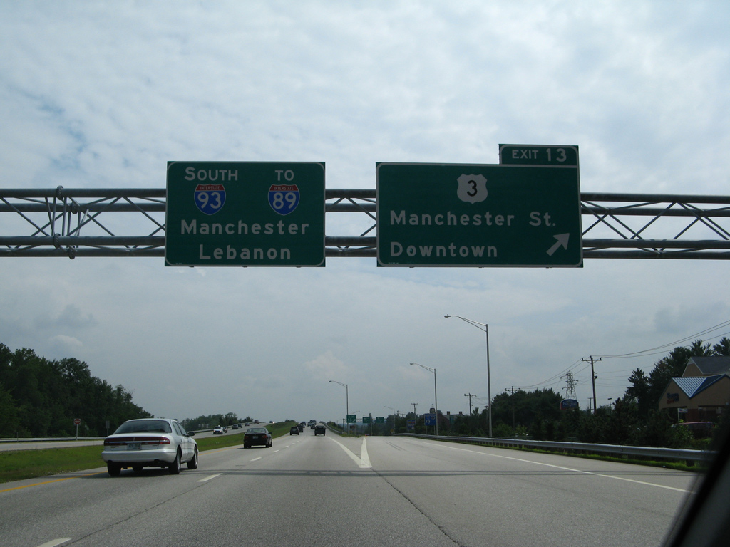
Exit 13 consists of a single point urban interchange (SPUI) sandwiched between the Merrimack River and Boston and Maine Railroad line. U.S. 3 spans the river east along Manchester Street to the town of Pembroke.
The SPUI at Exit 13 replaced a tight parclo interchange during a $16.6 million project undertaken between March 1998 and October 2000.1
07/30/07
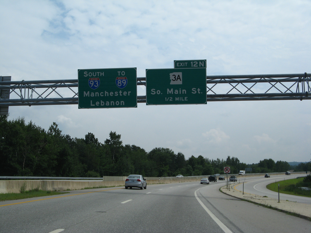
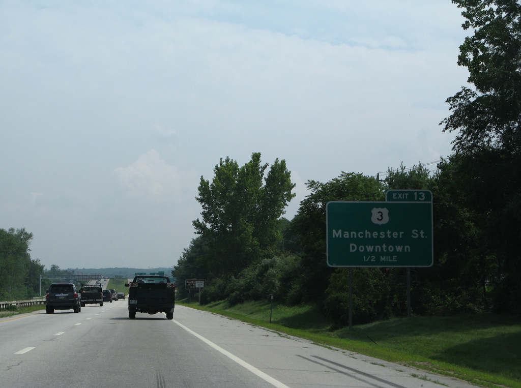
NH 3A extends South Main Street from U.S. 3 (Water Street) to Bow Junction beyond forthcoming Exits 12N/S.
07/30/07
Exit 12N provides return access to Concord via NH 3A (South Main Street) north to its end at U.S. 3 (Water Street).
A ground level sign replaced this overhead assembly at the Boston and Maine Railroad underpass by 2011.
06/27/05
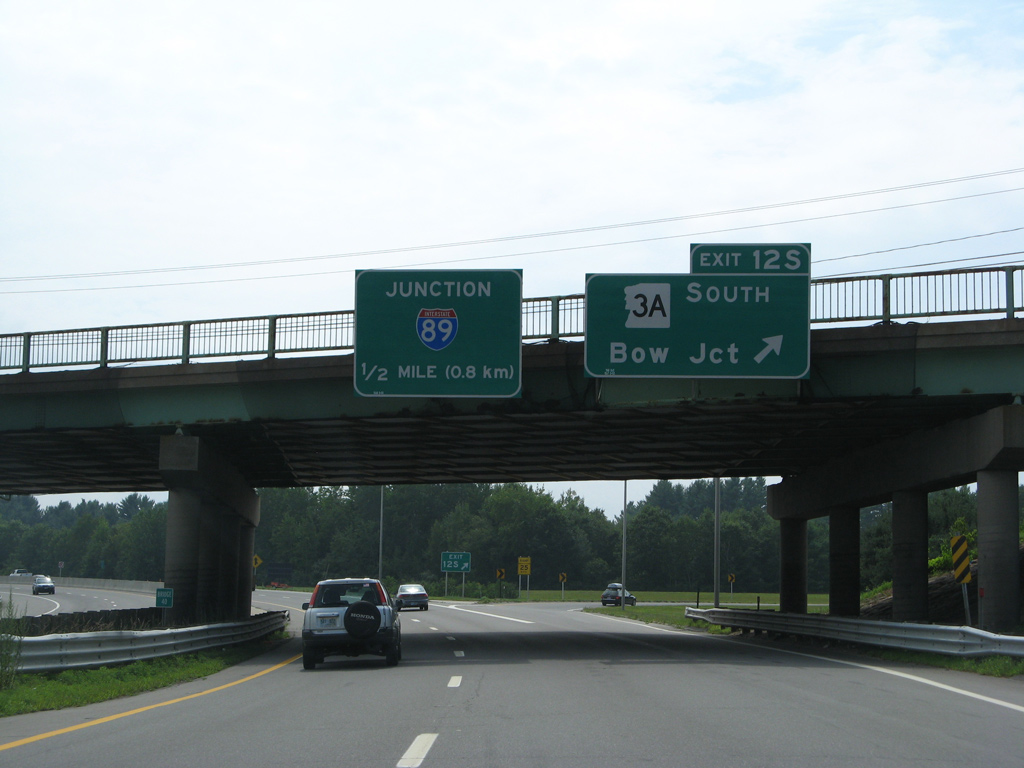
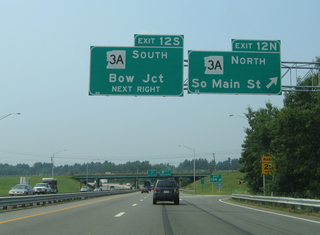
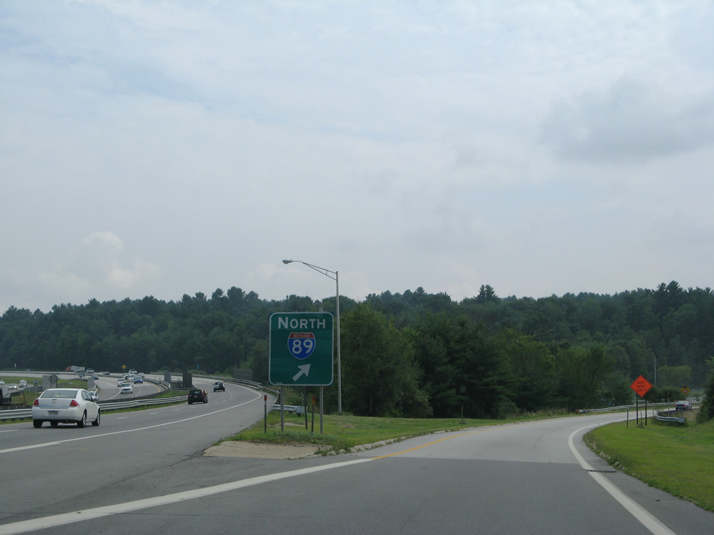
NH 3A follows a commercial boulevard south from Exit 12S to the freeway beginning of Interstate 89 north at Bow Junction. A half cloverleaf interchange joins I-89 with I-93 in one half mile.
07/30/07
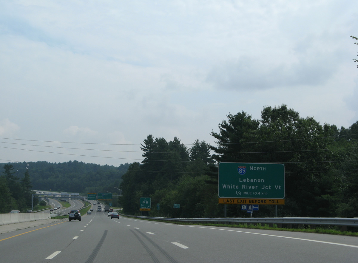
A third southbound lane accompanies Interstate 93 from NH 3A to Interstate 89 north. I-89 meanders northwest 60.87 miles to the Connecticut River, west of Lebanon and east of White River Junction, Vermont.
07/30/07
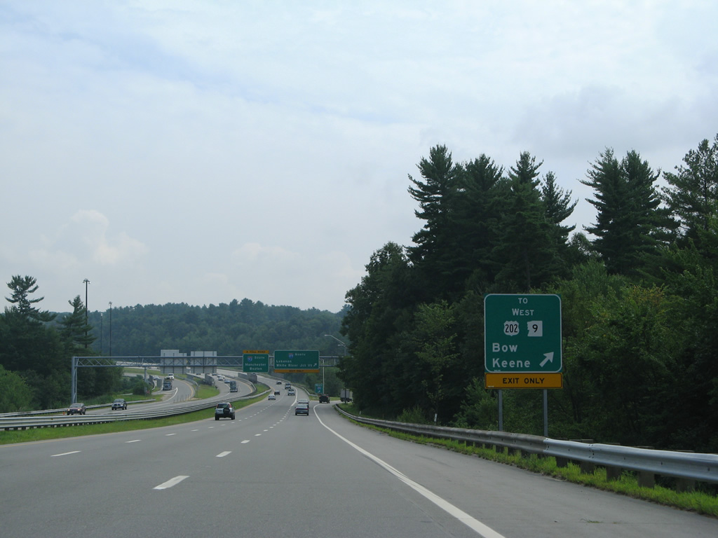
The initial eight miles of Interstate 89 north run west through Concord and the town of Hopkinton. Exit 5 joins the freeway with U.S. 202 & NH 9 west to Keene while the adjacent Exit 1 serves Bow.
07/30/07
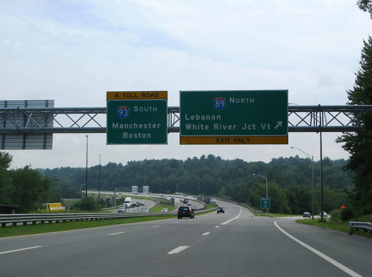
Motorists bound for Interstate 89 north depart I-93 south as the freeway transitions into the tolled F.E. Everett Turnpike to Manchester. I-89 adds long distance travelers to I-93 south from Montreal, Quebec and Burlington and Montpelier, Vermont.
07/30/07
Gore point signs at Interstate 89 include a route marker. This is typical signing practice for freeway to freeway interchanges in the Granite State.
07/30/07


References:
- "PUC To Proceed With Power Plant Sale Hearings. I-93 Bridge Work Over Route 3 Begins." New Hampshire Union Leader (Manchester, NH), March 17, 1998.
Photo Credits:
- AARoads: 07/29/07, 07/30/07
- Alex Nitzman, Carter Buchanan: 06/27/05
- ABRoads: 10/06/14
Connect with:
Page Updated Tuesday February 10, 2015.