
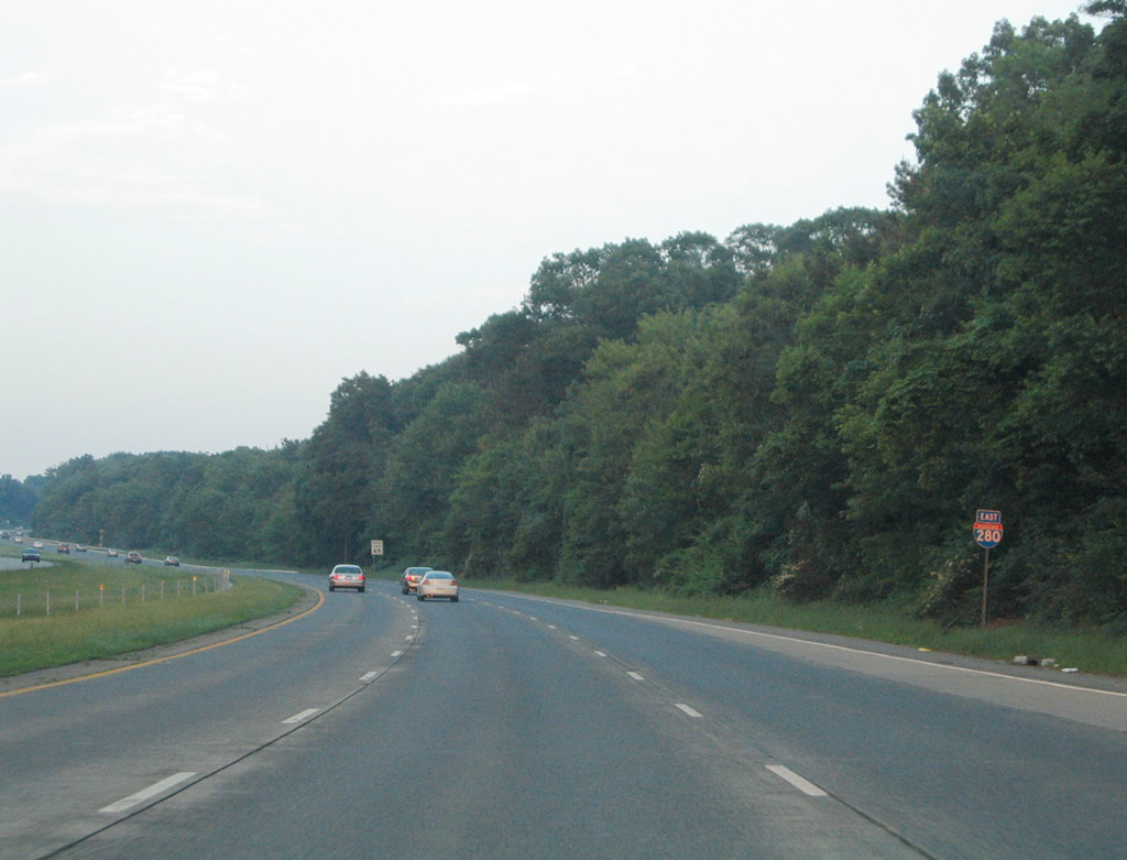
Interstate 280 East

 East
East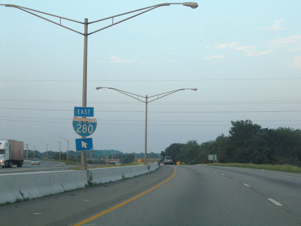
Interstate 280 shield posted at the beginning of the Exit 47A off-ramp from the Interstate 80 mainline.
06/13/05
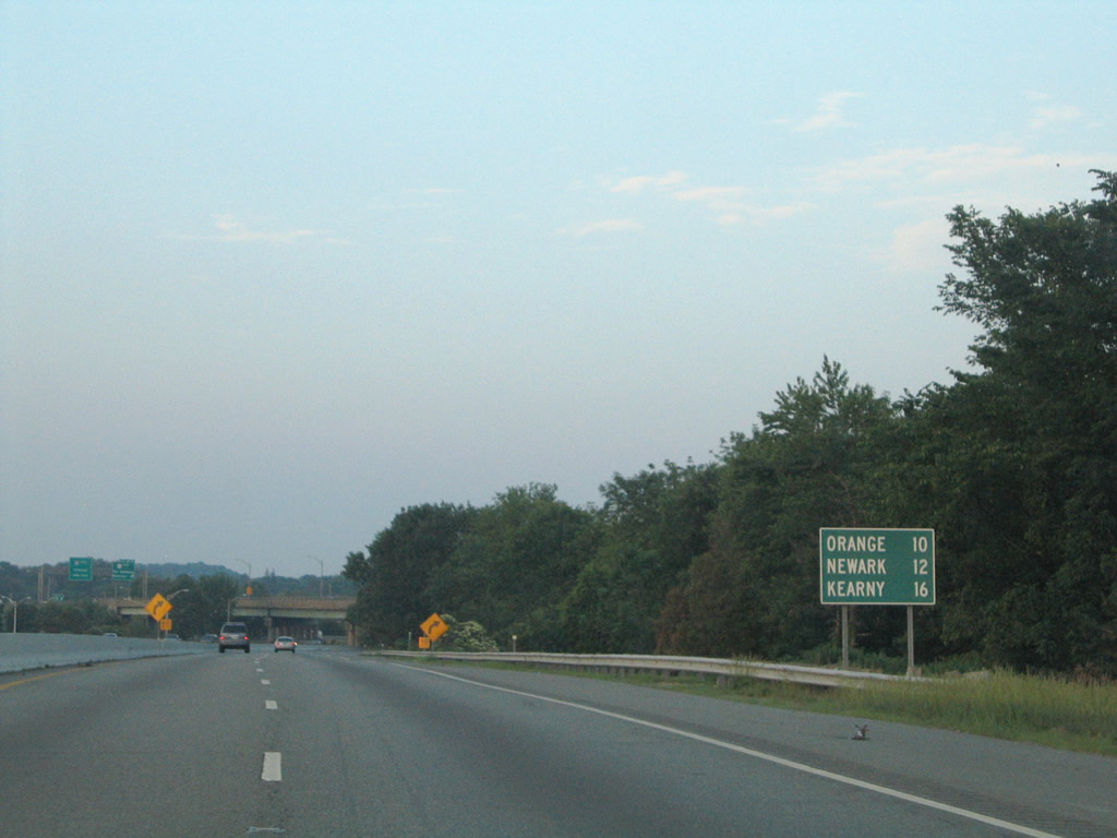
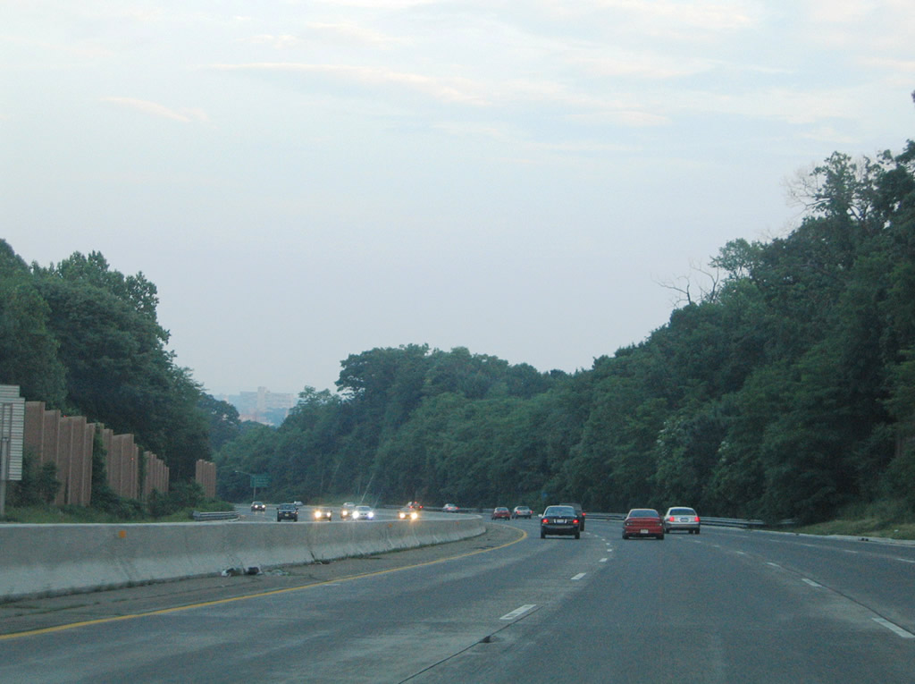
Distance sign listing Orange 10 miles, Newark 12 miles and Kearny 16 miles.
06/13/05
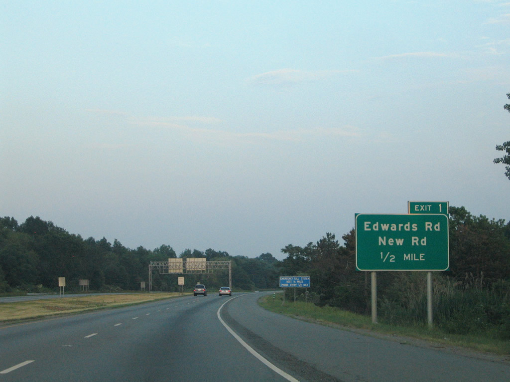
Interstate 280 travels southeast across Hatfield Swamp from Interstate 80 into a parclo interchange (Exit 1) with New Road and Ridgedale Avenue (CR 632).
06/13/05
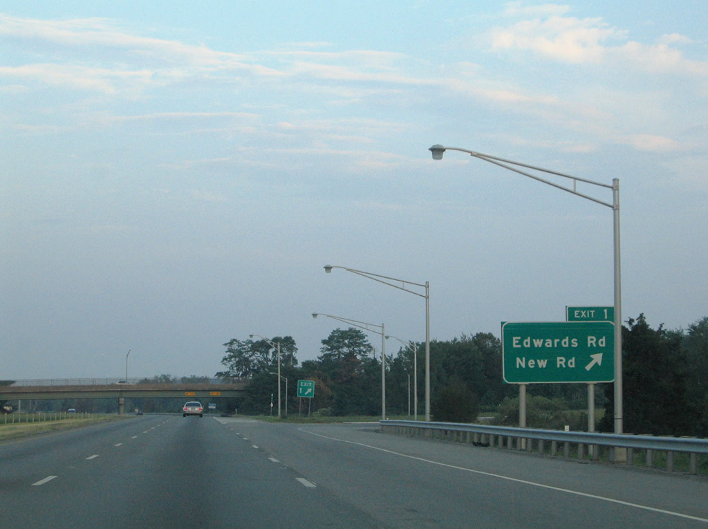
Edwards Road travels south from Vail Road and U.S. 46 to an industrial park area at New Road and Exit 1. Ridgedale Avenue (CR 632) extends south from New Road as an eastbound side frontage road into East Hanover township while New Road arcs north to U.S. 46 at Bloomfield Avenue near the Montville township line.
06/13/05
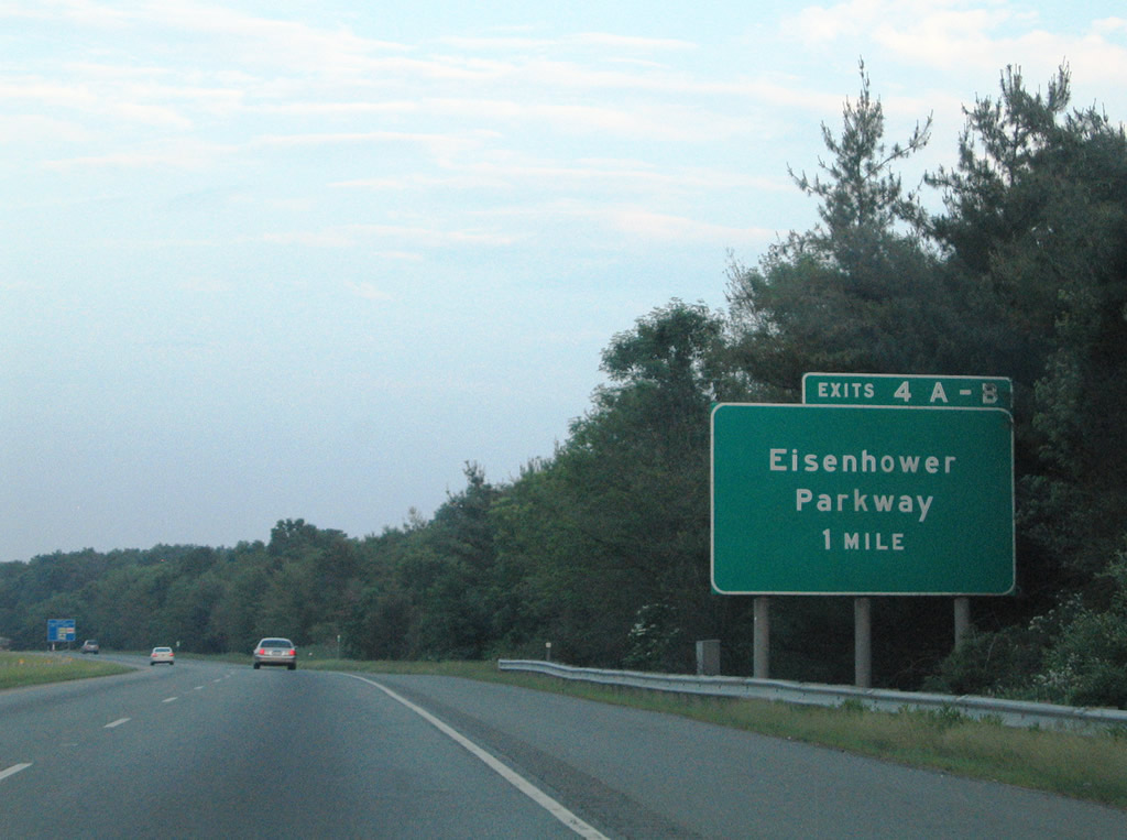
Interstate 280 descends from Morris County into Essex County ahead of the cloverleaf interchange (Exits 4A/B) with Eisenhower Parkway.
06/13/05
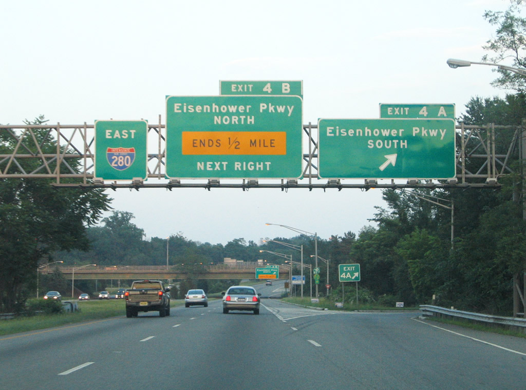
Eisenhower Parkway (CR 609) comprises a surface arterial southward from Interstate 280 to Route 10 (Mount Pleasant Avenue) and Essex County 510 (South Orange Avenue). Truck traffic bound for New Jersey 24 is directed southward from Interstate 280 via Exit 4A.
08/11/04

Exit 4B departs Interstate 280 east for Eisenhower Parkway north. The divided highway dead ends one half mile to the north of Interstate 280 at an area of wetlands. Eisenhower Parkway was planned as a longer route including what was known as Triborough Road in Chatham and Florham Park.2 An abandoned cloverleaf interchange remains on the New Jersey 24 from the scuttled plan.
06/13/05
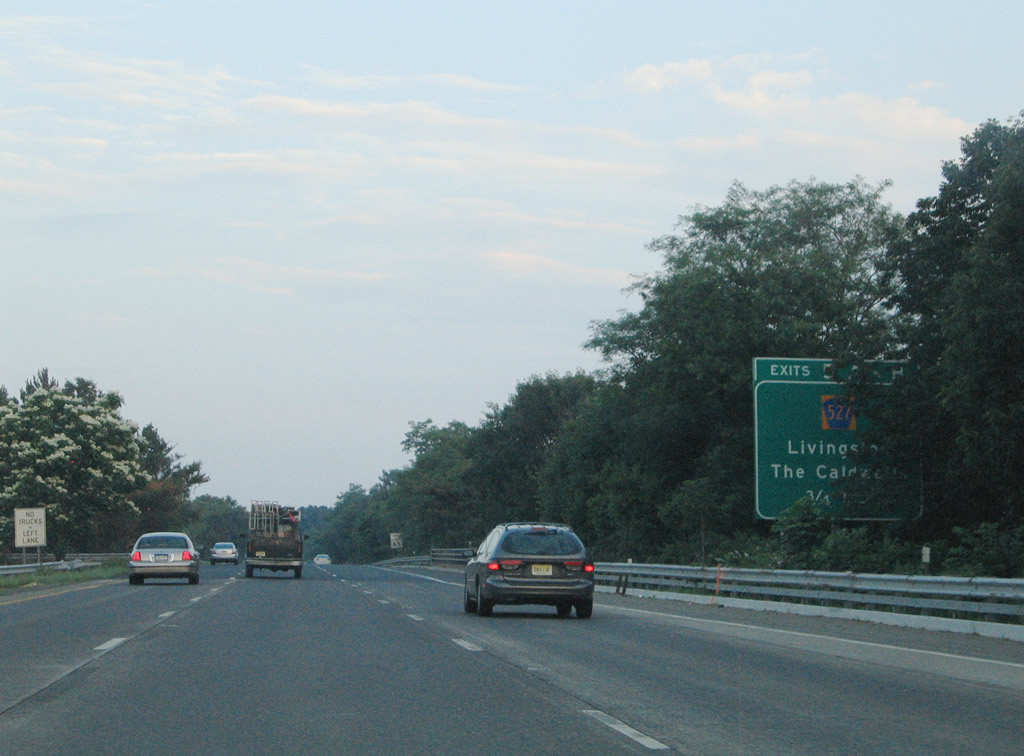
Essex County 527 (Livingston Avenue) meets Interstate 280 at a cloverleaf interchange (Exits 5A/B).
06/13/05
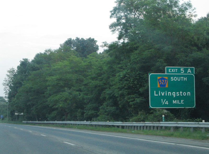
Exit 5A serves interests to Livingston via Essex County 527 south. Essex County 527 is part of an overall 84.86 mile route between Route 166 at Toms River and New Jersey 23 in Cedar Grove.
06/13/05

Interstate 280 east reaches Exit 5A with CR 527 (Livingston Avenue) south. The north-south highway travels south to Livingston onto John F. Kennedy Parkway to Short Hills and Chatham. The county route intersects Route 10 (Mount Pleasant Avenue) in 1.1 miles.
08/11/04
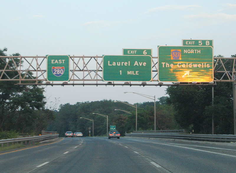
Eastbound I-280 at the Exit 5B loop ramp onto CR 527 north. Motorists using this ramp will reach Eagle Rock Avenue at Roseland within three quarters of a mile. From there CR 527 follows Roseland Avenue northward to Essex Fells, Caldwell, and North Caldwell. Connections with CR 506 (Bloomfield Avenue) and Passaic Avenue link the road with West Caldwell.
08/11/04
Interstate 280 winds east through a stand of trees along the Roseland borough and Livingston township line.
06/13/05
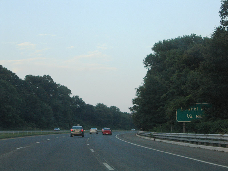
Laurel Avenue (CR 634) stems east from McClellan Avenue to overtake Shrewsbury Drive from Livingston to Interstate 280 at Exit 6.
06/13/05
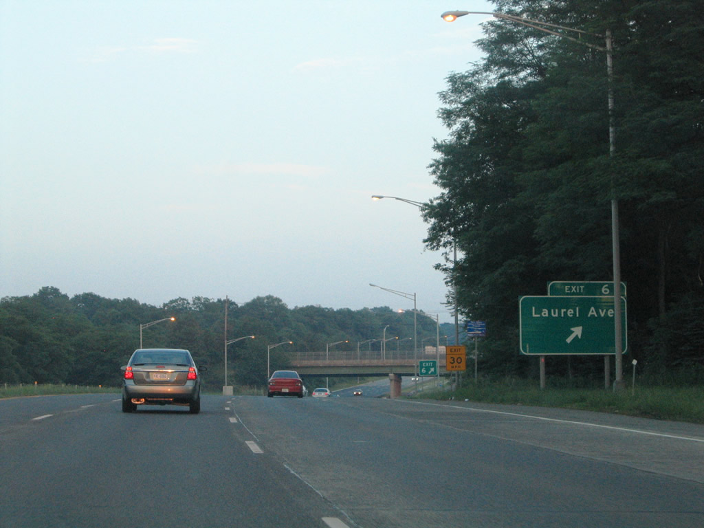
Exit 6 constitutes a six-ramp parclo interchange with Laurel Avenue (CR 634). Laurel Avenue heads east from Interstate 280 to Eagle Rock Avenue (CR 611) in West Orange.
06/13/05
Pleasant Valley Way (CR 636) meets Interstate 280 at the next interchange (Exit 7) in West Orange township. I-280 descends dramatically from Second Watchung Mountain to Exit 6 before ascending again over First Watchung Mountain.
06/13/05
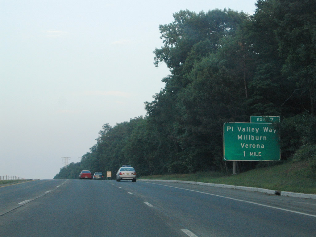
Pleasant Valley Road (CR 636) travels north-south from Milburn through the South Mountain Reservation and Pleasantdale to Verona township. A folded diamond interchange joins the surface boulevard with Interstate 280 at Exit 7.
08/11/04
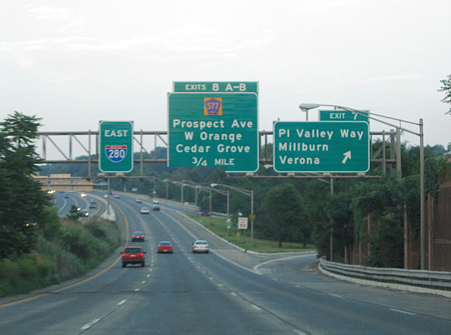
Essex County 577 (Prospect Avenue) meets Interstate 280 at a six-ramp parclo interchange (Exit 8) in West Orange. Pictured here is the Exit 8A off-ramp to CR 577 south to Route 10's eastern terminus nearby.
06/13/05
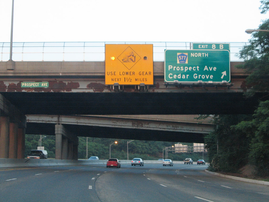
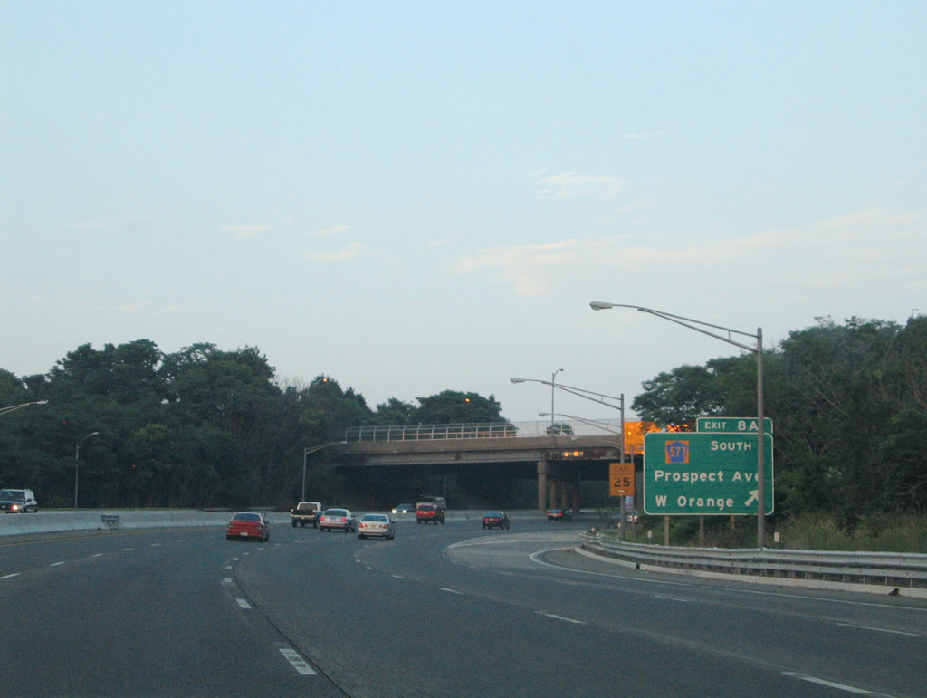
Exit 8B loops onto Essex County 577 (Prospect Avenue) north. CR 577 continues from Eagle Rock Avenue (CR 611) in West Orange to become New Jersey 23 north to Cedar Grove at CR 506 (Bloomfield Avenue) in Verona township.
06/13/05
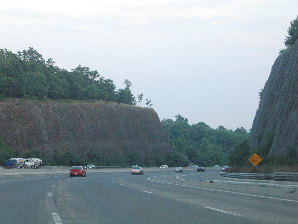
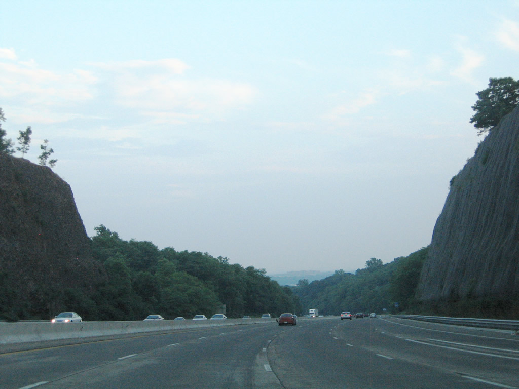
Traveling through a rock cut over First Watchung Mountain on Interstate 280 east.
06/13/05
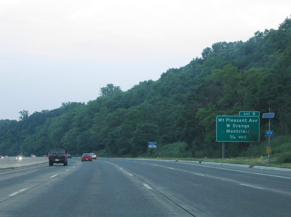
Interstate 280 curves southeastward toward the next West Orange interchange (Exit 9) at Mt. Pleasant Avenue (CR 660).
06/13/05
Exit 9 represents the transition of Interstate 280 into an urban freeway into the City of Orange township. Connections with Main Street (CR 659) at forthcoming Exit 9 eventually lead drivers north to Montclair.
06/13/05
Intestate 280 east at the half diamond interchange Exit 9 with Mount Pleasant Avenue (CR 660). Mount Pleasant Avenue west becomes Route 10 at its intersection with CR 577 (Prospect Avenue) both south of Exit 8 and west of Exit 9. East of Main Street (CR 659), Mount Pleasant Avenue becomes White Street into City of Orange township.
06/13/05
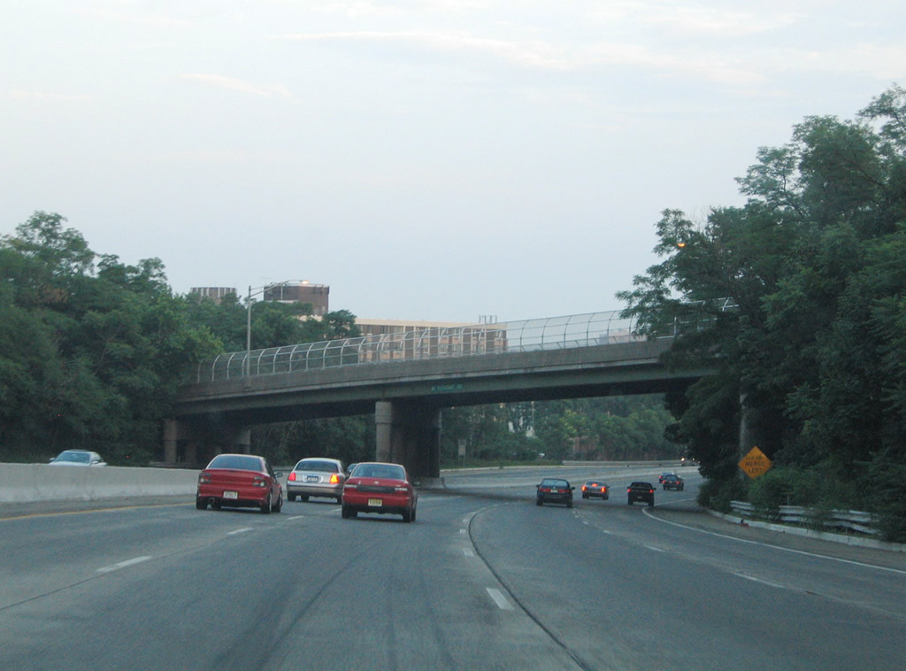
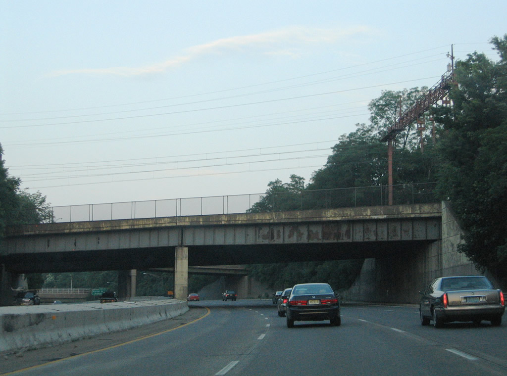
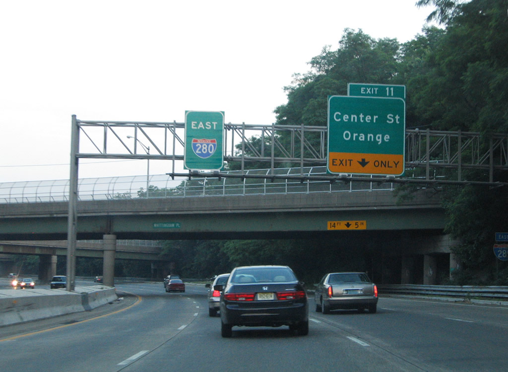
Interstate 280 descends below grade through the City of Orange township, East Orange and Newark. Upcoming Exit 11 ascends from the depressed freeway as Freeway Drive, an eastbound frontage road, for Essex Avenue and Center Street. The freeway varies between six and eight lanes through Orange.
06/13/05
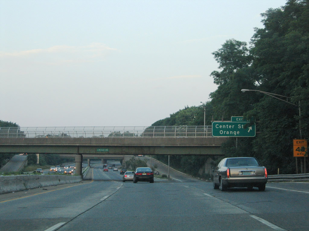
Exit 11 ascends from Interstate 280 east to Essex Avenue, Day Street, and Center Street for central Orange.
06/13/05

Continuing east on Interstate 280 as Freeway Drive meets Essex Avenue.
06/13/05
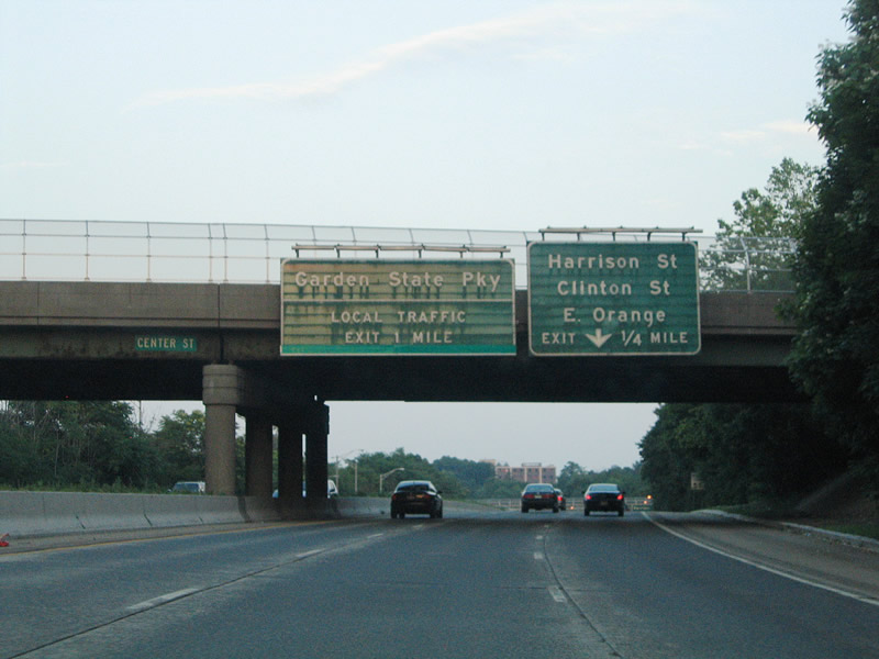
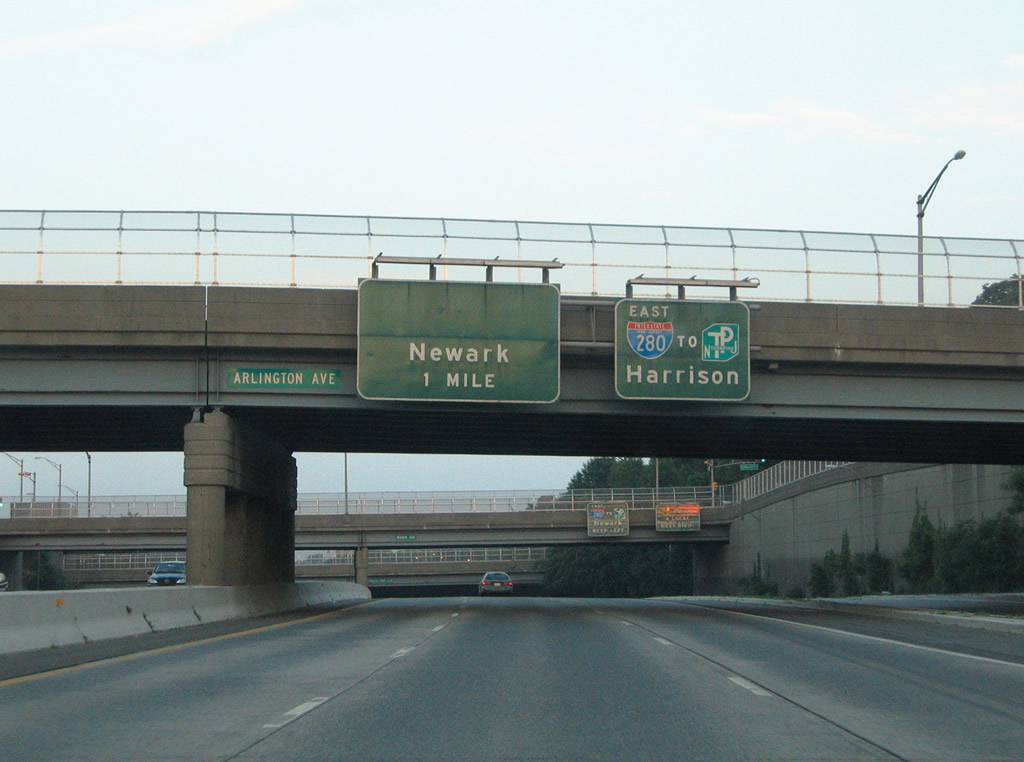
Exit 11A connects Interstate 280 east with Freeway Drive ahead of its intersections with Harrison Street and Clinton Street in East Orange. The freeway meets the Garden State Parkway at Exit 12.
06/13/05
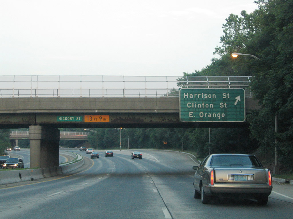
Harrison Street heads south from Exit 12B to Center Street near South Orange. Clinton Street ventures north to Dodd Street in East Orange.
06/13/05
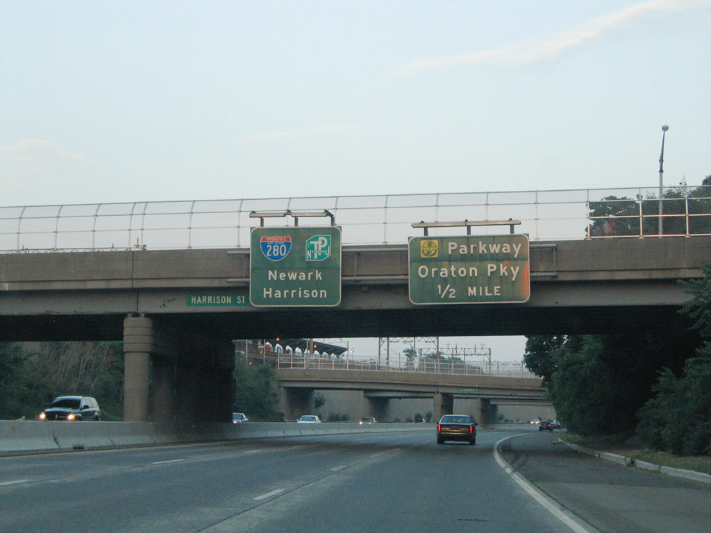
Original overheads, since replaced, posted at the Harrison Street overpass in the city of East Orange. I-280 continues below grade between a pair of frontage roads into New Jersey's largest city. Visible above is the NJ Transit Brick Church Station at Prospect Place and Brick Church Plaza.
Interstate 280 intersects the Garden State Parkway and Oraton Parkways (parallel frontage roads to the Parkway) in one half mile at Exit 12.
06/13/05
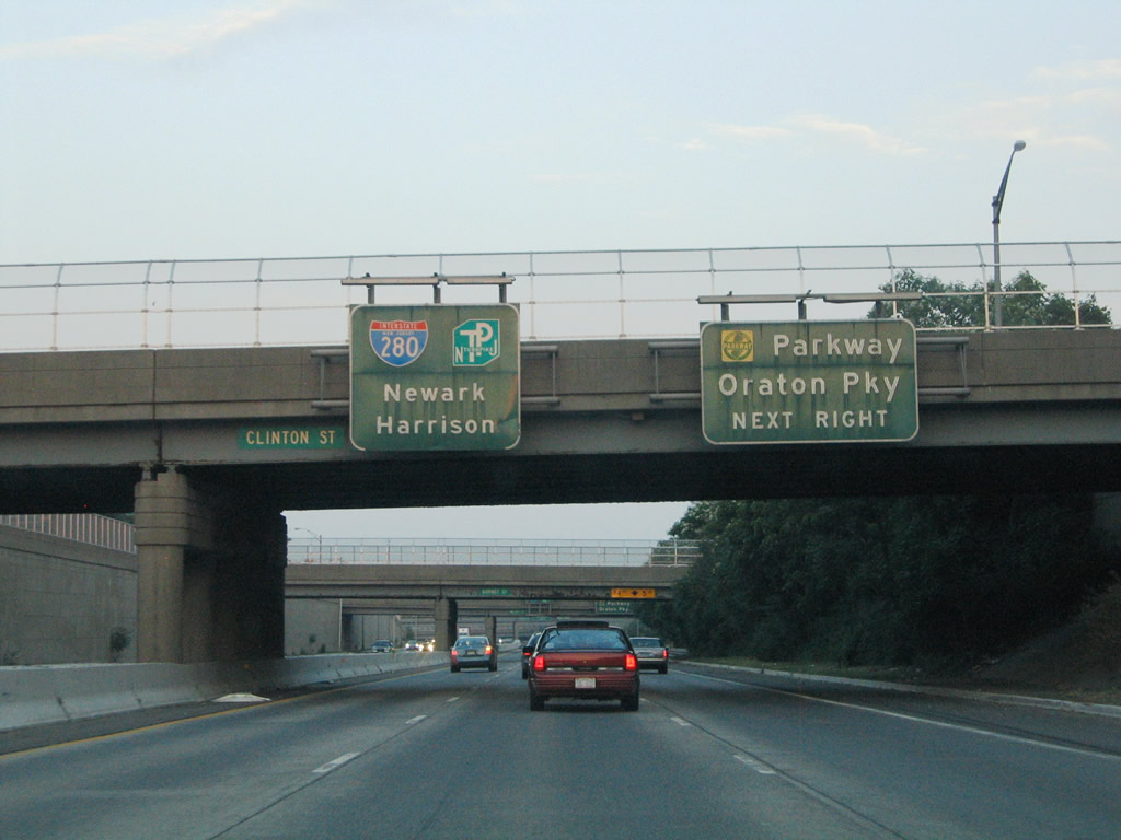
A tri-level stack interchange (Exit 12) connects Interstate 280 with the access road to the Garden State Parkway. The Garden State Parkway constitutes a north-south toll road through the urban areas of North Jersey and the coastal communities of South Jersey.
06/13/05
Exit 12 leaves well ahead of the actual interchange for the Garden State Parkway. Interstate 280's pull through-panel gains a New Jersey Turnpike trailblazer for its eastern terminus at Kearny.
06/13/05
The next interchange represents the planned north end of unconstructed Route 75. Route 75 was to join Interstate 280 with New Jersey 21 between Newark and Belleville. Known as the Newark Midtown Freeway, the route was aimed at providing congestion relief for the Garden State Parkway, doubling as a truck route. Design elements included a dual freeway with four local lanes and six express lanes. Cancelled in 1973 due to construction costs estimated in 1969 at $115 million, only the interchanges at the planned ends were ever built.2
06/13/05
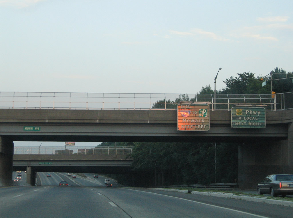
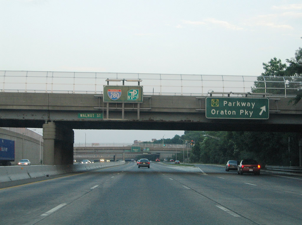
An on-ramp joins the Exit 12 c/d roadway for the Garden State Parkway (GSP) from Freeway Drive at Walnut Street. Before entering the toll plaza for the GSP, the exit yields a ramp to Oraton Parkway north ahead of its intersection with Freeway Drive. This is why "& Local" was displayed on the right side panel.
06/13/05
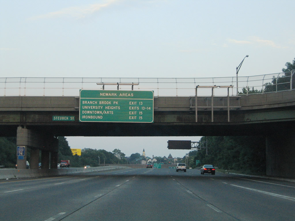
Interstate 280 continues east under Steuben Street. Remnant Route 75 related signage was removed and replaced with a "Newark Areas" exit sign to the left. The University Heights area is home the New Jersey Institute of Technology (NJIT).
06/13/05
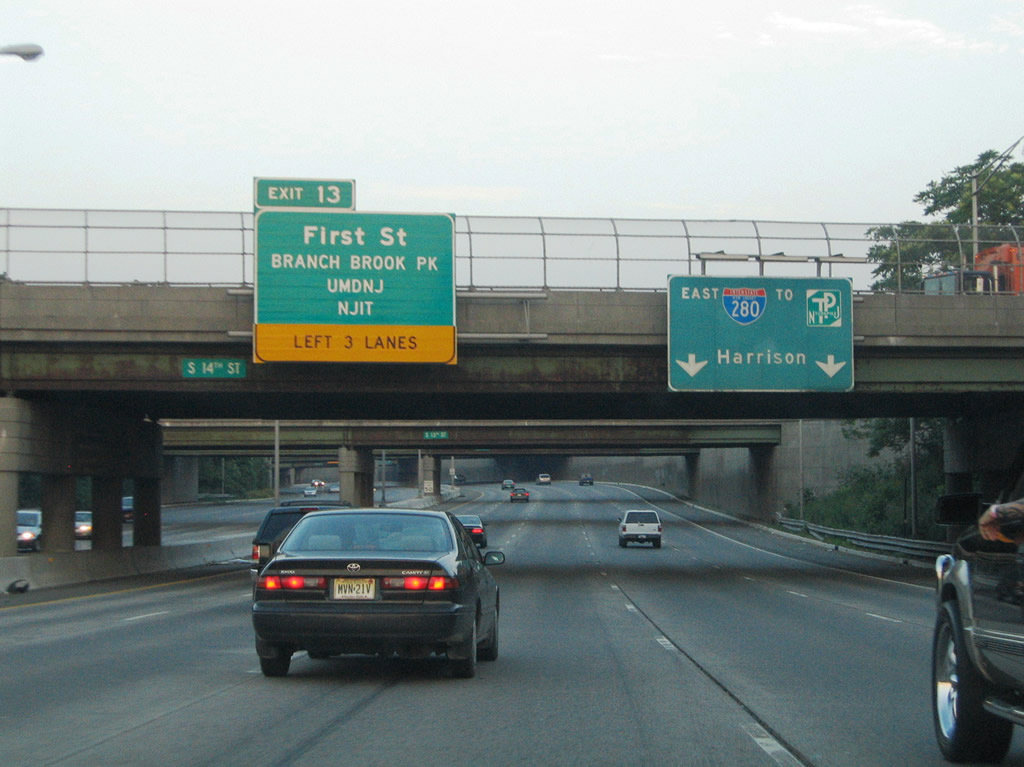
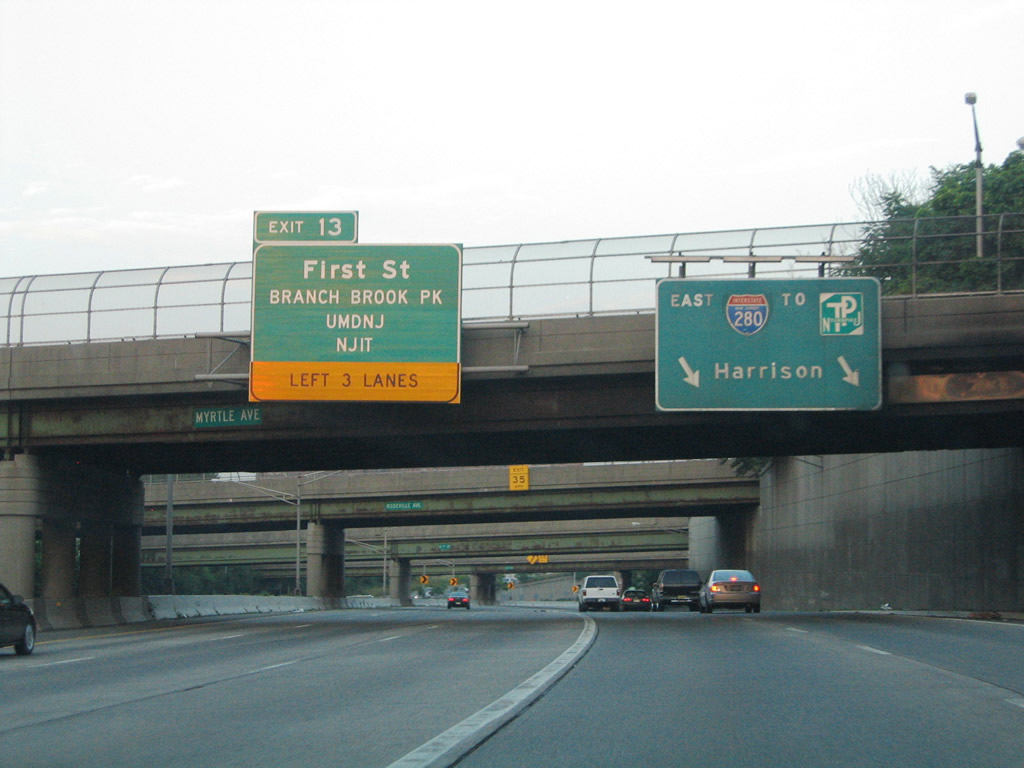
Entering the city of Newark, three lanes depart from the left side of Interstate 280 east for Exit 13 (First Street). The design is leftover from the scuttled Route 75 freeway plan.
06/13/05
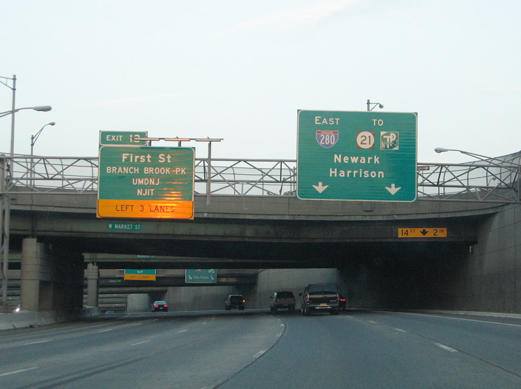
New signs were installed in 2001 (replaced by 2013) at the Market Street overpass along Interstate 280 east. First Street heads south to Bergen Street and the Rutgers Health Sciences campus and NJIT area and north to Branch Brook Park.
06/13/05
Interstate 280 and Exit 13 partition at the 7th Street overpass. 1st Street connects the freeway with 4th Street and Park Avenue to the north and CR 508 (Central Avenue) to the south. I-280 meanwhile elevates to pass over 1st Street and the Orange Street Light Rail Station (NJTransit) en route to Downtown Newark.
06/13/05
Descending along Interstate 280 east at the south end of Branch Brook Park.
06/13/05
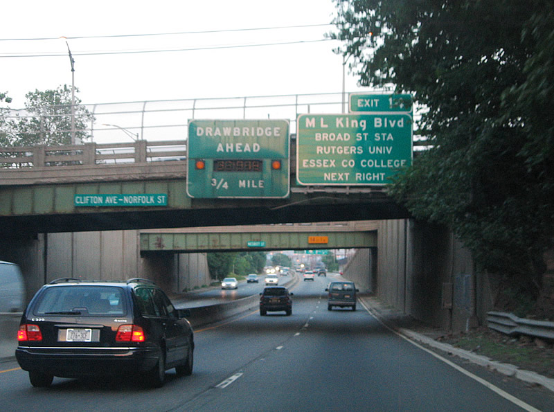
Martin Luther King, Jr. Boulevard connects Interstate 280 with Downtown Newark at Exit 14. Downtown is home to Essex County College, Rutgers-Newark - The State University of New Jersey and the New Jersey Performing Arts Center. Attached to the Clifton Avenue-Norfolk Street overpass is the first sign of the upcoming Passaic River draw bridge.
06/13/05
Exit 14 leaves the eastbound freeway for Martin Luther King, Jr. Boulevard. MLK Boulevard heads south through the Rutgers campus to Clinton Avenue and north to 7th Avenue and High Street nearby. New Jersey 21, which constitutes a freeway northward from Newark to Passaic, meets Interstate 280 in one quarter mile.
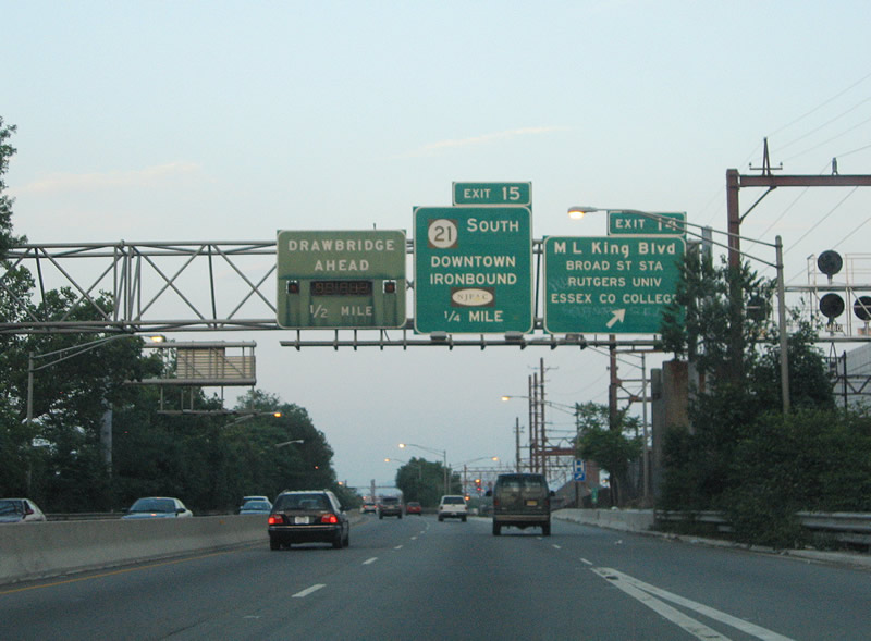
06/13/05
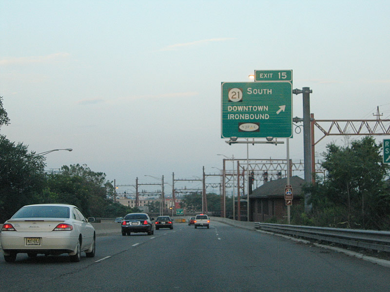
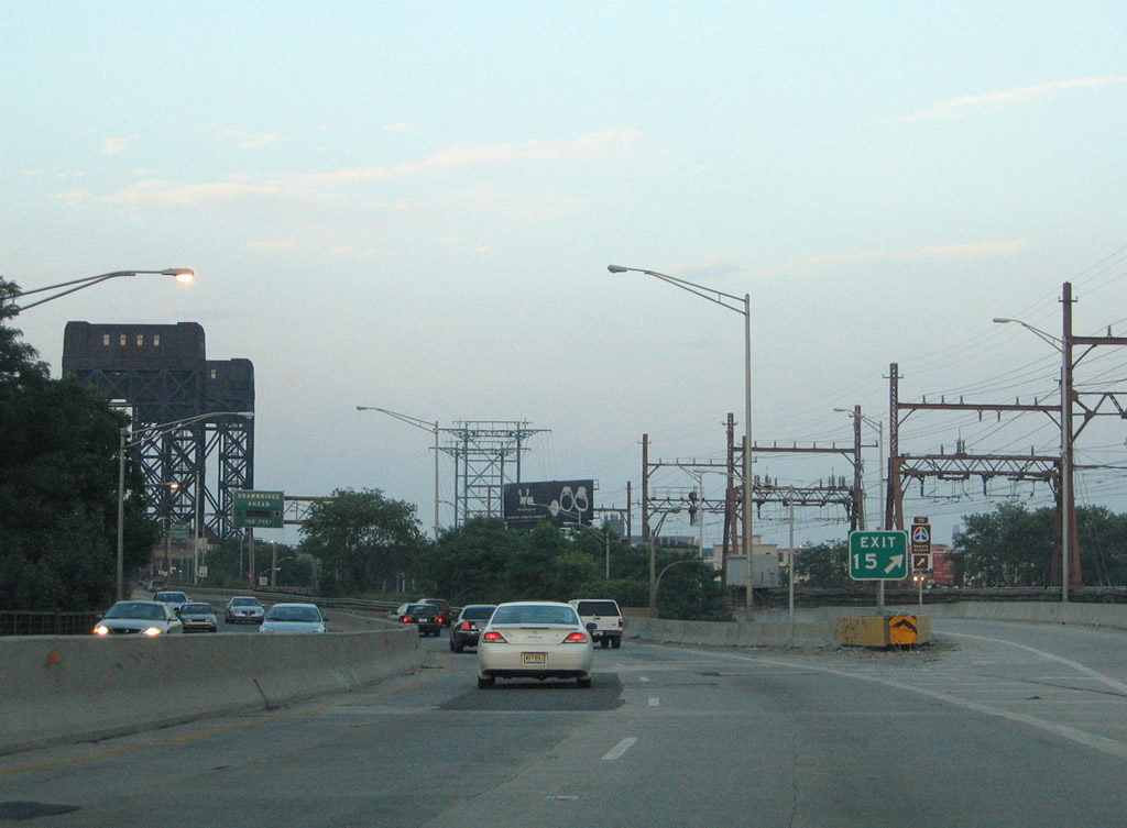
Exit 15 provides access to New Jersey 21 (McCarter Highway) southbound only from Interstate 280 east. The state route parallels the Passaic River as a surface route to 3rd Avenue before transitioning into a double-decked freeway adjacent to the river.
06/13/05
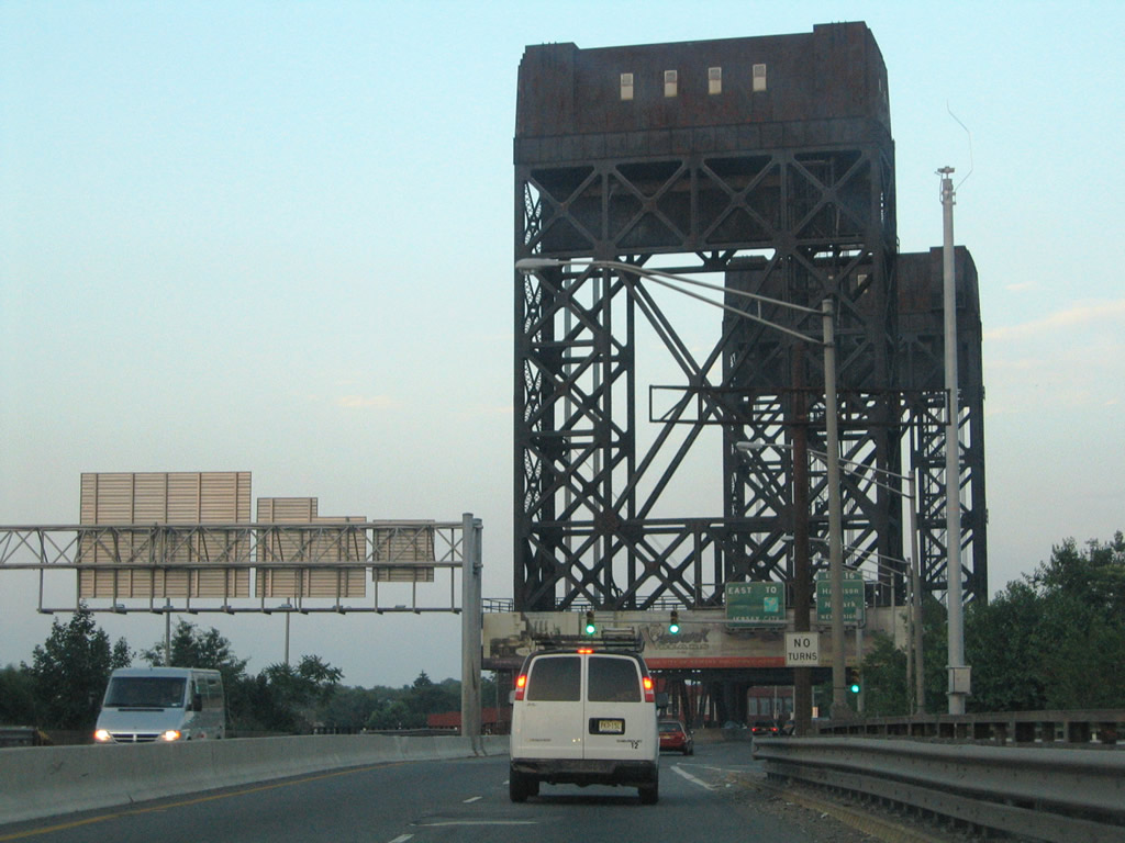
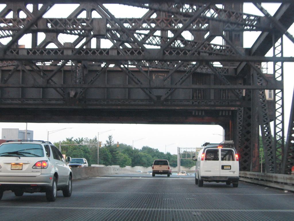
Interstate 280 crosses the Passaic River between Newark and Harrison via a six lane lift bridge. The draw span, one of a handful on the Interstate system, resides between Exits 15 (New Jersey 21) and Exit 16 (Hudson County 508). Designated the William A. Stickel Memorial Bridge, the Passaic River span was built between 1948-49. Opened on May 1, 1949, the bridge became part of the interstate system in 1971. Rarely opened for vessels below, the 209.6 meter long bridge is considered obsolete.1
06/13/05
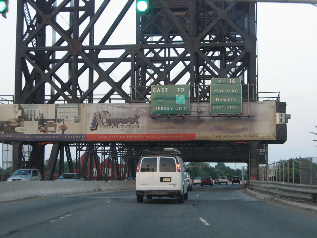
Exit 16 departs Interstate 280 east immediately after the draw bridge for Cleveland Avenue and Hudson County 508 (Harrison Avenue) in Harrison. Connections with Passaic Avenue and other north-south streets lead drivers into nearby East Newark.
06/13/05
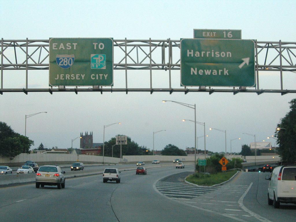
Eastbound at the half diamond interchange with Cleveland and Harrison Avenues on Interstate 280. Hudson County 508 totals 16.14 miles between Route 10 in Livingston and Route 7 in Kearny. The county route sees an implied overlap with Route 21 between Bridge and Center Streets to the west in Newark.
06/13/05
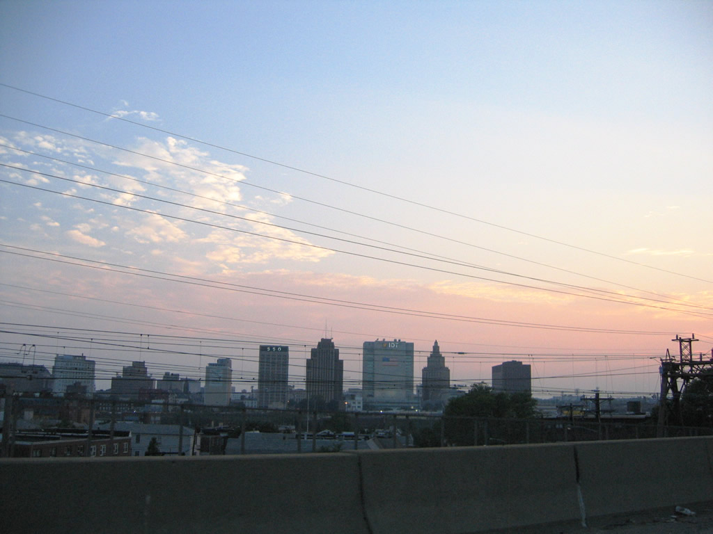
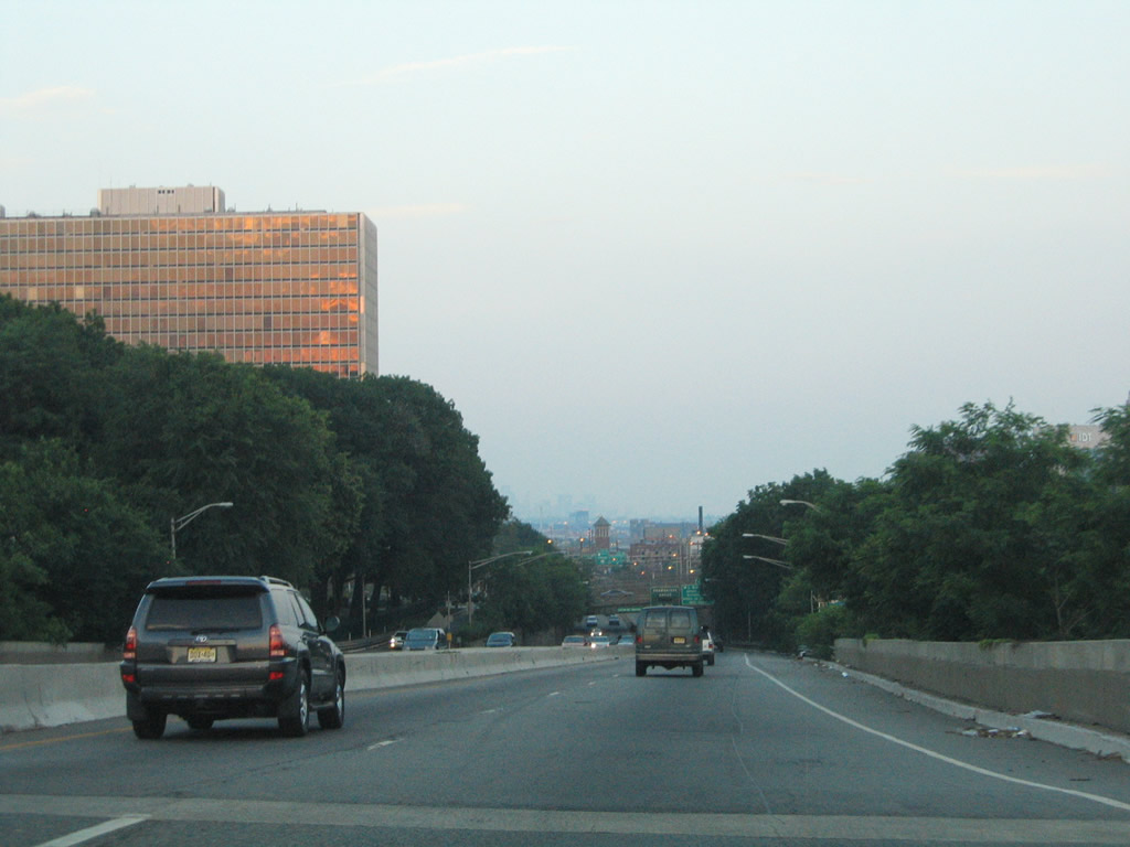
Looking back to the southwest at Downtown Newark and its skyline.
06/13/05
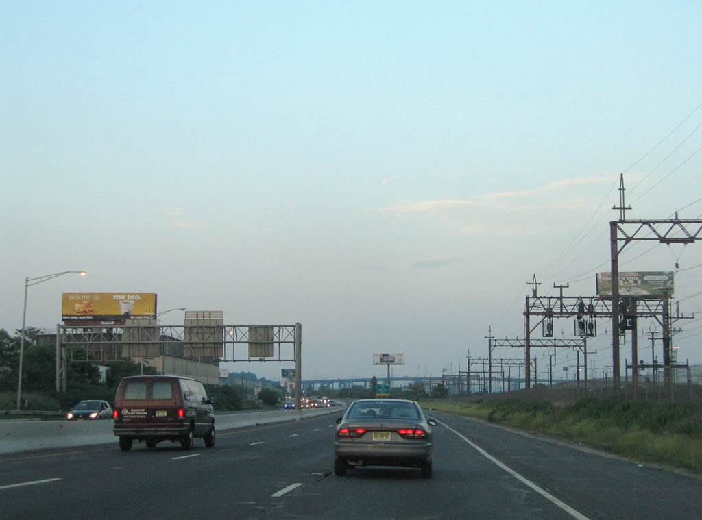
A PATH transit line parallels Interstate 280 closely through the industrialized south side of Harrison.
06/13/05
Hudson County 508 (Newark Turnpike) leaves Harrison and enters the town of Kearny to cross paths with Interstate 280 in a swampy area north of the Passaic River. I-280 ended at a half diamond interchange with County Route 508 west of the New Jersey Turnpike until 1980.
06/13/05
Directional ramps link Interstate 280 east with CR 508 (Newark Turnpike) east to Route 7 and Jersey City. The remainder of the interchange consists of a three-quarter cloverleaf.
06/13/05
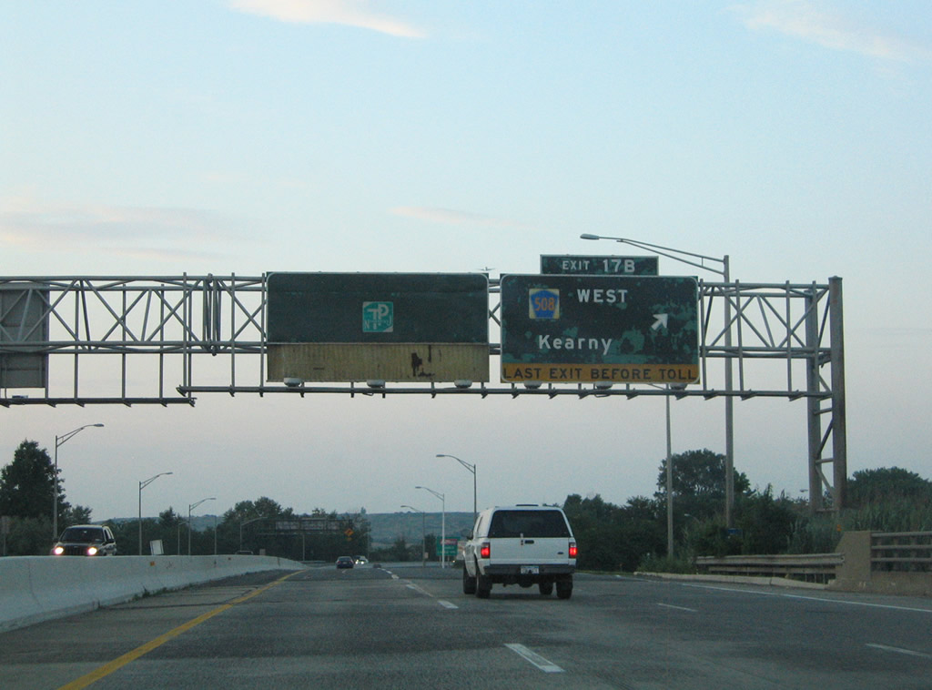
A left side on-ramp joins Interstate 280 west from Hudson County 508 as Interstate 280 turns northward toward Exit 17B and its eastern end point with the New Jersey Turnpike.
06/13/05
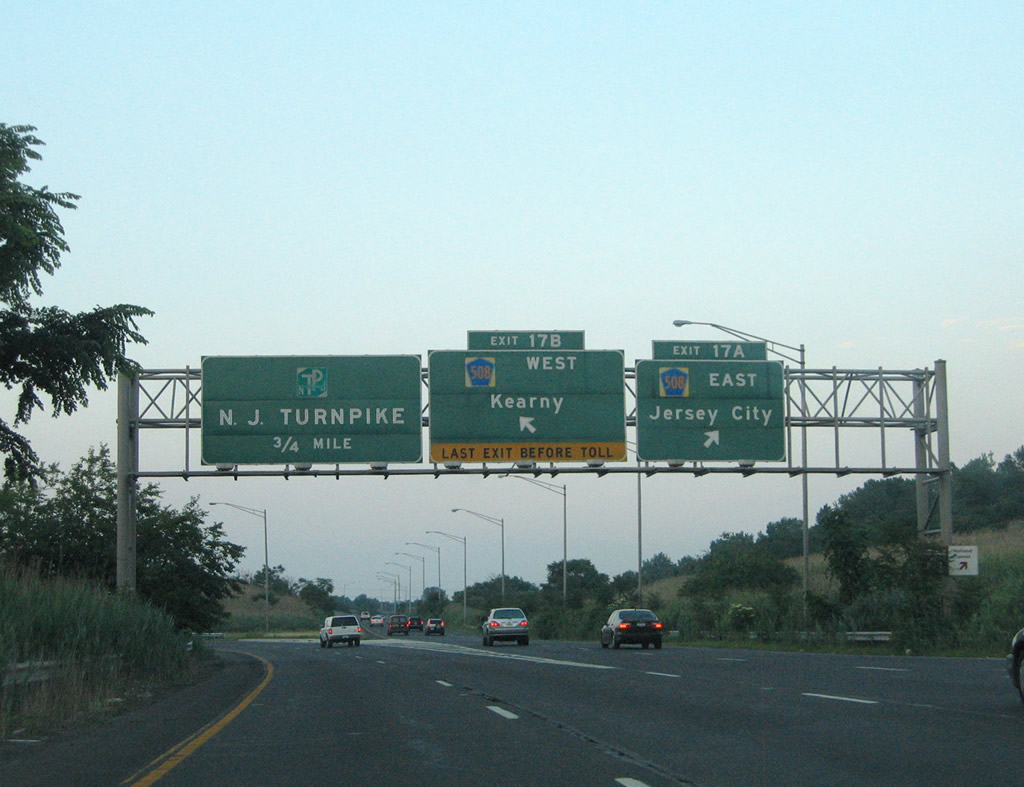
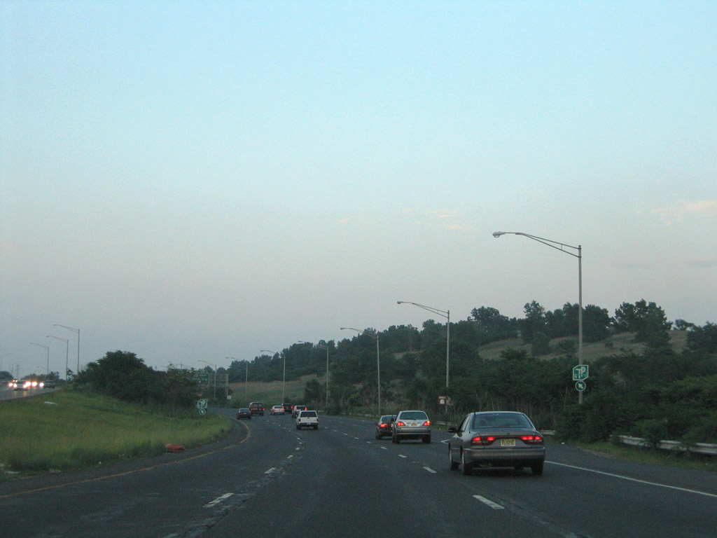
Exit 17A leaves Interstate 280 east for Hudson County 508 (Newark Turnpike) east. CR 508 ends at an interchange with Route 7 north of Kearny Point. Route 7 continues east to its end at U.S. 1/9 Truck in Jersey City.
06/13/05
Interstate 280 defaults into the Exit 15W toll plaza of the New Jersey Turnpike beyond the Exit 17B loop ramp to Hudson County 508 west.
06/13/05

Entering the N.J. Turnpike toll plaza on Interstate 280 east.
06/13/05
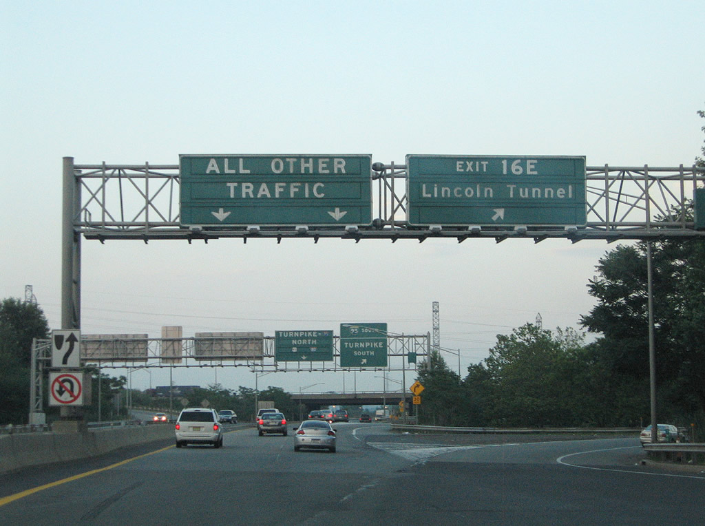
The first of three Turnpike ramps links with Interstate 95 on the eastern branch of the New Jersey Turnpike for interests to Route 495 (Lincoln Tunnel).
06/13/05
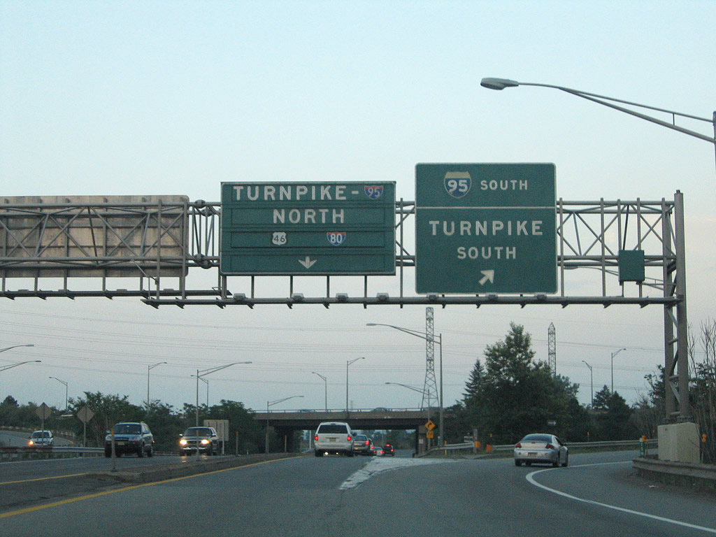
The second ramp is part of a conventional trumpet interchange with Interstate 95W just north of its merge with the eastern branch. Interstate 95 combines and heads south to Newark Liberty International Airport (EWR) and Elizabeth. Unsigned I-95W otherwise heads north to East Rutherford and the Meadowlands Sports Complex.
06/13/05
References:
- William A. Stickel Memorial Bridge, Nicolas Janberg's Structurae.
- Kevin Porter.
Photo Credits:
- Alex Nitzman, Justin Cozart: 06/13/05
- Carter Buchanan: 08/11/04
Connect with:
Page Updated Monday April 21, 2014.