
Interstate 285 Inner Loop - I-20 to College Park

 South
South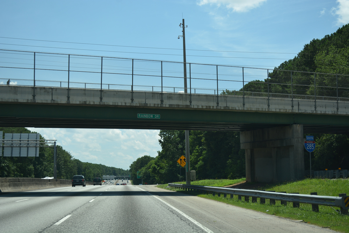
A confirming marker stands beside the Rainbow Drive overpass, as the c/d roadway from Exit 46 returns to the mainline of Interstate 285 south.
07/02/17
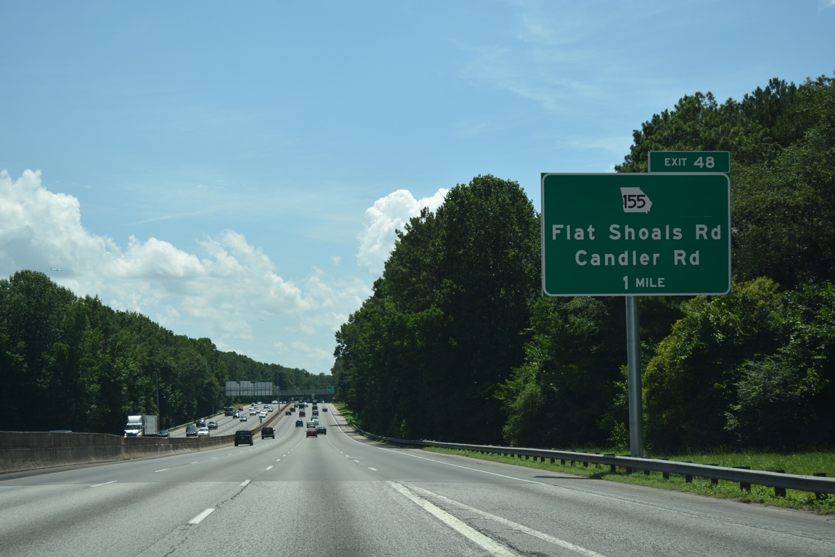
SR 155 commences a 57 mile long route north from Griffin. The state route meets Interstate 285 at Panthersville in one mile.
07/02/17
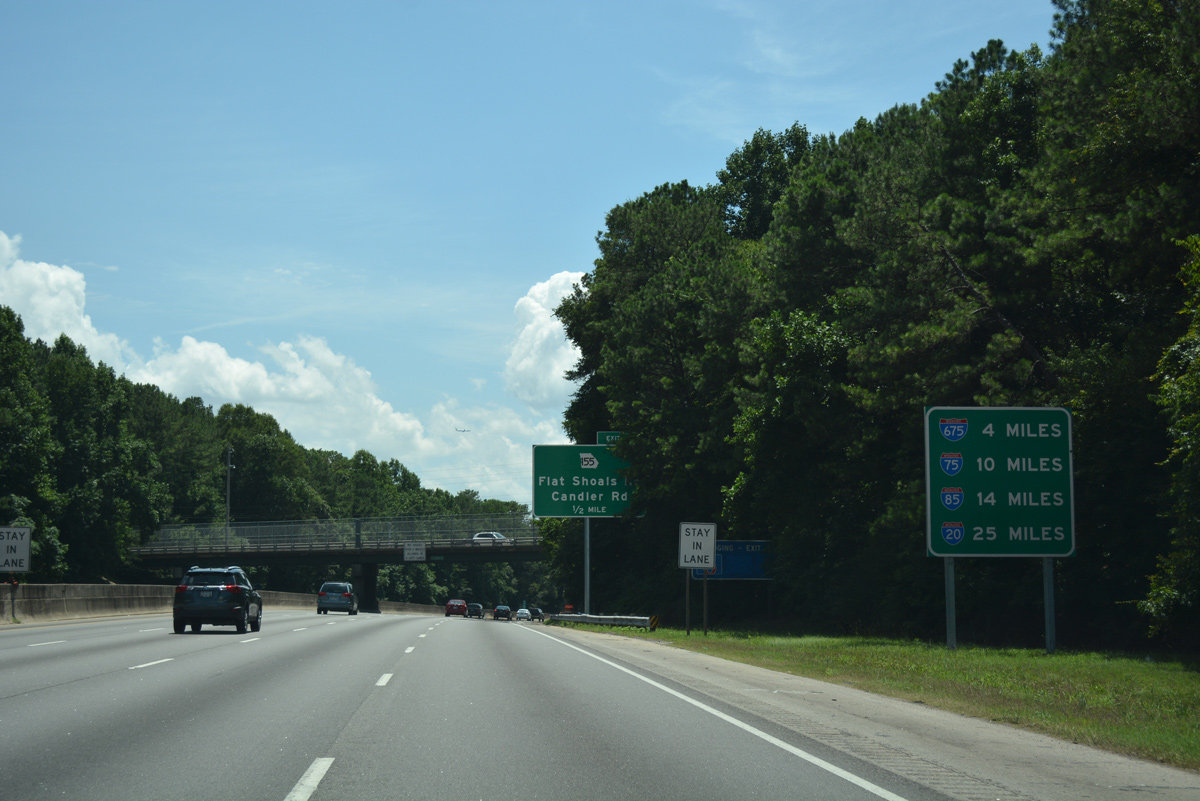
Circling southwest, the Perimeter Highway reaches I-675 in four miles and I-75 in ten miles. I-285 and I-20 come together again in 25 miles at Adamsville in west Atlanta.
07/02/17
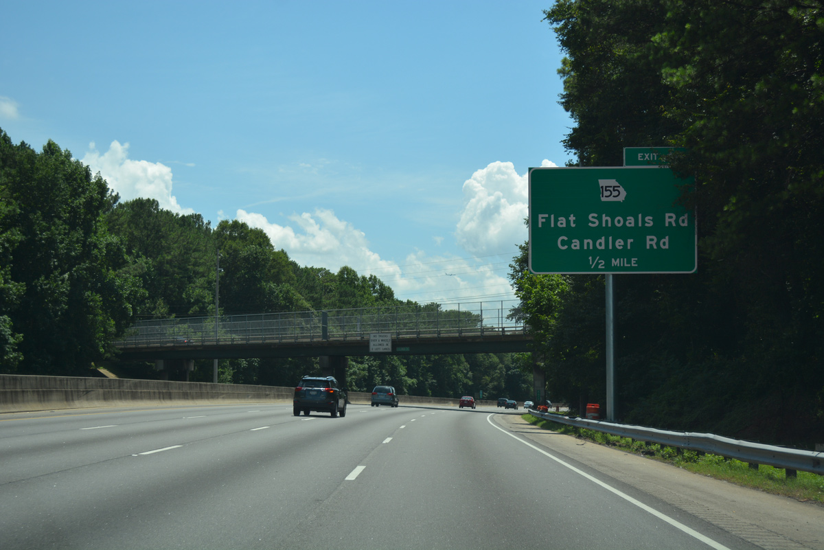
Flat Shoals Parkway takes SR 155 east from forthcoming Exit 48 to Snapfinger. Flat Shoals Road extends the route north to Candler Road near the Gallery at South DeKalb mall.
07/02/17
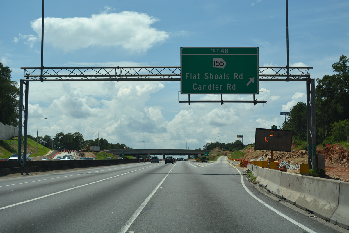
Construction through September 30, 2017 rebuilt the Flat Shoals Road overpass and diamond interchange (Exit 48) with I-285. The $34.77 million project also expanded the off-ramps to increase capacity and added bike lanes to SR 155.1
07/02/17
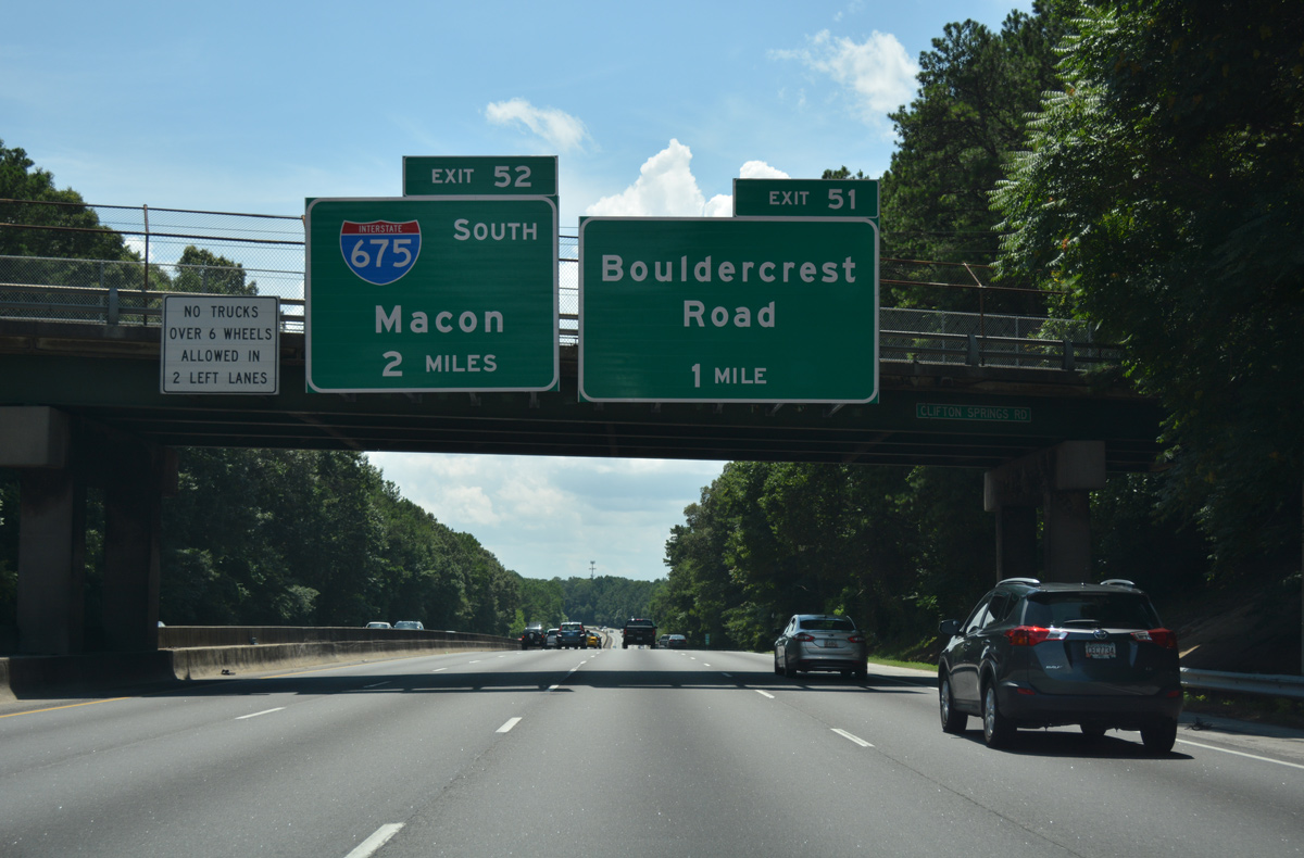
Angling southwest ahead of Sugar Creek Golf Course, Interstate 285 approaches Bouldercrest Road (Exit 51) and Interstate 675 south (Exit 52).
07/02/17
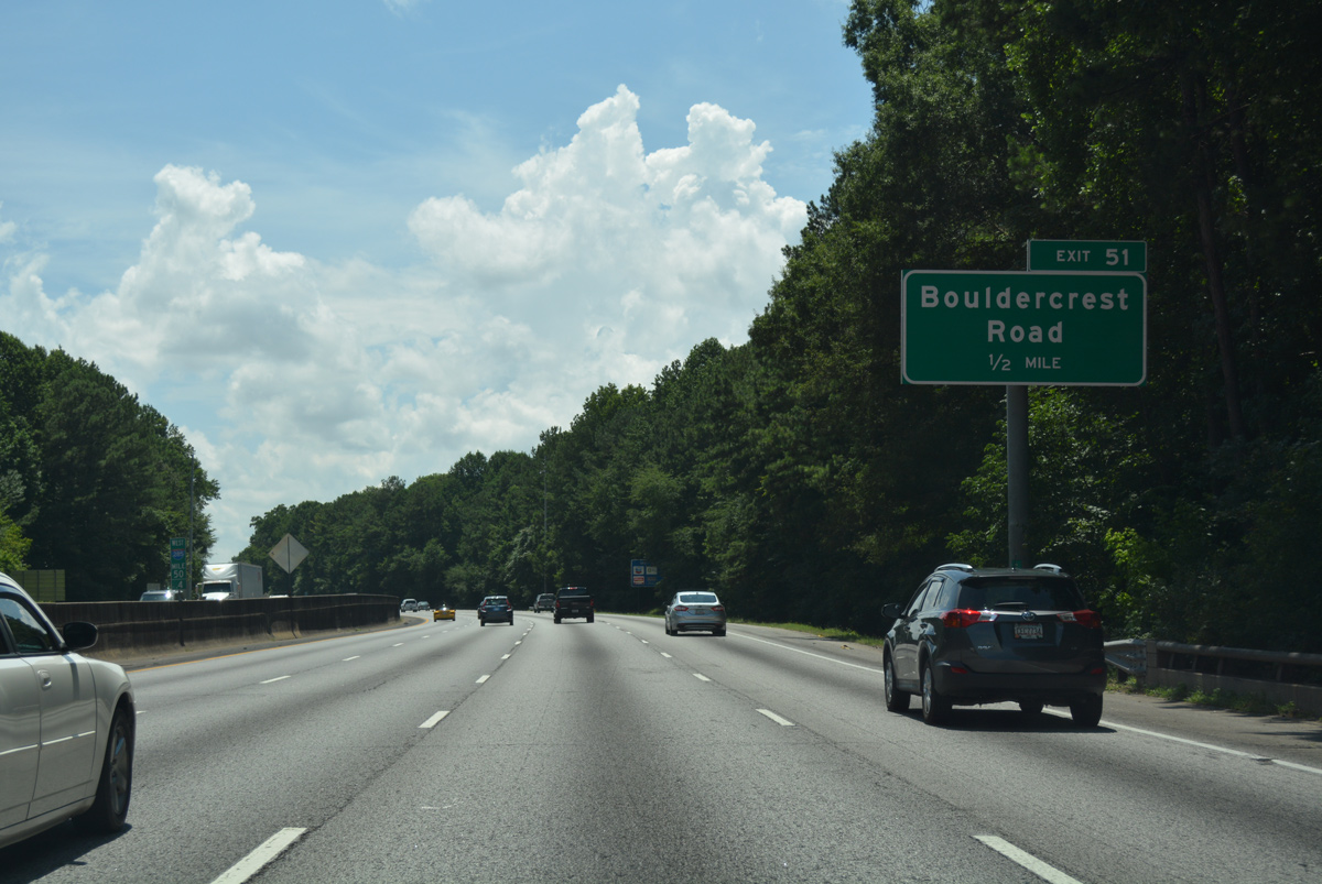
Bouldercrest Road meanders south from the Perimeter Highway through suburban areas to the community of Ellenwood.
07/02/17
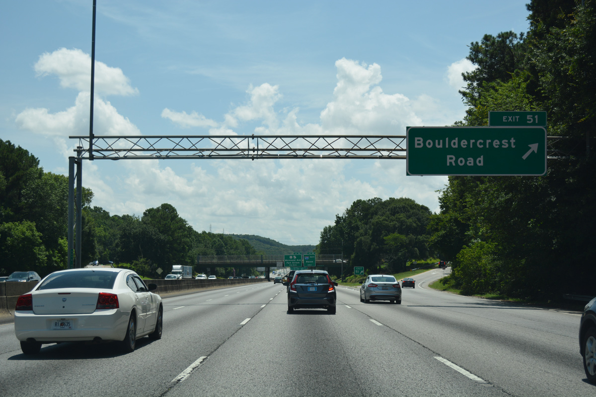
Entering the diamond interchange (Exit 51) with Bouldercrest Road on Interstate 285 westbound. Bouldercrest Road branches northwest from Constitution Road nearby en route to Gresham Park and East Atlanta.
07/02/17
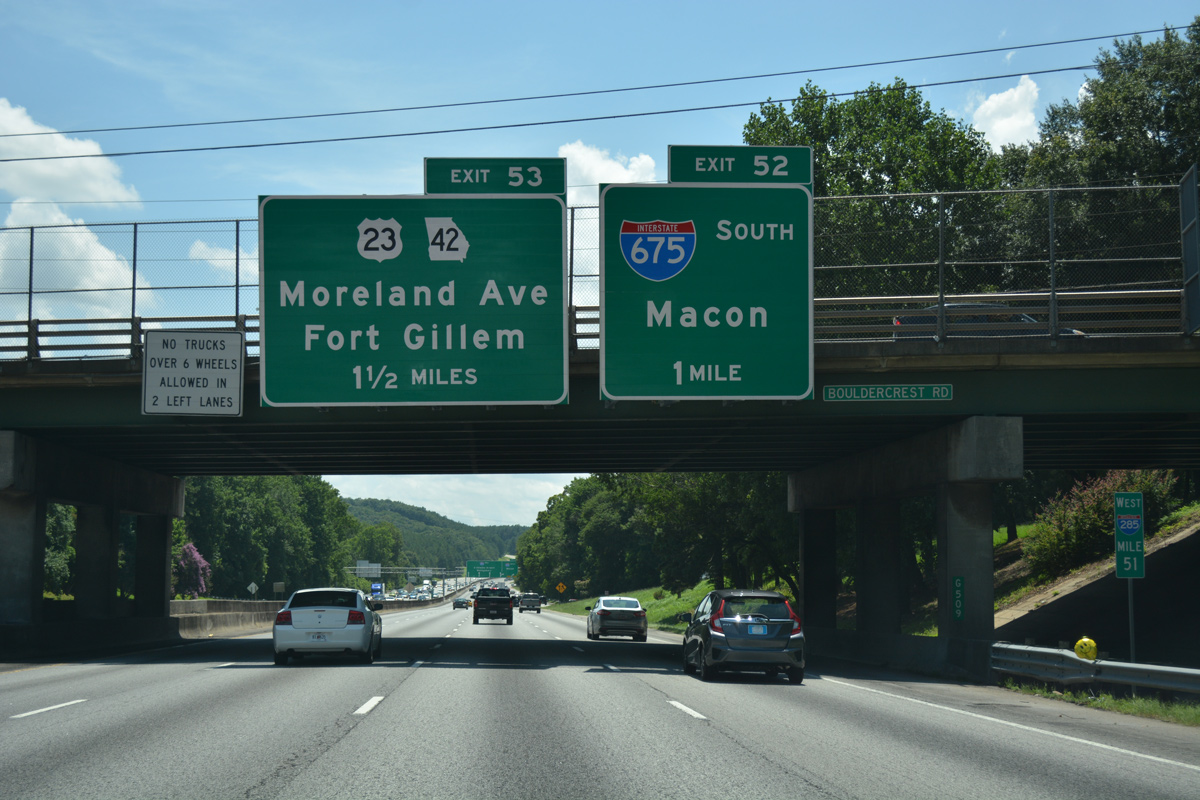
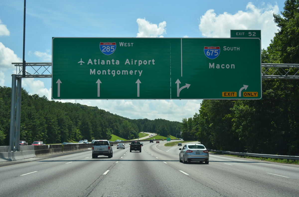
A directional T interchange (Exit 52) joins I-285/675 in south Dekalb County. I-675 comprises an 11.10 mile long suburban freeway linking the southeast quadrant of the Perimeter Highway with I-75 south to Macon. U.S. 23/SR 42 parallel the suburban freeway southward to Stockbridge.
07/02/17
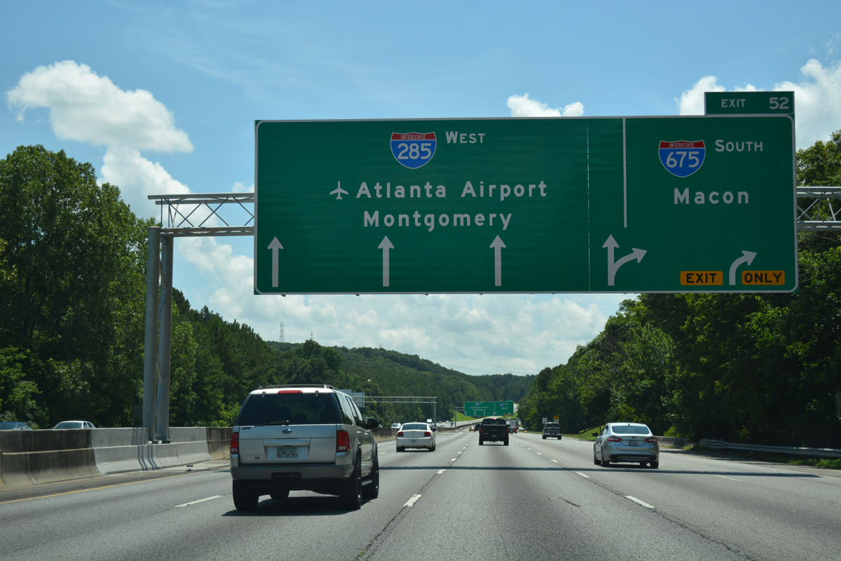
Crossing the South River, Interstate 285 west expands to five lanes to I-675. Future road work previously scheduled for 2019 will add a collector distributor roadway from Bouldercrest Road to Exit 52 to eliminate a weaving traffic pattern.
07/02/17
Fully opened to traffic in 1987, Interstate 675 provides a bypass of I-75 and Forest Park, Lake City and Morrow as it angles southeast through Henry County.
07/02/17
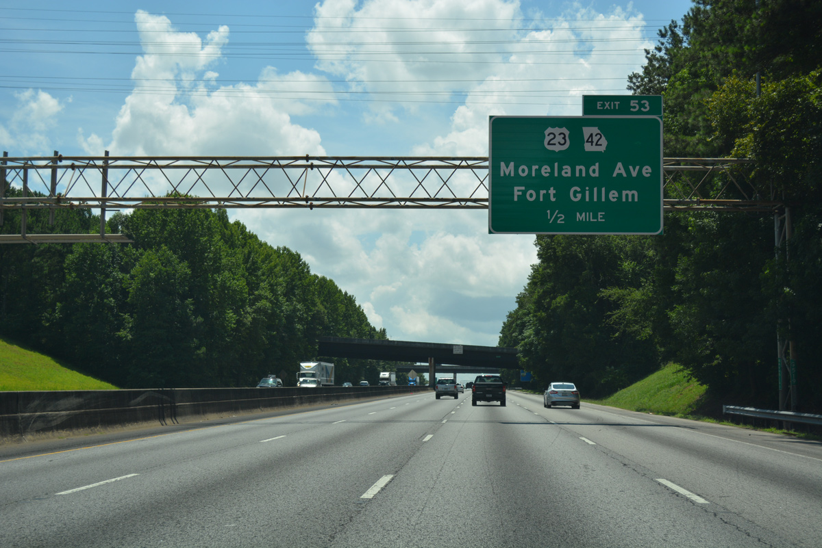
The last Dekalb County exit along I-285 west departs from within the I-675 exchange. U.S. 23/SR 42 (Moreland Avenue) head north to run along the Atlanta city line from the Leila Valley neighborhood to Ormewood Park.
07/02/17
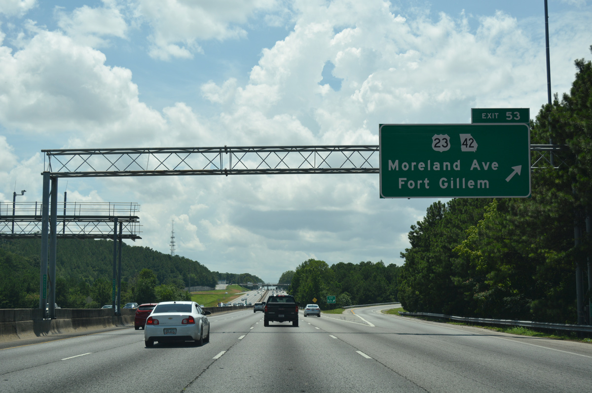
South from the diamond interchange (Exit 53) with I-285, U.S. 23/SR 42 (Moreland Avenue) continue by the Hickory Ridge Landfill Solar Farm to an industrial area populated by shipping and trucking companies. Further south, Moreland Avenue reaches the redevelopment site of Fort Gillem.
07/02/17
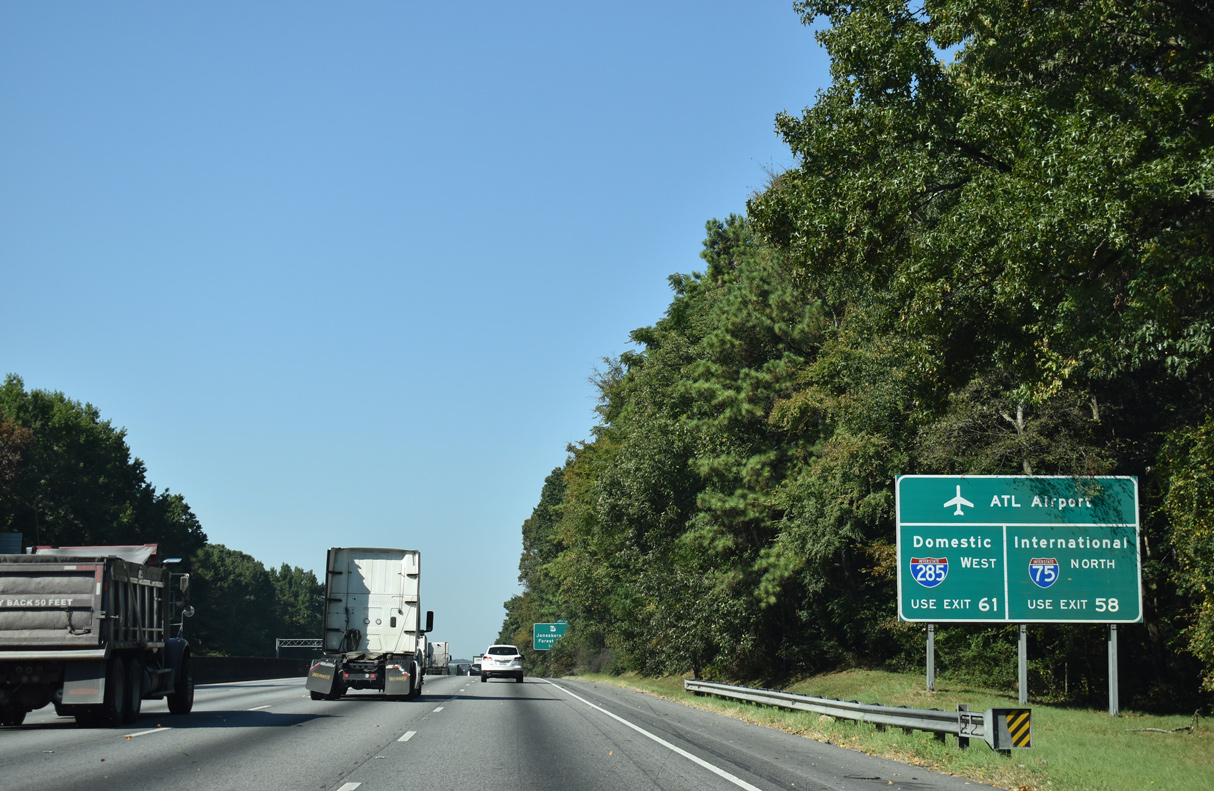
Signs posted throughout the Atlanta metro area direct travelers bound for Hartsfield-Jackson Atlanta International Airport (ATL) to use I-75 for the International Terminal and I-85 for the Domestic Terminal. Prior to 2012, all passengers used the main terminal off I-85.
09/22/22
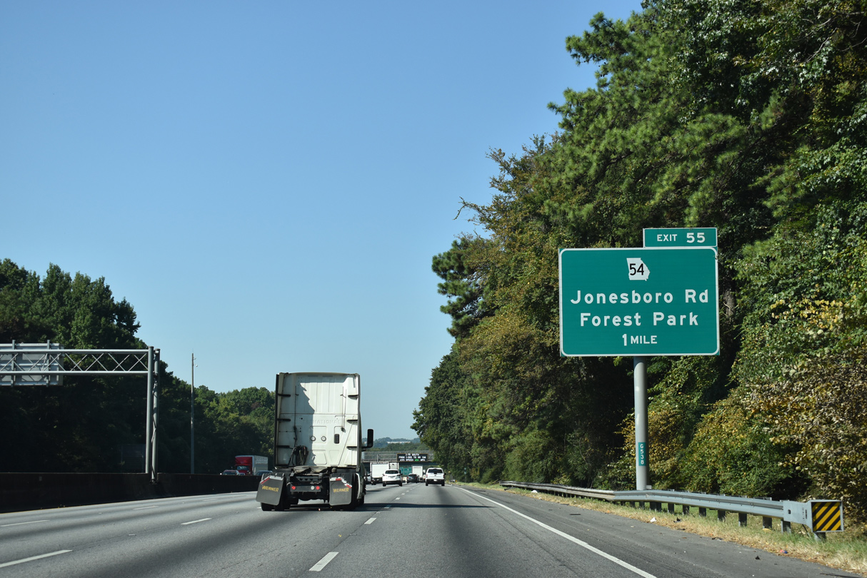
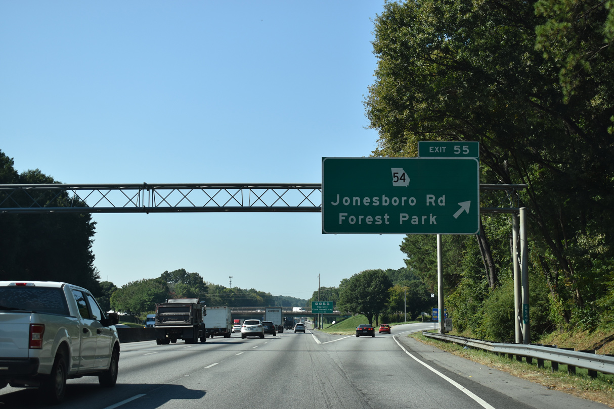
Interstate 285 nips the southeastern corner of Atlanta through the South River Gardens and Blair Villa/Poole Creek neighborhoods, meeting SR 54 (Jonesboro Road) at Exit 55.
09/22/22
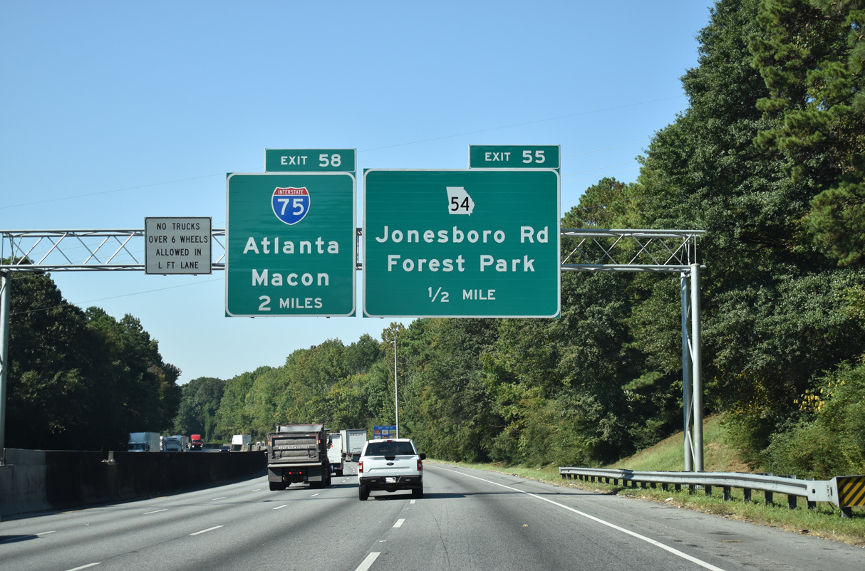
SR 54 (Jonesboro Road) leads south from upcoming Exit 55 to the city of Forest Park, Lake City and Morrow. A 3.1 mile long c/d roadway separates from Interstate 285 west for I-75 in two miles.
09/22/22
70.50 miles long, SR 54 originates from an interchange with the Downtown Connector (I-75/85) at the Pittsburgh neighborhood in Atlanta. The state route generally mirrors the I-85 corridor southwest from Clayton County to end west of Hogansville at U.S. 27.
09/22/22
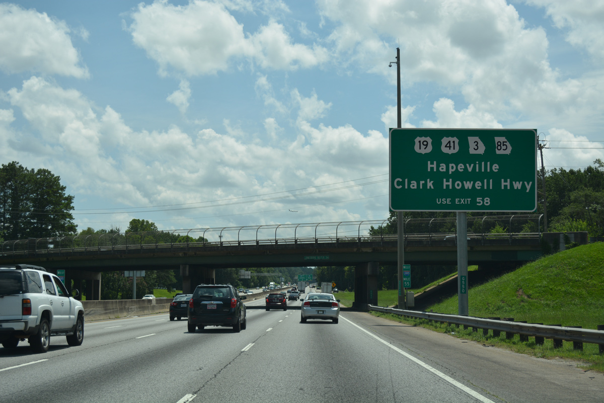
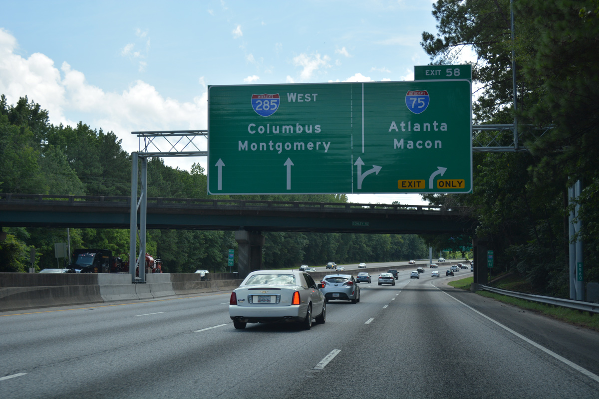
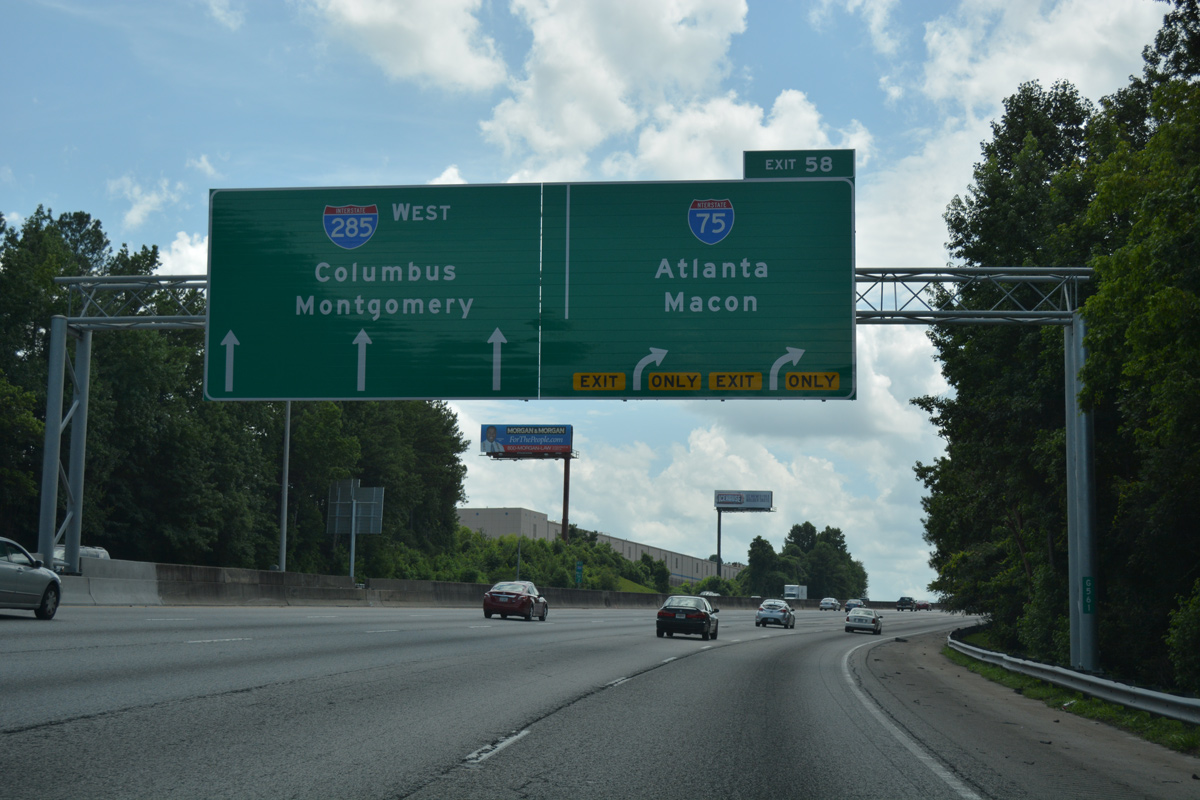
In addition to connecting I-285 west with I-75, the c/d roadway for Exit 58 links the Atlanta Beltway with U.S. 19-41/SR 3 (Old Dixie Road), SR 85 south and Clark Howell Highway.
07/02/17

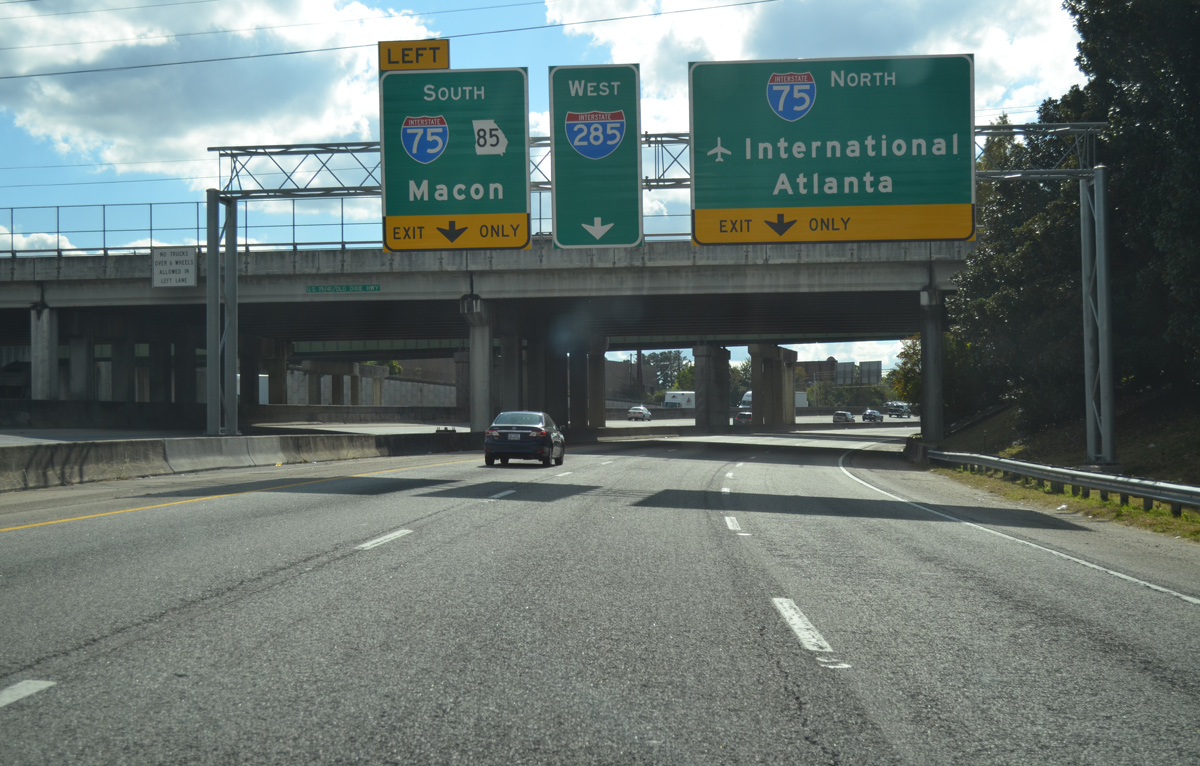
The first in a series of APL signs outline the upcoming split of Exit 58 from I-285 west for Interstate 75 north to Atlanta and south to Macon.
07/02/17
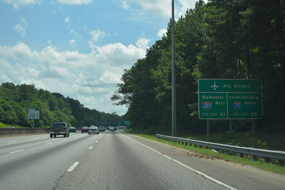
The International Terminal of ATL Airport lies just north of Interstate 285 via I-75 north to Exit 239 and Maynard H. Jackson, Jr. Boulevard west.
07/02/17
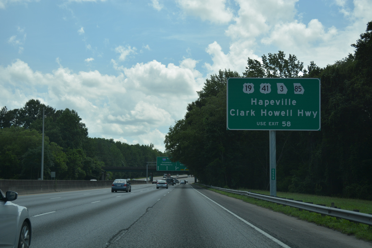
U.S. 19/41 arc northwest from Forest Park and the Perimeter Highway to the city of Hapeville.
07/02/17
Conley Road spans I-285 one quarter mile east of Exit 58. Interstate 75 combines with I-85 north in four miles along the Downtown Connector through Atlanta.
07/02/17
I-285 advances west uninterrupted with three lanes to ramps with Airport Loop Road. Leading southeast from Forest Park, I-75 comprises a busy freight corridor 75 miles to Interstate 16 within the city of Macon.
07/02/17
A folded diamond interchange joins the c/d roadway at Exit 58 with U.S. 19-41/SR 3 (Old Dixie Road) north to Mountain View and south to Forest Park.
07/02/17
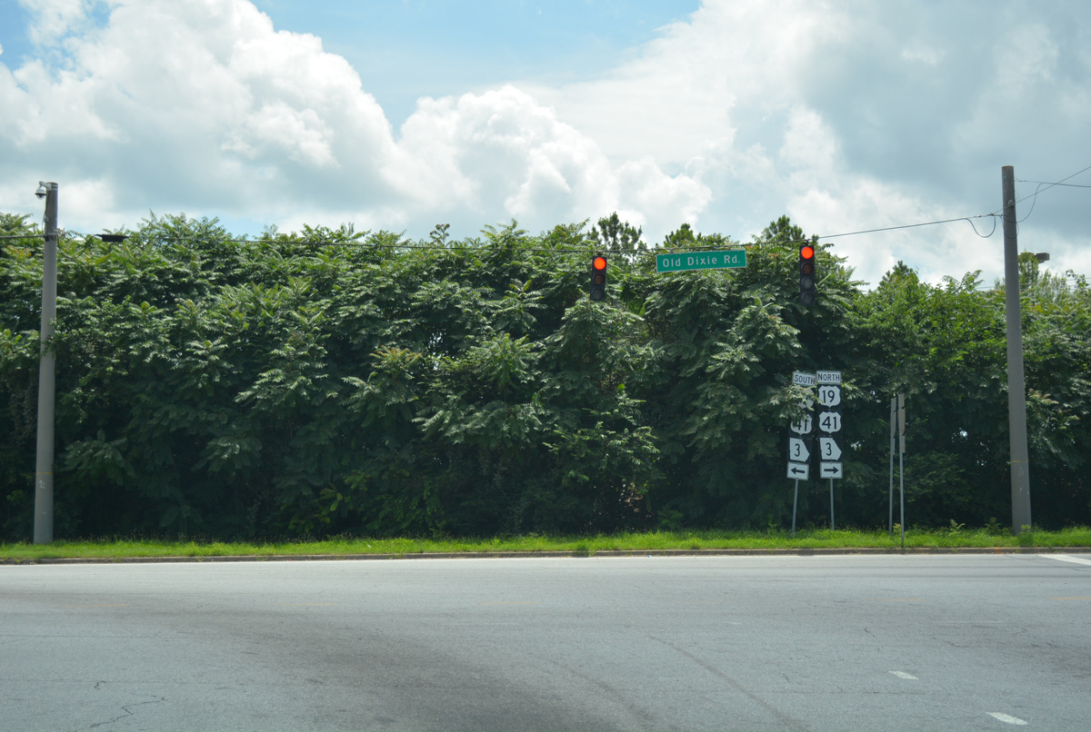
Shields posted at the end of the off-ramp from I-285 west at Old Dixie Road. Northward, construction in 2016-17 realigned U.S. 19/41 to accommodate a new overpass for Charles W. Grant Parkway west.
07/02/17
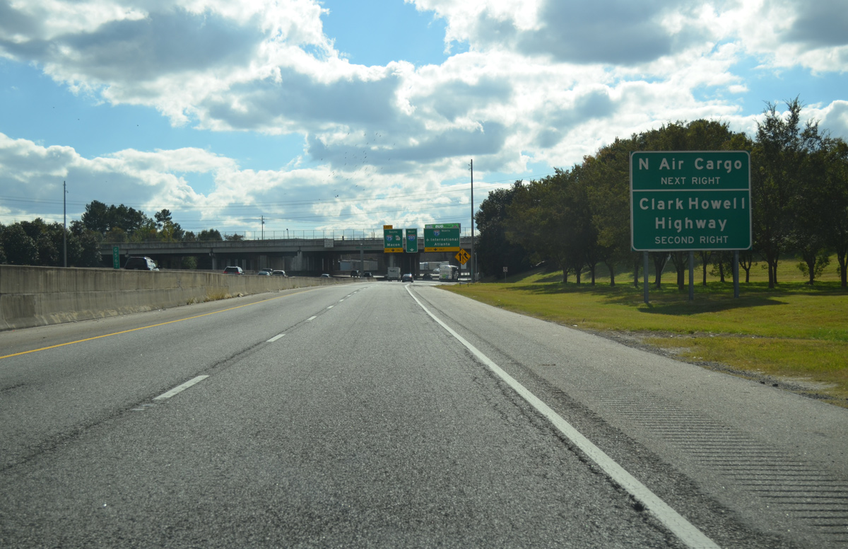
Airport Loop Road encircles the east side of Hartsfield-Jackson Atlanta International Airport (ATL) from cargo areas in Hapeville south to cargo facilities west of Clark Howell Highway.
10/22/15
The northbound exit ramp for I-75 joins the freeway ahead of a c/d roadway for Charles W. Grant Parkway to the International Terminal of ATL Airport and Old Dixie Highway to Hapeville. I-20 weaves 20 miles north through Atlanta, to meet I-285 again in Cobb County.
10/22/15
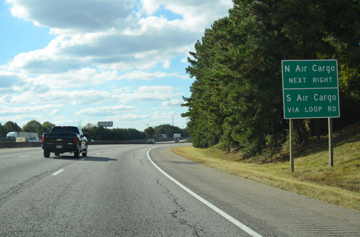
Airport Loop Road parallels Interstate 285 west of I-75 from Clark Howell Highway to the c/d roadway end of Exit 58.
10/22/15
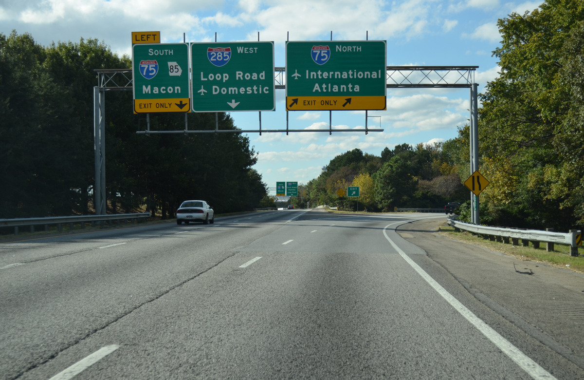
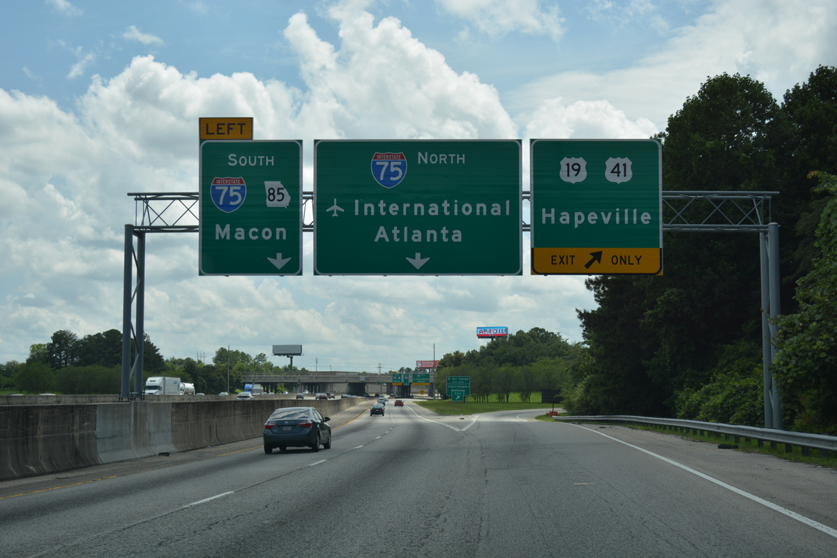
A left exit from the c/d roadway connects with both SR 85 south to the city of Riverdale and Interstate 75 south to McDonough, Forsyth and Macon.
10/22/15
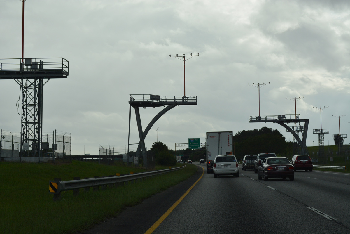
The lighting array for the 5th Runway of ATL Airport extends over the westbound c/d roadway by the Airport Loop Road overpass.
06/30/17
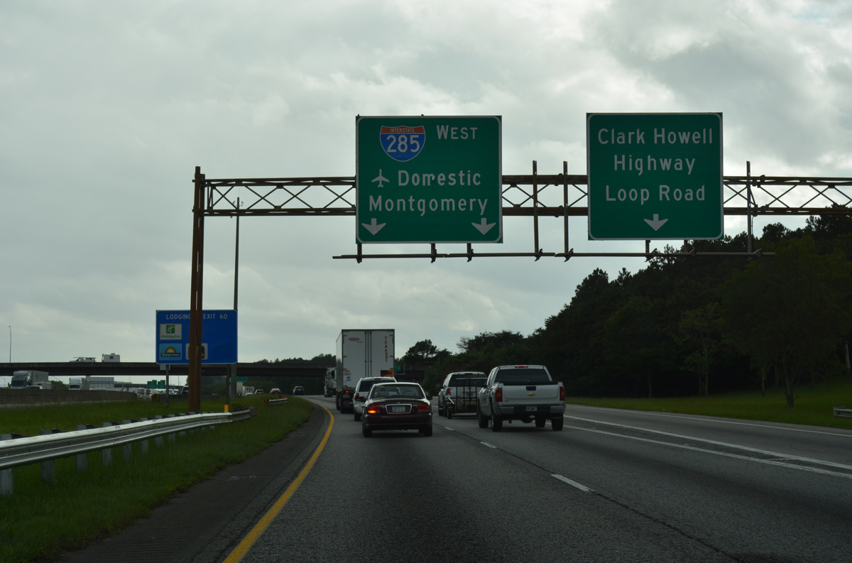
The c/d roadway partitions into ramps for Interstate 285 west to College Park and succeeding ramps for Clark Howell Highway south to Forest Parkway, and Airport Loop Road west to the south cargo area of ATL Airport.
06/30/17
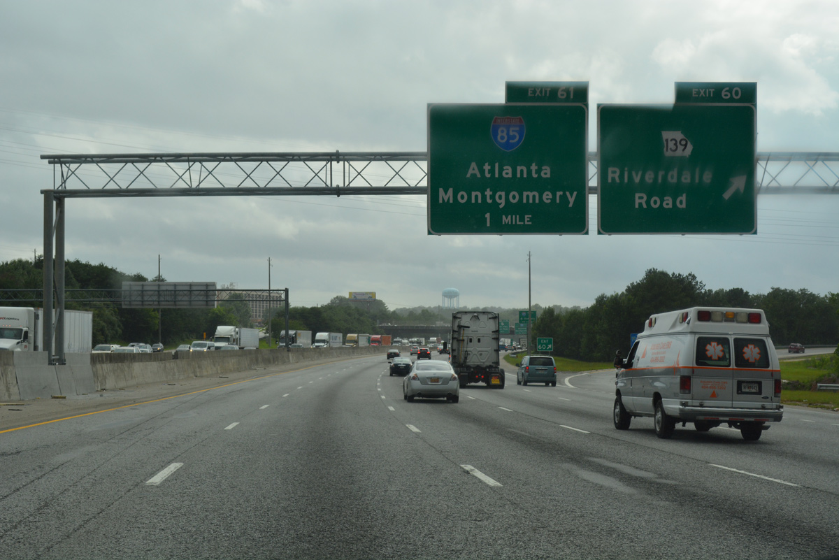
The succeeding off-ramps (Exit 60) from I-285 westbound depart in one mile for SR 139 (Riverdale Road) and two miles for Interstate 85 and the Domestic Terminal of ATL Airport.
06/30/17
SR 139 (Riverdale Road) takes a convoluted route around the boundary of Hartsfield-Jackson Atlanta International Airport (ATL) to connect with I-85 in College Park. South from Exit 60, the state route ends in 3.9 miles at SR 85 in the city of Riverdale.
06/30/17
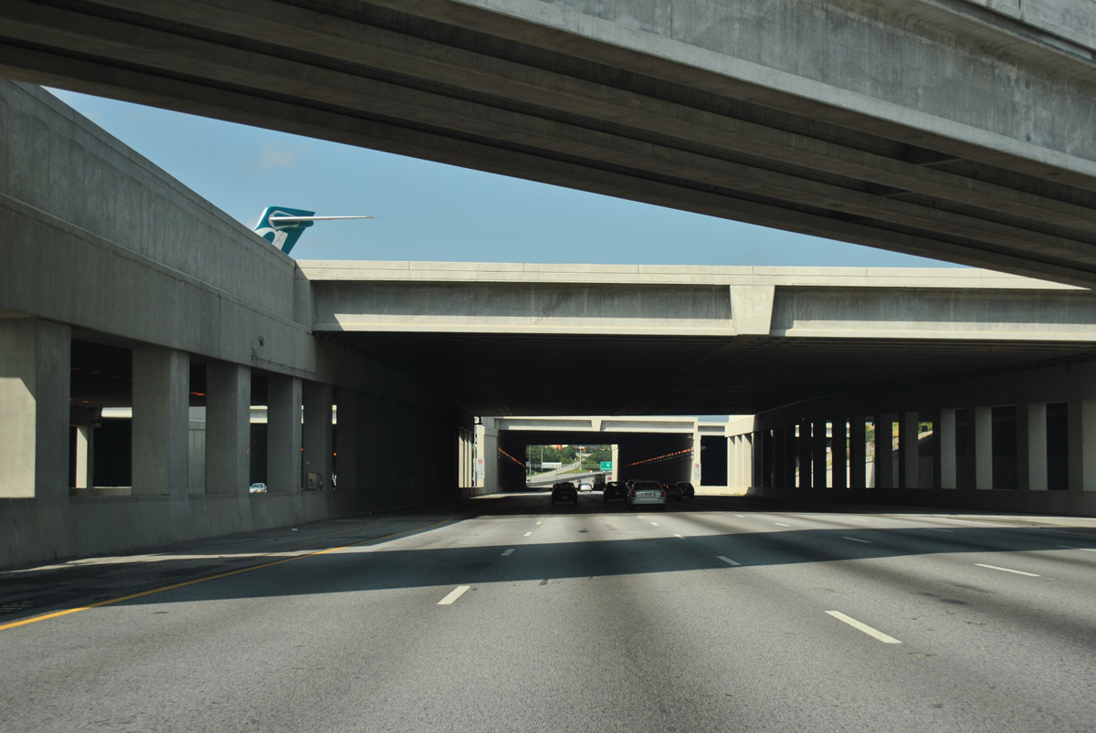
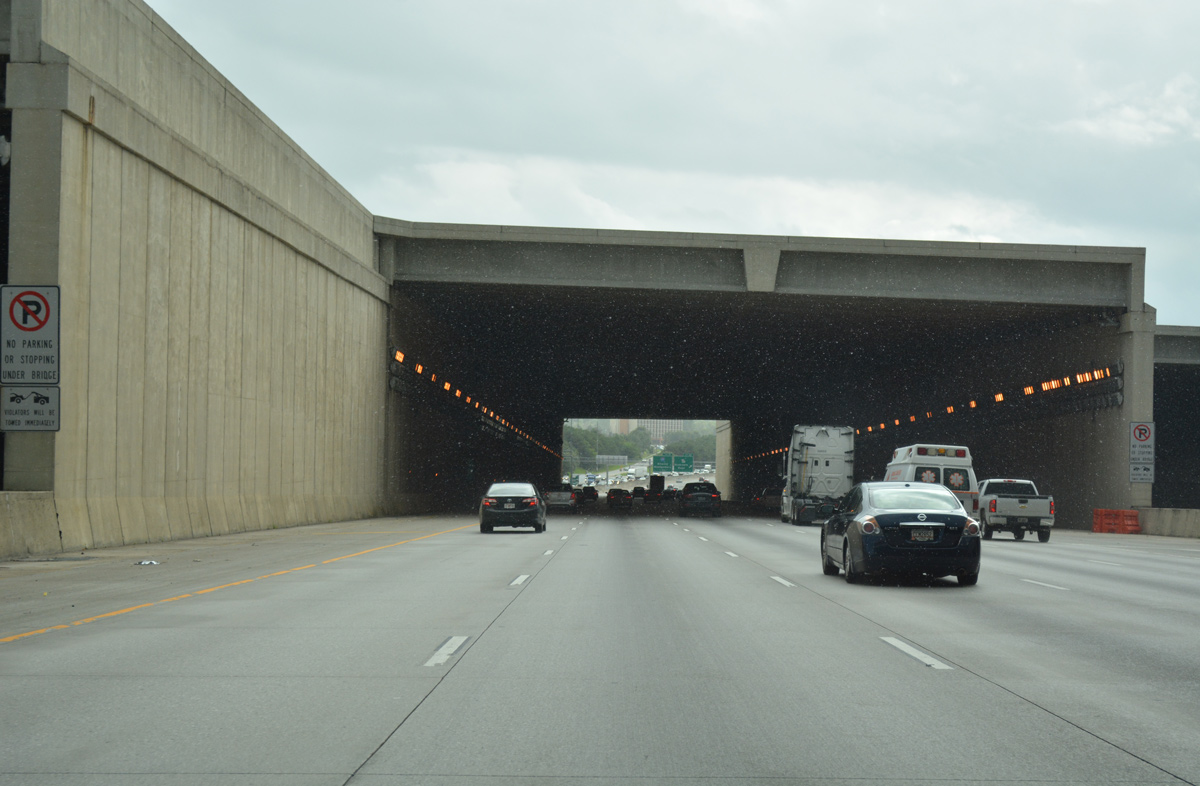
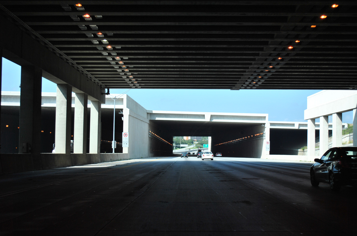
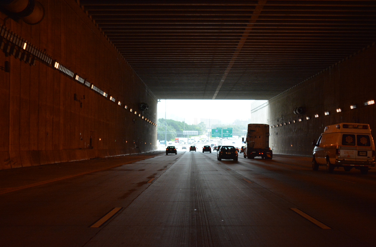
Interstate 285 angles southwest through a pair of tunnels below the Fifth Runway of ATL Airport. Completed in May 2006, the runway bridges were built during the $1.28 billion expansion of Hartsfield-Jackson Atlanta International Airport.2
07/31/11
The tunnels below both Runway 10/28 and the taxiway are 70 feet high and 700 feet wide. Unused tubes along both sides of Interstate 285 were built to accommodate future expansion of the Perimeter Highway.
06/30/17
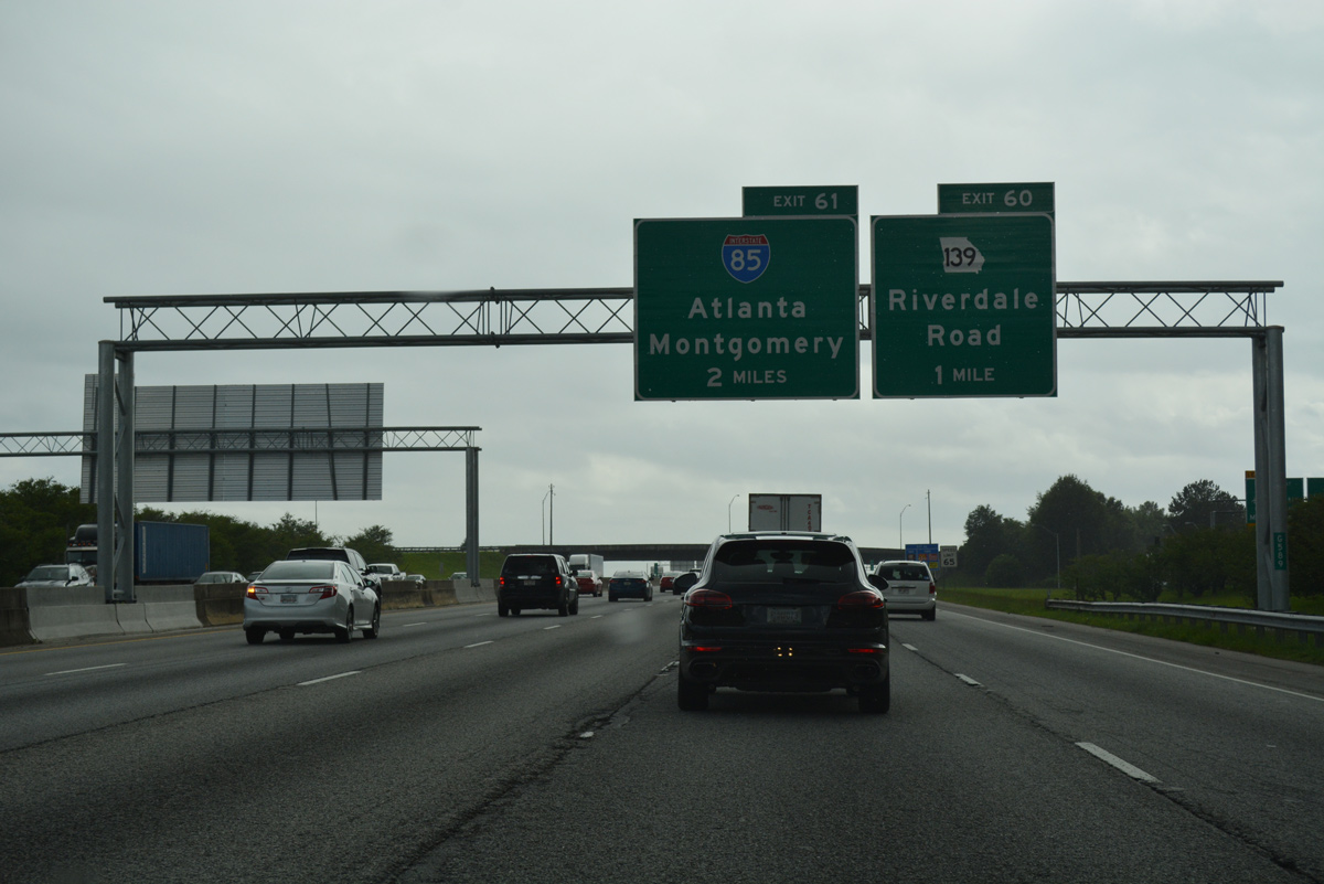
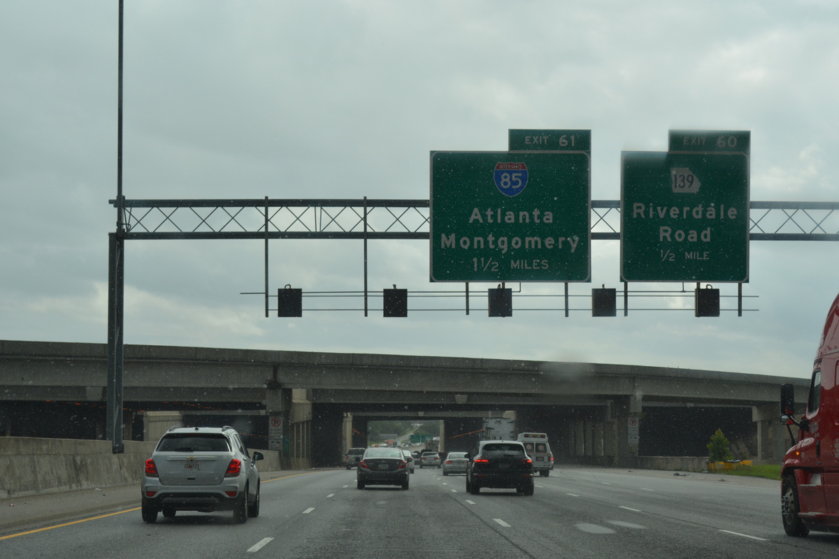
Exiting the airport tunnel system, drivers bound for SR 139 (Riverdale Road) leave I-285 west at a parclo interchange (Exit 60). Ramps for Interstate 85 north through College Park and south to Union City and Fairburn depart in one mile.
06/30/17
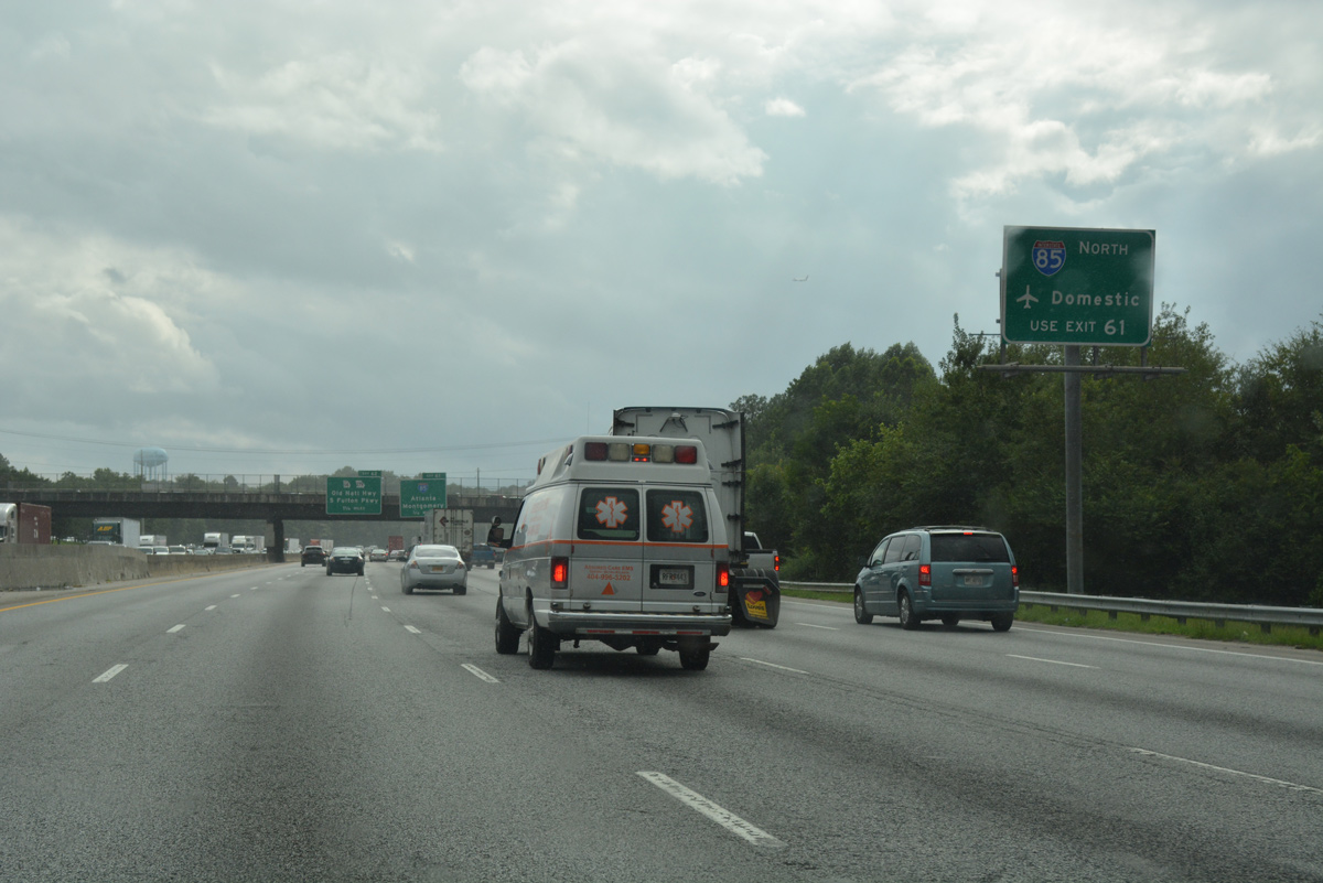
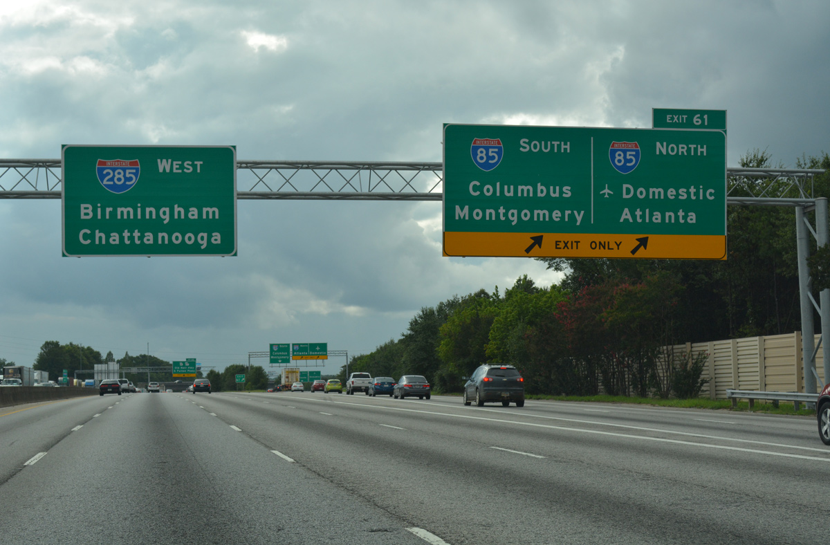
Exit 61 north to Interstate 85 splits into ramps for both the freeway mainline and a c/d roadway running north to the Domestic Terminal of ATL Airport.
06/30/17
0.75 miles ahead of the three-wye interchange (Exit 61) with Interstate 85 on I-285 west. A c/d roadway follows to connect both freeways with SR 279 (Old National Highway).
06/30/17
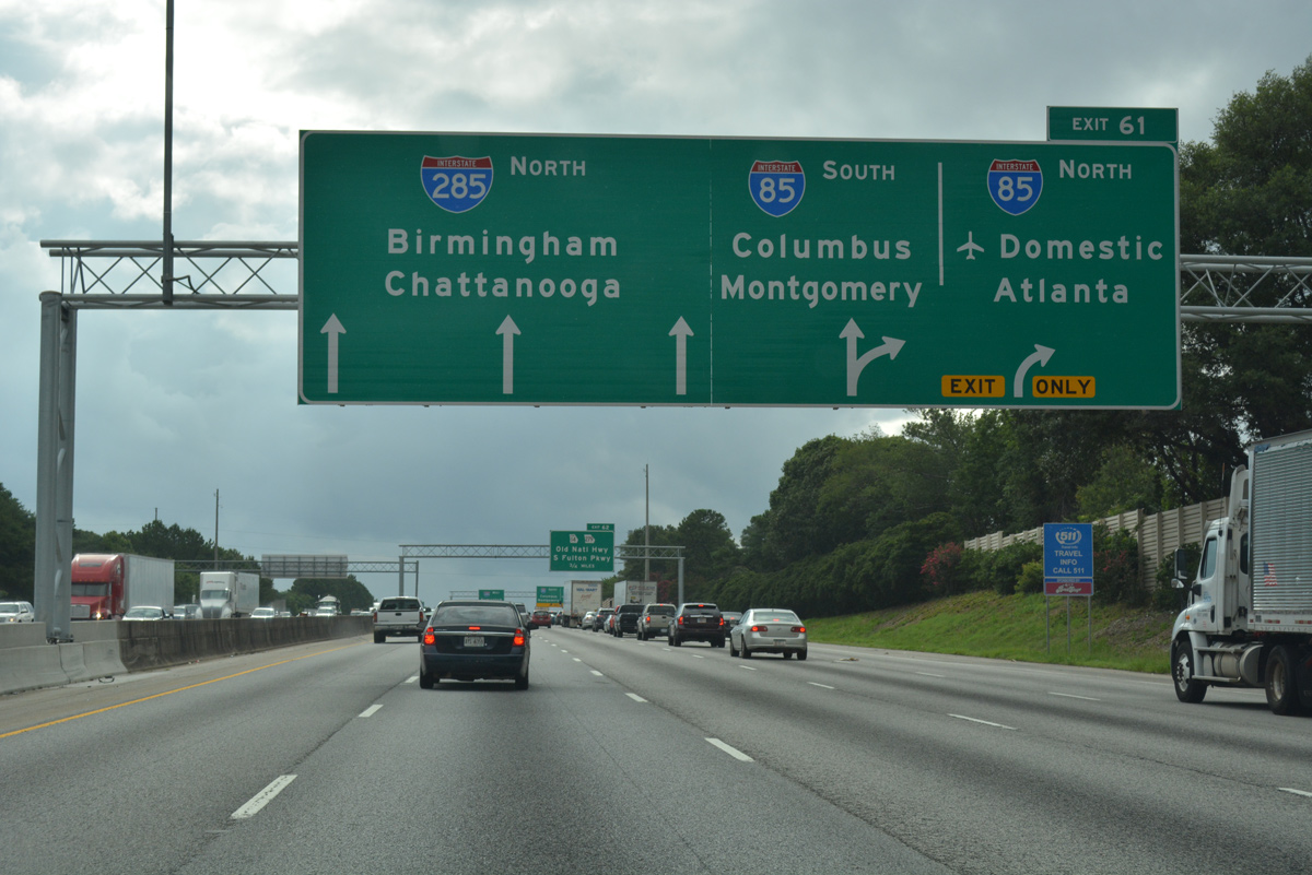
Interstate 85 travels 666 miles overall, from Montgomery, Alabama north to Petersburg, Virginia. Regionally, the freeway connects Atlanta with Columbus (via I-185) to the southwest, and Charlotte, Greensboro and Durham, North Carolina to the northeast.
06/30/17
SR 279 (Old National Highway) constitutes an arterial north through College Park. The state route serves adjacent areas of retail, warehouses and distributor centers.
06/30/17
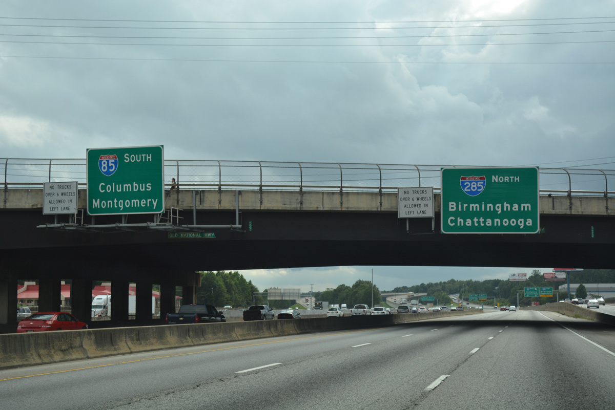
Two lanes branch away from the Perimeter Highway inner loop for Interstate 85. I-85 leads southwest from the south Fulton County suburbs to Newnan and LaGrange.
06/30/17
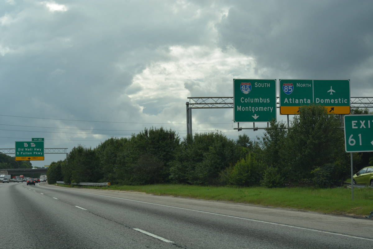
Exit 61 partitions into ramps for the I-85 north c/d roadway to SR 139 and Terminal Parkway, I-85 north to Hapeville and Hammond Park in Atlanta, and I-85 south as it runs alongside Interstate 285.
06/30/17
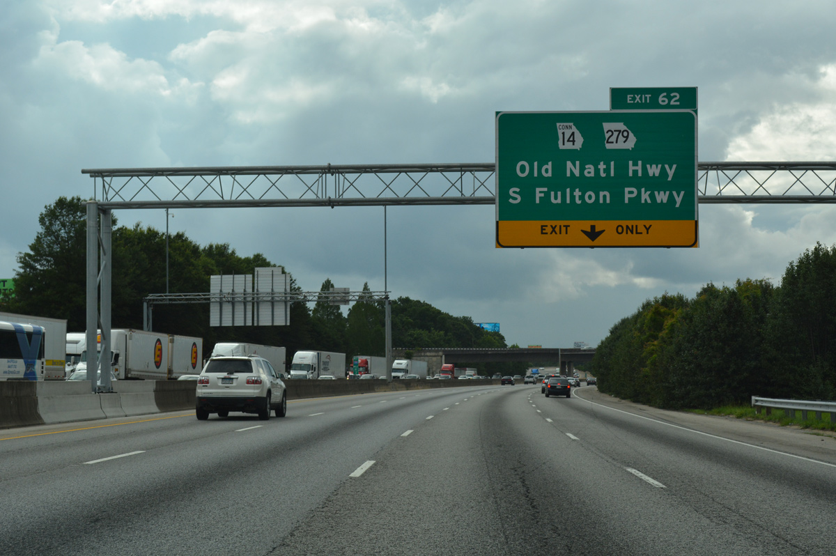
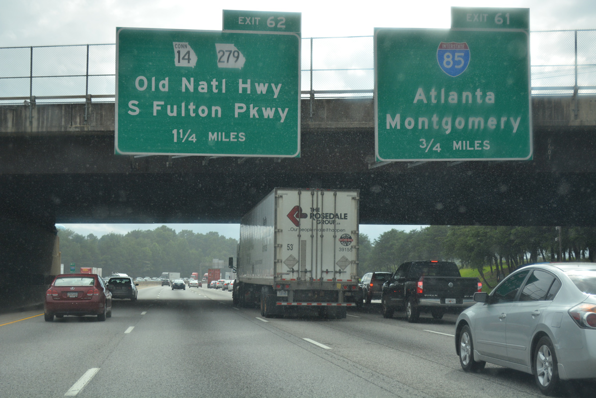
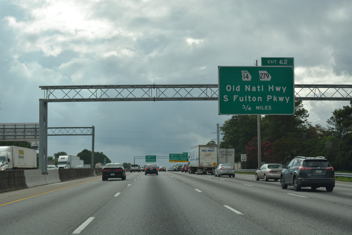
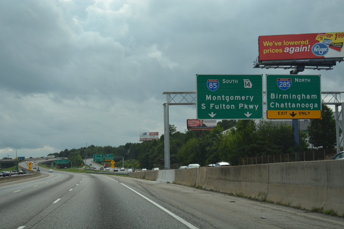
A lane drop occurs along I-285 west for the c/d roadway (Exit 62) to SR 279 (Old National Highway) and SR 14 Connector (South Fulton Parkway).
06/30/17
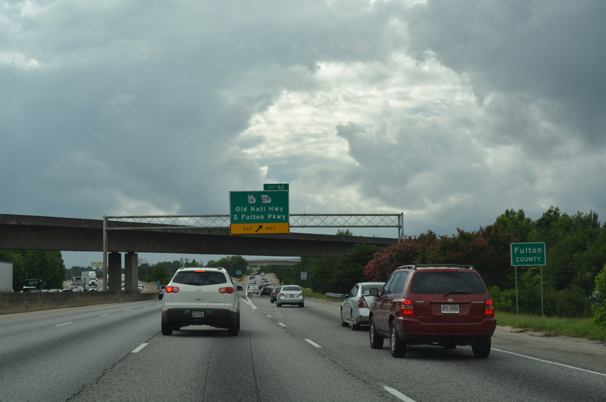
Interstate 285 reenters Fulton County within the exchange at I-85.
06/30/17
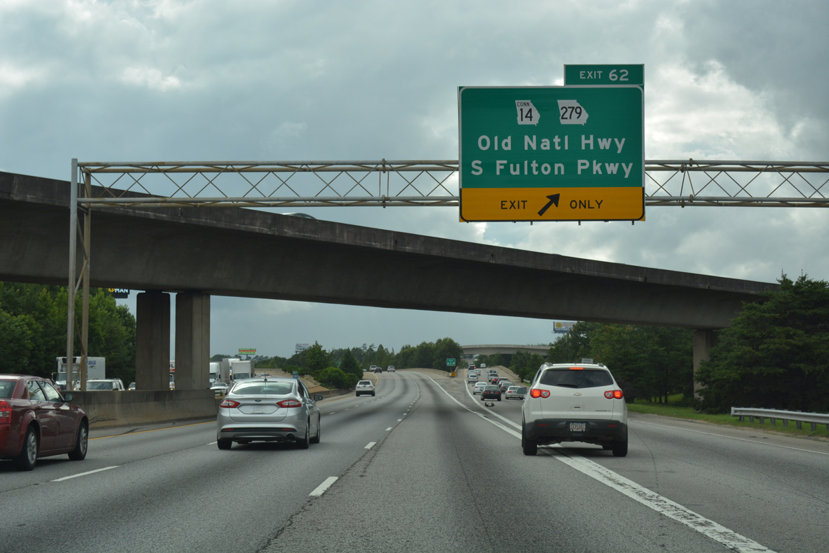
SR 14 Connector stems west from the Exit 62 c/d roadway along South Fulton Parkway.
06/30/17
SR 279 measures 9.52 miles in length from SR 85 in north Fayette County to U.S. 29/SR 14 in College Park.
06/30/17
I-85/285 do not overlap directly, and instead travel side by side in a dual freeway setup. Construction during the Freeing the Freeways megaproject, from 1982 to 1988, reconfigured the two highways to eliminate weaving traffic.
06/30/17
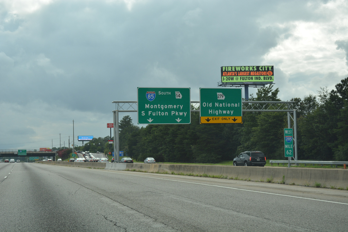
Continuing west from the diamond interchange with SR 279 (Old National Highway), motorists on the c/d roadway next partition with the northbound on-ramp to Interstate 285.
06/30/17
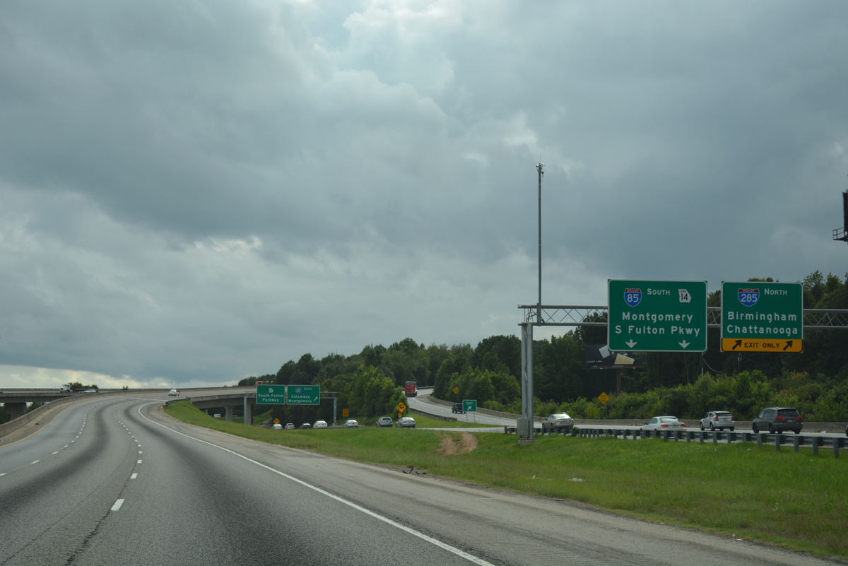
SR 14 Connector begins and carries traffic west to a loop ramp for I-85 south to Montgomery. South Fulton Parkway starts as a short freeway and extends west 19 miles as a controlled access expressway to SR 70.
06/30/17

References:
- Project: IMNHO-0285-01(354)01/ Dekalb County (I-285 @ Flat Shoals Road).
http://www.kathiegannon.com/ tl_files/documents/ Flat-Shoals-285.pdf - "Cleared for Landing Atlanta toasts airport's fifth runway Strip to cut delays, boost flight capacity." Atlanta Journal-Constitution (GA), May 17, 2006.
Photo Credits:
- Alex Nitzman: 10/22/15, 06/30/17, 07/02/17
- Brent Ivy: 07/31/11, 09/22/22
Connect with:
Page Updated Monday December 18, 2023.