
Interstate 465 Inner Loop - Castleton to Five Points
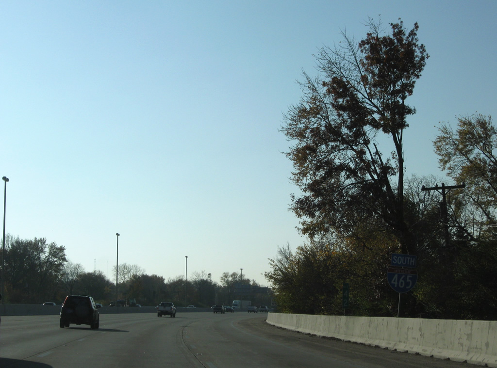
 South
South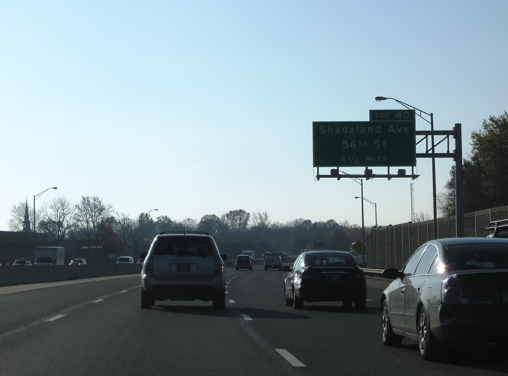
Turning southward along Interstate 465 between Shadeland Avenue and the Avalon Hills community, 1.50 miles north of the six-ramp parclo interchange (Exit 40) with 56th Street.
11/05/09
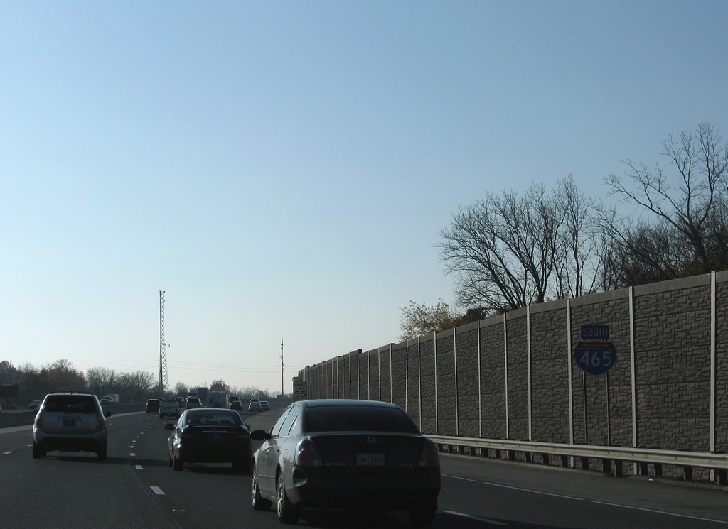
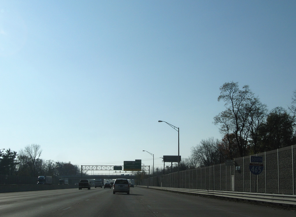
Shield for Interstate 465 south posted by a sound wall separating Avalon Hills from the Beltway. U.S. 31-52-421 and SR 37 also follow the freeway here.
11/05/09
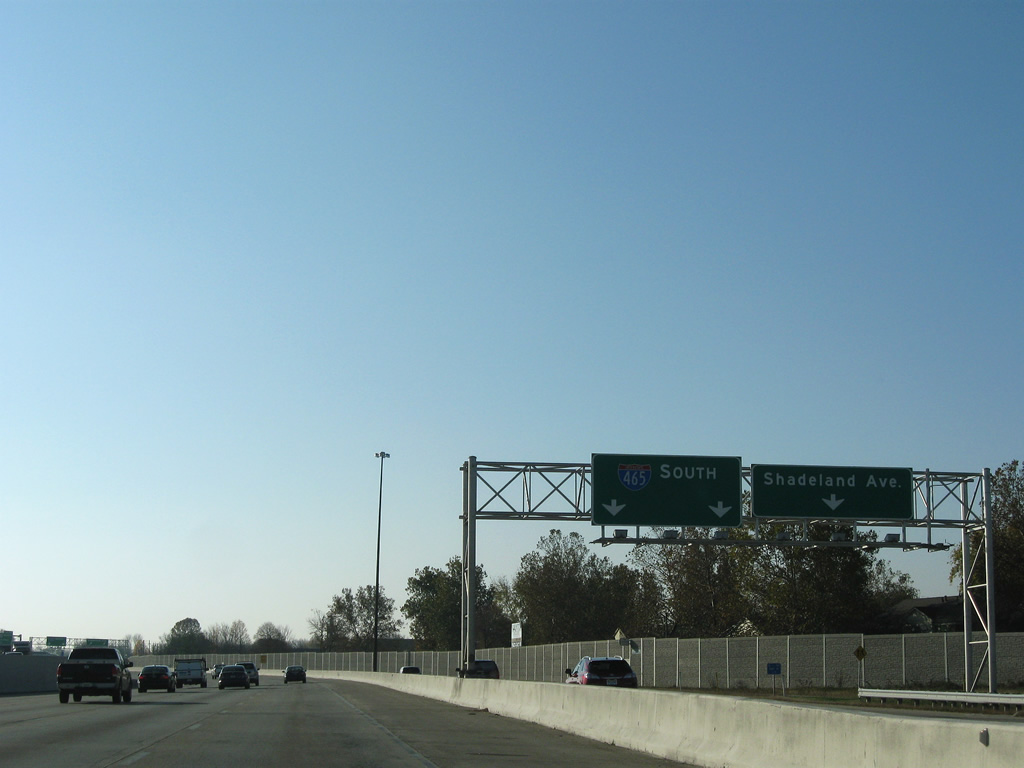
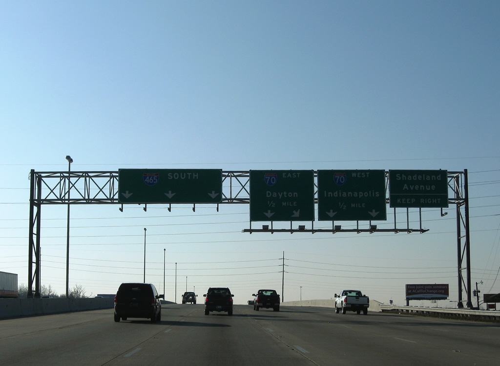
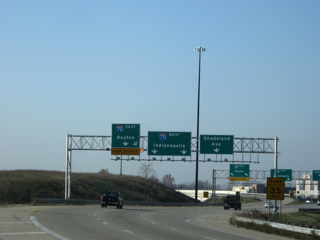
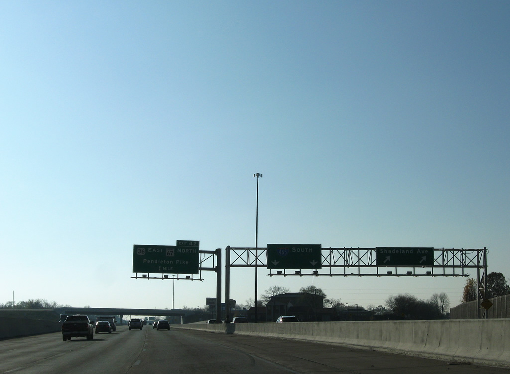
Shadeland Avenue (former SR 100) leads south from 82nd Street (former SR 100 west) to link with Interstate 465 directly at 56th Street and the city of Lawrence.
11/05/09
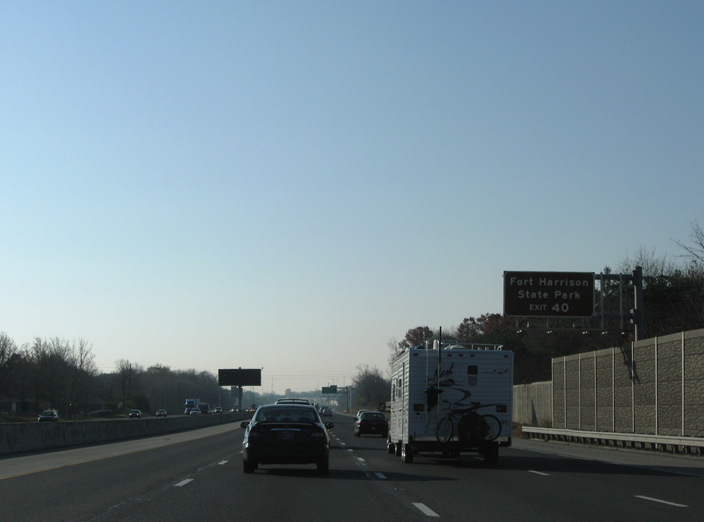
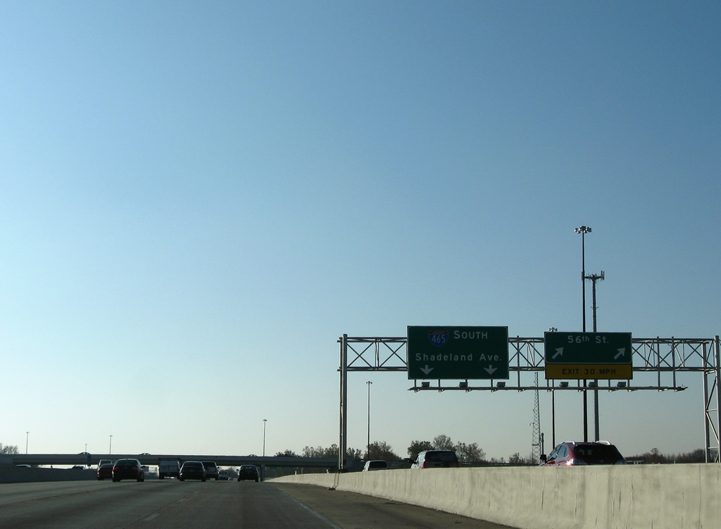
56th Street constitutes an east-west arterial linking Interstate 465 with Fort Benjamin Harrison and Fort Harrison State Park to the east and the Brendonwood neighborhood to the west.
11/05/09
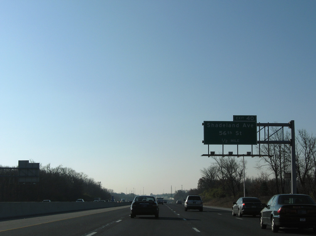
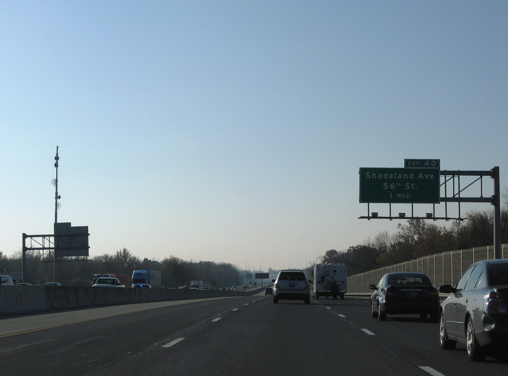
Interstate 465 south lowers to cross Fall Creek at the wye interchange with Shadeland Avenue. Shadeland Avenue provides collector distributor roadways through Exit 40.
11/05/09
Southbound at the Exit 40 ramp departure to Shadeland Avenue and 56th Street. 56th Street leads west to Binford Boulevard at Millersville and east to U.S. 36/SR 67 (Pendleton Pike) in Lawrence.
11/05/09
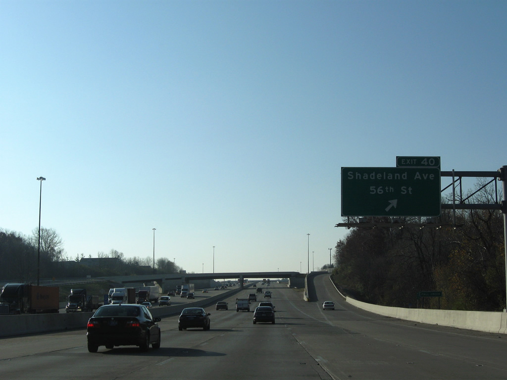
Motorists taking Exit 40 partition into the ramp for 56th Street and the Shadeland Avenue southbound mainline to 46th Street. Shadeland Avenue was the eastern leg of a planned SR 100 surface loop around Indianapolis that predated the Interstate 465 Beltway.
11/05/09
A two lane ramp parts ways with the Exit 40 c/d roadway (Shadeland Avenue) and Interstate 465 south.
11/05/09
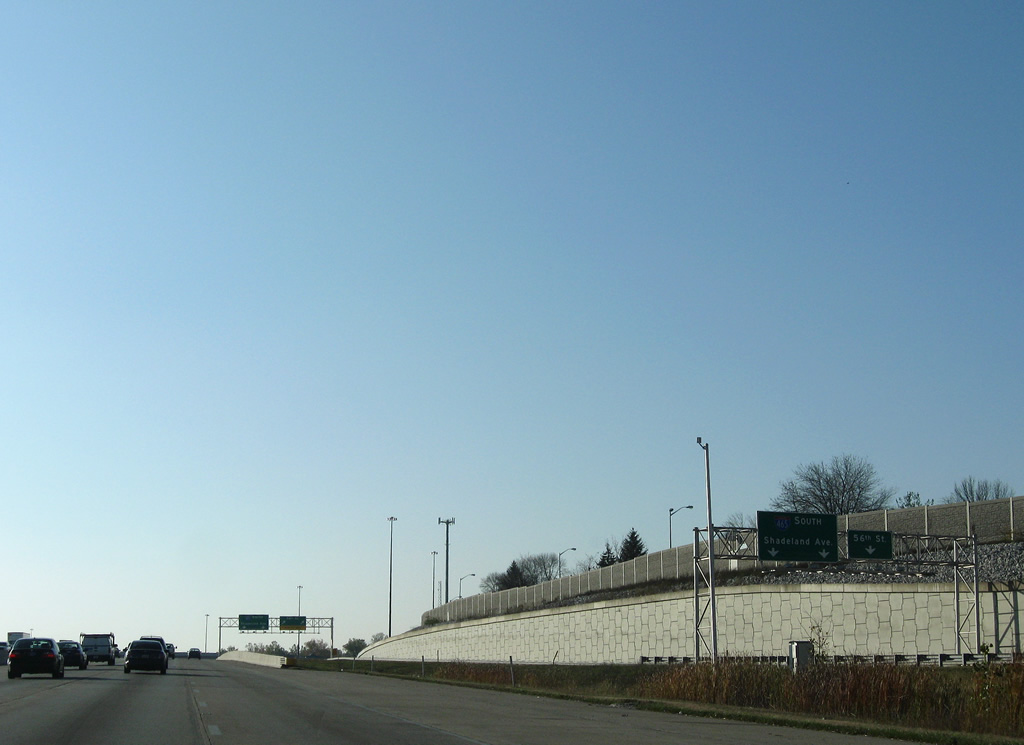
Shadeland Avenue (former SR 100) continues due south from Lawrence to meet Interstate 465 again at Exit 48 (northbound). The highway travels a freeway of its own from Washington Street (old U.S. 40) to the Beltway.
11/05/09
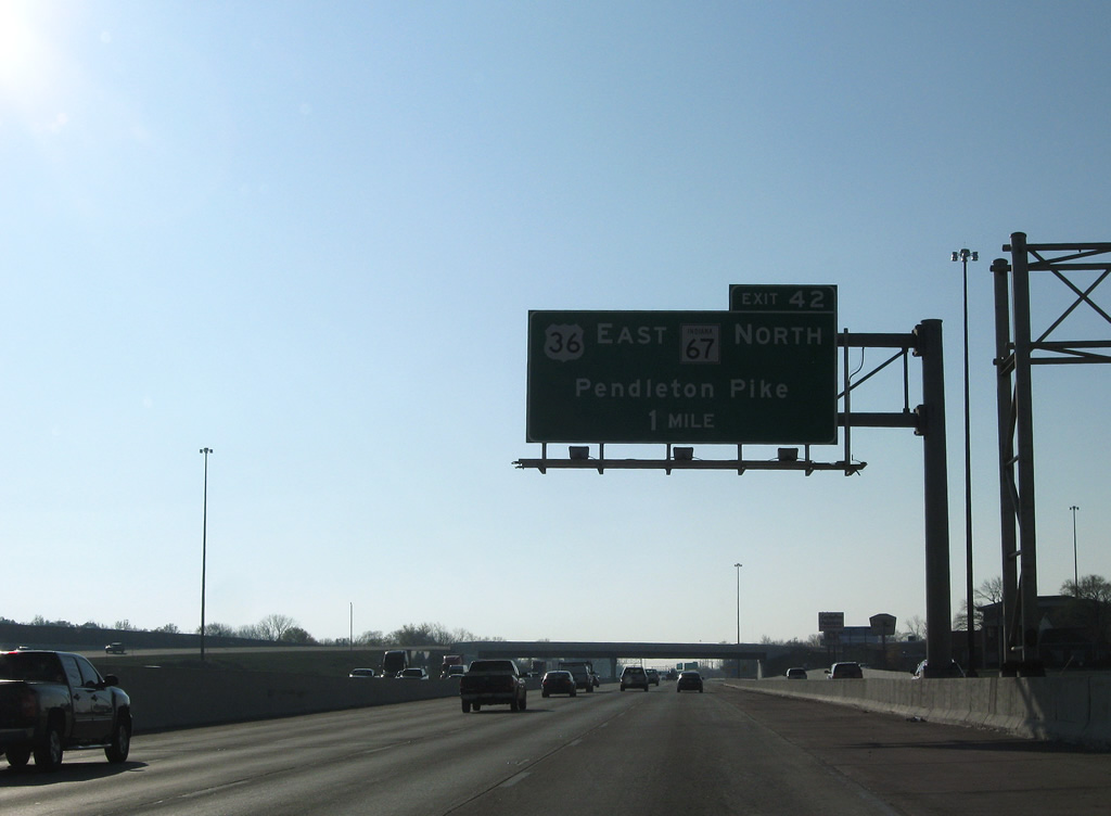
U.S. 36 west & SR 67 join Interstate 465 south from Pendleton Pike in one mile. U.S. 36 follows the beltway from Exit 42 to Exit 13 near Lynhurst. SR 67 joins the circumferential highway to Exit 8 near Valley Mills.
11/05/09
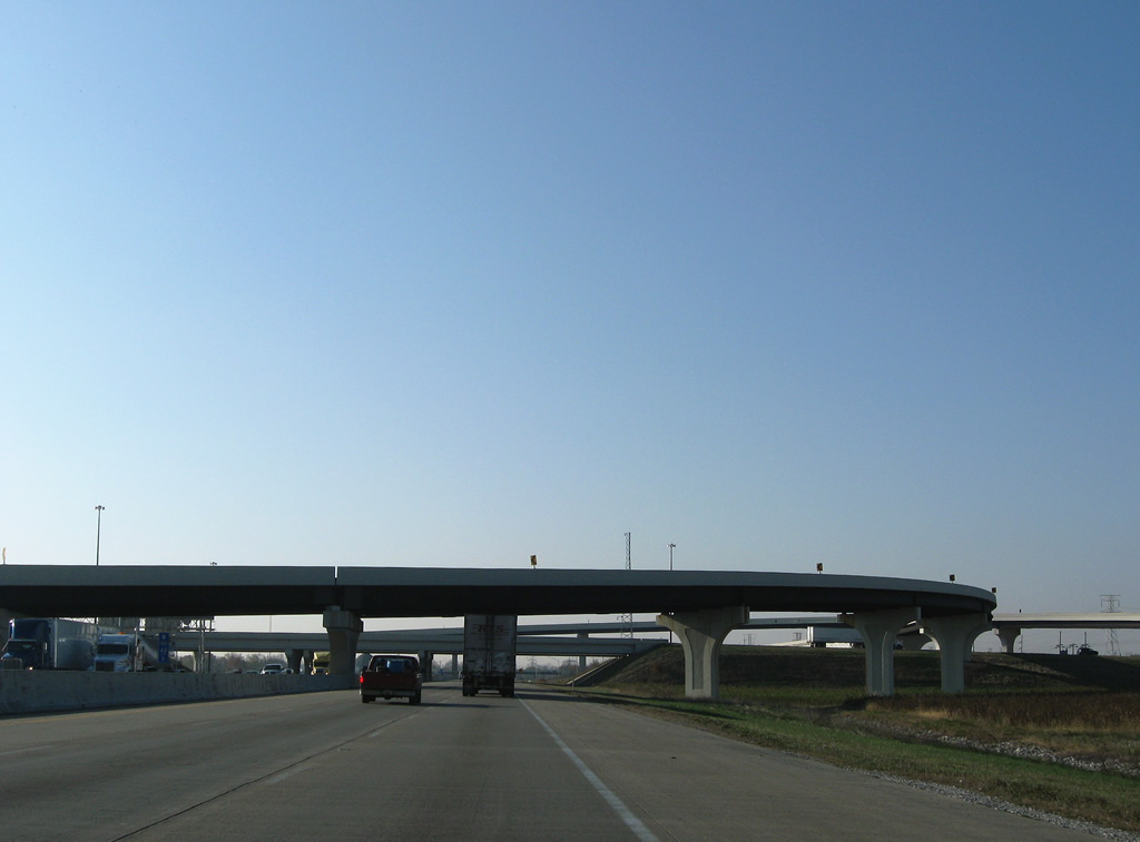
Eight lanes of Interstate 465 travel through western Lawrence between Exits 40 and 42.
11/05/09
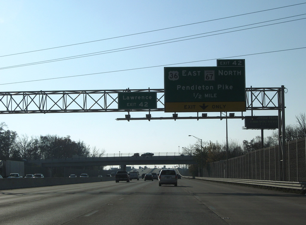
E 46th Street passes above Interstate 465 south on the half mile approach to a diamond interchange (Exit 42) with Pendleton Pike. Pendleton Pike represents the historic alignment of U.S. 36 west / SR 67 south to E 38th Street and Massachusetts Avenue (former SR 367).
11/05/09
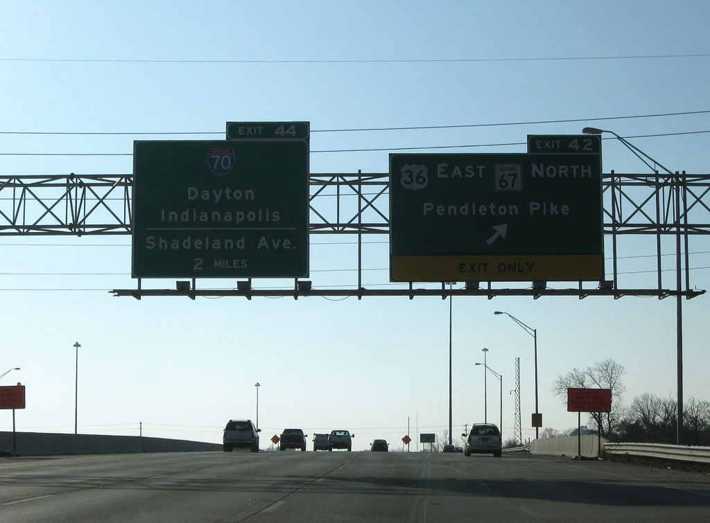
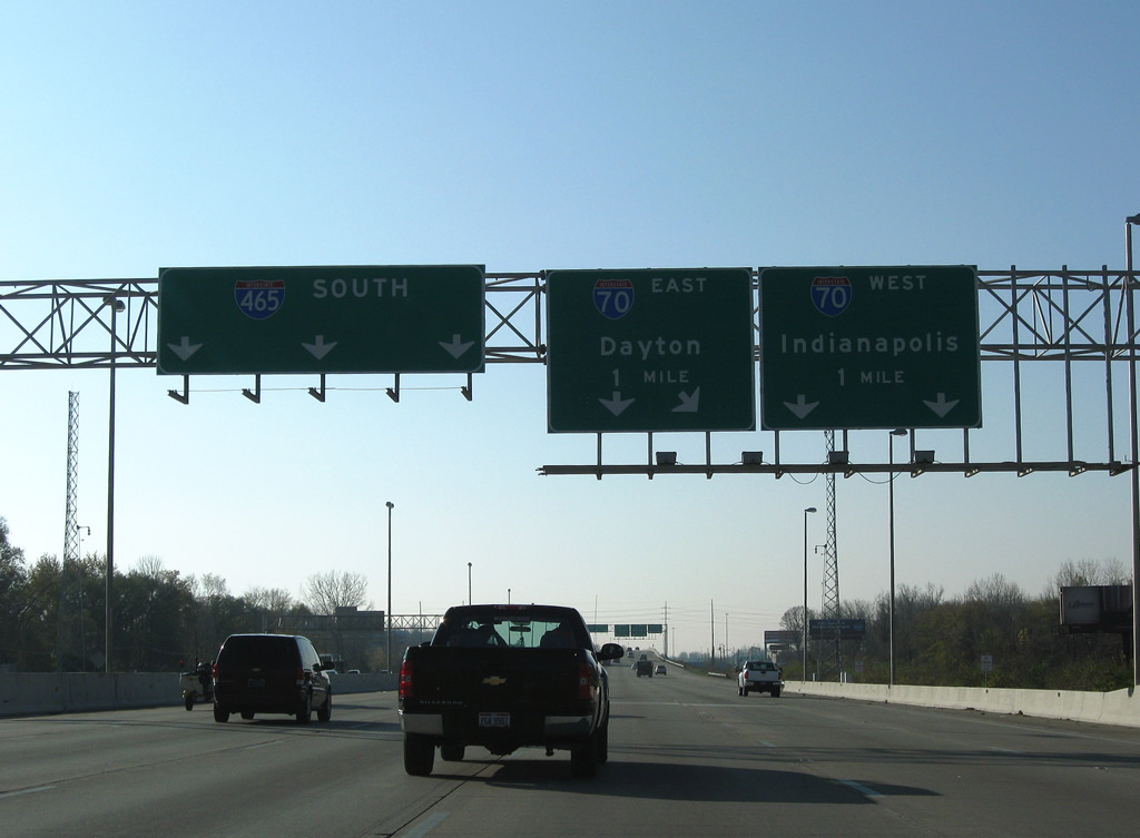
Interstate 70 (Exit 44) and Shadeland Avenue reappear at the Exit 42 sign bridge for U.S. 36 east & SR 67 north. U.S. 36 east & SR 67 continue along Pendleton Pike through Lawrence to Oaklandon and the county line. SR 67 overall travels 199.3 miles between Vincennes and the Ohio state line east of Trinity.
11/05/09
Interstate 465 and the number of unsigned companions swells to now include U.S. 31-36-52-421 and SR 37-67.
11/05/09
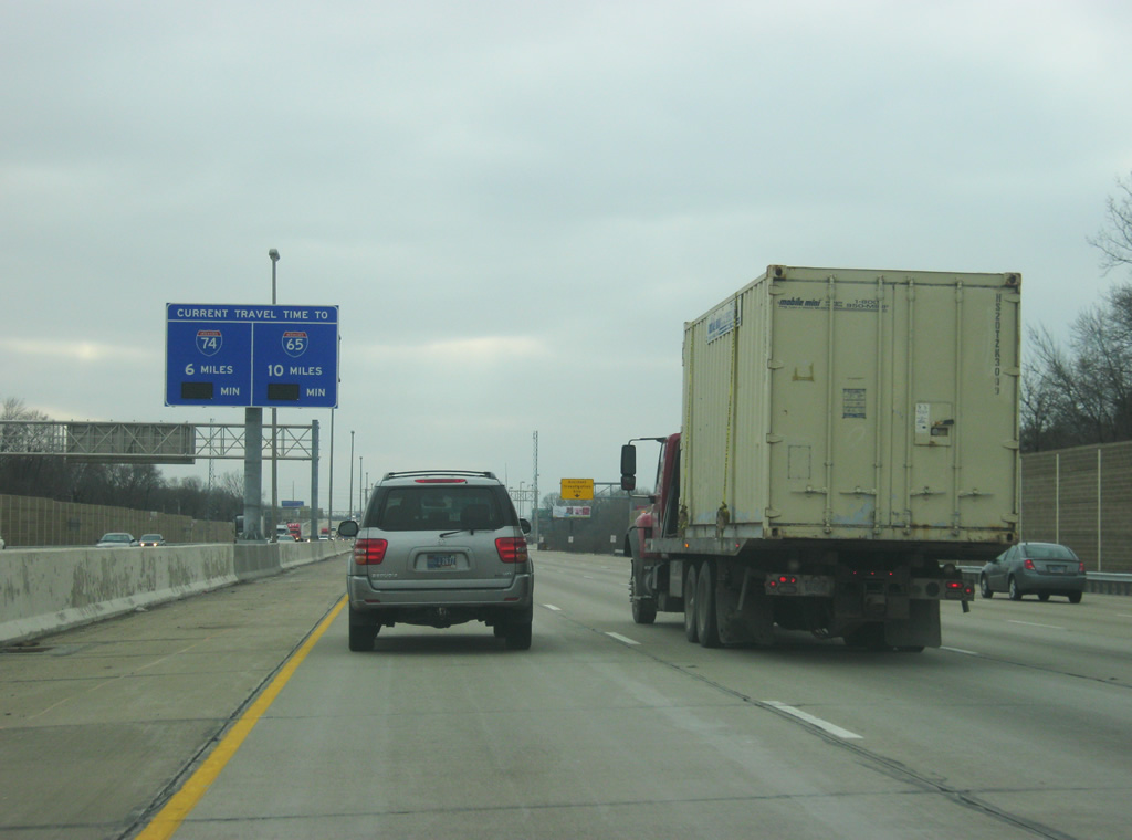
Approaching Interstate 70 (Exit 44), a new Travel Time Sign alerts motorists of the distance and estimated time to reach Interstates 74 and 65. As of February 2012, the signs were not yet operational.
02/08/12
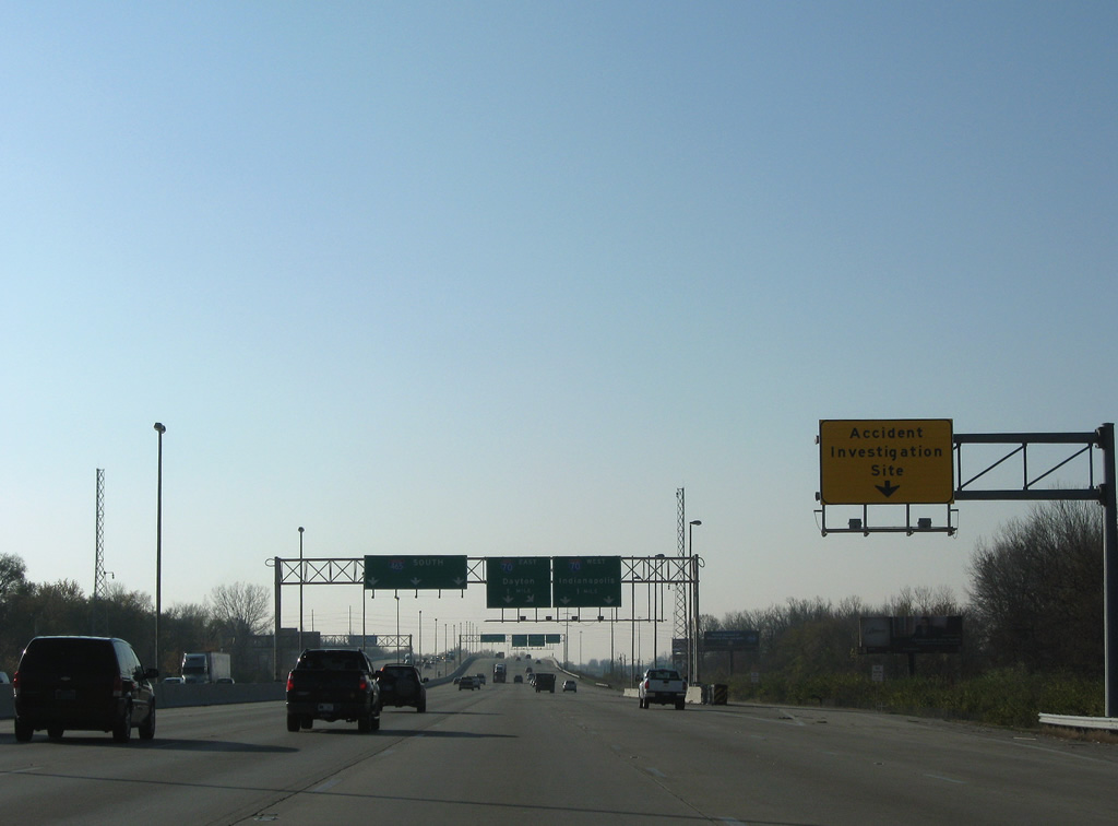
An accident investigation site lies along the southbound lanes on the Interstate 465 stretch between 34th and 30th Streets.
11/05/09
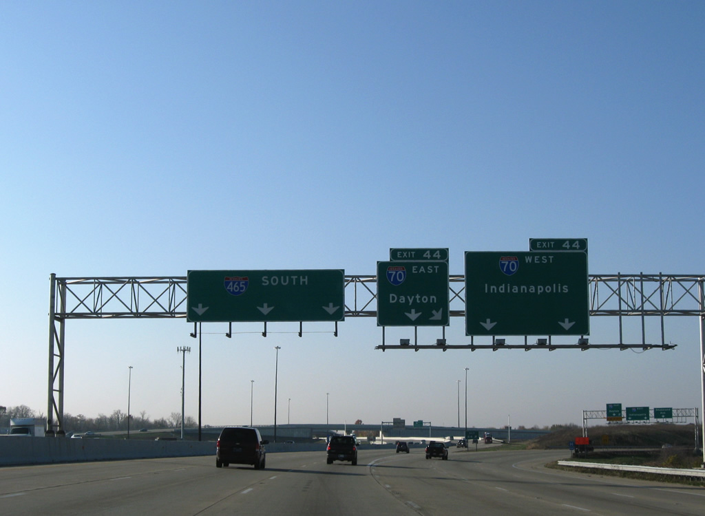
The Beltway southbound expands to six overall lanes in anticipation of the Exit 44 directional cloverleaf interchange with Interstate 70.
11/05/09
All traffic bound for Interstate 70 departs in unison from Interstate 465 southbound. Interstate 70 travels 156.60 miles across the state, paralleling or sharing pavement with U.S. 40 throughout. The freeway joins Indianapolis with Richmond and Dayton, Ohio to the east and Terre Haute and St. Louis, Missouri to the west.
11/05/09
Two lanes of Exit 44 default onto Interstate 70 west to adjacent Shadeland Avenue (Exit 89) and the seven mile drive to Downtown Indianapolis. Interstate 70 east next meets Post Road and continues 166 miles east to Columbus, Ohio.
11/05/09
A parting shot of the Exit 44 ramp split to Interstate 70 east, Interstate 70 west, and the adjacent Exit 89 parclo interchange with Shadeland Avenue at Warren Park. Interstate 70 in Indiana was completed by 1976.1
11/05/09
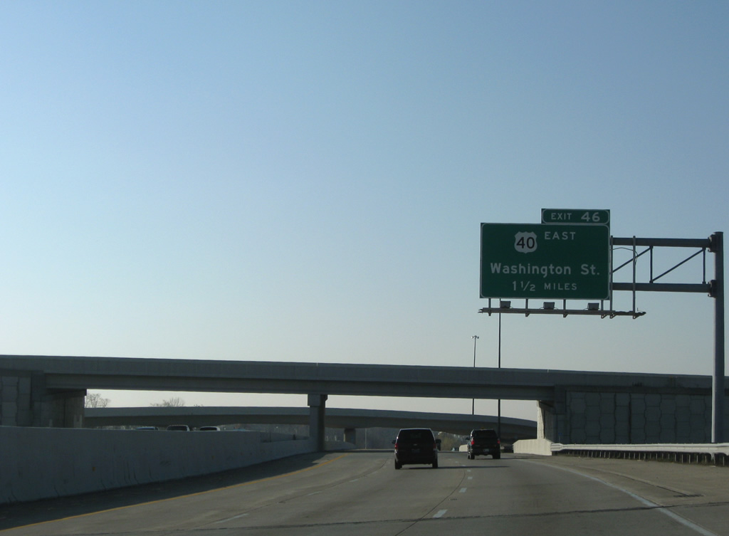
Continuing south, motorists next meet U.S. 40 (Washington Street) in 1.50 miles at Exit 46.
11/05/09
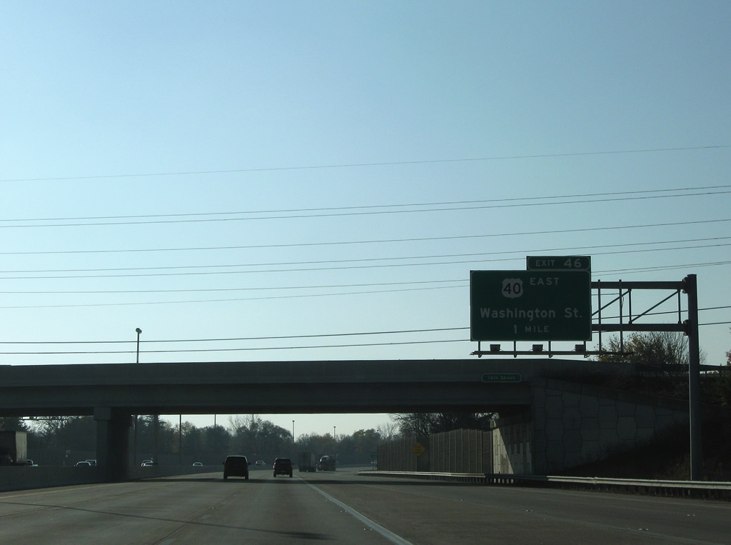
16th Street travels over Interstate 465 south on the one mile approach to the folded diamond interchange with U.S. 40 (Washington Street). U.S. 40 west joins the Beltway at Exit 46 as Washington Street continues through the Irvington and Southeast neighborhoods to downtown Indianapolis.
11/05/09
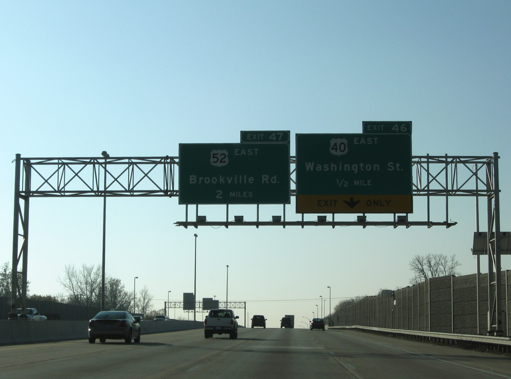
U.S. 40 continues east from Exit 46 to Cumberland and Greenfield. U.S. 52 east splits with the Beltway at the following interchange (Exit 47) in two miles.
11/05/09
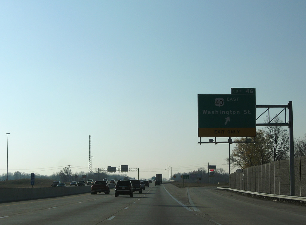
Exit 46 leaves Interstate 465 south for Washington Street and U.S. 40 east. A CSX Railroad travels nearby and is likely why ramps for Washington Street lie north of the commercial arterial. A cloverleaf interchange lies just west of the Beltway between old U.S. 40 and the freeway portion of Shadeland Avenue (former SR 100).
11/05/09
U.S. 40 is signed on a Interstate 465 shield assembly posted at the one mile sign bridge for U.S. 52 (Brookville Road). This brief stretch of Beltway includes seven additional routes.
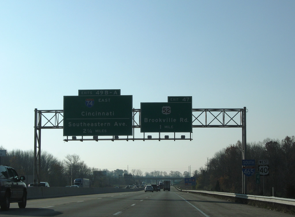
Interstate 74 merges onto the Beltway near Five Points in 2.25 miles. The 171.54 mile route in Indiana joins Indianapolis with Crawfordsville to the west and Greensburg to the east.
11/05/09
U.S. 52 leaves the Beltway for Brookville Road east through Julietta to Hancock County and New Palestine. The US highway totals 171.45 miles in the state between West Harrison and the Interstate 74 crossing into Ohio.
11/05/09
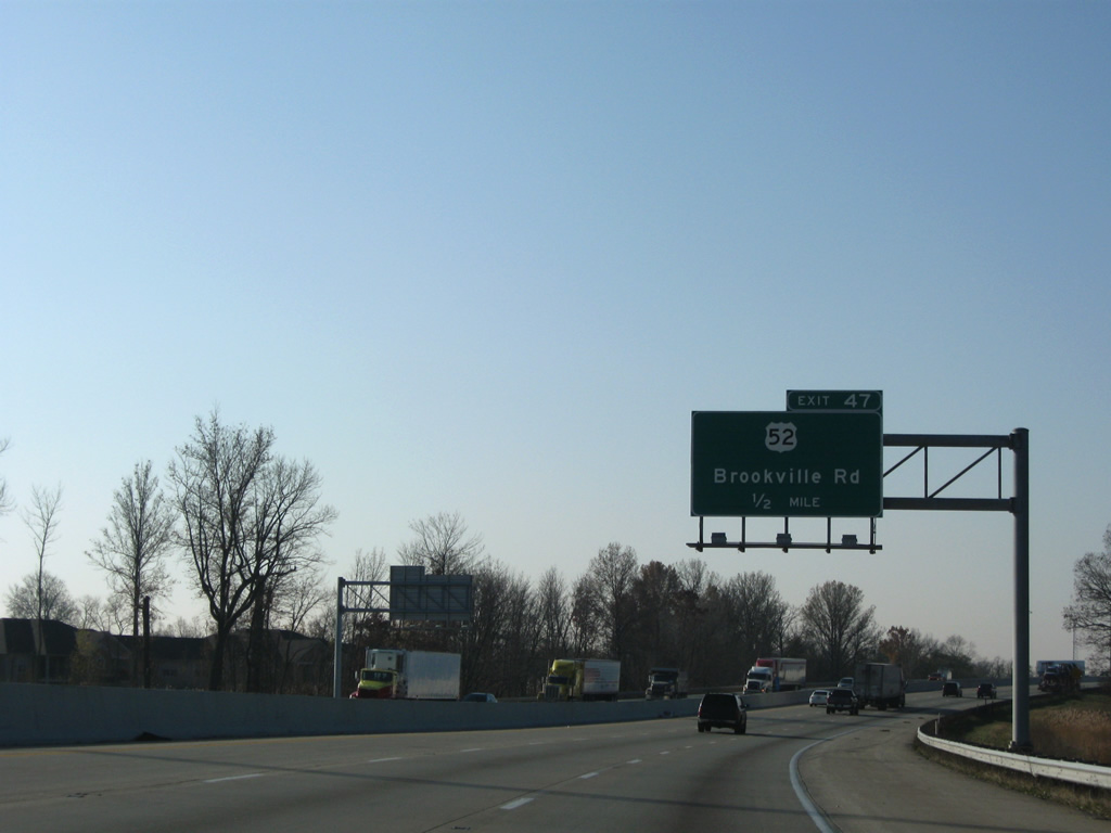
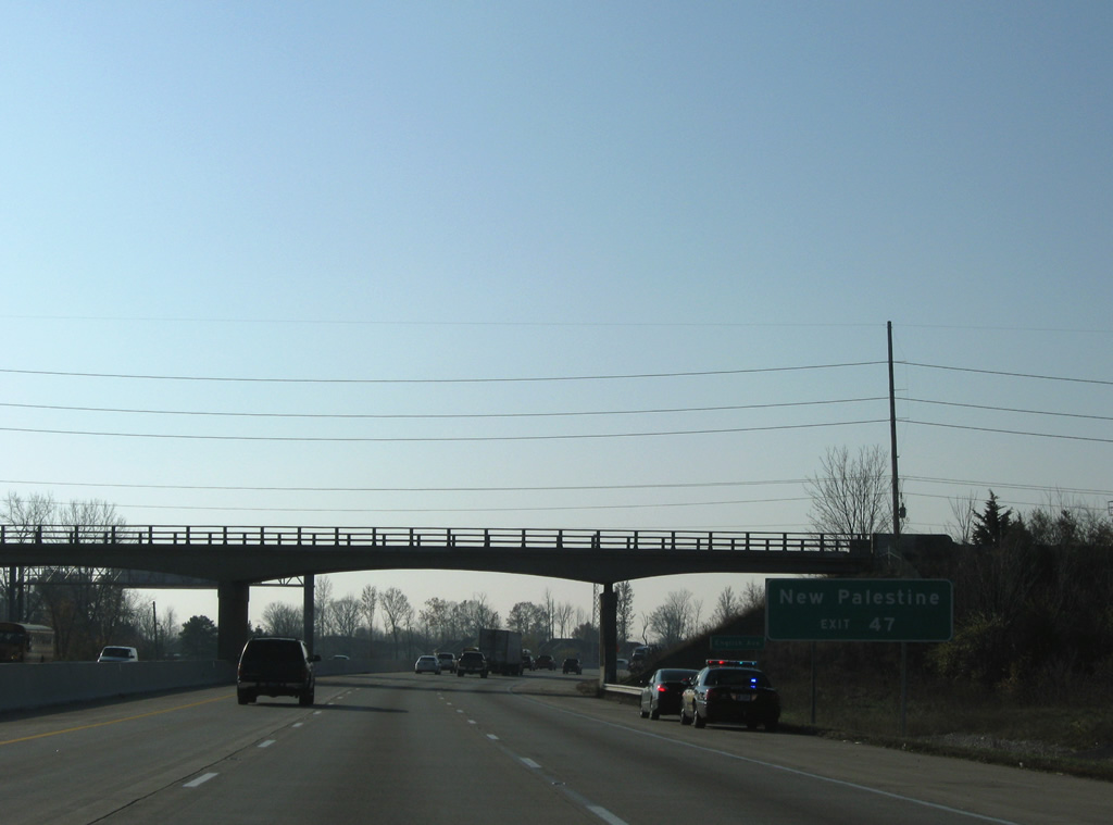
Beginning to turn west, Interstate 465 progresses one half mile to a folded diamond interchange (Exit 47) with U.S. 52 (Brookville Road) east.
11/05/09
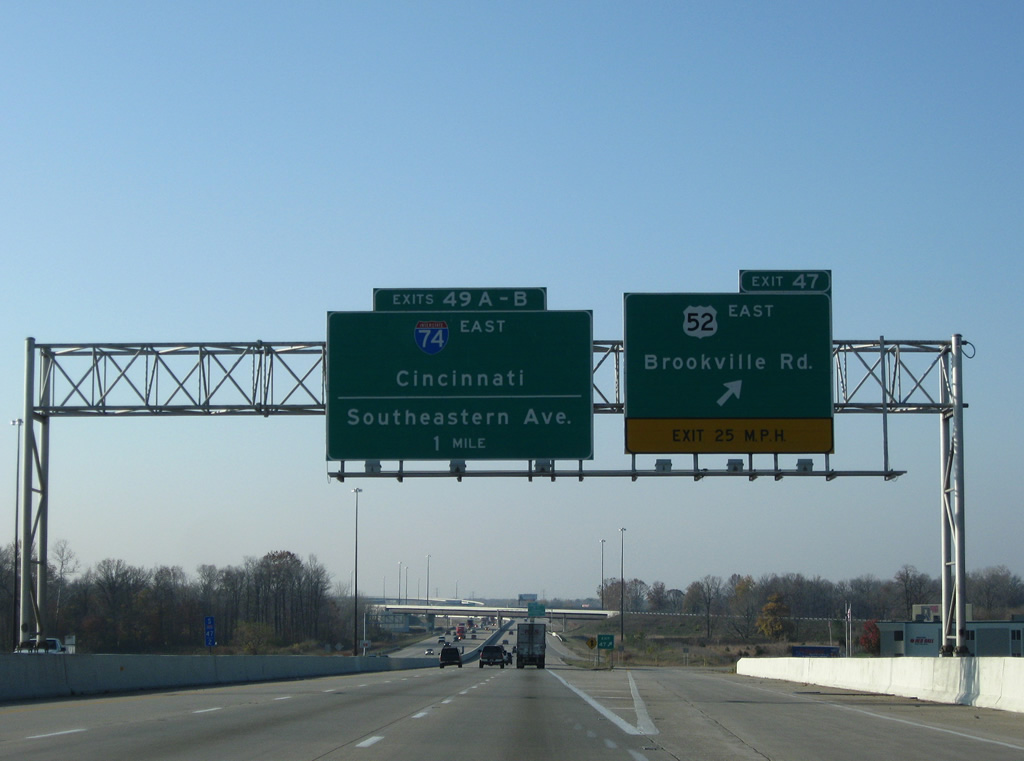
Exit 47 departs Interstate 465 south on the mile-approach to the directional cloverleaf interchange with Interstate 74 and U.S. 421 south (Exits 49A/B). Brookville Road west carried U.S. 52 to English Avenue and its merge with Southeastern Avenue (old U.S. 421) originally.
11/05/09
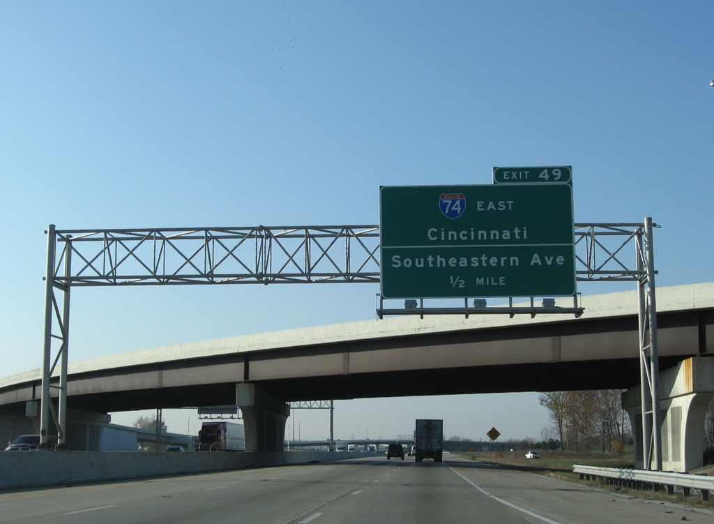
Shadeland Avenue merges onto Interstate 465 south to expand the southbound freeway to four lanes into Exit 49. Exit 49 joins the Beltway with Interstate 74 east to Cincinnati and a freeway spur west to Southeastern Avenue (former U.S. 421) near Five Points. The unsigned spur may have been built in anticipation of an unconstructed routing of Interstate 74 within the beltway.
11/05/09
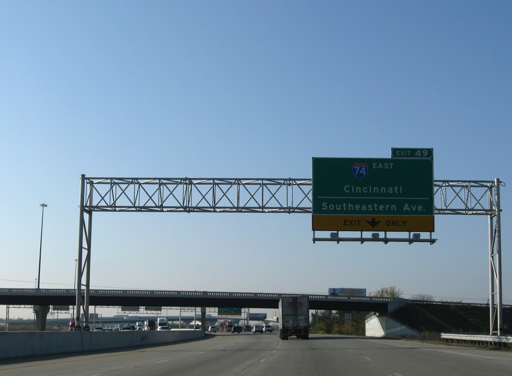
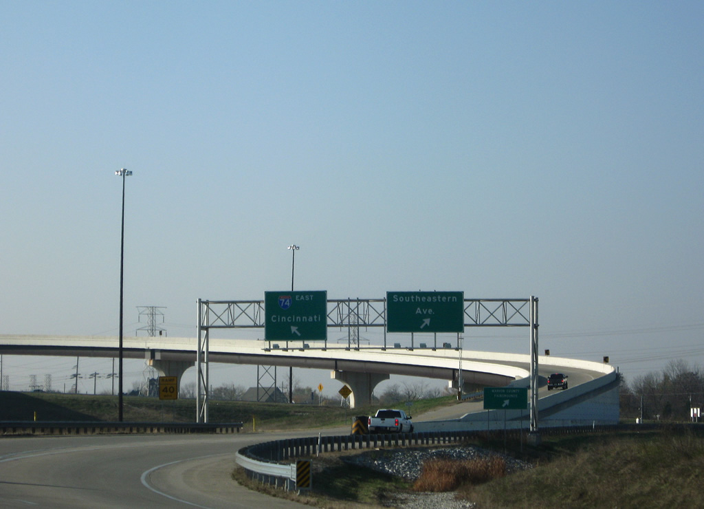
All traffic to II-74/U.S. 421 south and Southeastern Boulevard leave Interstate 465 in unison from just south of the Raymond Street overpass. Originally a cloverleaf interchange joined the two freeways.
11/05/09
Southbound at the Exit 49 ramp departure to Interstate 74 east, U.S. 421 south and Southeastern Avenue west. I-74/U.S. 421 share pavement through Shelbyville to their split at Greensburg. U.S. 421 south continues to Versailles and an exit of the state at Madison.
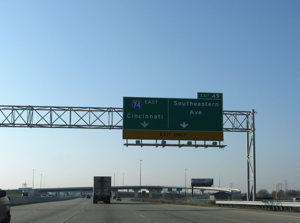
11/05/09
A flyover shuttles drivers onto II-74/U.S. 421 south. Old U.S. 421 north followed Southeastern Avenue to Sunnyview and merges with former U.S. 52 and 40 into Downtown.
11/05/09
A second flyover sees the Interstate 74 westbound mainline join Interstate 465 south. Interstate 74 exists between the Quad Cities and Cincinnati as the original mainline. Additional portions of the Interstate exist in North Carolina.
11/05/09
References:
- Indiana Highway Ends - I-70 (HighwayExplorer).
http://www.highwayexplorer.com/EndsPage.php?id=3070
Photo Credits:
- ABRoads: 11/05/09
- Thomas Decker: 02/08/12
Connect with:


Page Updated Wednesday February 29, 2012.