
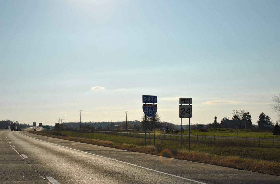
Interstate 469 South


 East
East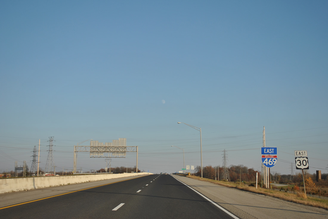
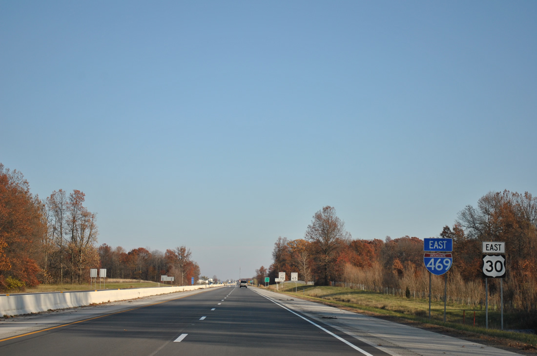
Interstate 469 eastbound begins from a trumpet interchange with Interstate 69 and U.S. 30 east near Dupont Hospital. The first set of shields for I-469 and U.S. 30 east lie ahead of the Leo Road overpass.
11/06/11
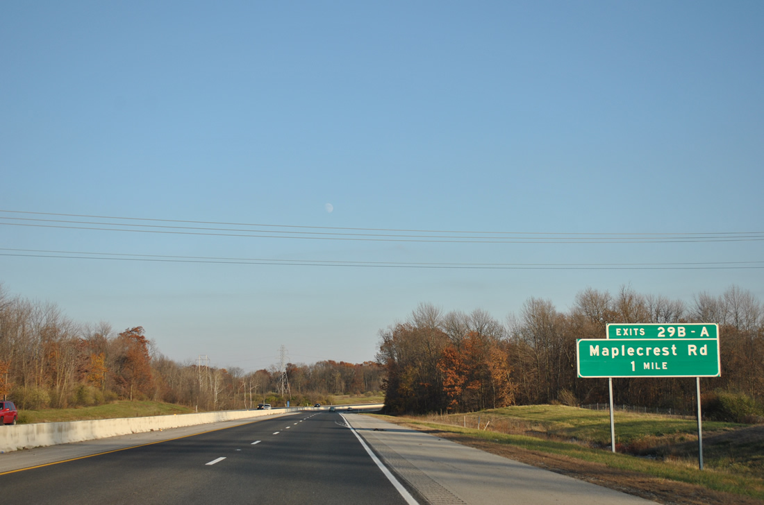
The portion of Interstate 469 southeast from Exit 115 of Interstate 69 to SR 37 was the last to open to traffic on October 23, 1995. A six-ramp parclo interchange (Exits 29B/A) join the freeway with Maplecrest Road along this stretch.
11/06/11
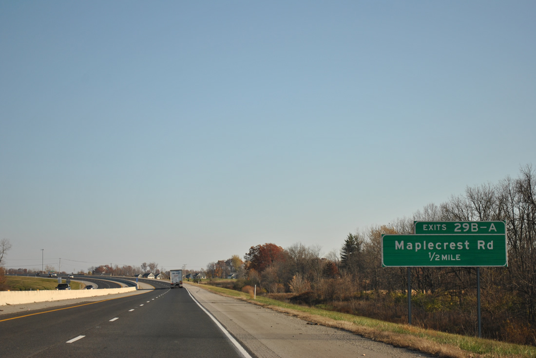
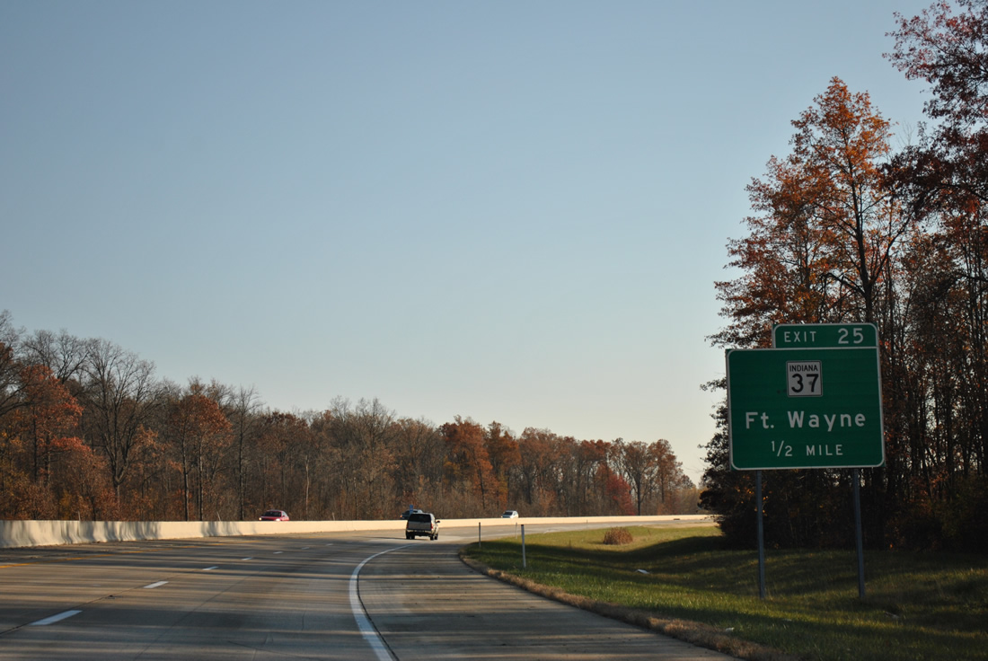
One half mile west of the Exit 29B off-ramp to Maplecrest Road south to Northeast Fort Wayne. Maplecrest Road comprises a suburban arterial route south to Lake Avenue.
11/06/11
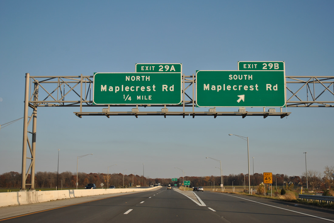
Interstate 469 & U.S. 30 eastbound at the Exit 29B to Maplecrest Road. Maplecrest Road was extended north from Rothman Road in conjunction with construction of the Fort Wayne freeway loop.
11/06/11
Exit 29A follows as a loop ramp onto the road north to adjacent St. Joe Road. St. Joe Road overtakes Maplecrest Road from near Exit 29A. Northward the road ventures toward Cedarville; southwest St. Joe Road passes by the Brooklake Estates neighborhood to Crescent Avenue (former SR 37).
11/06/11
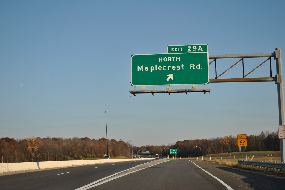
Interstate 469 continues with east/west cardinal directions from Maplecrest Road. The loop bisects suburban areas of Fort Wayne southeast to SR 37 (Exit 25).
11/06/11
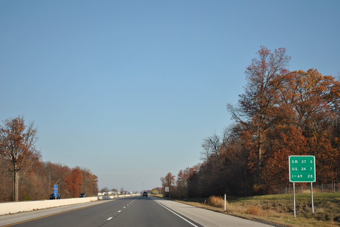
An interchange sequence sign substitutes for control-city based mileages on this panel of Interstate 469 & U.S. 30 east posted three miles out from the diamond interchange with SR 37 north and Maysville Road south.
11/06/11
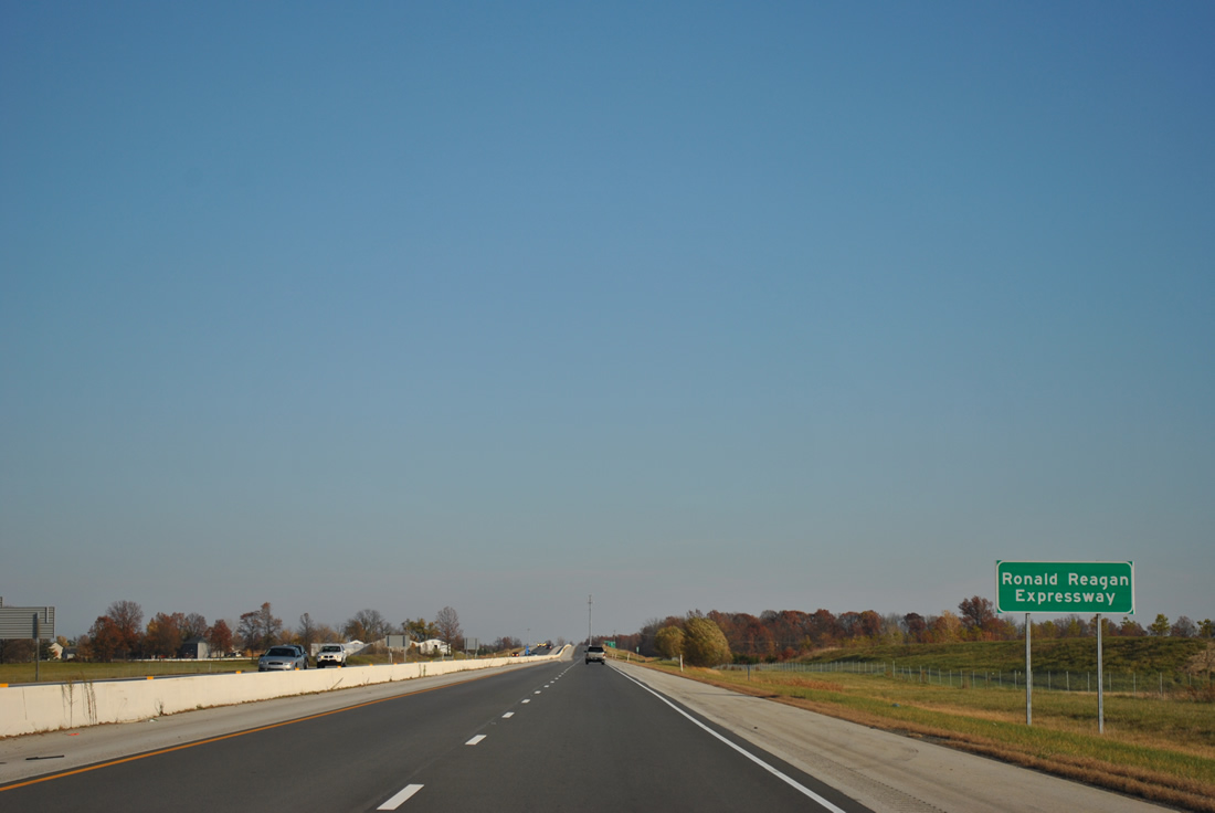
Interstate 469 is formally named the Ronald Reagan Expressway, though the name is not commonly used. Agricultural frontage gives way to clusters of single family homes along the west side of the freeway and newly built subdivisions along the north side at Wheelock Road.
11/06/11
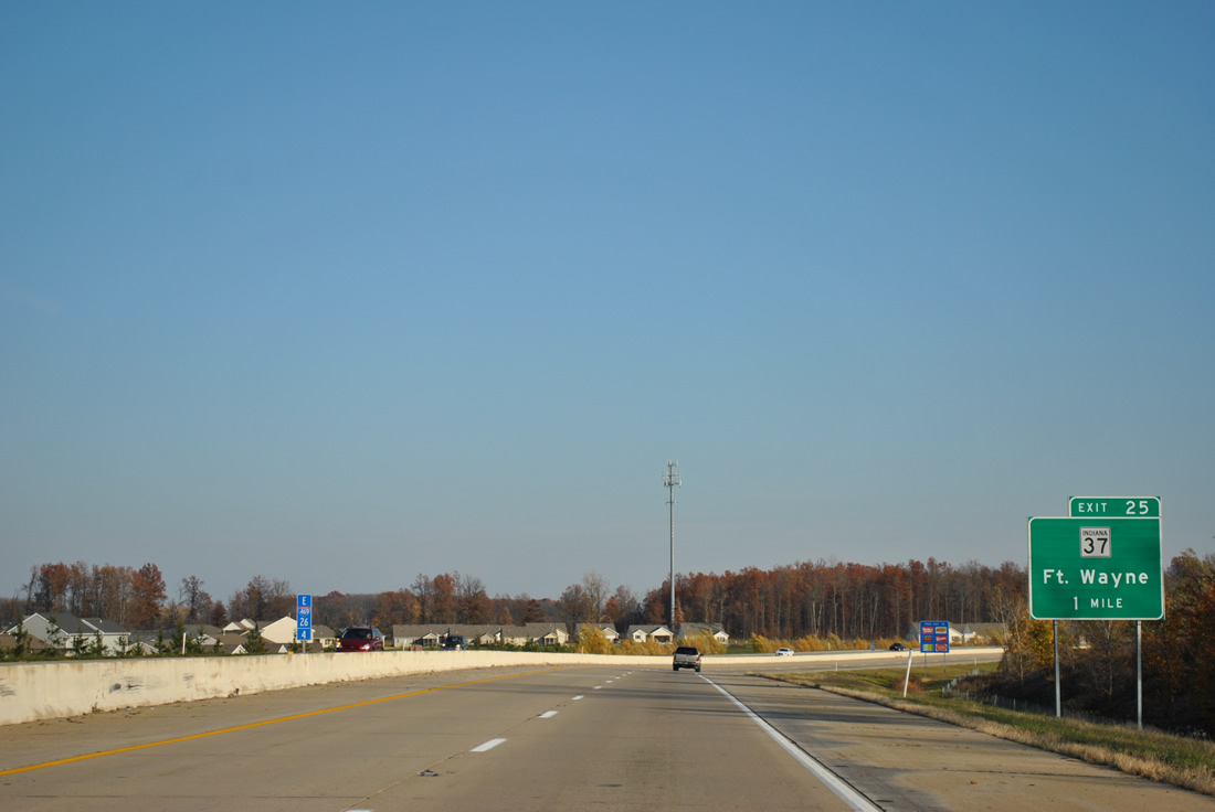
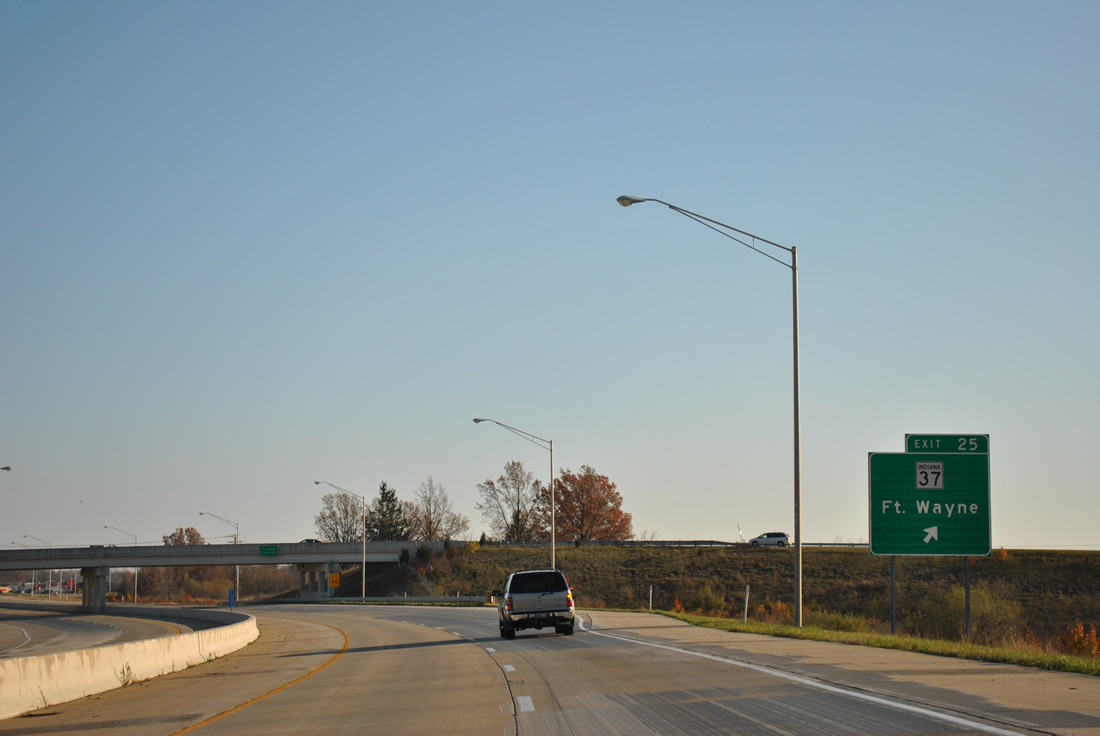
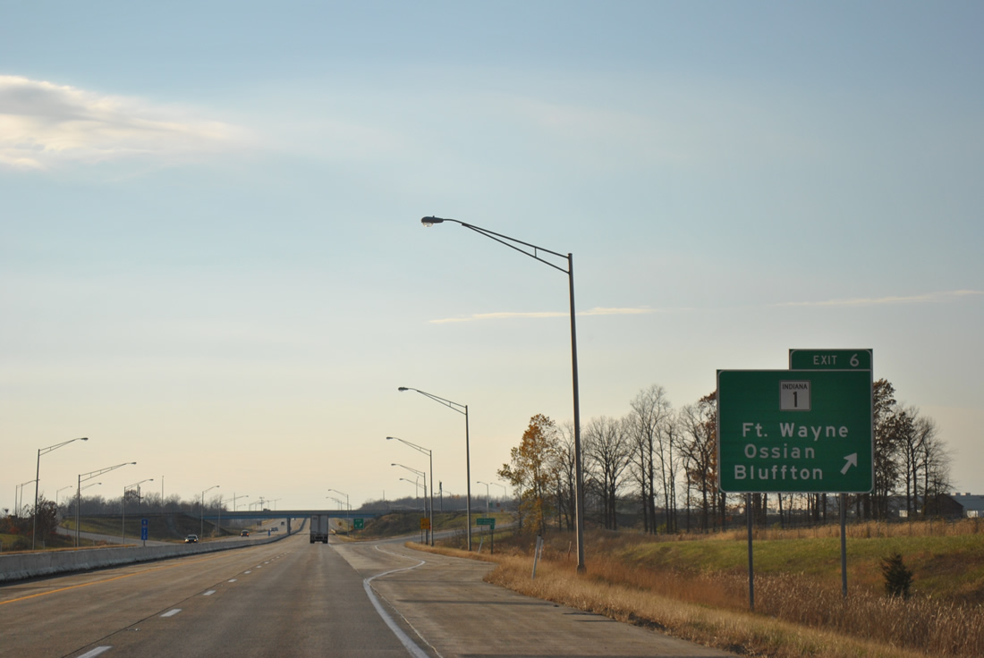
Turning southward from the Wheelock Road underpass on the one mile approach to SR 37 (Exit 25). SR 37 angles northeast from Interstate 469 & U.S. 30, 30.5 miles to Cuba, Harlan and the Ohio state line (where the route transitions into SR 2).
11/06/11
Maysville Road stems west from Exit 25 and SR 37 to Stellhorn Road west, the original path of SR 37 into Fort Wayne. SR 37 followed Stellhorn Road to Coliseum Boulevard (SR 930), where the route combined with then U.S. 24-30 & SR 14 west to Interstate 69 (Exit 109).
11/06/11
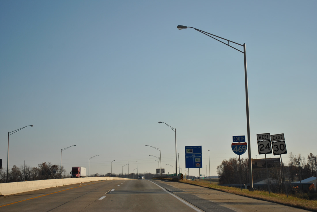
St. Joe Center Road passes over Interstate 469 & U.S. 30 north of the Exit 25 off-ramp to SR 37 north and Maysville Road south. Maysville Road continues from the freeway through a retail area nearby to suburban areas along State Boulevard and Lake Avenue. SR 37 exists in a second alignment from Marion south to Indianapolis and Tell City.
11/06/11
South East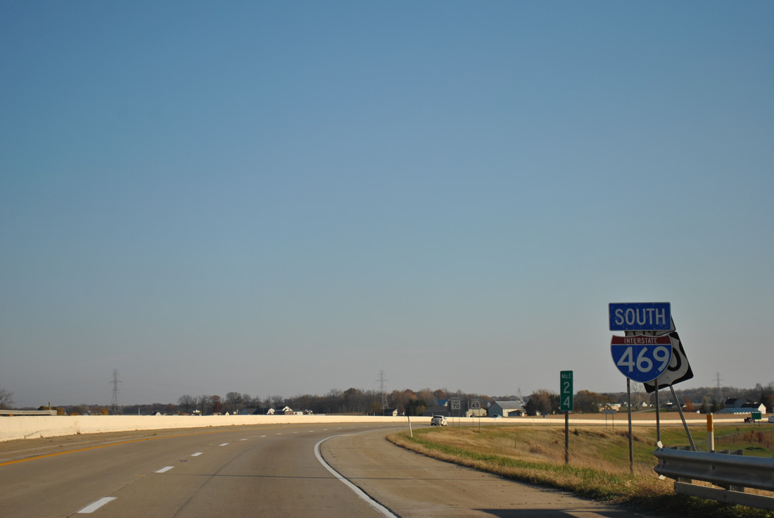
Now along Interstate 469 south & U.S. 30 east, as the freeway leads away from SR 37 through agricultural areas east of Thurman.
11/06/11
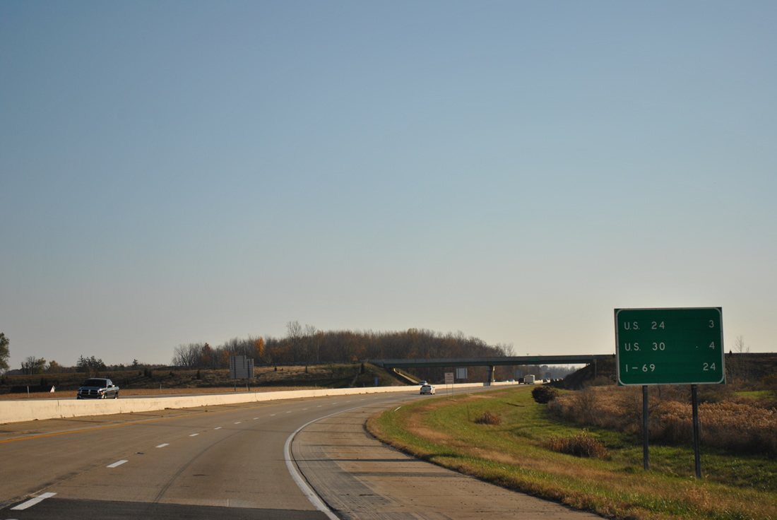
The next two interchanges see the arrival of U.S. 24 west and the departure of U.S. 30 east. Interstate 469 concludes in 24 miles.
11/06/11
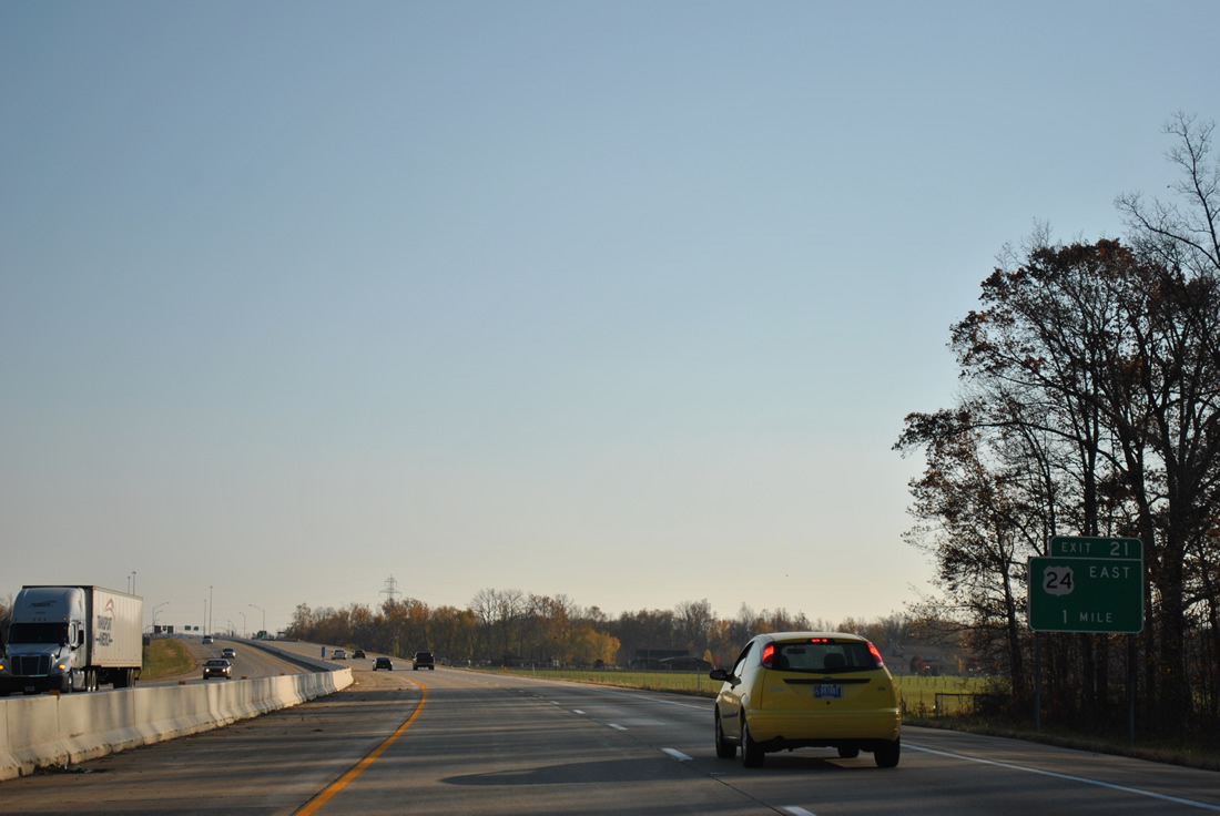
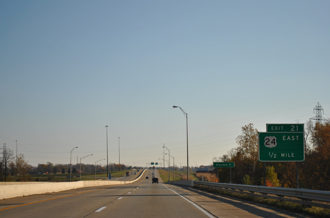
Approaching the Maumee River, Interstate 469 south & U.S. 30 eastbound drivers draw to within one mile of the folded-cloverleaf interchange with U.S. 24 (Exit 21).
11/06/11
Construction presently involves the upgrade of the U.S. 24 corridor leading east to the Ohio state line to expressway standards. Known as the "Fort to Port" Corridor, the U.S. 24 expansion is undertaken in an effort to join Fort Wayne and Toledo, Ohio with a high-speed four lane highway. U.S. 24 is already a four lane roadway east from the Indiana state line to Defiance, Ohio and work is slated for completion on the Indiana portion by late 2012.
11/06/11
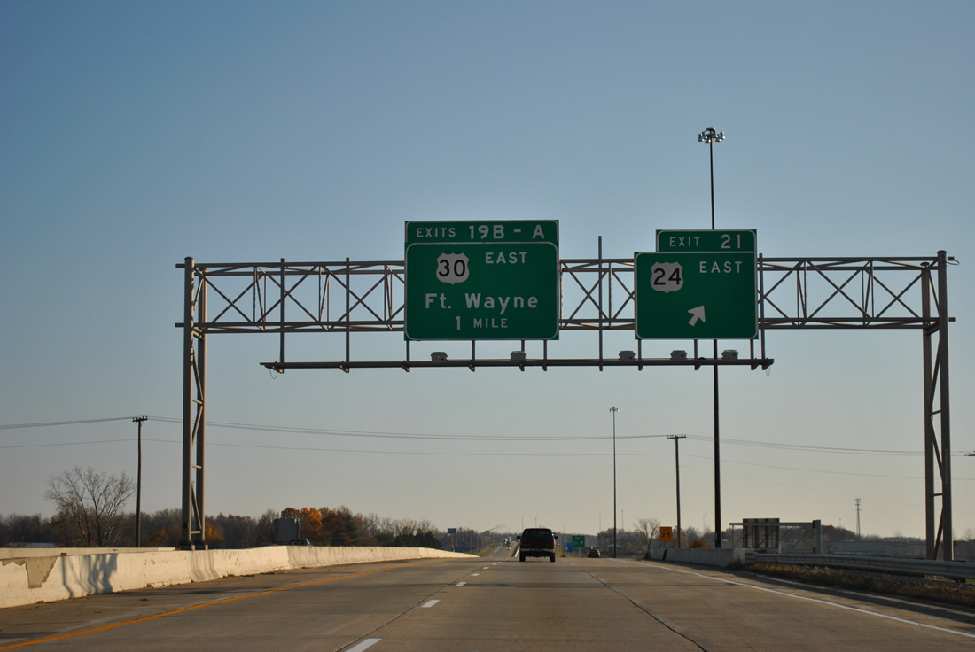
Exit 21 loops onto U.S. 24 east at Rose Avenue from Interstate 469 south & U.S. 30 east. The new four lane alignment will tie directly into Exit 21 and parallel two lane U.S. 24 just south of its present course parallel to the Maumee River. U.S. 24 connects Woodburn and areas of eastern Allen County with Fort Wayne otherwise.
11/06/11
South  West East
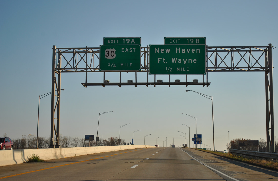
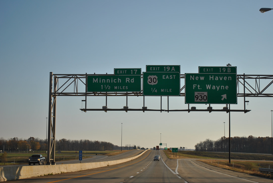
U.S. 24 and U.S. 30 briefly commingle with Interstate 469 just east of New Haven. Former U.S. 24 followed Rose Avenue west to a southward turn into the New Haven city center. Forthcoming Exit 19 joins the freeway with Lincoln Highway East (SR 930) at Newport in one half mile at a six-ramp parclo interchange.
11/06/11
Old SR 14 (Dawkins Road), which the southbound freeway passes beyond this reassurance shield assembly, combined with U.S. 24 in New Haven, with the tandem joining U.S. 30 west to Coliseum Boulevard (SR 930). SR 14 was truncated from Fort Wayne eastward to the Ohio state line near Edgerton around 1990.
11/06/11
Exit 19B departs Interstate 469 & U.S. 24-30 south for SR 930 (Lincoln Way East) to New Haven and downtown Fort Wayne. SR 930 travels 13 miles along former U.S. 30 within the beltway created by Interstates 69 and 469.
11/06/11
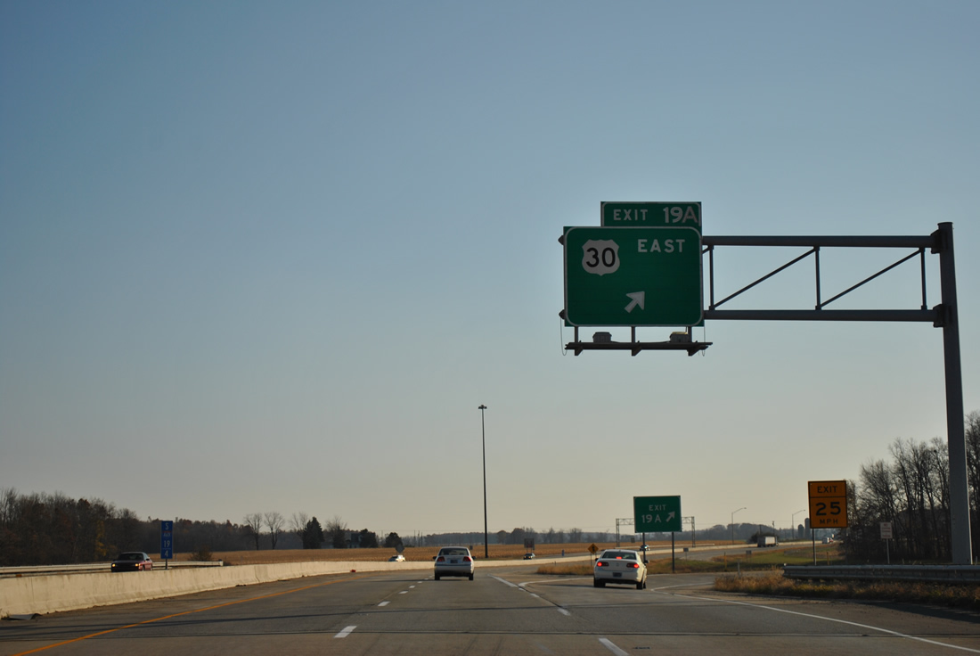
U.S. 30 eastbound parts ways with Interstate 469 south & U.S. 24 west at Exit 19A. The highway continues 13.8 miles to the Ohio state line. All of U.S. 30 from Indiana east to Van Wert, Delphos and Canton consists of four lane roadway, with stretches upgraded to freeway standards.
11/06/11
South West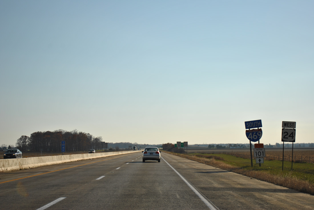
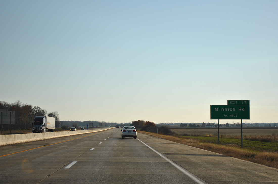
Interstate 469 south & U.S. 24 west remain on the outskirts of New Haven to a folded-cloverleaf interchange (Exit 17) with Minnich Road.
11/06/11
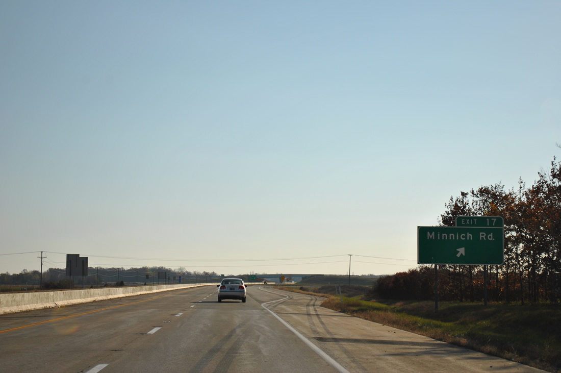
Minnich Road stems south from Dawkins Road (Old SR 14) and SR 930 in new Haven to meet Interstate 469 & U.S. 24 en route to Hoagland in rural southeast Allen County.
11/06/11
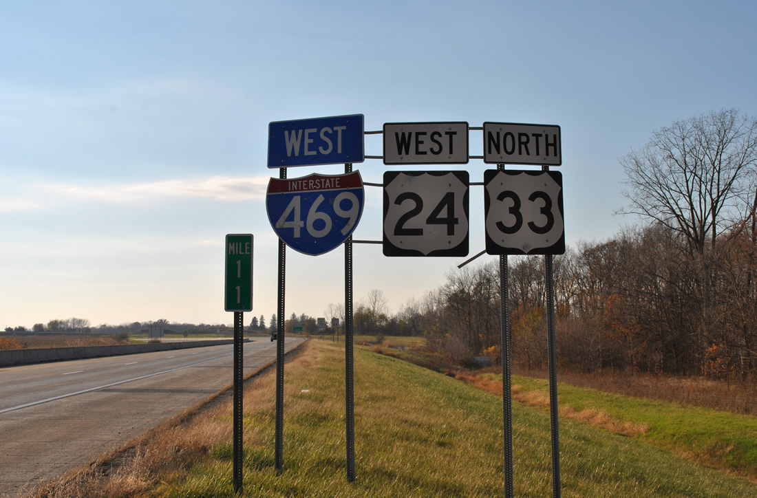
Bending southwest, Interstate 469 south & U.S. 24 west continue four miles to Marion Center Road and six miles to the merge with U.S. 33 north.
11/06/11
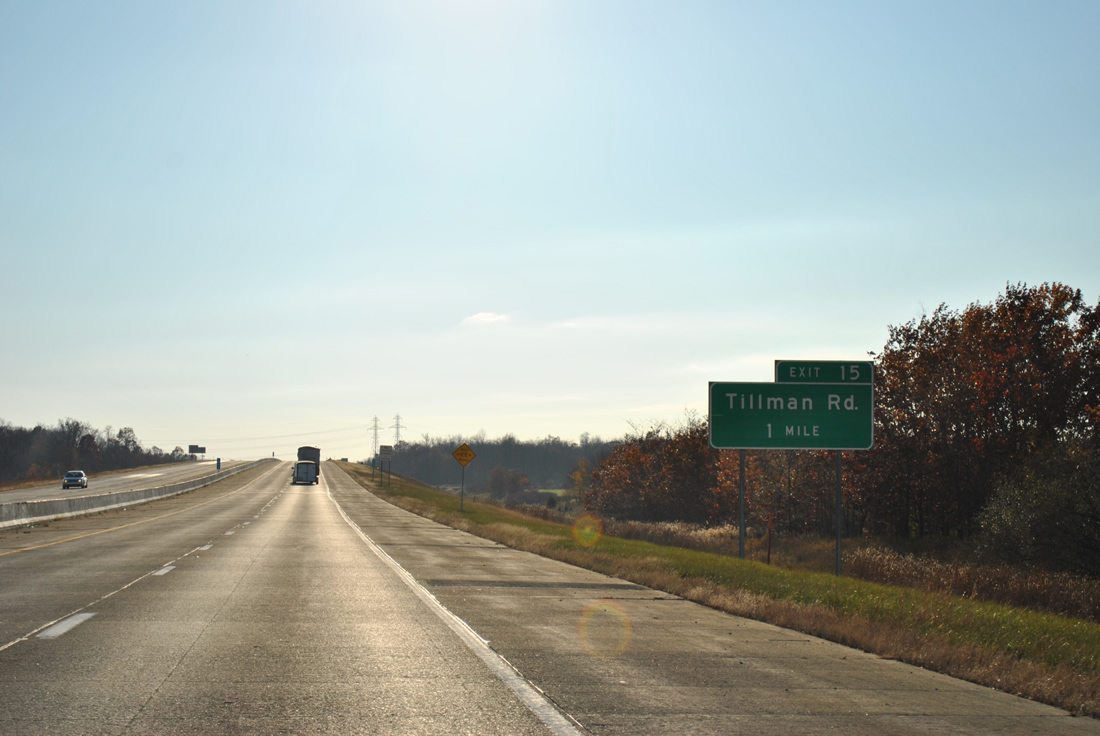
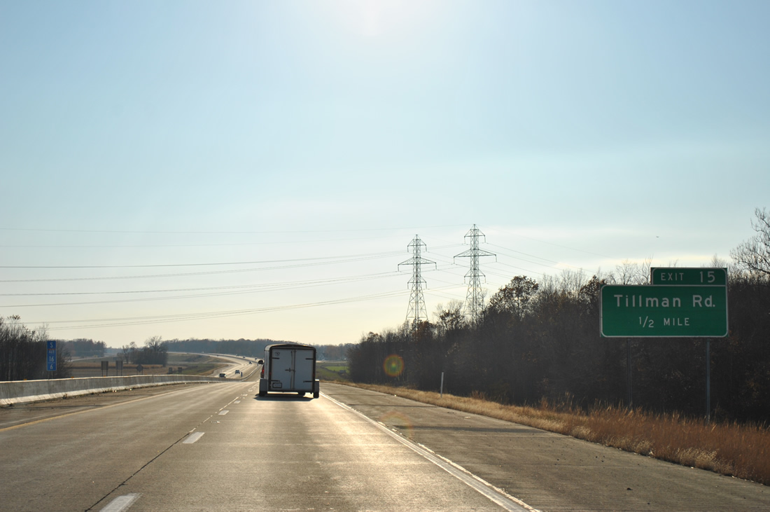
Tillman Road crosses paths with Interstate 469 & U.S. 24 at a diamond interchange (Exit 15) in one mile.
11/06/11
Tillman Road meets the freeway between two crossings with Norfolk Southern Railroad lines amid a swath of farm land. The rural road heads east from Exit 15 toward Maples and an end at Tillman by U.S. 30 and Zulu.
11/06/11
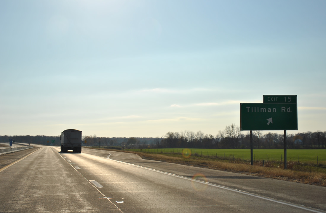
West from Exit 15, Tillman Road reaches southern areas of Fort Wayne at the Eastland Gardens neighborhood and U.S. 27 (Lafayette Street).
11/06/11
West
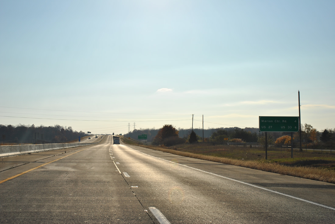
Now traveling along westbound Interstate 469, the freeway arcs southwest two miles to a diamond interchange (Exit 13) with Marion Center Road. U.S. 27 & 33 follow in three miles.
11/06/11
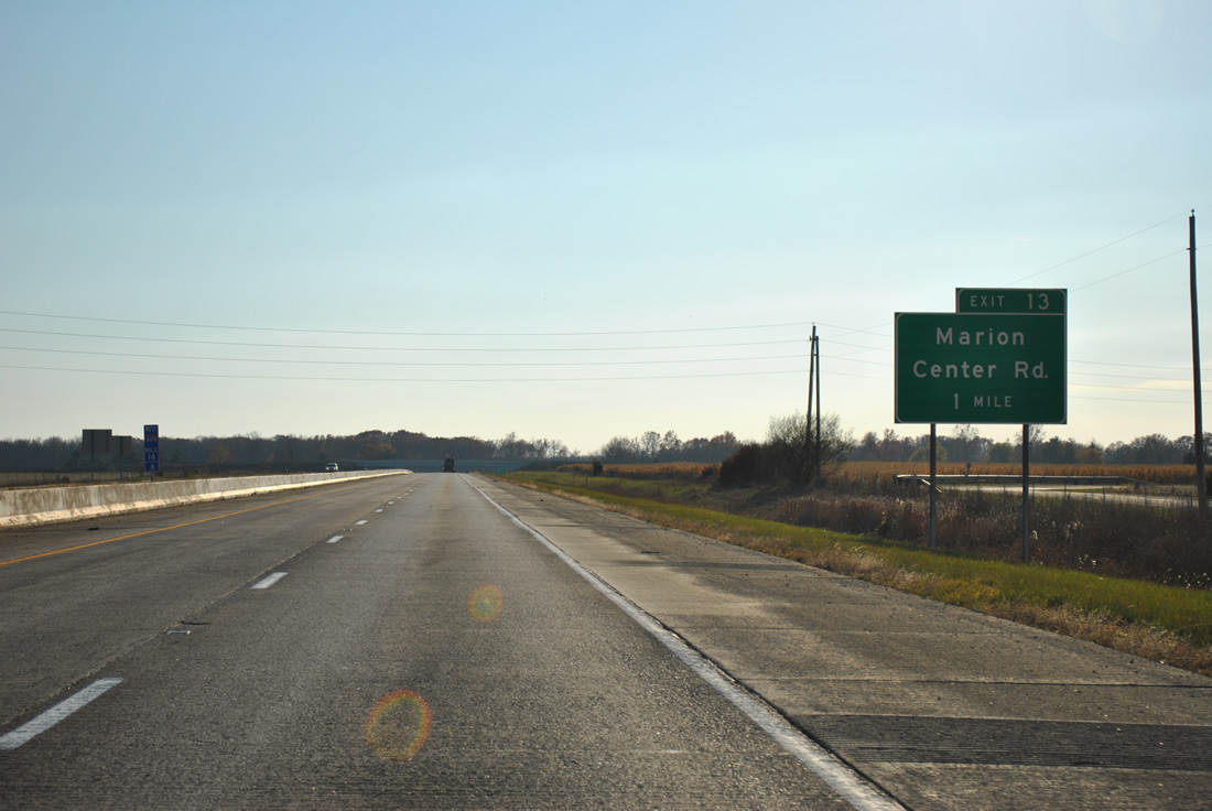
Marion Center Road ties Interstate 469 & U.S. 24 with Maples Road, Wayne Trace and Adams Center Road at a roundabout 0.8 miles north of Exit 13. Wayne Trace angles northwest into the suburbs of Fort Wayne with the other roads mainly serve agricultural interests.
11/06/11

Wayne Trace passes over Interstate 469 & U.S. 24 on the half mile approach to Exit 15 with Marion Center Road. Wayne Trace continues southeast to Minnich Road near Hoagland.
11/06/11
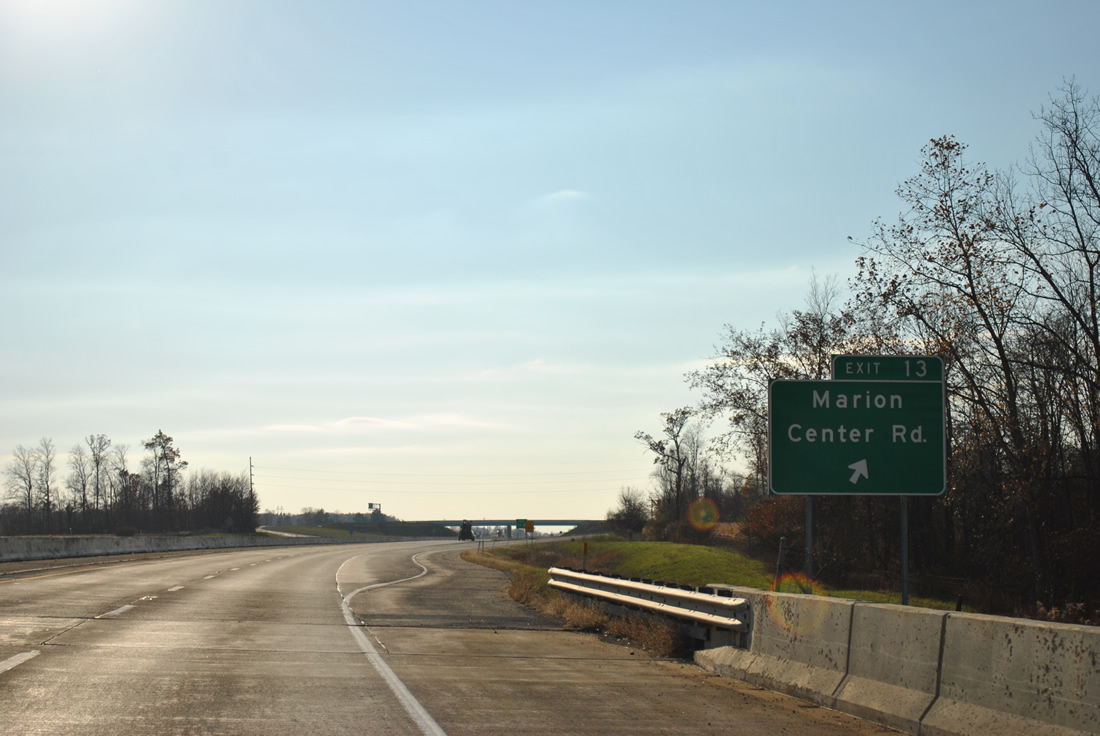
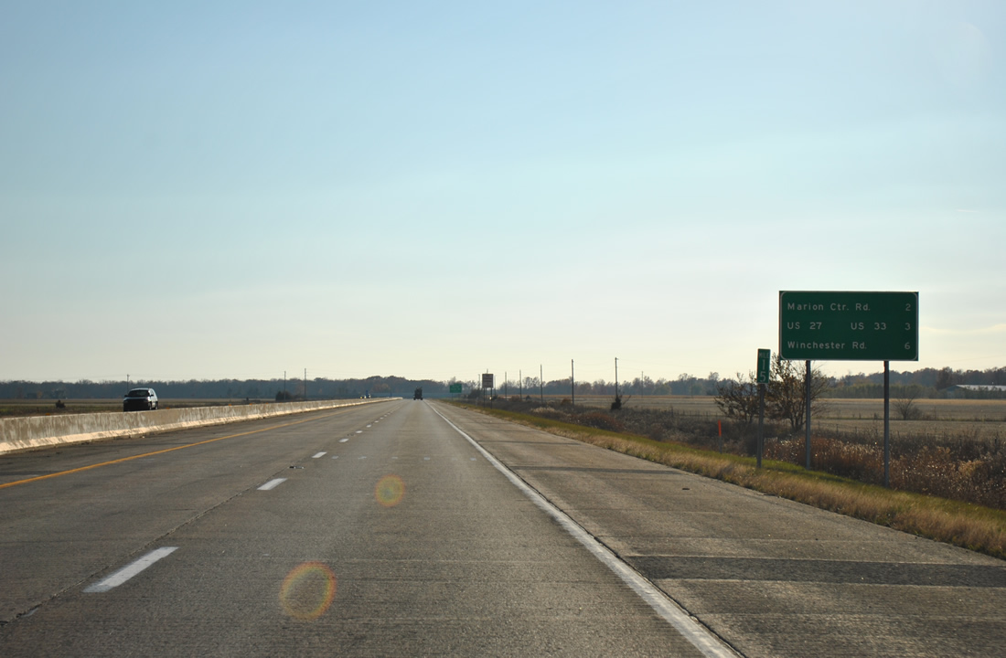
Exit 15 departs Interstate 469 & U.S. 24 west after the crossing over Houk Ditch. Marion Center Road ventures south from the freeway to U.S. 27 & 33 (as Somers Road) east of Poe.
11/06/11
Construction of Interstate 469 through southern Allen County interrupted several roads, with cul-de -sacs visible to the north and south of the freeway. Thompson Road was rerouted to tie into Marion Center Road at Exit 13 adjacent to this set of reassurance markers.
11/06/11
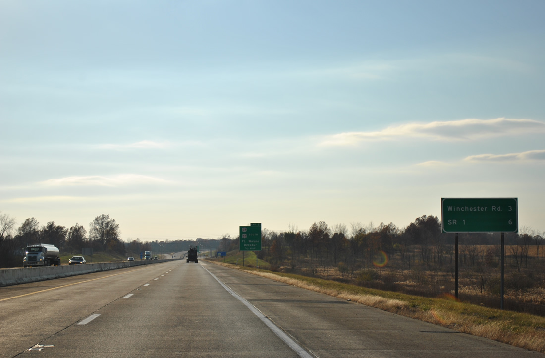
Winchester Road (Exit 9) and SR 1 (Exit 6) are featured on the next westbound distance sign for Interstate 469.
11/06/11
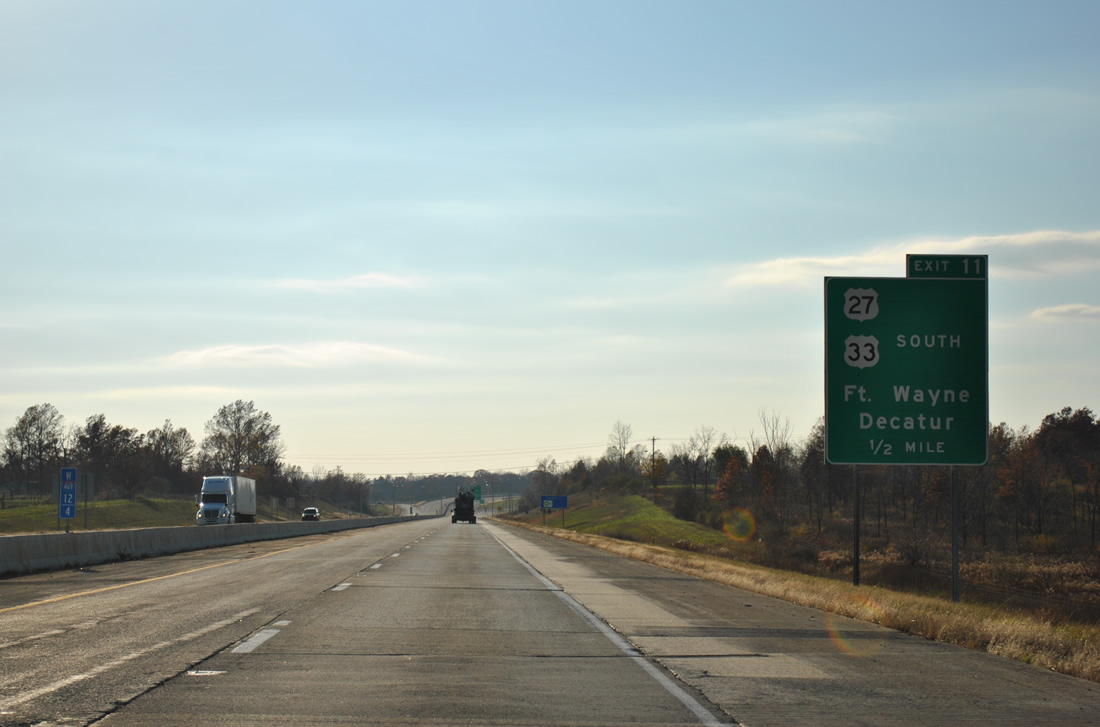
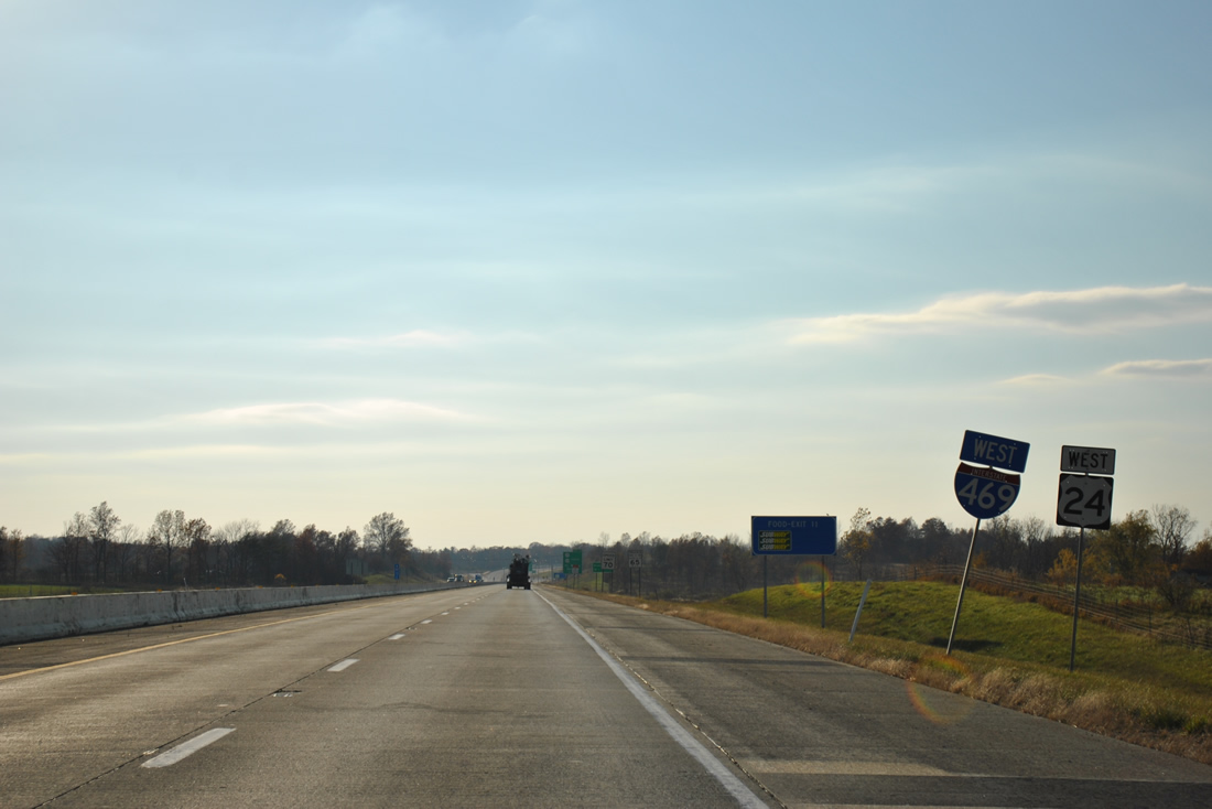
One half mile east of the diamond interchange (Exit 11) with U.S. 27 and 33 south (Decatur Road) on I-469. U.S. 27 & 33 combine southeast from the Fort Wayne bypass 10.2 miles to Decatur and U.S. 224. The pair split south of Decatur for respective paths to Berne and Wilshire, Ohio.
11/06/11
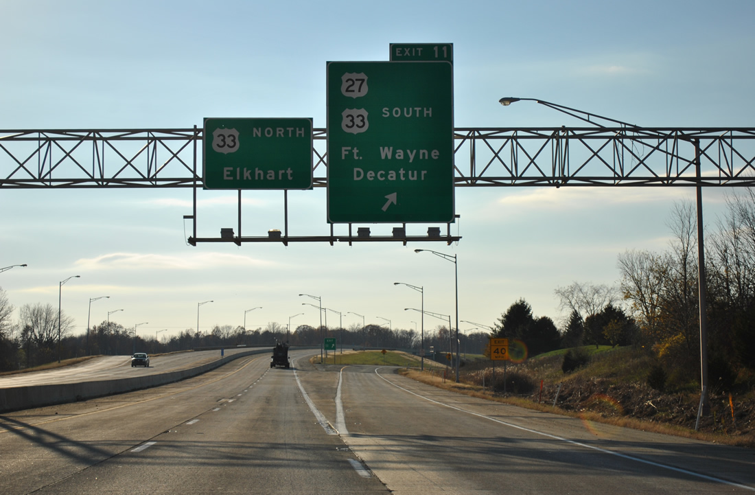
Westbound Interstate 469 & U.S. 24 at the ramp departure of Exit 11 to U.S. 27 and U.S. 33 south. U.S. 27 is the lone holdout to remain along a surface route through Fort Wayne. The US Highway follows Decatur Road north to Lafayette Street and a one way couplet with Clinton Street (south) to downtown Fort Wayne.
U.S. 27 ends at Exit 111 of Interstate 69, having been truncated south from Grayling, Michigan in 2002. U.S. 27 is a 1,364 mile route leading south from Fort Wayne to Miami, Florida. Within Indiana, the route joins Fort Wayne and Richmond with Cincinnati, Ohio.
11/06/11
West  North
North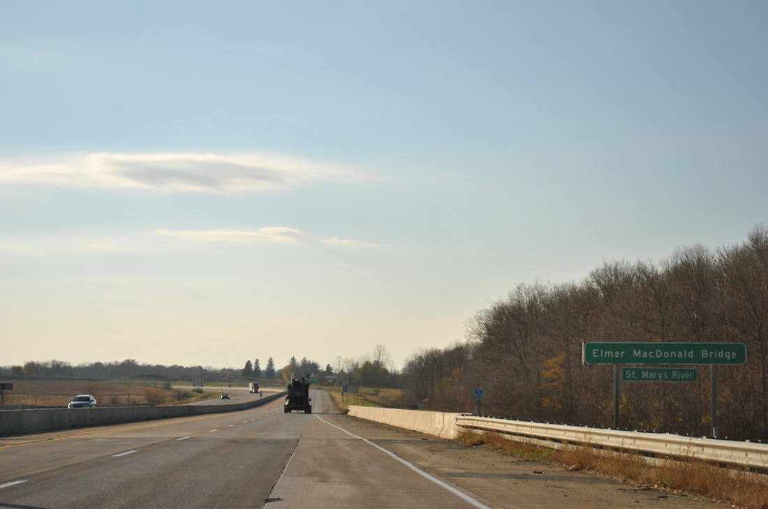
Spanning the Elmer MacDonald Bridge across the St. Marys River along Interstate 469-U.S. 24 west & U.S. 33 north near Hessen Cassel.
11/06/11
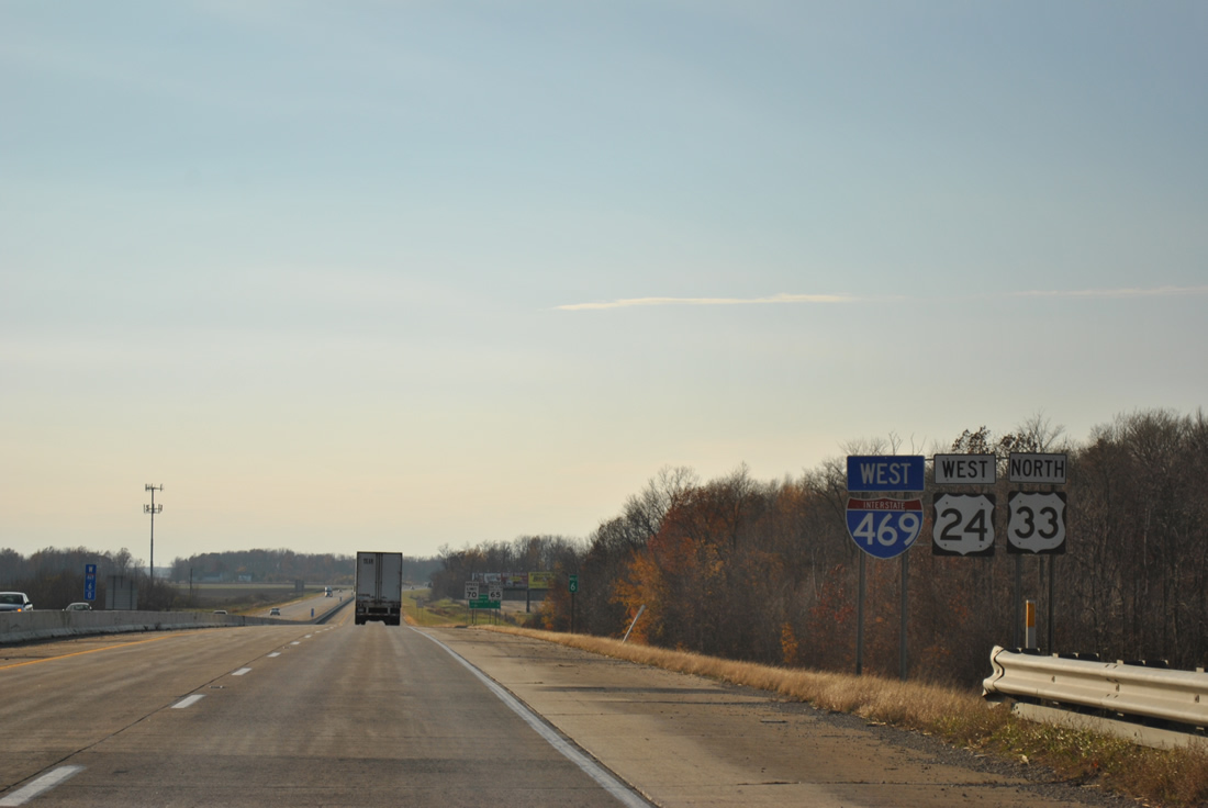
Confirming markers posted west of the St. Marys River. U.S. 33 follows the freeway bypass west to I-69 north to circumvent the city. U.S. 33 joins Fort Wayne with Goshen and Elkhart in the Michiana area to the north. Southward the route continues to Columbus, Ohio along a 709 mile long course to Richmond, Virginia.
11/06/11
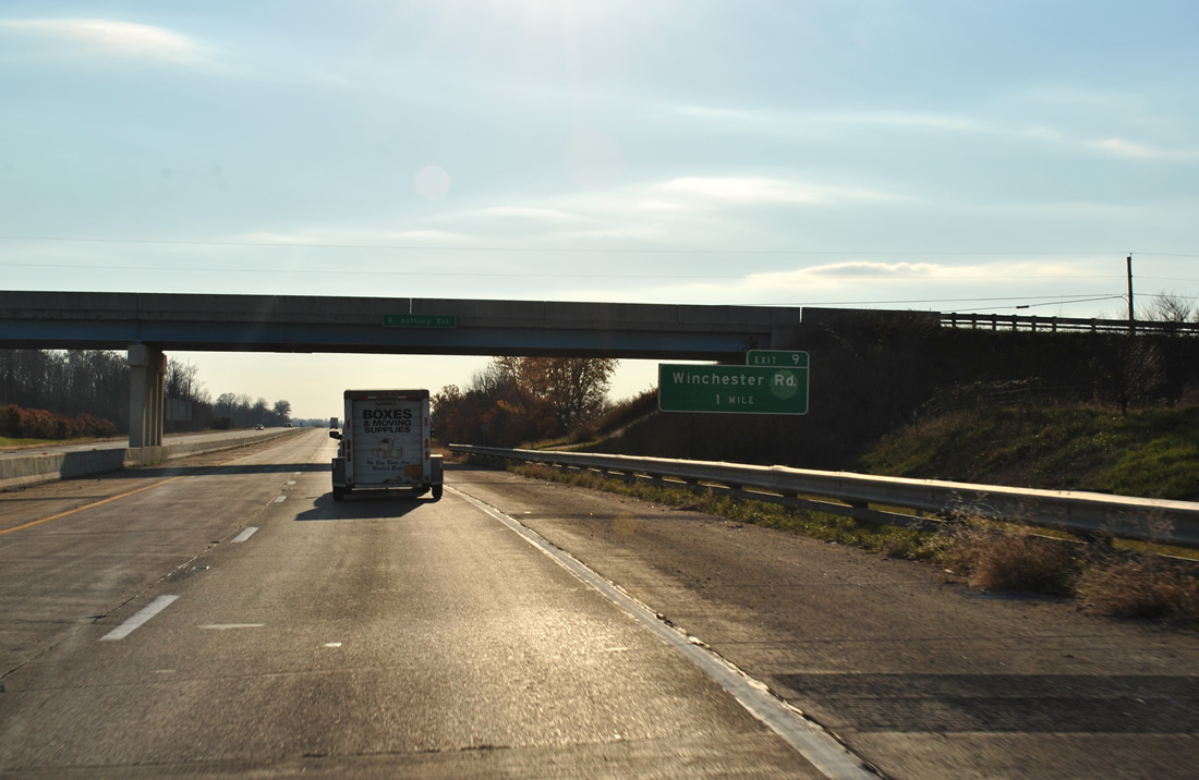
Kinking southwesterly again, Interstate 469-U.S. 24 west & U.S. 33 north next meet Winchester Road at a diamond interchange (Exit 9).
11/06/11
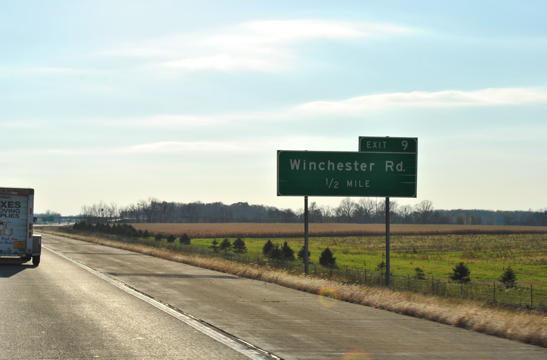
Winchester Road spurs south from Bluffton Road in Fort Wayne to Poe and Decatur.
11/06/11
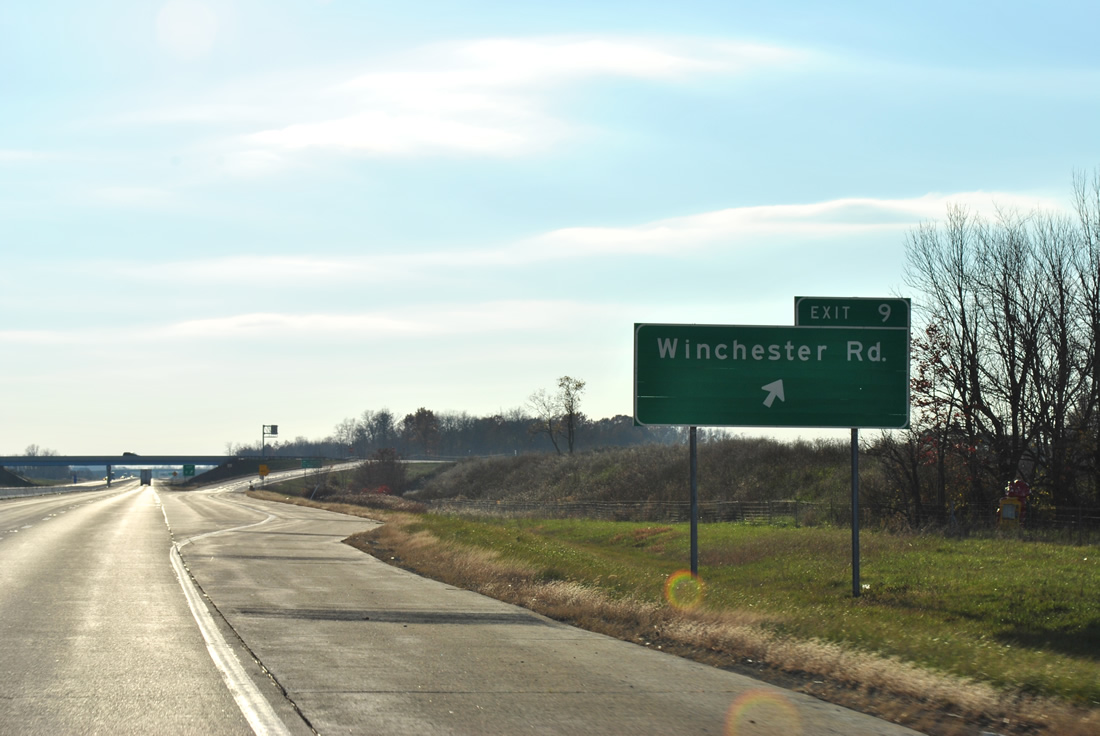
Interstate 469 westbound at the Exit 9 off-ramp to Winchester Road.
11/06/11
The next set of shields posted for Interstate 469-U.S. 24 west & U.S. 33 north reside ahead of the Thiele Road over crossing.
11/06/11
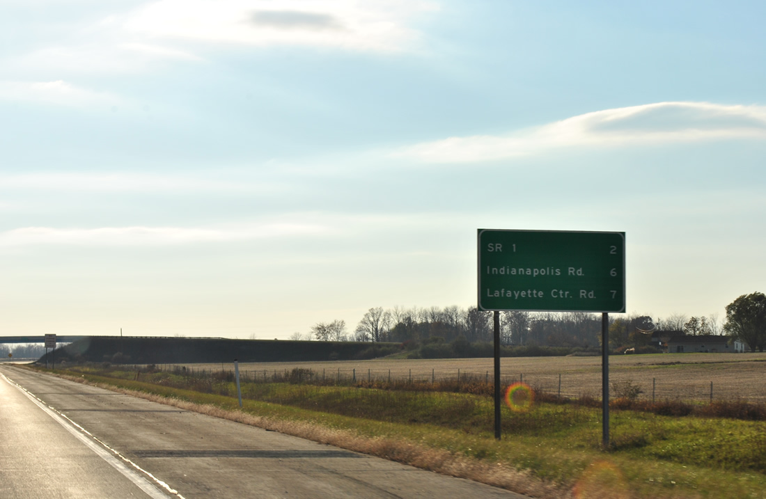
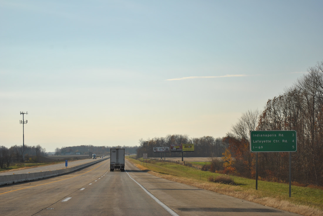
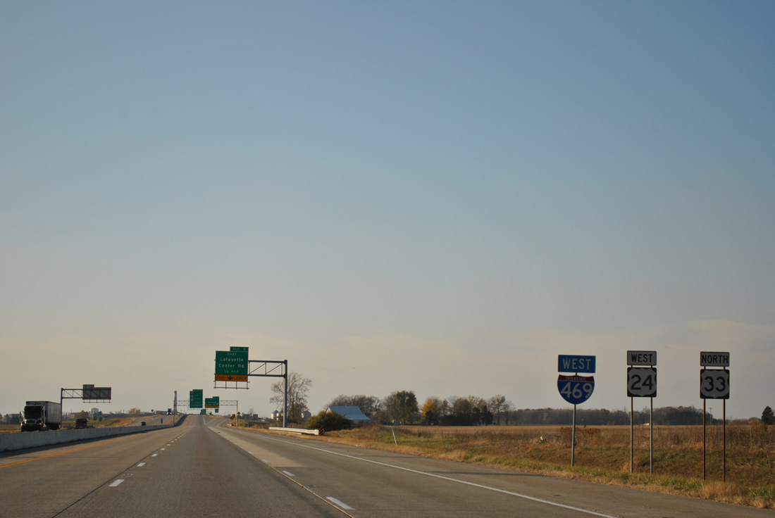
Three interchanges remain along Interstate 469 west before the freeway ends at Interstate 69. They are SR 1 (Exit 6), Indianapolis Road (Exit 2) and Lafayette Center Road (Exit 1).
11/06/11
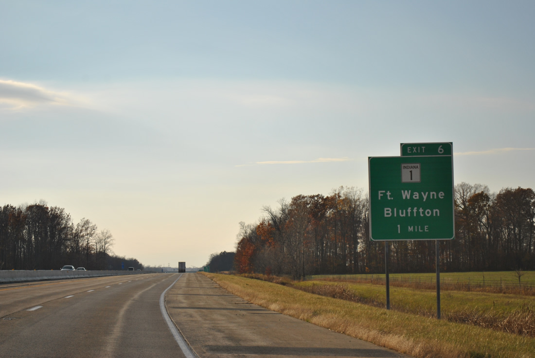
SR 1 north and Bluffton Road south come together at a diamond interchange (Exit 6) with I-469 in one mile. Exit 6 represents the north end of the 139.8 mile stretch of SR 1 between Fort Wayne and Lawrenceburg. A northern section of SR 1 exists from Interstate 69 to Ellis for 40.7 miles as well.
11/06/11

Bluffton Road carried SR 1 signage northward to a turn onto Airport Expressway north to Paulding Road and a merge with U.S. 27. Southward Bluffton Road remains as SR 1 to the east of Yoder and the Wells County line.
11/06/11
SR 1 south joins Interstate 469 and U.S. 24-33 with Ossian and Bluffton in Wells County.
11/06/11
Interstate 469 follows the southern periphery of Fort Wayne International Airport on the three mile stretch to Indianapolis Road (Exit 2).
11/06/11
Indianapolis Road represents the alignment of State Road 3 decommissioned in 1972 due to the completion of Interstate 69.1
11/06/11
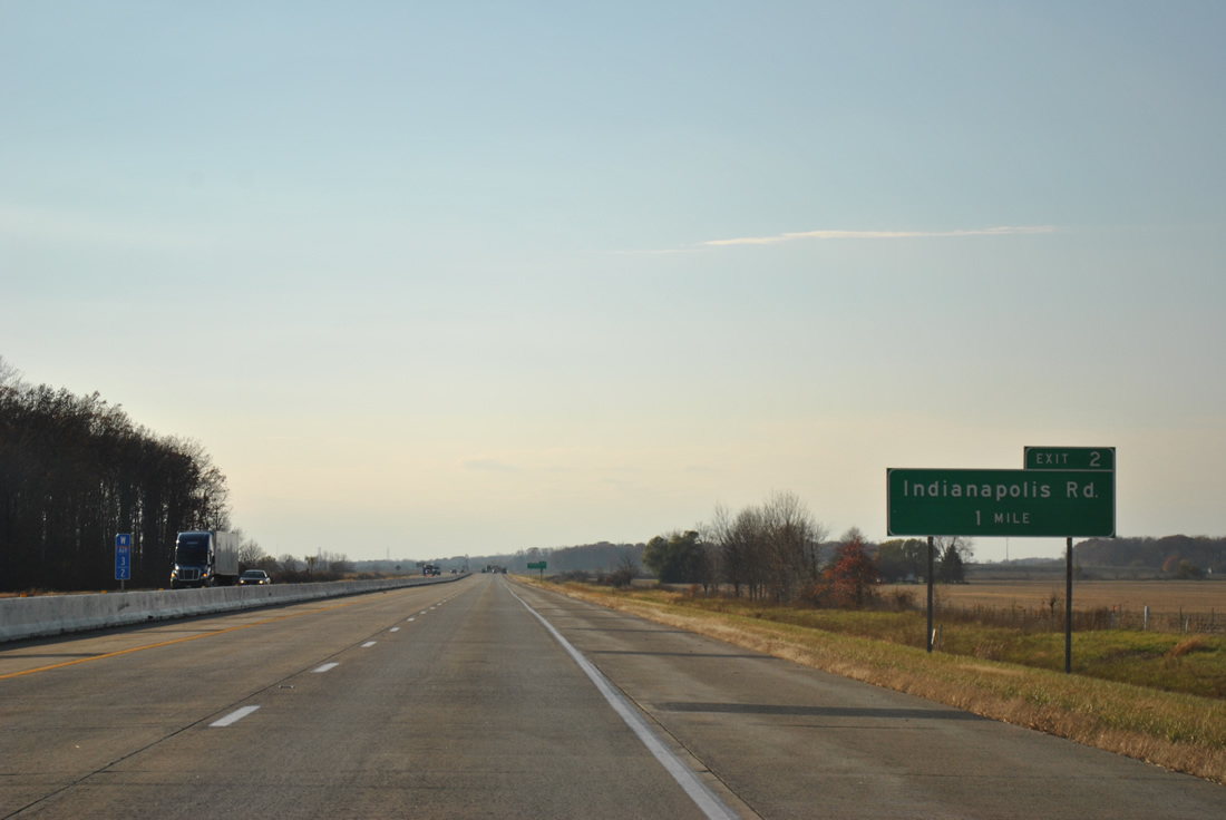
Interstate 469 turns northerly on the half mile approach to Exit 2 and Indianapolis Road. Indianapolis Road travels northeast to Nine Mile and Airport Expressway (as Smith Road). Extension of airport runways made the road discontinuous northeast to the segment of Indianapolis Road north of Airport Expressway.
11/06/11
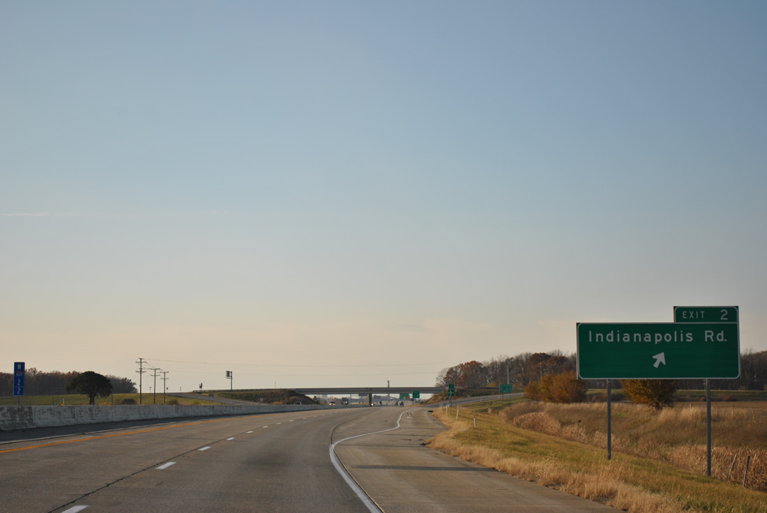
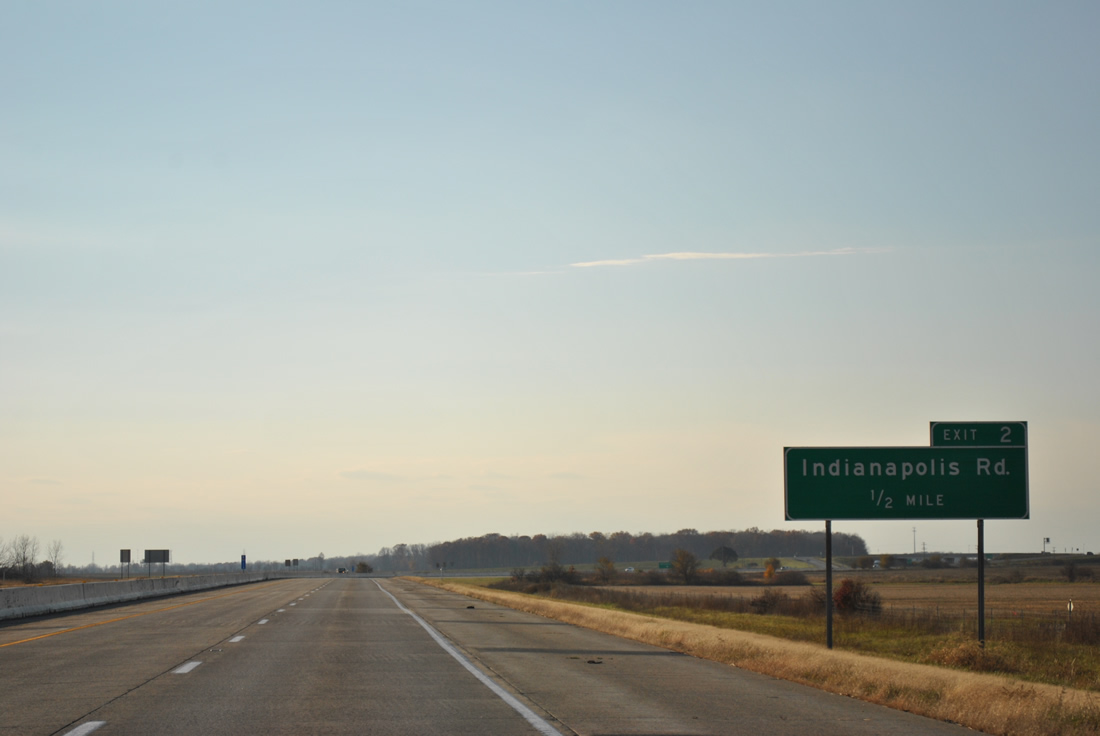
Entering the diamond interchange at Exit 2 on Interstate 469 westbound. Indianapolis Road south continues to Zanesville on the Wells County line.
11/06/11
A third westbound lane joins Interstate 469-U.S. 24 west / U.S. 33 north from Indianapolis Road to the diamond interchange at Exit 1.
11/06/11
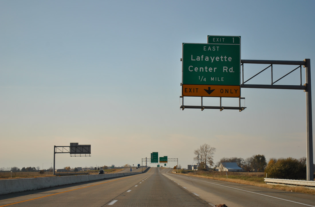
Lafayette Center Road heads west from the Fort Wayne International Airport area to cross paths with Interstate 469 opposite Tom Worrel Road.
11/06/11
Tom Worrel Road connects Exit 1 and Lafayette Center Road with Feighner Road. The original alignment of Lafayette Center Road was built over with Interstate 469 leading into the directional cloverleaf interchange with Interstate 69. This is why the Exit 1 panels indicate "East", as westbound continues directly from Exit 0.
11/06/11
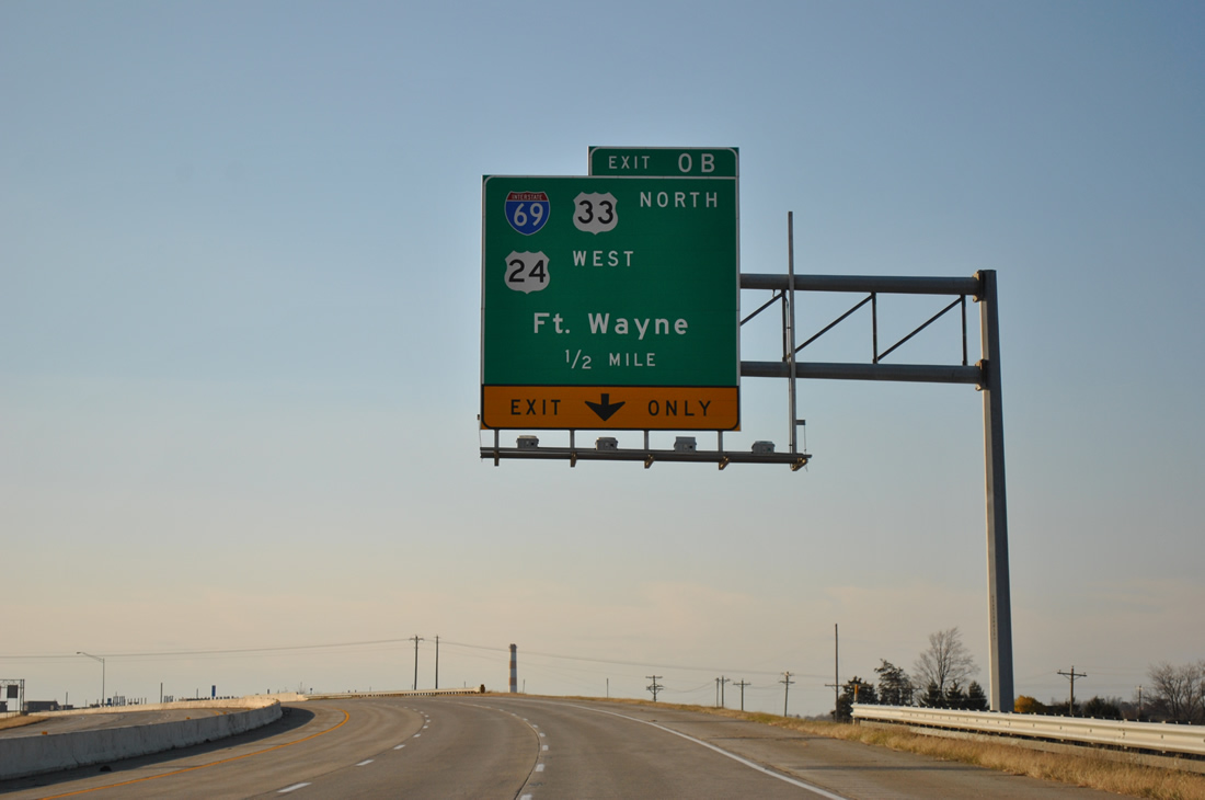
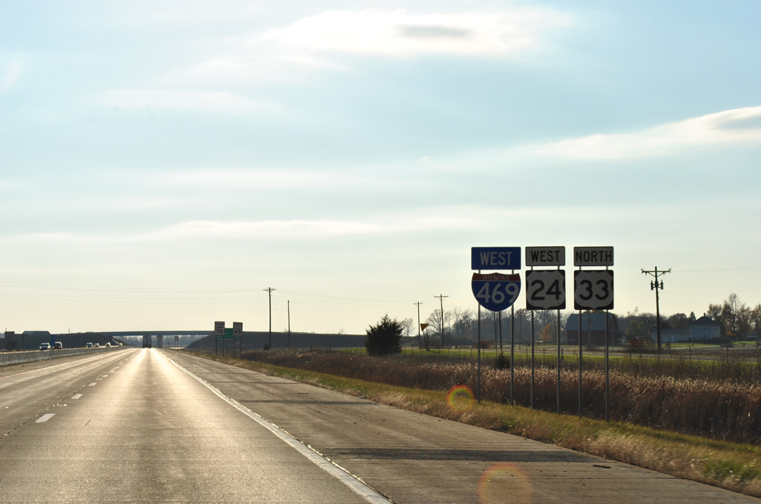
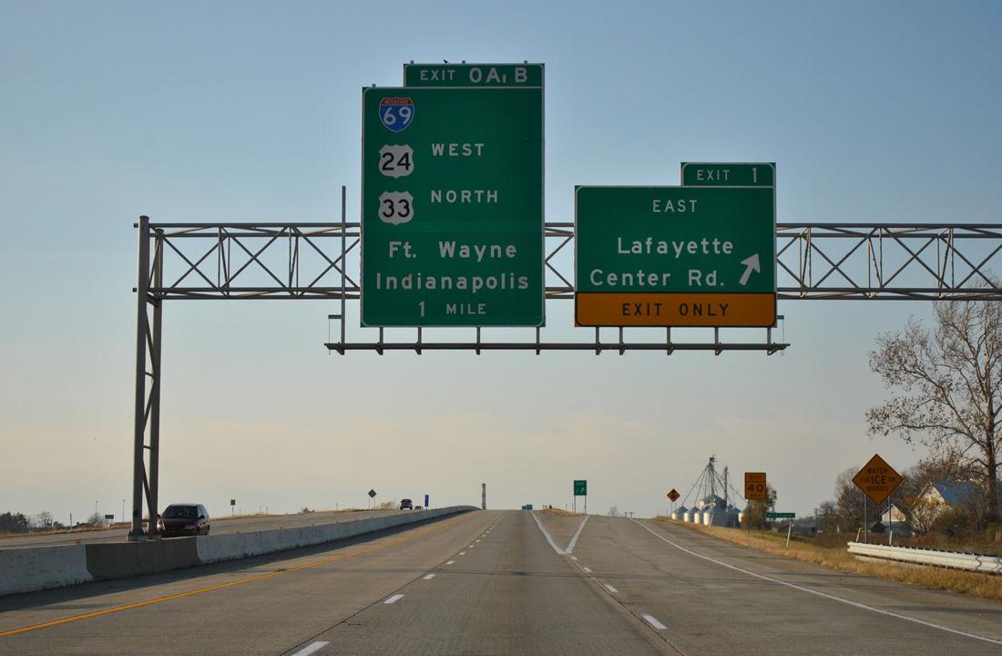
Three lanes of Interstate 469 west meet Interstate 69 (Exit 0) in one half mile. Exit 0B provides for the continuation of U.S. 24 west to Exit 102 of I-69 and U.S. 33 north to Exit 109 of I-69 (U.S. 30). Lafayette Center Road west from Interstates 69-469 provides a direct route to U.S. 24 at Roanoke in lieu of the arc utilizing Interstate 69 north and the original U.S. 24 southwest.
11/06/11
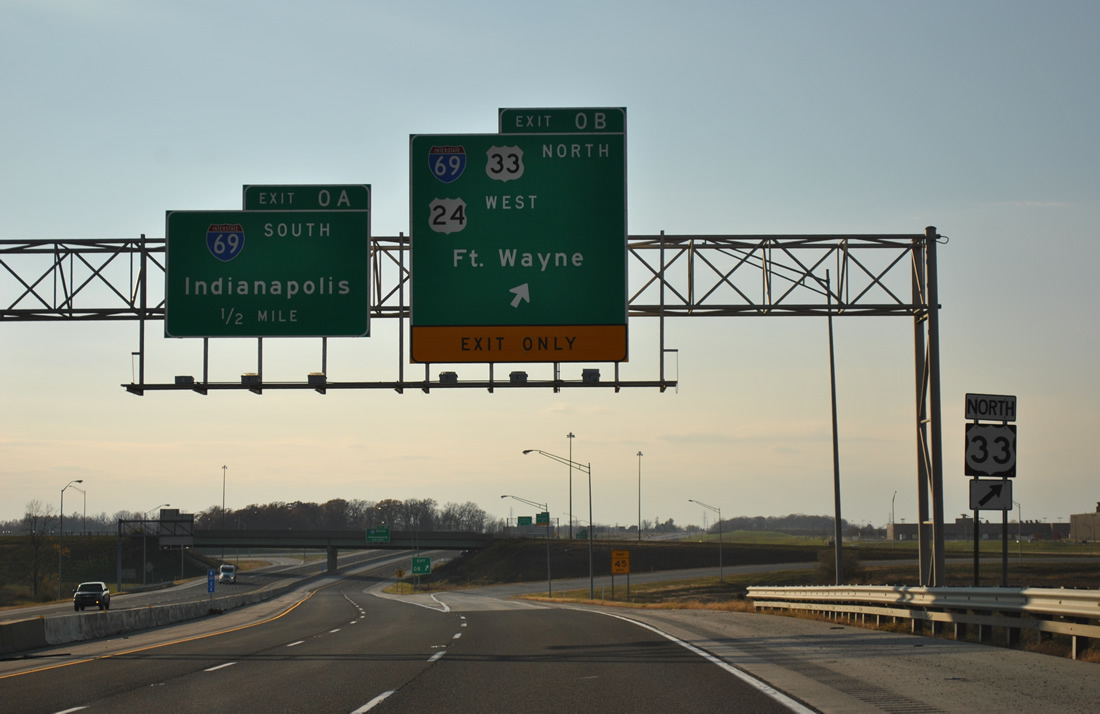
Interstate 469 ends as Exit 0B leaves for Interstate 69-U.S. 33 north & U.S. 24 west back to Fort Wayne. Exit 0A follows as a loop ramp onto Interstate 69 south to Muncie, Anderson and Indianapolis. The freeway mainline defaults onto Lafayette Center Road ahead of the General Motors (GM) Fort Wayne assembly plant.
11/06/11
References:
- Indiana Highway Ends - SR 3.
http://highwayexplorer.com/EndsPage.php?id=1003§ion=1
Photo Credits:
- ABRoads: 11/06/11
Connect with:
Page Updated Tuesday January 24, 2012.