
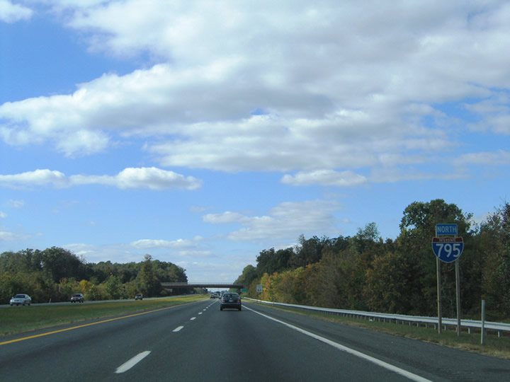
Interstate 795 North
 North
North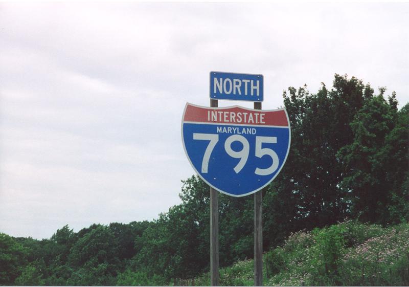
The first Interstate 795 northbound reassurance shield posted at the Metro under crossing near Mt. Wilson Lane. The mainline shield was one of only three to retain the state name as of October 2004. All were replaced by 2010.
06/17/00
08/27/05
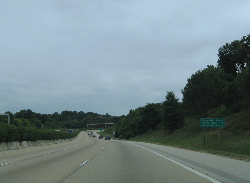
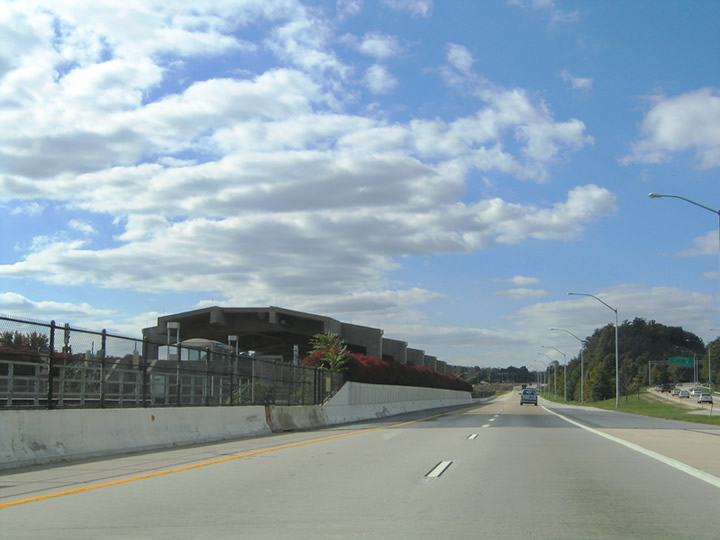
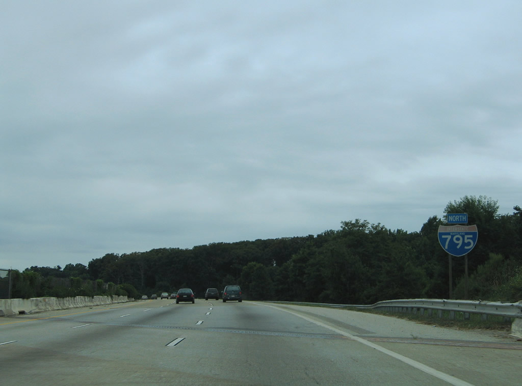
Shrubbery lines the median of the six lane freeway of Interstate 795 initially. Eventually the Metro transit replaces the landscaped median as I-795 advances northwest to Owings Mills. Pictured here is a interchange sequence sign listing the distance to Exits 4, 7 and 9.
08/27/05
The construction of Interstate 795 (Northwest Expressway) included a large interchange with the Owings Mills transit station at the end of the Metro subway line from Downtown Baltimore.
10/10/04
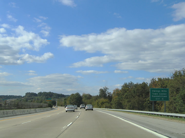
Forthcoming Owings Mills Boulevard links I-795 with the Metro subway station, Owings Mills Town Center, MD 140 (Reistertown Road) and Lyons Mill Road. Portions of the surface boulevard were built in conjunction with the Northwest Expressway.
10/10/04
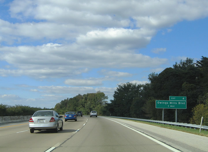
Auxiliary guide sign for Exit 4 touting the Owings Mills Town Center mall and Randallstown. The community of Randallstown lies to the southwest via Painters Mill Road and McDonogh Roads. Direct ramps from Interstate 795 to Owings Mills Town Center carry traffic to the shopping complex at the corner of Owings Mills and Red Run Boulevards.
10/10/04
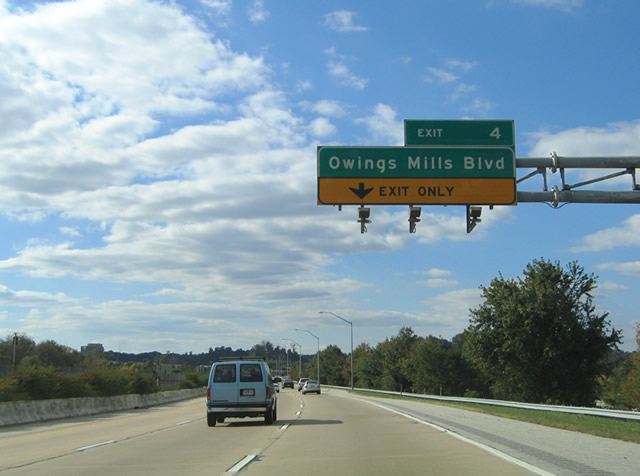
Interstate 795 reduces from a six lane to a four lane freeway at the directional cloverleaf interchange with Owings Mills Boulevard. A directional ramp departs ahead for the boulevard east and west and Owings Mills Town Center (Mill Run Circle).
10/10/04
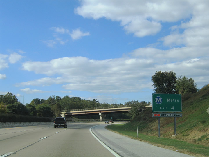
Exit 4 expands into a two lane off-ramp as it departs Interstate 795 northbound. A Metro transit train travels northward into the Owings Mills station within the median of the freeway in this scene.
08/27/05
The Metro platform lies between the roadways of -795 at Owings Mills. The parking area and station are located off Painters Mill Road southeast of Owings Mills Town Center and Owings Mills Boulevard.
10/10/04
Northbound neutered shield for Interstate 795 posted ahead of the Pleasant Hill Road overpass. The Northwest Expressway remains at four lanes to its northern terminus north of Reistertown.
10/10/04
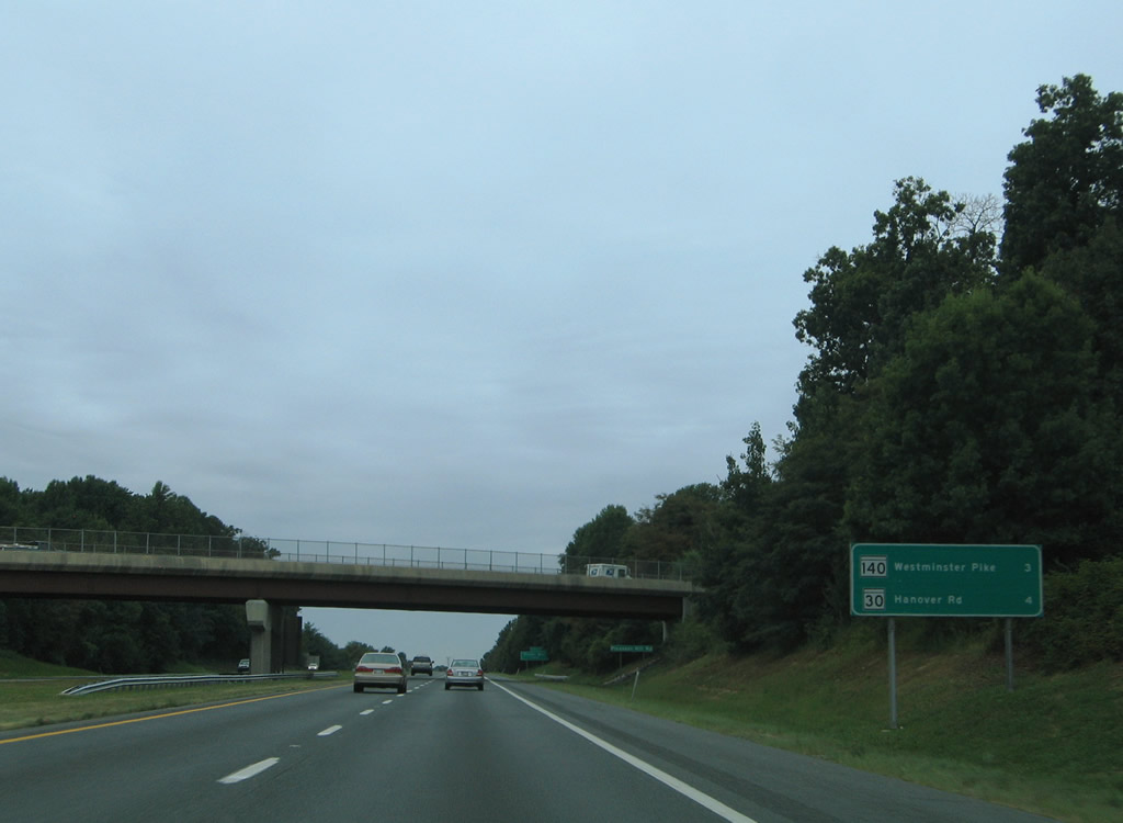
Distance sign for MD 140 (Westminster Pike / Main Street) and MD 30 (Hanover Road) on Interstate 795 north. MD 30 begins at Reistertown and travels northward 9.5 miles to Hampstead and 14 miles to Manchester.
08/27/05
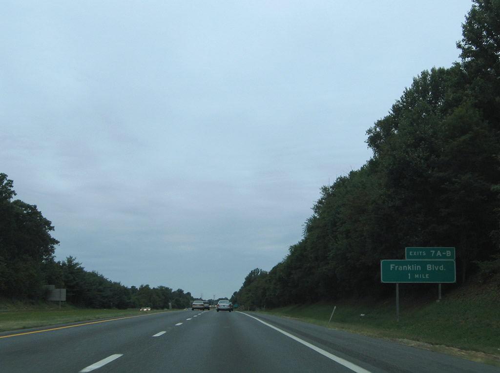
The first of two interchanges to serve the suburb of Reistertown is that of the Exit 7 parclo interchange with Franklin Boulevard. Interstate 795 meets Franklin Boulevard at its intersection with Nicodemus Road in one mile.
08/27/05
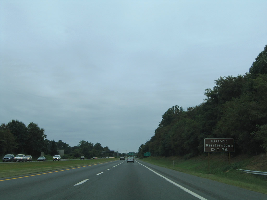
Exit 7A onto Franklin Boulevard eastbound serves Reistertown. Franklin Boulevard intersects MD 140 (Reistertown Road) one half mile to the east of Interstate 795 in the heart of town.
08/27/05
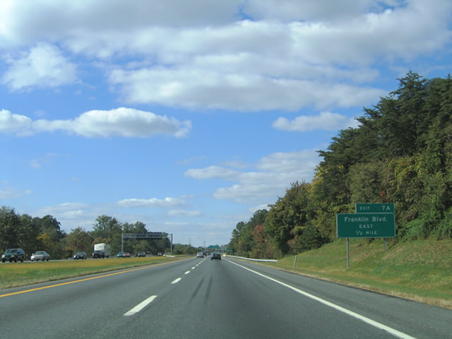
One-half mile guide sign for Exit 7A (Franklin Boulevard East). Franklin Boulevard becomes Cherry Hill Road east of MD 140. Nicodemus Road was displaced by Interstate 795 and stems southeast from W. Cherry Hill Road to Reistertown Road. Cherry Hill Road parallels Franklin Boulevard to the south and was also displaced by Interstate 795.
10/10/04
Interstate 795 northbound at the Franklin Boulevard eastbound off-ramp to Reistertown.
08/27/05

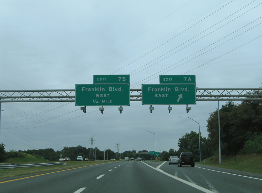
Exit 7B loops below Interstate 795 onto Franklin Boulevard westbound. Franklin Boulevard splits between Church Road and Red Run Boulevard 0.6 miles to the west to serve growing suburban areas west of Reistertown.
08/27/05
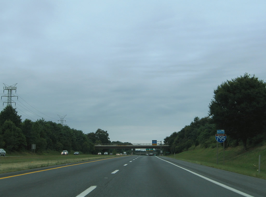
Continuing northbound on Interstate 795 from Franklin Boulevard (Exit 7A/B) to the Berrymans Lane over crossing.
08/27/05
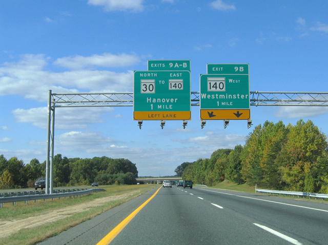
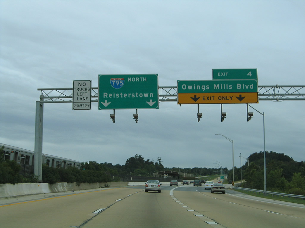
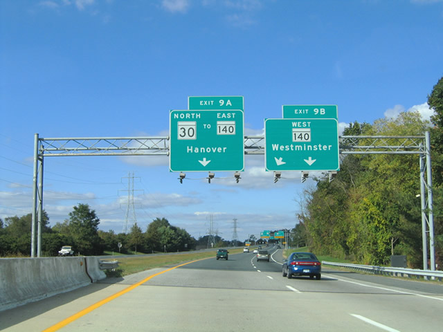
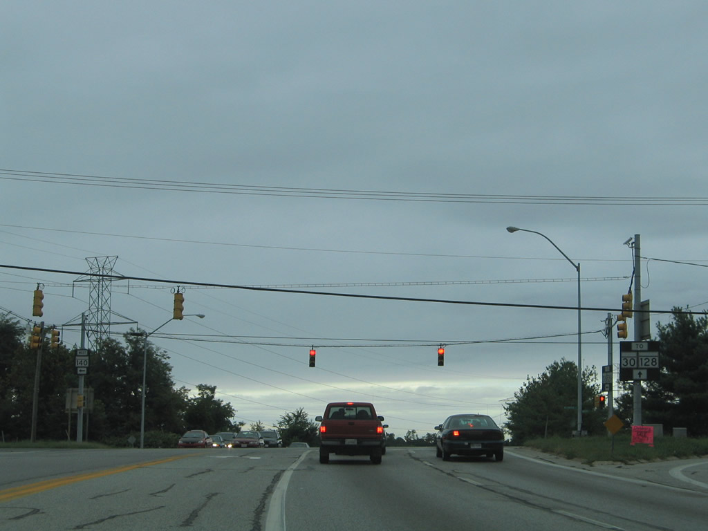
Exits 9A/B sign bridge for the upcoming split of the Interstate 795 freeway into ramps for MD 140 west, and MD 140 east & 30 north. It is unclear why the westbound ramp carries Exit 9B while the eastbound branch also carries Exit 9B in addition to Exit 9A.
10/10/04
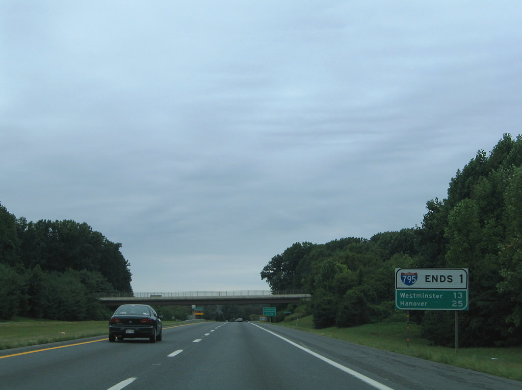
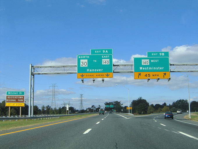
Distance sign and Interstate 795 end advisory sign combo posted ahead of the Stocksdale Avenue overpass. Hanover lies 25 miles to the north via MD 30 (Hanover Road). Westminster is the westbound control city of MD 140 (former U.S. 140).
08/27/05
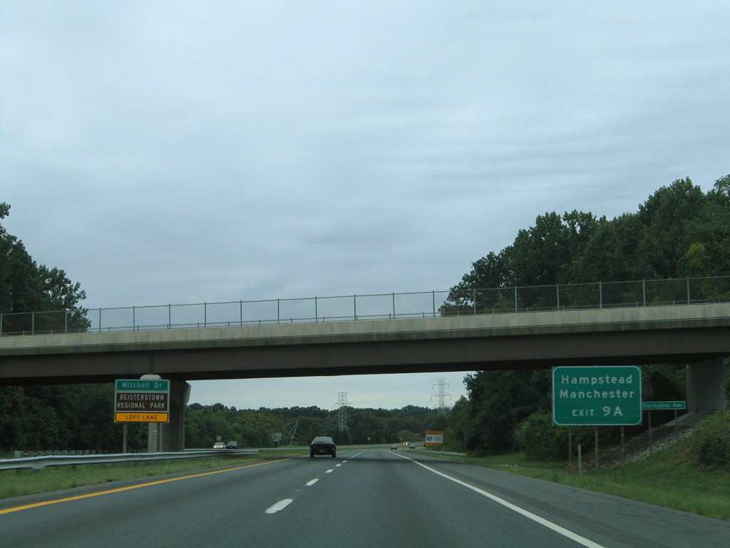
Auxiliary sign for the Maryland communities of Hampstead and Manchester for MD 30 (Hanover Road) northbound. The left sign directs drivers bound for Reisterstown Regional Park and Mitchell Road via Exit 9A.
08/27/05
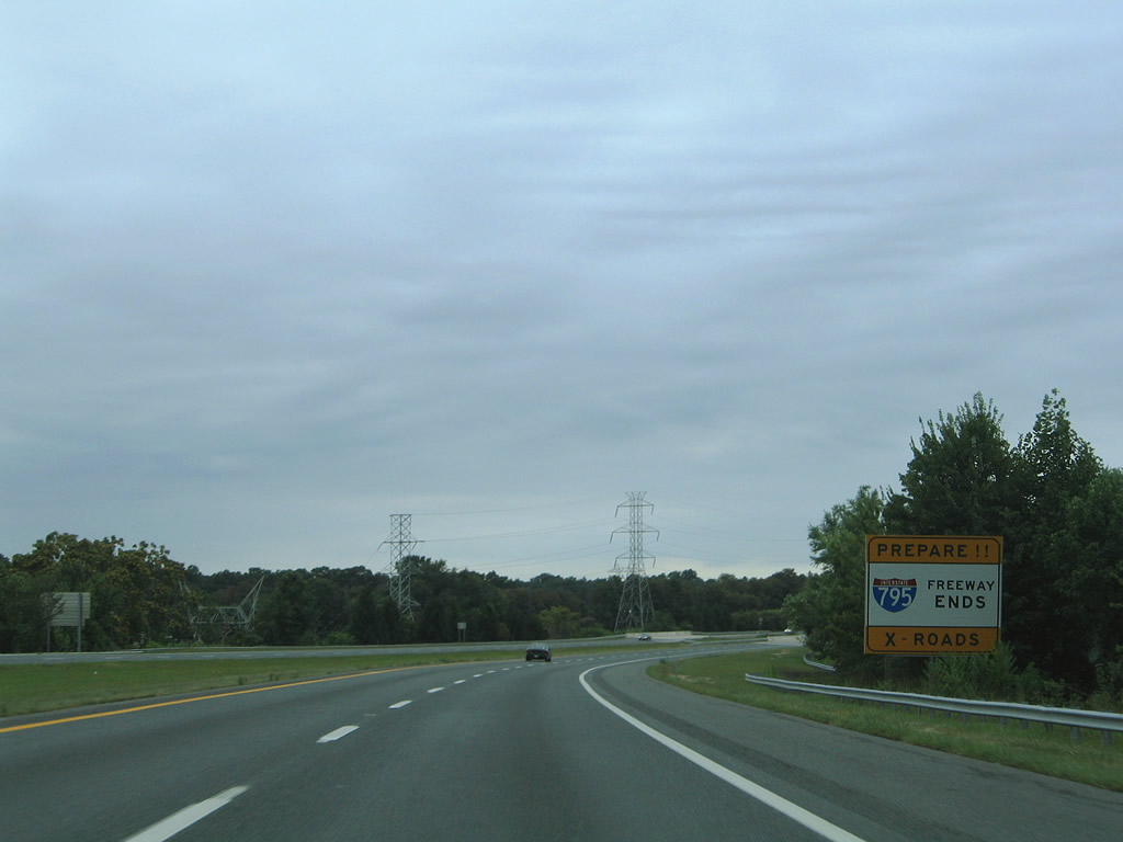
End advisory sign for Interstate 795 with the mentioning of the upcoming crossroads on both MD 140 and MD 30 beyond the freeway off-ramps of Exits 9A/B.
08/27/05
Crossing over Cockeys Mill Road ahead of the partition of Interstate 795 into ramps for MD 140 East (Main Street) & MD 30 north (Hanover Road) and MD 140 west (Westminster Pike).
10/10/04
Interstate 795 partitions into Exits 9A/B near Reistertown. The Exit 9B off-ramp defaults onto MD 140 westbound ahead of its intersection with Mitchell Drive. Mitchell Drive spurs alongside MD 140 eastbound into Reisterstown Regional Park. MD 140 (Westminster Pike) otherwise continues northwest to Finksburg, Westminster, and Taneytown. At Westminster, MD 97 begins and travels northward via the old U.S. 140 to Gettysburg, Pennsylvania.
10/10/04
Meanwhile Exit 9A ascends to pass over the Exit 9B ramp onto MD 140 west for the intersection of MD 140 (Westminster Pike) and MD 128 (Butler Road). By continuing straight through the upcoming intersection, one travels Butler Road one half mile to MD 30 (Hanover Road) and onward to Glyndon. MD 30 itself ends at MD 140 (Main Street) to the east.
08/27/05
10/10/04
Exit 9A ends at the intersection of MD 140 (Westminster Pike) and MD 128 (Butler Road). All shields posted at the signal are one-piece assemblies. To the right Westminster Pike becomes Main Street at the southern terminus of MD 30 (Hanover Road) in 0.4 miles.
10/10/04
08/27/05
Photo Credits:
- Alex Nitzman: 06/17/00, 10/10/04, 08/27/05
Connect with:
Page Updated Friday August 27, 2010.