
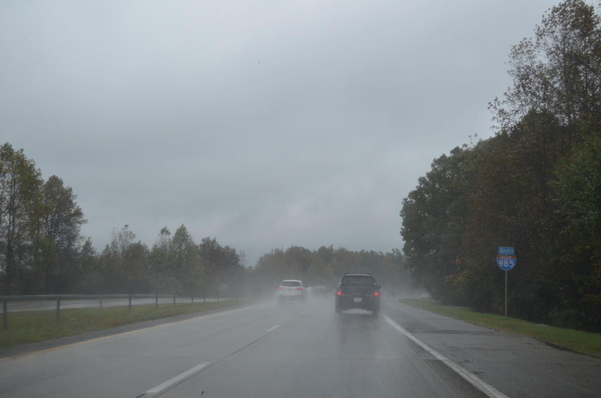
Interstate 985 South


 South
South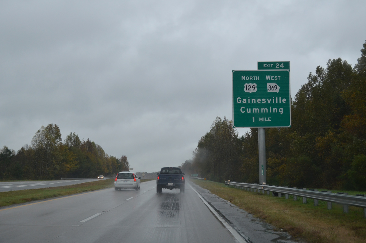
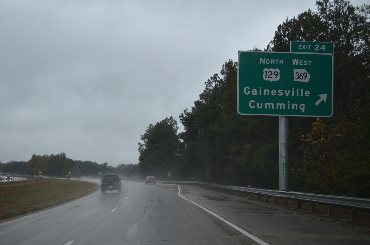
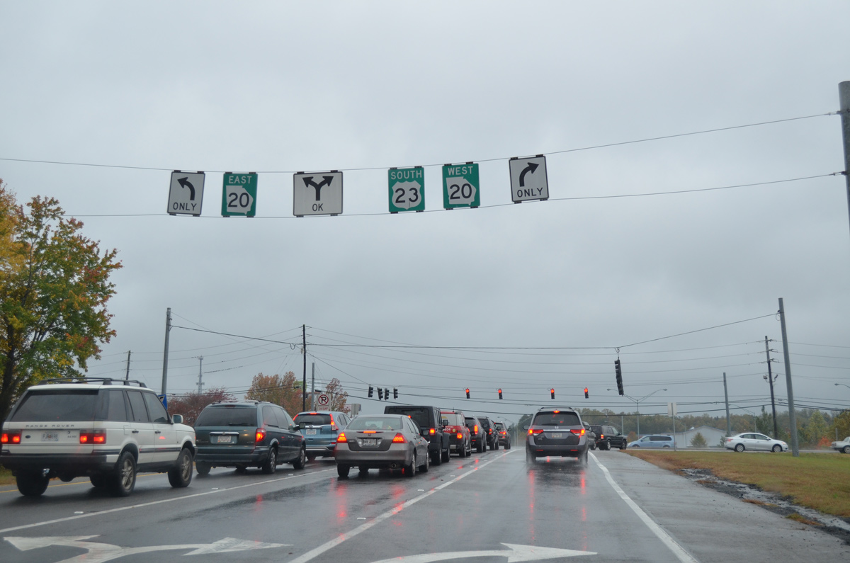
U.S. 23 advances one mile south from the signalized intersection with Howard Road west and Lanier Tech Drive east to a diamond interchange (Exit 24) with U.S. 129 north, SR 369 west and the southbound beginning of I-985.
10/26/15
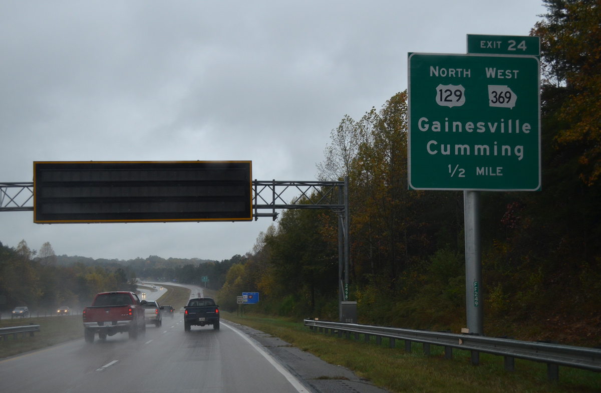
U.S. 129/SR 369 overlap 0.6 miles west from U.S. 23 to Limestone Parkway and New Holland Marketplace shopping center. There U.S. 129 turns north to bypass north Gainesville to SR 11 Business (Cleveland Highway).
10/26/15

Jesse Jewell Parkway arcs north from Old Cornelia Highway (old U.S. 23/SR 23) to cross paths with Interstate 985 and U.S. 23 at Exit 24. SR 369 and U.S. 129 Business follow the parkway west to Downtown Gainesville. Old Cornelia Highway meanders northeast to White Sulphur Springs.
10/26/15
Prior to 2003, Exit 24 connects Interstate 985 and U.S. 23 with SR 369 alone. U.S. 129 was relocated east to continue its bypass of Gainesville at that time, with the former route along Jesse Jewell Parkway and E.E. Butler Parkway south from Downtown redesignated as U.S. 129 Business.
10/26/15
 South
South
The first shield for Interstate 985 appears just beyond the Old Cornelia Highway overpass.
10/26/15
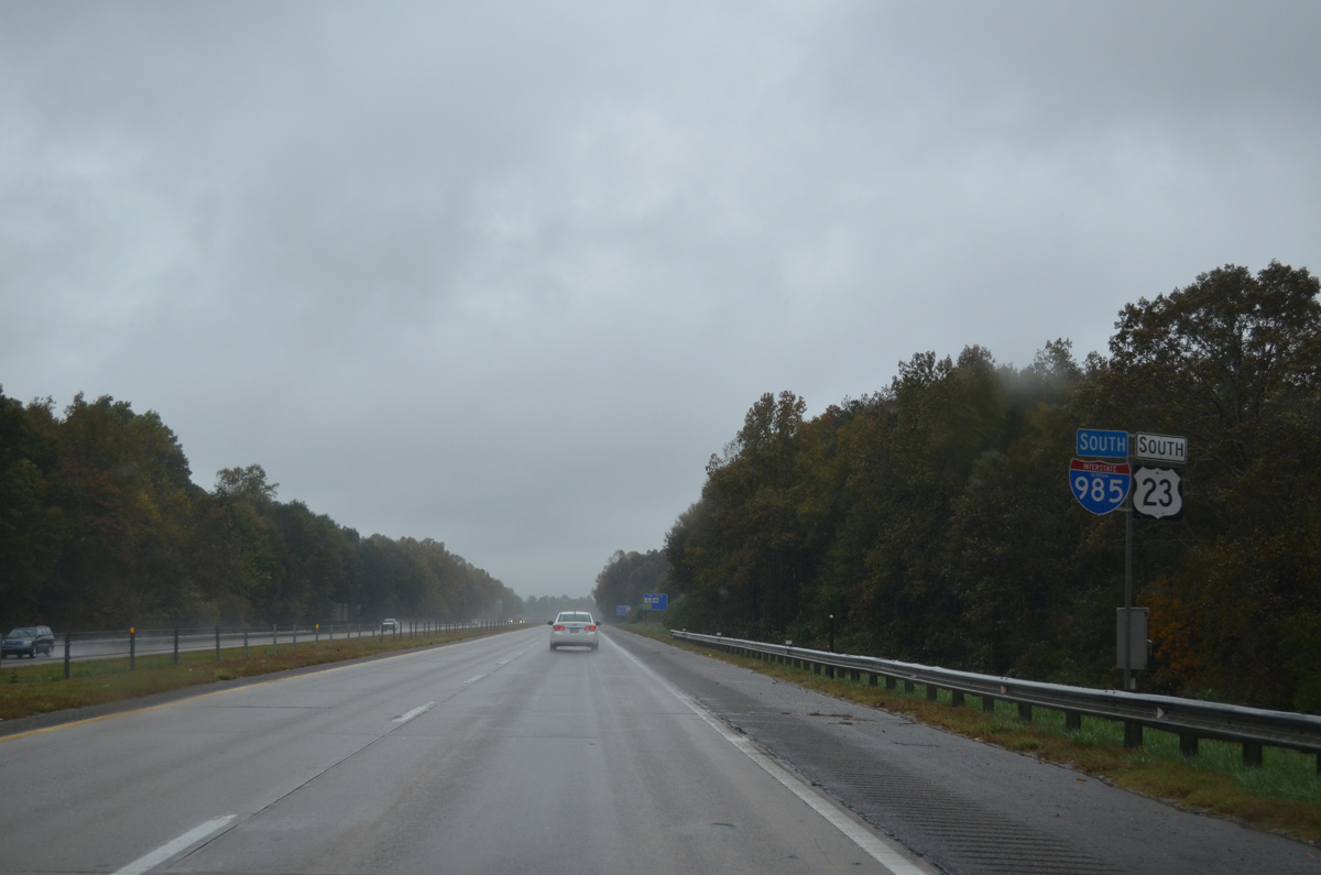
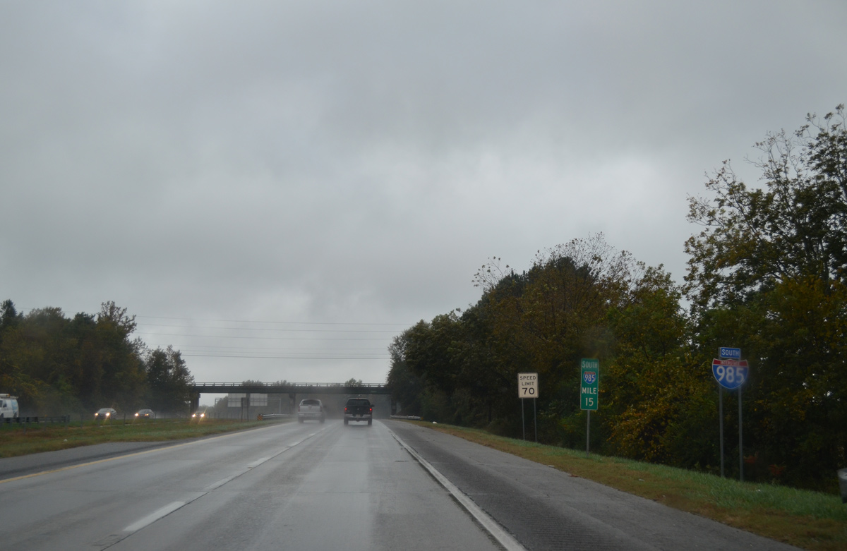
A subsequent shield assembly includes U.S. 23, but not U.S. 129. U.S. 23 is generally unsigned along its 20.1 mile overlap with Interstate 985.
10/26/15
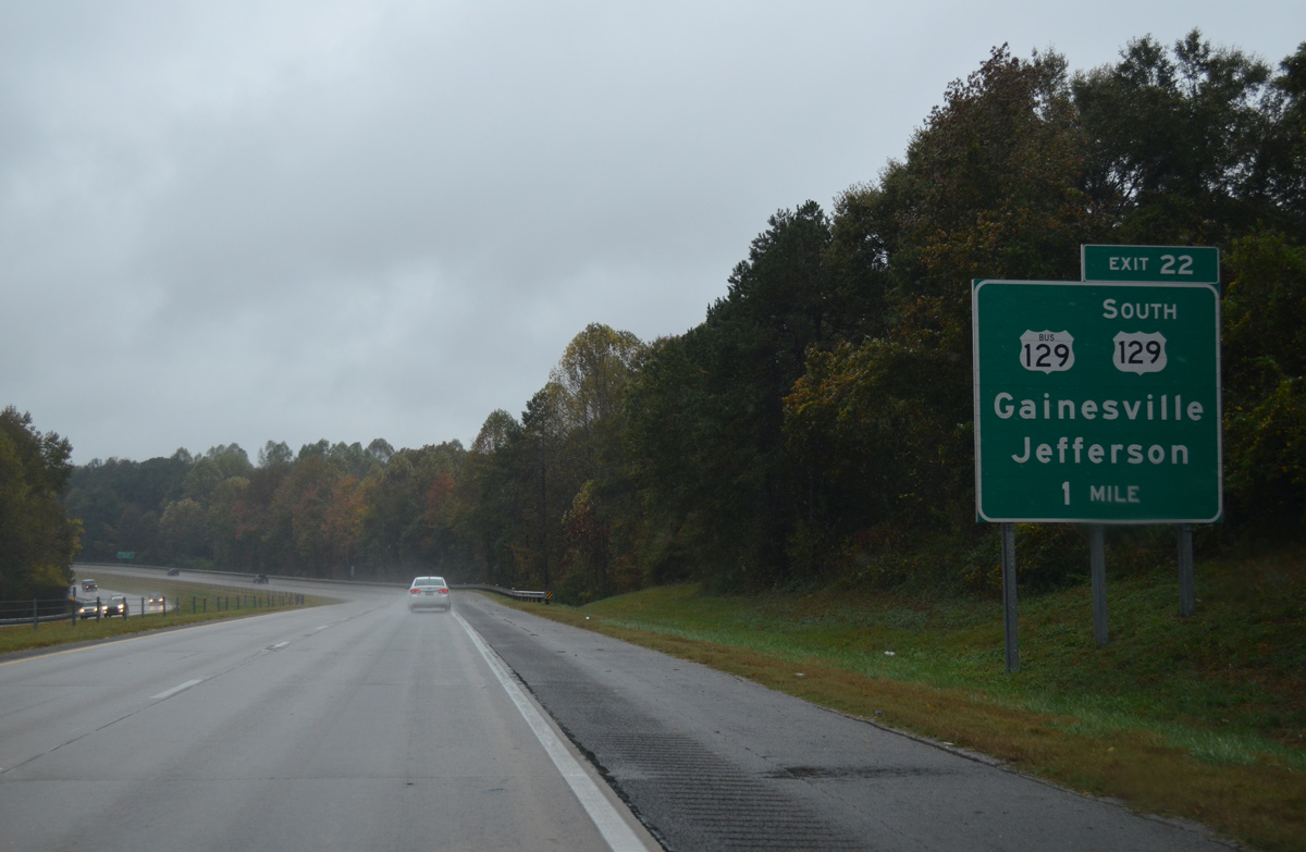
U.S. 129 joins I-985/U.S. 23 south for 2.5 miles to Exit 22 with E.E. Butler Parkway (U.S. 129 Business) north and Athens Highway south.
10/26/15

Athens Street (old U.S. 129) spans I-985/U.S. 23 south, one half mile ahead of their split with U.S. 129. U.S. 129 rejoins SR 11 south nine miles to Talmo and 18 miles to Jefferson.
10/26/15
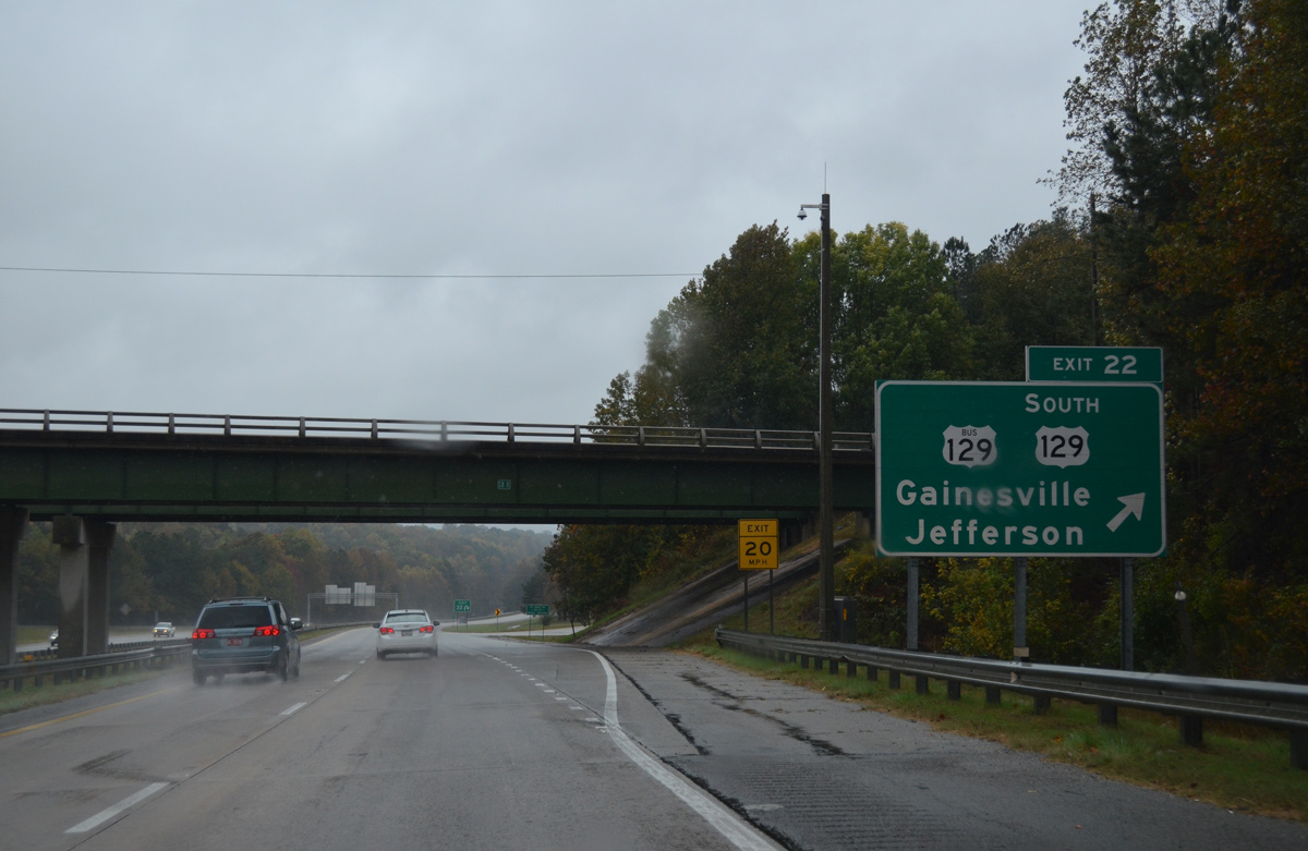
Entering the diamond interchange (Exit 22) with U.S. 129 Business north and Athens Highway south. U.S. 129 Business & SR 11 combine northwest to Jesse Jewell Parkway, where SR 11 Business, SR 60 and SR 369 tie in from western and northern reaches of Gainesville.
10/26/15
South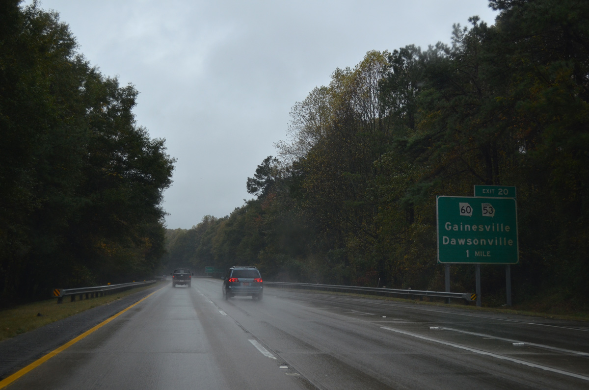
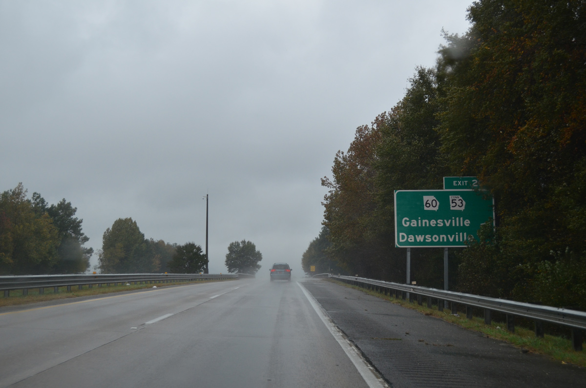
SR 60 turns south from SR 369 (Jesse Jewell Parkway) to overlap with SR 53 Connector (Queen City Parkway) to Exit 20 with I-985/U.S. 23.
10/26/15
A forest median separates traffic along I-985 south of Allen Creek. Forthcoming Exit 20 lies just south of Lee Gilmer Memorial Airport (GVL).
10/26/15

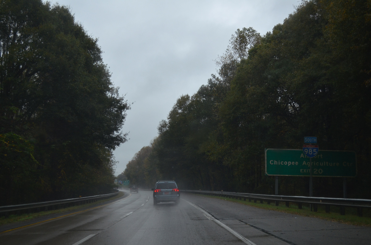
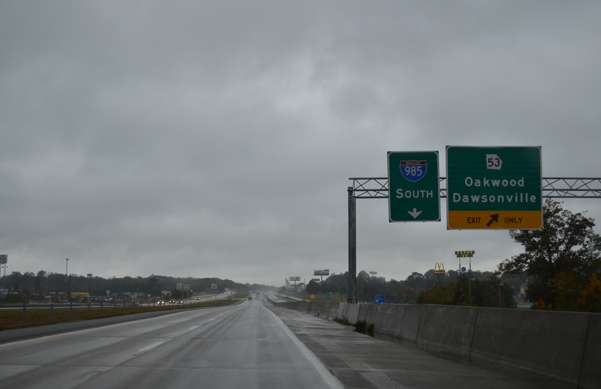
SR 53 Connector winds 3.7 miles northward from Exit 20 through the city of Gainesville to a commercialized intersection with SR 53 (McEvers Road). SR 53 overtakes Dawsonville Highway from the connector route there and continues 21 miles to the Dawson County seat.
10/26/15
Exit 20 loops away from I-985/U.S. 23 for SR 60 (Candler Road) south to Braselton.
10/26/15
A forested section of freeway ensues along Interstate 985 southbound from Exit 20. The highway passes by the Elachee Nature Science Center and Chicopee Woods Golf Course along this stretch.
10/26/15
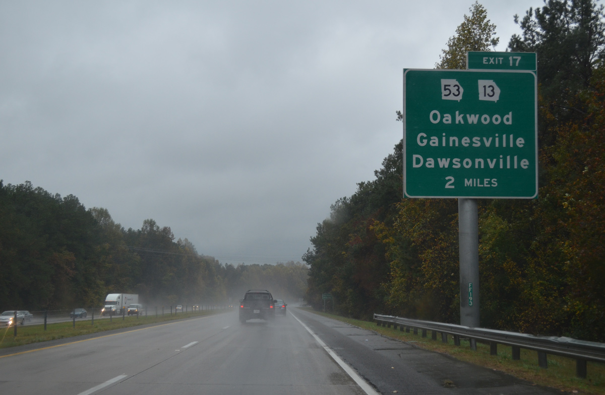
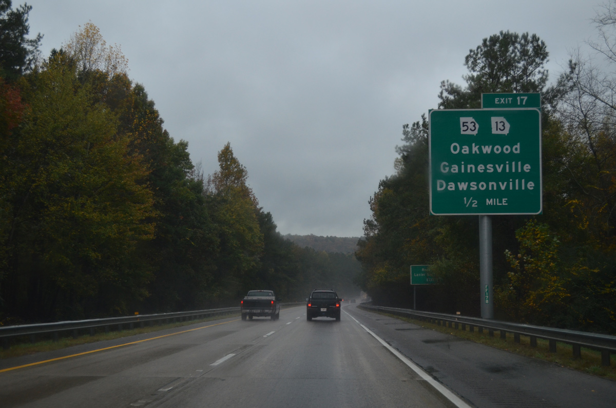
SR 13 branches southwest from SR 369 (Jesse Jewell Parkway) in Gainesville to meet Interstate 985 at Exit 17. The former alignment of U.S. 23 (Atlanta Highway) loops south from I-985 across southern reaches of Oakwood.
10/26/15
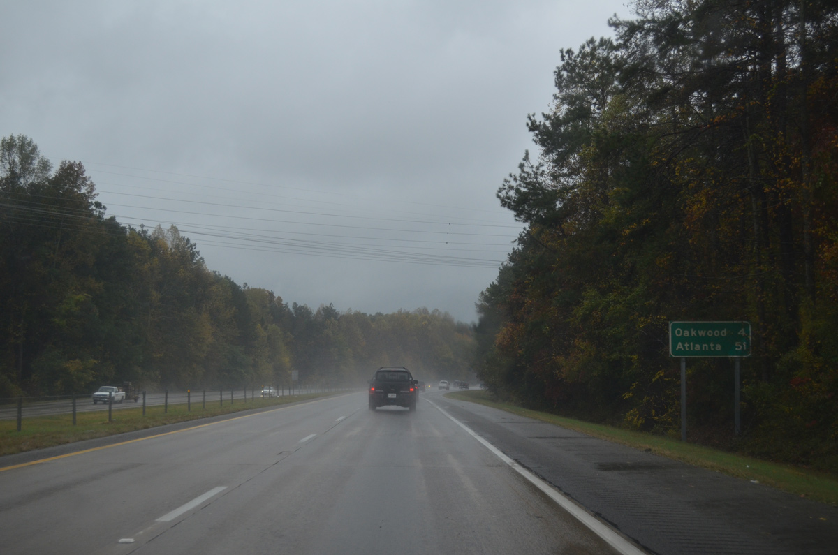
Thurmon Tanner Road stems west from the SR 13 off-ramp (Exit 17) to Oakwood Road, which leads to the Oakwood city center. Atlanta is 51 miles to the southwest.
10/26/15

SR 53 takes an arterial bypass around the west side of Gainesville along McEver Road to north Oakwood, and Mundy Mill Road southeast to a commercialized diamond interchange with Interstate 985.
10/26/15
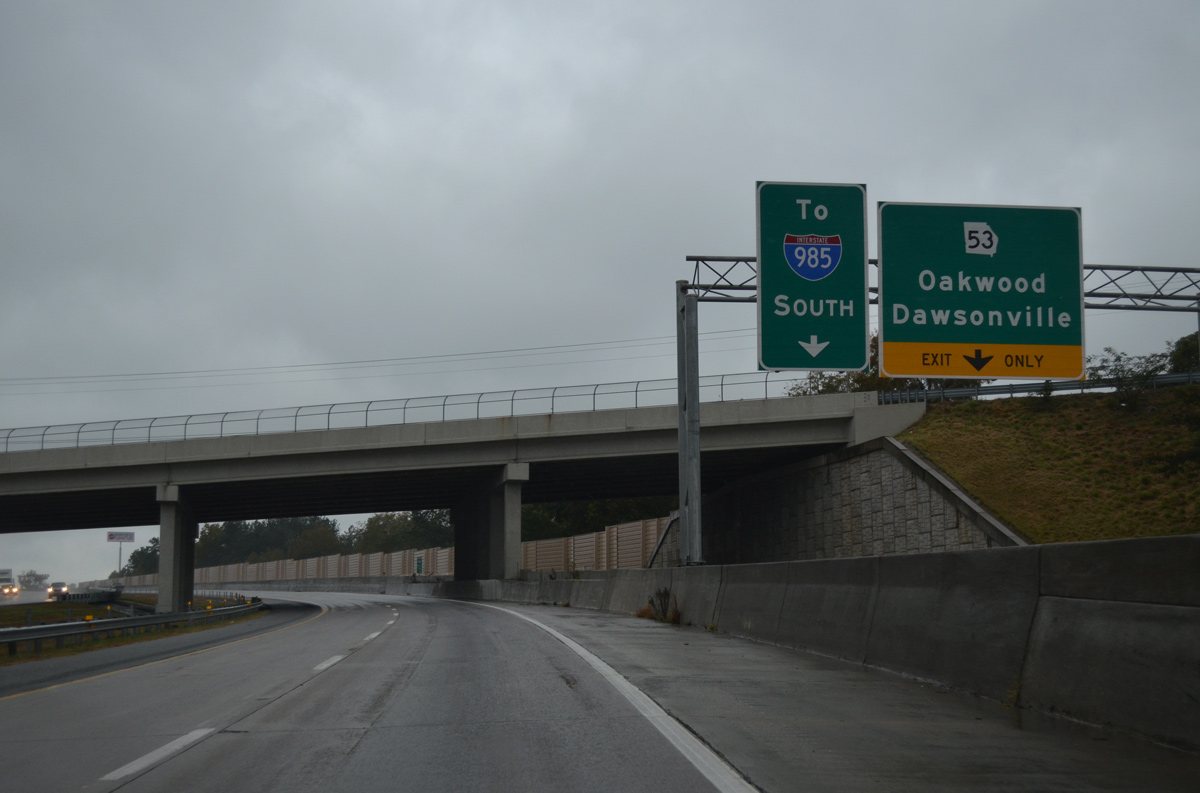
Leading south from I-985 and SR 13 (Atlanta Highway), SR 53 (Winder Highway) advances to Chestnut Mountain, Road Atlanta and Lanier National Speedway.
10/26/15
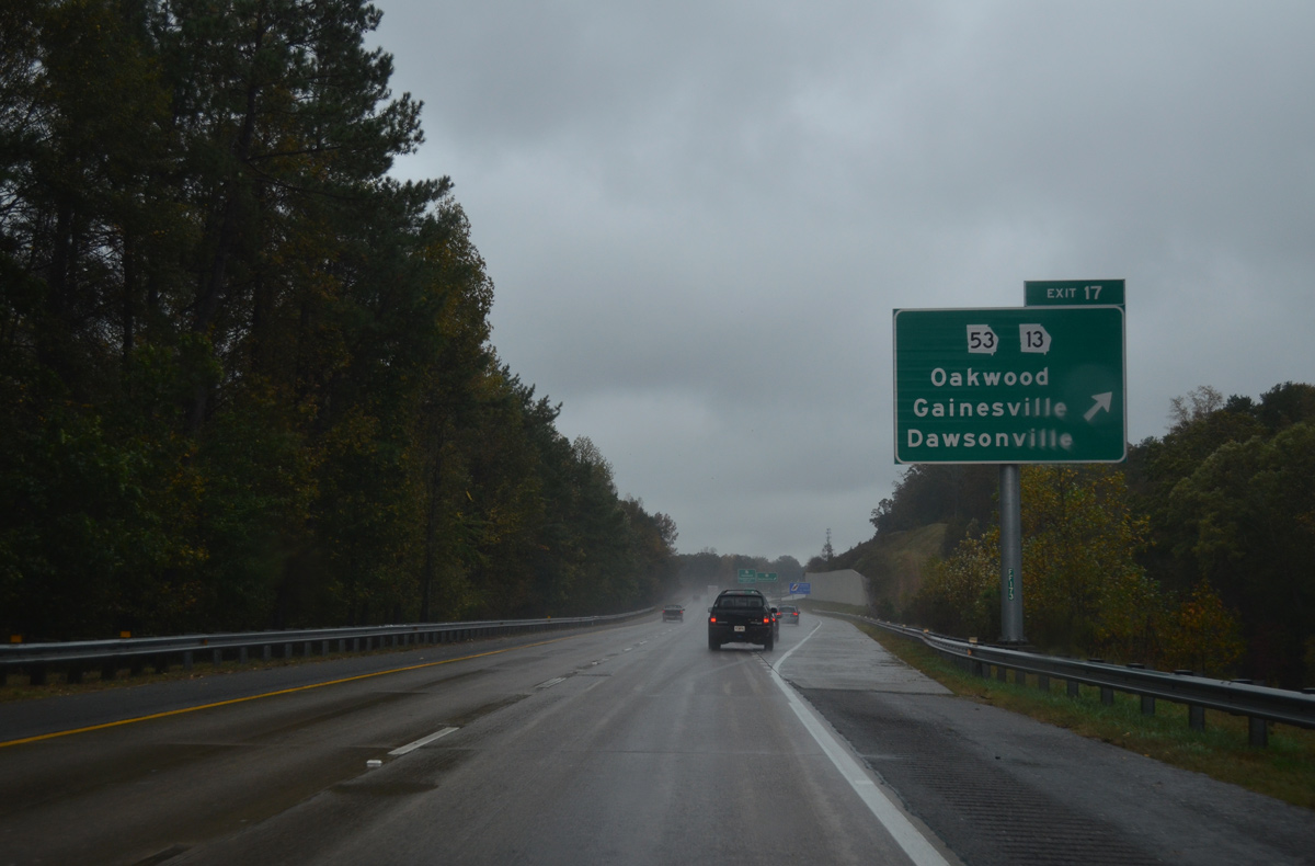
Road work from June 2006 to July 2009 added a new parclo interchange with SR 13 (Atlanta Highway). A collector distributor roadway links the southbound freeway with both Atlanta Highway and SR 53 (Mundy Mill Road).
10/26/15
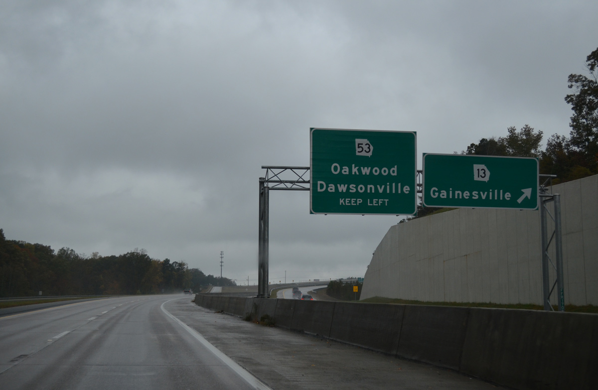
SR 13 heads 4.3 miles northeast from I-985/U.S. 23 to end in Gainesville. South of Sugar Hill, SR 13 is the companion route of U.S. 23 (Buford Highway).
10/26/15
The off-ramp for SR 53 north to the University of North Georgia - Gainesville Campus and south to Braselton departs from the Exit 17 c/d roadway next.
10/26/15
SR 53 totals 172 miles in an arc southeast from Oakwood to Winder and Watkinsville, and west from Gainesville to Dawsonville, Jasper, Rome and the Alabama state line west of Cave Spring.
10/26/15
Reassurance marker posted south of the Exit 17 c/d roadway. A set of abandoned rest areas are located beyond the upcoming Plainview overpass.
10/26/15
A diamond interchange will be built two miles north of Exit 12 with an extension of H.F. Reed Industrial Parkway south to SR 13 (Falcon Parkway). SR 13 curves west to cross Interstate 985 ahead of South Hall Business Park as the freeway continues into the city of Flowery Branch.
10/26/15
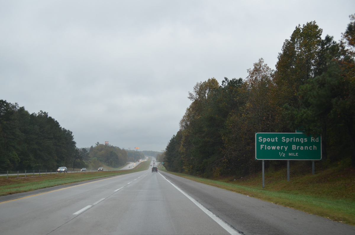
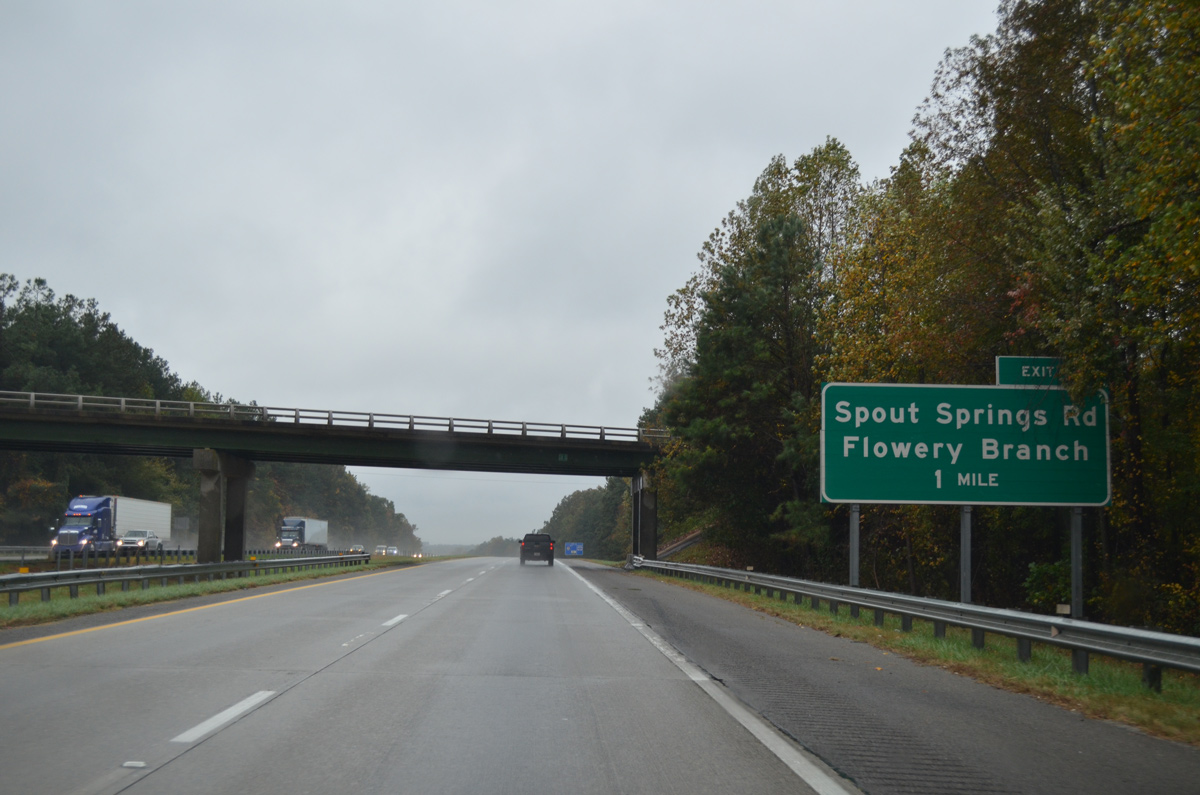
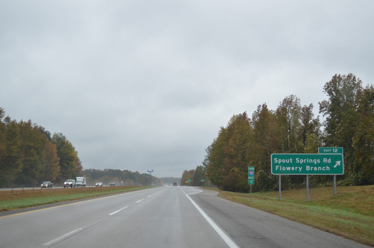
Spout Springs Road meanders north from the city of Braselton to become Phil Niekro Boulevard below Interstate 985 and U.S. 23 at Exit 12.
10/26/15
North from Exit 12, Phil Niekro Boulevard links I-985 with SR 13 (Atlanta Highway) by the Flowery Branch city center.
10/26/15
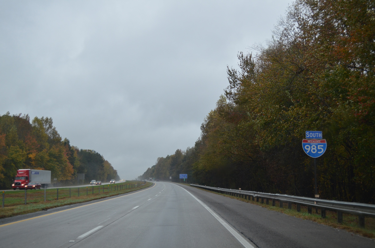
Continuing south, Interstate 985 leaves the city of Flowery Branch and approaches the city of Buford.
10/26/15
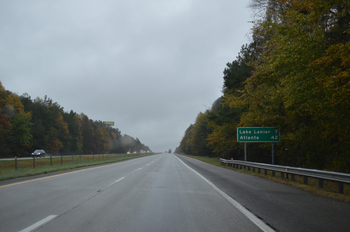
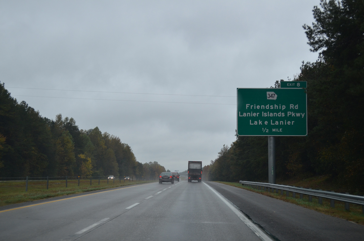
Forthcoming SR 347 leads motorists west from I-985 to Lake Lanier. Atlanta is now 42 miles to the southwest.
10/26/15
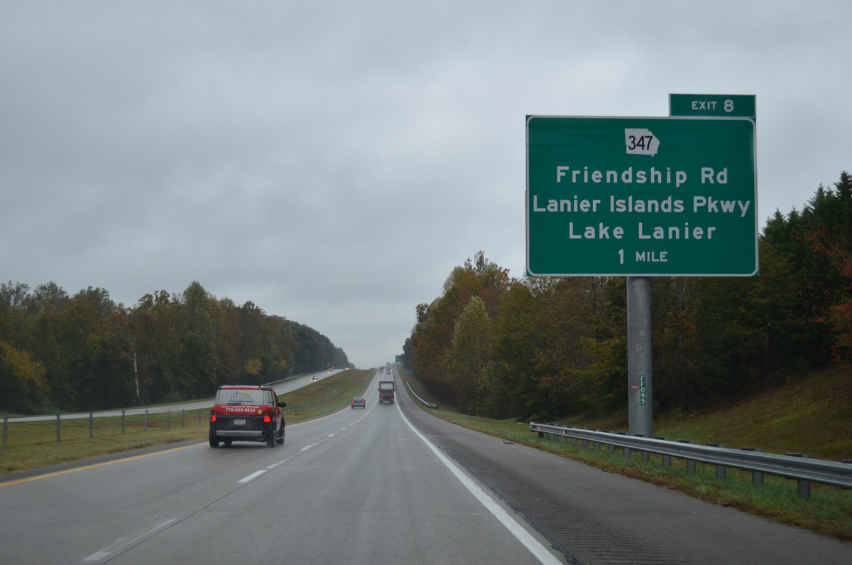
A diamond interchange (Exit 8) joins I-985 with SR 347 (Lanier Islands Parkway) west and SR 347 (Friendship Road) east in one mile.
10/26/15
SR 347 spurs four miles northwest from Exit 8 to Islands Parkway on the Lake Lanier Islands.
10/26/15
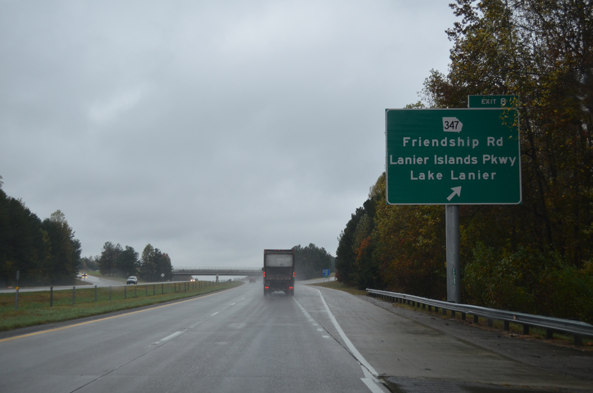
Exit 8 parts ways with I-985/U.S. 23 south for SR 347. Friendship Road comprises a four to six lane suburban arterial east to SR 211 and north Braselton.
10/26/15
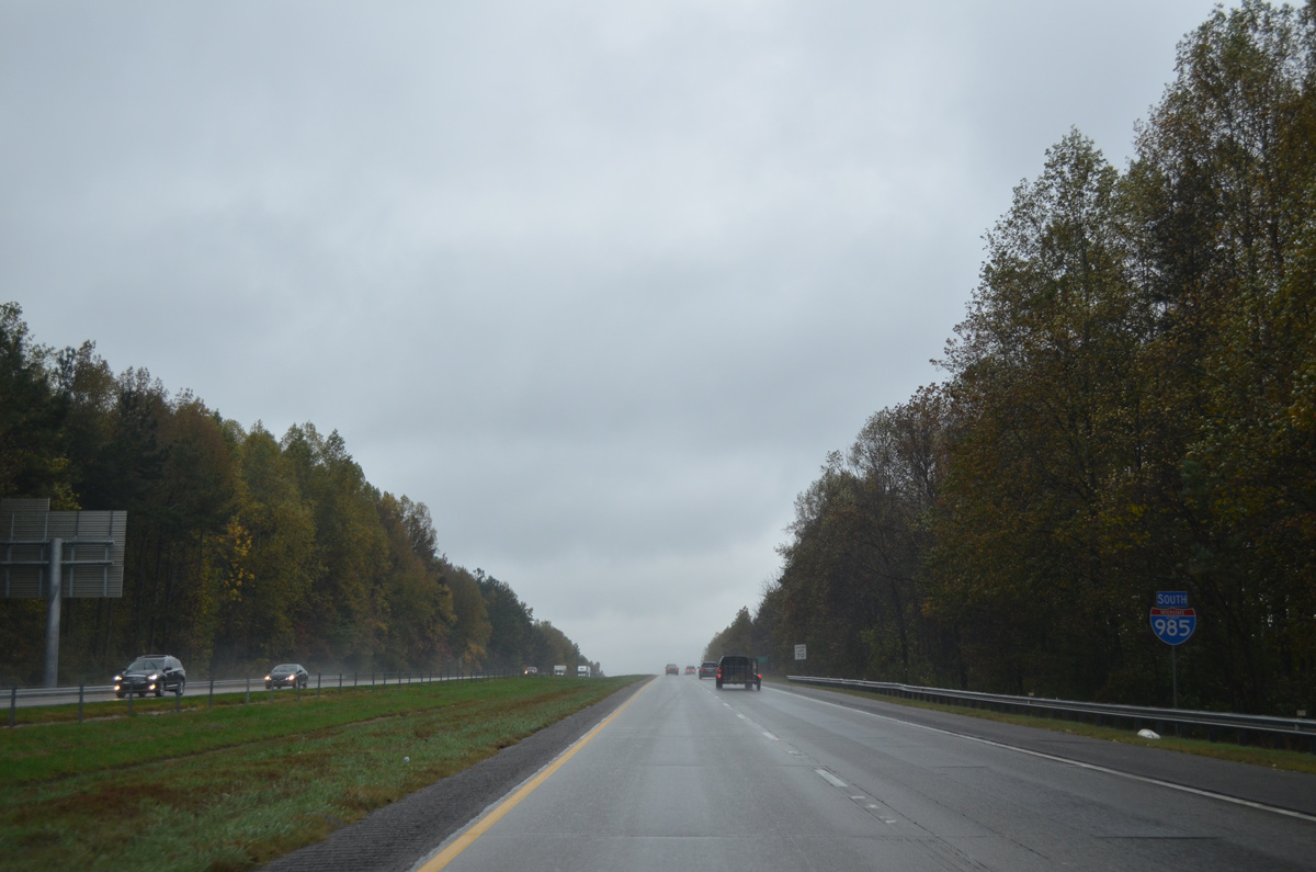
U.S. 23 is again ignored on confirming markers as Interstate 985 travels south through Buford.
10/26/15
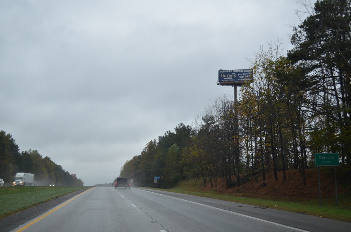
I-985/U.S. 23 cross into northern Gwinnett County to the south of the industrial town of Rest Haven.
10/26/15

Although already in Buford, the city center is still six miles away via SR 20 (Buford Drive) and South Lee Street. Atlanta is 39 miles to the southwest.
10/26/15
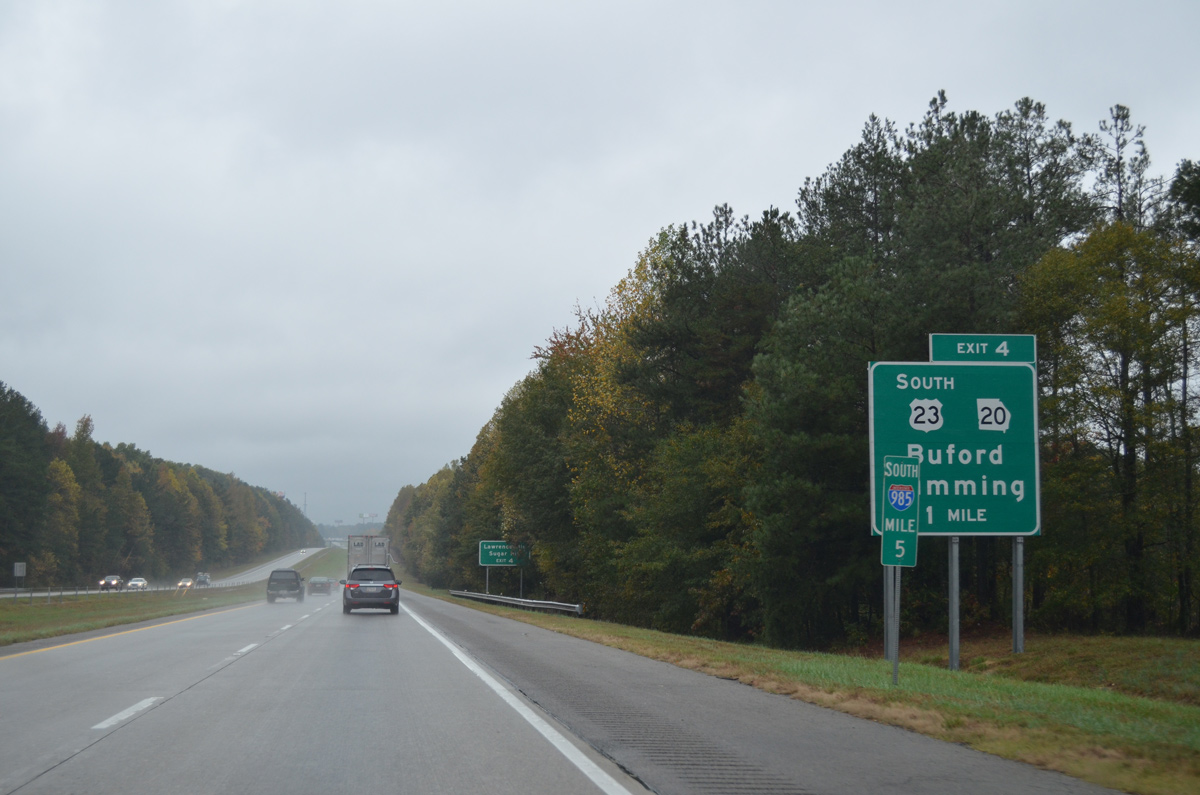
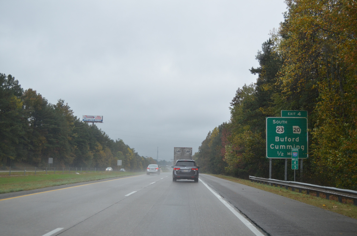
U.S. 23 separates with Interstate 985 to overlap with SR 20 (Buford Drive) northwest 1.3 miles to SR 13 (Buford Highway).
10/26/15
Buford Drive arcs south from Buford Highway (SR 13) as heavily developed commercial arterial to the Mall of Georgia and a cloverleaf interchange with Interstate 85.
10/26/15
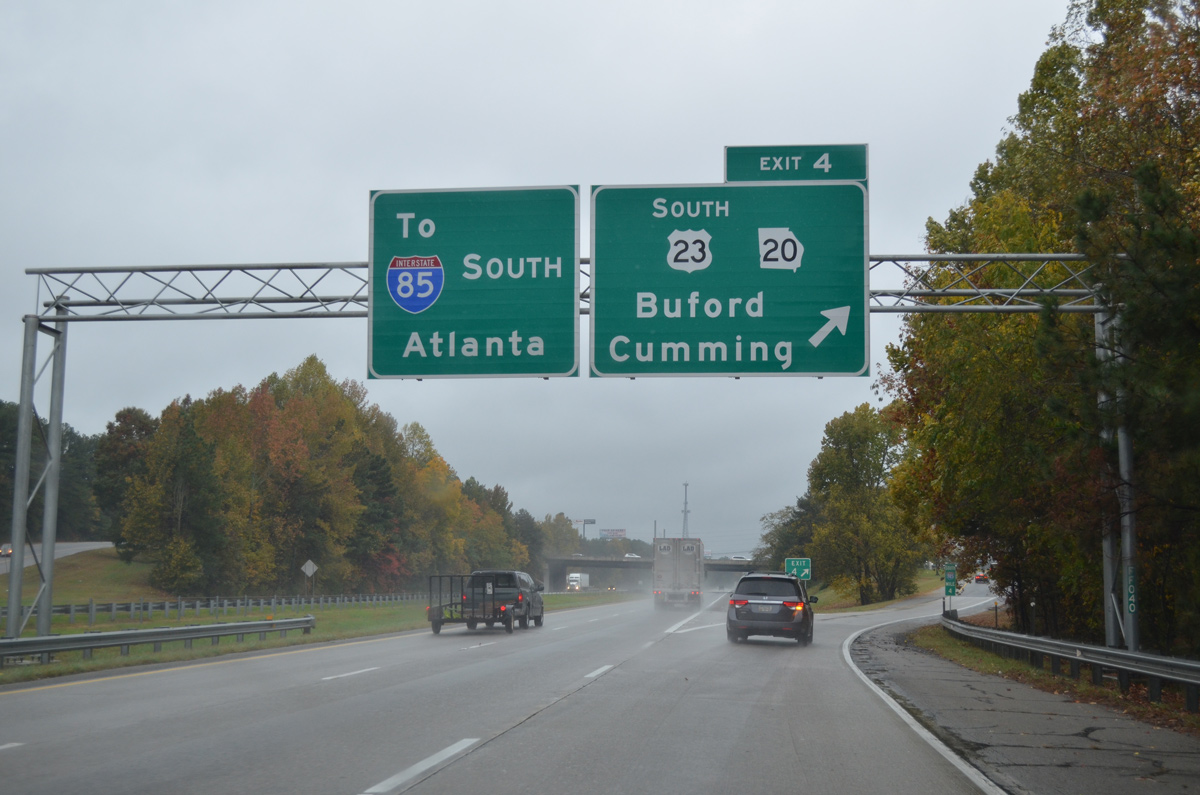
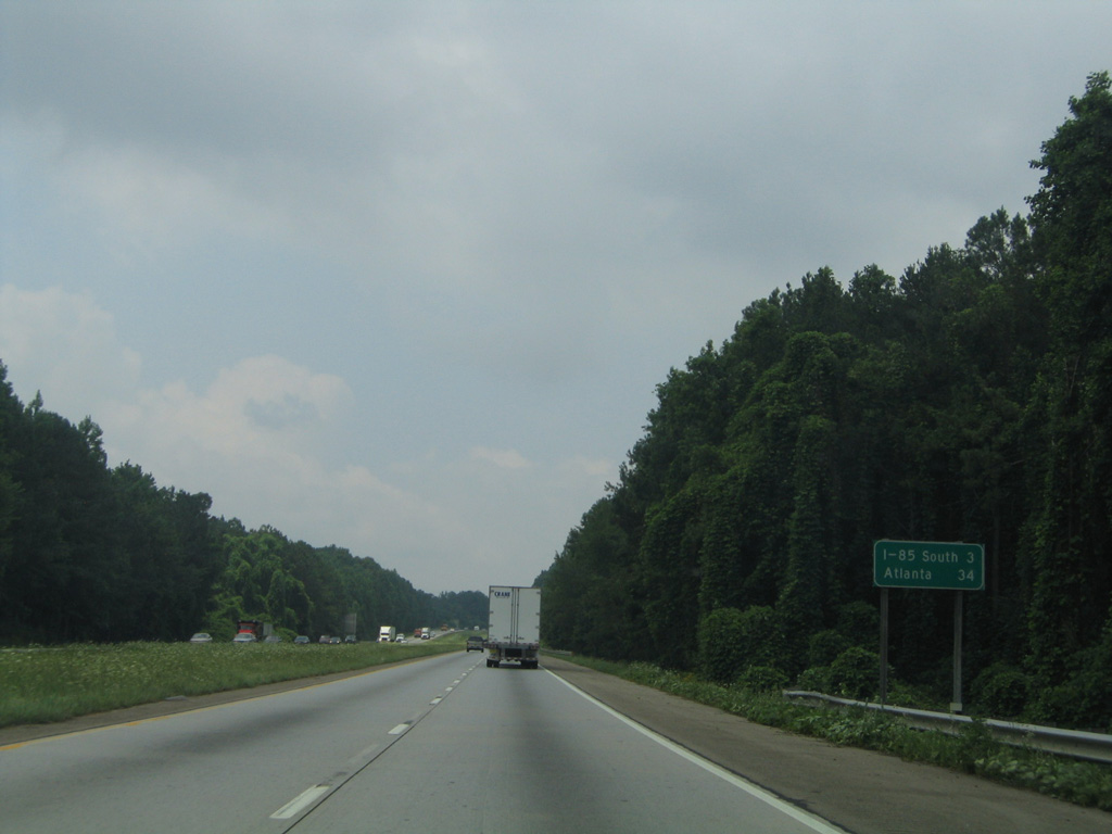
Beyond the split with U.S. 23 at Exit 4, I-985 defaults south onto Interstate 85 at Suwanee. U.S. 23 parallels the I-85 corridor southwest to Chamblee while SR 20 angles northwest to the Forsyth County seat of Cumming.
10/26/15
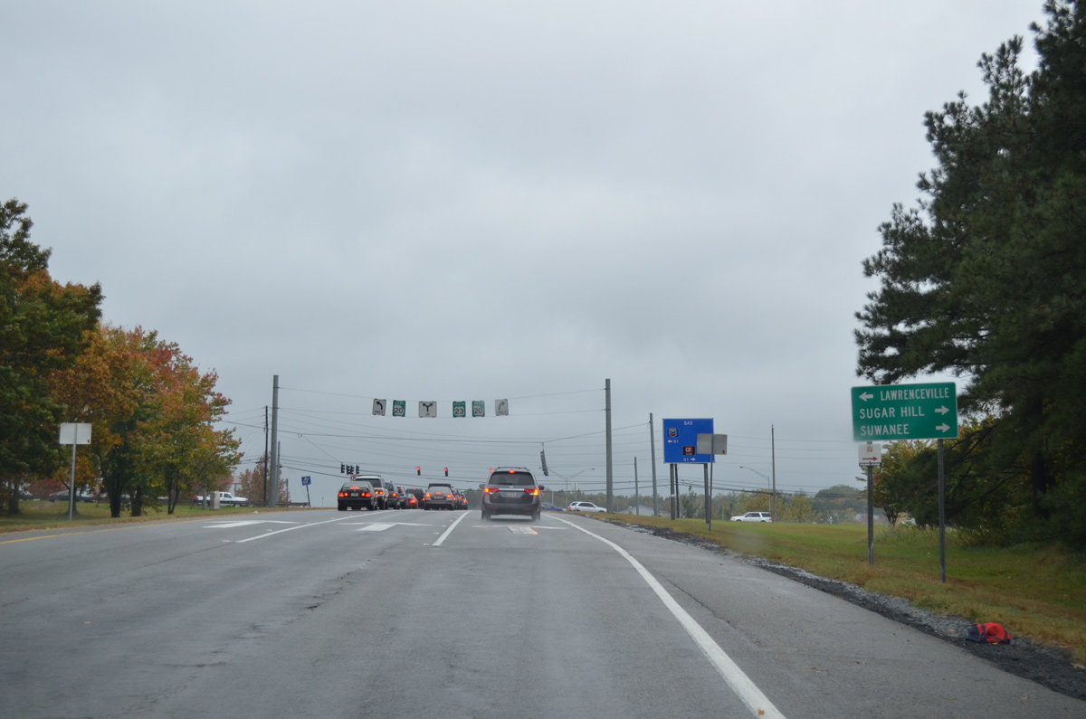
SR 20 heads south from Buford along a suburban route 9.6 miles to Lawrenceville. Sugar Hill lies just west of Buford along both SR 20 and Peachtree Industrial Boulevard.
10/26/15
A 165 mile route, SR 20 circles around the Atlanta metro area from Hampton to McDonough, Conyers, Loganville, Canton and Cartersville. The state route concludes west of Rome at Alabama 9.
10/26/15
South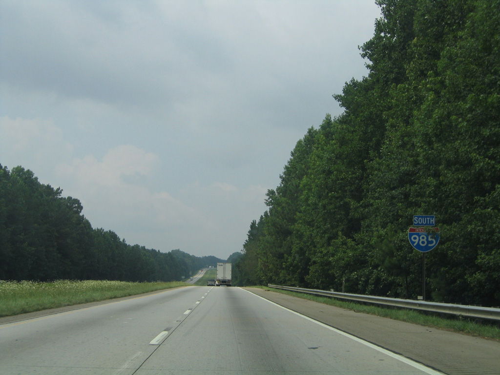
Interstate 985 progresses south through the Buford city limits to the Woodward Mill Road overpass. This scene looks at the final reassurance marker.
07/12/05
Interstate 985 ends at a wye interchange with I-85 in three miles.
07/12/05
Road work through summer 2018 extends the I-85 Express Lanes ten miles east from Exit 109 (Old Peachtree Road) to Exit 120 (Hamilton Mill Road). Work at the merge with I-985 expands the southbound overpass for I-85 to accommodate the new tolled lane.
07/12/05
Photo Credits:
- Alex Nitzman: 07/12/05, 10/26/15
Connect with:
Page Updated Thursday July 06, 2017.