
State Road 49

Indiana 49 is a 44 mile state highway in Northwest Indiana, entirely within Jasper and Porter Counties. The highway starts at Indiana 14 northeast of Rensselaer and heads north through northeastern Jasper County before going into Porter County. Indiana 49 is the primary north-south highway within Porter County, the fastest growing county in Northwest Indiana with a growing suburban population based out of Chicago. As of 2010, Porter County had 164,348 people, mainly along a strip from Chesterton down to Valparaiso and from Chesterton westward along Interstate 94/U.S. 6. From U.S. 30 northward toward the Indiana Toll Road and Interstate 94 the highway is a four-lane expressway that bypasses Valparaiso and Chesterton.
This stretch of highway forms an important part of the Northwestern Indiana highway network as it is a well-traveled commuter corridor to access the main freeways to Chicago. The highway is used often by those traveling on U.S. 30 across Northern Indiana to access either the Toll Road or Interstate 94 to avoid the congestion along U.S. 30 west of Valparaiso. North of Interstate 94 the highway heads into the Indiana Dunes where it ends at the gate into Dunes State Park. Because of this, the stretch of Indiana 49 from Interstate 94 northward is part of the main gateway into the Indiana Dunes region.
Guide by Thomas Decker.
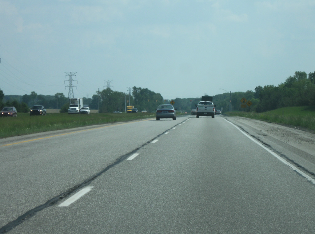
We begin just south of the interchange between SR 49 and U.S. 12, known locally as the Dunes Highway. U.S. 12 spends just over 45 miles within the Hoosier State starting out at the far northwest tip in Hammond and flowing along the lake shore (mostly) toward the south end of the lake in Gary before riding up the Indiana Dunes shoreline through Portage, Porter, and finally Michigan City. The highway provides access to multiple locations within the Indiana Dunes National Lakeshore. North of this interchange, SR 49 leads up to the entrance gate for Dunes State Park (an Indiana DNR property.) Finally the Northern Indiana Commuter Transportation District (NICTD) South Shore Line, which provides a commuter rail link from South Bend to the Chicago Loop, has their Dune Park Station located east of this interchange. Up ahead is the interchange with U.S. 20, a cloverleaf interchange of sorts that provides a link with the 155 mile highway that stretches from Hammond to Angola via Gary, Michigan City, South Bend, and Elkhart.
05/23/10
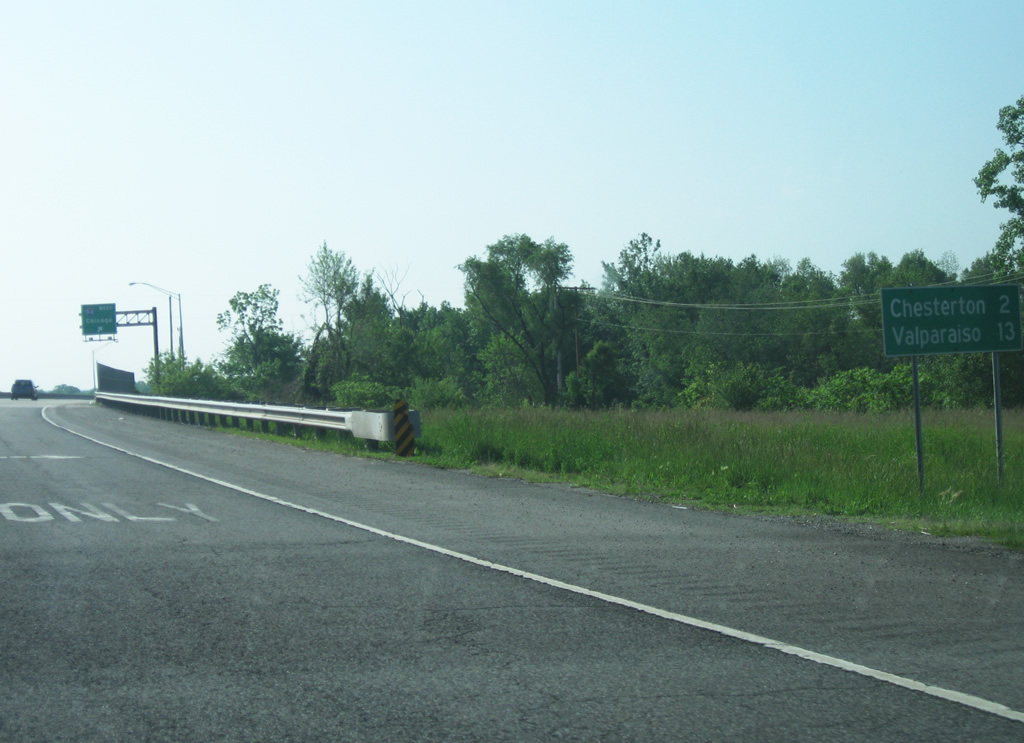
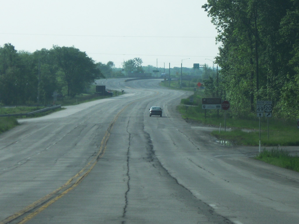
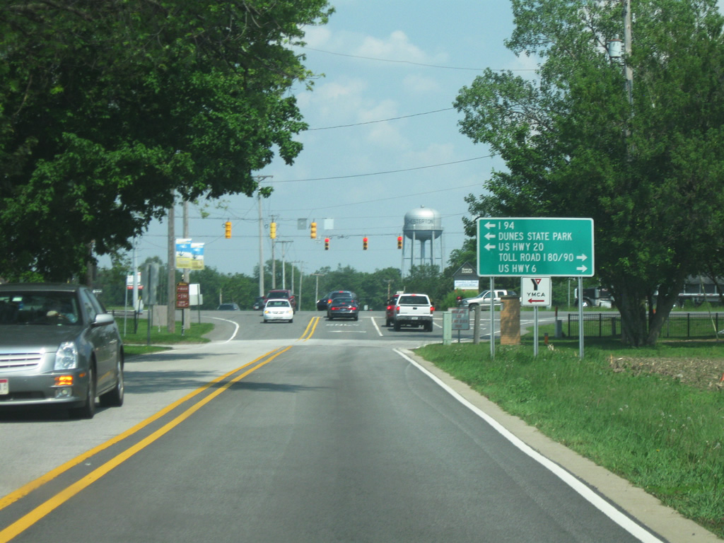
South of the interchange with U.S. 20, a distance sign announces the distances to Chesterton (2 miles) and Valparaiso (13 miles). At this point, the highway is within the town of Porter (population 4,972), a community noted for its access to several major railroads and the Indiana Dunes area. SR 49 through this stretch is four lanes and has three interchanges within a mile from U.S. 12 to Interstate 94. The SR 49 corridor from Interstate 94 northward is slated for improvements to make it a more dramatic entryway into the Dunes area which also includes providing walking paths to the park. The Indiana Dunes Visitor Center is located to the southeast of the SR 49/U.S. 20 interchange.
05/23/10
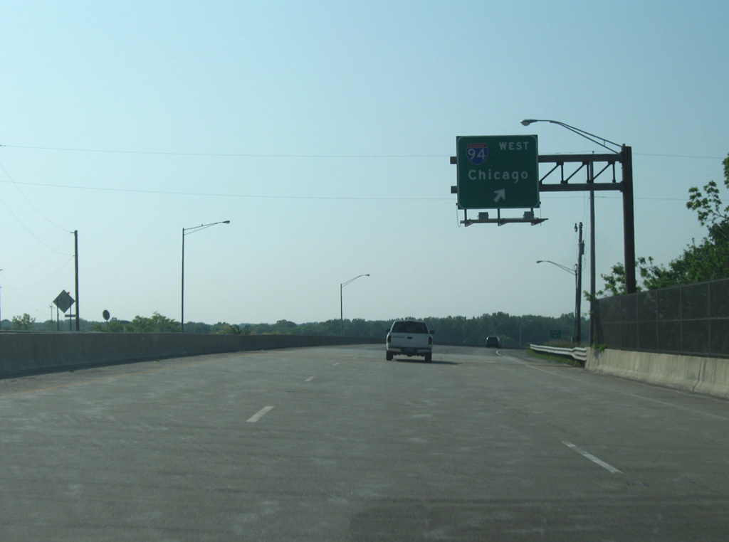
Now past Oak Hill Road, SR 49 reaches the cloverleaf interchange with Interstate 94, a busy six lane highway that crosses Indiana along the Lake Michigan shoreline from Hammond to beyond Michigan City. The highway combines with Interstate 80 to form the Borman Expressway, the busiest highway in Northwest Indiana. Because of its free status as a highway, it carries a larger share of freight traffic through. At this point, the interstate is 50 miles away from Downtown Chicago.
05/23/10
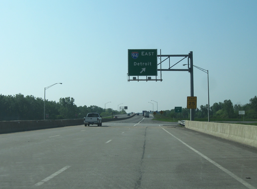
Crossing over the freeway, the loop ramp for Interstate 94 eastbound appears. To the east of Chesterton are Michigan City, Benton Harbor, Kalamazoo, Jackson, Ann Arbor and Detroit. The highway finally ends at Port Huron, Michigan as it enters Canada. Detroit is about 248 miles from this interchange.
Interstate 94 as a whole is 1,580 miles long from its western end in Billings, Montana to Port Huron. On a different note, this is an interchange between two highways with reversible route numbers.
05/23/10
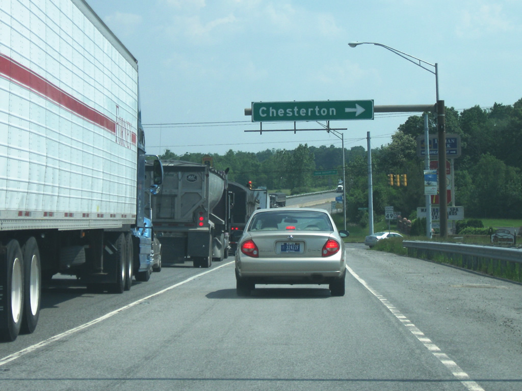
South of the Interstate 94 interchange, SR 49 approaches the Indian Boundary Road intersection. This intersection was reconstructed because of the heavy amount of traffic that flows through here with the road providing the most direct access to the core of Chesterton. Regardless, traffic here can still be heavy at peak hours. Numerous shops, restaurants, and other services have gravitated toward this intersection due to its close access to Interstate 94.
05/23/10
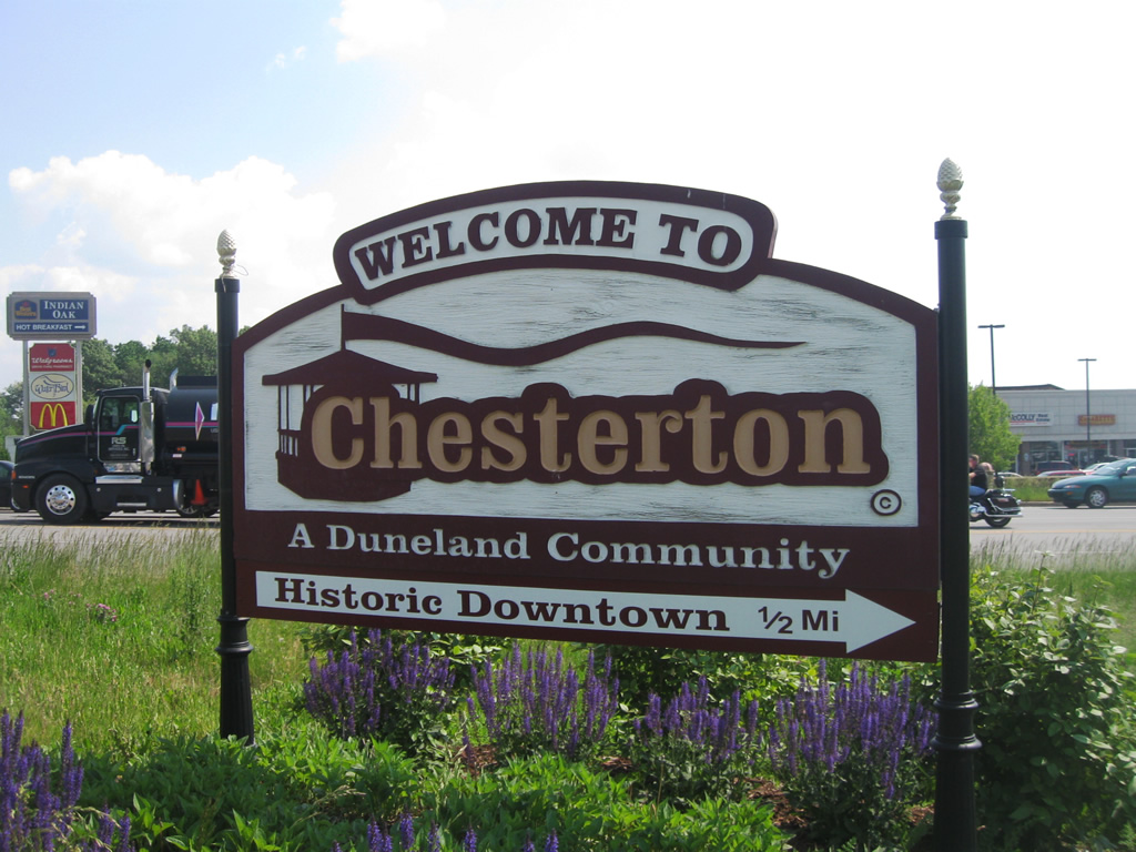
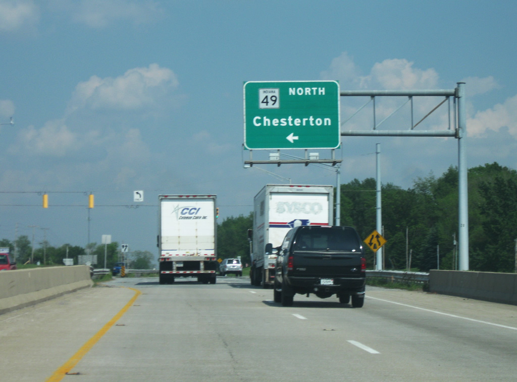
SR 49 enters the community of Chesterton, with a population of 13,068. This community is among the fastest growing in the state and is best known for both its nearby access to the Indiana Dunes area and its Wizard of Oz Festival, considered the largest of its kind. The region of northern Porter County is known locally as the Duneland Area, which includes Chesterton, Porter, and Burns Harbor.
05/23/10
SR 49 south of the Indian Boundary Road intersection with an Indiana Toll Road highway shield in the distance. The Indiana Toll Road is the only highway in Indiana (other than Historical Roads) that has its own shield.
05/23/10
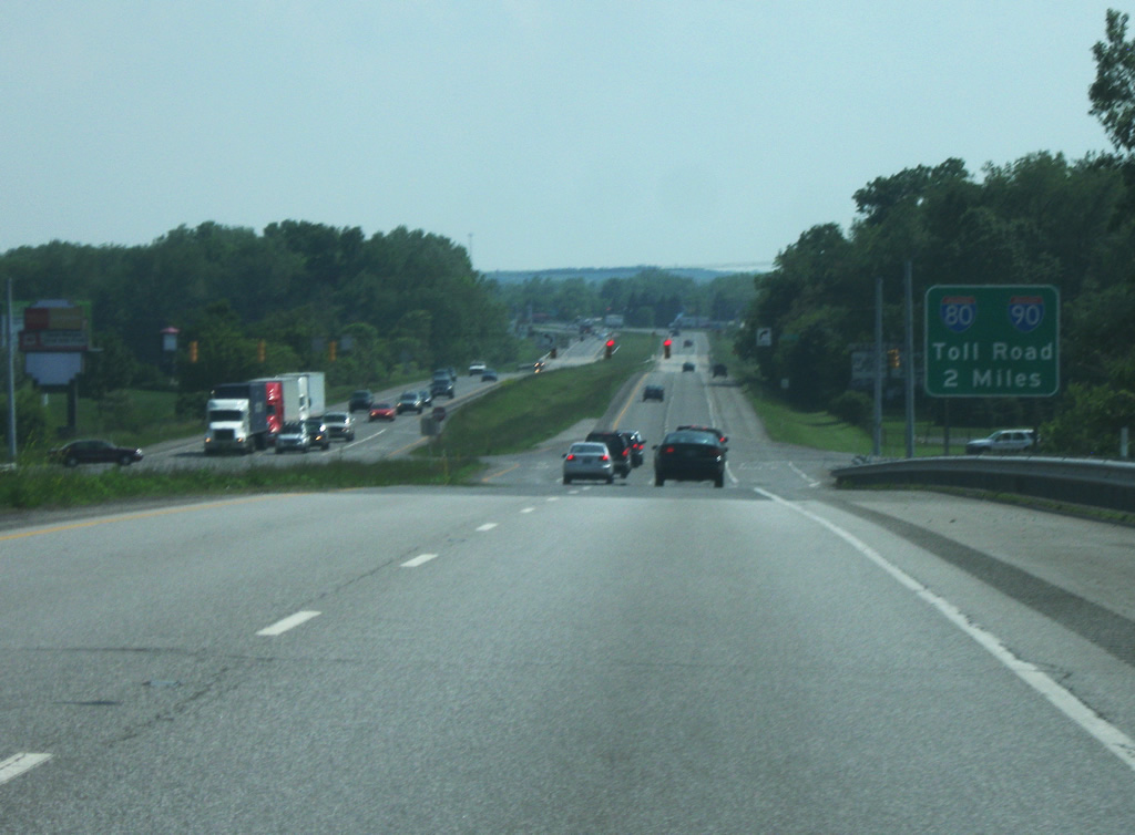
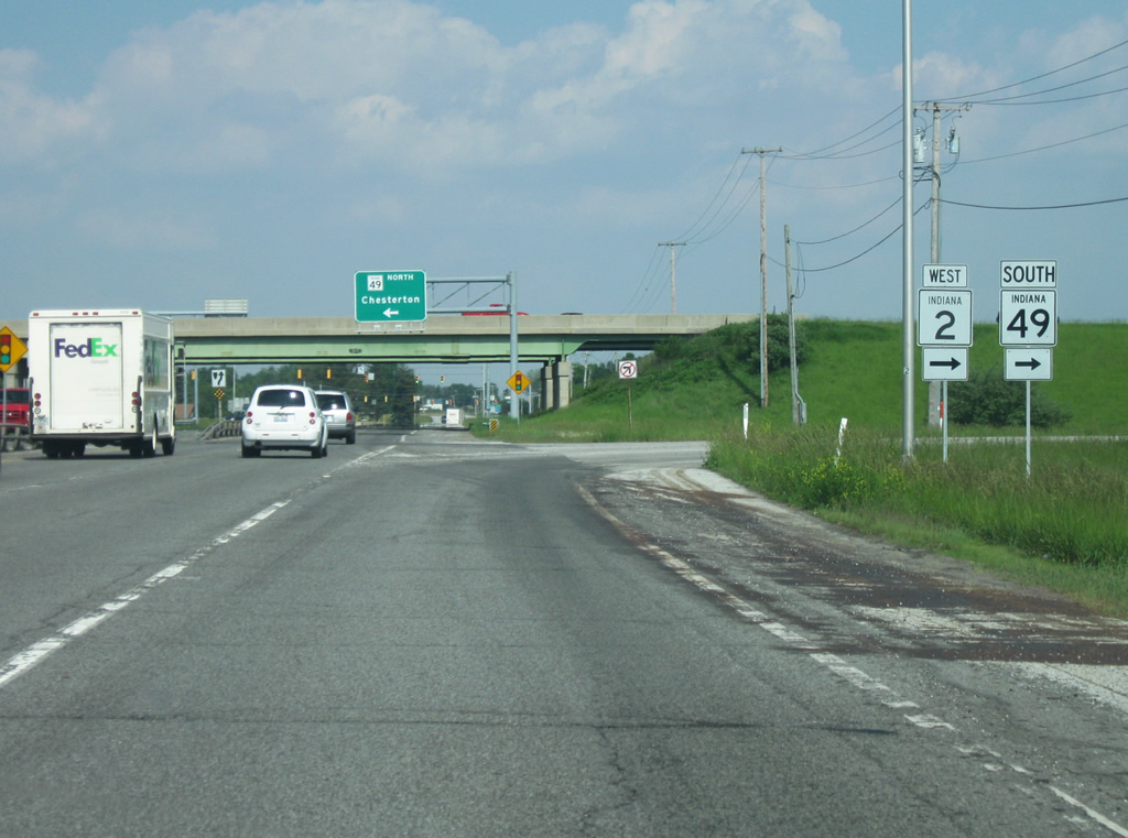
Coming up to the SR 49 intersection with Porter Avenue/County Road 1200 North, a guide sign announces that the Indiana Toll Road is now two miles ahead. The Indiana Toll Road is the only toll highway in the state and carries Interstate 90 and Interstate 80 (mostly) across Northern Indiana connecting the Northwest Indiana to South Bend, Elkhart, and the Ohio border.
05/23/10
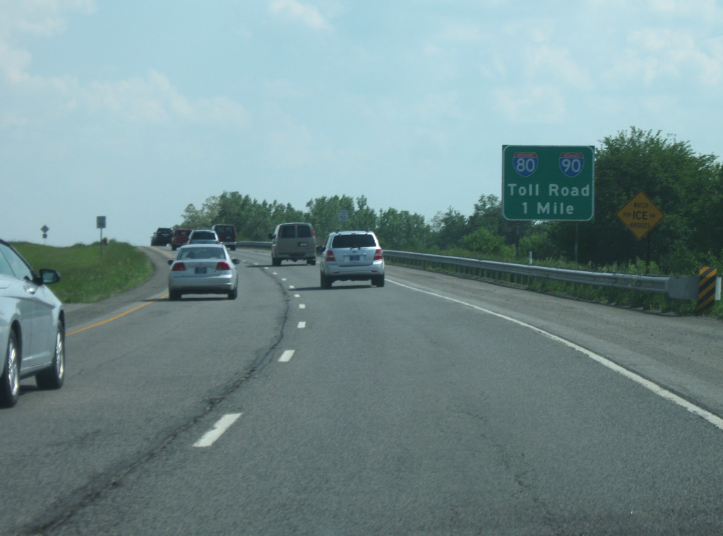
The Indiana Toll Road is now one mile away as SR 49 passes the County Road 1100 North intersection. The Indiana Toll Road was sold to a joint Spanish and Australian consortium in 2006 for $3.8 billion that was used for various Indiana construction projects under the Major Moves program. This deal has been praised for the added revenue for various highway projects across the state, but has also been criticized by those living in Northern Indiana who will have to endure higher rates along the highway.
05/23/10
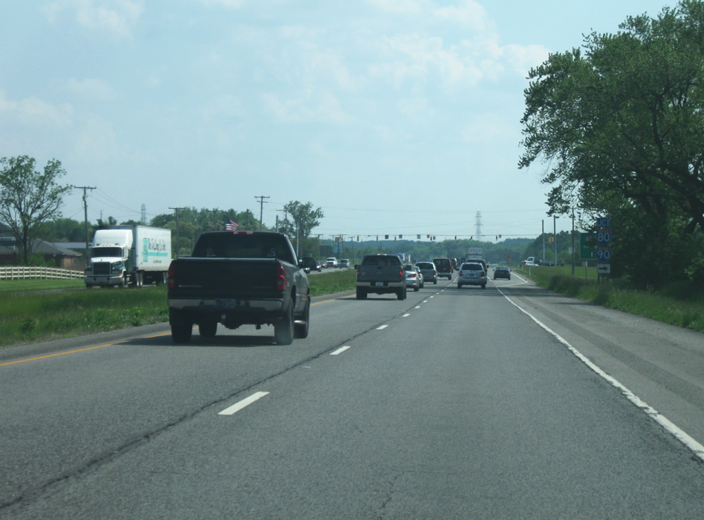
SR 49 now comes up to the signalized interchange that leads to the trumpet interchange with the Indiana Toll Road. Here, SR 49 connects to the two longest interstate highways in the country. Interstate 80 travels from San Francisco to outside New York City on its 2,890 miles trek while Interstate 90 travels from Seattle to Boston on its 3,100 miles.
05/23/10
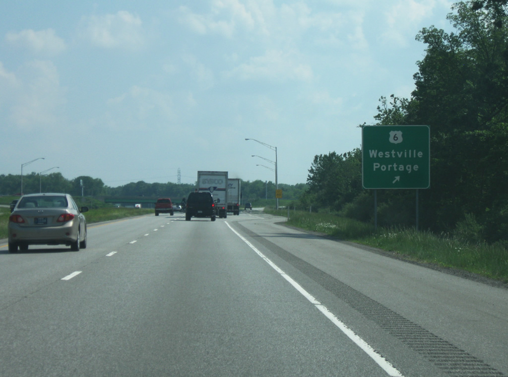
About a mile south of the Indiana Toll Road interchange, SR 49 has a diamond interchange with U.S. 6 in what is currently a rural area in between the Toll Road and Valparaiso, but is slowly becoming suburbanized. The new Porter Hospital at the northwest corner of this interchange will serve both Valparaiso and Chesterton from a centralized location. U.S. 6 travels for 149 miles from Hammond along the Borman Expressway to Portage, Westville, Nappanee, Kendallville, and Waterloo before crossing the Ohio border.
05/23/10
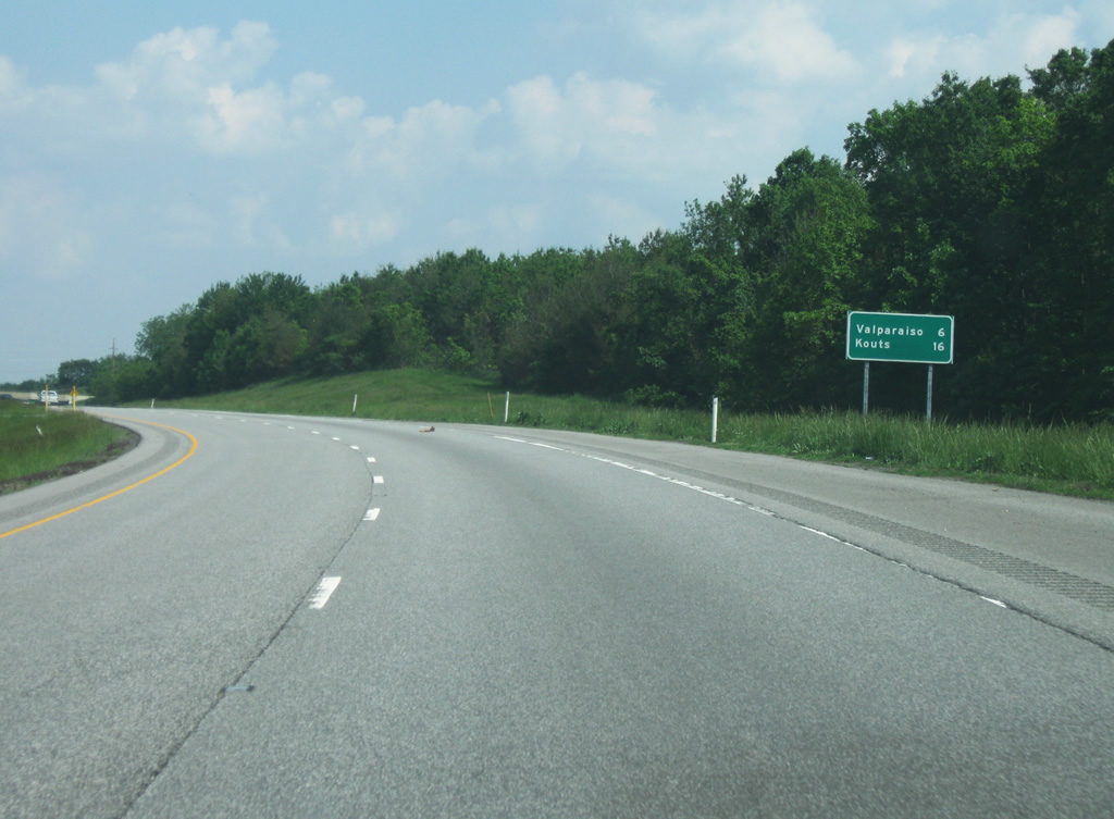
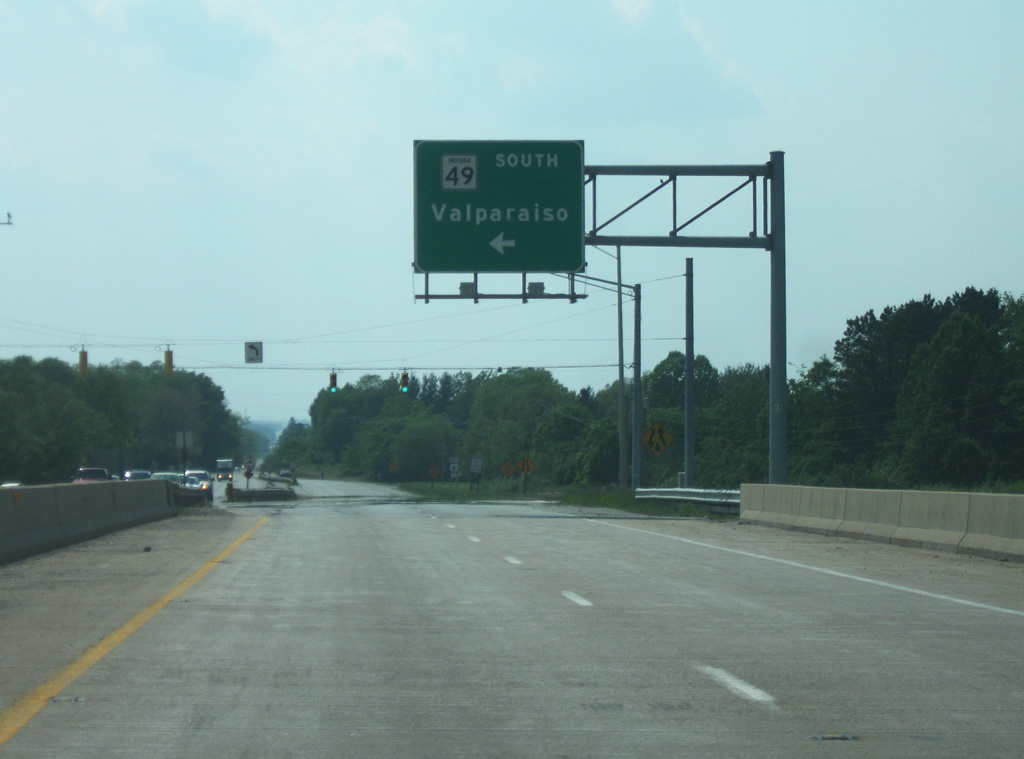
South of the U.S. 6 interchange, SR 49 turns toward the southeast as it prepares for its bypass around the east side of Valparaiso. The old SR 49 crosses over the highway in this area and takes the name of Calumet Avenue through the heart of Valparaiso. From this spot, the downtown of Valparaiso is 6 miles to the south with Knots, located in southern Porter County, 16 miles away.
05/23/10
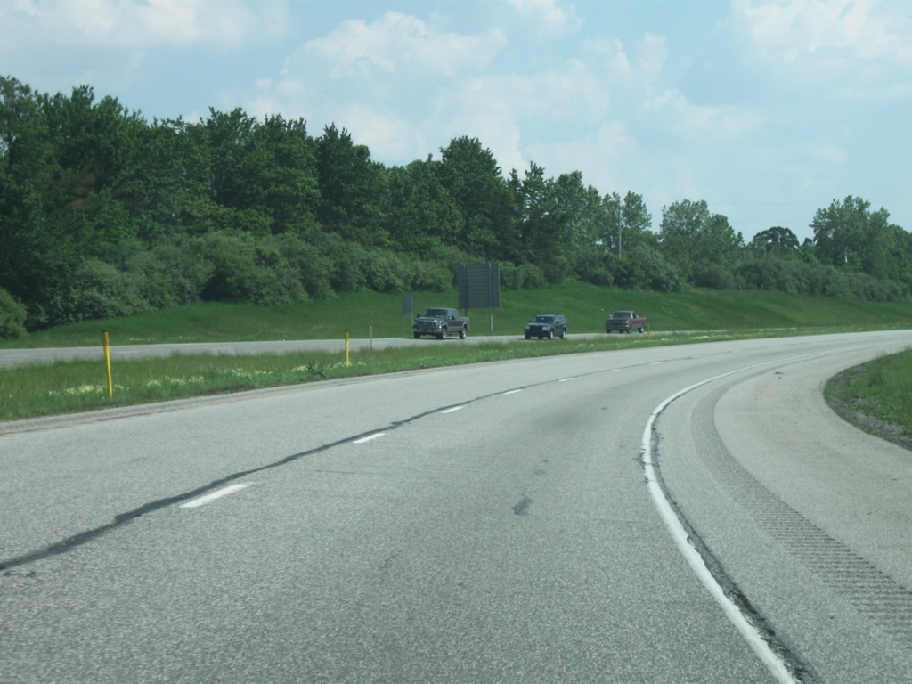
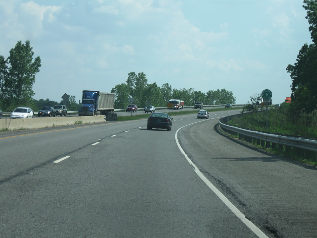
The SR 49 bypass of Valparaiso is an important link for those in central Porter County to take to the Indiana Toll Road and Interstate 94, but the highway isn't as congested as the stretch through Chesterton. The stretch of SR 49 around the northeastern side of Valparaiso is a four lane expressway with at-grade intersections with County Road 600 North, Burlington Beach Road/County Rod 500 North, and Vale Park Road/County Road 400 North. The latter two of those intersections are signalized, the only stoplights from between the Toll Road and Division Road (south of U.S. 30). The Vale Park Road intersection is planned for upgrade into a diamond interchange with SR 49 with construction starting in 2012.
05/23/10
Approaching the Vale Road/County Road 400 North intersection, a sign announces the upcoming two interchanges serving Valparaiso at SR 2 and U.S. 30. Of course, in the future this will be changed to read three new interchanges with the planned Vale Road Park interchange. Eventually, SR 49 will likely be a freeway-like road from U.S. 30 to the Indiana Toll Road. Valparaiso, the county seat of Porter County (population 31,730) is the second largest community in the county after Portage. The growing city is home to Valparaiso University (known locally as Valpo), the largest independent Lutheran university in the country and that is best known for its landmark chapel, the Chapel of the Resurrection (the second largest collegiate chapel in the world). Their athletic teams are called the Crusaders.
05/23/10
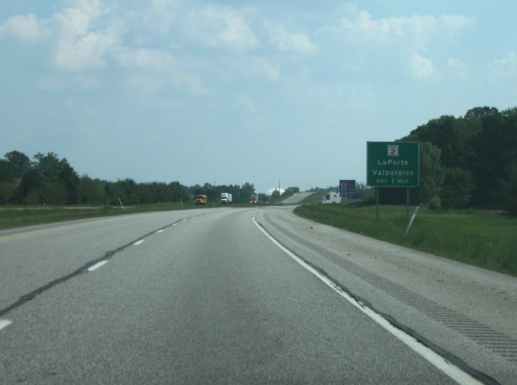
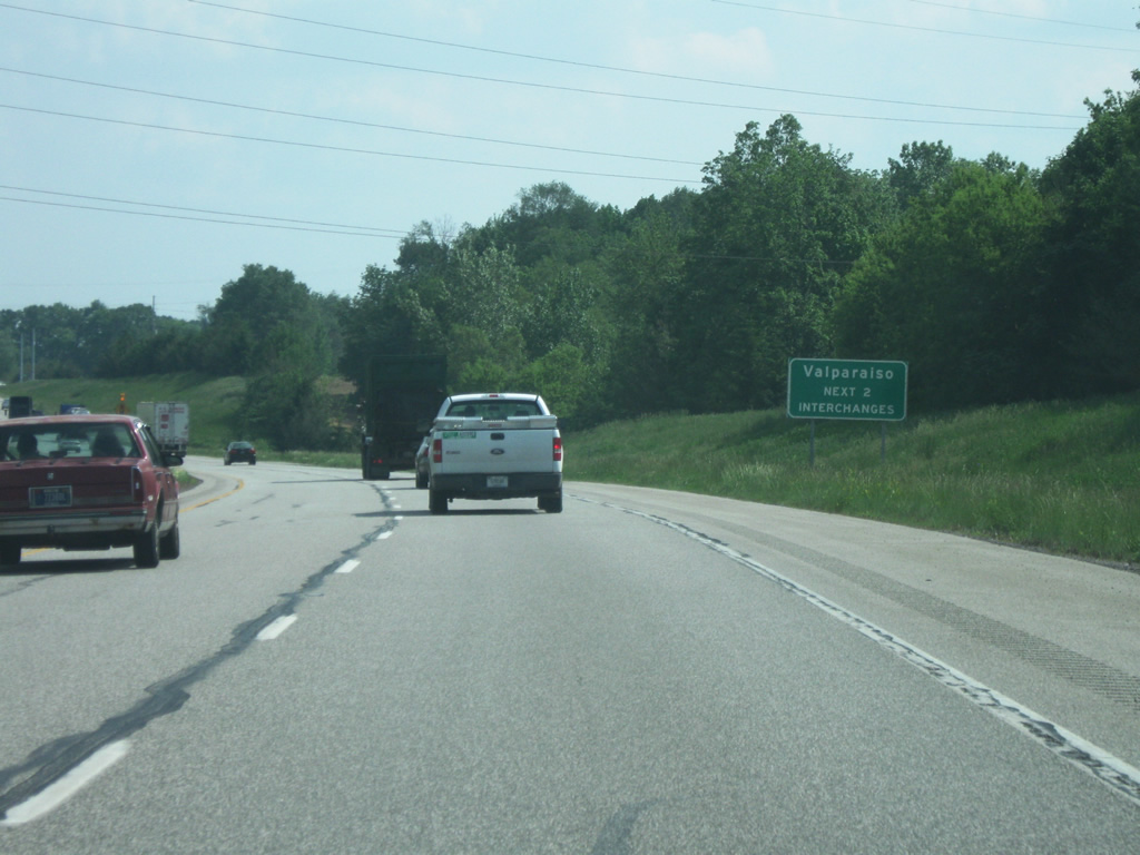
A guide sign for the upcoming diamond interchange with SR 2 East, connecting Valparaiso with the LaPorte County seat of LaPorte. SR 2 is an 81 mile highway that begins at the Illinois state line west of Lowell in Lake County and follows a diagonal path northeast to Hebron, Valparaiso, Westville, LaPorte and finally South Bend, where it ends at the U.S. 20/U.S. 31 Bypass.
05/23/10
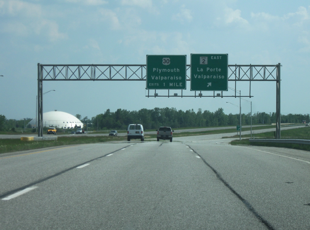
SR 49 at the interchange with SR 2 East. SR 2 used to be routed town where it left on the southwest side by its current alignment south of U.S. 30. Now the highway is routed along SR 49 south to U.S. 30 and then west on U.S. 30 to the original SR 2 where the highway then resumes its route. To the west of the interchange, the road is known as LaPorte Avenue, which meets up at a roundabout interchange with SR 130, part of the original Lincoln Highway. The interchange with SR 49 and SR 2 is home to several shopping centers and restaurants. The U.S. 30 interchange is one mile south from here. The U.S. 30 interchange is a three-quarter cloverleaf with loops in all but the southeast quadrants.
05/23/10
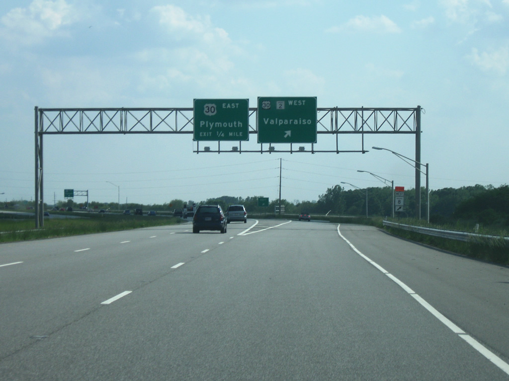
SR 2/49 enter the interchange with U.S. 30, a major four lane highway across Northern Indiana. The highway spends 152 miles in Indiana from Dyer, along the Illinois border to Schererville, Merrillville, Valparaiso, Plymouth, Warsaw, Columbia City, and Fort Wayne before exiting into Ohio. Overall, U.S. 30 stretches from Astoria, Oregon to Atlantic City, New Jersey for 3,073 miles. SR 2 exits off to westbound U.S. 30 which is given the control city of Valparaiso while U.S. 30 heads east for Plymouth. South of this interchange, SR 49 becomes a two lane rural highway that goes through Knots before entering Jasper County where it goes through Wheatfield before finally ending at SR 14.
05/23/10
SR 2 and SR 49 shields going east on LaPorte Avenue at the interchange with SR 49 in Valparaiso.
05/23/10
At the U.S. 6 interchange with SR 49, going eastbound on U.S. 6, the northbound control city is Chesterton.
05/23/10
At the U.S. 6 interchange with SR 49, going westbound on U.S. 6, the southbound control city for SR 49 is Valparaiso.
05/23/10
Going east on Porter Avenue approaching the SR 49 intersection in Chesterton, a guide sign directs traffic to the various west-east highways that connect with SR 49.
05/23/10
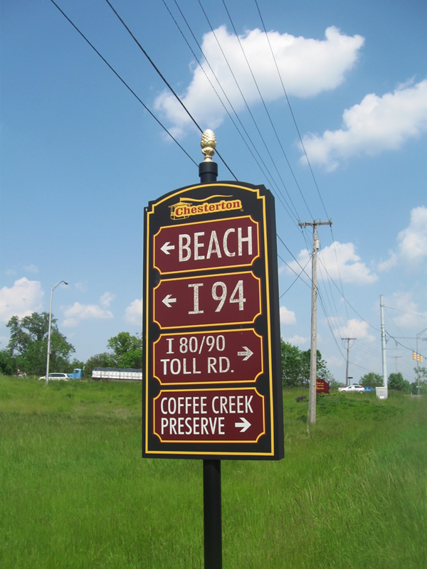
A Chesterton wayfinding sign directs traffic to either Interstate 94 or the Indiana Toll Road at the Indian Boundary Road intersection with SR 49.
05/23/10
Photo Credits:
- Thomas Decker: 05/23/10
Connect with:


Page Updated Thursday December 08, 2011.