
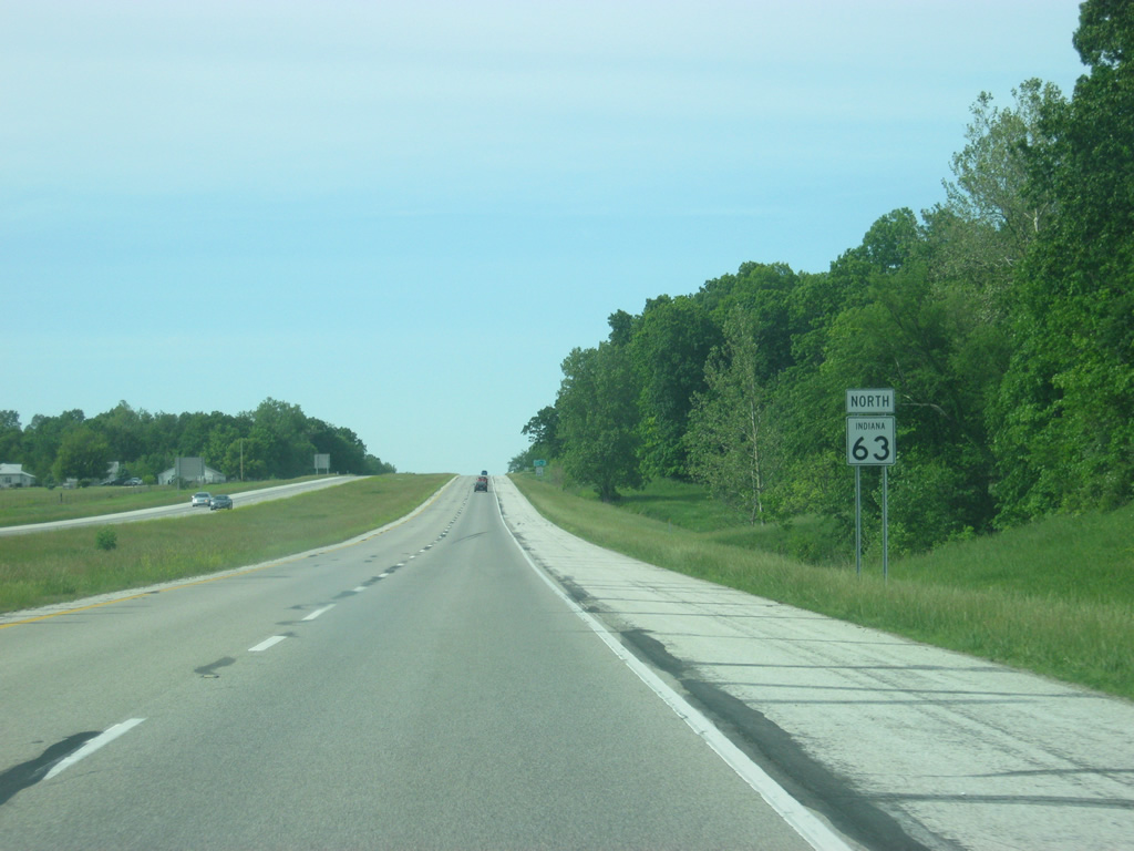
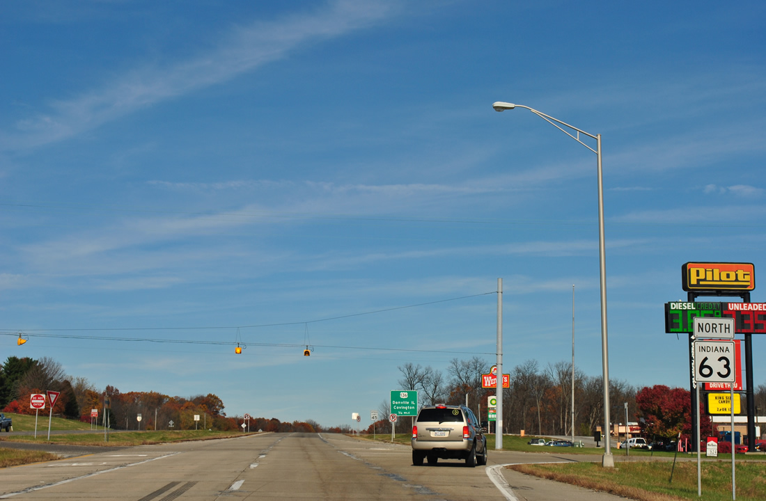
State Road 63 North – Vigo, Vermillion, and Warren Counties
 North
North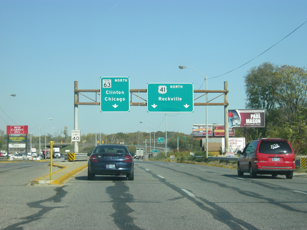
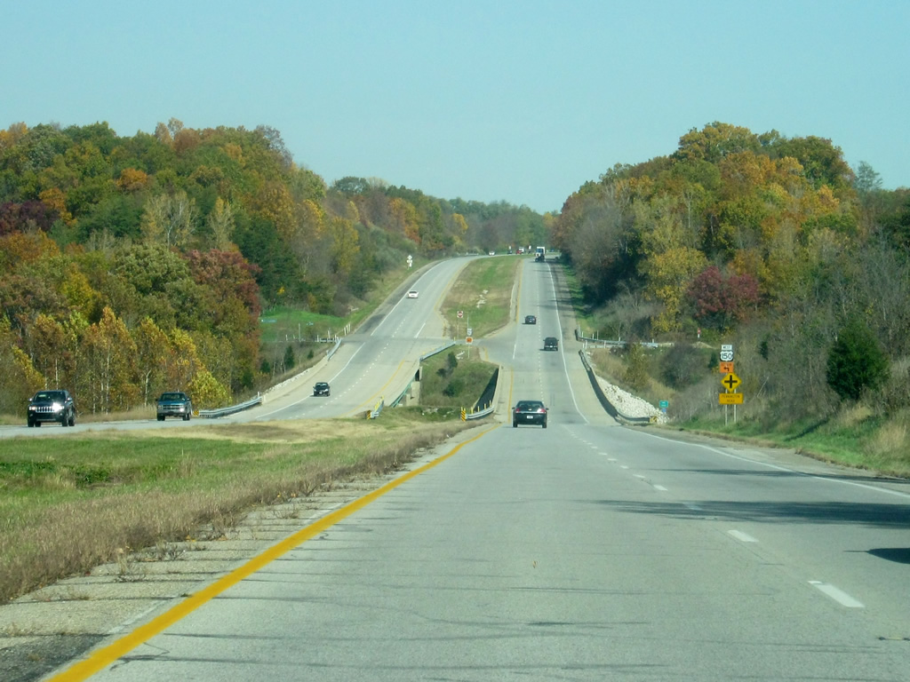
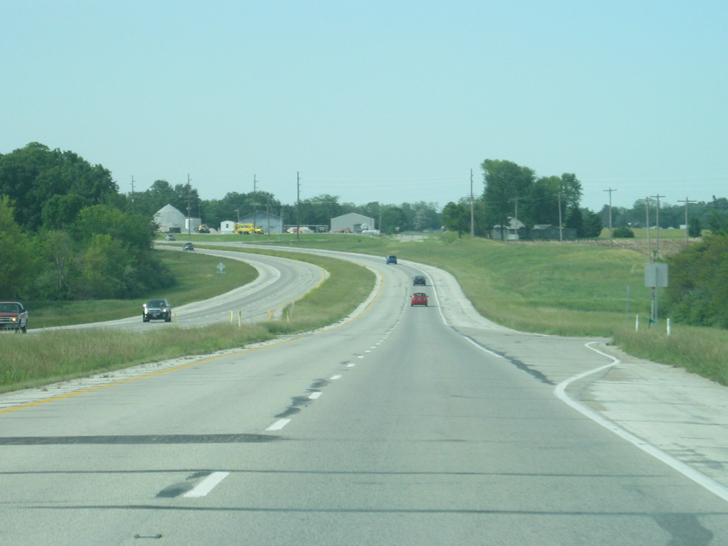
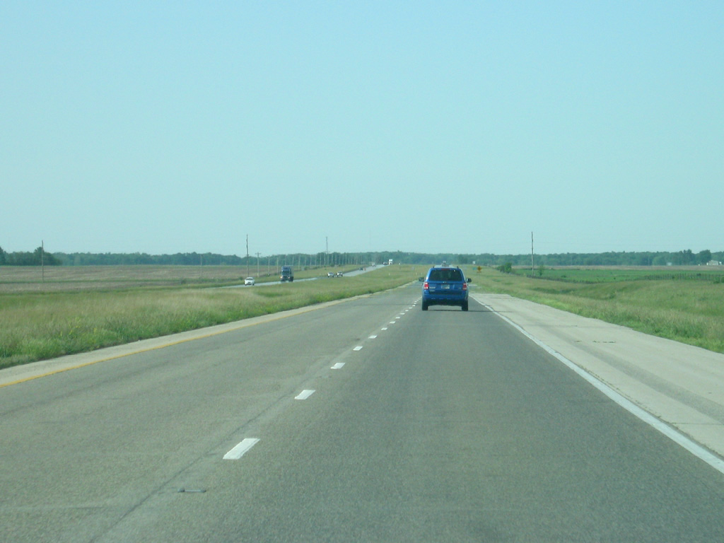
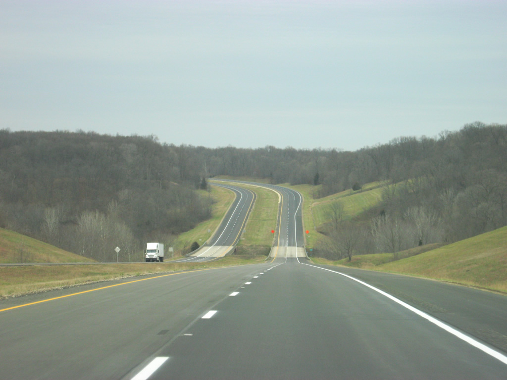
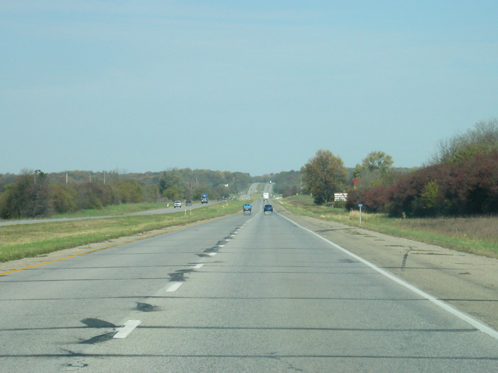
Starting on U.S. 41 North (former SR 63) in Terre Haute (population 60,785), locally known as 3rd Street, a stack interchange facilitates the movements between U.S. 41 and SR 63.
Terre Haute is the largest city in the Wabash Valley region and is home to Indiana State University. Traffic bound for SR 63 should be in the left lanes of northbound 3rd Street and U.S. 41 in the right lanes. Control cities of Clinton and Chicago are mentioned for SR 63, directing long-distance traffic onto the four lane expressway with local traffic to Parke County being directed on U.S. 41 to Rockville.
10/16/12
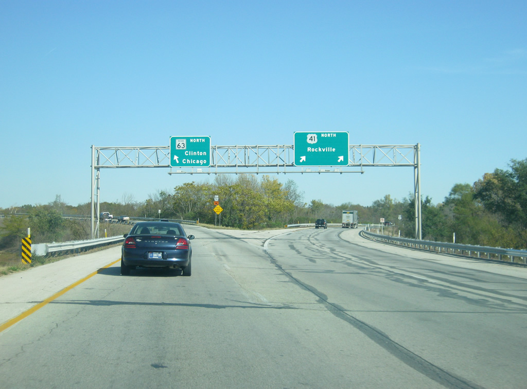
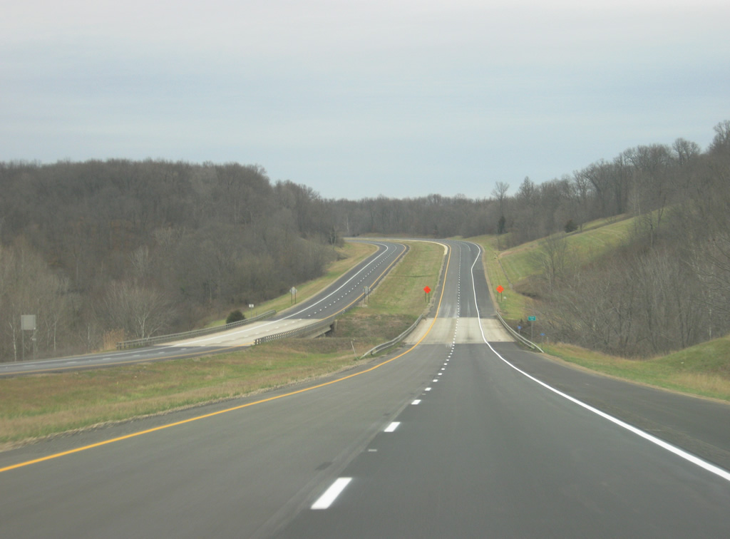
Now at the interchange split with SR 63 and U.S. 41. Both highways split into two lanes going north. Originally, SR 63 had followed U.S. 41 into Parke County where it crossed over the Wabash River into Clinton. It was when the SR 63 expressway was built that the interchange and new bridge over the Wabash River was built. U.S. 41 continues for another three miles as a four lane expressway of its own as it bypasses the community of North Terre Haute before it reduces to two lanes and heads into Parke County. The highway then runs through Rockville, Veedersburg, and Attica before intersecting with SR 63 in Warren County.
10/16/12
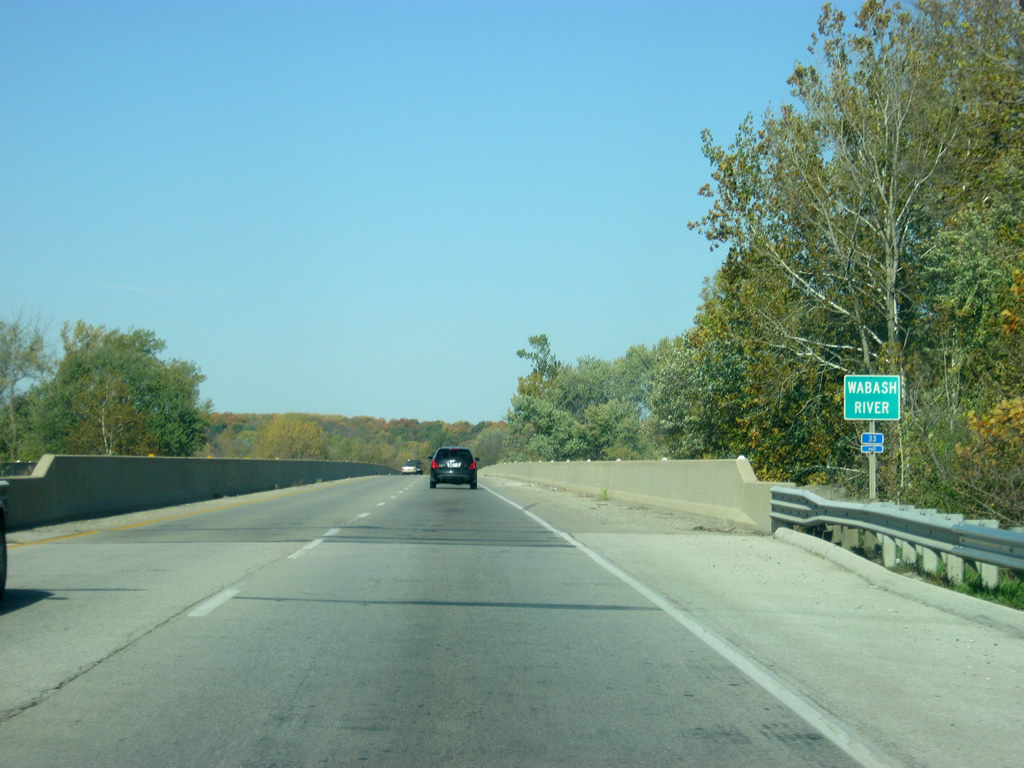
Immediately after the U.S. 41 interchange, SR 63 crosses the Wabash River, which at 503 miles is the longest river in Indiana. The SR 63 bridge is the only crossing of the Wabash from between Downtown Terre Haute and Clinton.
10/16/12
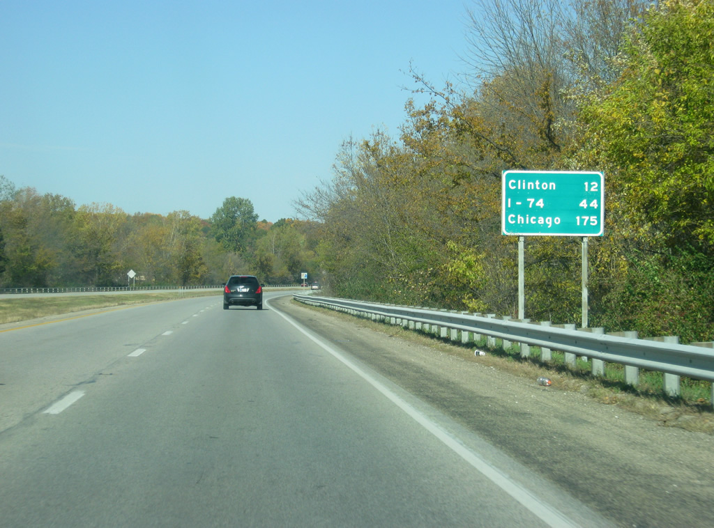
After crossing the Wabash River, the longest in Indiana, the first distance sign on SR 63 appears. Clinton, in southern Vermillion County appears first at 12 miles. Interstate 74, the next freeway junction with SR 63 is 44 miles away and the Windy City of Chicago, Illinois is 175 miles away. This is the first mention of Chicago in a distance sign since U.S. 41 north of Interstate 64 in Vanderburgh County.
10/16/12
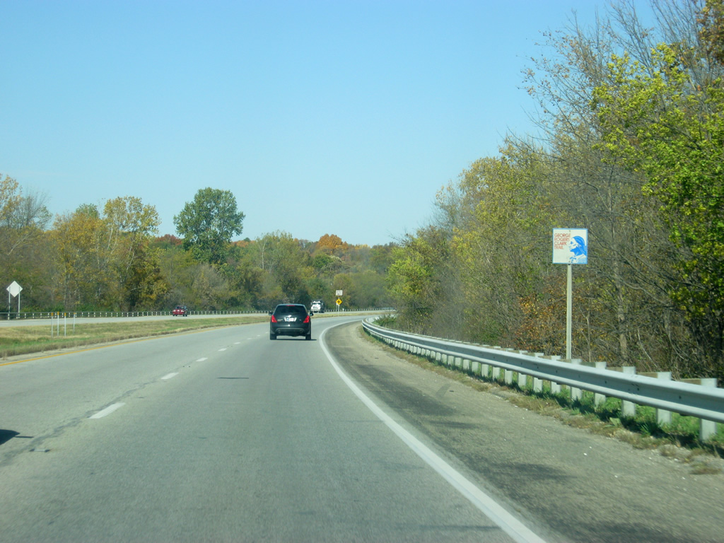
The first SR 63 shield along the expressway follows a shield for the George Rogers Clark Trail, which roughly follows the Wabash River.
10/16/12
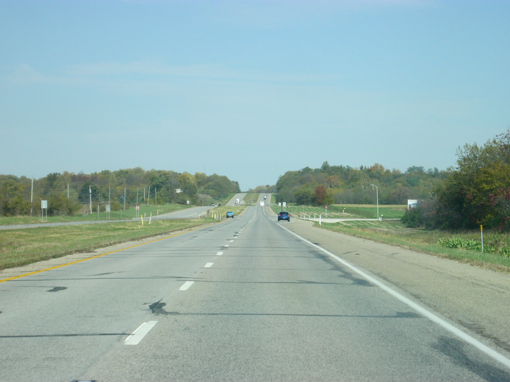
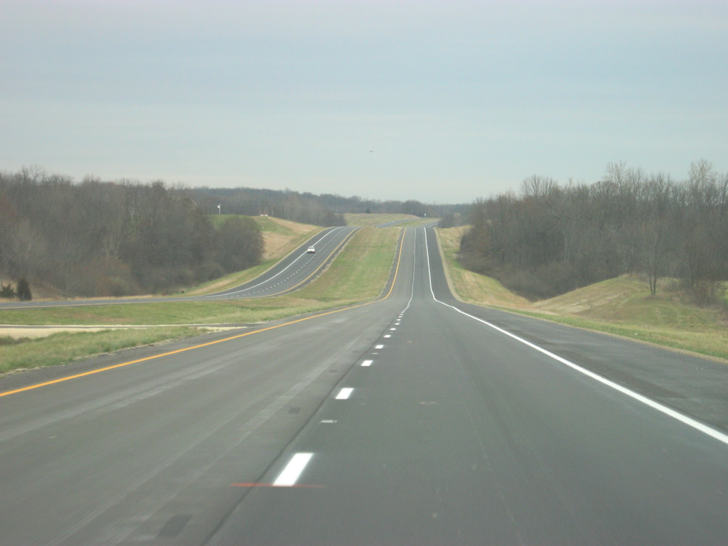
SR 63 is a 60 mile-per-hour facility for the vast majority of its route and it becomes a rural expressway as it heads northward through the northern tier of Vigo County. U.S. 150, which intersects with U.S. 41 in Downtown Terre Haute, follows the path of SR 63 for a few miles before angling off toward the west en route to Paris, Illinois.
10/16/12
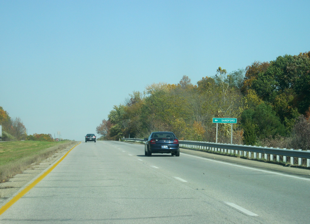
Sandford Road heads west from SR 63 to the town of Sandford, which is located on the Illinois state line.
10/16/12
SR 63 crosses over Coal Creek as it nears the Pennington Road intersection. At the time of this photo U.S. 150 was closed in West Terre Haute and detoured traffic were directed north on SR 63 to Pennington Road, which goes a short distance to U.S. 150 to the west.
10/16/12
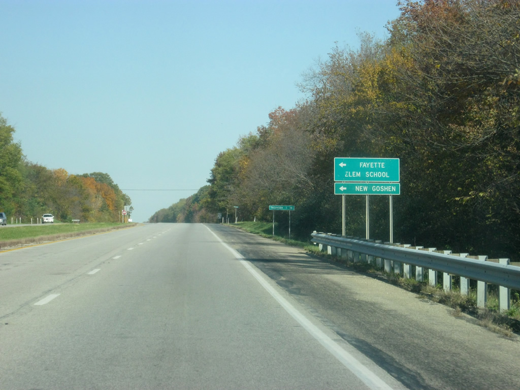
Durkees Ferry Road connects SR 63 with New Goshen and Fayette Elementary School to the west and Tecumseh to the east.
10/16/12

Scenes of SR 63 to the north of Durkees Ferry Road, setting the tone of the expressway's trip across northern Vigo County.
10/16/12
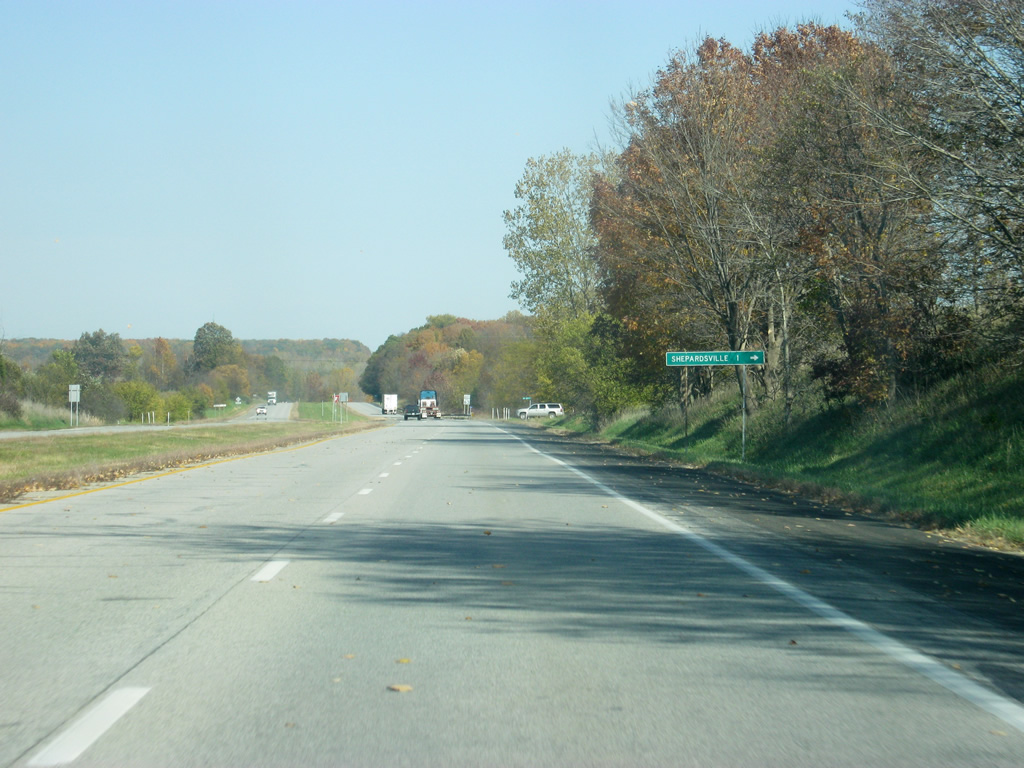
SR 63 crosses Trinity Avenue, which leads east to the town of Shepardsville one mile to the east.
10/16/12
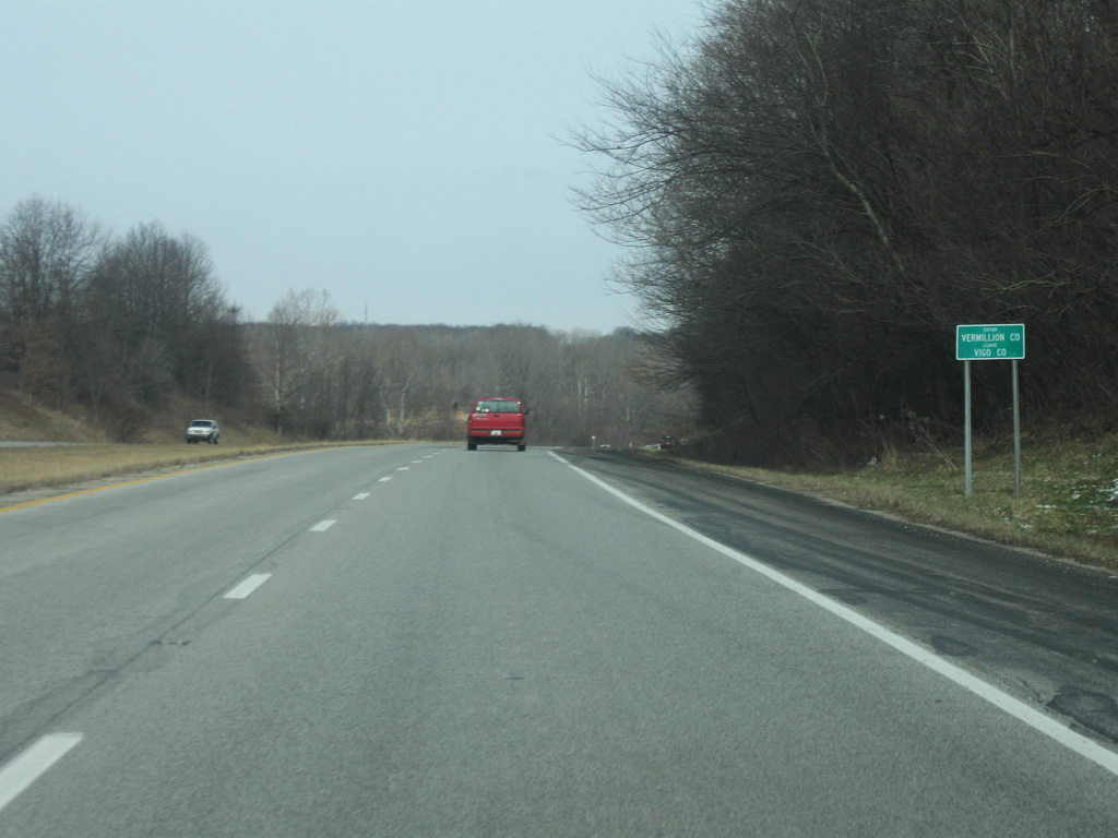
SR 63 enters Vermillion County (population 16,212), the longest and skinniest county in Indiana. SR 63 crosses the county from south to north for 36 miles in a county as long, with 10 miles at its widest point. The county is abutted by the Wabash River and the Illinois border with Warren and Vigo Counties to the north and south.
01/03/10

Just north of the Vermillion County boundary, up ahead is the first of two stoplights along SR 63, both in the vicinity of Clinton.
01/03/10
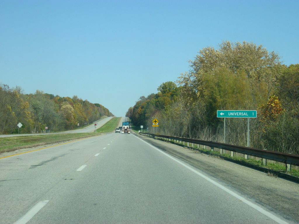
County Road 1780 South leads one mile to the west of SR 63 to the town of Universal.
10/16/12
SR 63 approaches the intersection with Hazel Bluff Road (County Road 1680 South), which is a minor county road that nevertheless provides a more direct route to Clinton. Hazel Bluff Road will meet back up with SR 163, the main highway into Clinton, a mile to the east. Since most of the traffic from Clinton is bound for the larger city of Terre Haute, County Road 1680 gets plenty of use by those in Clinton who do not want to take SR 163.
10/16/12
North of the Hazel Bluff Road intersection, the junction with SR 163 approaches. SR 163 is a short, nine mile highway across the southern tier of Vermillion County. The highway begins at the Illinois state line, goes through Blanford and then intersects with SR 63 before going into Clinton. East of the Wabash River, the highway continues east for one more mile before it connects with U.S. 41 in southwestern Parke County.
10/16/12
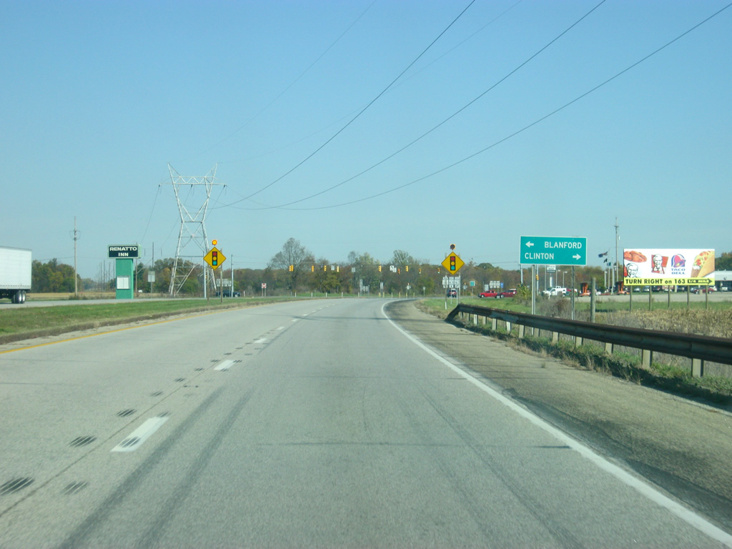
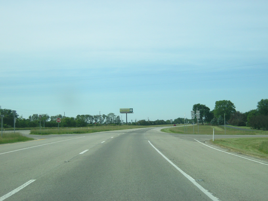
The control cities for SR 163 and the only two communities on the highway are Blanford and Clinton. The stoplight with Clinton approaches as SR 163 passes through a commercial strip adjacent the expressway. East of there, the highway descends into the Wabash River valley as Western Avenue. The road then follows 9th Street, Elm Street and Main Street before following Walnut Street across the Wabash River.
10/16/12
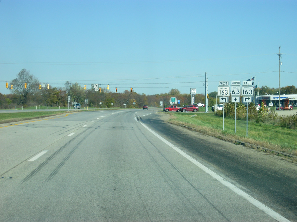
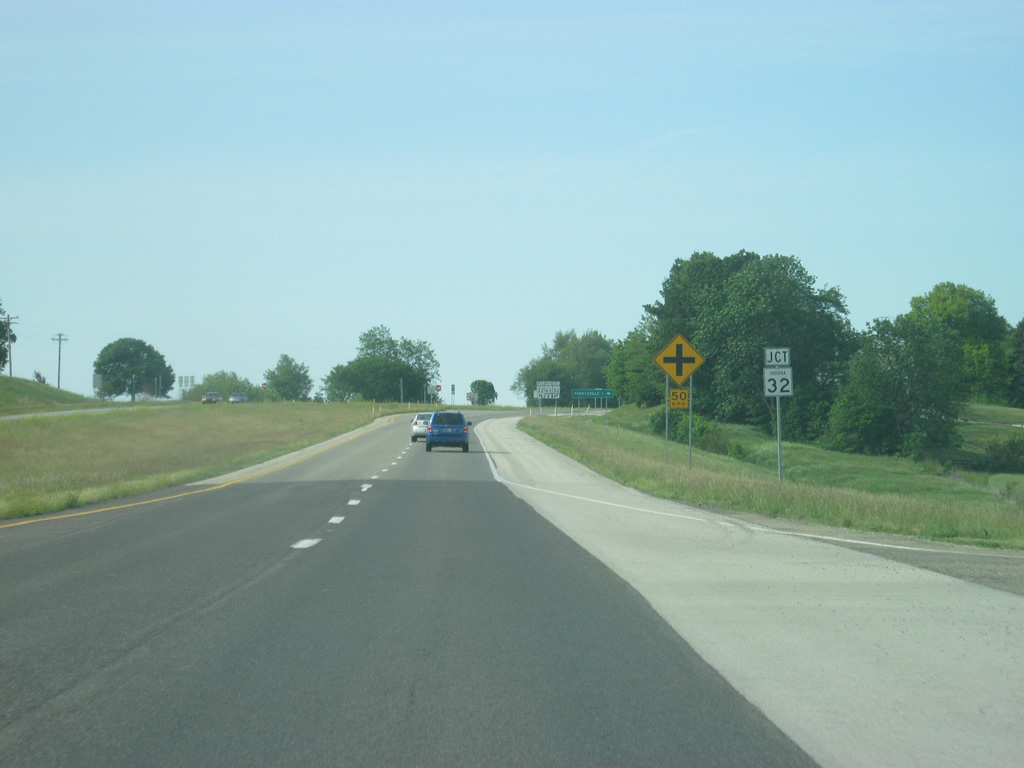
SR 63 at the stoplight intersection with SR 163. The far western part of Indiana is sparsely populated along both the SR 63 and U.S. 41 corridors. Because of that, Clinton is the largest city along SR 63 and U.S. 41 until Cedar Lake in Northwest Indiana (125 miles). This stoplight will be the last until the U.S. 24/52 West intersection in Kentland in Newton County (82 miles away).
10/16/12

Clinton (population 4,893) is the largest community in Vermillion County and contains about a third of the county's population. It is the business center of Vermillion and parts of Parke Counties. Clinton is best known for its Italian-American population and its Little Italy Festival which brings 75,000 visitors every Labor Day Weekend.
01/03/10
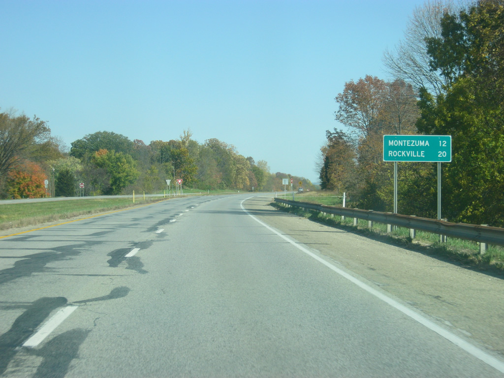
North of the SR 163 intersection, a distance sign announces the next two communities, both off of SR 63 on U.S. 36. Montezuma (12 miles) and Rockville (20 miles) are both in Parke County. Because of the lack of communities along this route, towns located off the highway appear on the distance signs along this highway.
10/16/12
SR 63 at this point is still bypassing Clinton, which stretches to the north of SR 163 for a couple of miles; still the highway has a rural appearance.
10/16/12
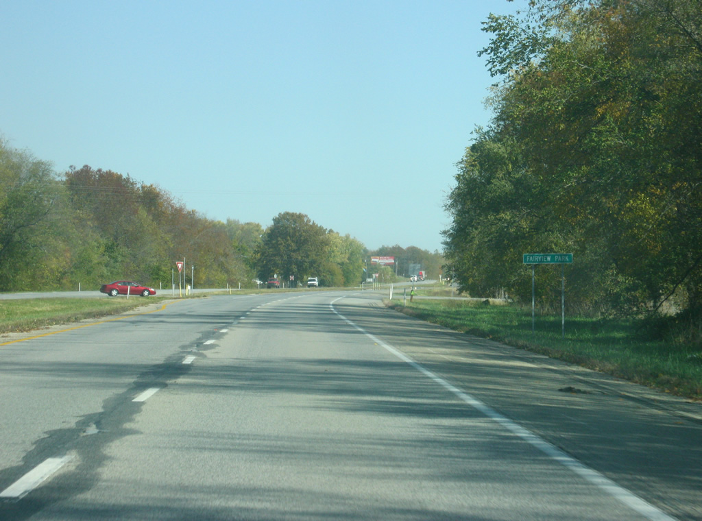
SR 63 enters the community of Fairview Park (population 1,386). Fairview Park is an adjacent city of Clinton that abuts the northern boundary of the city. SR 63 cuts across the grid of Fairview Park but goes through the community with no traffic.
10/16/12
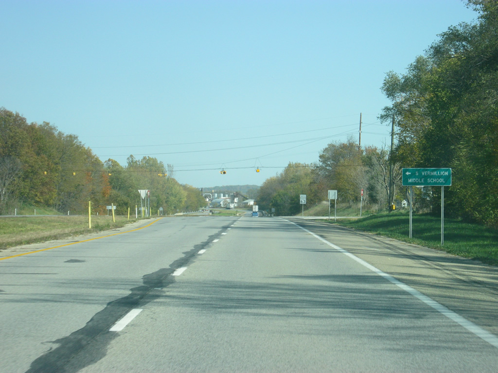
Washington Street connects SR 63 with 9th Street in Clinton, a major north-south road through that city. To the north of the expressway is South Vermillion Middle School.
10/16/12
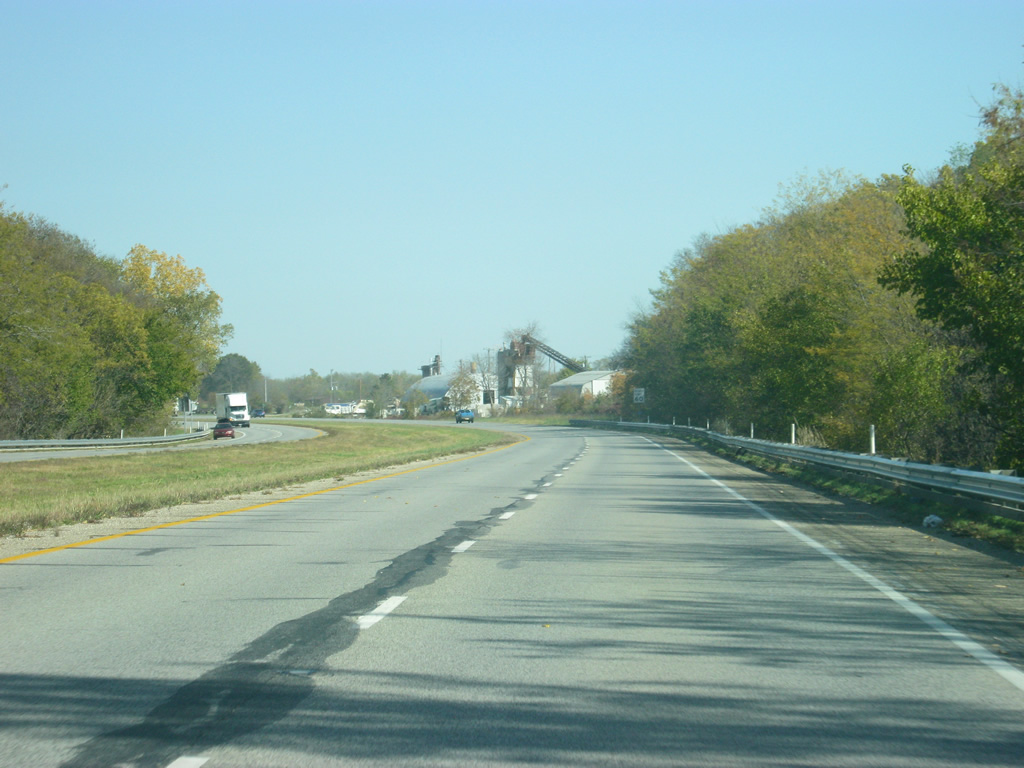
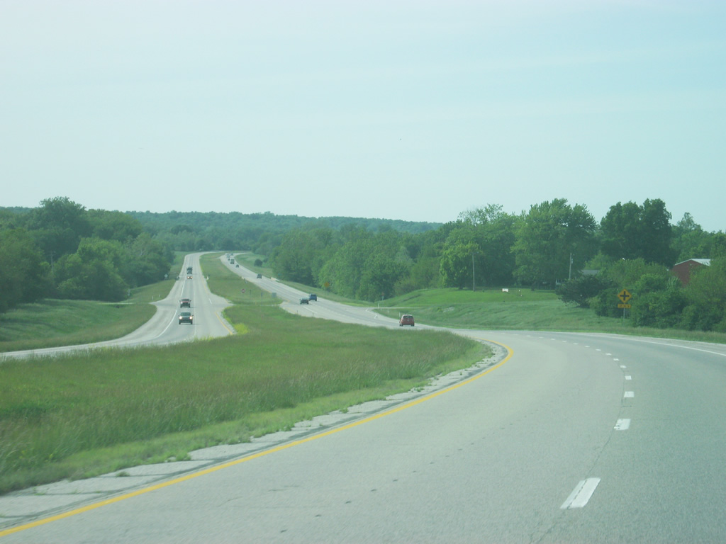
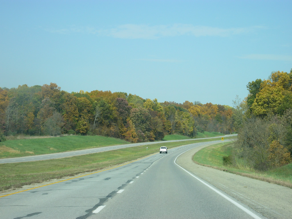
North of Fairview Park, SR 63 becomes a rural expressway as it does not touch another town along its route (it does bypass a few however). The highway follows the Wabash River on its way to the north, about a mile to the east.
10/16/12
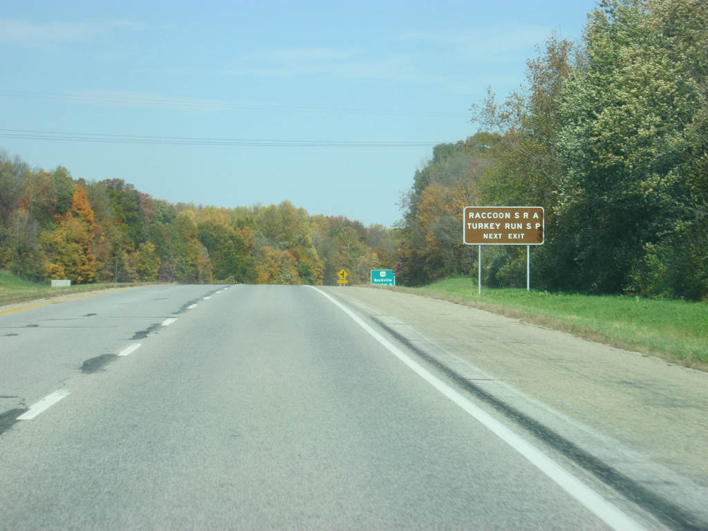
Now a mile away from the first interchange along SR 63 with U.S. 36. U.S. 36 goes for 1,414 miles from the Rocky Mountain National Park to Uhrichsville, Ohio and for 139 miles across Indiana from the Illinois line, through Rockville, Danville, Indianapolis, and Pendleton before leaving into Ohio. Both Turkey Run State Park and Raccoon Lake State Recreational Area are located to the east in Parke County via U.S. 36.
10/16/12
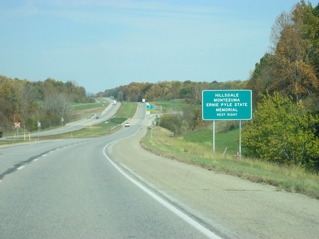
Now a half mile away from the U.S. 36 interchange with SR 63. There is mention of Hillsdale and Montezuma, two smaller communities along the highway within the general area of the interchange. The Ernie Pyle State Memorial in Dana is also accessed via the interchange.
10/16/12
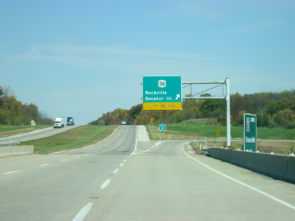
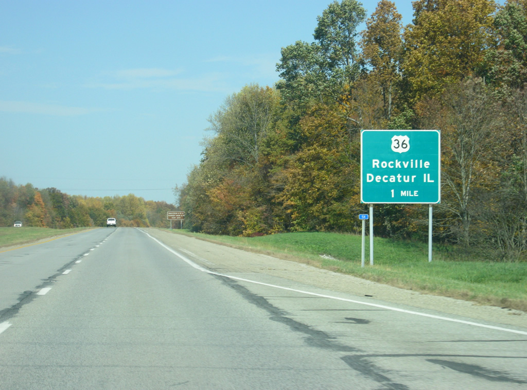
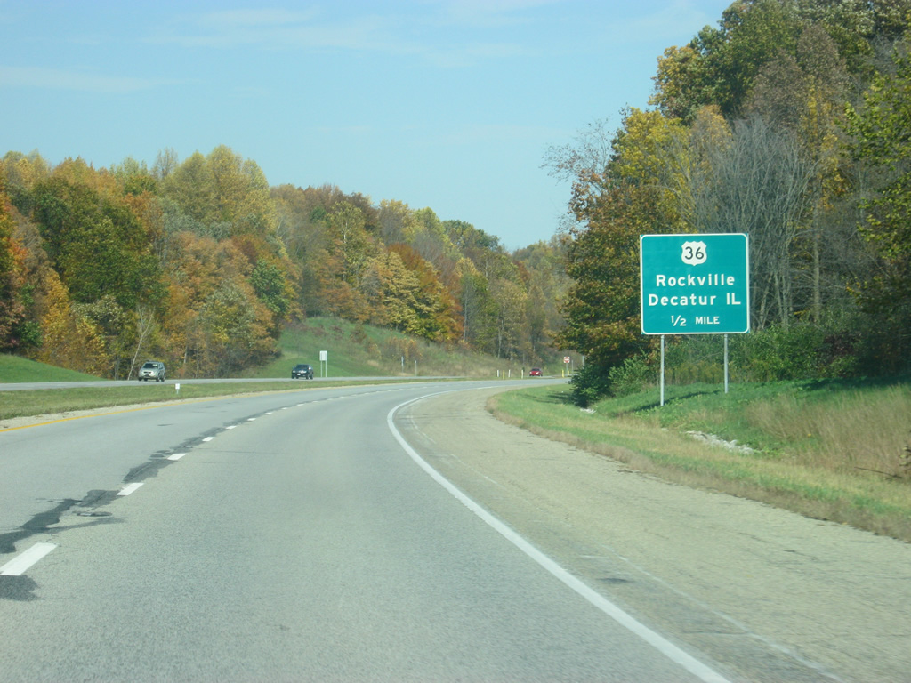
Now at the folded interchange with U.S. 36. This is the first of two interchanges along SR 63 to service U.S. highways. The controls for U.S. 36 are Rockville and Decatur, Illinois. Rockville, the county seat of Parke County (the Covered Bridge Capital of the World) is 11 miles away and Decatur, Illinois is 85 miles away.
10/16/12
A reassurance shield for SR 63 north of the U.S. 36 interchange.
05/11/12
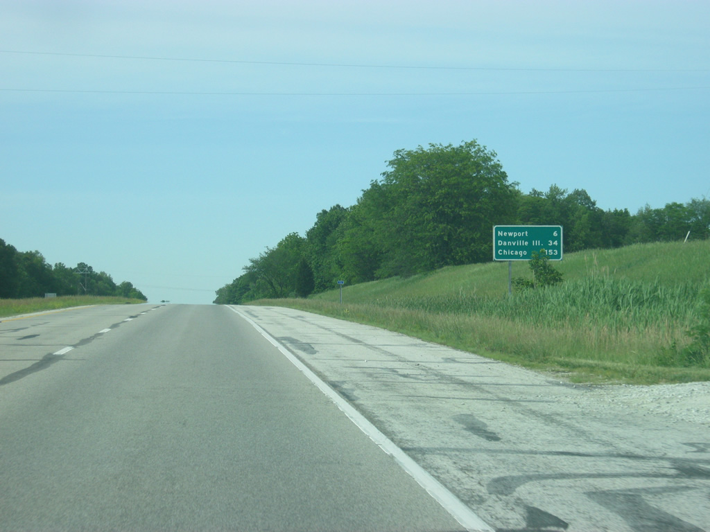
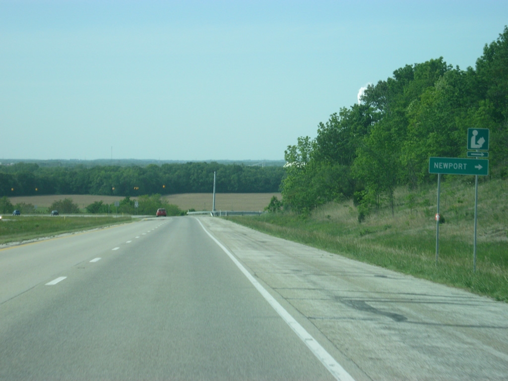
North of the U.S. 36 interchange, Newport is the next destination at 6 miles. Danville, Illinois gets its first mention at 34 miles with the main control city of Chicago now 153 miles away. SR 63 is used often as a quicker route for those in far eastern Illinois in lieu of U.S. 150 and Illinois 1. For that reason, Danville is used as a control along this stretch of SR 63.
05/11/12
The next few miles of SR 63 from U.S. 36 to Newport pass by the Newport Chemical Depot. Until 2010, the Newport Chemical Depot was a bulk chemical storage and destruction facility and was one of several places that stored the deadly VX nerve agent gas. The VX gas has since been destroyed and the facility closed. This stretch of SR 63 consequently is quite desolate.
05/11/12
Coming up to the intersection with County Road 100 South. To the left the road continues west as part of the northern boundary of the Newport Chemical Depot. To the right, the road turns to the north and becomes Old State Road 63 following the state highway's original alignment into Newport. SR 63 turns toward the northwest to bypass Newport.
05/11/12
A flasher indicates the intersection with SR 63 and Market Street, the main road into Newport. Newport (population 515) is the county seat of Vermillion County. This small community is best known for the Antique Auto Hill Climb that takes place each fall and is considered the second largest automobile event in the state after the races at the Indianapolis Motor Speedway. The event brings in thousands of people into its small community. In the distance, the Wabash River valley opens up as the highway turns toward the northwest toward Cayuga.
05/11/12
SR 63 turns northwestward from the intersection with Market Street toward the upcoming intersection with SR 71 south.
05/11/12
SR 63 north of the Market Street intersection as it approaches the intersection with SR 71, the westernmost (by number) of Indiana's north-south highways. SR 71 exists as two segments, with a northern one in Newton and Benton Counties and the southern one in Vermillion County.
05/11/12
SR 63 at the northern terminus of the southern segment of SR 71. SR 71 goes for 20 miles from Blanford at the intersection with SR 163 north through Dana before meeting up with SR 63 to the north of the Newport Chemical Depot.
05/11/12
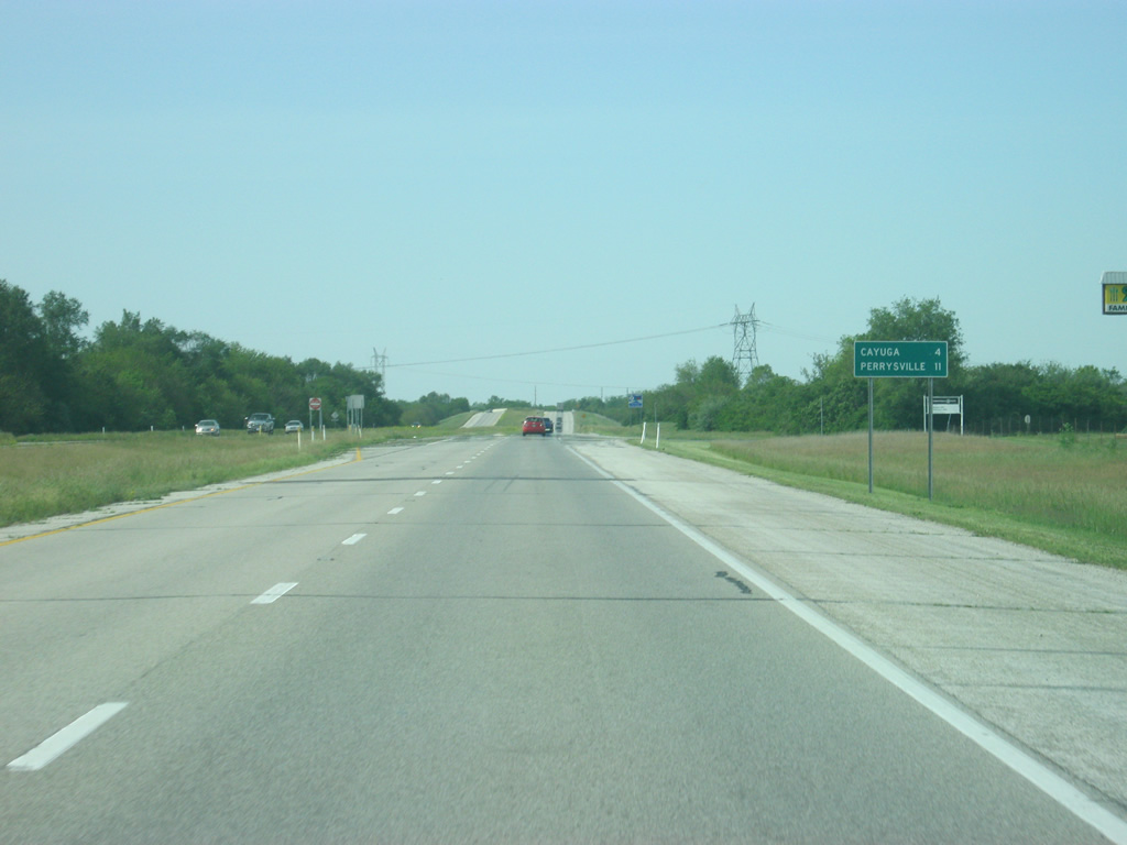
North of the SR 71 intersection, the two next communities along SR 63 are visible on the distance sign with Cayuga at 4 miles and Perrysville at 11 miles.
05/11/12

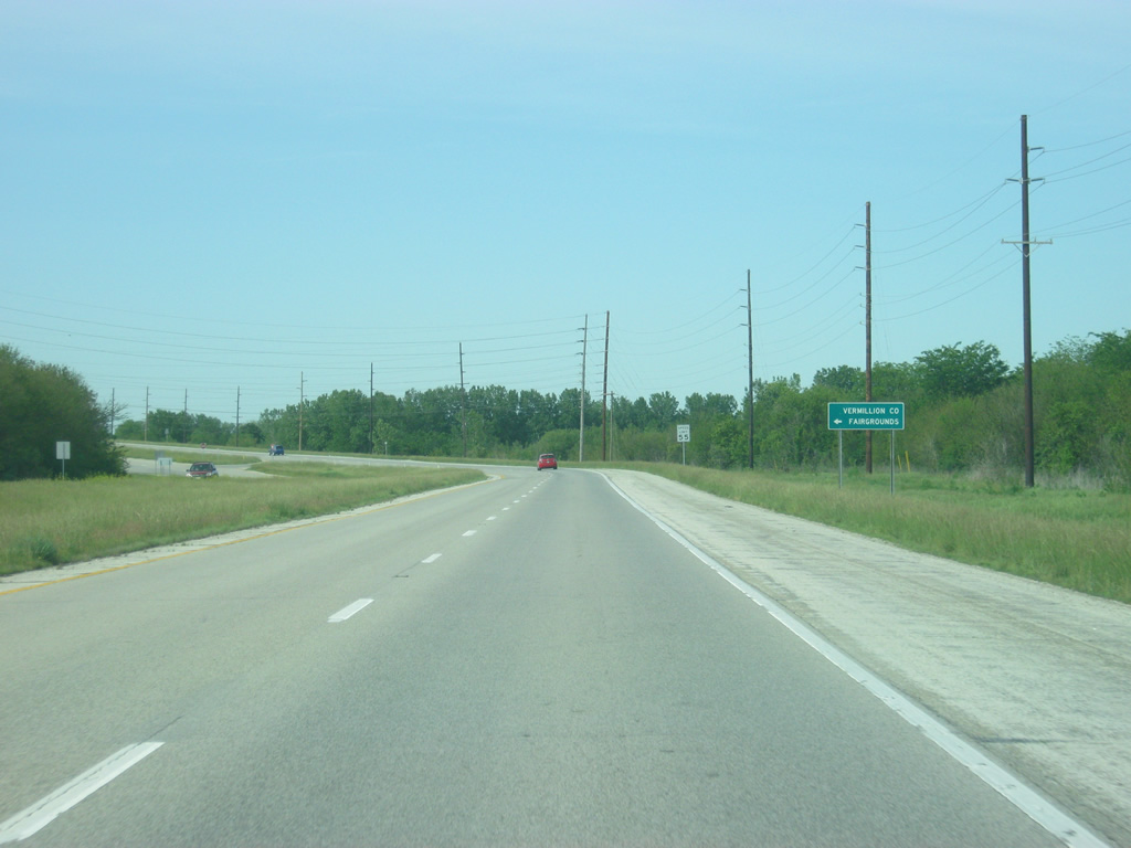
SR 63 passes by the Cayuga Generating Station and the Vermillion County Fairgrounds en route to the town of Cayuga.
05/11/12
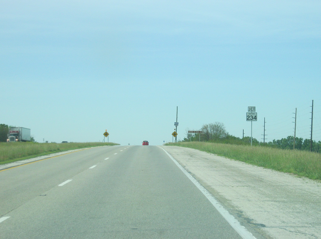
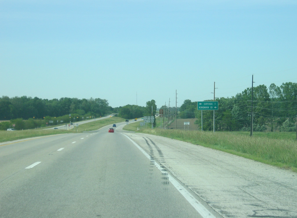
Coming up to the intersection with SR 234 and the town of Cayuga (population 1,162). SR 234 exists in two segments with the western one stretching for 54 miles from the Illinois state line to Jamestown in southwestern Boone County, along with a 23 mile stretch in Hancock and Henry counties.
05/11/12
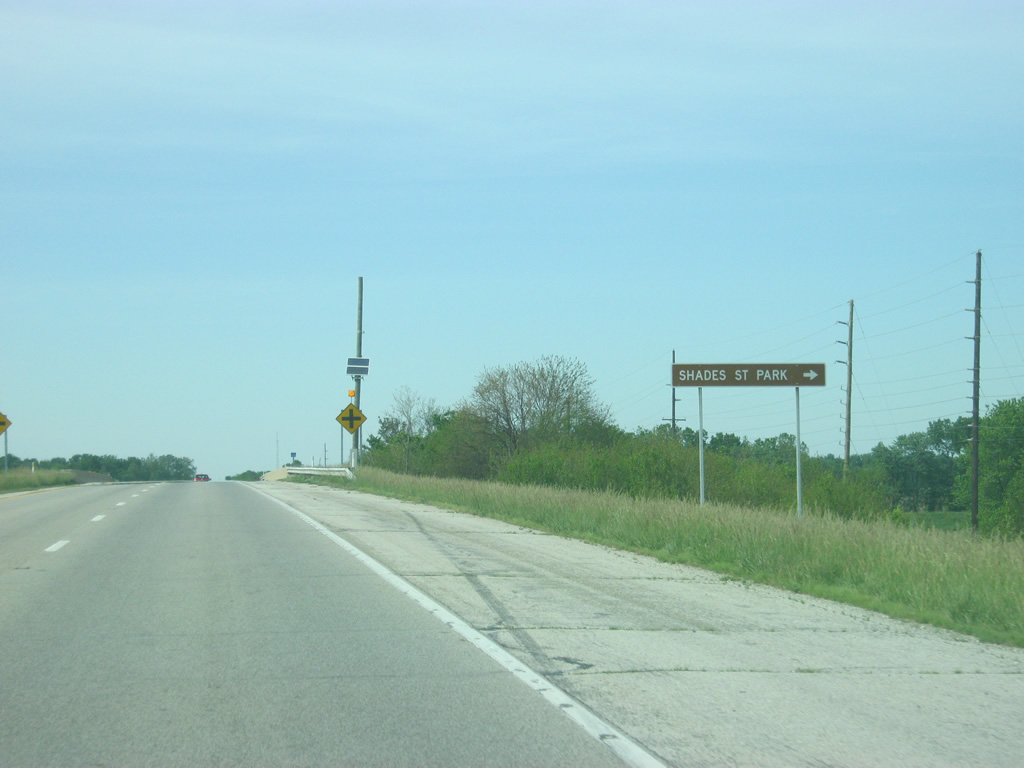
SR 234 is the best route for traffic heading to Shades State Park, about 22 miles to the east. The Fountain County community of Kingman is ten miles to the east while Cayuga is less than a mile to the west.
05/11/12
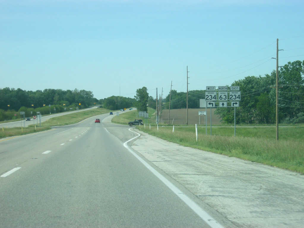
SR 234 follows Ferry Street into the north side of Cayuga as it continues west to the Illinois state line and onto the town of Georgetown, Illinois. The small towns of Waterman and Silverwood are 2 1/2 and 3 miles away to the east.
05/11/12
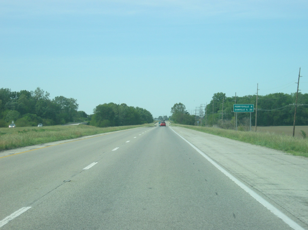
The next community along SR 63 is Perrysville at a distance of eight miles. Danville, Illinois is 20 miles away.
05/11/12
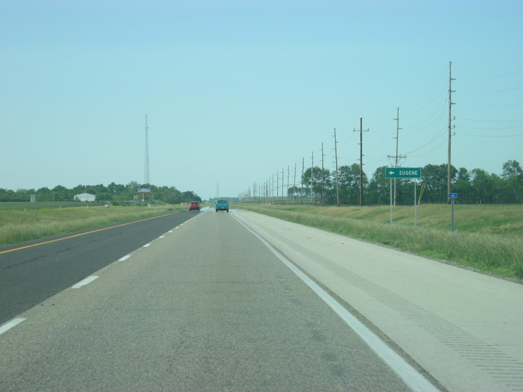
County Road 600 North leads west from SR 63 to the town of Eugene.
05/11/12
The stretch of SR 63 from SR 234 to SR 32 is flat with little terrain change as the highway follows the Wabash River.
05/11/12
SR 32 is a 157 mile highway that crosses the state from the Illinois border to Ohio, going through Perrysville, Crawfordsville, Lebanon, Noblesville, Anderson, Muncie, Winchester and Union City.
05/11/12

Perrysville is one mile to the east along SR 32. Further down the road is the city of Crawfordsville in Montgomery County.
05/11/12
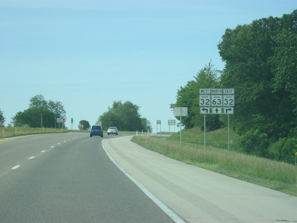
Now at the intersection with SR 32. To the west, the highway crosses into Illinois and becomes Perrysville Road which leads to Interstate 74 and Danville, Illinois.
05/11/12
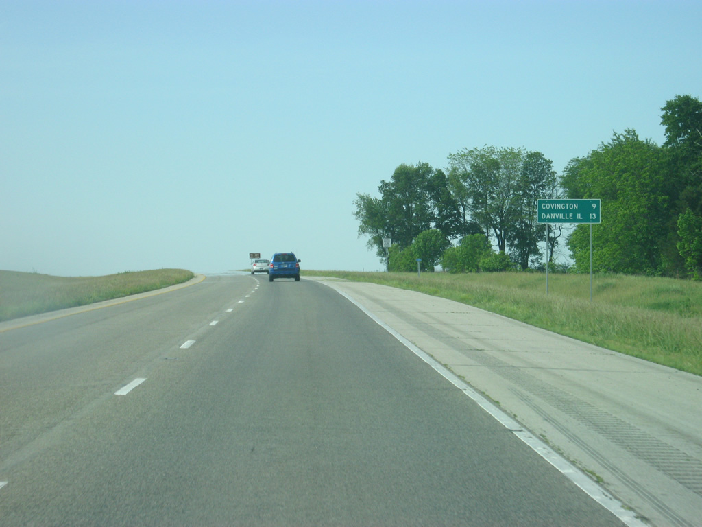
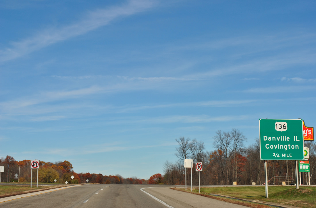
North of the SR 32 intersection, the next two communities of interest are Covington (9 miles) and Danville, Illinois (13 miles). In this part of the state, Danville is the primary city for the local residents, who use Perrysville Road, Interstate 74 or U.S. 136 to get there.
05/11/12
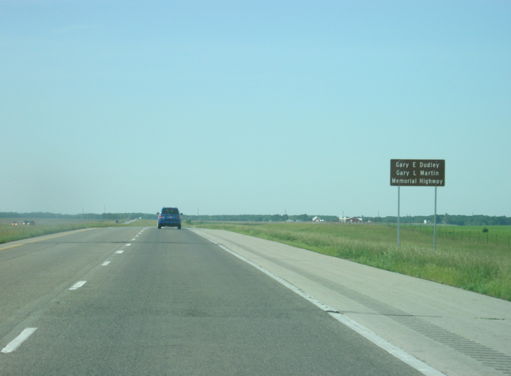
The stretch of SR 63 from SR 32 north to Interstate 74 is named for Gary E. Dudley and Gary L. Martin, two police officers from Lake County who were killed along this stretch of highway while participating in a charity motorcycle ride in 2006.
05/11/12
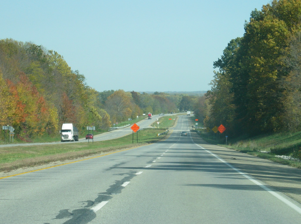
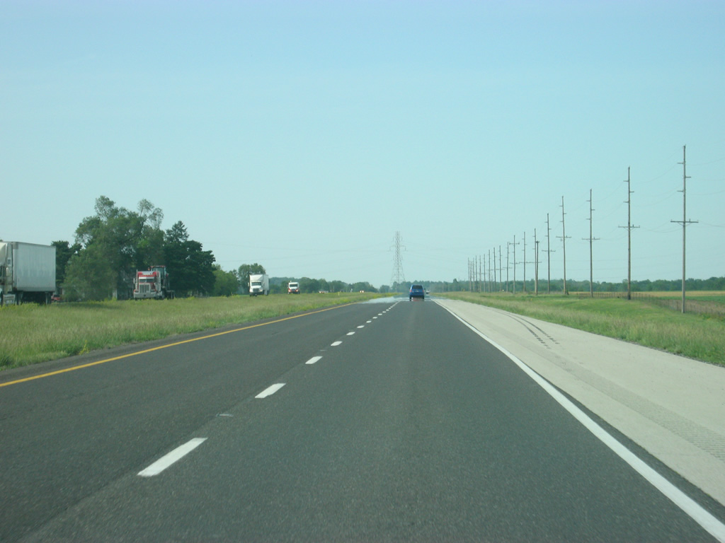
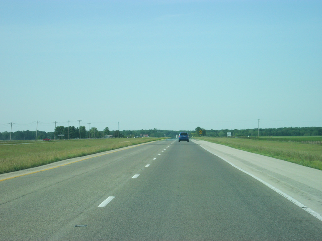
The stretch of SR 63 north of SR 32 is very flat and desolate as it approaches the junction with Interstate 74.
05/11/12
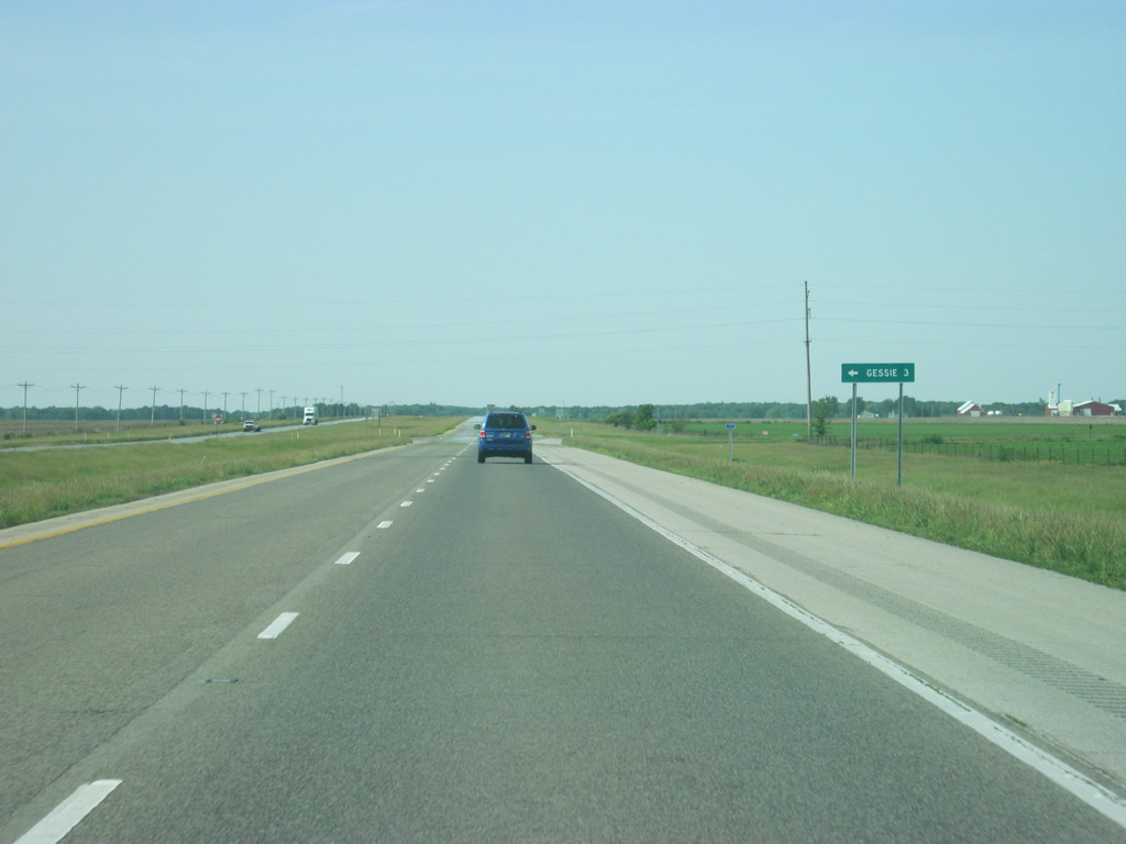
The small community of Gessie is 3 miles to the left off SR 63 along County Road 1300 North.
05/11/12
SR 63 north of the intersection with County Road 1300 North.
05/11/12
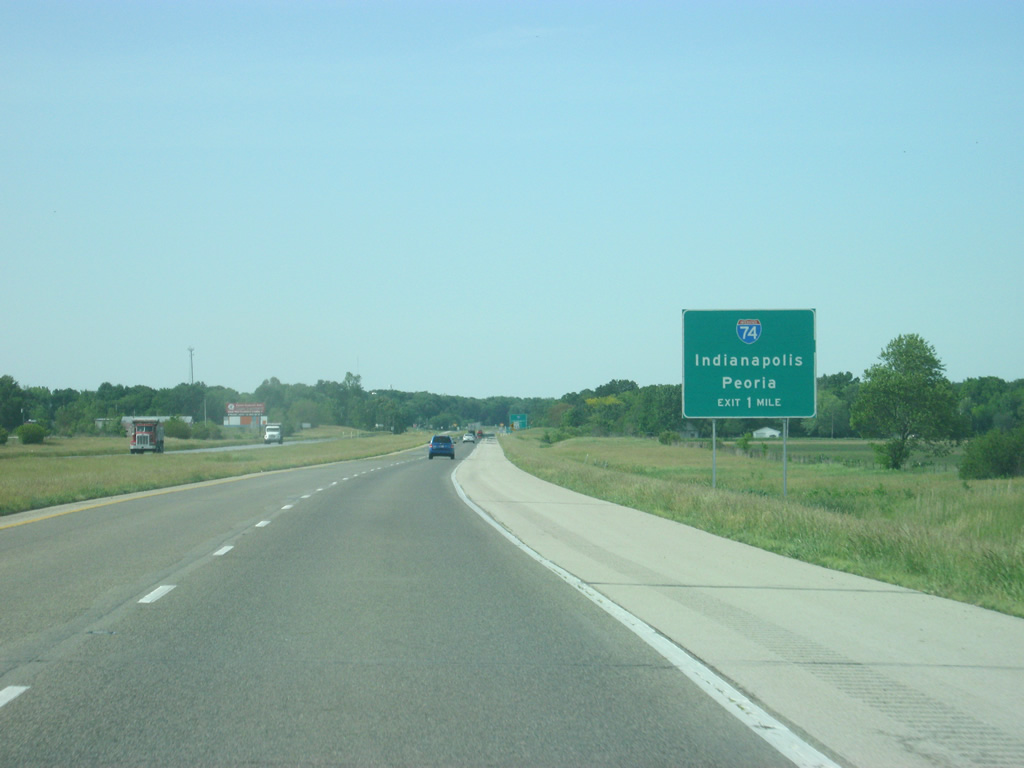
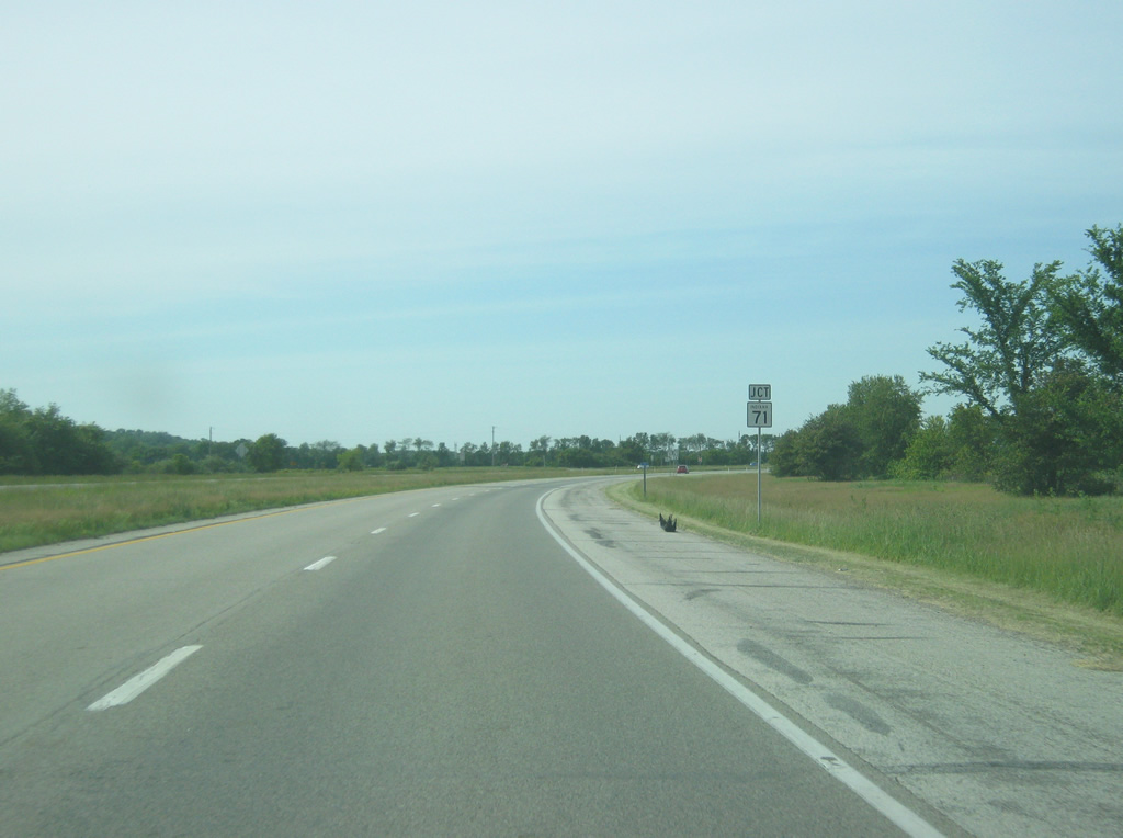
SR 63 now approaches the intersection with Interstate 74, linking SR 63 with the nearby communities of Danville, Illinois and Crawfordsville.
12/02/11
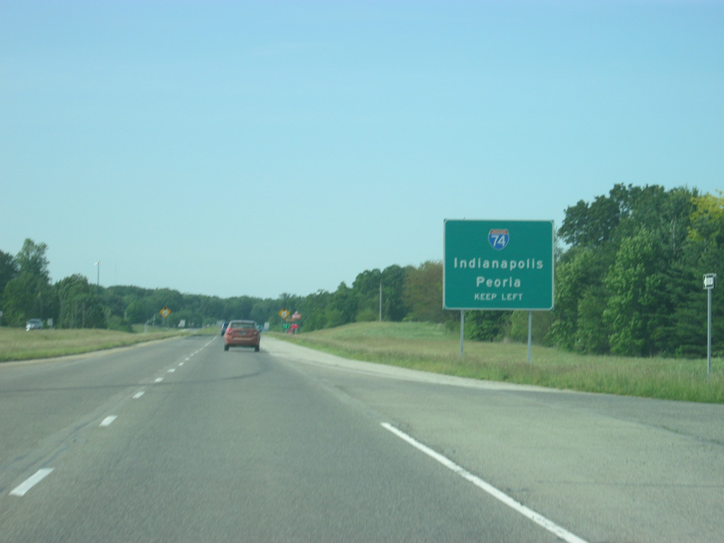
About a half mile away of the interchange with Interstate 74. Interstate 74 is a 423 mile highway that begins in Davenport, Iowa and ends in Cincinnati, Ohio, with an additional 75 mile segment in North Carolina. In Indiana, Interstate 74 goes for 172 miles as it stretches from outside Danville to Crawfordsville, Brownsburg, Indianapolis, Shelbyville, Greensburg, and Batesville before leaving at West Harrison.
12/02/11
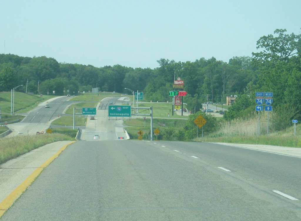
Now approaching the interchange with Interstate 74. Both ramps are served from the left side of SR 63. Despite being an intersection with an interstate there are no stoplights.
12/02/11
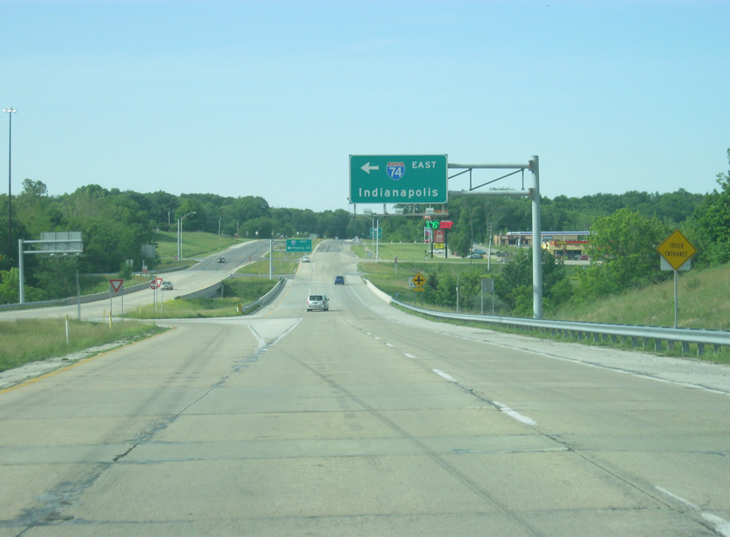
The first left off of SR 63 directs traffic to Interstate 74 east toward Crawfordsville and Indianapolis.
12/02/11
The second left off SR 63 directs traffic to Interstate 74 west to Danville, Champaign, Bloomington, and Peoria, Illinois. Note the state-named Interstate 74 shield on the sign.
11/04/11
A flashing light with County Road 1650 North follows at truck stop that serves both traffic along Interstate 74 and SR 63.
11/04/11
Just north of the intersection with County Road 1650 North a guide sign announces the upcoming junction with U.S. 136, 3/4 mile away.
11/04/11
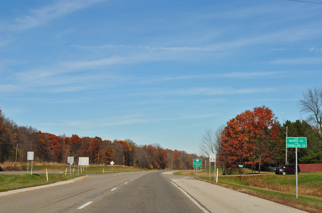
Before reaching the U.S. 136 interchange, SR 63 enters Warren County (population 8,508). Warren County is among the most rural of Indiana counties as it has fewer people than Vermillion County and has the lowest population density in the state.
11/04/11
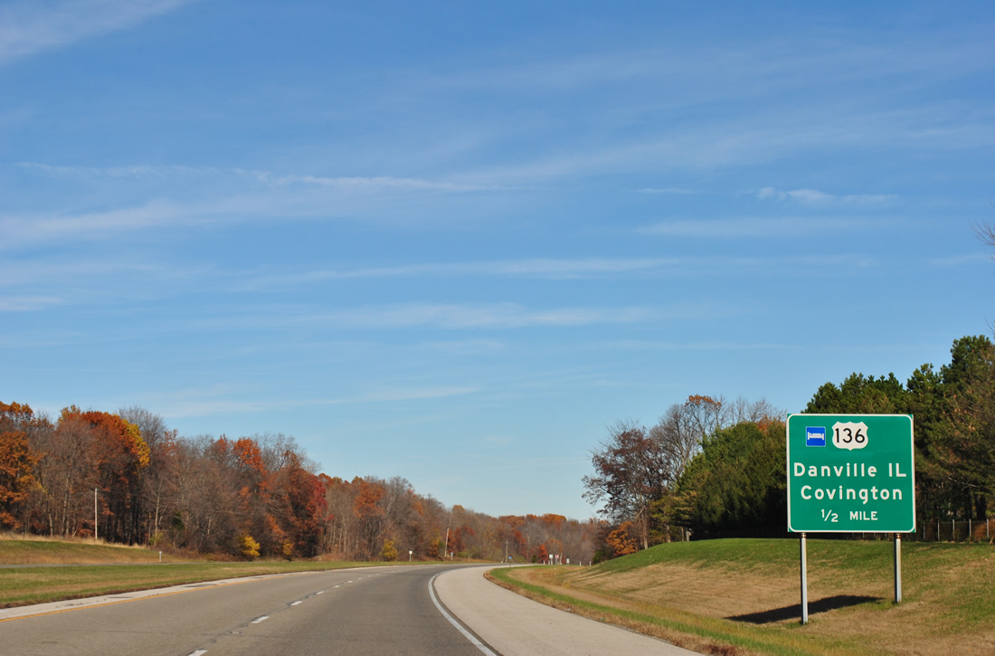
SR 63 is now 1/2 mile away from the interchange with U.S. 136. U.S. 136 goes for 804 miles from Edison, Nebraska to Indianapolis, following the route of Interstate 74 through its routing in Indiana.
11/04/11
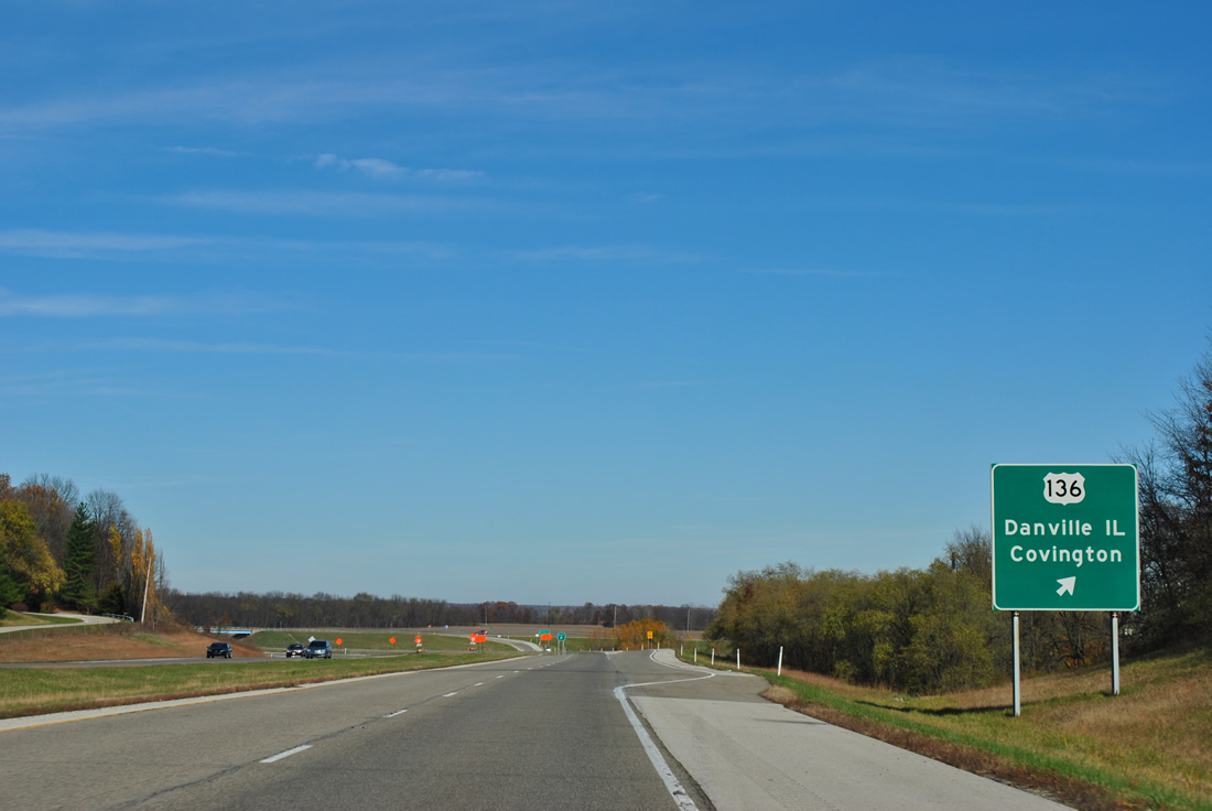
A diamond interchange facilitates the movements between SR 63 and U.S. 136. Covington, the county seat of nearby Warren County, is only a couple of miles to the east across the Wabash River. Danville, Illinois, the county seat and largest city of Vermilion County, Illinois is just less than 10 miles to the west.
11/04/11
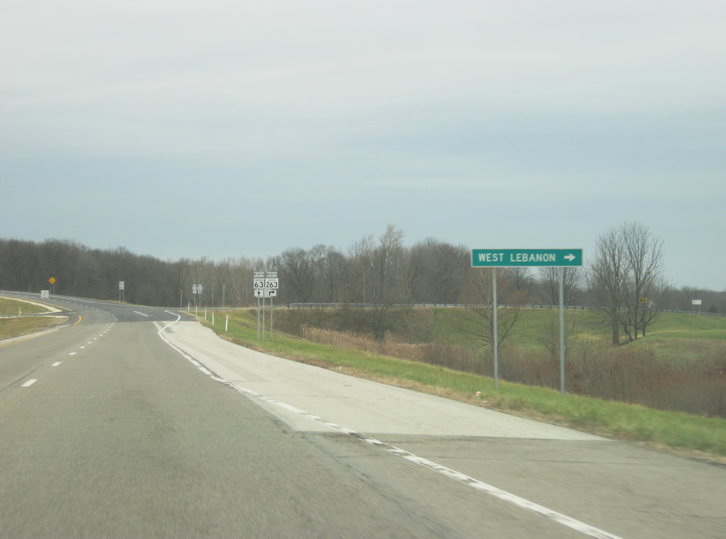
North of the U.S. 136 interchange, the junction with SR 236 appears with a link to West Lebanon. SR 263 represents the original routing of SR 63 through Warren County and stretches for 13 miles through West Lebanon before reaching back to SR 63. Locally, the route is sometimes referred to as "Old 63" with the current SR 63 called "New 63."
12/02/11
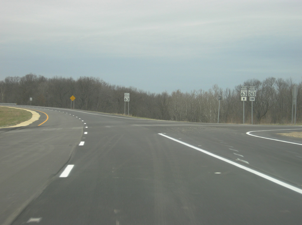
SR 63 at the junction of SR 263. SR 263 will follow the Wabash River up in its routing toward West Lebanon.
12/02/11
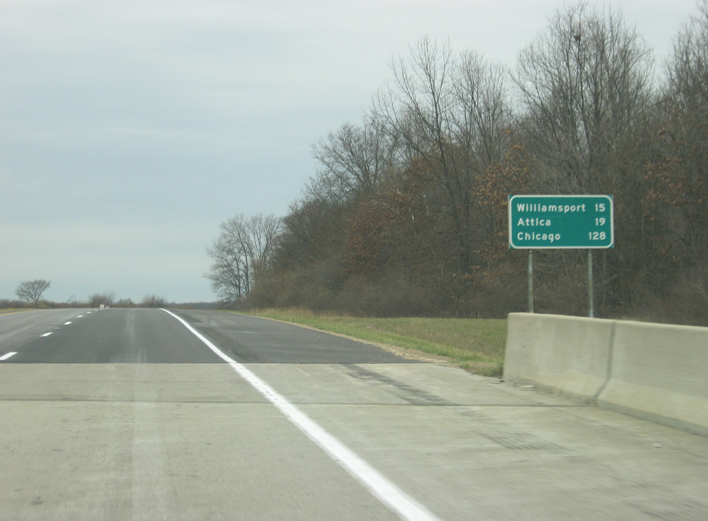
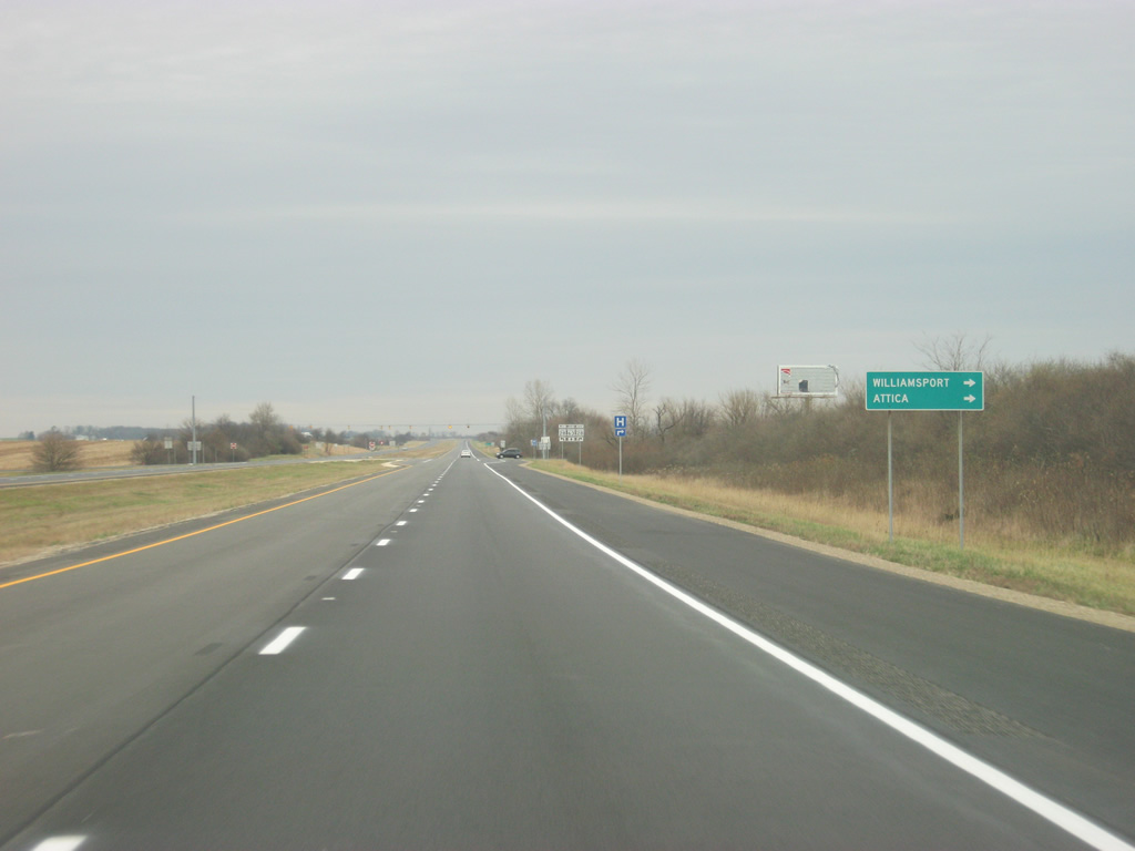
North of the junction with SR 263, the next two significant communities are the Warren County seat of Williamsport (15 miles) and the Fountain County community of Attica (19 miles). It's another 128 miles to Chicago, Illinois.
12/02/11
SR 63 goes through some hilly terrain as it heads through the Opossum Run valley.
12/02/11
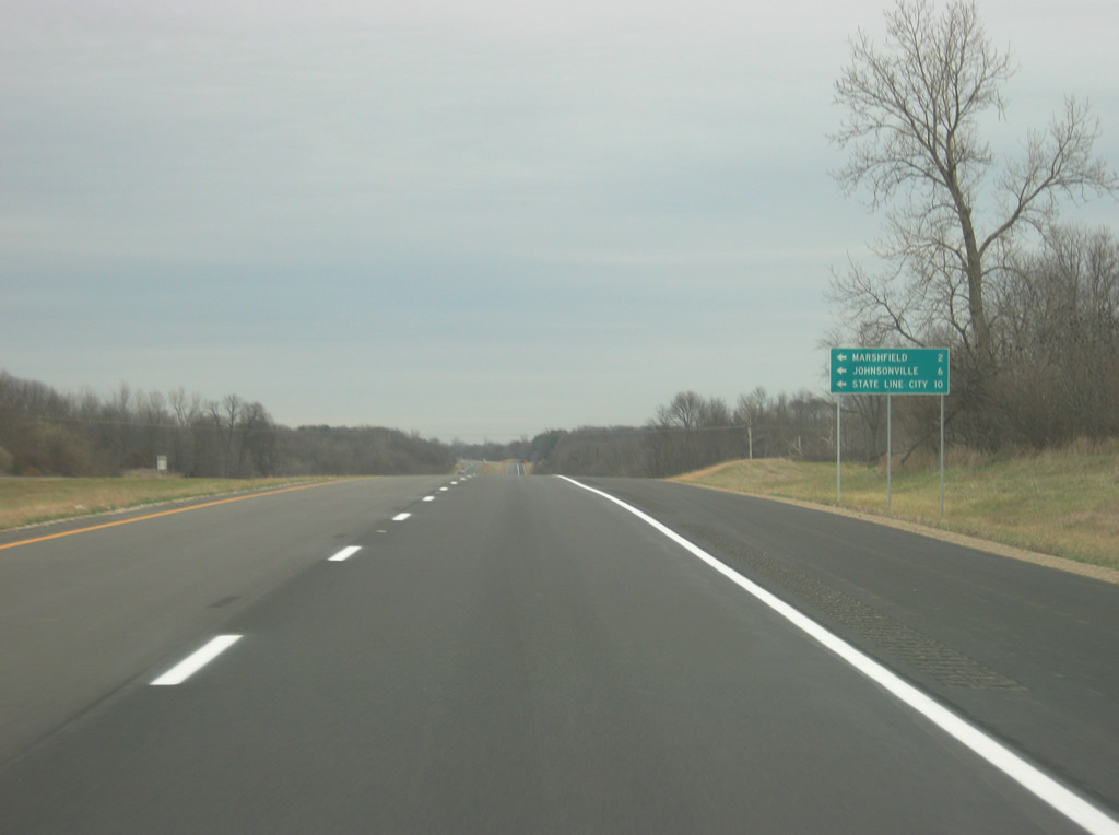
Now at the intersection with County Road 450 South. West along this road you'll reach the small communities of Marshfield, Johnsonville and State Line City.
12/02/11
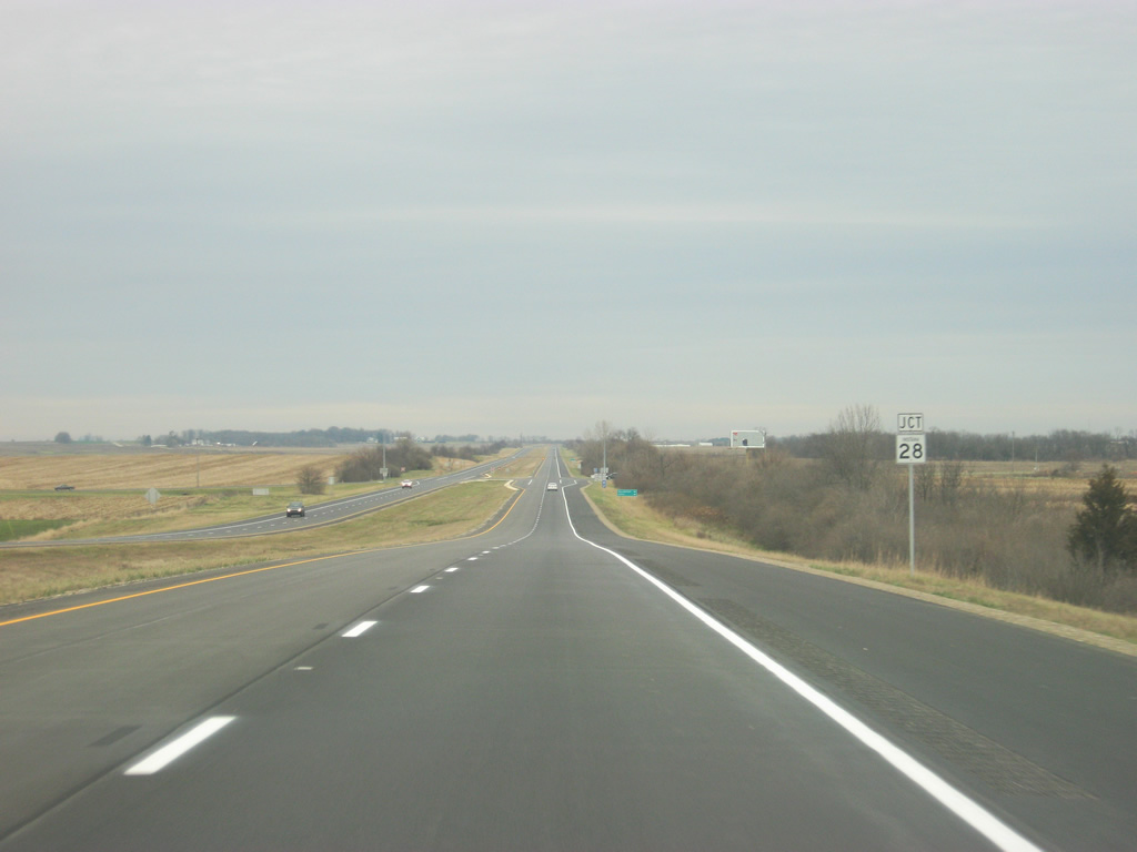
West of West Lebanon, SR 63 approaches the junction with SR 28, a 153 mile highway that crosses the state from west to east. The highway starts only a few miles to the west and goes through Attica, Frankfort, Tipton, Elwood, and Alexandria before ending in Union City.
12/02/11
The Warren County seat of Williamsport is a few miles away along SR 28. The town is home to St. Vincent Williamsport Hospital, the only one in the region. Across the Wabash River from Williamsport is the larger city of Attica.
12/02/11
SR 63 at the junction with SR 28. West Lebanon is only a mile to the east of this highway.
12/02/11

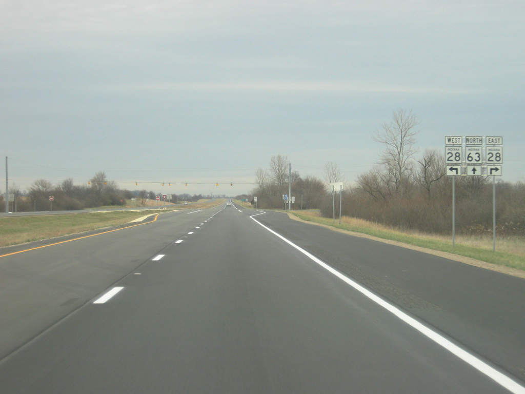
SR 63 is now six miles from its northern terminus with U.S. 41. Pine Village, a small community in northern Warren County, accessed via U.S. 41 an SR 26, is 21 miles.
12/02/11

SR 63 meets back up with SR 263 north of West Lebanon.
12/02/11
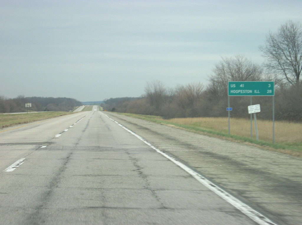
U.S. 41 is now three miles away. Hoopeston, Illinois, accessed via U.S. 41, SR 26, and Illinois 9 is 28 miles away. Because of the lack of available control cities for SR 63 and U.S. 41, the second control city is listed despite being 15 miles to the west of U.S. 41.
12/02/11
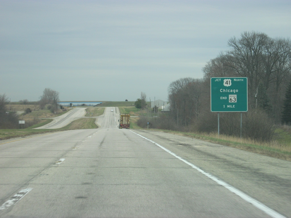
SR 63 finally approaches its end at U.S. 41. The sign ahead indicates that Chicago-bound traffic continue north to U.S. 41.
12/02/11
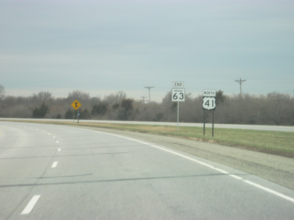
After 61 miles, SR 63 comes to an end as it flows back into U.S. 41, or rather it is U.S. 41 that flows into the four lane expressway.
12/02/11
North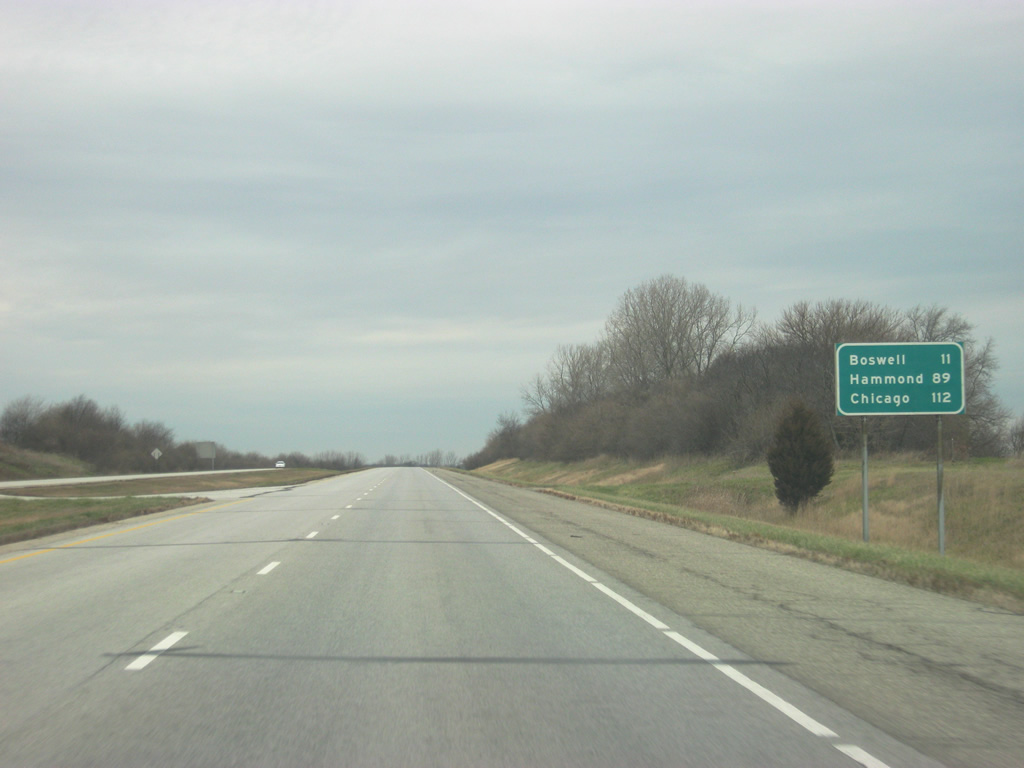
Officially back on U.S. 41, Boswell is the next community of any size at 12 miles. Hammond is at 89 miles and Chicago, Illinois at 112 miles. U.S. 41 carries on the four lane expressway all the way up to Hammond and Chicago.
12/02/11
Photo Credits:
- Thomas Decker: 01/03/10, 12/02/11, 05/11/12, 10/16/12
- ABRoads: 11/04/11
Connect with:
Page Updated Thursday October 03, 2013.