Maryland Route 97 travels 55 miles north from Silver Spring, just outside Washington, D.C., to the Pennsylvania state line northwest of Union Mills. Forming a multi state route with PA 97 north toward Gettysburg, MD 97 replaced part of what was U.S. 140 south to Westminster.
|
| Leaving the exchange with MD 27 (Railroad Avenue west / Manchester Road north), MD 97/140 (Baltimore Boulevard) regain commercialized frontage to the traffic light with Englar Road. Englar Road loops east as Hahn Road to MD 27 and west to Carroll Street. 06/04/05 |
|
| One half mile south of the parclo interchange with Pennsylvania Avenue (former U.S. 140) south and Littlestown Pike (MD 97) north on Baltimore Boulevard west. 06/04/05 |
|
| Sullivan Avenue stems east from Pennsylvania Avenue to become Sullivan Road at MD 97/140 (Baltimore Boulevard). Sullivan Road leaves Westminster through suburban development before transitioning into rural areas to MD 27 at Cranberry. 06/04/05 |
|
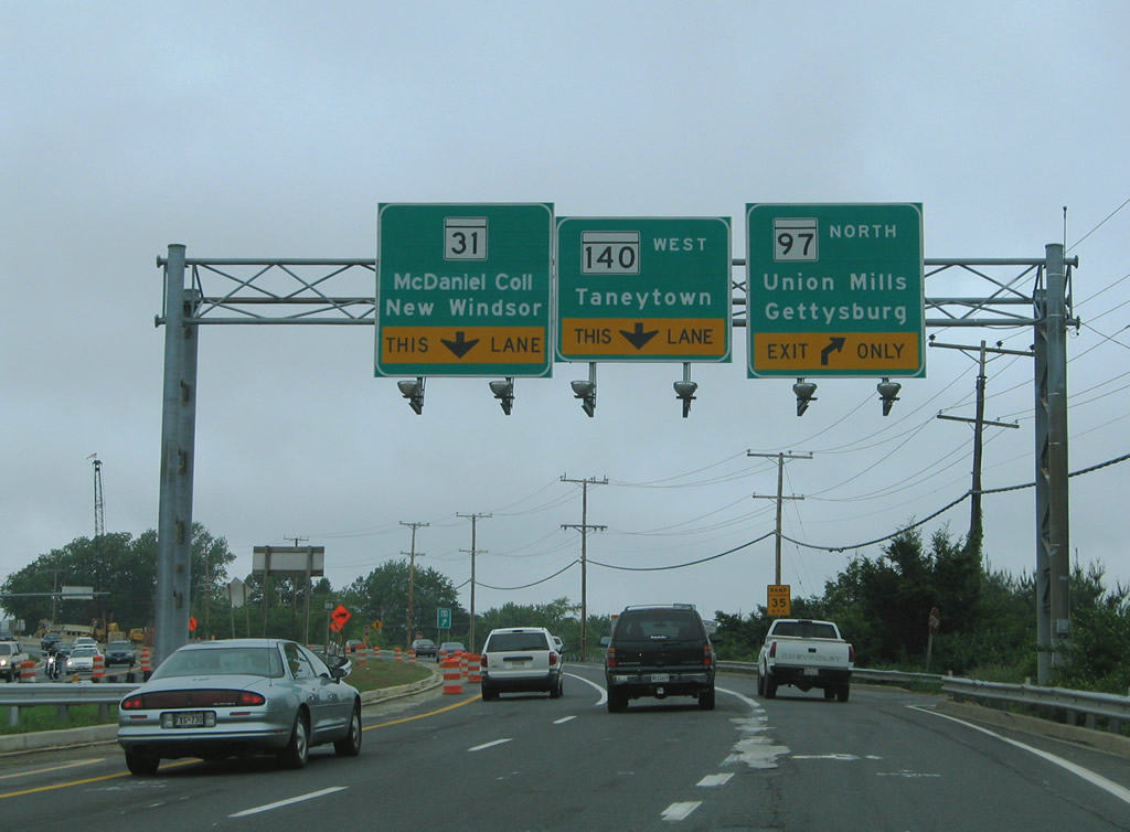
| MD 140 (College View Boulevard) splits with MD 97 north at Littlestown Pike. MD 97 continues 10.4 miles north through Mt. Pleasant, Union Mills and Silver Run to become PA 97. Prior to 1977, MSR 97 north was a part of U.S. 140 leading into Gettysburg. 06/04/05 |
|
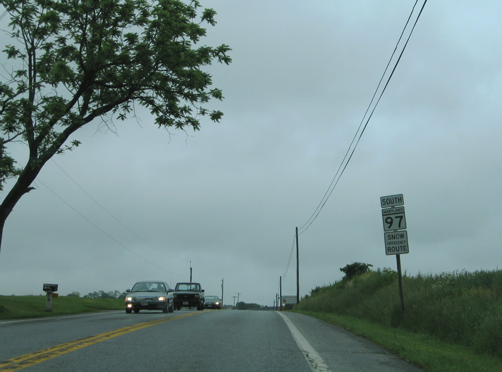
| PA 97 (Baltimore Pike) transitions to MD 97 (Littlestown Pike) north of Silver Run. The first shield for MD 97 stands near the state line. 06/04/05 |
|
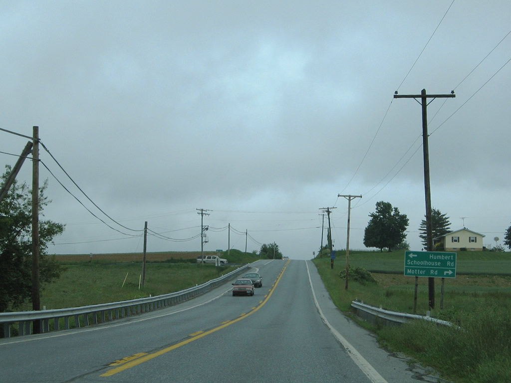
| Approaching the intersection with Humbert Schoolhouse Road east and Motter Road west along MD 97 (Littlestown Pike) south. 06/04/05 |
|
| Humbert Schoolhouse Road meanders northeast to the state line at Old Hanover Road. 06/04/05 |
|
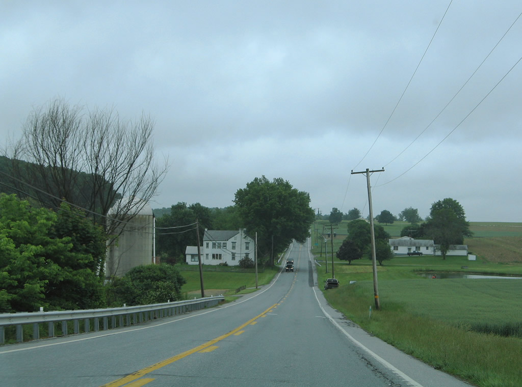
| Sinking toward the crossing of Silver Run along MD 97 south. 06/04/05 |
|
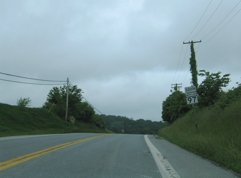
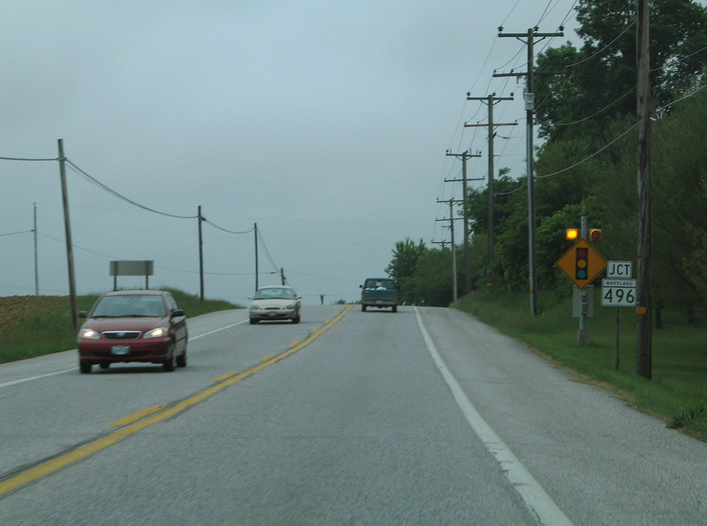
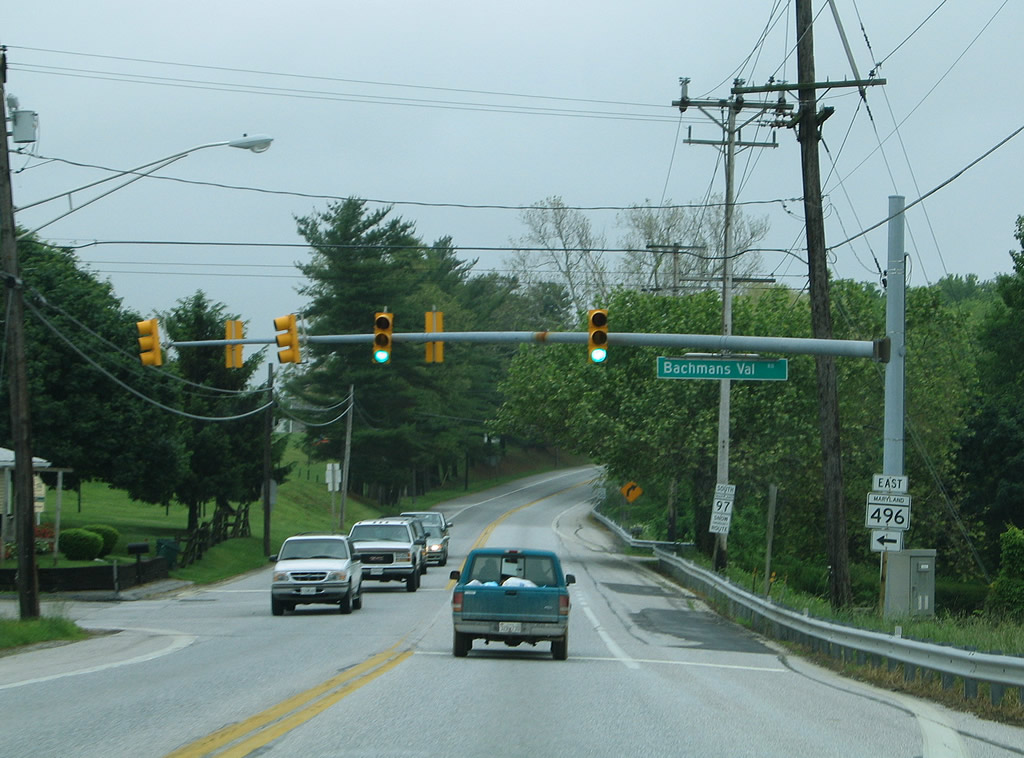
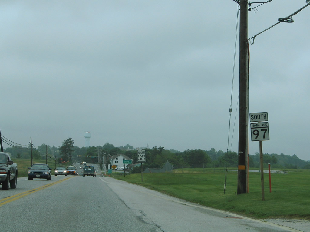
| Continuing south from Silver Run, MD 97 (Littlestown Pike) passes through Union Mills and Mount Pleasant before intersecting the west end of MD 496 (Bachmans Valley Road). 06/04/05 |
|
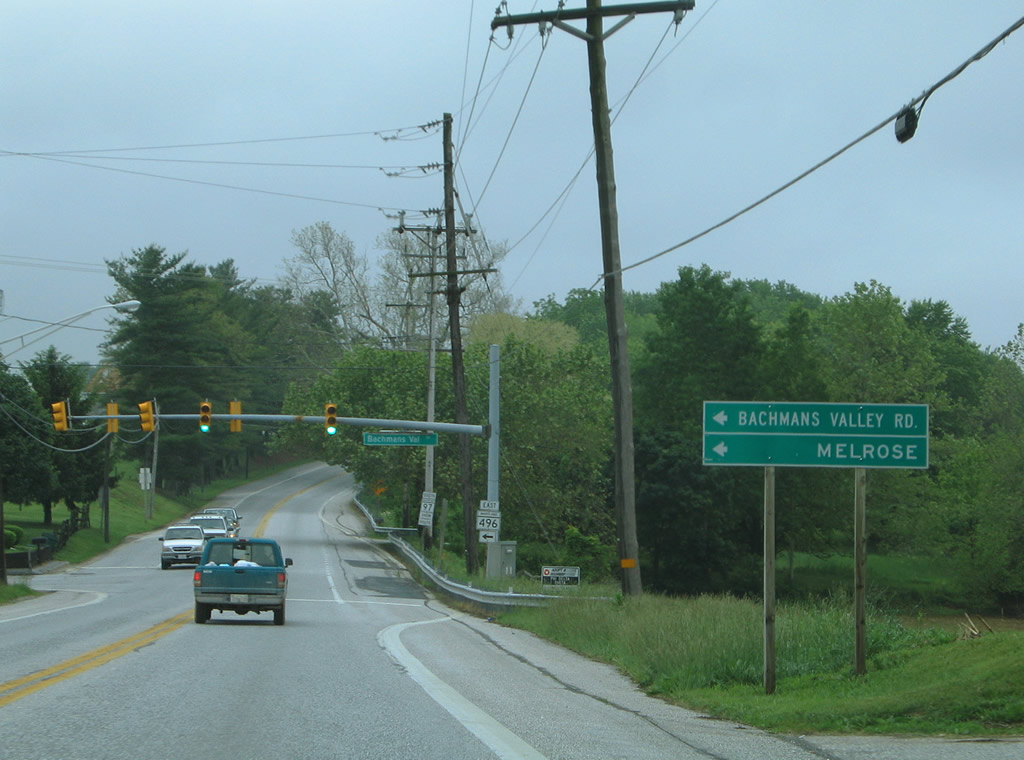
| MD 496 follows Bachmans Valley Road northeast to Bachman Mills and MD 30 (Hanover Pike) near Melrose for a distance of 7.23 miles. 06/04/05 |
|
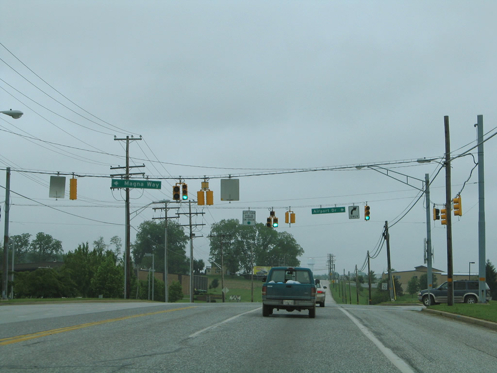
| Entering the city of Westminster, MD 97 (Littlestown Pike) intersects Airport Drive west to Carroll County Regional Airport /Jack B. Poage Field (DMW) and Magna Way east to Old Bachmans Valley Road. 06/04/05 |
|
| MD 97 reassurance shield posted between Magna Way and Old Bachmans Valley Road. Magna Way was constructed to better improve access to Carroll County Regional Airport from the east. 06/04/05 |
|
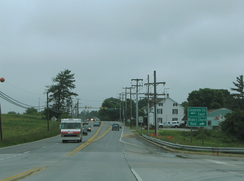
| Meadow Branch Road loops north and then southwest from MD 97 to MD 140 (Taneytown Pike). Following that intersection is the traffic light with Corporate Center Court. 06/04/05 |
|
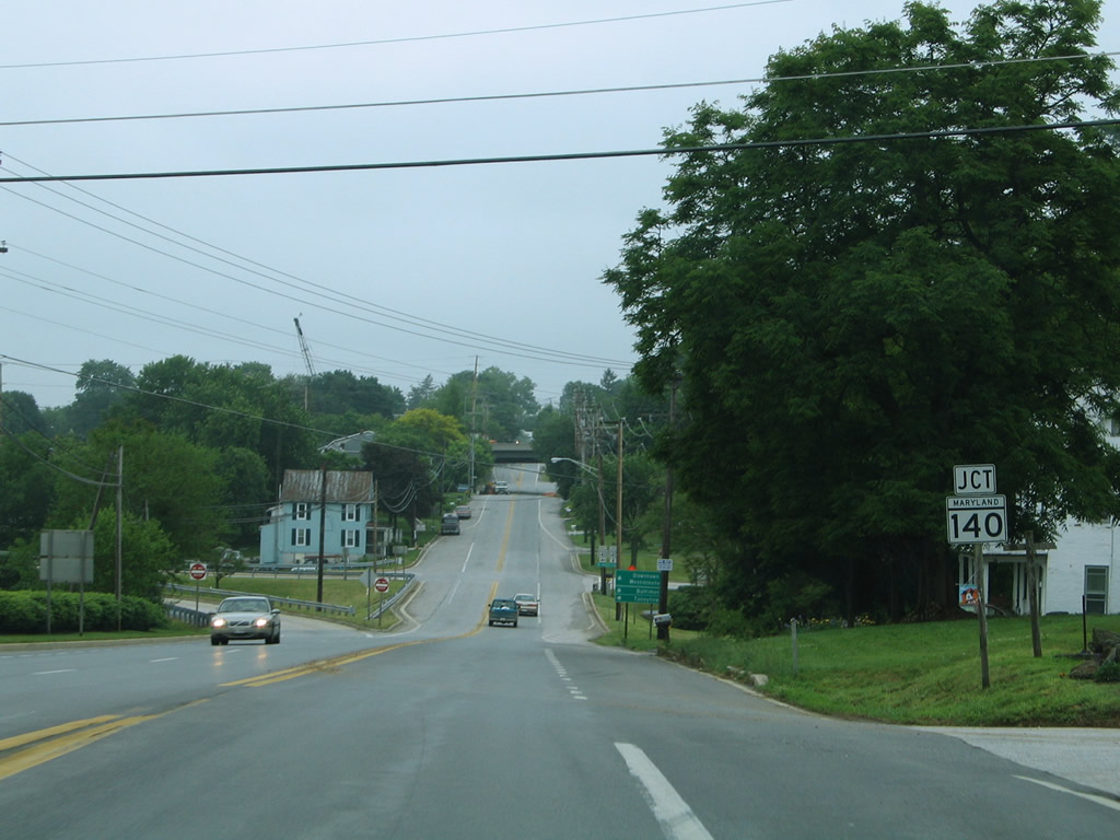
| Lowering to the parclo interchange with the MD 140 / Westminster Bypass along MD 97 (Littlestown Pike) south. The Westminster Bypass is a semi-controlled access expressway encircling the Carroll County seat from Center Street and MD 27 (Manchester Road) west to MD 31 (New Windsor Road) and WMC Drive. 06/04/05 |
|
| MD 97 south joins MD 140 (Baltimore Boulevard) east to Malcolm Drive on the south side of Westminster. Much of the drive is inundated with shopping centers, car dealerships and other businesses. South of the exchange, Littlestown Pike becomes Pennsylvania Avenue en route to Downtown. 06/04/05 |
|
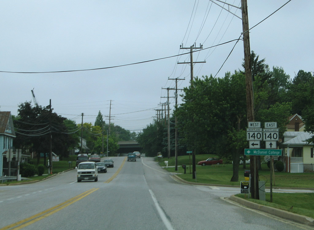
| MD 140 west (College View Boulevard) travels from MD 97 to MD 31 (New Windsor Road) and south to McDaniel College on the ten mile drive to Taneytown. 06/04/05 |
|
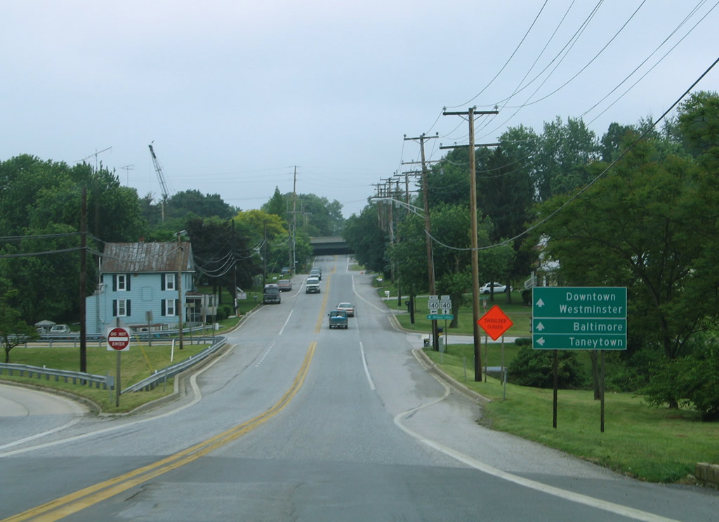
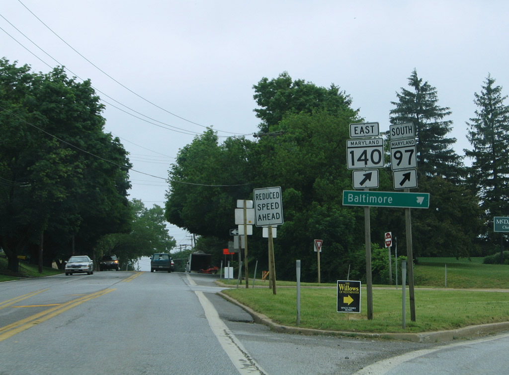
| MD 97 overlaps with MD 140 east for 2.3 miles along the east side of Westminster. MD 140 leads southeast from the split with MD 97 to Reistertown and Baltimore while MD 97 vacates the area for Cooksville and Washington, DC. 06/04/05 |
Page Updated 08-27-2010.