
Route 101 West - Hampton to Manchester

The westbound beginning of NH 101 follows Church Street from NH 1A (Ocean Boulevard) in Hampton Beach.
07/30/07
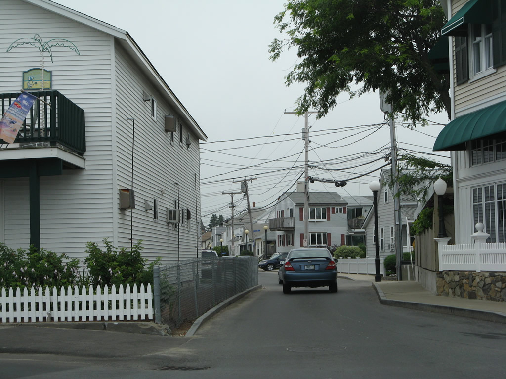
A series of residential streets stem northward from Church Street as NH 101 heads west through Hampton Beach.
07/30/07
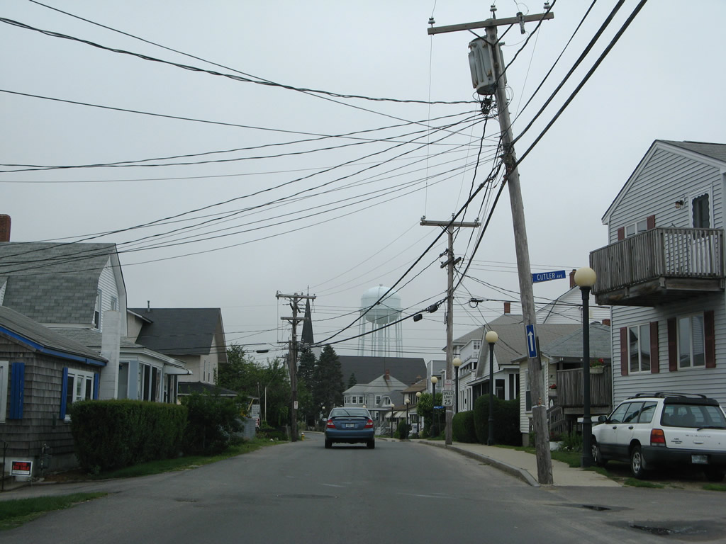
A connector provides return access to Highland Avenue (NH 101 east) back toward the beach.
07/30/07
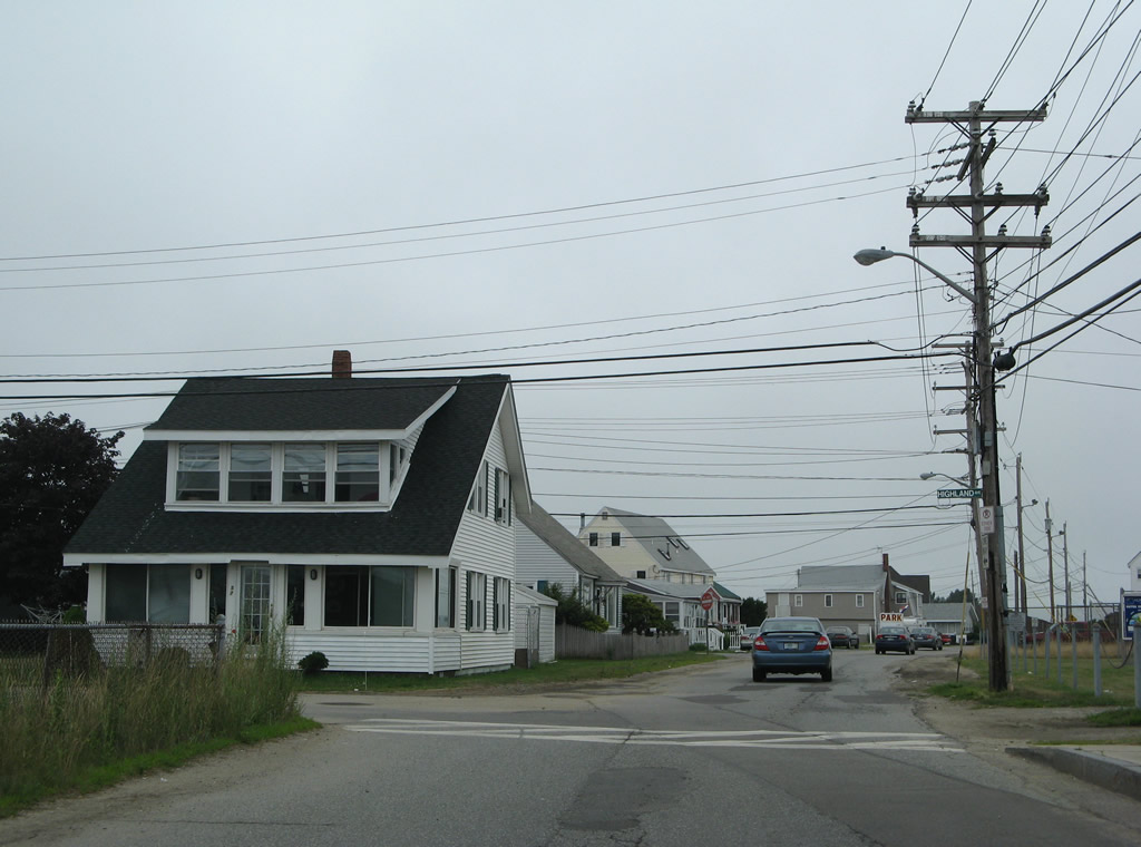
Glade Path spurs west to Eastman Point as the couplet of NH 101 comes together.
07/30/07
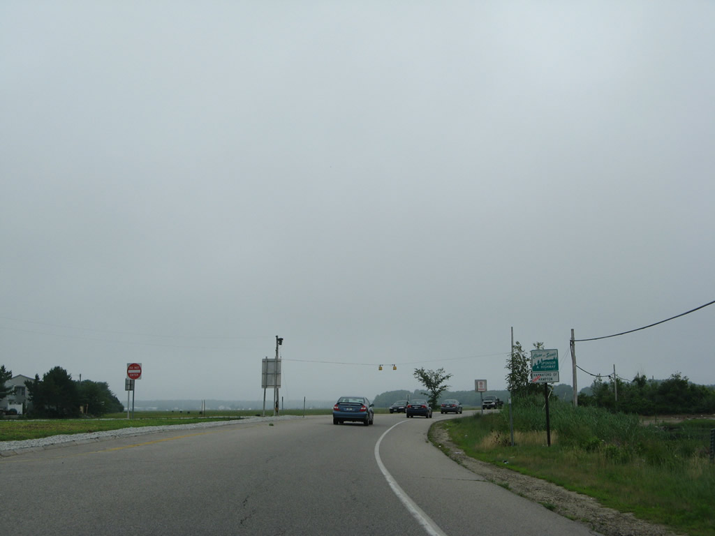
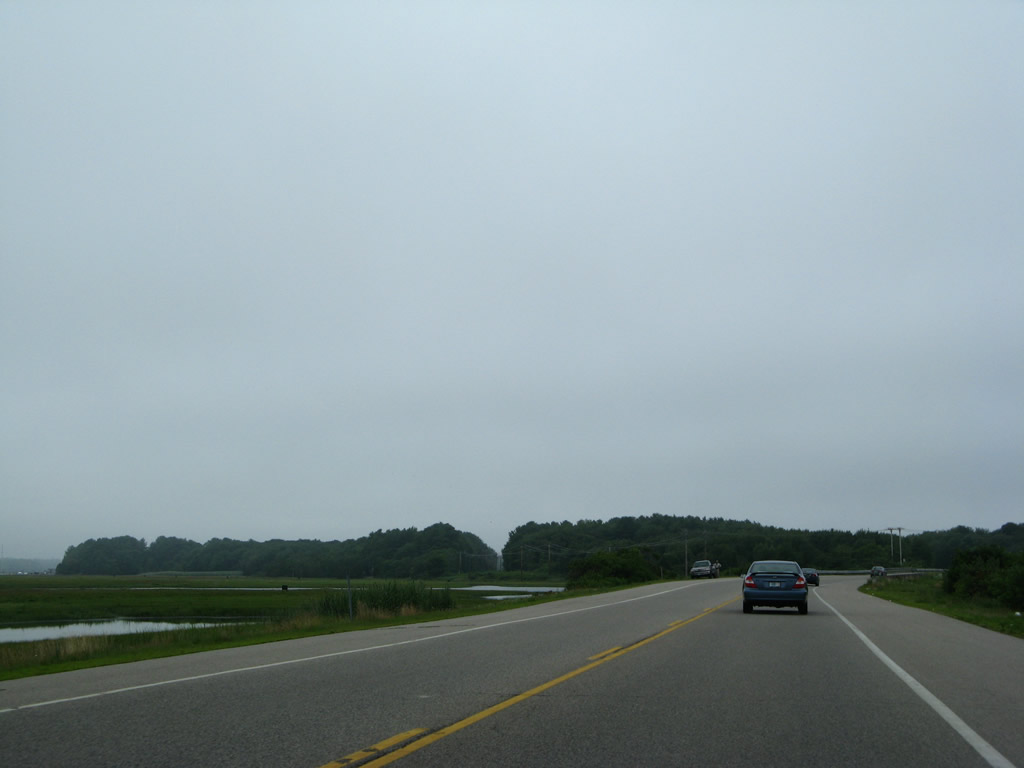
Leaving Hampton Beach, NH 101 west plies across marshland along Exeter-Hampton Expressway.
07/30/07

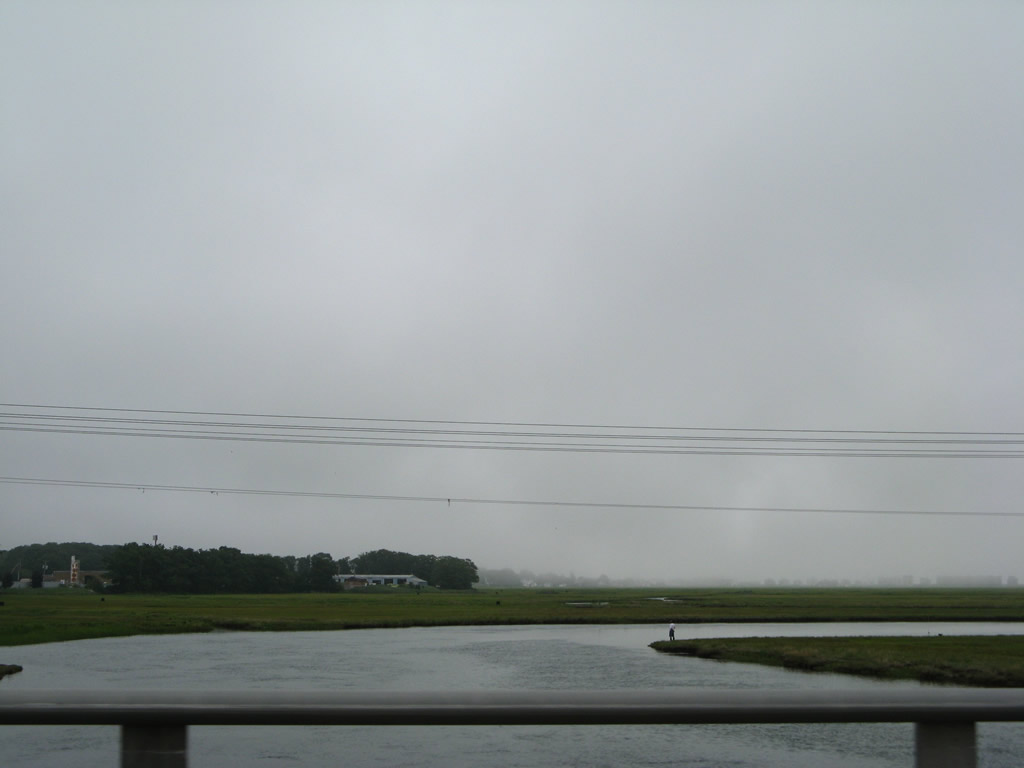
Tide Mill Creek winds southwest into the Hampton River south of NH 101. The NH 101 causeway ends beyond the creek.
07/30/07
The first reassurance marker for NH 101 west appears beyond the signalized intersection with Landing Road.
06/27/05
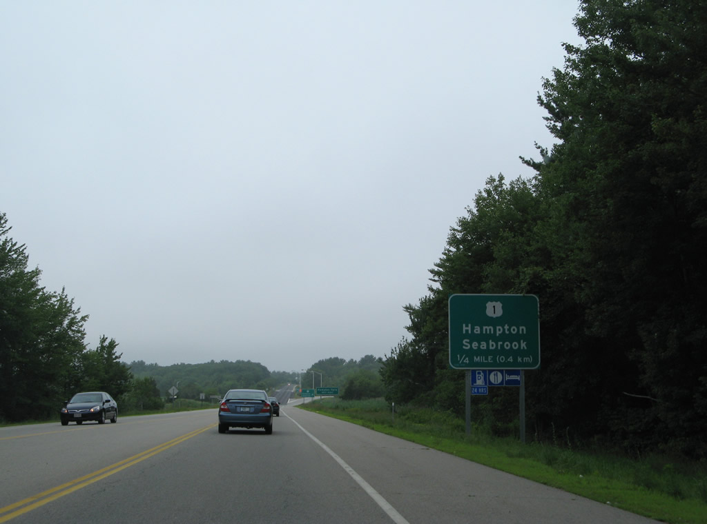
U.S. 1 (Lafayette Road) and NH 101 (Exeter-Hampton Expressway) come together in one quarter mile on the south side of the Hampton town center.
07/30/07
U.S. 1 crosses the Taylor River southwest to Hampton Falls en route to Seabrook.
07/30/07
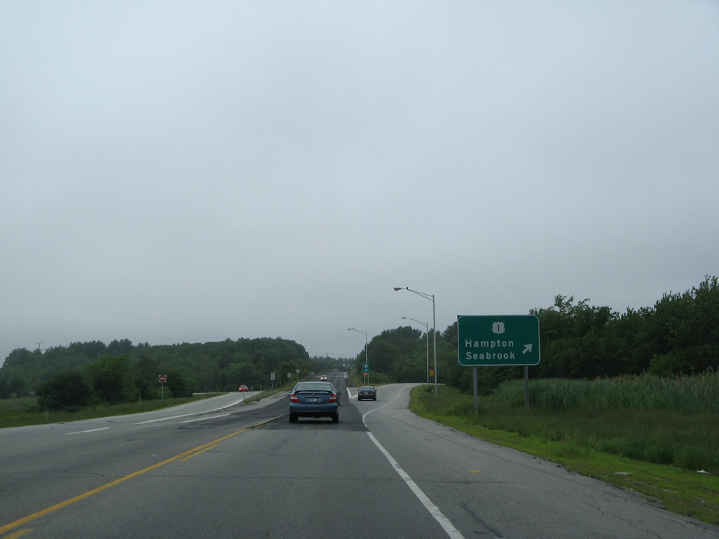
NH 101 upgrades to a super-two expressway beyond the off-ramp to U.S. 1 (Lafayette Road) north. A U-turn ramp provides southbound access from U.S. 1 nearby.
07/30/07
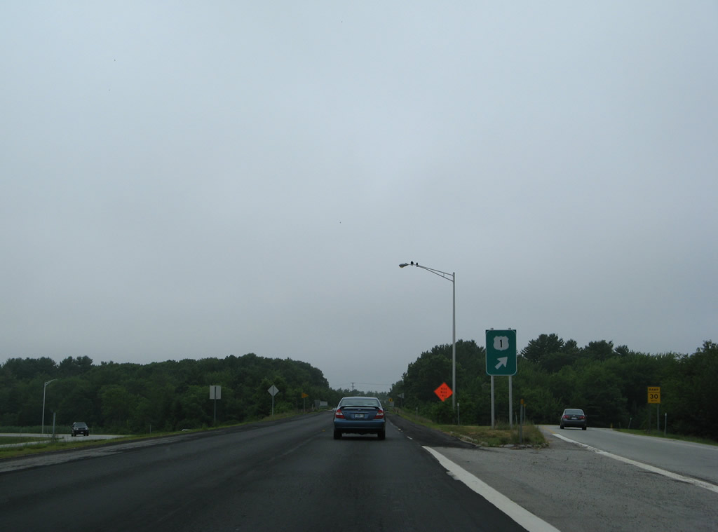
An Interstate 95 trailblazer accompanies this NH 101 reassurance sign after the on-ramp from U.S. 1 north.
07/30/07
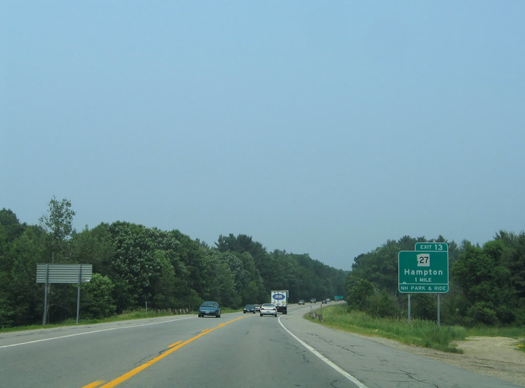
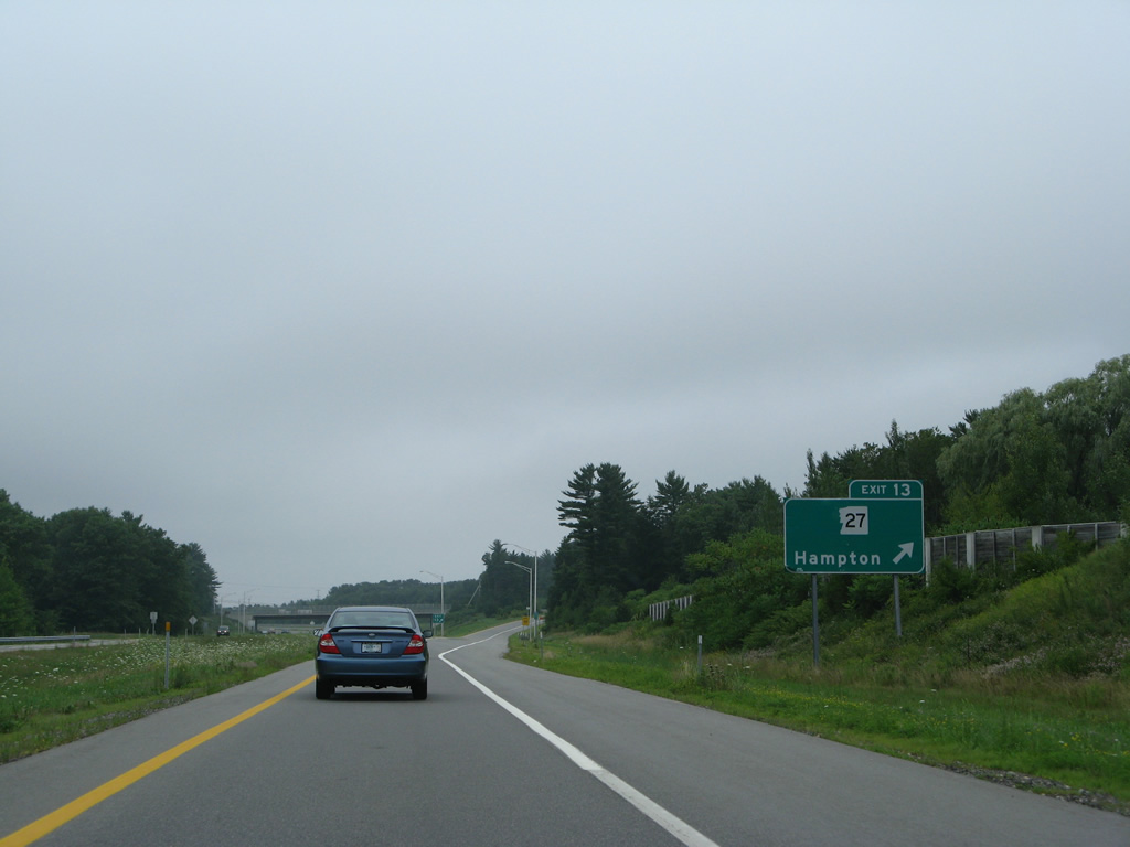
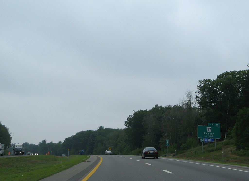
Curving northward, NH 101 (Exeter-Hampton Expressway) next meets NH 27 (Exeter Road) at a parclo interchange (Exit 13) in one mile.
06/27/05
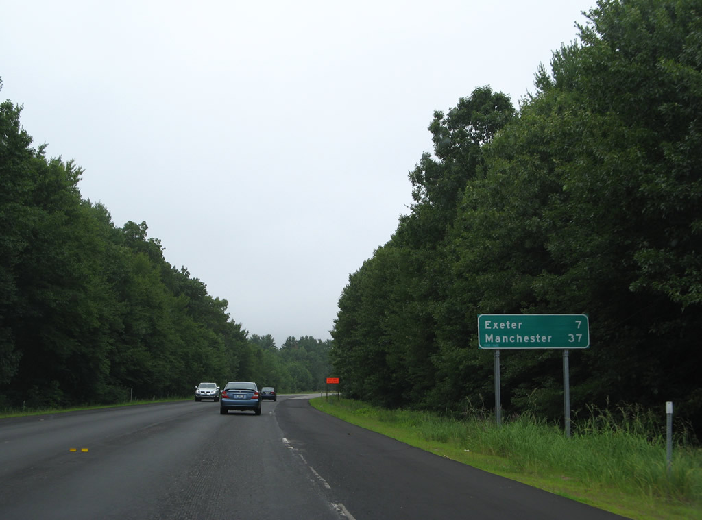
Leading west from Hampton, the NH 101 freeway reaches Exeter in seven miles and Manchester in 37 miles.
07/30/07
The super-two expressway expands into a conventional four lane freeway beyond the Towle Farm Road overpass.
07/30/07
NH 27 ventures west from NH 1A at North Beach to the Hampton town center and Exit 13. The state route replaced the former alignment of NH 101C from Hampton west to Dows Corner in east Exeter.
07/30/07
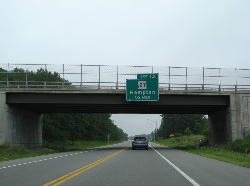
Exit 13 departs NH 101 west for NH 27 east back into Hampton and west to Dows Corner. The original Hampton interchange of the Blue Star Turnpike tied into NH 27 nearby. It was replaced by direct ramps with the NH 101 freeway ahead.
07/30/07
NH 101 veers west to cross over Interstate 95 ahead of the trumpet interchange and access road to the Blue Star Turnpike.
07/30/07
Interstate 95 travels north to Portsmouth and Kittery, Maine and south to Seabrook and Salisbury, Massachusetts as the tolled Blue Star Turnpike.
07/30/07
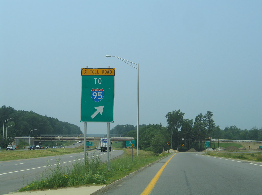
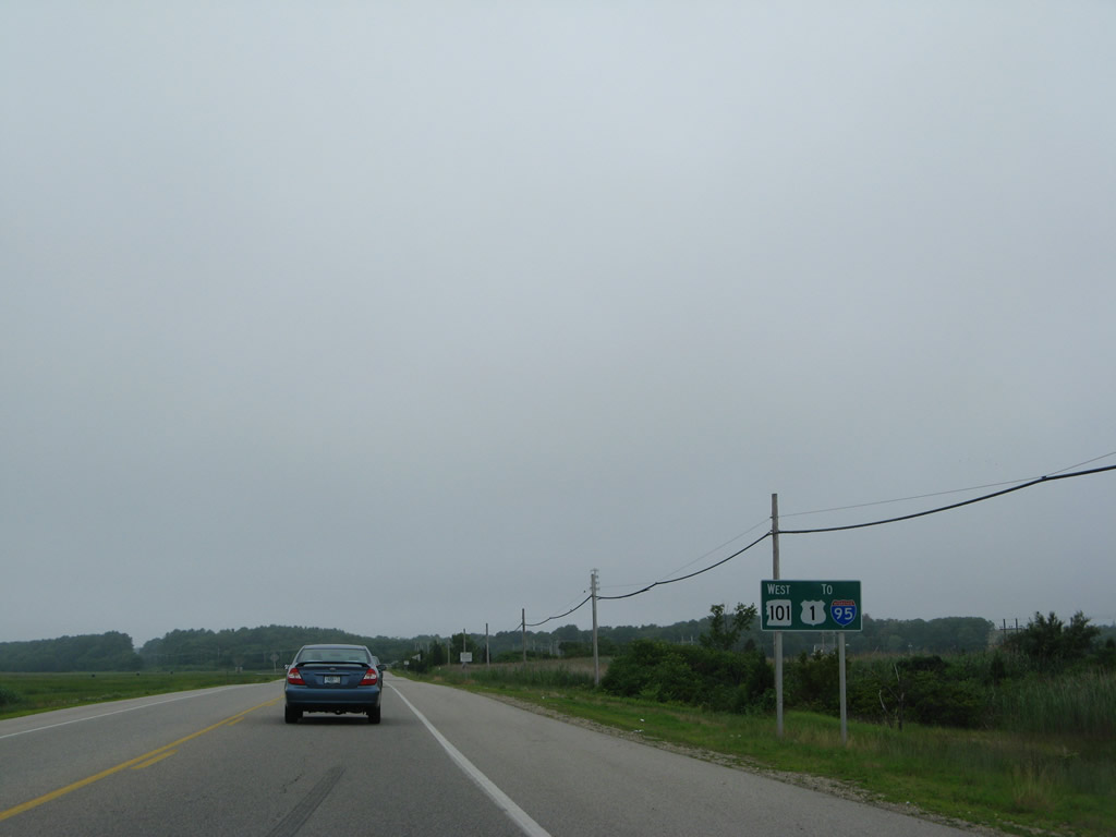
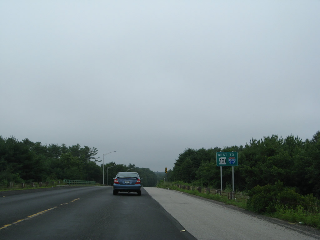
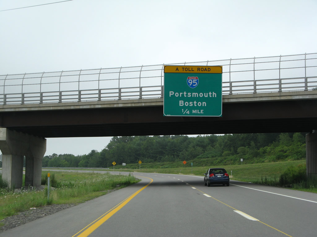
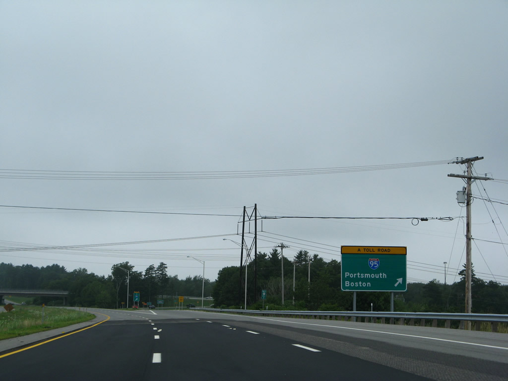
All traffic bound for Interstate 95 north to Portland, Maine and south to Boston, Massachusetts departs NH 101 in unison.
06/27/05
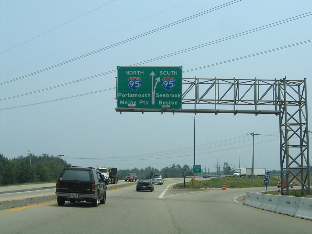
This diagrammatic sign once directed travelers onto Interstate 95 (Blue Star Turnpike) beyond the Hampton Side Toll Plaza from NH 101. Tolls are charged at half the main line rate for drivers originating from NH 101.
06/27/05
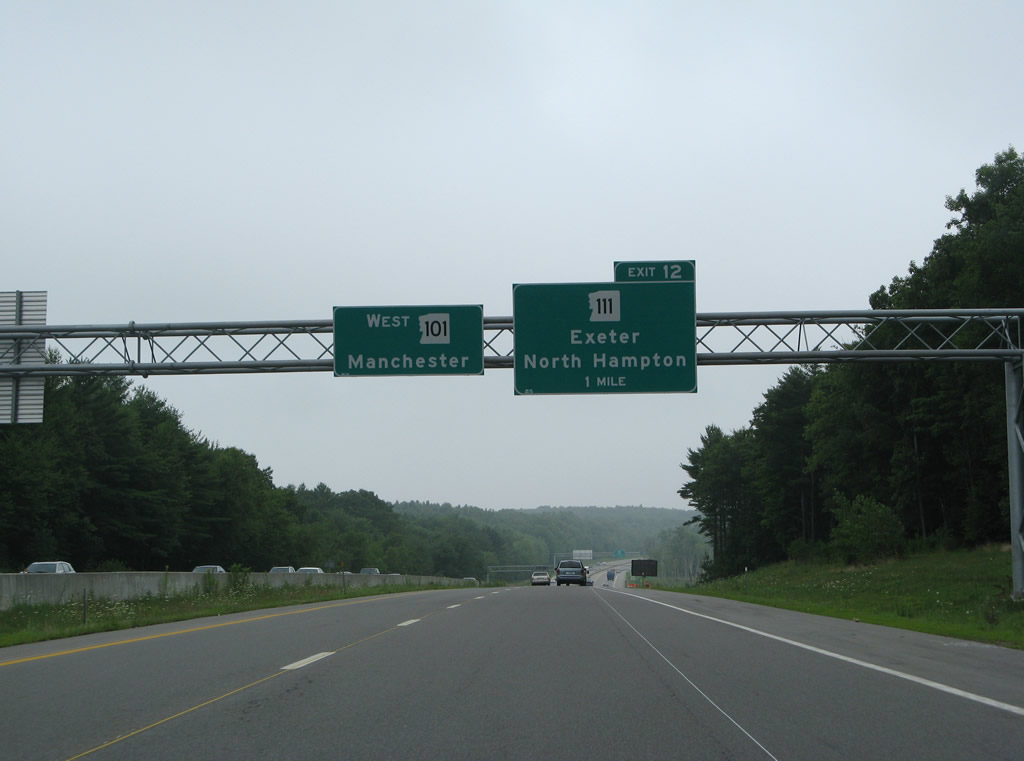
NH 101 heads west over Car Barn Hill toward the first of four exits for the town of Hampton. Meeting the freeway in one mile is NH 111 west from North Hampton.
07/30/07
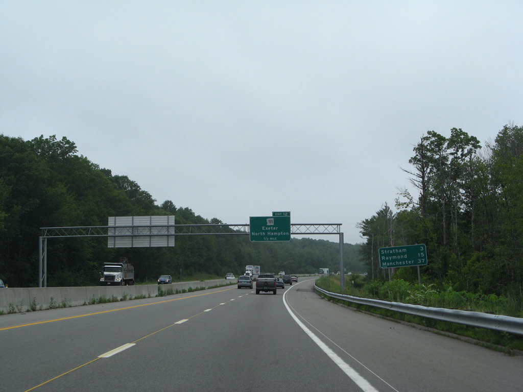
NH 101 nips the western corner of Stratham beyond Exit 12 and reaches the town of Raymond in 15 miles. The largest city in New Hampshire is 37 miles away.
07/30/07
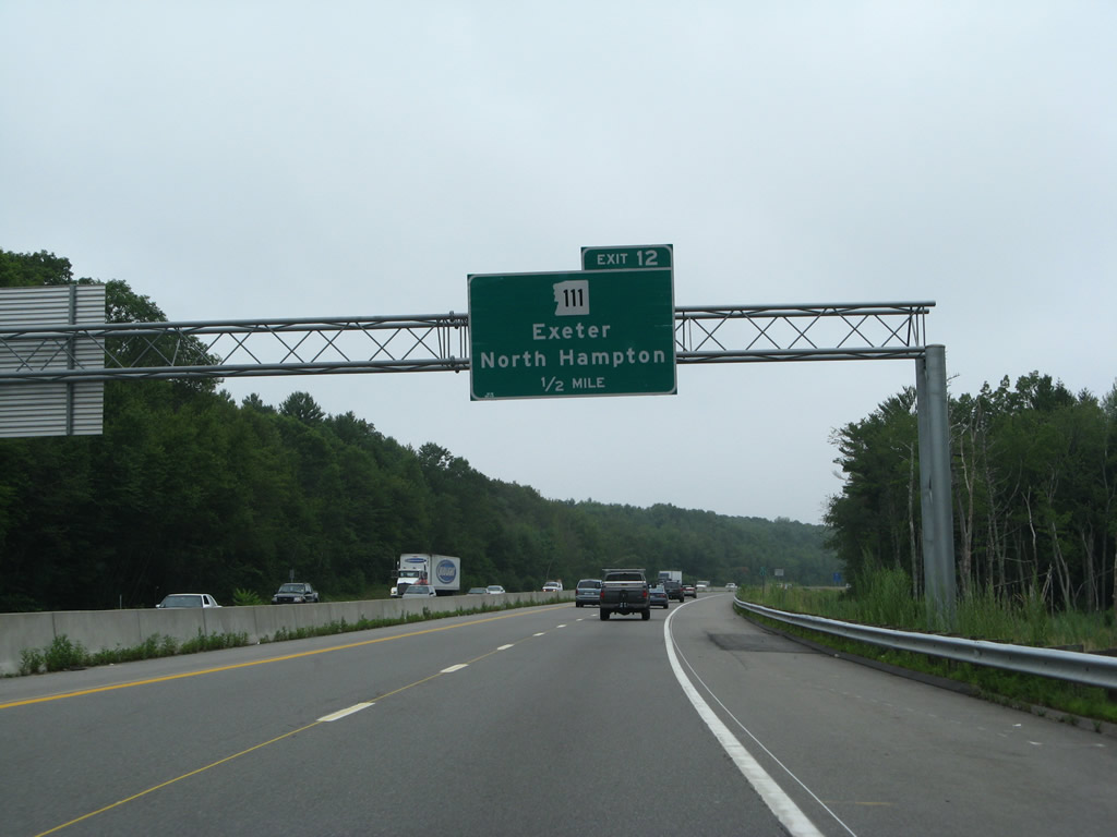
NH 111 replaced the routing of NH 101D west from Little Boars Head (NH 1A) to NH 27 at Dowers Corner. A diamond interchange (Exit 12) joins the state route with the NH 101 freeway in one half mile.
07/30/07
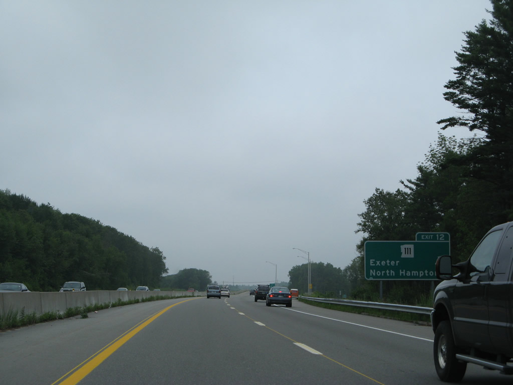
Exit 12 leaves NH 101 west for NH 111 (Exeter Road) east to the Hampton town center. Leading west, NH 111 combines with NH 27 (Hampton Road) into Exeter. Connection with NH 88 south nearby lead motorists into the town of Hampton Falls.
07/30/07
The freeway parallels NH 27 & 101 (Hampton Road) just north of Dows and Hayes Corner over the next two miles.
07/30/07
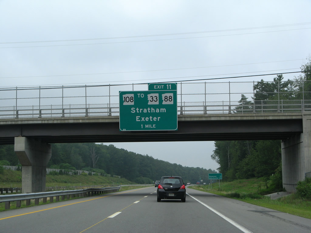
NH 108 (Portsmouth Avenue) angles northeast from NH 27 & 111 (High Street) outside Downtown Exeter to cross paths with NH 101 at a single point urban interchange (SPUI) in one mile.
07/30/07
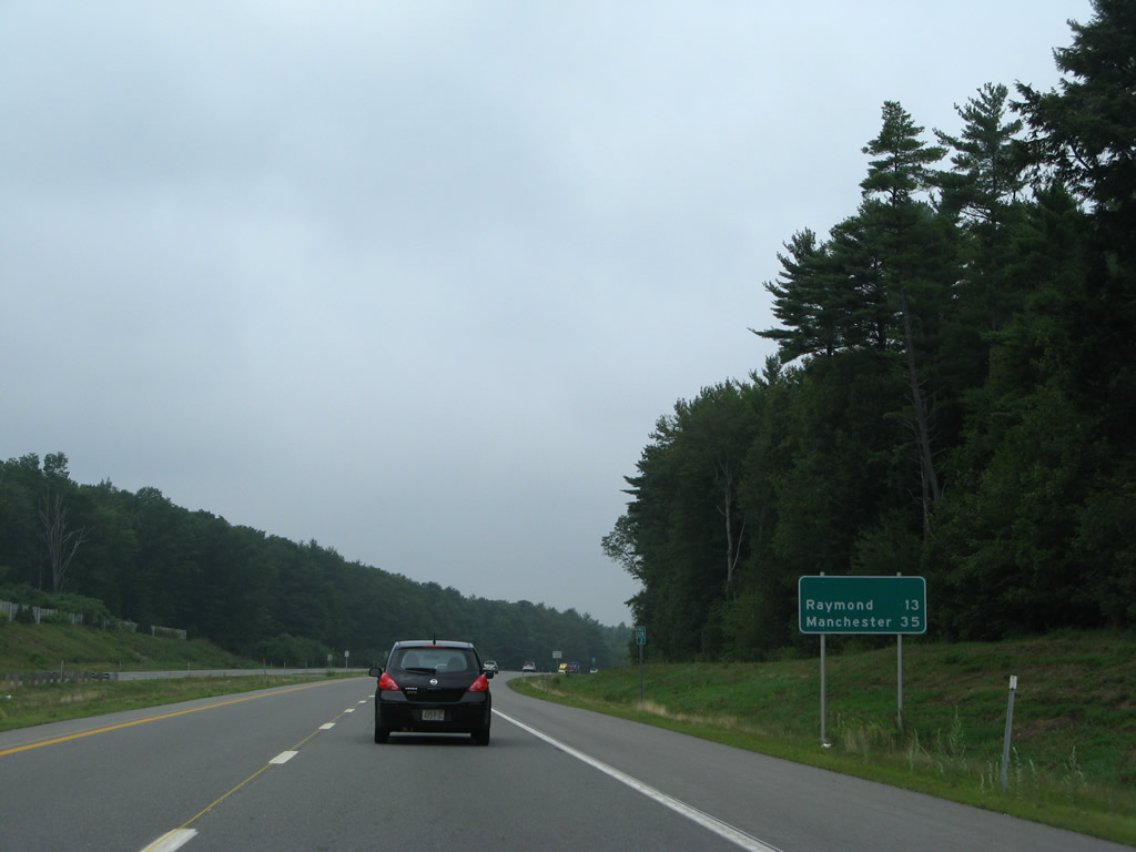
Raymond lies 13 miles ahead, with Manchester now 35 miles away.
07/30/07
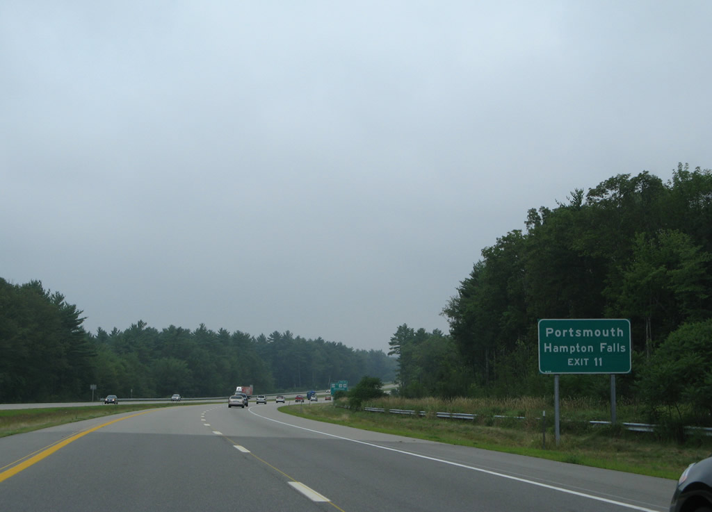
Portsmouth, the original eastern terminus of NH 101, is served by NH 108 north to NH 33 east. NH 33 was designed over old NH 101 by 1995 when NH 101 shifted southeast over the NH 51 freeway into Hampton.
07/30/07
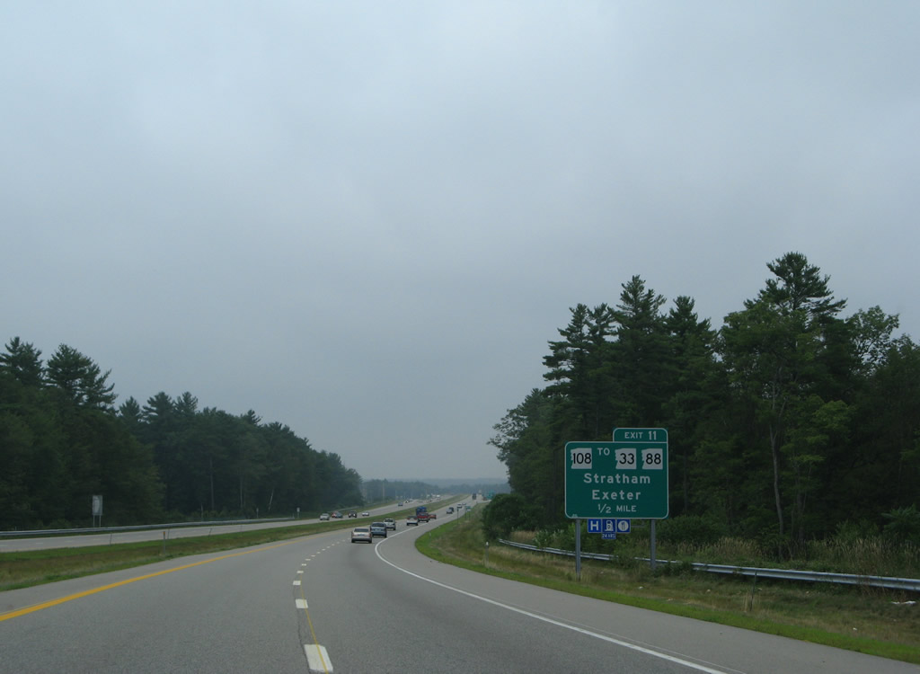
NH 88 ends a 6.67 mile route north from U.S. 1 in Hampton Falls at NH 108 (Portsmouth Avenue) just west of Exit 11. The state route used to end at NH 101 directly, but that at-grade connection was eliminated with the freeway upgrade completed in 2001.
07/30/07
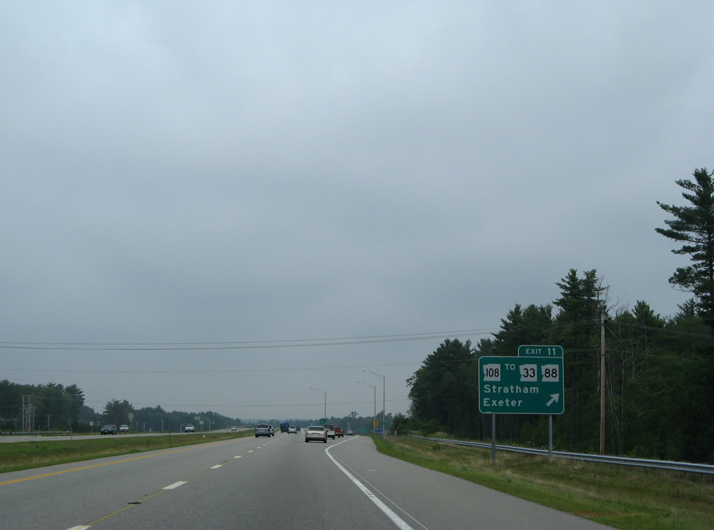
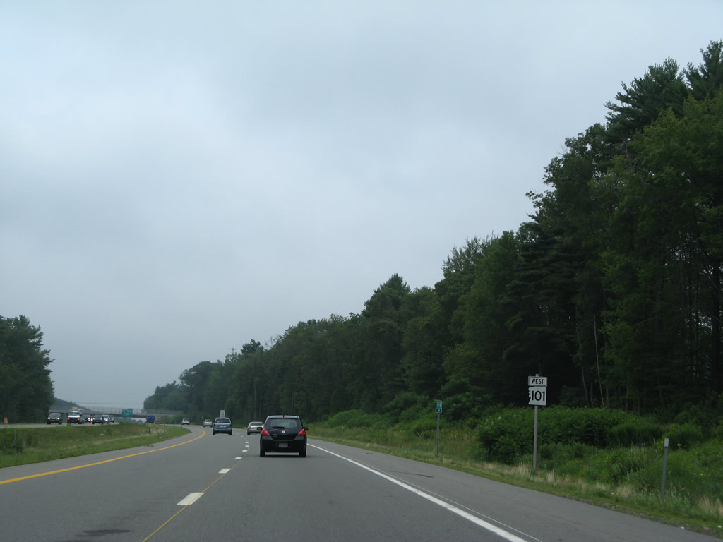
Westbound NH 101 at Exit 11 to NH 108 (Portsmouth Avenue). Portsmouth Avenue constitutes a busy commercial route southwest into Exeter and north to Parkman Corner in Stratham. The state route travels 42.4 miles overall from Rochester south to Haverhill, Massachusetts.
07/30/07
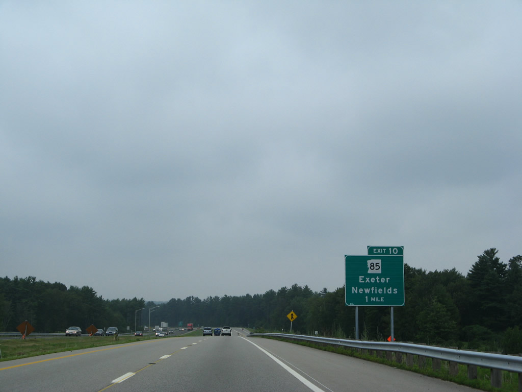
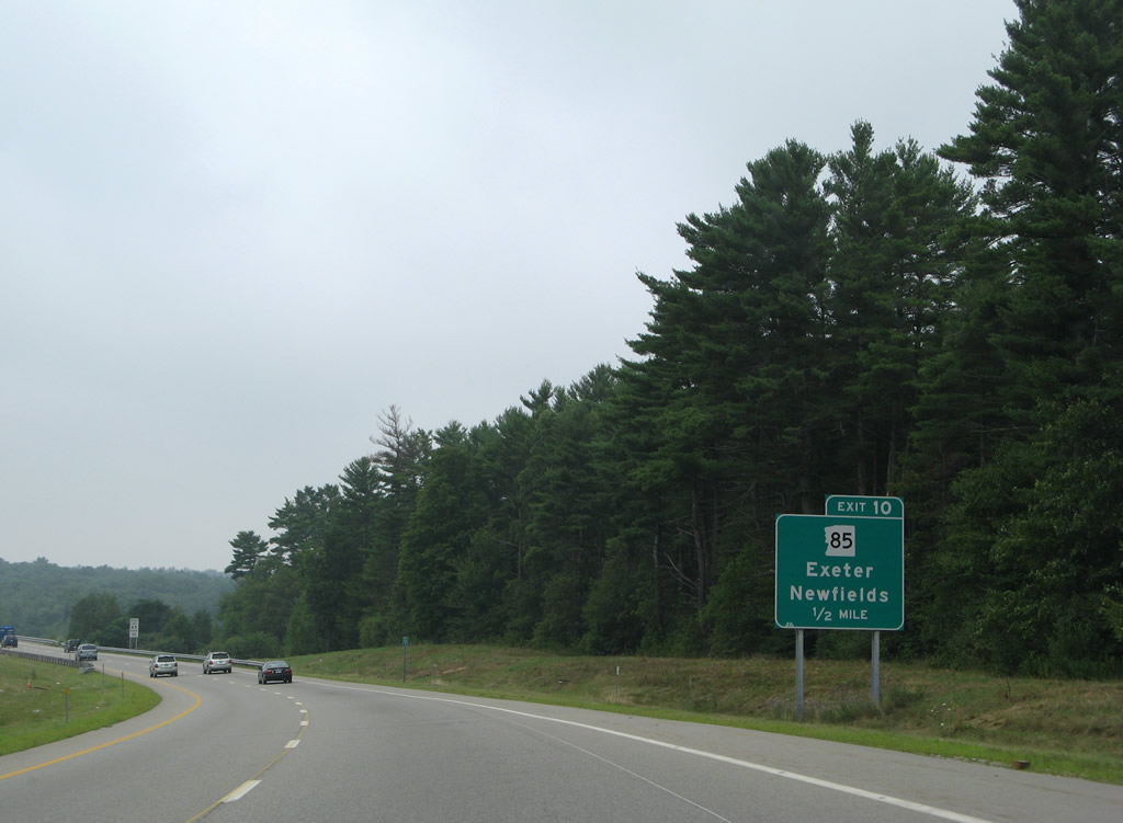
Continuing west, NH 101 bypasses Exeter to the north to next meet NH 85 (Newfields Road) at Exit 10.
07/30/07
NH 85 travels just 4.86 miles from NH 108 in Newfields to NH 27 & 111A (Main Street) at Downtown Exeter.
07/30/07
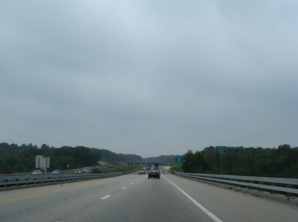
Crossing the Squamscott River, NH 101 west reenters the town of Exeter.
07/30/07
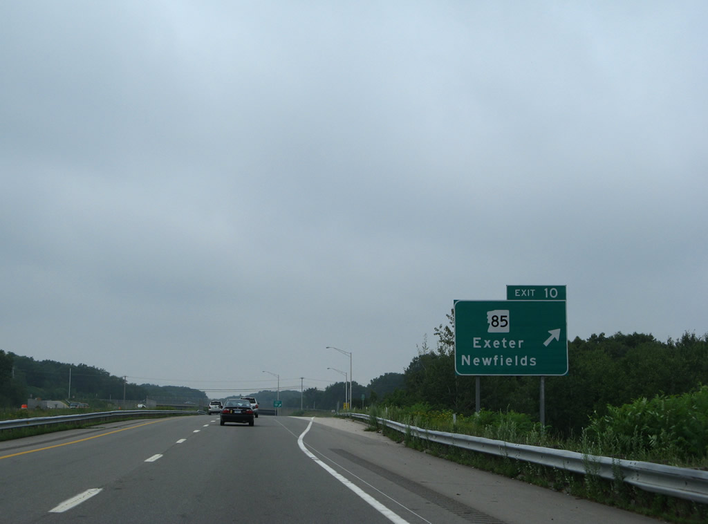
A diamond interchange (Exit 10) joins NH 101 with NH 85.
07/30/07
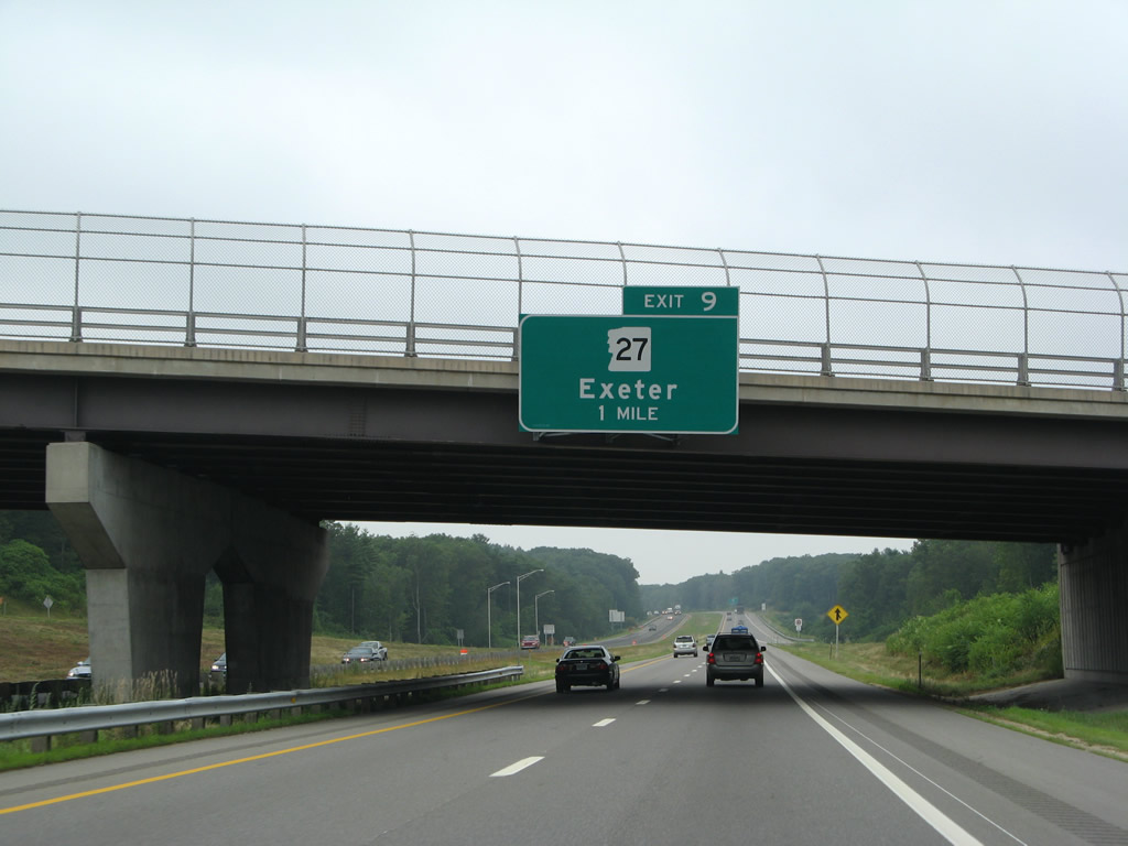
NH 27 and 101 come together again at a diamond interchange (Exit 9) north of Exeter in one mile.
07/30/07
NH 27 (Epping Road) extends west from Exeter as the former alignment of NH 101 to Epping.
07/30/07
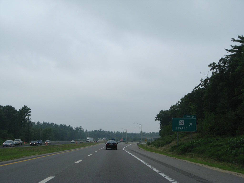
Exit 9 parts ways with NH 101 west for NH 27 (Epping Road). The state route remains just north of the freeway to North Road at New England Dragway.
07/30/07
The 4.5 mile stretch of NH 101 between Exits 9 and 8 was known as the Gap until its completion in September 1999. The state route west and east of this portion preexisted as a super-two expressway.
07/30/07
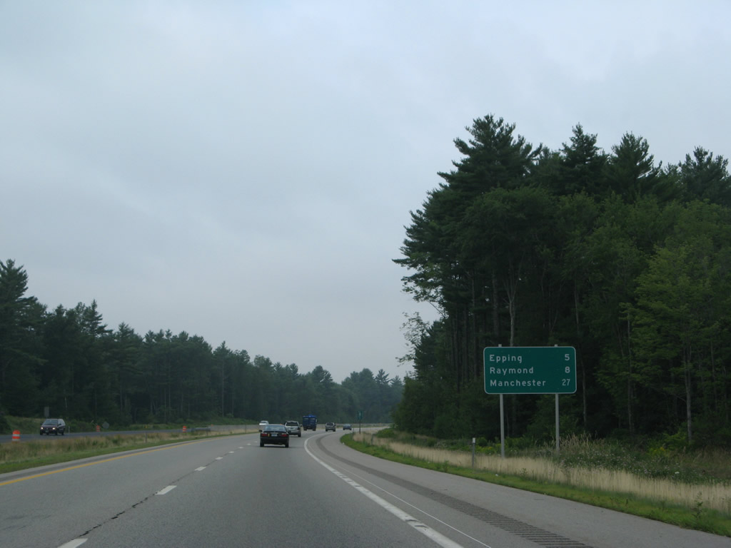
The Epping town center is a five mile drive west along NH 101 to Exit 7. Raymond sees two exits from the freeway within the next eight miles.
07/30/07
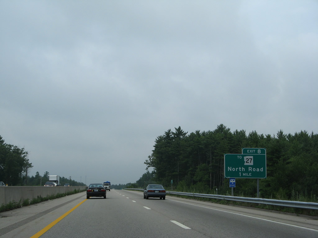
North Road stems west from NH 27 (Exeter Road) to a parclo interchange (Exit 8) with NH 101 in one mile.
07/30/07
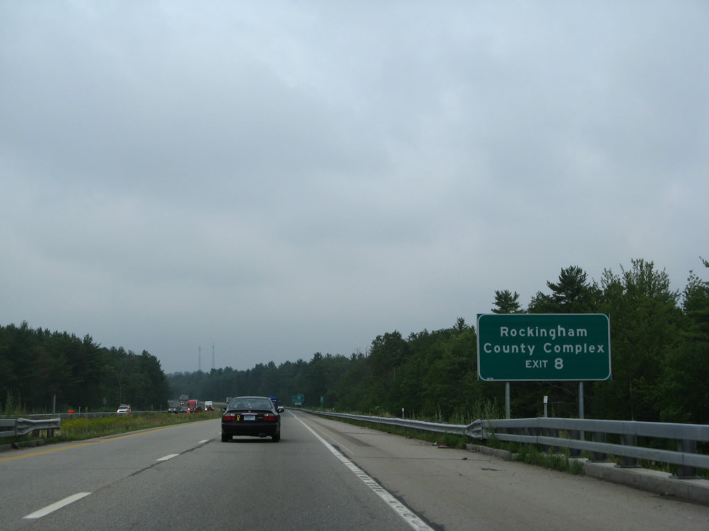
West from Exit 8, North Road serves the Rockingham County Complex en route to NH 125 at Brentwood Corners in the town of Brentwood.
07/30/07
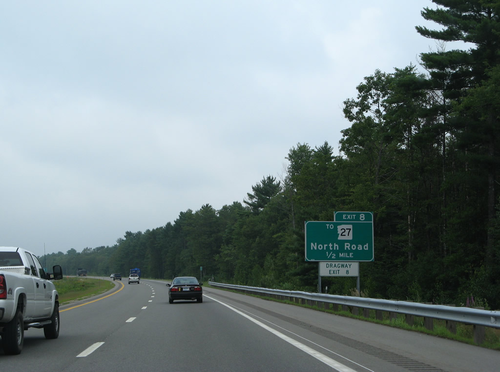
One half mile ahead of the off-ramp (Exit 8) to North Road on NH 101 west. NH 27 meanders northwest to the Epping town center and West Epping.
07/30/07
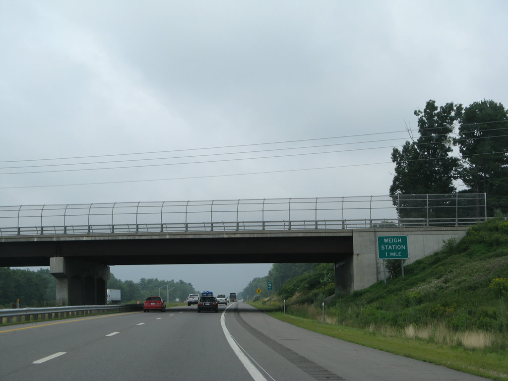
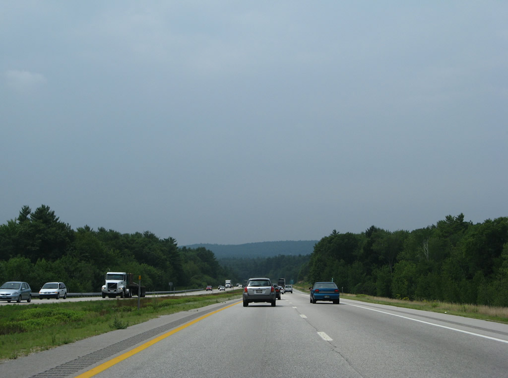
The 4.8 mile section of NH 101 west from North Road to the Raymond town line was upgraded to a full freeway by November 1997. This part of NH 101 includes weigh stations operating in both directions.
07/30/07
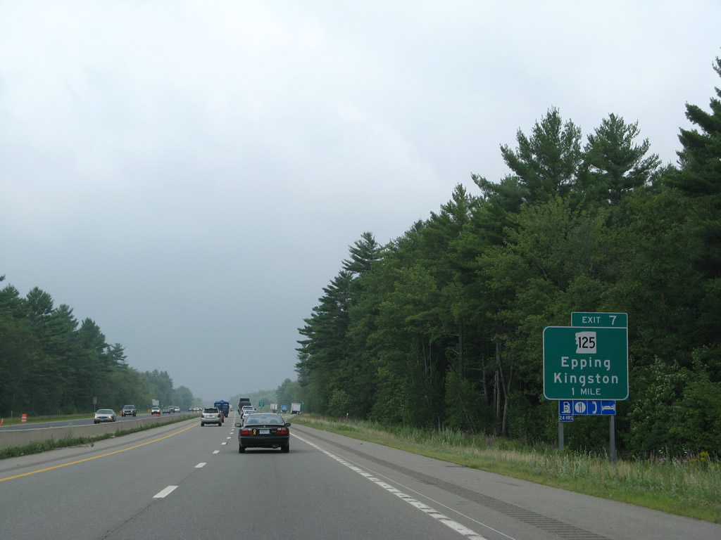
NH 125 (Calef Highway), a 52 mile route from Haverhill, Massachusetts to Wakefield, sees a diamond interchange (Exit 7) with NH 101 west in one mile at milepost 119.
07/30/07
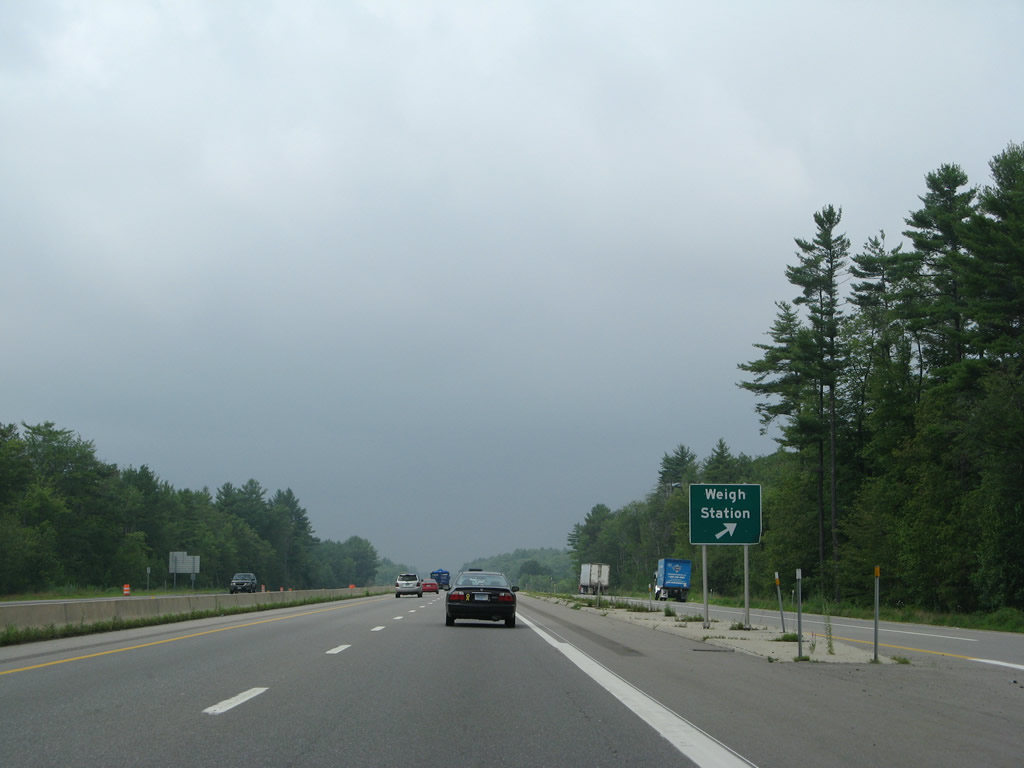
The NH 101 weigh station lies just east of the Piscassic River in the town of Epping.
07/30/07
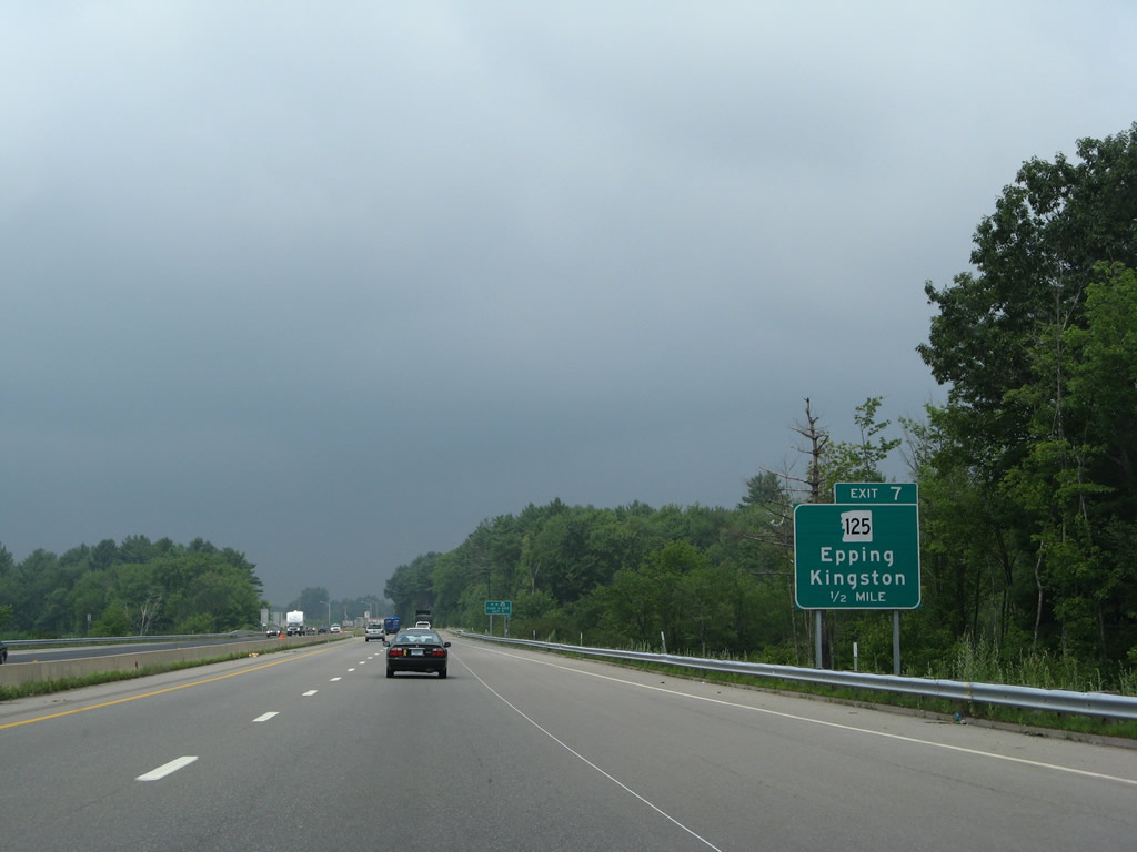
Locally NH 125 joins NH 101 with the Epping town center to the north via Main Street and the Brentwood town center, 3.5 miles to the south.
07/30/07
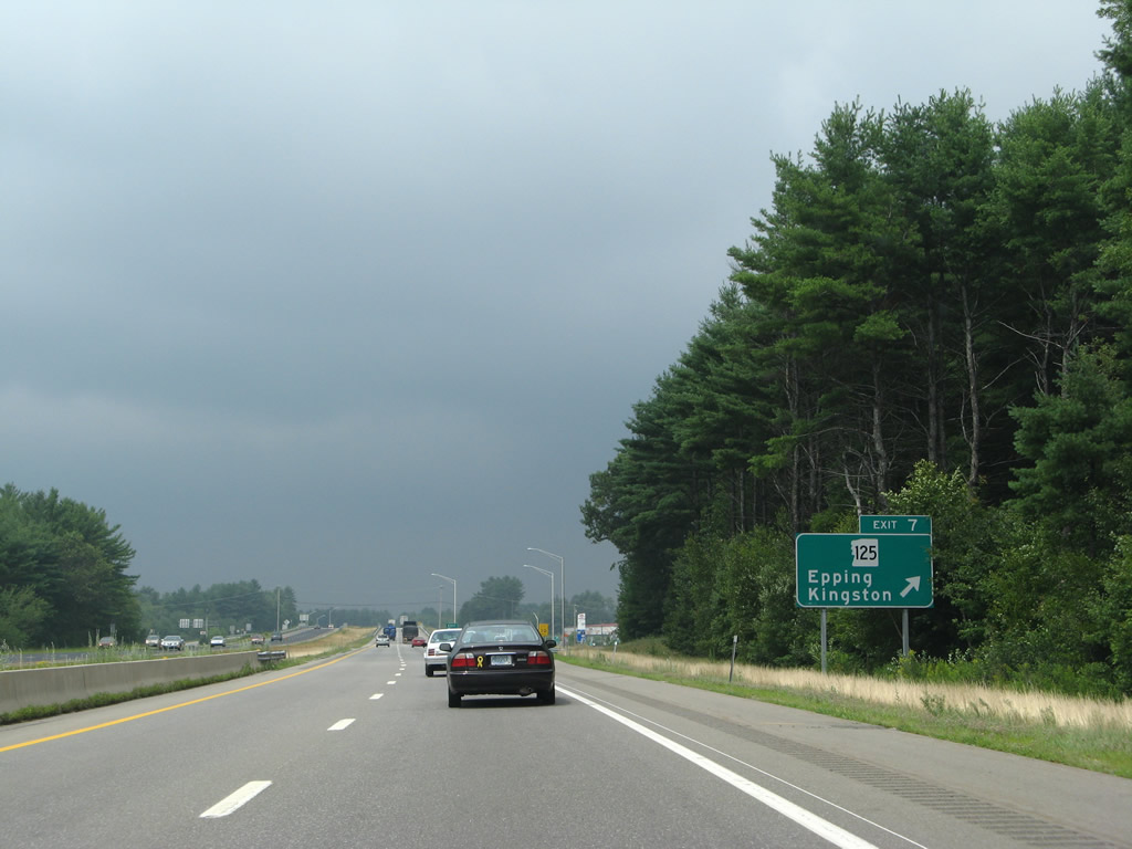
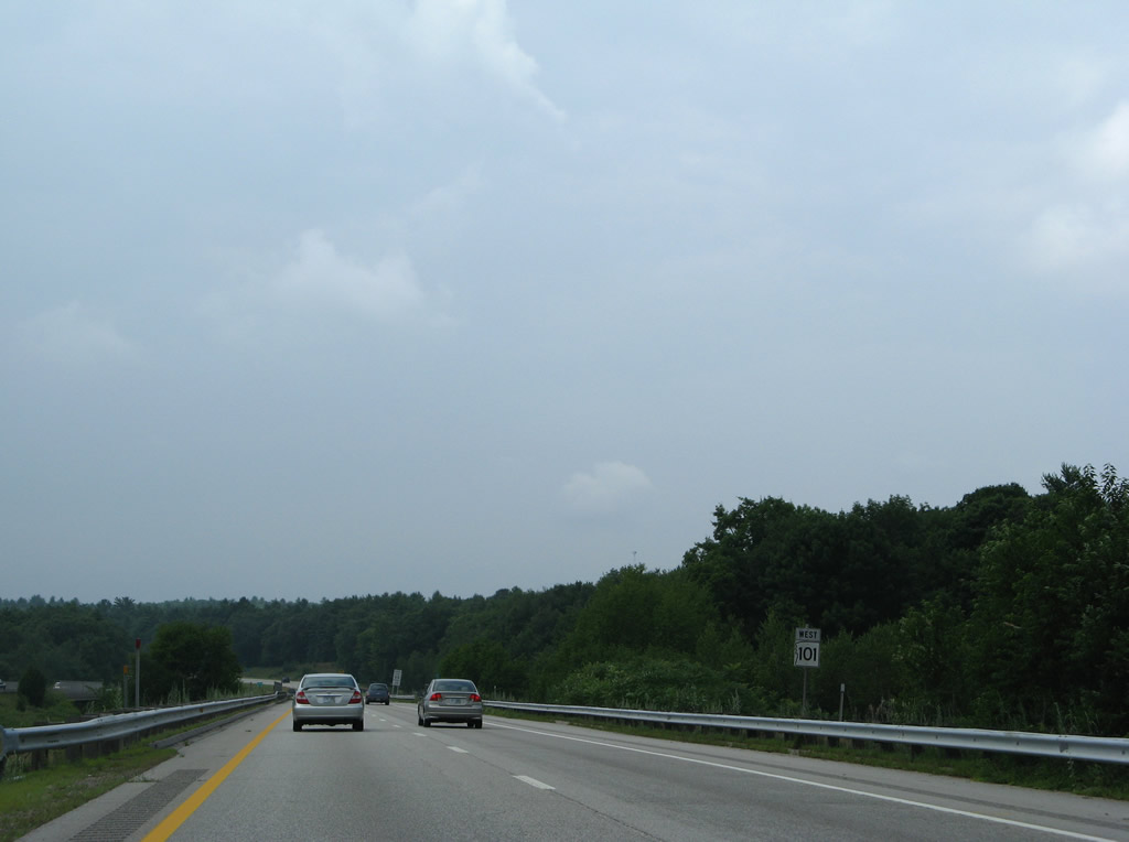
Retail lines both sides of NH 125 (Calef Highway) within the immediate vicinity of Exit 7. The state route otherwise reaches Kingston seven miles to the south.
07/30/07
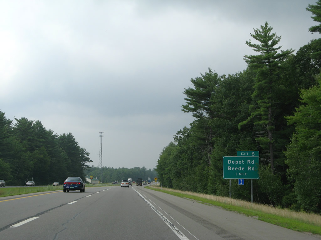
Advancing westward, NH 101 approaches the diamond interchange (Exit 6) with Depot Road north and Beede Road south at milepost 117.
07/30/07
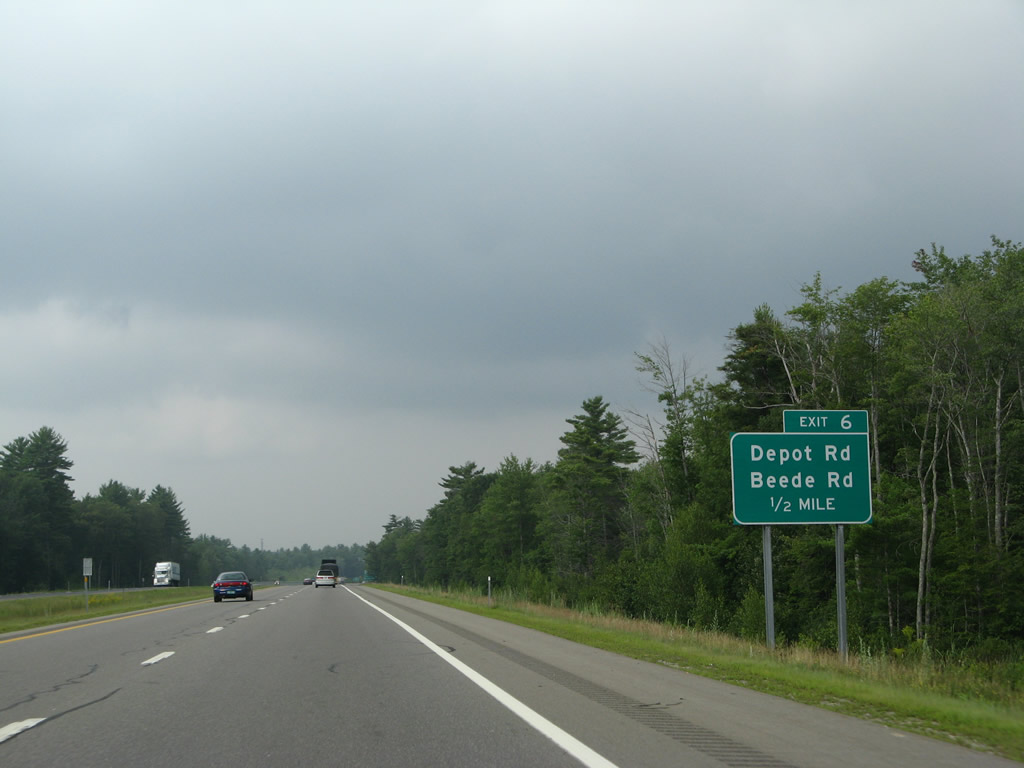
Depot Road extends Beede Road north from Exit 6 to NH 27 (Pleasant Street) at West Epping.
07/30/07
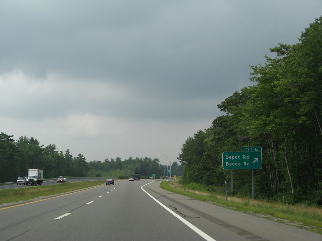
Beede Road leads motorists south from NH 101 to NH 107 near the Fremont town center.
07/30/07
NH 101 next heads into the town of Raymond, where the route used to merge with NH 107 northwest to NH 27 west into Candia.
07/30/07
A folded diamond interchange facilitates movement between the NH 101 freeway and NH 107 (Freetown Road) by a Wal-mart distributor center. NH 107 locally combines with NH 27 (Epping Road) west toward the Raymond town center.
07/30/07
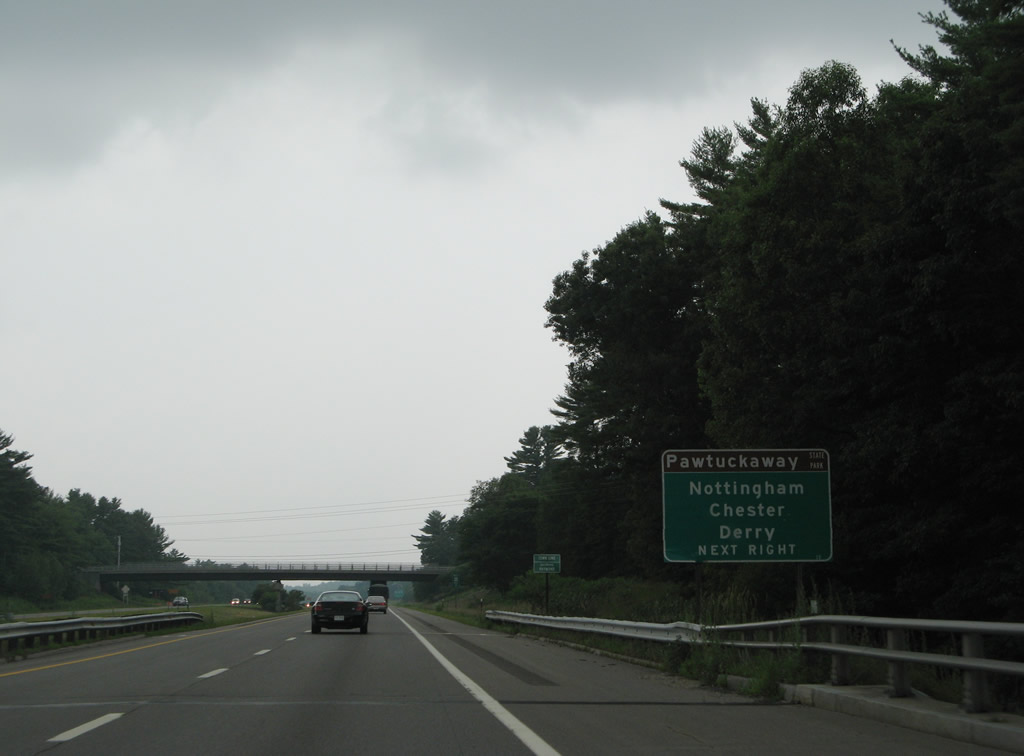
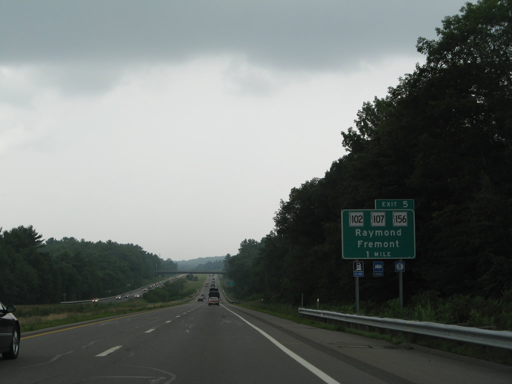
NH 107 (Freetown Road) connects forthcoming Exit 6 with NH 156 (Nottingham Road) north to Pawtuckaway State Park and Nottingham and NH 102 (Chester Road) southwest to Chester and Derry.
07/30/07
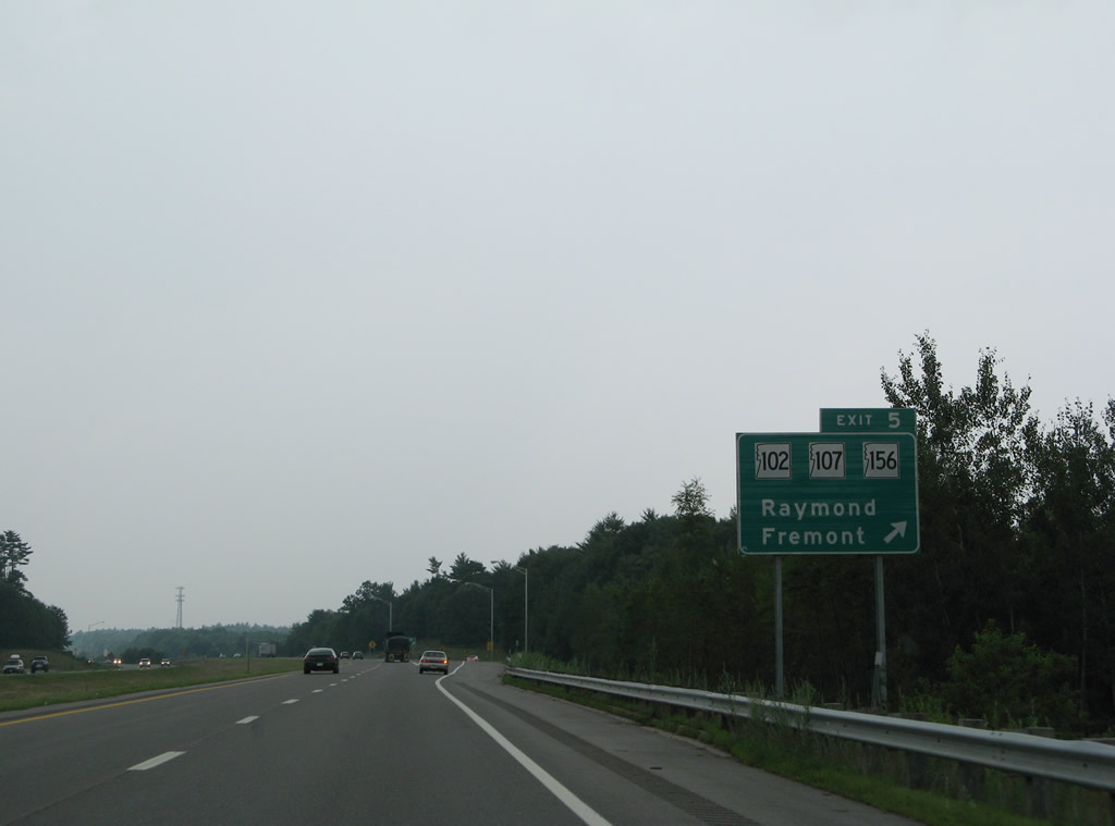
Westbound at the off-ramp (Exit 5) to NH 107 (Freetown Road) north to Raymond and south to Fremont. NH 107 totals 69.1 miles on the drive northwest from U.S. 1 in Seabrook to U.S. 3 in Laconia.
07/30/07
NH 101 crosses the Lamprey River for the second time ahead of this shield assembly posted after Exit 5.
07/30/07
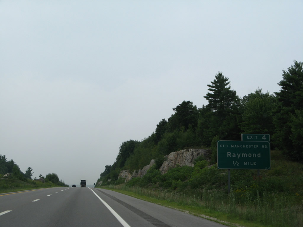
Old Manchester Road arcs southwest from the Epping town center to Batchelder Road east and Lane Road west, just south of Exit 4.
07/30/07
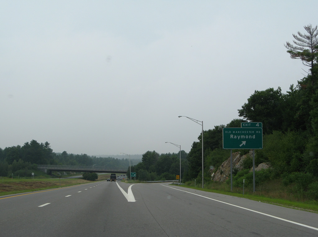
Entering the diamond interchange (Exit 4) with Old Manchester Road on NH 101 west.
07/30/07
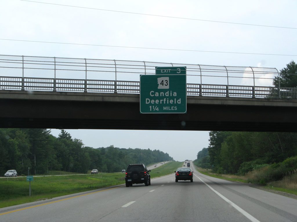
Now within the town of Candia, NH 101 veers westward around Patten Hill to a trumpet interchange (Exit 3) with NH 43 north.
07/30/07
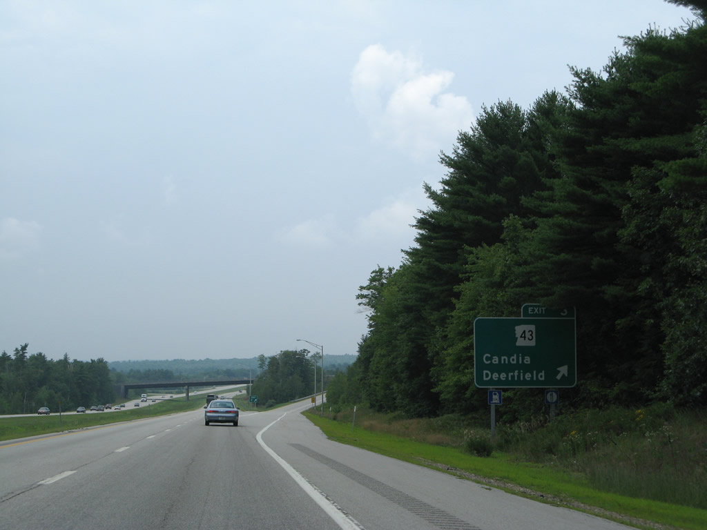
NH 43 follows Old Candia Road (old NH 101) north to Candia Four Corners and junction NH 27. The 16.4 mile route continues north from there to the Candia town center, Deerfield and U.S. 4-202 & NH 9 at Northwood.
07/30/07
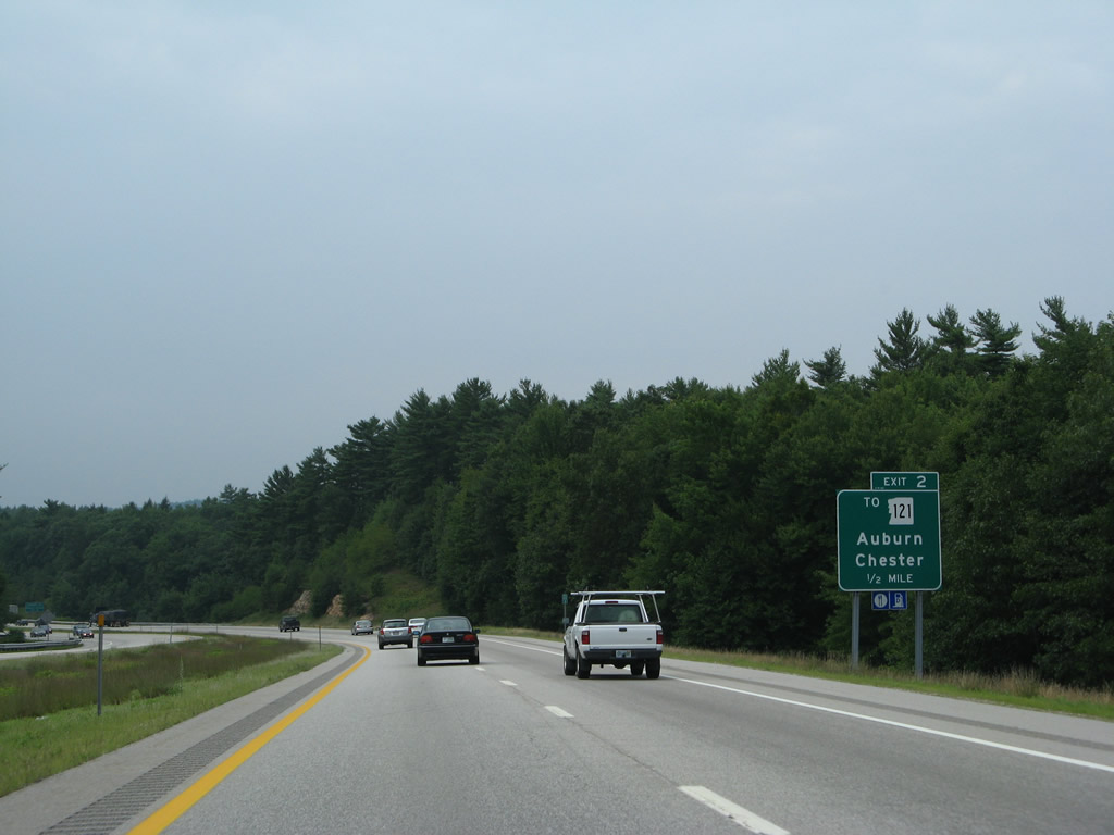
Reassurance marker posted by the Old Candia Road underpass on NH 101 west. The former alignment of NH 101 stays south of the freeway to Clark Pond outside Exit 2.
07/30/07
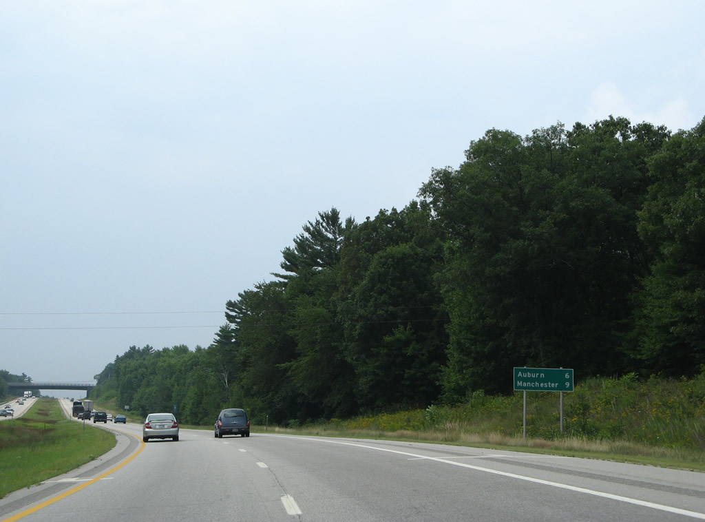
Auburn is the last town NH 101 travels through before the freeway reaches the city of Manchester. Downtown is a nine mile drive away.
07/30/07
Mount Miner (elevation 561 feet) appears to the southwest as NH 101 lowers to cross Maple Falls Brook.
07/30/07
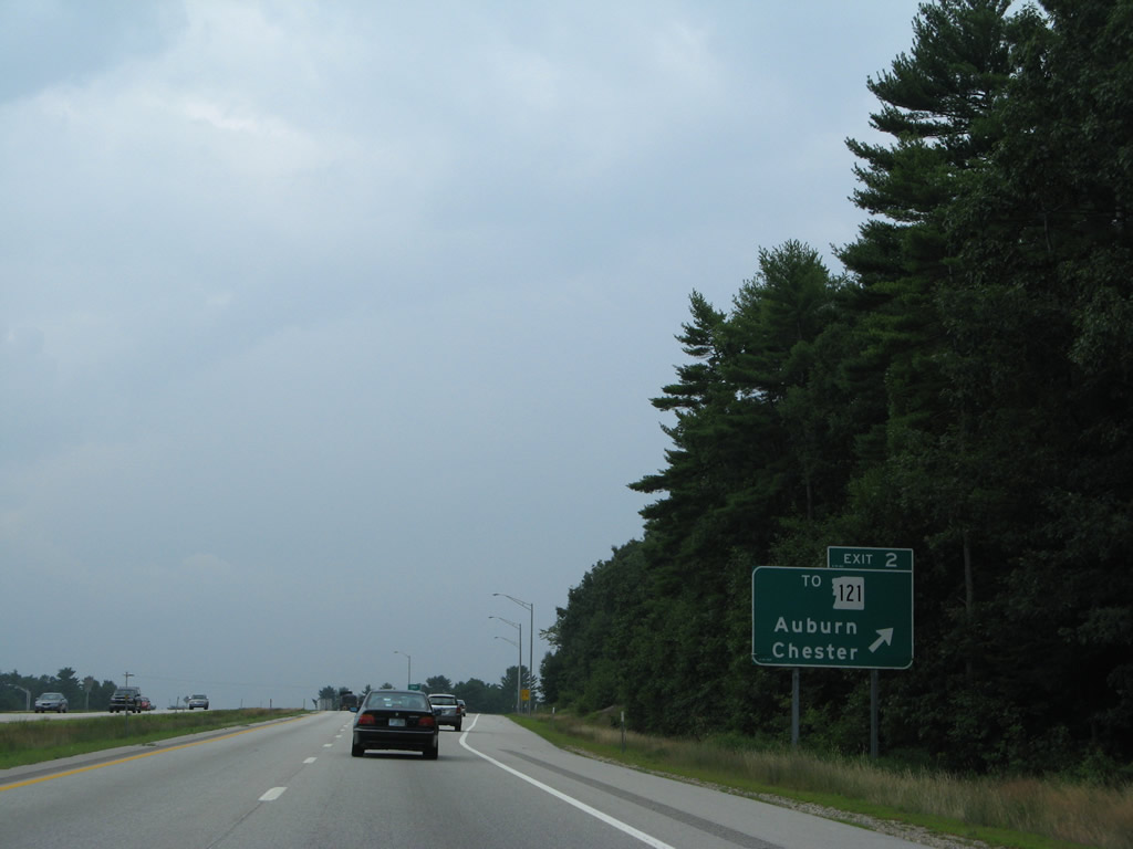
NH 121, a 22.5 mile route from Haverhill, Massachusetts to NH 28 Bypass at Massabesic, stays south of NH 101 to the Auburn town center and Chester.
07/30/07
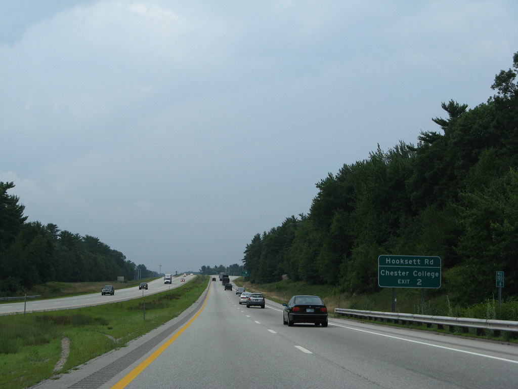
Hooksett Road stems north from the NH 121 turn from Chester to Manchester Roads in Auburn to Exit 2 with the NH 101 freeway.
07/30/07
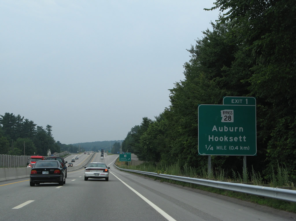
Westbound NH 101 at the diamond interchange (Exit 2) with Hooksett Road south to Auburn and west to NH 28 Bypass in Hooksett.
07/30/07
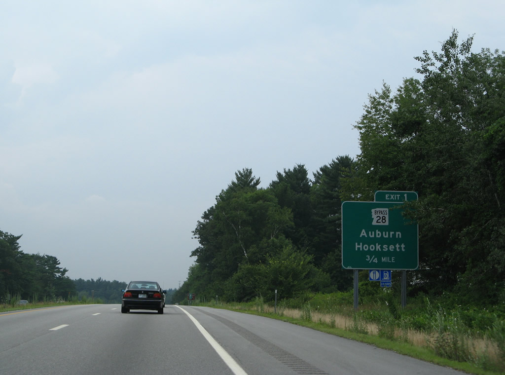
Turning more southwesterly, NH 101 parallels Rockingham Road and NH 121 (Manchester Road) to cross the Manchester city line at Exit 1 with NH 28 Bypass (Londonberry Turnpike).
07/30/07
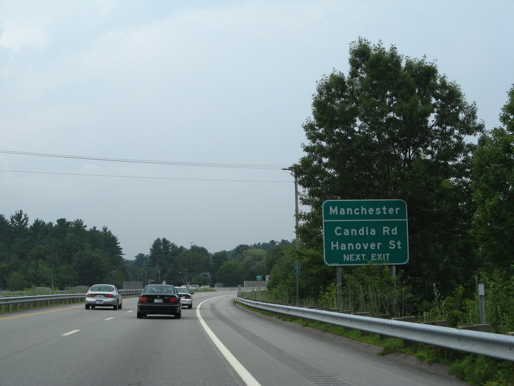
Beyond Exit 1, NH 101 merges with Interstate 93 south. The merge takes place opposite the ramp departure of Exit 6 to Hanover Street and Candia Road. Therefore motorists bound for those streets through east Manchester are directed onto NH 28 Bypass south to its roundabout with Candia Road.
07/30/07
Exit 1 departs in one quarter mile for NH 28 Bypass (Londonberry Turnpike) north to Martins Corner and south to Massabesic Lake through Auburn. The state route loops 14.1 miles east from NH 28 between Hooksett and Derry.
07/30/07
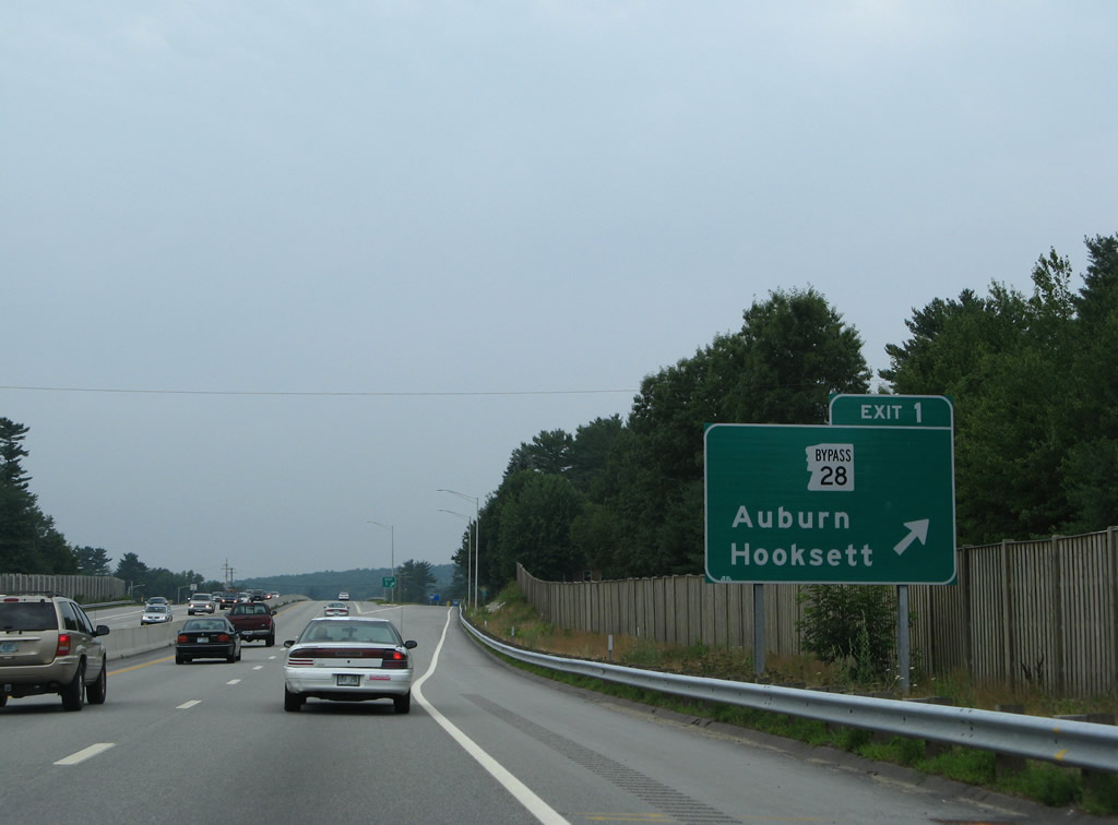
Drivers bound for NH 28 Bypass (Londonberry Turnpike) part ways with NH 101 west as the freeway becomes more urban. Use Exit 1 for the Audubon Center.
07/30/07
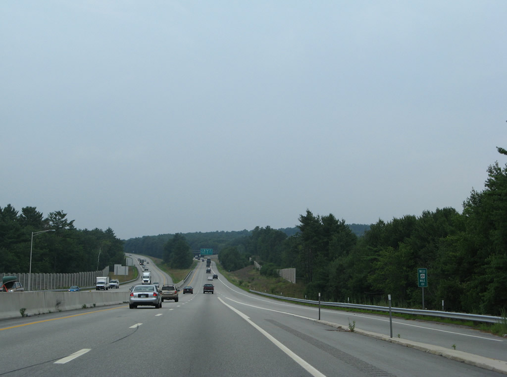
The roadways of NH 101 separate in anticipation of the tri-level stack interchange with Interstate 93 south of Bald Hill.
07/30/07
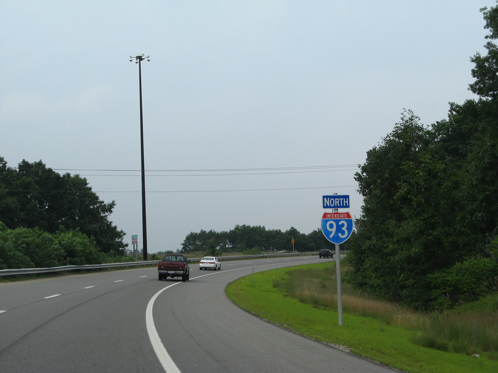
An I-93 trailblazer accompanies this NH 101 reassurance sign for motorists retuning to the Interstate from the Candia Road on-ramp to NH 101 east.
07/30/07
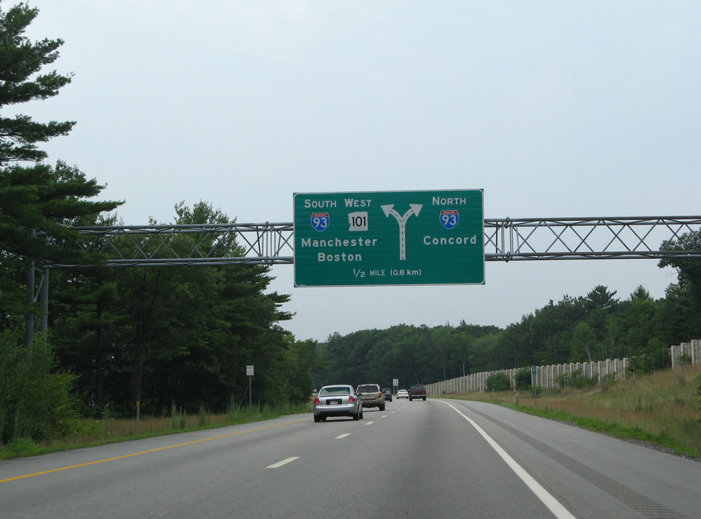
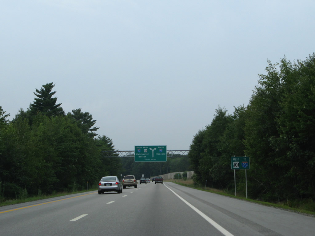
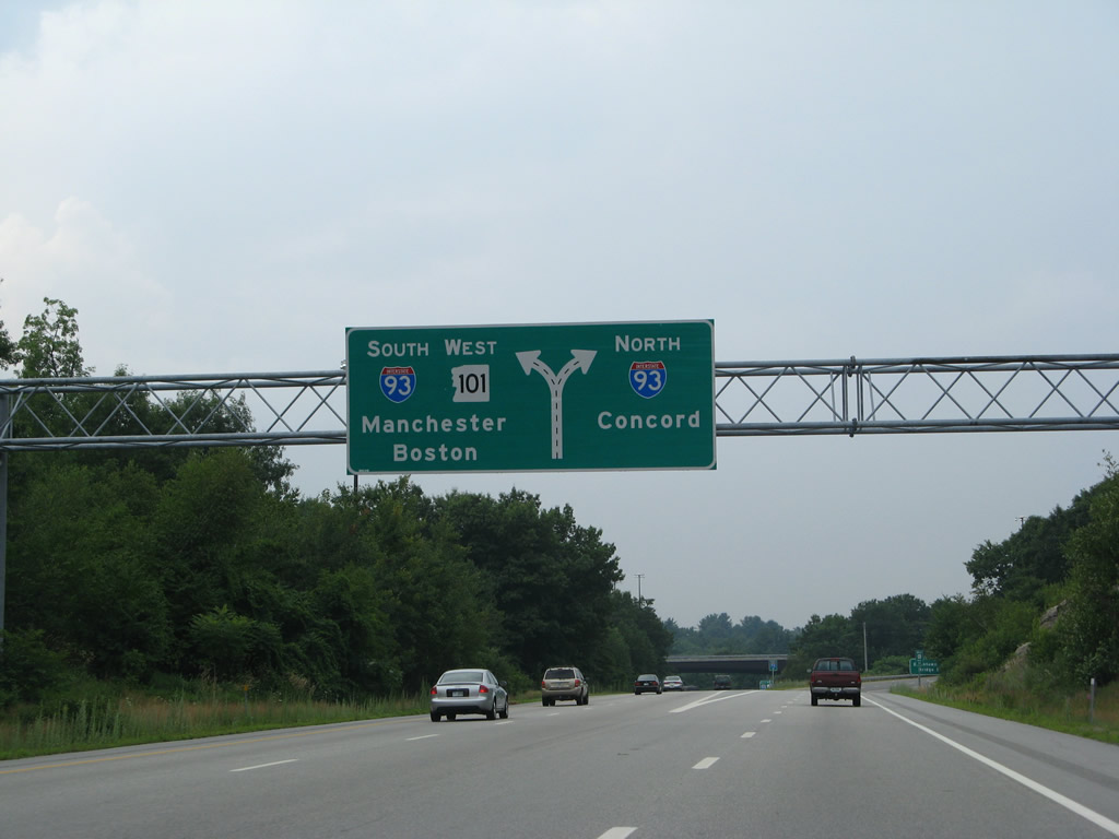
Two lane ramps join Interstate 93 north to Concord and the White Mountains and south to Salem an Boston, Massachusetts.
07/30/07
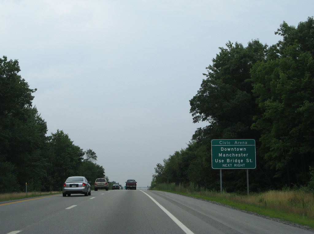
Interests to Downtown Manchester are directed onto Interstate 93 north across Stevens Pond to the nearby interchange with Wellington Road. Wellington Road becomes Bridge Street west to the central business district.
07/30/07
NH 101 south combines with Interstate 93 to bypass the east side of Manchester to the south split with I-293. I-93 continues into Hooksett, where it joins the tolled F.E. Everett Turnpike north to I-89 at Bow.
07/30/07
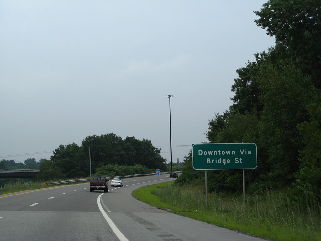
An auxiliary sign reminds motorists of the Bridge Street connection to Downtown on the departing off-ramp for Interstate 93 north. Nicknamed the Queen City, Manchester is home to 110,000.
07/30/07
Shields for I-93 stand along both ramps from NH 101 west. Travelers remaining on the NH 101 mainline join the left side of I-93 south.
07/30/07
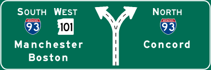

Photo Credits:
- AARoads: 07/30/07
- Alex Nitzman, Carter Buchanan: 06/27/05
Connect with:
Page Updated Monday February 23, 2015.