
Loop 375 East - Downtown El Paso to IH 10
Heading southeast from the west end of U.S. 54 (Patriot Freeway), SL 375 (Cesar Chavez Border Highway). A distance sign here referenced the egress points for the Express Toll lanes.
04/25/17
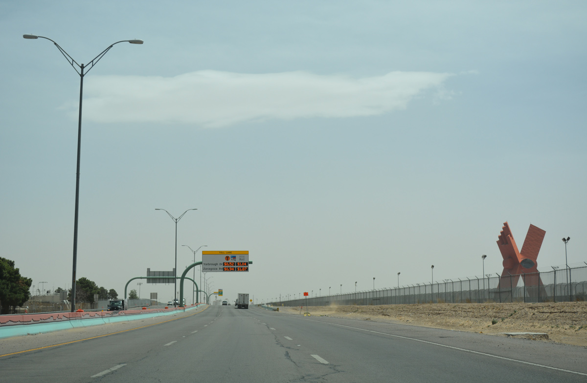
The Monument to the Mexican People sculpture rises beyond the border fence from Plaza de la Mexicanidad in Juarez.
04/25/17
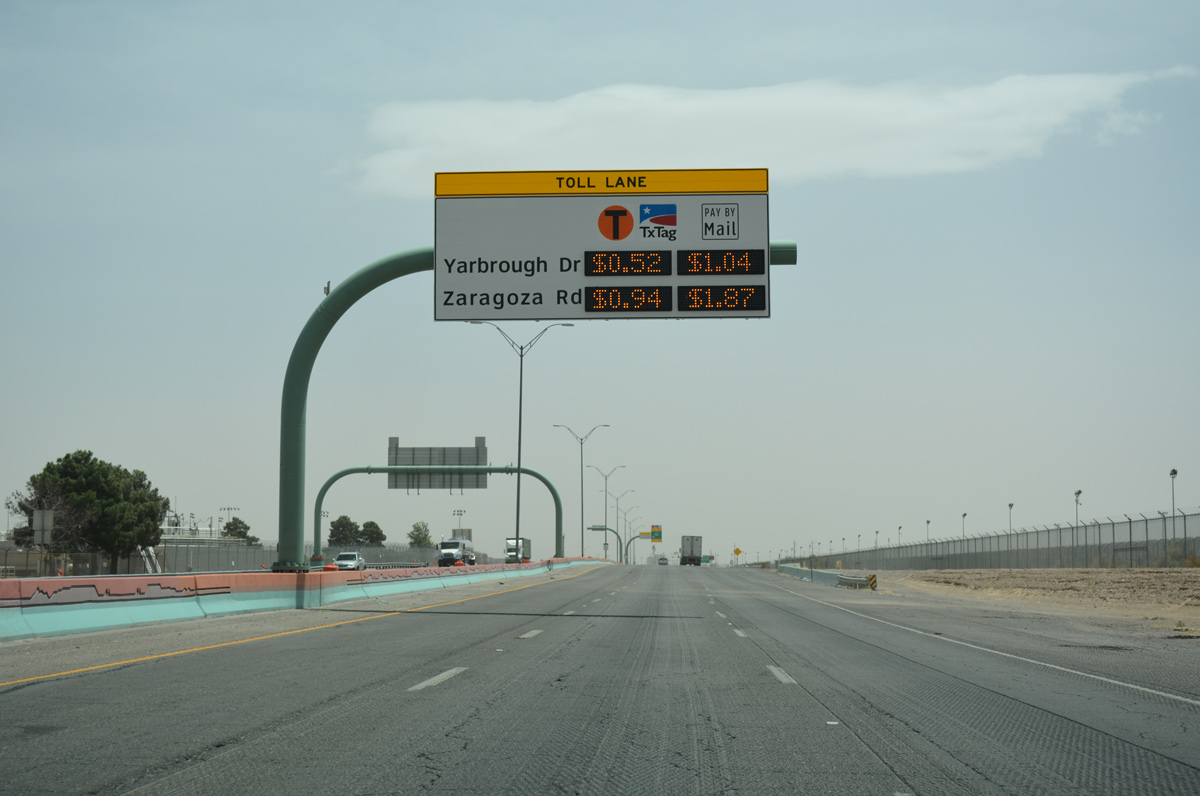
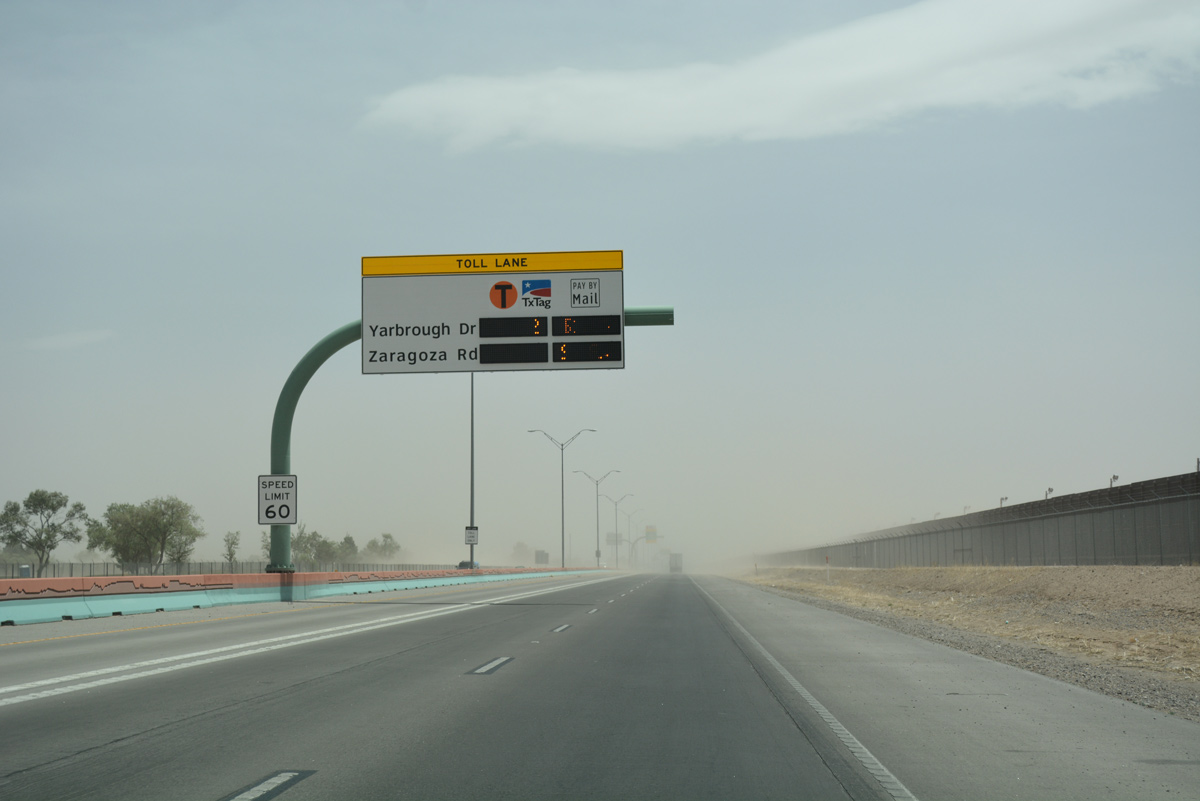
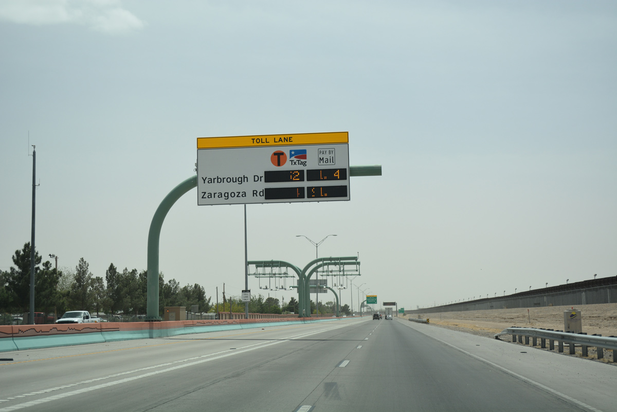
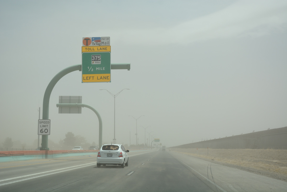
Former toll schedule sign for the Express Toll lanes. Tolling along Loop 375 ceased operations on August 10, 2017.
04/25/17
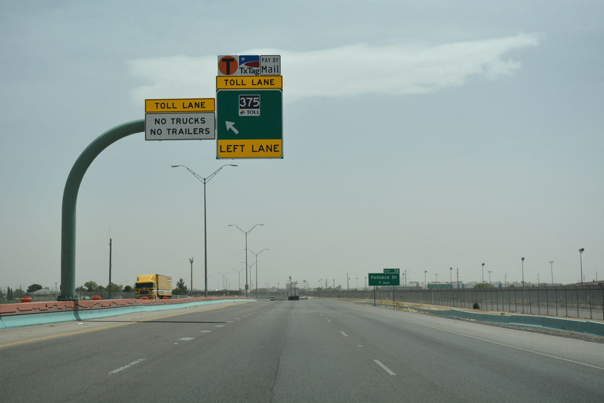
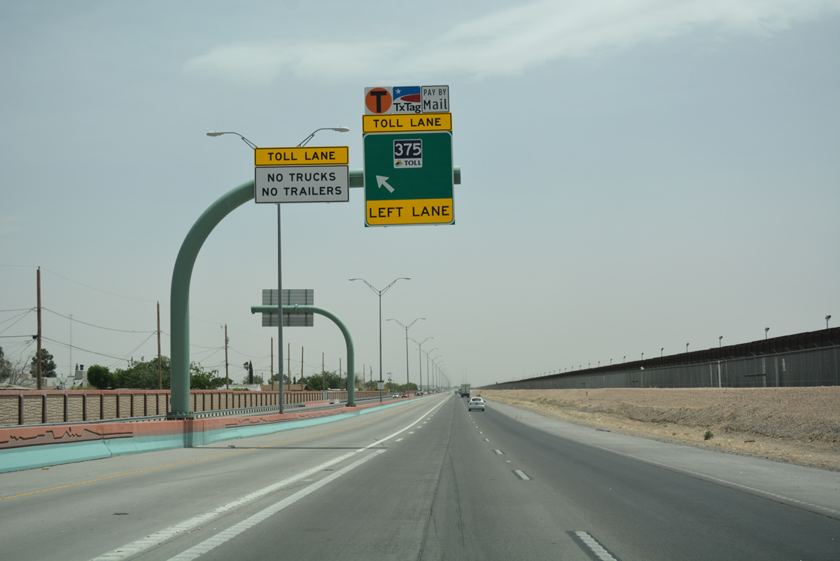
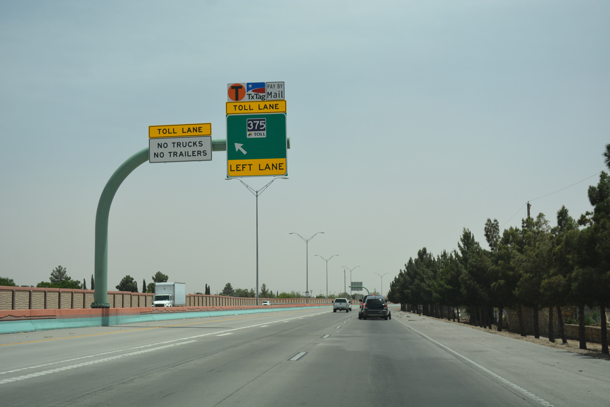
The Express Toll lanes began 0.4 miles southeast from the U.S. 54 eastbound on-ramp. They were added to Loop 375 between 2011 and 2014.
04/25/17

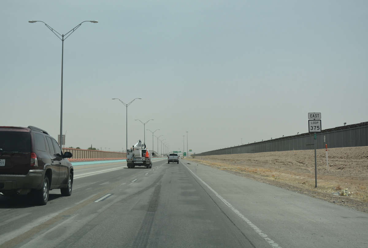
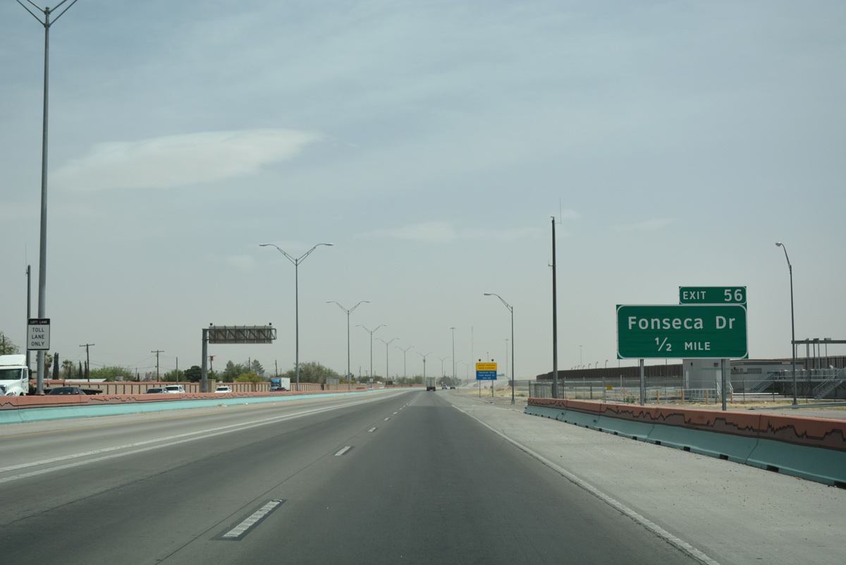
A diamond interchange (Exit 56) joins Loop 375 with Fonesca Drive north in one mile.
04/25/17
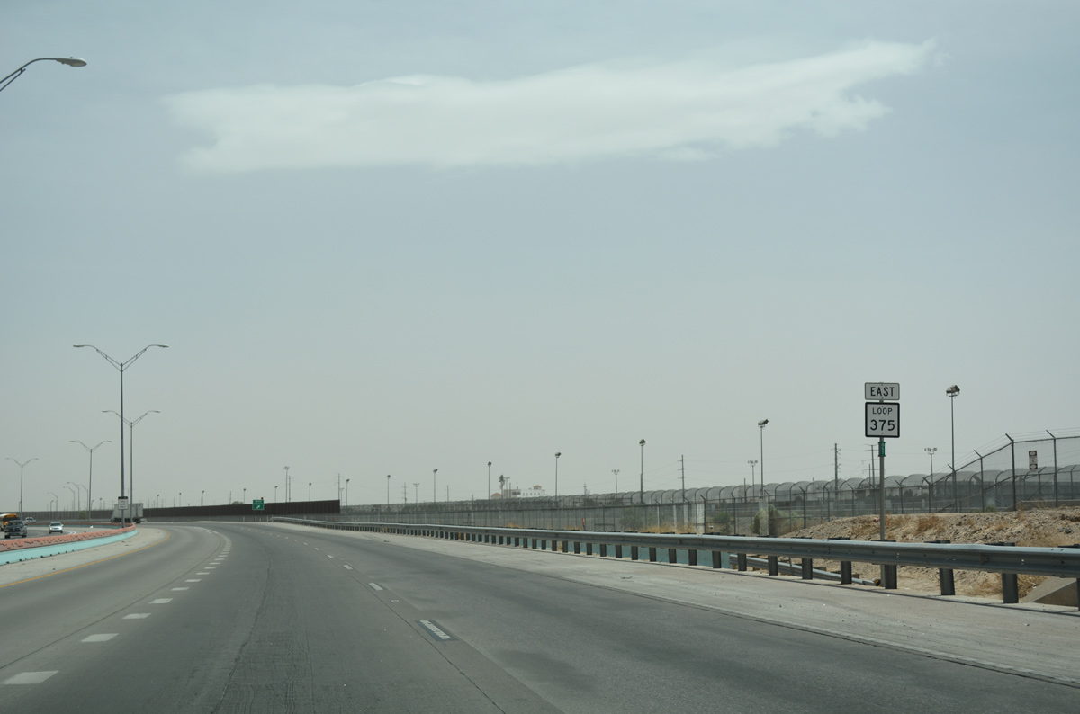
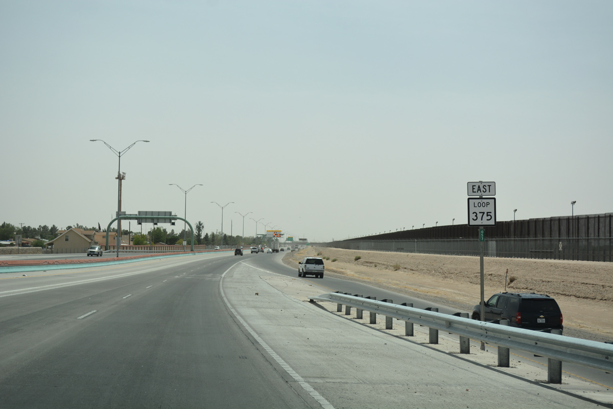
Confirming marker for Loop 375. The Cesar Chavez Border Highway parallels the border fence and the culverted Rio Grande River along this stretch.
04/25/17

A weigh station operates along Loop 375 eastbound just ahead of the Fonesca Drive off-ramp.
04/25/17

Fonesca Drive arcs northward to Delta Drive between residential areas and Ascarate Park.
04/25/17
The second ingress point to the Loop 375 Express Lanes was located south of Fonesca Drive.
04/25/17
A turn off for the U.S. Border Patrol lines the south side of Loop 375 across from the Cedar Grove neighborhood.
04/25/17
A reassurance marker for SL 375 east precedes the off-ramp to Midway Drive.
04/25/17
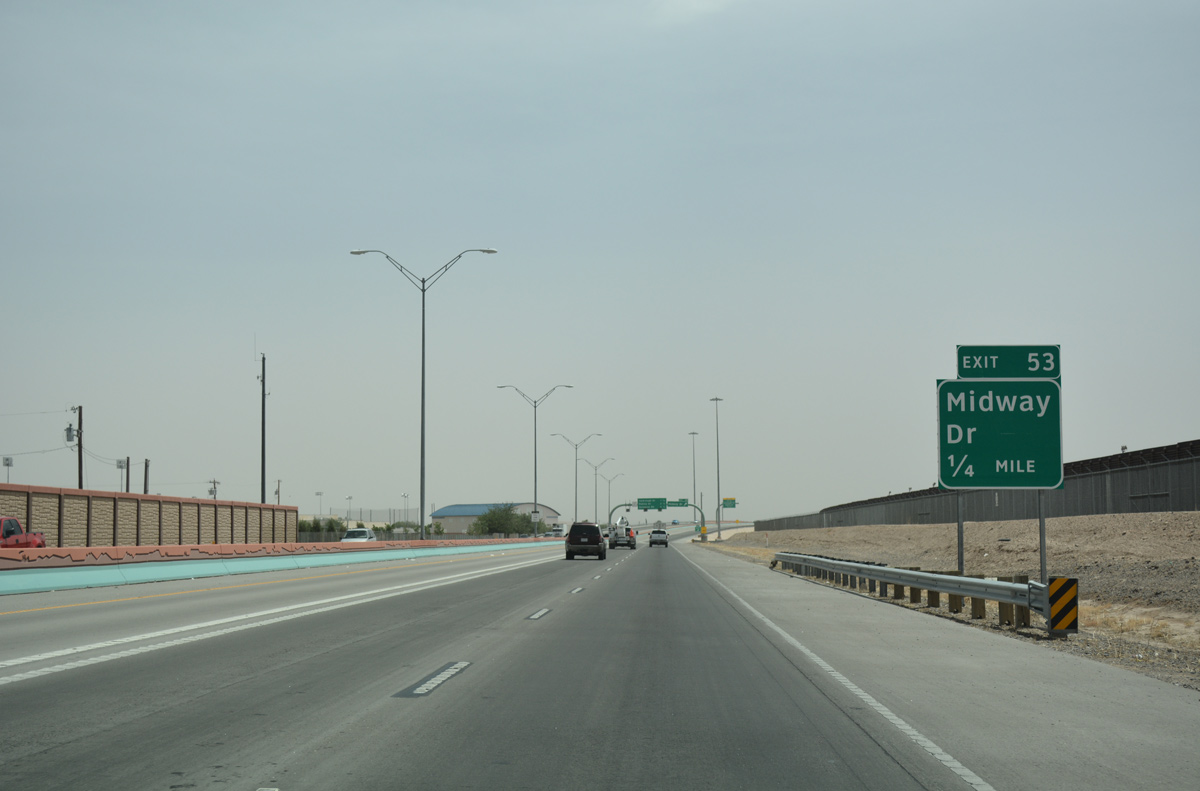
Midway Drive stems east from SL 375 to Riverside High School and SH 20 (Alameda Avenue).
04/25/17
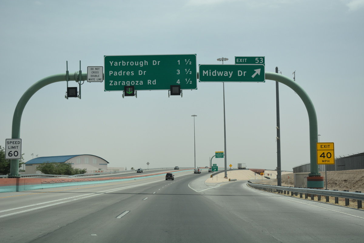
Entering the diamond interchange (Exit 53) with Midway Drive east on SL 375 east.
04/25/17
Turning southward along the course of the Rio Grande, an egress point for the Express Lanes provided access to the general travel lanes for Exit 51 and 49.
04/25/17
Loop 375 (Cesar Chavez Border Highway) runs alongside the Thomas Manor community south from Midway Drive.
04/25/17
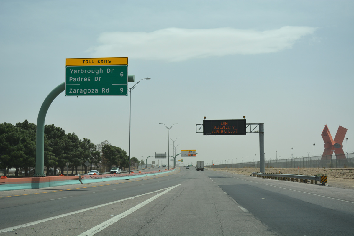
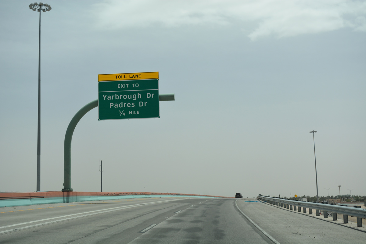
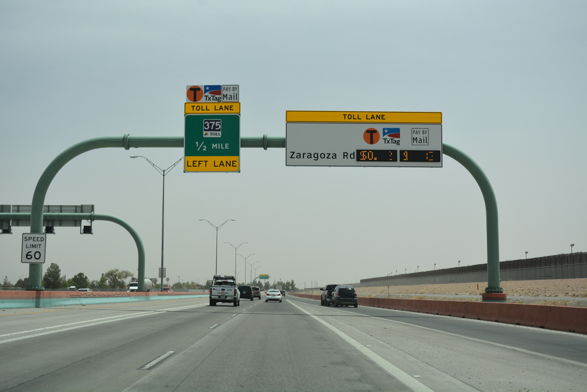
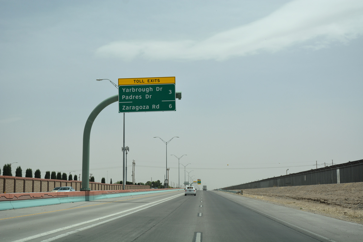
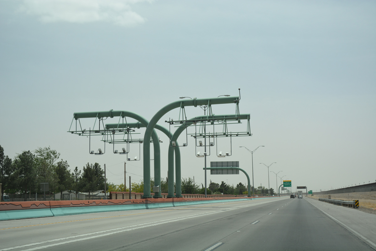
A toll collection gantry collected fares along Loop 375 east ahead of the egress point for Yabrough and Padres Drives.
04/25/17
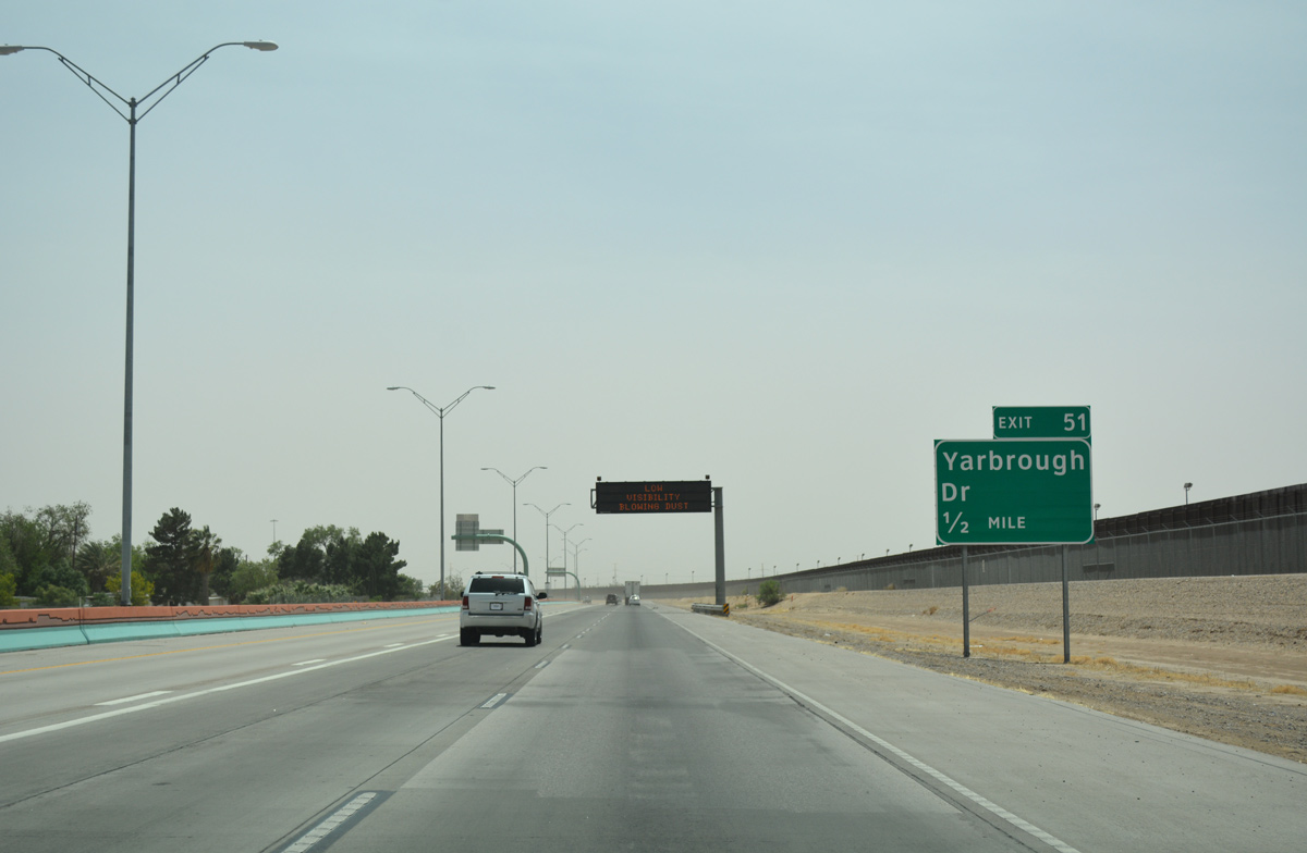
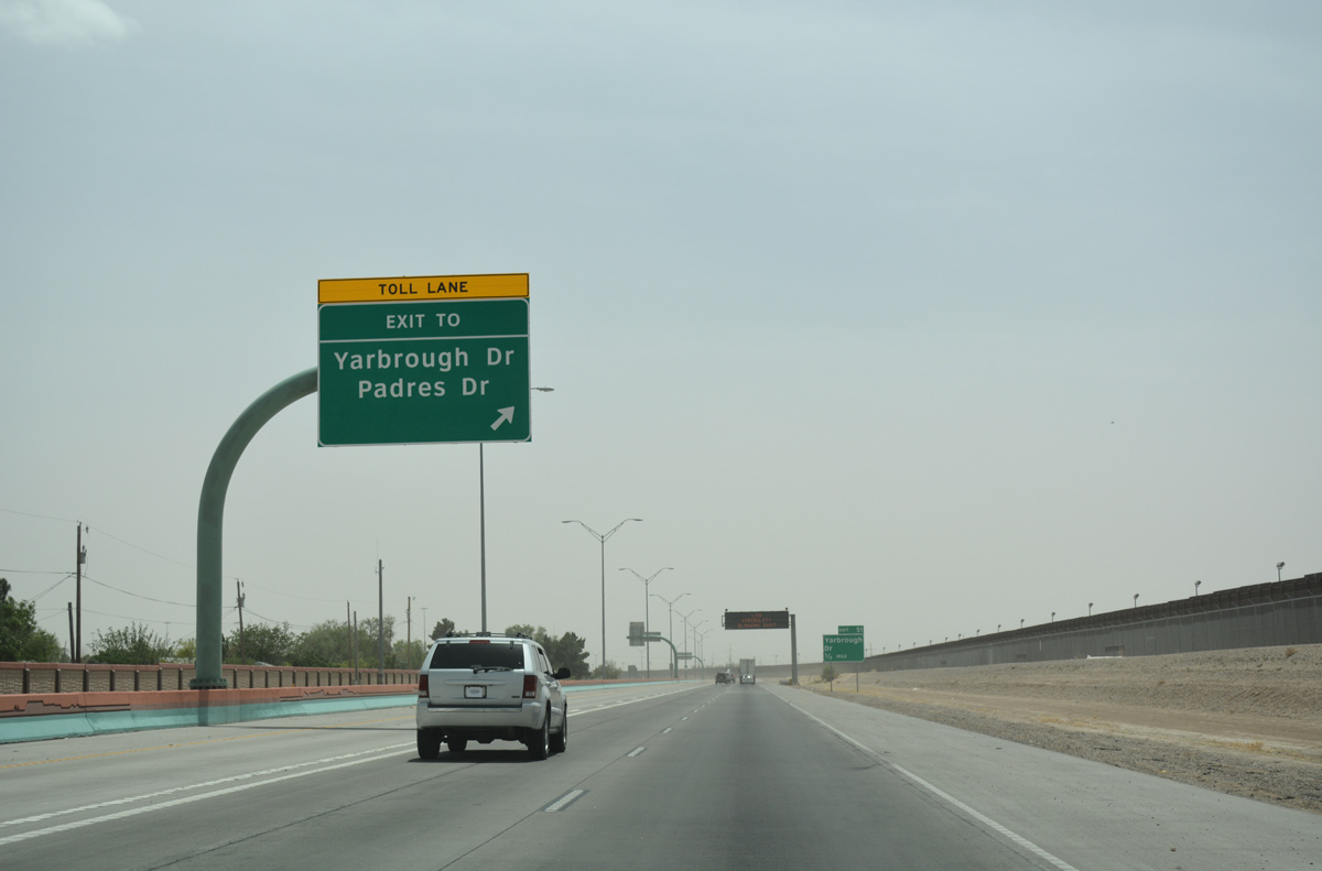
Motorists continue south one half mile to the diamond interchange (Exit 51) with Yabrough Drive north.
04/25/17
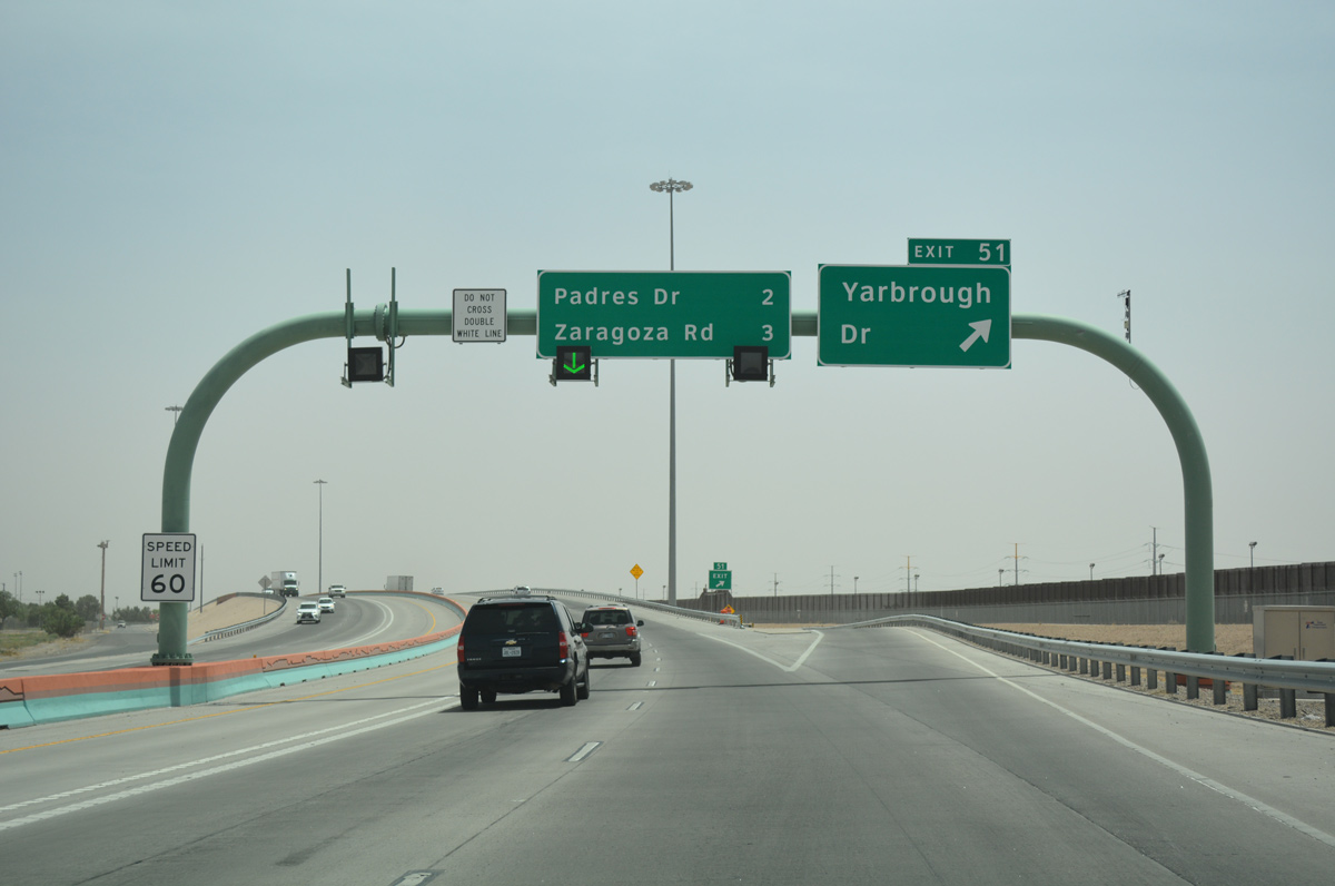
Yabrough Drive winds northward through the East Side of El Paso all the way to U.S. 62/180 (Montana Avenue) at Global Reach Drive into Fort Bliss.
04/25/17
The final ingress point for the Express Toll Lanes separated from SL 375 east by JP Shawver Park.
04/25/17
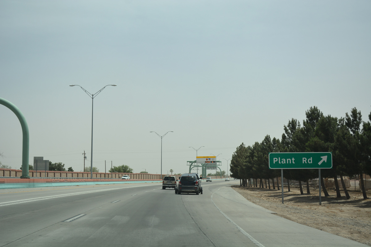
Right in right out (RIRO) ramps link Loop 375 east with Plant Road, a local street serving a handful of industrial businesses.
04/25/17
The last all electronic toll (AET) gantry for Loop 375 east operated at the RIRO for Plant Road.
04/25/17
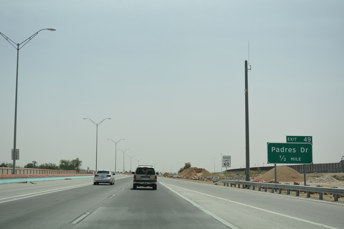
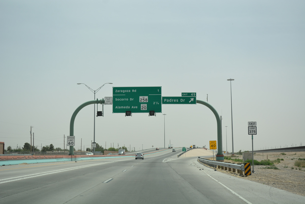
Shifting even further southward, SL 375 approaches Exit 49 with Padres Drive east to the Capistrano Park community.
04/25/17
Entering the diamond interchange (Exit 49) with Padres Drive on SL 375 east. Padres Drive is a short divided boulevard linking the freeway with Alameda Avenue (historic U.S. 80).
04/25/17
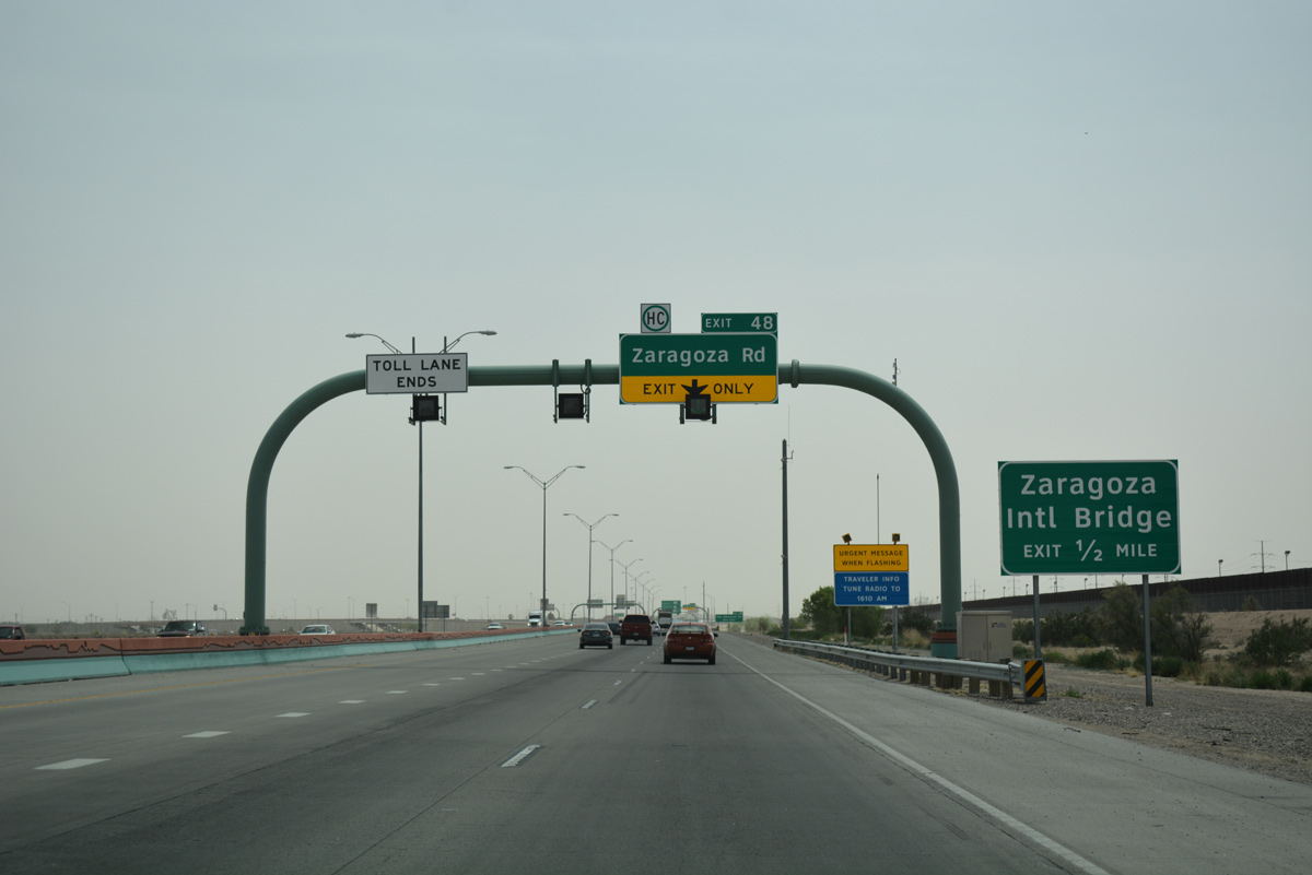
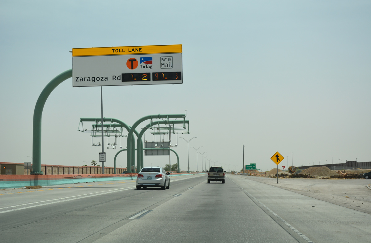
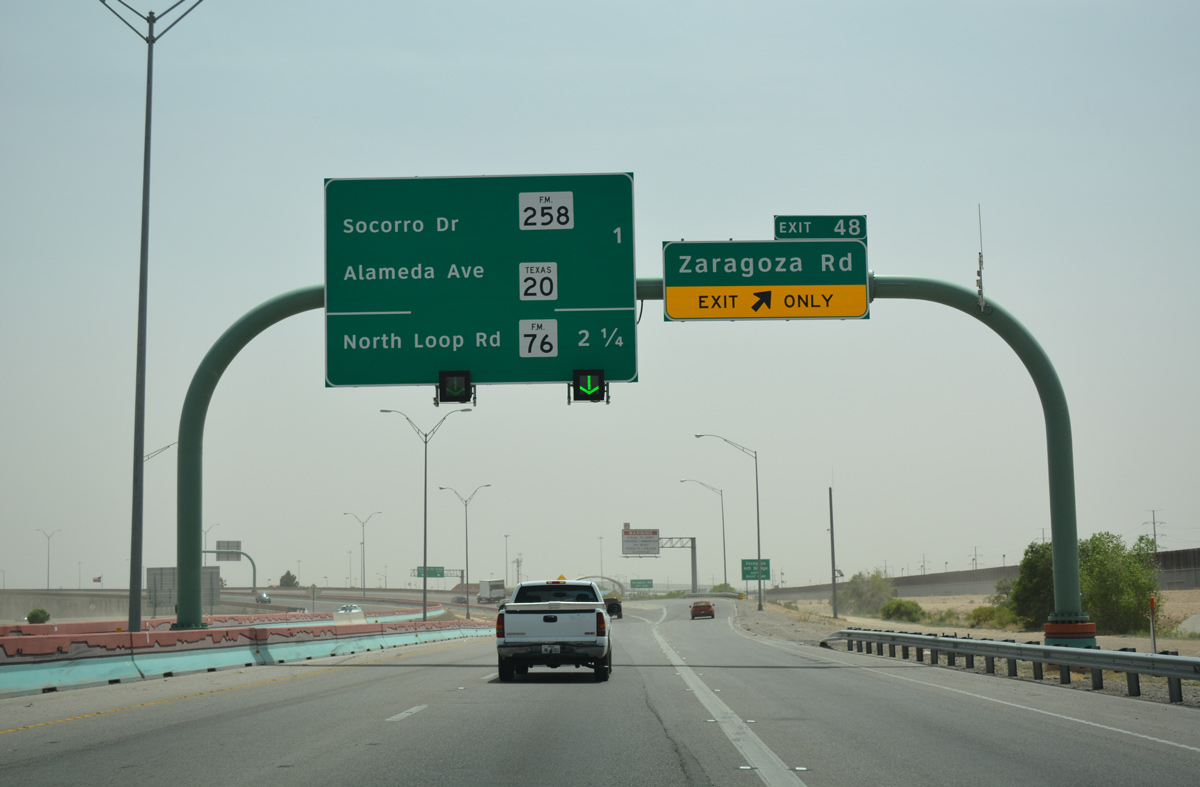
The Express Toll Lanes concluded just ahead of Exit 48 for Zaragoza Road and the Zaragoza International Bridge into Juarez, Mexico.
04/25/17
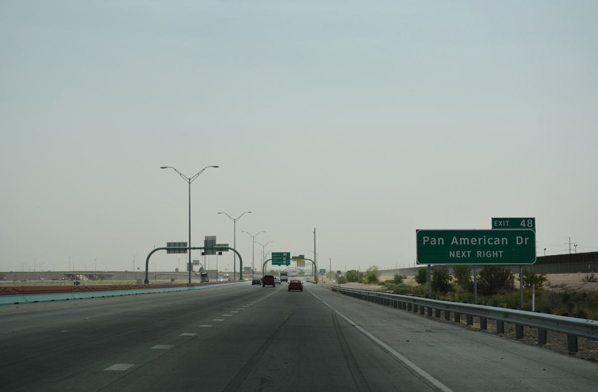
Loop 375 gains a frontage road system (South Americas Drive) east from Exit 48. The service road leads motorists east to Pan American Drive and a large industrial park.
04/25/17
Loop 375 abruptly curves east beside the Zaragoza Bridge port of entry by Exit 48.
04/25/17
Zaragoza Road extends north from the Zaragoza International Bridge through the East Side of El Paso to Yselta and Loop 375 again at Exit 40A.
04/25/17
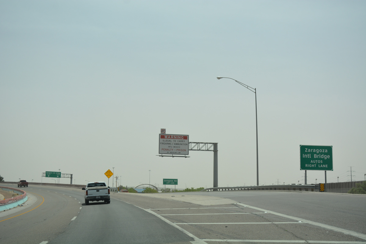
The Zaragoza International Bridge spans the Rio Grande west to Avenida Zaragoza in Juarez. The span represents the former south end of Loop 375, which followed Americas Avenue at the time.
04/25/17
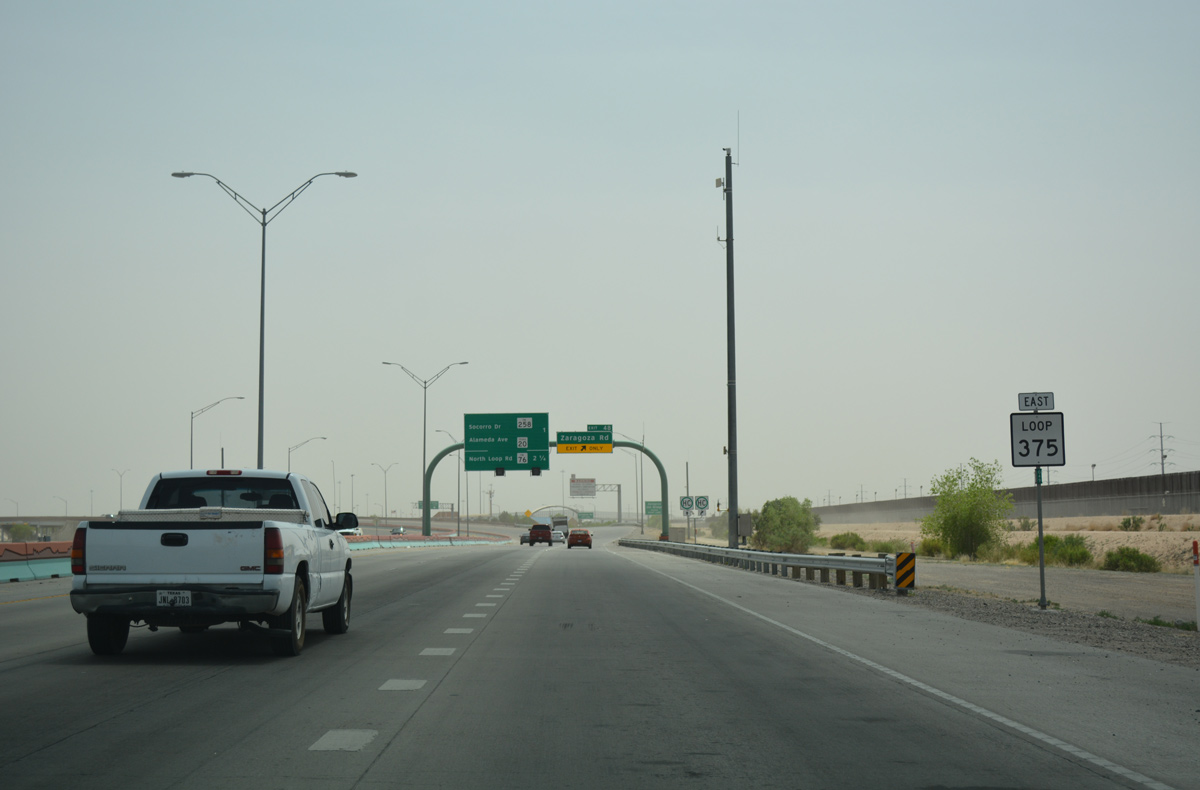
Reassurance marker posted east of the Zaragoza Road underpass.
04/25/17
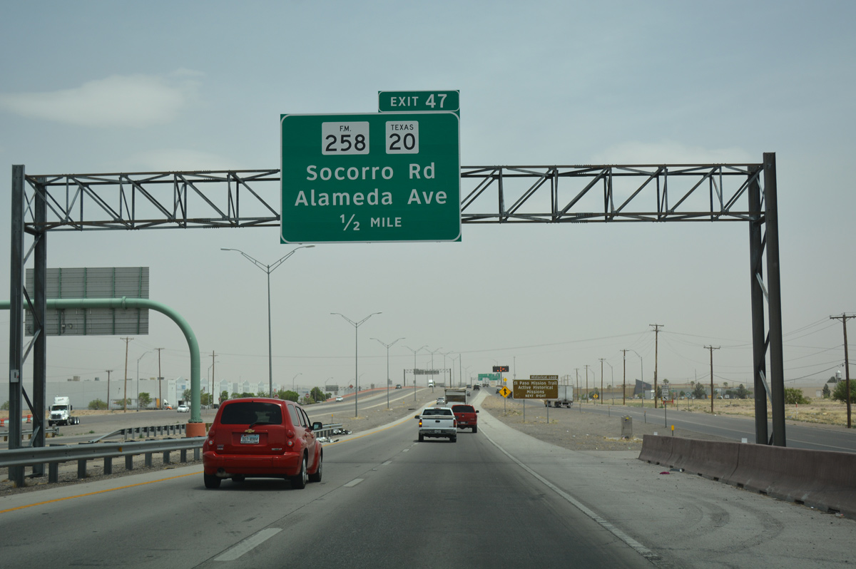
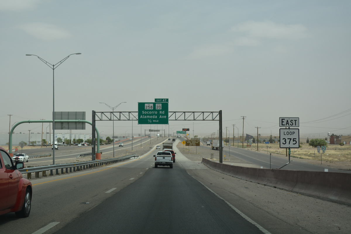
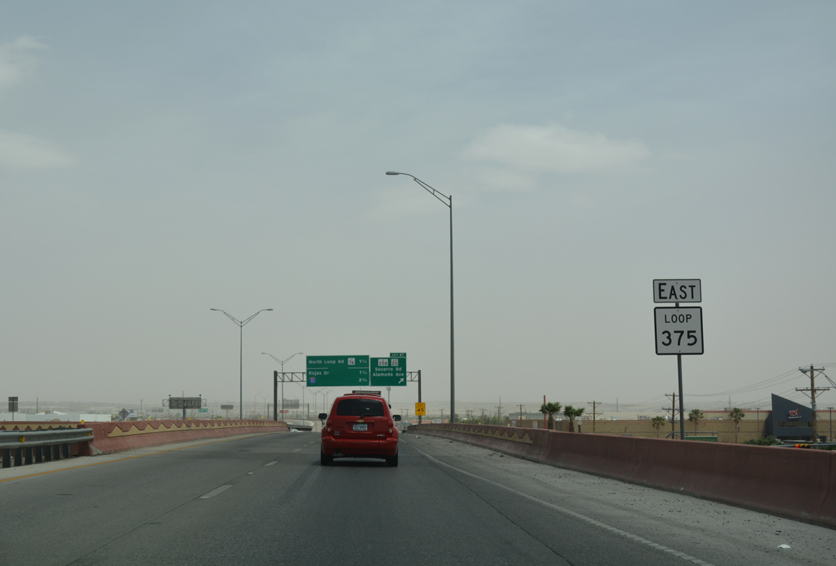
Advancing east, the subsequent exit along Loop 375 east connects with Americas Avenue to FM 258 (Socorro Road) and SH 20 (Alameda Avenue). SH 20 is old U.S. 80, and former U.S. 80 Business from when U.S. 80 realigned onto IH 10.
04/25/17
Crossing over Pan American Drive on Loop 375 east.
04/25/17
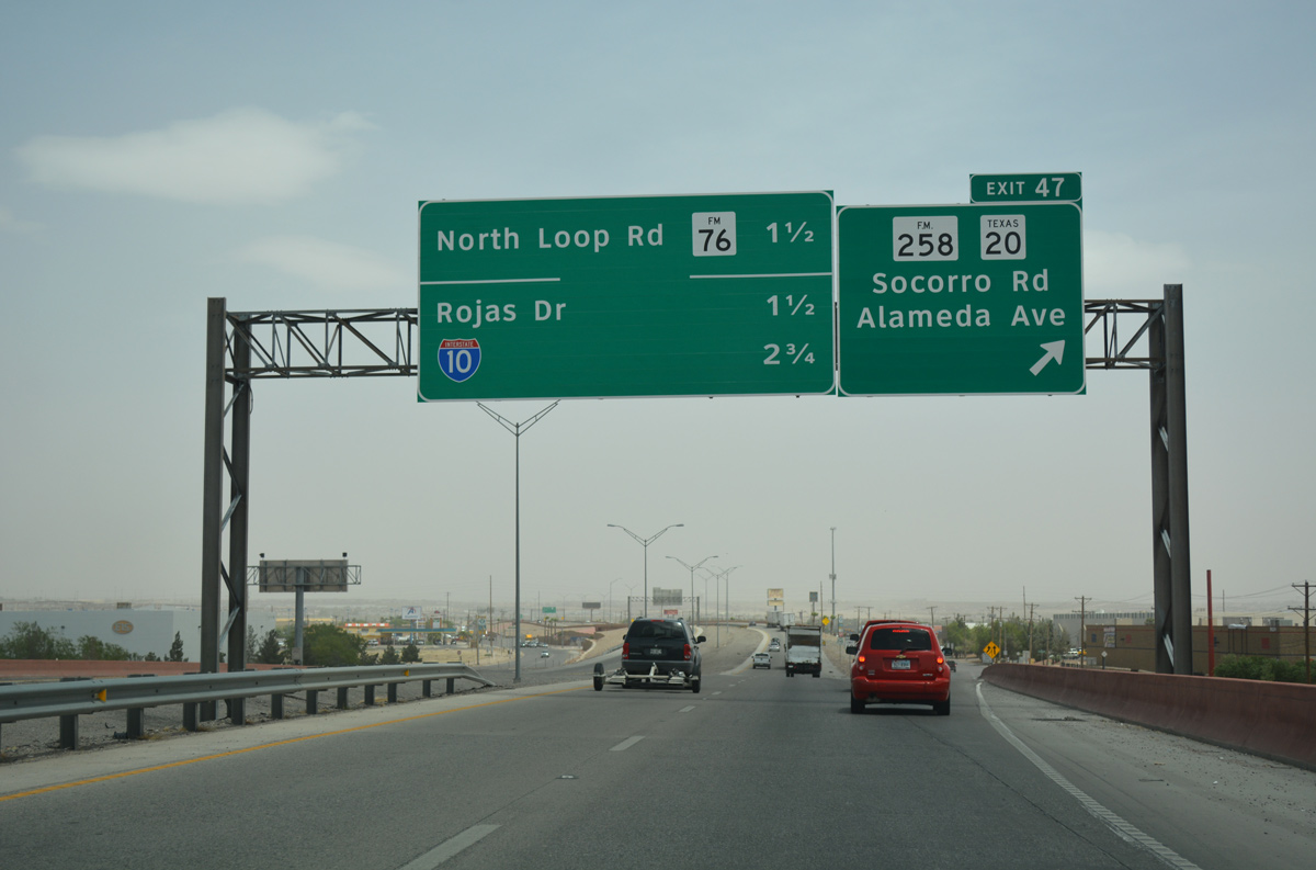
FM 258 (Socorro Road) branches southwest from SH 20 at Yselta in south El Paso to parallel Alameda Avenue as they both head south across Loop 375 into the city of Socorro.
04/25/17
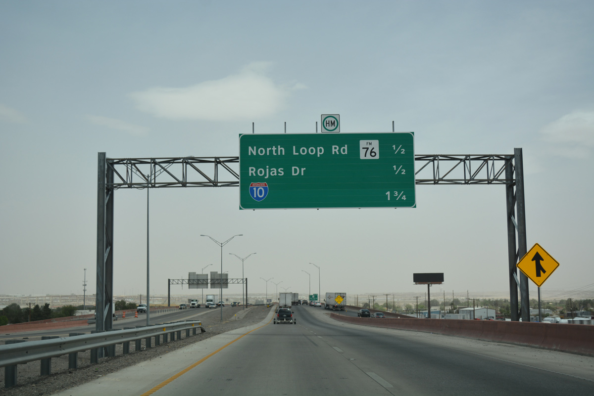
The on-ramp from SH 20 (Alameda Avenue) merges onto SL 375 beyond this distance sign posted a half mile ahead of the diamond interchange (Exit 45) for FM 76 (North Loop Road)
04/25/17
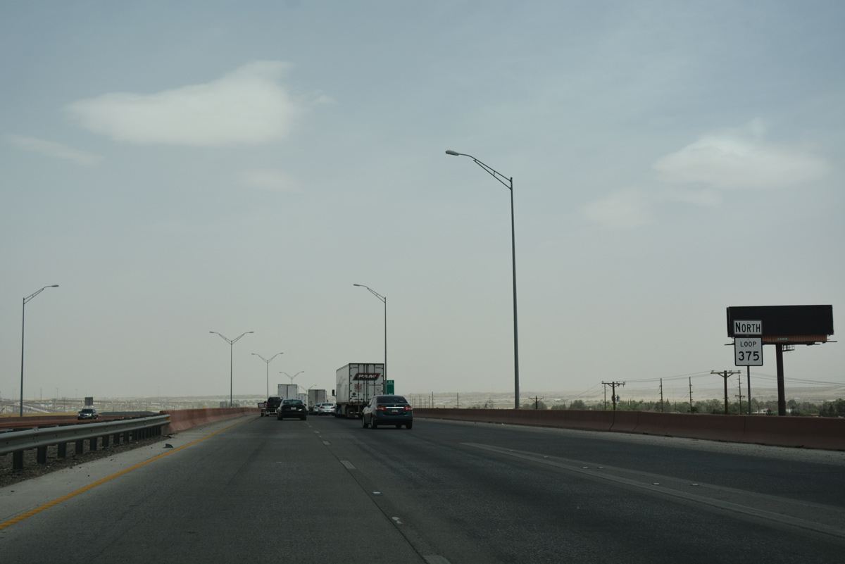
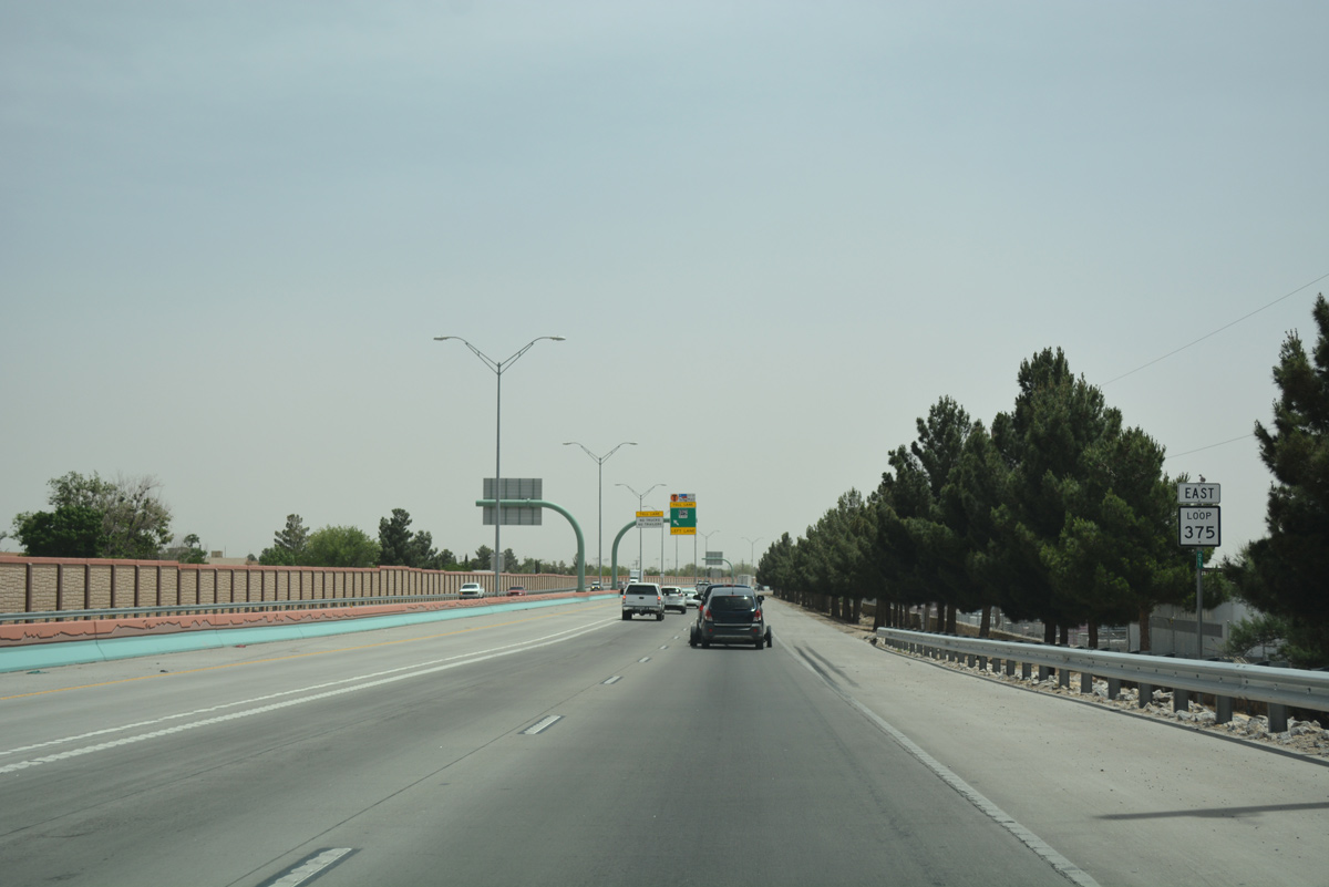
Cardinal directions for SL 375 shift from east to north beyond SH 20 (Alameda Avenue).
04/25/17

FM 76 (North Loop Road) provides another route south from SL 375 to Socorro. The FM road parallels SH 20 along a 23.80 mile course from El Paso to Fabens.
This guide sign erroneously references Exit 45 as 46.
04/25/17
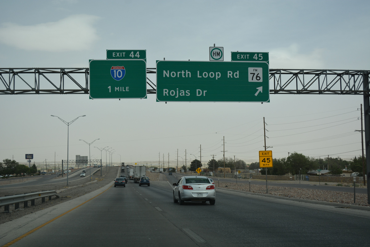
The systems interchange with IH 10 lies one mile ahead. Prior to completion of the flyovers between the two freeways in 2015, travelers were required to use the frontage road system north through a cloverleaf interchange to access Interstate 10. These ramps remain, with the service road continuing north to Rojas Drive.
04/25/17
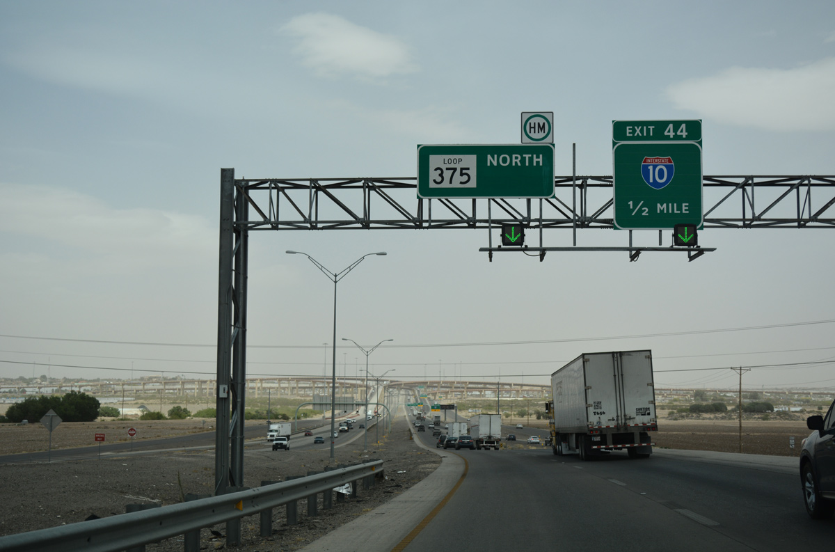
Interstate 10 angles southeast from El Paso to meet Loop 375 on the southeast side of the city. The freeway replaced U.S. 80 east to Sierra Blanca, Van Horn and IH 20.
04/25/17
Motorists bound for both directions of IH 10 depart from SL 375 north in unison. No control cities are used for Interstate.
04/25/17
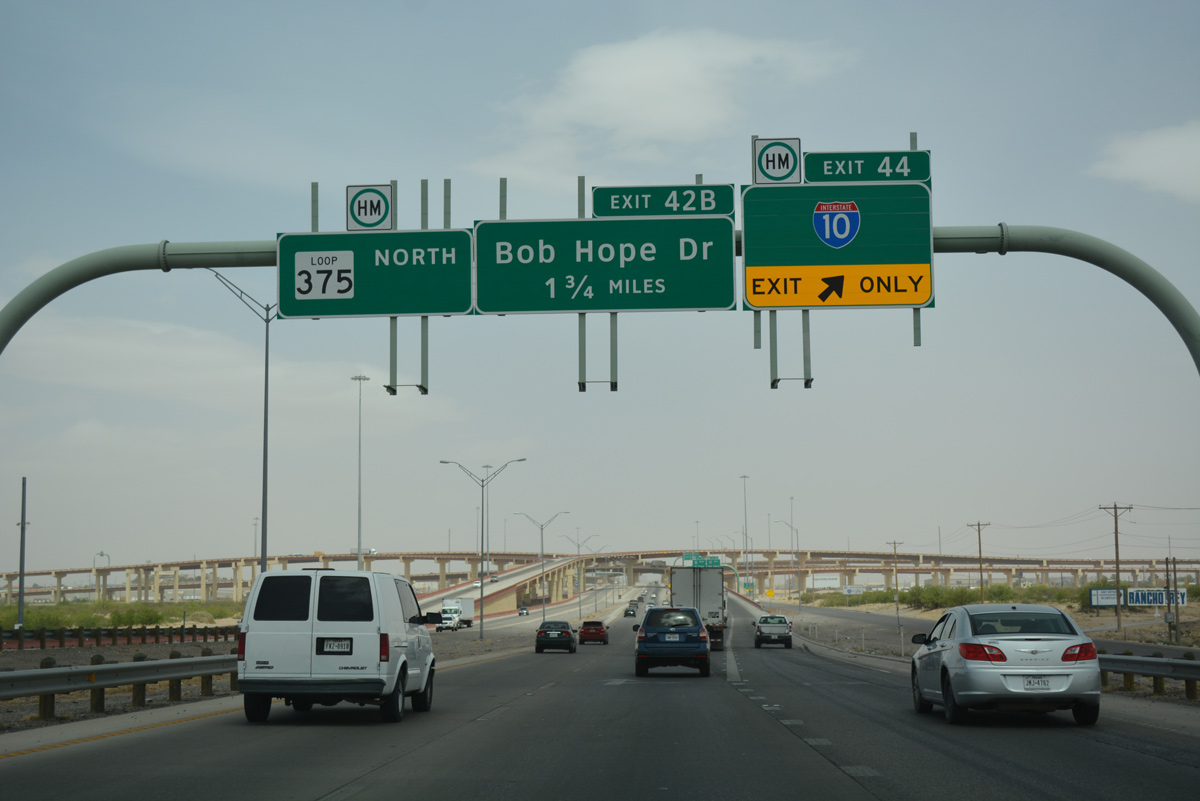
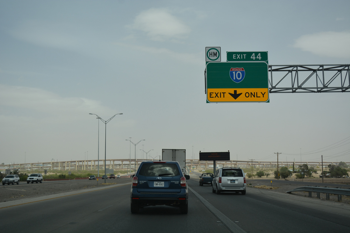
The symmetrical four-level interchange spreads into view as Exit 44 leaves SL 375 north.
04/25/17
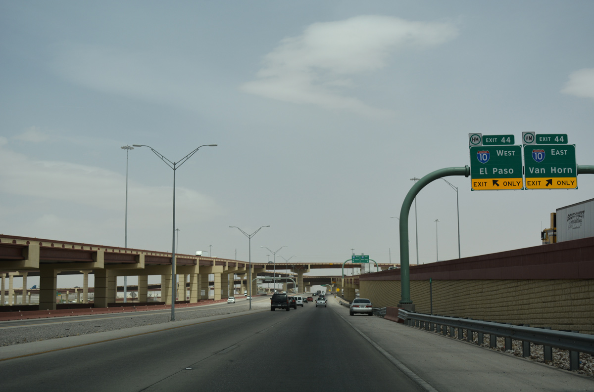
Single lane flyovers separate for IH 10 west 14 miles to Downtown El Paso and 106 miles to Van Horn and the west end of U.S. 90.
04/25/17
Photo Credits:
- ABRoads: 04/25/17
Connect with:
Page Updated Thursday February 01, 2018.