
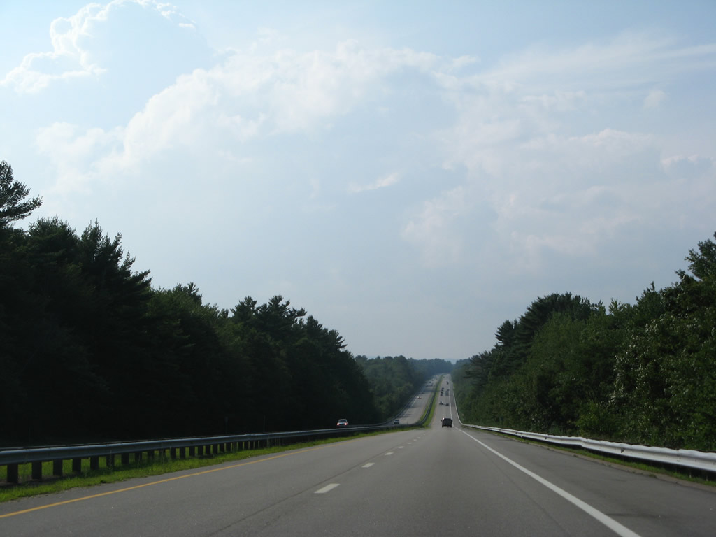
Spaulding Turnpike - North
 West
West 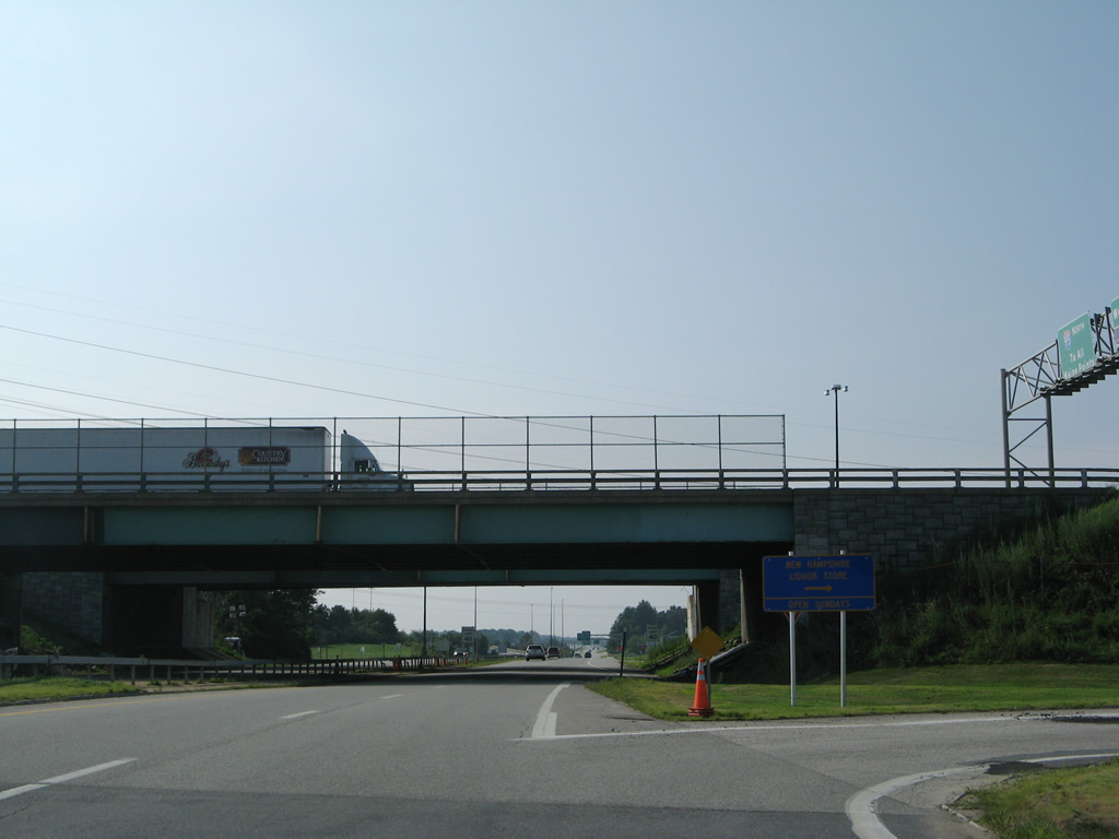
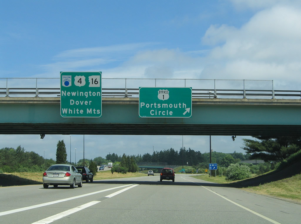
A turn-off takes motorists to an N.H. liquor store situated between Portsmouth Circle and Interstate 95 from the northbound beginning of the Spaulding Turnpike.
07/29/07
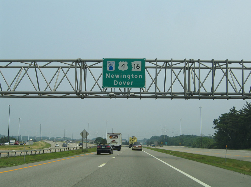
U.S. 4 west & NH 16 north pass under the I-95 mainline ahead of a turn-off for Rockingham Avenue. Rockingham Avenue is a residential street linking the Spaulding Turnpike with Woodbury Avenue.
07/29/07
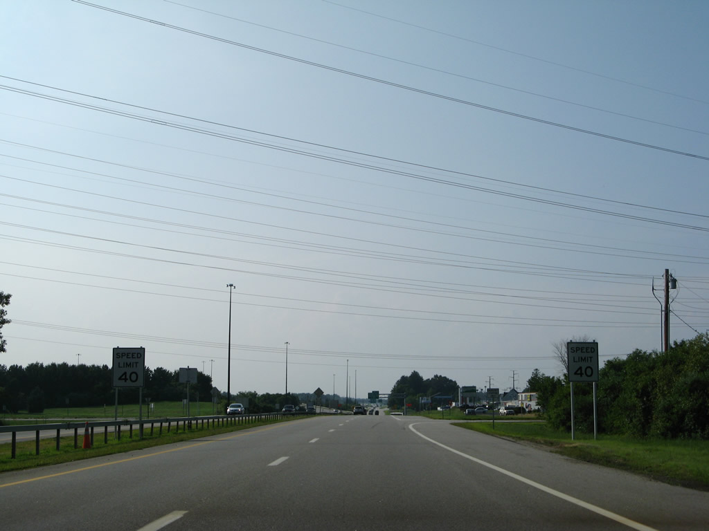
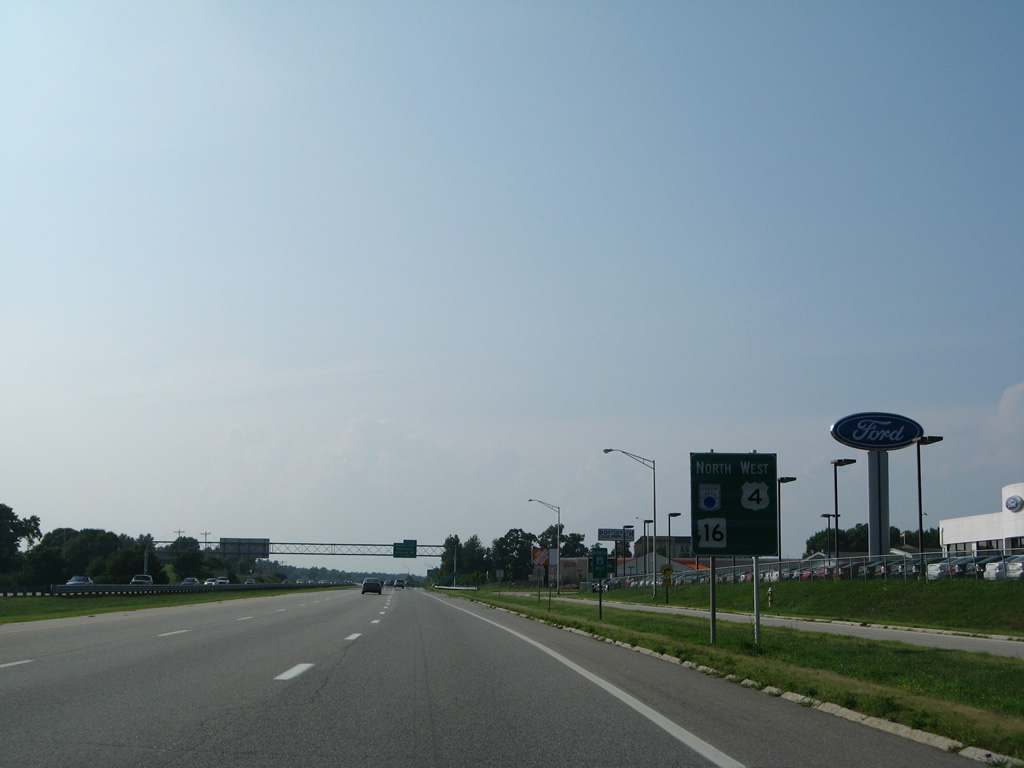
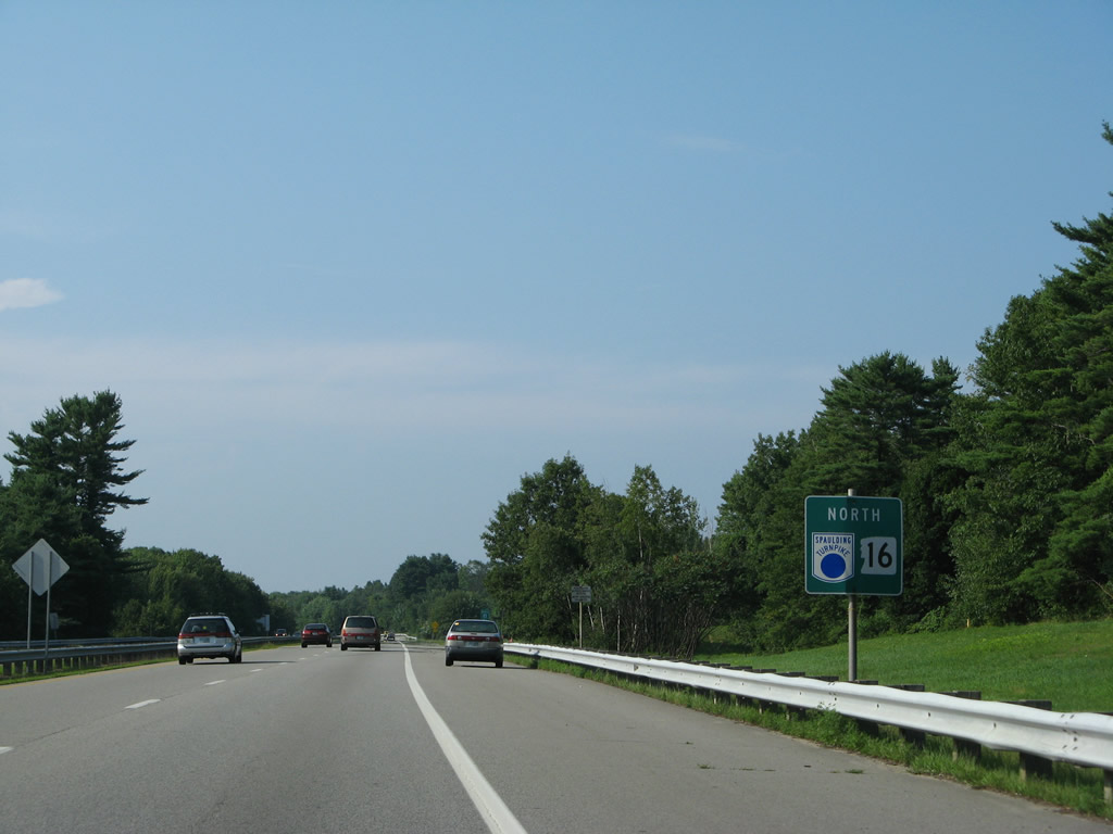
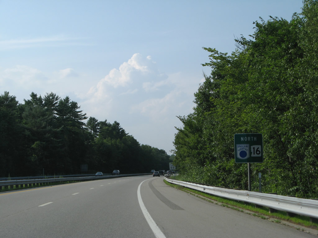
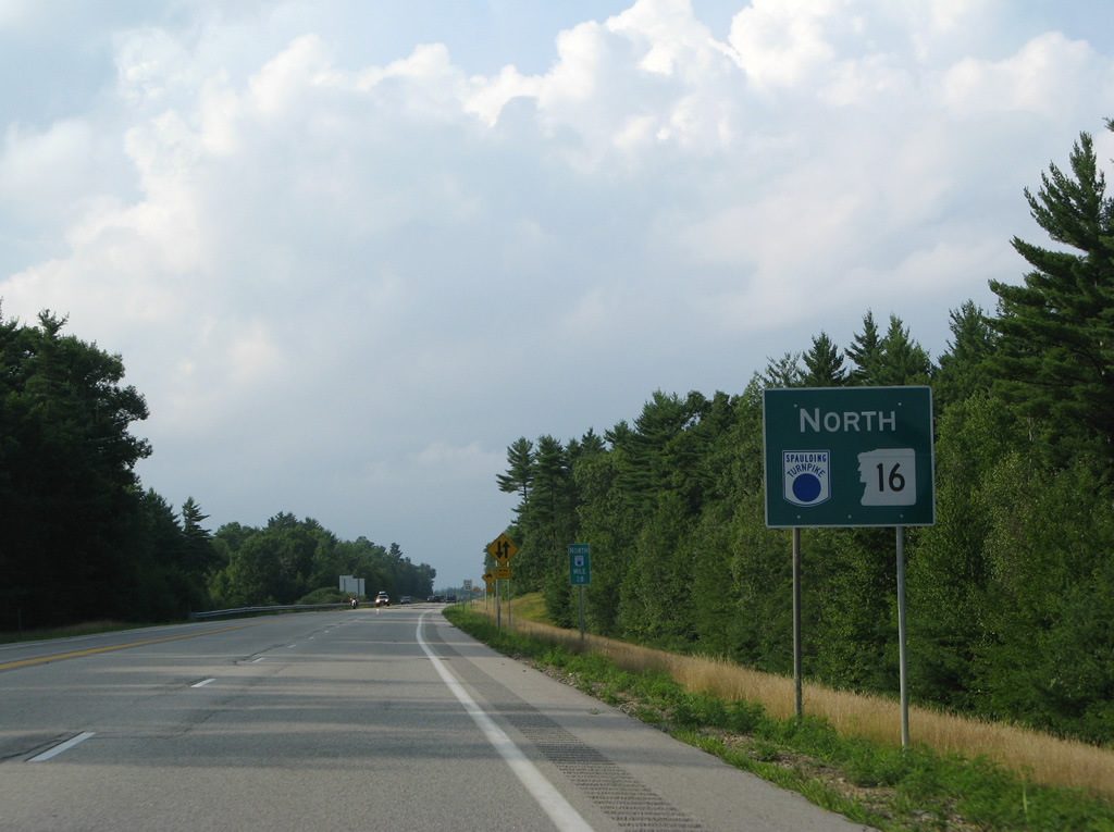
The first reassurance markers for all three routes appears as the Spaulding Turnpike passes by a series of driveways to adjacent car dealerships. Access if fully controlled southbound, but not northbound until the merge with the access road from I-95 north.
07/29/07
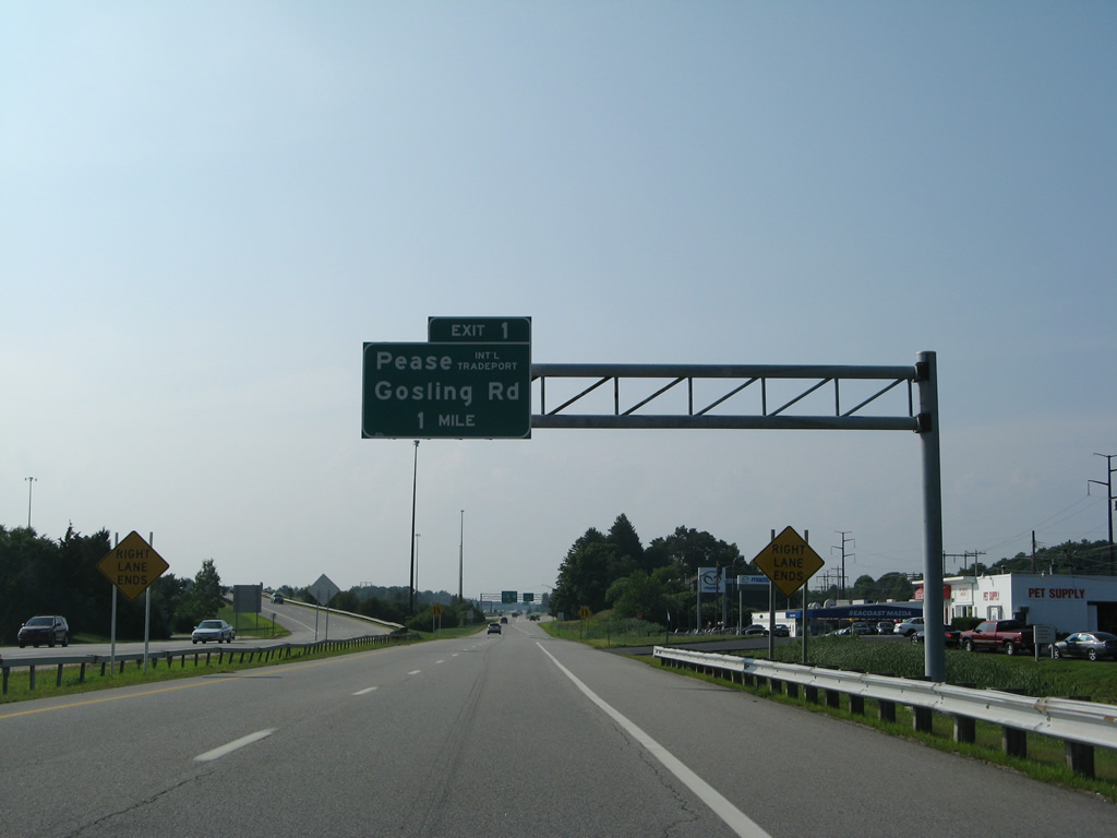
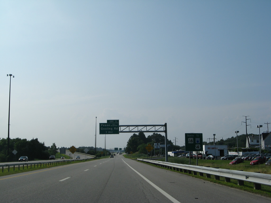
A diamond interchange (Exit 1) lies one mile ahead with Gosling Road west to Pease International Tradeport (PSM) and east to Newington.
07/29/07
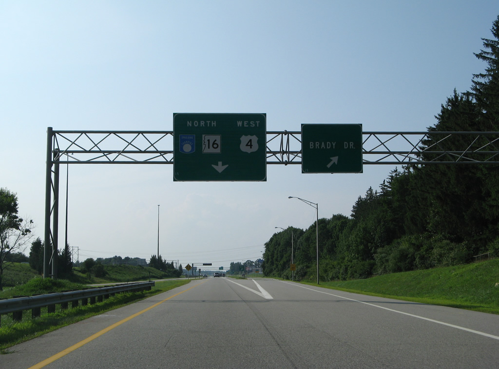
The Spaulding Turnpike mainline reduces to one lane as the Brady Drive off-ramp departs to the right and an on-ramp from the I-95 access road merges from the left. Brady Drive otherwise comprises a north side frontage road to another car dealership and a turn to Woodbury Avenue (former U.S. 4 & NH 16).
07/29/07
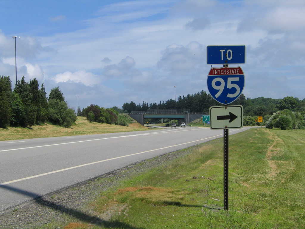
A wye interchange leads traffic from Interstate 95 (Blue Star Turnpike) north onto the Spaulding Turnpike ahead of Portsmouth Circle.
06/27/05
The access road from I-95 north to U.S. 4 west & NH 16 north includes a return ramp for the Spaulding Turnpike south for motorists joining the road from I-95 south headed to Portsmouth Circle.
06/28/05
This I-95 trailblazer posted for the southbound ramp to Portsmouth Circle was replaced by a small green sign by 2012.
06/28/05
A distance sign stands at the wye interchange merge with U.S. 4 west & NH 16 north from the I-95 access road. The Newington exit lies one mile ahead, with Durham and Dover reached within ten miles.
06/27/05
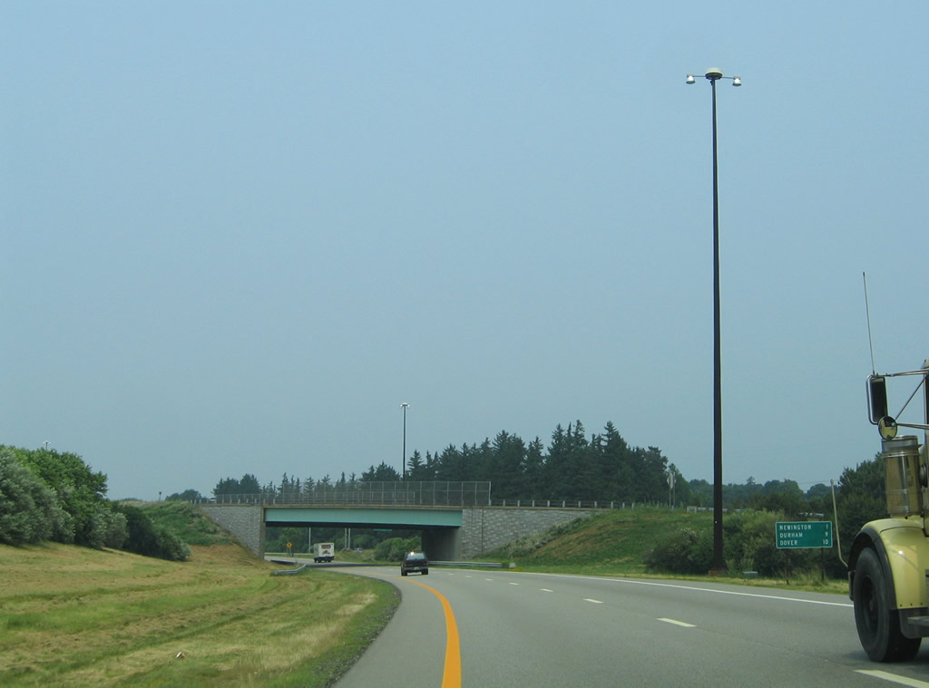
The Spaulding Turnpike north expands to three lanes alongside Brady Drive to the Newington town line.
07/29/07
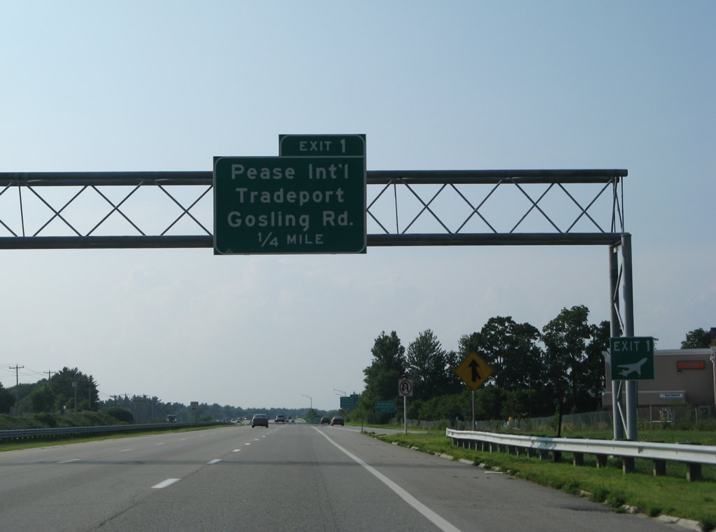
An on-ramp from Brady Drive adds a fourth northbound lane to the Gosling Road off-ramp (Exit 1). Gosling Road connects the turnpike with the Newington business district to the east of U.S. 4 & NH 16. The area is home to big box retail and The Mall at Fox Run.
07/29/07
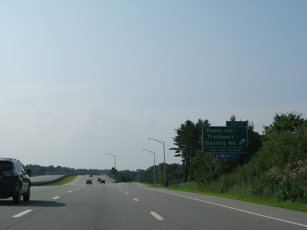
Exit 1 leaves U.S 4 west & NH 16 (Spaulding Turnpike) north for Gosling Road. Pease Boulevard west extends west from Gosling Road into Pease International Tradeport. The former air force base serves a cargo hub and a national guard base.
07/29/07
U.S. 4 west & NH 16 (Spaulding Turnpike) north enter the town of Newington beyond the Gosling Road overpass.
07/29/07

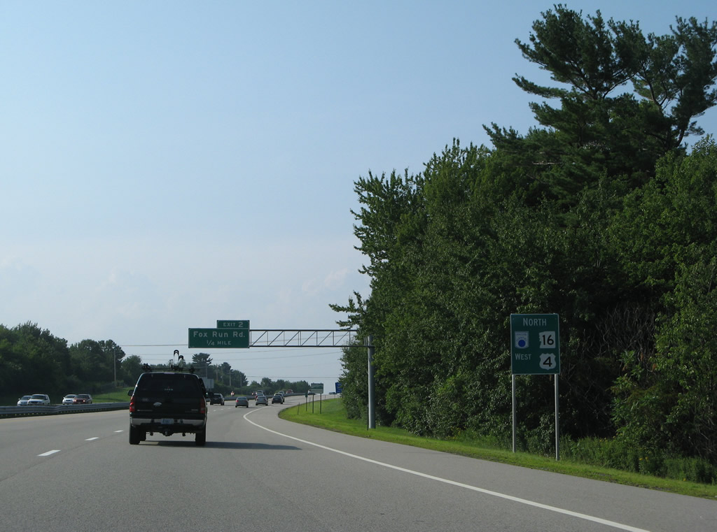
A set of northbound only ramps (Exit 2) join the Spaulding Turnpike next with Fox Run Road east to The Mall at Fox Run.
07/29/07
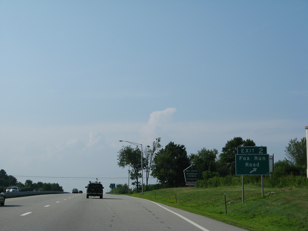
Fox Run Road spurs east from Exit 2 to the mall and Woodbury Avenue (old U.S. 4 & NH 16).
07/29/07
Northbound, U.S. 4 & NH 16 overtake Woodbury Avenue on the remaining drive to Little Bay and Dover Point. This stretch of freeway is undergoing widening and redesign through 2019 as part of the Spaulding Turnpike Newington-Dover Project.
07/29/07
An on-ramp joins the Spaulding Turnpike north from Woodbury Avenue a half mile ahead of the folded diamond interchange (Exit 4) with Shattuck Way. A new off-ramp (Exit 3) was added to this stretch from northbound for Woodbury Avenue by mid-2015.
07/29/07
The roadways of the Spaulding Turnpike originally split with a pair of U-turn ramps providing access to the reverse direction between Woodbury Avenue and the Shattuck Way exit. Reconstruction from 2012-15 shifted both roadways to run alongside one another to the left of this northbound scene.
07/29/07
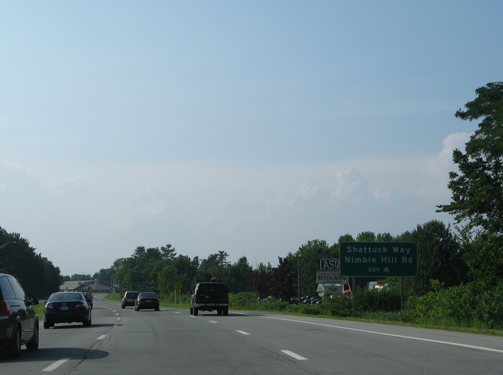
Shattuck Way extends north from an industrial area along the Piscataqua River to circle underneath the Little Bay bridges of U.S. 4 & NH 16 southward to end at Nimble Hill Road. Nimble Hill Road stems west from Exit 4 on the turnpike southbound to the Newington town center.
07/29/07

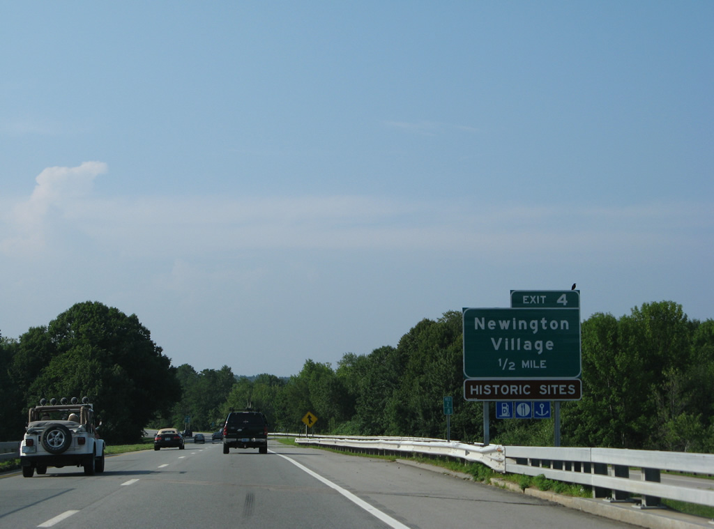
Exit 4 parts ways with U.S. 4 west & NH 16 north to adjacent Shattuck Way for interests to Newington Village.
07/29/07
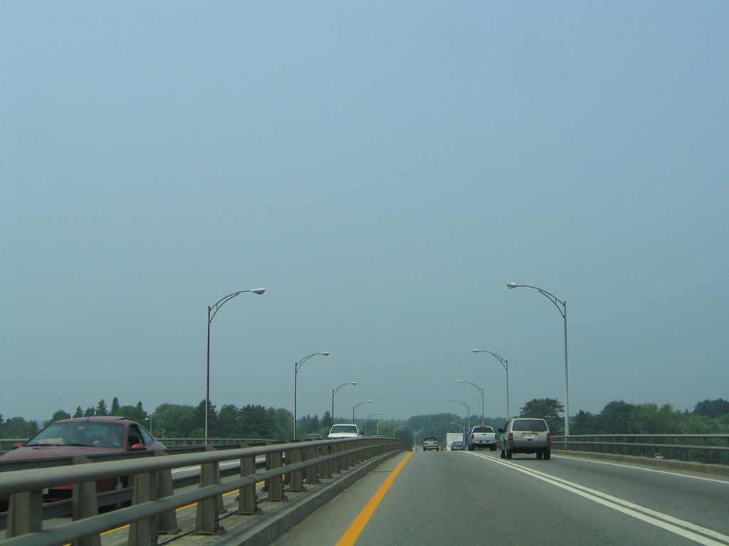
Three bridges span the waters of Little Bay. The 1934-built General Sullivan Bridge carries pedestrian/bicycle traffic to the left. Collectively known as the Captain John F. Rowe Bridge, the Spaulding Turnpike utilizes a 1966-built southbound bridge and a 1984-built northbound bridge. Both of these spans were redecked and expanded during the Spaulding Turnpike Newington-Dover Project.
07/29/07
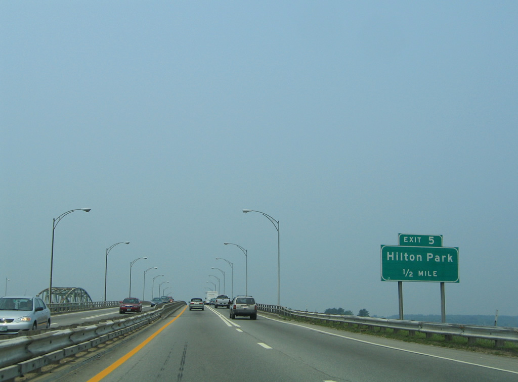
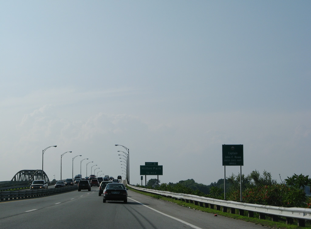
Widening of the Spaulding Turnpike to Exit 6 included the elimination of Exit 5 for Hilton Park.
07/29/07
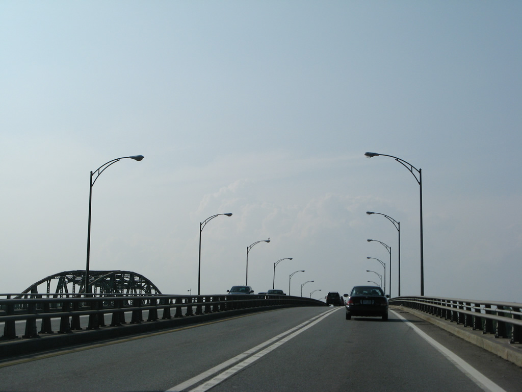
The Little Bay Bridges originally carried just four lanes of traffic with lane changes prohibited. Work running through mid-2016 expands the crossing to eight overall lanes.
07/29/07
06/27/05
The Dover Main Toll Plaza of the Spaulding Turnpike lies just north of Exit 6.
07/29/07
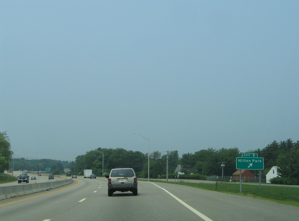
Exit 5 consisted of a short loop ramp joining Hilton Drive south to Dover Point Road underneath the Little Bay bridges. Dover Point Road runs north as Boston Harbor Road to U.S. 4 just west of Exit 6.
06/27/05
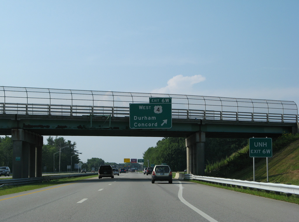
Exit 6 originally consisted of a parclo interchange with separate ramps for Dover Point Road north and U.S. 4 west. Construction through late 2017 eliminates the loop ramp (Exit 6W) for U.S. 4 west and consolidates the exit into a single ramp to a signalized intersection. U.S. 4 west spans the Bellamy River west into Durham while Dover Point Road, the old alignment of NH 16, runs north to Huckleberry Hill in south Dover.
07/29/07
Spaulding Turnpike northbound at the departure of Exit 6N to Dover Point Road. Dover Point Road (former NH 16) runs alongside the turnpike to Stark Avenue near Exit 7.
07/29/07
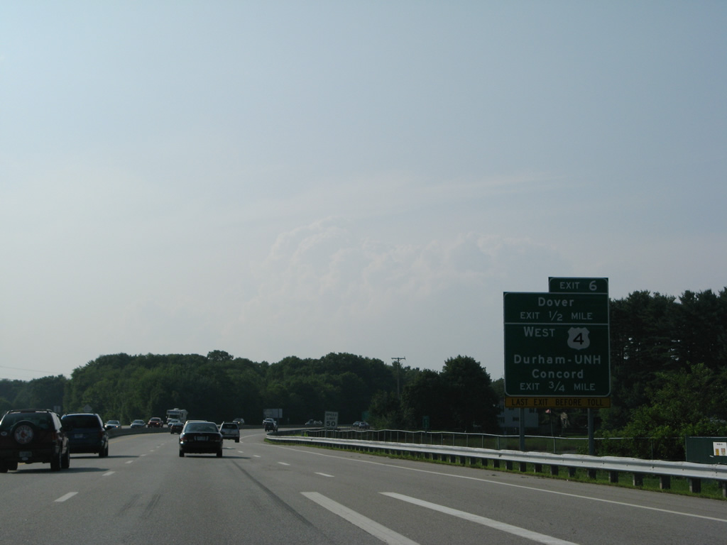
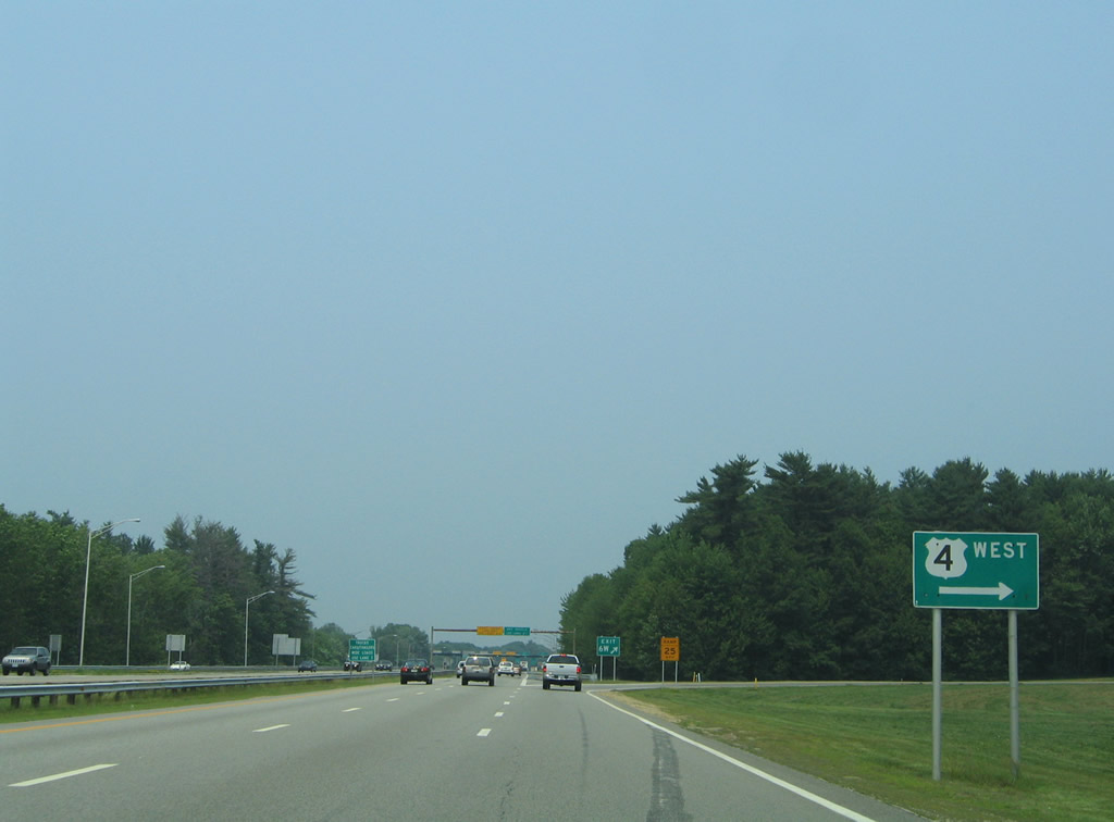
U.S. 4 travels west along Piscataqua Road parallel to the Oyster River through Durham to an expressway bypass of the town center. Durham is home to the University of New Hampshire, which lies along Main Street (NH 155A / old U.S. 4) west of Downtown.
U.S. 4 heads west from its bypass of Durham to Northwood, Chichester and I-393 into Concord.
07/29/07
The loop ramp for the U.S. 4 westbound split from NH 16 north will be replaced by a new on-ramp from Dover Point Road and U.S. 4 east onto the Spaulding Turnpike north. Previously all traffic from U.S. 4 east defaulted onto the freeway south, which is why the U-turn ramps were in place in Newington.
06/27/05
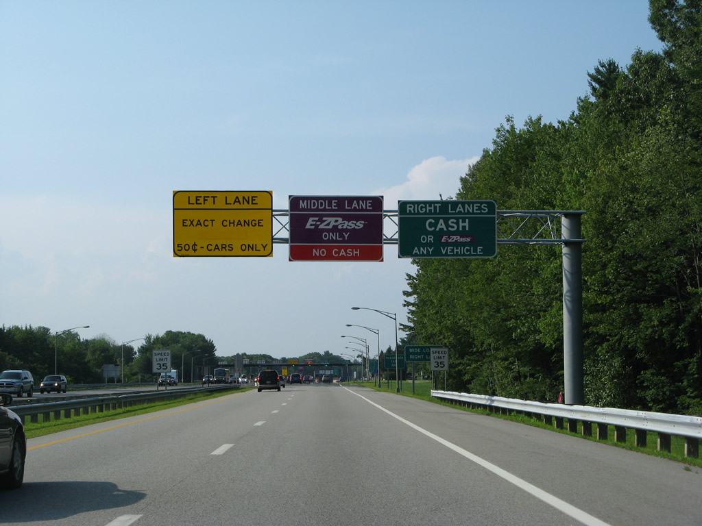
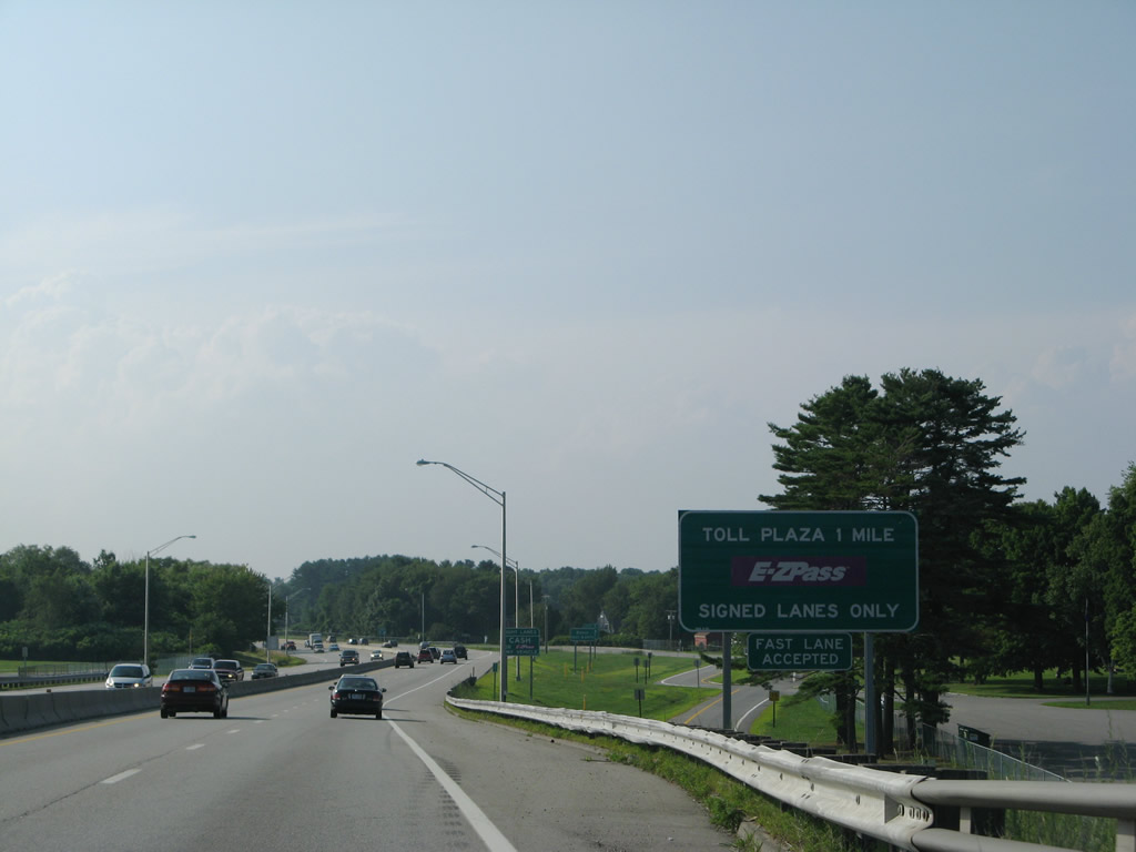
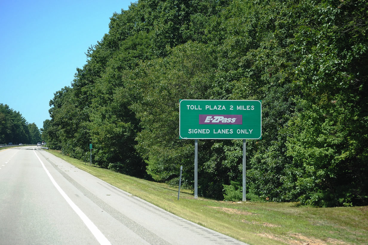
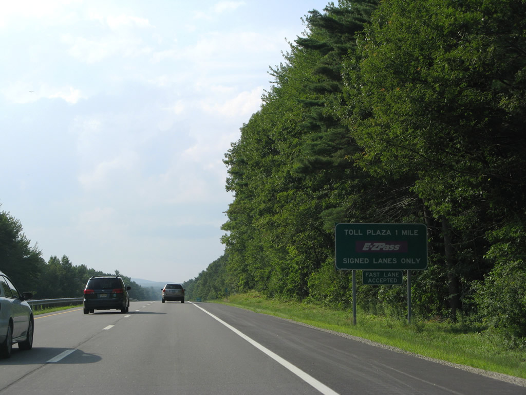
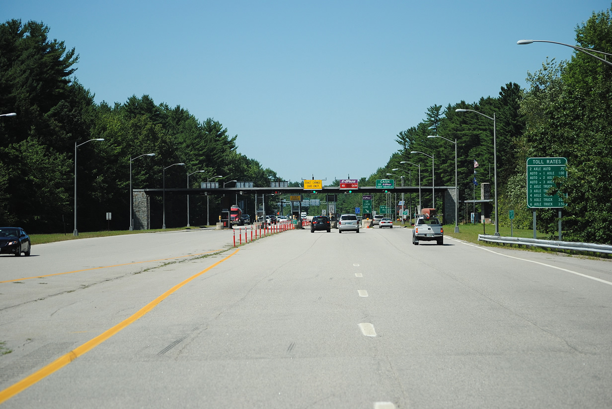
The 4.1 mile stretch of the Spaulding Turnpike north between Exits 6 and 7 is tolled.
07/29/07
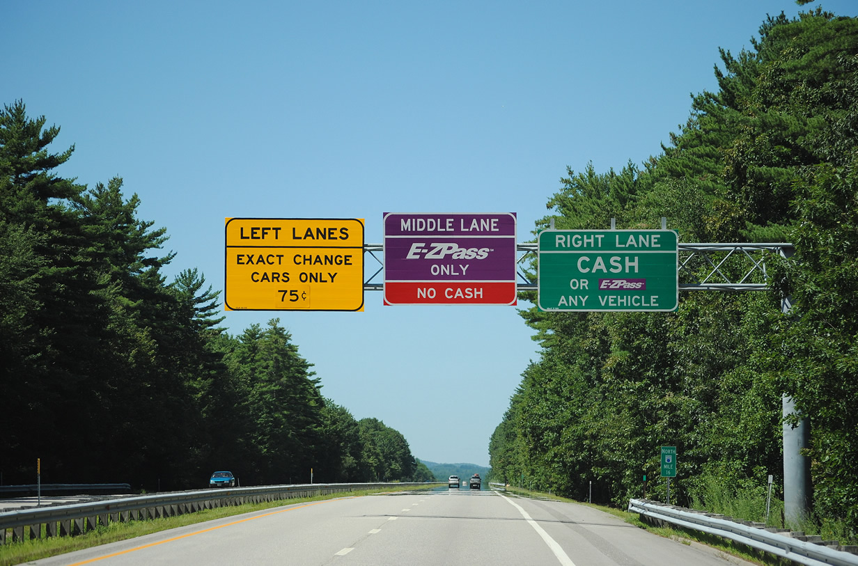
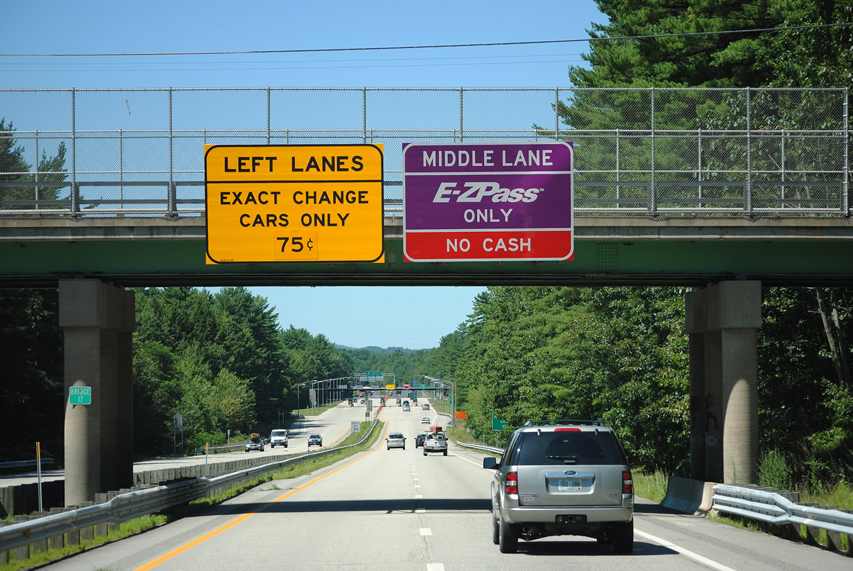
The Dover Main Toll Plaza is eight lanes wide with two lanes dedicated to E-ZPass transactions where motorists can pass through at 25 MPH.
07/29/07
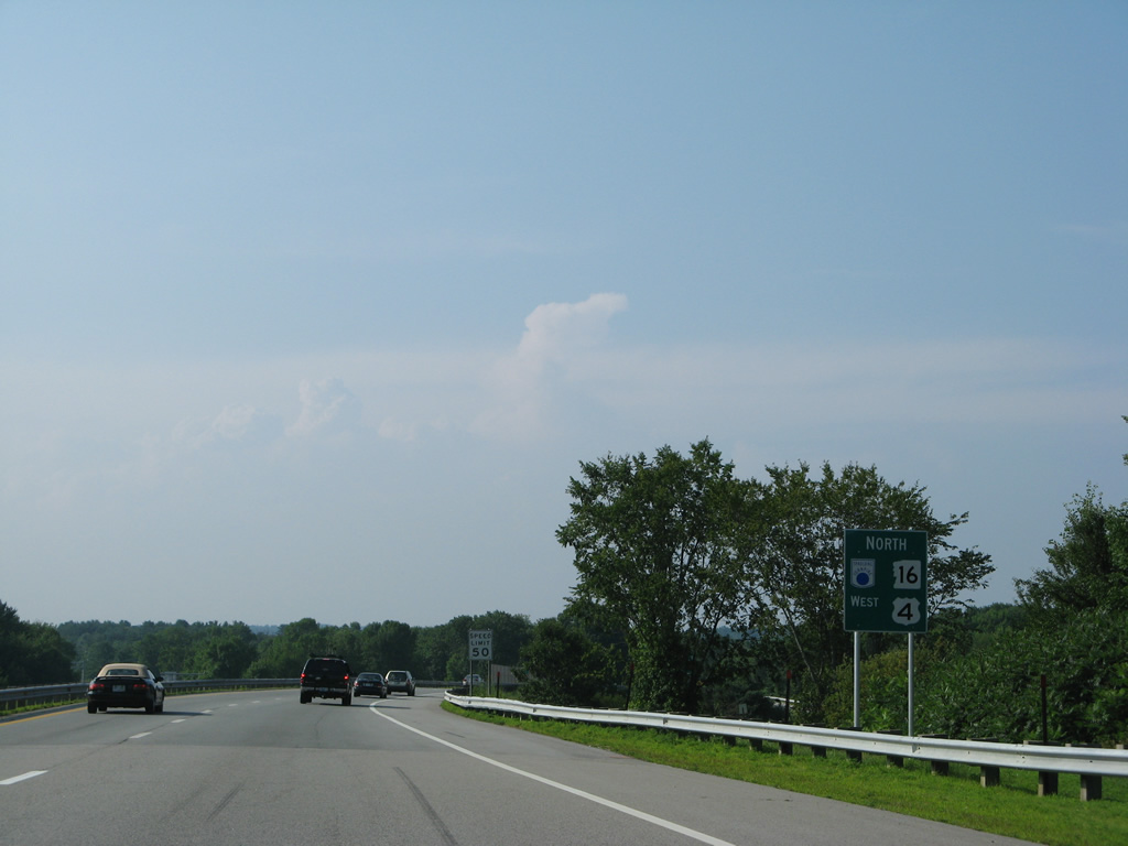
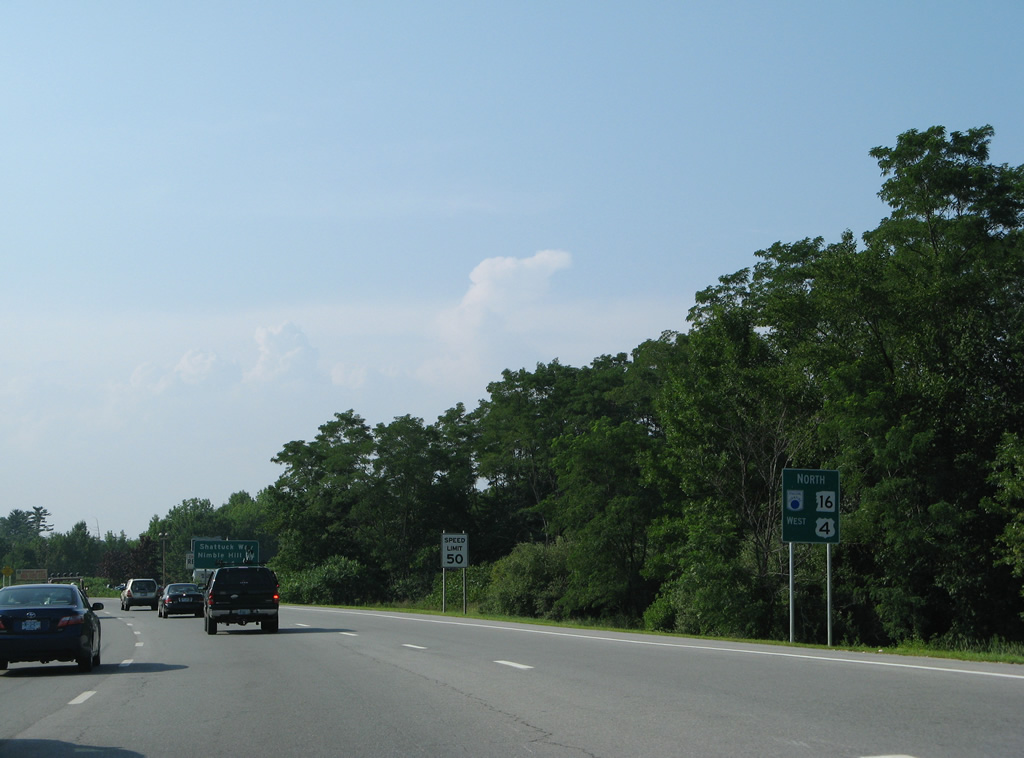
Northbound reassurance sign for NH 16 and the Spaulding Turnpike posted beyond the toll booths. The toll road parallels Spur Road and the Bellamy River on this stretch.
07/29/07
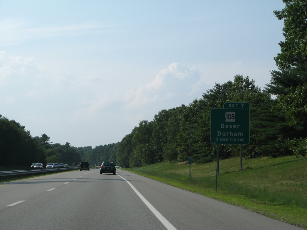
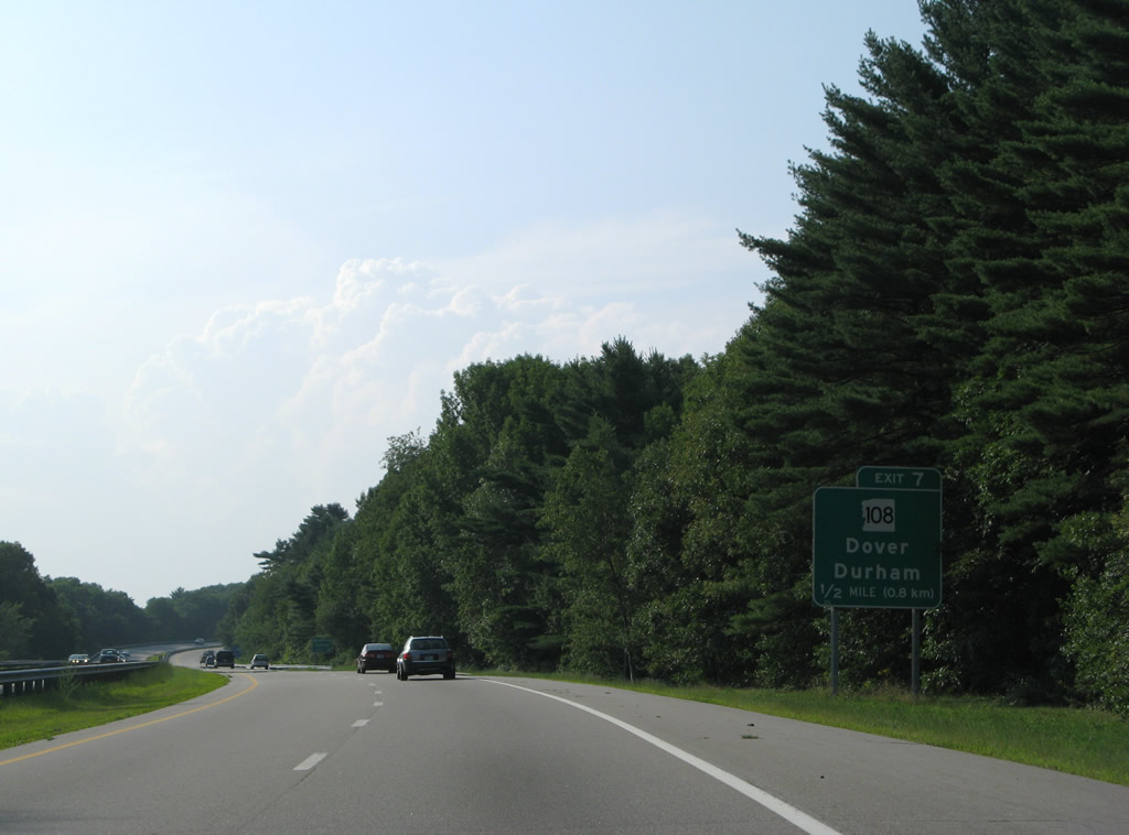
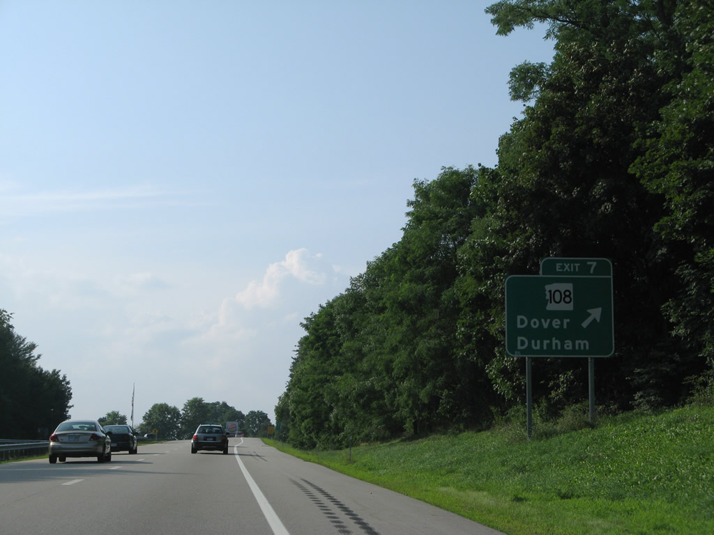
A parclo A2 interchange (Exit 7) joins NH 16 (Spaulding Turnpike) with NH 108 (Durham Road / Central Avenue) in one mile.
07/29/07
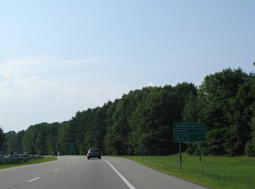
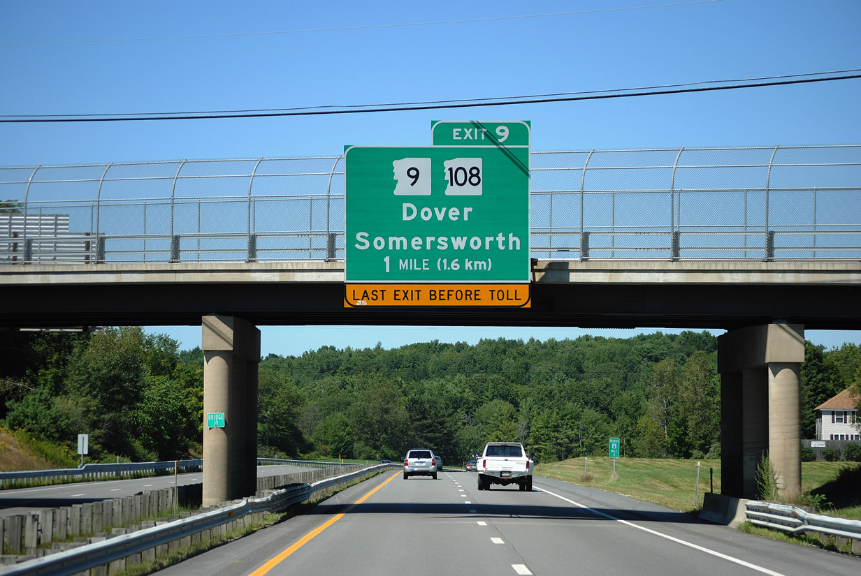
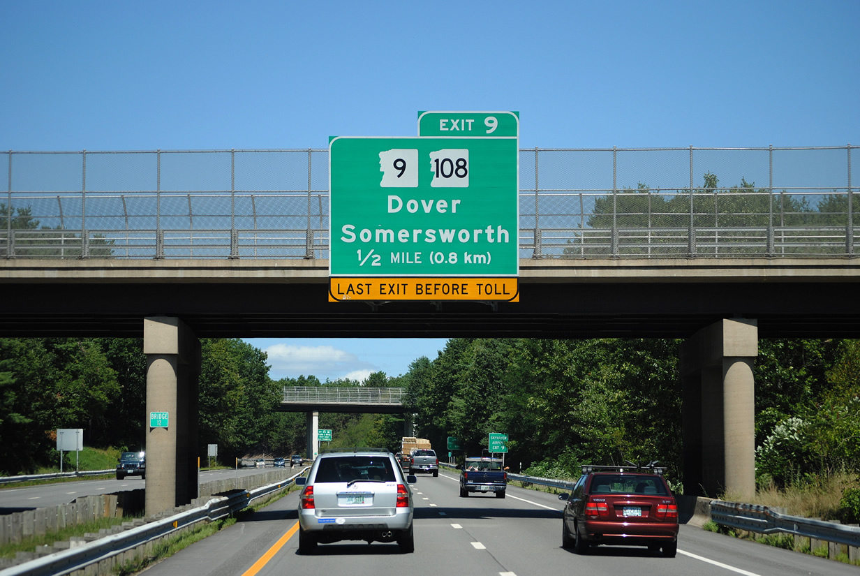
Exit 7 is the first of three exits for the city of Dover. Interests to Downtown are directed onto NH 9 east to its merge with NH 108 (Central Avenue) north. A large retail area lies on the north side of the city, east of Exit 9 at the split of NH 9 and 108 at High Street.
07/29/07
NH 108 forms a 43.3 mile long multi-state route from Haverhill, Massachusetts north to Rochester. The state route ventures south from Exit 7 through east Madbury to the Durham town center.
07/29/07
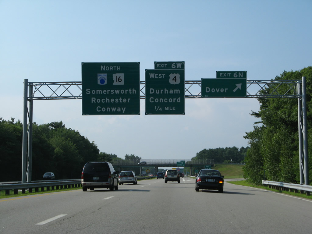
North from Exit 7, NH 108 overtakes the former alignment of NH 16 from Stark Avenue along Central Avenue toward Downtown. The state route was extended north from Dover to Rochester in the early 1990s when NH 16 shifted wholly onto the Spaulding Turnpike.
07/29/07
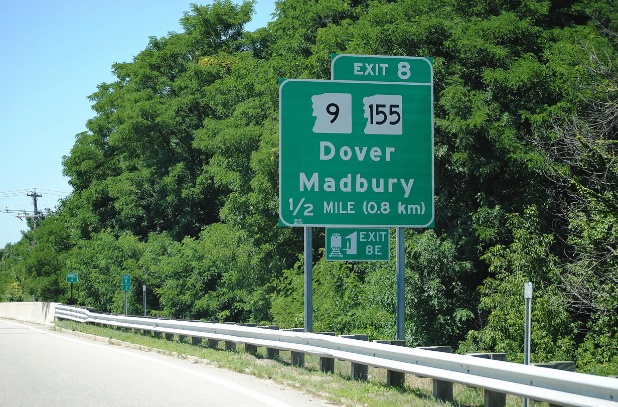
A cloverleaf interchange (Exits 8E/W) follows with NH 9 at Knox Marsh Road. NH 155 stems west from nearby to the Madbury town center and east Lee where it meets U.S. 4 west to Concord.
08/16/11
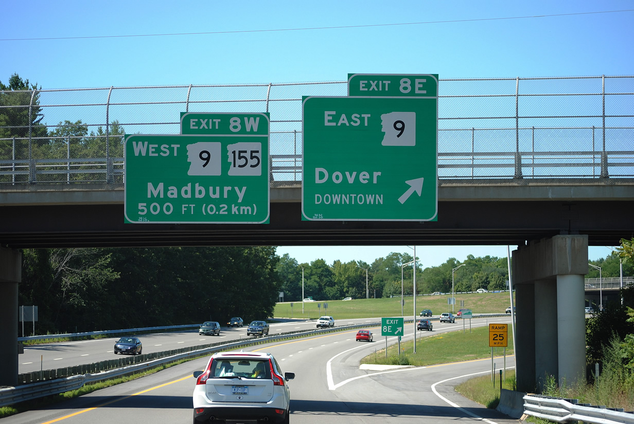
NH 9 arcs northward onto Silver Street east to its merge with NH 108 (Central Avenue). The two routes share 2.7 miles of pavement, including a one way couplet through Downtown, to High Street at Indian Brook Drive.
08/16/11
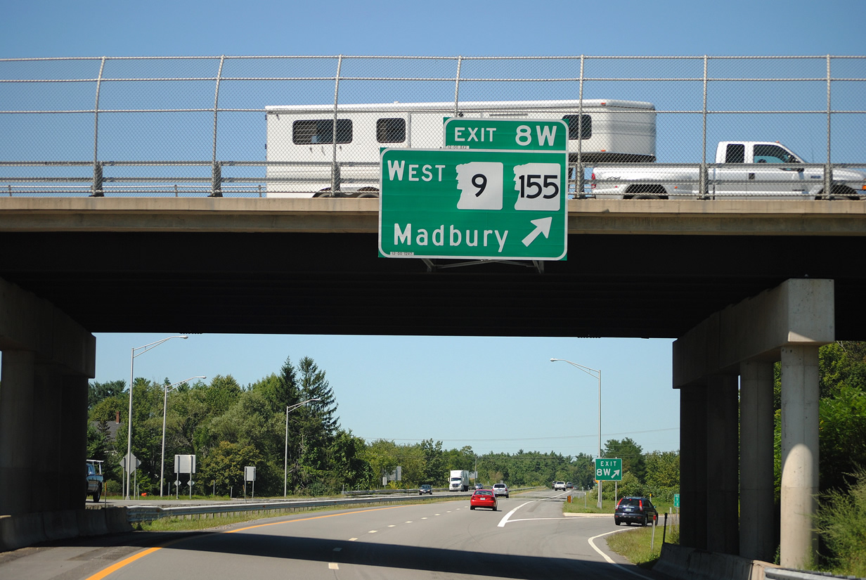
Exit 8W loops away from the Spaulding Turnpike north to NH 9 west. NH 155 extends Knox Marsh Road west as NH 9 turns northwest onto Littleworth Road to Barrington. NH 9 totals 110 miles across the state as part of a long distance route west to Bennington, Vermont and east to Calais, Maine.
08/16/11
NH 16 (Spaulding Turnpike) encircles the west side of Dover to the Cochecho River.
07/29/07
Indian Brook Drive connects the Spaulding Turnpike with NH 9 (High Street) east and NH 108 (New Rochester Road) north through Somersworth in one mile.
08/16/11

Spanning the Cochecho River along NH 16 north. The 38.3 mile long river flows southeast from Strafford County through Farmington, Rochester and Dover to combine with the Salmon Falls River and form the Piscataqua River.
07/29/07
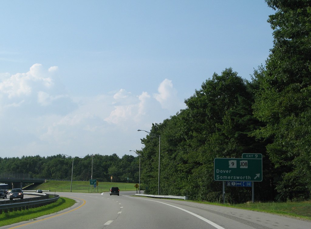
6th Street and Glenwood Avenue pass overhead as the Spaulding Turnpike nears the off-ramp (Exit 9) for Indian Brook Drive. NH 9 angles northeast from NH 108 (New Rochester Road) to the Somersworth town center and Berwick, Maine. NH 108 remains along old NH 16 north to Skyhaven Airport (RCM) and its terminus at NH 125 in Downtown Rochester.
08/16/11
Entering the parclo interchange (Exit 9) with Indian Brook Drive on the Spaulding Turnpike north. Indian Brook Drive west leads motorists to 6th Street and County Farm Road for the Strafford County Complex (home of the County Administration Building / Courthouse).
07/29/07
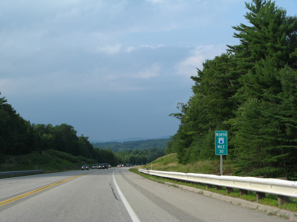
NH 16 bee lines northwest to Rochester on a 6.7 mile exit less stretch.
07/29/07
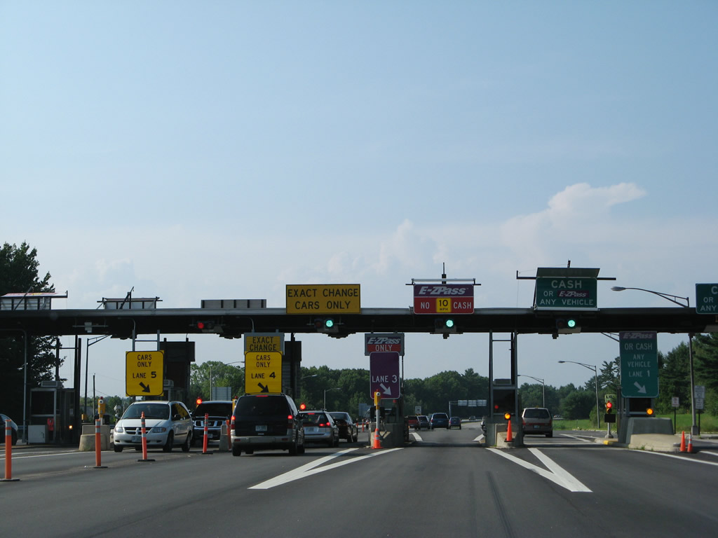
The Rochester Main Toll Plaza resides after the Tebbetts Road overpass in two miles. This is the final toll collection point on the Spaulding Turnpike northbound.
08/16/11
The six-booth plaza includes one lane per direction for electronic toll collection using E-ZPass.
08/16/11
07/29/07
Entering the Rochester Main Toll Plaza along NH 16 (Spaulding Turnpike) north.
08/16/11
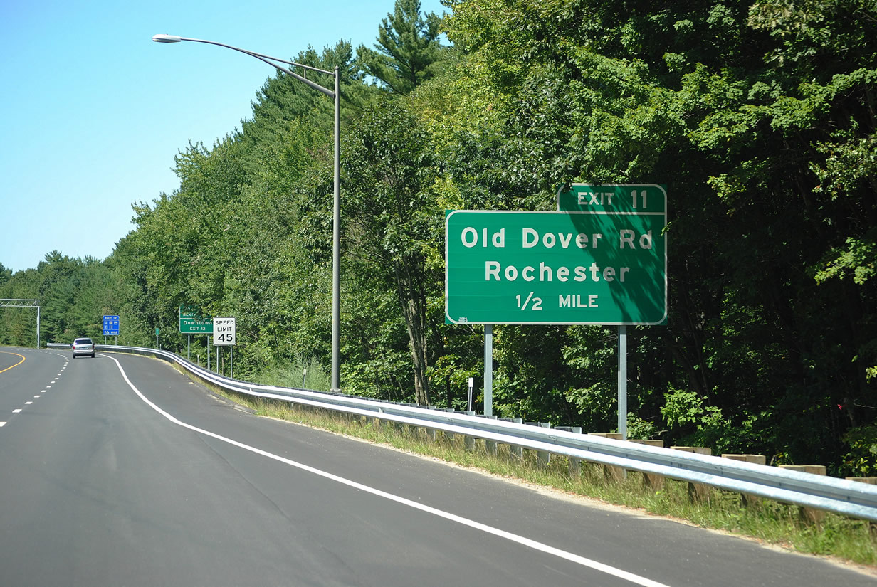
A northbound only exit departs one half mile ahead onto Old Dover Road (former NH 16A).
08/16/11
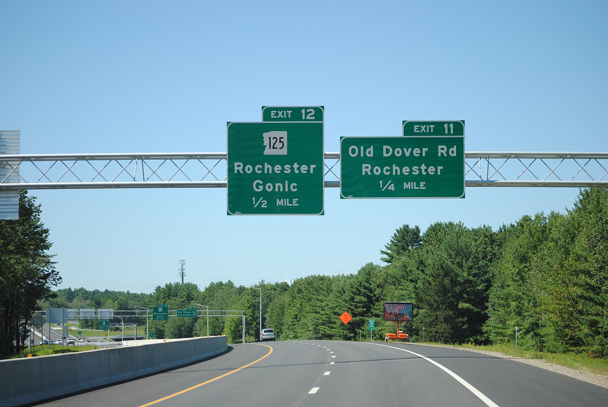
Exit 11 joins Old Dover Road north ahead of NH 125 (Charles Street). NH 125 meets the Spaulding Turnpike directly at an adjacent parclo interchange (Exit 12) in one half mile.
08/16/11

NH 16 (Spaulding Turnpike) north at the ramp departure (Exit 11) to Old Dover Road. Old Dover Road leads drivers back south seven miles to Dover.
The turnpike crosses the Cochecho River again at the off-ramp (Exit 11) for NH 125. NH 125 is a 52 mile route extending north from MA 125 at Haverhill to Epping, Lee, Rochester and Wakefield.
08/16/11
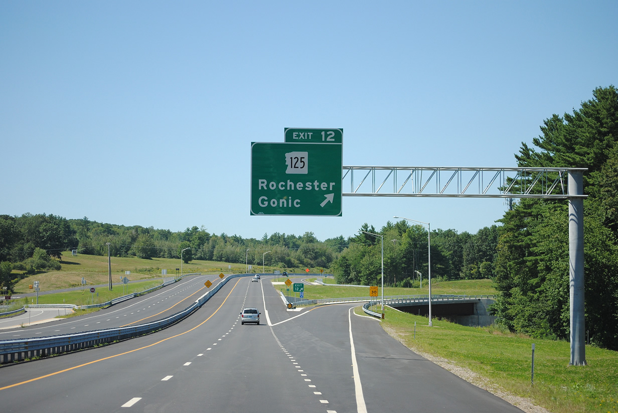
NH 12 (Gonic Road) leads south to West Gonic and Gonic and north as a direct route to Downtown. The state route overtakes former NH 16 north from Rochester to Milton and Union.
08/16/11
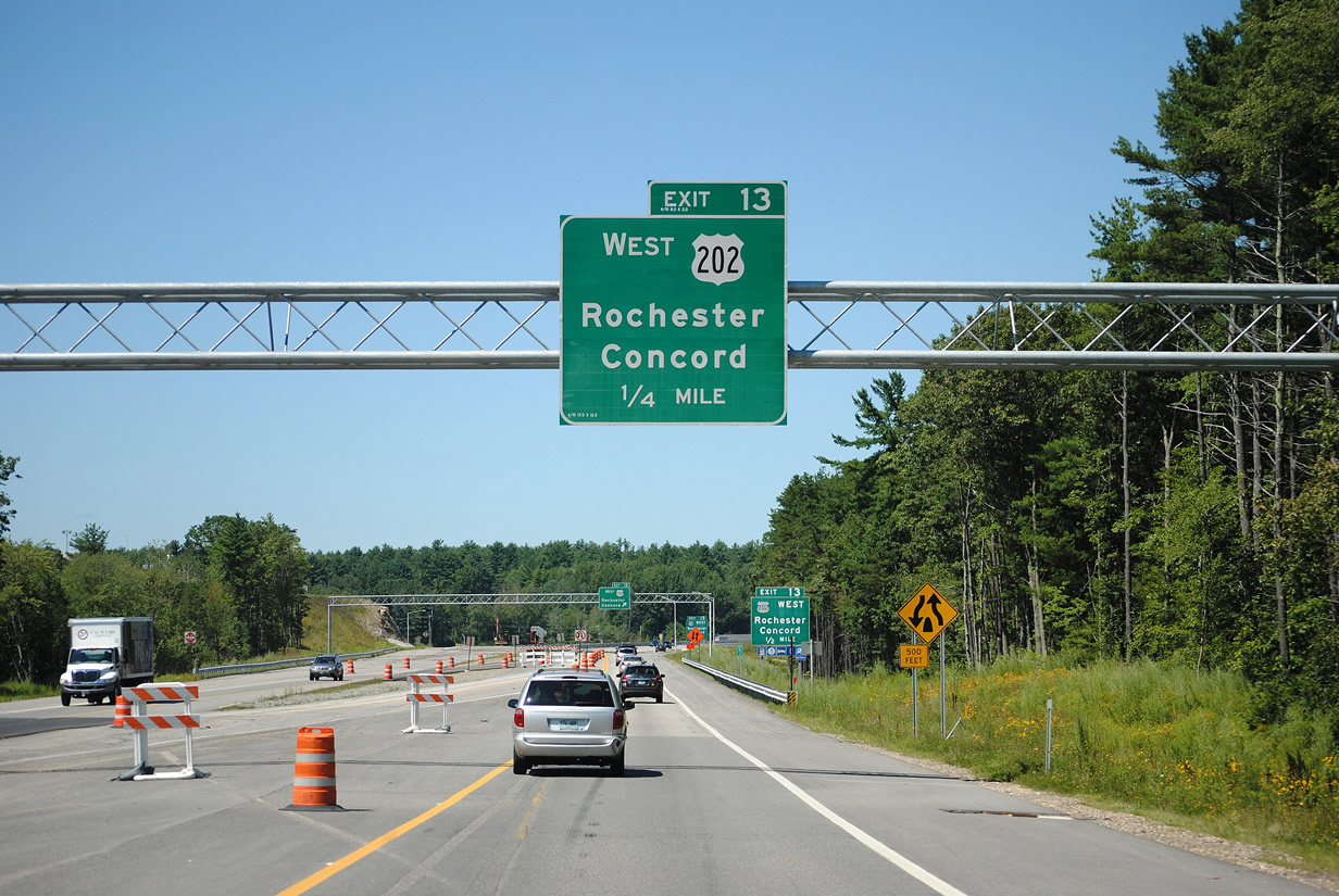
U.S. 202 enters the city of Rochester from Barrington and Northwood to the southwest of forthcoming Exit 13. The eight-state route combines with U.S. 4 and I-393 west to Concord.
08/16/11
 East
East 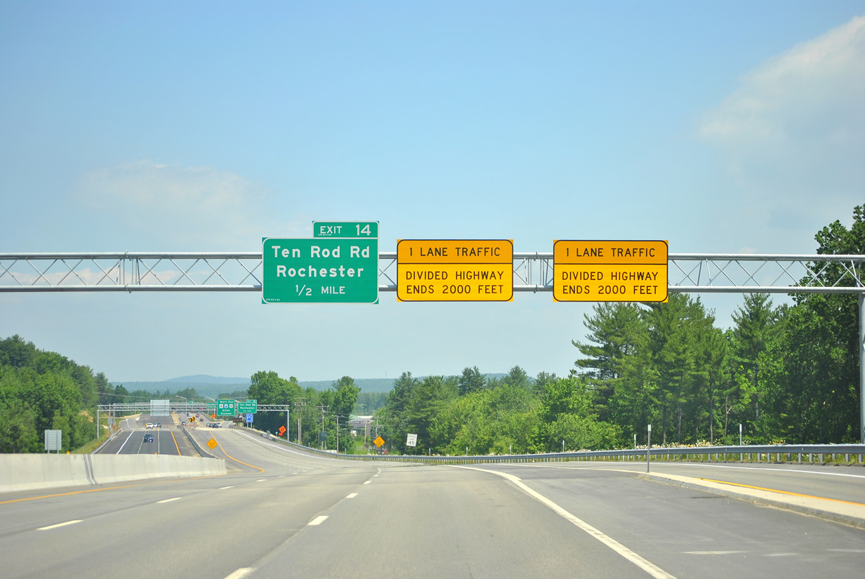
Construction between 2008 and 2012 expanded the Spaulding Turnpike to six overall lanes to the split with U.S. 202 at Exit 16.
06/20/12
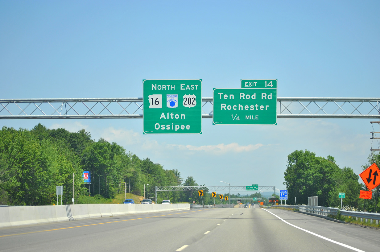
Ten Road Road branches northwest from North Main Street to cross paths with U.S. 202 & NH 16 at a half diamond interchange (Exit 14) in one quarter mile.
06/20/12
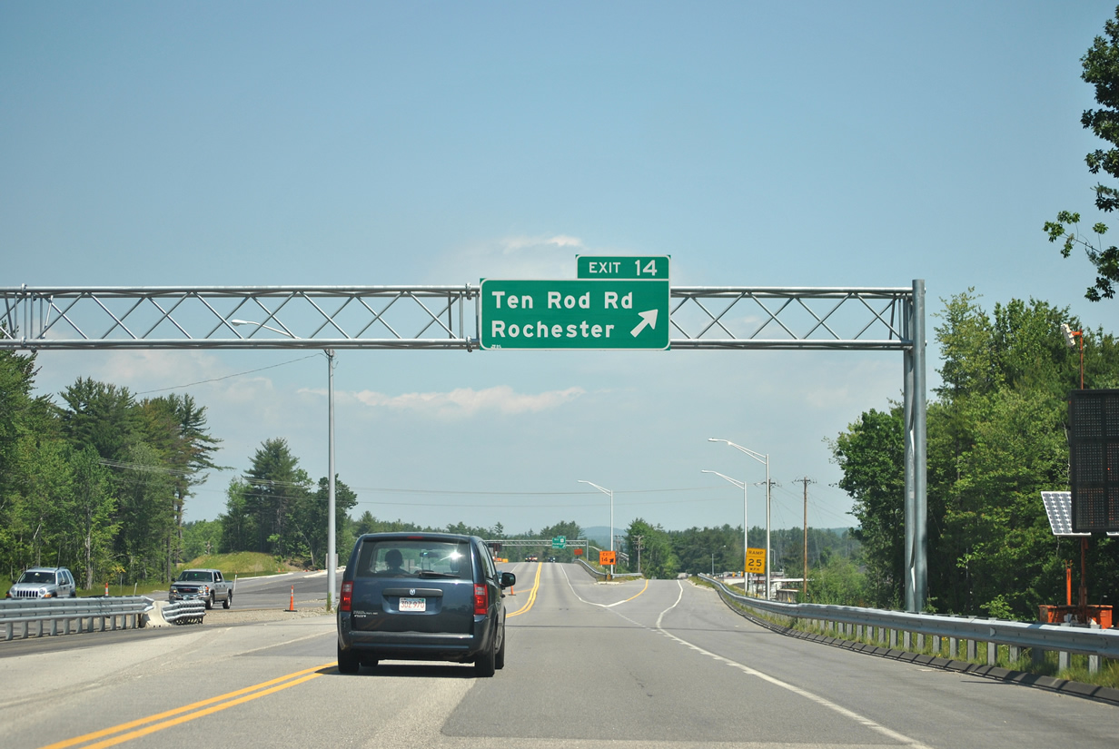
Exit 14 leaves the Spaulding Turnpike north for Ten Road Road northwest to Chelsey Mountain in Farmington.
06/20/12
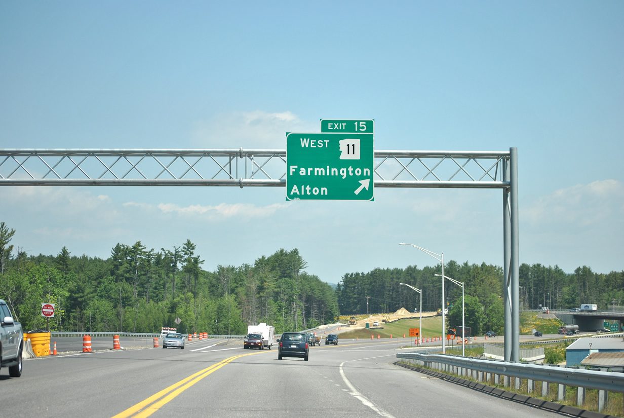
A diamond interchange (Exit 15) immediately follows along U.S. 202 east & NH 16 north with Main Street south and NH 11 (Farmington Road) west. A cross-state route, NH travels 108 miles from Springfield, Vermont to Lebanon, Maine.
06/20/12
NH 11 East 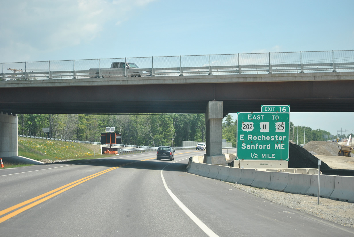
NH 11 combines with the Spaulding Turnpike to bypass Rochester east to Exit 16.
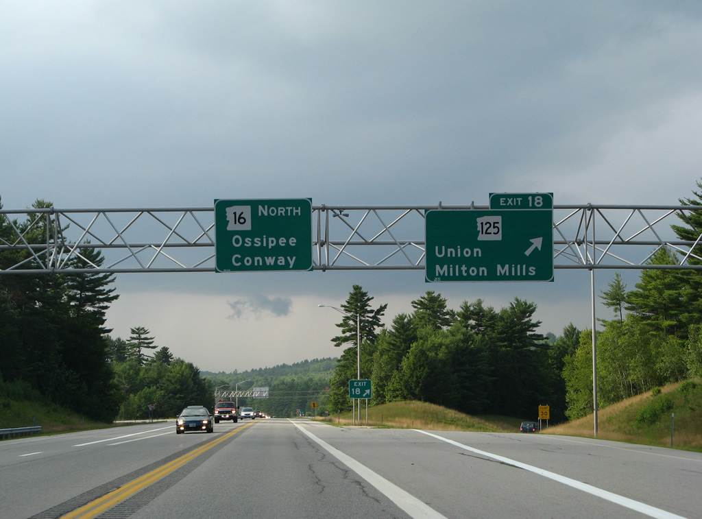
U.S. 202 & NH 11 split with NH 16 at Exit 16 and take the original turnpike spur east to NH 125 (Milton Road). The tandem continue to East Rochester and Sanford, Maine while NH 125 remains parallel to the Spaulding Turnpike north into Milton.
06/20/12
The final 12 miles of the Spaulding Turnpike north to the Wakefield town line remains as a super-two freeway. This stretch opened to traffic in 1981.
07/29/07
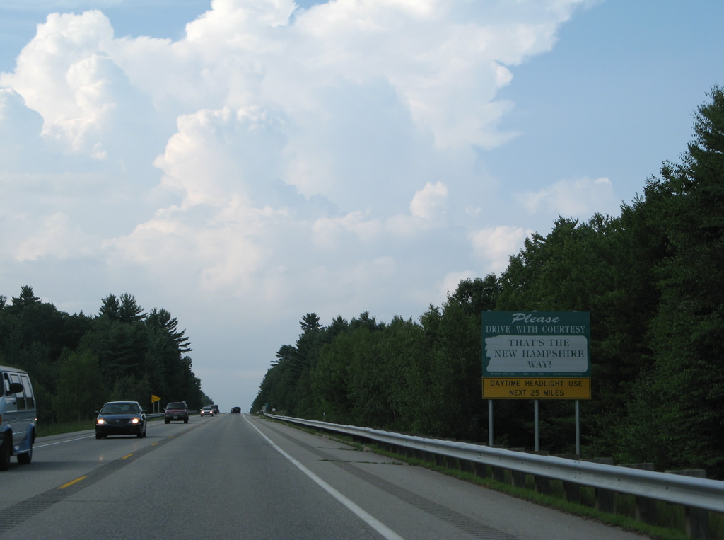
Daytime headlight uses is advised on the 25 mile stretch of NH 16 leading north from Rochester to Ossipee due to high volumes during the summer tourist season.
07/29/07

The Spaulding Turnpike cuts across a hillside by North Rochester at milepost 25.
07/29/07
Drivers along NH 16 enter the town of Milton just west of Spaulding Pond in this scene.
07/29/07
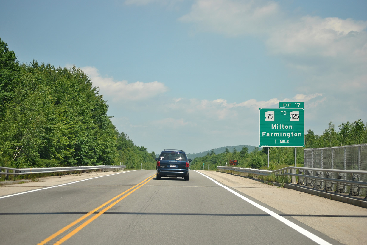
Passing over McKeagney Road, the Spaulding Turnpike is one mile ahead of the diamond interchange (Exit 17) with NH 75 (Farmington Road).
06/20/12
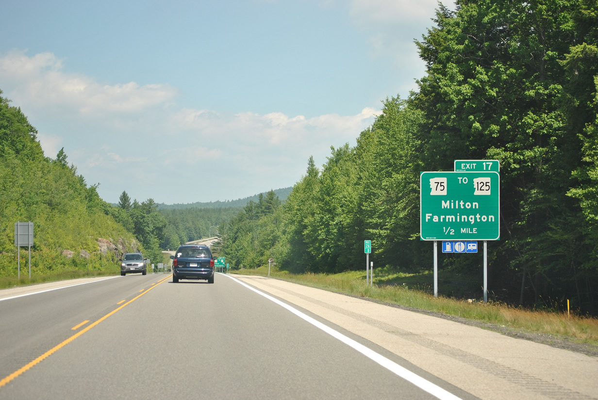
NH 75 arcs 5.7 miles west from parallel NH 125 (White Mountain Highway) to end at NH 153 (Main Street) at the Farmington town center.
06/20/12
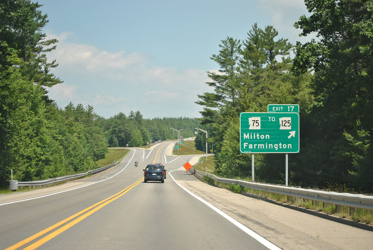
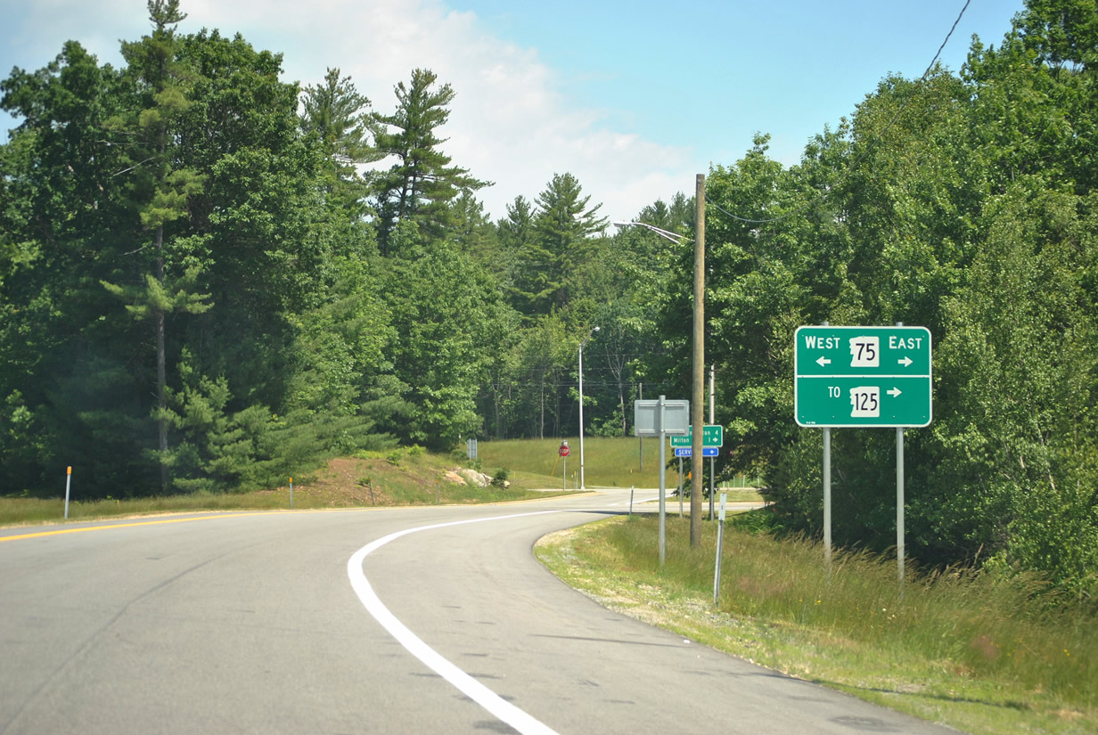
Exit 17 leaves NH 16 (Spaulding Turnpike) north to NH 75 (Farmington Road) west to Hayes Corner and Farmington and east to NH 125 south of the Milton town center.
06/20/12
NH 75 formerly took Elm Street directly into Milton from just east of Exit 17.
06/20/12
The Spaulding Turnpike advances another 5.4 miles to Exit 18 on Milton Ridge.
07/29/07

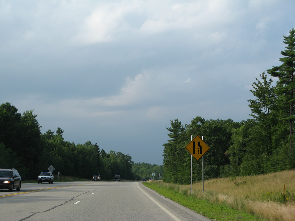
A passing lane ensues northward from Exit 17 to milepost 29.8.
07/29/07
NH 16 (Spaulding Turnpike) veers eastward by Teneriffe Mountain (elevation 991 feet) to cross a New Hampshire Northcoast Railroad line at milepost 31.
07/29/07

NH 125 leads motorists back south from a folded diamond interchange (Exit 18) with NH 16 to Milton and northward along the former alignment of NH 16 through Union in south Wakefield.
07/29/07
Exit 18 departs the Spaulding Turnpike north for NH 125 (White Mountain Highway). NH 125 loops through Union to end at NH 16 in 1.8 miles. All guide signs for Exit 18 were replaced by 2008.
07/29/07
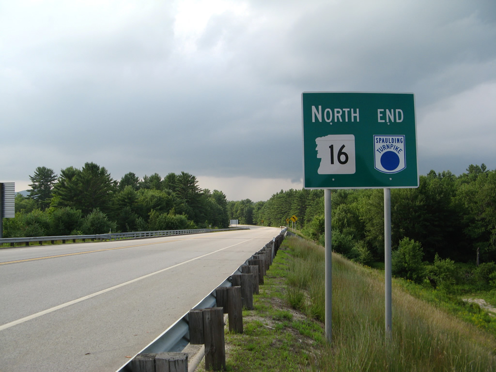
An end sign for the Spaulding Turnpike stands between the NH 125 on-ramp and the bridge across the Branch River.
07/29/07
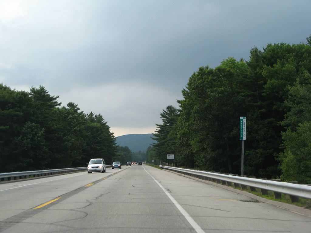
NH 16 continues north across the Carroll County line into Wakefield as the White Mountain Highway.
07/29/07
Photo Credits:
- AARoads: 07/29/07
- Alex Nitzman, Carter Buchanan: 06/27/05, 06/28/05
- I.C. Ligget: 08/16/11, 06/20/12
Connect with:
Page Updated Friday February 20, 2015.