
St. Joseph Valley Parkway West / North
 West
West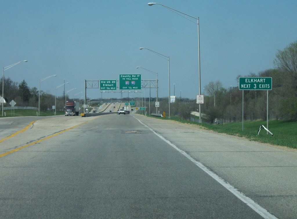
We start off in Elkhart County (population 197,559), home to Elkhart and Goshen and part of the Indiana Amish Country (along with adjacent LaGrange County). Elkhart (population 50.949) is an older industrial city that forms a core part of the Michiana area. The three interchanges serving Elkhart are with County Road 17, U.S. 33, and SR 19. At this point, U.S. 20 westbound expands to four lanes as it becomes the St. Joseph Valley Parkway. In Elkhart County, the highway is also known as the Dean R. Mock Expressway, although the name is rarely used.
04/10/10
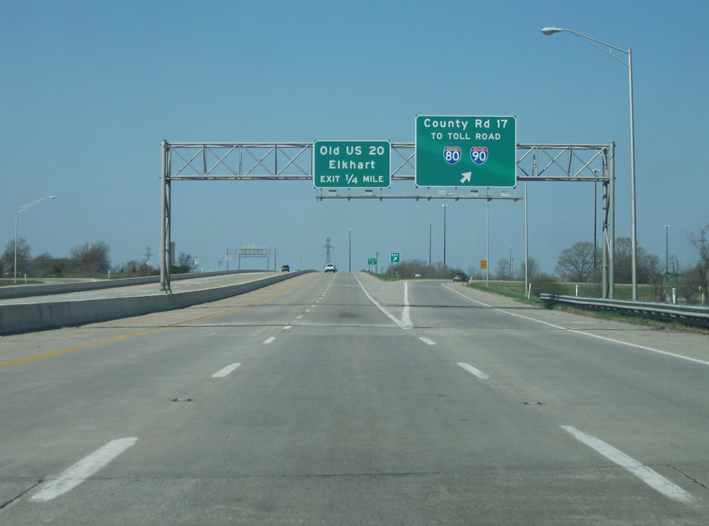
Now at the interchange with Elkhart County Road 17 and Old U.S. 20 (Toledo Road). County Road 17 is a four lane arterial that was built to connect the St. Joseph Valley Parkway (U.S. 20) with the Indiana Toll Road (Interstate 80/Interstate 90). Several industrial complexes line the road in between the two highways. The four lane road continues south and connects with U.S. 33 in between Elkhart and Goshen and will be constructed along the western side of Goshen, the county seat of Elkhart County in the future. Old U.S. 20, known as Toledo Road follows the original routing of U.S. 20 into Downtown Elkhart.
04/10/10
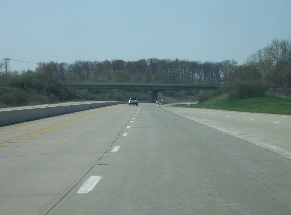
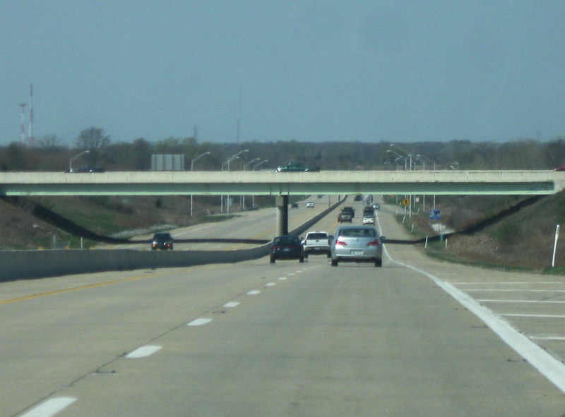
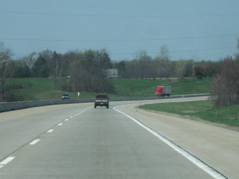
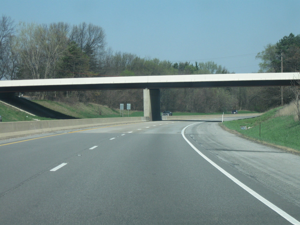
West of the Elkhart County Road 17/Old U.S. 20 interchange, the St. Joseph Valley Parkway (U.S. 20) is a four lane freeway with a jersey barrier as it bypasses Elkhart to the southeast. A sign that this is a newer stretch of highway is the concrete highway surface, which continues west to the U.S. 31 interchange in South Bend.
04/10/10
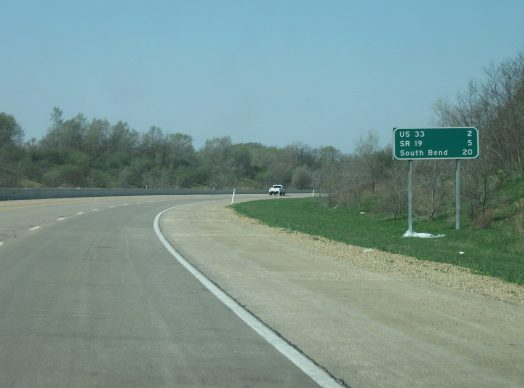
The next two exits in Elkhart are U.S. 33 (2 miles) and SR 19 (5 miles). South Bend is 20 miles away.
04/10/10

One mile away from the interchange with U.S. 33. U.S. 33 starts a 709 mile long course at the interchange as it heads southeast to its southern terminus at Richmond, Virginia.
04/10/10
Now about half mile away from the U.S. 33 interchange. Originally, U.S. 33 continued north of the St. Joseph Valley Parkway (U.S. 20) along Main Street, which heads straight for Downtown Elkhart. From there, the highway went west along Lincoln Way through Mishawaka and South Bend, following the path of present day SR 933. The highway originally went as far north as St. Joseph, Michigan.
U.S. 33 was truncated to U.S. 20 in 1998.
04/10/10
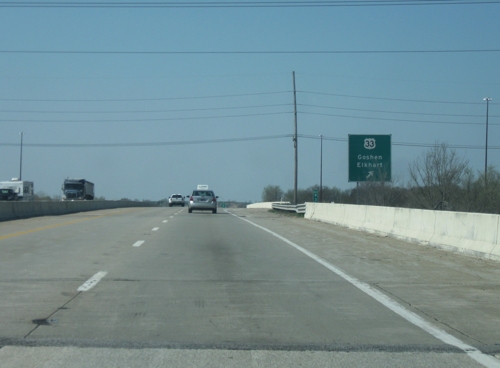
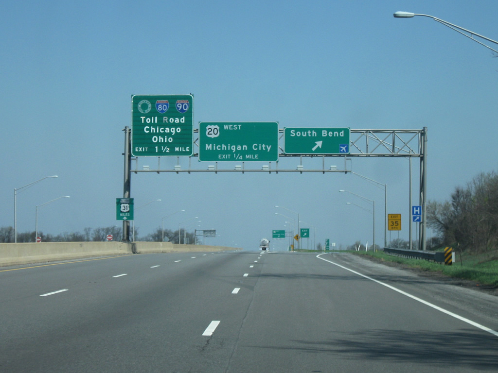
A folded diamond interchange facilitates movements between the St. Joseph Valley Parkway (U.S. 20) and U.S. 33. U.S. 33 is a four lane highway southeast from here to Goshen, the Elkhart County seat. Numerous businesses line the highway between U.S. 20 and Goshen including the Concord Mall. South of Goshen, the highway is a busy two lane highway connecting Elkhart with Fort Wayne.
04/10/10
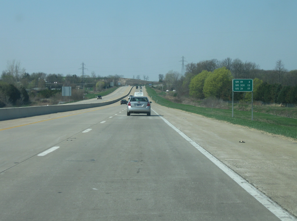
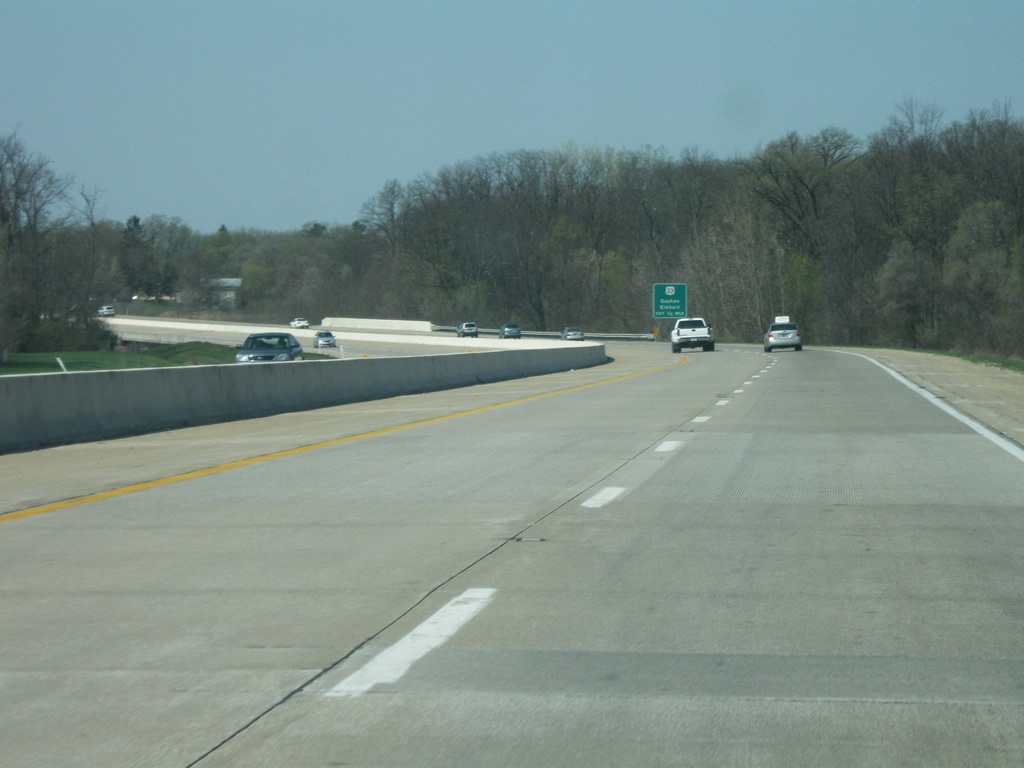
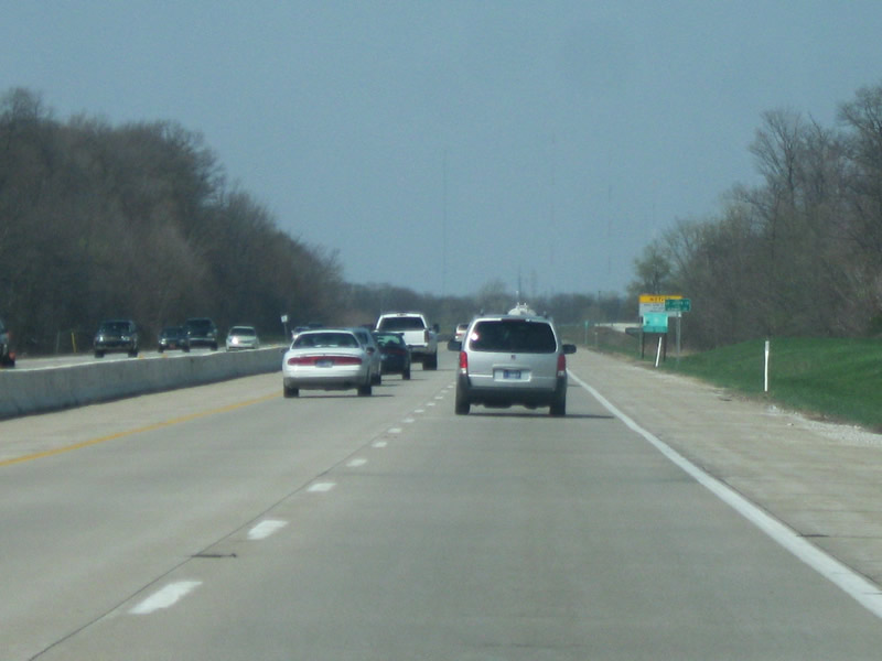
West of U.S. 33, the next two interchanges are with SR 19 (3 miles) and SR 331 (13 miles). U.S. 31 is 17 miles away.
04/10/10
The St. Joseph Valley Parkway (U.S. 20) turns toward the west as it approaches the interchange with SR 19.
04/10/10
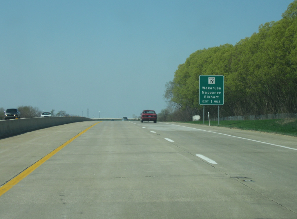
One mile away from the interchange with SR 19. SR 19 is a 143 mile state highway that starts in Noblesville in Central Indiana and heads through Tipton, Peru, and Nappanee before heading through Elkhart. In Elkhart it is also called Nappanee Road.
04/10/10
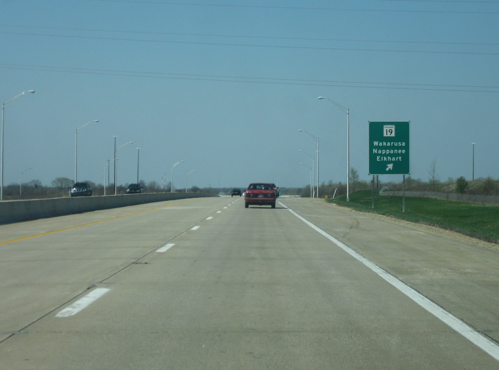
The St. Joseph Valley Parkway (U.S. 20) at the SR 19 interchange. SR 19 south heads toward Wakarusa and Nappanee. Nappanee in southwestern Elkhart County is home to Amish Acres, a popular Amish attraction in the state. North of U.S. 20, SR 19 heads up Nappanee Road. Utilizing Nappanee Road and Bristol Road, SR 19 bypasses Elkhart to the west and north before heading north toward the Michigan state line with an interchange at the Indiana Toll Road.
04/10/10
West of the SR 19 interchange, the St. Joseph Valley Parkway (U.S. 20) aims toward the west as it approaches the county line with St. Joseph County.
04/10/10
St. Joseph Valley Parkway (U.S. 20) enters St. Joseph County (population 266,931), home to South Bend and the University of Notre Dame. The county is also the economic and cultural heart of the Michiana region of Northern Indiana and Southwestern Michigan. West of the county line the freeway continues its trek through agricultural land on the far southern fringes of the suburb of Mishawaka. Mishawaka (population 48,252), the Princess City, is the eastern component of the South Bend-Mishawaka metropolitan area and has received much of the suburban growth in the Michiana area. Mishawaka is best known for its AM General automotive plant which has produced the Humvee vehicle for many years and produced the Hummer until 2010.
04/10/10
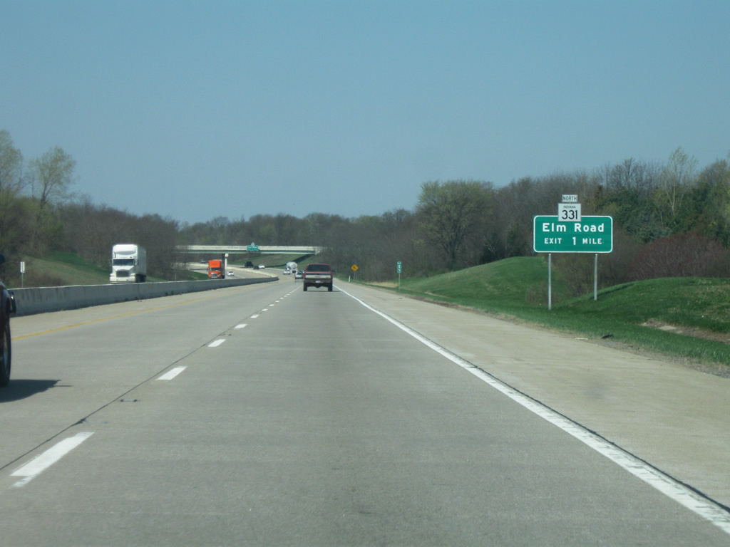
The next interchange for Elm Road/SR 331 North is one mile away. Elm Road (SR 331 North) is currently a two lane road north to Lincolnway (SR 933) where it becomes the four lane expressway known as Capital Avenue. This road continues north to the Indiana Toll Road and SR 23 in Granger. Within the next couple of years (as of 2011) the stretch from the St. Joseph Valley Parkway (U.S. 20) north to Lincolnway (SR 933) will be bypassed by a new four lane expressway to complement the Capital Avenue corridor to the north. This will create a four lane route connecting the St. Joseph Valley Parkway and the Indiana Toll Road. The new corridor is expected to be called SR 331 in lieu of both Capital Avenue and Elm Road (which will still exist as a local road anyway).
04/10/10
Now a half of mile away from the Elm Road/SR 331 North interchange. SR 331's history has been rather interesting in its development as a cross-county highway. The highway has always started in the south in Tippecanoe at SR 25 in Fulton County. From there the highway went north through Bourbon and Bremen before ending in Downtown Mishawaka. Starting in the late 1990s, a new segment of SR 331 from SR 25 in Granger to the Indiana Toll Road and points south was constructed as a part of a new four lane road across the eastern side of Mishawaka. In 2006, Elm Road from Lincolnway (SR 933) to the St. Joseph Valley Parkway (U.S. 20) was designated as SR 331 down to the St. Joseph Valley Parkway (U.S. 20) and west along the highway to the next interchange where it continued south on its original course.
04/10/10
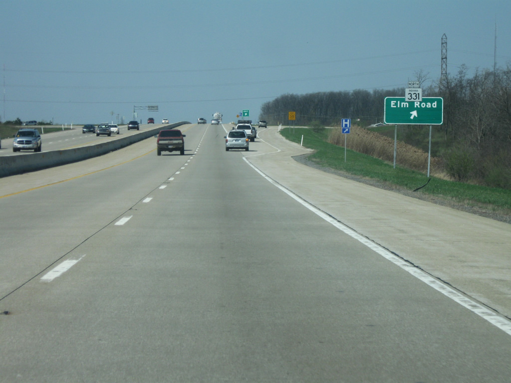
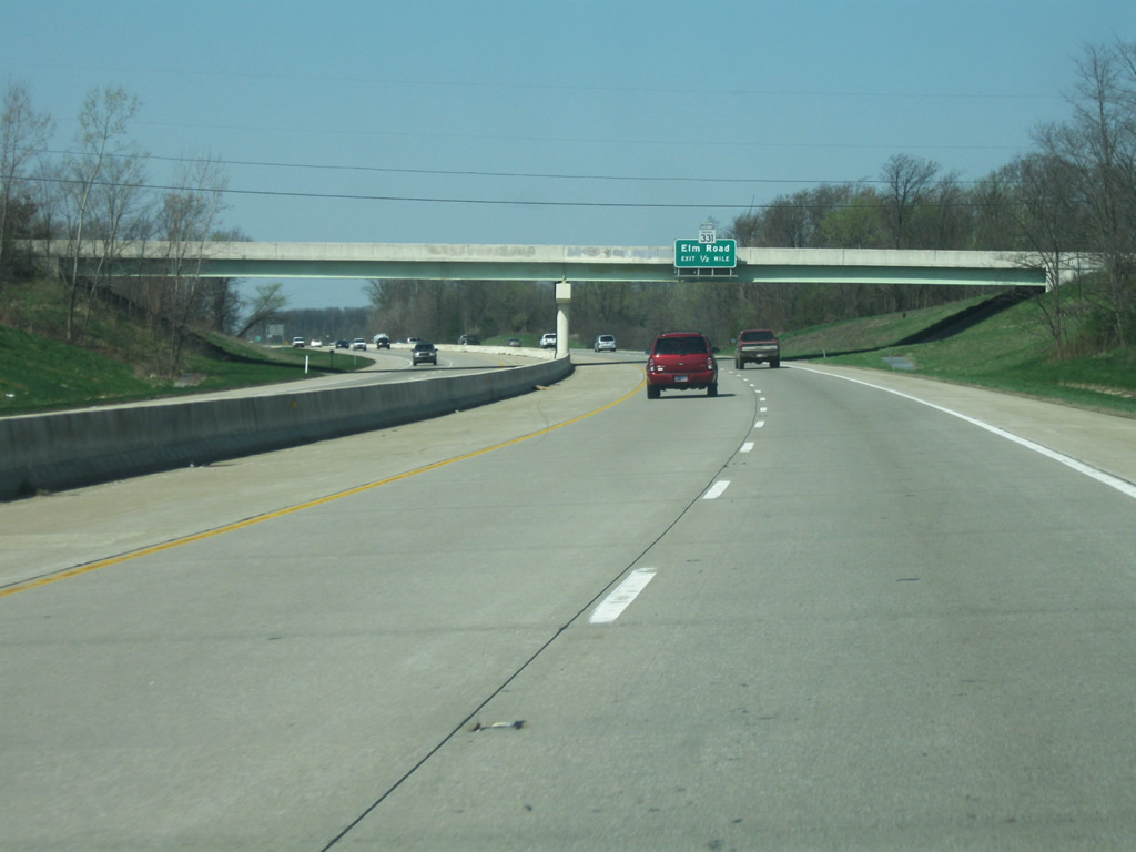
Now at the Elm Road/SR 331 North interchange. The signage on the St. Joseph County section of the St. Joseph Valley Parkway (U.S. 20) is older than the Elkhart County section and this is evident by the SR 331 shield being placed on top of the older Elm Road sign. From this point westward to the next interchange the St. Joseph Valley Parkway (U.S. 20) carries SR 331 southbound. To the south of the interchange, Elm Road continues south as a county road all the way into Marshall County.
04/10/10
West 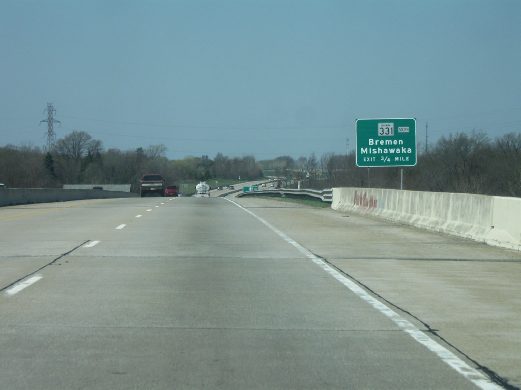
West of the Elm Road/SR 331 North interchange, the next interchange for Bremen Highway/SR 331 South approaches. Bremen Highway becomes Union Street in the Mishawaka city limits and then turns northwest to become Church Street and then Main Street. This is the main route into Downtown Mishawaka.
04/10/10
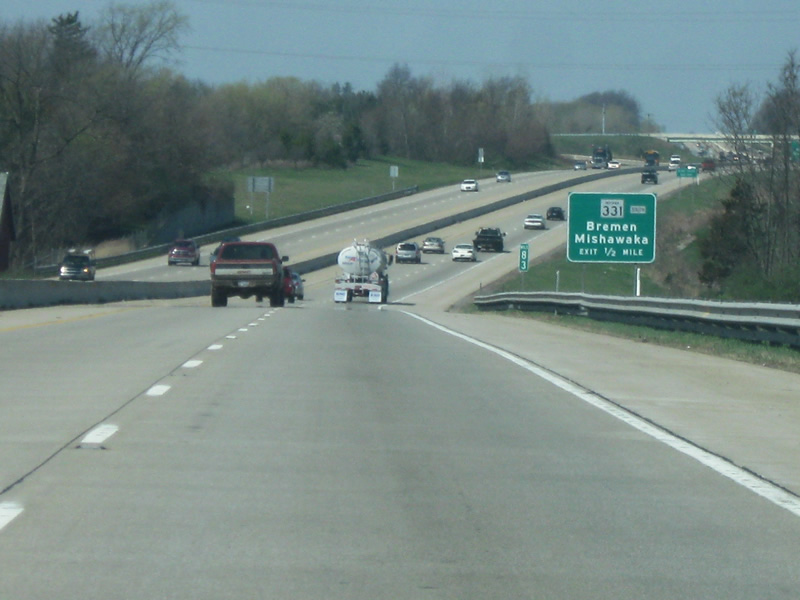
One half mile away from the Bremen Highway/SR 331 South interchange. Note the "South" banner on the guide signs. This is a vestige to when SR 331 continued northward into Mishawaka. When the highway was rerouted, INDOT simply placed the banners on these signs. SR 331 in is totality is 35 miles long from its northern end at SR 23 in Granger to SR 25 in Tippecanoe.
04/10/10
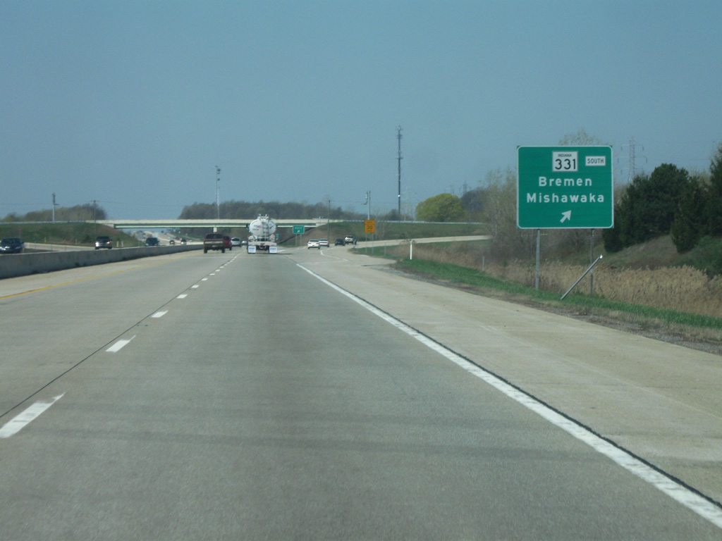
A newer (no button copy) but older sign nonetheless directs traffic onto the diamond interchange with Bremen Highway/SR 331 South. Some of the new suburban development to the south of Mishawaka has made its way to the interchange, such as a Meijer store and some subdivisions nearby.
04/10/10
West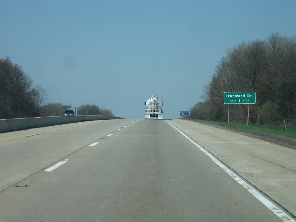
West of the Bremen Highway/SR 331 South interchange, we are now a mile away from Ironwood Road, the first interchange to serve South Bend. South Bend (population 101,168) is the largest city in the Michiana area and is best known for as the home to University of Notre Dame and the one-time home to the Studebaker car company. It is also the home to the College Football Hall of Fame, which is slated to move to Atlanta in 2013.
04/10/10
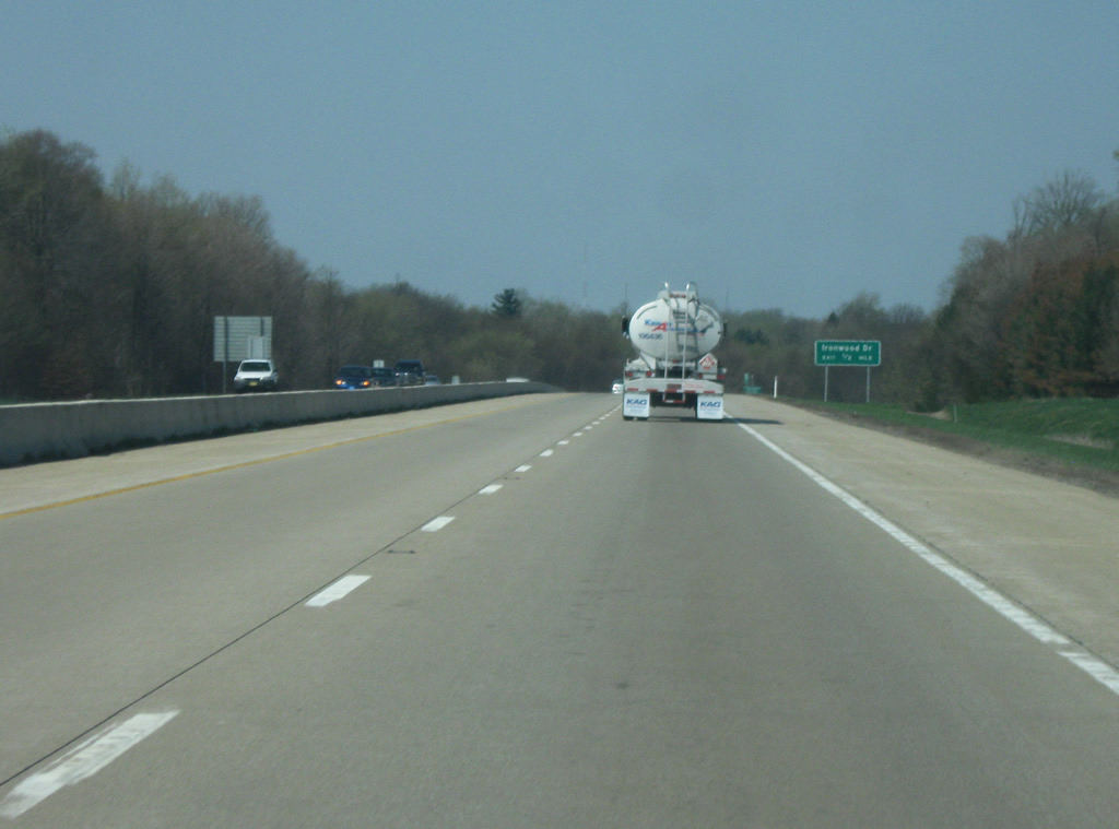
Now about a half mile away from the Ironwood Road interchange. Ironwood Road is a four lane arterial that crosses the eastern part of South Bend and provides access to the University of Notre Dame and its famed athletic facilities such as Notre Dame Stadium and the Joyce Center.
04/10/10
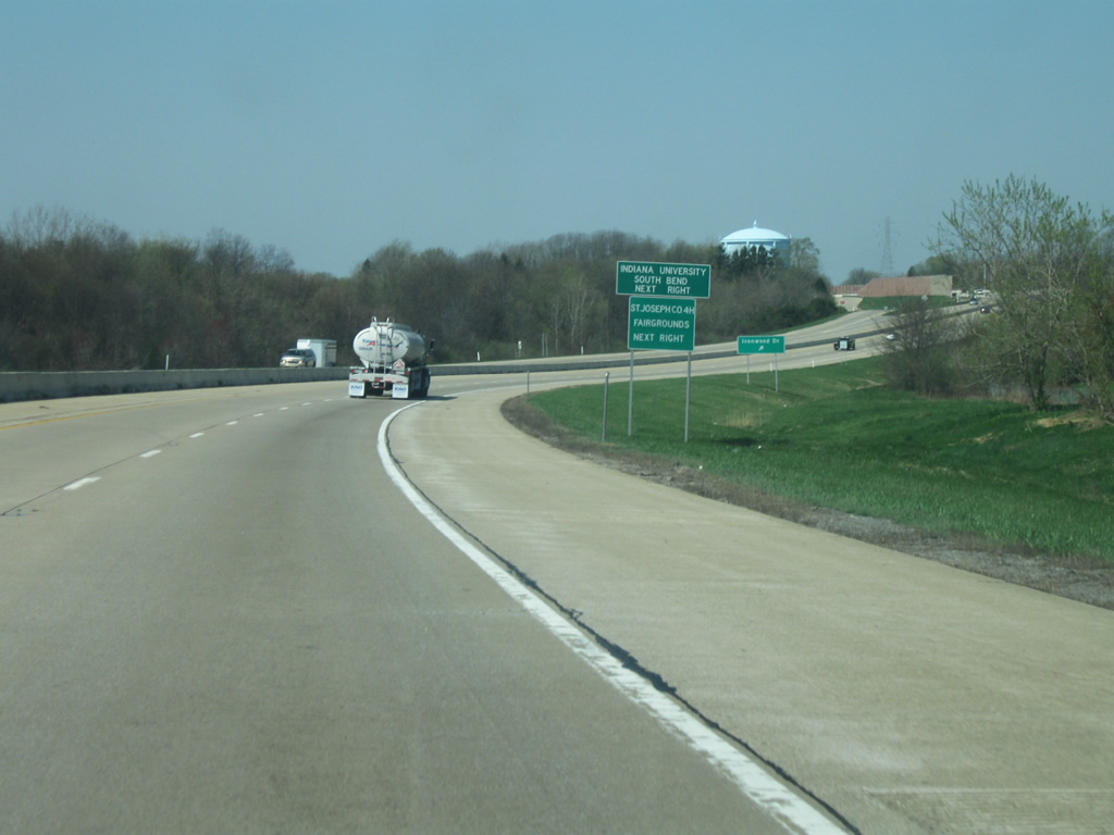
Indiana University-South Bend and the St. Joseph County Fairgrounds can both be reached from the Ironwood Road interchange.
04/10/10

Now at the Ironwood Road interchange, this is the only Single-Point Urban Interchange (SPUI) in Northern Indiana.
04/10/10
Sound barrier walls abut the St. Joseph Valley Parkway (U.S. 20) from between the Ironwood Road and U.S. 31 South/Michigan Street interchanges. This is the only section of the highway that goes through a residential area, hence the walls. Up ahead is the cloverleaf interchange with U.S. 31 South/Michigan Street.
04/10/10
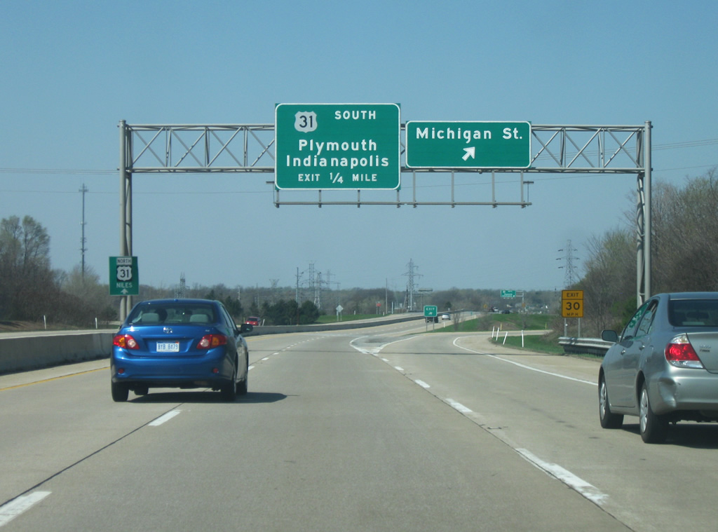
The St. Joseph Valley Parkway (U.S. 20) at the Michigan Street ramp. Michigan Street represents the original U.S. 31 that ran up through Downtown South Bend as part of a one way pairing with Main Street (which carried U.S. 31 South). North of downtown, Michigan Street carries SR 933 up to the Michigan state line. There are several restaurants and shops located just north of the interchange at the intersection of Michigan Street and Ireland Road. Note the small guide sign in the median directing U.S. 31 North traffic to Niles, Michigan.
04/10/10

U.S. 31 joins the St. Joseph Valley Parkway to continue its route north toward Niles, Michigan. To the right, a loop ramp connects with U.S. 31 South which heads toward Lapaz, Plymouth, Kokomo, and Indianapolis. Plymouth is about 20 miles away with Indianapolis around 130 miles. U.S. 31 south of the Parkway is a four lane arterial into Marshall County before becoming a four lane expressway to Interstate 465 in Indianapolis. A new freeway segment of U.S. 31 from the Parkway south to U.S. 30 in Plymouth will be completed by 2014.
04/10/10
West  North
North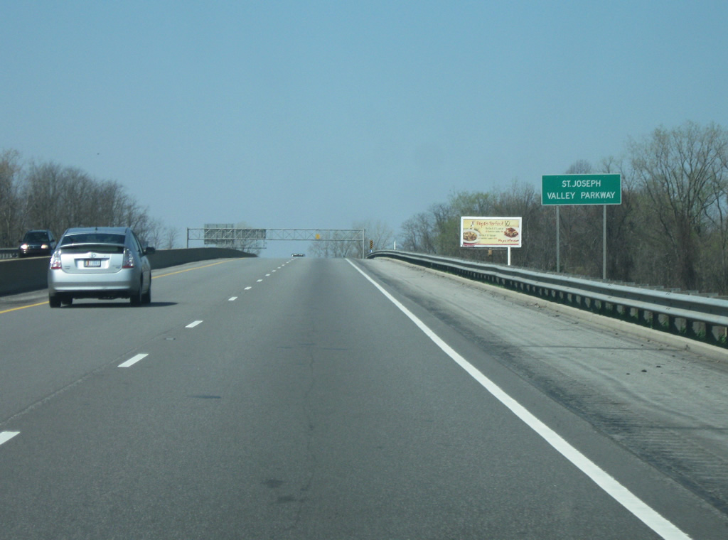
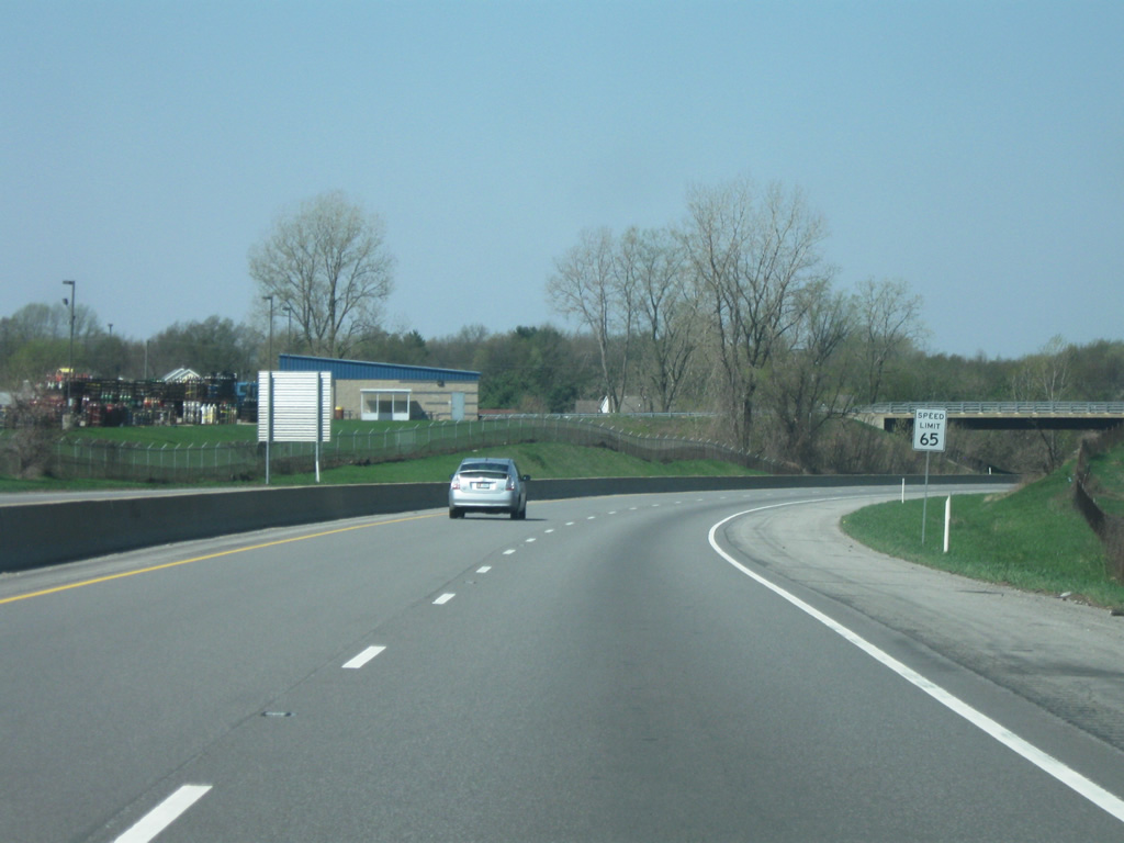
Reassurance sign for the St. Joseph Valley Parkway, which now carries both U.S. 20 and U.S. 31. Note how the road changes to asphalt, marking the original part of the Parkway which differs from east of the U.S 31 South/Michigan Street interchange. The Parkway is generally up to freeway standards with a mix of older and newer bridges and a 65 MPH speed limit, the only non-interstate highway in the state to have one.
04/10/10
The overpass for Locust Street precedes the interchange with SR 23.
04/10/10
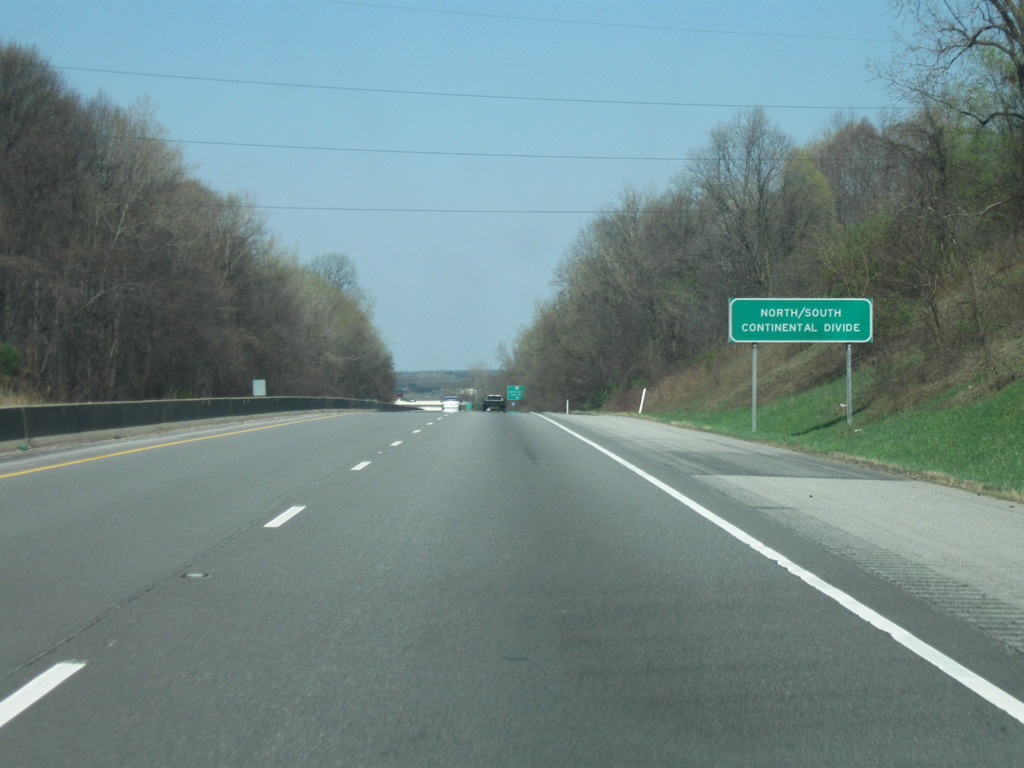
A sign indicates the location of the North-South Continental Divide, which runs through the southern part of South Bend. The divide separates the Ohio River (and thus Mississippi River) basin from the Great Lakes (St. Lawrence River) basin. The SR 23 interchange is a half mile away.
04/10/10
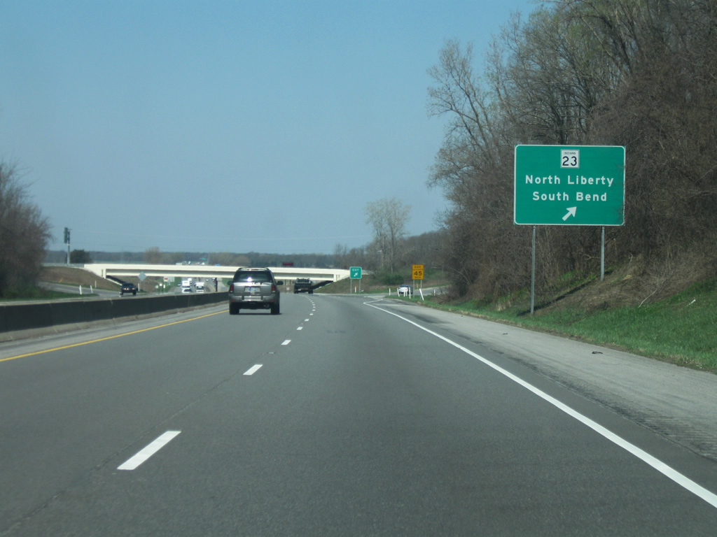
A diamond interchange facilitates movements between the St. Joseph Valley Parkway (U.S. 20/U.S. 31) and SR 23. SR 23 goes for 51 miles from SR 10 in Starke County and runs through Walkerton and North Liberty before going through South Bend. It is one of two state highways that still run through South Bend via Prairie Avenue, Sample Street, Eddy Street, and South Bend Avenue to the Michigan state line in Granger. Traffic bound for southbound Mayflower Road south of SR 23 should use this ramp instead of the Mayflower Road interchange.
04/10/10
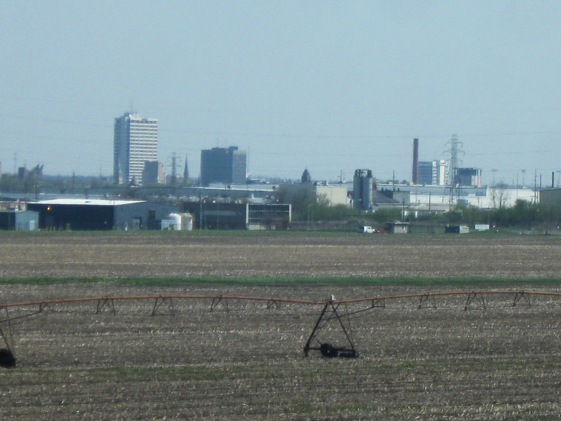
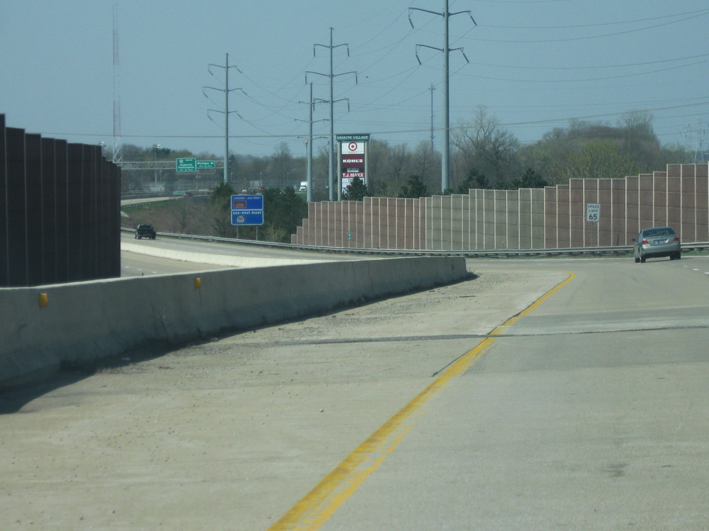
Between the SR 23 and Mayflower Road interchange, the skyline of South Bend can be seen from the St. Joseph Valley Parkway (U.S. 20/U.S. 31). The southwest side of South Bend is more sparsely populated than the other sides, which explains the agricultural fields in the foreground of the city skyline. We are merely three miles away from Downtown South Bend.
04/10/10
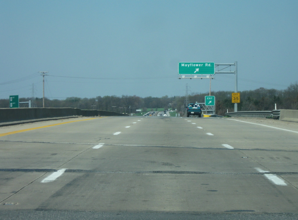
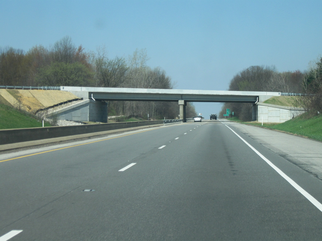
Now at the Mayflower Road interchange, this consists of a ramp that angles toward the north. For whatever reason, there is no access to the southbound lanes without making a U-turn going north. Mayflower Road used to be SR 123 before decommissioning in the 1980s. The old state road connected SR 23 to the south with the old U.S. 20 south of the South Bend Regional Airport.
04/10/10

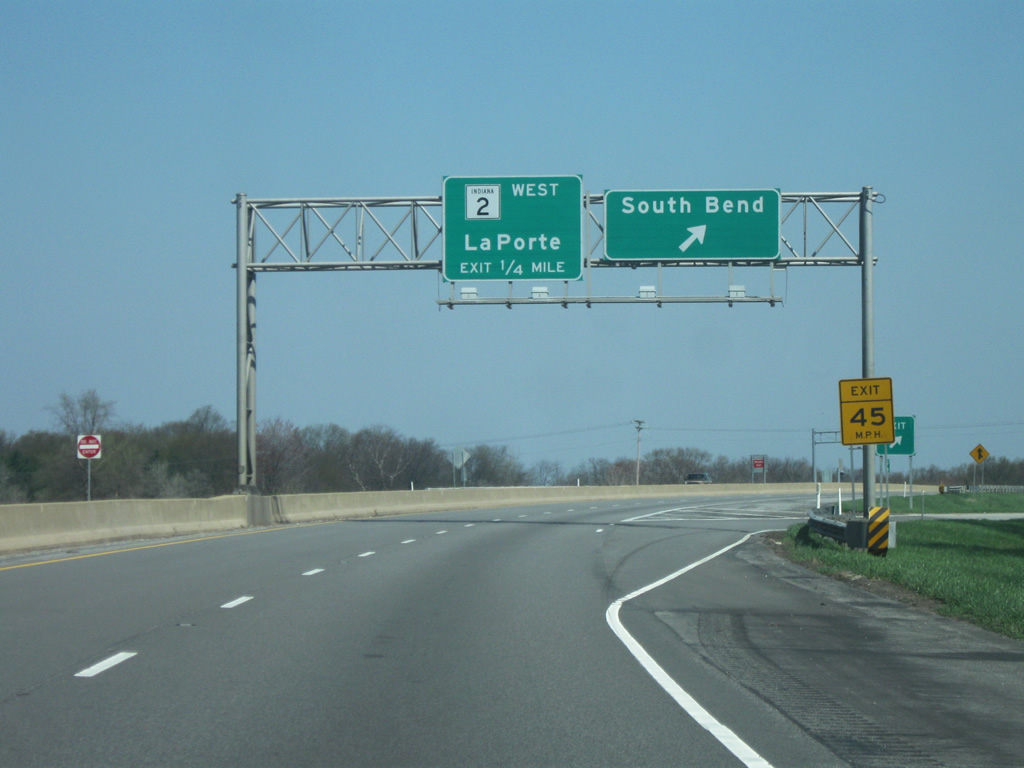
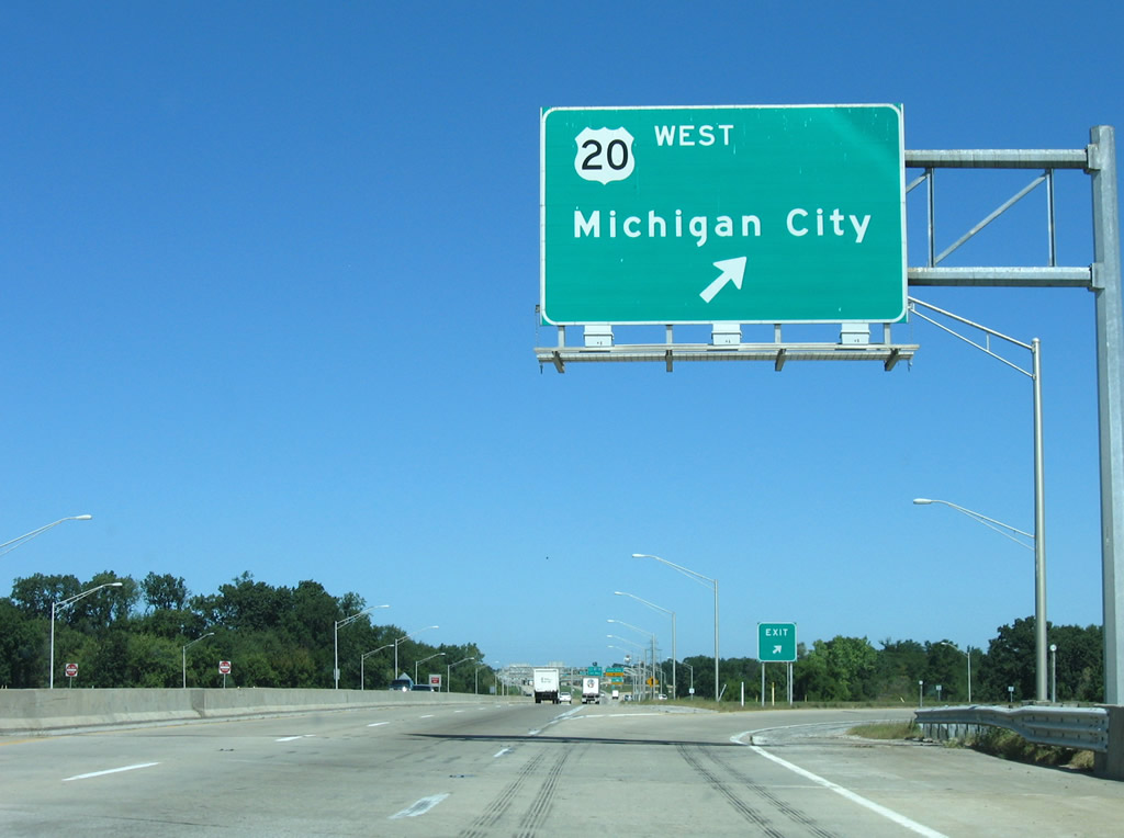
The St. Joseph Valley Parkway (U.S. 20/U.S. 31) makes the turn toward the north as it approaches the next interchange at SR 2 West/Western Avenue. SR 2 is an 81 mile state highway that starts at the St. Joseph Valley Parkway (U.S. 20/U.S. 31) and angles southwest to LaPorte, Valparaiso, Hebron, and Lowell before ending at the Illinois border. The highway is a four lane expressway from South Bend to LaPorte and serves as an alternative highway to the Indiana Toll Road for traffic from LaPorte to South Bend.
04/10/10
Now at the cloverleaf interchange with SR 2 West and Western Avenue. Unlike other urban areas in Indiana where the local street name takes precedence over the regional control cities, Western Avenue is not noted on the highway signs and only South Bend is mentioned. Before the completion of the St. Joseph Valley Parkway SR 2 was routed down Western Avenue to downtown South Bend.
04/10/10
A view of the St. Joseph Valley Parkway (U.S. 20/U.S. 31) north of the SR 2 West/Western Avenue interchange. The next interchange is with U.S. 20 West/Lincolnway West.
04/10/10
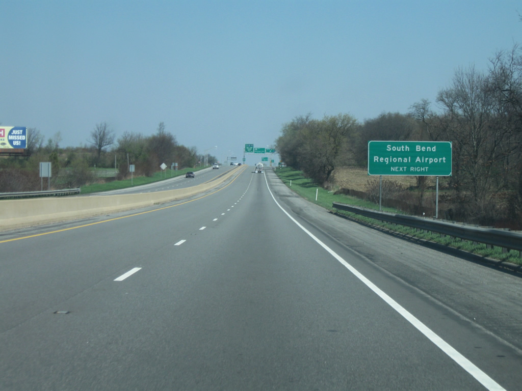
The South Bend Regional Airport (SBD) is the second largest airport in Indiana after Indianapolis. The South Shore Line, a commuter rail line from Downtown Chicago ends at the airport providing passenger rail service to the Windy City via Michigan City, Gary, and Hammond.
04/10/10
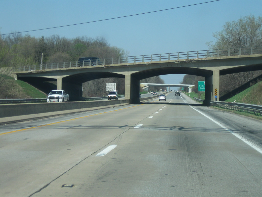
Now at the interchange with U.S. 20 West/Lincolnway West. The US route travels 153.5 miles statewide between Ohio westward to Elkhart and South Bend on its way to Hammond and Illinois. Lincolnway West represents the pre-1982 routing of U.S. 20 east to South Bend Regional Airport (SBD) and downtown South Bend.
04/10/10
U.S. 20 west parts ways with U.S. 31 (St. Joseph Valley Parkway) at a cloverleaf interchange west of South Bend Regional Airport (SBD). The US highway turns west 9.5 miles to New Carlisle, parallel to the Indiana Toll Road and SR 2.
09/02/05
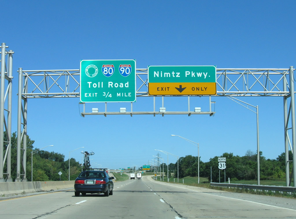
Continuing north on its own, U.S. 31 next meets the confluence of Nimtz Parkway east / Cleveland Road west and the Indiana East West Toll Road.
09/02/05
Nimtz Parkway replaced Cleveland Road east from U.S. 31 (St. Joseph Valley Parkway) to industrial parks on the northeast side of South Bend Regional Airport. The parkway ends at Bendix Drive near Cleveland Road (U.S. 31 Business).
09/02/05

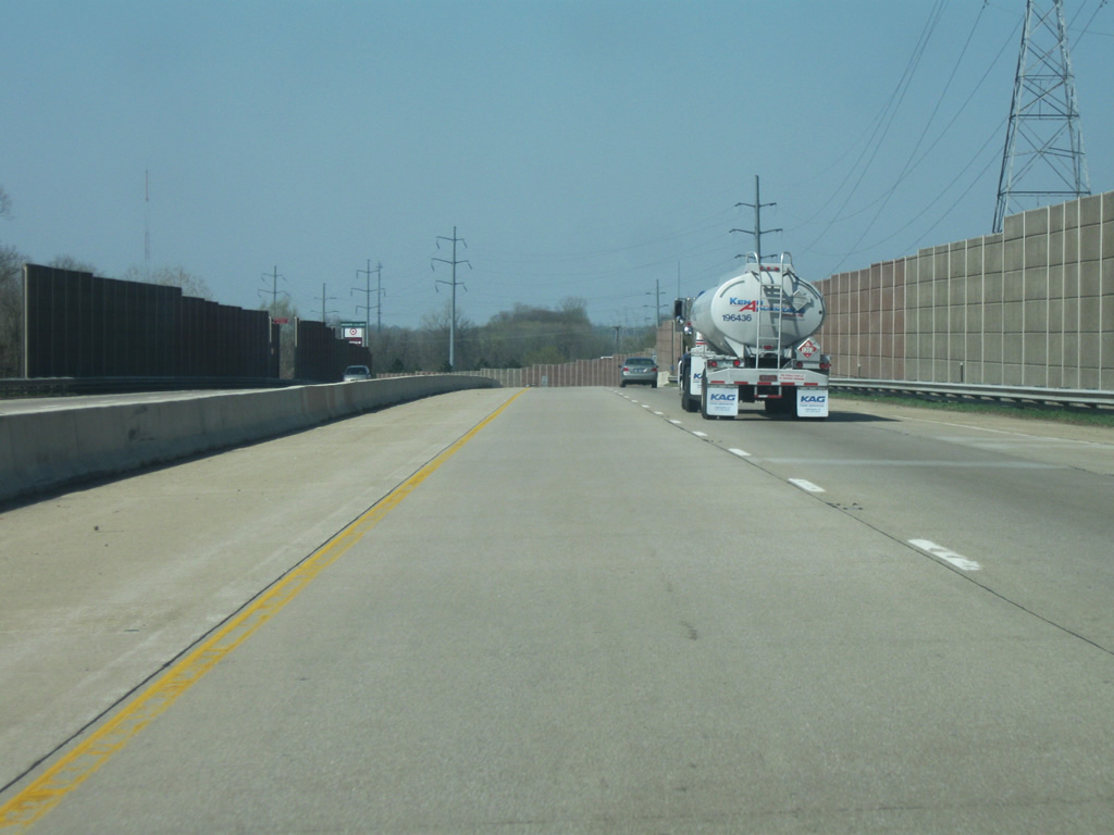
A trumpet interchange with the Indiana Toll Road access road follows to I-80/90 west to Gary and east to Elkhart.
09/02/05
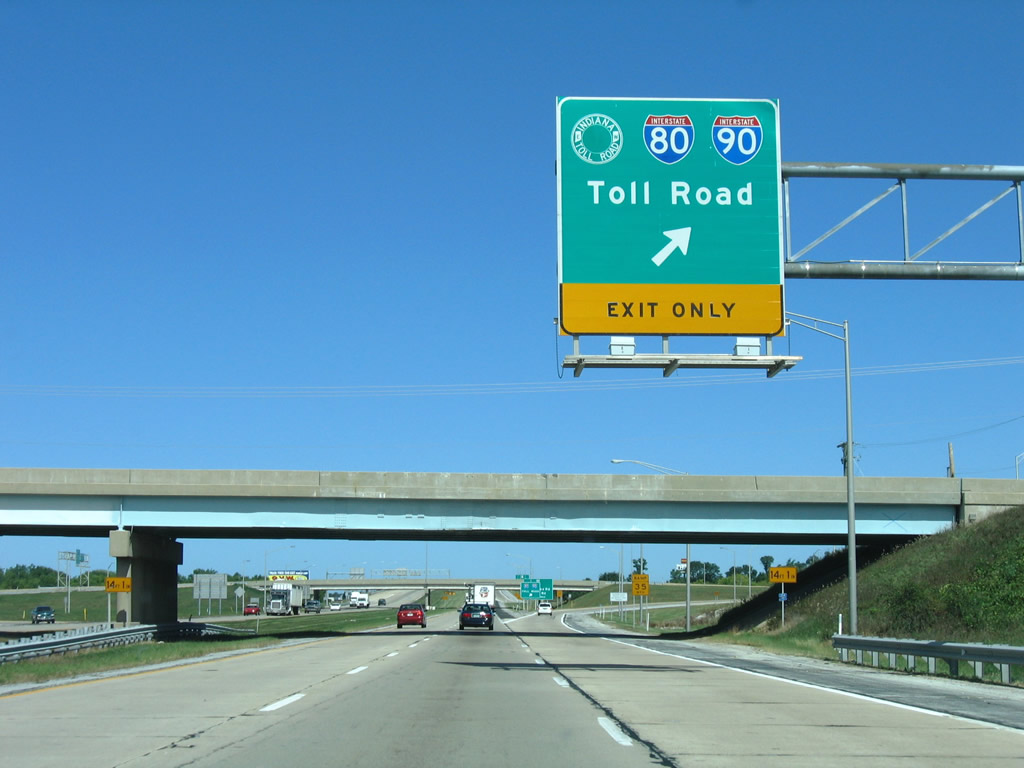
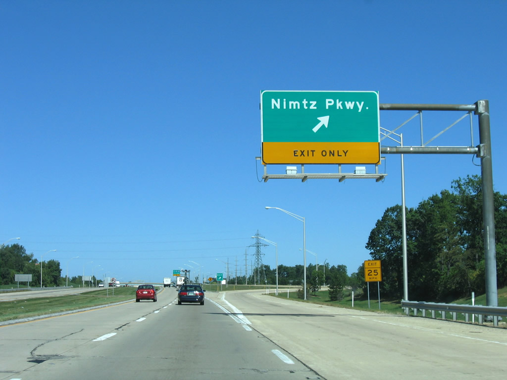
Nimtz Parkway passes over U.S. 31 north ahead of the ramp departure for I-80/90. The Indiana East West Toll Road ties directly into the Chicago Skyway for interests to Chicago and to the Ohio Turnpike for travelers bound for Toledo and Cleveland.
09/02/05
Drivers leave U.S. 31 north for the Indiana East West Toll Road. I-80/90 stay generally north of South Bend, passing through the Roseland, Indian Village, and Granger areas. Westward the tandem continue 48 miles west to Portage and their split.
09/02/05

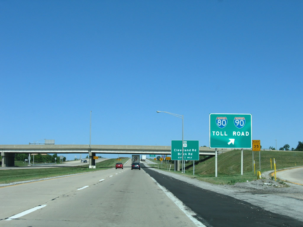
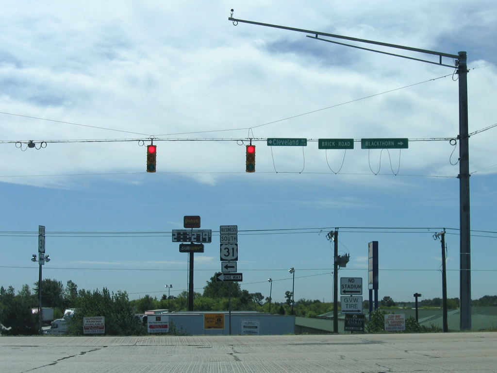
U.S. 31 Business follows Cleveland Road east from St. Joseph Valley Parkway to SR 933 (Dixie Highway) near Exit 77 of the Indiana Toll Road. The route is not consistently signed.
09/02/05
Passing over the Indiana Toll Road one half mile south of the folded diamond interchange with U.S. 31 Business (Cleveland Road) east and Brick Road west.
09/02/05
U.S. 31 Business travels southward with SR 933 through South Bend, returning to U.S. 31 on the south side of town via Michigan Street. The route south of SR 933 is locally maintained and signed with older shields.
09/02/05
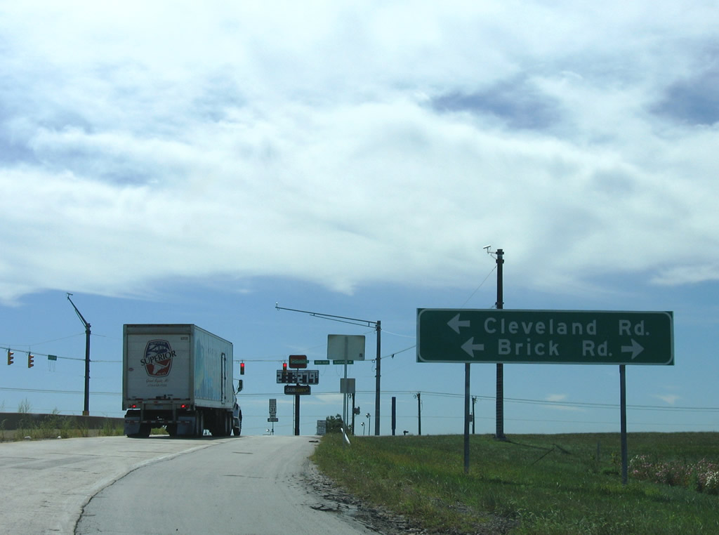
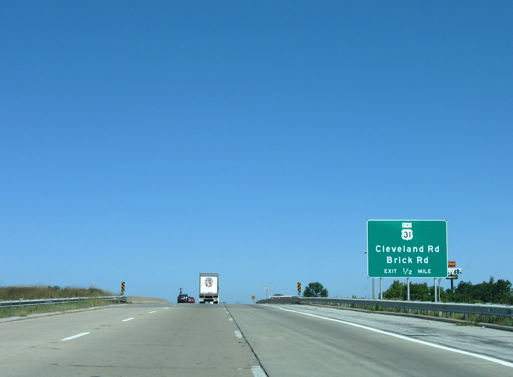
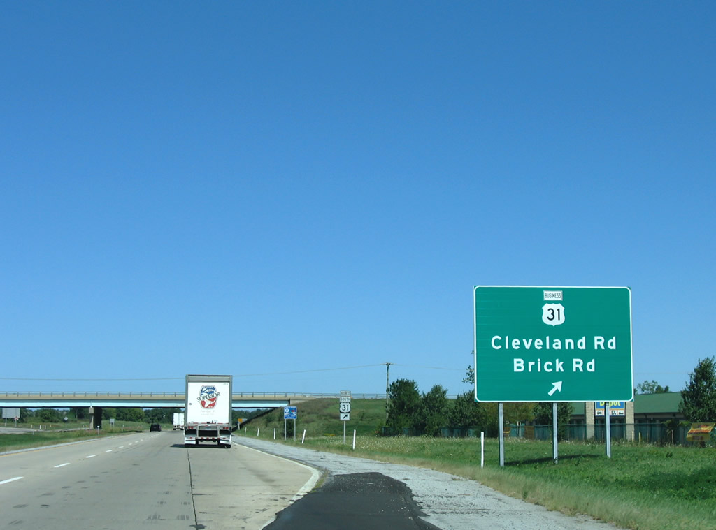
Brick Road continues west from Cleveland Road to an adjacent business park before ending at Primrose Road near Twin Lakes. Cleveland Road parallels I-80/90 closely from its split with Brick Road east to Roseland.
09/02/05
U.S. 31 Business shield posted at the U.S. 31 off-ramp to Cleveland Road east. Use Brick Road west for the Blackthorn West Business Park.
09/02/05
North of the Brick Road/Cleveland Road interchange, the St. Joseph Valley Parkway (U.S. 31) opens up with a grassy median as the highway prepares to enter Michigan. The Parkway's appearance in Michigan is more rural than the freeway-like bypass in Indiana. The speed limit will also go up to 70 MPH upon crossing the border.
04/10/10
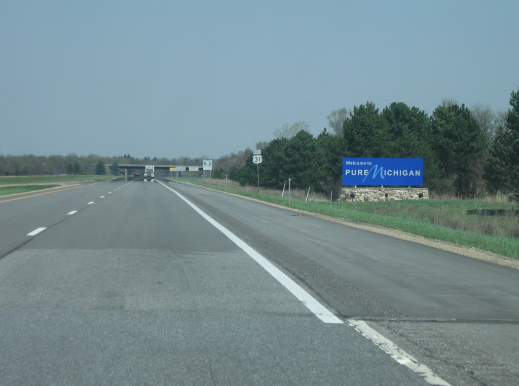
After 266 miles in Indiana, U.S. 31 enters the Wolverine State of Michigan. The highway retains the name of the St. Joseph Valley Parkway as it enters Berrien County. The highway remains a freeway for another 25 miles while serving Niles and Buchanan before resorting to arterials near Benton Harbor for a connection to Interstate 94 and Interstate 196. U.S. 31 will go on for another 357 miles to its northern terminus at Interstate 75 in Mackinaw City, Michigan.
04/10/10
Photo Credits:
- Thomas Decker: 04/10/10
- AARoads: 09/02/05
Connect with:
Page Updated Tuesday January 24, 2012.