
State Highway 44

SH 44 begins at U.S. 83, 11.92 miles west of IH 35. Meeting IH 35 at Encinal, the highway travels 44.38 miles east to meet U.S. 59 just west of Freer. Continuing through Freer, SH 44 turns southeast to San Diego. SH 44 follows SH 359 into Alice, then continues to Robstown and Corpus Christi. The state highway totals 133.61 miles in length.
SH 44 was first designated in 1939 between Corpus Christi and Alice. The route was extended to Freer in 1940, followed by the section from Freer to U.S. 83. TxDOT files show the section from U.S. 83 to Freer added in 1990, however maps show this section signed as SH 44 in 1957. The state highway through Robstown was bypassed in 1956, and the route was truncated at SH 358 in Corpus Christi in 1966.
Signed as BS 44-C, the lone business loop on SH 44 is located in Robstown along the original alignment. The section of Agnes Street between SH 44 and Downtown Corpus Christi was signed as BS 44-D, but is designated by TxDOT as unsigned SS 544.
SH 44 between the Corpus Christi International Airport (CRP) and SH 358 was originally built in 1979 as frontage roads. When opened, local businessmen were upset because of the bypass of their businesses. Construction was accelerated on the freeway main lanes along the bypass to appease local business owners, and the section of Agnes Street between the bypass and Downtown was signed "Business SH 44". The business route remains posted between SH 44 and SH 358 (Padre Island Drive).
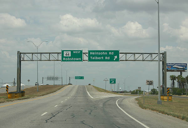
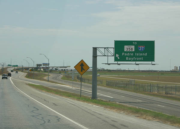
Ramps from SH 358 combine at the westbound beginning of SH 44 just ahead of a diamond interchange with Heinsohn Road.
07/11/05
The initial stretch of the SH 44 freeway parallels Agnes Street along the north side of Corpus Christi International Airport (CRP).
07/11/05
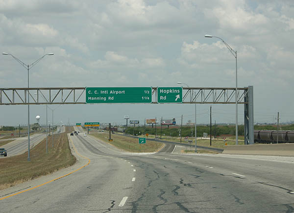
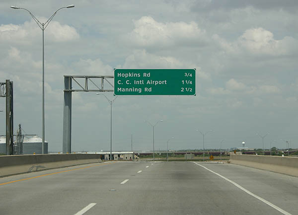
Hopkins Road ties into the freeway from industrial businesses beyond the adjacent Kansas City Southern Railway.
07/11/05
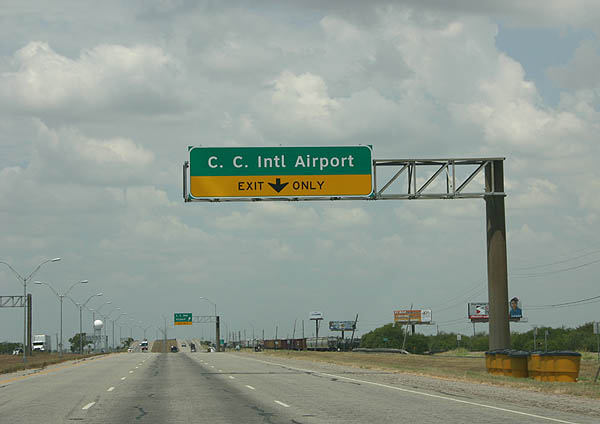
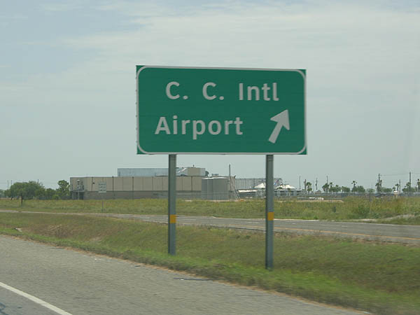
SH 44 is the primary access to the CRP Airport from Downtown Corpus Christi.
07/11/05
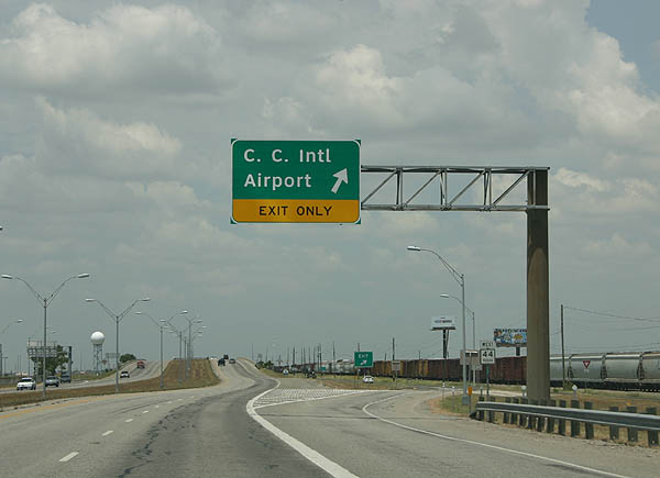
International Drive stems south from SH 44 and Agnes Street to the Corpus Christi International Airport (CRP) passenger terminal.
07/11/05
The SH 44 freeway previously ended just west of the airport, with traffic shifted onto the Agnes Street frontage road system. The limited access highway was subsequently extended west around Clarkwood and further to Violet. Agnes Street is posted as SH 44 Business here.
07/11/05
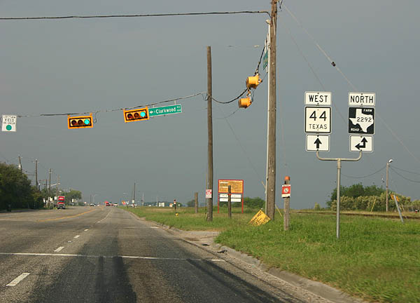
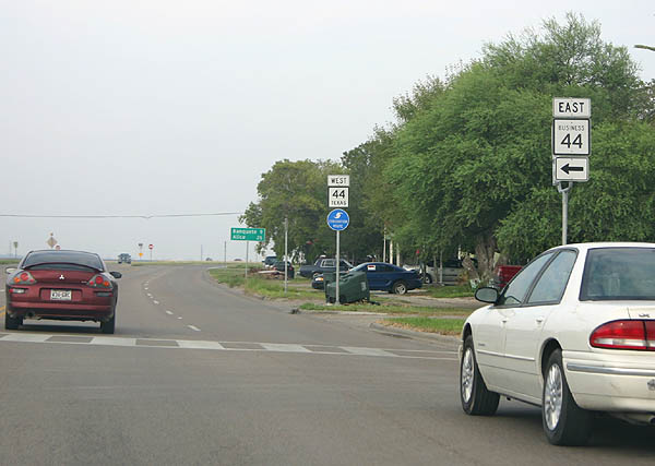
With SH 44 shifting onto a freeway bypass of Clarkwood, the former alignment on Agnes Street was redesignated as SH 44 Business (BS-44D). The south leg of FM 2292 (Clarkwood Road) ties into Agnes Street, 4.11 miles north from FM 665.
10/13/05
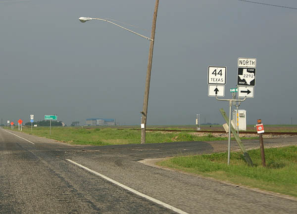
FM 2292 dog legs west alongside SH 44 Business (Agnes Street) to Rand Morgan Road. FM 2292 continues 3.47 miles north to IH 37.
10/13/05
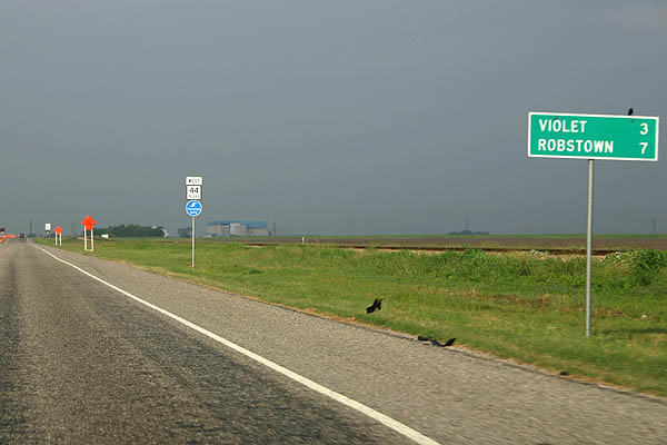
The 1.61 mile long alignment of BS-44D rejoins SH 44 ahead of Violet.
10/13/05
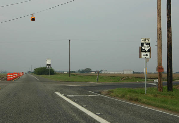
SH 44 previously intersected the south end of FM 3386 at-grade. This section was upgraded to a freeway by 2018, and ongoing work through December 2021 extends the limited access highway west toward FM 1694.
10/13/05
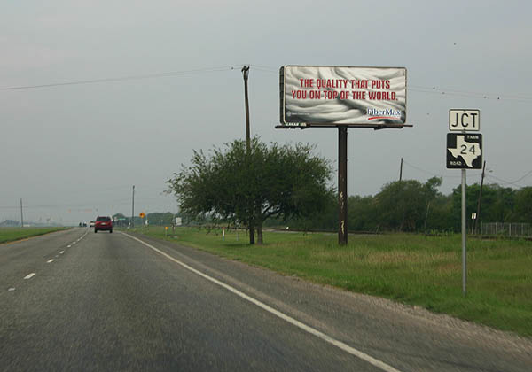
FM 24 is a 5.10 mile long highway leading north from SH 44 to IH 37 in Corpus Christi. This intersection will be replaced by a grade separation during 2019-21 construction.
10/13/05
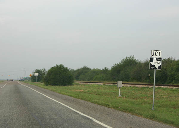
A 12.06 mile long highway, FM 1694 connects SH 44 with IH 37 to the north while leading south to FM 665 at Petronila.
10/13/05
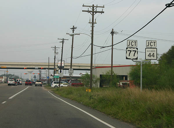
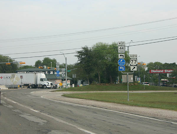
Approaching IH 69C & U.S. 77 in Robstown, SH 44 also meets BS 44-C, a 2.11 mile loop through the city center.
10/13/05
SH 44 turns north along the IH 69C/U.S. 77 frontage road system as part of its bypass of Robstown via Avenue J. U.S. 77 joins Robstown with Driscoll to the south and IH 37 at Calallen in Corpus Christi to the north.
10/13/05
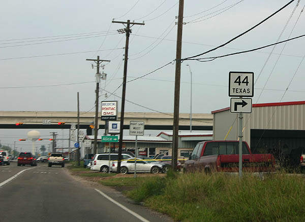
Branching northwest from IH 69C/U.S. 77, SH 44 crosses over a Union Pacific Railroad line and U.S. 77 Business (Upshaw Boulevard) ahead of Ligustrum Boulevard and Avenue J. Avenue J is SS 22, a 0.27 mile link between SH 44 and BU-77U.
10/13/05
Avenue J leads SH 44 west along a five lane boulevard to BS 44-C (Western Avenue) on the west side of Robstown.
10/13/05
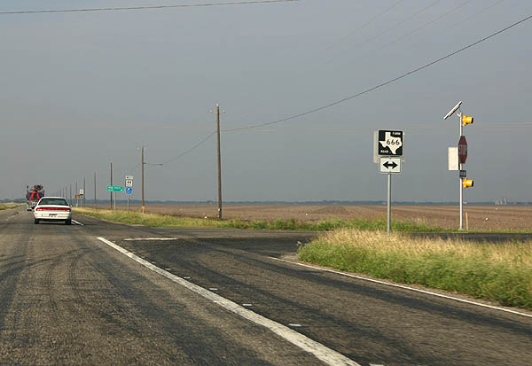
Leading west from Robstown, SH 44 maintains four lanes to the community of Banquete, where it meets FM 666. FM 666 begins at Mathis and travels 36.58 miles south to FM 70 near Bishop.
10/13/05
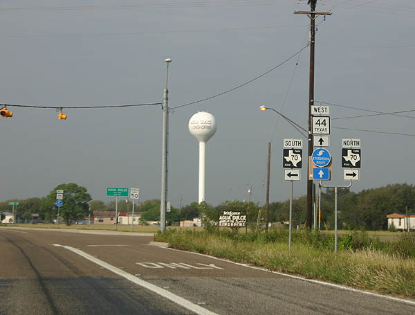
Entering Agua Dulce, SH 44 meets FM 70. FM 70 heads 21.18 miles north to meet SH 359 at Sandia.
10/13/05
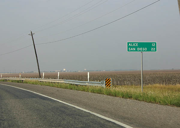
Continuing west from FM 70 at Agua Dulce, SH 44 reaches Alice in 12 miles and the Duval County seat of San Diego in 22 miles.
10/13/05
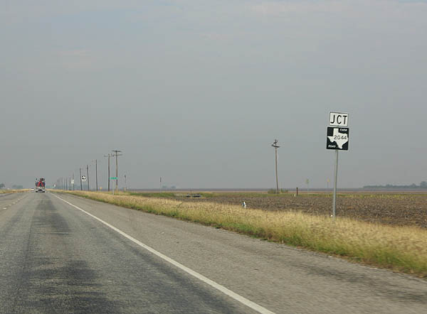
FM 2044 follows an L-shaped route north from SH 44 at Bentonville to Rosita Creek and west across the Embleton Oil Field to U.S. 281 in 12.99 miles.
10/13/05
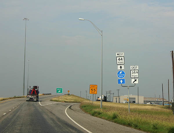
Just outside Alice, SH 44 meets SH 359 eastbound, which travels north to Orange Grove, Mathis and Skidmore.
10/13/05
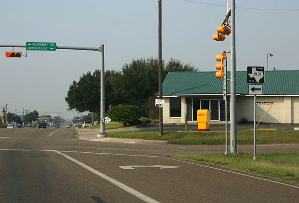
SH 44 & 359 west overlap for 14.4 miles. Heading into the city of Alice, the four lane highway narrows onto a five lane boulevard at Morningside Drive north and FM 1931 (Flournoy Road) south.
10/13/05
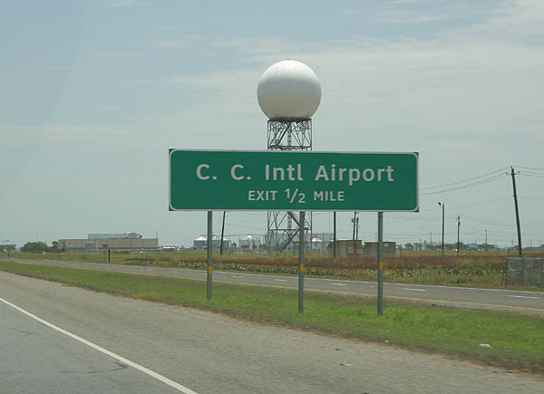
The SH 44 freeway in Nueces County leads east from Violet to Corpus Christi International Airport (CRP) and SH 358 (Padre Island Drive). The freeway provides the most direct route to the passenger terminal from Corpus Christi.
07/11/05
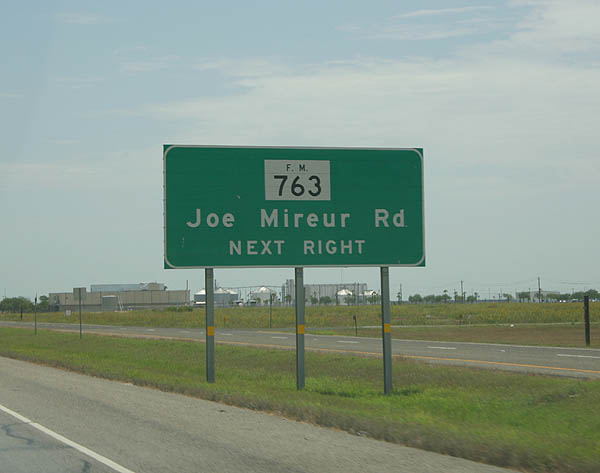
FM 763 (Joe Mireur Road) stems south from the SH 44 frontage roads around the east side of CRP Airport to FM 665 near what was Cuddihy Field.
07/11/05
International Drive heads south from SH 44 to air cargo facilities, the passenger terminal and car rental areas of Corpus Christi International Airport (CRP).
07/11/05
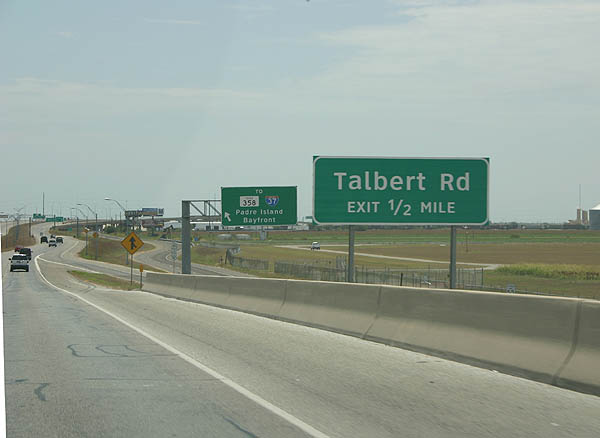
The ensuing off-ramp joins the SH 44 frontage road between FM 763 south and Talbert Lane (signed from SH 44 as Talbert Road).
07/11/05
The entrance ramp from International Drive and CRP Airport onto SH 44 eastbound.
07/11/05
Photo Credits:
- Kevin Trinkle: 07/11/05, 10/13/05
Connect with:
Page Updated Friday July 26, 2019.