
State Highway 225 - La Porte / Pasadena Freeways
SH 255 follows the LaPorte Freeway east from IH 610 at Harrisburg / Manchester to the Pasadena city line by the Park Place neighborhood in Houston. East across the Pasadena city line, SH 255 transitions onto the Pasadena Freeway en route to Deer Park and SH 146 at La Porte. The 15.78 mile long state highway originates within the Houston street grid at Lanwdale and Bowie Streets and ends just south of the Fred Hartman Bridge taking SH 146 across the Houston Ship Channel. A heavily traveled truck route, SH 255 runs by a number of refineries, chemical plants and tank farms.
The initial plans for a freeway along SH 225 envisioned a high speed route joining the industrial areas of La Porte, Deer Park and Pasadena with Downtown Houston. Initial work was undertaken in the late 1960s east of Loop 610, where the freeway was built using the existing alignment of SH 225 along Sterling Avenue and La Porte Road. Meant to relieve overcrowding along the Gulf Freeway (IH 45/U.S. 75), plans for the route within Houston however met resistance in 1971 from East End area residents, who sign petitions and organized against the planned road. The state highway department outlined the Harrisburg Freeway along a corridor following an abandoned railroad two blocks north of Harrisburg Boulevard. The acquisition of 1,200 homes and apartments was needed to build the highway.1
The high costs to both the community and state funding during the mid-1970s budget crisis, ultimately led to the cancellation of the Harrisburg Freeway. Although the state dropped efforts for the freeway along a corridor by the late 1970s, it remained on planning maps until the mid 1990s. Ramps were also built in anticipation of the Harrisburg Freeway along the Eastex Freeway (U.S. 59) by the George R. Brown Convention Center. These were subsequently removed during a late 1990s repaving project. The abandoned railroad line planned for conversion to the SH 225 freeway was repurposed as a city bicycle trail (Harrisburg Hike and Bike Trail).1
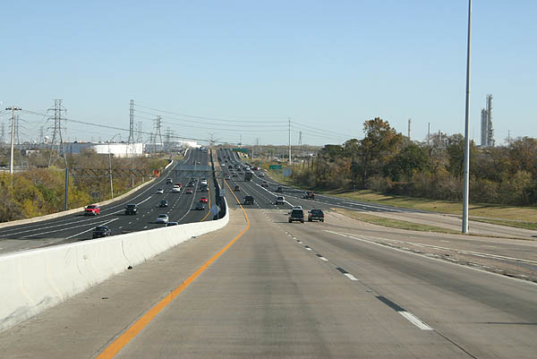
Viewing SH 225 along the transition ramp from IH 610 southbound.
12/24/05
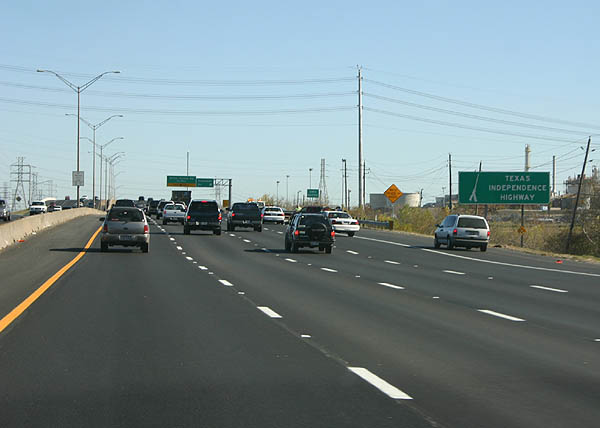
SH 225 was designated the Texas Independence Highway in 2001.
12/24/05
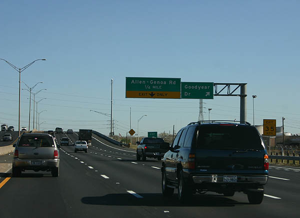
Heading into the Meadowbrook / Allendale neighborhood in Houston, SH 225 (La Porte Freeway) reaches the exit for Goodyear Drive.
12/24/05
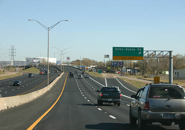
Allen-Genoa Road angles southeast from Lawndale Street (old SH 225) to cross paths with the La Porte Freeway at a diamond interchange. The arterial continues to residential areas of Meadowbrook / Allendale.
12/24/05
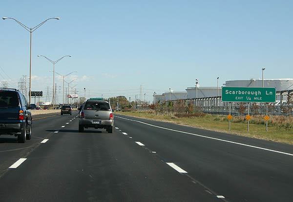
The La Porte Freeway becomes the Pasadena Freeway ahead of Scarborough Lane. Tanks from the many chemical plants along SH 225 appear on both sides of the freeway here.
12/24/05
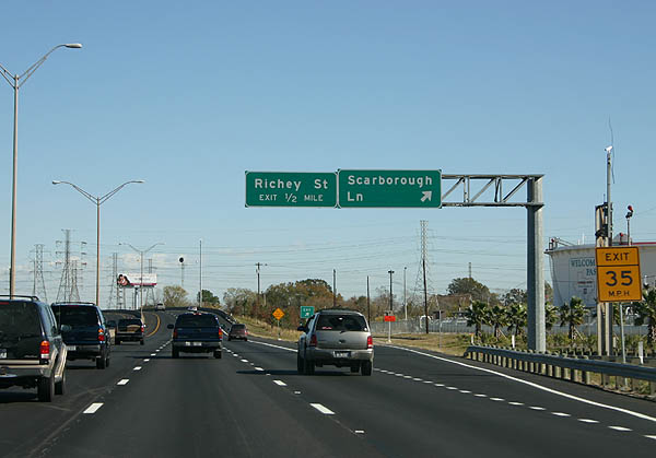
Scarborough Lane marks the line between Houston and Pasadena. SH 225 links northward over the ensuing half mile to Richey Street.
12/24/05
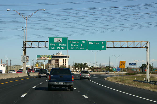
The diamond interchange with Richey Street represents the east end of the original 1966 freeway.
12/24/05
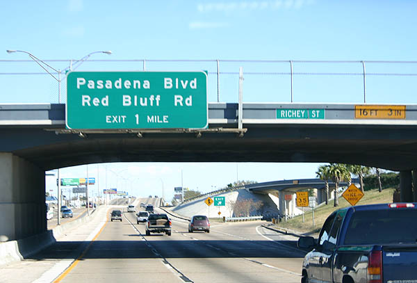
Advancing east across Vince Bayou, SH 225 to Pasadena Boulevard and Red Bluff Road in Pasadena opened in 1971.
12/24/05
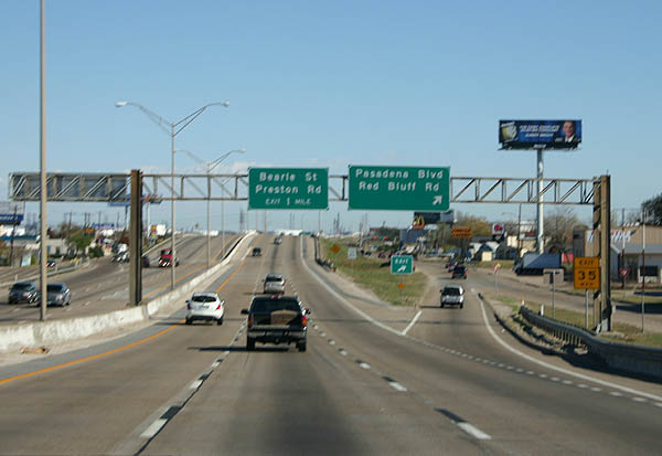
Pasadena Boulevard stems south from Red Bluff Road to SH 225 and Macroplaza Mall. Red Bluff Road angles southeast across the city of Pasadena to Pasadena Convention Center.
12/24/05

The Pasadena Freeway east from Red Bluff Road opened to traffic in 1983. Several petrochemical plants line the northern frontage of SH 225 along this stretch.
12/24/05
Bearle Street meets SH 225 north of Red Bluff Road at a diamond interchange. Preston Road parallels along an arterial route to the east.
12/24/05
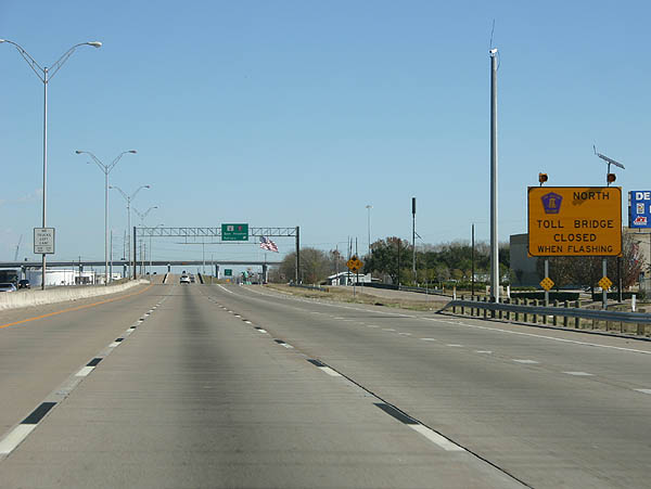
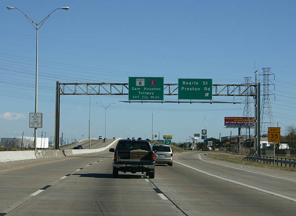
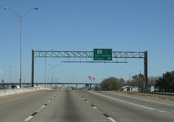
The ensuing exit joins SH 225 east with Sam Houston Tollway and Beltway 8. The Sam Houston Tollway Ship Channel Bridge, located north across Buffalo Bayou, is subject to periodic closures.
12/24/05
Sam Houston Tollway travels south through Pasadena to South Belt / Ellington in Houston and IH 45 (Gulf Freeway). Heading north from SH 225, the toll road meets IH 10 (East Freeway) between Cloverleaf and Channelview.
12/24/05
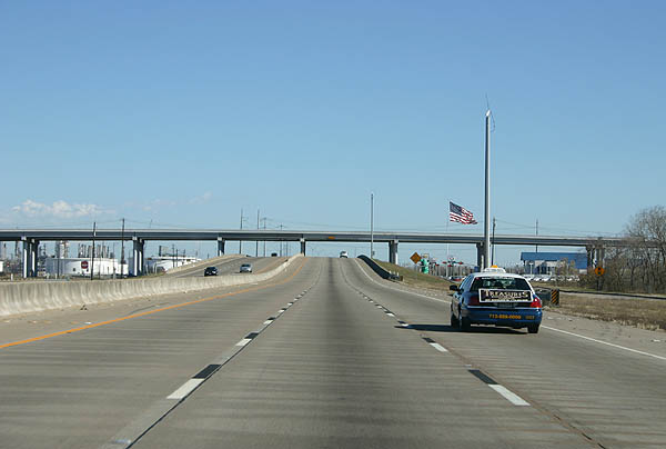
The exchange with Beltway 8 is a three level interchange, with no direct ramps between SH 225 and Sam Houston Tollway. All traffic between the two expressways must use connections along the frontage roads. This marks the end of the freeway completed in 1983 and start of the freeway opened in 1984.
12/24/05
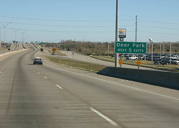
Five exits serve the city of Deer Park along SH 225 (Pasadena Freeway) east of Beltway 8. Deer Park incorporated in the 1960s to avoid annexation by Houston.
12/24/05
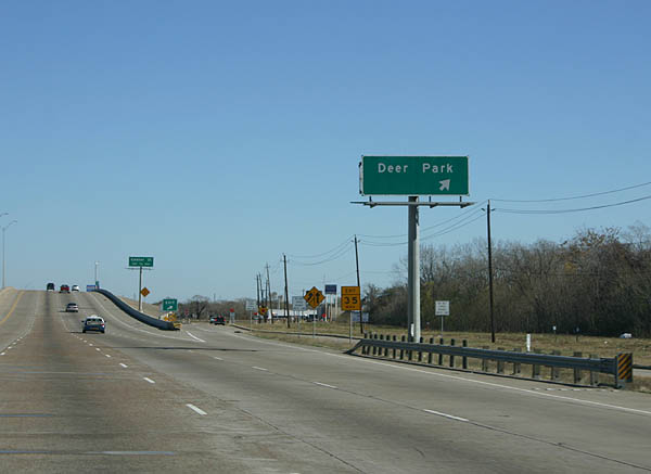
The first Deer Park exit joins the Pasadena Freeway frontage road ahead of Railroad Avenue. The ensuing segment of SH 225 was completed in 1992.
12/24/05
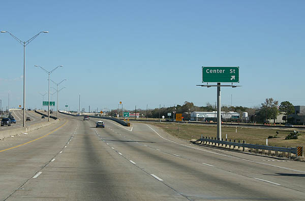
Spanning Deerwood Glen Drive and a Union Pacific Railroad line, SH 225 (Pasadena Freeway) reaches the off-ramp for Center Street. Center Street leads south to Downtown Deer Park.
12/24/05
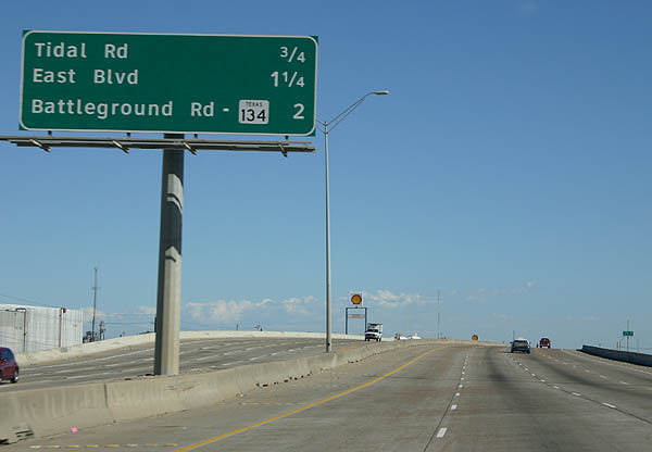
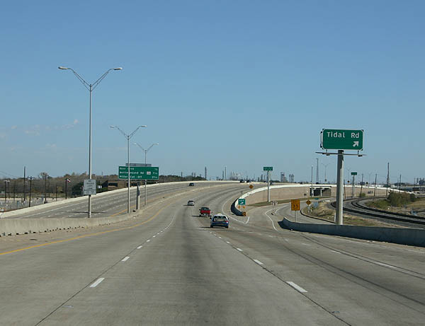
SH 225 turns southward ahead of Tidal Road to East Boulevard, Independence Parkway / Battleground Road, and the La Porte city line.
12/24/05
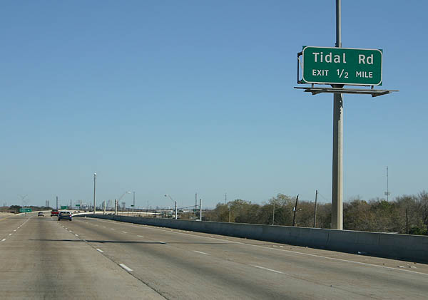
The succeeding ramp connects SH 225 (Pasadena Freeway) eastbound with Tidal Road north to a variety of chemical plants and operations along the Port Terminal Railroad and Houston Ship Channel.
12/24/05
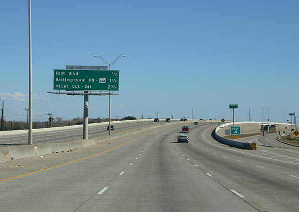
The next three exits along SH 225 eastbound are East Boulevard, Independence Parkway (former SH 134) and Miller Cut-Off.
12/24/05
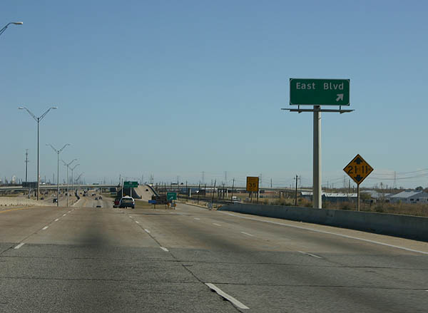
East Boulevard stems south from SH 225 (Pasadena Freeway) through east Pasadena to Canada Road in southwest La Porte.
12/24/05
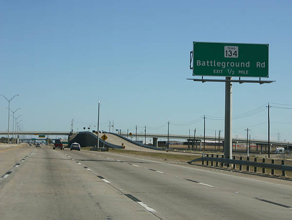
Battleground Road north to San Jacinto Battleground State Historic Site was renamed to Independence Parkway in 2008. SH 134 was previously removed from the state highway system in 2006.
12/24/05
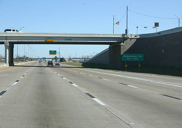
Battleground Road extends south from Independence Parkway and SH 225 to Underwood Road. Underwood Road straddles the Pasadena and La Porte city line south to Spencer Highway.
12/24/05
Independence Parkway represents the transition point from the 1992 freeway onto the 1996 freeway along SH 225 eastbound.
12/24/05
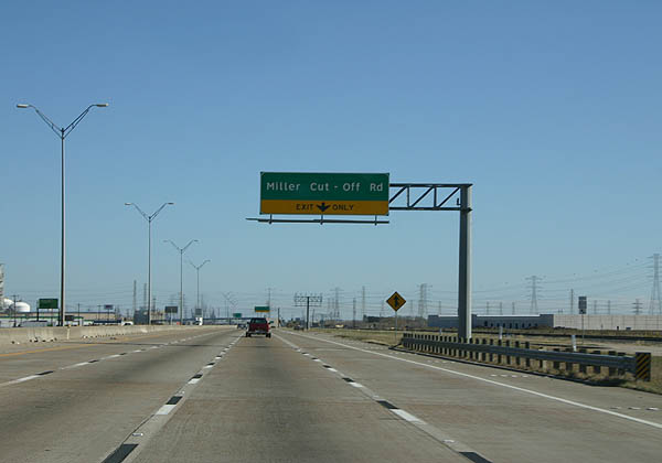
Entering La Porte, an auxiliary lane opens along SH 225 eastbound to Miller Cut-Off Road.
12/24/05
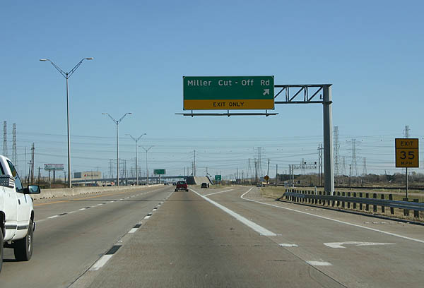
Miller Cut Off Road spurs north into industrial areas off Upper San Jacinto Bay.
12/24/05
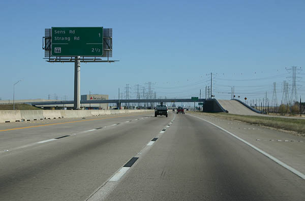
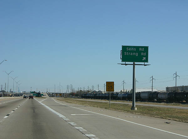
The last two exits on SH 225 are for the frontage road to Sens Road and Strang Road and the flyovers to SH 146.
12/24/05
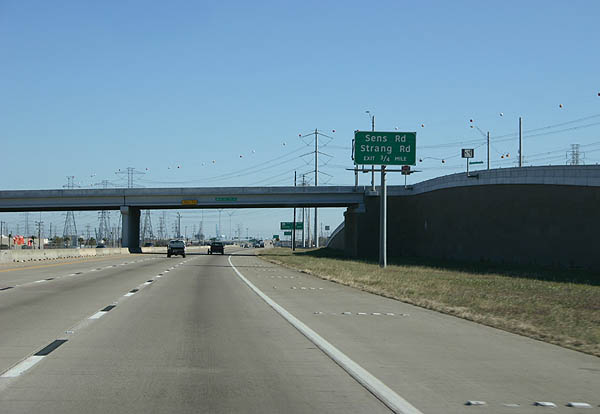
Miller Cut Off Road crosses over SH 225 (Pasadena Freeway) 0.75 miles ahead of the off-ramp to Sens Road.
12/24/05
The Pasadena Freeway from Miller Cut-Off Road to SH 146 was completed in 2000.
12/24/05
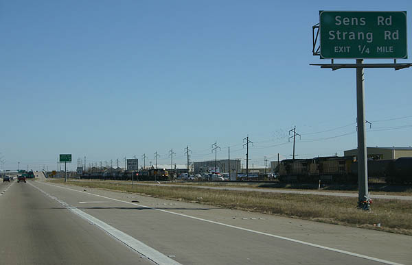
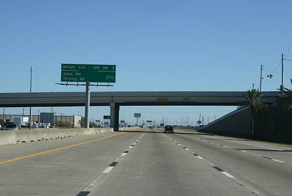
Sens Road runs south through La Porte to Bay Area Boulevard, which extends south to the Bayport Industrial District. Strang Road is a local roadway joining La Porte with industrial areas to the north.
12/24/05
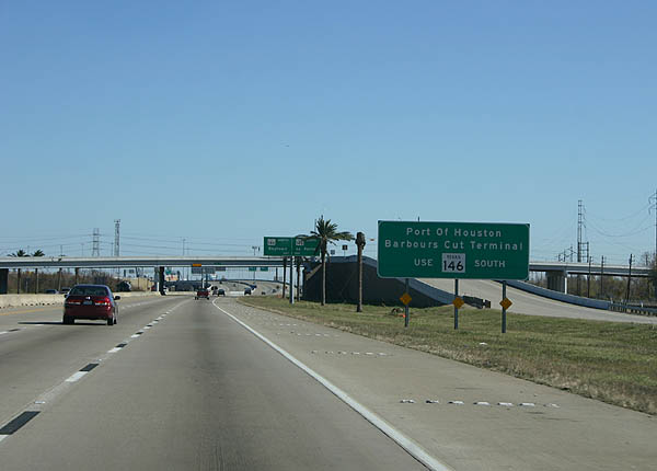
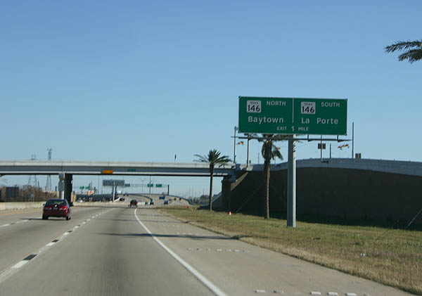
SH 146 constitutes a freeway north to the Fred Hartman Bridge and Baytown and south through La Porte to Seabrook. Barbours Cut Boulevard connects with the freeway nearby west from the city of Morgan's Point and the Port of Houston.
12/24/05
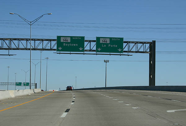
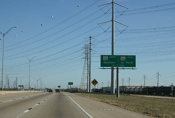
Two lane flyovers separate for SH 146 south toward Downtown La Porte and SH 146 northeast to Baytown.
12/24/05
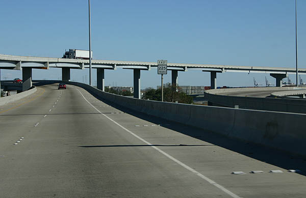
The final SH 225 reassurance sign stands along the transition ramp to SH 146 northbound.
12/24/05
References:
- "Construction Ahead - Today: La Porte Freeway - Texas 225 is shortest of freeways - East End protest kept it out of downtown." Houston Chronicle (TX), August 9, 1999.
Photo Credits:
- Kevin Trinkle: 12/24/05
Connect with:
Page Updated Monday July 29, 2019.