
U.S. 20 East - Elkhart, LaGrange & Steuben Counties

 East
East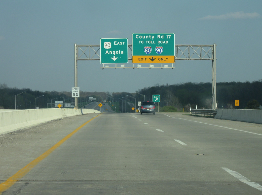
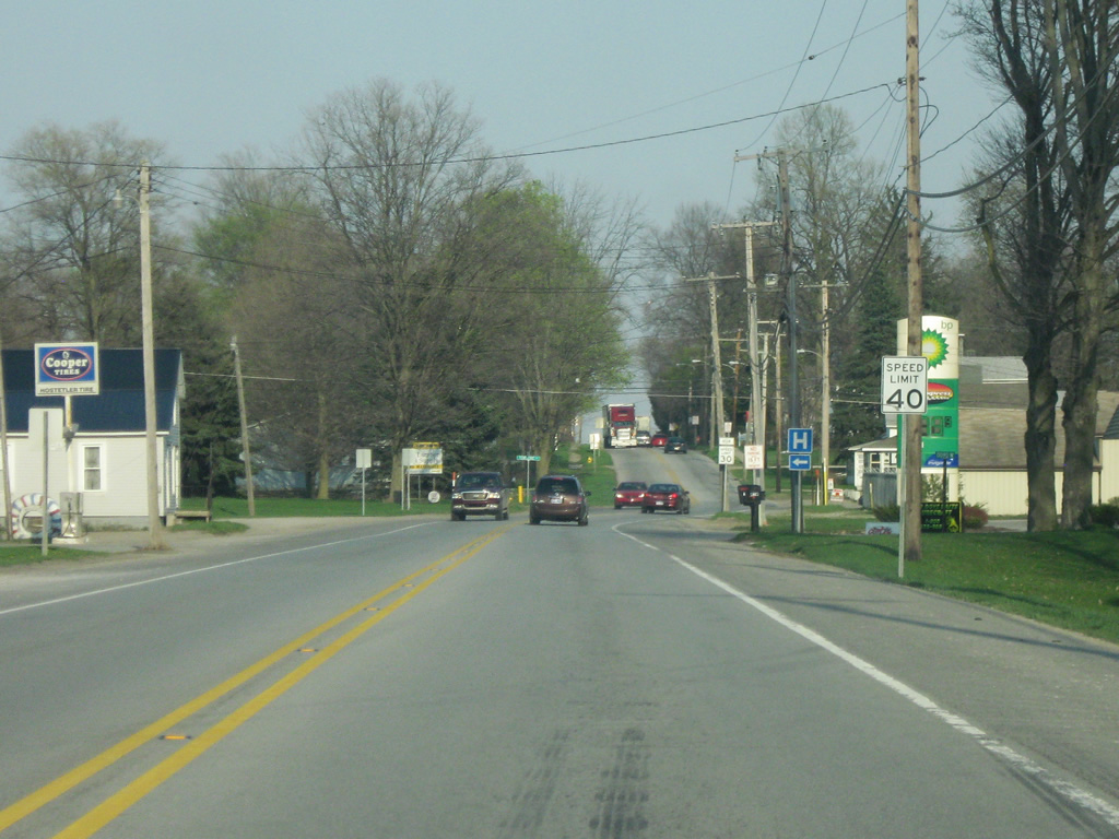
On the entrance ramp from eastbound Toledo Road (old U.S. 20) to U.S. 20 in Elkhart County, another exit ramp directs Toledo Road traffic to Elkhart County Road 17. U.S. 20 ceases being the St. Joseph Valley Parkway, a four lane freeway bypassing South Bend and Elkhart. Angola becomes the primary control city for U.S. 20. Despite its two lane nature the road receives plenty of traffic as a shunpiking route to the Indiana Toll Road a few miles to the north.
04/10/10

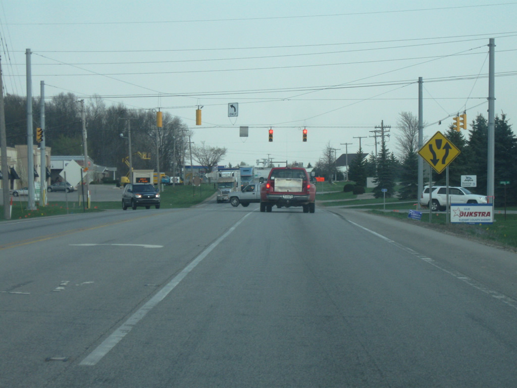
U.S. 20 remains a busy highway in between Elkhart County Road 17 and SR 15. The stretch of U.S. 20 from Elkhart County Road 17 to SR 15 is slated on being expanded to four lanes by 2014.
04/10/10

U.S. 20 at the intersection with SR 15. SR 15 goes for 95 miles from Marion north to Wabash, Warsaw and Goshen. North of U.S. 20, it connects with Bristol and the Indiana Toll Road before crossing the Michigan state line.
04/10/10

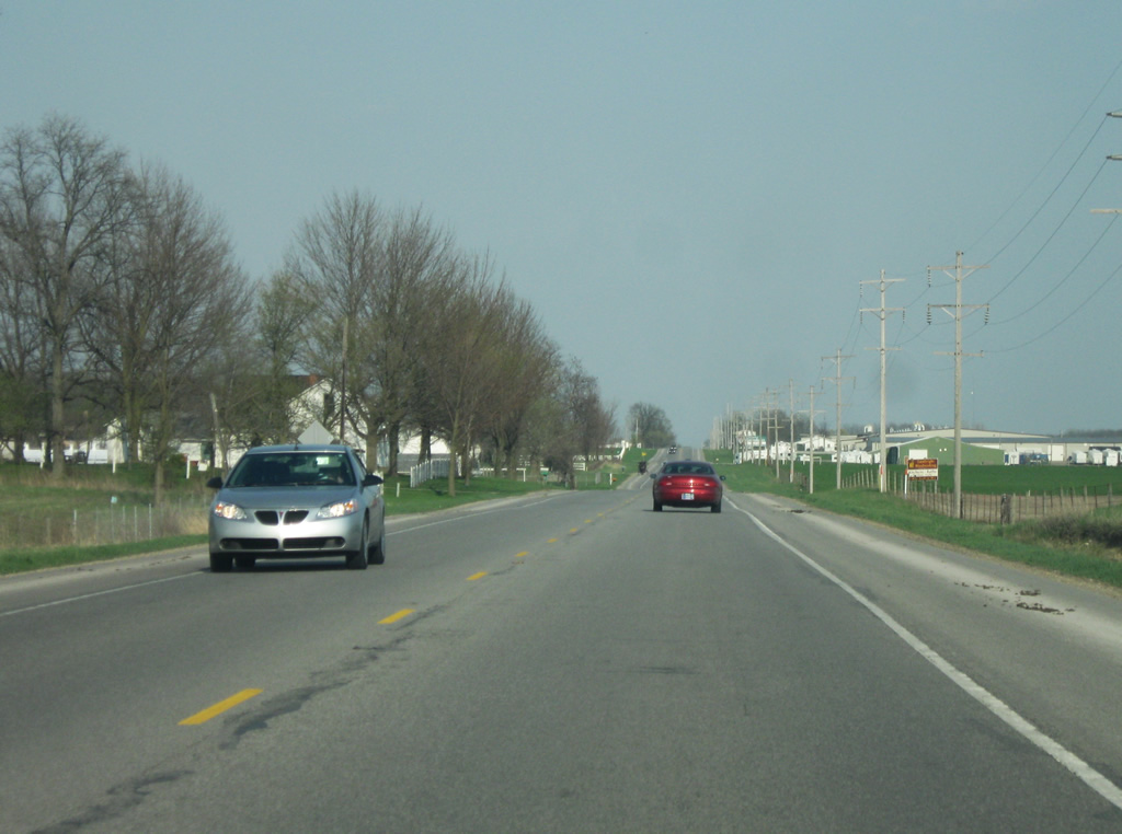
East of SR 15, the next two communities along U.S. 20 are Middlebury (7 miles) and Shipshewana (14 miles).
04/10/10

U.S. 20 between SR 15 and Middlebury.
04/10/10
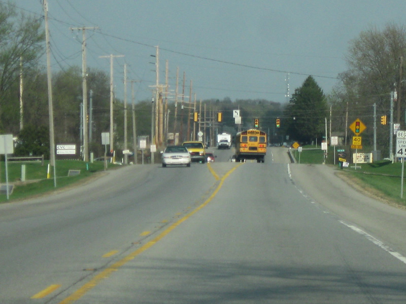
U.S. 20 enters Middlebury (population 3,420). Middlebury is a small industrial town that is located in the heart of Indiana Amish Country. The town is best known as the location of Das Dutchman Essenhaus, an Amish themed restaurant, conference center and inn.
04/10/10
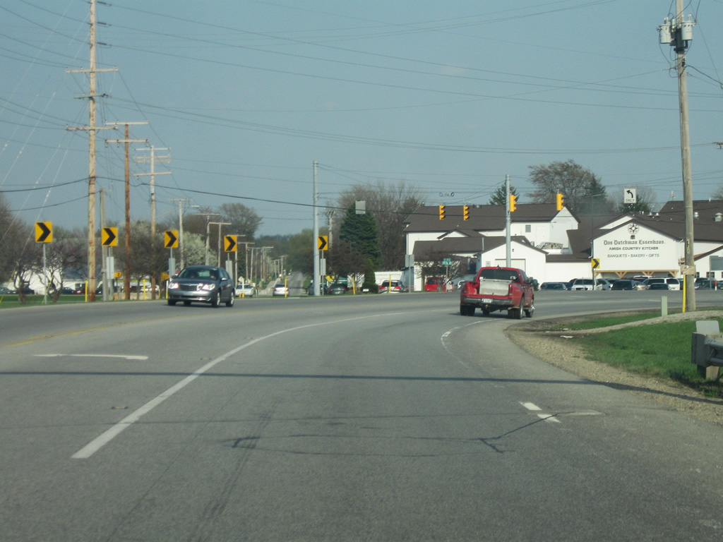
U.S. 20 turns toward the southeast as it bypasses Middlebury. Straight ahead is Wayne Street, providing access toward the town. The white building ahead is Das Dutchman Essenhaus.
04/10/10

U.S. 20 as it bypasses Middlebury to the south. In the second picture, the highway widens briefly to two lanes as it approaches the junction with SR 13.
04/10/10
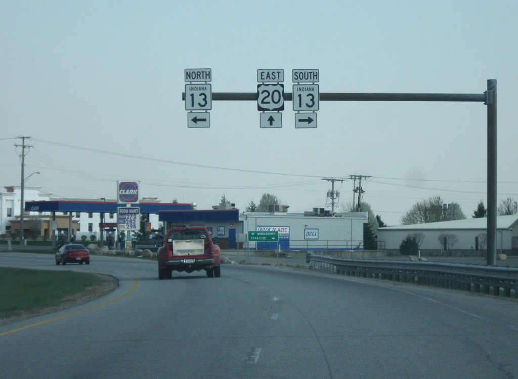
U.S. 20 at the intersection with SR 13. SR 13 provides direct access to the heart of Middlebury and to the Indiana Toll Road. To the south, SR 13 links up the smaller communities of Syracuse, North Manchester, Wabash, and Elwood, ending in Fortville, going for 138 miles in length.
04/10/10

U.S. 20 returns to two lanes east of SR 13.
04/10/10

East of Middlebury, Shipshewana is now seven miles away with the LaGrange County seat of LaGrange at 15 miles.
04/10/10

U.S. 20 enters LaGrange County (37,128), the heart of Indiana's Amish Country. The Amish moved into LaGrange County from Pennsylvania in the 1840s and have since settled throughout the county.
04/10/10

U.S. 20 between the LaGrange-Elkhart County line and Shipshewana. The presence of the Amish becomes very evident as one travels toward Shipshewana, one of the main communities for the Amish in LaGrange County. U.S. 20 has shoulders throughout the county to provide a space for the horse and buggies that travel the highway.
04/10/10

U.S. 20 as it approaches the community of Shipshewana and the intersection with SR 5. As with Middlebury, U.S. 20 stays to the south of the community, which is accessed via SR 5.
04/10/10

U.S. 20 at the intersection with SR 5. SR 5 is a 96 mile highway that starts in Upland in Grant County and heads north through Huntington, South Whitney and Ligonier before reaching U.S. 20. North of here, it enters the town of Shipshewana (population 628). Shipshewana is the most famous of the Amish communities in LaGrange County and is known as a tourist attraction for its Amish attractions, most famous among them being their flea markets and auctions. North of Shipshewana, SR 5 ends at SR 120.
04/10/10

East of the SR 5 intersection, U.S. 20 is now 10 miles from LaGrange and 32 miles from Angola. Until 2005, U.S. 20 continued straight where it made two sharp turns as the highway went a mile to the south. That alignment was fixed as the highway now curves to the southeast to meet the original alignment. The old alignment still exists as County Road 100 North.
04/10/10

Now going southeast on the new alignment of U.S. 20 in western LaGrange County.
04/10/10

Now at the intersection with County Road 600 West. This is the spot where the new alignment meets the original routing of U.S. 20. This was the location of one of the two sharp curves along the old U.S. 20. South along County Road 600 West are the towns of Emma and Topeka.
04/10/10

East of County Road 600 West, U.S. 20 continues east toward LaGrange, now less than six miles away.
04/10/10
U.S. 20 enters LaGrange (population 2,625), the county seat of LaGrange. In town, the highway carries the name of Central Avenue. At the shift in the highway ahead, U.S. 20 (Central Avenue) intersects with Townline Road, which provides access to the Parkview LaGrange Hospital and SR 9 north of town. Townline Road marks the division between west and east LaGrange County and the shift in U.S. 20 is a result of it being a township boundary, where such shifts are common.
04/10/10

U.S. 20 (Central Avenue) at the intersection with SR 9, known as Detroit Street in LaGrange. The County Courthouse is a couple of blocks to the north of U.S. 20. SR 9 goes for 196 miles from Columbus to the Michigan state line, passing through Shelbyville, Greenfield, Anderson, Marion, Huntington, Columbia City and LaGrange. SR 9 also provides another connection with the Indiana Toll Road.
04/10/10
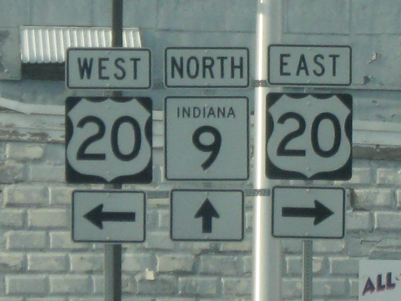
A close up of the highway shields at the junction of U.S. 20 (Central Avenue) and SR 9 (Detroit Street) in LaGrange.
04/10/10

A view of U.S. 20 (Central Avenue) as it leaves LaGrange.
04/10/10

East of LaGrange, Angola is now 22 miles away. Columbia, Ohio, at the state line is 35 miles away.
04/10/10
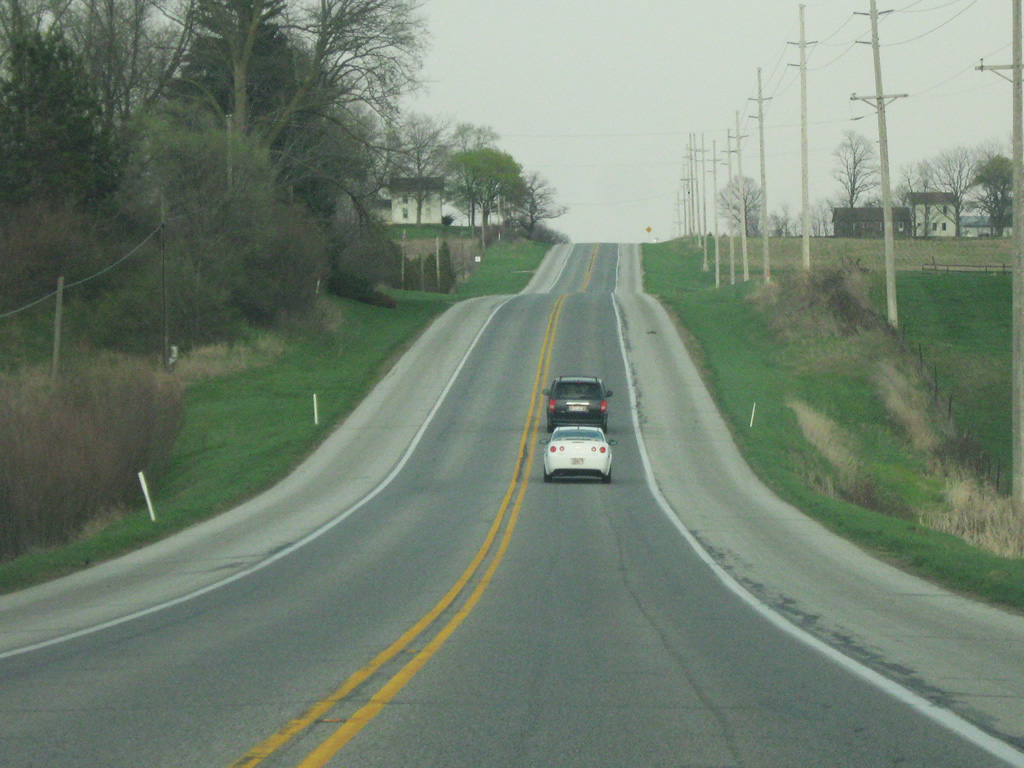
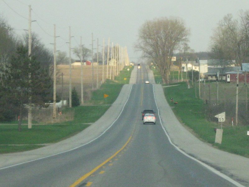
U.S. 20 east of LaGrange continues a relatively straight line along the rolling hills of the moraines of Northern Indiana. These hills are the deposits of the glaciers that ran across the region, leaving behind these moraines and small lakes around the landscape.
04/10/10
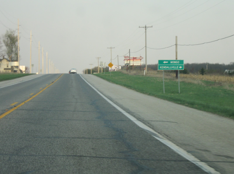
U.S. 20 approaches the intersection with SR 3. SR 3 goes for 224 miles in two segments that start in Charlestown near the Ohio River and ends at Interstate 69 south of Fort Wayne. SR 3 restarts in Fort Wayne and continues through Kendallville before ending at SR 120 north of Mongo.
04/10/10

East of SR 3, U.S. 20 is 15 miles from Angola and 28 miles from Columbia, Ohio.
04/10/10

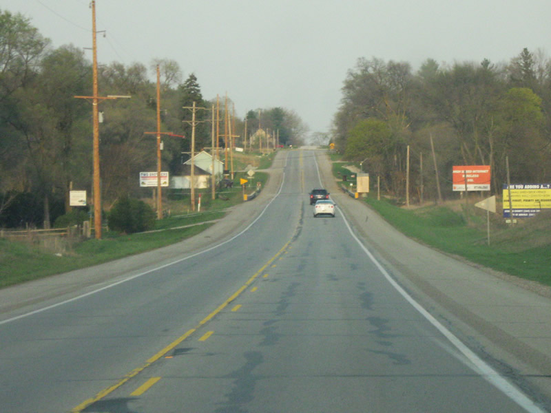
U.S. 20 winds toward the east as it approaches the LaGrange-Steuben County line. In the second picture, the highway intersects with County Road 1150 East, providing access to Stroh and Prairie Heights High School.
04/10/10

U.S. 20 enters Steuben County (population 34,185), the highway's last county before crossing into Ohio.
04/10/10
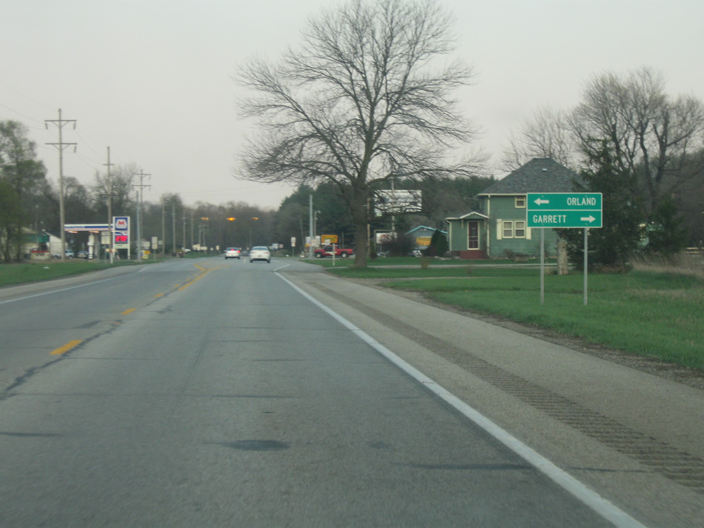
U.S. 20 comes up to the intersection with SR 327, a 32 mile highway from Garrett in DeKalb County to the Michigan state line. Here, it provides access to Orland to the north and Garrett to the south.
04/10/10

East of SR 327, Angola is 10 miles away with Columbia, Ohio at 23 miles.
04/10/10

U.S. 20 heads straight after its trip around the northern tip of Otter Lake. Steuben County is well-known for its small lakes scattered throughout.
04/10/10
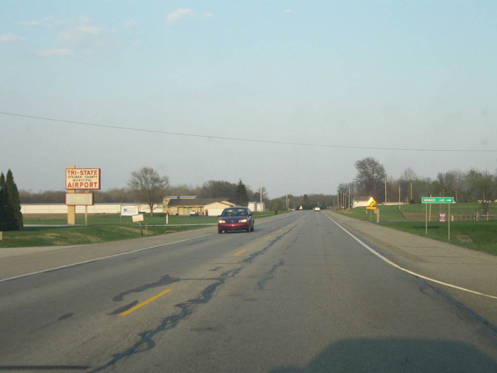
U.S. 20 as it passes the Tri-State Airport and Hogback Lake. The area around Angola is known as the Tri-State area (with Indiana, Michigan, and Ohio), evident by the former Tri-State University (now renamed Trine University).
04/10/10

U.S. 20 winds its way around Silver Lake as it approaches the junction with Interstate 69. In the second picture, Golden Lake Road provides access to Golden Lake and Big Boner Lake.
04/10/10
02/06/12

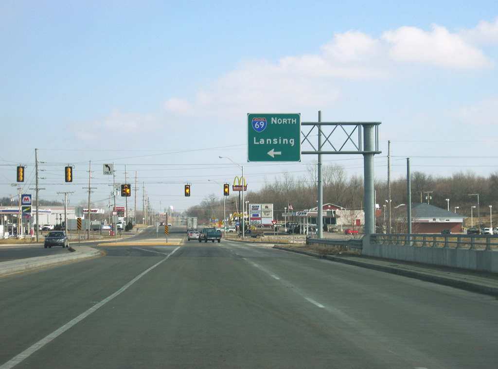
U.S. 20 reaches the diamond interchange with Intestate 69, which at the moment of the picture was being widened and rebuilt. Interstate 69 goes for 157 miles (currently) from the Michigan state line through Auburn, Fort Wayne, and Anderson before ending in Indianapolis. In the future the interstate will double in length as it extends further south toward Evansville. The U.S. 20 interchange at Interstate 69 had to be rebuilt to handle the extra truck traffic that utilizes U.S. 20 east into Ohio to access the Ohio Turnpike.
02/06/12

East of the Interstate 69 interchange, U.S. 20 enters the Steuben County seat of Angola (population 8,612).
02/06/12

Despite having already entered the city limits, Angola (its downtown) is listed as being three miles away from the Interstate 69 interchange. Columbia, Ohio, and the Ohio Turnpike (Interstate 80/Interstate 90) is 12 miles away.
02/06/12
A view of U.S. 20 east toward the intersection with County Road 200 West. In Angola, U.S. 20 takes on the name of Maumee Street.
02/06/12

U.S. 20 approaches the intersection with County Road 200 West/Fox Lake Road. Buck Lake can be accessed via County Road 200 West and Buck Lake Road to the north.
02/06/12

A testament to the 101 lakes that inhabit Steuben County, the following guide sign directs motorists to the north to Crooked Lake and Lake James and to the south to Fox Lake.
02/06/12

Now at the intersection with U.S. 20 (Maumee Street) and County Road 200 West/Fox Lake Road.
02/06/12

East of the intersection with County Road 200 West/Fox Lake Road, U.S. 20 (Maumee Street) enters the developed part of Angola along the city's west side. This street was recently rebuilt to better handle the through traffic in Angola, although the number of lanes is the same.
02/06/12

U.S. 20 (Maumee Street) crosses the Indiana Northeastern Railroad tracks as it passes by the entrance into Trine University. The highway passes by Trine University, called Tri-State University until 2008. Tri-State is the main university in far Northeastern Indiana.
04/10/10

At the intersection of U.S. 20 (Maumee Street) and University Avenue, the road turns slightly toward the left as it heads into Downtown Angola. The tower from the Steuben County Courthouse looms in the distance.
02/06/12

U.S. 20 (Maumee Street) enters Downtown Angola with the traffic circle at SR 127 north (Wayne Street). Following the original path of the old U.S. 27, SR 127 goes north from the circle for five miles to Interstate 69. North of Angola, SR 127 has most of the big-box stories serving the area.
U.S. 20 continues east for another 10 miles before crossing into Ohio.
04/10/10

Shops line both U.S. 20 (Maumee Street) and the square the surround the traffic circle, which contains a Civil War memorial in the middle. Locally, the circle is known as the Square or the Mound.
02/06/12
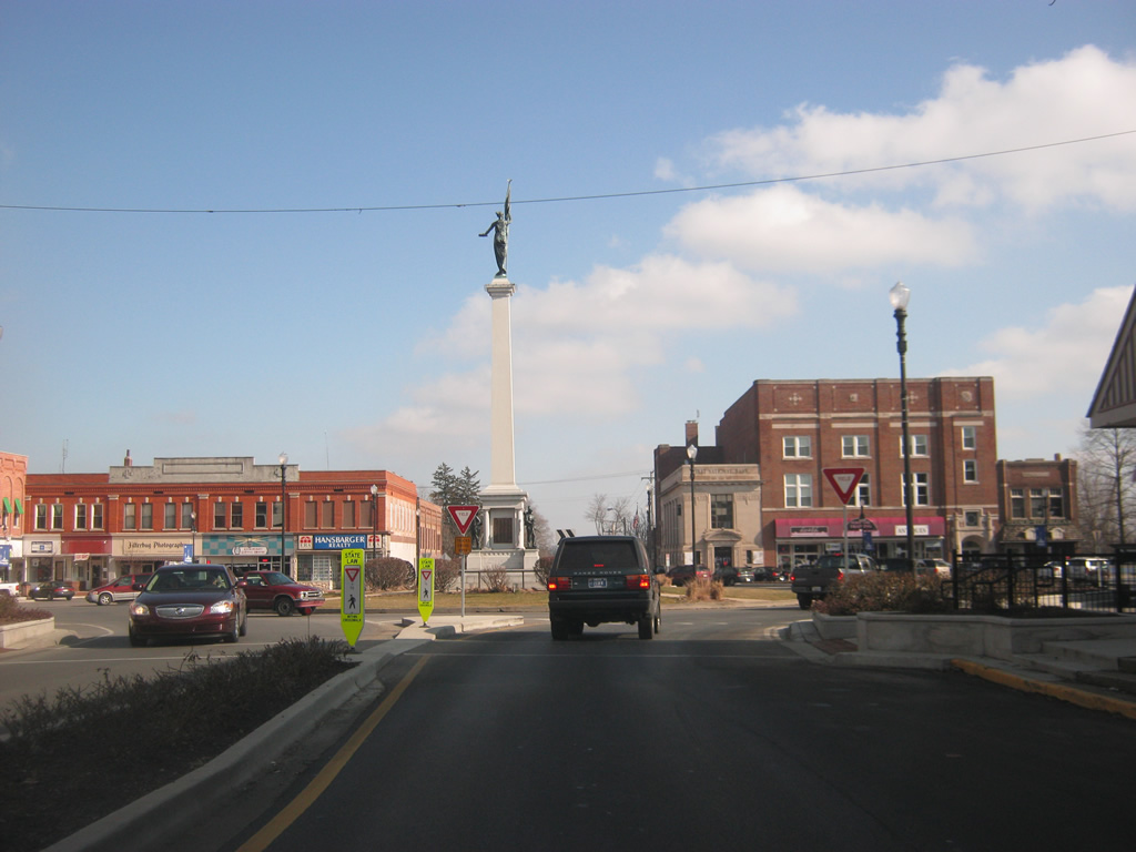
Now at the traffic circle with U.S. 20 (Maumee Street) and SR 127 north (Wayne Street.) The area around the traffic circle, plus the four spokes that radiate from it (along Maumee and Wayne Streets), were rebuilt in 2011 as part of a project to make travel along the roads safer for both motorists and pedestrians.
02/06/12

Another view of the traffic circle that forms the intersection of U.S. 20 (Maumee Street) and SR 127 (Wayne Street). Unlike other Indiana county seats where the courthouse is the center of the community, the Steuben County courthouse is located in the southeast corner of the square surrounding the circle.
04/10/10
Photo Credits:
- Thomas Decker: 04/10/10, 02/06/12
Connect with:
Page Updated Thursday March 01, 2012.