
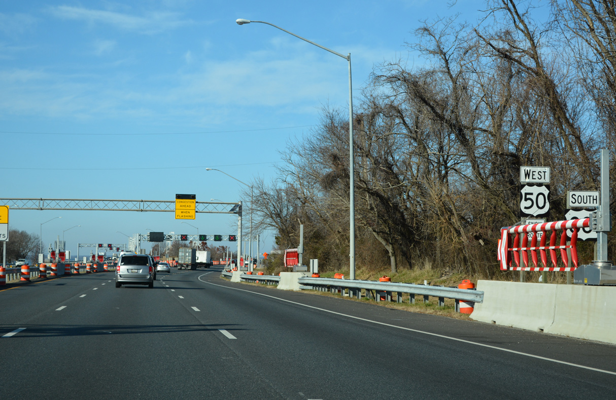
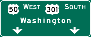
U.S. 50 West / U.S. 301 South - Queenstown to Bay Bridge
 West
West  South
South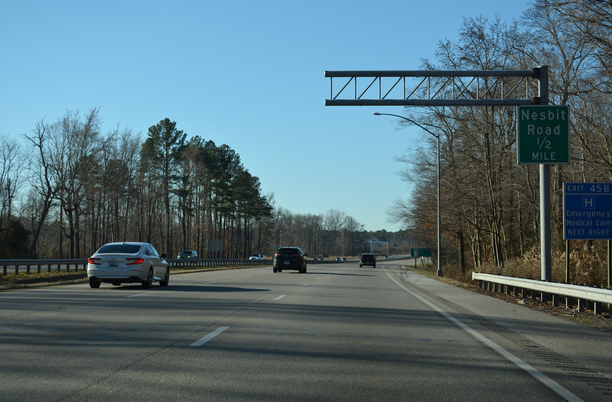
U.S. 50/301 overlap along a six lane freeway from Queenstown nine miles west to the Chesapeake Bay Bridge. The first of several exits for the community of Grasonville links with Nesbit Road.
12/27/22
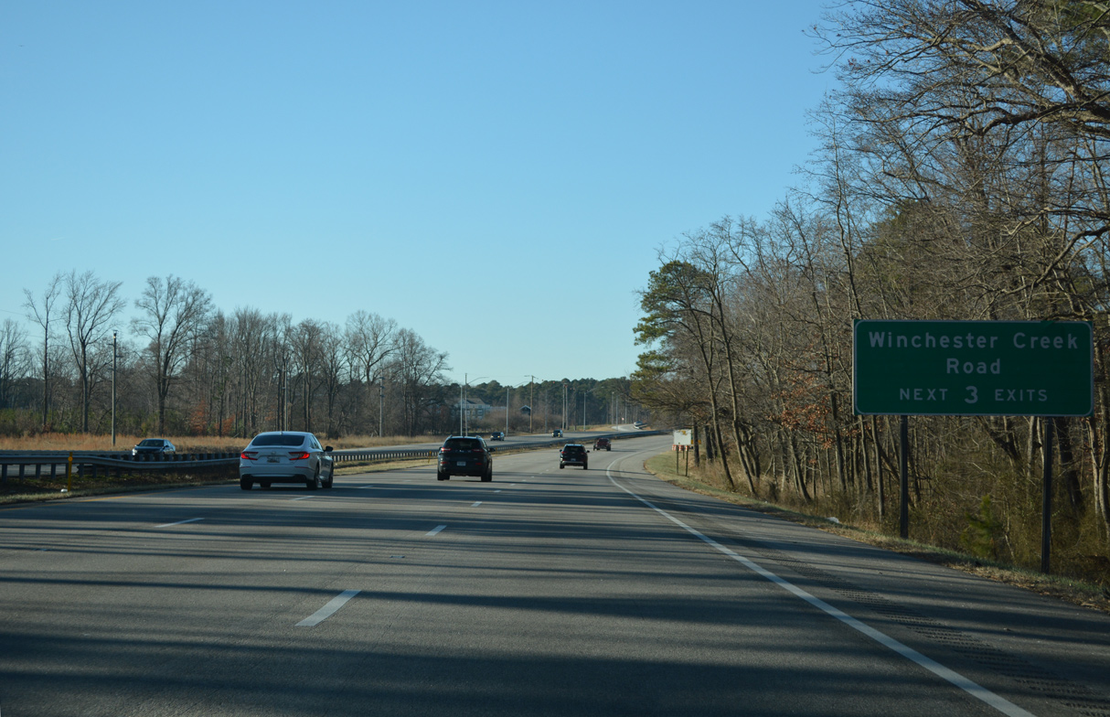
Winchester Creek Road (MD 835J / MD 835H) comprises the north side frontage road for U.S. 50/301 over the ensuing stretch.
12/27/22
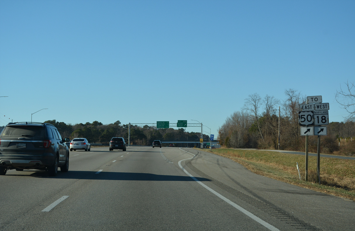
A modified diamond interchange (Exit 45B) connects U.S. 50/301 with Winchester Creek Road (MD 835J) and Nesbit Road (MD 835K) south 0.31 miles to MD 18B (Main Street).
12/27/22
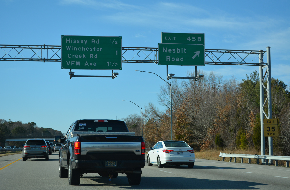
Exit 45 B departs U.S. 50/301 west for adjacent Winchester Creek Road (MD 835J). An unsigned route, MD 835J runs west 0.67 miles from Blackbeard Road to Hissey Road (MD 835I).
12/21/22
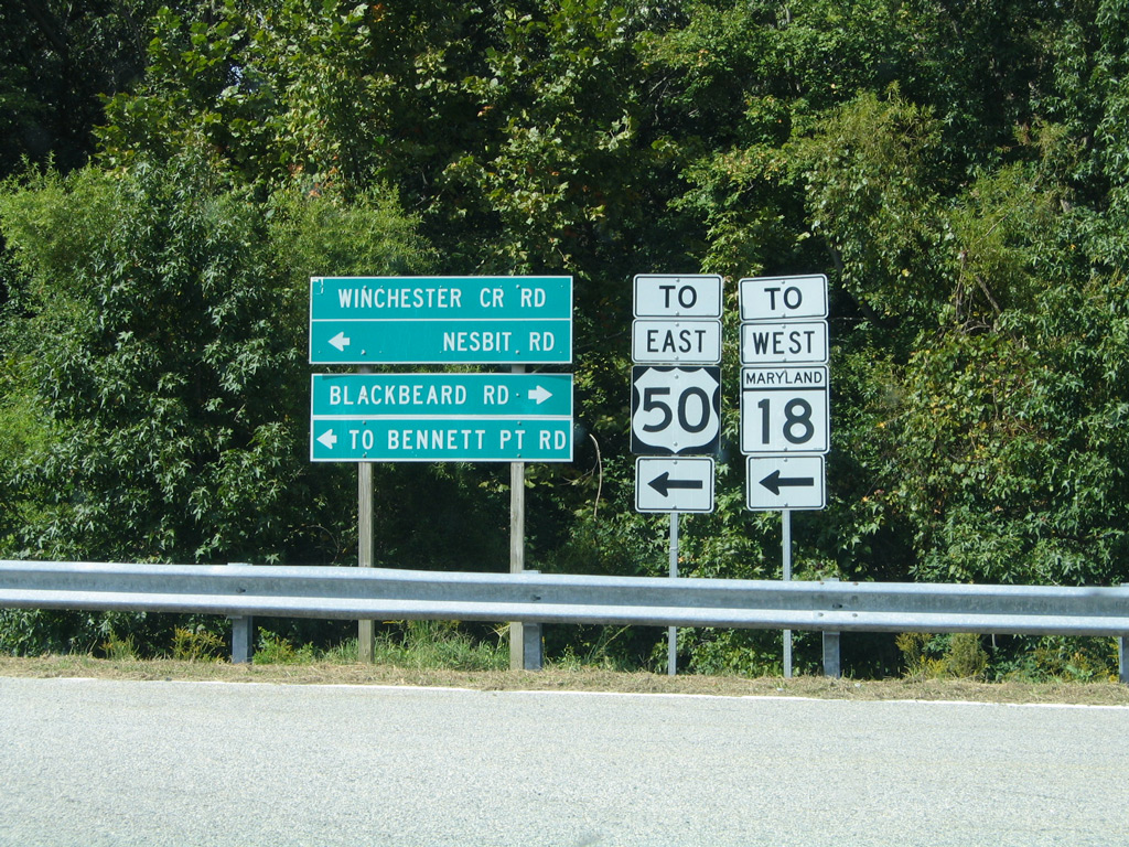
Nesbit Road (MD 835K) ties into MD 18 (Main Street) west of Bennett Point Road south to Bryantown.
09/25/04
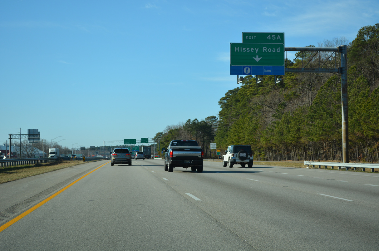
A set of Right in Right Out (RIRO) ramps links U.S. 50/301 with Hissey Road (MD 835I) north and Hess Road (MD 18X) south at Exit 45 A.
12/21/22
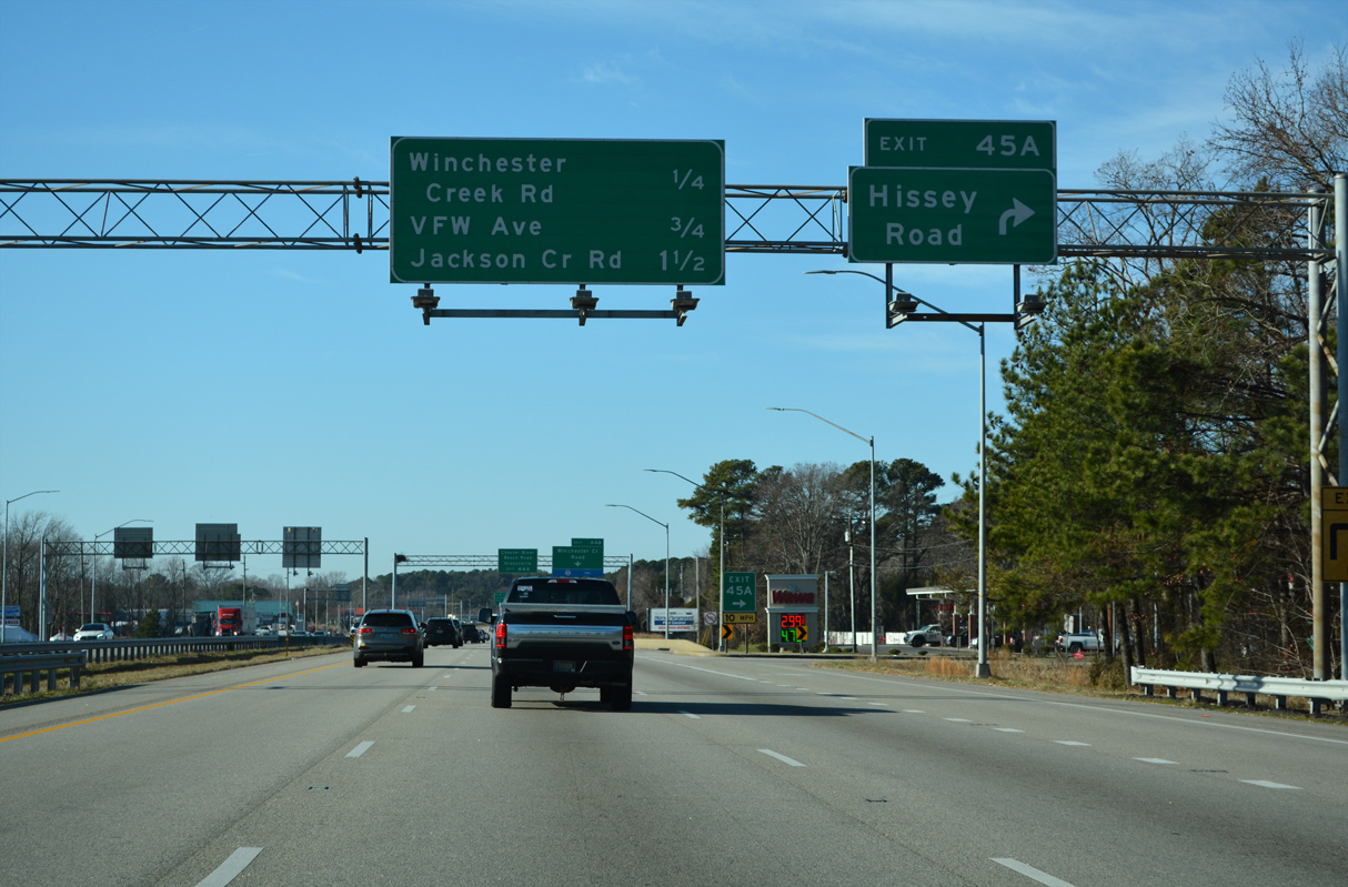
Hissey Road (MD 835I) leads 0.20 miles north from Exit 45 A to Homeport Drive and the continuation of Winchester Creek Road (MD 835H) west.
12/21/22
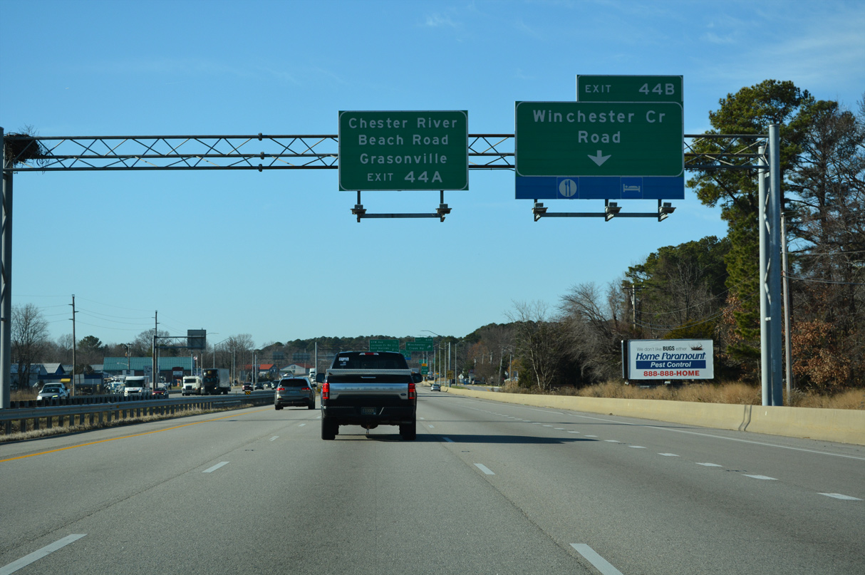
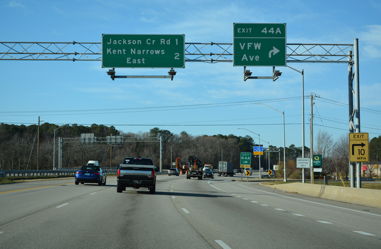
Winchester Creek Road (MD 835H) runs along the north side of U.S. 50/301 for 0.74 miles between Homeport Drive and VFW Avenue (MD 18W) at Exit 44 B.
12/21/22
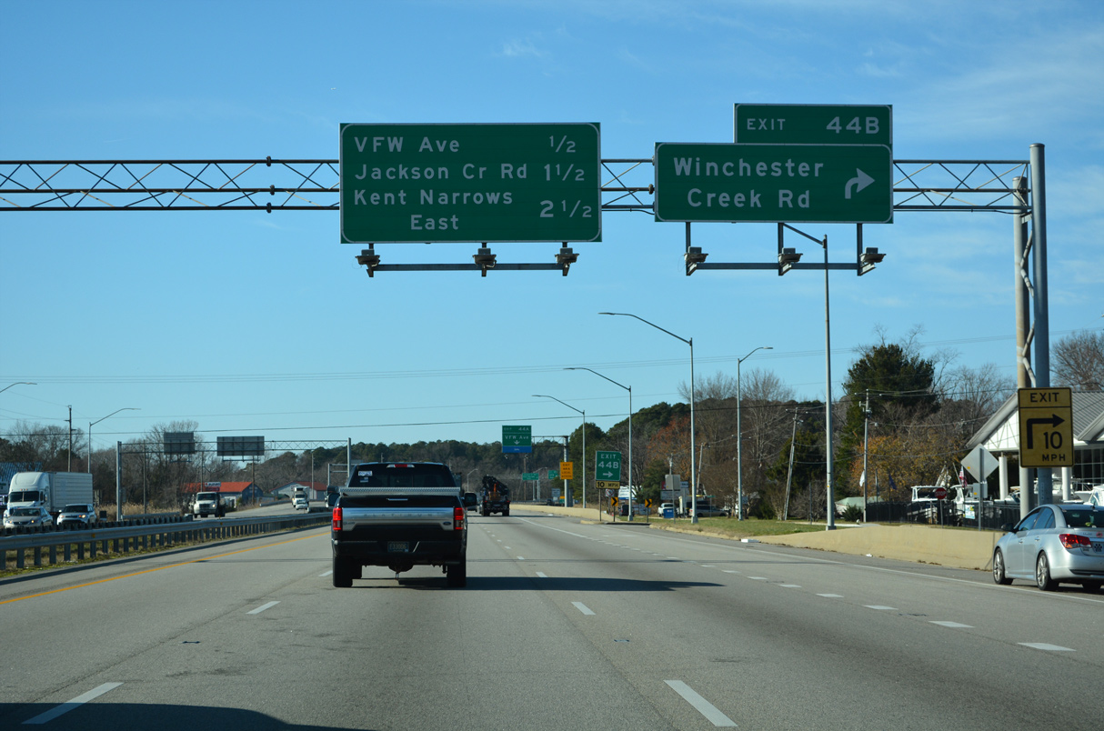
Exit 44 B constitutes RIRO ramps with adjacent Winchester Creek Road (MD 835H).
12/21/22
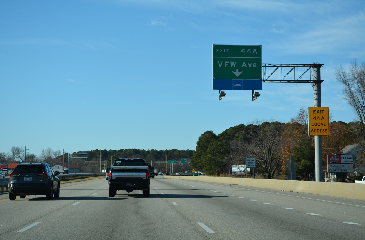
VFW Avenue (MD 18W) stems 0.28 miles north from the RIRO ramps at Exit 44B and Winchester Creek Road to Chester Beach Road (MD 18V).
12/21/22
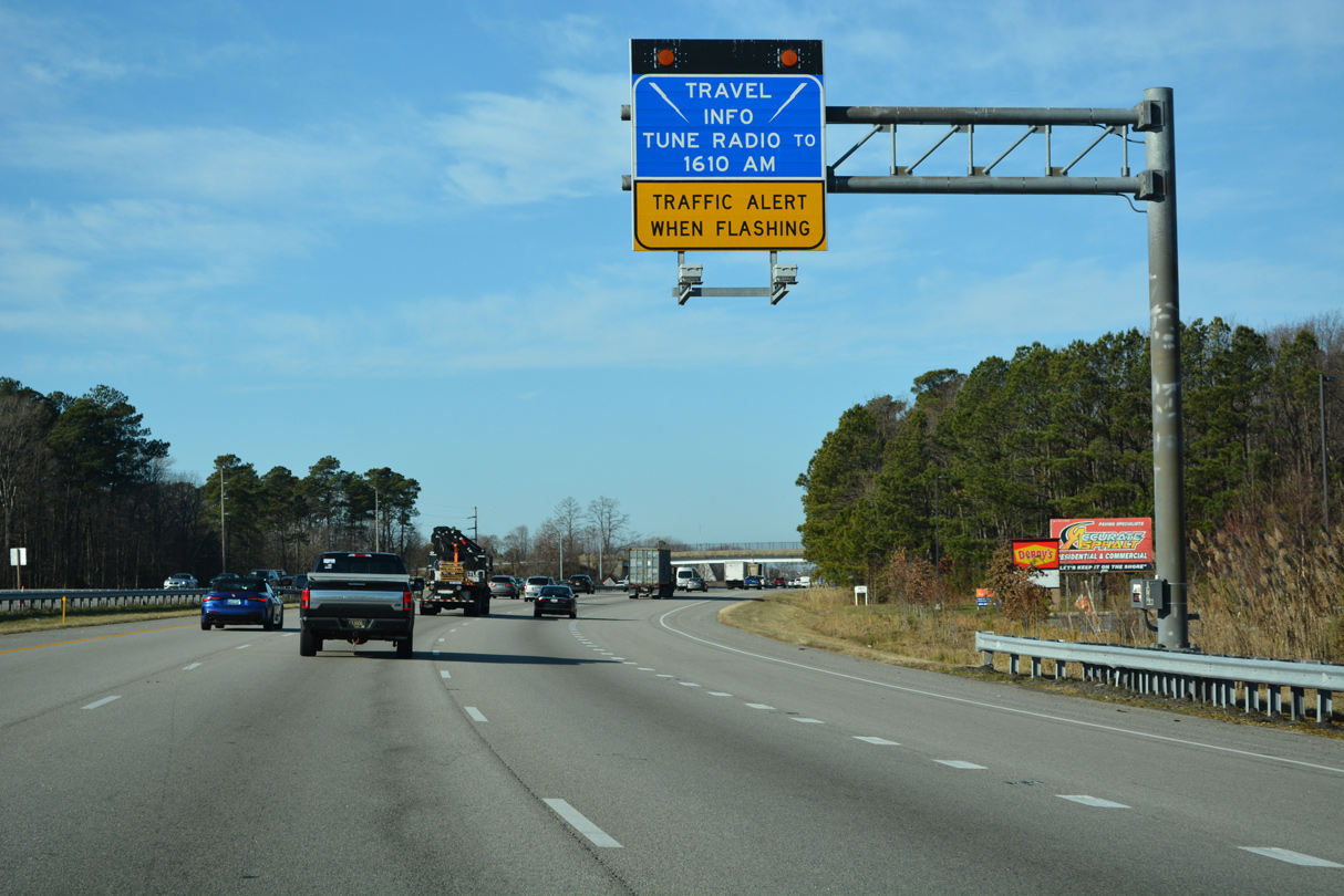
Travel information for the Chesapeake Bay Bridge is broadcast on 1610 AM.
12/21/22
The entrance ramp from Chester River Beach Road (MD 18V) for an auxiliary lane west to the RIRO ramps (Exit 43A) with Saddler Road (MD 835B).
12/21/22
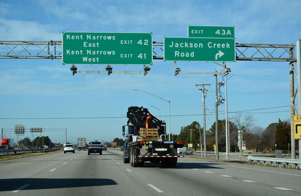
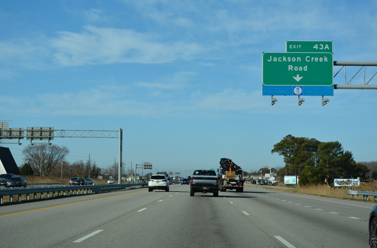
Jackson Creek Road spurs 0.17 miles north from Exit 43A and Saddler Road (MD 835B). Long Point Road extends from adjacent Long Point Park 1.27 miles to Long Point on the Chester River.
12/21/22
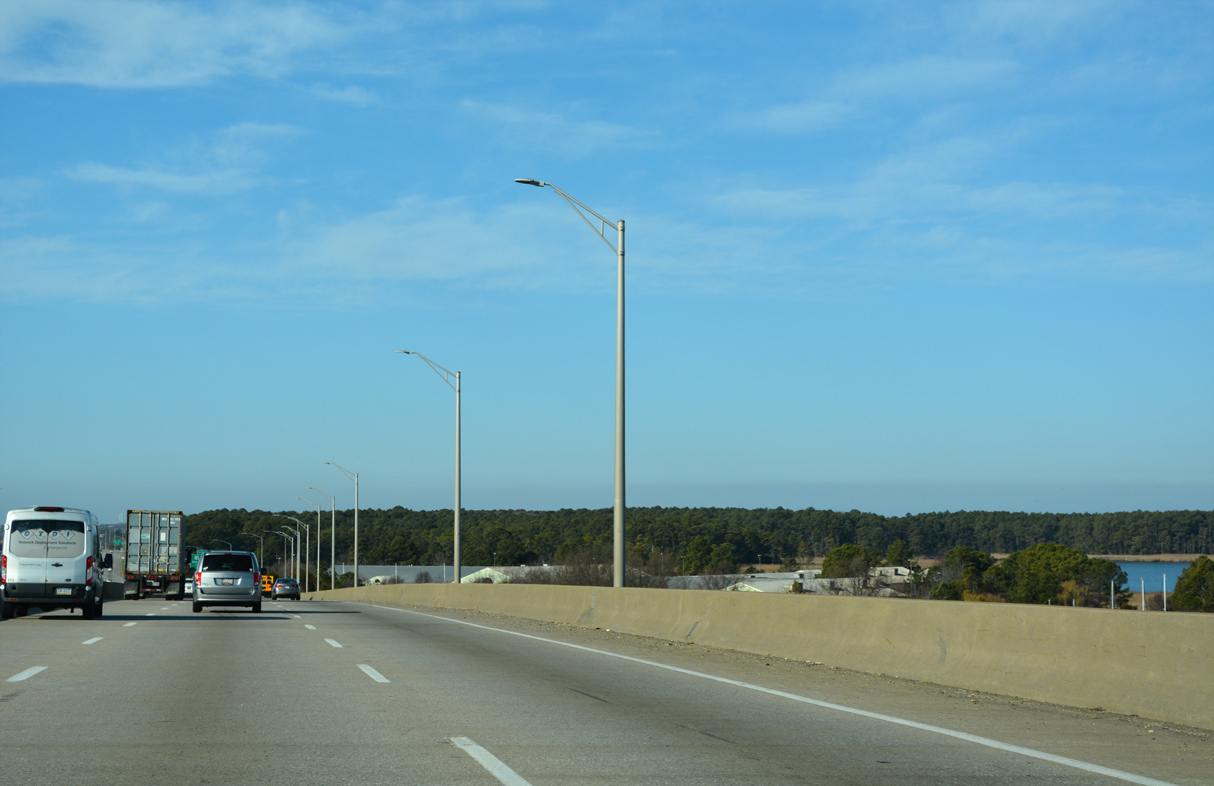
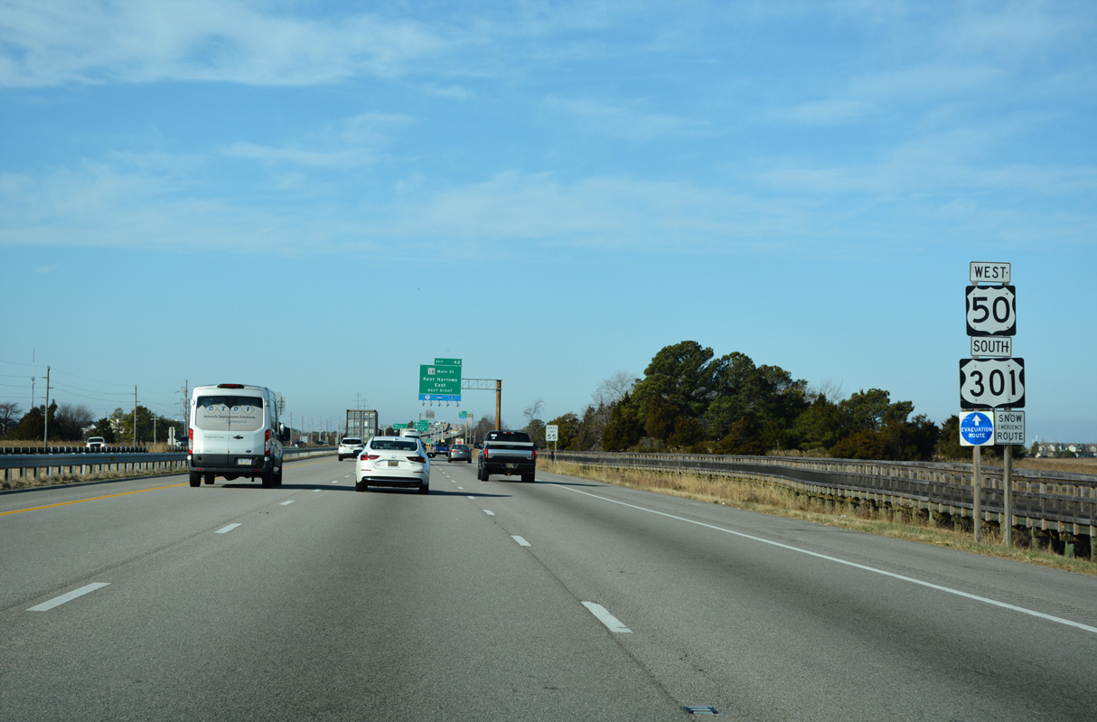
U.S. 50/501 advance west from Grasonville toward Kent Narrows.
12/21/22
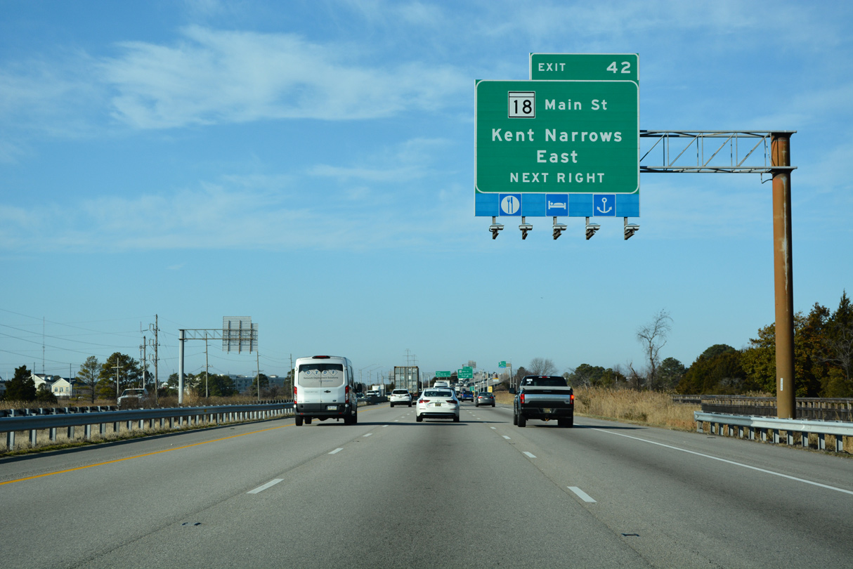
Kent Narrows Road (MD 835G) separates from the RIRO ramps at Exit 42 ahead of Kent Narrows East.
12/21/22

Kent Narrows Road (MD 835G) parallels U.S. 50/301 west 0.40 miles to Kent Narrows Way N. MD 18B runs along the south side of the freeway on Main Street.
12/21/22
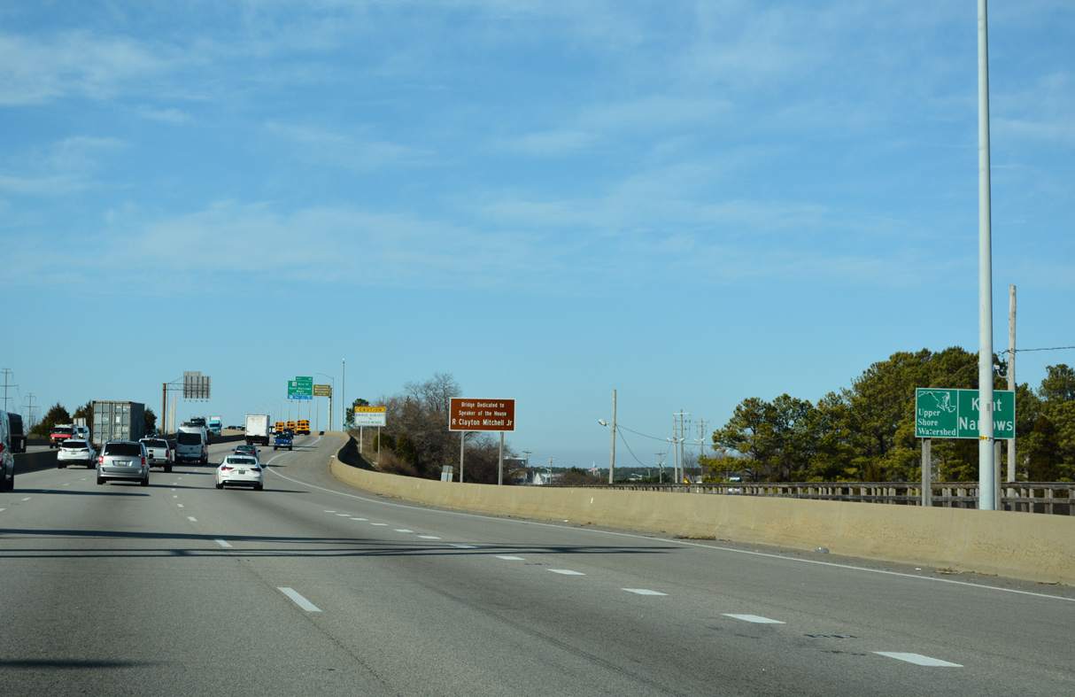
Kent Narrows is a waterway separating Kent Island from the rest of Queen Anne's County.
12/21/22
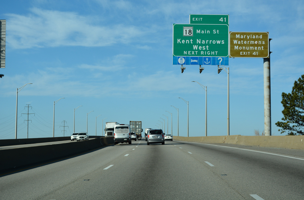
A folded diamond interchange (Exit 41) joins U.S. 50/301 (Blue Star Memorial Highway) next with Kent Narrows Road to the north and MD 18 (Main Street) to the south.
12/21/22
The steel stringer bridge spanning Kent Narrows was built in 1990. The 3,001.1 foot long bridge rises to a height of 62.3 feet (Baughn, n.d.a).
12/21/22

Exit 41 loops onto Piney Narrows Road east to MD 18 (Main Street) at Kent Narrows West.
12/27/22
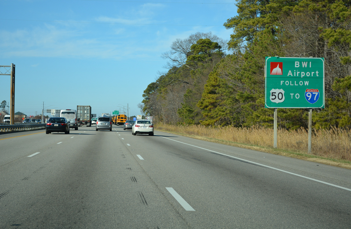
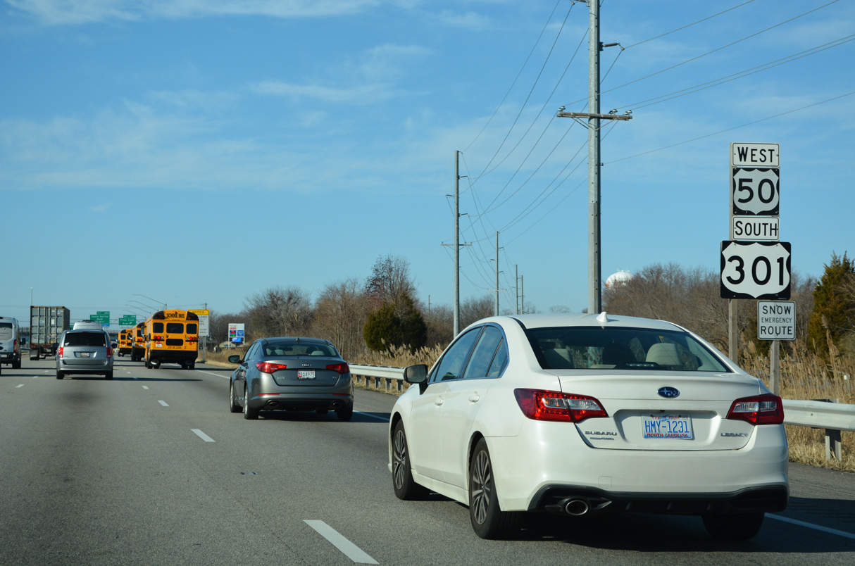
Exit 21 to Interstate 97 north to Thurgood Marshall Baltimore Washington International Airport (BWI) departs 17.8 miles west from this sign posted ahead of Exit 40 A.
12/21/22
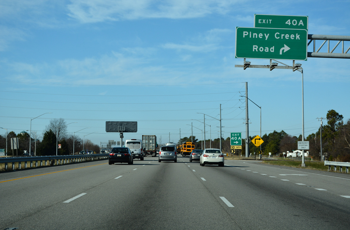
RIRO ramps links U.S. 50/301 with adjacent Piney Creek Road at Exit 40 A near the Gibson's Grant development.
12/21/22
Continuing west into the community of Chester, U.S. 50/301 proceed to RIRO ramps with Chester Station Road (MD 552A), a 0.08 mile connector to Piney Creek Road.
12/21/22
Pine Creek Road continues west from Chester Station Road (MD 552A), 0.38 miles as MD 18T to MD 18 Segment B on Main Street.
12/21/22
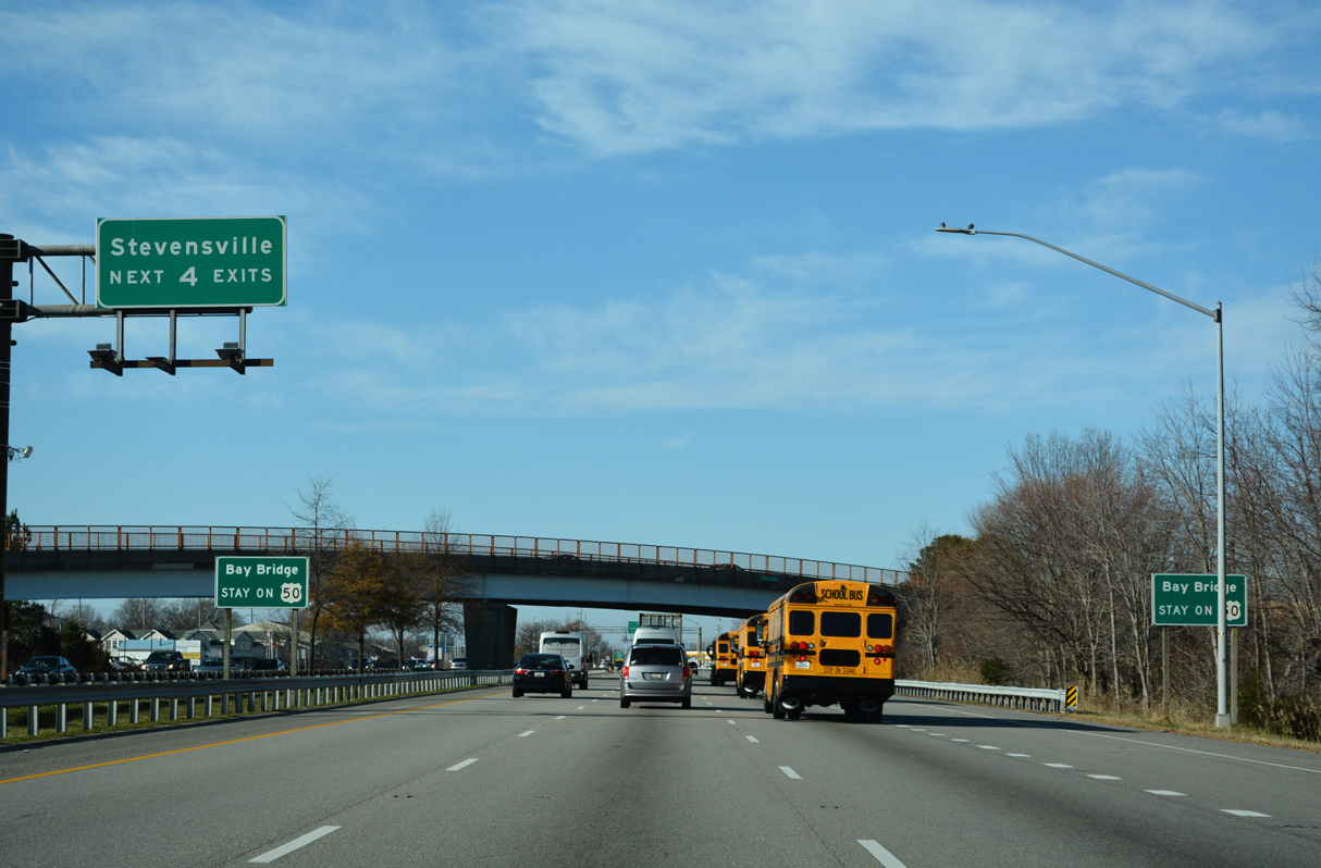
MD 18 (Main Street) angles across U.S. 50/301 by the commercial center of Chester. MD 18 and U.S. 50/301 (Blue Star Memorial Highway) both advance west to Stevensville.
12/21/22
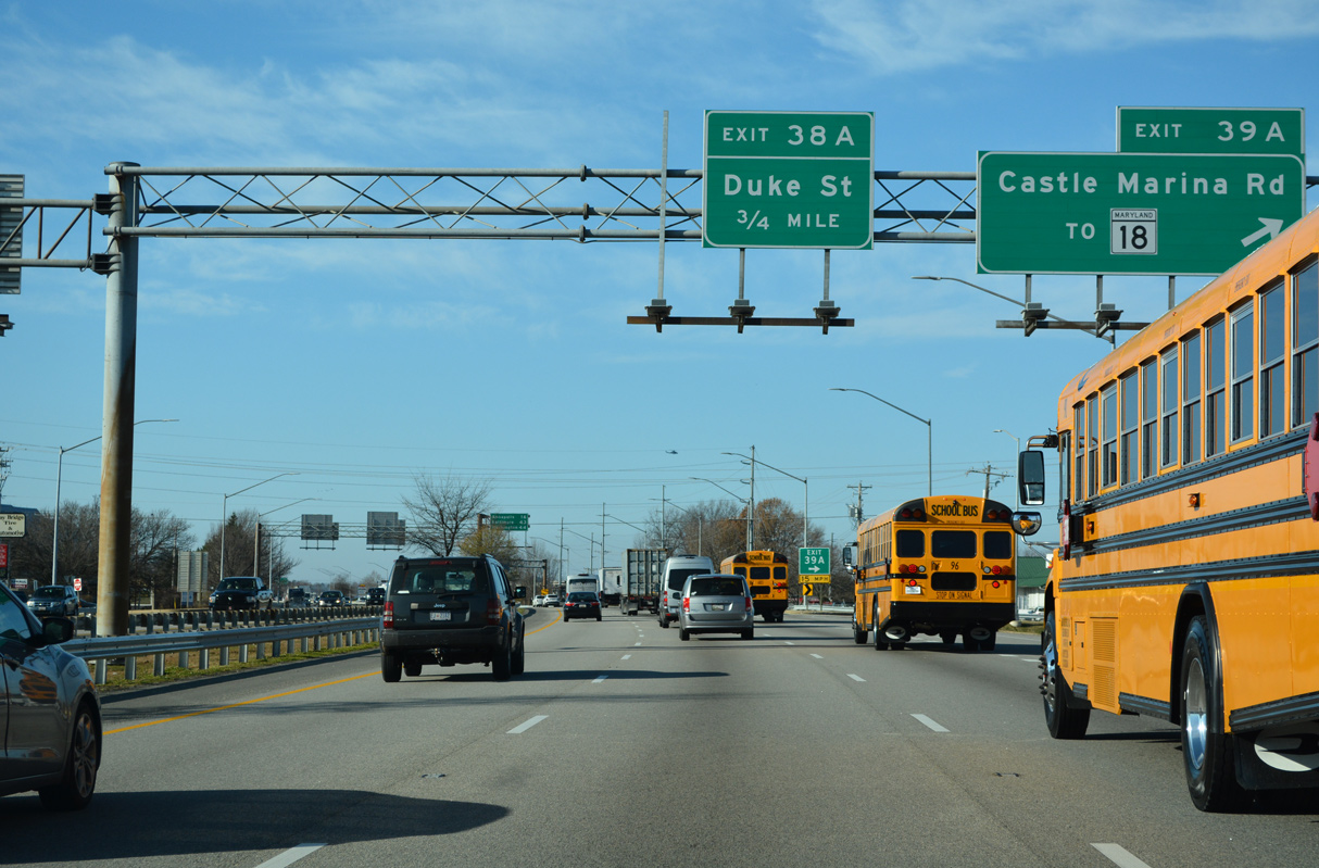
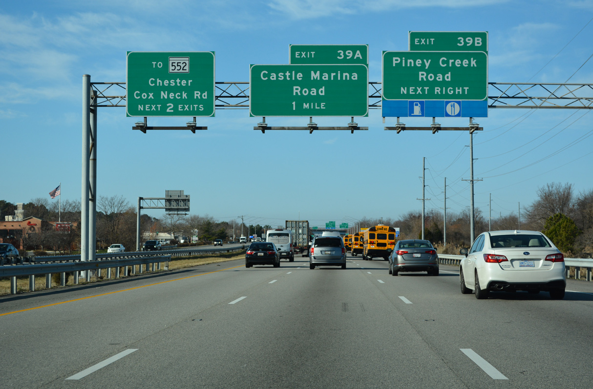
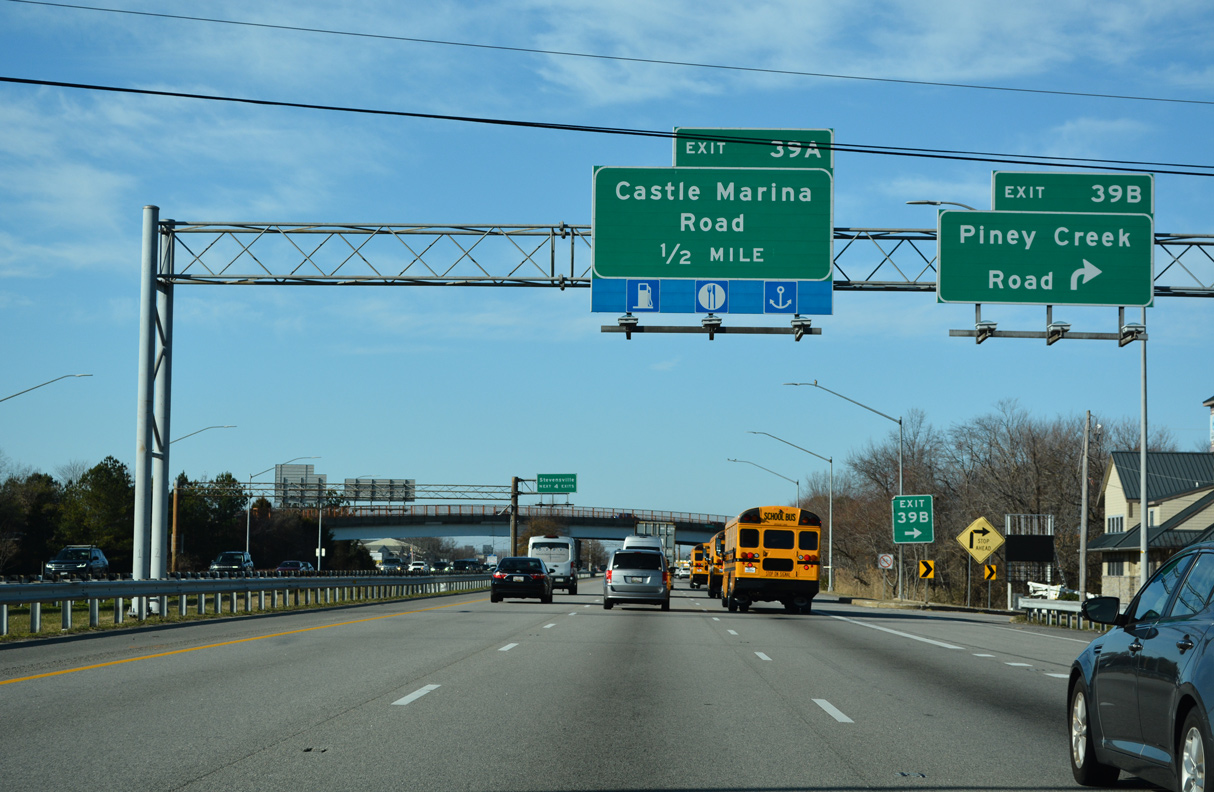
Castle Marina Road (MD 18H) stems 0.19 miles north from Exit 39 A to a roundabout with Main Street (MD 18A/18B). Castle Marina Road extends beyond Main Street to the Four Seasons at Kent Island and Bayside developments.
12/21/22
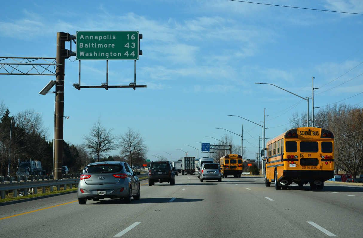
The capital city of Annapolis is 16 miles away. Baltimore is 43 miles to the north via I-97 and Washington 44 miles to the west via U.S. 50.
12/21/22
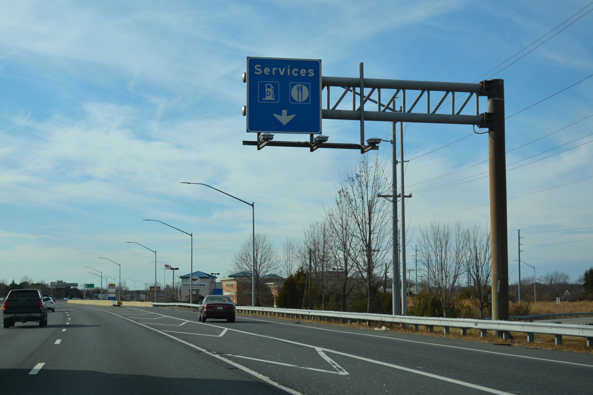
A service road separates from U.S. 50/301 between Exit 39 A and Cox Creek.
12/31/16

Located on the adjacent service road, an escort area precedes the Chesapeake Bay Bridge for permit loads and others requiring assistance crossing the span. A similar service is implemented at the Delaware Memorial Bridge as well.
12/27/22
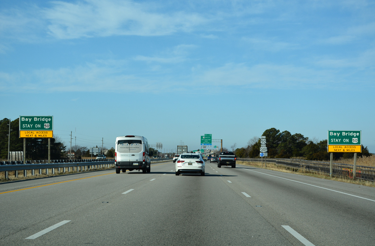
Two exits remain along U.S. 50 west / U.S. 301 north on Kent Island ahead of the Chesapeake Bay Bridge.
12/27/22
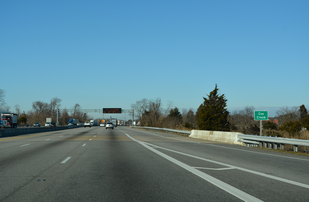
U.S. 50/301 (Blue Star Memorial Highway) west next crosses Cox Creek.
12/27/22
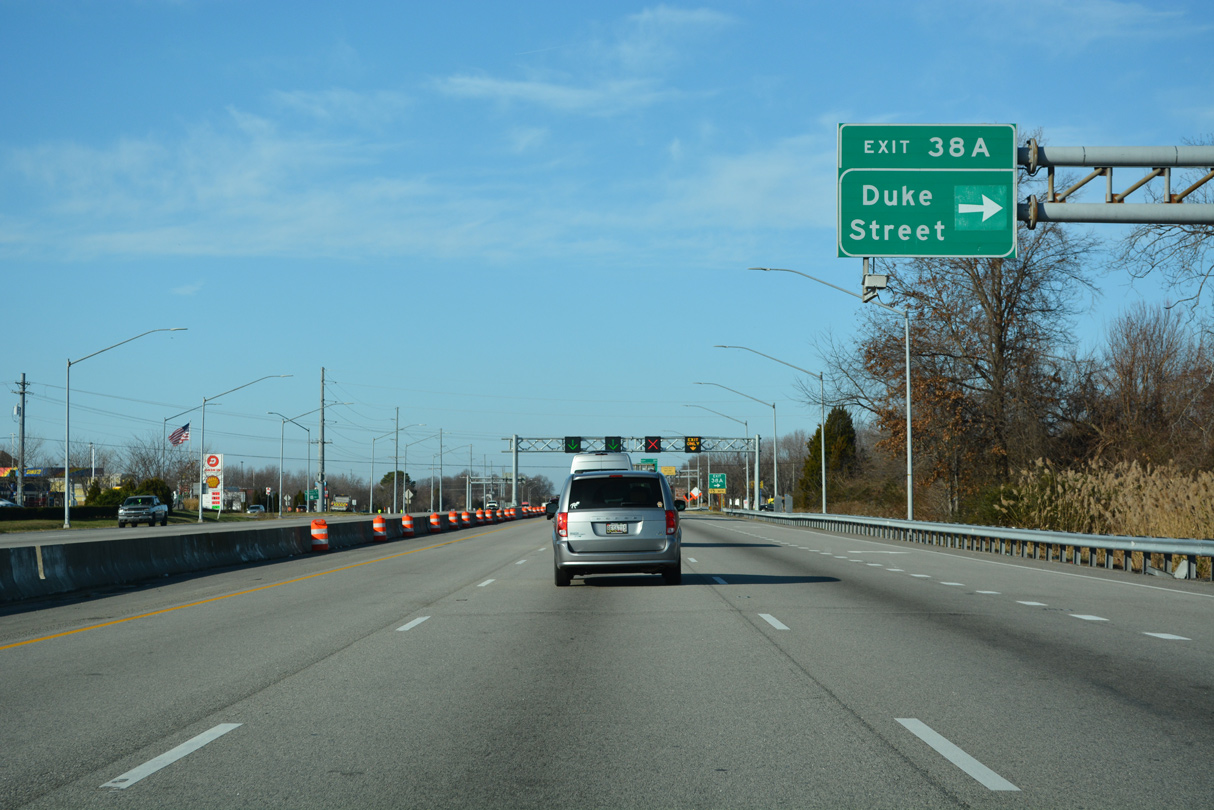
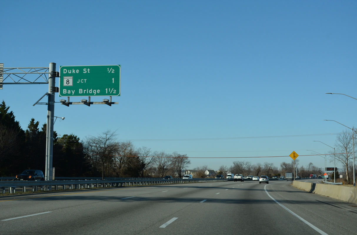
Duke Street links the RIRO ramps at Exit 38 A with MD 18 (Main Street), 0.15 miles to the north in Stevensville.
12/21/22
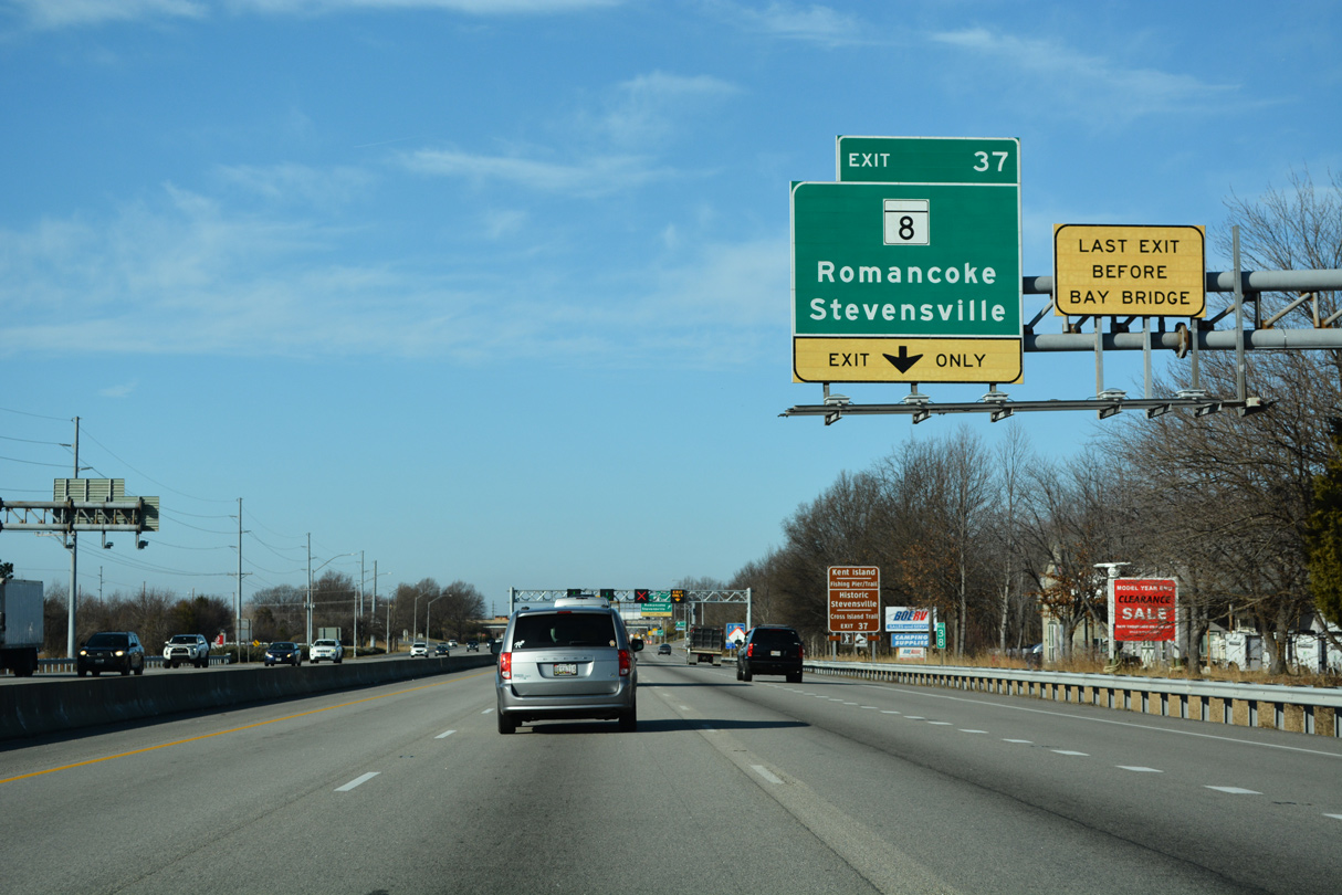
The last exit before the Chesapeake Bay Bridge is the diamond interchange (Exit 37) joining U.S. 50/301 with MD 8 (Business Parkway / Romancoke Road). MD 8 is an 8.35 mile long route.
12/21/22
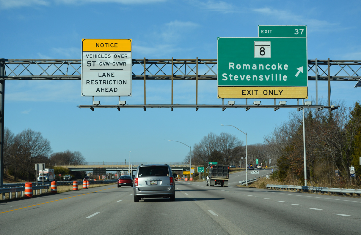
MD 8 (Business Parkway) concludes 0.32 miles to the north at MD 18 (Main Street). MD 18 spurs 3.01 miles north to Love Point. The remainder of MD 8 follows Romancoke Road south to Normans, Mattapex and Romancoke along Eastern Bay.
12/21/22
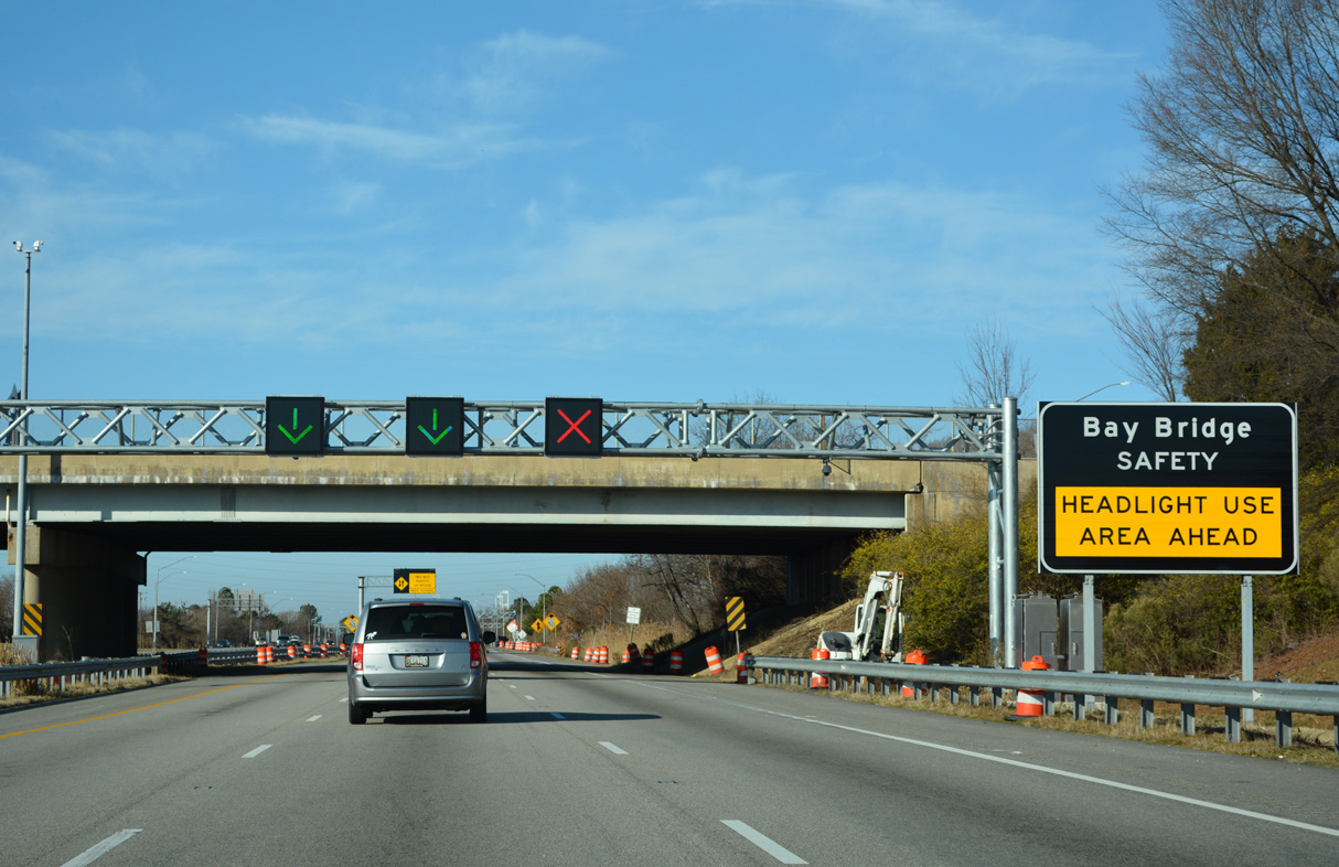
A safety initiative, headlight use is required by motorists crossing the Chesapeake Bay Bridge.
12/21/22
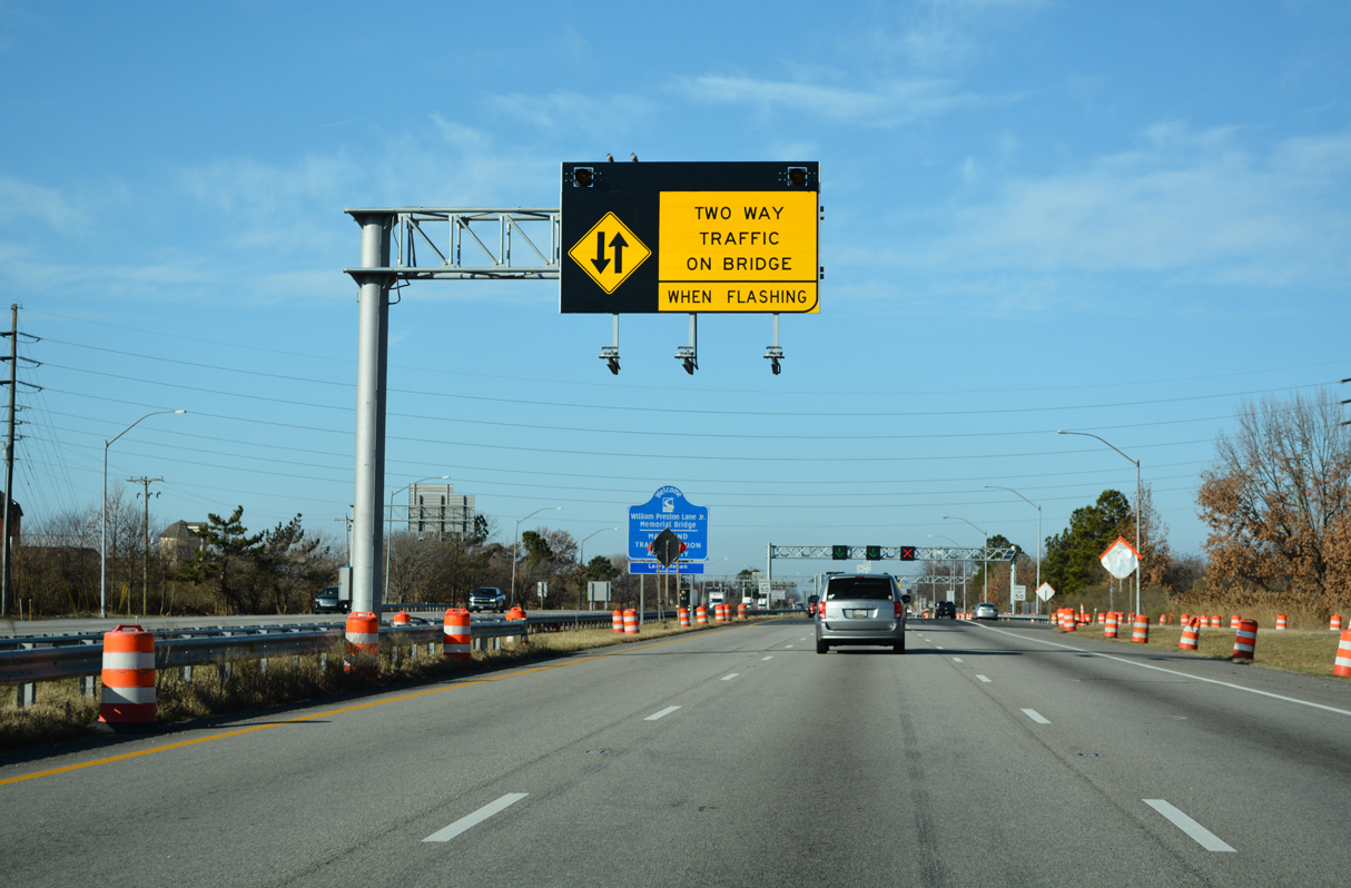
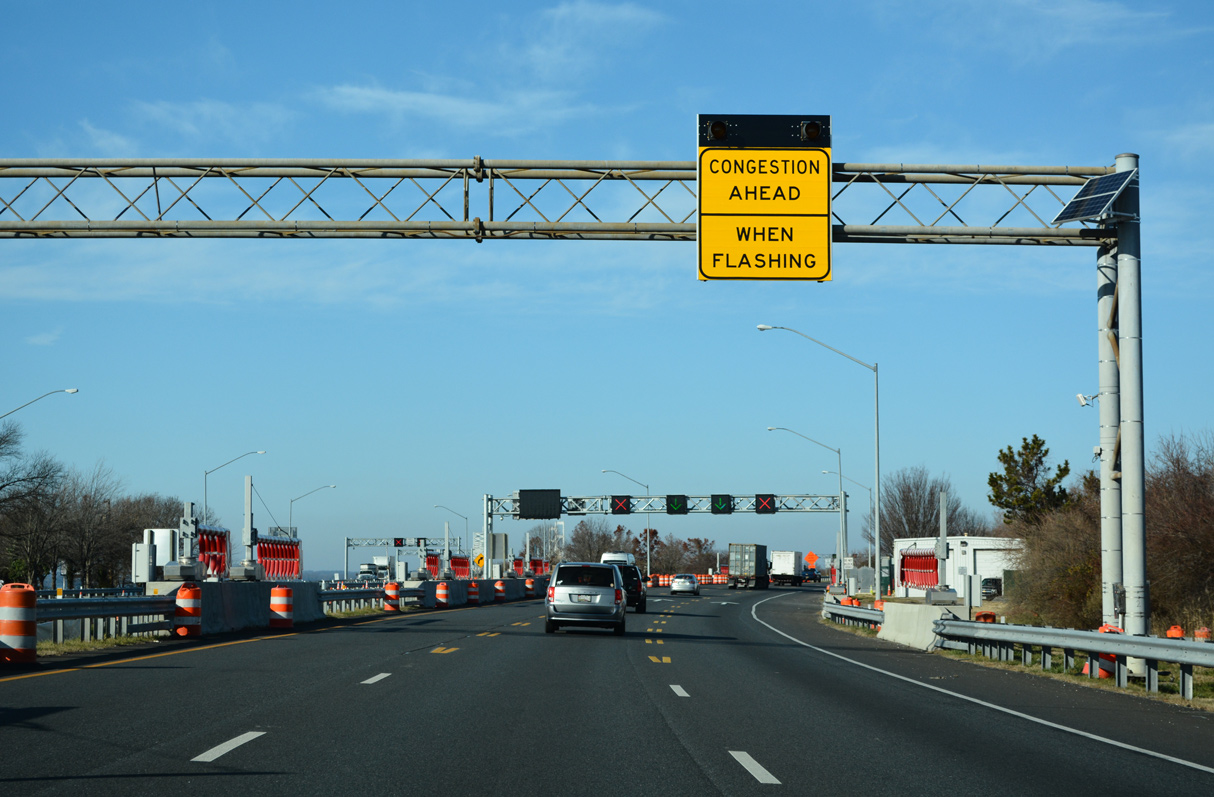
During periods of heavy traffic such as Summer weekends and holidays, the MDTA can implement contraflow on the Chesapeake Bay Bridge westbound span.
12/21/22
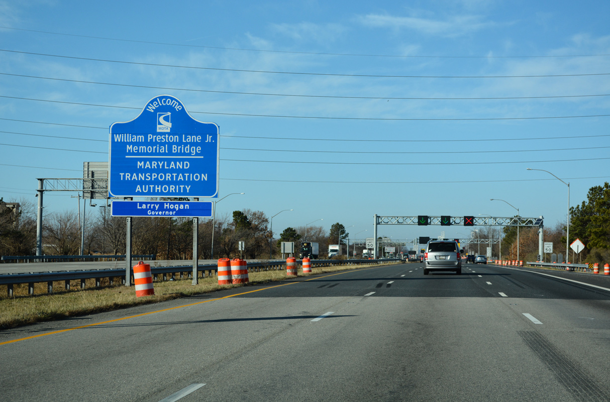
Maintained by the Maryland Transportation Authority (MDTA), the Chesapeake Bay Bridge honors William Preston Lane, Jr. Tolls are collected in the eastbound direction.
12/21/22
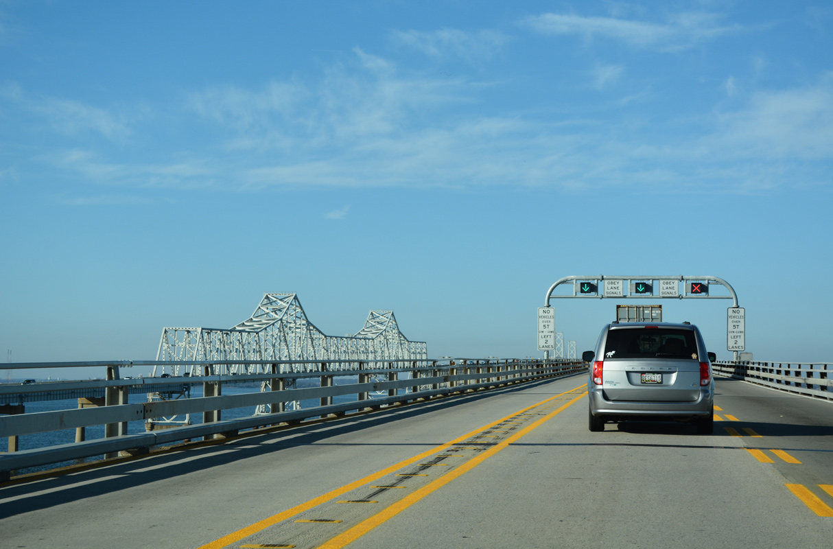
U.S. 50/301 shields preceding the William Preston Lane, Jr. Memorial Bridge.
12/21/22
Congestion occurs regularly across the Chesapeake Bay Bridge during Summer weekends due to heavy beach traffic.
12/21/22
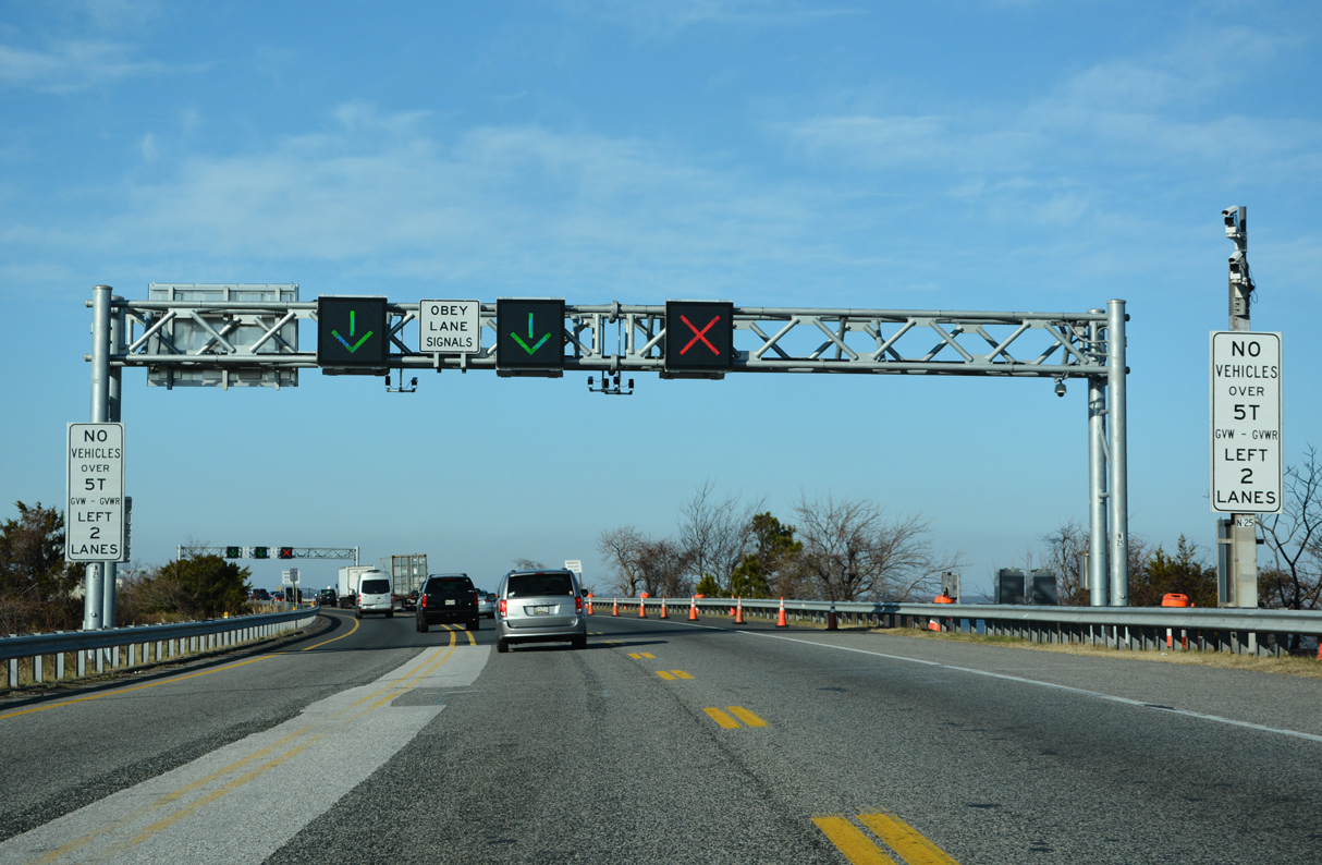
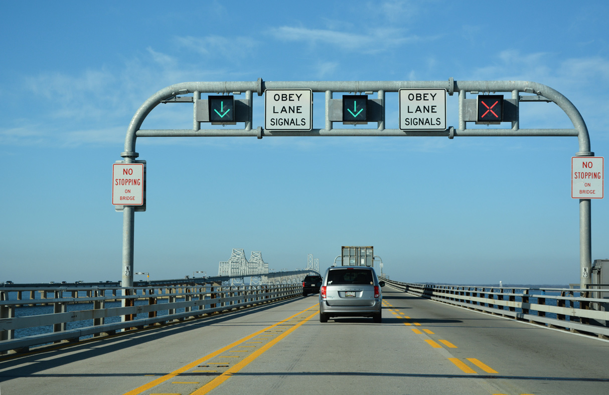
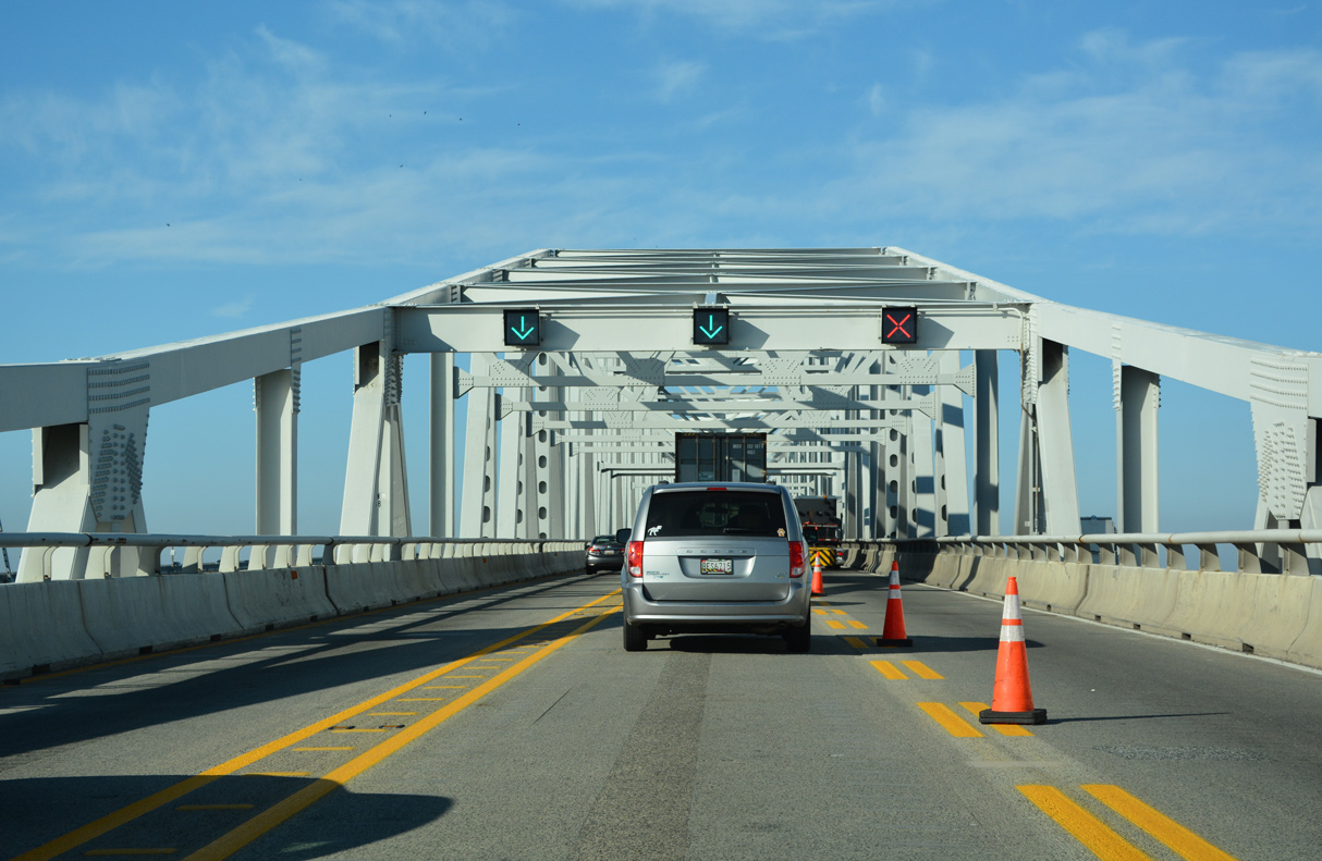
Indicating lane closures due to construction, accidents or during contraflow, a system of lane control signals operate along both the approaches and spans of the William Preston Lane, Jr. Memorial Bridge.
12/21/22
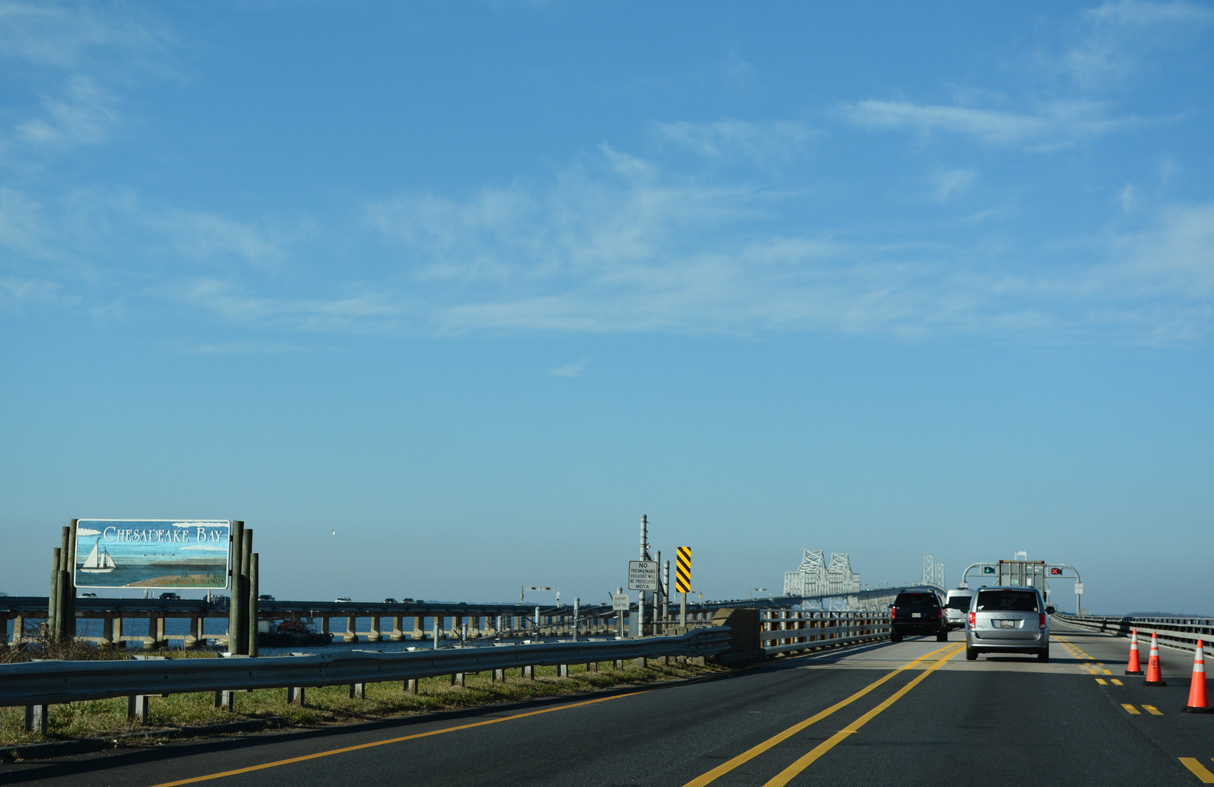
Chesapeake Bay spreads north to the Susquehanna River and Northeast River in Cecil County and south to the Atlantic Ocean by Virginia Beach, Virginia.
12/21/22
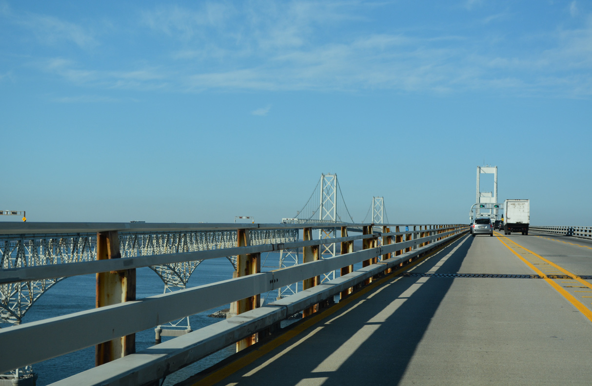
The William Preston Lane, Jr. Memorial Bridge consists of a three lane span westbound and a two lane span eastbound.
12/21/22

Costing $45 million to build, the eastbound crossing on the Chesapeake Bay Bridge opened to traffic on July 30, 1952 (MDTA, 2018).
12/21/22

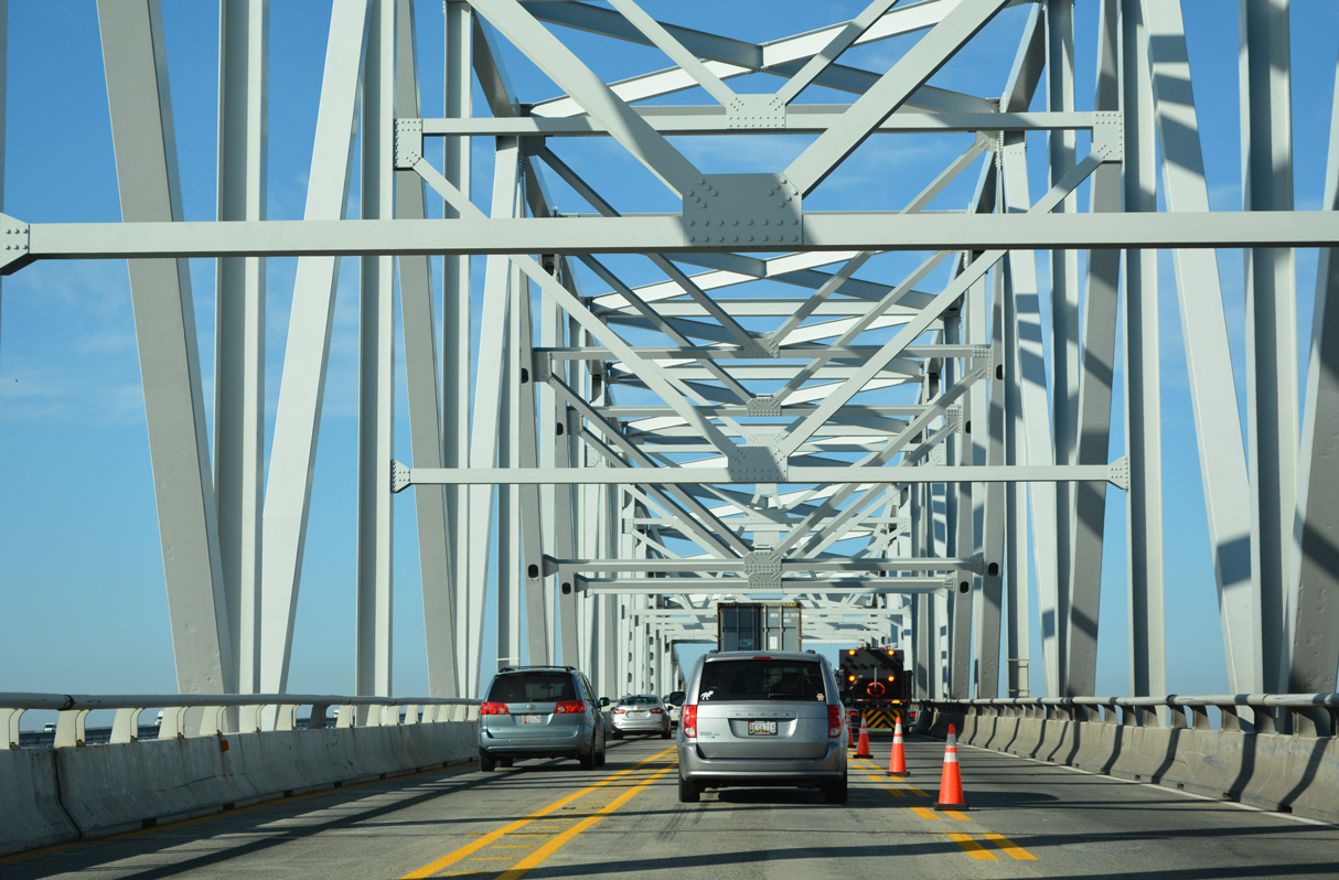
The cantilever truss sections of the William Preston Lane, Jr. Memorial Bridge span the east channel of Chesapeake Bay.
12/21/22
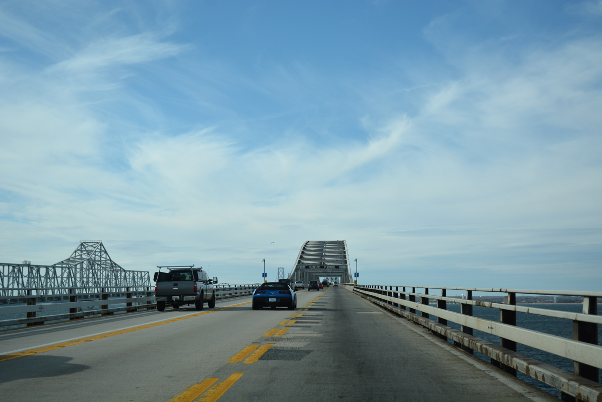
The westbound span accommodate three lanes across a 41.0 foot wide deck (Baughn, n.d.b). The eastbound bridge carries two lanes on a 31.2 foot wide deck (Baughn, n.d.c).
12/31/16
The westbound bridge across Chesapeake Bay opened to traffic on June 28, 1973 (MDTA, 2018). The span was reconstructed in 2001 (Baughn, n.d.b).
12/21/22
The suspension bridges crests at 186 feet (MDTA, 2018) above the main channel of Chesapeake Bay.
12/21/22
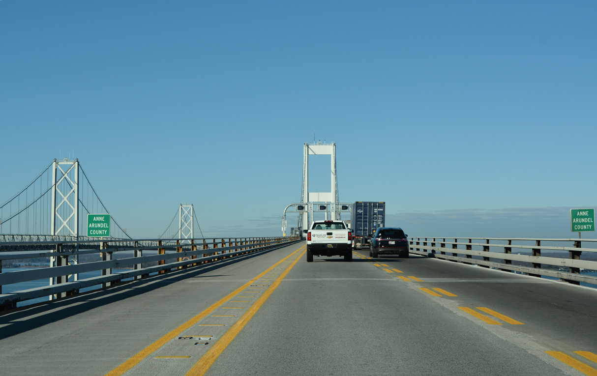
U.S. 50/301 enter Anne Arundel County 2.07 miles beyond the east shore of Chesapeake Bay.
12/27/22

References:
Baughn, J. (n.d.) BridgeReports.com. https://bridgereports.com/1241716
Maryland Transportation Authority (MDTA). (2018, September 11). The William Preston Lane, Jr. Memorial Bridge. MDTA. https://baybridge.maryland.gov/sites/default/files/Files/baybridge/BB_Fact_Sheet_09-11-18.pdf
Baughn, J. (n.d.) US RTE 50 EB over CHESAPEAKE BAY, Anne Arundel County, Maryland. BridgeReports.com. https://bridgereports.com/1244427
Baughn, J. (n.d.) US 50/301 over KENT ISLAND NARROW, Queen Anne's County, Maryland. BridgeReports.com. https://bridgereports.com/1244428
Photo Credits:
- Alex Nitzman: 09/25/04, 12/31/16, 12/21/22, 12/27/22
Page Updated Wednesday January 11, 2023.