
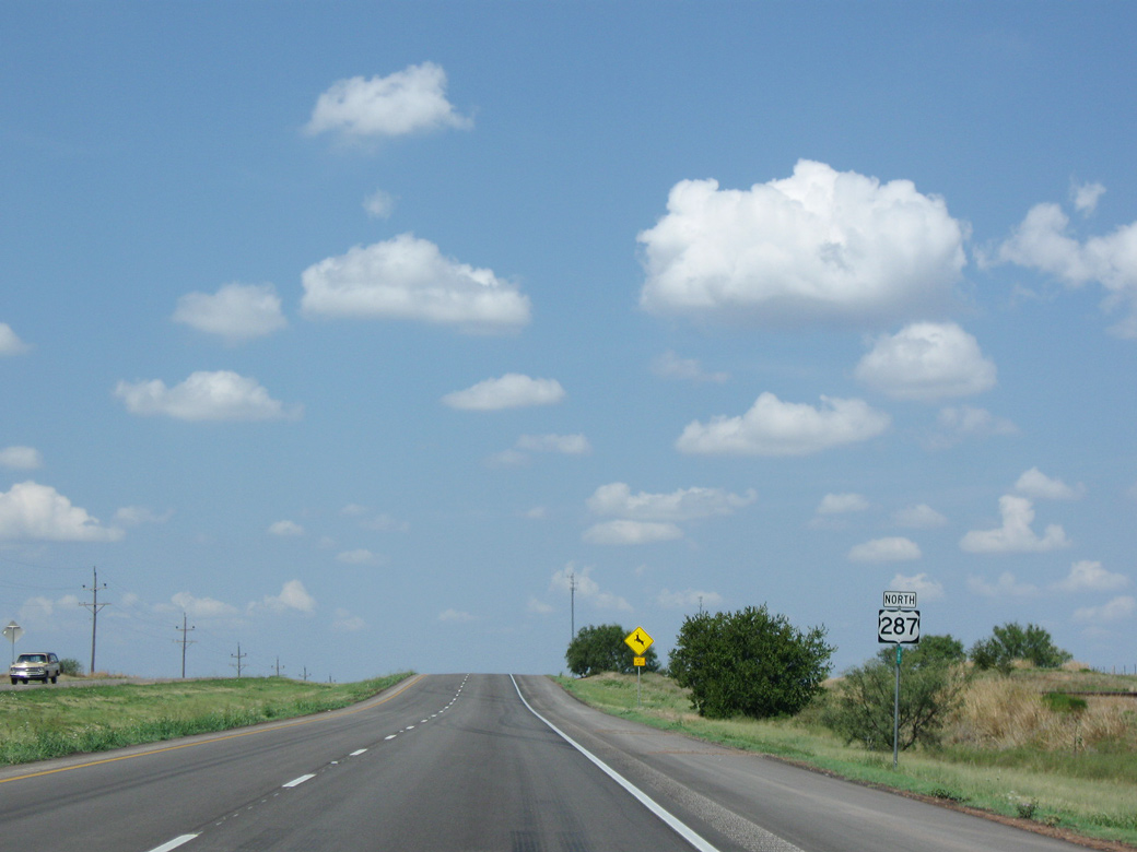
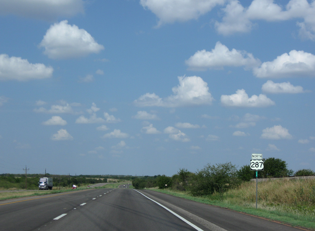
U.S. 287 North - Bowie to Henrietta
 North
North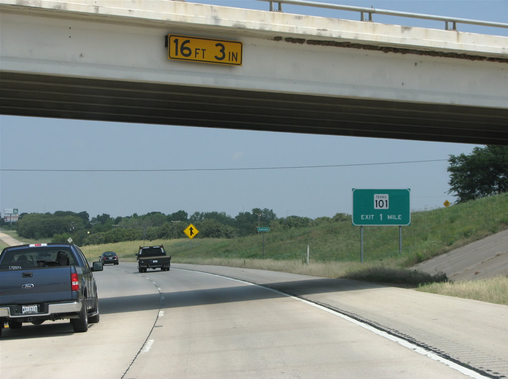
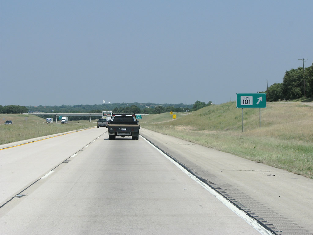
U.S. 81-287 advance north from the split with Spur 511 to a diamond interchange with SH 101 (Forest Avenue).
05/24/08
SH 101 runs north into Bowie on the old routing of US 81, and continues south to US 380 and Bridgeport.
05/24/08
US 81/287 is a freeway through Sunset with two way frontage roads.
05/24/08
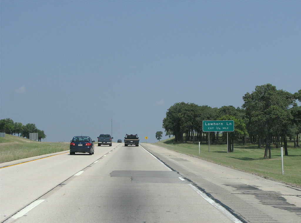
Lawhorn Lane is the next exit. The road runs through the forest belt called the Upper Cross Timbers, which has larger trees like oak, blackjack, walnut and pecan.
05/24/08
US 287/81 northbound at the diamond interchange with Lawhorn Lane. Lawhorn Lane comprises a short connector to adjacent SH 101.
05/24/08
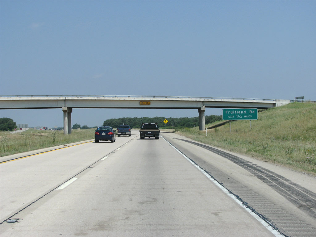
The off-ramp to Fruitland Road lies 1.25 miles north of the Lawhorn Lane overpass along U.S. 81-287.
05/24/08
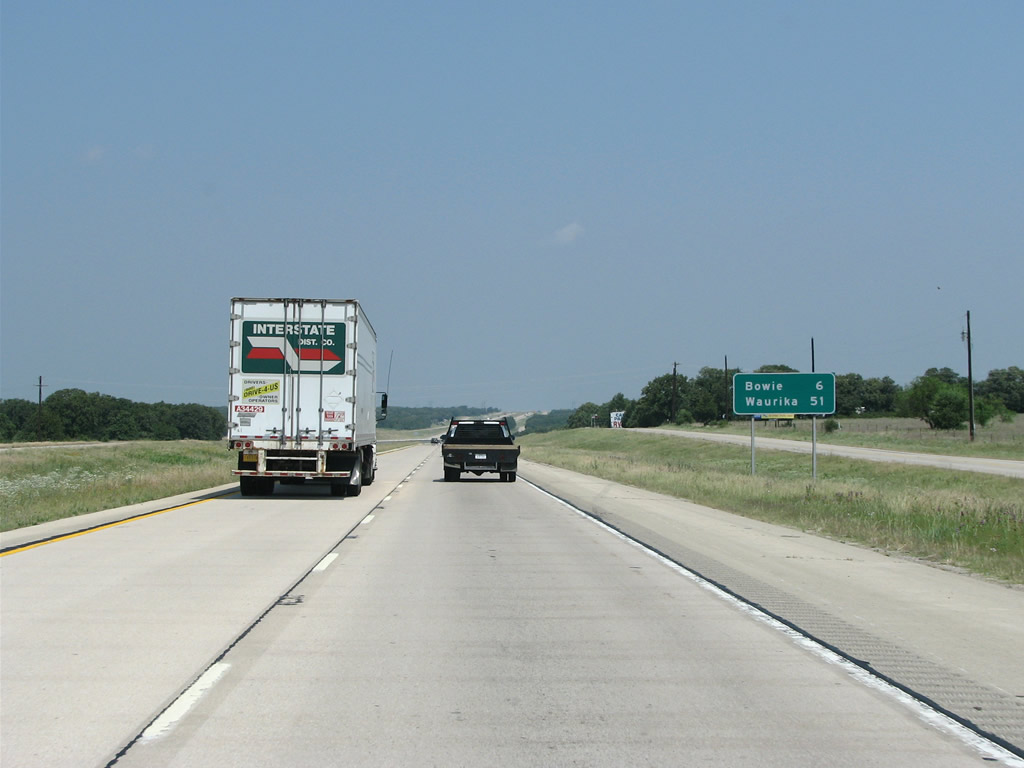
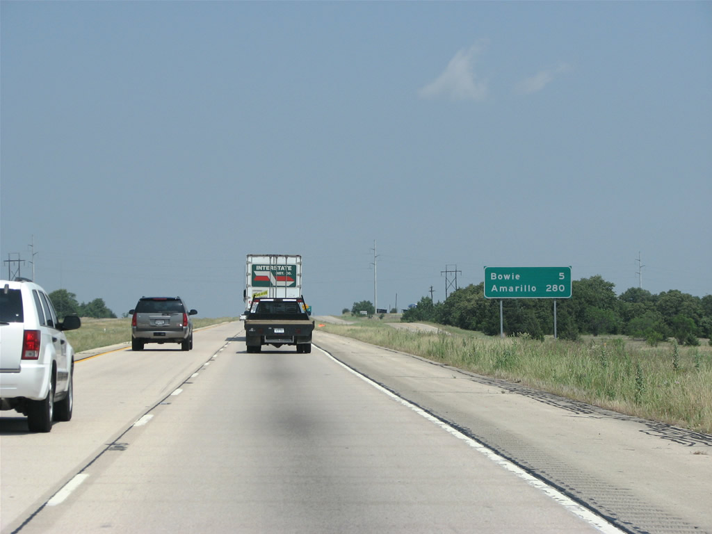
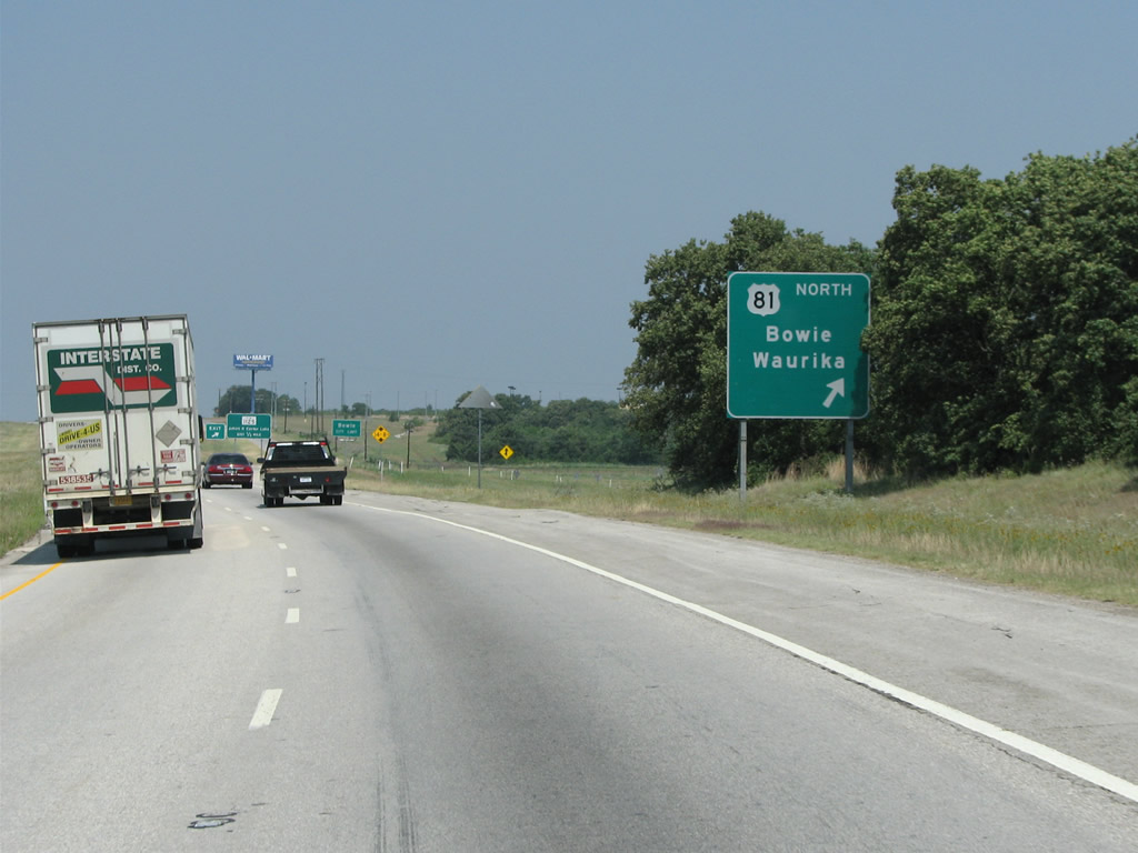
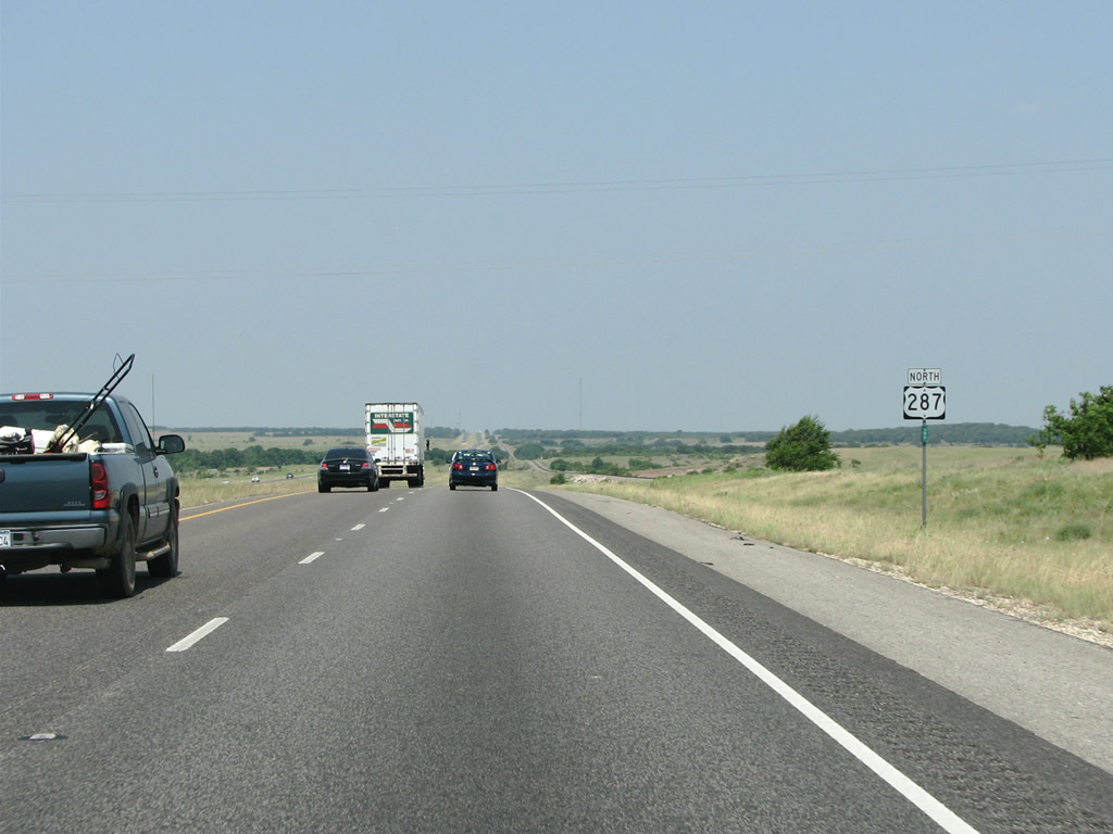
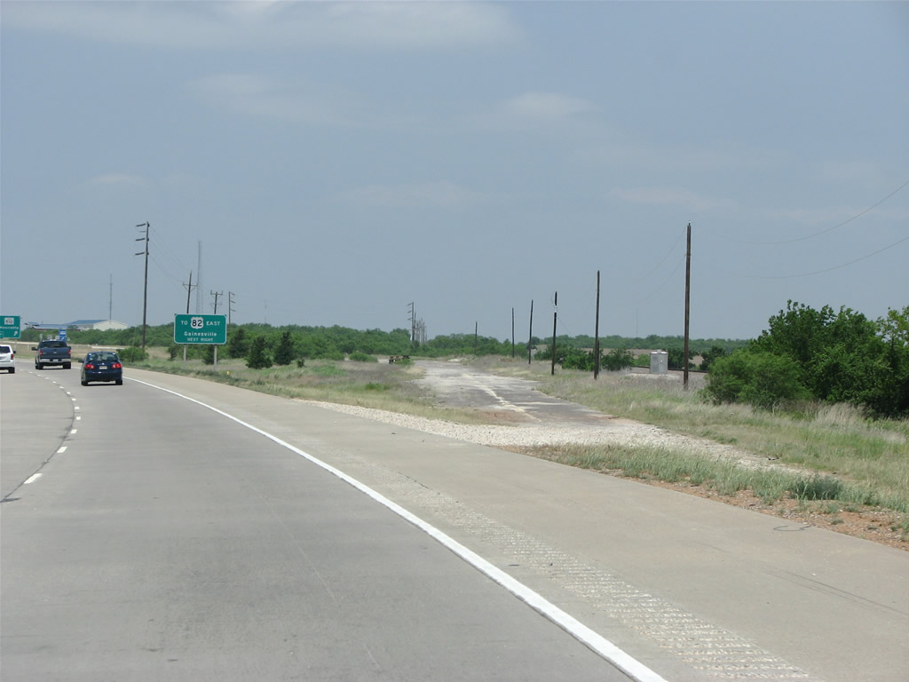
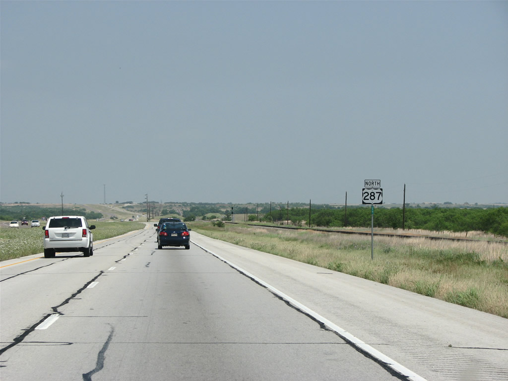
Bowie and Waurika are shown on this distance sign. Waurika, Oklahoma sits along U.S. 81, while Bowie is the next town along U.S. 287.
05/24/08
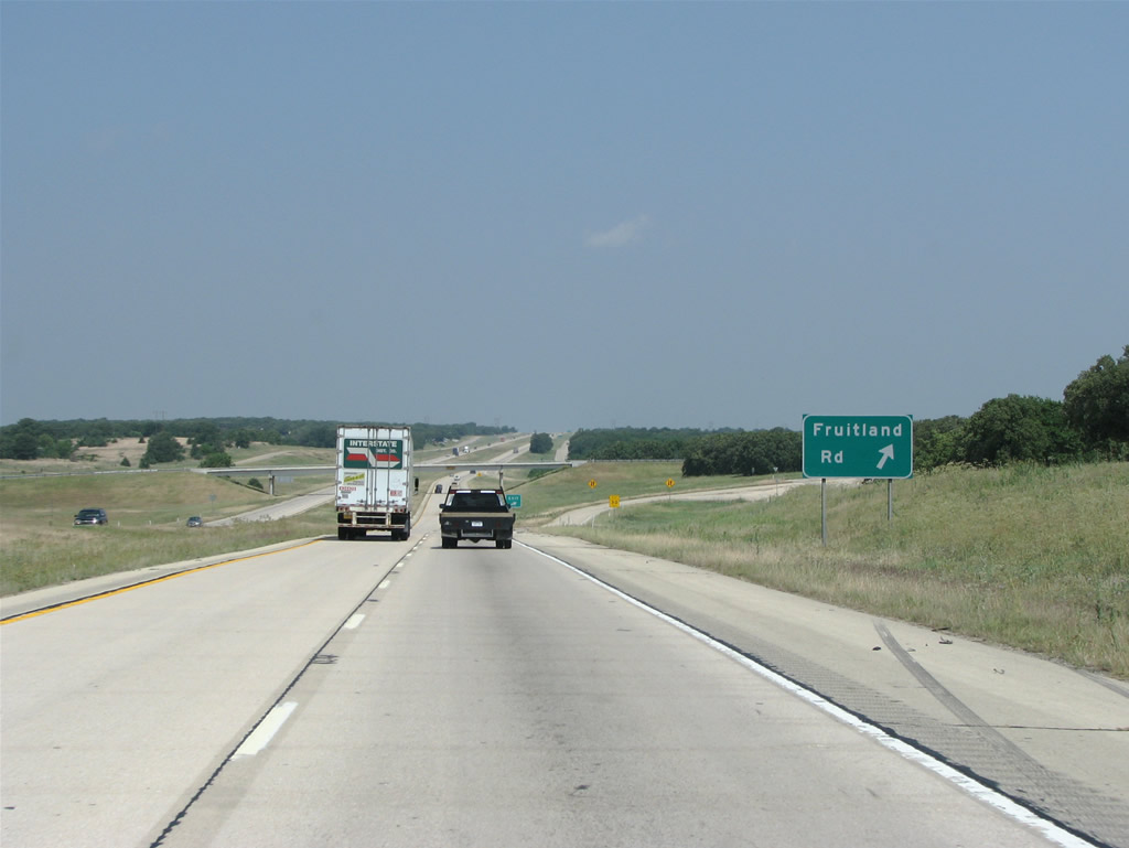
US 287/81 northbound at Fruitland Road, which runs just east to SH 101.
05/24/08

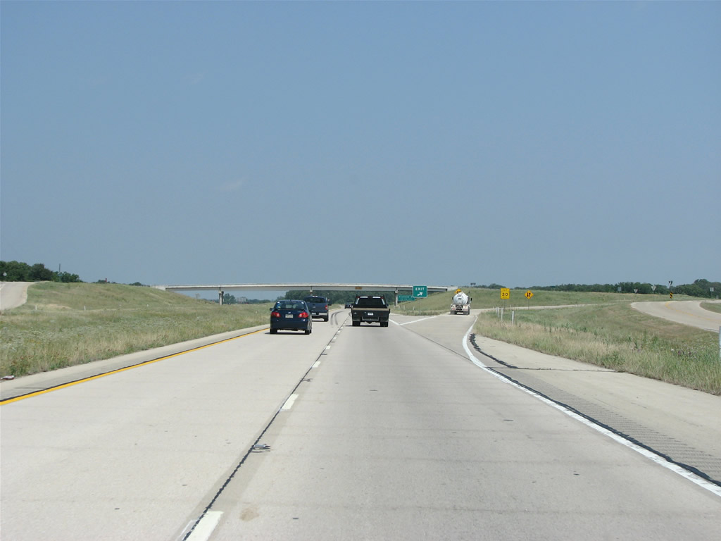
Progressing northwest from Fruitland, the succeeding diamond interchange along U.S. 81-287 is with Wagonseller Road.
05/24/08
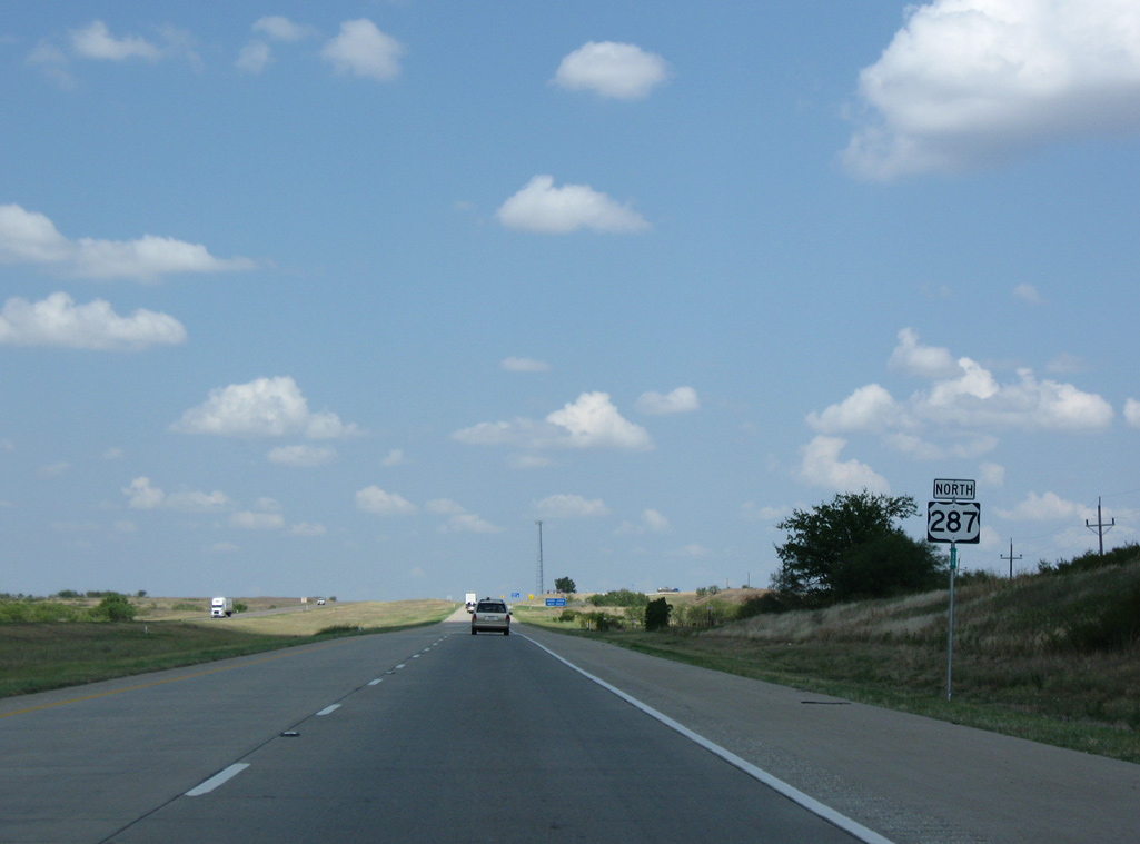
The ensuing distance sign references the U.S. 287 long distance destination of Amarillo.
05/24/08
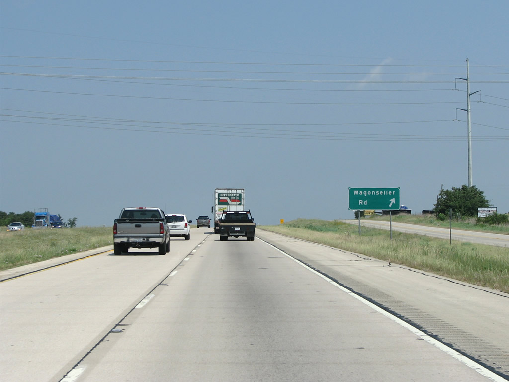
Wagonseller Road is yet another local route that links U.S. 81-287 with parallel SH 101.
05/24/08
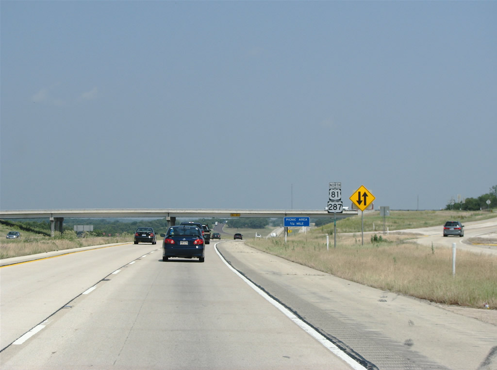
The north end of SH 101 ties into the frontage road system of U.S. 81 and 287 in the city of Bowie. There are no control points for the state highway as it leads back south to Fruitland and Sunset.
05/24/08
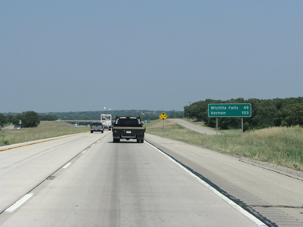
The next two largest cities along U.S. 287, Wichita Falls and Vernon are shown on this distance sign.
05/24/08
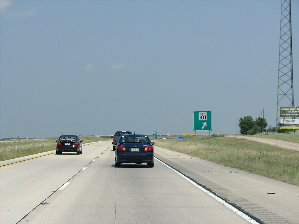
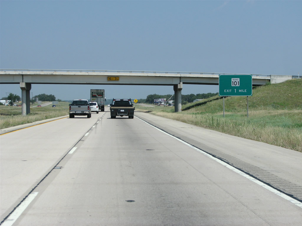
SH 101 concludes a 7.56 mile course at U.S. 81 just beyond its separation with U.S. 287 northbound in the town of Bowie.
05/24/08
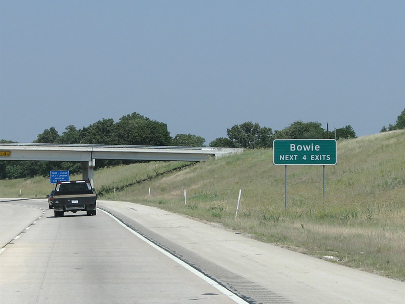
U.S. 287 bypasses Bowie along a freeway. U.S. 81 splits at the ensuing ramp to Wise Street and the Bowie business district.
05/24/08
U.S. 81 branches north from a trumpet interchange with U.S. 287 through Bowie. U.S. 81 extends northward to Ringgold, Wichita, Kansas and ultimately the Canadian border at Pembina, North Dakota.
05/24/08
North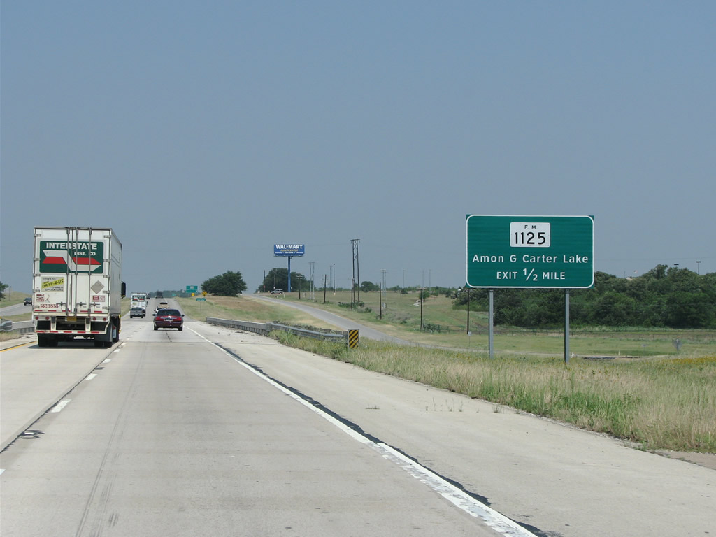
FM 1125 is the second exit in Bowie. Bowie is home to over 5,000 people. Founded in 1882 when the Fort Worth and Denver Railroad came through, the town was named for James Bowie of the Texas Revolution and the Bowie knife.
05/24/08
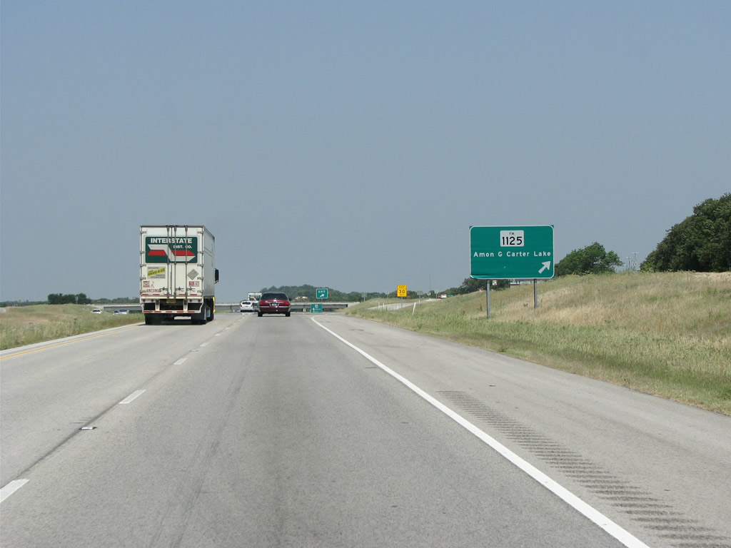
Amon G. Carter Lake is a popular recreational area that also serves as Bowie's water supply. Located just a few miles to the south, it was named after Fort Worth philanthropist and businessman Amon G. Carter. The lake was built in 1955 just a month after Carter's death.
05/24/08

SH 59 runs through Bowie's town square and northeast to Montague. An unincorporated community, Montague is the county seat with just 304 residents as of the 2010 census. This stems from a Texas law that requires county seats to be within a few miles of the geographic center of the county.
05/24/08
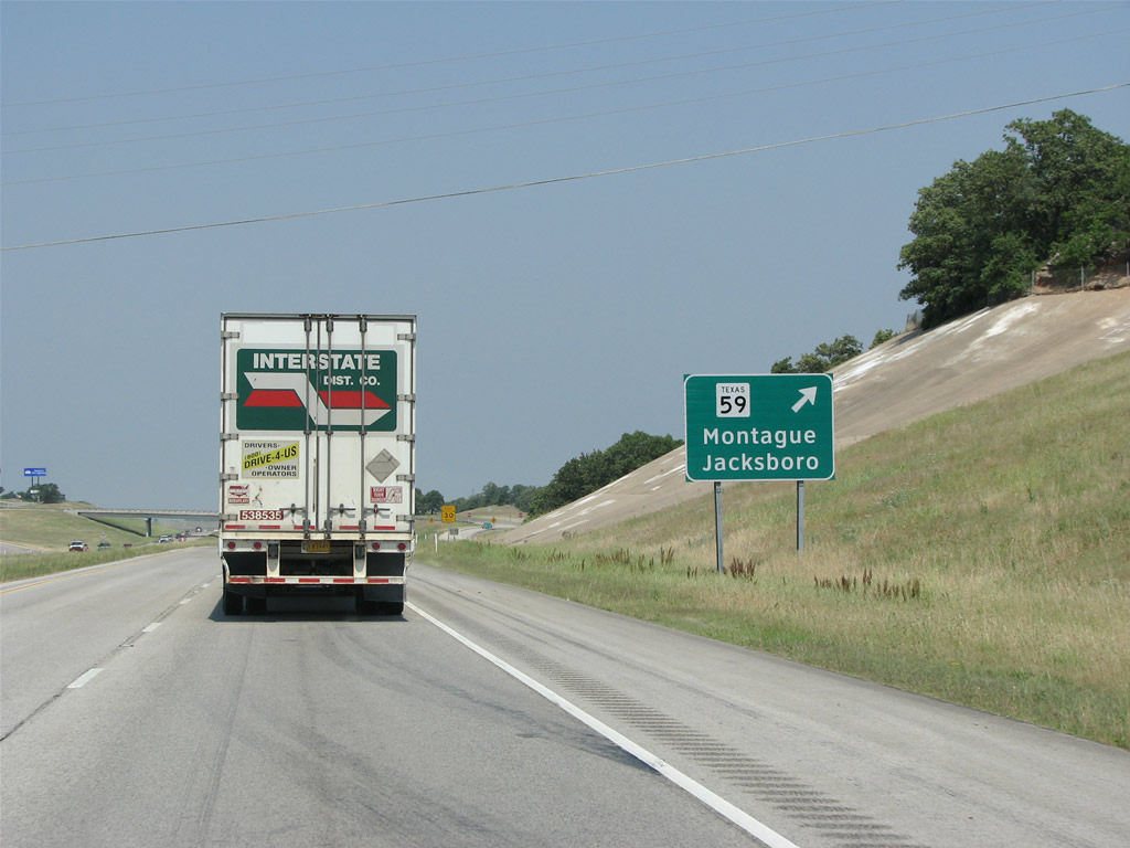
U.S. 287 northbound at the diamond interchange with SH 59. SH 59 runs 56 miles diagonally across Montague County and eventually to Jacksboro.
05/24/08
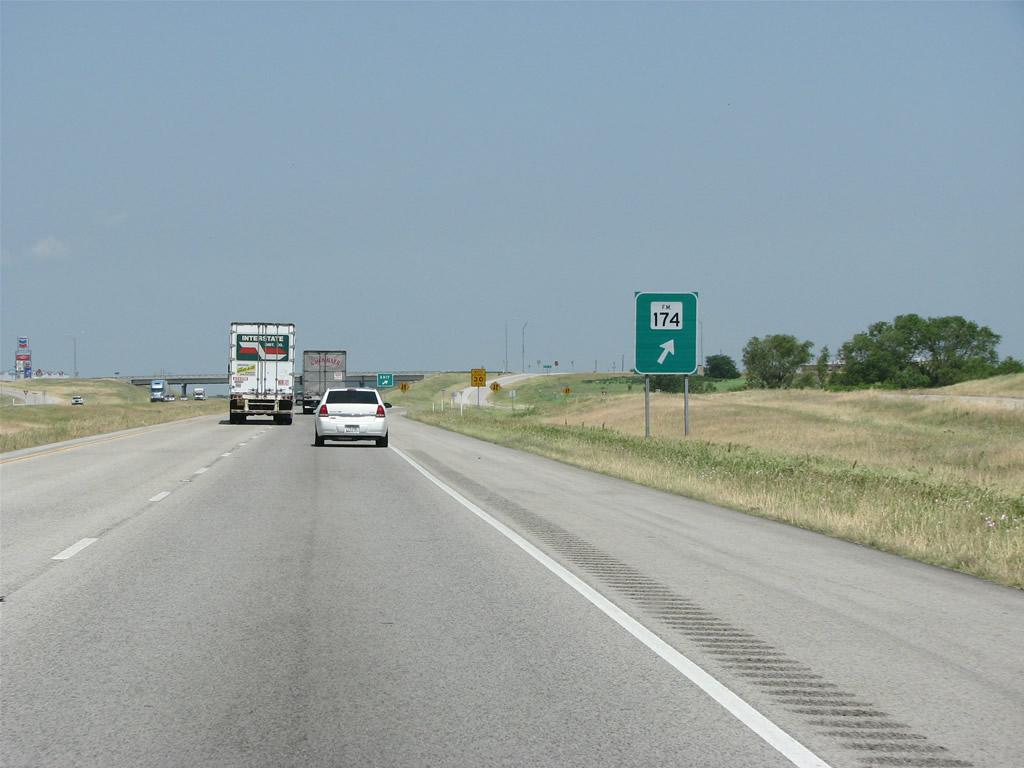
The trend of no control points along U.S. 287 continues here at FM 174, which runs west from Bowie all the way to Windthorst and U.S. 281.
05/24/08
The land's green coverage thins out beyond Bowie, as U.S. 287 makes a turn toward the west.
05/24/08
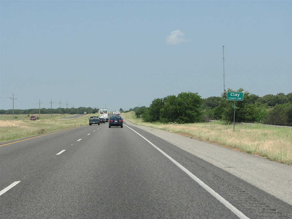
U.S. 287 enters Clay County 7.6 miles northwest of Bowie. The ninety-eighth meridian, the unofficial line between the eastern and western US, bisects the center of the county. The county was named for Kentuckian Henry Clay.
05/24/08
Approaching the rural city of Bellevue, U.S. 287 narrows onto a four lane boulevard.
05/24/08
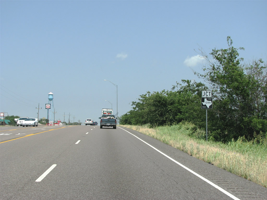
FM 1288 (Franklin Street) ties into U.S. 287 from the Bellevue city center.
05/24/08
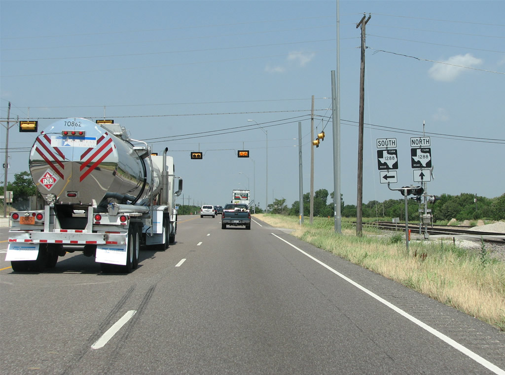
Bellevue was home to 362 as of the 2010 census, and was named by a surveyor for New York City's Bellevue Hospital. The southern branch opf FM 1288 leads 6.23 miles to FM 174 at Vashti and 13.73 miles to SH 59 at Newport.
05/24/08
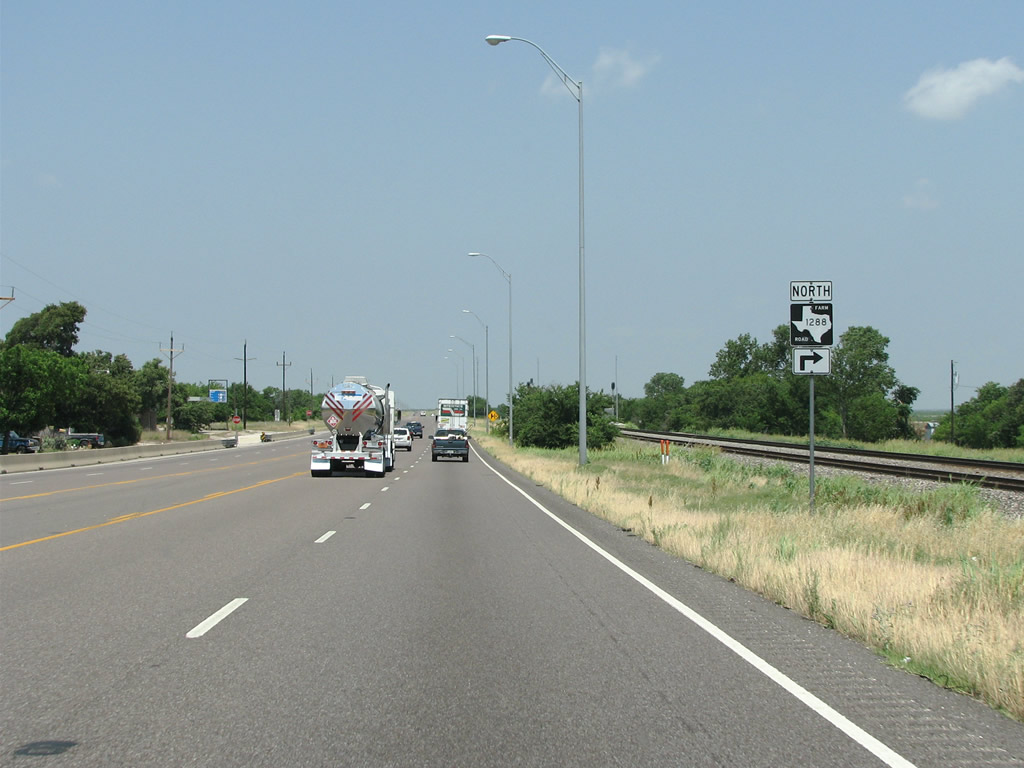
Following a five block overlap with U.S. 287 in Bellevue, FM 1288 resumes a northward course 4.78 miles to the end of state maintenance at Worsham Road.
05/24/08
09/06/09
Leading away from Bellevue, the speed limit along U.S. 287 increases to 75 miles per hour as the roadways separate with a grass median.
09/06/09
U.S. 287 runs through open cattle country northwest of Bellevue.
09/06/09
05/24/08
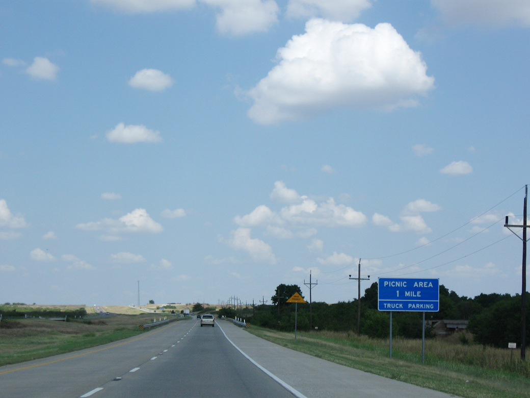
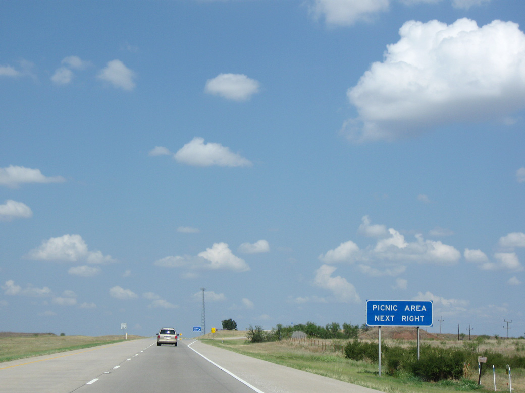
U.S. 287 crosses the East Fork of the Little Wichita River ahead of a picnic / truck parking area.
09/06/09
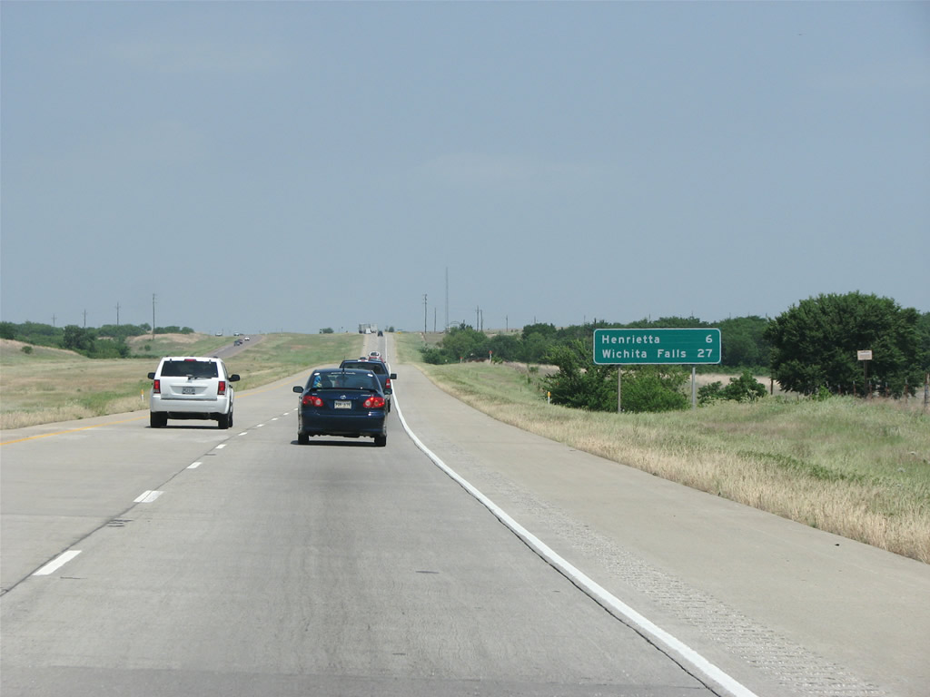
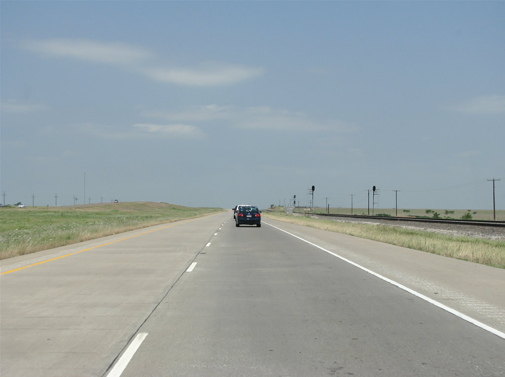
A distance sign stands north of the picnic area by the railroad siding of Dickworsham. Henrietta is the Clay County seat and next town. Wichita Falls is the regional service center sitting 27 miles away
05/24/08
The Fort Worth and Denver Railroad parallels U.S. 287 throughout North Texas. The railroad was chartered in 1873 and completed in 1888. The rails made every settlement they crossed into a town, and greatly influenced growth in this part of Texas. The railroad was eventually taken over by BNSF.
09/06/09
05/24/08

Reassurance marker posted after of the intersection with New York Road south and Alcorn Road north.
09/06/09
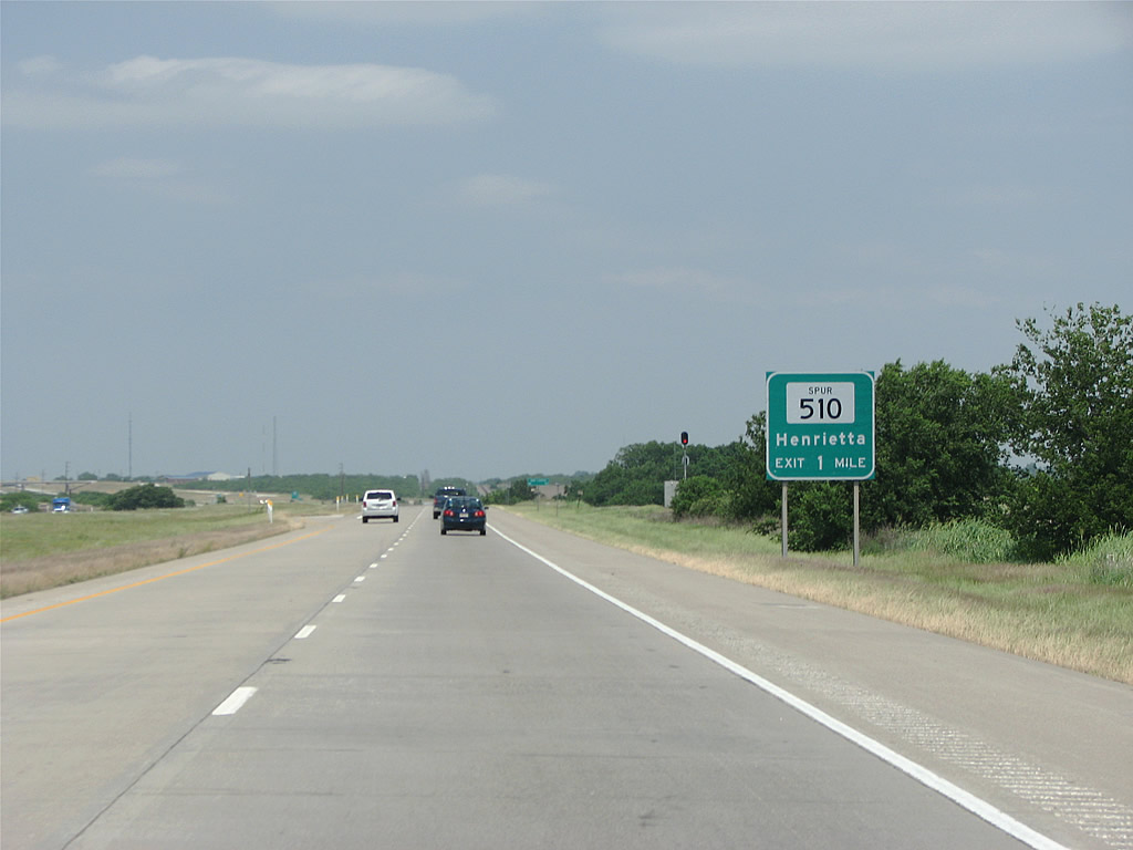
U.S. 287 reaches the city of Henrietta at the upcoming exit for Spur 510.
05/24/08
U.S. 287 shifts to the south of Henrietta on a freeway bypass. A segment of abandoned roadway along old U.S. 287 precedes the diamond interchange with Spur 510 north.
05/24/08

Spur 510 provides a cut off north from U.S. 287 to U.S. 82, the Red River Highway, east to Sherman and Texarkana.
05/24/08
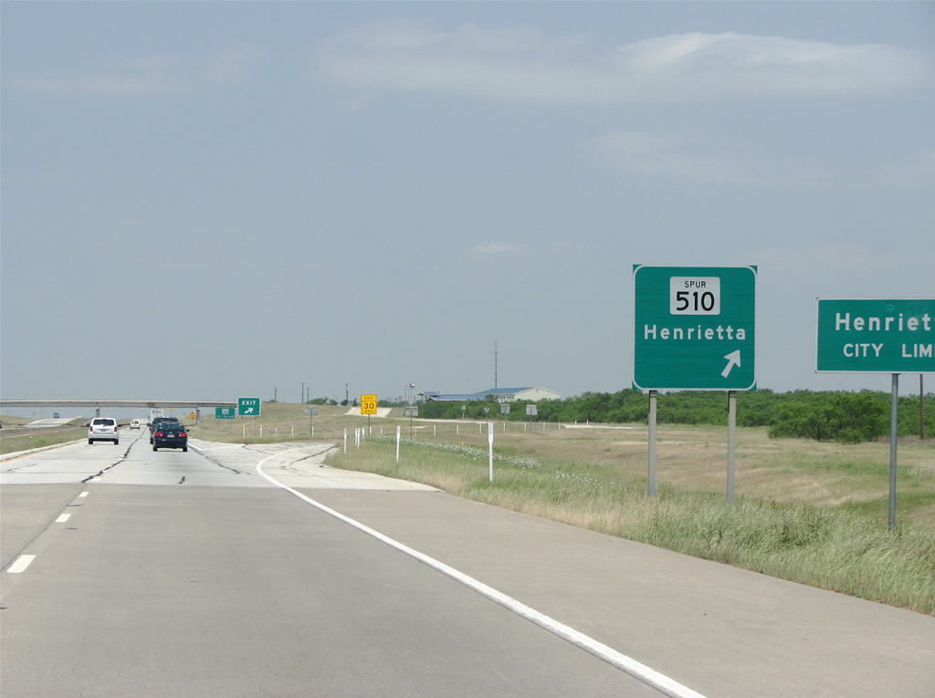
Spur 510 arcs 1.72 miles north to U.S. 82 (Omega Street) east of the Henrietta business district. When Clay County was broken off from Cooke County in 1857, the legislation required the future county seat be named Henrietta. The origin of the name remains a mystery. When it was founded, the town was the farthest west American settlement in North Texas.
05/24/08
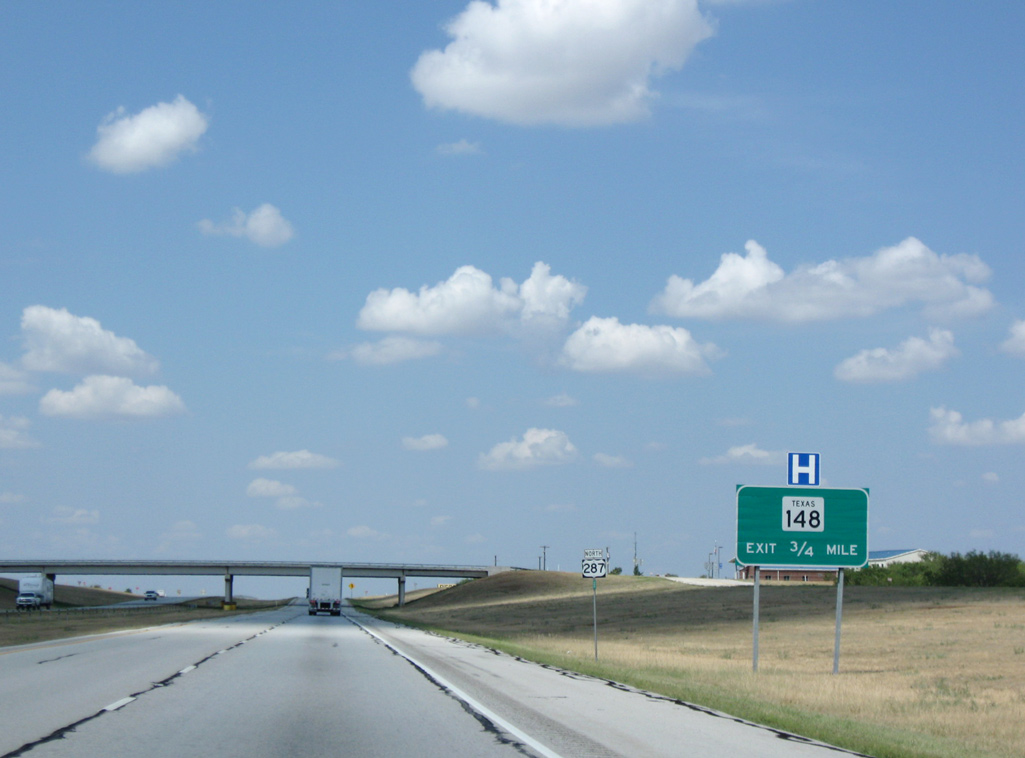
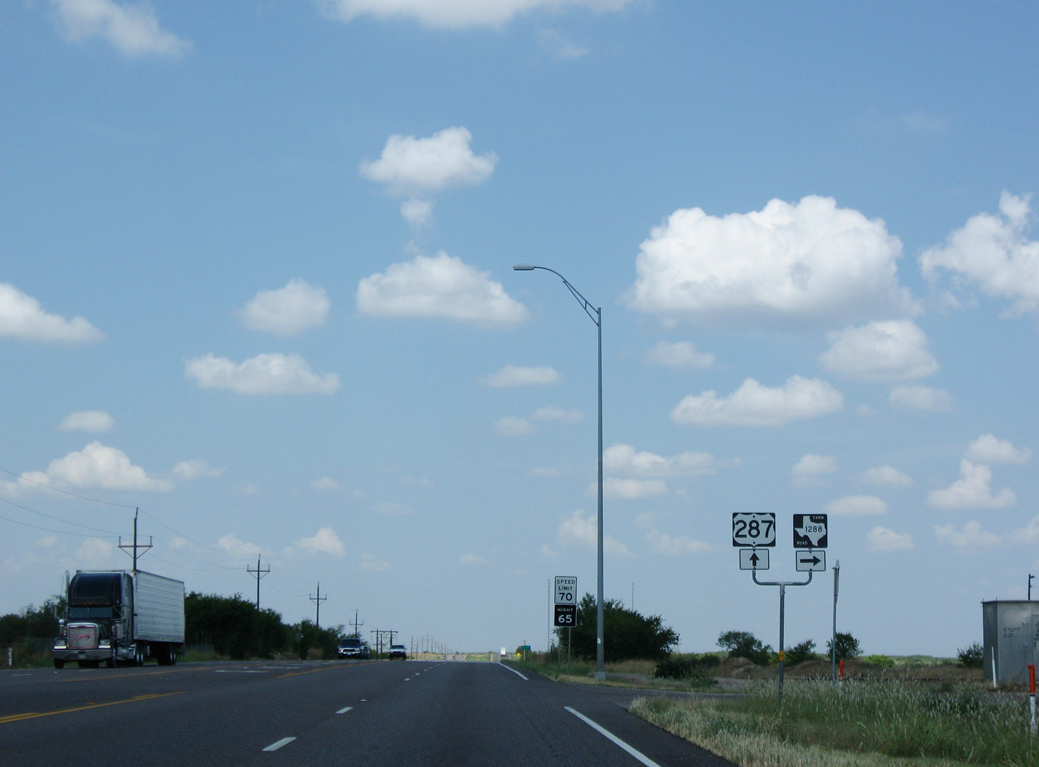
Forthcoming SH 148 originates from U.S. 281 at Jacksboro to the south. The state highway travels 55.48 miles overall to SH 79 at Petrolia north of Henrietta.
09/06/09
U.S. 287 proceeds west through Henrietta to a diamond interchange with SH 148. The 1995 film "The Stars Fell on Henrietta ", starring Robert Duvall, was based and filmed here.
05/24/08
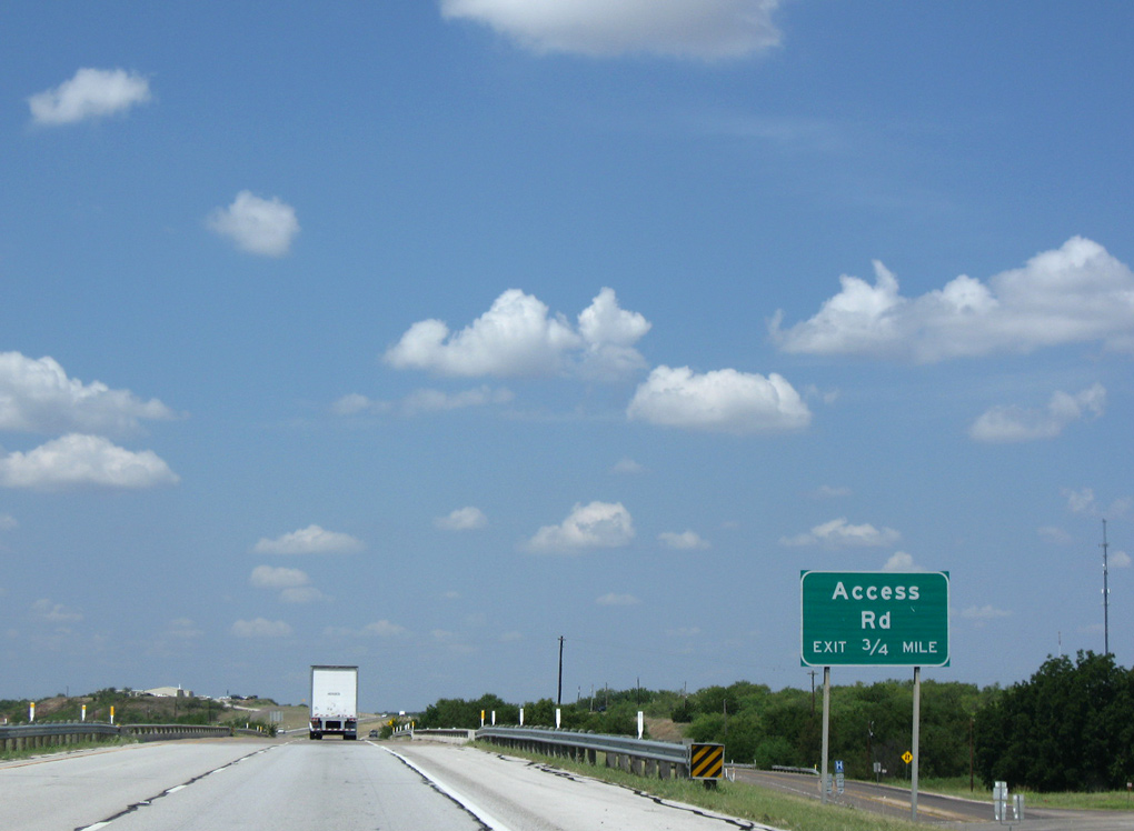
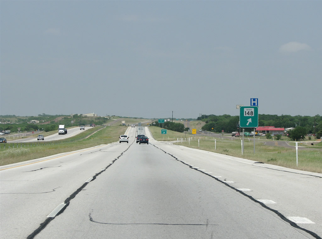
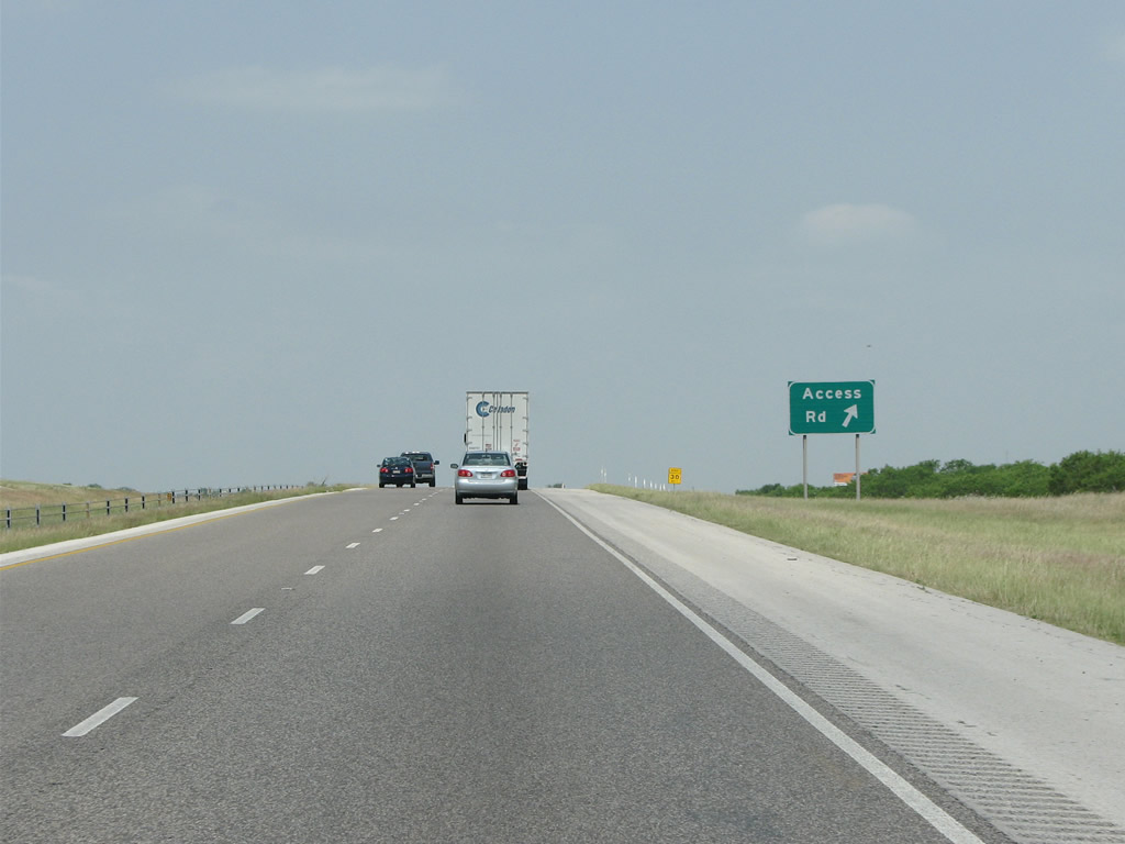
This exit serves businesses and residences along the frontage road west of SH 148. The use of Access Road for this ramp is an exception, as TxDOT generally signs these exits as Frontage Roads.
09/06/09
05/24/08
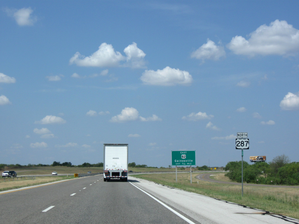
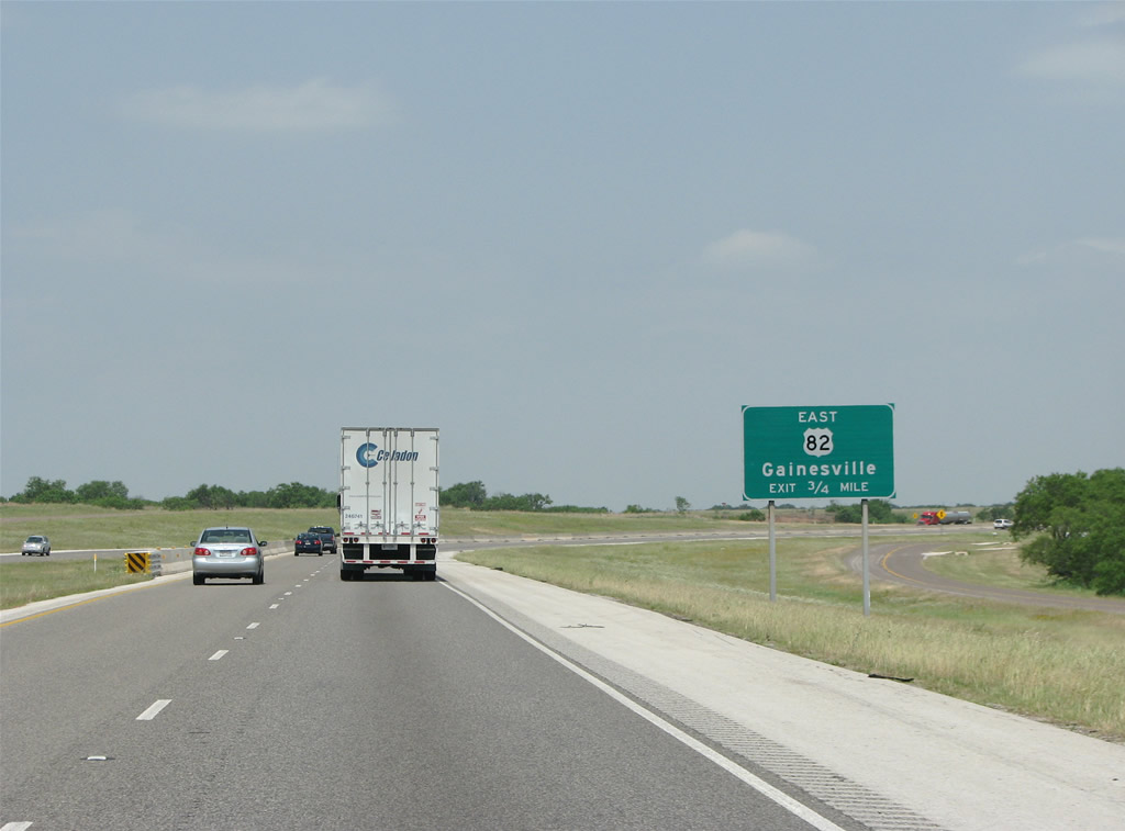
Curving north across the BNSF Railroad, U.S. 287 converges with U.S. 82 (Omega Street) at a folded diamond interchange.
09/06/09
05/24/08
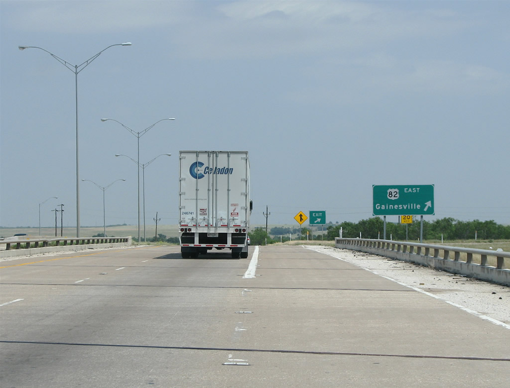
The ramp for U.S. 82 east makes a sharp turn from U.S. 287 northbound. U.S. 82 forms an expressway through Cooke, Grayson and Fannin Counties to the east.
05/24/08
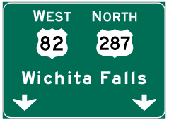
Photo Credits:
- Justin Cozart: 05/24/08
- ABRoads: 09/06/09
Connect with:
Page Updated Monday July 08, 2019.