Interstate 45
Overview
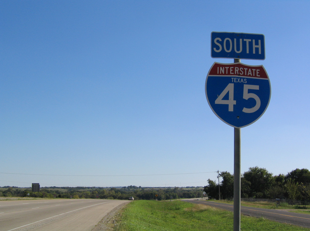
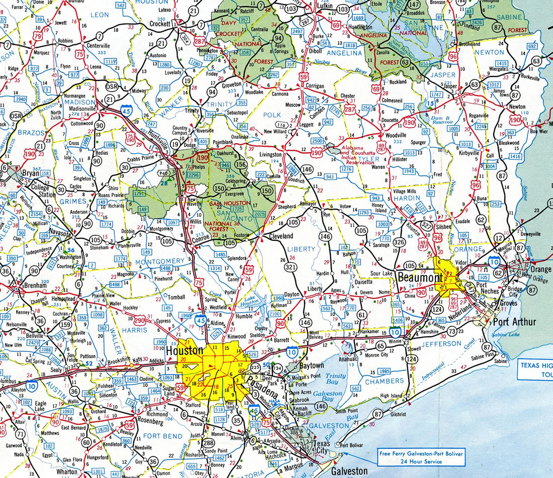
An intrastate route, Interstate 45 joins Houston and the Texas Gulf Coast with the Dallas/Ft. Worth Metroplex. Beginning on Galveston Island, IH 45 replaced U.S. 75 along the Gulf Freeway, a pre-Interstate era highway constructed between Galveston and Houston. Angling northwest, the freeway passes by NASA’s Johnson Space Center toward South Houston, Park Place and Downtown Houston.
Within central Houston, IH 45 briefly runs side by side with IH 10 and U.S. 90. This will further change with the North Houston Highway Improvements Project, which relocates IH 45 into dual freeway configuration with IH 69 / U.S. 59 along the Eastex Freeway along the east side of Downtown. IH 45 will also extend further adjacent to IH 10 north of Downtown before joining the North Freeway to Westfield, Spring, The Woodlands and other northern Houston suburbs.
Beyond Conroe, IH 45 transitions to a rural freeway through Sam Houston National Forest. Exiting the forest, the freeway shifts westward from Huntsville to Madisonville while remaining rural to Coriscana. U.S. 287 combines with the freeway between Corsicana to Ennis, where it branches northwest to Waxahachie, Mansfield and Fort Worth. With increasing industrial development, IH 45 proceeds from U.S. 287 to Ennis, Ferris, Wilmer and south Dallas.
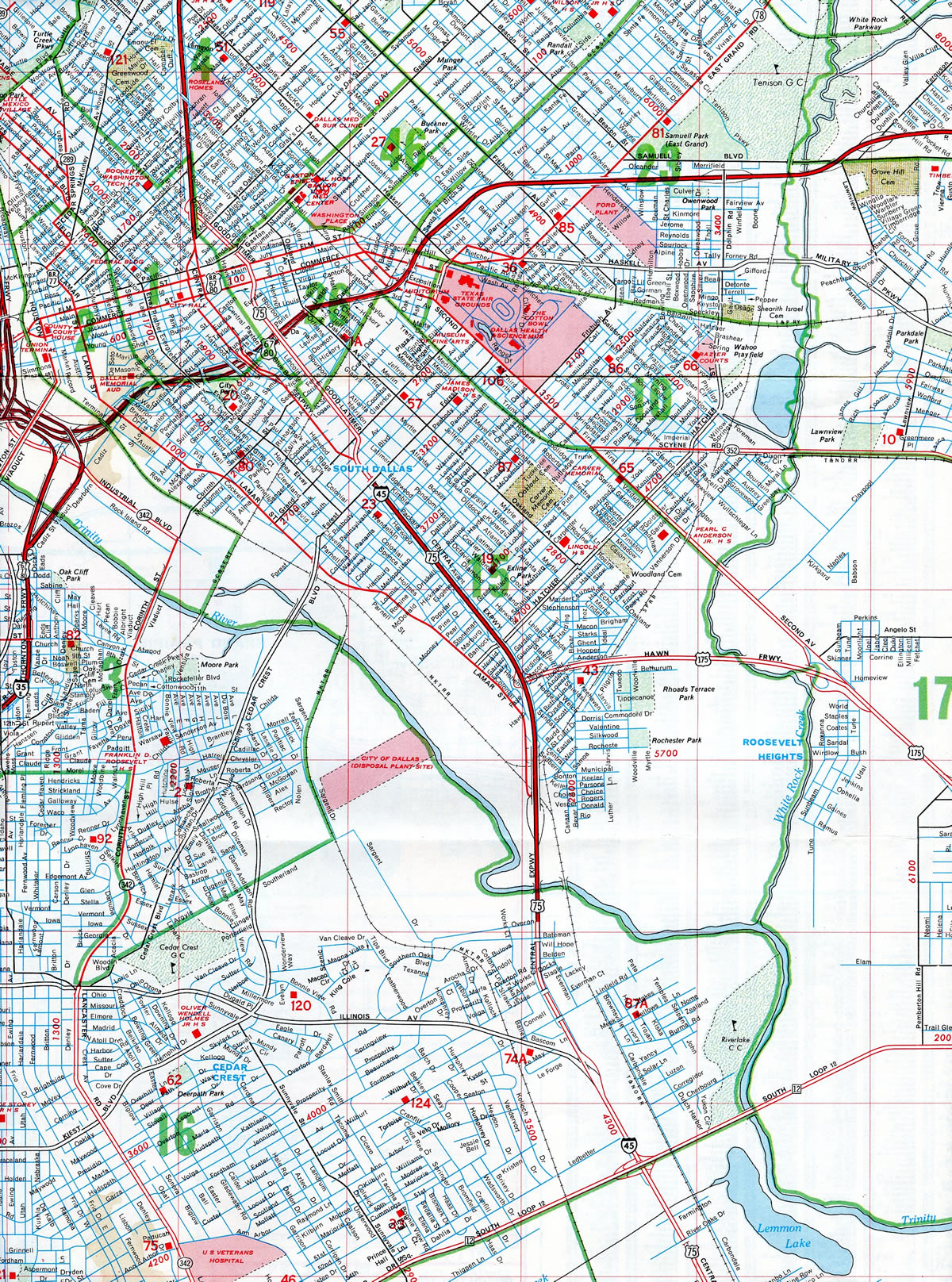
IH 45 concludes at IH 30 and U.S. 75 (Central Expressway) by Deep Ellum and Downtown Dallas. The southern 1.427 miles of U.S. 75 double as unsigned IH 345. Exit numbers continue northward along the IH 345 segment to Spur 366 (Woodall Rogers Freeway), where they reset using a sequential system along the remainder of U.S. 75 northward.
 History
Approved by the Texas State Highway Commission in 1962 with 286 miles, IH 45 was an original Interstate Highway.1 Authorized in 1956, the section of IH 45 in Navarro County near Corsicana represents the first Interstate Highway contract to be let in Texas.2 However, the U.S. 75 / Gulf Freeway portion of IH 45 predated the Interstate system, which opened in September 1948. The Gulf Freeway was fully signed as IH 45 in 1971 following a series of upgrades to Interstate standards.
Construction started on the North Freeway segment of IH 45 in Houston in December 1959. It was completed north to Spring by February 1963. Succeeding sections of IH 45 were completed in the 1960s, including the stretch from Conroe to Madisonville, the section from Madisonville to Centerville, and the bypass around Corsicana.
During the early 1970s, the section from Centerville to Buffalo opened. A 12 mile segment of IH 45 between Fairfield and Streetman in Freestone County opened to traffic on October 13, 1971. Remaining sections, including the relocated Central Expressway in Dallas and the portion of IH 45 connecting Buffalo, Richland and Fairfield, were built in the mid to late 1970s.3
Route Information
North End – Dallas, TX
South End – Galveston, TX
Branch Routes – 1
Mileage – 284.91
Cities – Galveston, Texas City, Houston, Huntsville, Corsicana, Ennis, Dallas
- Junctions –


Source: December 31, 2021 Interstate Route Log and Finders List
IH 45 ran north from Galveston to Madisonville by 1964. The route was extended north to Buffalo in 1971.
Interstate 45 Extension
Despite the U.S. 75 extending north along a freeway to McKinney and U.S. 69 at Sherman, there are no formal plans to extend Interstate 45 northward from Dallas into Oklahoma. A section in the ISTEA (1991) legislation however indicated that U.S. 69 in the Sooner State would become part of the Interstate highway system once it was upgraded to Interstate standards. ISTEA Section 1074, Designation of United States Route 69, states:
Notwithstanding any other provision of law, upon the request of the Oklahoma State highway agency, the Secretary shall designate the portion of United States Route 69 from the Oklahoma-Texas State line to Checotah in the State of Oklahoma as a part of the Interstate System pursuant to section 139 of title 23, United States Code.
A subsequent unrealized plan was to construct a new segment of the Oklahoma Turnpike along the U.S. 69 corridor.
 Photo Guides
North End 
 – Dallas, Texas
![]() North at
North at ![]()
![]()
![]()
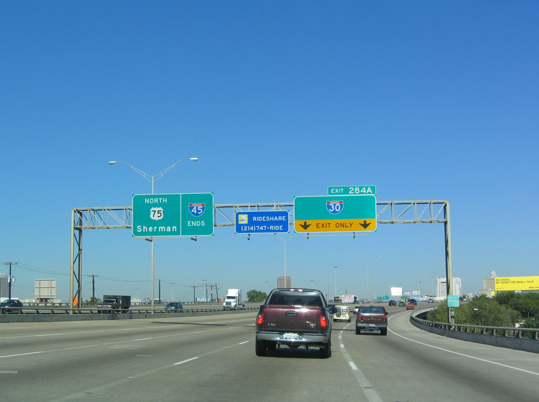
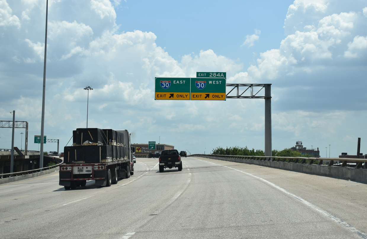
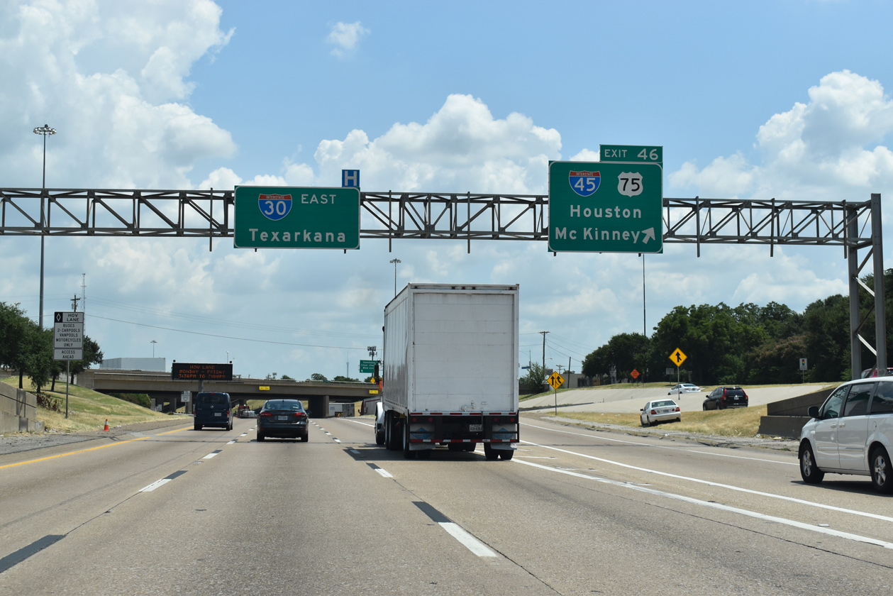
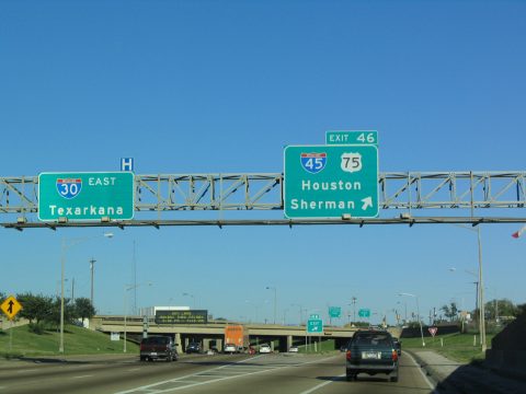
IH 45 north ends opposite U.S. 75, which extends northward along the Central Expressway toward McKinney and Sherman. Exit 284 A departs next for IH 30 to Fort Worth and Texarkana. 10/19/03
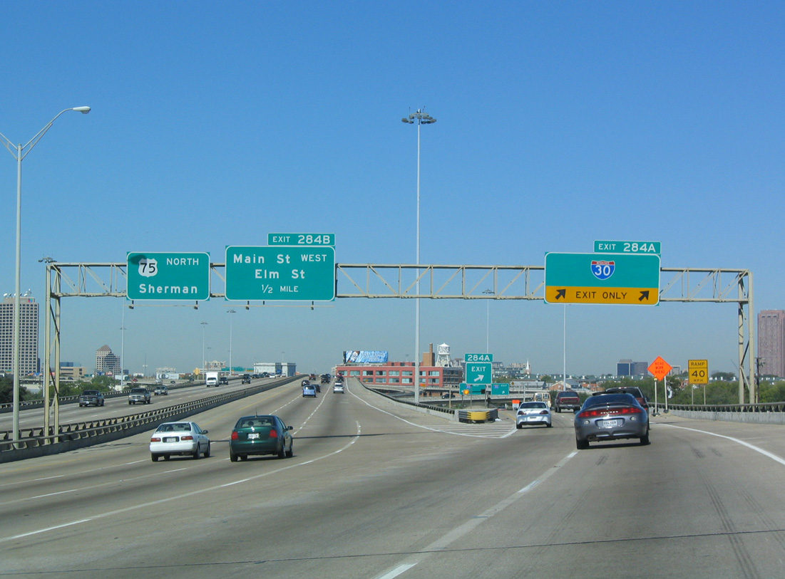
Exit 284 A separates from IH 45 north as IH 345 and U.S. 75 north begin. The Central Expressway forms the east leg of an inner belt freeway network encircling Downtown Dallas. IH 30, IH 35E and SS 366 make up the other three legs. 10/19/03
IH 30 crosses the city of Dallas west to Grand Prairie and Arlington and east to Mesquite and Lake Ray Hubbard. IH 30 connects with IH 35E (Stemmons Freeway) nearby at the Mixmaster Interchange. 10/19/03
![]()
![]() South at
South at ![]()
![]()
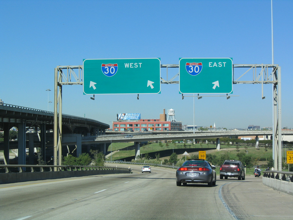
Connecting with IH 30 at a symmetrical stack interchange (Exit 284 A), the Central Expressway navigates through an elevated S-curve between Downtown and Deep Ellum. 08/06/19
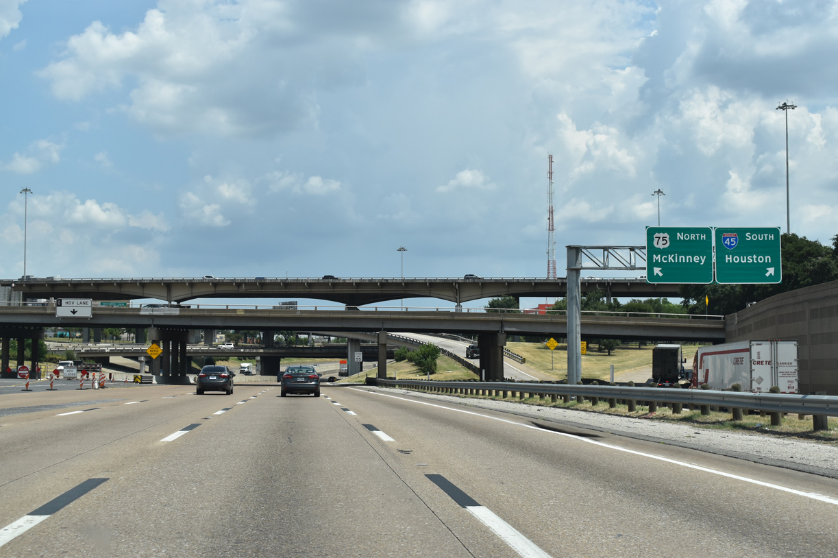
IH 345 and U.S. 75 end opposite IH 45, which extends the freeway southeast along the Trinity River to the city of Hutchins. 08/06/19
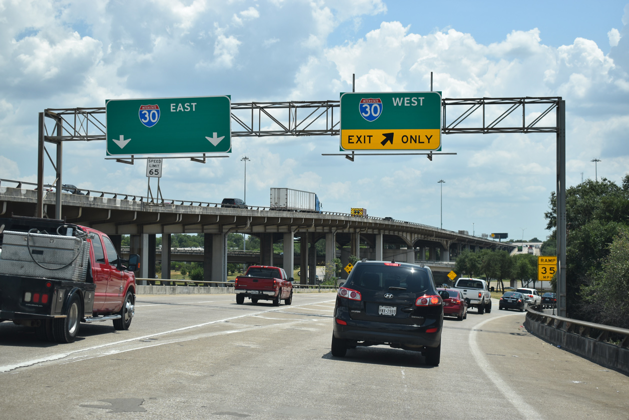
Two lanes lower from the elevated roadway for IH 30 east to Mesquite and west to Arlington and Fort Worth. 08/06/19
![]() East at
East at ![]()
![]()
![]()
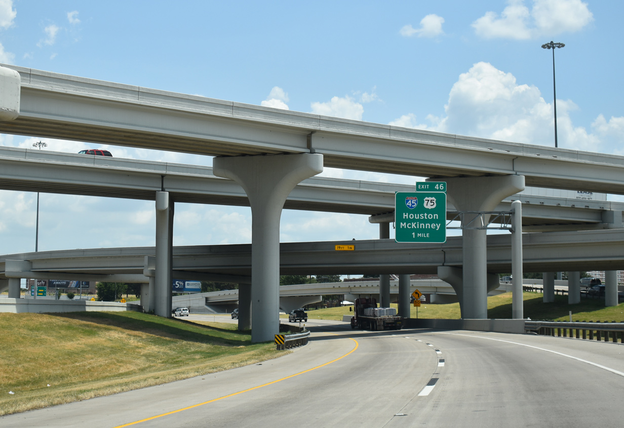
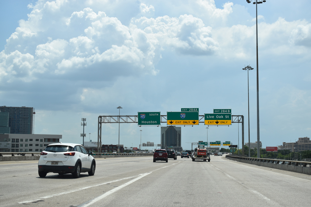
Leaving the Mix Master Interchange with IH 35E (Stemmons Freeway), IH 30 advances east one mile to IH 45 south and IH 345/U.S. 75 (Central Expressway) north. 08/06/19
Collector distributor roads accompany both sides of IH 30 from the Mix Master Interchange to Cesar Chavez Boulevard. The next departure point from the mainline is for the Central Expressway north and IH 45 south. 08/06/19

A slip ramp takes motorists on the adjacent c/d roadway onto IH 30 east at the upcoming Griffin and Ervay Street overpasses. Just a quarter mile separates the ingress point with Exit 46, resulting in a weaving traffic pattern. 08/06/19
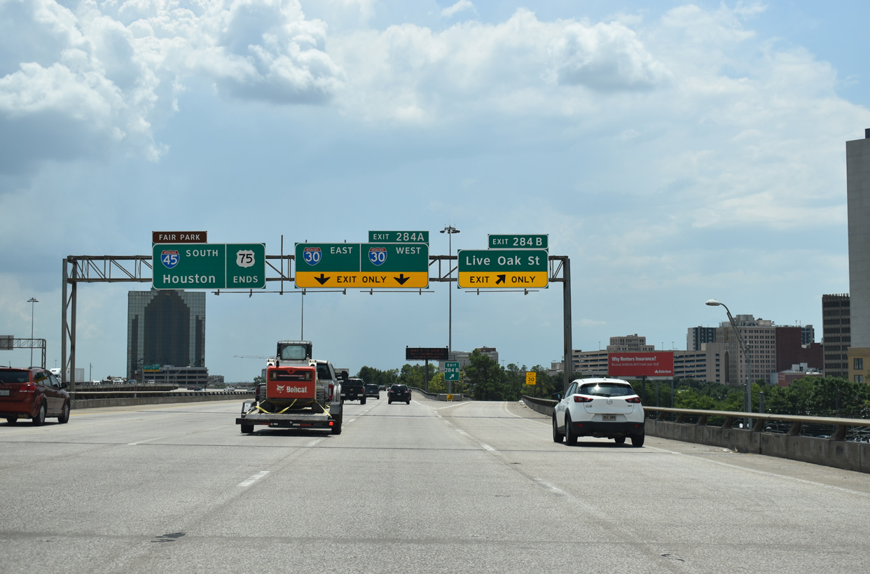
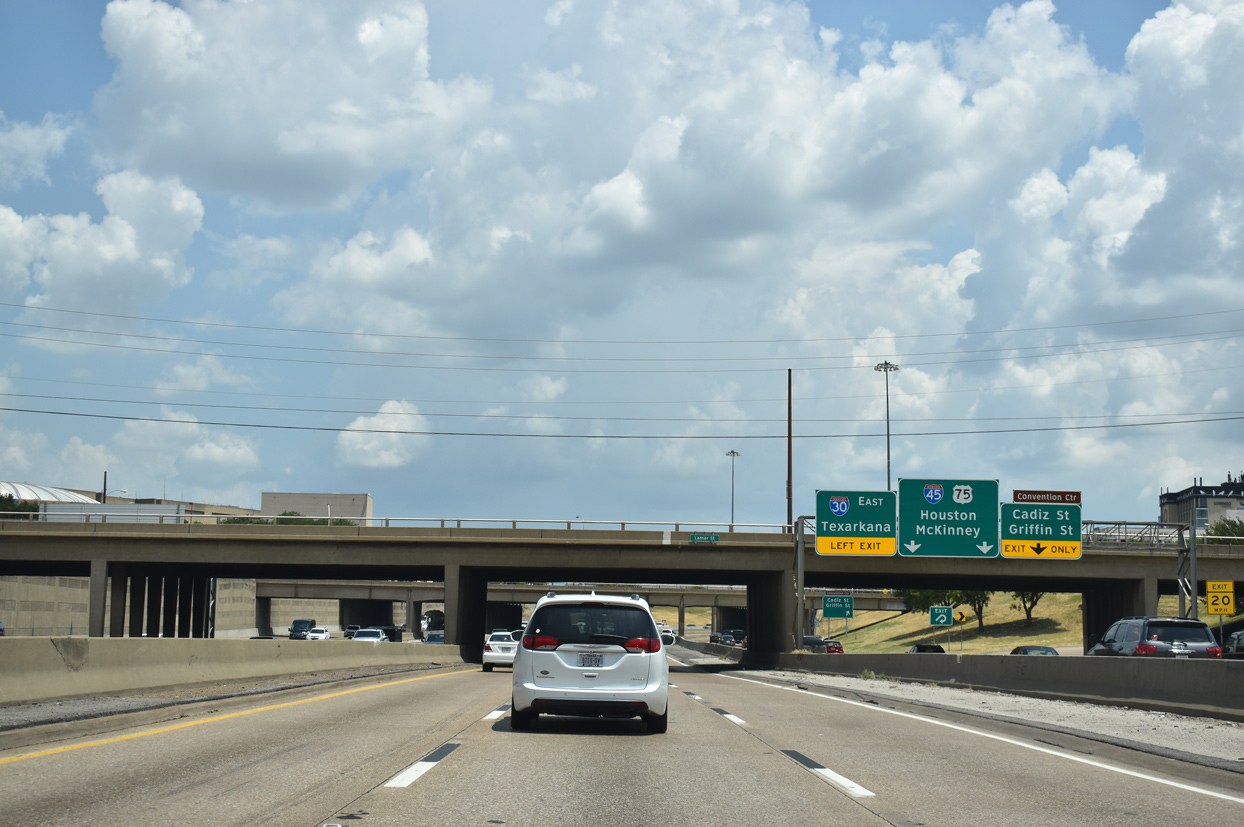
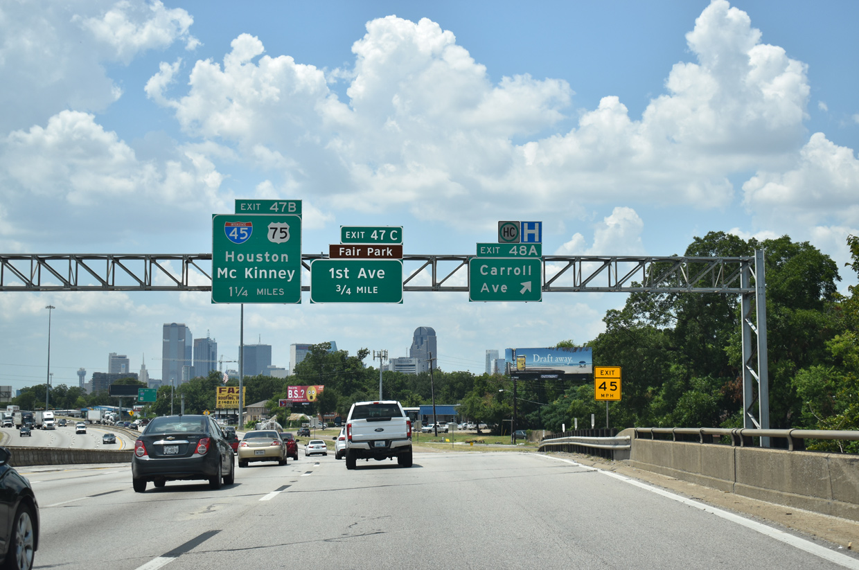
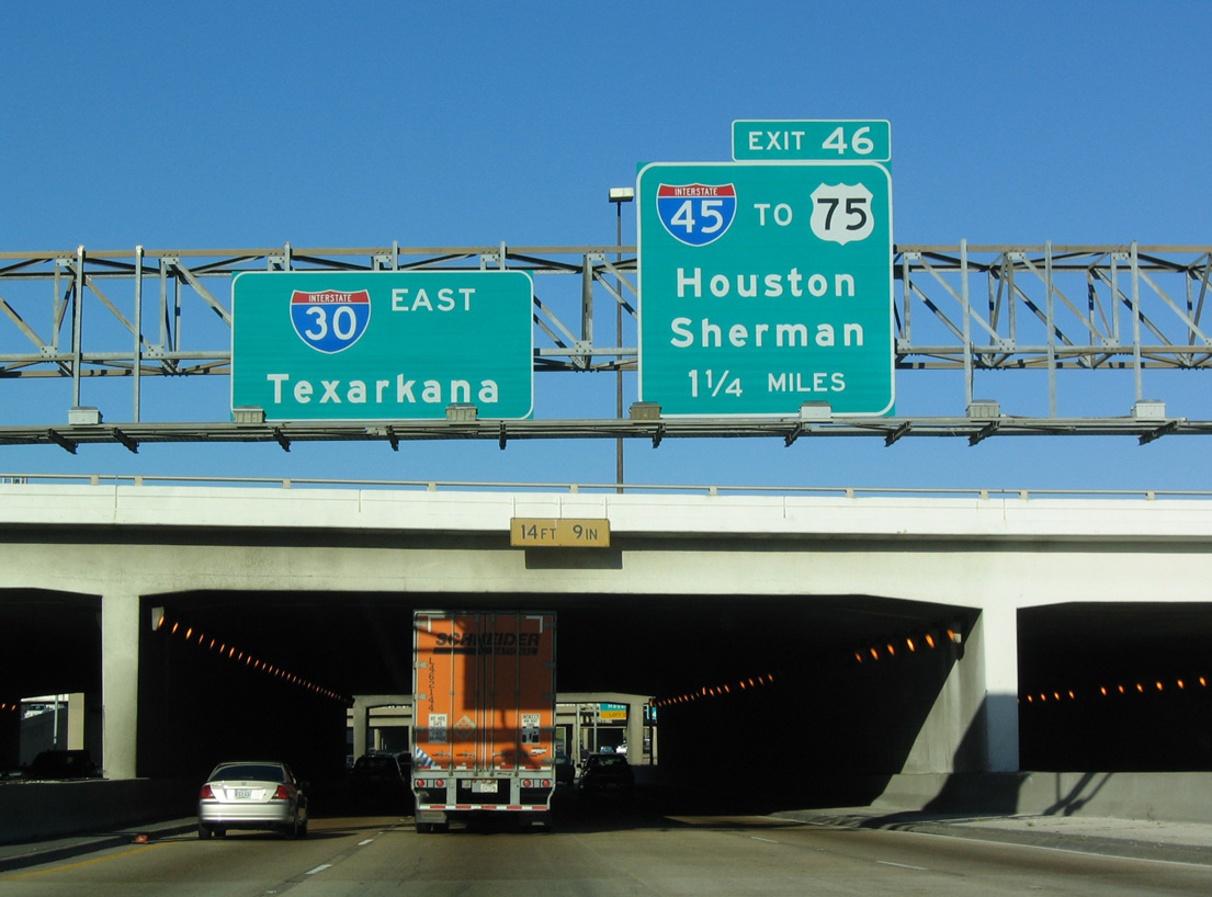
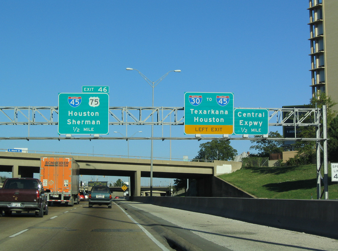
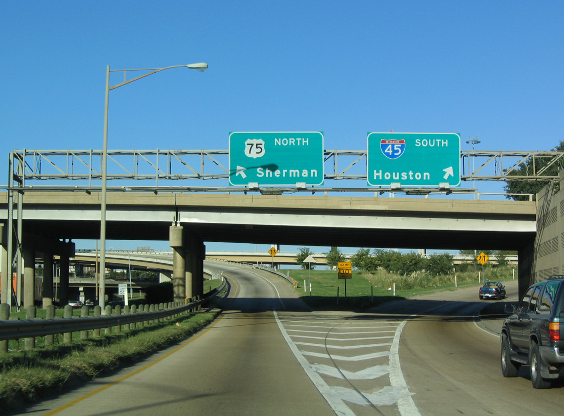
Exit 46 separates from IH 30 east for the distributor roadway to IH 45 south to Ennis, Corsicana and Houston and IH 345/U.S. 75 north to Plano, McKinney and Sherman. 08/06/19
IH 45 ends 285 miles south of the systems interchange with IH 30 in Galveston. IH 345 northbound accompanies U.S. 75 (Central Expressway) for just 1.40 miles to Spur 366 (Woodall Rogers Freeway). 08/06/19
![]() West at
West at ![]()
![]()
![]()
IH 30 weaves southwest through the Deep Ellum community to IH 45 south and U.S. 75 (IH 345) north. 08/06/19
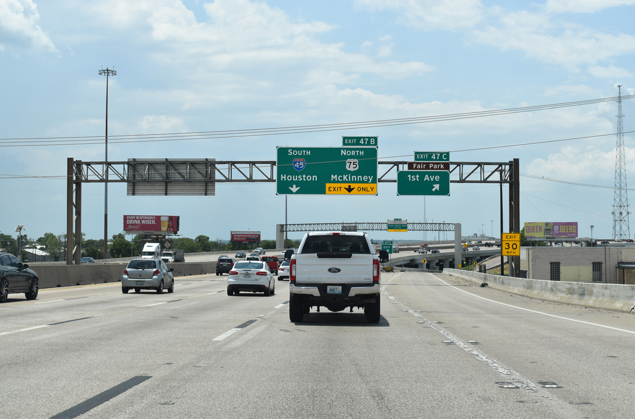
Exit 47 B separates from IH 30 westbound with two lanes for IH 45 south and unsigned IH 345/U.S. 75 (Central Expressway) north. 08/06/19
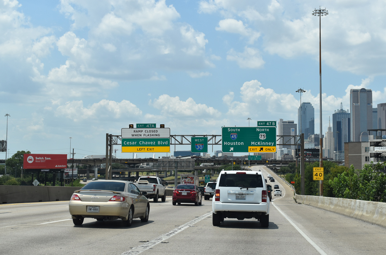
Left Exit 47 A follows IH 45/345 to Cesar Chavez Boulevard, an older section of the Central Expressway and U.S. 75. 08/06/19
North End Throwback
The IH 30 mainline continues east 1.25 miles to the distributor roadway (Exit 46) for IH 45 south and IH 345/U.S. 75 north. 10/19/03
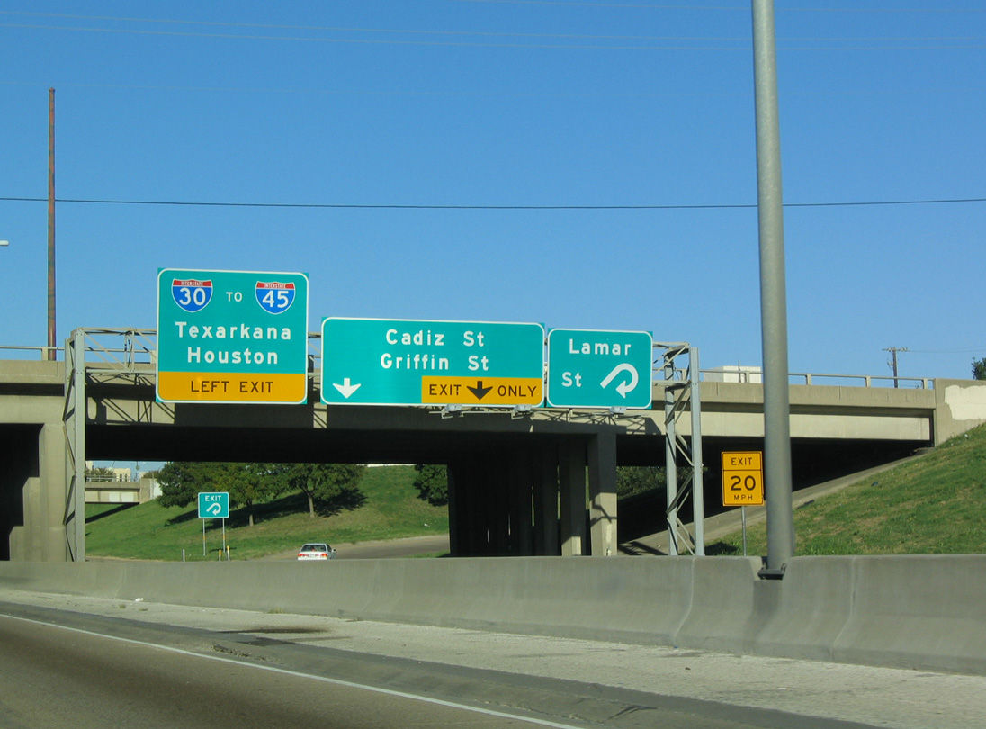
The overhead at the loop ramp for Lamar Street at Cadiz Street was removed during sign replacements made by June 2018. 10/19/03
The succeeding interchange joins the outer roadway of IH 30 with the older Central Expressway (since renamed to Cesar Chavez Boulevard), which is the former route of U.S. 75. 10/19/03
Ramps from IH 30 east, parallel Griffin Street and the outer R.L Thornton Freeway roadway converge along the distributor roadway (Exit 46) for IH 45 and the Central Expressway. 10/19/03
Good Latimer Expressway spans the distributor roadway along IH 30 east at the separation for IH 345/U.S. 75 north and IH 45 south. 10/19/03
South End – Galveston, Texas
![]() South at
South at ![]()
![]()
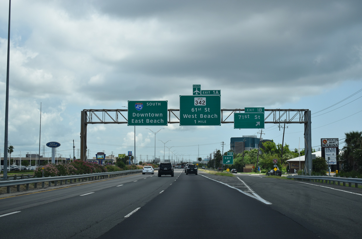
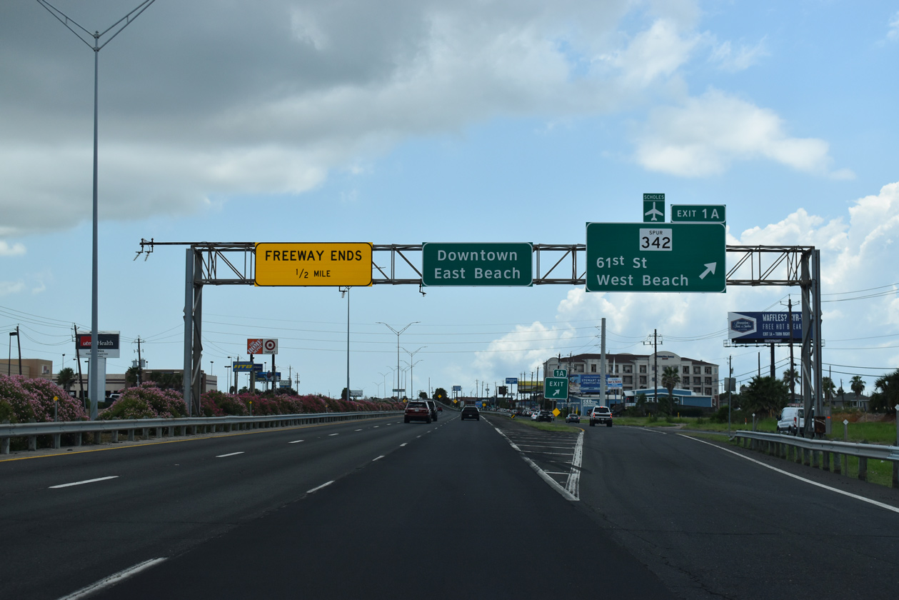
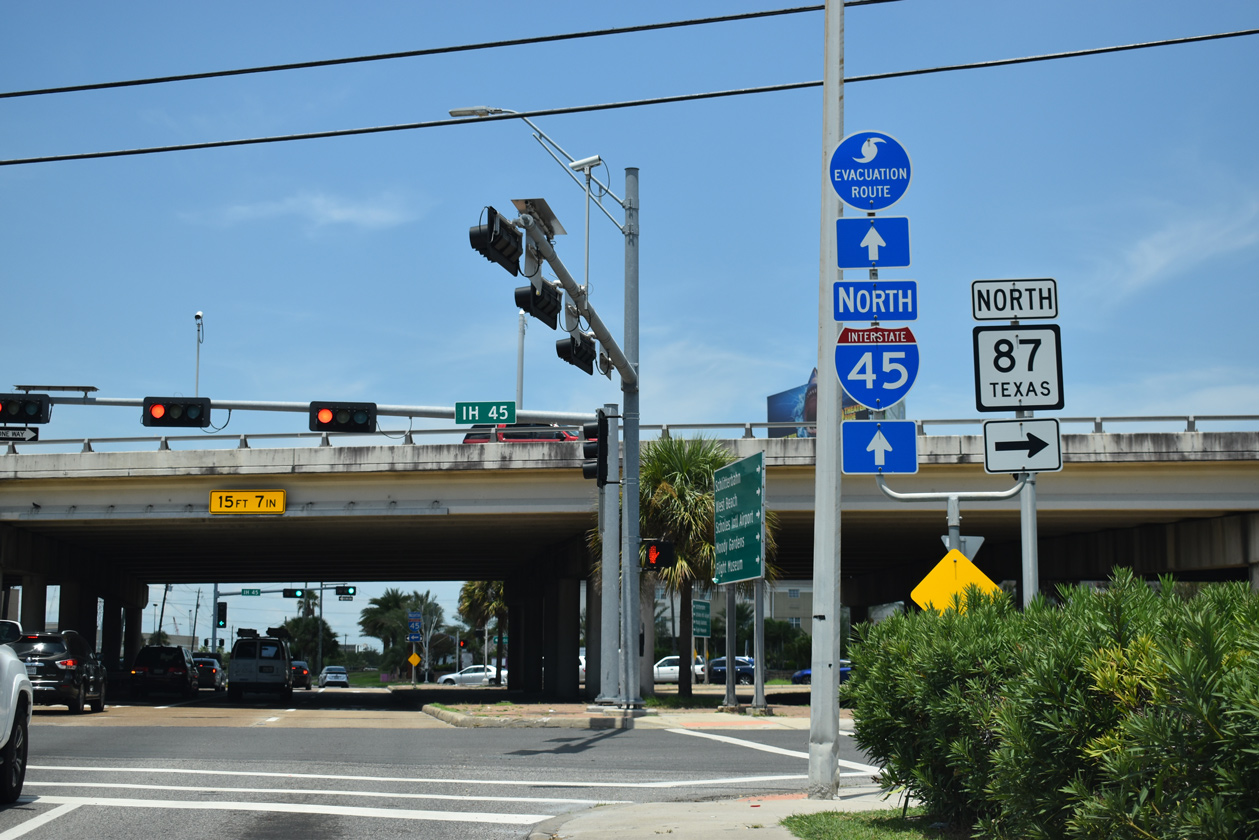
The final two interchanges of IH 45 south connect with 71st Street at Exit 1 B and State Spur 342 (61st Street) at Exit 1 A. Traffic interests to the Galveston beaches partition between 61st Street for the West beaches and SH 87 (Broadway Avenue) for the East beaches. 08/02/19
Exit 1 A departs for SS 342 (61st Street) southbound to Scholes International Airport at Galveston (GLS). SS 342, in conjunction with FM 3005, provides a coastal route from Galveston southwestward to Jamaica Beach, Sea Isle, Surfside Beach and ultimately Freeport. 08/02/19
The 61st Street (SS 342) north entrance ramp ties into the south end of IH 45 ahead of 59th Street along SH 87 (Broadway Avenue) northbound. SH 87 heads 5.50 miles east to the Galveston Ferry Terminal near Fort Point. 08/02/19
![]() North at
North at ![]()
![]()

Spur 342 (61st Street) leads 1.67 miles north from the Gulf of Mexico waterfront and Seawall Boulevard to the diamond interchange joining IH 45 and SH 87 (Broadway Avenue). 08/02/19
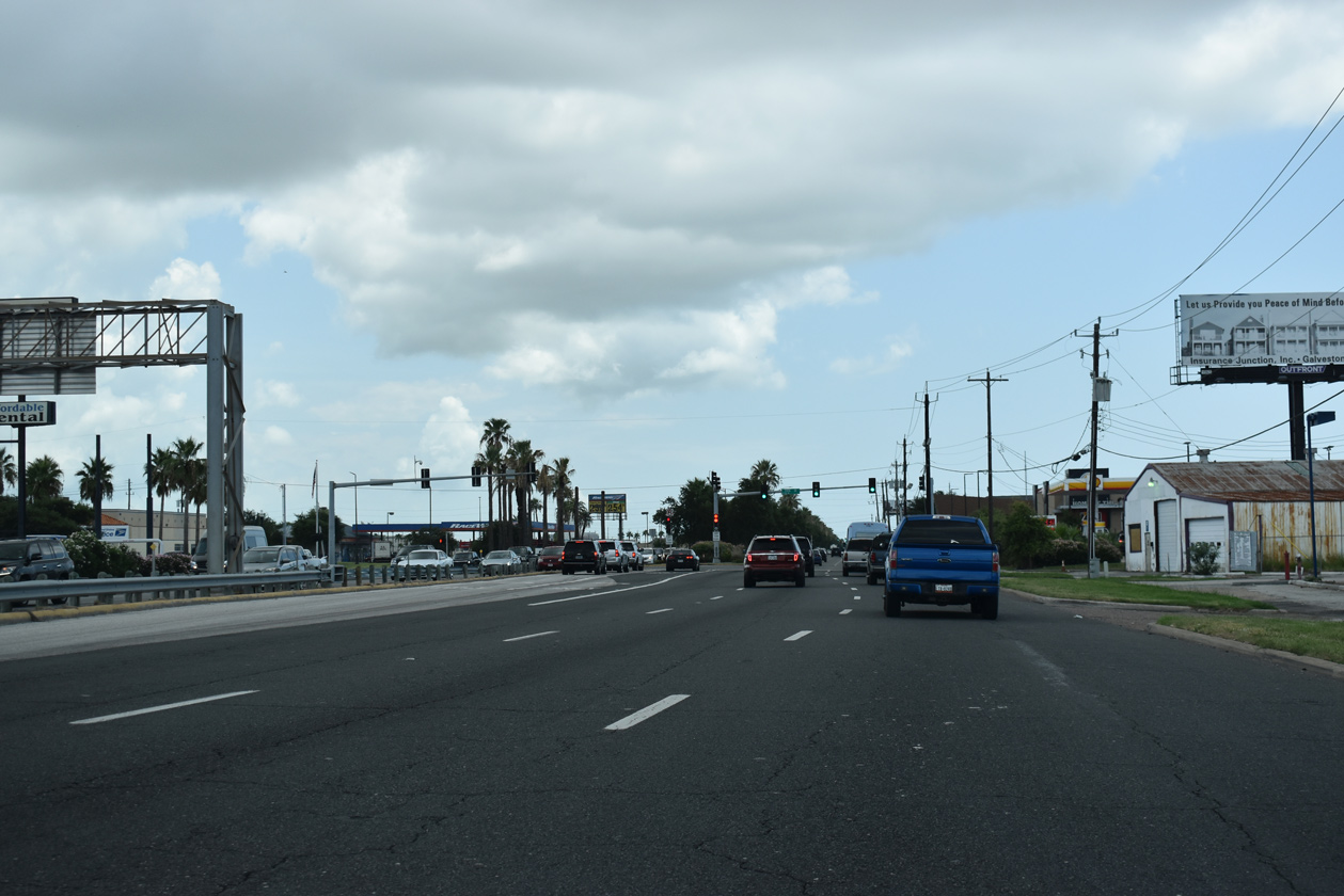
SH 87 links IH 45 and Galveston Island with the Bolivar Peninsula and Port Bolivar via a auto ferry. The state highway is part of a longer coastal route that formerly traveled to High Island and Sabine Pass. Beach erosion however, washed away the roadway between High Island and Sabine Pass. 08/02/19
Traffic at the north end of SS 342 utilizes the Broadway Avenue frontage road to access IH 45 northbound. 08/02/19
![]() North
North
SH 87 (Broadway Avenue) transitions into IH 45 north just beyond the signal with 59th Street and an adjacent retail center. Exit 1 A follows to SS 342 (61st Street). 08/02/19
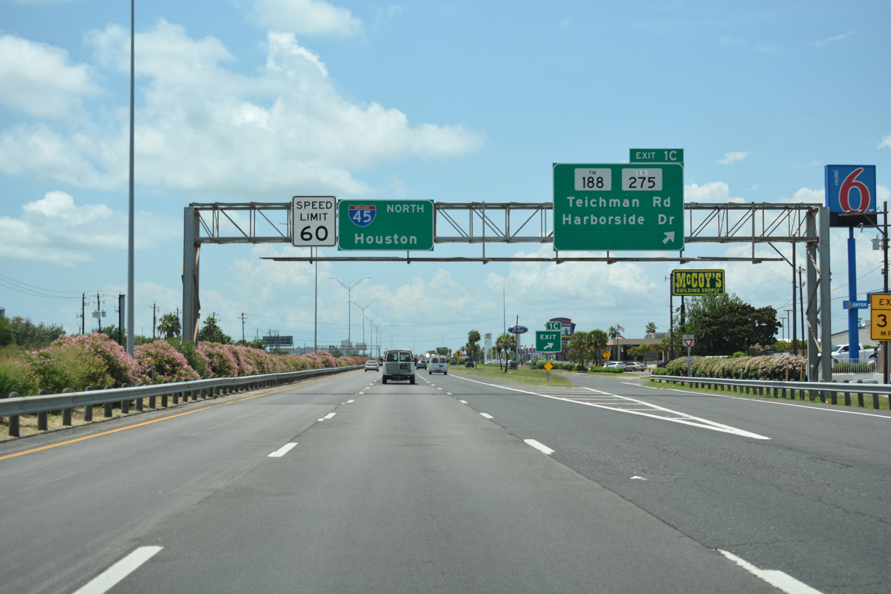
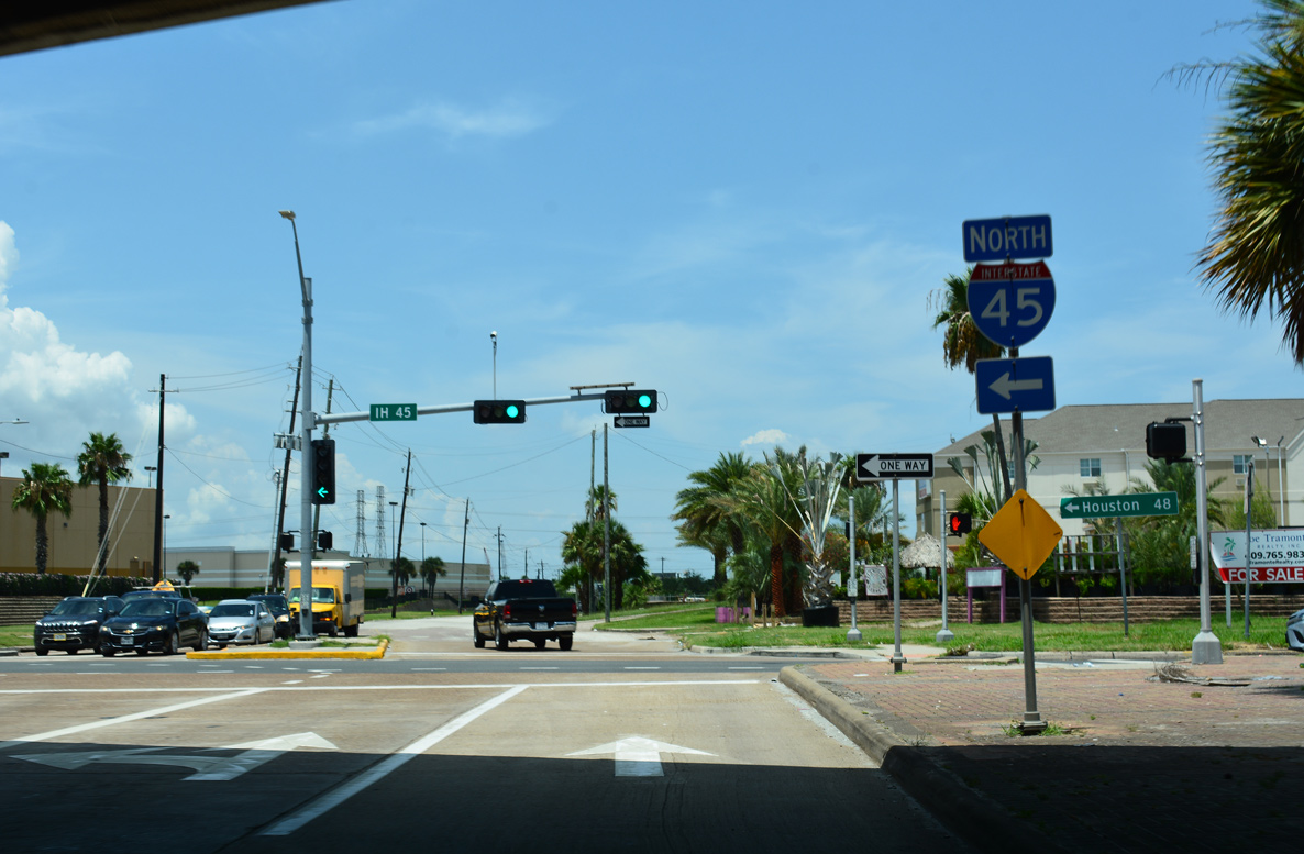
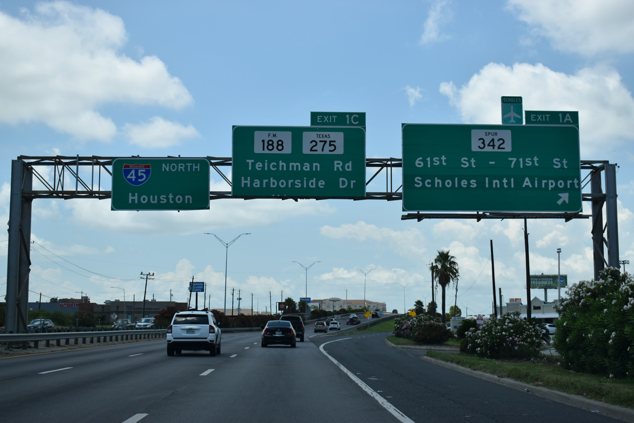
The succeeding ramp (Exit 1 C) on IH 45 north connects with SH 275 (Harborside Drive), a road straddling the southern shoreline of Galveston Bay and Galveston Channel. 08/02/19
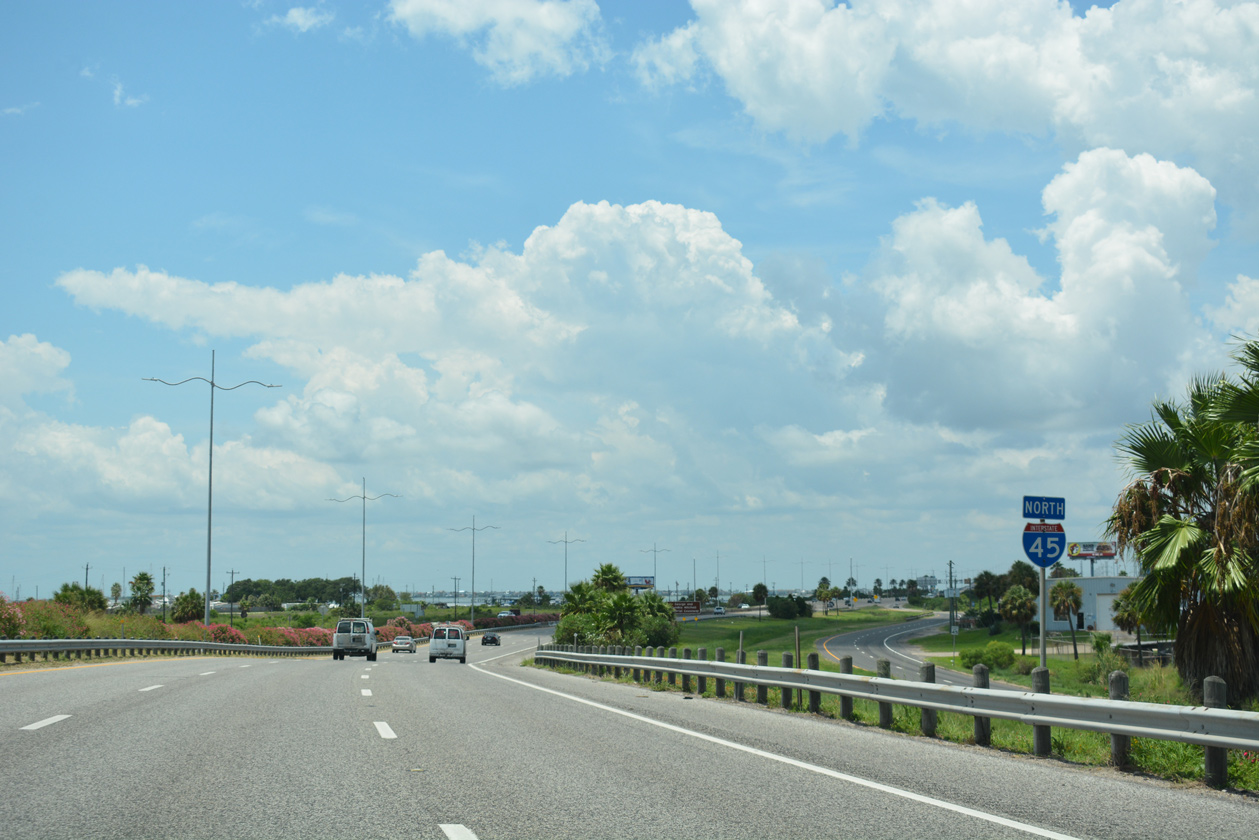
The first confirming marker for IH 45 precedes the George and Cynthia Mitchel Memorial Causeway crossing Galveston Bay. 08/02/19
Sources:
- “From Anywhere to Everywhere: The Development of the Interstate Highway System in Texas.”
http://tti.tamu.edu/interstate_anniversary/white_paper/by Penny Beaumont, Rhonda Brinkmann, David Ellis, Chris Pourteau, and Brandon V. Webb, Texas Transportation Institute, page 29 and 34. - Celebrating the 50th Anniversary of the Eisenhower Interstate Highway System: Previous Interstate Facts of the Day by the Federal Highway Administration (FHWA).
- Chapter 6 Excerpt: US 175, S.M. Wright and C.F. Hawn Freeways, Dallas-Fort Worth Freeways, 2014 ebook.
Page updated June 3, 2022.