Interstate 66
Overview
Interstate 66 connects Washington, DC with Fairfax County, Front Royal and I-81 near Strasburg in Northern Virginia. The freeway serves commuters west from the District of Columbia to Tysons and Centerville in Fairfax County and Manassas and Gainesville in Prince William County. Traversing the Blue Ridge Mountains, the westernmost extent of I-66 is both rural and scenic.
Within the Capital Beltway (Interstate 495), I-66 is a toll road with Express Lanes operating eastbound on weekday mornings and westbound on weekday evenings. Tolls are collected electronically with rates varying based upon traffic congestion. The I-66 Inside the Beltway Express Lanes commenced toll collection on December 4, 2017. Fully opened to traffic on November 22, 2022, the I-66 Outside the Beltway Express Lanes project added 22.5 miles of managed lanes west from I-495 to U.S. 29 (Lee Highway) in Gainesville. These accompany three General Purpose Lanes along each roadway.

Beyond the separation with U.S. 50 in Arlington, Virginia, Interstate 66 is part of the tolled Inside the Beltway Express Lanes. 12/27/22
Originally I-66 was planned to connect to the planned alignment of Interstate 95 through Washington. Crossing the Potomac River on the Theodore Roosevelt Bridge, Interstate 66 turns northward onto the Potomac River Freeway alongside the John F. Kennedy Center for the Performing Arts and the Watergate complex. Planned as a much longer route linking the unconstructed Southwest Freeway (I-695) with I-70S (I-270), the Potomac River Freeway leads a short distance north to U.S. 29 (Whitehurst Freeway). I-66 ends with ramps to Rock Creek Parkway and U.S. 29 south while the westbound beginning is accessible from the Whitehurst Freeway east and 27th Street NW.
 Parallel U.S. Routes
Interstate 66 largely parallels or replaced U.S. 211 between I-81 and Washington, D.C. U.S. 29 follows the freeway corridor east through Arlington to the Francis Scott Key Bridge into Georgetown in Washington. U.S. 50 overlaps with I-66 across the Potomac River between Arlington Boulevard and Constitution Avenue.
Interstate 66 East-West Trans-America Freeway
The Interstate 66 East-West Trans-America Freeway was an idea hatched by Wichita business people in the early 1990s as a means to bring additional commerce to southern Kansas. Capitalizing on the fabled number “66,” the coast-to-coast route was envisioned to connect Fresno, California, with Washington, D.C., via the Four Corners, Wichita and the width of Kentucky. Proponents of the I-66 plan saw the business that I-40 and I-70 brought along their respective corridors, and felt southern Kansas would similarly benefit economically. The idea was presented to area politicians, which managed to get I-66 listed as an ISTEA high priority corridor. Included with that congressional act was funding for a million dollar feasibility study.
Unrealized plans called for an extension of Interstate 66 westward along a rough routing determined between I-55 in Missouri and proposed I-73/74 and U.S. 52 in West Virginia. Added as a high priority corridor in 1991 and amended in subsequent transportation bills, I-66 was the generally accepted designation for Corridor 3. The Fiscal Year 2002 Transportation Appropriations Bill added I-66 as an Interstate Highway in the state of Kentucky. The legislation facilitated adding new mileage to the route, but construction did not follow. The 2004 official map of Kentucky showed the anticipated corridor of the route.
Future corridor signage for I-66 was erected on eligible sections of the Cumberland (Louis Nunn) Parkway on March 23, 2005 as part of the planned route between Paducah and Pikeville, Kentucky. The future designation was authorized in the December 2001 Transportation Appropriations Bill for Fiscal Year 2002, with $22.5 million allocated to Interstate 66. The Cumberland Parkway was already Interstate compatible. All that was required was eliminating the cloverleaf interchanges at the former toll booth locations at U.S. 127 and U.S. 68.
East of I-75, the Interstate 66 corridor was proposed to follow the Hal Rogers Parkway east to Exit 56 (KY 451). Hal Rogers Parkway is a two lane highway with periodic passing lanes. Extensive reconstruction is needed to bring it to Interstate standards. There is no freeway connection between the Cumberland and Hal Rogers Parkways, so one would have to be constructed. The section of proposed I-66 through Kentucky previously had a proponent web page at http://www.interstate66.com/ – Interstate 66: TransAmerica Corridor (by the Kentucky Transportation Cabinet.
Beyond the hills of eastern Kentucky, the I-66 corridor was projected to cross into West Virginia between Matewan and Edgarton. It was to end at the proposed King Coal Highway (I-73/74) in West Virginia. It is unclear how I-66 in southwest West Virginia would connect with I-66 in Virginia. While this could be accomplished through U.S. 119 and U.S. 48/Corridor H via Charleston, it is not known if this was considered. Corridor H in northeast West Virginia is a controlled access expressway with at-grade intersections.
History
Interstate 66, from I-495 (Capital Beltway) east to Washington, D.C., was approved for federal funding on January 5, 1977 by Secretary of Transportation William T. Coleman, Jr. The freeway was built with four lanes and had truck restrictions. Additional restrictions were in place during commuting hours limiting I-66 within the Capital Beltway to vehicles with four or more occupants, buses, airport traffic and emergency vehicles. The final section of Interstate 66 within the beltway opened to traffic on December 22, 1982. The Theodore Roosevelt Bridge, which carries I-66 from Arlington, Virginia, east into the District of Columbia, opened to traffic on June 23, 1964.2
Interstate 66 travels just a 1.5 miles in D.C. north to K Street (U.S. 29) near George Washington University. The freeway was planned to continue northward along Rock Creek to Massachusetts Avenue, where it would turn eastward parallel to Florida Avenue and U Street. The route was proposed to arc southeast from 11th Street to end at Interstate 95 where 14th and P Streets intersect. This portion, and the northern extension of the Center Leg Freeway (I-95) were withdrawn from the Interstate system when all unbuilt sections of the D.C. freeway network were canceled in 1977.
An addition of a third westbound lane was considered for congested stretch of Interstate 66 between Rosslyn and the Dulles Connector in 2003. Supported by Representatives Frank R. Wolf (R) and Thomas M. Davis III (R), the proposal was brought to Governor Mark R. Warner (D). Debate from Arlington officials ensuing involving concerns that may accompany any traffic relief on that stretch. Thus additional options considered ranged from HOV lanes, toll lanes, transit opportunities and a non-build option. County officials remained adamant in their opposition to any expansion of the existing roadway. Rep. Wolf however maintained that the highway could be expanded for only $18 million within the existing right of way. Many residents were not opposed to the potential project, and Wolf contested that Interstate 66 expansion would also benefit adjacent streets and neighborhoods with potential relief.1
Route Information
Virginia – 74.80
Cities – Front Royal, Manassas, Fairfax, Vienna, Falls Church, Arlington
- Junctions –


District of Columbia – 1.48
Source: December 31, 2021 Interstate Route Log and Finders List
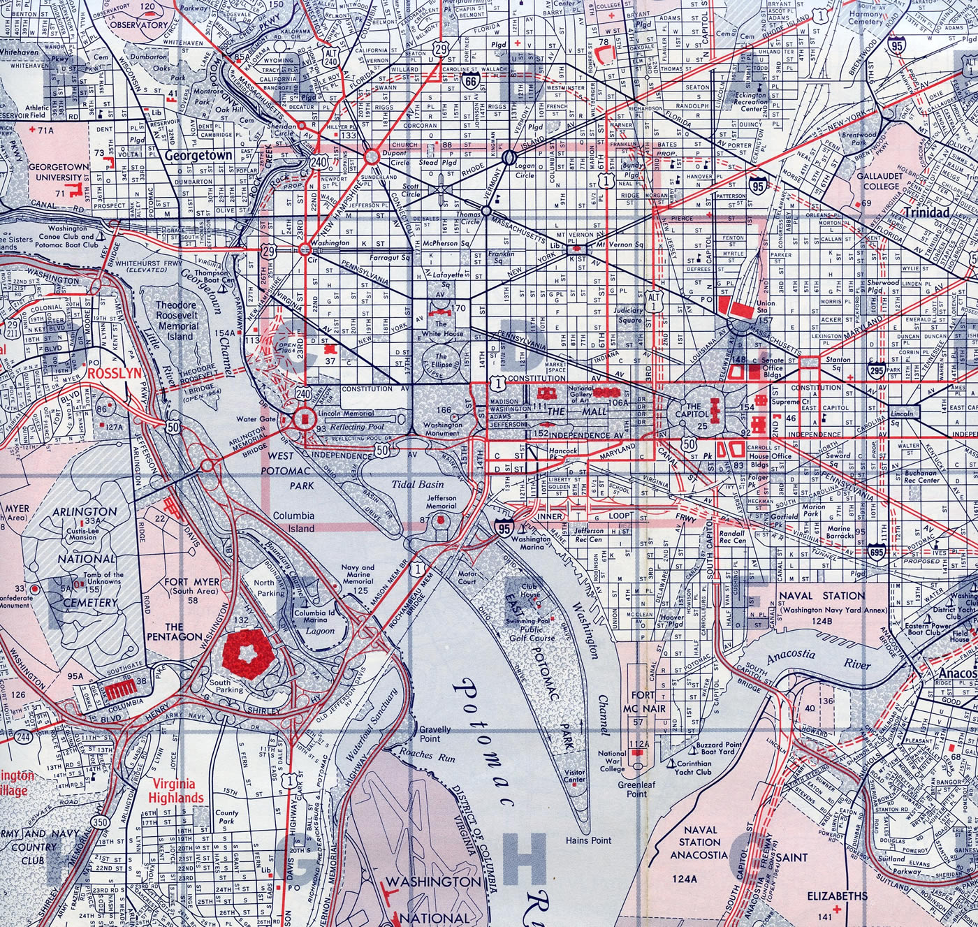
In addition to the cancellation of I-66 north of K Street, the Center Leg Freeway was unconstructed north of New York Avenue (U.S. 60), Interstate 295 north of the Southeast Freeway was unbuilt, and all of I-95 between I-66 and the Capital Beltway was canceled.
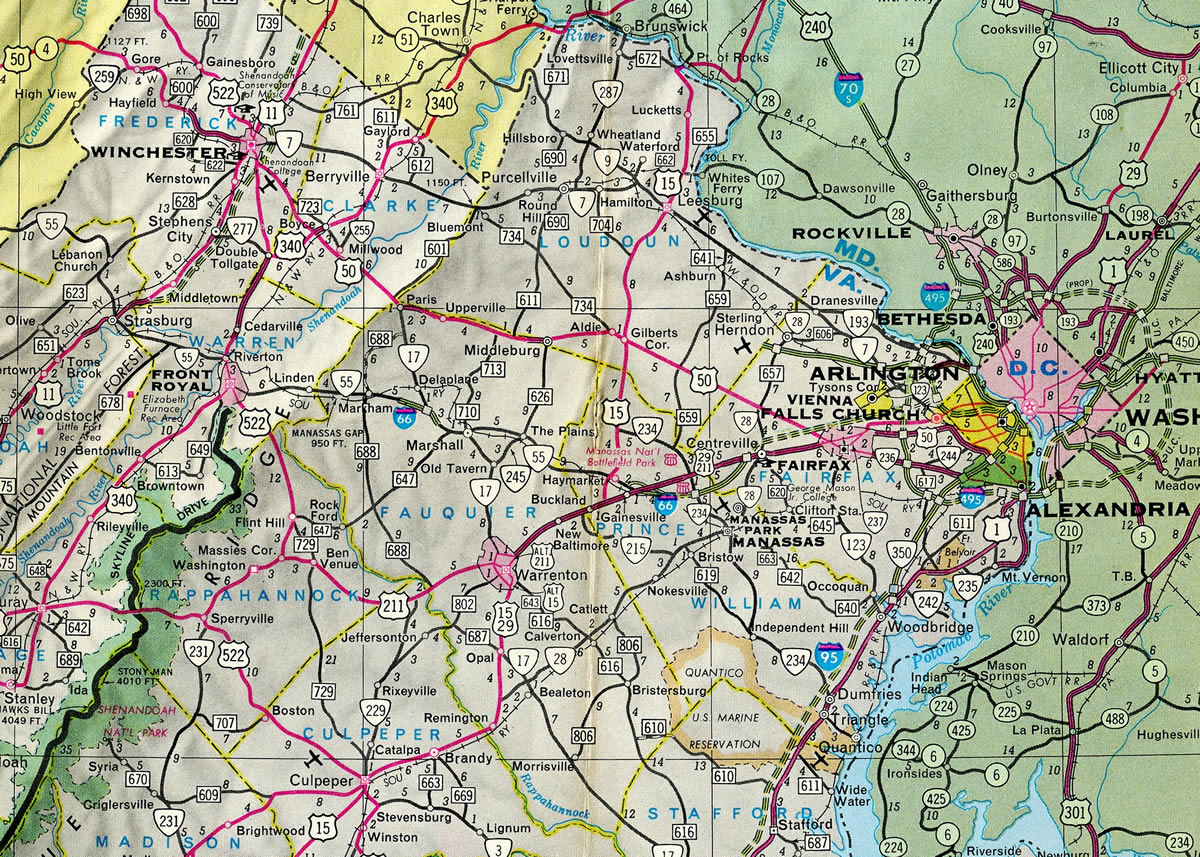
A nine mile portion of Interstate 66 was open between Gainesville and Centreville by December 16, 1961. A 3.3 mile segment opened the following year west of Marshall on May 18.4

12 mile section of Interstate 66 lengthened the route east from U.S. 29 at Centreville to the Capital Beltway (I-495) on November 18, 1964. The westernmost extent of I-66 opened to traffic, between I-81 and U.S. 340/522, next on October 12, 1971.4
 Photo Guides
East End  (Whitehurst Freeway) – Washington, D.C.
![]() East at
East at ![]() Whitehurst Frwy
Whitehurst Frwy
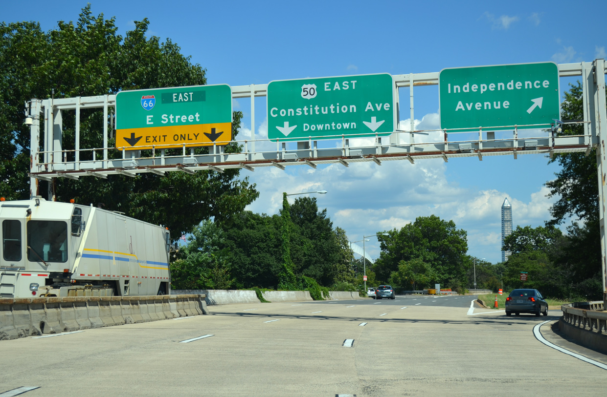
The last reference for Interstate 66 appears at the split with U.S. 50 on the Theodore Roosevelt Bridge. U.S. 50 joins Constitution Avenue NW east along the National Mall. 08/04/13

Interstate 66 turns northward onto the Potomac Freeway, next entering a directional T interchange with the E Street Expressway. 08/04/13
The Potomac Freeway passes through a cut and cover tunnel below Virginia Avenue NW and New Hampshire Avenue NW east of the Watergate Complex. 08/04/13

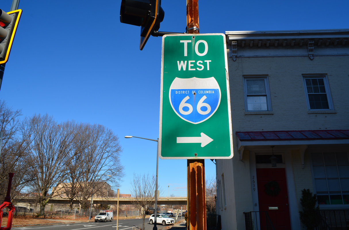
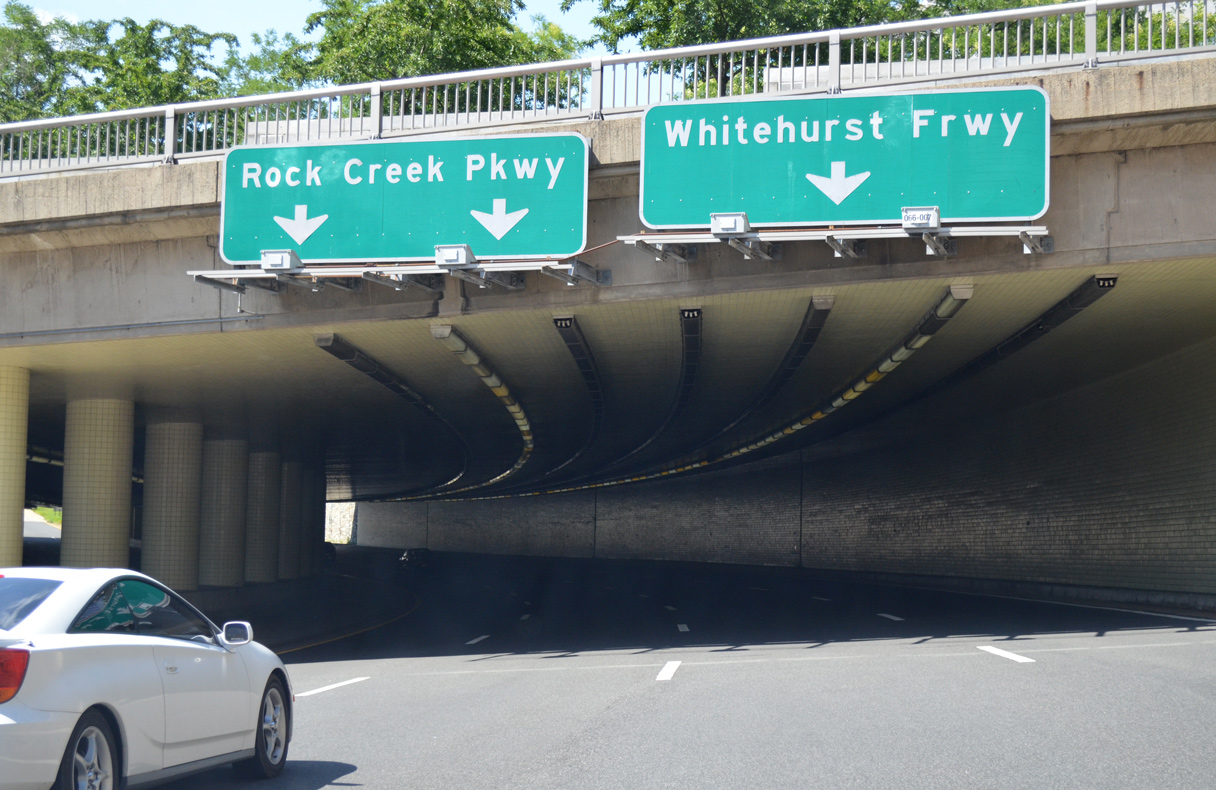
Interstate 66 partitions beyond the tunnel into ramps for 27th Street SW, the Whitehurst Freeway (U.S. 29) and L Street NW to K Street NW (U.S. 29). 08/04/13
![]() Whitehurst Frwy – North at
Whitehurst Frwy – North at ![]()

The Whitehurst Freeway travels east from the Francis Scott Key Bridge to a wye interchange with Interstate 66 (Potomac Freeway) west. 08/04/13

U.S. 29 joins K Street east from the Whitehurst Freeway end as I-66 begins to the south. 08/04/13
![]() West
West
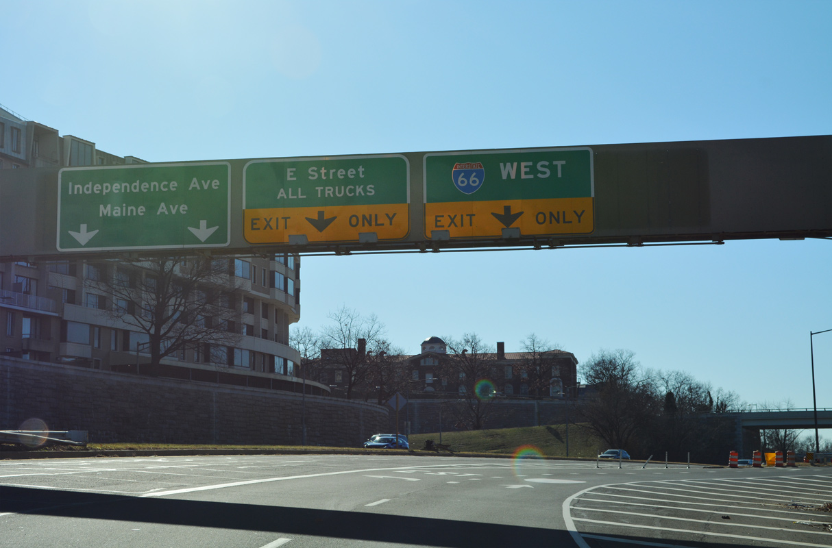
The Potomac Freeway emerges from a cut and cover tunnel below Triangle Park and separates with I-66 west at the E Street Expressway. The Potomac Freeway spurs south to Ohio Drive SW. 12/27/22
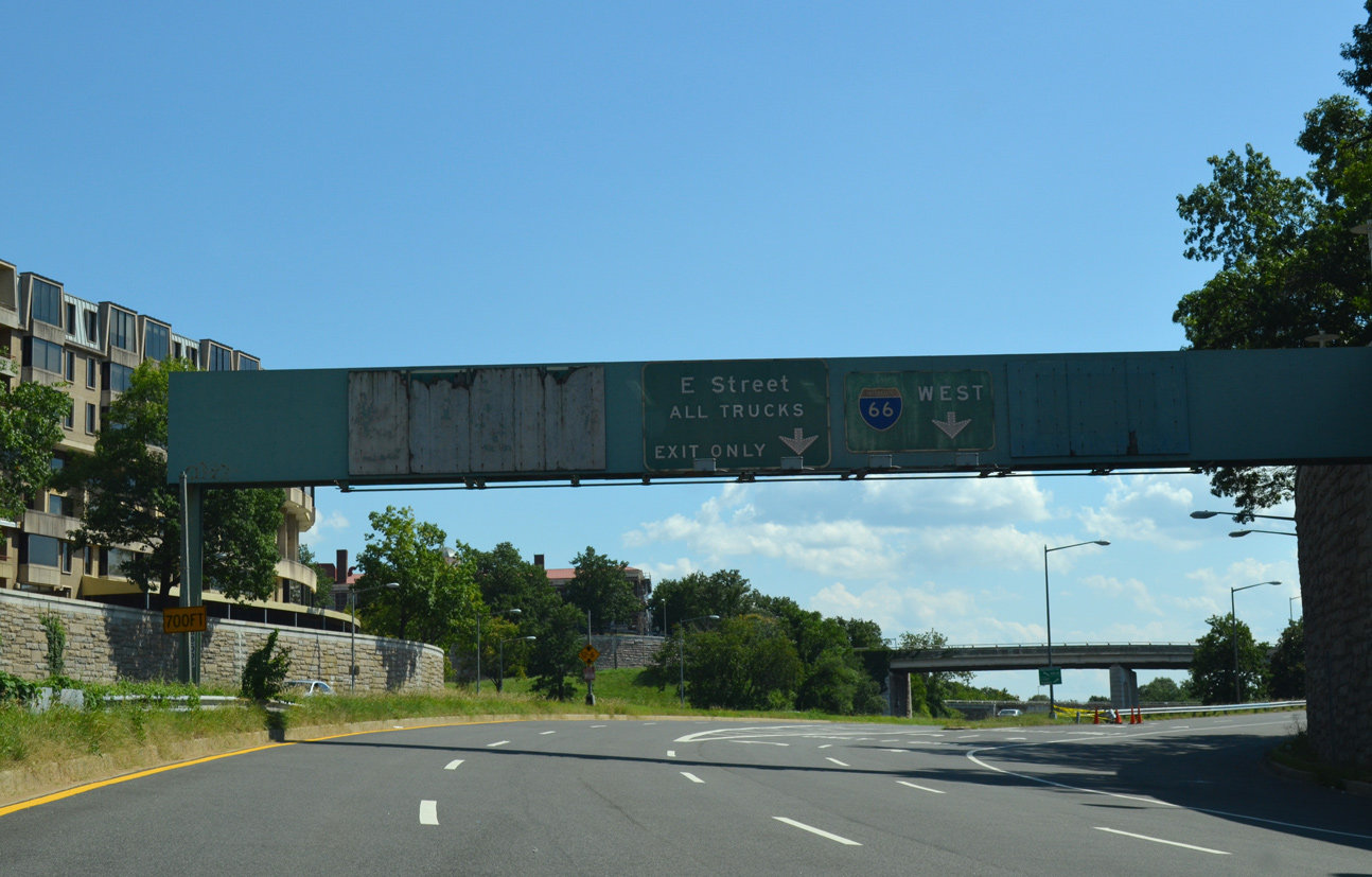
The previous overhead assembly on I-66 west at the E Street Expressway included plywood concealing an overhead or I-695 south. The unconstructed Southwest Freeway would have linked I-66 with I-395 (then I-95). 08/04/13
West End – Middletown, Virginia
![]() West at
West at ![]()
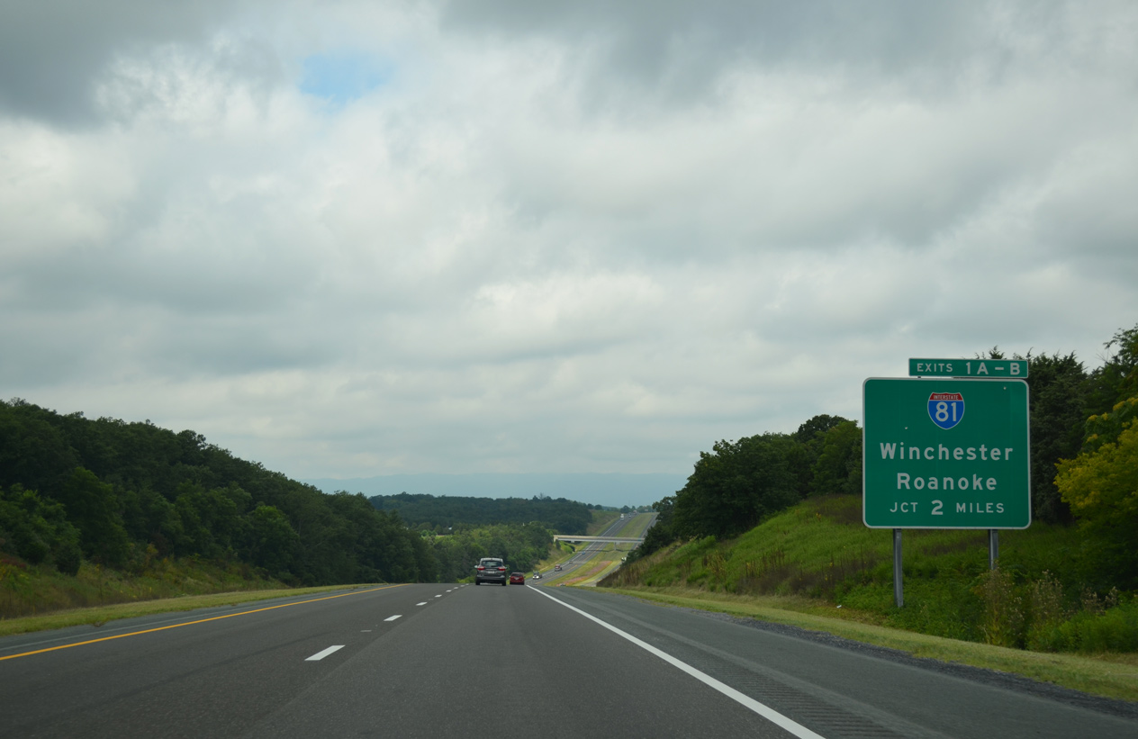
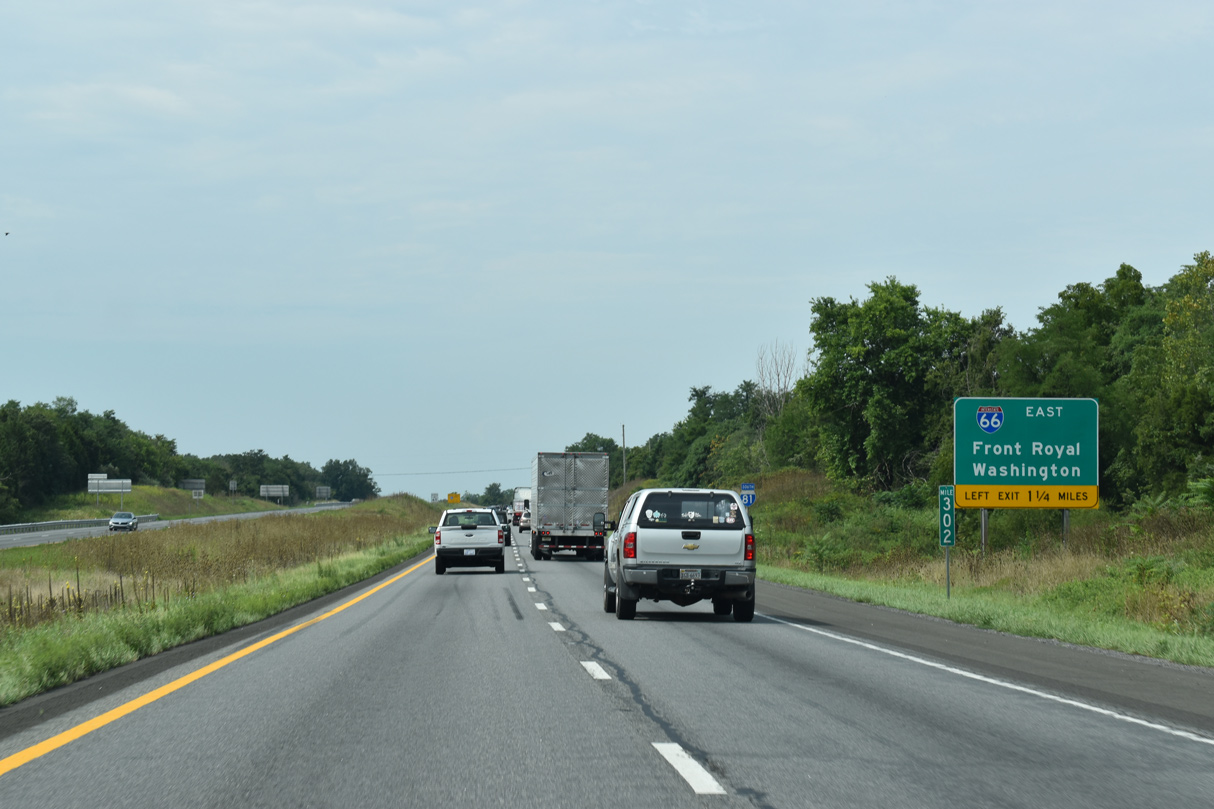
Little North Mountain rises along the western horizon as I-66 advances to within two miles of Interstate 81. 08/06/13
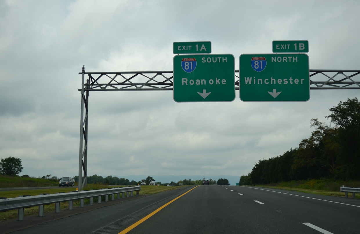
Traffic partitions for Exit 1A north to Martinsburg, West Virginia and Hagerstown, Maryland and Exit 1B for Harrisonburg, Staunton and Roanoke. 08/06/13

I-66 extends 64 miles west from the Capital Beltway / Interstate 495 to I-81. The freeway concludes 16 miles south of Winchester and 23 miles from the West Virginia state line along I-81. 08/06/13
![]() North at
North at ![]()

The first sign for Interstate 66 east to Washington along I-81 north precedes Exit 298 for U.S. 11 into the town of Strasburg. 09/23/14
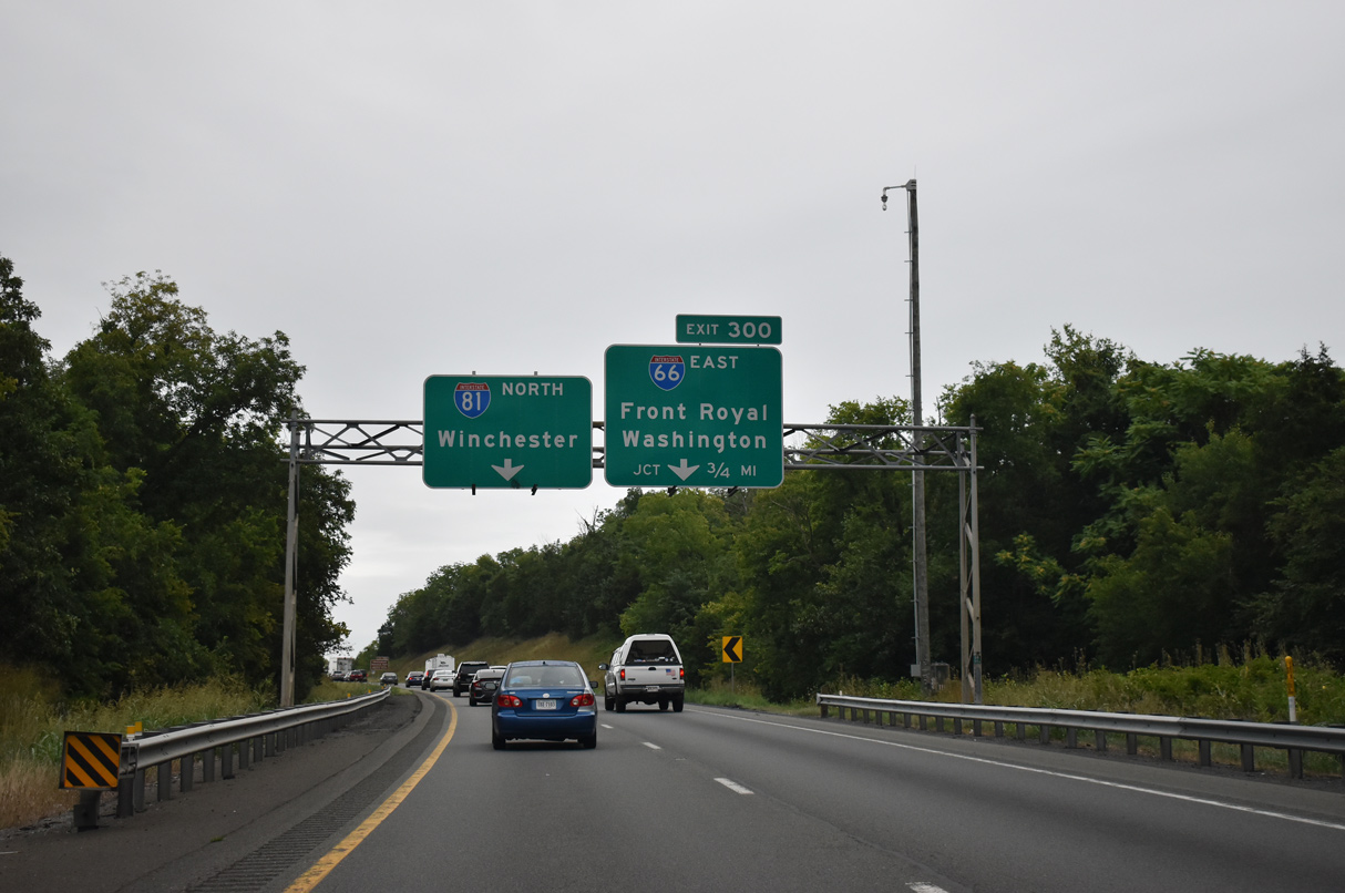
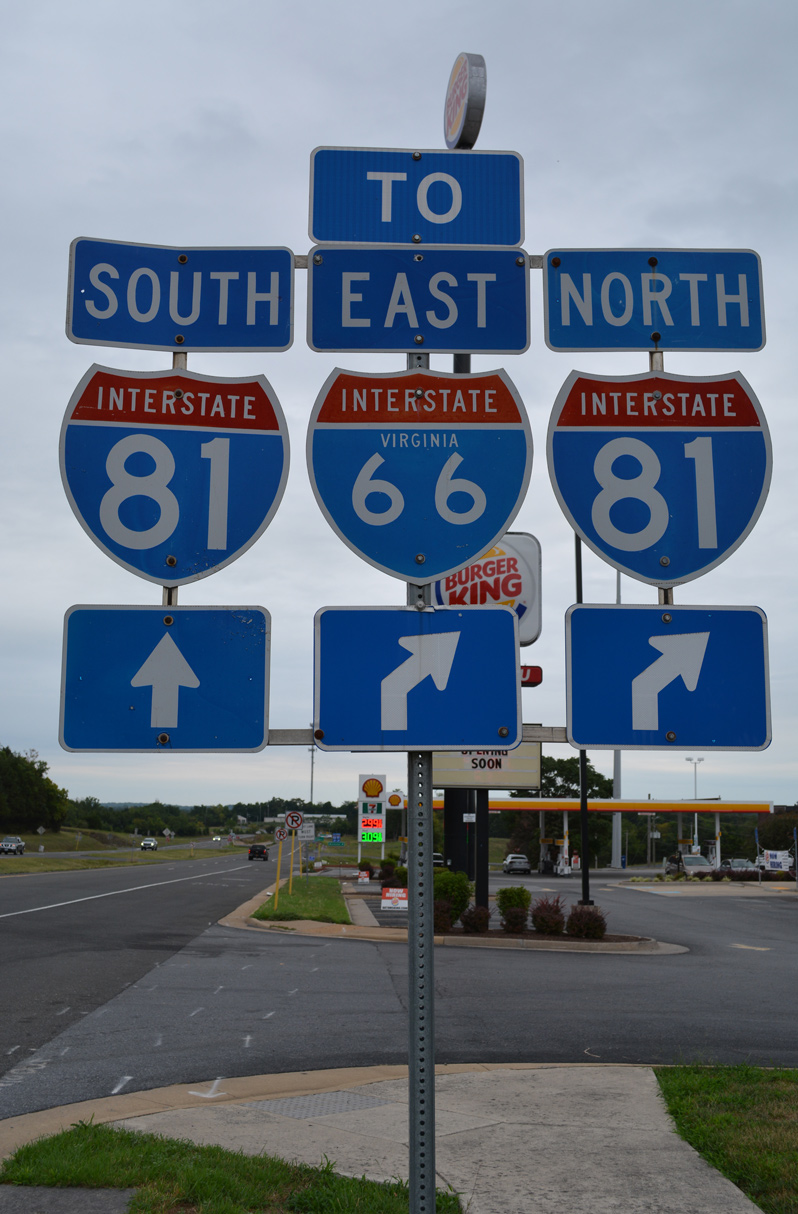
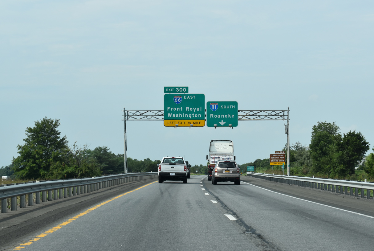
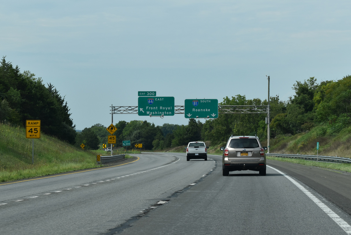
Interstate 81 spans Cedar Creek and enters Frederick County ahead of Exit 300 with Interstate 66. A three-wye interchange joins the two freeways just east of parallel U.S. 11. 08/15/21
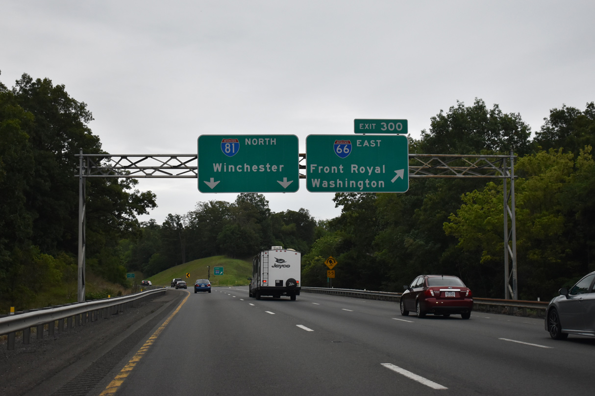
Exit 300 leaves I-81 north for Interstate 66 east six miles to U.S. 340/522 at Front Royal and 74 miles to Washington, DC. 08/15/21
![]() South at
South at ![]()
Interstate 81 heads southwest from the town of Middletown to the west end of I-66 at Exit 300. 08/22/21
Interstate 81 continues southwest along the Appalachian Mountains 158 miles from I-66 to the city of Roanoke. 08/22/21
Left Exit 300 departs from I-81 south for Interstate 66 east. The town of Front Royal lies nine miles to the southeast. 08/22/21
Throwback – at

Older guide signs for I-81 north at I-66 simply referenced Winchester with no mention of North. These were replaced by the 2000s. 05/27/95

An older guide sign again for I-81 north at Exit 300 for I-66 east. The 6.6-mile stretch of Interstate 66 east from here to U.S. 340/522 opened in October 1971.3 05/27/95
Sources:
- “Running Room on I-66.” The Washington Post, September 8, 2003.
- Celebrating the 50th Anniversary of the Eisenhower Interstate Highway System: Previous Interstate Facts of the Day by the Federal Highway Administration (FHWA).
- Interstate 66 in Virginia, Roads to the Future (Scott Kozel).
- Interstate 66 and Metrorail Vienna Route, Roads to the Future (Scott Kozel).
Page updated April 6, 2013.