Interstate 164 Indiana
Overview
Prior to 2014, Interstate 164 was the designation for the freeway spur linking I-64 with the city of Evansville in southwest Indiana. Renumbered as a southward extension of Interstate 69, the freeway connects Downtown Evansville and U.S. 41 north of the Twin Bridges across the Ohio River with Newburgh and the eastern suburbs.
Interstate 164 was signed as an east/west route between Exits 0 and 5 (SR 662) and with north/south banners from Exit 5 to I-64 (Exit 21). Center line ITS reference markers were posted along the freeway at 2/10th of a mile intervals. Typical of Indiana three digit Interstates, there were no control cities for I-164, although on I-64, Evansville and Henderson, Kentucky were used for southbound.
Superseding a portion of SR 57 north from Evansville to Wheatonville, Interstate 164 combined with the state road from a pair of wye interchanges at Exit 19 to I-64. SR 57 emerges from the freeway southwest to Evansville Regional Airport (EVV).
Route Information
North End – Elberfeld, IN
South End – Evansville, IN
Mileage – 21.24
Cities – Evansville
- Junctions –

Source: October 31, 2002 Interstate Route Log and Finders List
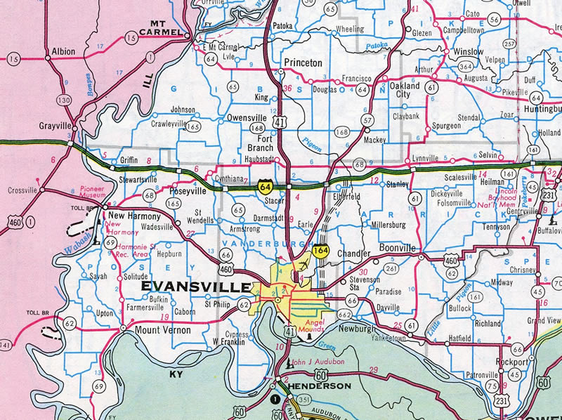
While appearing on maps in 1976, construction on Interstate 164 was still many years away.
 History
Interstate 164 was designated in 1968 and approved by the American Association of State Highway Officials (AASHO) on June 23, 1969. The freeway was not completed until August 2, 1990. Work at the south end included construction of a $46 million interchange with U.S. 41 and Veterans Memorial Parkway. This was the most expensive interchange built for an Interstate highway in Indiana at the time.1
The adjacent Lloyd Expressway (State Road 66) stems west from the I-164 freeway at Exit 7. It was completed in 1988.1 I-164 was subsequently named the Robert D. Orr Highway in February 1989. Orr was a former Indiana Governor who lived in Evansville and supported the $160 million road.2
The first step in the renumbering of Interstate 164 as I-69 was made at the American Association of State Highway and Transportation Officials (AASHTO) Fall meeting on October 21, 2013. Approval was given then to redesignate 20.70 miles of the 21.39 mile long route as an extension of Interstate 69 south from I-64 to U.S. 41 in Evansville. Following approval by the Federal Highway Administration (FHWA), the Indiana Department of Transportation (INDOT) began replacing signs in November 2014.3,4 The remaining mileage for I-164 represents the connection with Veterans Memorial Parkway, an expressway maintained by the city that leads west from U.S. 41.
 Photo Guides
North End  – Elberfeld, Indiana
![]()
![]() North at
North at ![]()
![]()
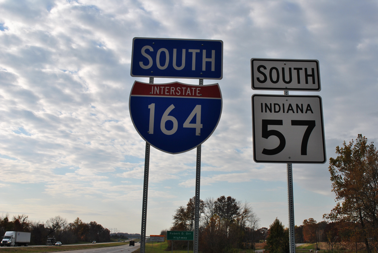
State Road 57 merged onto I-164 north at a wye interchange two miles ahead of Interstate 64. Photo by Brian Dowd (10/05/02).
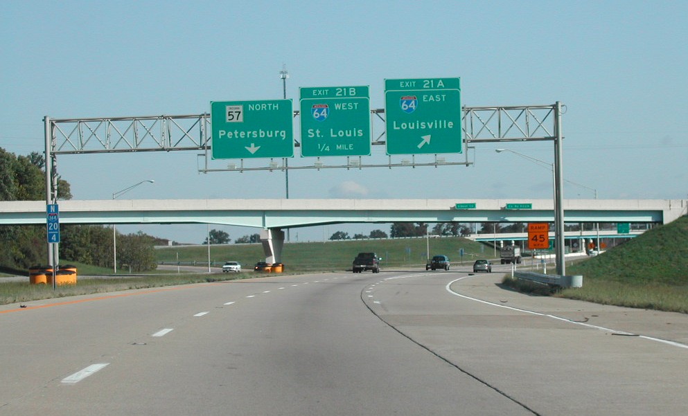
County Road 800 N crossed over I-164 one mile ahead of Exit 21A for Interstate 64 east to Louisville. 05/27/11
Originally a diamond interchange joined I-64 and SR 57. When Interstate 164 was built, the exchange was upgraded to a cloverleaf as the new freeway overtook a portion of the state road alignment to the south. Photo by Brian Dowd (10/05/02).
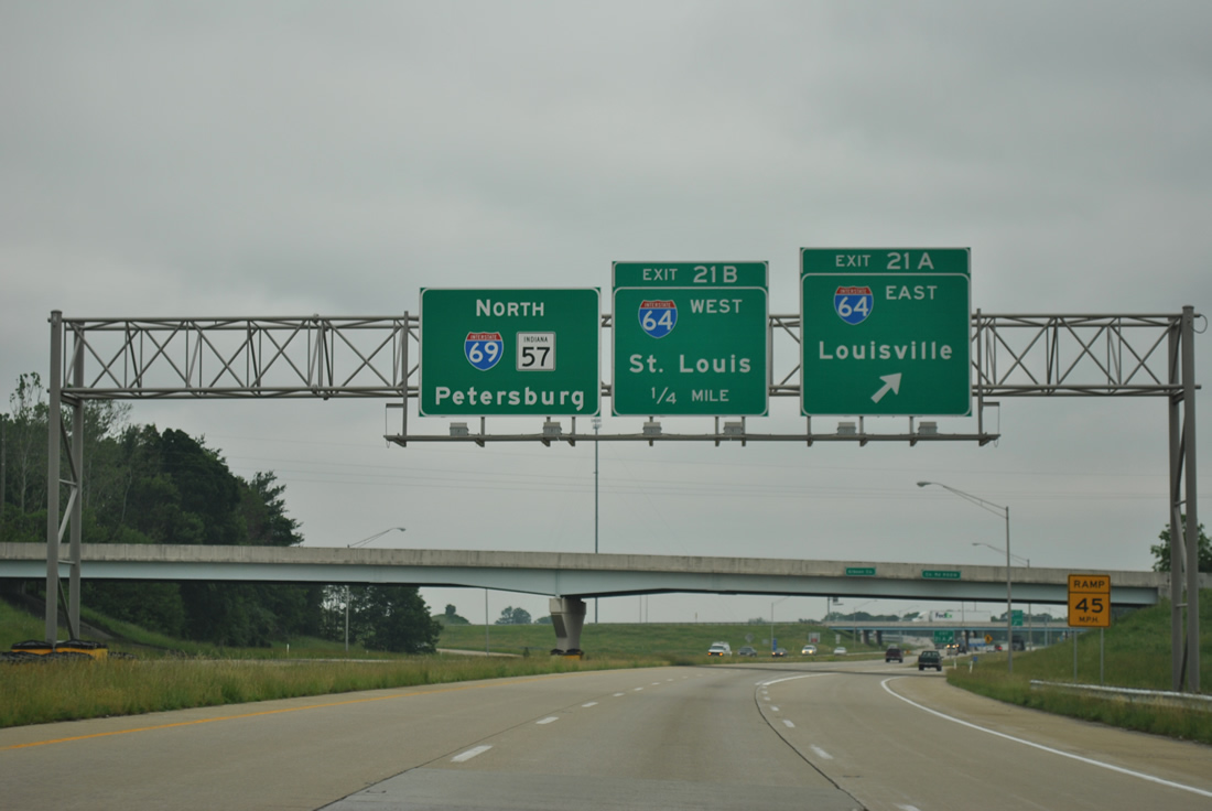
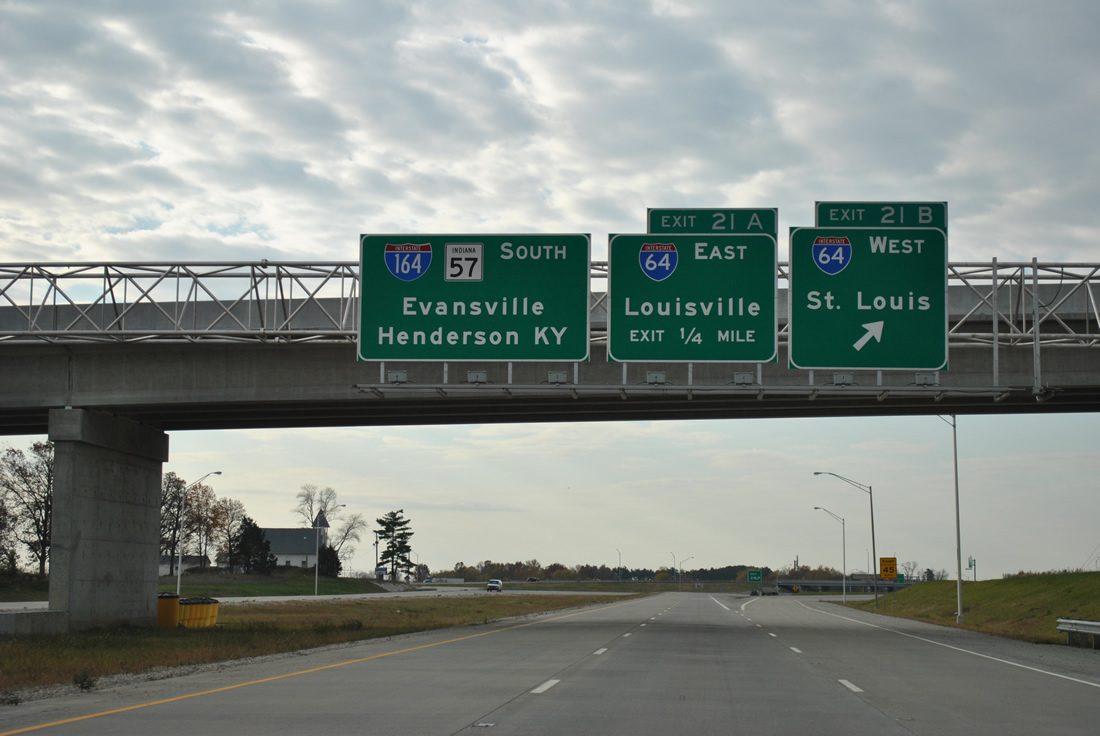
Interstate 164 transitioned into I-69 north beyond the ramps with I-64. A 1.77 mile segment of Interstate 69 opened to traffic northward to SR 67 on October 1, 2009. The succeeding section opened north to Crane and U.S. 231 on November 19, 2012. 05/27/11
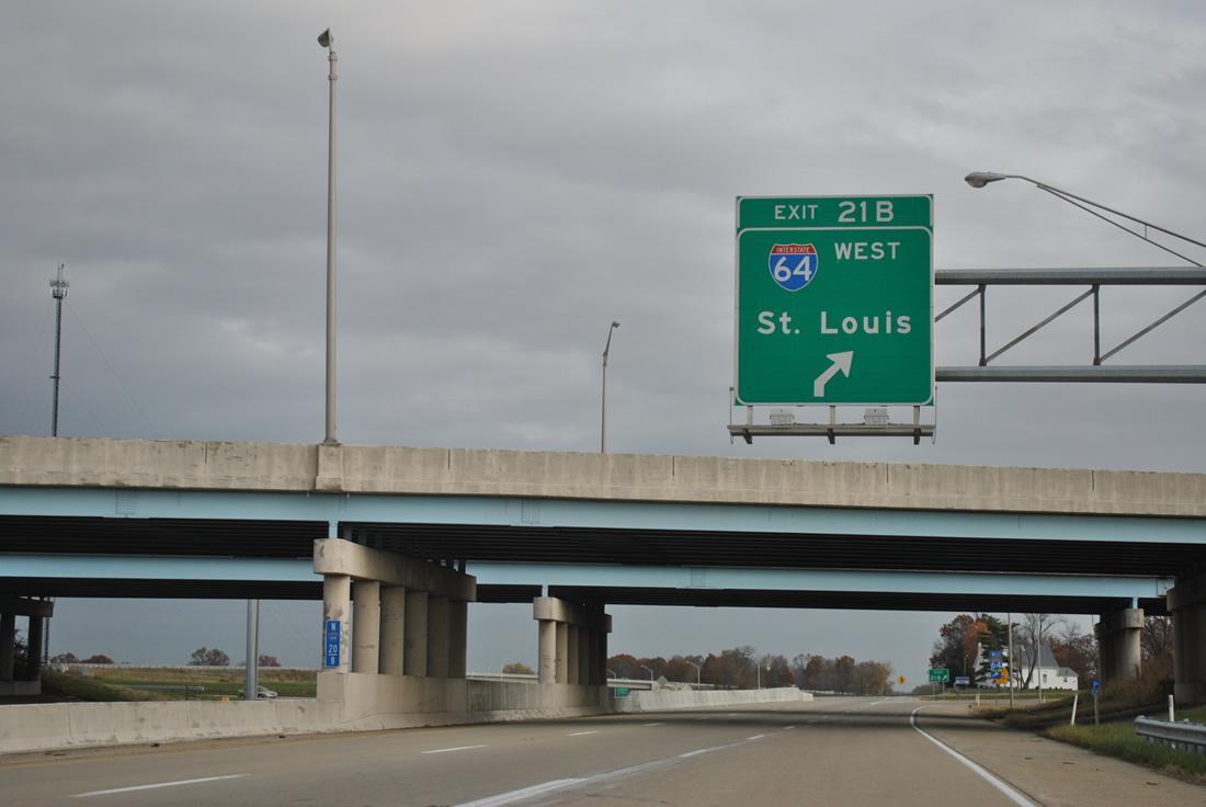
Interstate 64 travels 161 miles west from Exit 21B to St. Louis. SR 57 continues north along I-69 to SR 68 east, where it rejoins its original route to Oakland City. 05/27/11
![]() East at
East at ![]()
![]()
![]()

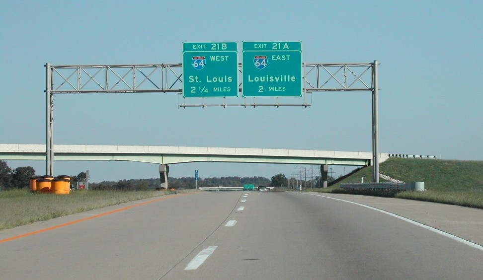
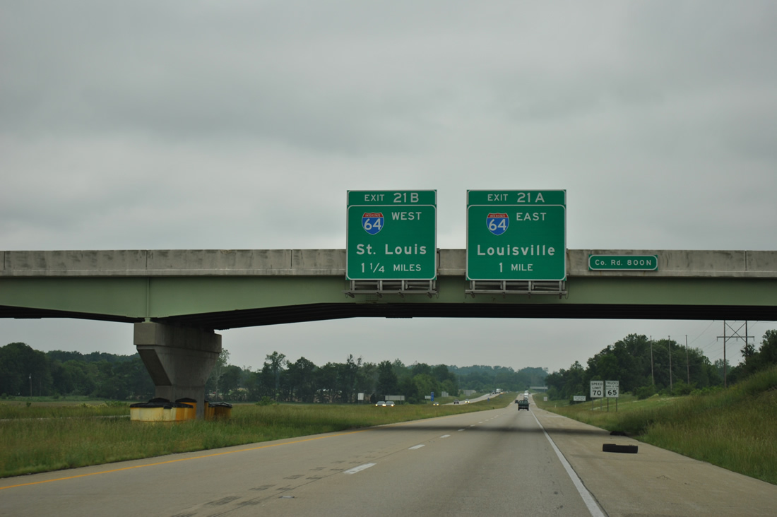
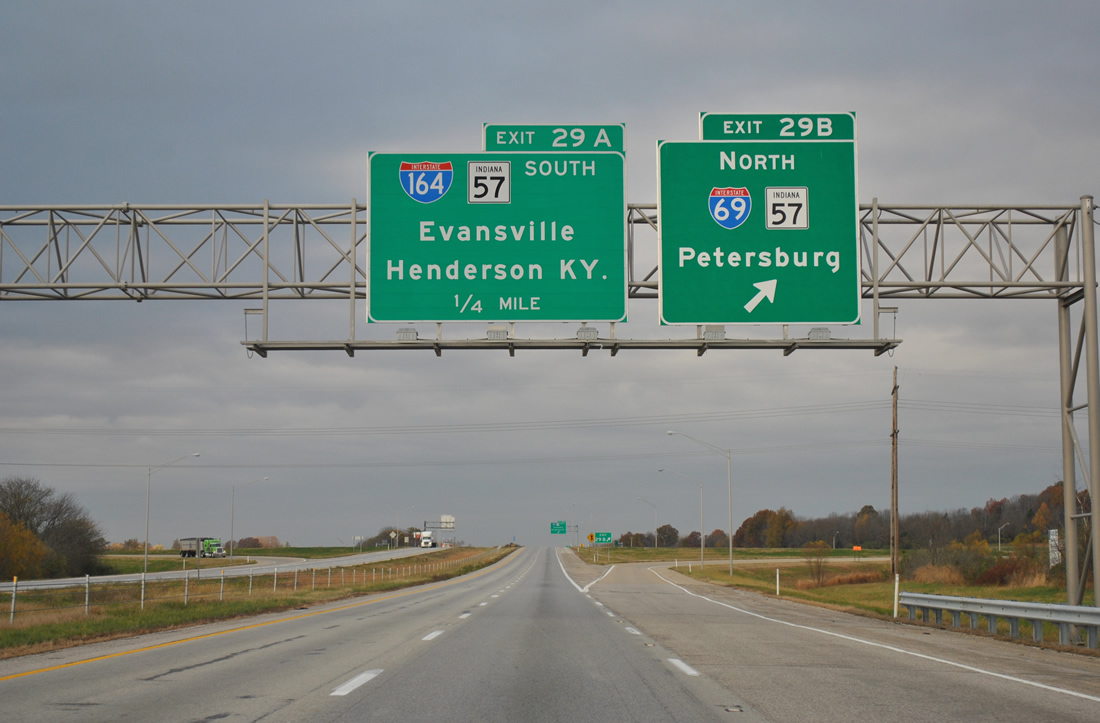
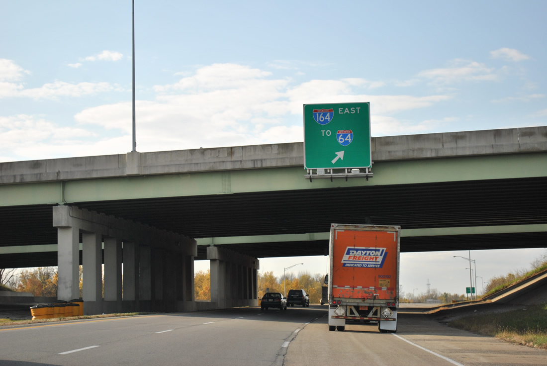
Two miles ahead of the interchange (Exits 29A/B) with former I-164/SR 57 south and I-69/SR 57 north along Interstate 64 east. 11/07/11
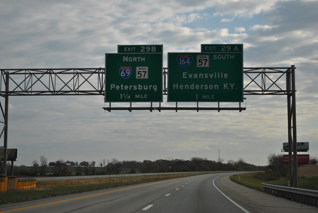
Interstate 69 replaced SR 57 north from Exit 29B when it opened to traffic on October 1, 2009. By November 19, 2012, the freeway traveled an additional 65 miles northeast to Crane. SR 57 follows the freeway for 1.77 miles to SR 68 nearby. 11/07/11
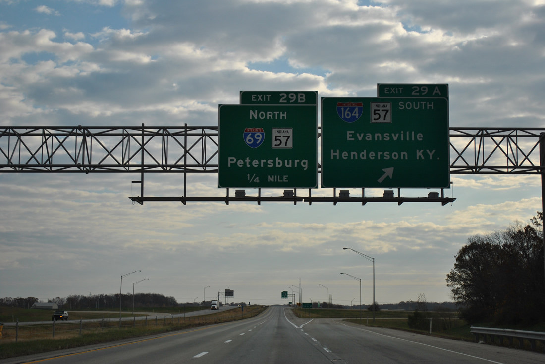
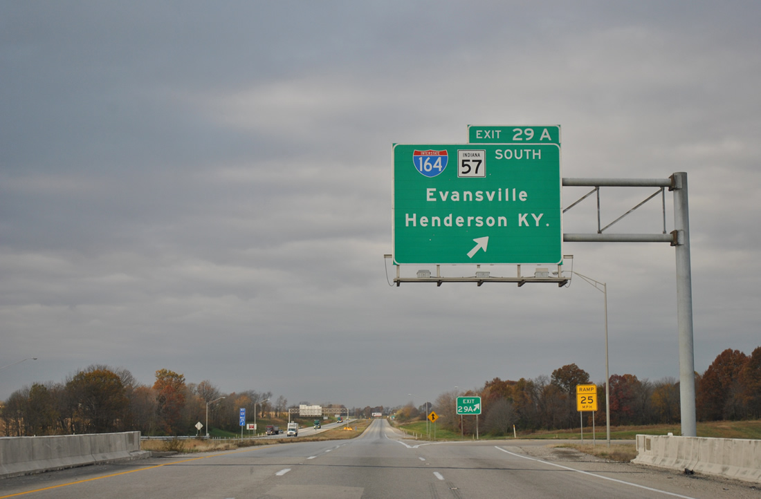
Exit 29A departed from I-64 east for I-164/SR 57 south. The city limits of Evansville lies 13 miles away. SR 57 parts ways with the freeway at the ensuing exit for Daylight and north Evansville. 11/07/11
![]() West at
West at ![]()
![]()
![]()
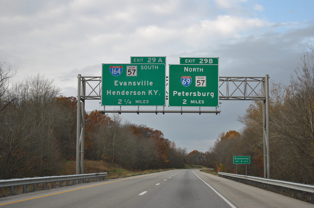
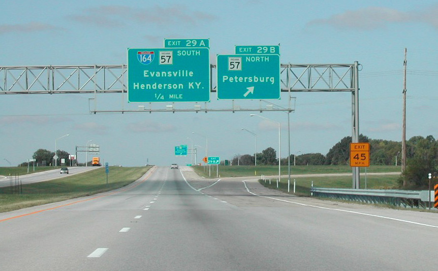
Two miles east of former I-164 south, SR 57 and I-69 on Interstate 64 west. 11/07/11
SR 57 parallels I-69 north 26 miles to the Pike County seat of Petersburg. 11/07/11
Interstate 164 and SR 57 met I-64 at the first of two Evansville area interchanges. U.S. 41 connects with the freeway six miles further west. Photo by Brian Dowd (10/05/02).
Exit 29B connects I-64 with I-69/SR 57 north to SR 68 and nearby Wheatonville. I-69 travels 67 miles northeast to Crane. 11/07/11
Westbound Interstate 64 at Exit 29B prior to the addition of I-69. SR 57, in conjunction with SR 67, was the main corridor between Evansville and Indianapolis. Photo by Brian Dowd (10/05/02).
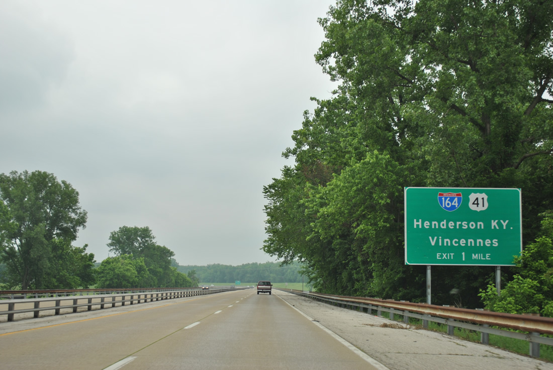
Interstate 164 extended southward from I-69, which opened in October 2009, to Newburgh, Evansville and U.S. 41 ahead of the Twin Bridges to Henderson, Kentucky. 11/07/11
![]()
![]() South at
South at ![]()
![]()
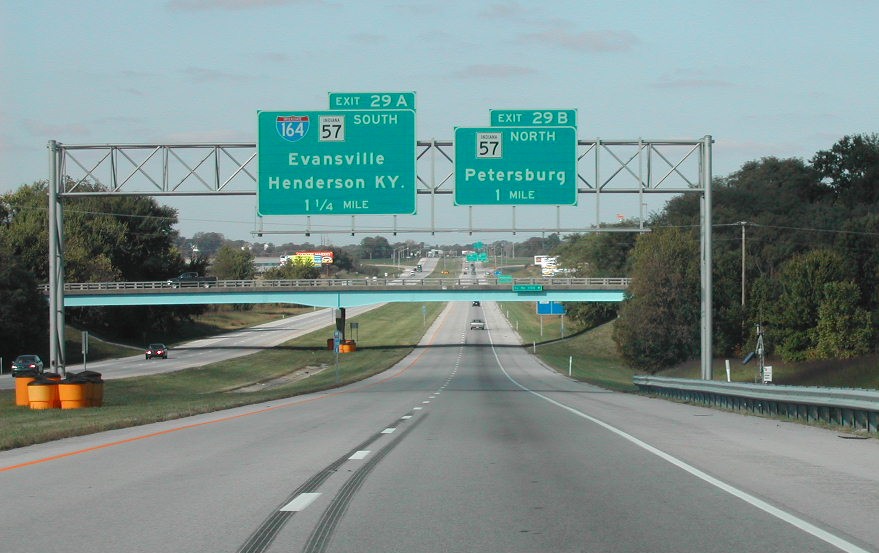
Prior to the addition of I-69, SR 57 expanded to four lanes at the cloverleaf interchange with I-64 and I-164. Photo by Brian Dowd (10/05/02).
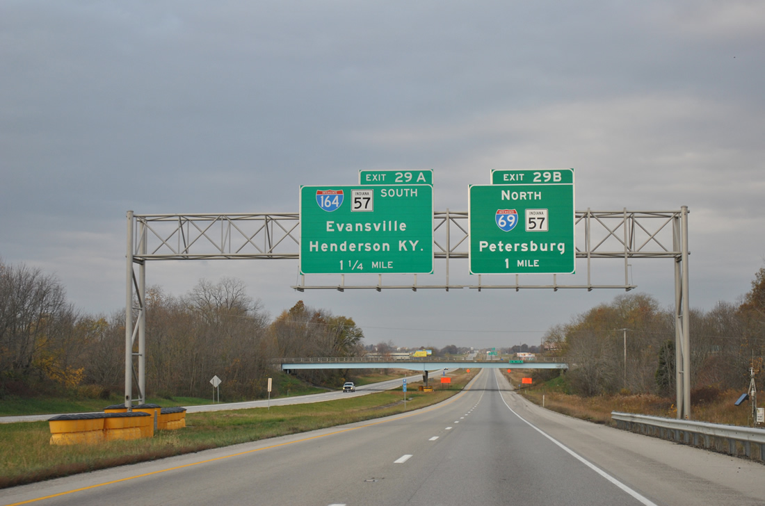
I-69/SR 57 south at I-64/164. Construction of I-69 cut across the old alignment of SR 57 and County Road 1250 S. A new overpass and access road was built to connect old SR 57 with County Road 1250 S to the west as part of the I-69 project. Ramps with the freeway were extended northward to the new overpass. 10/07/11
South End – Evansville, Indiana
![]() West at
West at ![]()
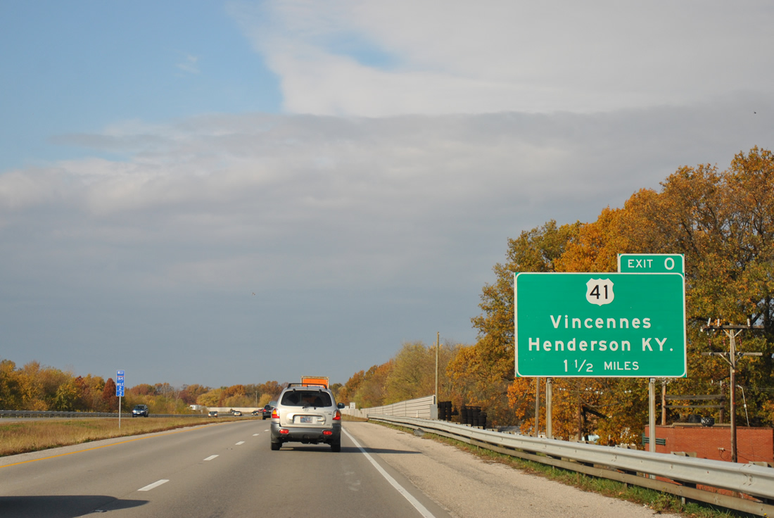
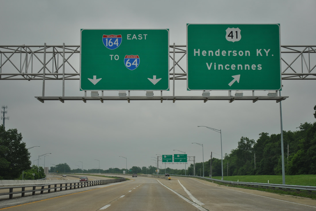
One and a half miles east of Exit 0 for U.S. 41 on Interstate 164 westbound. 11/07/11
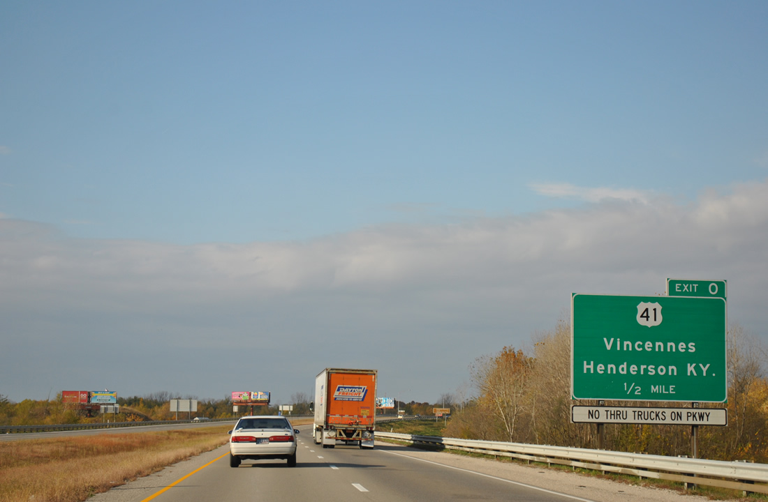
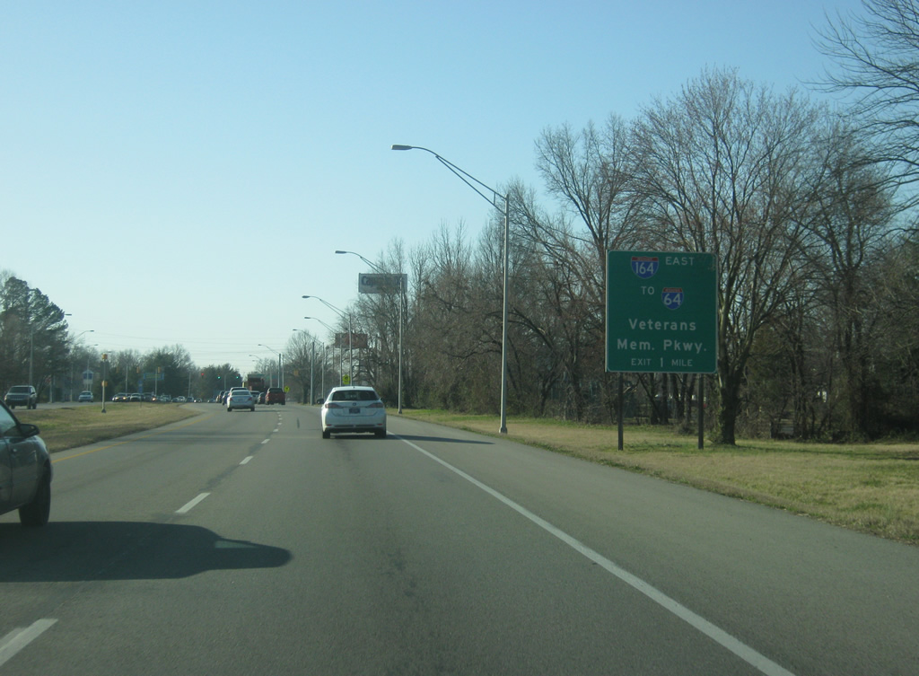
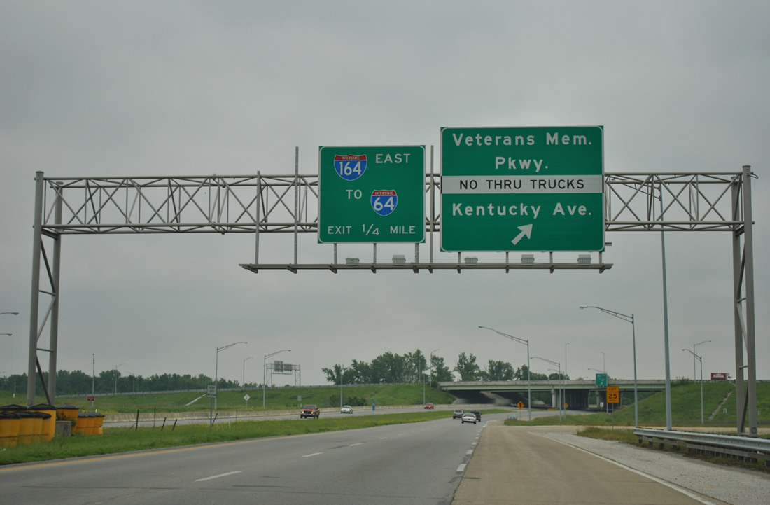
U.S. 41 leads south from the freeway end across the Twin Bridges into Henderson, Kentucky. With a restriction on Veterans Memorial Parkway west beyond the end of Interstate 164, all trucks were directed to take Exit 0. 11/07/11
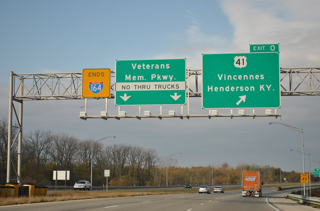
The end sign for I-164 was similar to the yellow end sign at the northern terminus of Interstate 65 in Gary. The I-164 shield was removed from the panel by late 2014. 11/07/11
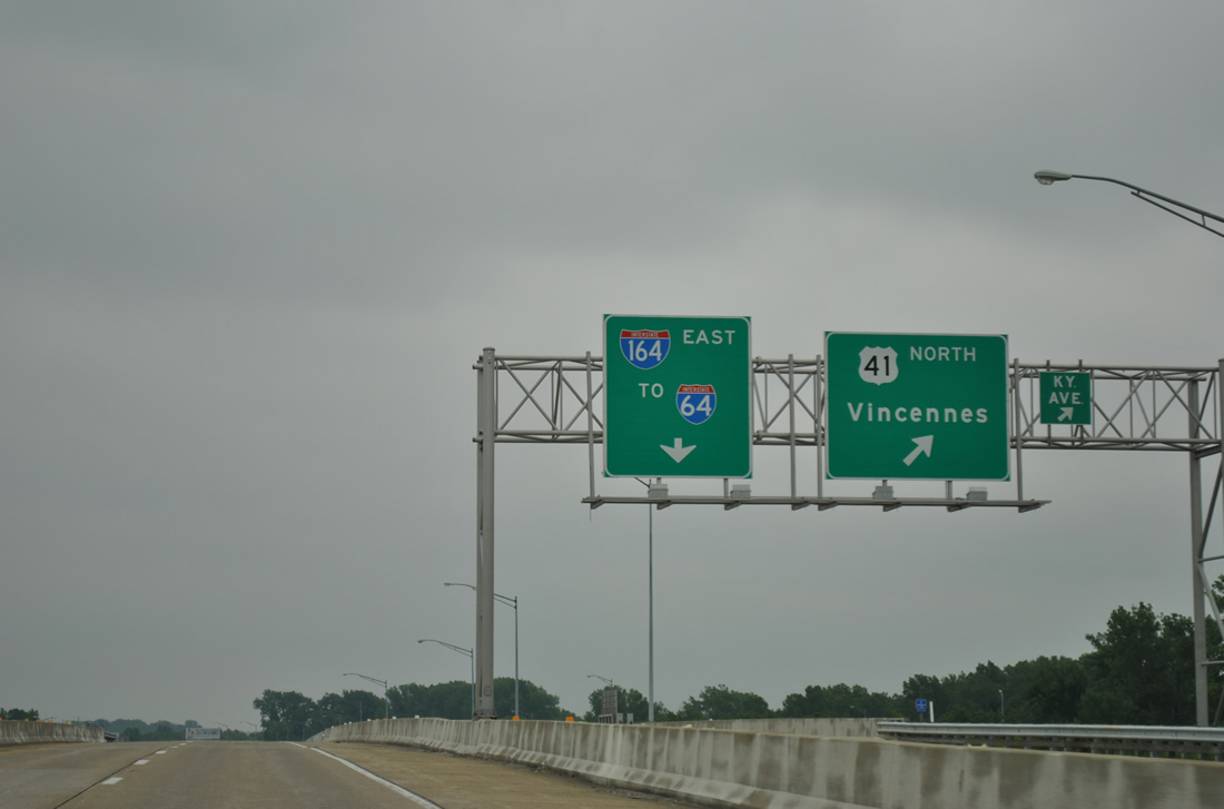
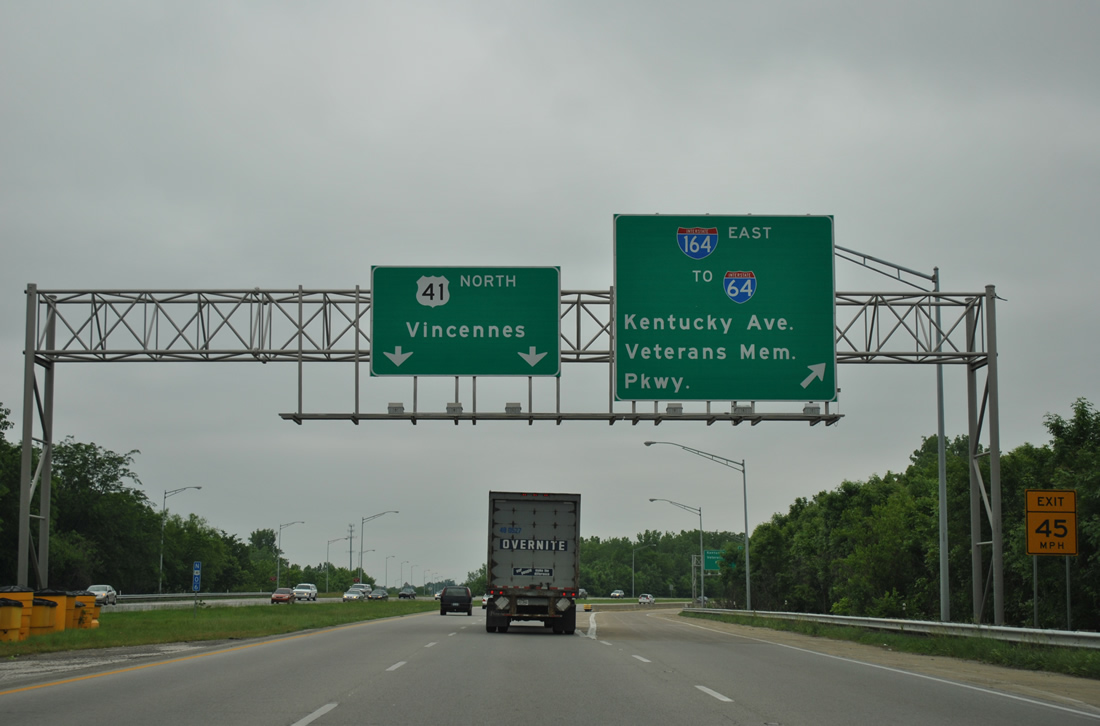
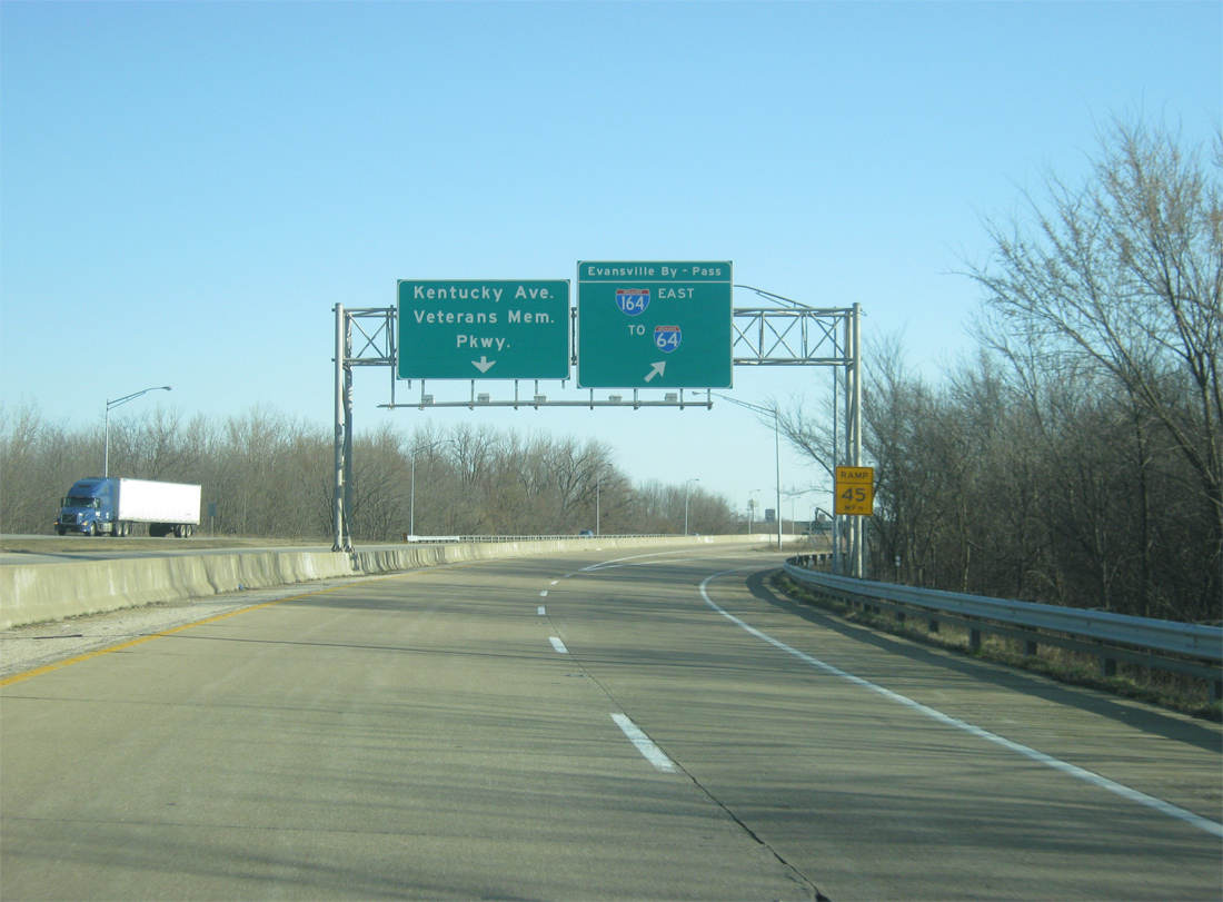
A collector distributor separates from the freeway for U.S. 41. U.S. 41 north leads toward Downtown Evansville and SR 62/66 (Lloyd Expresway), the main arterial from west to east across the city. 11/07/11
The c/d roadway continues to split with ramps for U.S. 41 south to Henderson, Kentucky and Kentucky Avenue, a local street that was formerly U.S. 41 Business. 11/07/11
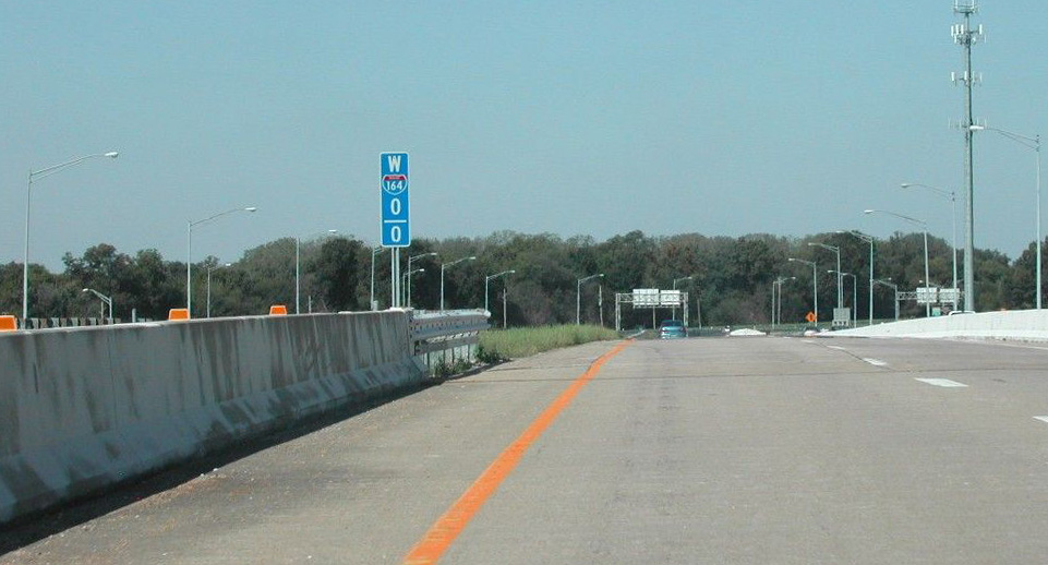
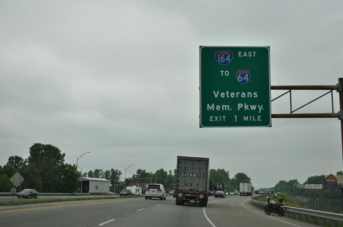
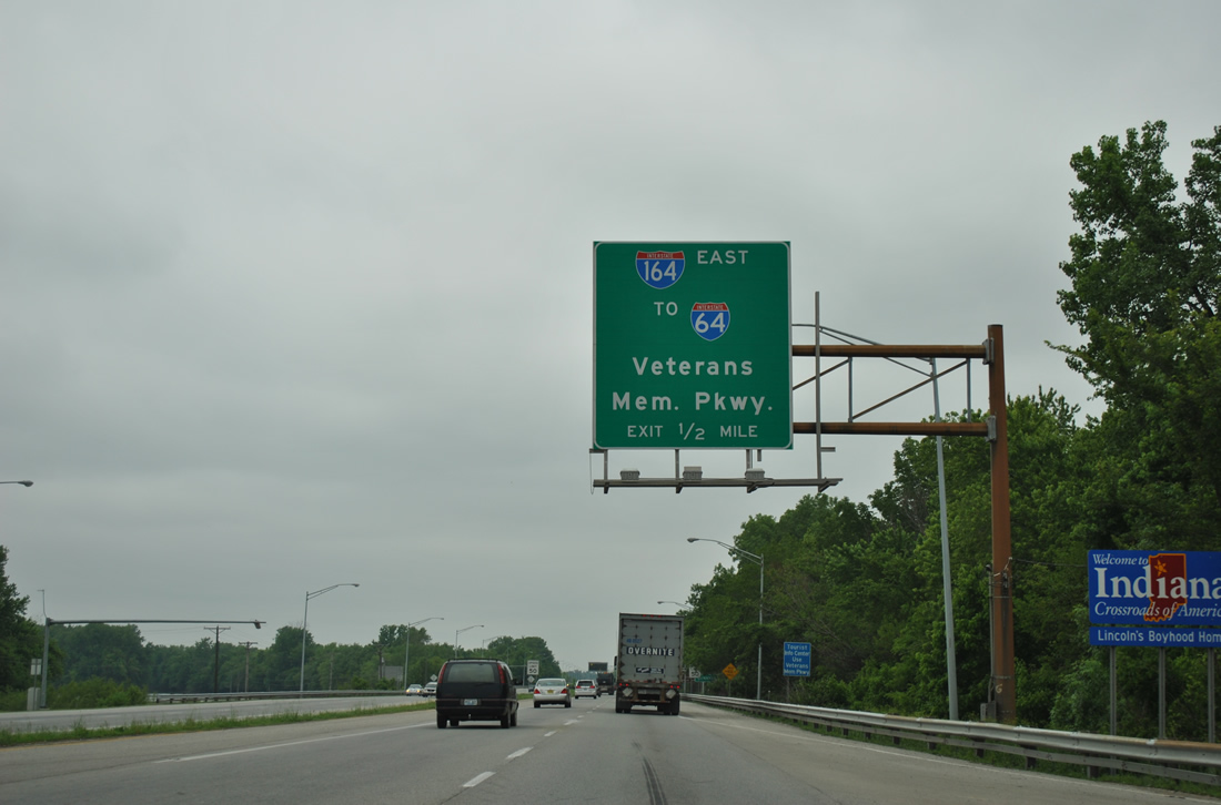
Mile post 0.0 for Interstate 164 west. Veterans Memorial Parkway extends northwest toward SR 62 (Lloyd Expressway). Photo by Brian Dowd (10/05/02).
Veterans Memorial Parkway – East at ![]()
![]()
Traveling southeast from Sunrise Park, Veterans Memorial Parkway advances one mile to Interstate 164 and U.S. 41. 05/27/11
Control cities for guide signs along Veterans Memorial Parkway referenced U.S. 41. Interstate 164 served the eastern suburbs and Newburgh before turning north to a rural junction with I-64/69. 05/27/11
I-164 began as Veterans Memorial Parkway entered the cloverleaf interchange with U.S. 41. 05/27/11
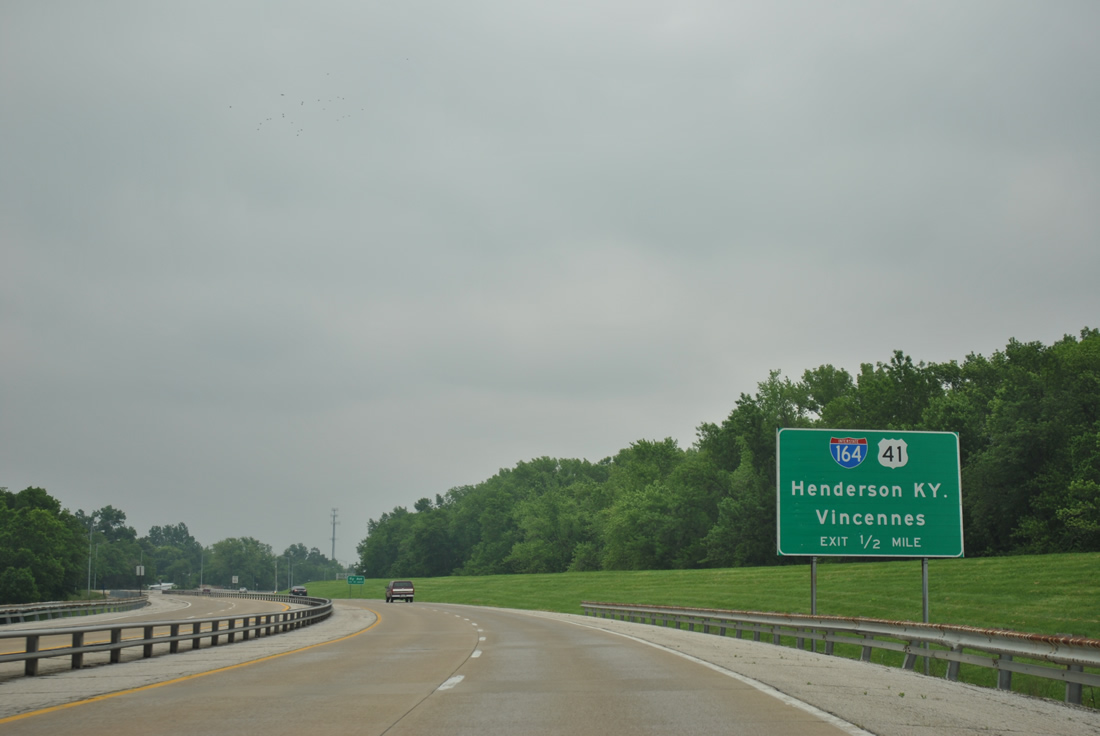
U.S. 41 continues north from Interstate 164 as the main arterial through Evansville. Despite that, Vincennes is used as the control city since this exchange spreads across the Evansville city line. 05/27/11
![]() North at
North at ![]()
North of the Ohio River, but still in Kentucky, U.S. 41 passed by Ellis Park on Green River Island, one mile from Interstate 164. 05/27/11
U.S. 41 intersects Waterworks Road at the Indiana state line, a half mile south of former I-164. 05/27/11
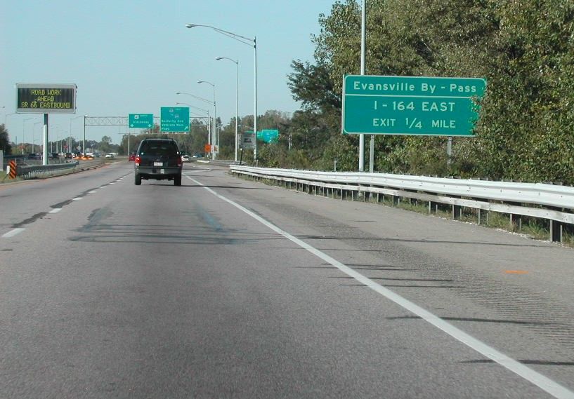
Evansville By – Pass sign preceding the eastbound entrance ramp for Interstate 164. This sign was removed when I-69 was signed. Photo by Brian Dowd (10/05/02).
A collector distributor roadway separated from U.S. 41 north for Interstate 164 east and Veterans Memorial Parkway west. 05/27/11
No control point for I-164 was used as it does not enter any other city outside of Evansville. The Warrick County suburb of Newburgh however lies east of Exit 5 and 7. Photo by Thomas Decker (03/06/12).
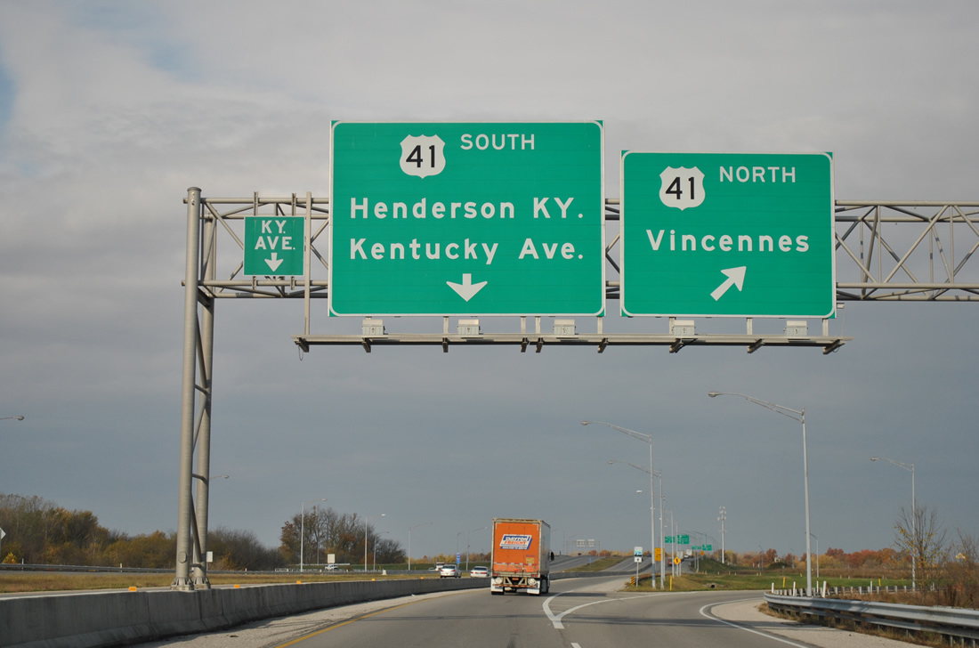
![]() South at
South at ![]()
One mile north of Interstate 164 east along U.S. 41 south ahead of Covert Avenue. Photo by Thomas Decker (03/06/12).

U.S. 41 continues a half mile south from the signalized intersection with E Riverside Drive to the cloverleaf interchange with I-164 east and Veterans Memorial Parkway west. Photo by Thomas Decker (03/06/12).
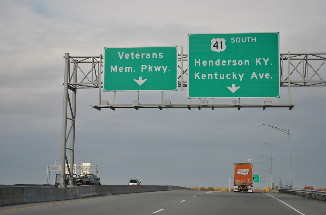
Southbound U.S. 41 at the ramp for Veterans Memorial Parkway north from I-164 to adjacent Kentucky Avenue and Downtown Evansville. 05/27/11
U.S. 41 curves to the southwest to overtake the alignment of Kentucky Avenue (former U.S. 41 Business) beyond the loop ramp for old I-164 east. 11/07/11
Sources:
Brian Dowd for assisted with the background information on Interstate 164.
- “bypass allows nonstop traffic around Evansville.” Owensboro Messenger-Inquirer (KY), August 3, 1990.
- “Highway may be Named for Orr.” Post-Tribune (IN), December 1, 1988.
- “Recalculating: I-164 to become I-69.” WFIE (Evansville, IN), November 15, 2013.
- “I-164 Renamed to I-69 by End of Year.” Indiana Department of Transportation, press release. November 18, 2014.
Page updated July 23, 2021.