Interstate 180 Pennsylvania
Overview
Interstate 180 spurs north from I-80 and PA 147 near the borough of Milton to Williamsport and the Lycoming Valley. The rural freeway mirrors the course of the Susquehanna River West Branch north from McEwensville to Muncy. Turning west ahead of Lycoming Mall, I-180 travels around the borough of Montoursville by Williamsport Regional Airport (IPT) to Downtown Williamsport.
U.S. 220 overlaps with Interstate 180 from Montoursville west to Williamsport and the Susquehanna Beltway. U.S. 15 accompanies I-180 between the Market Street Bridge to South Williamsport and the west end at Lycoming Creek. U.S. 220 west to Lock Haven and I-80, and U.S. 15 north to the New York state line, are both a part of the future Interstate 99 corridor.
 History
Interstate 180 was established by the American Association of State Highway and Transportation Officials (AASHTO) on October 1, 1983 after the final segment of the freeway along PA 147 between I-80 and Williamsport opened to traffic in 1982. Work on the initial segment of PA 147 started in 1969.1
Route Information
East End – Milton, PA
West End – Williamsport, PA
Mileage – 28.84
Cities – Williamsport, Montoursville
- Junctions –

Source: December 31, 2021 Interstate Route Log and Finders List
I-180 Annual Average Daily Traffic (AADT)
Source: 2017 PennDOT Traffic Volume Maps

The exchange joining I-80 with I-180 in Turbot Township was originally numbered Exits 31 A/B. 12/17/93
 Photo Guides
East End 
 – Milton, Pennsylvania
![]() East at
East at ![]()
![]()
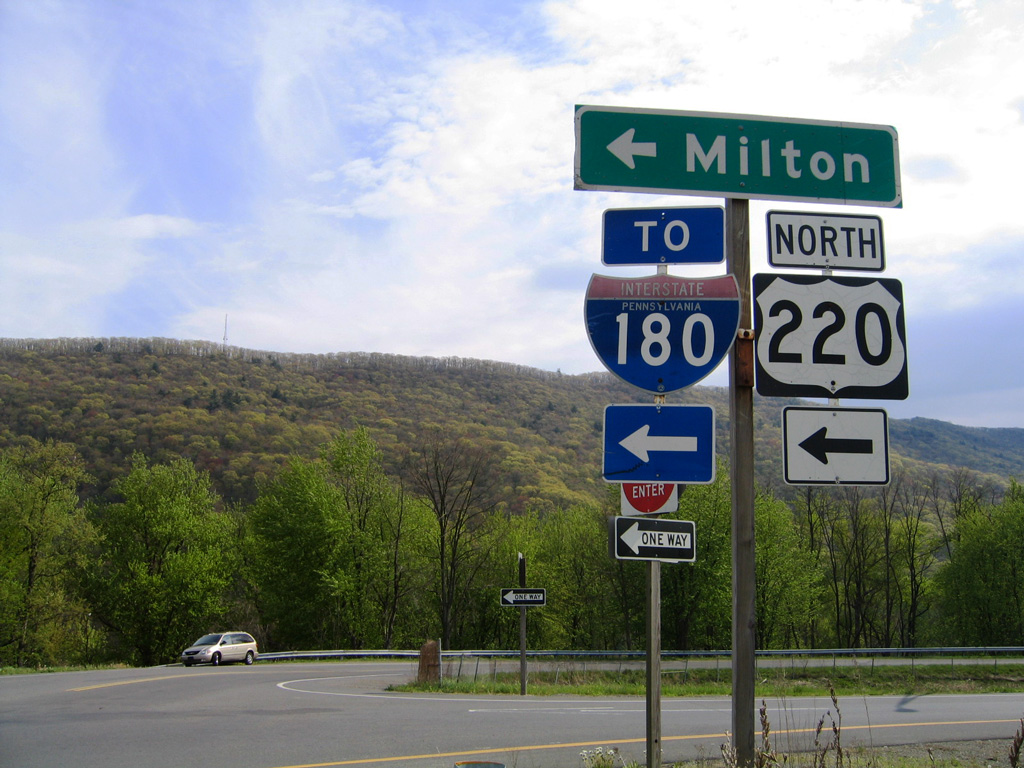
Susquehanna Trail angles southwest along a portion of old PA 147 from the borough of McEwensville to meet Interstate 180 three quarters of a mile north of I-80. 01/18/17
Prior to construction of Interstate 180, PA 147 extended south from McEwensville to a diamond interchange with I-80. The exchange was eventually incorporated into I-180 with loop ramps added in all directions. 01/18/17
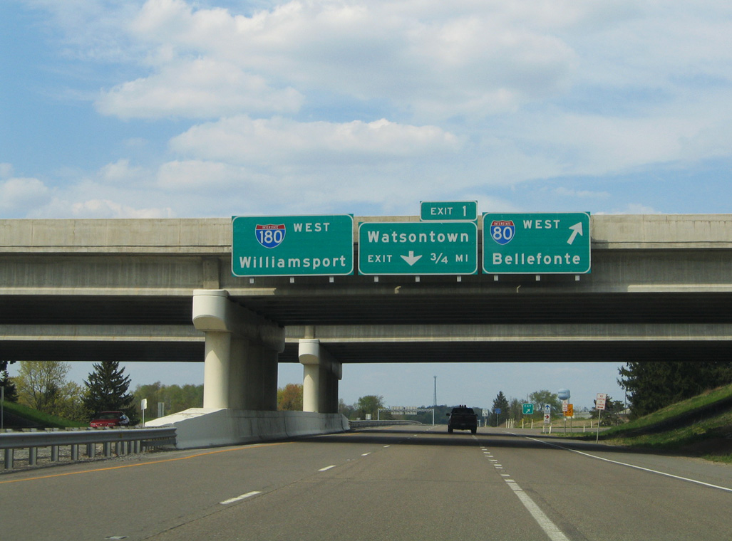
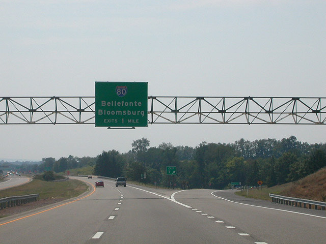
Ramps for I-80 west to Bellefonte and east to Bloomsburg are unnumbered along Interstate 180. I-80 spans the Susquehanna River to the immediate west into Union County. Youngstown, Ohio lies 220 miles away. 01/18/17
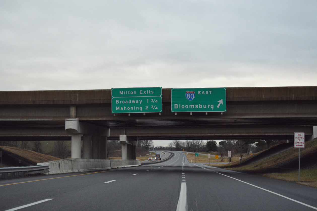
Interstate 80 trends southeast from I-180 to cross Limestone Ridge into Liberty township. The freeway proceeds east from Mooresburg through Frosty Valley to the town of Bloomsburg. 01/18/17
![]() North at
North at ![]()
![]()
PA 147 northbound bypasses the borough of Milton along a freeway leading north directly into the exchange joining I-80 and I-180. 05/07/05
PA 147 previously expanded from a two lane expressway to a four lane freeway just ahead of the cloverleaf interchange with Interstate 80. I-80 was rebuilt between U.S. 15 and PA 147/I-180 in 2000-02. 05/07/05
Interstate 80 leads east from PA 147 and I-180 to Bloomsburg, Hazelton and the Pocono Mountains. 05/07/05
PA 147 north concludes as I-180 begins below the Interstate 80 center line. The state route historically extended 26 miles north into Williamsport. 05/07/05
![]() East at
East at ![]()
![]()
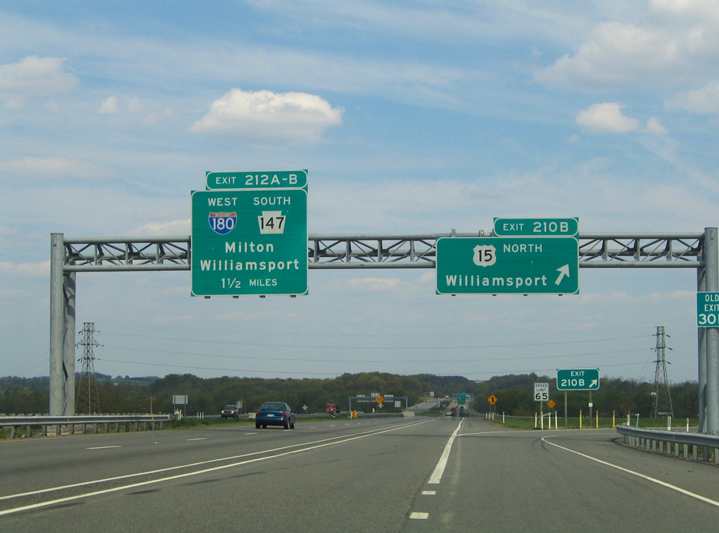
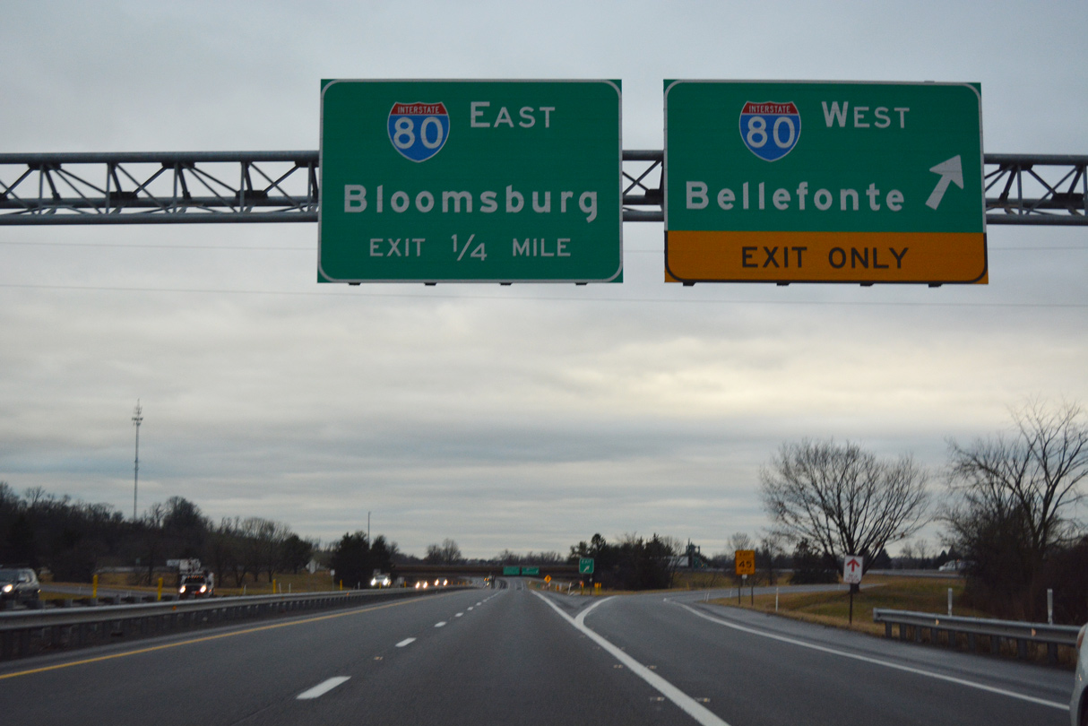
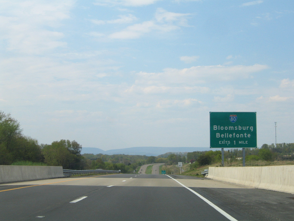
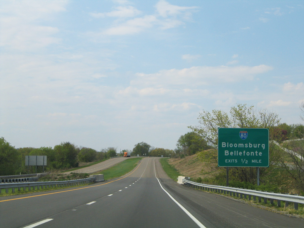
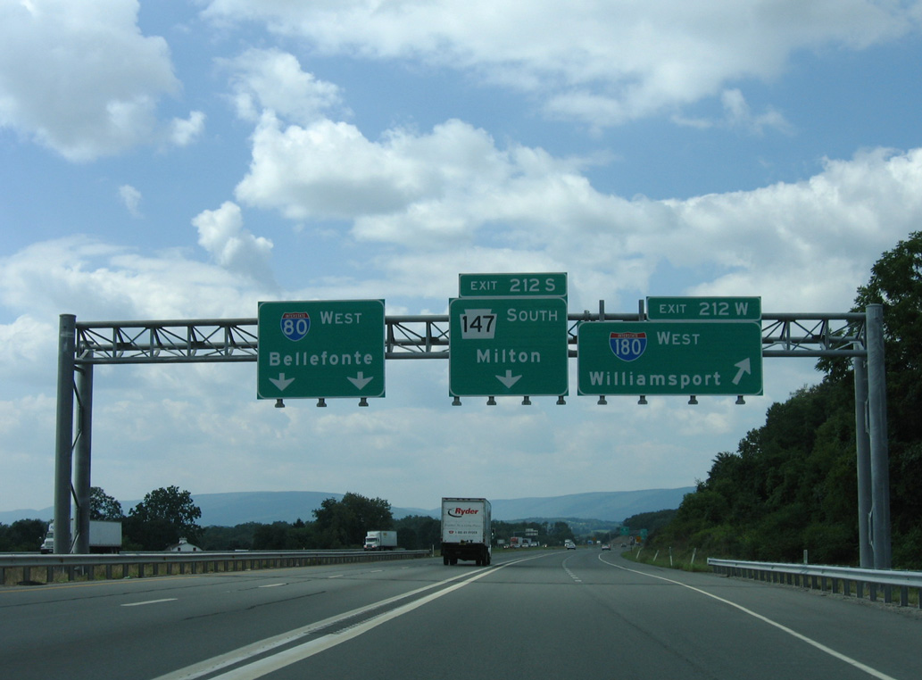
Interstate 80 advances 1.5 miles east from the cloverleaf interchange with the freeway along U.S. 15 at New Columbia to PA 147 south and I-180 north at Exit 212. 05/07/05
An auxiliary lane opens along Interstate 80 eastbound across the Susquehanna River West Branch to Exit 212 A for PA 147 south to Milton and Exit 212 B for I-180 west to Williamsport. 05/07/05
2000-02 reconstruction of I-80 expanded the freeway with c/d lanes through the cloverleaf interchange with Interstate 180 west and PA 147 south. 05/07/05
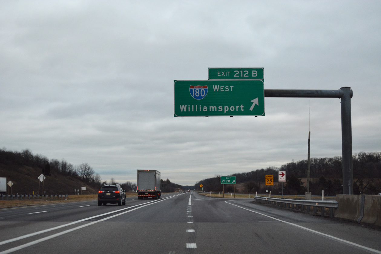
Exit 212B loops onto I-180 leading north to Muncy and west to Montoursville and Williamsport. 01/18/17
![]() West at
West at ![]()
![]()
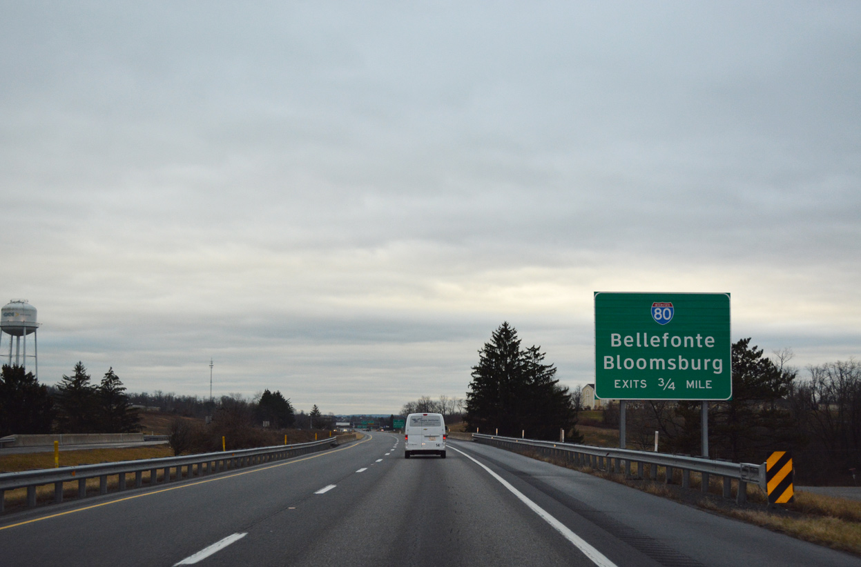
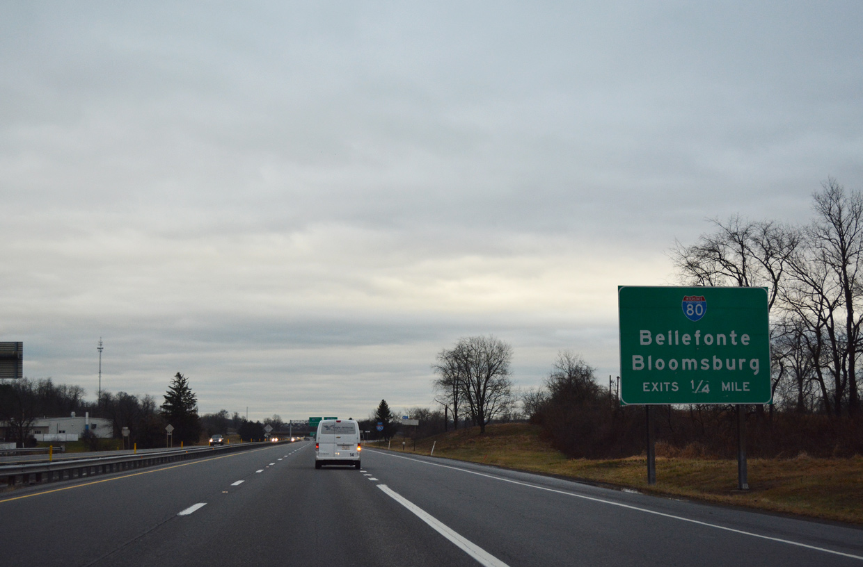
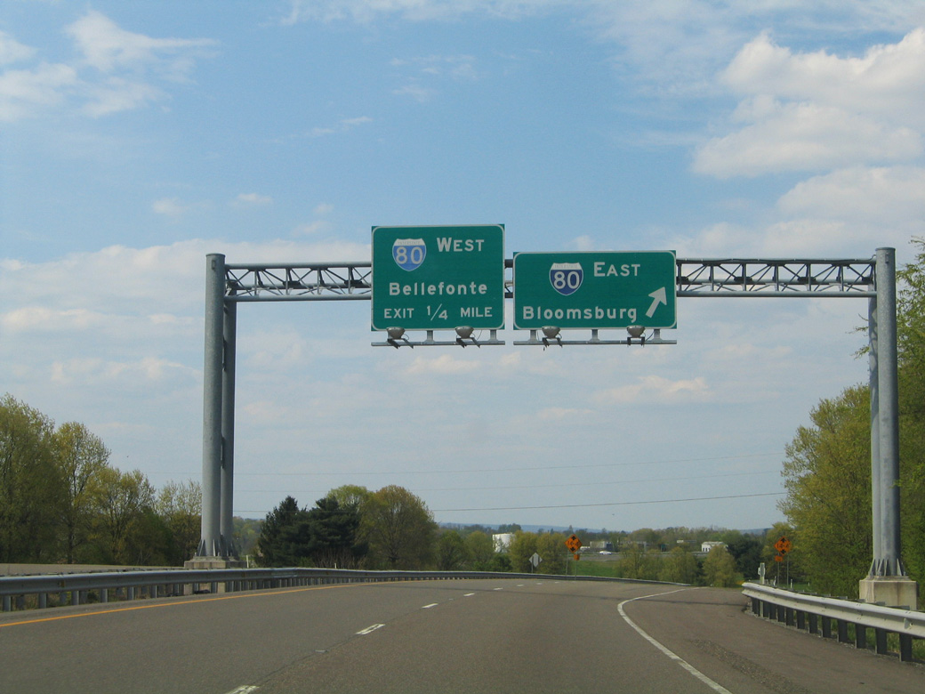
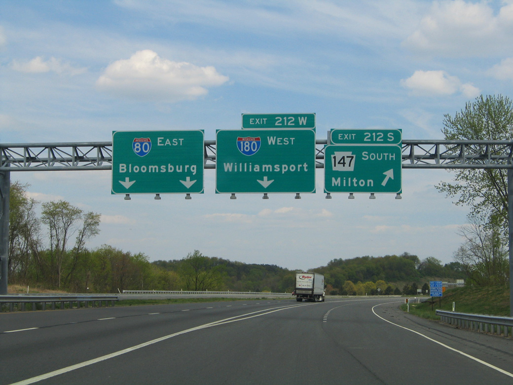
Interstate 80 heads three miles northwest from PA 254 through Turbot township to meet I-180 and PA 147. 09/01/05
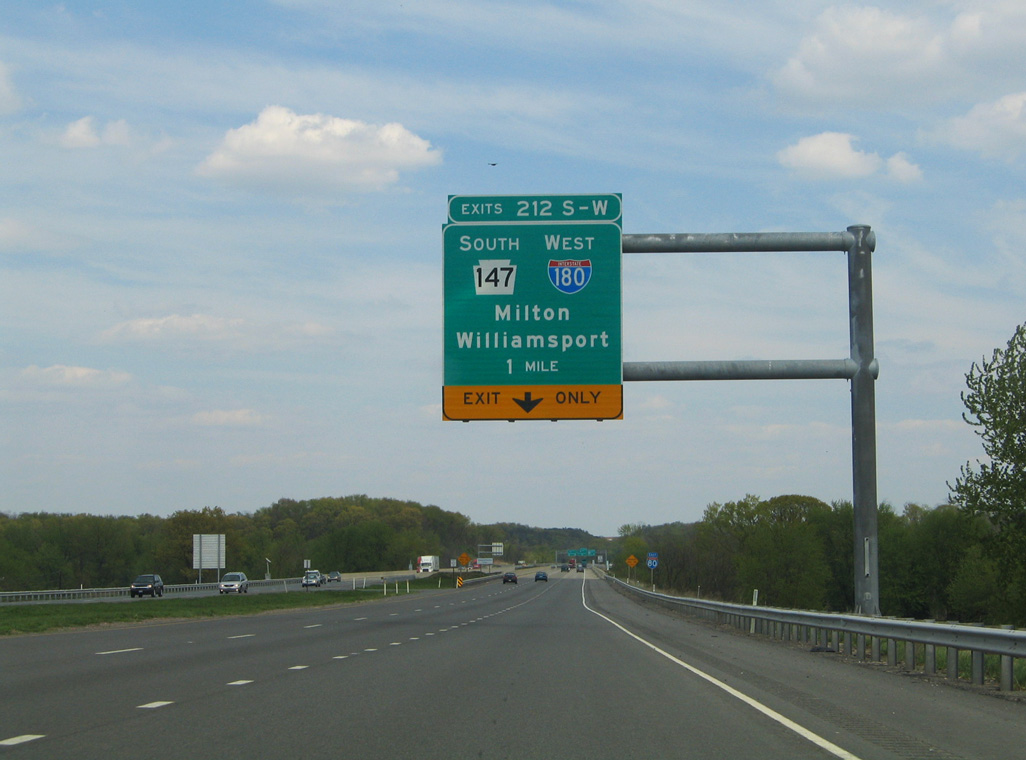
One mile ahead of the c/d lane for I-180 west 26 miles to Williamsport and PA 147 south to nearby Milton. 09/01/05
The I-80 roadways separate leading into the cloverleaf interchange (Exits 212B/A) with Interstate 180 and PA 147. 09/01/05
Westbound I-80 reaches Exit 212B for Interstate 180 west to Williamsport and U.S. 15 north to I-99 and the Southern Tier of New York. 09/01/05
 East End – Throwback
Removed sign bridge one mile north of Interstate 80 on I-180 eastbound at Exit 1. Photo by Tim Reichard (08/11/02).

An end sign for Interstate 180 was previously posted just south of I-80. PA 147 extends the freeway along the east side of Milton southward to the community of Montandon. 05/07/05
West End – Williamsport, Pennsylvania
![]() West
West ![]() North
North ![]() South
South
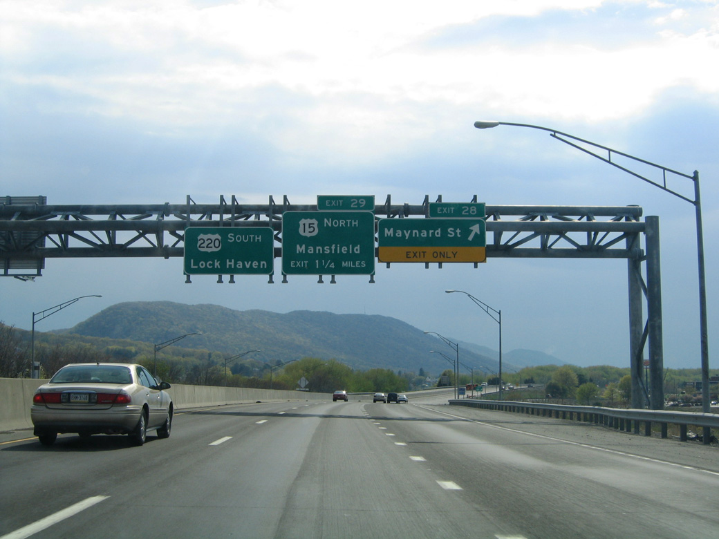
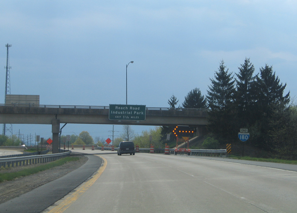
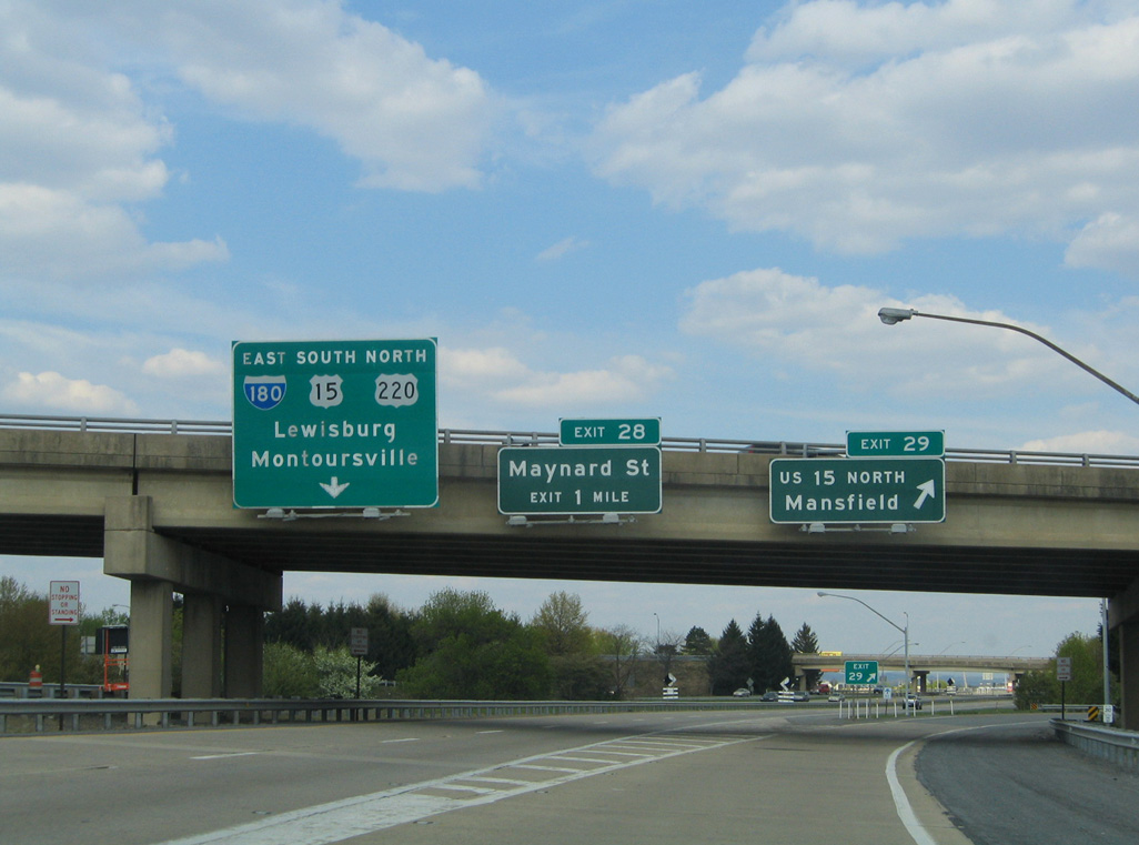
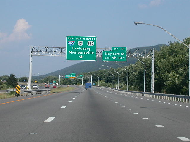
Interstate 180 concludes one mile west of the diamond interchange (Exit 28) joining the freeway with Maynard Street and the Pennsylvania College of Technology. 05/07/05
U.S. 15 turns north from I-180 and U.S. 220 (Susquehanna Beltway) along the future Interstate 99 freeway 47 miles to Mansfield. 05/07/05
U.S. 220 overlays the Future I-99 corridor 23 miles west to Lock Haven and 31 miles to Interstate 80 south of Mill Hall. 05/07/05
An I-180 end shield stands ahead of the U.S. 220 bridge spanning Lycoming Creek. The freeway for U.S. 220 continues another 3.9 miles toward Linden. 05/07/05
![]() South at
South at ![]()
![]()
U.S. 15 runs along side Lycoming Creek south from the Garden View community in Old Lycoming township to enter Williamsport at 4th Street (old U.S. 220). I-180 commences along side U.S. 15 south at forthcoming U.S. 220 (Susquehanna Beltway). 01/18/17

The ramp for U.S. 220 (Susquehanna Beltway) south to Lock Haven and I-99 to State College parts ways with U.S. 15 south just ahead of the bridge across Lycoming Creek and connection with I-180. 01/18/17
Two lanes continue south from a bridge built across Lycoming Creek in 1974 directly onto I-180 east / U.S. 220 south. 01/18/17
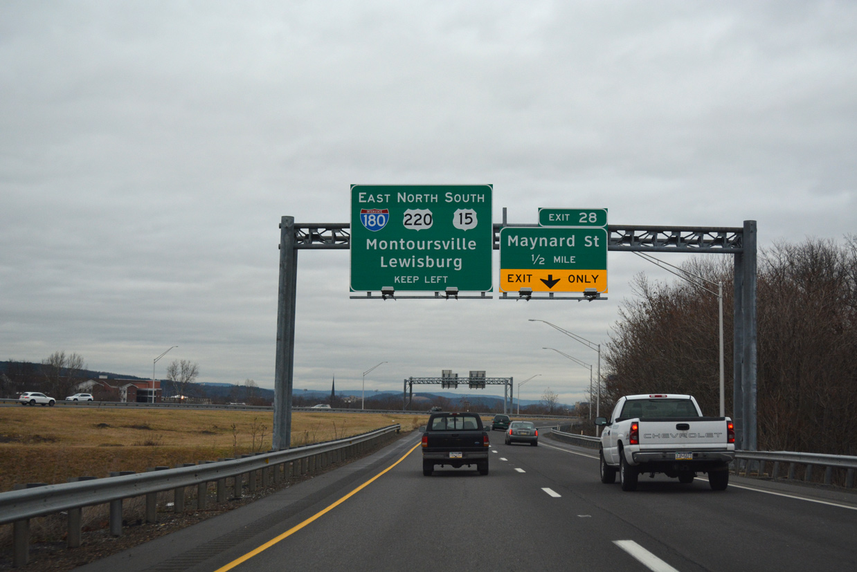
Traffic from U.S. 15 south merges with I-180 and U.S. 220 (Susquehanna Beltway) just ahead of Exit 28 with Maynard Street. 01/18/17
West End – Throwback
![]() North at
North at ![]()
![]()
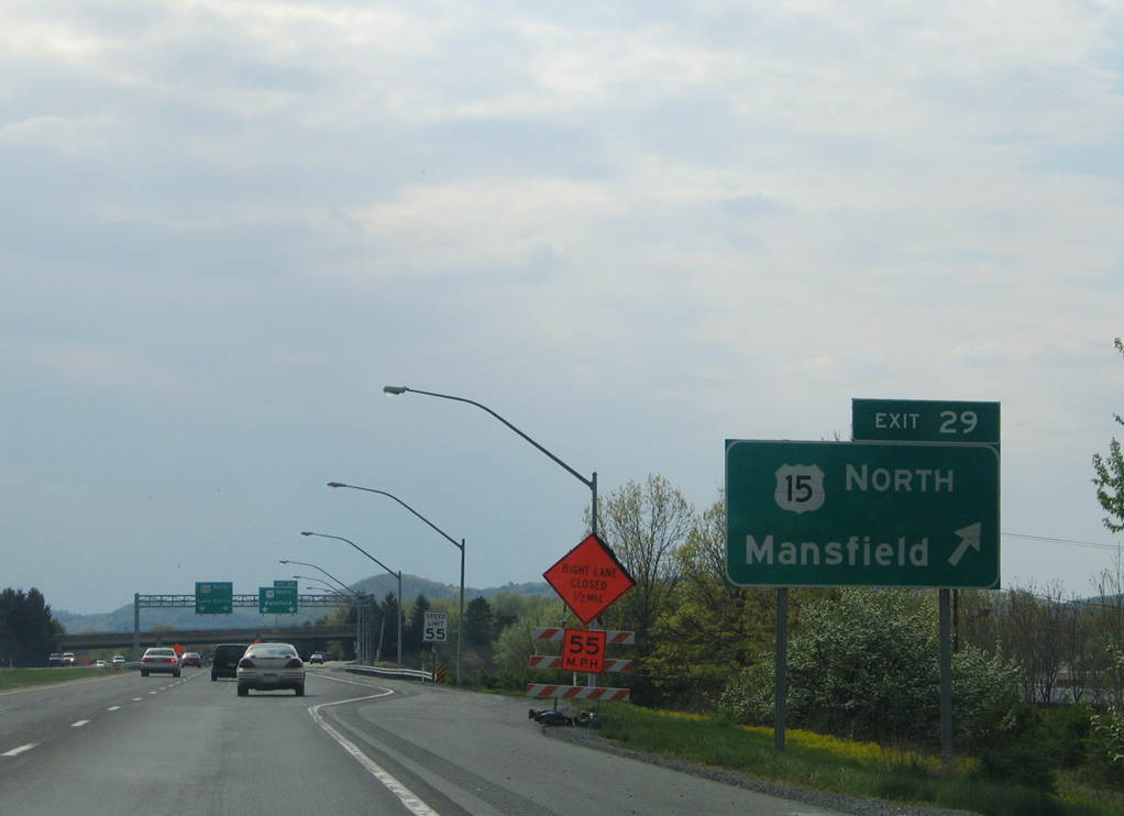
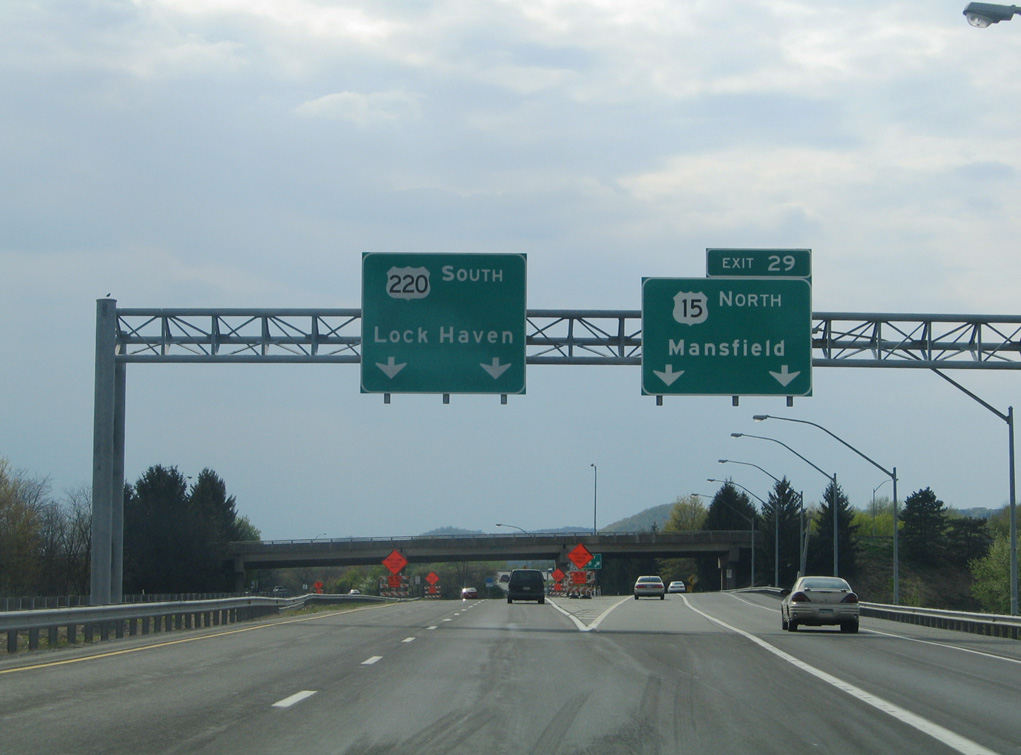
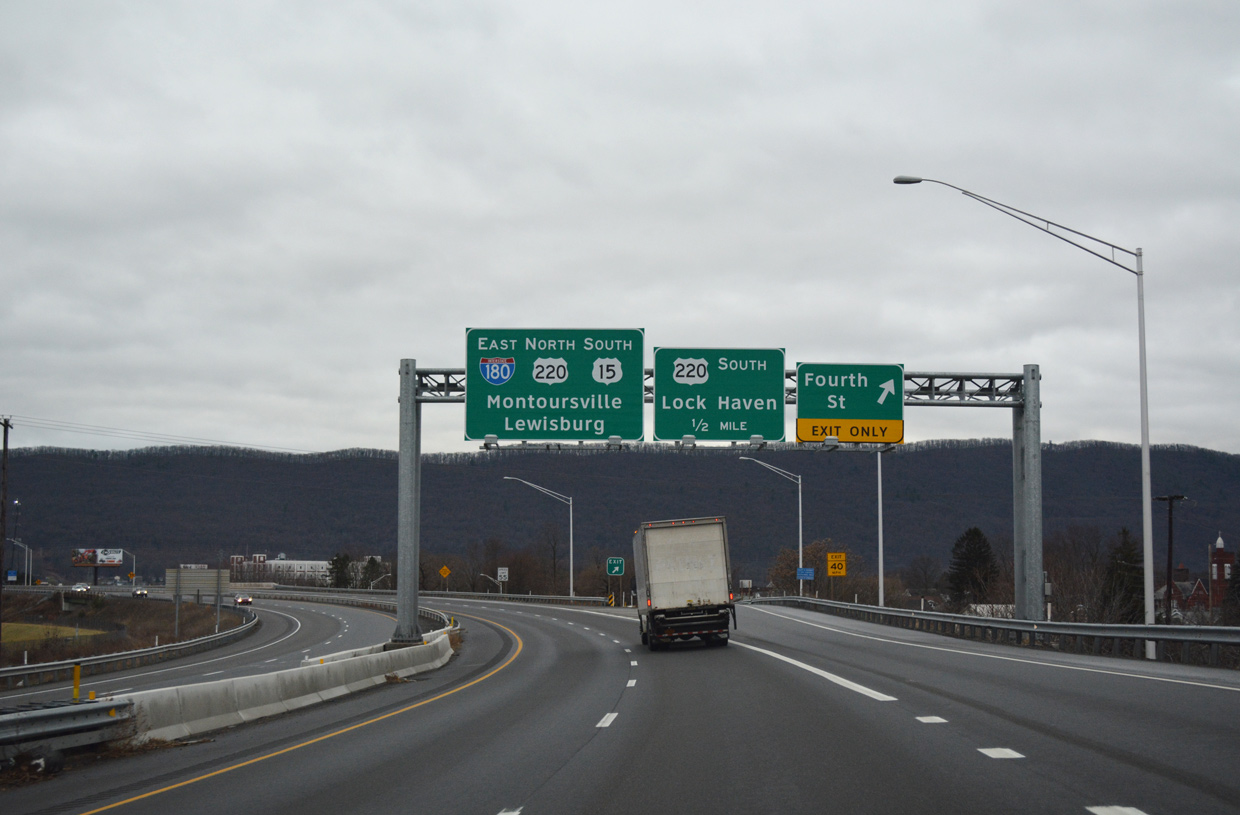
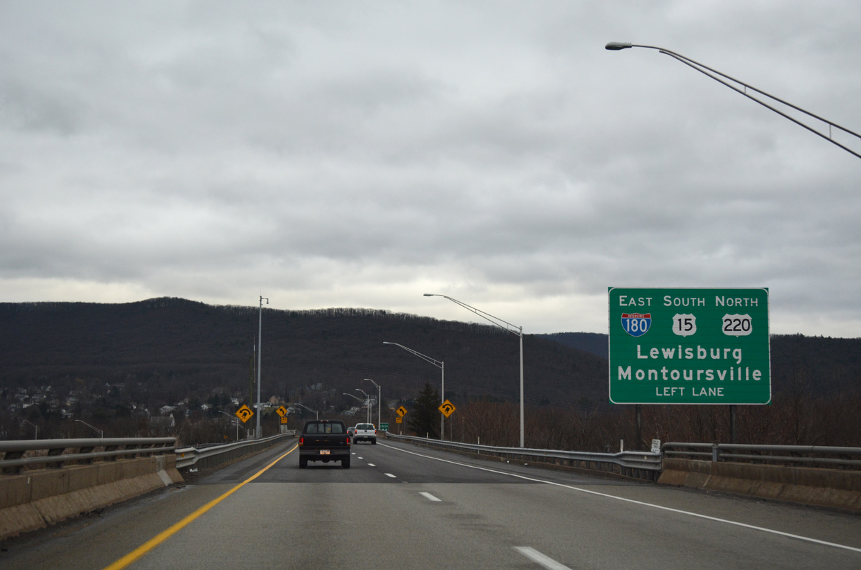
Interstate 180 begins at the trumpet interchange (Exit 29) joining U.S. 220 with U.S. 15 north to Mansfield. I-180 accompanies U.S. 15 south and U.S. 220 east to Downtown Williamsport. 05/07/05
The entrance ramp from U.S. 15 south adds an auxiliary lane along I-180 east to Exit 28 with Maynard Street. I-180/U.S. U.S. 15-220 proceed eastward from Williamsport to Montoursville. Montoursville was where TWA Flight 800 bound for Paris, France crashed on July 17, 1996. Of the 230 killed, 16 were from Montoursville. Photo taken by Tim Reichard (08/03/02).
Page updated January 18, 2020.