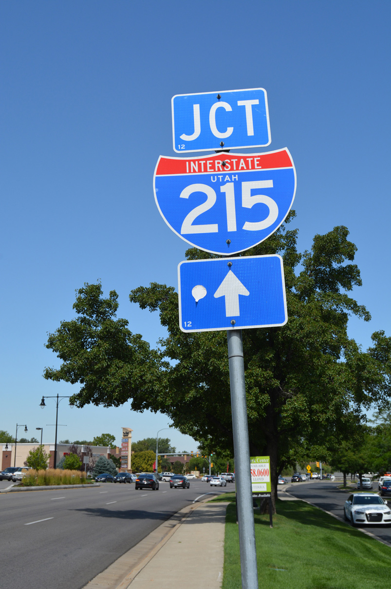
Interstate 215 Utah
Overview
Interstate 215 is the belt route for Salt Lake City in Utah. Originating from I-15 within the city of North Salt lake, I-215 closely parallels I-15 south to Taylorsville, then turns east across I-15 between Murray and Midvale. The southeastern quadrant of I-215 encircles Cottonwood West and Holladay northward to Interstate 80. As such, Interstate 215 provides a bypass for both I-15 and I-80 while also connecting with Salt Lake City International Airport (SLC).
With reconstruction of I-15 from 1997 to July 2001 and closures of I-80 in 1998 and 1999, Interstate 215 defaulted as the main through route. With completion of those major projects, I-215 returned to its role as an alternate and commuter route.
 History
The original plan for the Salt Lake City Belt Route divided the freeway into a 17.5 mile long western quadrant, Interstate 215, and a 11.6 mile eastern portion, Interstate 415. The $65 million freeway was separated into nine Sections and was expected to be completed in 1974. The initial segment of the Belt Route opened by 1963 as a two lane access road linking 2100 North with Utah State Route 68 (Redwood Road) to improve access to Salt Lake Municipal Airport. A second section under construction by 1963 was the I-415 link with Interstate 80 at the mouth of Parleys Canyon.1
Work in 1968 included completion of the I-215 link between 2200 North and Interstate 15 at the north end of the Belt Route. Land clearing was also underway in 1968 for I-415 southward from I-80 at Parleys Canyon. Bids for work on the Belt Route from there to 4500 South were taken in March 1968.1
Construction was scheduled for September 1968 to build Section Number 2, from 2200 South to I-80 with completion expected in 1970. This portion was delayed until the 1980s, as where sections south of I-80 on the west side of Salt Lake City and the southeastern belt route due to public opposition. The original Nine Sections were as follows with their projected completion dates:1
- Section 1 – 2200 North to I-15, opened in 1968
- Section 2 – Interstate 80 to 2200 North, projected for 1972
- Section 3 – 2100 South to Interstate 80, projected for March 1969 to late 1972
- Section 4 – 4700 South to 2100 South, projected for June 1970 to late 1972
- Section 5 – Utah 68 (Redwood Road) by 6200 South to 4700 South, projected for late 1972 with Section 6
- Section 6 – Interstate 15 west to Utah 68 (Redwood Road), under construction in 1968, projected for late 1972
- Section 7 – Interstate 15 to 200 East, projected for late 1972 with Section 6
- Section 8 – 2000 East to Wasatch Boulevard, projected from March 1971 to late 1973
- Section 9 – Wasatch Boulevard north to Interstate 80, under construction from April 1968 to late 1970
As an effort to maintain continuity to benefit the motoring public, the state of Utah opted to redesignate the entire Salt Lake City Belt Route as just I-215. A petition by the Utah State Department of Highways to the American Association of State Highway Officials (AASHO) on October 14, 1968 was approved in 1969 to both eliminate I-415 from I-15 in south Murray northeast to I-80 near the mouth of Parleys Canyon and extend I-215 over the same route.2
Route Information
East End – Park Terrace, UT
North End – North Salt Lake, UT
Mileage – 28.90
Cities – Cottonwood Heights, Holladay, Midvale, Millcreek, Murray, North Salt Lake, Salt Lake City, West Valley City
- Junctions –

Source: December 31, 2021 Interstate Route Log and Finders List
I-215 Annual Average Daily Traffic (AADT)
Source: 2016 AADT Utah Department of Transportation – Traffic Management System
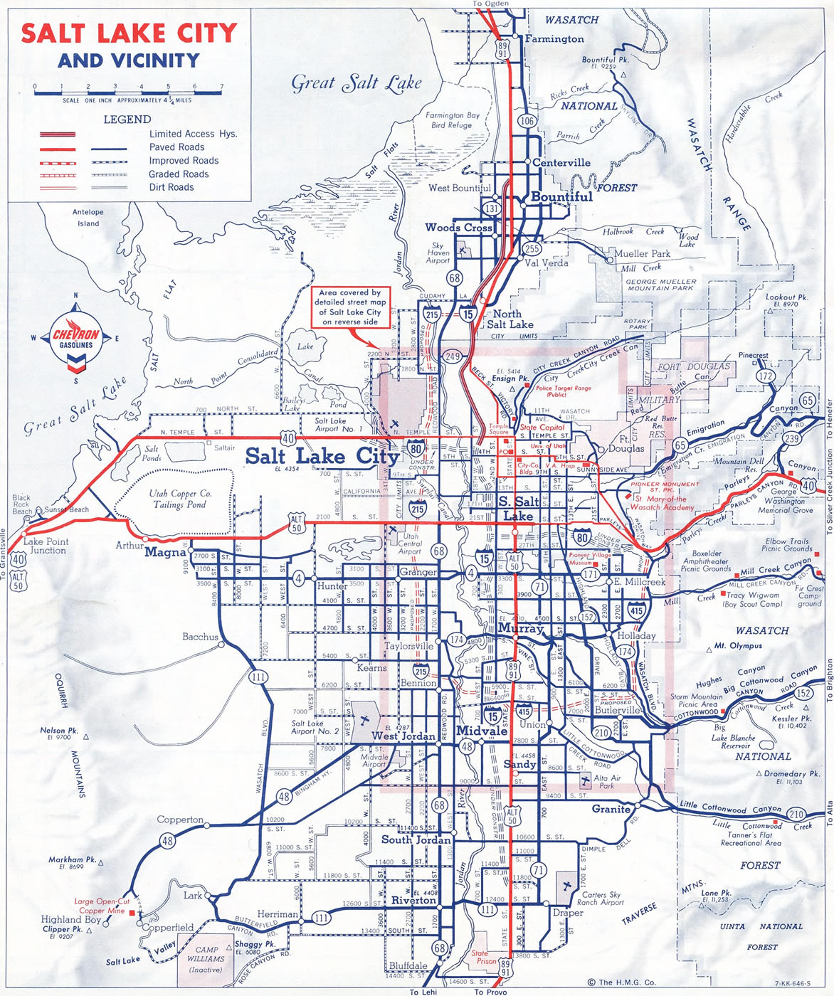
Interstate 415 was mostly unconstructed before the designation was dropped in favor of a longer I-215. Two short sections of I-415 were opened to traffic by 1969: a 0.6 mile spur from I-15 to SR 68 (Redwood Road) at Murray and a 3.1 mile section from Parleys Canyon to 4500 South.7
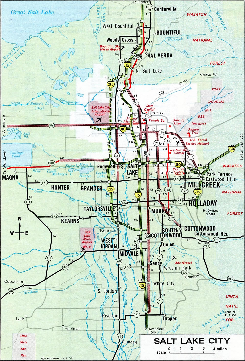
Salt Lake City in 1978. The western section of I-215 leading north and south of I-80 and the southeast quadrant would remain incomplete for another ten years.
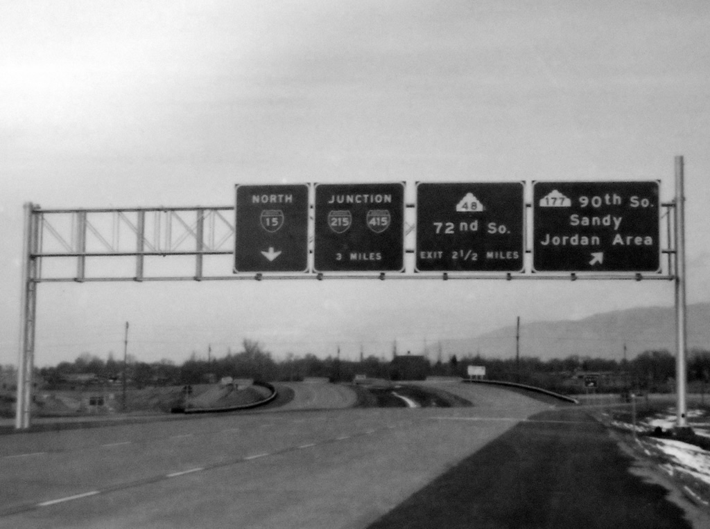
Interstate 415 signed along I-15 north. This late 1960s photo from the Utah State Archives was scanned by AARoads Forum Member CL.
The alignment for a 6.5 mile section of the southeast belt route, through Holladay and Cottonwood, was endorsed by the Utah Transportation Commission on December 17, 1975.3 Of five alternatives outlined, Alternative A-6 was selected from the Environmental Impact Statement (EIS). The EIS was prepared after area residents along the corridor filed suit over the controversial southeast quadrant in July 1973. Preliminary findings of the study indicated that the completed portions of the Belt Route north and west would not be used to their full potential without completion of the section in between. It also added that congestion and air pollution levels would increase along major arterials due to expected growth through 1995.4
Alternative A-6, which favored a vacant area between 900 East and 1300 East, included three interchanges and ran east from 300 East / 6800 South to Knudsens Corners (6200 South / 2000 East) and north to the preexisting I-215 at 4500 South.3 Despite the Utah Department of Transportation (UDOT) adopting the final EIS on March 4, 1977, the section was still contested by area residents, the Cottonwood, Inc. citizen group and Salt Lake City Mayor Ted Wilson. Opponents claimed that the endorsement by UDOT of the EIS was done without discussion, paving the way to submit the statement to the Federal Highway Administration. The proposed beltway along 6200 South called for a depressed design 20 to 30 feet below grade, requiring a relocation of Little Cottonwood Creek onto an aqueduct. Concerns for air quality, runoff, drainage and flood problems were cited.5
A lawsuit was eventually filed by Cottonwood, Inc., but the court did not grant the injunction, allowing work to proceed on completing the route. A closure of the Belt Route from 300 East to 700 East took place on June 4, 1979 in preparation for excavation work. Subsequent construction was divided into five sections.6 Delays however continued through the next decade.
Construction on I-215 from 1100 East (Exit 9) to Highland Drive (Exit 8) was completed by November 1987. Work on three additional sections remained scheduled through late 1988. They included segments from Highland Drive east to 6400 South and north to 4500 South (Exit 5), from 2000 North / 2000 West (Exit 25) south to I-80 (Exit 22) and 2100 South / 2000 West (Exit 20) north to I-80.7
The Belt Route western section was completed on October 7, 1988 with the opening of I-215 between Interstate 80 and 2100 South. The six lane, 3.2 mile long section cost $36.6 million. The southeast section, from 6500 South to 3300 East remained under construction for another 18 months.8
 Photo Guides
East End  – Park Terrace, Utah
![]() North at
North at ![]()
![]()
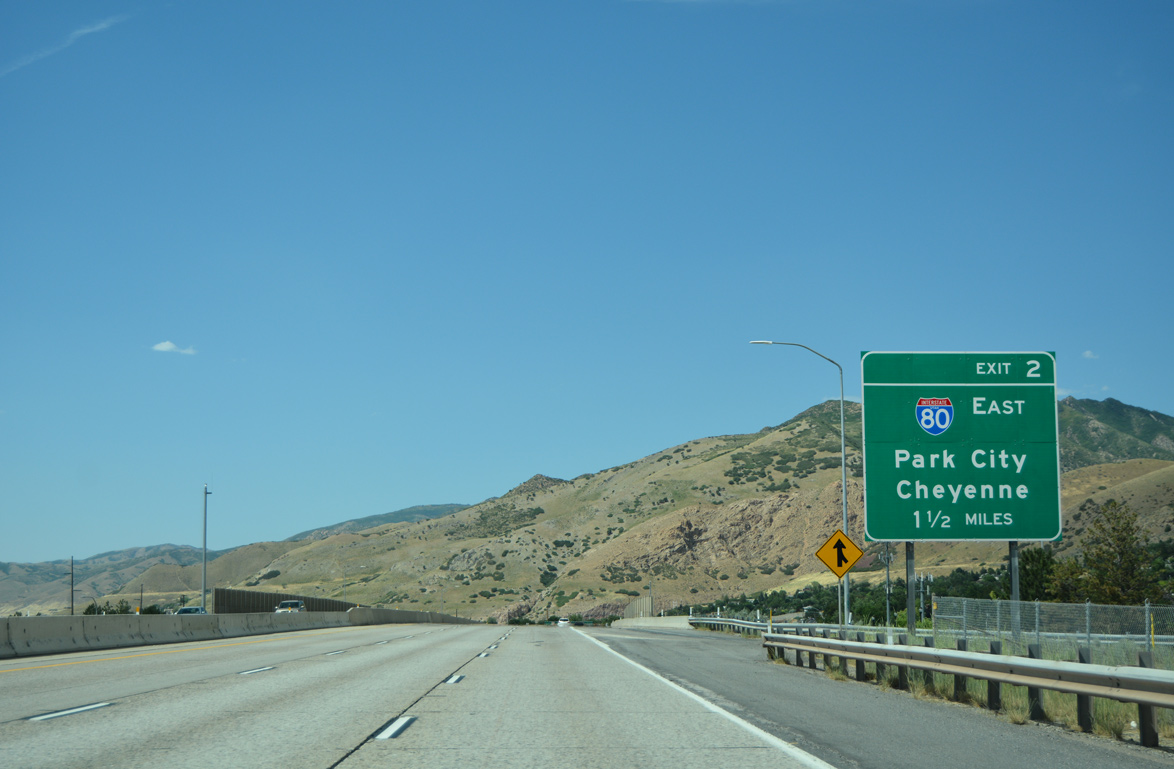
The access road linking I-215 north with I-80 east through Parleys Canyon lies 1.5 miles beyond the entrance ramp from 3900 South at Holladay. The I-215 mainline extends directly to I-80 west in 2.8 miles. 07/08/16
Exit 2 branches northeast from I-215, one half mile from Exit 3 with SR 171. I-80 ascends through Parleys Canyon from Salt Lake City to Kimball Junction. 07/08/16
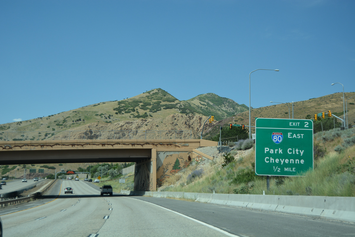
Interstate 80 serves bedroom communities located within the Park City area such as Silver Creek Junction and the Park City and Deer Valley ski resorts on the eastern slopes of the Wasatch Range. 07/16/17
The connection to I-80 east from Exit 2 consists of a two lane road running along the former alignment of SR 5. The freeway mainline of I-215 parallels I-80 west from SR 186 (Foothill Drive) to the Salt Lake City line. 07/16/17
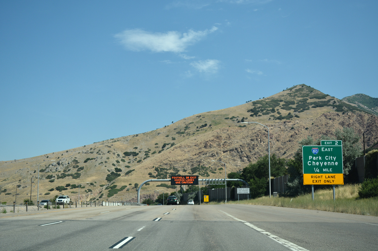
The two lane roadway linking I-215 north with I-80 east winds around the north slopes of Grandeur Peak to a wye interchange. This configuration is partially due to the lack of space at the mouth of Parleys Canyon. 07/16/17
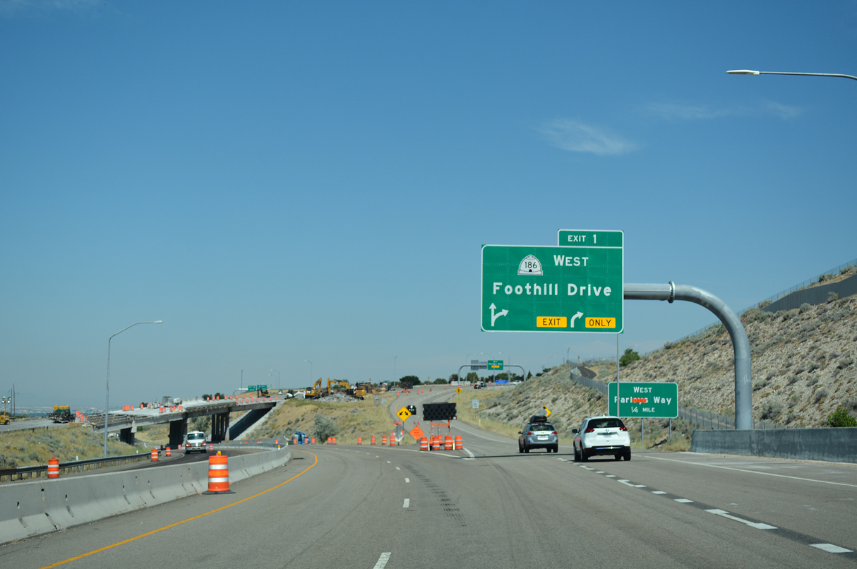
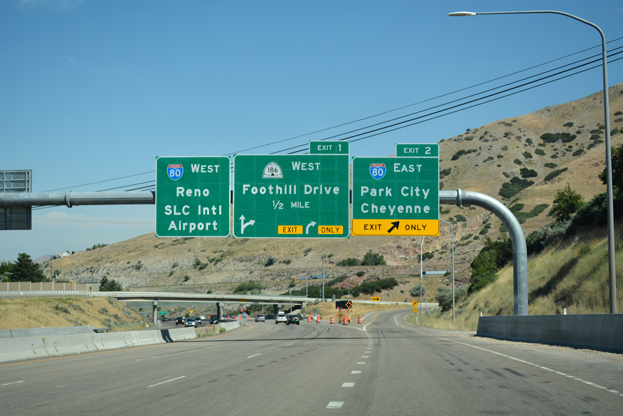
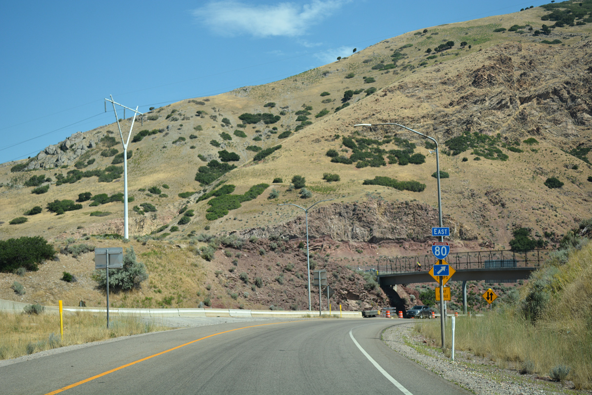
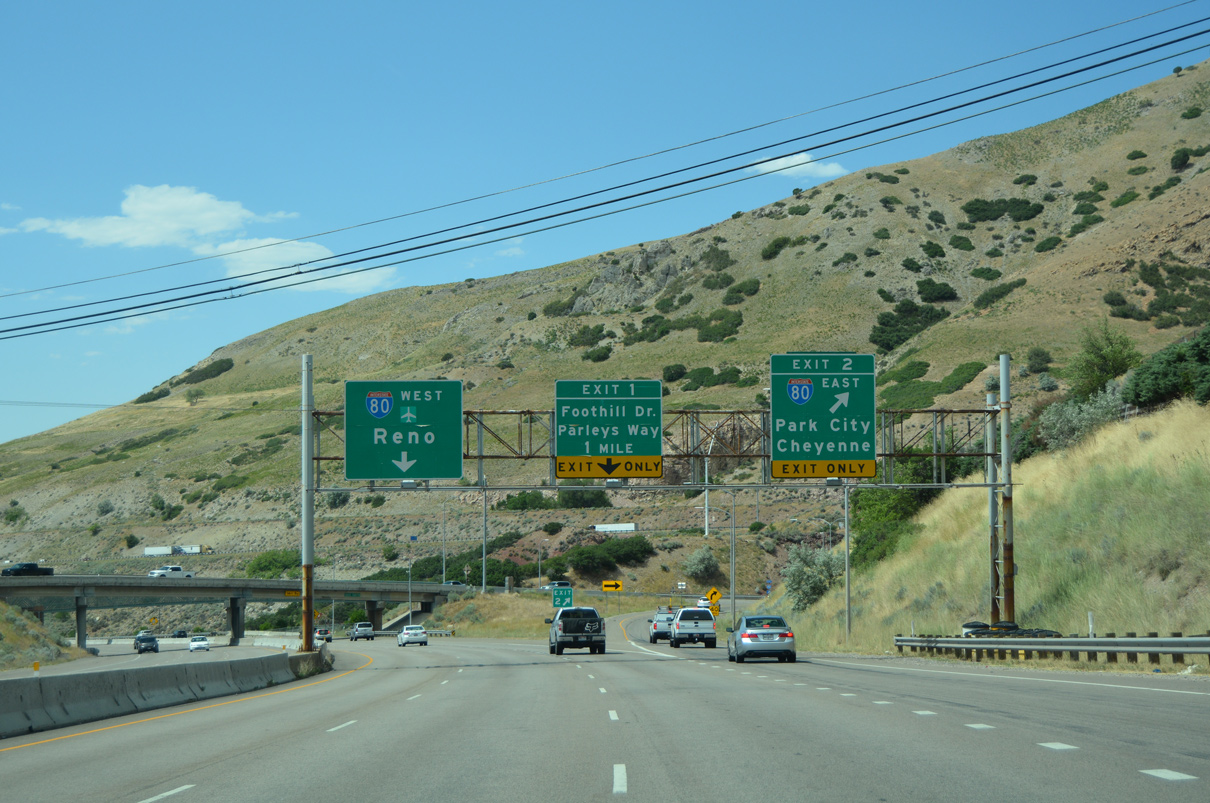
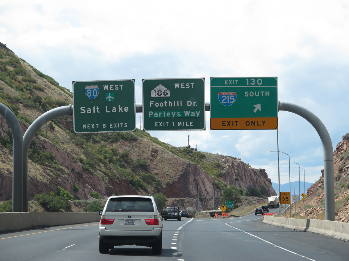
SR 186 branches northwest from a wye interchange (Exit 1) with I-215 along Foothill Drive to the University of Utah and Downtown Salt Lake City. I-215 converges with I-80 westbound in the Sugar House area of east Salt Lake City. 07/16/17
![]() West at
West at ![]()
Descending rapidly from the high desert of Wyoming and the ski resorts of Park City to the flats of Salt Lake City, Interstate 80 winds through Parleys Canyon to the Salt Lake Valley. 07/16/17
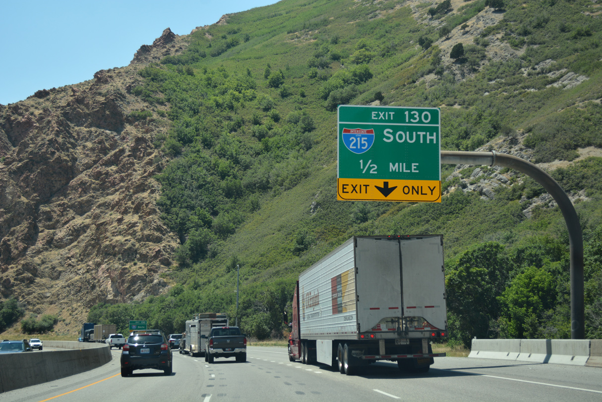
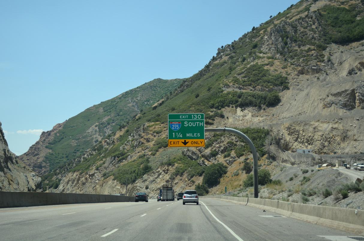
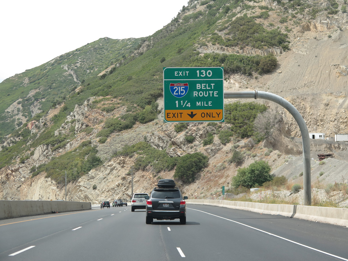
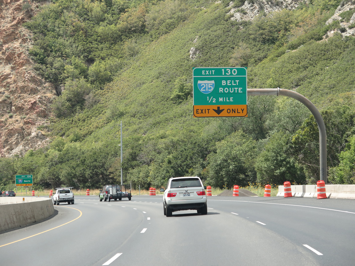
A lane drop occurs on the westbound lanes for Exit 130 to the two lane roadway linking I-80 with I-215 south at Canyon Rim. 07/16/17
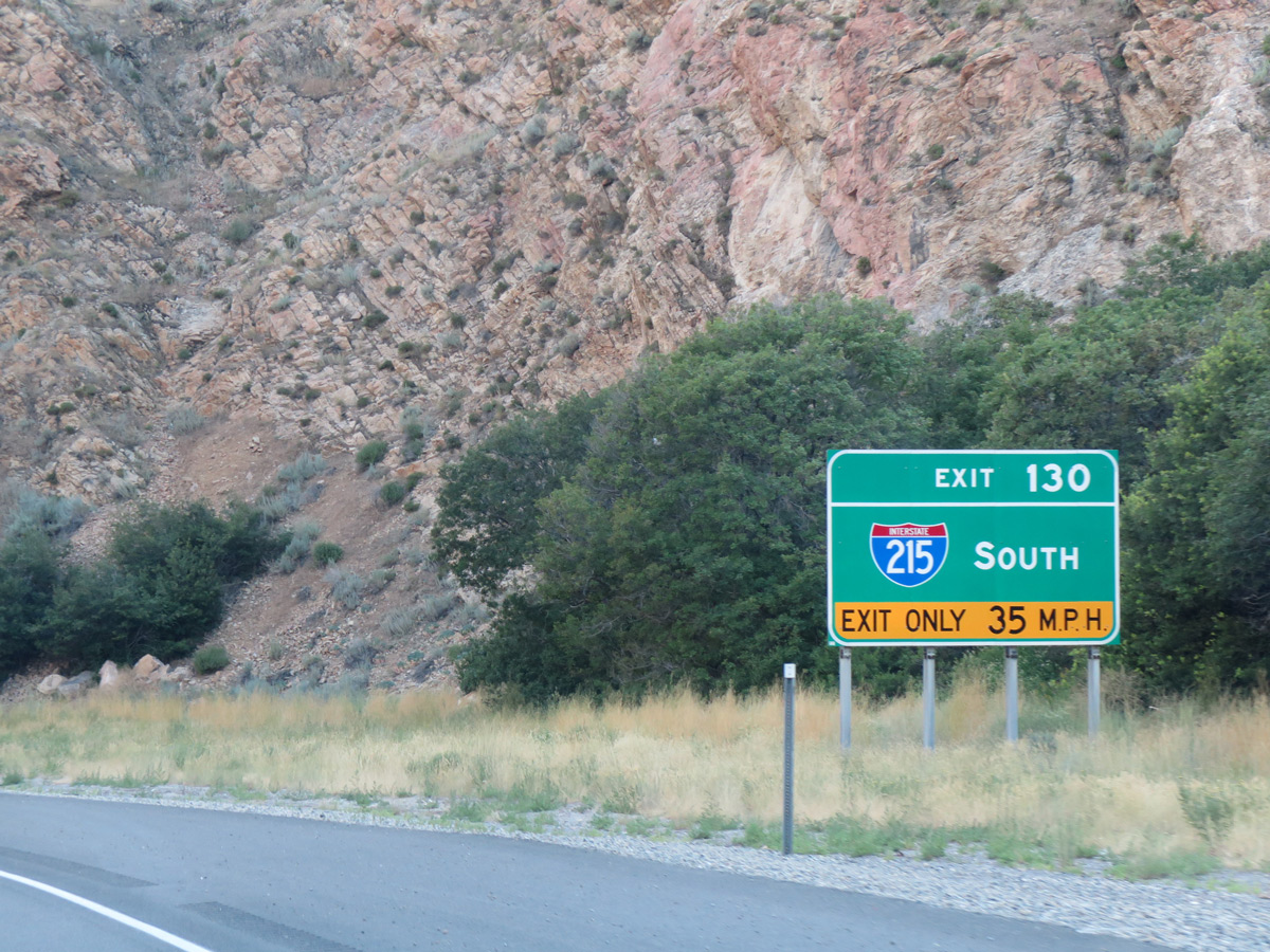
Signs for the belt route use no control city. The freeway forms a 270 degree beltway for the city of Salt Lake, with the southeastern quadrant serving the suburbs such of Canyon Rim, Holladay, Cottonwood Heights, Midvale and Murray. 08/25/14

Exit 130 leaves Interstate 80 west as the freeway exits Parleys Canyon ahead of the Country Club neighborhood in Salt Lake City. SR 186 (Foothill Drive) spurs north from I-215 nearby to run along former U.S. 40 Alternate toward Downtown. 07/16/17
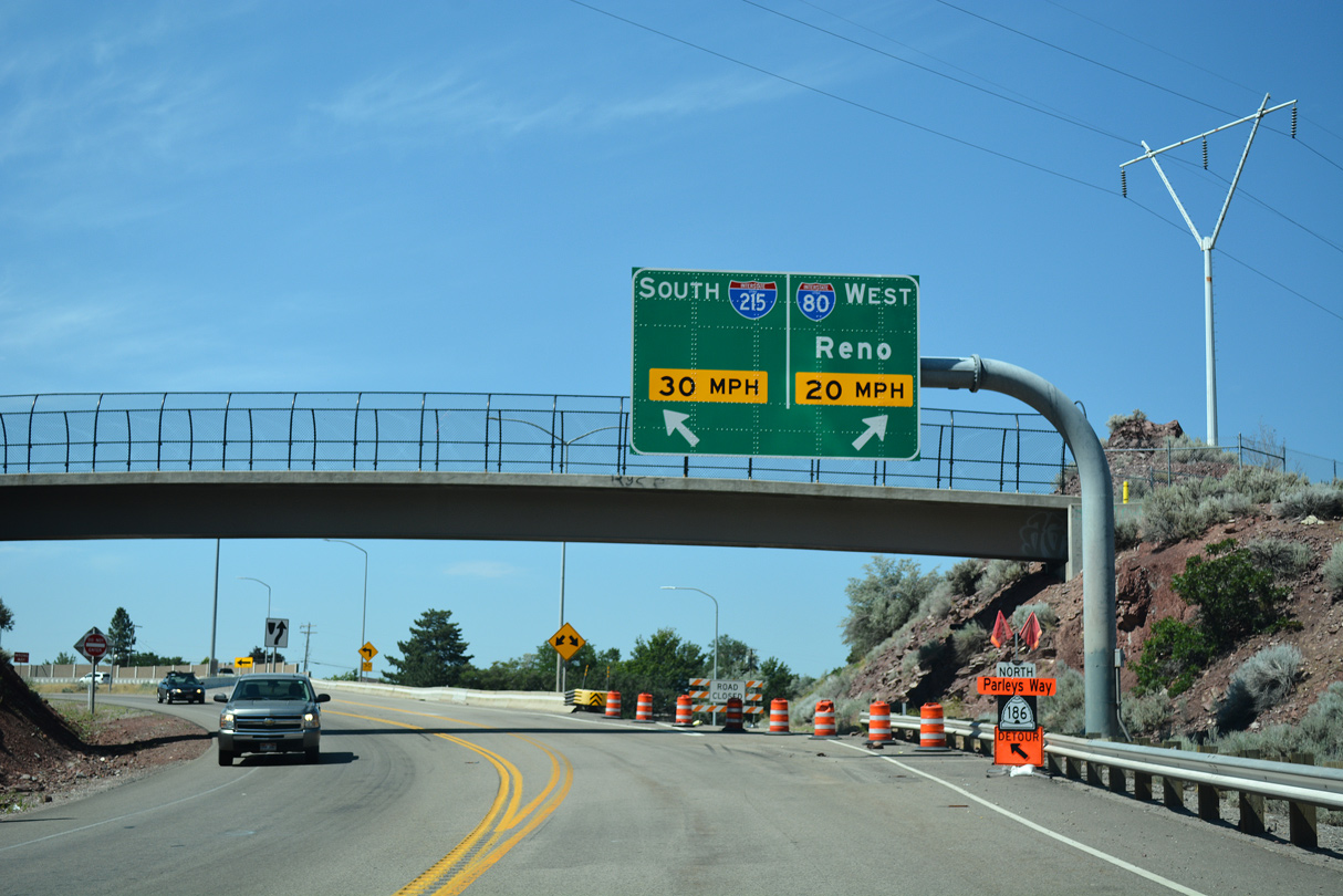
The wye interchange (Exit 130) with Interstate 215 is located at the mouth of Parleys Canyon. 07/16/17
![]() East at
East at ![]()
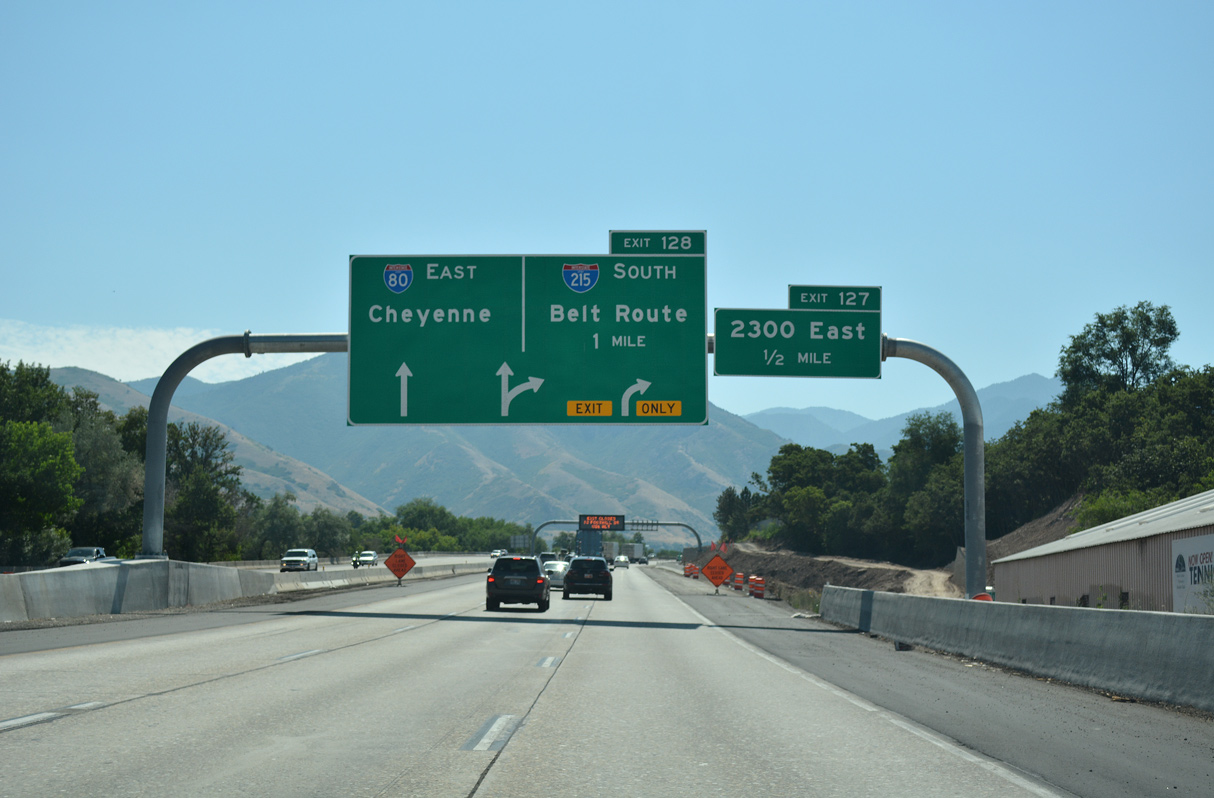
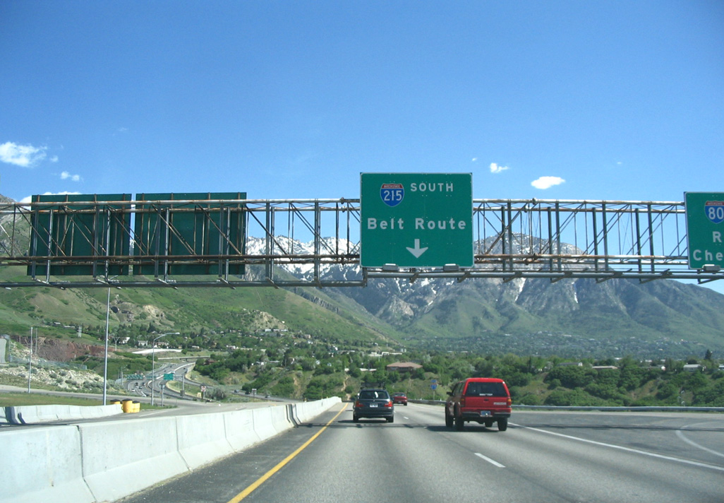
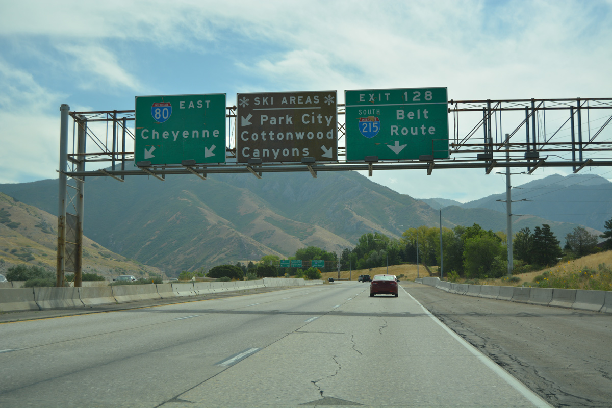
Interstate 80 east traverses a valley fed by Parleys Creek ahead of the wye interchange (Exit 128) with I-215 south. 07/16/17
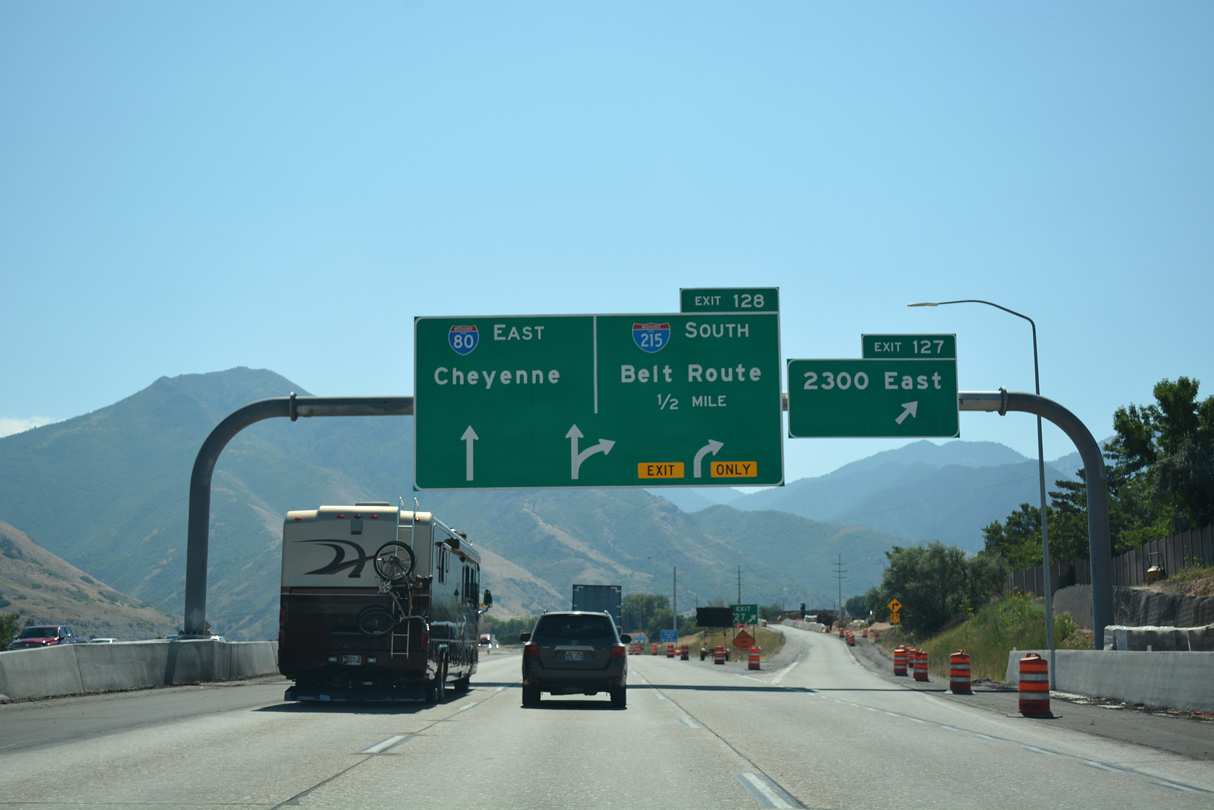
I-80 and Interstate 215 parallel one another east of 2300 East and the Sugar House neighborhood in Salt Lake City to SR 186 (Foothill Drive). 07/16/17
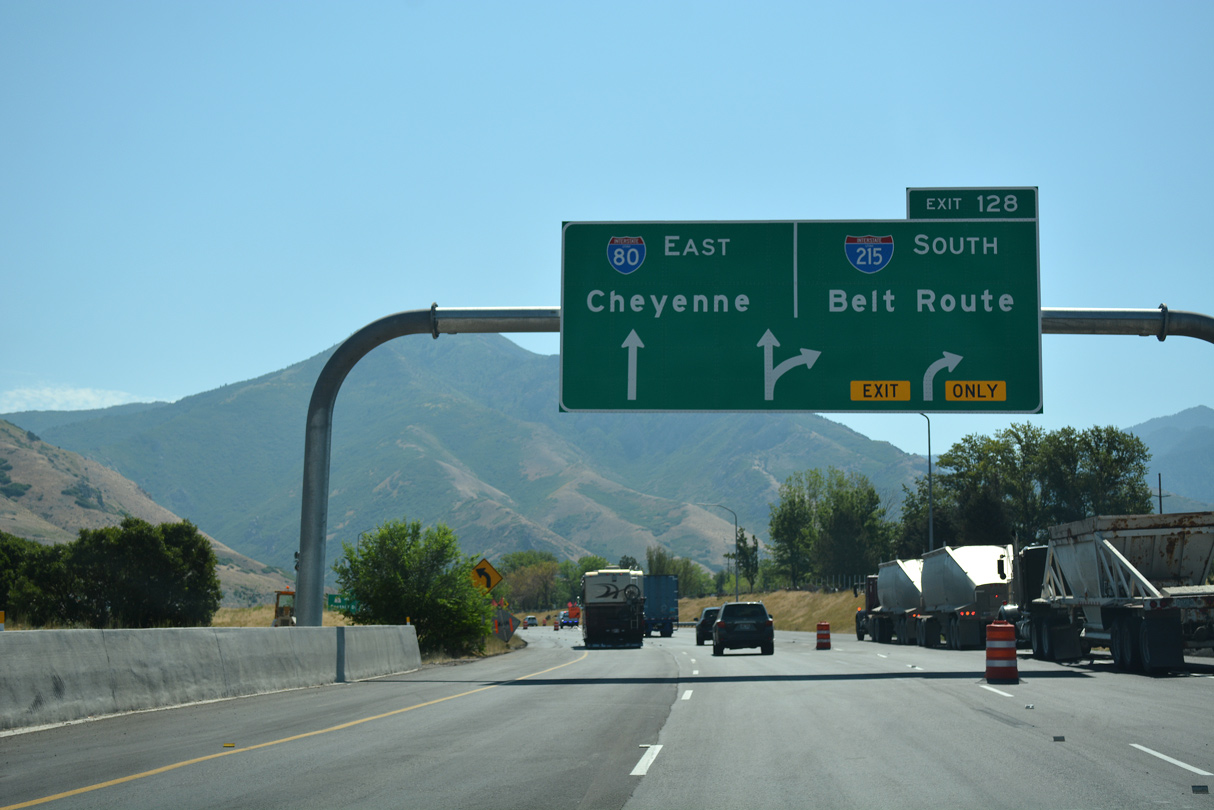
Two lanes separate from I-80 east for the beginning of Interstate 215. The belt route turns south from Foothill Boulevard to run between the Canyon Rim community and Grandeur Peak. 07/16/17
![]() East at
East at ![]()
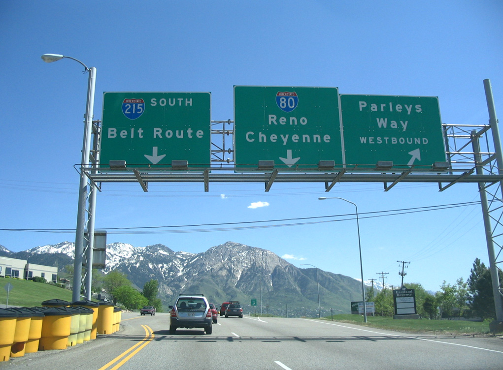
With the Wasatch Range in view, SR 186 (Foothill Drive) concludes with ramps for Parleys Way west to the Country Club neighborhood in Salt Lake, I-80 and Interstate 215 south. Photo by Steve Hanudel (05/16/06).
A loop ramp departs SR 186 (Foothill Drive) for I-80 west to Sugar House in Salt Lake and I-80 east to Parleys Canyon and Park City. Foothill Drive converges with I-215 south ahead of the Wasatch Front foothills and the city of Holladay. Photo by Steve Hanudel (05/16/06).
 East End Throwback
![]() North at
North at ![]()
![]()

Advance guide signs for Exit 2 and the connection with I-80 east to Cheyenne, Wyoming were replaced by 2014. 09/08/05
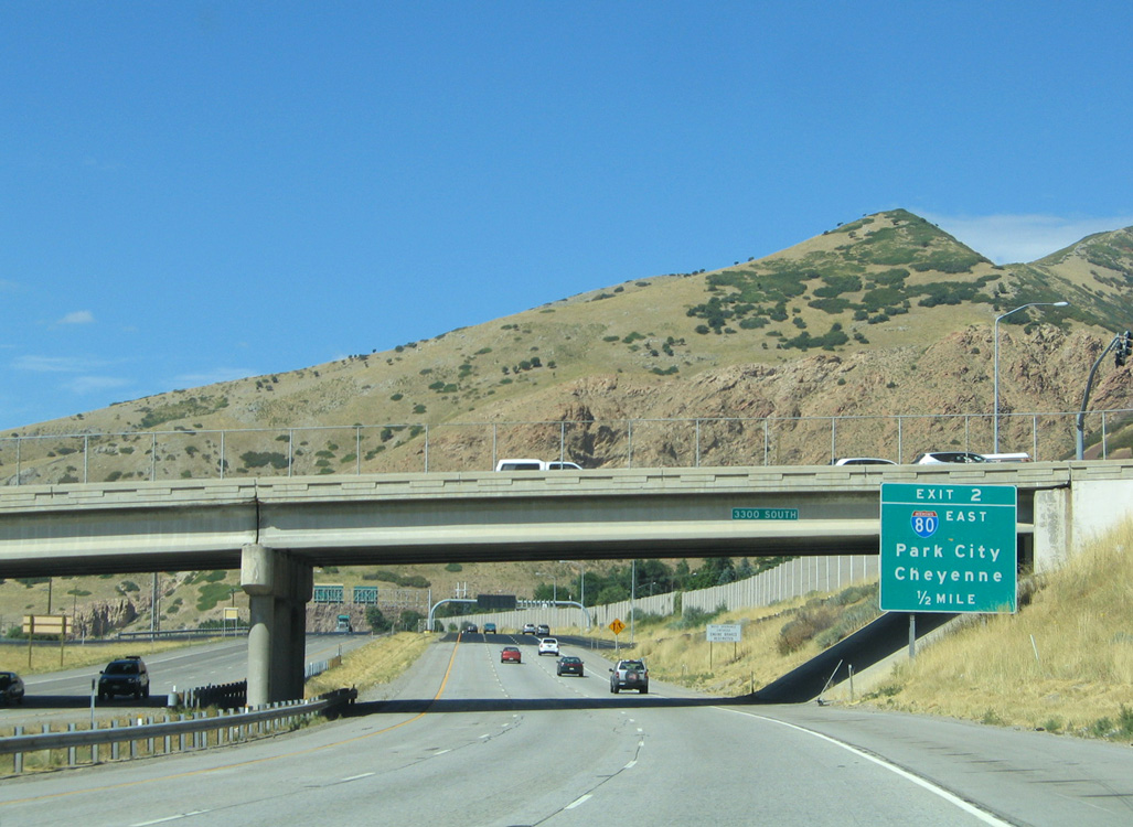
I-215 drops below grade beside Wasatch Boulevard and through the exchange with SR 171 (3300 South). Wasatch Boulevard parallels the northbound lanes of I-215 closely between Millcreek Road and a dead end beside Exit 2. 09/08/05
A monotube assembly replaced this sign bridge at Exit 2. Replacement guide signs for Exit 1 added SR 186 and removed Parleys Way. 07/08/16

A single arrow per lane overhead for SR 186 (Foothill Drive) replaced this sign bridge referencing the connection with I-80 west from I-215 north at Exit 1. 09/08/05
![]() West at
West at ![]()
Replacements of advance signs for Exit 130 on I-80 west do not reference Interstate 215 as Belt Route. 08/25/14
Vintage button copy signs at I-215 / Exit 130 were finally replaced by 2017. 08/25/14
![]() East at
East at ![]()
Replacing these overheads for Exit 128, a separate monotube assembly references the Park City and Deer Valley ski areas via I-80 east and the Solitude – Brighton and Snowbird – Alta ski areas via I-215 south. 08/10/16
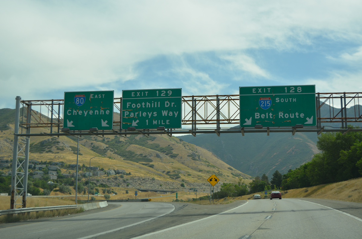
Removed sign bridge at the separation of I-215 south from I-80 east at Exit 128. 08/10/16
North End – North Salt Lake, Utah
![]() North at
North at ![]()
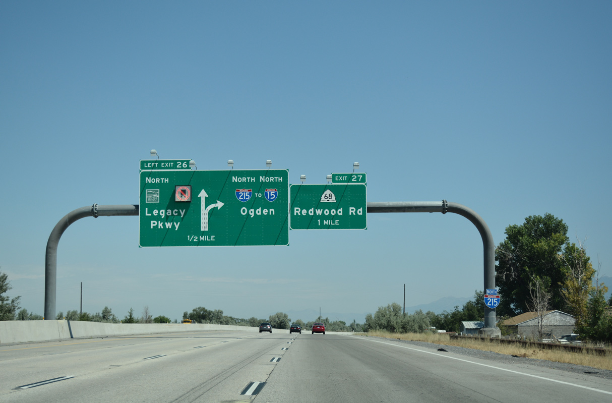
Legacy Parkway (SR 67) branches north from Interstate 215 to Farmington two miles from I-15. 07/16/17
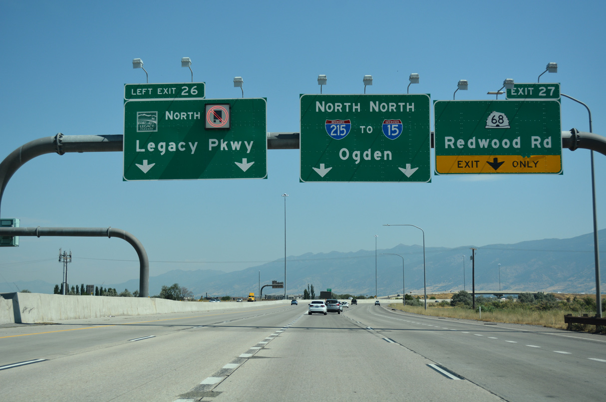
Legacy Parkway (SR 67) provides an alternate route to Interstate 15 between the north end of I-215 in North Salt Lake and U.S. 89 in Farmington. 07/16/17
Interstate 215 converges with I-15 north east of a diverging diamond interchange (Exit 27) with SR 68 (Redwood Road). 07/16/17
The wye interchange joining the north end of I-215 with I-15 lies adjacent to the wye connecting I-15 with U.S. 89 along S Main Street in North Salt Lake. 07/16/17
![]() South at
South at ![]()
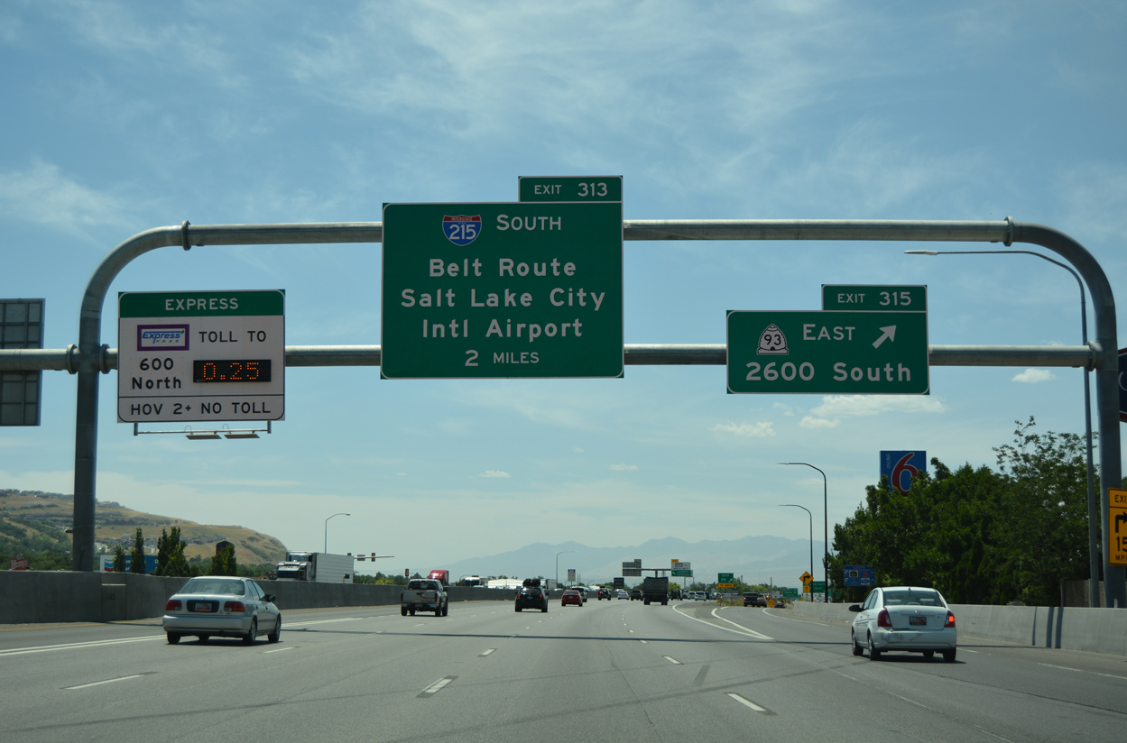
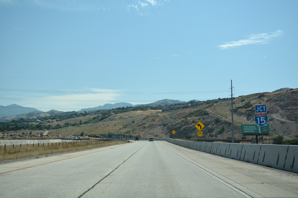
I-15 enters the city of North Salt Lake at Exit 315 for SR 93 (2600 South), two miles north of the split with I-215. The Salt Lake City belt route provides a bypass for travelers headed to Provo, St. George and Las Vegas, Nevada. 07/08/16
Interstate 215 initially leads west to SR 68 (Redwood Road) before it merges with SR 67 (Legacy Parkway) south into Salt Lake County. The belt route continues from there to Salt Lake City International Airport (SLC). 07/08/16
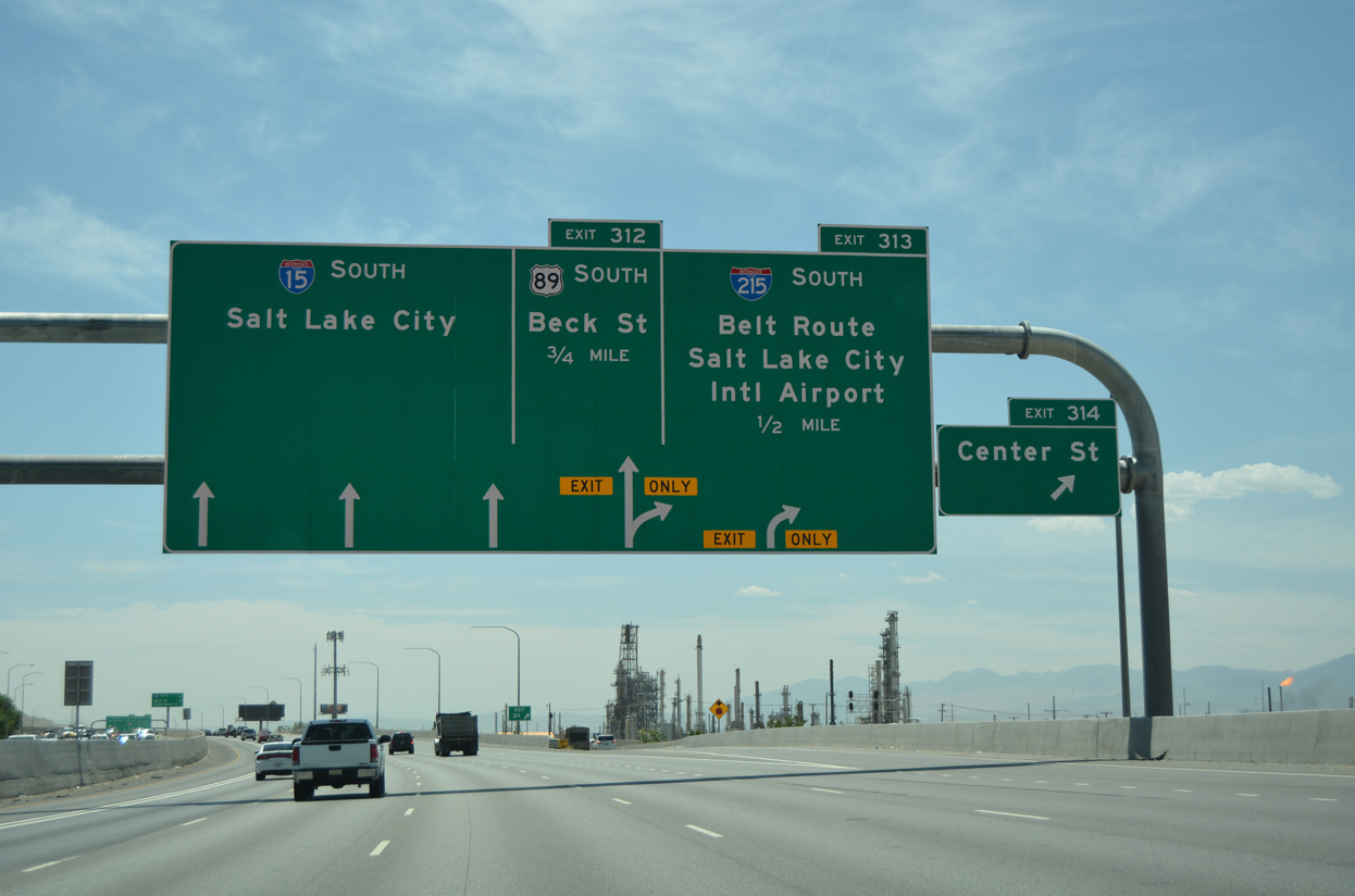
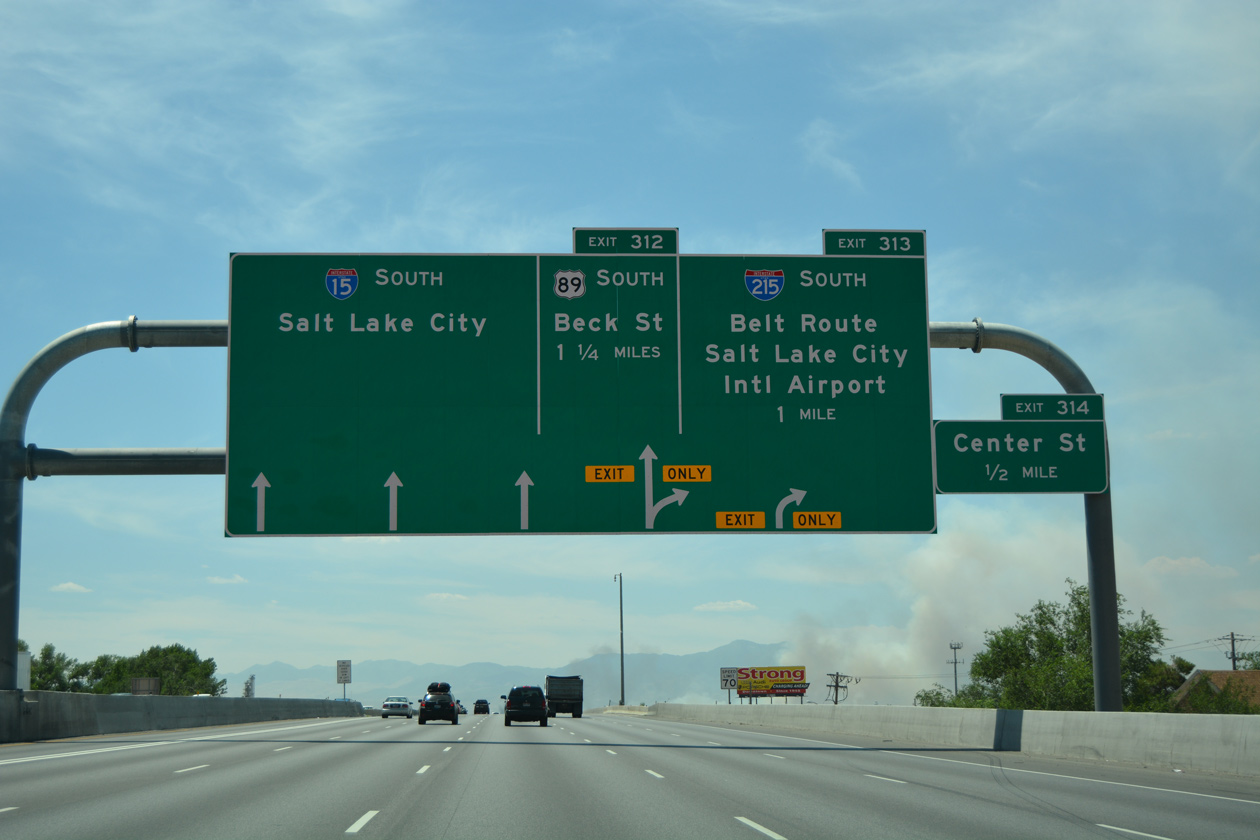
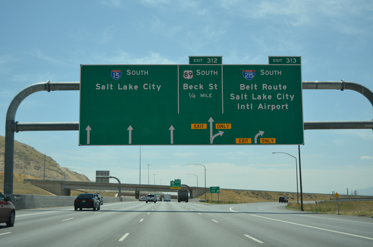
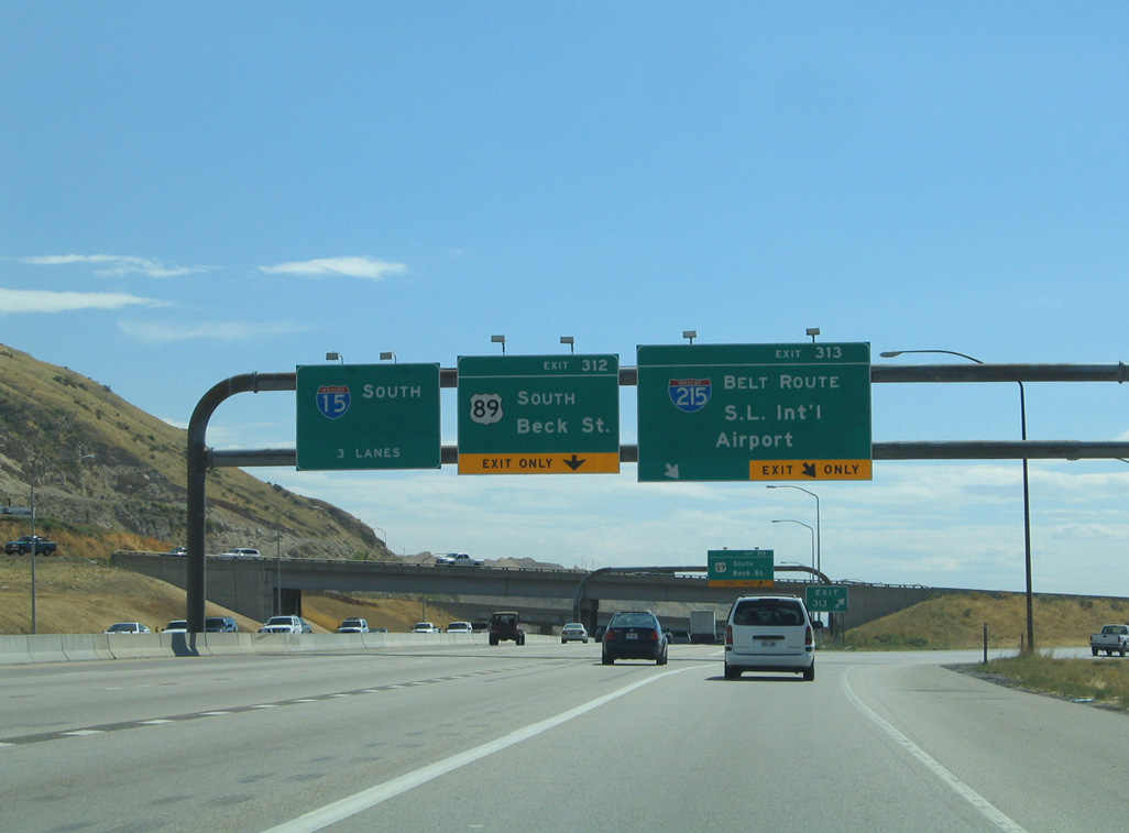
Succeeding exit ramps depart Interstate 15 south for I-215 and U.S. 89 (Beck Street). I-215 provides part of a bypass for Interstate 80 west to Wendover, Elko and Reno, Nevada. The belt route returns to I-15 at Exit 298. 07/08/16
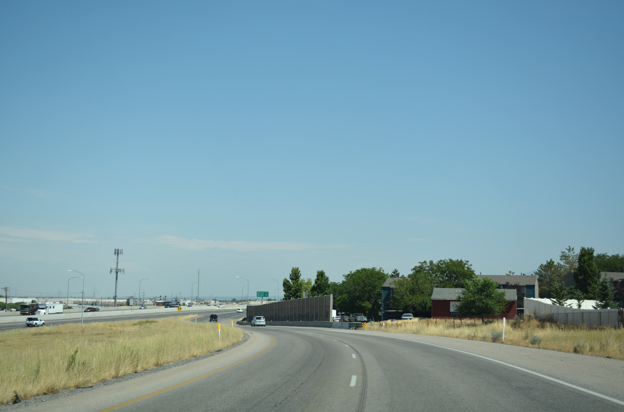
Interstate 15 leads due south toward Downtown Salt Lake City while I-215 travels by the Westpointe, Jordan Meadows and Glendale neighborhoods of Salt Lake to West Valley City. 07/08/16
North End Throwback
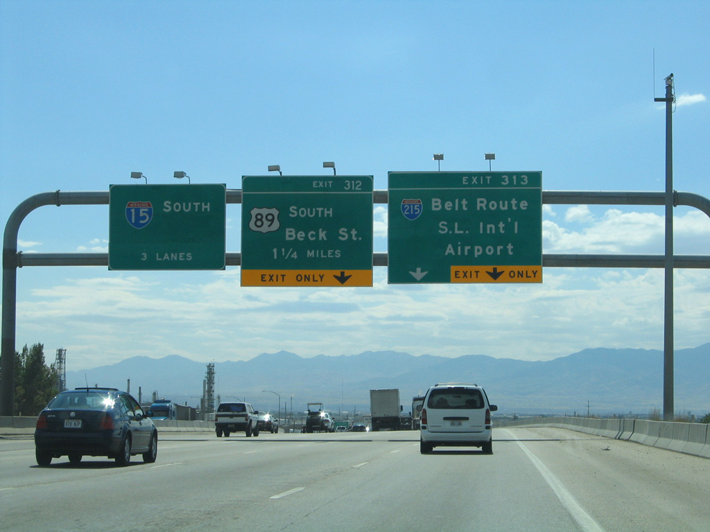
Extension of the I-15 Express Lanes northward added a sixth southbound lane through North Salt Lake. Work in 2015 included the installation of new signs for U.S. 89 and I-215. 09/08/05
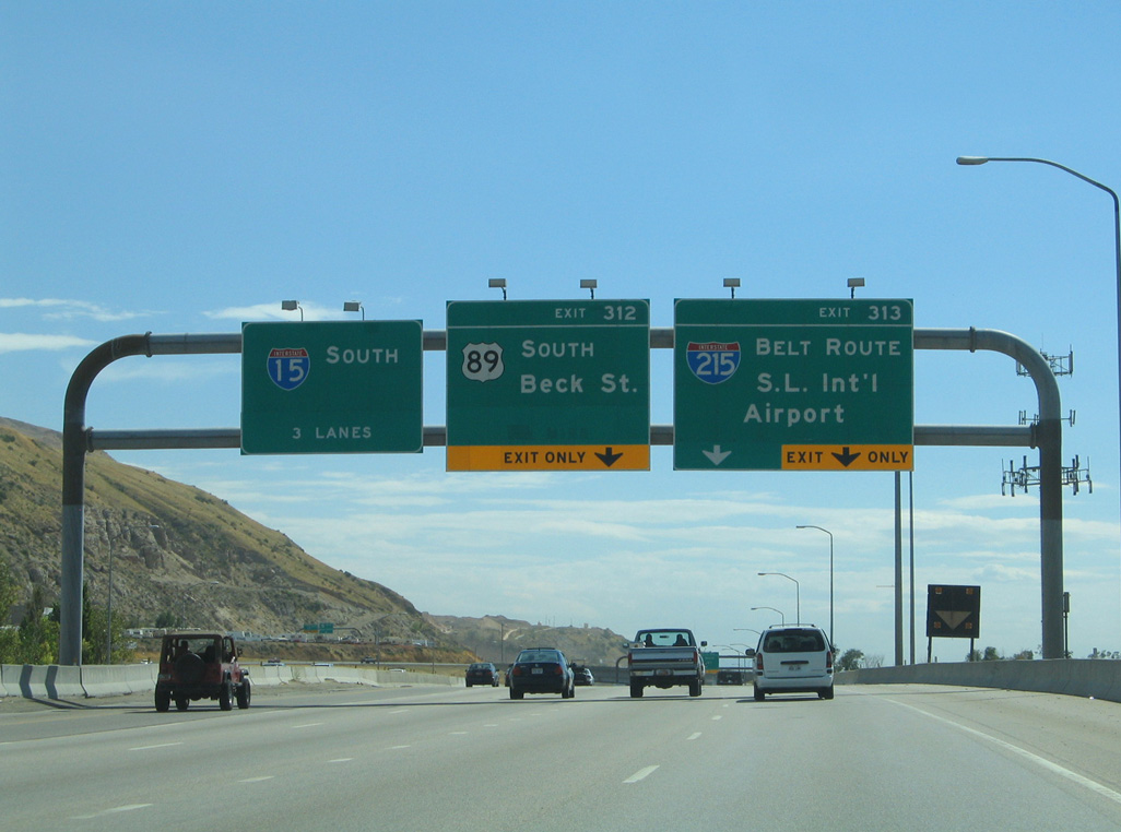
Large arrow-per-lane (APL) signs replaced these overheads for the wye interchange (Exit 313) with Interstate 215 south on I-15 south. 09/08/05
Sources:
- “Belt Freeway Construction Shows Continued Progress.” The Deseret News, February 24, 1968.
https://www.udot.utah.gov/main/uconowner.gf?n=200609121744533.- “Five alternatives for design of I-215.” The Deseret News, March 26, 1975.
- “State endorses I-215 belt route.” The Deseret News, December 12, 1975.
- “Citizen group girds for battle to halt I-215 belt route.” The Deseret News, April 22, 1977.
- “Work begins on segment of belt route.” The Deseret News, June 4, 1979.
- “Belt route – section by section.” The Deseret News, July 30, 1987.
- “Delay in opening I-215 interchange questioned.” The Deseret News, September 30, 1988.
- “105 Miles Planned For Utah’s Interstate.” The Deseret News, January 11, 1969.
Page updated April 12, 2023.