Interstate 296 Michigan

Overview
Interstate 296 is the hidden designation for a 3.4 mile long section of U.S. 131 north from I-196 to I-96 in central Grand Rapids. U.S. 131 extends south from I-296 as a freeway to Kalamazoo and Portage and north to Cadillac and Manton.

Interstate 296 acknowledged on the 1978 Michigan Official State Map
 History
Until 1979 Interstate 296 was co-signed along U.S. 131 in Grand Rapids with the exception of the long two lane exit ramps to I-96 west and from I-96 east. Signs for I-296 were removed at the request of the Michigan Department of Transportation (MDOT). The American Association of State Highway Officials (AASHTO) approved the elimination for the signing of I-296 on October 13, 1979:
The deletion of I-296 Route Markers in the Grand Rapids area will eliminate the dualing of I-296 / US 131, I-296/I-196, and I-296/ I-96 Route Markers. Existing signing presents a duplication of numbers in this area which is confusing to motorists, particularly at interchanges.
The removal of markers for Interstate 296 was the result of a Federal Highway Administration (FHWA) sponsored Positive Guidance Demonstration Project, which determined that the signing was a potential source of confusion for motorists. The geometric design of the exchange joining I-96 and I-296/U.S. 131 and the complete overlap of I-296 with U.S. 131 were cited as reasons that the signing for the interchange became unnecessarily complex. Furthermore, the length of proposed diagrammatic signing would be substantially shortened. The FHWA recommended at a meeting in January 1979 with MDOT that the state of Michigan eliminate I-296 and relocate M-37, which overlapped with I-96 through the exchange.
The state agreed with the recommendation, indicating a preference of removing both the signing of I-296 and the designation from the official State Map. MDOT however expressed concern that removing the signage for I-296 might also result in its removal from the Interstate System. It followed with a recommendation to remove I-296 from guide signs, but retaining trailblazers for the route. FHWA countered that the compromise was not in the best interest of the motorist:
While it would certainly make the guide signing simpler, it would increase the discrepancy between the maps and the signs, and play havoc with driver expectancy.
MDOT eventually agreed with the FHWA position in a letter from April 11, 1979 to remove all I-296 references if the three mile section continued to remain in the Interstate System. This allowed Interstate funding to be applied to future projects along the route.
Route Information
North End – Grand Rapids, MI
South End – Grand Rapids, MI
Mileage – 3.50
Cities – Grand Rapids
- Junctions –


Source: December 31, 2021 Interstate Route Log and Finders List
I-296 Annual Average Daily Traffic (AADT)
| Location | Vehicles per day |
|---|---|
| Exits 86 to 87 | 129,801 |
| Exits 87 to 88 | 118,047 |
| Exits 88 to 89 | 110,519 |
| Exits 89 to 89A | 109,346 |
Source: 2017 AADT – MDOT Traffic Volumes Map
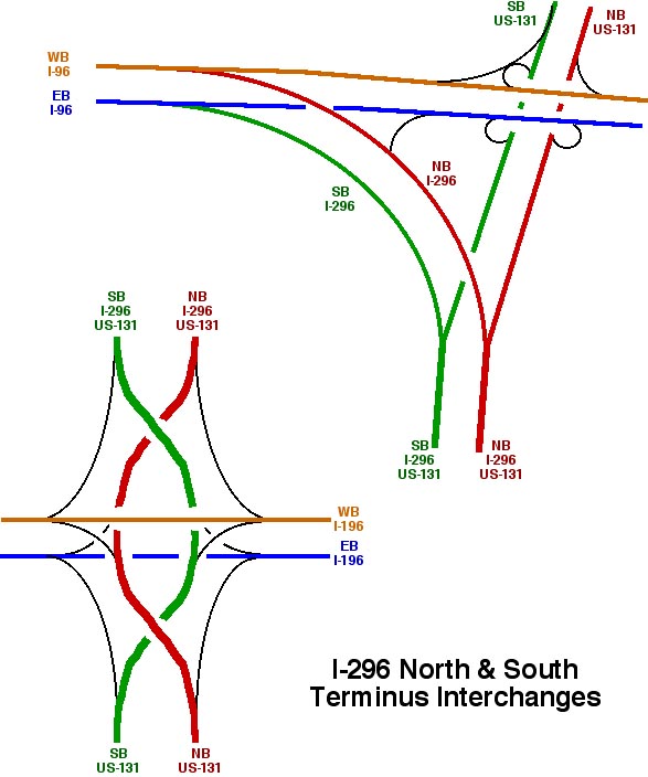
Overview of the interchanges joining Interstate 296 with I-196 and I-96. Graphic prepared by Eric W. Vander Yacht.
North End  – Grand Rapids, Michigan
![]()
![]() North at
North at ![]()
![]()
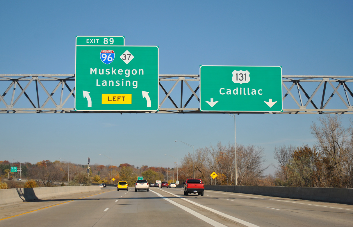
Connecting U.S. 131 with I-96 and M-37 (Alpine Avenue), Interstate 296 branches west from the wye interchange at Exit 89. 11/05/11

M-37 overlaps with I-96 east from Alpine Avenue in Walker to M-44 at Beltline Avenue in Grand Rapids. 11/05/11
![]()
![]() East at
East at ![]()
![]()
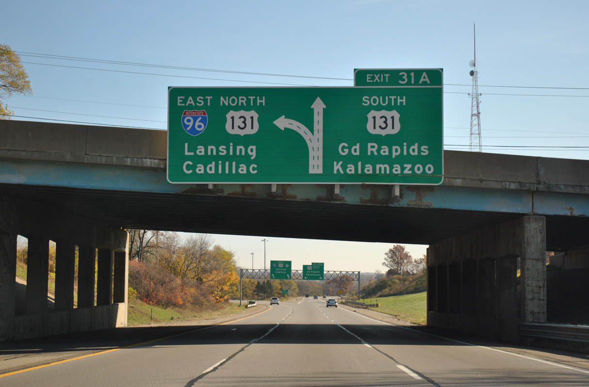
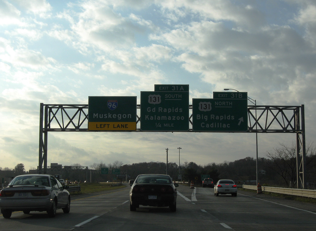
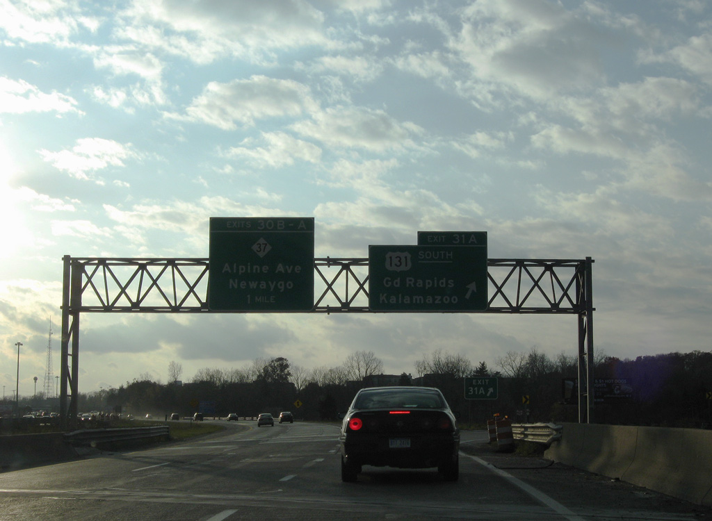
Interstate 296 curves southeast from the exchange joining I-96 and M-37 at Alpine Avenue to U.S. 131 and Grand Rapids. 11/05/11
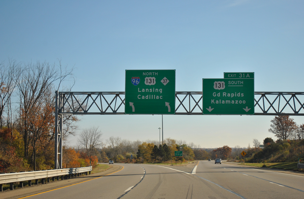
I-96/M-37 shift northward from Exit 31A for I-296/U.S. 131 south to a loop ramp with U.S. 131 north to Cadillac. 11/05/11
![]()
![]() West at
West at ![]()
![]()
I-96/M-37 cross the Grand River ahead of the cloverleaf interchange (Exit 31) with U.S. 131. 11/05/09
U.S. 131 parallels the Grand River south from I-96/M-37 at Walker into Grand Rapids alongside Interstate 296. 11/05/09
South End 
 – Grand Rapids, Michigan
![]()
![]() South at
South at ![]()
The southbound roadway for I-296/U.S. 131 switches sides with the northbound roadway beyond Exit 86B for Interstate 196 west to Holland. 11/05/09
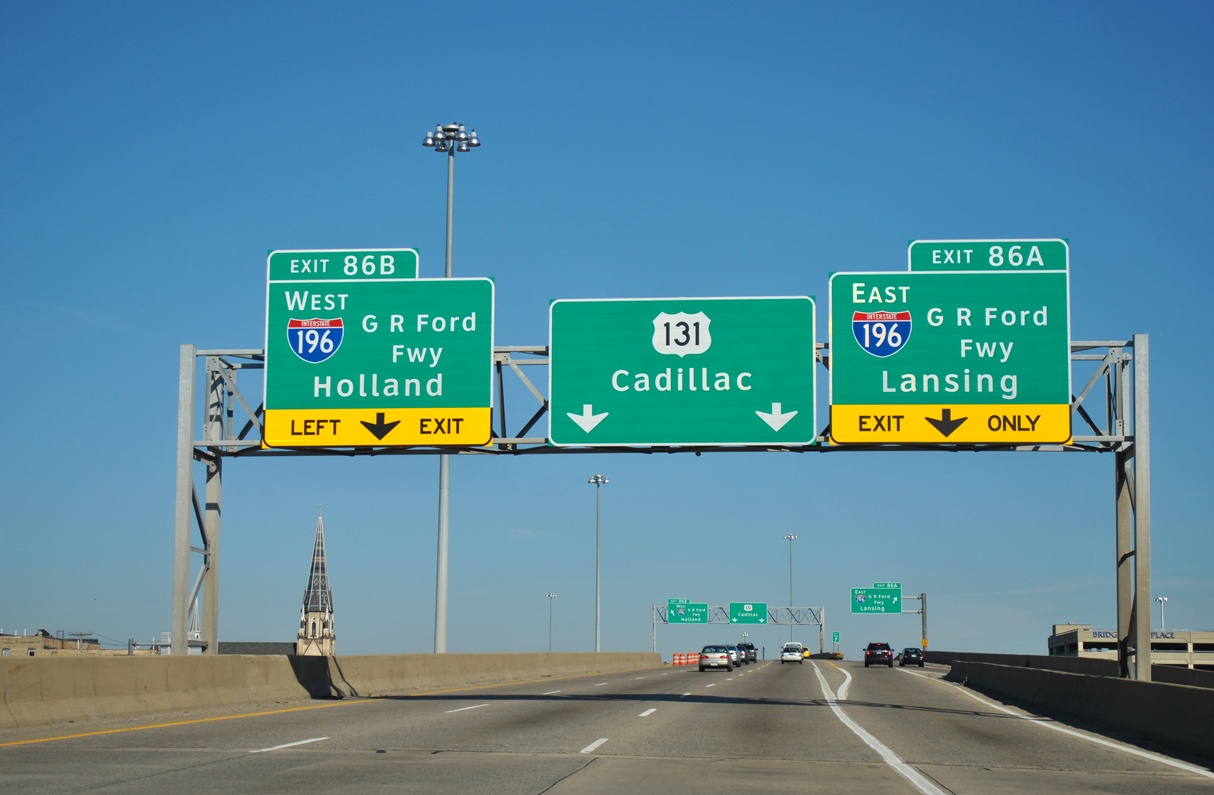
Interstate 296 concludes southbound at the multi level interchange (Exit 86) with I-196 (Gerald R. Ford Freeway). U.S. 131 continues south to Wyoming, Wayland and Kalamazoo. 11/05/09
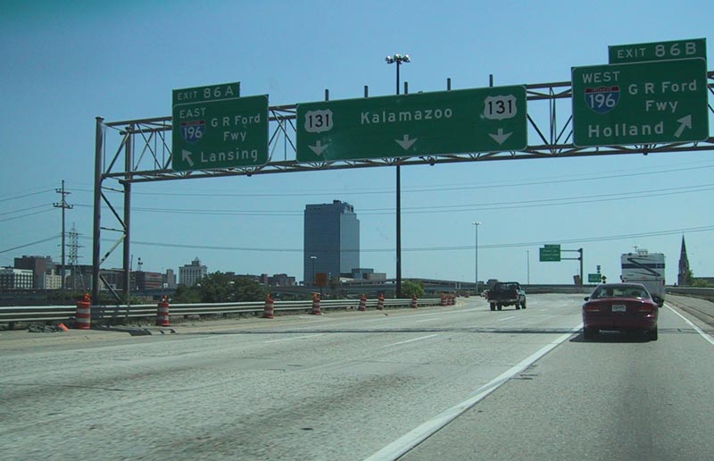
Replace overheads at the simultaneous departure of Exits 86B/A for Interstate 196 from U.S. 131 south. Photo by Eric W. Vander Yacht (06/01).
![]() North at
North at ![]()
![]()
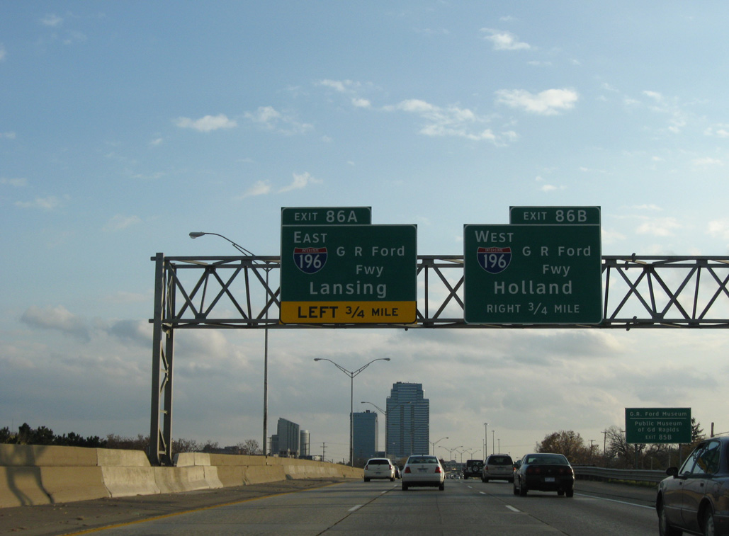
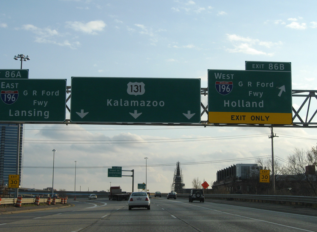
U.S. 131 advances north by the Gerald Ford Presidential Museum into the systems interchange (Exit 86) with Interstate 196. 11/05/11
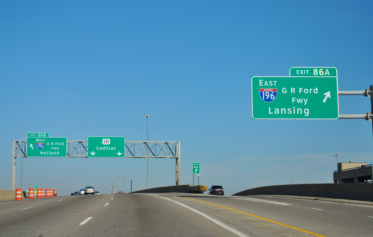
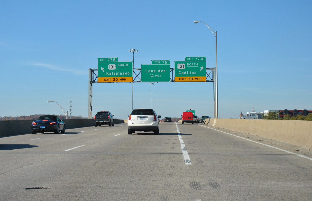
Exit 86A leaves U.S. 131 north for I-196 east toward Lansing. I-296 accompanies U.S. 131 north through the succeeding two interchanges. 11/05/11
![]() East at
East at ![]()
![]()
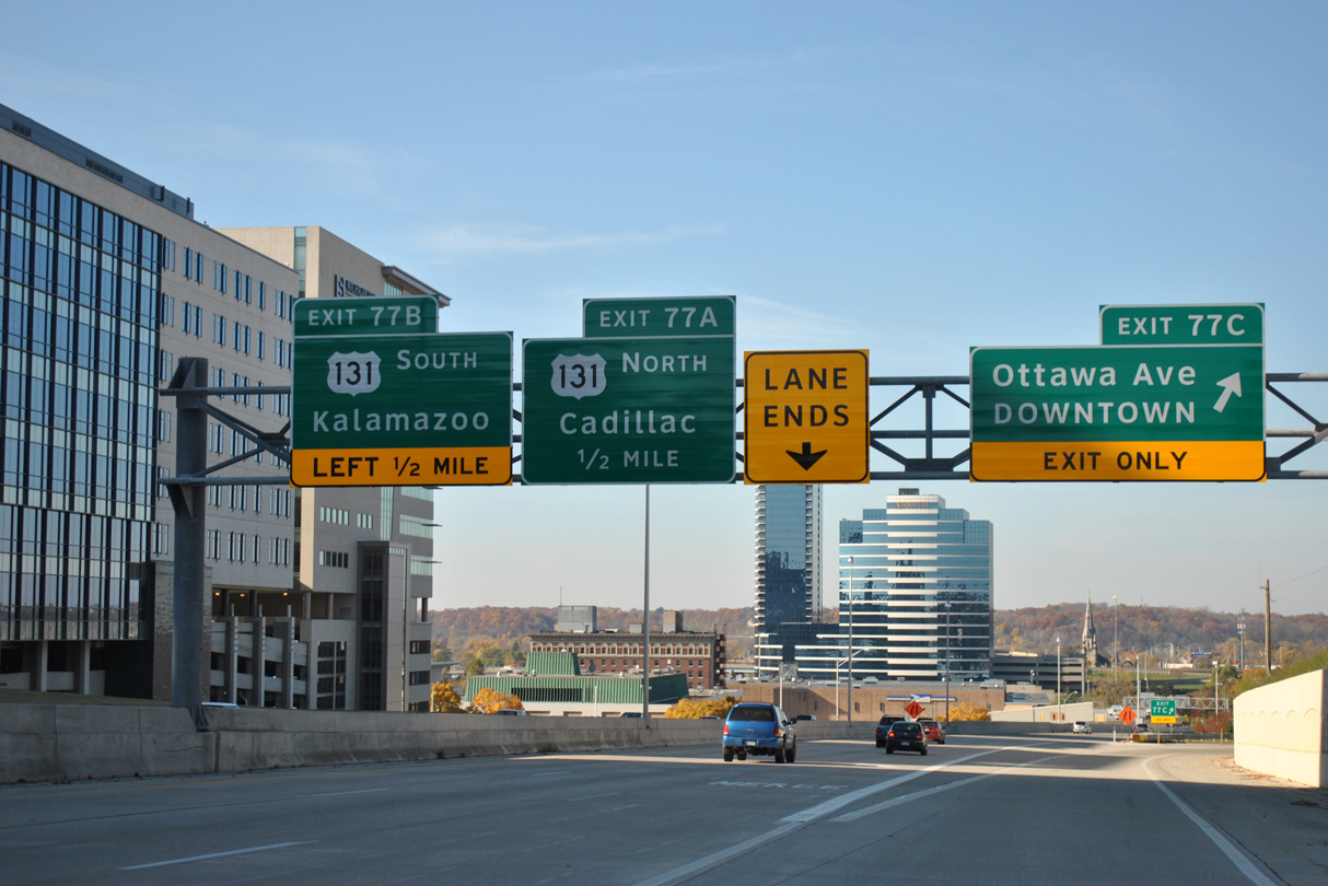
Similar to the configuration along U.S. 131, ramps separate from both sides of I-196 (Gerald R. Ford Freeway) for U.S. 131 south and I-296/U.S. 131 north. 11/05/09

The succeeding exit beyond I-296/U.S. 131 along I-196 leads to U.S. 131 Business and Downtown Grand Rapids. 11/05/09
![]() West at
West at ![]()
![]()
I-196 (Gerald R. Ford Freeway) runs west between the Belknap Lookout neighborhood and the Medical Mile north of Downtown Grand Rapids ahead of U.S. 131/I-296. 11/05/11
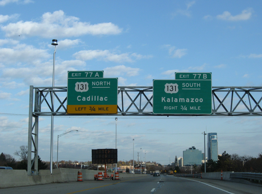
I-196 spans the Grand River leading into the exchange with U.S. 131 and I-296 north at Exit 77. 11/05/11
Sources:
Thanks to Eric Vander Yacht and Chris Bessert for additional information on hidden Interstate 296.
Page updated July 23, 2021.