Interstate 305 California

Overview
Interstate 305 is the hidden Interstate designation for U.S. 50 / Business Loop I-80 (Capital City Freeway) between I-80 in West Sacramento and the interchange with California State Route 99 (Veterans Purple Heart Freeway) south, U.S. 50 east and the Elvas Freeway (State Route 51) north in Sacramento. Unlike most signed routes in California, there is no assigned State Route 305, but the number is reserved because I-305 is used for funding petitions along this freeway (Federal-Aid Interstate 305 [FAI 305]).1
The Federal Highway Administration (FHWA) Route Log and Finder List attributes 6.00 miles for Interstate 305, reflecting the distance along U.S. 50 between I-80 and SR 51/99 in Sacramento. The FHWA log published in November 2002 listed I-305 at 8.44 miles in length, extending the designation northeast along the Elvas Freeway from SR 99 and U.S. 50 to the curve north of C Street at Sutter’s Landing Regional Park. This is the location where the 5.1 mile long canceled realignment for I-80 to north Sacramento was to diverge en route to what was then Interstate 880.2,3 Completed in 1968, Interstate funds were used for the construction of the 29th/30th Street Freeway (unsigned SR 51) and the W-X Freeway (U.S. 50). Predating the Interstate Highway System, the Elvas Freeway north from C Street opened in 1955.4
Route Information
East End – Sacramento, CA
West End – West Sacramento, CA
Mileage – 6.00
Cities – West Sacramento, Sacramento
- Junctions –

Source: December 31, 2021 Interstate Route Log and Finders List
I-305 Annual Average Daily Traffic (AADT)
Source: 2017 Traffic Volumes – Caltrans Traffic Census Program
 History
Planning for the Elvas Freeway commenced in 1947. The route north from C and 29th/30th Street to Arden Way and Swanston Road in Sacramento was approved by the California Highway Commission in 1949. Construction on the bridges across the American River started in May 1950, but halted in 1951 due to steel shortages. Succeeding work on the 2.9 mile long highway resumed in 1952 and the Elvas Freeway opened to traffic on May 12, 1955.4
Interstate 305 was created in May 1980 by an action of the FHWA, after the long planned upgrade of the Capital City Freeway (Business Loop I-80) was canceled.1 This upgrade outlined a new freeway to replace the Elvas Freeway north across the American River at Arden Fair to former I-880 at Watt Avenue. The realignment of I-80 would remove substandard sections of freeway, including some sharp curves, poor sight distance, narrow right-of-way, and small or nonexistent shoulders. The plan was moving forward through the 1970s until 1979, when the Sacramento City Council voted that year to delete the new Interstate 80 alignment and use the funding and right-of-way for a rail transit system. As a result of this action, the acquired right-of-way intended for I-80 and the partially built roadway was converted into a parking lot for Sacramento’s light rail system.
Subsequent actions by the State of California and the FHWA rerouted Interstate 80 onto the existing Interstate standard Sacramento Bypass (then numbered as I-880). The unbuilt portion of I-80 in Sacramento was formally withdrawn from the Interstate System on May 15, 1980.2 The Elvas Freeway was renumbered as California State Route 51, but it was signed as part of Business Loop I-80 (Capital City Freeway) to allow for clear direction for travelers along Interstate 80 into Downtown Sacramento.
Interstate 305 (FAI 305) was established between I-80 in West Sacramento and U.S. 50 and SR 99 in Sacramento formally by the American Association of State Highway and Transportation Officials (AASHTO) on November 14, 1980. This included extending U.S. 50 west from SR 99 to I-80 over the 29/30th Street Freeway and the W-X Freeway. I-80 and I-880 remained in their previous, legislatively defined alignments in the California state highway system until 1982.
California State Senate Bill 191 in 1981 made several changes in the highway system to reflect the FHWA and AASHTO actions. The SB 191 legislation deleted Interstate 880 from the state highway system and rerouted I-80 over it. The FAP 51 segment of the Elvas Freeway was renumbered as SR 51. SB 191 did not call for the creation of Interstate 305 as a state route; instead it outlined the westward extension of U.S. 50 to I-80 in West Sacramento.
SB 191 established Business Loop I-80 along both the U.S. 50 extension west along the W-X Freeway (FAI 305) and the Elvas Freeway (SR 51) northeast from SR 99. Caltrans references the FAI 305 section a Legislative Route Route (LRN) 50.
Business Loop I-80 was renamed as the Capital City Freeway by the Sacramento Area Council of Governments (SACOG) in 1996. Despite the change, motorist confusion remained an issue and in 2015 sign changes implemented along the U.S. 50 portion of the route reduced the emphasis of the Business Route.
 Photo Guides
East End 
 – Sacramento, California
![]()
![]() East at
East at ![]()
![]()
![]()
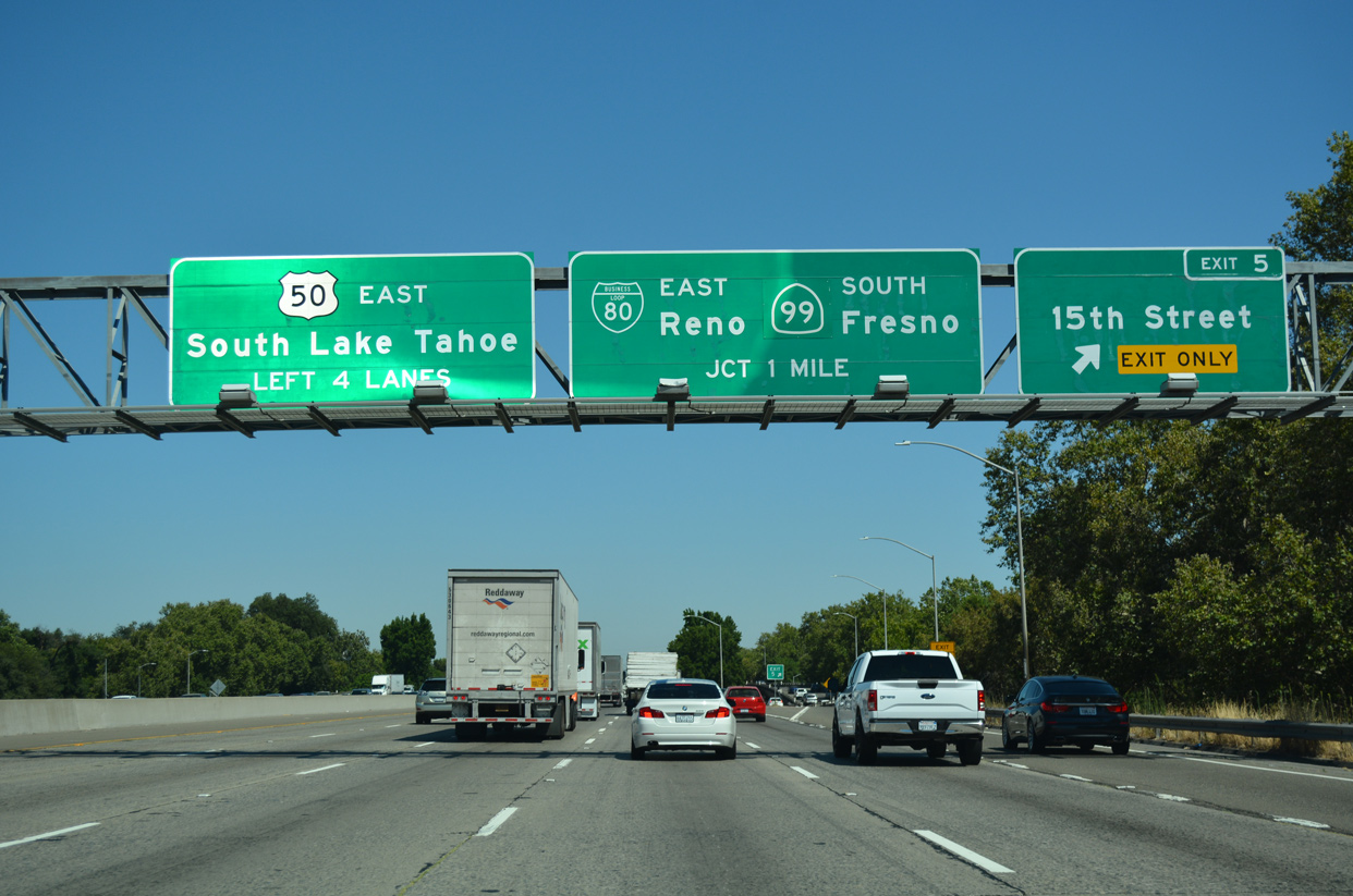
Exit 5 departs U.S. 50 (I-305) eastbound for 15th Street and former SR 160 one mile from the systems interchange with Business Loop I-80 and SR 99. 07/10/18
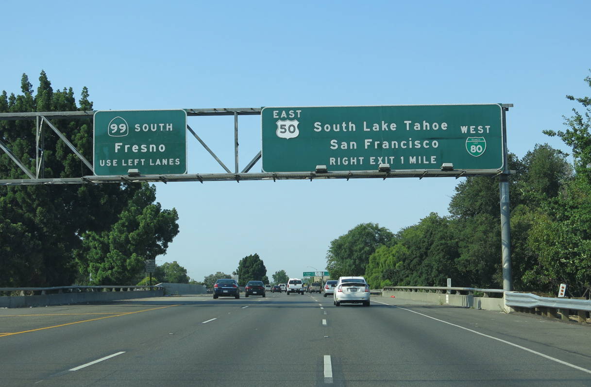
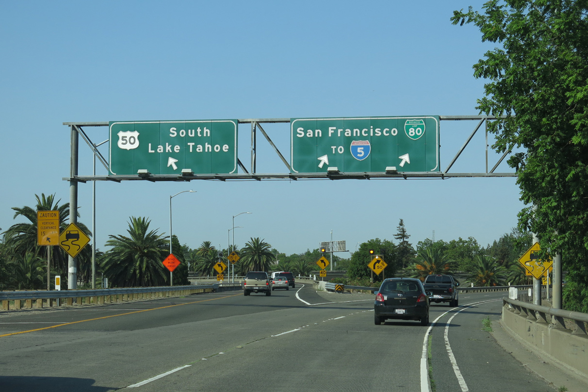
U.S. 50 and I-305 follow what is locally known as the WX Freeway east to the split with Business Loop I-80 (Elvas Freeway) and SR 99 south. The freeway parallels W and X Streets across the Sacramento street grid. 03/10/15
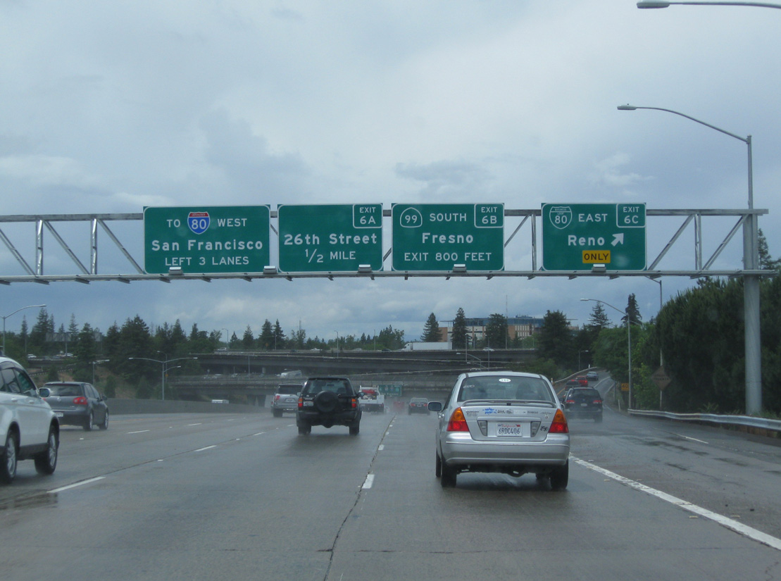
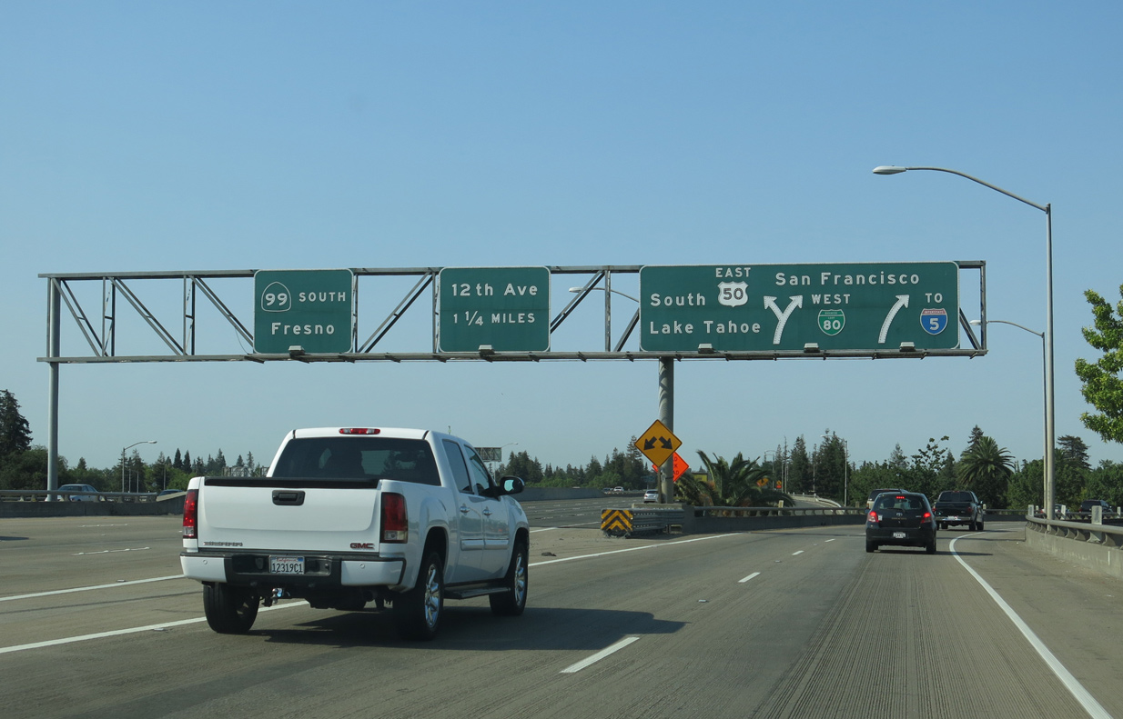
Three lanes separate from the WX Freeway for Business Loop I-80 (Capital City Freeway) east to I-80 ahead of Roseville and Auburn and the continuation of SR 99 south from Sacramento to Lodi and Stockton. 07/10/18
Unsigned Interstate 305 concludes along the transition ramp from U.S. 50 east to Business Loop I-80 (SR 51). SR 99 emerges from an unmarked overlap with U.S. 50 south toward Fresno. 07/10/18
![]() West at
West at ![]()
![]()
![]()
![]()
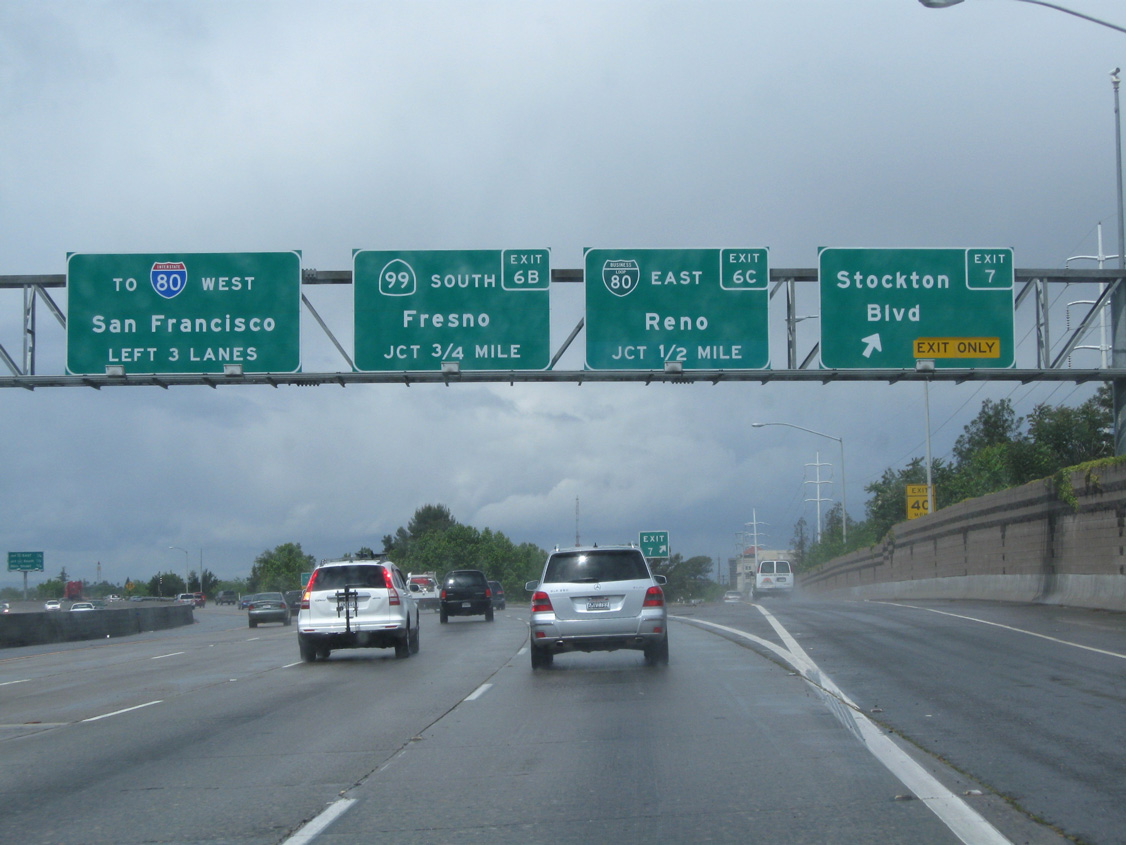
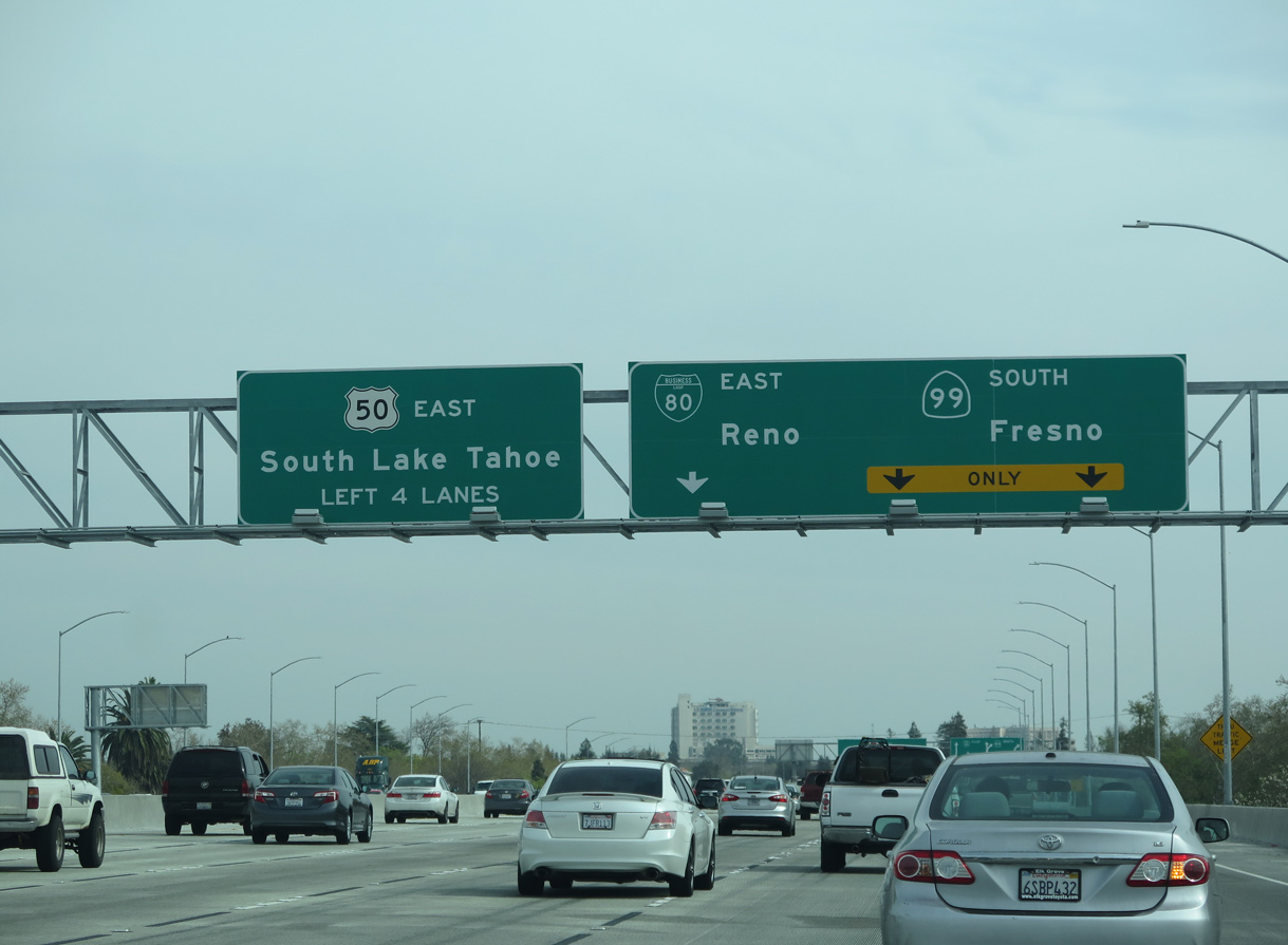
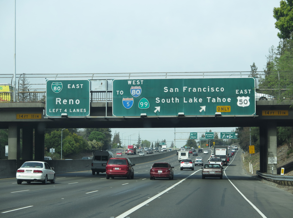
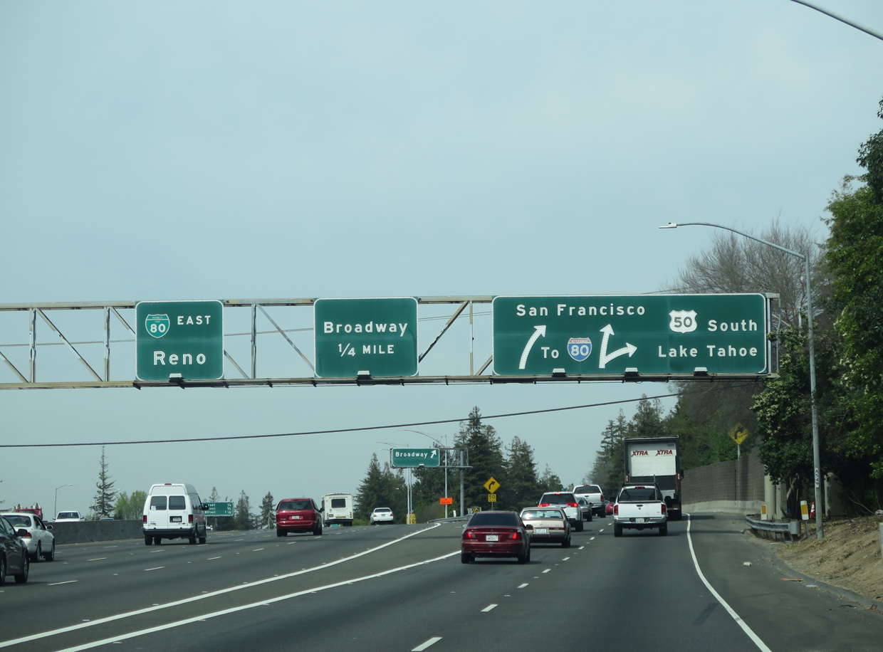
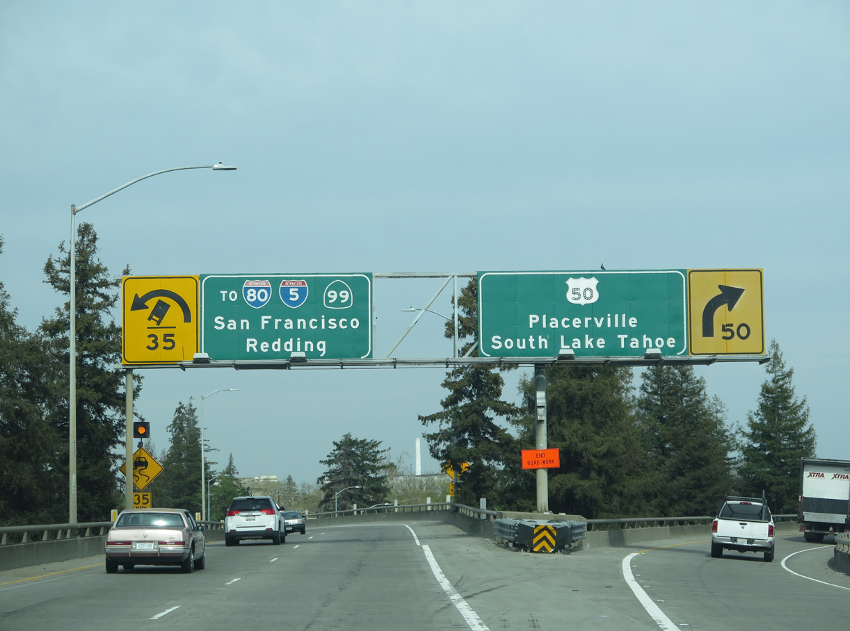
U.S. 50 travels west from Placerville to Sacramento mostly as an Interstate standard freeway. With increased commuter traffic from Folsom and the eastern suburbs, U.S. 50 swells to over ten lanes in places preceding the exchange with Business Loop I-80 east at Exit 6 C and SR 99 south at Exit 6 B. 05/13/11
Exit 6 C departs U.S. 50 westbound for Business Loop I-80 (Elvas Freeway) east as unmarked Interstate 305 begins. Business Loop I-80 (SR 51) leads northeast toward the retail corridor at Arden Way, connecting with I-80 near Watt Avenue. 05/13/11
SR 99 heads south from U.S. 50 in Sacramento through the Central Valley to Stockton, Modesto, Fresno and Bakersfield. Providing a connection to Southern California, the freeway along SR 99 joins Interstate 5 near Wheeler Ridge. 05/13/11
![]()
![]() West at
West at ![]()
![]()
![]()
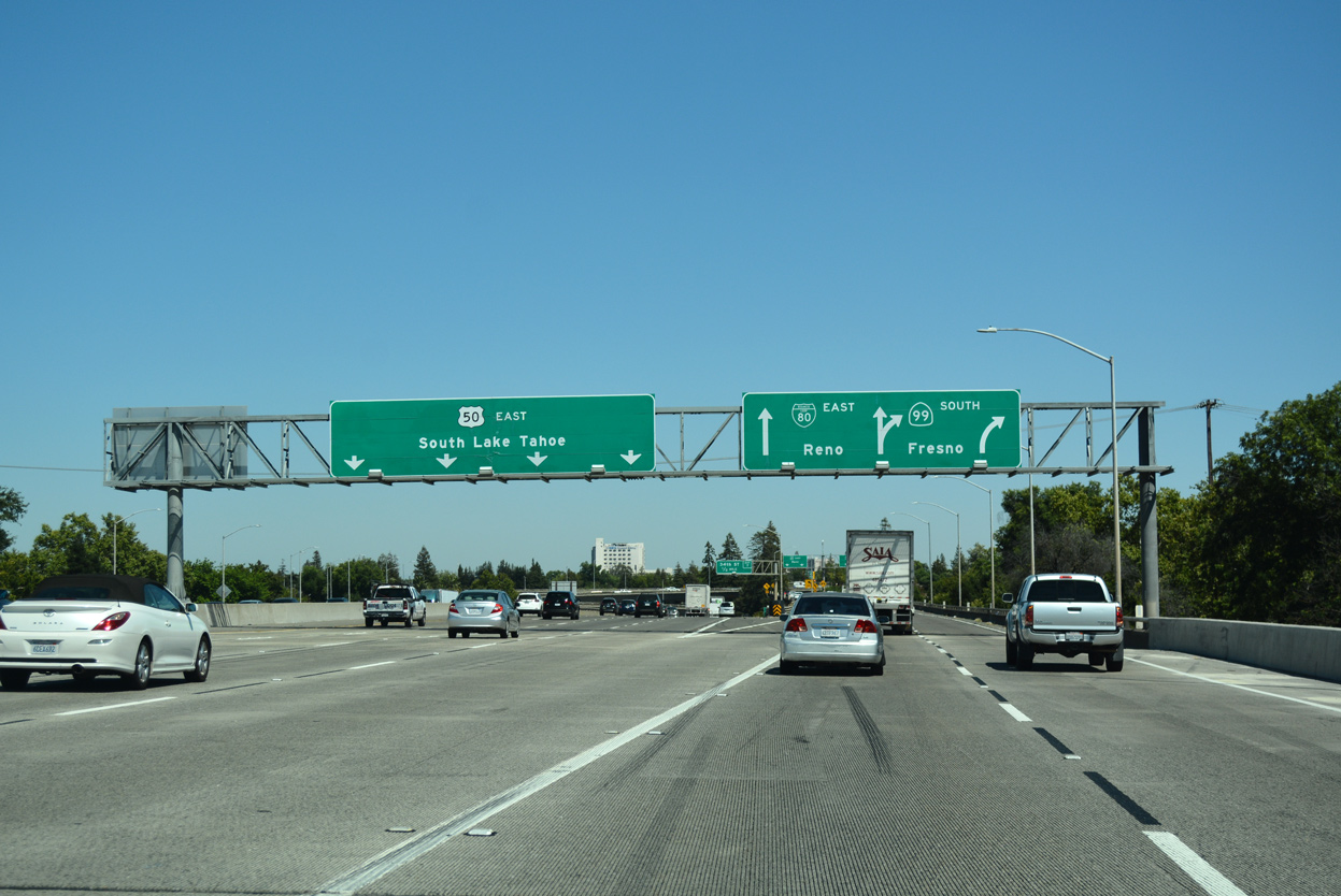
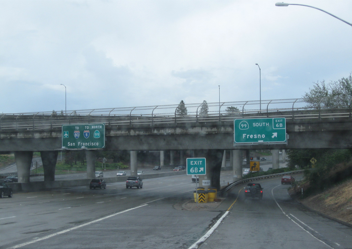
Spanning E Street, Business Loop I-80 (Elvas Freeway) advances southwest one mile to U.S. 50, SR 99 and Interstate 305. All guide signs for U.S. 50 were replaced in Fall 2016 to remove Business Loop I-80. 07/02/13
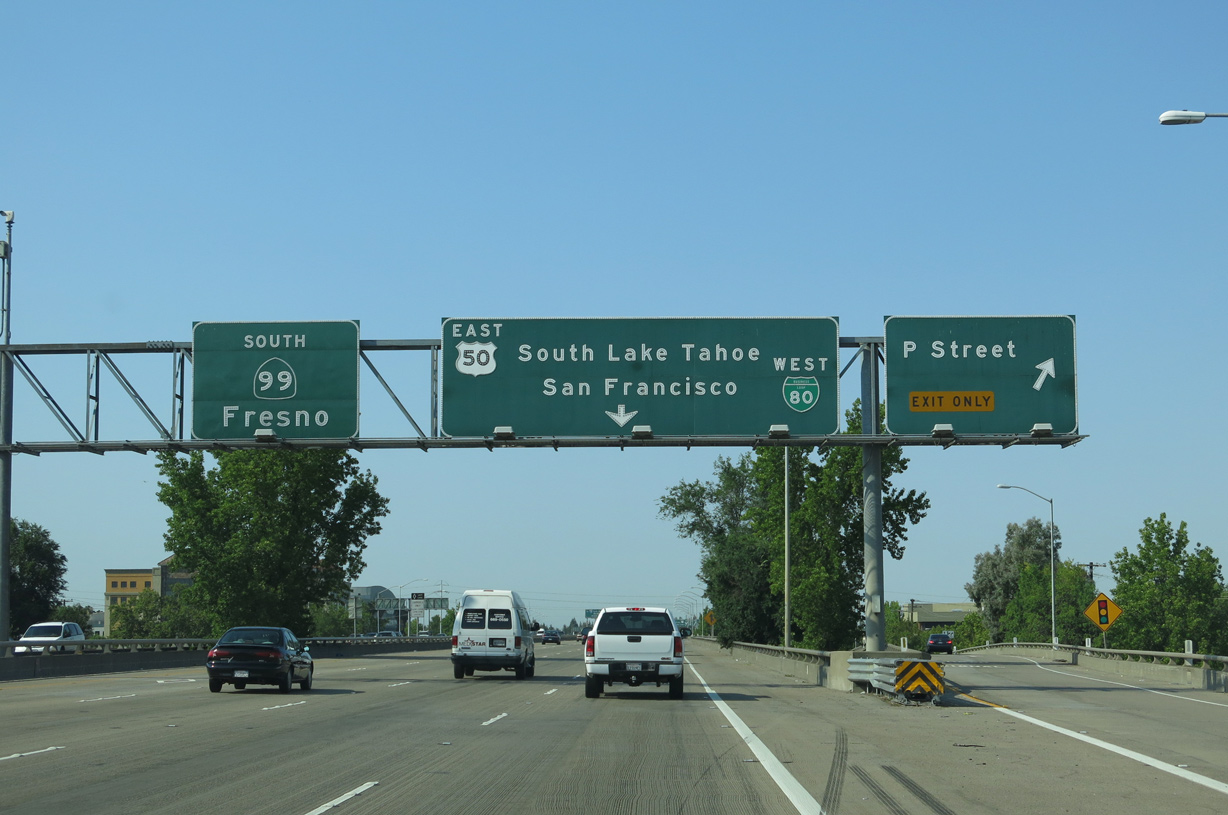
The mainline of Business Loop I-80 (29-30th Street Freeway) westbound leads to SR 99, while two lanes partition beyond the P Street off-ramp for U.S. 50 and unsigned Interstate 305 to Downtown Sacramento. 07/02/13
SR 99 takes over from the 29th-30th Street Freeway south toward Elk Grove while Business Loop I-80 and unsigned end of SR 51. U.S. 50 enters the capital city from Folson and Rancho Cordova to the east. 07/02/13
U.S. 50 and I-305 elevate westward along the WX Freeway by Midtown Sacramento. The two routes overlap six miles west to I-80 in West Sacramento. 07/02/13
![]() North at
North at ![]()
![]()
![]()
![]()
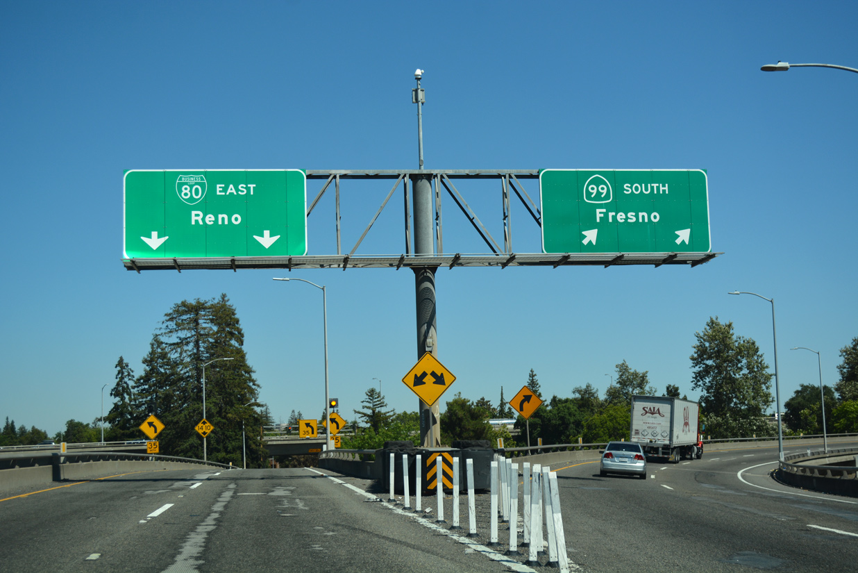
Advancing to U.S. 50, unsigned I-305 and Business Loop I-80 (Capital City Freeway) on SR 99 north at 2nd Avenue in Sacramento. Prior to 1964, U.S. 50 ran concurrent along what was U.S. 99 north from Stockton to this exchange. 07/02/13
Four lanes extend north from SR 99 onto Business Loop I-80/SR 51 (Elvas Freeway) eastbound. 07/02/13
SR 99 turns west alongside U.S. 50 and I-305 to Interstate 5, but is unmarked beyond the exchange with Business Loop I-80. The state route emerges from I-5 north near Sacramento International Airport (SMF) to Yuba City, Oroville and Chico. 07/02/13
West End – West Sacramento, California
![]()
![]() West at
West at ![]()
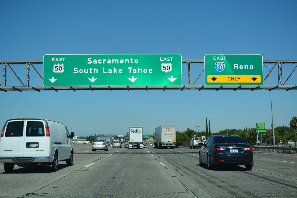
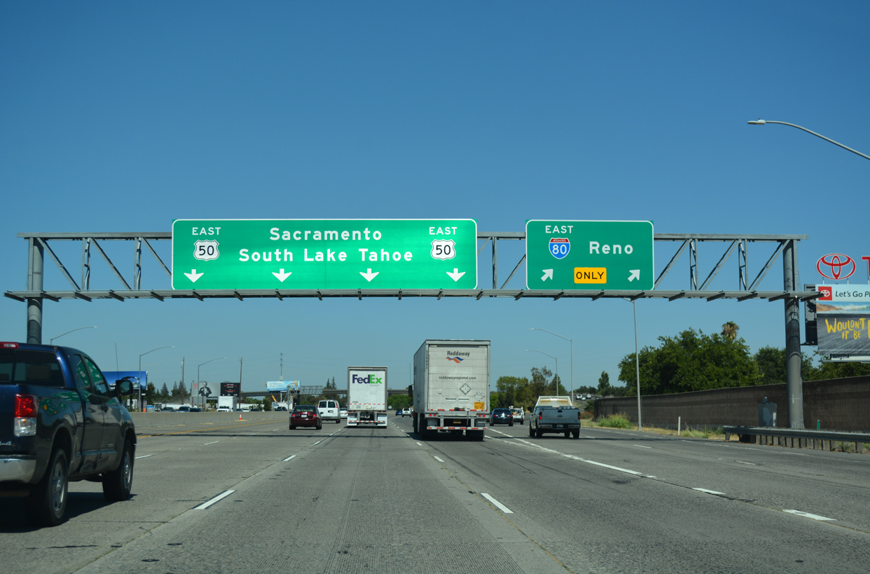
U.S. 50 proceeds a half mile west from the six-ramp parclo interchange (Exit 1 B) with Harbor Boulevard to the eastbound entrance ramp for I-80 in West Sacramento. 07/02/13

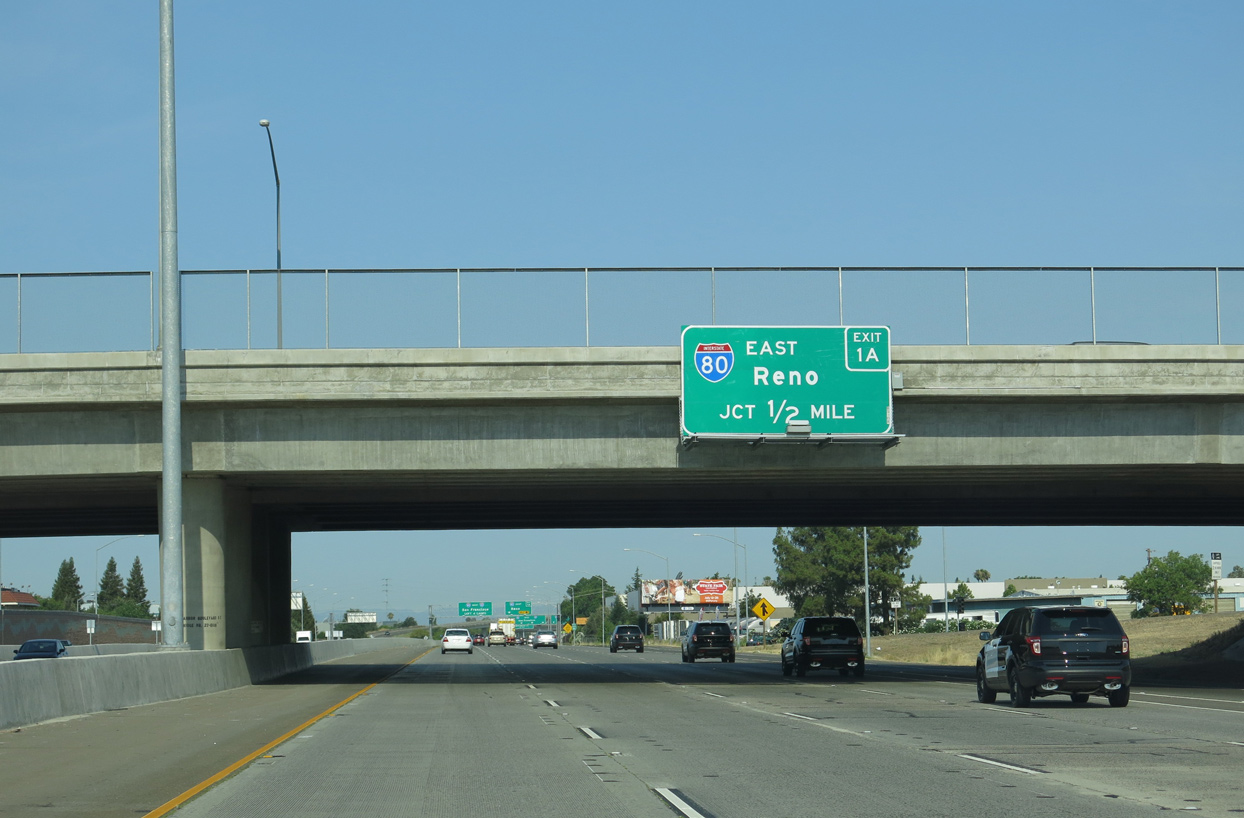
Four lanes continue west from U.S. 50 and I-305 onto Interstate 80 westbound ahead of the Yolo Causeway to Davis. 07/02/13
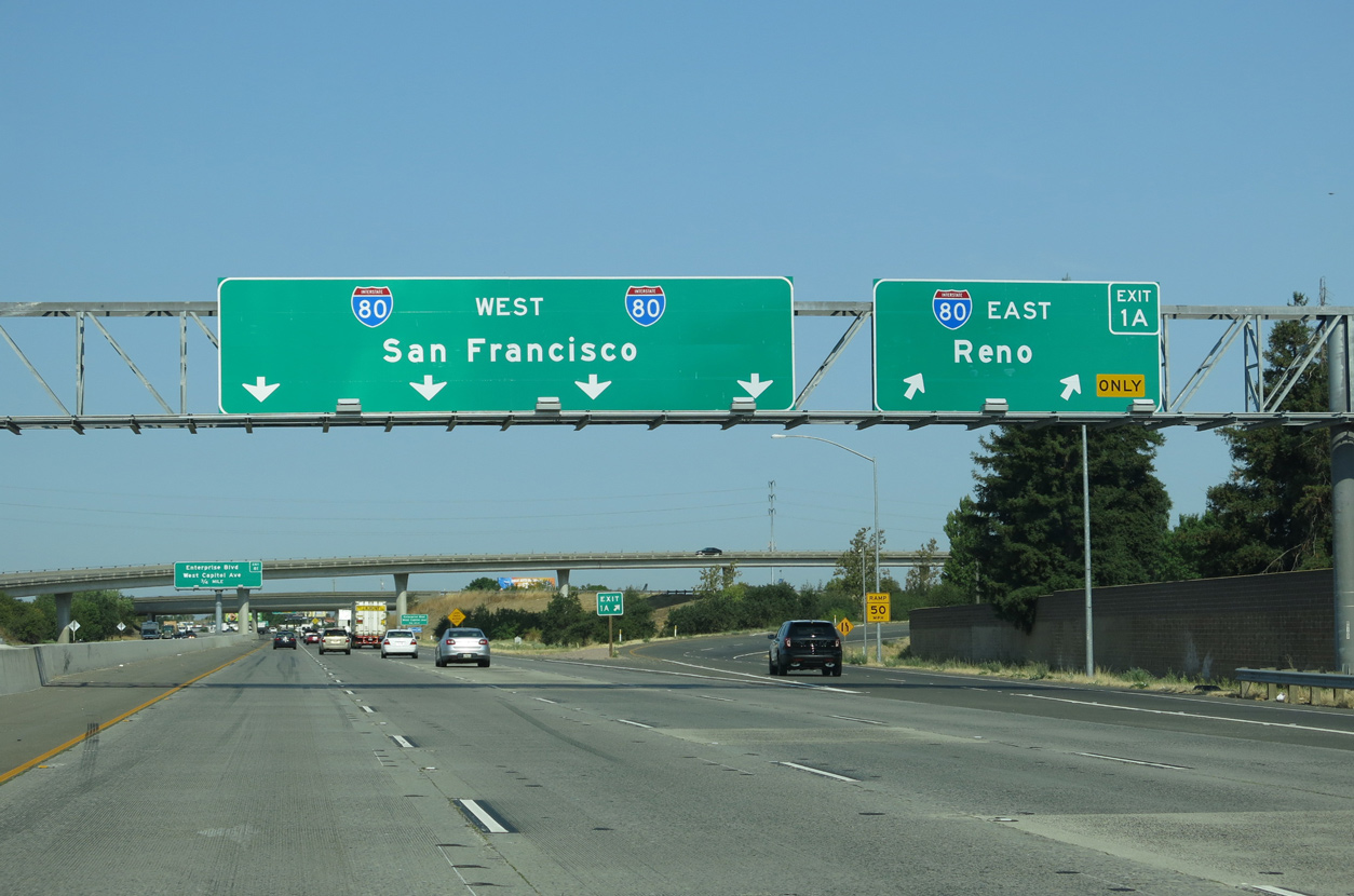
U.S. 50 concludes a 3,000 plus mile route from the Atlantic coast along with unsigned I-305 at the directional T interchange (Exit 1 A) with I-80. I-80 arcs northeast to meet I-5 south of Sacramento International Airport (SMF). 07/02/13
![]() East at
East at ![]()
![]()
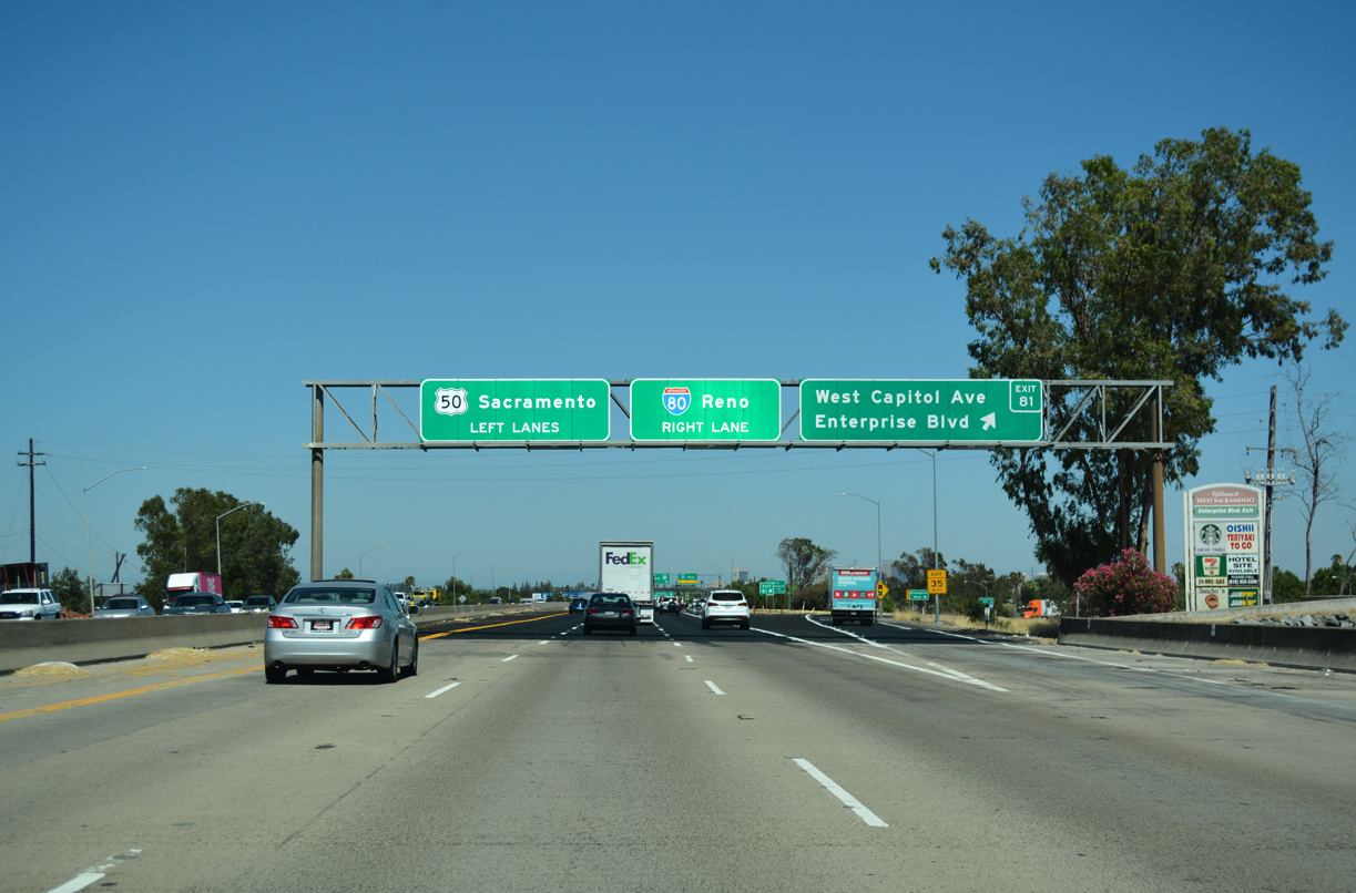
Interstate 80 crosses Yolo Causeway to the city of West Sacramento. Exit 81 to West Capitol Avenue (Historic U.S. 40/99W) precedes the separation with U.S. 50 (I-305). 07/10/18
Four lanes transition onto U.S. 50 / unsigned Interstate 305 toward Downtown Sacramento while I-80 branches northeast along a two lane flyover to bypass the capital city. 07/10/18
U.S. 50 commences the cross county route to Ocean City, Maryland along side Interstate 305 from I-80 in West Sacramento. Within the Golden State, U.S. 50 joins Sacramento with Placerville and South Lake Tahoe. 07/10/18
East End Throwback – at 


Interstate 80 east at I-305 and U.S. 50 prior to the replacement of signs acknowledging Business Loop I-80 and the Capital City Freeway. 07/24/16
Sources
- California Highways (www.cahighways.org): Route 305.
- The Dwight D. Eisenhower System of Interstate and Defense Highways, Part V – Interstate Withdrawal-Substitution Program.
- Parker, Scott. Personal Email, “99 rewrite, info/suggestion re Sacramento road mystery,” June 6, 2006.
- Elvas Freeway – US 99E.
http://home.pacbell.net/ hywaymn/Elvas_Freeway_001.htm. The Highwayman’s Road Reports (Joel Windmiller).
Page updated March 11, 2019.