Interstate 391 Massachusetts
Overview
Interstate 391 branches north from I-91 alongside the Connecticut River in the city of Chicopee. Straddling a ridge by the Ferry Lane and Willimansett communities, I-391 crosses the Connecticut River into the city of Holyoke ahead of a series of ramps for Main, Jackson and High Streets.
 History
Interstate 391 was designated in 1965, with construction beginning in 1967 and ending in 1982.1
$15.9 million in road construction underway built 2.8 miles of I-91 from Chicopee to Springfield, including a short spur of Interstate 391. Associated construction built another 1.9 miles of I-91 from Holyoke to West Springfield for $3 million and $1 million for the interchange joining I-91 with the Massachusetts Turnpike.2
Route Information
North End – Holyoke, MA
South End – Chicopee, MA
Mileage – 4.46
Cities – Chicopee, Holyoke
- Junctions –

Source: December 31, 2021 Interstate Route Log and Finders List
I-391 Annual Average Daily Traffic (AADT)
Source: 2010, 2016 MassDOT Transportation Data Management System
 Photo Guides
North End  / Resnic Boulevard – Holyoke, Massachusetts
![]() North
North
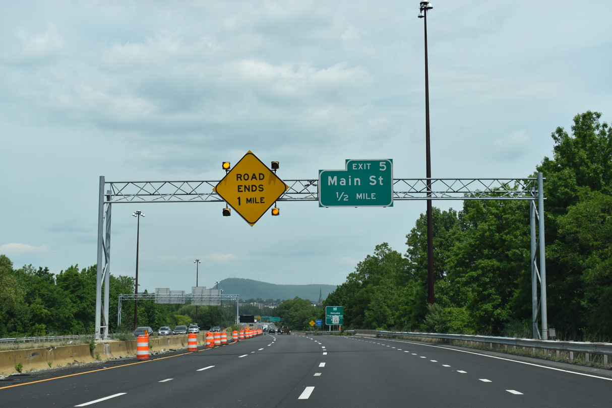
Interstate 391 crosses the Connecticut River on the final mile leading into the city of Holyoke. Exit 5 departs ahead for Main Street. 05/31/22
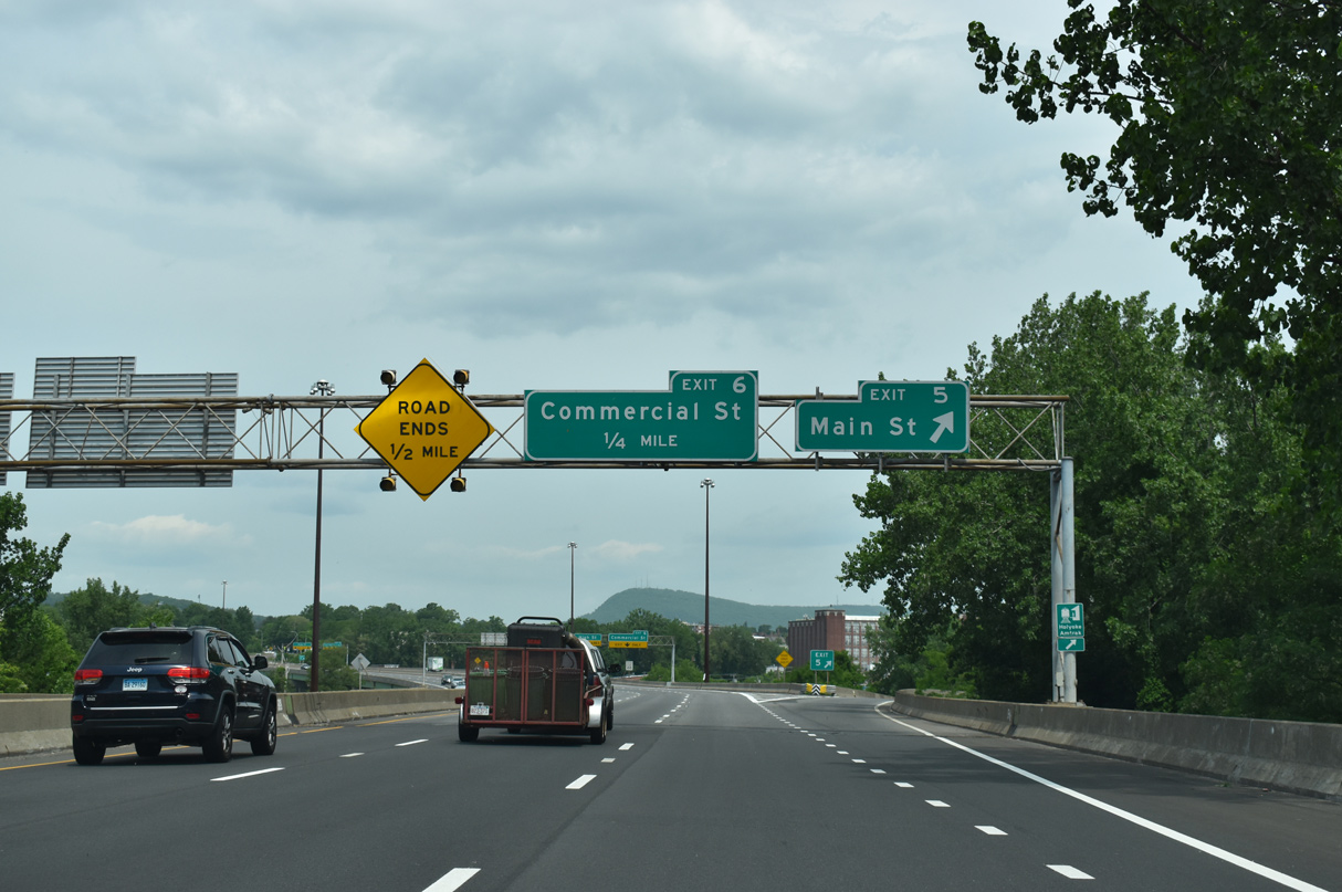
A half diamond interchange (Exit 5) joins I-391 northbound with Main Street from the Connecticut River bridge. 05/31/22
Interstate 391 extends north into the city of Holyoke along a six lane viaduct to the wye interchange (Exit 6) with Commercial Street. 05/31/22
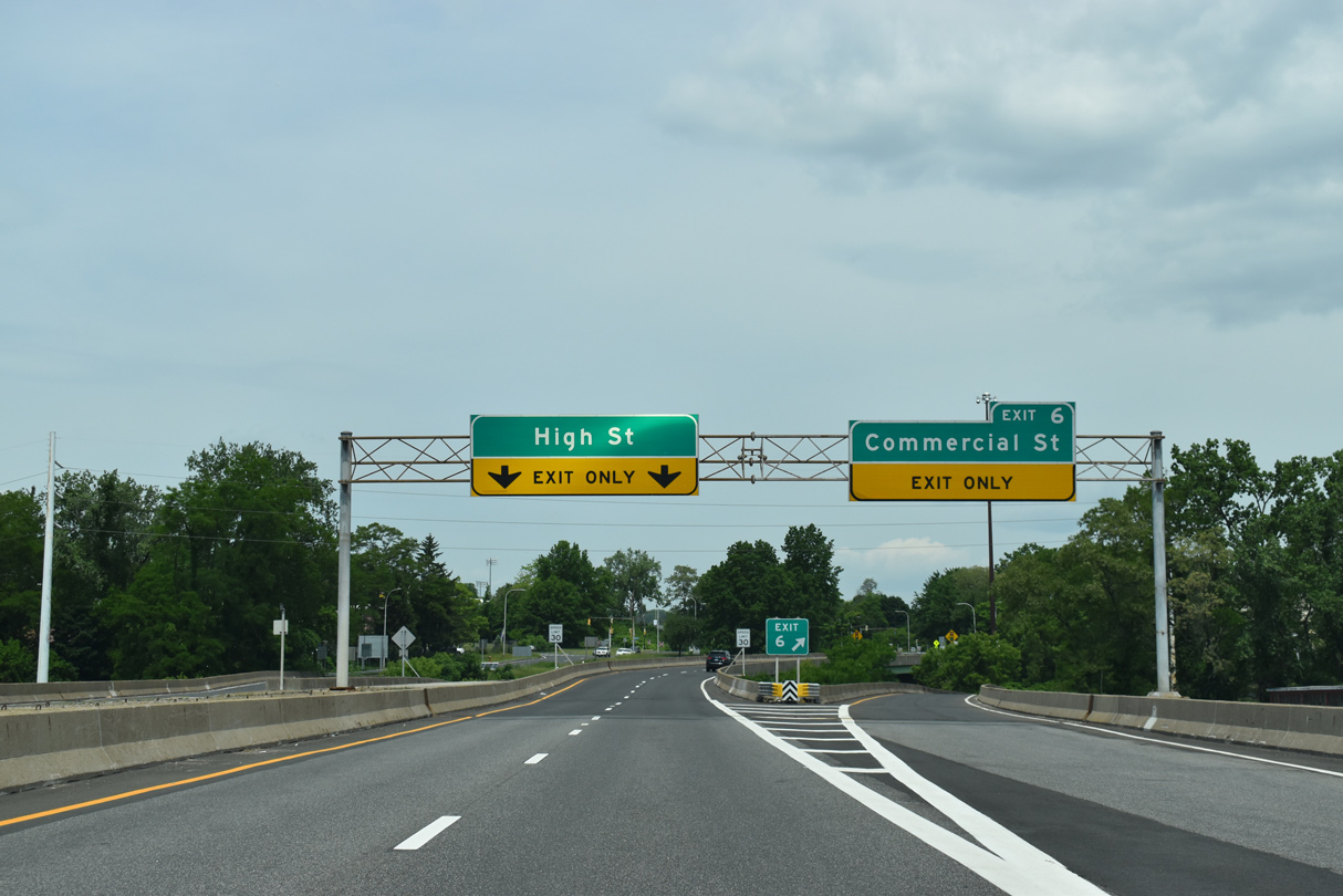
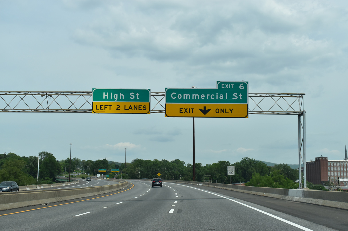
Exit 6 leaves Interstate 391 for Commercial Street northbound to Route 141 (Appleton Street) at Downtown Holyoke. High Street parallels Commercial Street one block to the north. 05/31/22
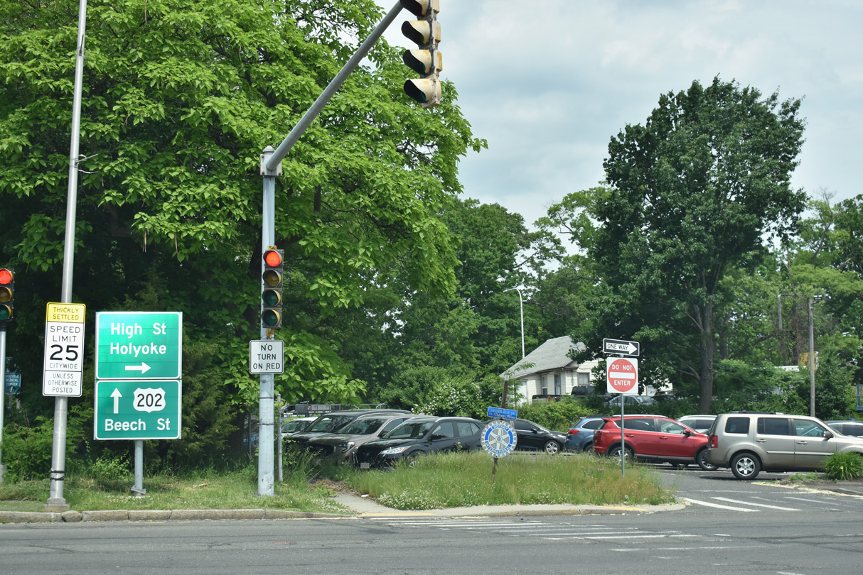
I-391 concludes at the signalized intersection joining Resnic Boulevard north with High Street. Resnic Boulevard extends north to U.S. 202 (Beech Street) at Franklin Street. 05/31/22
Maple Street – West at ![]()
Maple Street flows westbound and meets the couplet along Resnic Boulevard one block north of Interstate 391 at High Street. 05/31/22
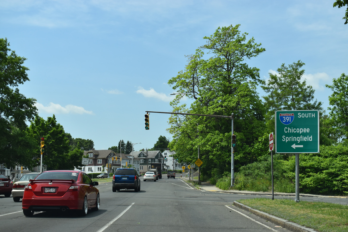
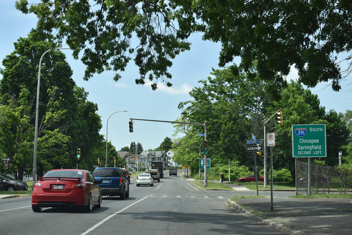
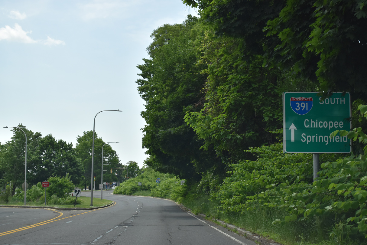
Interstate 391 extends south from Resnic Boulevard to I-91 in Chicopee. 05/31/22
High Street – East at ![]()
South Street lowers from the Elmwood neighborhood in Holyoke to become High Street ahead of Resnic Boulevard and Interstate 391 south. 05/31/22
Resnic Boulevard leads 0.4 miles south from Franklin Street at U.S. 202 (Beech Street) to become Interstate 391 at High Street. 05/31/22
Resnic Boulevard – South at ![]()
Resnic Boulevard transitions into Interstate 391 south beyond the couplet of Maple Street west and High Street east. 05/31/22

A turn off follows the signal at High Street from Resnic Boulevard/I-391 onto a short section of Kay Avenue and parallel South Street. 05/31/22
Interstate 391 elevates onto a six lane viaduct beyond the entrance ramp from Commercial Street to the Connecticut River and Chicopee. 05/31/22
South End  – Chicopee, Massachusetts
![]() South at
South at ![]()
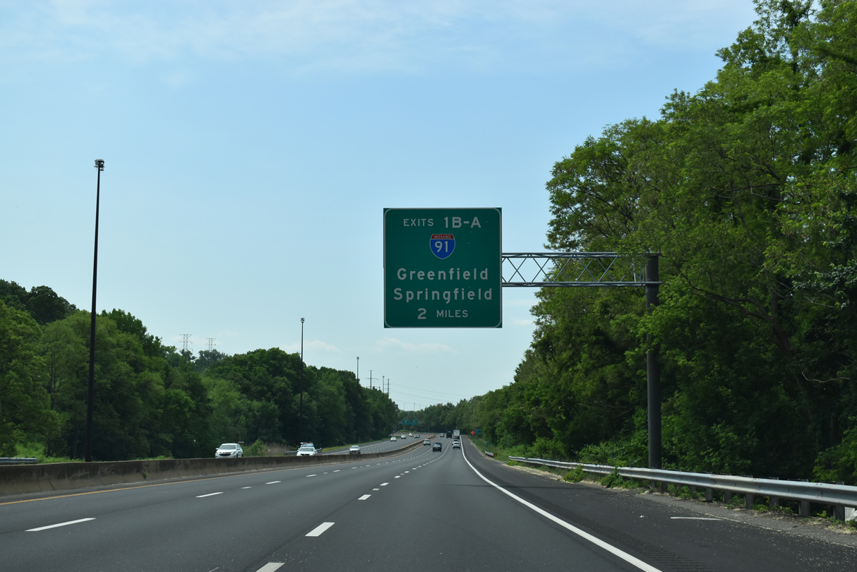
Heading south from the exchange with Route 141 (Grattan Street) in Chicopee, Interstate 391 passes underneath the Mass Pike (I-90) with no direct access on the two miles leading to Exits 1 B/A for I-91. 05/31/22
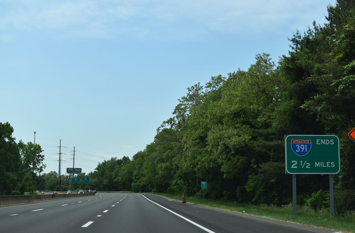
Preceding Exit 3 for Route 116, an end sign for I-391 stands 1.75 miles ahead of Interstate 91. 05/31/22
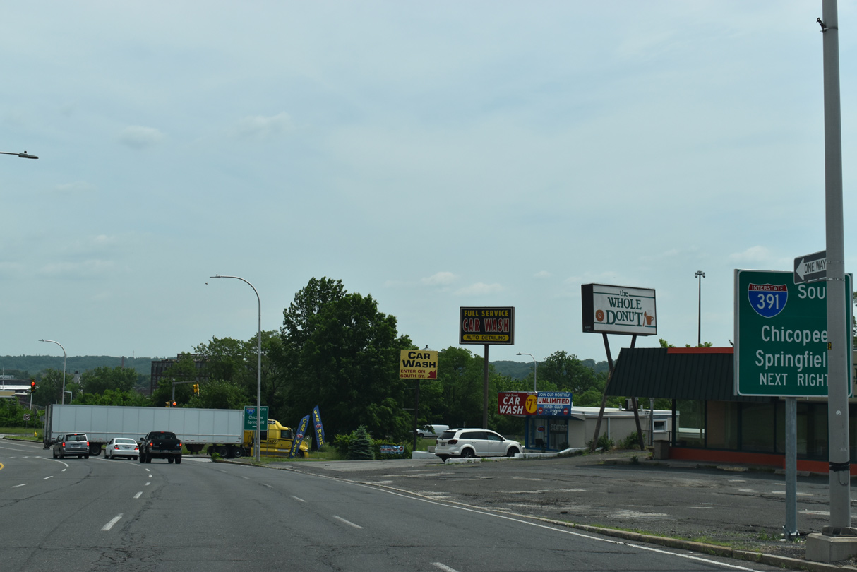
Route 116 converges with I-391 just south of I-90 at Exit 3 and again ahead of Interstate 91 along Chicopee Street. 05/31/22
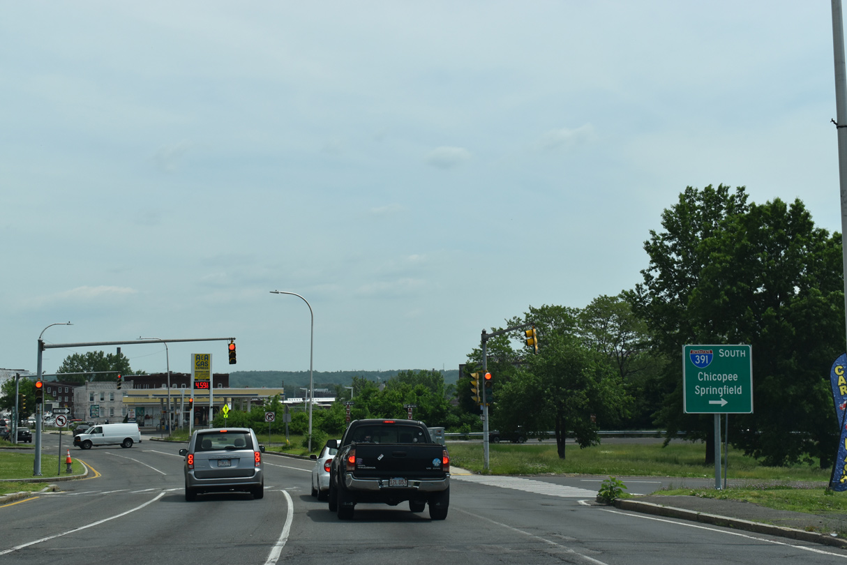
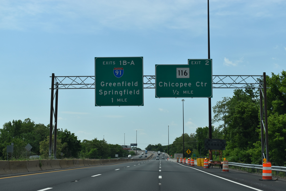
Exit 2 leaves I-391 south for Route 116 to Chicopee Center. The modified trumpet interchange (Exit 1) with Interstate 91 follows. 05/31/22
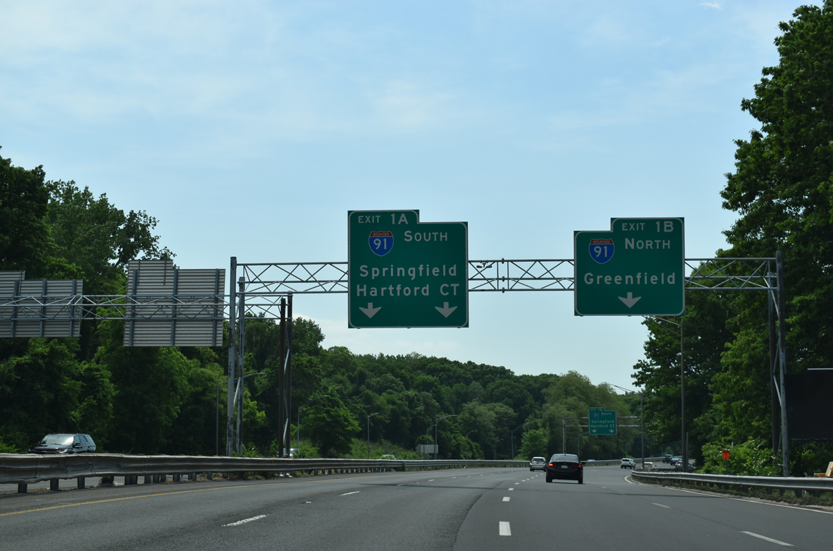
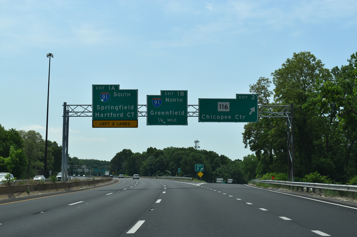
The mainline of I-391 defaults onto Interstate 91 southbound toward Downtown Springfield. I-91 joins the city with Hartford, Connecticut. 05/31/22
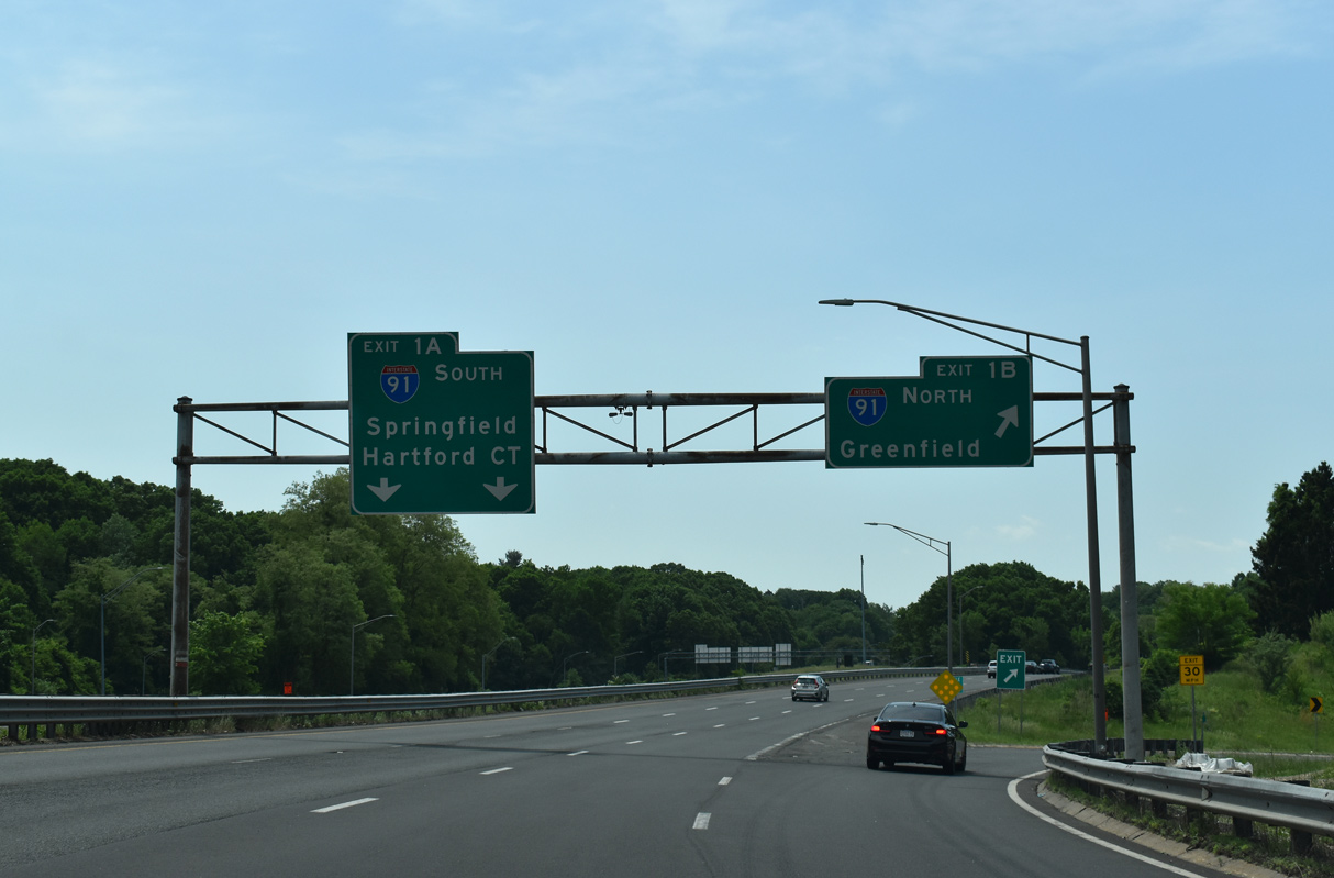
Exit 1 B departs for I-91 north across the Connecticut River into the city of West Springfield. A lane drop precedes the southbound merge with Interstate 91 ahead of the Brightwood and Memorial Square neighborhoods in Springfield. 05/31/22
![]() North at
North at ![]()
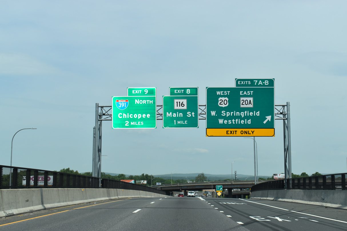
U.S. 20 continues west from I-291 across the Connecticut River into West Springfield as I-91 northbound leaves Downtown Springfield two miles south of Interstate 391. 05/31/22
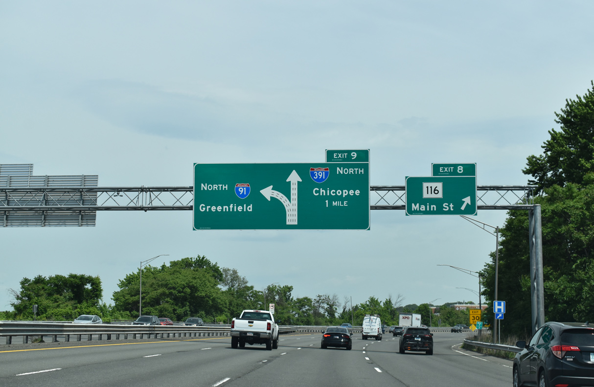
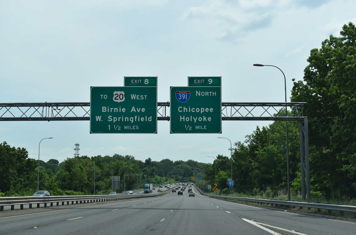
Shifting east through an S-curve, I-91 crosses over Route 116 (Main Street) at Exit 8, one mile from the split with I-391 at Exit 9. 05/31/22
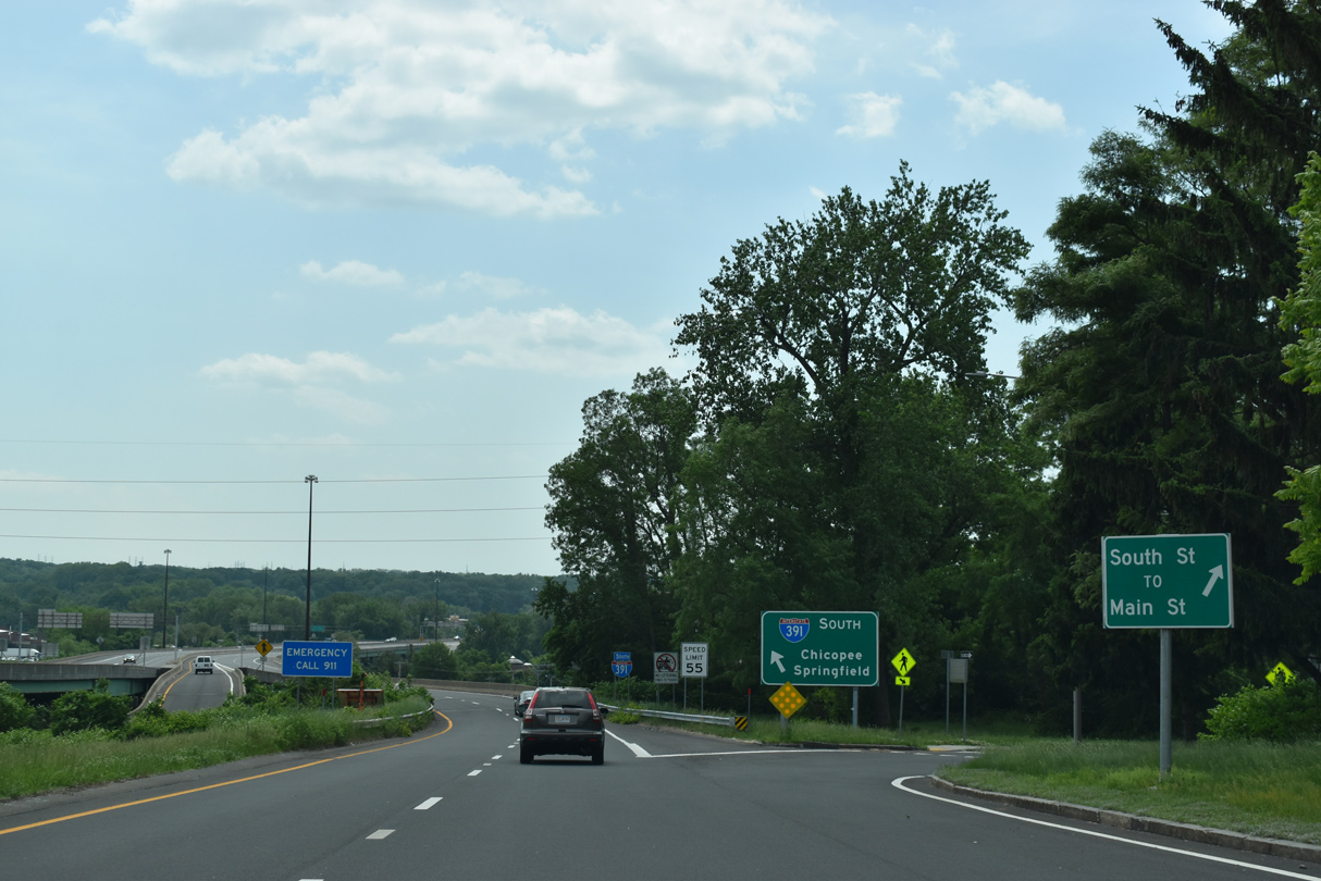
The modified trumpet interchange (Exit 9) with I-391 lies adjacent to Atwater Park along the Connecticut River. I-91 spans the waterway into West Springfield while I-391 stems north through the city of Chicopee to the Holyoke city center. 05/31/22
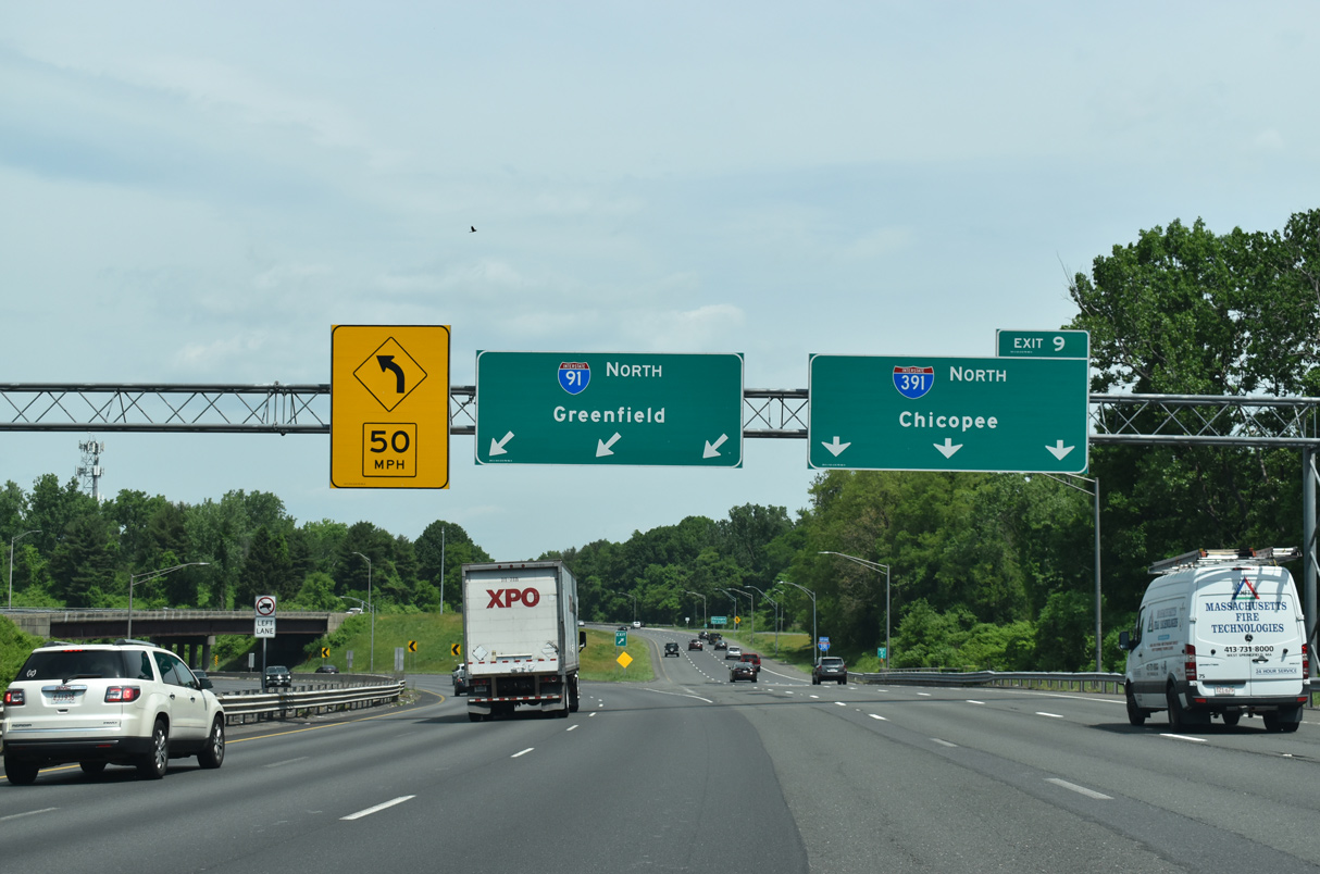
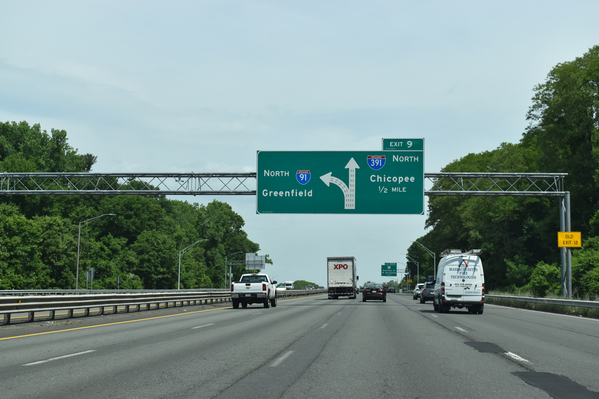
Three lanes separate for both I-91 north toward Greenfield and Brattleboro, Vermont and I-391 north to Holyoke. 05/31/22
![]() South at
South at ![]()
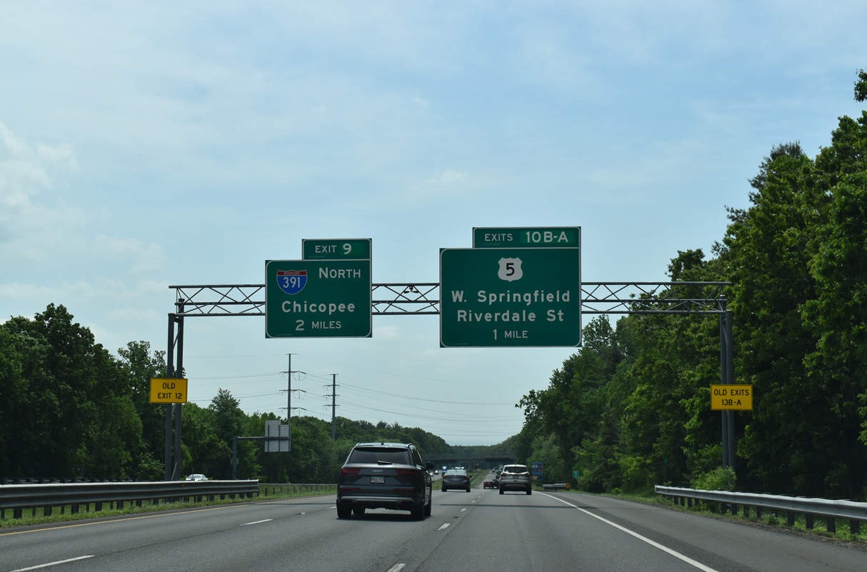
A unique symmetrical interchange (Exit 10) joins Interstate 91 with U.S. 5 (Riverdale Street) one mile from I-391 in Chicopee. Riverdale Street comprises a busy commercial arterial through West Springfield. 05/31/22
Interstate 91 converges with I-391 north at Exit 9 just across the Connecticut River in 1.25 miles. 05/31/22
Interstate 91 turns south at Exit 9 into the city of Springfield. I-391 spurs north through Chicopee, leading back toward Holyoke. 05/31/22
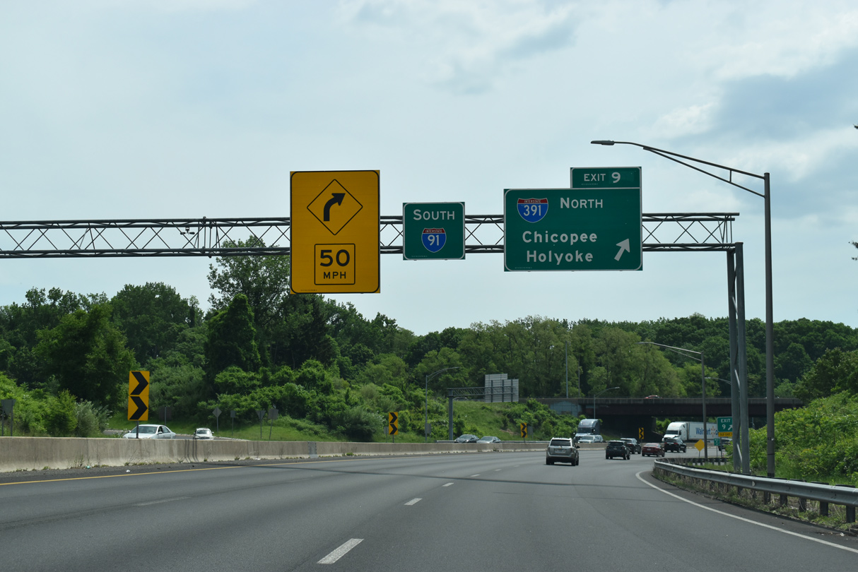
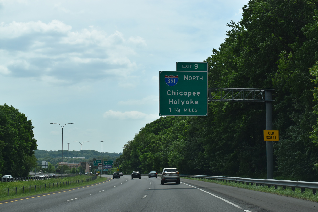
Exit 9 loops northward onto I-391 ahead of the Chicopee city center. I-91 continues south two miles to the west end of Interstate 291 and U.S. 20 at Downtown Springfield. 05/31/22
![]() North
North

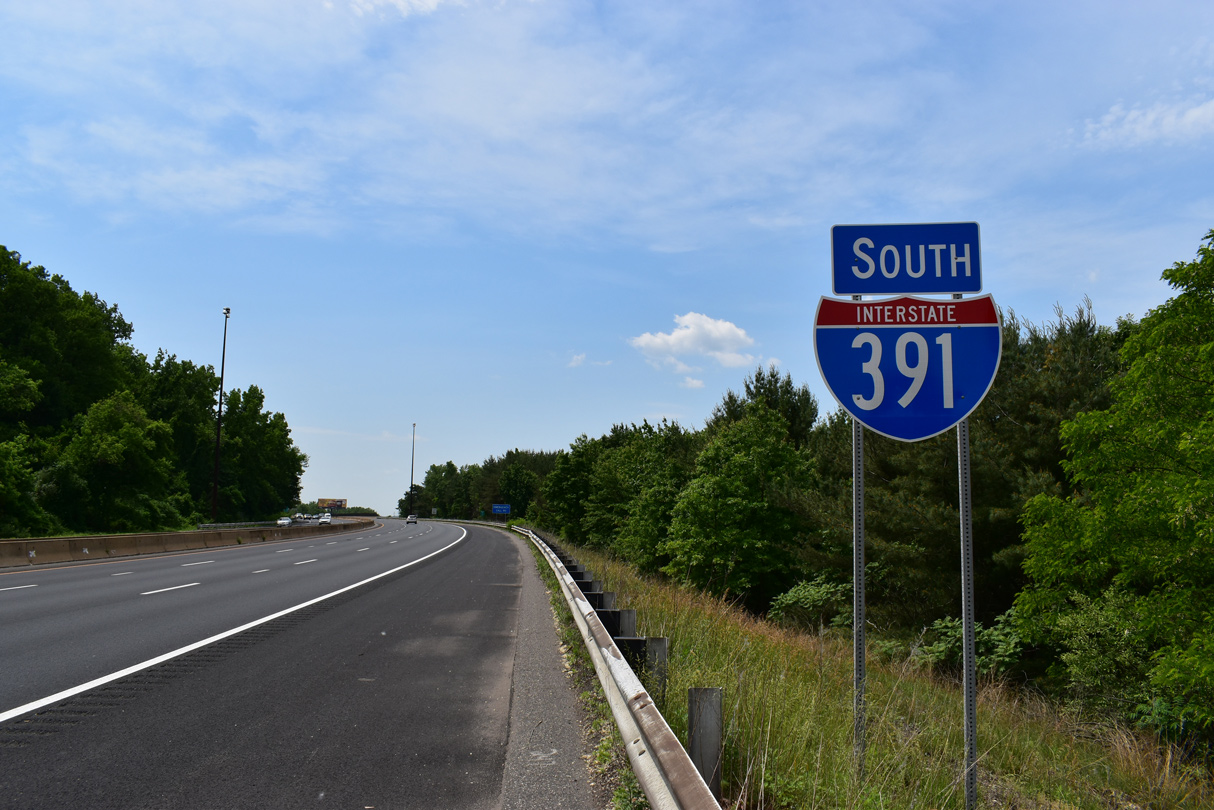
Like many other Massachusetts Interstate highways, a shield assembly marks the beginning of I-391. 05/31/22
Sources:
- Interstate 391 (Massachusetts). BostonRoads.com.
- “4 Highway Projects in Making.” The North Adams Transcript (North Adams, MA), November 10, 1966.
Page updated June 9, 2022.