Interstate 394 Minnesota
Overview
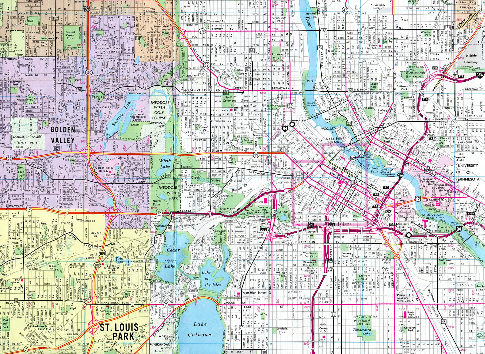
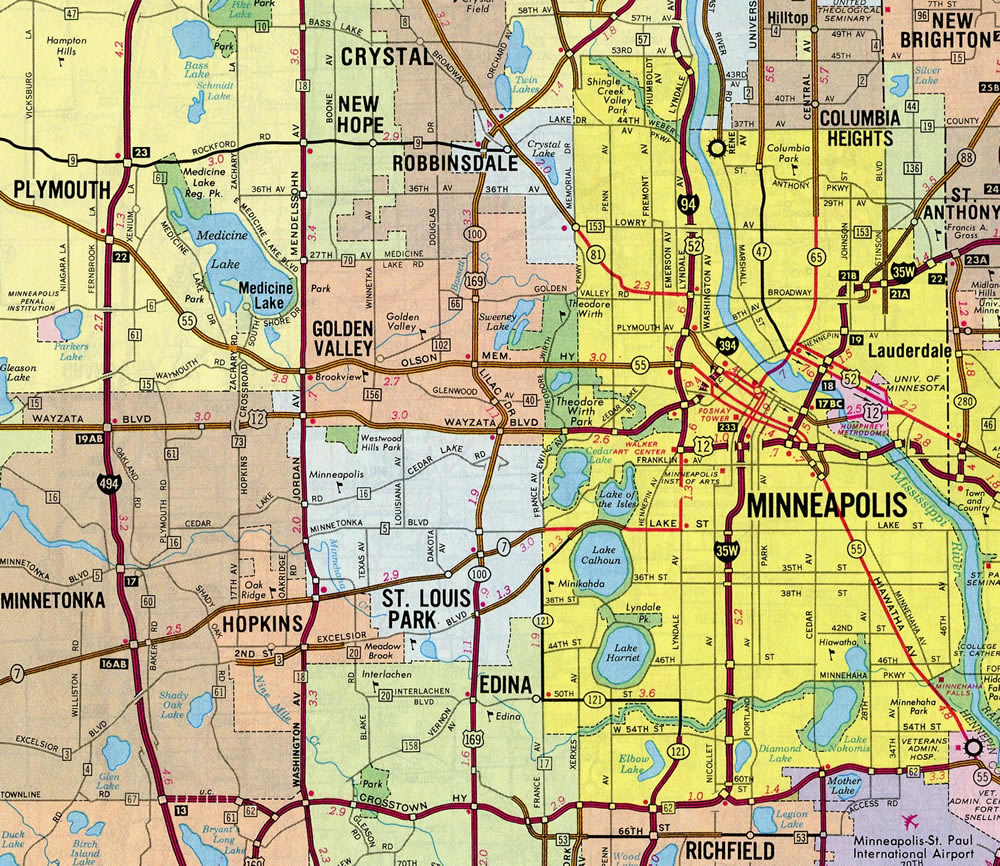
Also known as Wayzata Boulevard, Interstate 394 is a freeway linking Minneapolis with the western suburbs. I-394 replaced U.S. 12 for much of its length, excluding a short stretch west to Wayzata and the spur into Downtown. MnPass (HO/T) lanes run along the route through Minnetonka, Golden Valley and St. Louis Park to I-94 at Lowry Hill.
The short freeway spur from Interstate 94 east to Washington Avenue includes three exit ramps serving the Loring Park, Downtown West and North Loop neighborhoods in addition to the ABC Ramps parking garages.
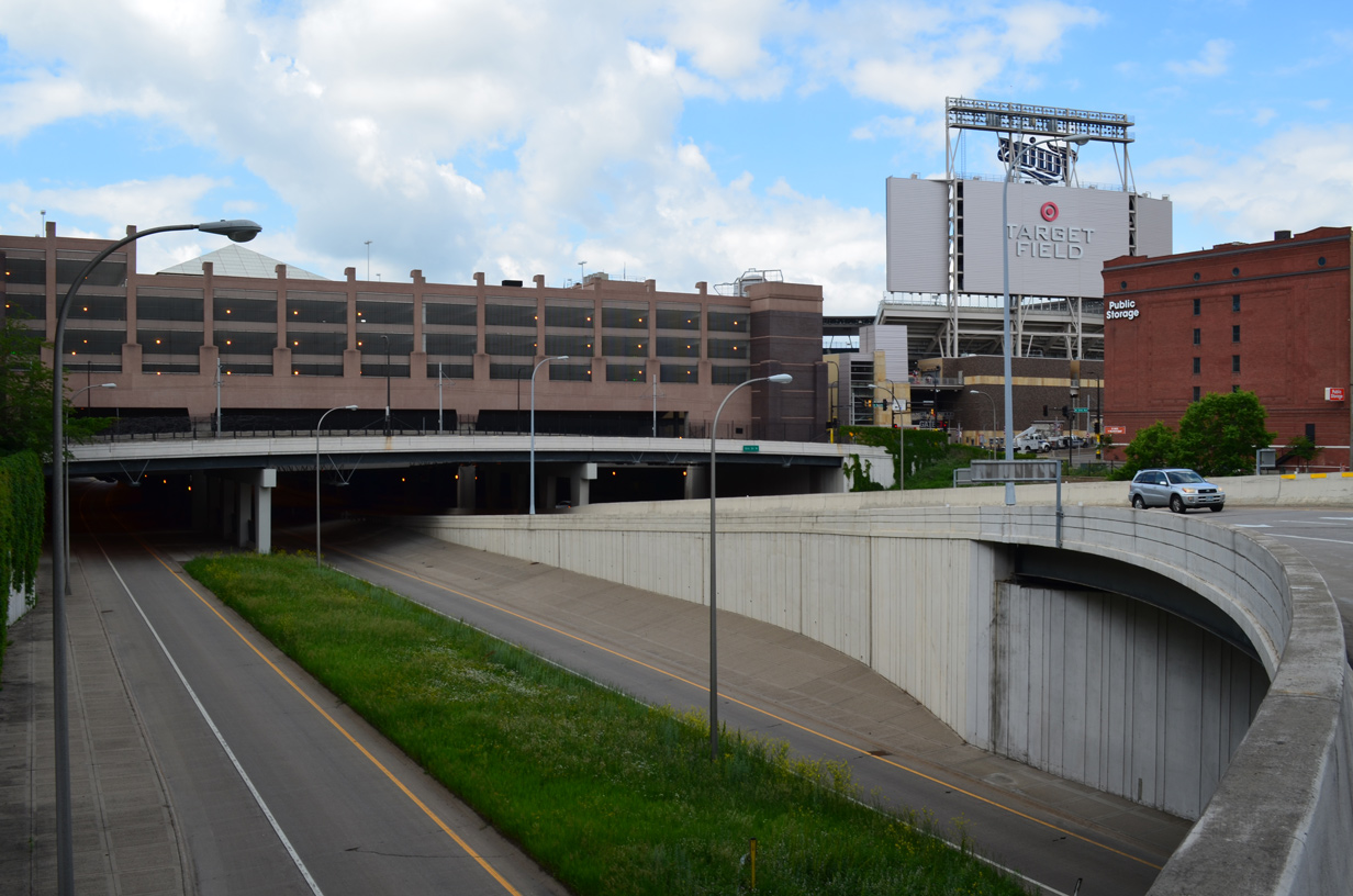
I-394 below Ramp B includes a tunnel section beneath a portion of Target Field. This may be the only stretch of Interstate that passes below a major sports venue. 06/15/15
 History
Interstate 394 was established by the American Association of State Highway and Transportation Officials (AASHTO) on June 23, 1969 as a spur from I-494 eastward to Downtown Minneapolis. Work to upgrade U.S. 12 (Wayzata Boulevard) to freeway standards from Minnetonka to Downtown Minneapolis was completed during a six year, $420 million project that extended 11 miles.
The new eastbound lanes opened to traffic on September 28, 1991. The eastbound frontage road was converted to two-way traffic at that time. Westbound traffic shifted from the north frontage road onto the freeway between Florida Avenue and General Mills Boulevard on October 4, 1991.
Traffic lights remained in use on the freeway for U.S. 12. An eastbound signal at MN 100 was removed on October 14th. Three westbound signals remained in operation at MN 100, Vernon and Louisiana Avenues until Thanksgiving of 1991. Final work upgrading Interstate 394 included building direct links at the east end with the Downtown Minneapolis parking ramps in 1992.1
Route Information
East End – Minneapolis, MN
- West End – Minnetonka, MN
Mileage – 9.75
Cities – Minneapolis, St. Louis Park, Golden Valley
- Junctions –


Source: December 31, 2021 Interstate Route Log and Finders List
Upgrades for U.S. 12 (Wayzata Boulevard) to freeway standards took place in stages from 1972 to 1986.9
Interstate 394 was displayed on the 1983-84 Minnesota Official Highway map, but omitted on the Rand McNally North American Road Atlas at least through 1992.
A grand opening event was held to celebrate the overall completion of Interstate 394 on October 24, 1992. This work followed the completion of several Downtown ramps to I-394, and preceded the opening of connecting ramps around MN 100 by three weeks. The finished I-394 incorporated high-occupancy express lanes linking three transit centers, suburban park and ride lots and three parking garages at the east end.3
The HOV lanes along Interstate 394 were converted to High-Occupancy Toll (HOT) lanes on May 16, 2005. The change allowed single occupant vehicles to use the express lanes for a toll collected electronically via the MnPass program. Rates vary depending upon peak and off-peak hours. The success of the toll lanes along I-394 led to the addition of toll lanes on Interstate 35W.4 Project costs for the conversion of the express lanes were estimated at between $8 and 10 million in 2003. A private company constructed the toll lanes and covered 25% of the overall project cost.2
East End – Third Street N / Washington Avenue – Downtown Minneapolis, Minnesota
![]() East
East
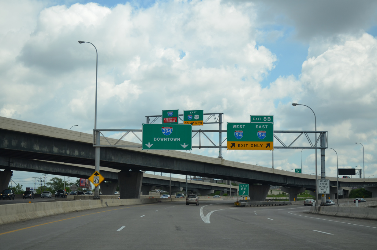
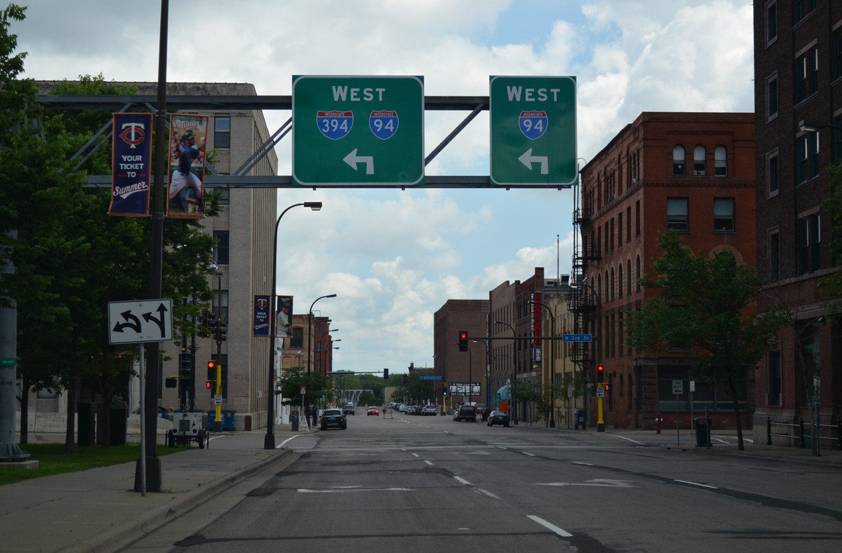
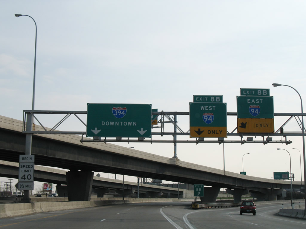
A turbine style interchange joins I-394 with I-94 on the west side of Downtown Minneapolis. Exit 8B departs for I-94 west to the Near North, Hawthorne and McKinley neighborhoods of north Minneapolis and I-94/U.S. 12 east to Elliot Park, Ventura Village and Seward. 06/14/15
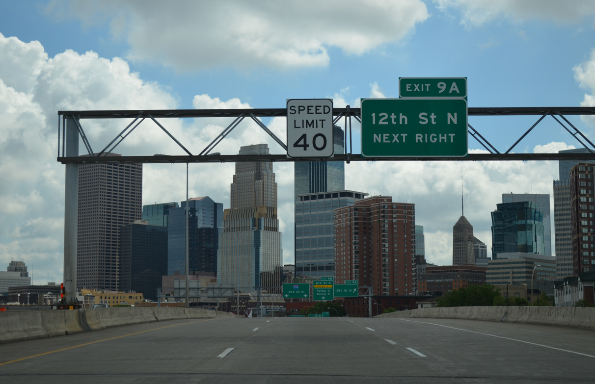
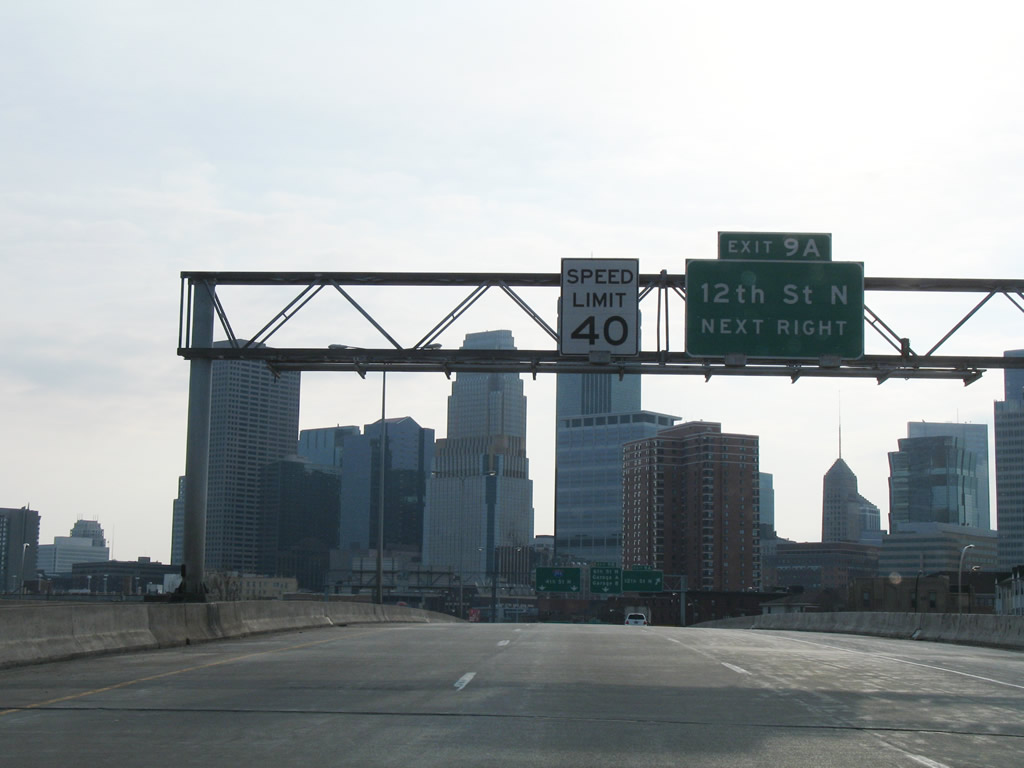
Skyscrapers of Downtown Minneapolis come into view as I-394 crosses over the I-94 mainline, Hawthorne Avenue and 16th Street N along a viaduct. Exit 9A follows to 12th Street N while the speed limit reduces to 40 miles per hour. 06/14/15
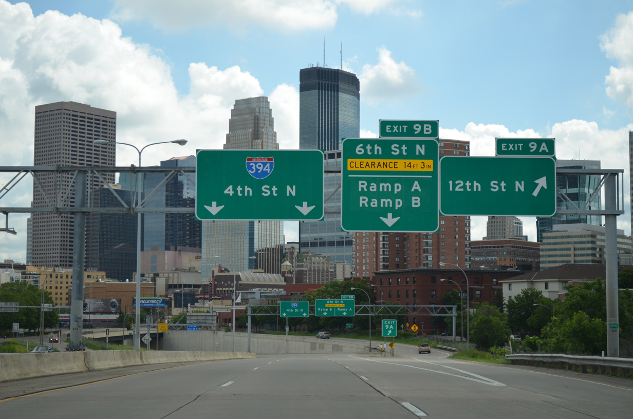
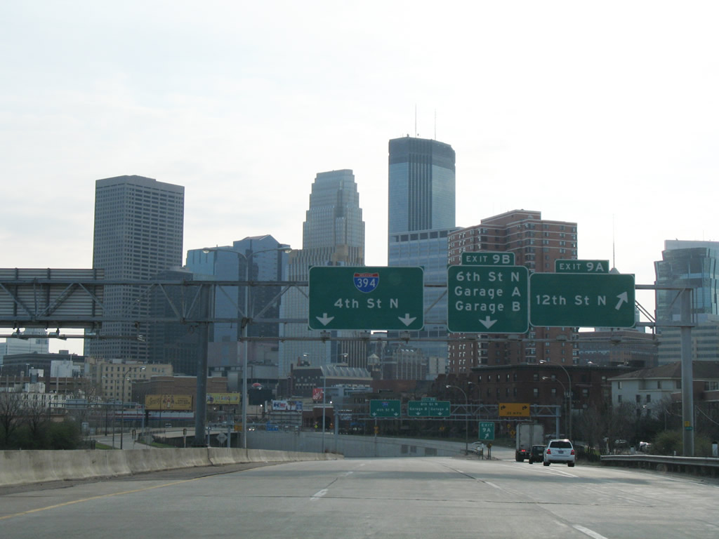
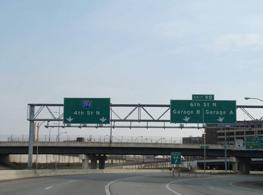
Interstate 394 curves northward around Downtown West as Exit 9A leaves for the 12th Street N. 12th Street N angles southeast to Loring Park and north to Glenwood Avenue. Exit 9B quickly follows to the first two I-394 parking garages. 06/14/15
Interstate 394 drops below grade as it runs between Downtown West and the North Loop community to Washington Avenue. 06/14/15
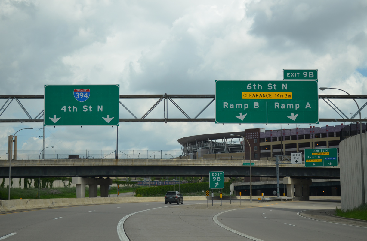
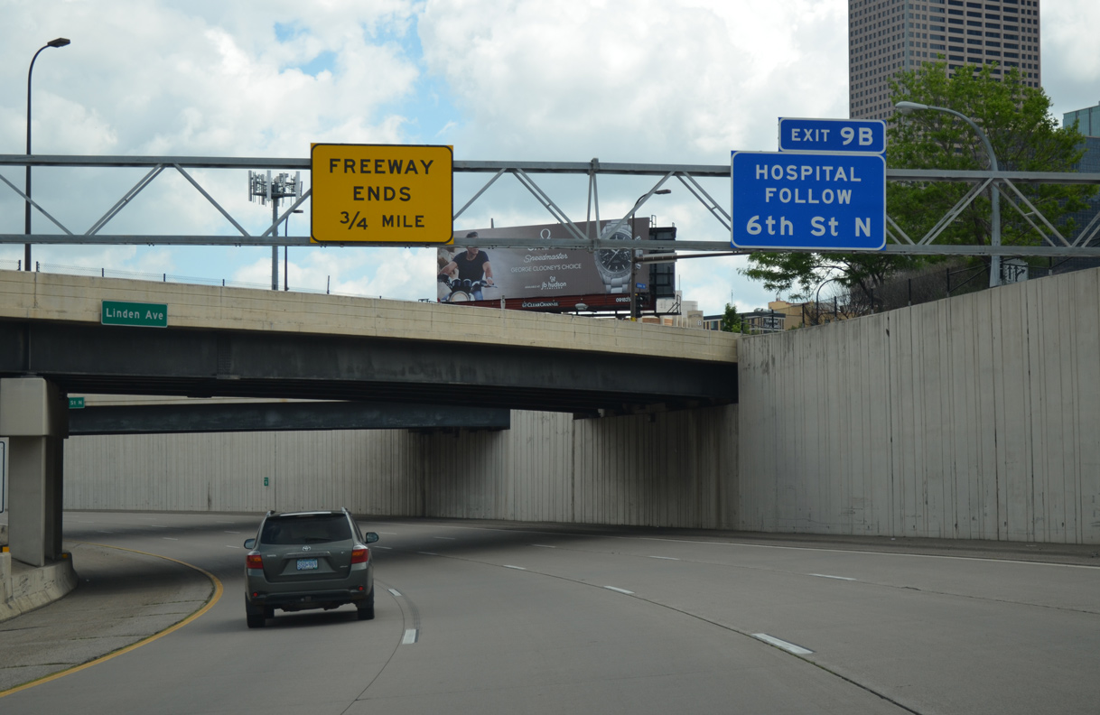
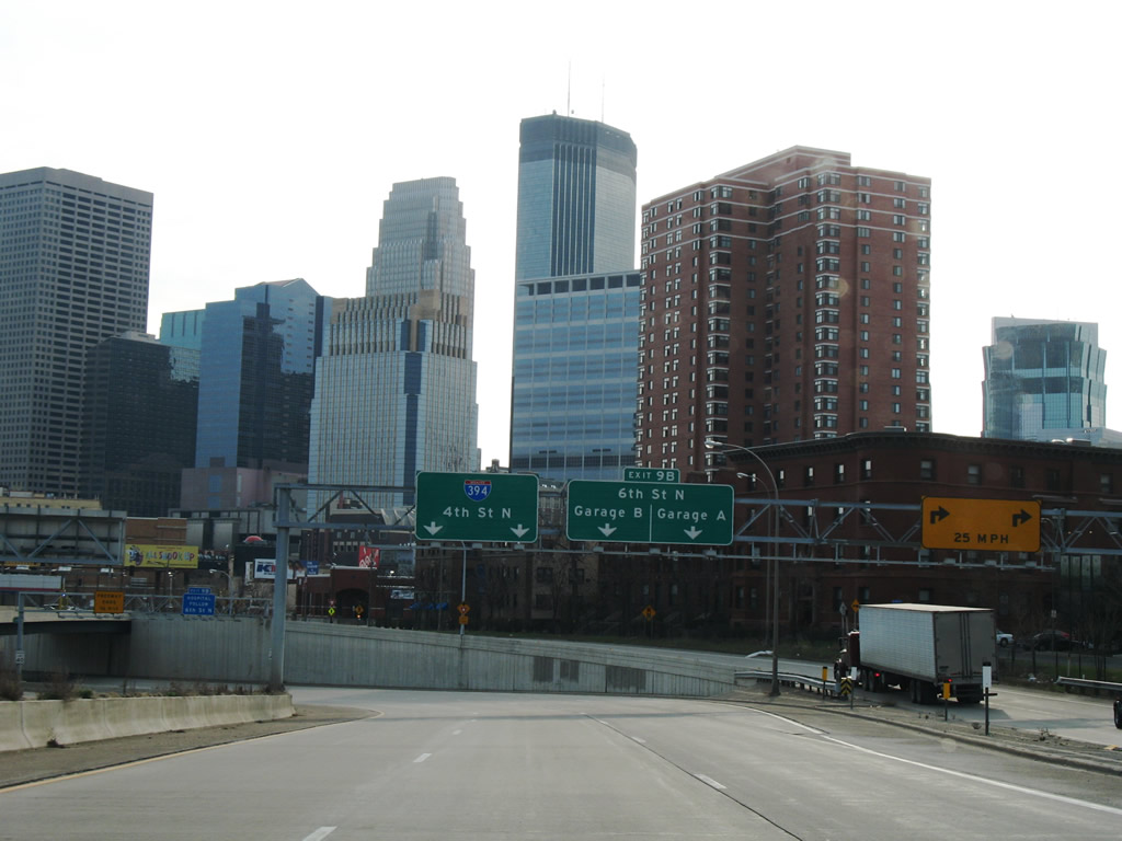
I-394 east expands to four lanes ahead of Exit 9B. The A Ramp parking garage occupies space above the freeway between 10th and 7th Streets N. Ramp B lies one block further east at 6th Street adjacent to Target Field (home of the Minnesota Twins MLB franchise). 06/14/15
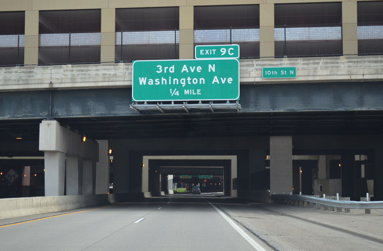
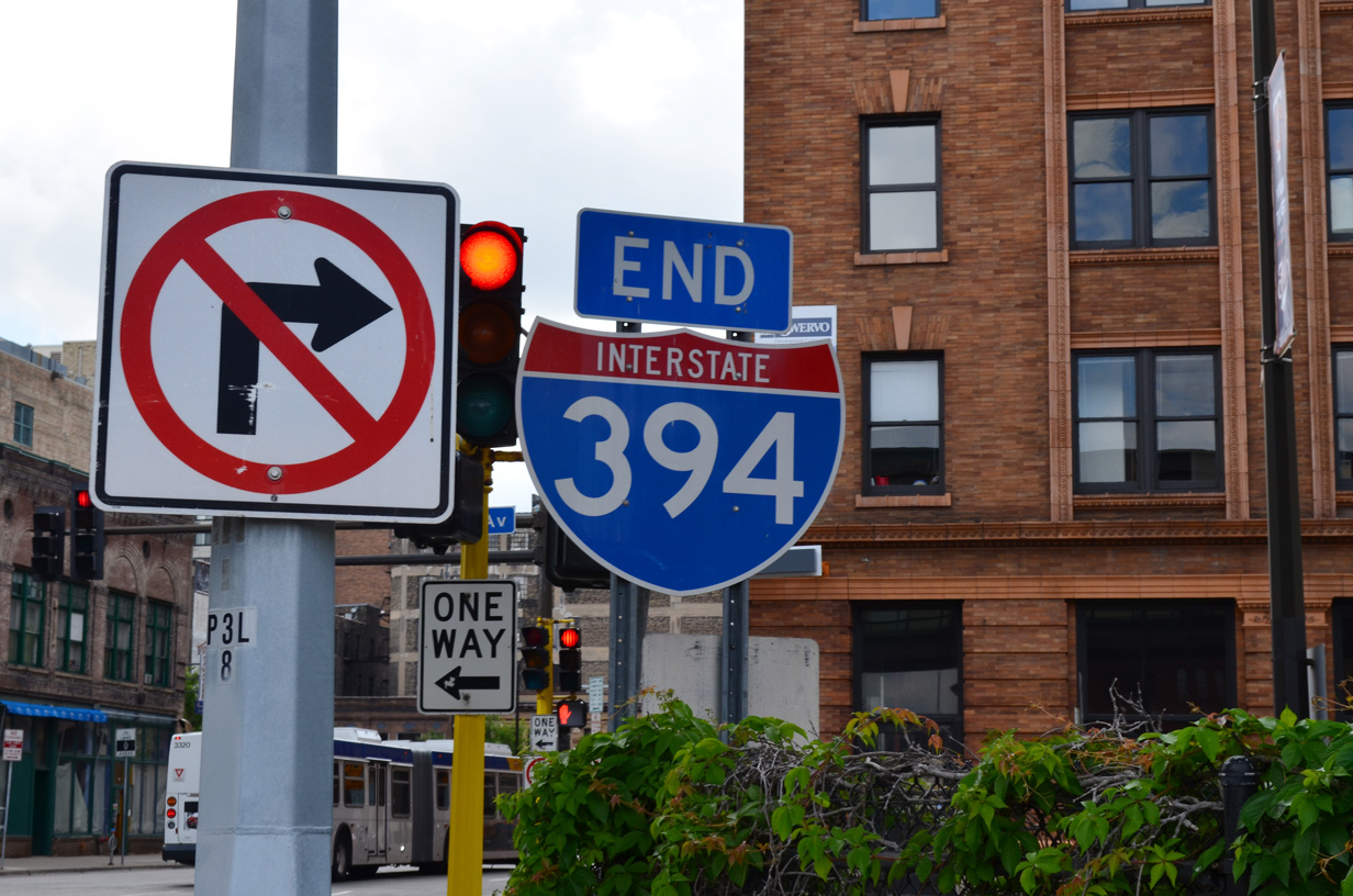
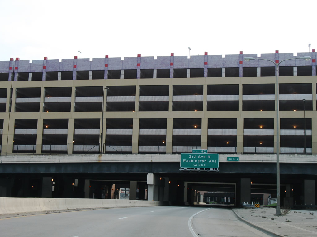
Motorists pass under Ramp A, 7th Street N and Ramp B to the final separation of ramps for 3rd Avenue N (Exit 9C) and the mainline end at 2nd Avenue N at 4th Street. 06/14/15
Target Field, built between August 2007 and December 2009, extends partially over Interstate 394. A portion of the right field seats and Target Plaza, an open air park, extend above the freeway at the ramp split. The single lane ramp for Washington Avenue passes under the Ramp C parking garage to 3rd Avenue N. 06/14/15

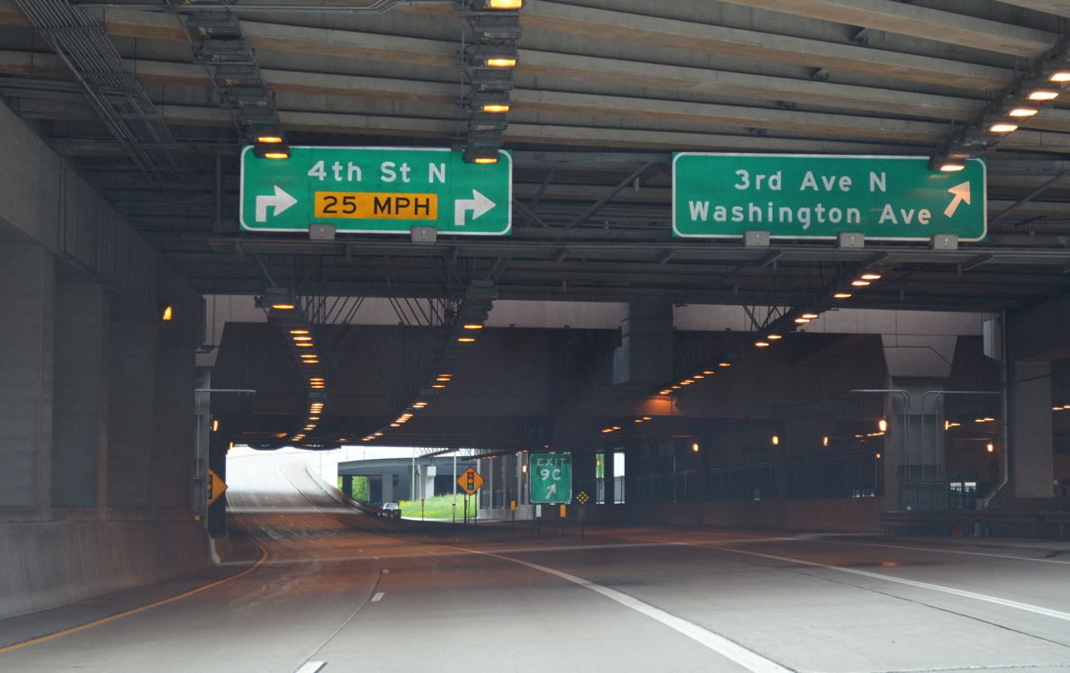
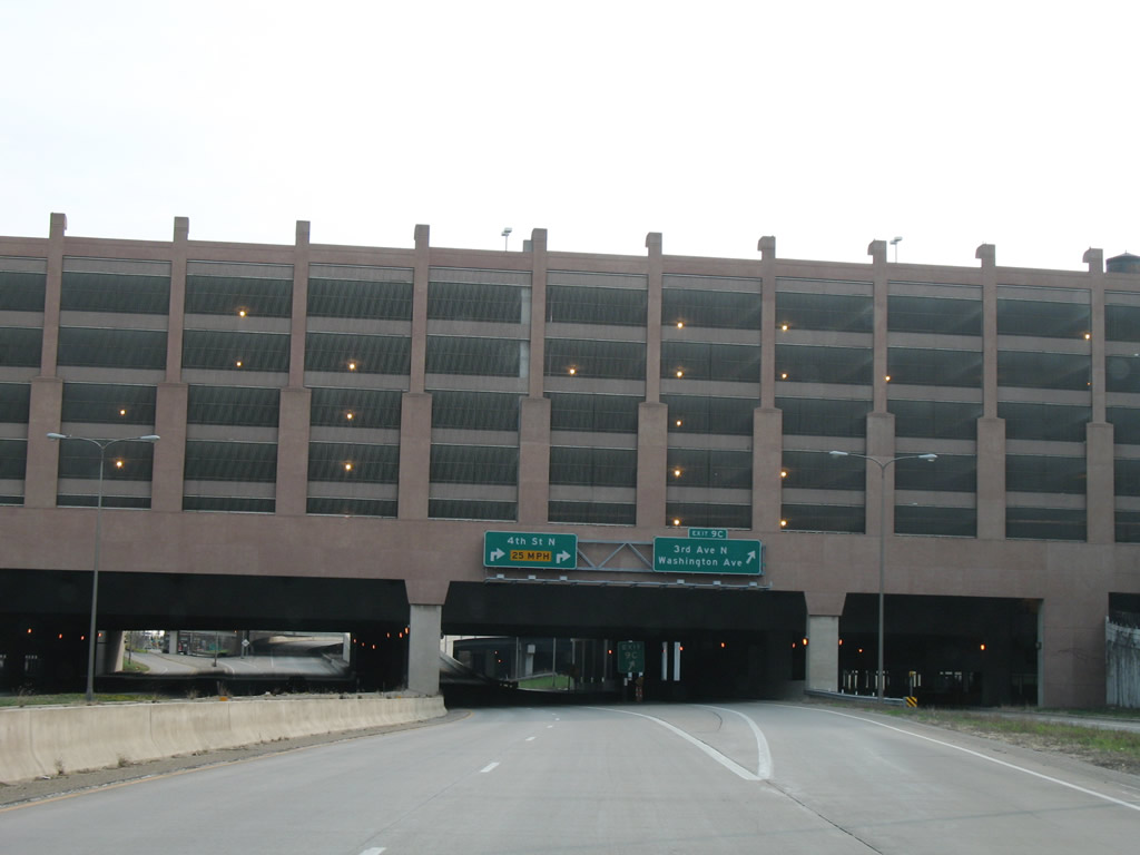
An end shield stands at the 4th Street N ramp intersection with N 2nd Avenue. This sign is not necessarily correct, as the MnDOT route log equivalent lists the terminus instead at the ramp end of Exit 9C at 3rd and Washington Avenues.8 06/14/15
2nd Avenue N / 3rd Street N at ![]()
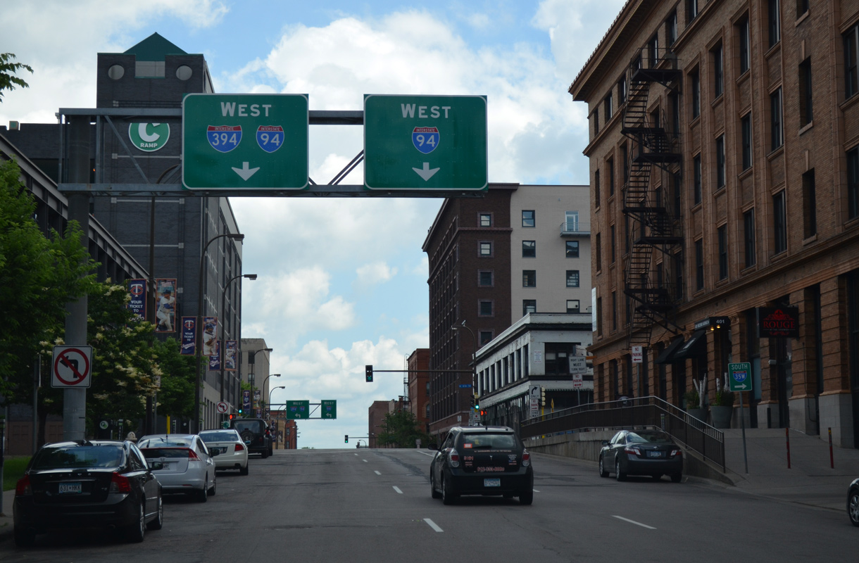
2nd Avenue N runs beside a sky bridge linking Ramps B and C. Motorists leaving Ramps A or B are directed onto 2nd Avenue N to the N 3rd Street entrance ramps for I-394 west and I-94 west. 06/14/15
Dual turn lanes join the entrance ramps for Interstate 394 west to Lowry Hill and Bryn-Mawr and a limited access connector to I-94 west at Near-North. 06/14/15
3rd Street N is discontinuous between I-394 and the Northstar Commuter tracks. The street instead splits into ramps for Interstate 394 west and the unnumbered freeway spur north to I-94 and Brooklyn Center. This long ramp is considered part of the Third Street/Fourth Street couplet and signed as “I-94 west”. 04/12/07
![]()
![]() East at
East at ![]()
![]()
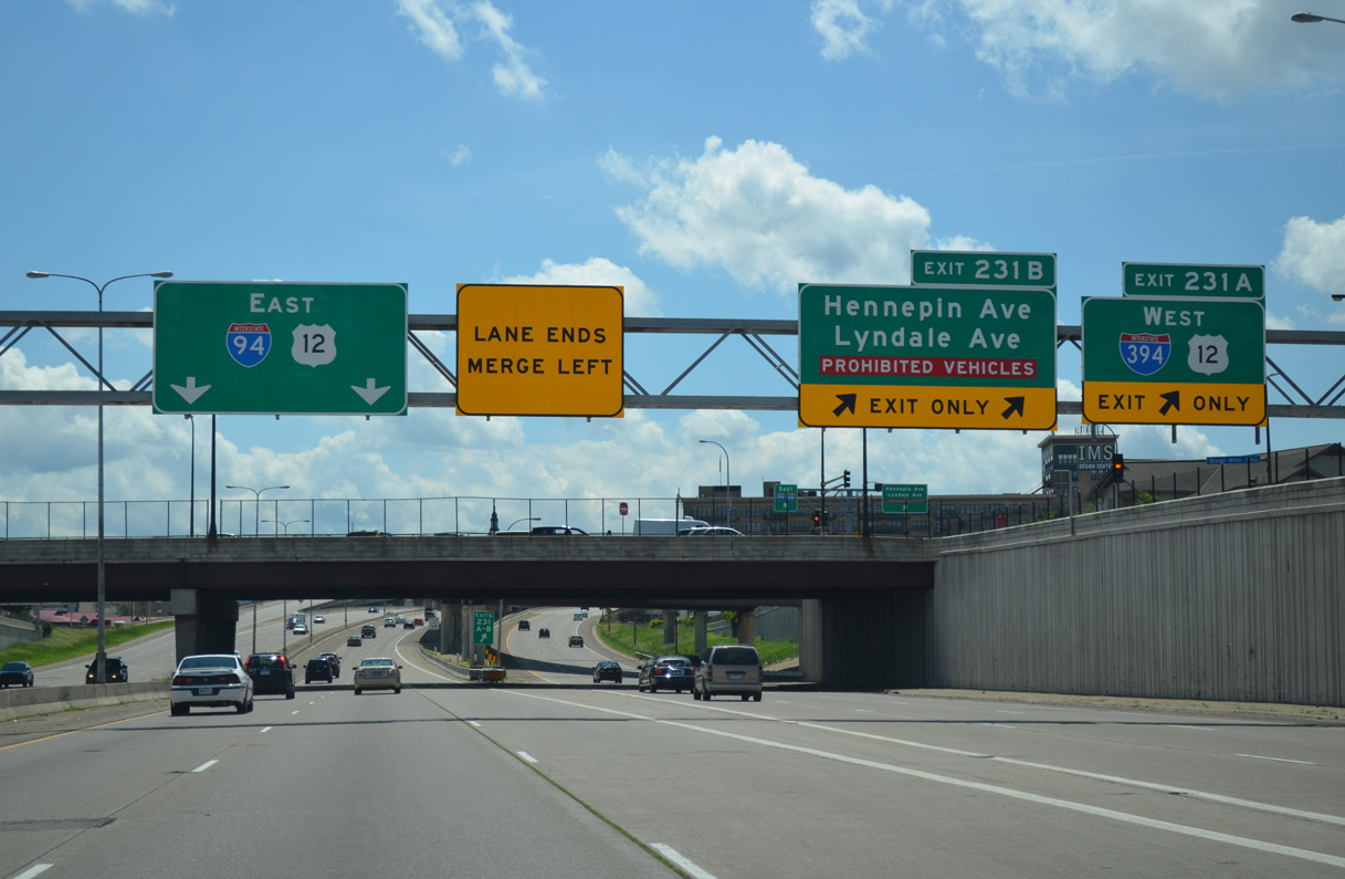
I-94 travels south from the split with I-694 at Brooklyn Center to enter the city of Minneapolis at the Lind-Bonhanon neighborhood. Following the Mississippi River to Hawthorne, the I-94 curves westward to encircle Downtown by Loring Park. Exits 231A/B departs simultaneously for both I-394/U.S. 12 west toward Golden Valley and Hennepin Avenue to Downtown West. Vehicles carrying hazardous cargo must depart here as well to avoid the Lowry Hill Tunnel. 06/16/15
![]()
![]()
![]() West at
West at ![]()
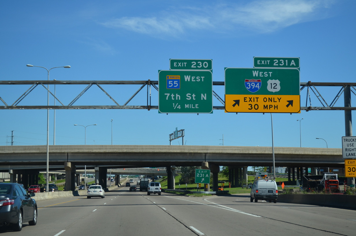
I-94 west emerges from the Lowry Hill Tunnel and splits with U.S. 12 west at Exit 231 for Interstate 394. There is no access for the I-394 spur into Downtown Minneapolis from this direction. 06/16/15
 East End Throwback
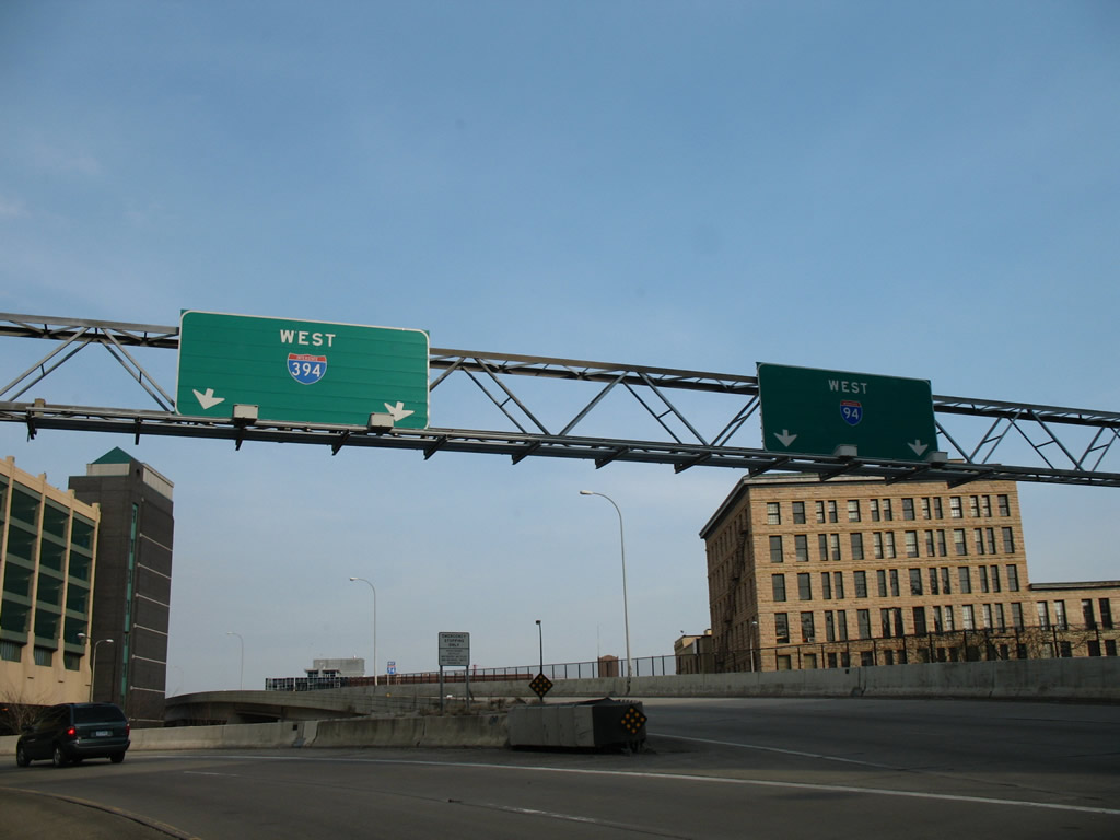
Separate panels for Exit 8B here were replaced with a single sign by October 2007. The MnPass lanes connect with I-94 east via a flyover above. 04/21/07
Sign replacements made here by August 2007 removed the light fixtures for both panels while shifting the exit tab for 12th Street N to the right. 04/21/07
The mainline of I-394 defaults to 4th Street N beyond these replaced signs for Exits 9A/B. 04/21/07
Sign replacements made for Exit 9B added the 14 foot 3 inch clearance for the approaching parking garages. Garage A and B was renamed to Ramp A and B as well. 04/21/07
Interstate 394 east at Exit 9B for 6th Street N and two of the parking garages (Ramps A and B). The two left lanes continued east to 4th Street N and Ramp C. 04/21/07
Replaced overhead for Exit 9C at the 10th Street N overpass. The freeway passes below Ramp A here. 04/21/07
This set of overheads appeared along the west side of Ramp B. Construction of Target Field, which opened in December 2009, includes a paved plaza that protrudes over I-394 between Ramps A and B. This scene is now located under the structure. 04/21/07
West End  – Minnetonka, Minnesota
![]()
![]() West at
West at ![]()
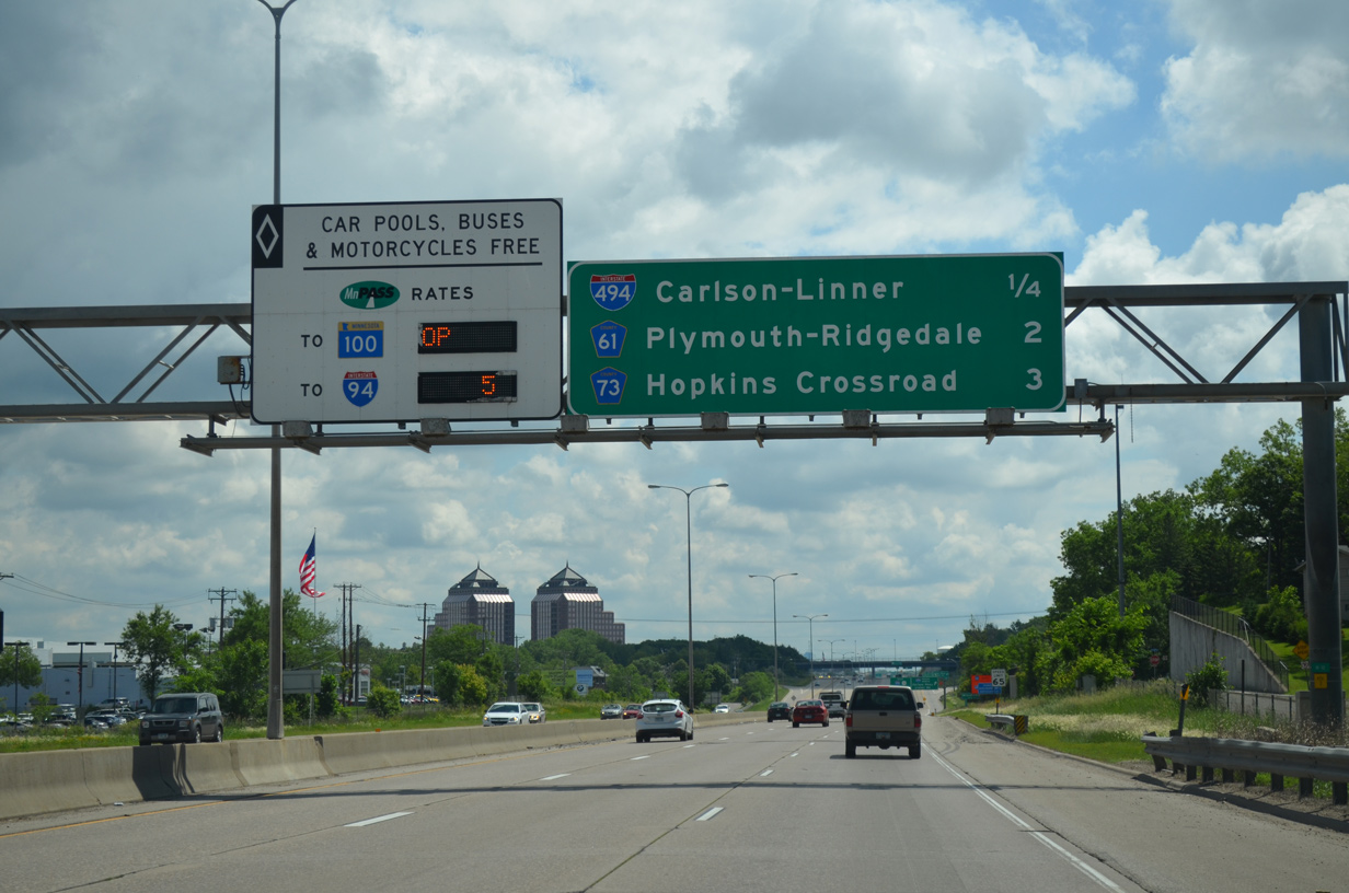
Interstate 394 travels west from a retail corridor anchored by Ridgedale Center mall directly to the cloverleaf interchange with I-494. 06/15/15
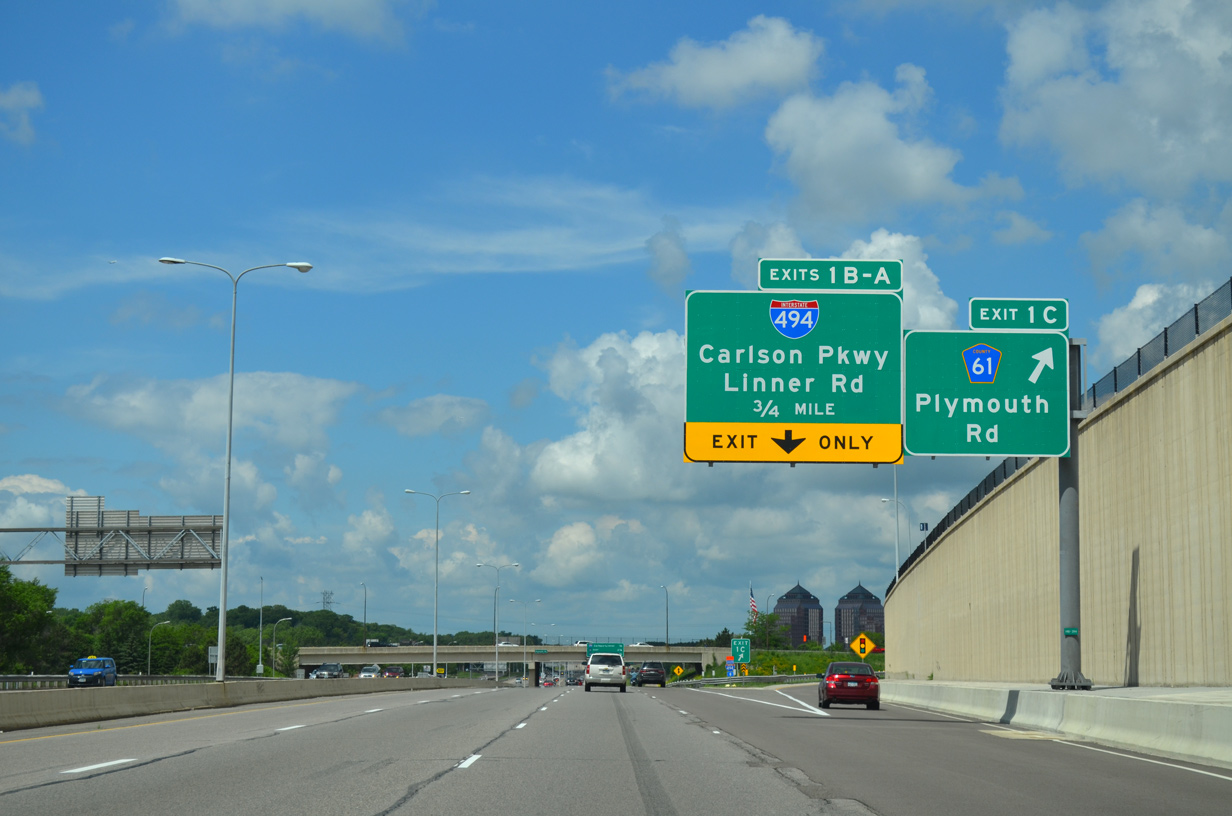
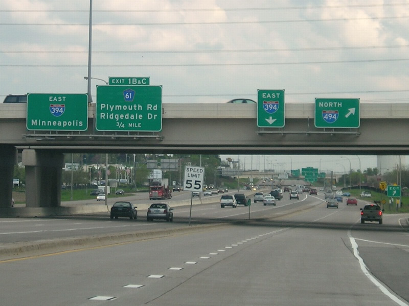
An $8 million construction project completed on November 5, 2014 added a new westbound entrance ramp to I-394 from Ridgedale Drive and the north side frontage road. Coinciding with the work was the addition of an auxiliary lane west to Exit 1C with Plymouth Road.5,6 06/15/15

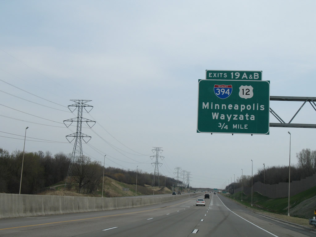
An interchange sequence sign at the Plymouth Road overpass outlines the subsequent exits from the freeway along U.S. 12 west through Wayzata. 06/15/15
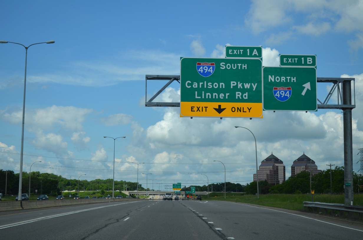
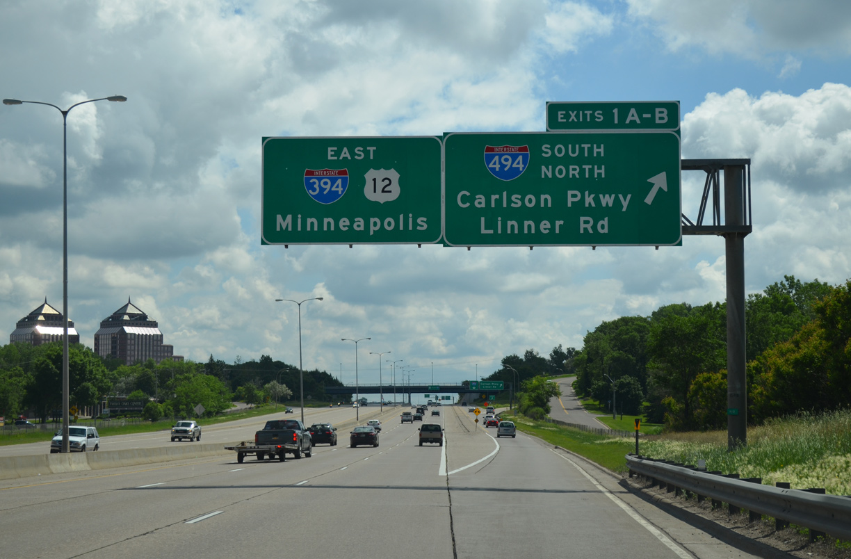
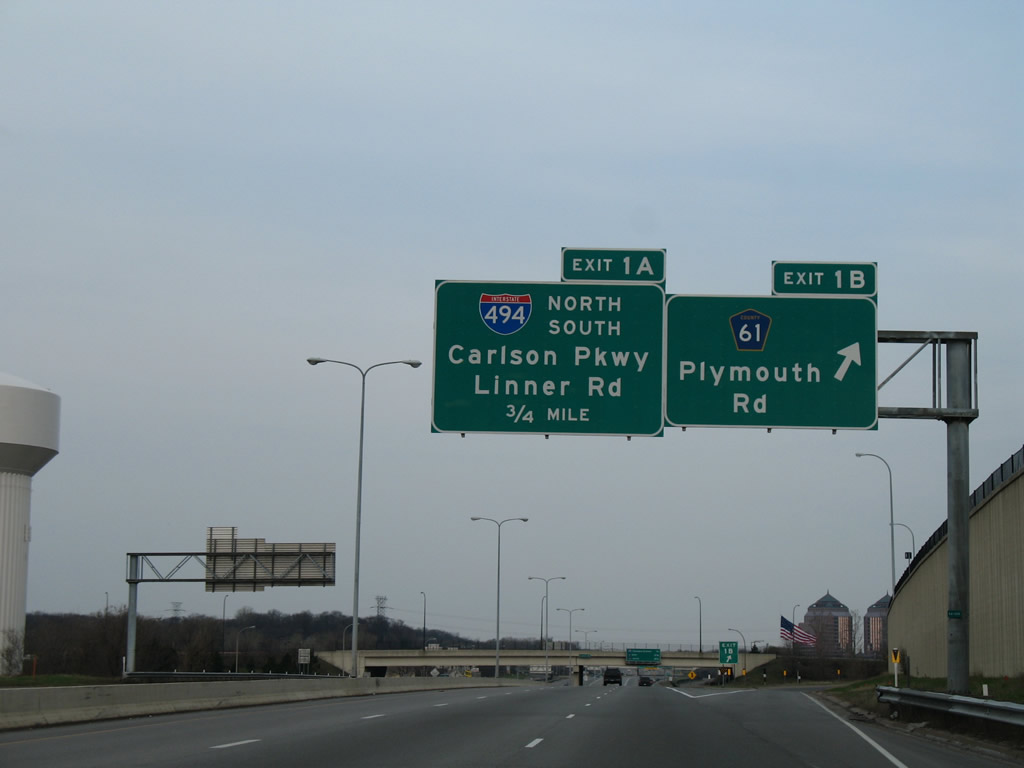
A $1 million project between September and October 2013 reconfigured the exit ramps from I-394 to both I-494 north and south. Movements to the belt line originally utilized a single lane c/d roadway. Exit 1B now departs independent of Exit 1A.7 06/15/15
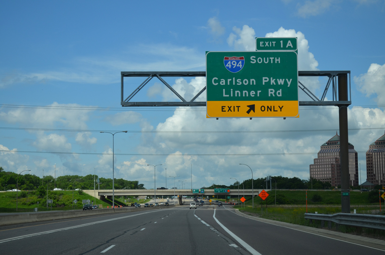
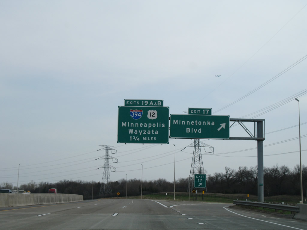
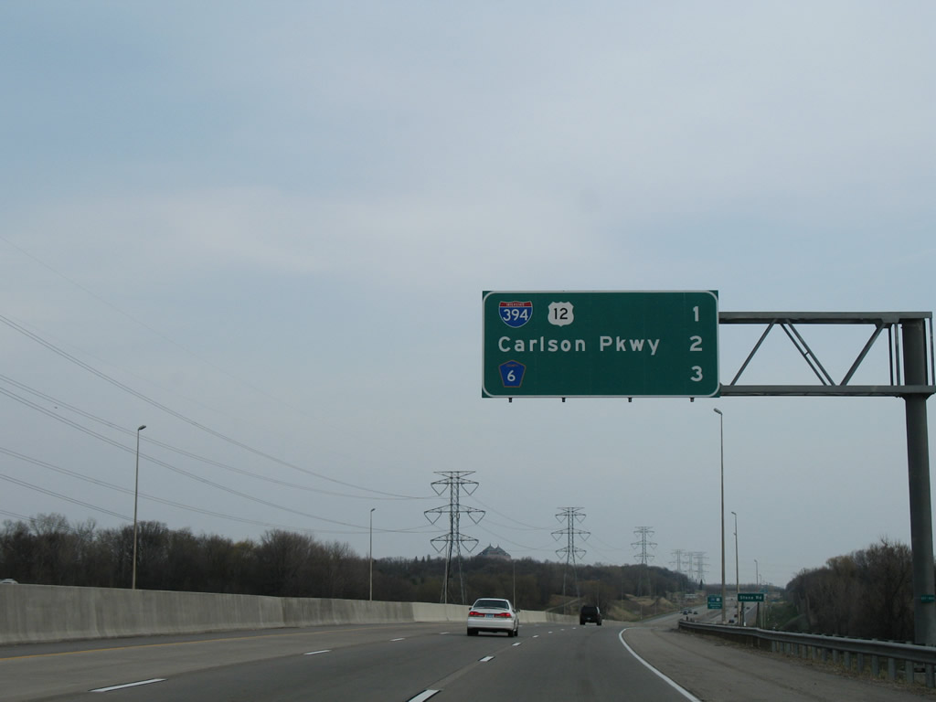
A collector distributor roadway parts ways with I-394/U.S. 12 next for Interstate 494 south to Eden Prairie and the adjacent folded diamond interchange with Carlson Parkway north and Linner Road south. 06/15/15
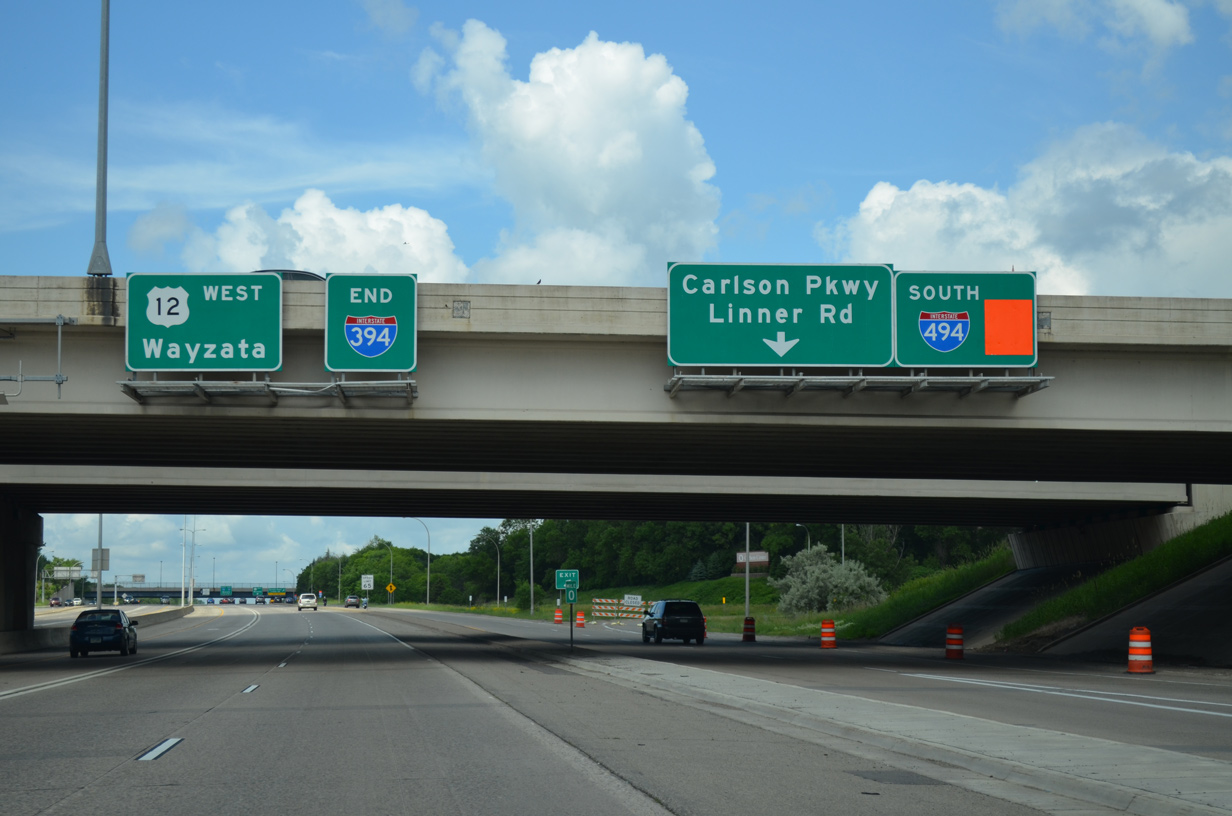
Interstate 394 formally ends as U.S. 12 takes over on the suburban freeway extending west through Wayzata. U.S. 12 eventually shifts to a two-lane alignment en route to Litchfield and Willmar. 06/15/15
![]() East at
East at ![]()
![]()
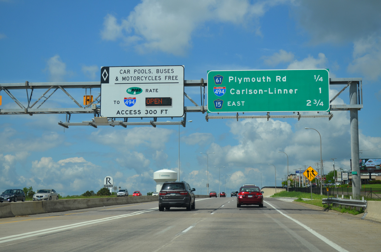
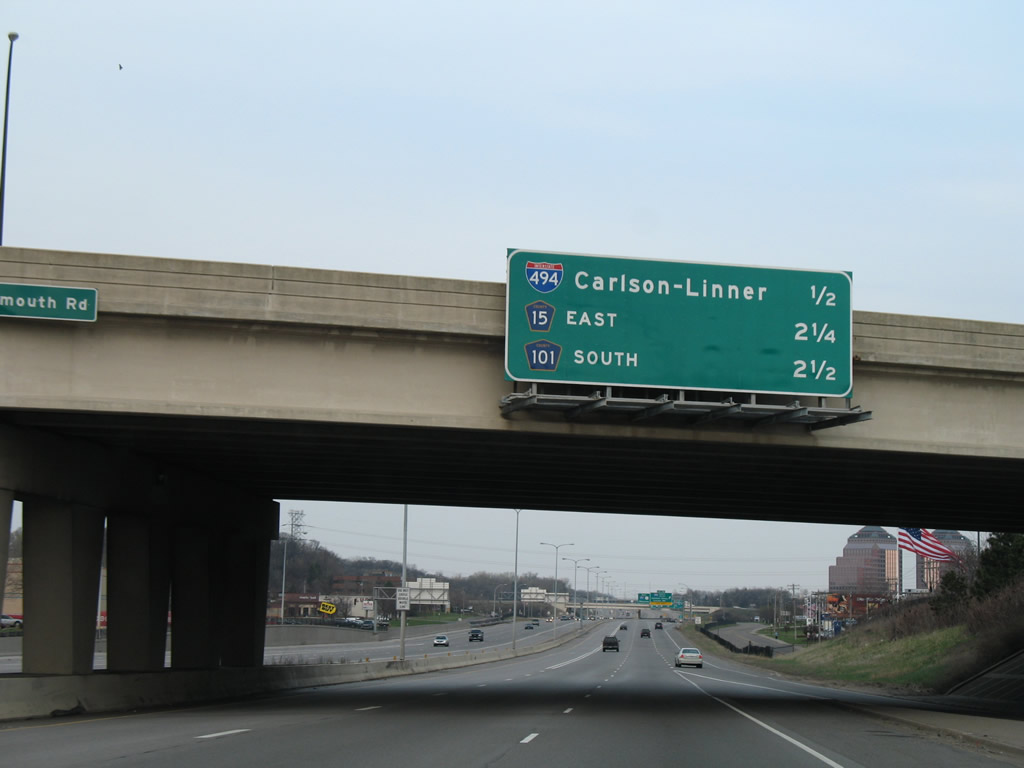
Frontage roads (Wayzata Boulevard) accompany the freeway along U.S. 12 leading east to the c/d roadway for Carlson Parkway / Linner Road (Exit 1A) and I-494. Exit 1C with CSAH 61 follows in two miles from I-394 as a toll schedule sign appears for the MnPass lanes leading toward Downtown Minneapolis. 06/15/15
Traffic for Exit 1A (Carlson Parkway north / Linner Road south) and 1B (I-494) departs from U.S. 12 east for the c/d roadway. Interstate 394 appears alongside U.S. 12 here while subsequent signs on the freeway toward Golden Valley omit U.S. 12. 06/15/15
Beyond the folded diamond interchange with Carlson Parkway, the c/d roadway along I-394/U.S. 12 separates with the southbound ramp for Interstate 494 to Eden Prairie and Bloomington. Photo by Jeff and David Morrison (05/08/07).
A loop ramp joins I-494 north to Plymouth and Maple Grove. The remainder of U.S. 12 in Minnesota is unsigned along I-394 and I-94 to the Wisconsin state line. Photo by Jeff and David Morrison (05/08/07).
![]() North at
North at ![]()
![]()
1.75 miles south of Interstate 394 east and U.S. 12 on I-494 north at Exit 17 with Minnetonka Boulevard. 04/12/07
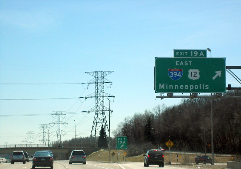
Interchange sequence sign along I-494 north, one mile ahead of Exits 19A/B with I-394 and U.S. 12 at the Stone Road and BNSF Railroad underpass. 04/12/07
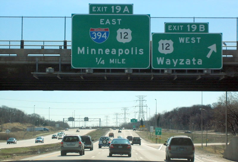
Interstate 394 leads east from I-494 and Minnetonka as a direct route from the western suburbs to Downtown Minneapolis. U.S. 12 extends the freeway west a short distance to Wayzata. 04/12/07
Oakland Road passes over I-494 as part of the U.S. 12 frontage road system linking the Ridgedale Drive retail corridor with residential areas to the west. I-394 passes by Ridgedale Center mall as a busy commuter freeway en route to Golden Valley and St. Louis Park. 04/12/07
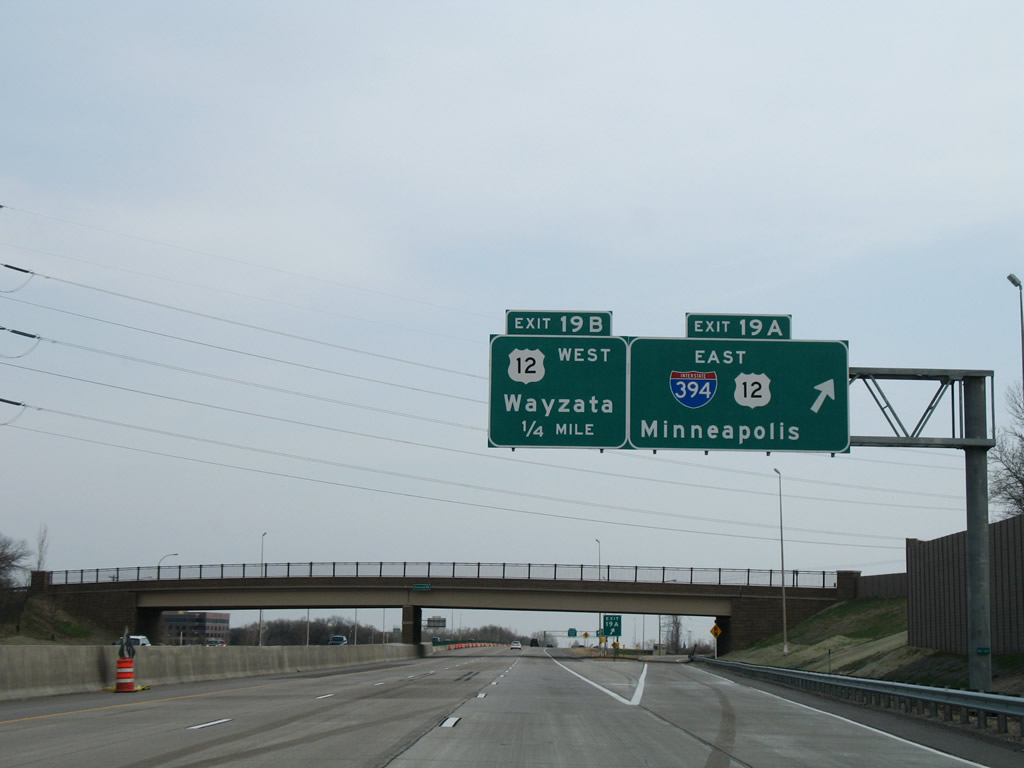
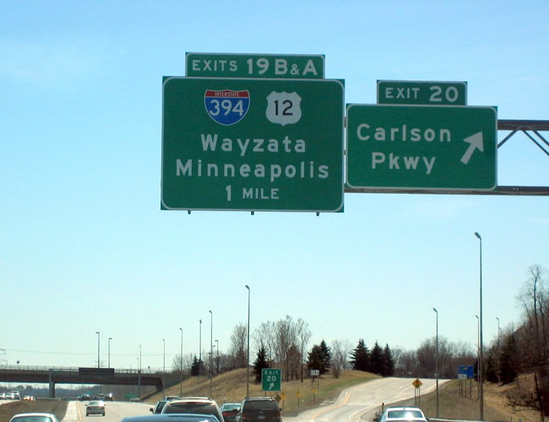
Exit 19B follows onto U.S. 12 west from the end of Interstate 394. U.S. 12 leaves the I-94 corridor for good to Independence. 04/12/07
![]() South at
South at ![]()
![]()
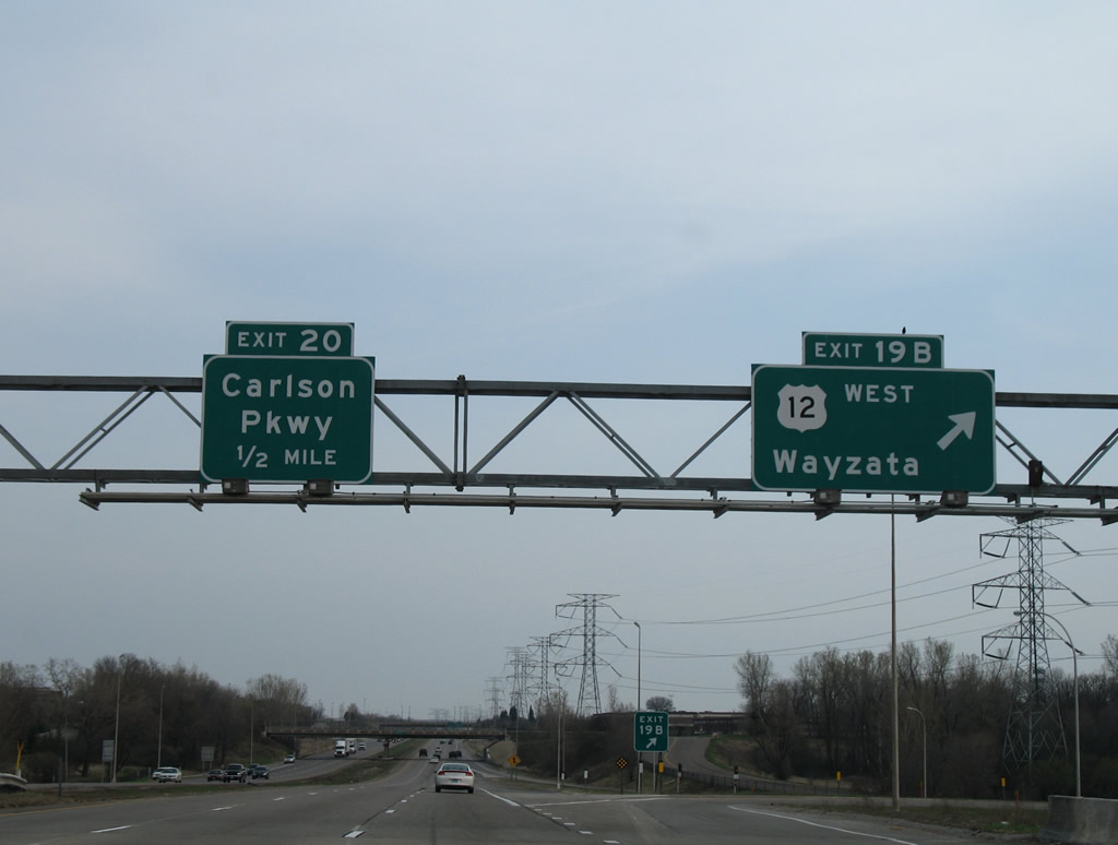
Carlson Parkway angles southwest from Exit 20 to U.S. 12 (Exit 1A) just west of the forthcoming exchange with Interstate 394. Photo by Patrick Lilja (04/08/07).
Cheshire Lane spans Interstate 494 south as Exit 19B parts ways for U.S. 12 west to Wayzata, Orono and Long Lake. U.S. 12 leaves the Twin Cities for Litchfield and Willmar. Photo by Patrick Lilja (04/08/07).
U.S. 12 east transitions to Interstate 394 from I-494 east through Golden Valley and St. Louis Park to I-94 in Minneapolis. Photo by Patrick Lilja (04/08/07).
West End Throwback
This sign bridge was replaced with a new assembly during the 2014 project to add the Ridgedale Drive on-ramp from Minnetonka. The expanded travel lanes now abut the adjacent retaining wall. 04/12/07
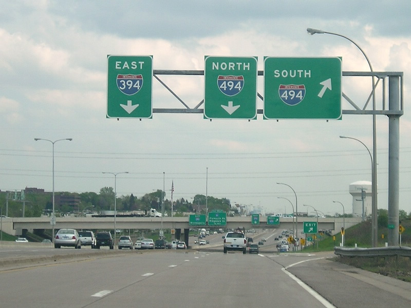
The Carlson Towers Rotunda & Amphitheatre complex appeared as Exit 1A departed I-394/U.S. 12 west for both directions of I-494. Exits were renumbered along this stretch in 2013 following the separation of ramps for I-494. Exit 1A is now Exit 1B. 04/12/07

The old c/d roadway split with I-494 north to Maple Grove while leading west to I-494 south to Eden Prairie. Movements to I-494 south now depart from the freeway mainline just to the left. 04/12/07
Sources:
- “Eastbound I-394 Lanes Will Open Saturday/Minneapolis-Wayzata Link Near Completion After 7 Years.” St. Paul Pioneer Press (MN), September 27, 1991.
- “State OKs plan to try toll lane.” Star Tribune (Minneapolis, MN), November 6, 2003.
- “Frolic On Freeway Celebrates I-394.” St. Paul Pioneer Press (MN), October 20, 1992.
- “No Pain, Slight Gain In The MnPass Lane – St. Paul-Minnetonka Commuter Gives The New Toll System A Go.” St. Paul Pioneer Press (MN), March 9, 2005.
- “I-394/Ridgedale Drive Westbound On-Ramp Grand Opening.” SRF Consulting, November 5, 2014.
- Minnetonka – I-394/Ridgedale Drive westbound on-ramp, Minnesota Department of Transportation (MnDOT) project web site.
- I-394 and I-494 Interchange, Minnesota Department of Transportation (MnDOT) project web site.
- Froehlig, Adam.
- US 12 West Metro (Adam Froehlig).
Page updated November 18, 2020.