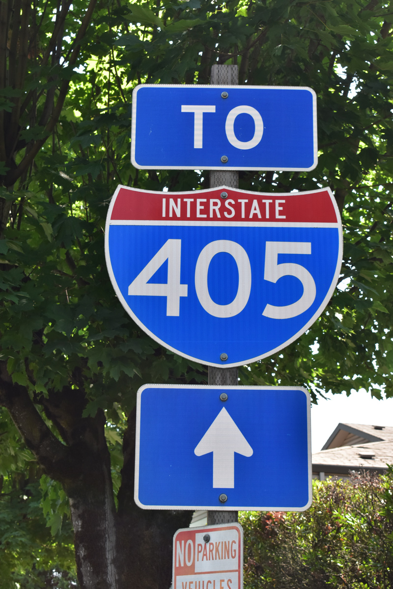
Interstate 405 Oregon
Overview
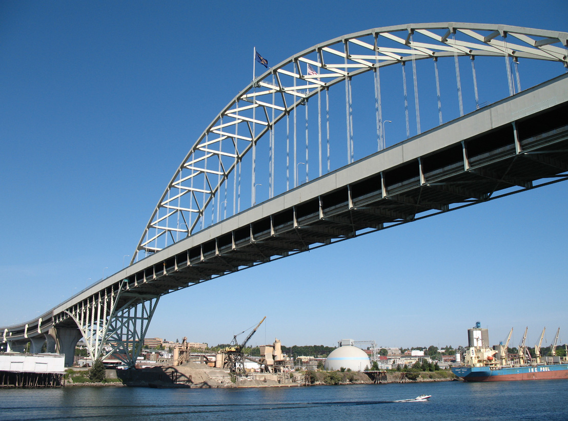
Built in 1973, the double deck Fremont Bridge carries Interstate 405 and U.S. 30 over the Willamette River north of the Pearl District in Portland. Supporting 6,000 tons on its center span, the Fremont Bridge is the longest tied arch bridge in the world.1 08/27/06
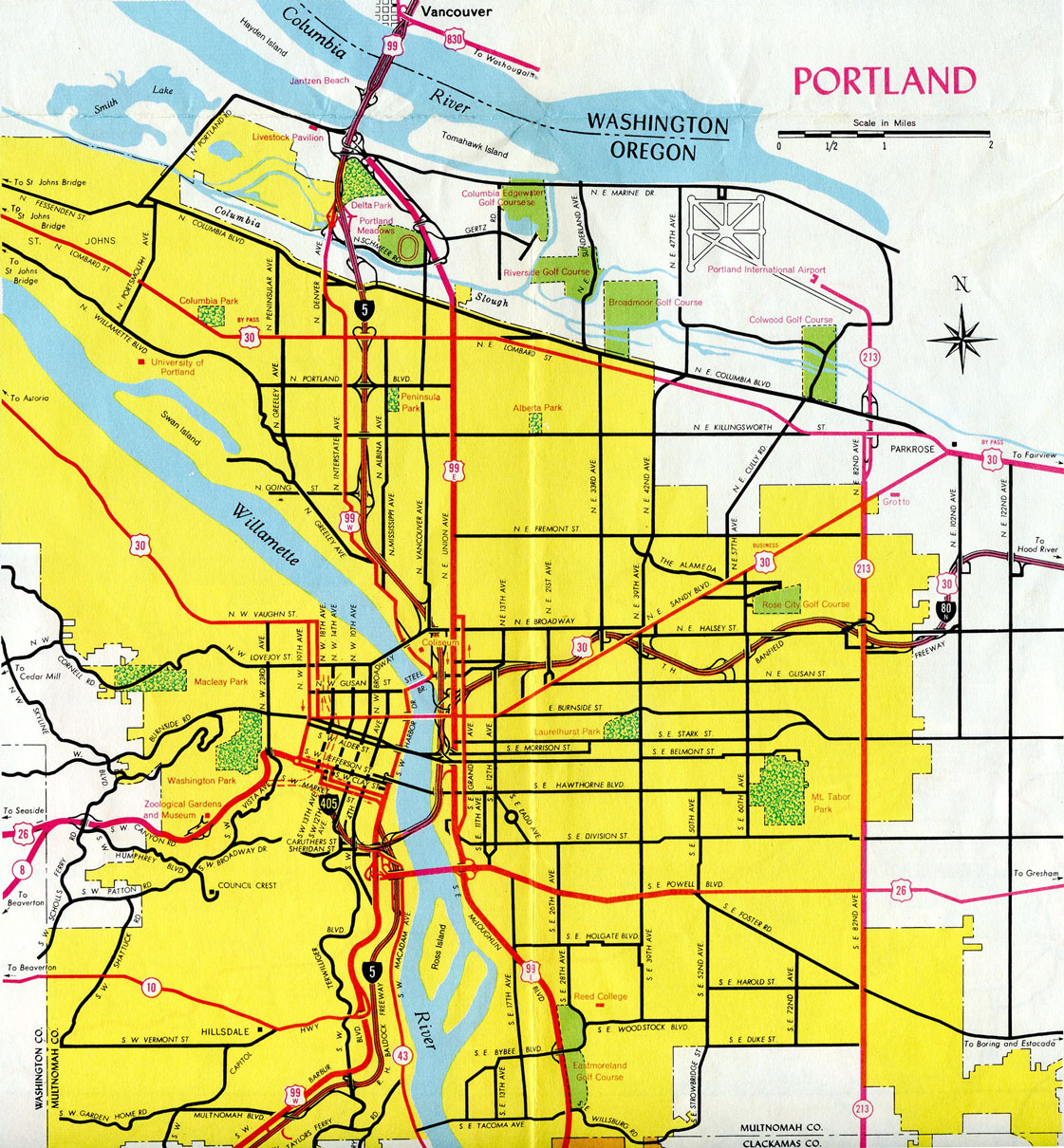
The Stadium Freeway, Interstate 405 is a short urban loop encircling Downtown and the Pearl District in Porland west of the Willamette River. I-405 overlaps with U.S. 30 across the Fremont Bridge to I-5 at the Boise and Eliot neighborhoods. The south end of the freeway ties into the Marquam Bridge taking Interstate 5 northeast from the South Waterfront area to East Portland.
U.S. 26 westbound briefly overlaps with I-405 north from the SW 6th Avenue entrance ramp to Exit 1 D for Sunset Highway west. U.S. 26 eastbound follows I-405 south from Sunset Highway to SW Broadway at Exit 1 C. U.S. 26 (Sunset Highway) extends west across the Tualatin Mountains to the city of Beaverton along a freeway.
 History
Construction on the Stadium Freeway began in 1964. Interstate 405 opened south of the Fremont Bridge on February 25, 1969. The tied arch bridge across the Willamette River opened on November 11, 1973. Costing $121 million, I-405 was the single most expensive Interstate Highway construction project in Oregon.2
Route Information
North End – Portland, OR
South End – Portland, OR
Mileage – 3.53
Cities – Portland
- Junctions –

Source: December 31, 2021 Interstate Route Log and Finders List
I-405 Annual Average Daily Traffic (AADT)

1965 Gousha map showing Interstate 405 under construction south of the Portland city center.
Interstate 405 completed north to Montgomery Street in Portland on the 1968 Oregon Official Highway Map
 Photo Guides
North End  – Portland, Oregon
![]() North
North ![]() East at
East at ![]()

U.S. 30 combines with Interstate 405 north along the lower level of the Fremont Bridge to I-5. 07/20/23

A left exit ramp connects with I-5/U.S. 30 south to the Lloyd District where it meets I-84 (Banfield Expressway) east to The Dalles. 07/20/23
U.S. 30 overlaps with Interstate 5 south to I-84 east to Gresham, Troutdale and through the Columbia River Gorge. 07/20/23
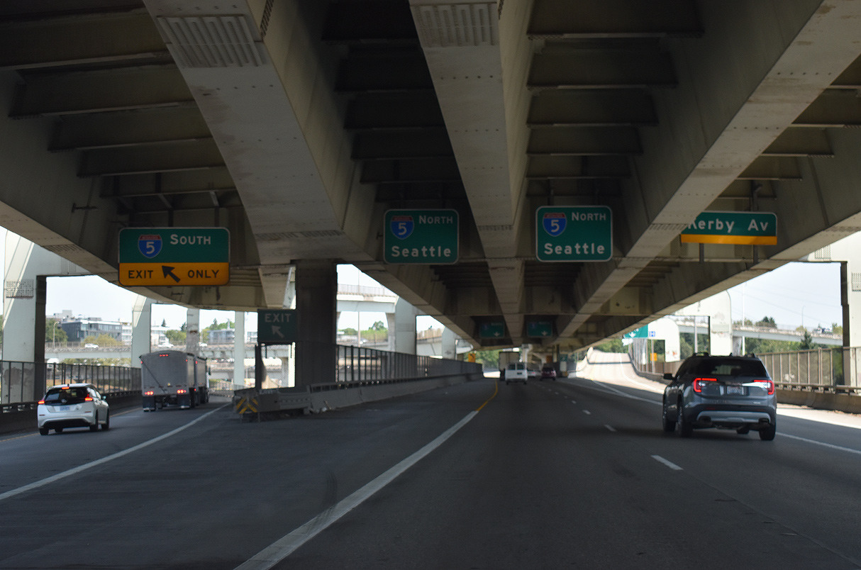
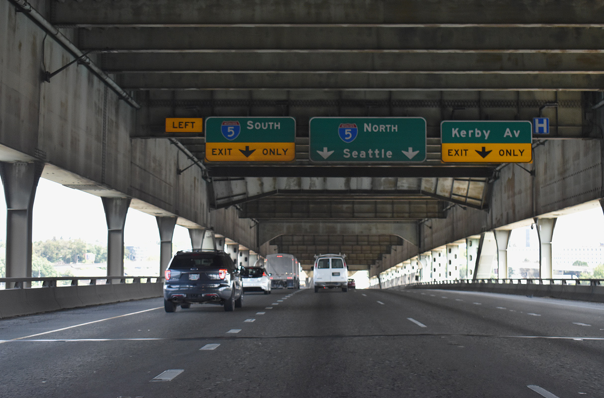
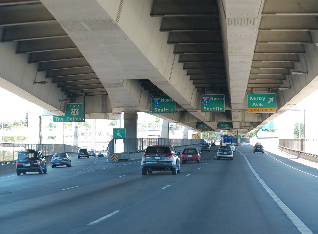
Three lanes continue northbound from the Fremont Bridge to Interstate 5 north and the freeway spur to Kerby Avenue. The spur is a remnant of the cancelled Rose City Freeway through Portland’s Boise neighborhood. 07/20/23

Interstate 405 concludes along a two lane flyover with I-5 north to the Overlook and Piedmont neighborhoods in north Portland. 07/20/23
![]() South at
South at ![]()
![]()

Traveling south between the Overlook and Boise neighborhoods, one mile ahead of the separation with Interstate 405 (Stadium Freeway). 08/27/06

An auxiliary lane opens south from the Going Street entrance ramp to Exit 302B. Beaverton is a western Portland suburb along U.S. 26 (Sunset Highway). 08/27/06

I-5 angles southeast toward the Lloyd District and the Banfield Expressway (I-84). U.S. 30 west joins I-405 south over the Fremont Bridge for 0.6 miles to a three wye interchange with the Industrial Freeway spur (canceled I-505) to Yeon Avenue. 08/27/06
![]() North
North ![]() West at
West at ![]()

U.S. 30 combines with Interstate 5 north from the west end of I-84 to the Fremont Bridge with I-405 south. 09/02/06

One quarter mile south of the full-Y interchange (Exit 302B) with Interstate 405 (Stadium Freeway) south / U.S. 30 west at the Flint Avenue overpass. U.S. 30 leads through the Northwest Industrial Area from I-405. 09/02/06

A two lane flyover departs I-5 north for I-405 south / U.S. 30 west at Exit 302B. St. Helens, seat of Columbia County, lines the Columbia River north of the Portland area along U.S. 30. 09/02/06
 North End Throwback

Previous overheads on the Fremont Bridge northbound referenced U.S. 30 to The Dalles. 06/24/15
A second reference to U.S. 30 for I-5 south was removed with sign changes made at the north end of I-405 by 2016. 06/24/15

Trapezoidal overheads for Interstate 5 at the spur to Kerby Avenue were replaced with conventional signage by 2016. 06/24/15
South End / Marquam Bridge – Portland, Oregon
![]() South
South ![]() East at
East at ![]()

Southbound I-405 reaches Exit 1C for U.S. 26 east, 6th Avenue, and the Ross Island Bridge just ahead of Interstate 5. 08/27/06

The southern extent of Interstate 405 (Stadium Freeway) travels below grade. The entrance ramp from SW Broadway expands the southbound roadway to four lanes. 08/27/06

Two lanes continue south from I-405 to Interstate 5 for Lake Oswego, Tualatin, Salem, Albany and Eugene. 08/27/06

A two lane flyover links I-405 south with Interstate 5 north across the Marquam Bridge to East Portland. I-5 connects with I-84/U.S. 30 east to Gresham, Troutdale, The Dalles and Boise, Idaho. 08/27/06
![]() North at
North at ![]()
![]()

I-5 runs along the South Waterfront adjacent to the Willamette River north toward Interstate 405 and the Portland city center. 07/20/23
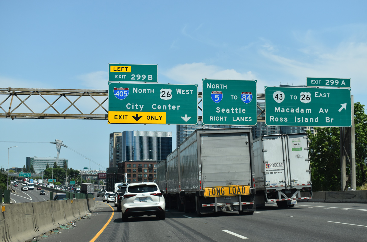
Exit 299 A connects with U.S. 26 and OR 43 east across the Ross Island Bridge 0.4 miles ahead of the split with I-405. Left Exit 299 B follows from I-5 north for I-405 (Stadium Freeway) and SW Harbor Drive to the Portland city center. 07/20/23
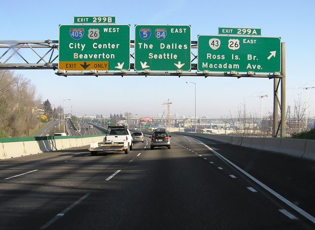
Replaced button copy signs along I-5 north for U.S. 26/OR 43 and I-405 west. Photo by Chris Elbert (03/06/04).

Northbound I-405 shifts onto a two lane flyover at SW Harbor Drive (Exit 1 A). Harbor Drive replaced a portion of the Old Harbor Freeway. The former roadway for U.S. 99W extended north through what is now Portland’s Waterfront Park to the Steel Bridge. 07/20/23
![]() South at
South at ![]()
![]()
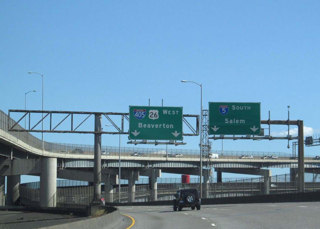
Southbound Interstate 5 spans the Willamette River across the lower deck of the Marquam Bridge leading directly to I-405 (Stadium Freeway) north. Photo by Doug Kerr (06/07/14).

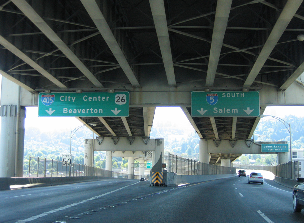
Two lanes separate for both the continuation of Interstate 5 south toward Salem and the I-405 north to U.S. 26 (Sunset Highway) west to Beaverton. Photo by Doug Kerr (06/07/14).
Ramp stubs at the three-wye interchange connecting the Marquam Bridge (I-5) with I-405 (Stadium Freeway) remain from the unbuilt Mount Hood Freeway. The Mount Hood Freeway was planned as a high speed route for U.S. 26 east to Gresham. 08/27/06
Sources:
http://egov.oregon.gov/ODOT/HWY/GEOENVIRONMENTAL/ docs/Historic_Bridge/Willamette_Fremont_Bridge.doc- Interstate 50th Anniversary: The Story of Oregon’s Interstates.
Page updated February 1, 2024.