Interstate 440 Arkansas
Overview
Interstate 440 follows the East Belt Freeway from I-30/530 to I-40 around Little Rock and North Little Rock. The freeway loop provides a truck route for hazardous materials and connects with the passenger terminal at Bill and Hillary Clinton National Airport (LIT). Highway 440 extends from I-40/440 along the Northbelt Freeway to U.S. 67/167 (Future Interstate 57). The rural freeway traverses Ink Bayou and other wetlands into the city of Jacksonville.
The Exit number sequence along I-440 continues along Arkansas Highway 440. Long range plans extend the Northbelt Freeway westward to the exchange joining Interstate 40 with I-430 at Crystal Hill. The roadway will be designed as a four lane, divided highway.1
 History
The Northbelt Freeway was completed by February 2003. It remains signed as a state highway, because it does not connect with an Interstate highway at each end.2 This will change once I-57 is fully signed along the freeway leading U.S. 67/167 northeast from North Little Rock and Jacksonville to Walnut Ridge.
Route Information
East End – North Little Rock, AR
West End – Little Rock, AR
Mileage – 9.96
Cities – Little Rock, North Little Rock
- Junctions –

 Future
Source: December 31, 2021 Interstate Route Log and Finders List
I-440 Annual Average Daily Traffic (AADT)

Button copy guide signs for I-440 on I-40 referenced Little Rock Airport and River Port in addition to Texarkana. 05/30/95
East End 
 – North Little Rock, Arkansas
![]() East at
East at ![]()
![]()
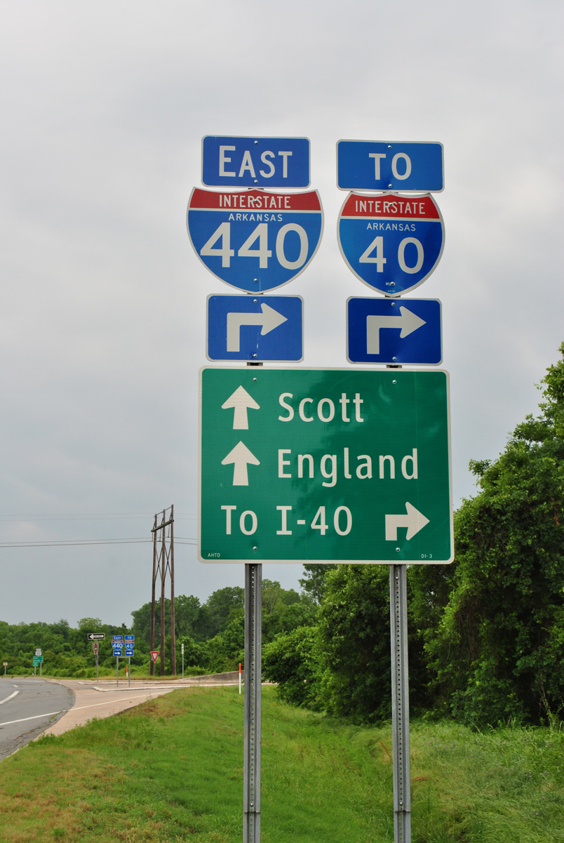
Interstate 440 proceeds north from a folded diamond interchange (Exit 10) with U.S. 70 to the exchange with I-40 and Highway 440 (Northbelt Freeway). 09/09/20
Spanning the Arkansas Midland Railroad, two lanes part ways at the north end of Interstate 440 for I-40. AR 440 extends the freeway north five miles to U.S. 67/167 (Future I-57) in Jacksonville. 09/09/20
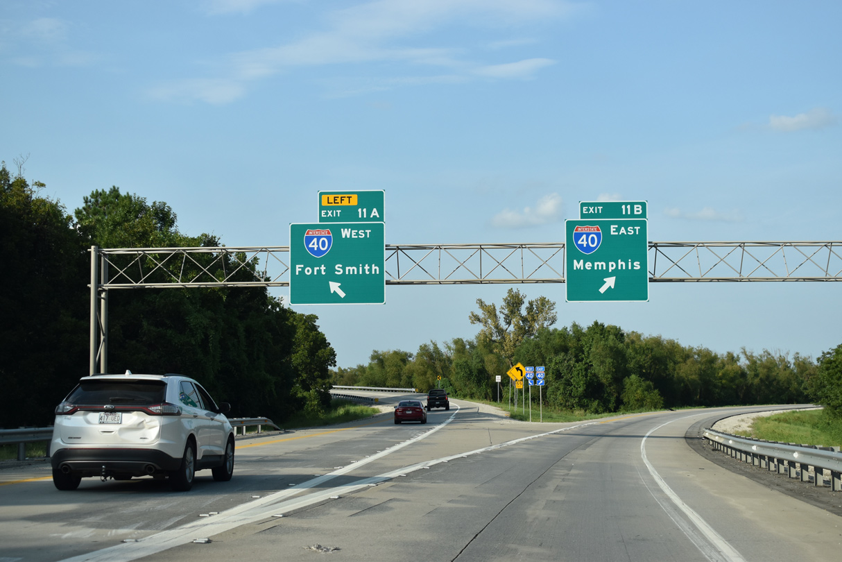
Exits 11A/B separate for Interstate 40 west across North Little Rock and the rural freeway 118 miles east to I-55 at West Memphis. 09/09/20
![]() South at
South at ![]()
![]()
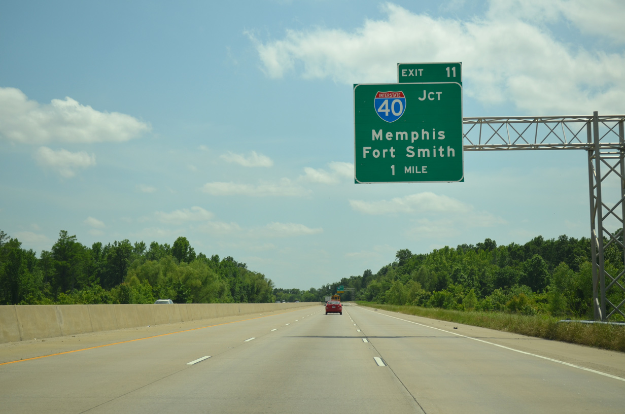
Highway 440 advances one mile south from Ink Bayou to the cloverstack interchange (Exit 11) with Interstate 40. 05/20/14
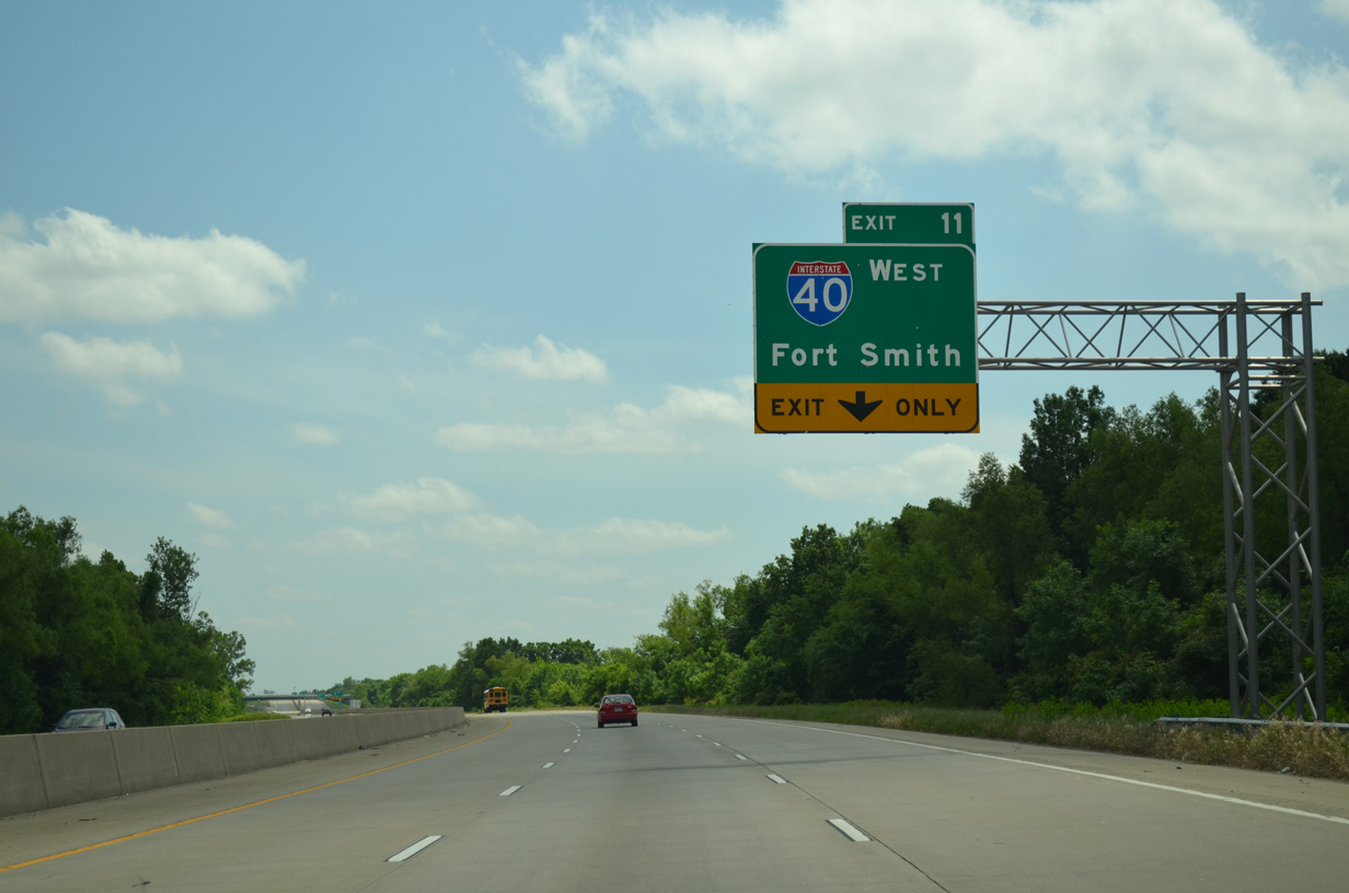
A lane drop occurs at Exit 11 for Interstate 40 west across Little Rock toward Fort Smith. 05/20/14

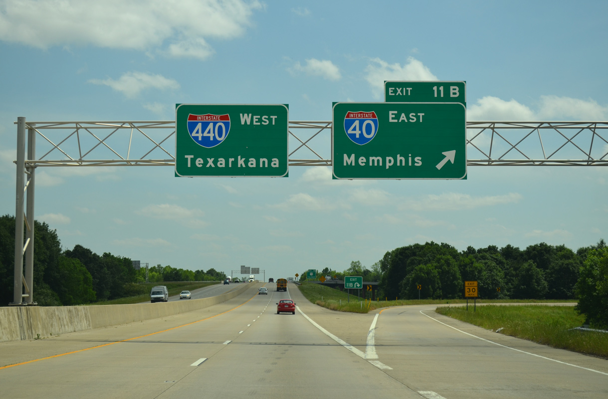
Eanes Road spans AR 440 southbound at Exit 11. A loop ramp (Exit 11B) follows for Interstate 40 east to West Memphis and Memphis, Tennessee. 05/20/14
Interstate 440 commences south from I-40 to U.S. 70 in North Little Rock and across David D. Terry Lake (Arkansas River) into the capital city. 05/20/14
![]() East at
East at ![]()
![]()
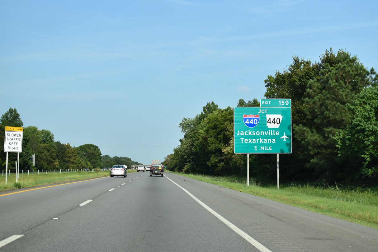
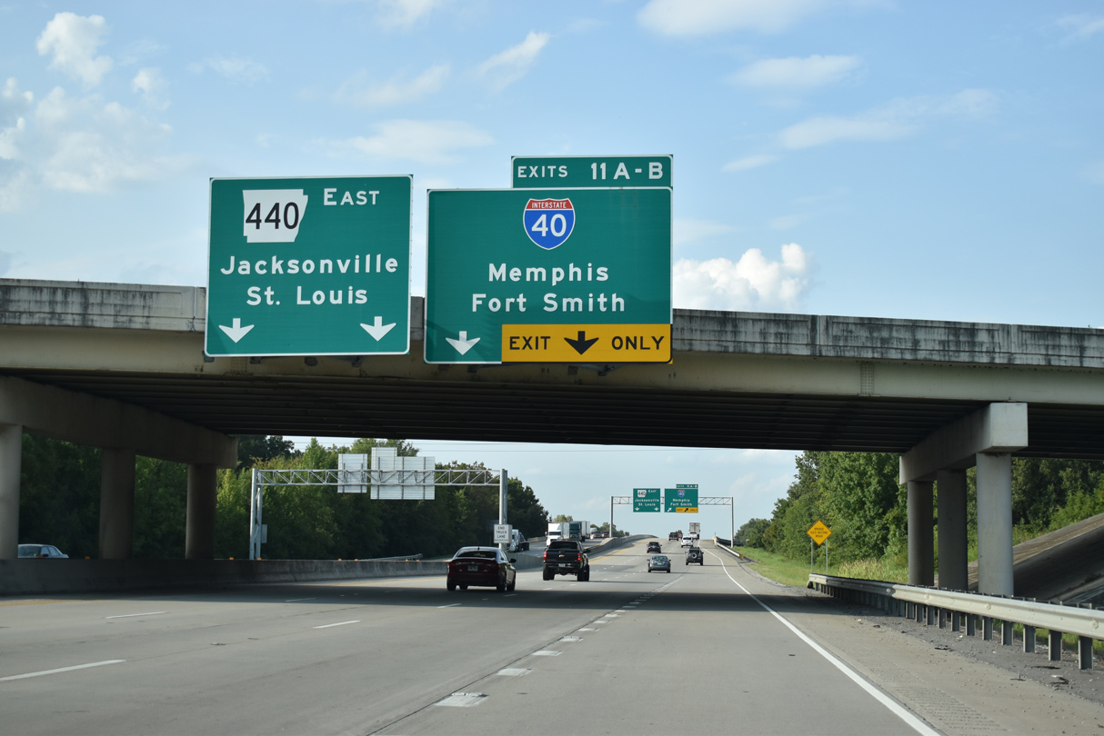
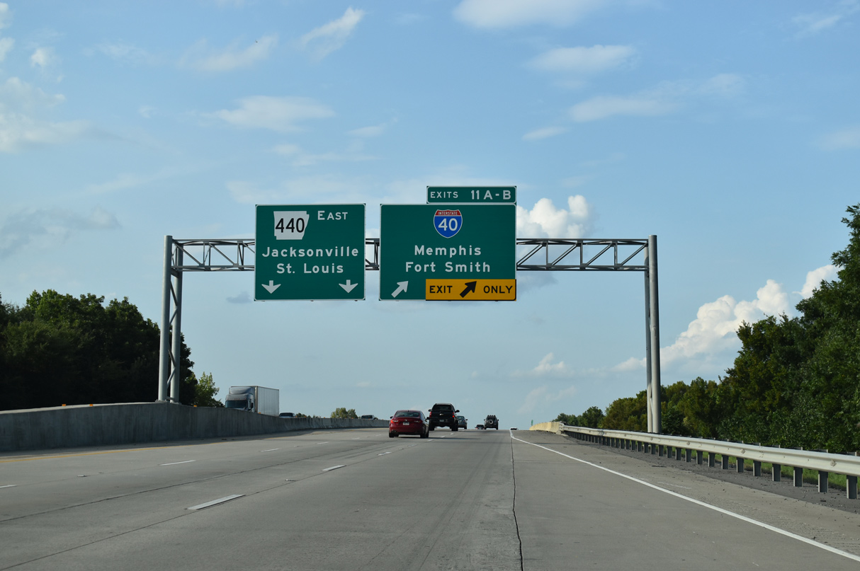
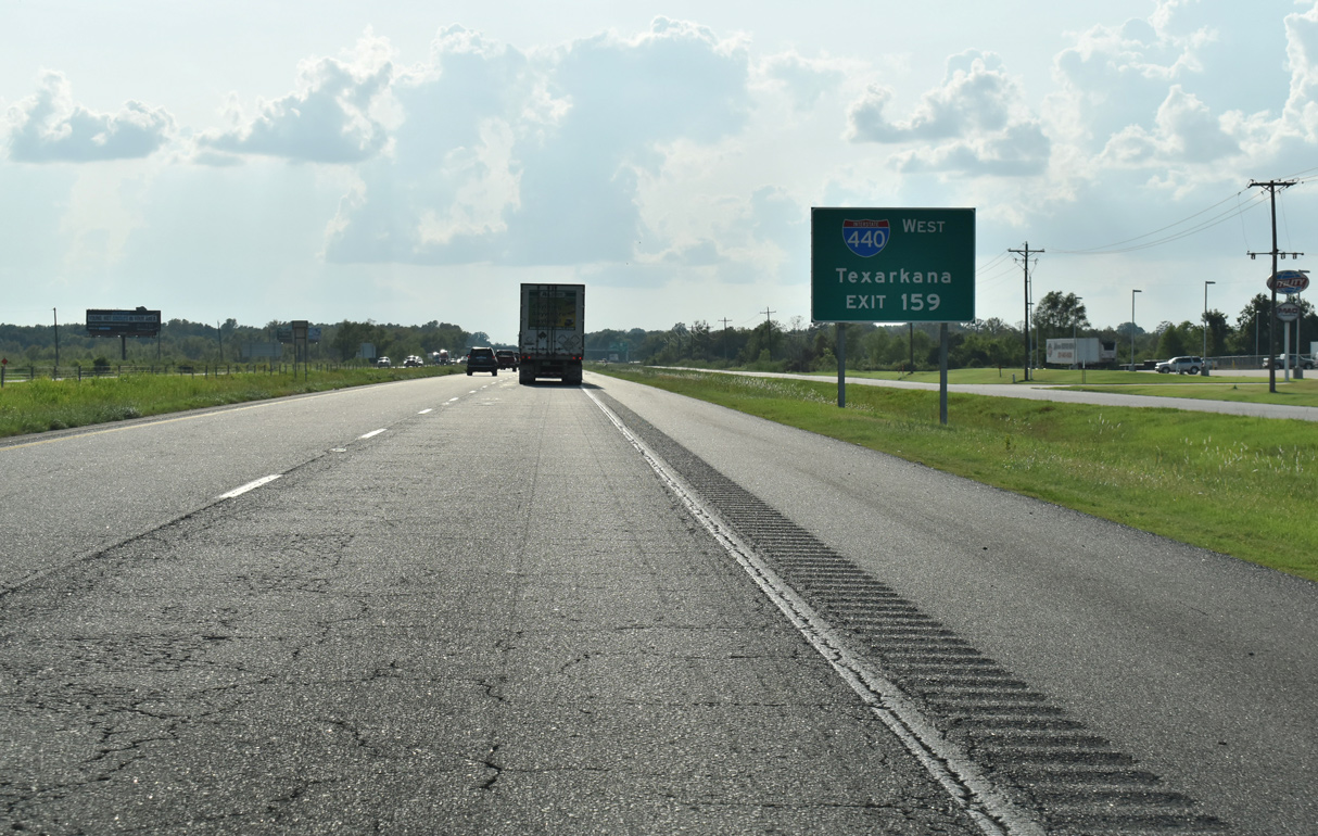
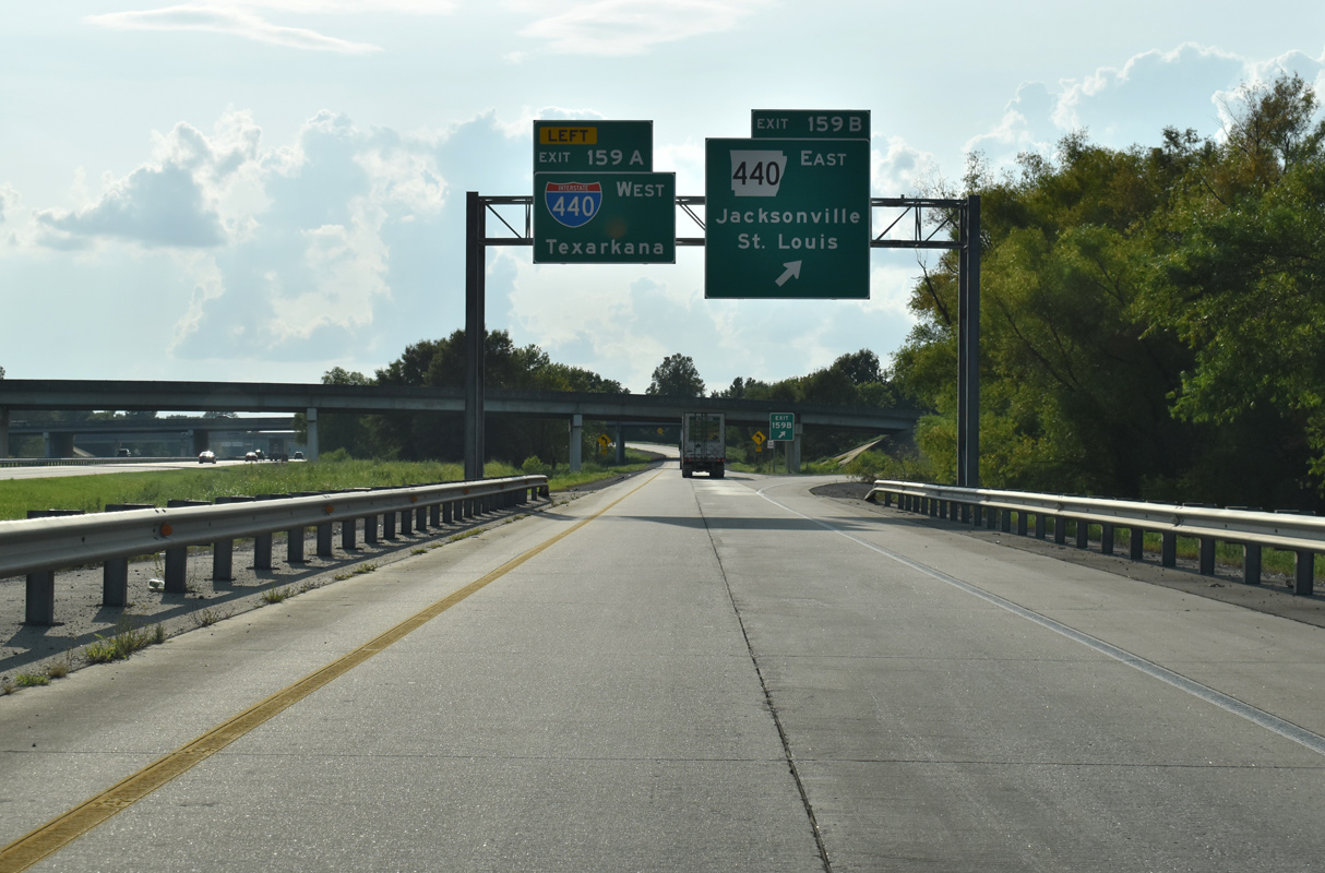
Interstate 40 crosses wetlands south of Stark Bend on the rural approach to Exit 159 with I-440 west and Highway 440 north. 09/09/20
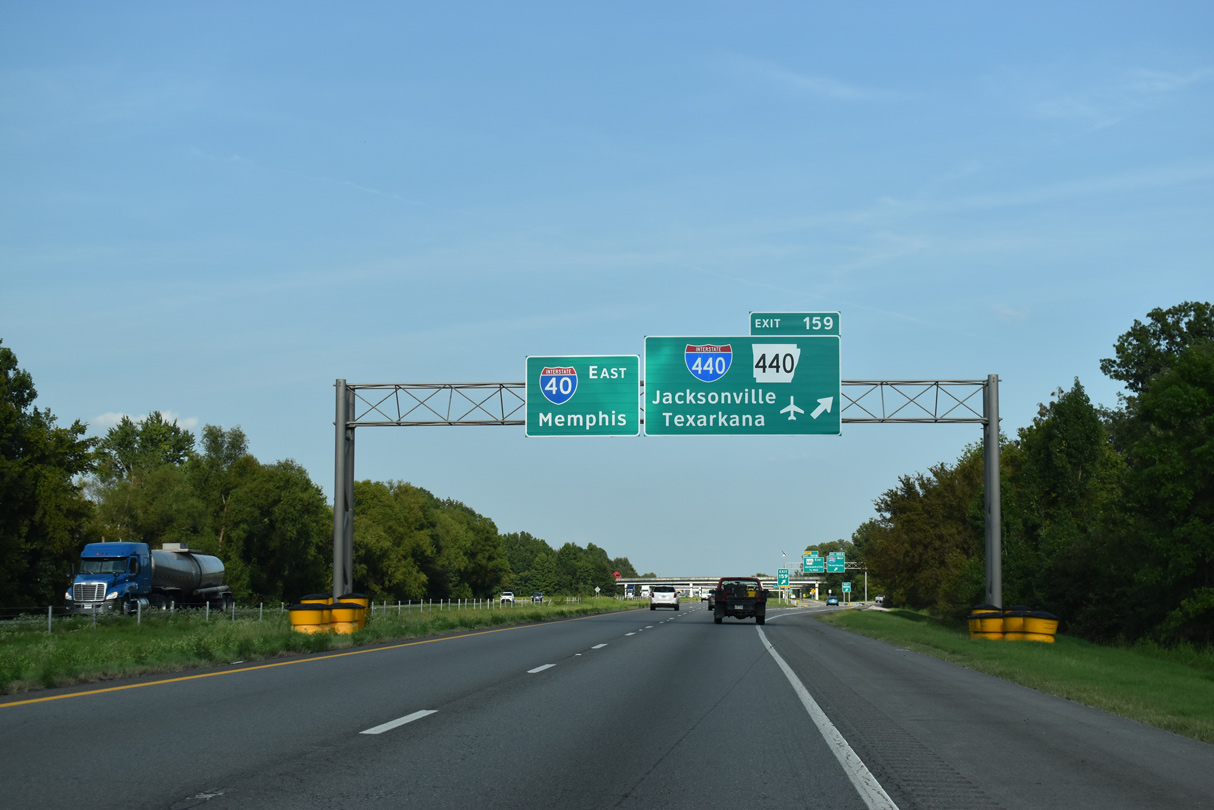
A collector distributor roadway partitions from Interstate 40 east for I-440 west to Bill and Hillary Clinton National Airport (LIT) and Highway 440 north to Jacksonville. 09/09/20
The westbound ramp for Interstate 440 to the Little Rock River Port and I-30 west to Texarkana departs from the c/d roadway at Exit 159A. 09/09/20
![]() West at
West at ![]()
![]()
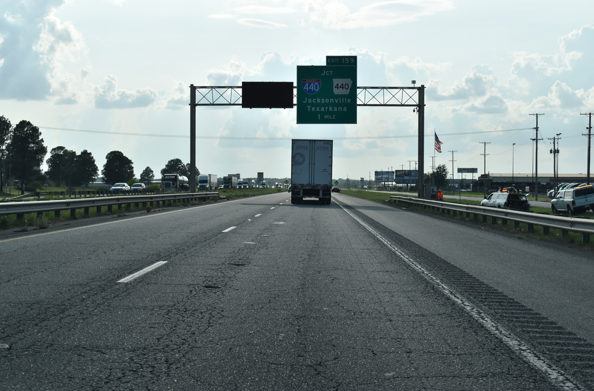
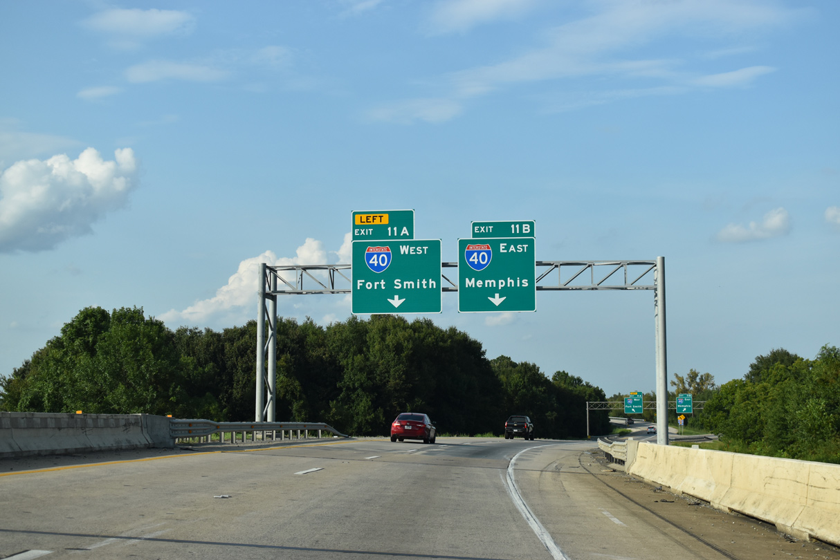
An array of truck stops and service centers line the I-40 frontage roads leading west to the cloverstack interchange (Exit 159) with Interstate 440 west and AR 440 north. 09/09/20
Interstate 440 arcs southwest across the Arkansas River to connect with I-30 south of Downtown and I-530 north of Sweet Home. 09/09/20
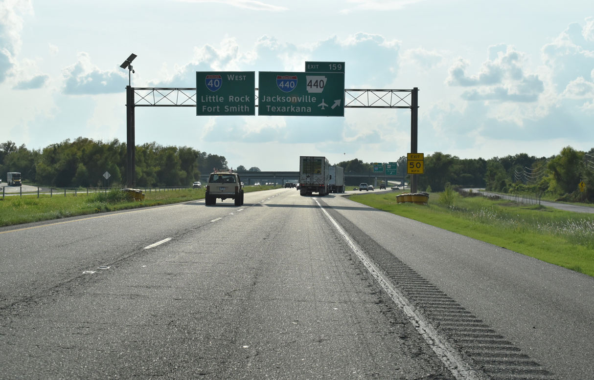
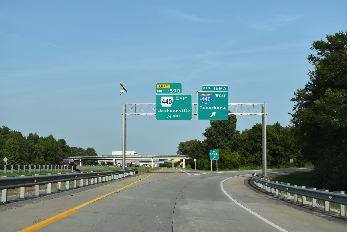
Exit 159 partitions from Interstate 40 westbound by Harris Lake for both I-440 west to LIT Airport and Highway 440 (Northbelt Freeway) to Jacksonville. 09/09/20
Highway 440 continues the belt route north from I-440 to U.S. 67-167/Future I-57 at Jacksonville. 09/09/20
 East End Throwback


May 3, 2003 photos from Chris Patriarca showing replaced guide signs for the exchange joining I-40 with I-440 and Highway 440 in North Little Rock.
West End  – Little Rock, Arkansas
![]() West at
West at ![]()
![]()
![]()
![]()
![]()
![]()

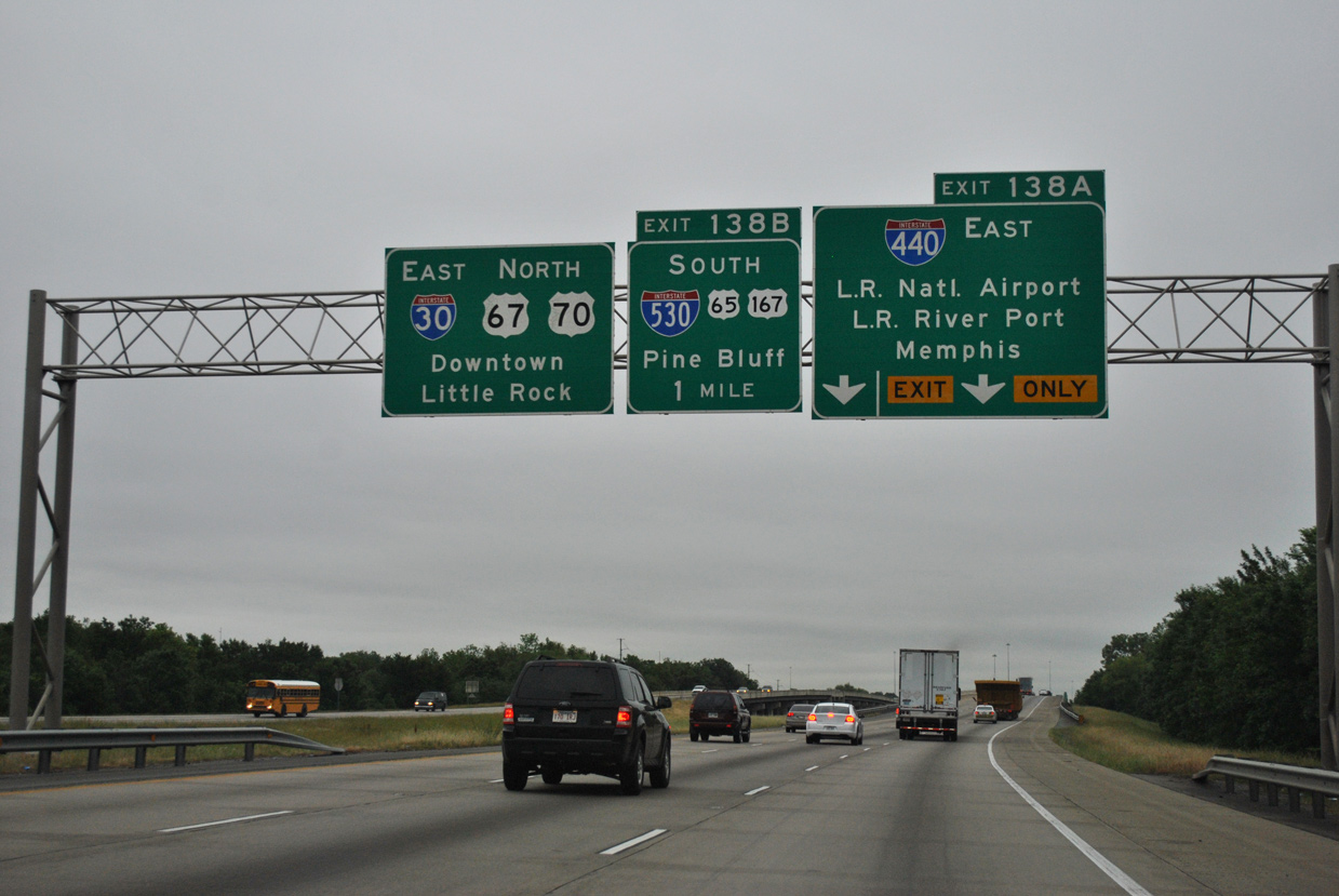
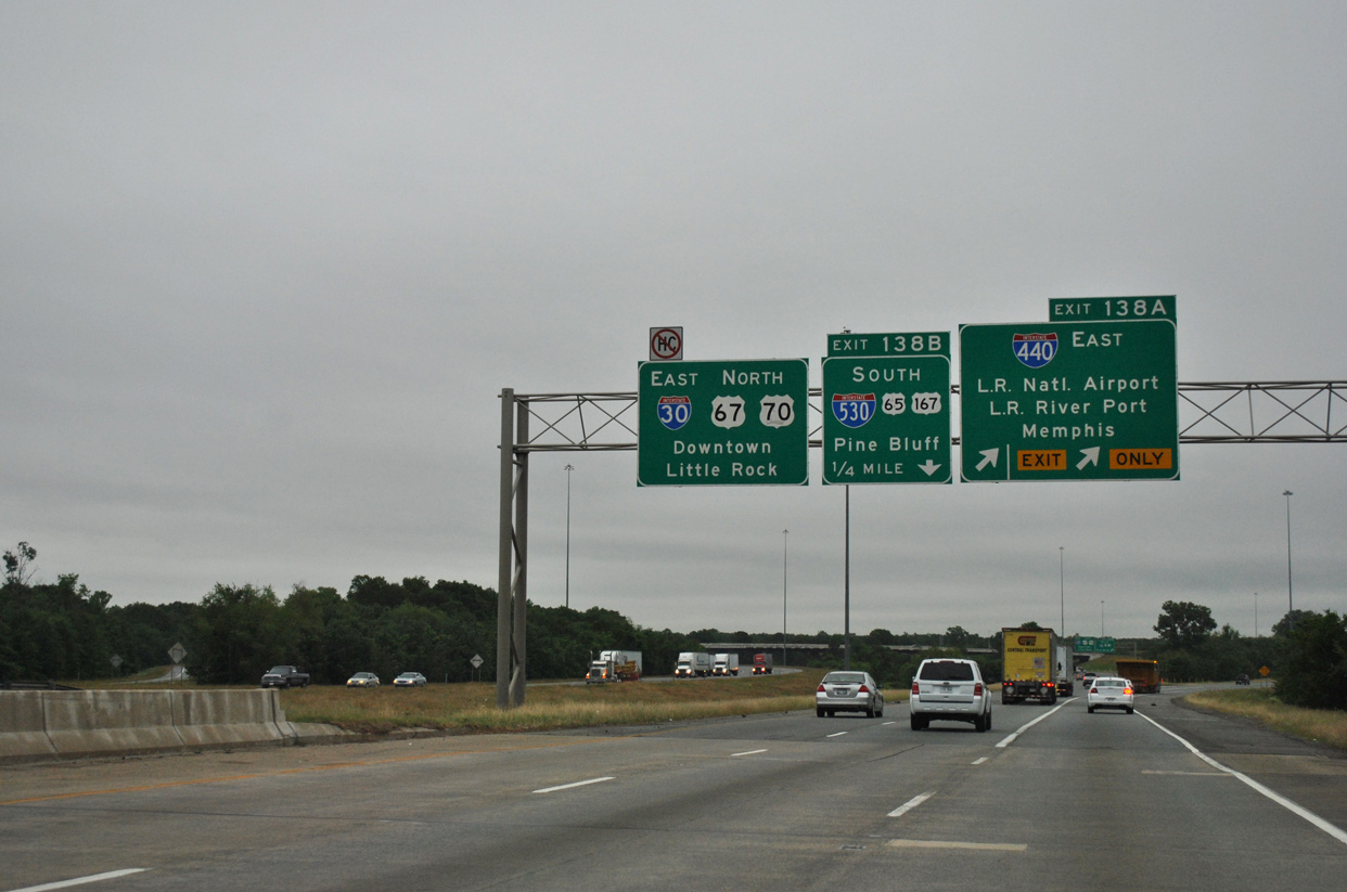
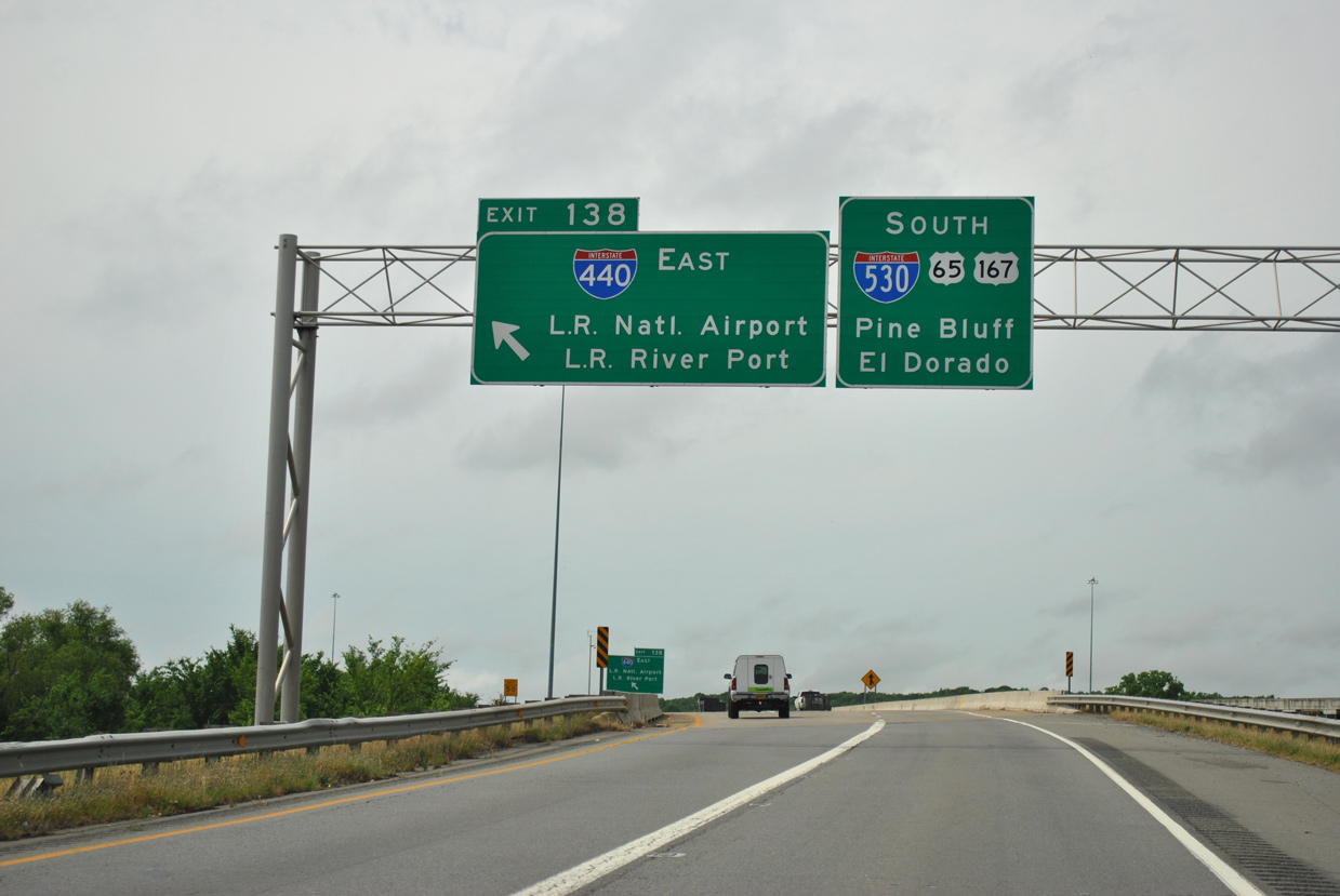
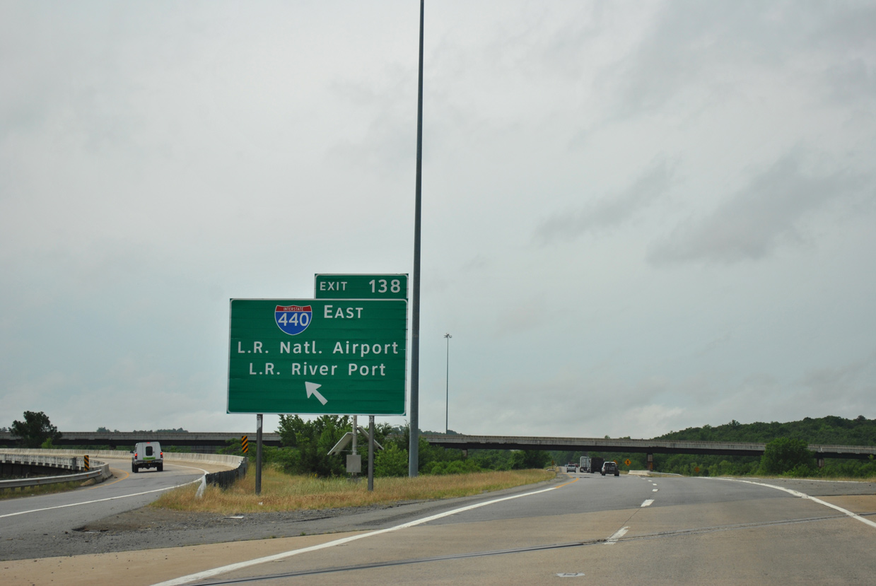
Westbound Interstate 440 elevates along a 2.3 mile long viaduct from College Station to the systems interchange (Exit 138) with I-30, I-530 and U.S. 65/167. 05/20/14
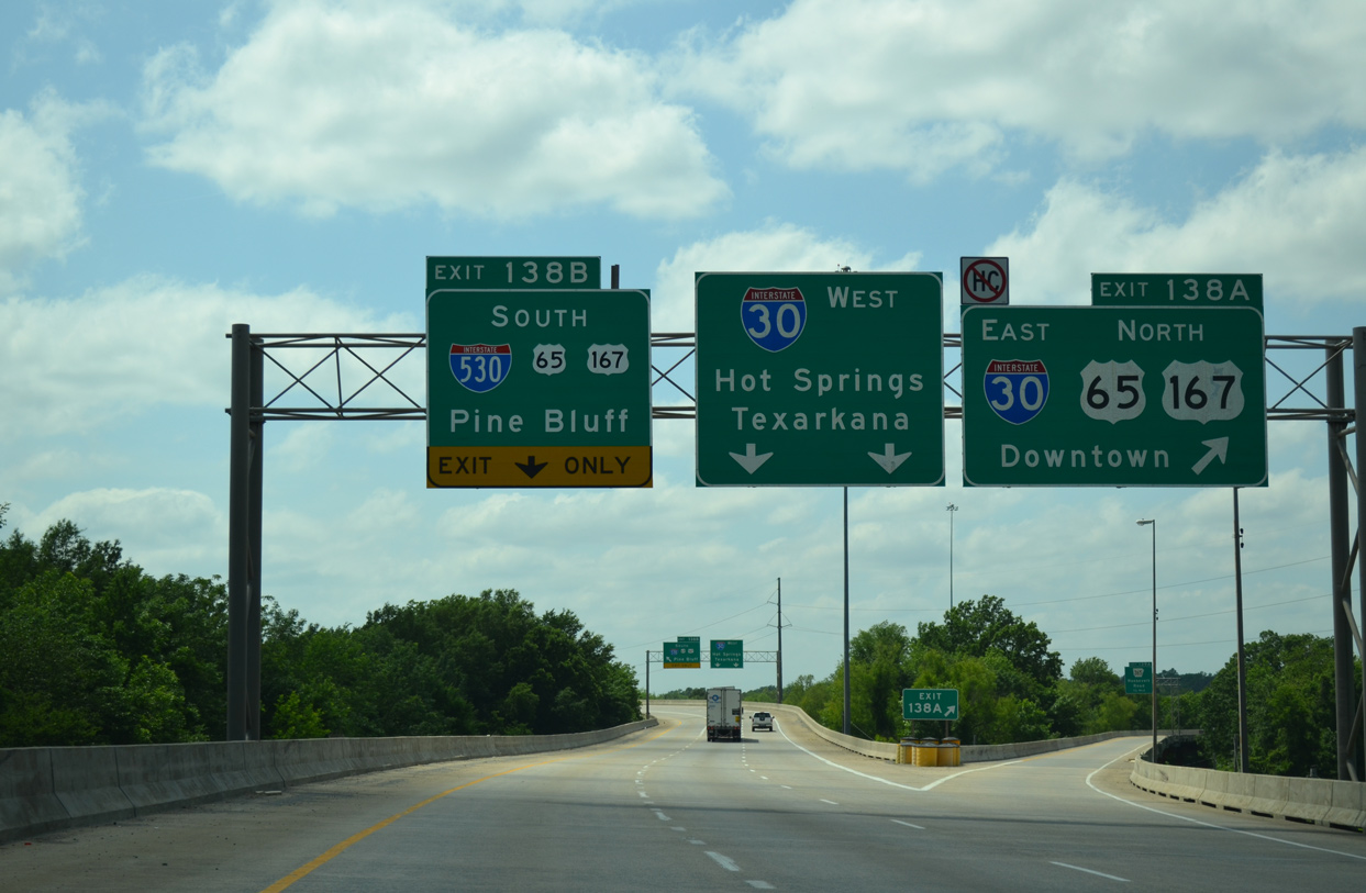
I-440 westbound partitions into ramps for I-30 east to Downtown Little Rock and I-530/U.S. 65-167 south to Pine Bluff. The mainline defaults onto I-30 westbound toward Benton and Hot Springs. 05/20/14
![]() East
East ![]()
![]() North at
North at ![]()
![]()
![]()
![]()
Interstate 30 arcs northeast around the periphery of Granite Mountain to Exit 138 with I-440 (East Belt Freeway) and I-530/U.S. 65-167 south. 05/07/12
Crossing Fourche Creek and a Union Pacific Railroad along a 0.4 mile viaduct, I-30 east reaches the split with Exit 138A for I-440 to LIT Airport. The ensuing ramp connects with I-530 south to Sweet Home and Pine Bluff. 05/07/12
![]()
![]()
![]() North at
North at ![]()
![]()
![]()
![]()
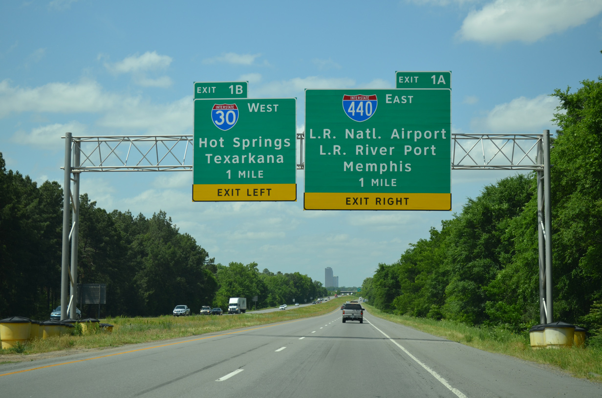
One mile south of Exit 1A for Interstate 440 east and Exit 1B for I-30 west on I-530/U.S. 65-167 north between Echo Valley and Gillam Park. 05/20/14

A systems interchange (Exit 1) with three left side ramps connects I-30, I-440 and I-530 amid wetlands along Fourche Creek. 05/20/14
Exit 1A leaves I-530/U.S. 65-167 north for Interstate 440 east to Bill and Hillary Clinton National Airport (LIT) and the College Station community. 05/20/14
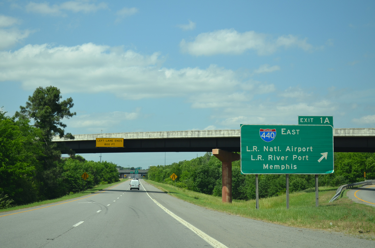
Leading 10.1 miles east from I-530, Interstate 440 allows travelers to bypass Downtown Little Rock en route to Memphis, Tennessee. 05/20/14
![]()
![]() West
West ![]()
![]()
![]() South at
South at ![]()
![]()
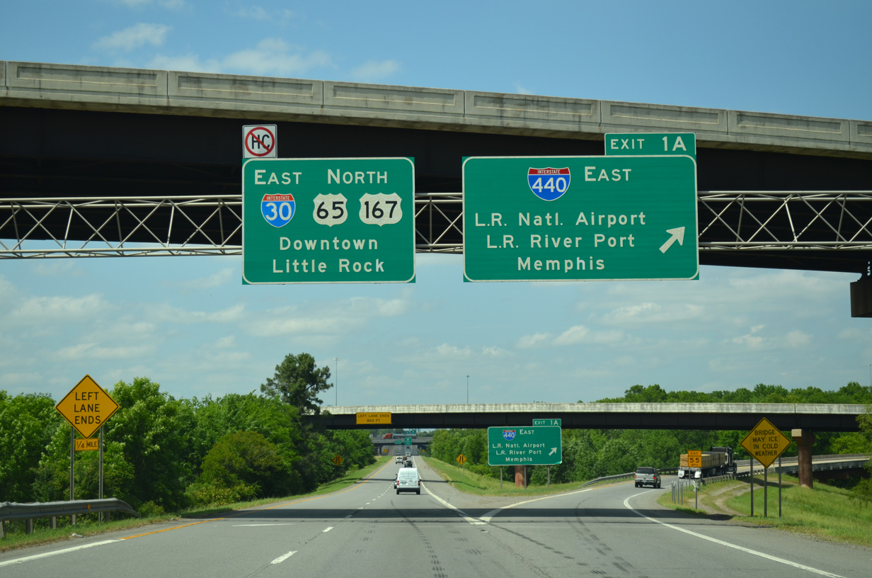
Left Exit 138 connects with I-440 east beyond the Interstate 530 separation from I-30 west. 05/07/12
The flyover at Exit 138 spans Fourche Creek ahead of the I-440 viaduct extending east to Highway 365 and Frazer Pike at College Park. 05/07/12
Sources:
- “Notice to Media.” Arkansas State Highway and Transportation Department (AHTD), September 25, 2003.
- Arkansas 440 information courtesy Matt Hollis.
Page updated September 25, 2020.