Interstate 470 Missouri
Overview
Interstate 470 in Missouri connects southern Kansas City with Independence, providing a bypass of the Kansas City metropolitan area to the southeast and a commuter route to Lee’s Summit. The freeway overlaps with U.S. 50 from the Three Trails Crossing Memorial Highway interchange with I-49 and I-435 to Exits 7 A/B, and doubles as Missouri Route 291 on its east leg between Exit 10 and Exit 16. Old U.S. 50 is designated Route 350 between Interstate 470 and I-435 through Raytown and Kansas City.
 History
The state of Missouri submitted Interstate 170, a connector between I-435 and I-70 southeast of Kansas City, as part of the Urban Route Numbering proposals to the American Association of State Highway Officials (AASHO) on July 31, 1958. The route was changed to Interstate 470 since it constituted a loop and approved by AASHO on November 10, 1958.1
The alignment of Intestate 470 appeared on the Missouri Official Highway Map by 1964 from the Grandview Triangle Interchange with U.S. 71 and I-435 east to then-U.S. 71 Bypass north of Lee’s Summit. U.S. 71 Bypass ran north from U.S. 50 to U.S. 40 as part of the planned route. Missouri Route 291 replaced U.S. 71 Bypass by 1975, with a short stretch of expressway completed by 1969 from south of U.S. 40 to 39th Street. The 1983-84 Missouri Official Highway Map shows the Interstate fully opened to traffic.
The Grandview Triangle Interchange, where I-435, I-470 and U.S. 71 came together in south Kansas City, was redesigned during an eight year project completed in May 2008. The original junction was chronically congested, having been designed when the area was vastly more rural. Suburban growth both along I-435 and U.S. 71 overran the exchange with commuter traffic, leading to the need for the $300 million upgrade. Construction removed some of the left-hand ramps and expanded the freeway mainlines among other improvements. The junction was renamed the Three Trails Crossing Memorial Highway to reflect the end of the Grandview Triangle Interchange era.
A $46 million project between 2006 and June 2010 improved the junction of Interstate 470 with U.S. 50 leading east and Route 350 in Lee’s Summit. A new split-diamond interchange with Pryor Road and Blue Parkway frames the cloverleaf interchange with the U.S. 50 freeway leading south through Lee’s Summit. The new ramps provide local access to the Summit Woods and Summit Fair retail area, reducing traffic on U.S. 50 to the adjacent Chipman Road exit.2
A new diamond interchange opened to traffic along I-470 at Strother Road on August 19, 2010. The $15 million project extended Strother Road and provides additional access to industrial park areas served by Lee’s Summit Municipal Airport (LXT).3
The 1981 Rand McNally North American Road Atlas showed Interstate 470 open from the Grandview Triangle east to Route 350 at Lee’s Summit.
U.S. 50 was relocated onto I-470 and I-435, bypassing Kansas City, when the east-west section of I-470 opened. U.S. 50 previously followed Blue Parkway northwest to Swope Parkway, where it combined with U.S. 56 west to Interstate 35 at Merriam, Kansas.
Route Information
East End – Independence, MO
West End – Kansas City, MO
Mileage – 16.72
Cities – Kansas City, Lee’s Summit, Independence
- Junctions –


Source: December 31, 2021 Interstate Route Log and Finders List
U.S. 71 Bypass provided a surface route bypass of the Kansas City area. The designation was renumbered as Missouri Route 291 by 1972. It ran from Harrisonville north to Lee’s Summit, Liberty, Nashua and U.S. 71, six miles southeast of Platte City.
1960s and 1970s era maps showed I-470 proposed in a more northeasterly alignment than what was ultimately constructed over Route 291.
I-470 Annual Average Daily Traffic (AADT)
 Photo Guides
North End 
 – Independence, Missouri
![]()
![]() North at
North at ![]()
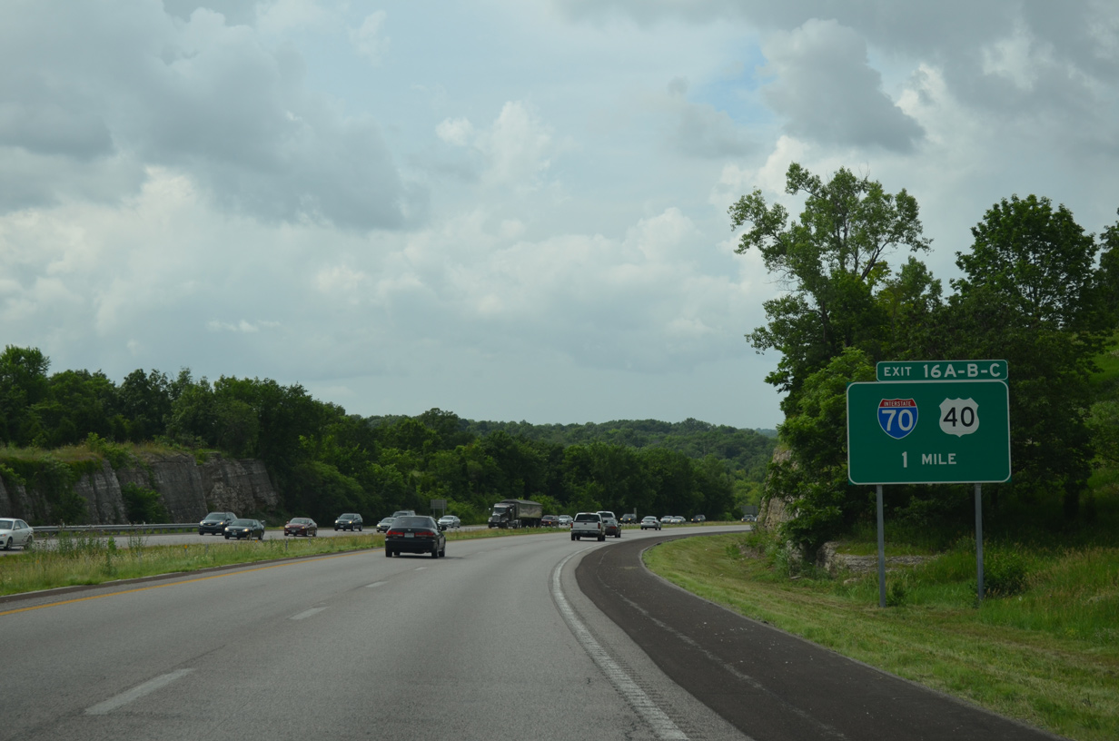
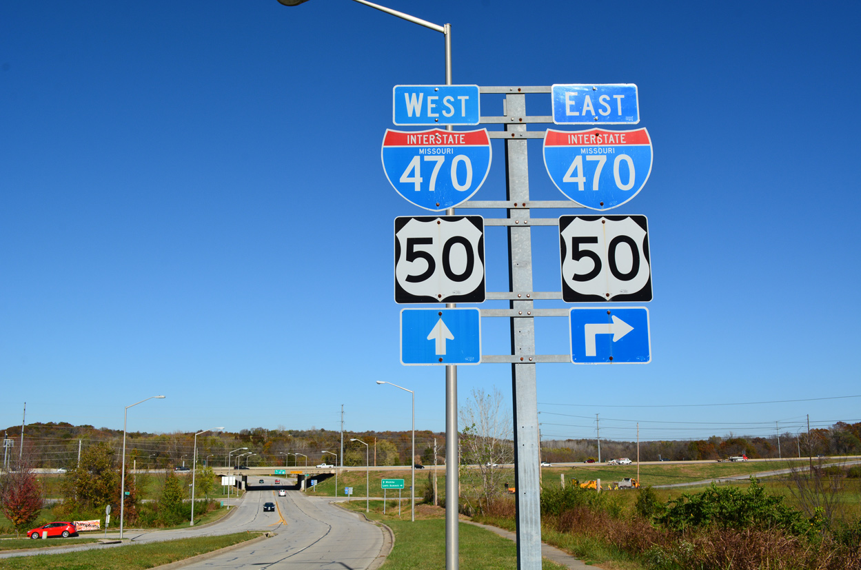
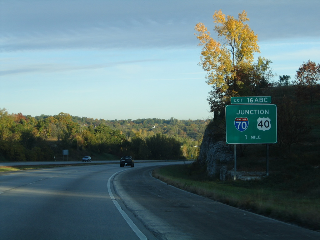
I-470/Route 291 lower through a rock cut toward the Little Blue River beyond the first sign for U.S. 40 and Interstate 70 in Independence. 06/18/15
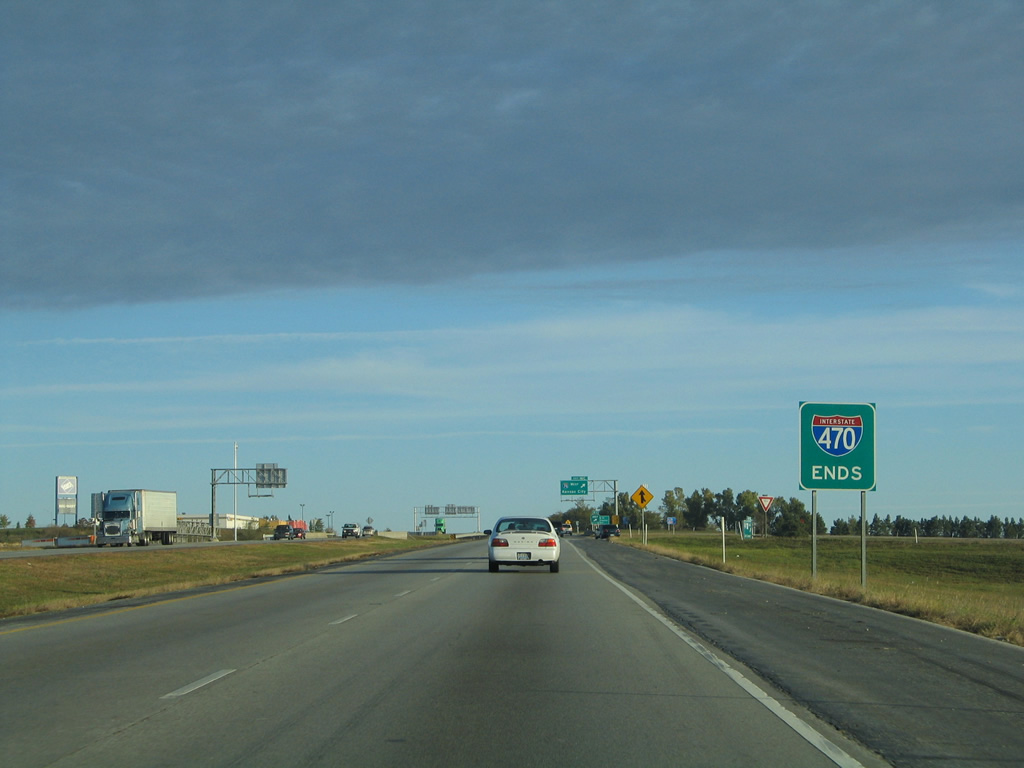
Interstate 470 ends a half mile north of the diamond interchange (Exit 16) with U.S. 40. Like U.S. 69 with I-35, U.S. 40 intertwines or overlaps with I-70 through the Kansas City area. Missouri Route 291 extends north from the end of I-470 along a short freeway to 39th Street. 10/17/04
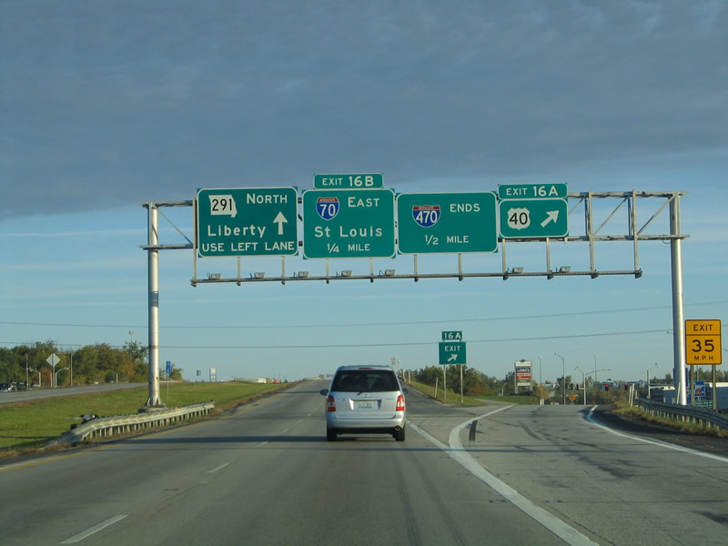
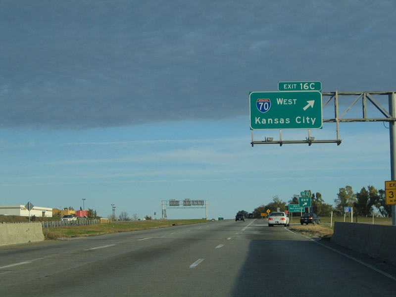
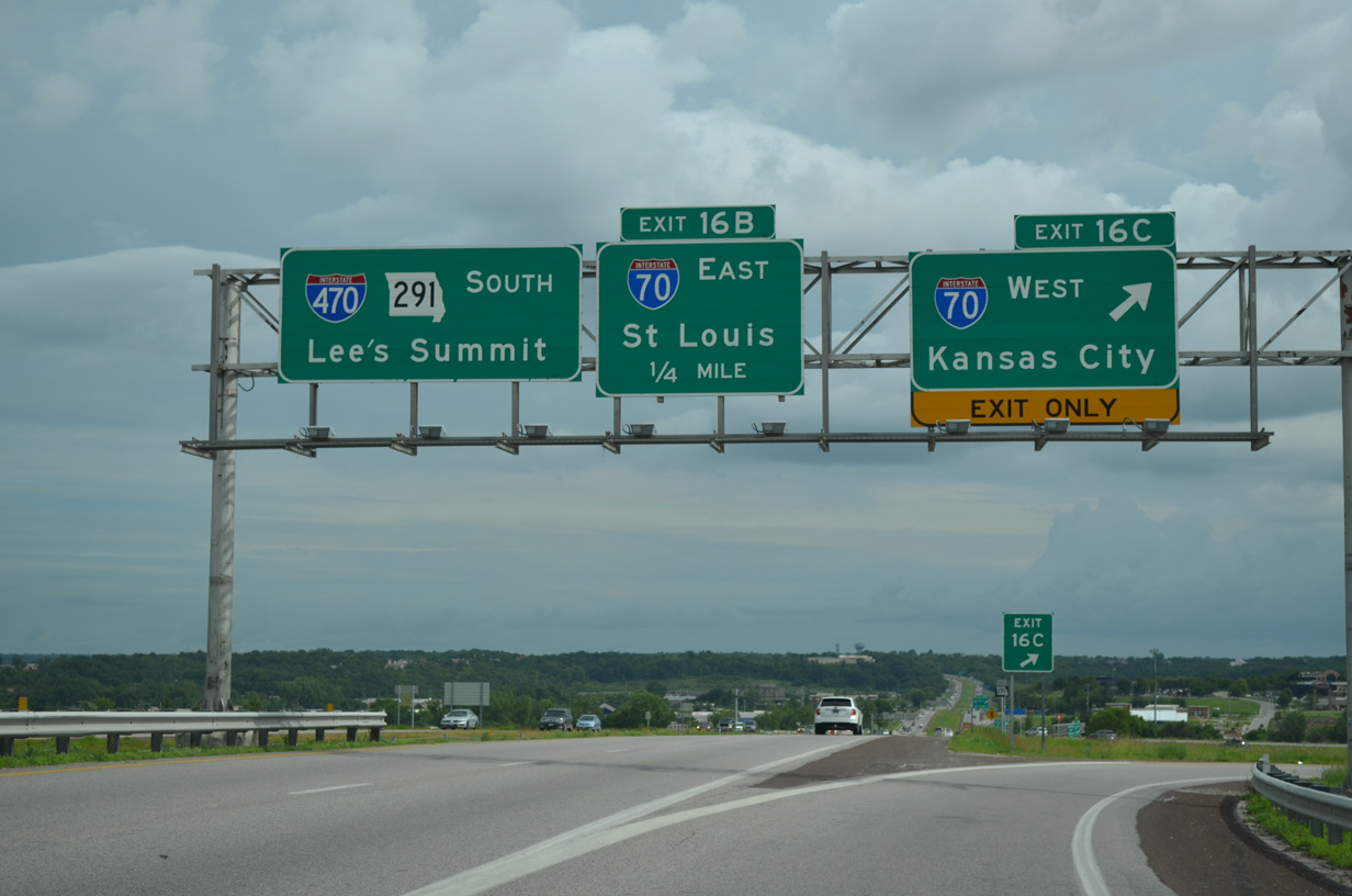
I-470/Route 291 northbound reach Exit 16 B for Interstate 70 east. St. Louis lies 227 miles to the east across the Show-Me State. 06/18/15
An end sign for Interstate 470 stands between the I-70 off-ramps within the cloverleaf interchange. Traffic continuing northward along Route 291 transitions to an at-grade, divided highway to Liberty and I-35 beyond the Missouri River. 06/18/05
Interstate 70 enters the city limits of Kansas City in five miles and reaches Downtown Kansas City in 14 miles. 10/17/04
![]() South at
South at ![]()
![]()
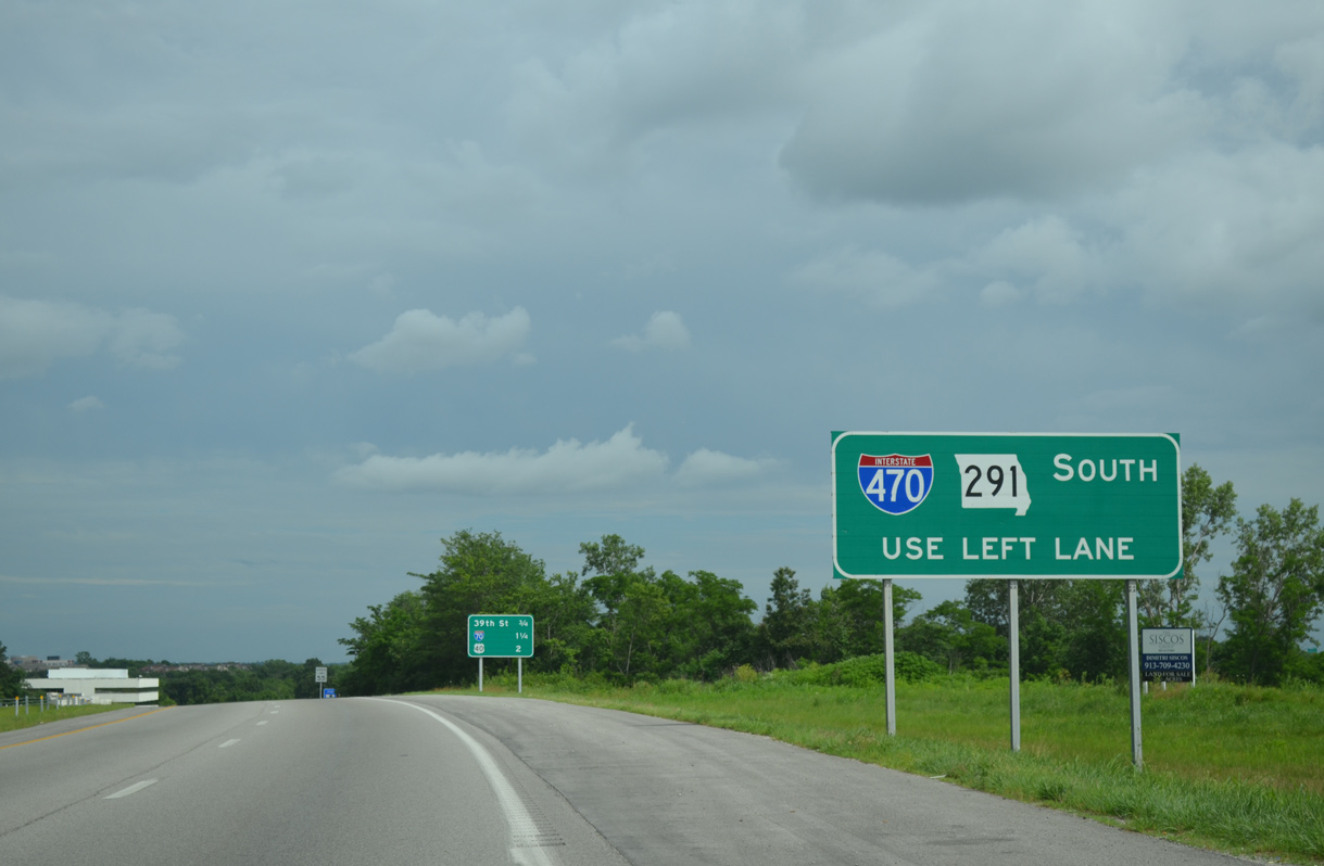
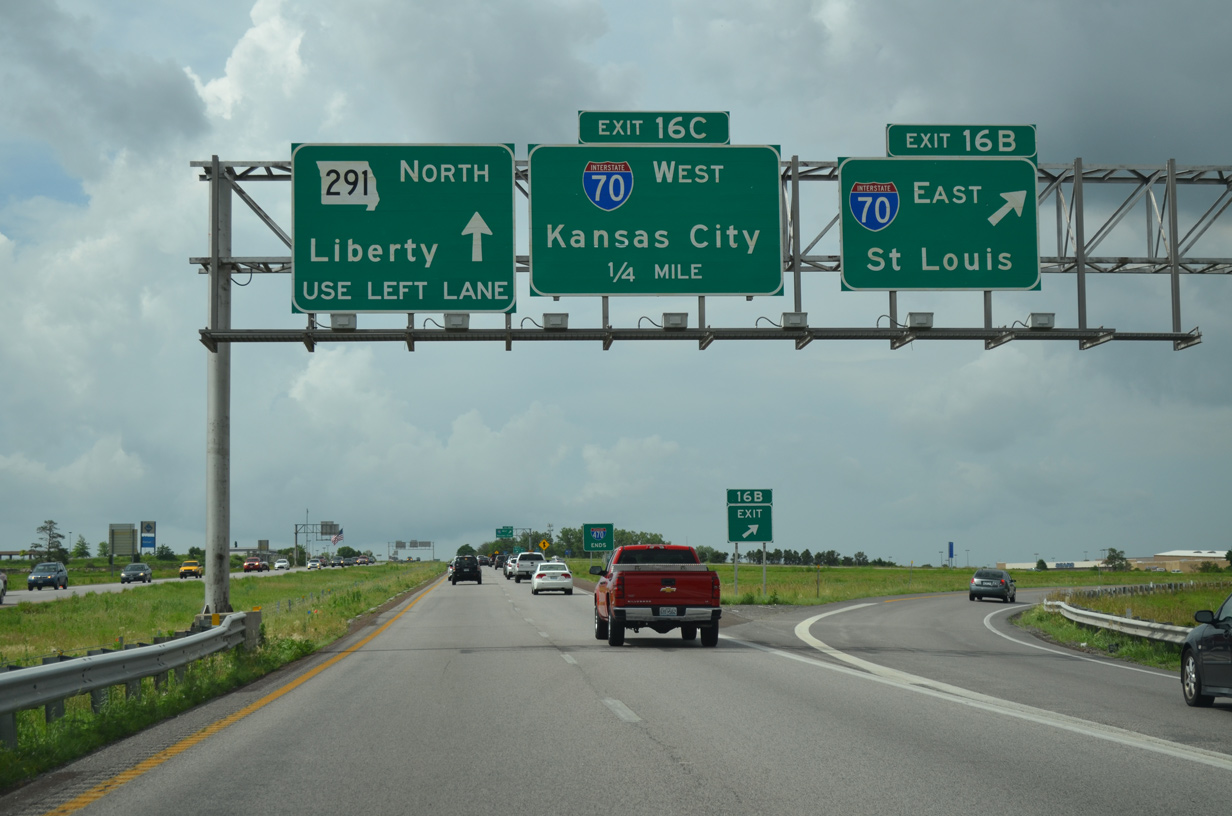
Route 291 heads southeast from a commercialized stretch at Route 78 to become an expressway leading to I-70 and I-470. 06/18/15
Interstate 470 begins midway through the cloverleaf interchange with I-70 along Route 291 south. 06/18/15
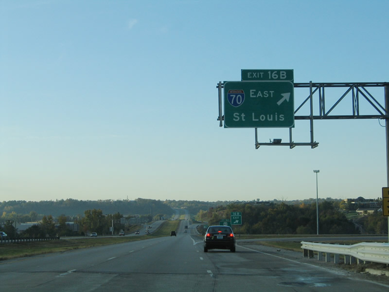
Exit 16 B loops away from I-470/Route 291 south for Interstate 70 east to Columbia and St. Louis. 10/17/04
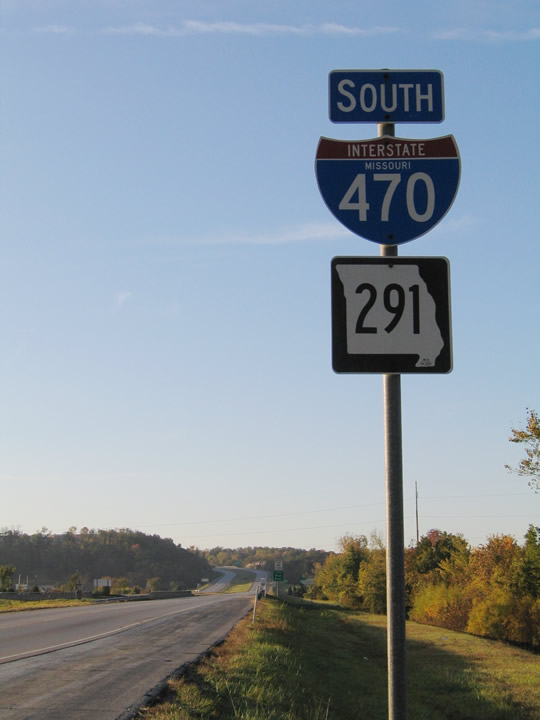
Interstate 470 and Route 291 are cosigned along the eastern leg of the freeway loop. This is the first shield assembly on southbound. 10/17/04
![]() West at
West at ![]()
![]()
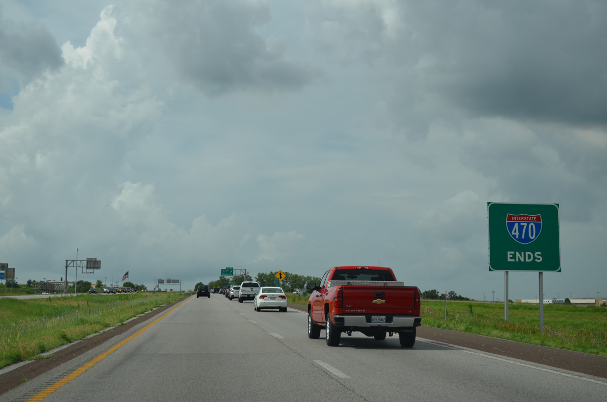
Interstate 70 west straddles the Blue Springs and Independence city line to the Little Blue River preceding Exit 17. Upcoming I-470/Route 291 south meet U.S. 40 in Independence before crossing into Lee’s Summit. 10/17/04
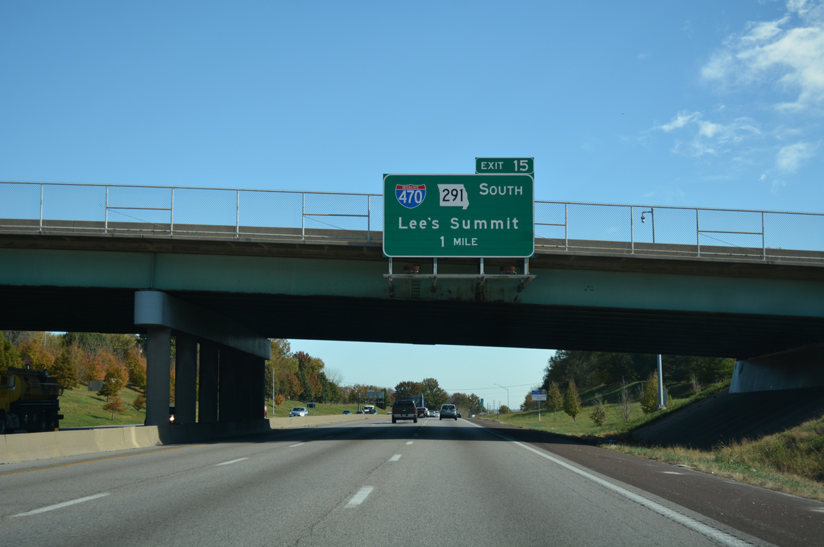
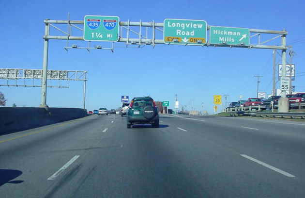
One mile ahead of Exit 15 with Interstate 470 south and Route 291 on I-70 westbound. MO 291 replaced the U.S. 71 Bypass designation from Nashua and Liberty south to Lee’s Summit and Harrisonville. I-470 was built directly over a portion of the state highway. 10/17/04
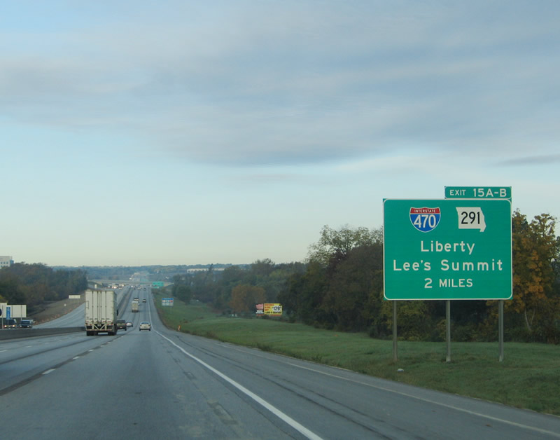
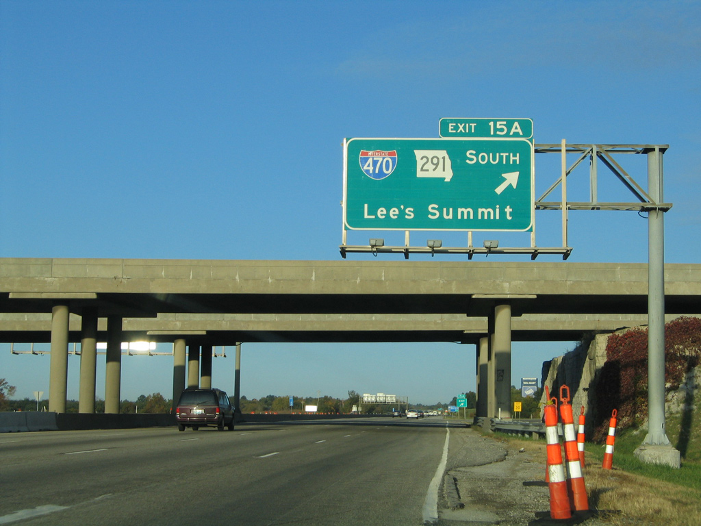
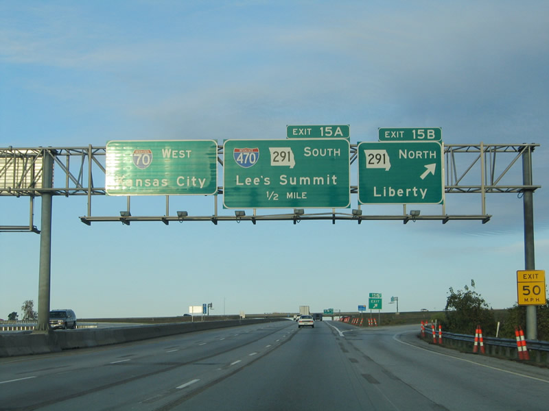
Missouri Route 291 extends north as a freeway to adjacent 39th Street by Independence Center mall. South from Exit 15A, Route 291 and I-470 overlap for 6.62 miles. 11/03/16
The suburban loop of Interstate 470 leads southwest to I-49/U.S. 71 near Grandview and I-435 west to Johnson County, Kansas. 10/17/04
![]() East at
East at ![]()
![]()
Interstate 70 runs between several subdivisions to the commercialized junction with Interstate 470 and Missouri Route 291. Independence Center mall and an array of shopping centers surround the upcoming exchange. 11/03/16
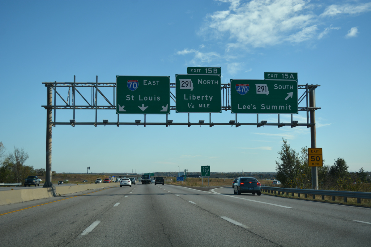
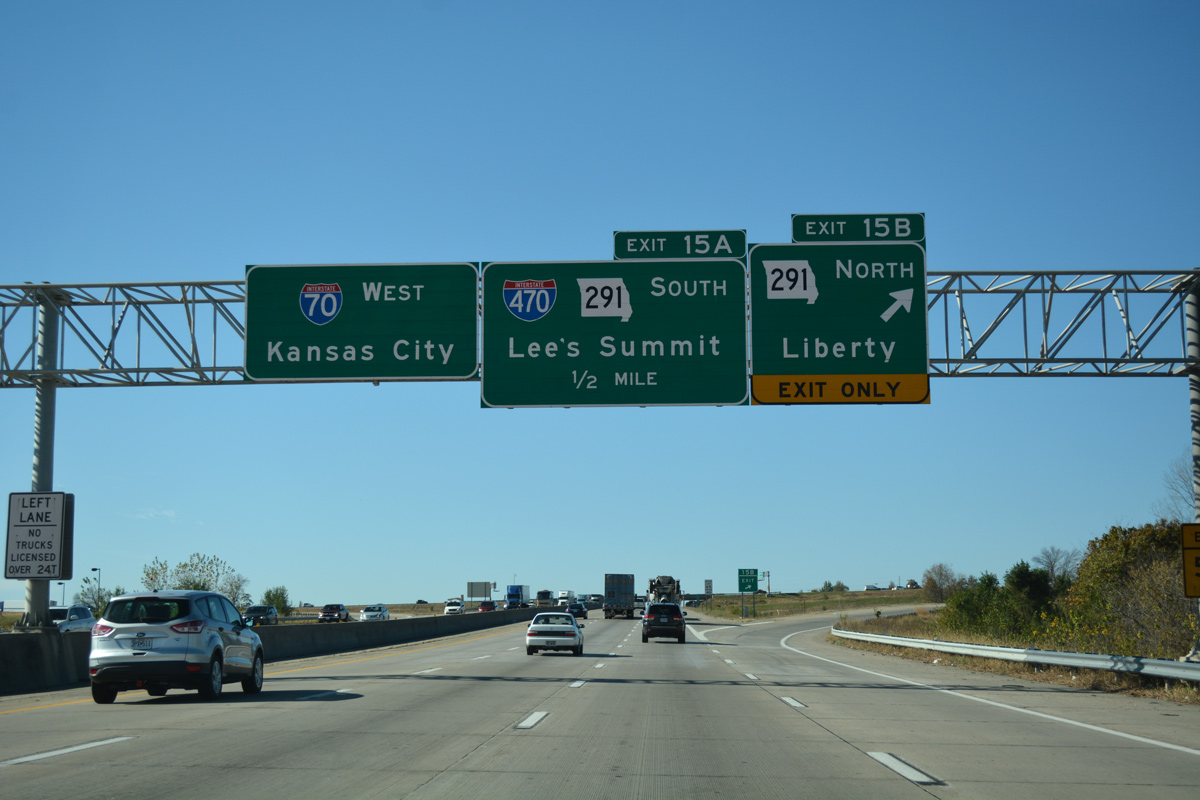
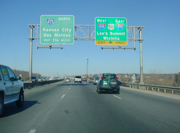
Exit 15 A leaves I-70 east for I-470/Route 291 south to Fleming Park and Lee’s Summit. 11/03/16
North End Throwback
The first indication that Interstate 470 was about to end. This sign was replaced by 2008 to no longer display Junction. 10/17/04
Replaced end sign for Interstate 470 north beyond Exit 16 B to I-70 east. 10/17/04
This sign bridge was replaced during an expansion project to add an auxiliary lane from the Little Blue Parkway entrance ramp to the Route 291 north off-ramp. 10/17/04
West End – south Kansas City, Missouri
![]()
![]() West at
West at ![]()
![]()
![]()
The initial signs on I-470/U.S. 50 west for the Three Trails Crossing Memorial Highway interchange with I-49 and I-435 precedes the exit for Blue Ridge Boulevard to the Fairlane and Hickman Mills South communities. 11/03/16
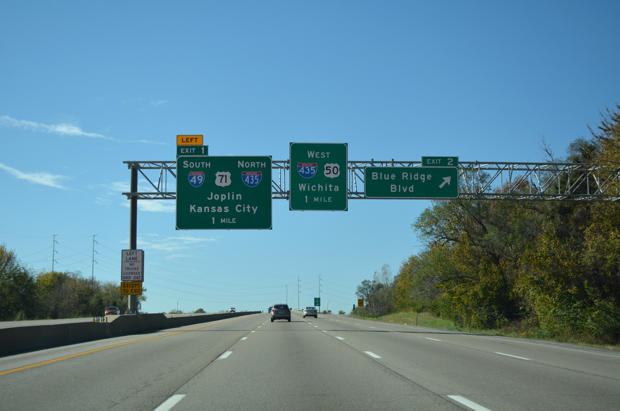
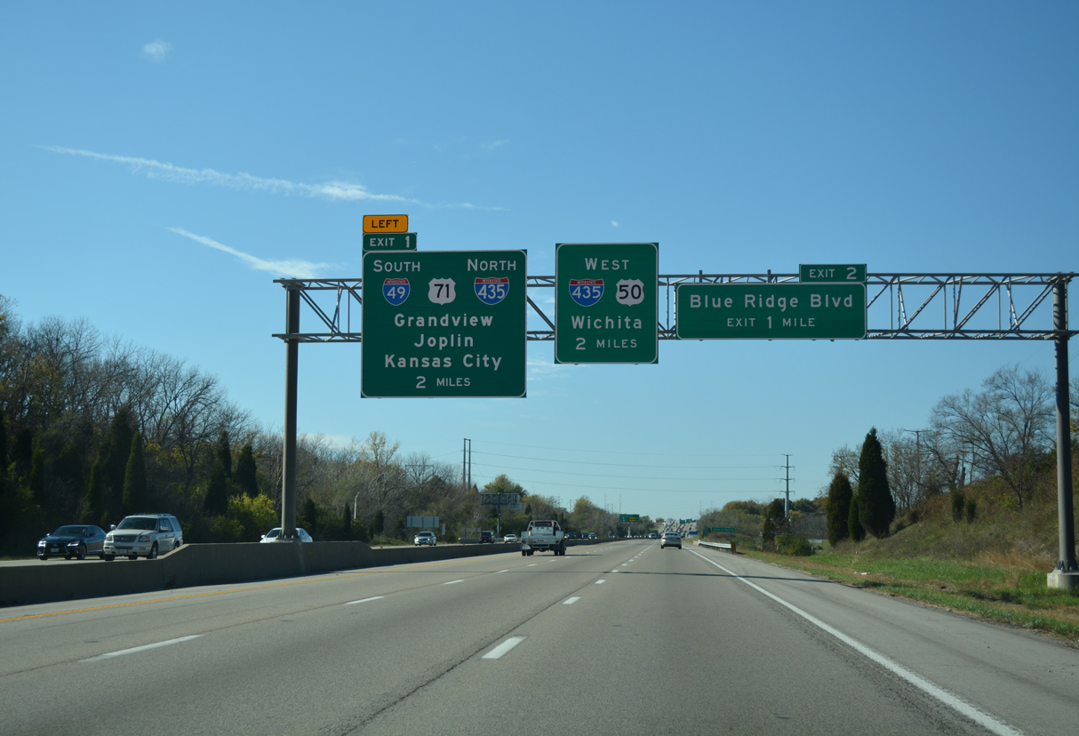
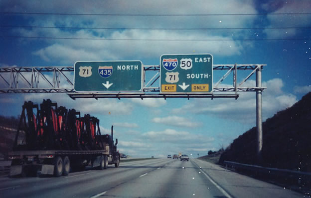
I-470/U.S. 50 proceed west with three lanes to the directional T interchange with I-49 south and U.S. 71 at Exit 1. 11/03/16
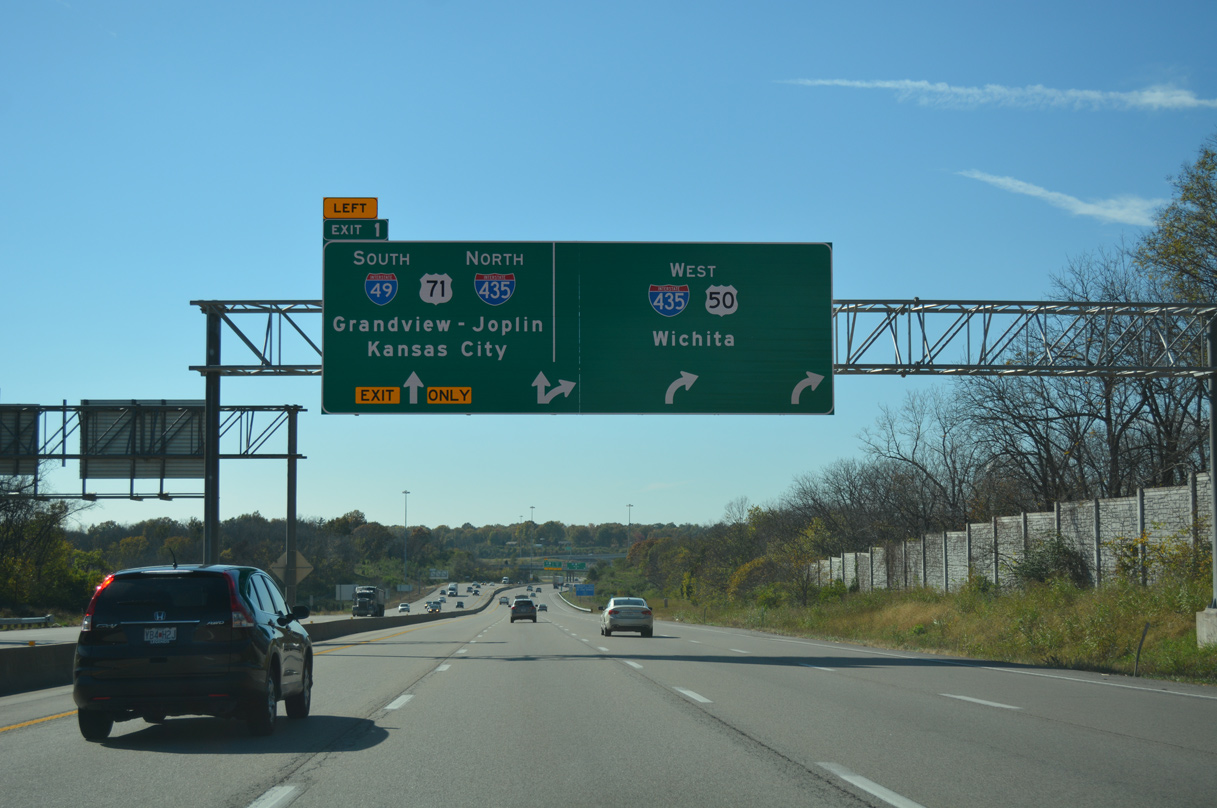
An arrow per lane sign (APL) directs motorists to the left for I-49/U.S. 71 south to Grandview and Joplin and the Kansas City beltway north toward Independence and Claycomo. 11/03/16
The I-470 mainline continues with three lanes directly to I-435/U.S. 50 west for Leawood, Overland Park and Lenexa, Kansas. 11/03/16
![]()
![]() North at
North at ![]()
![]()
![]()
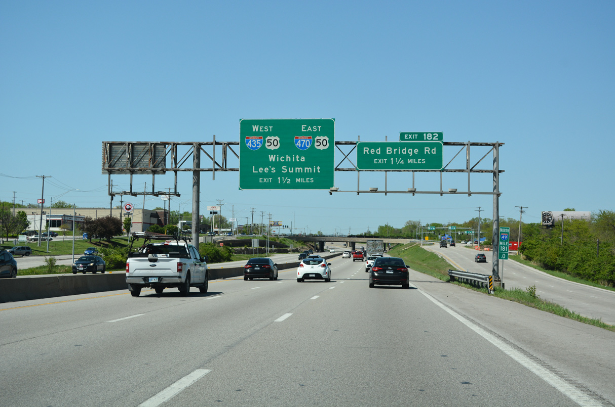
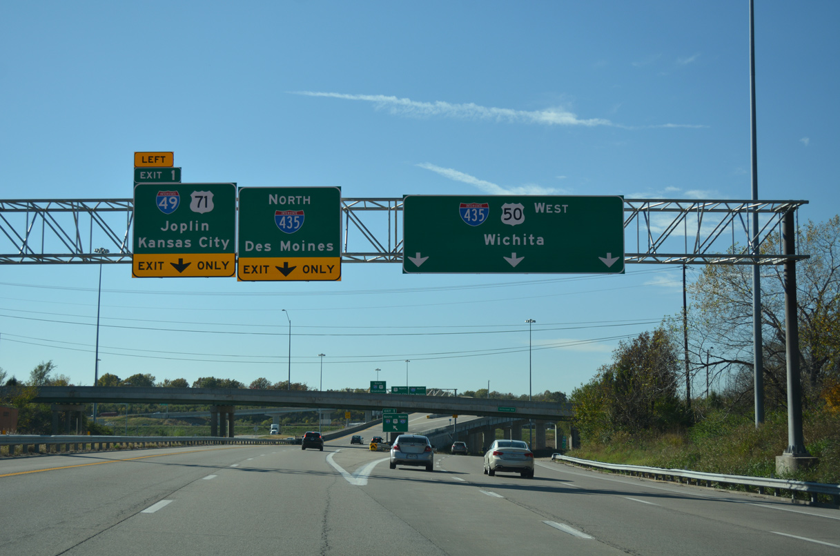
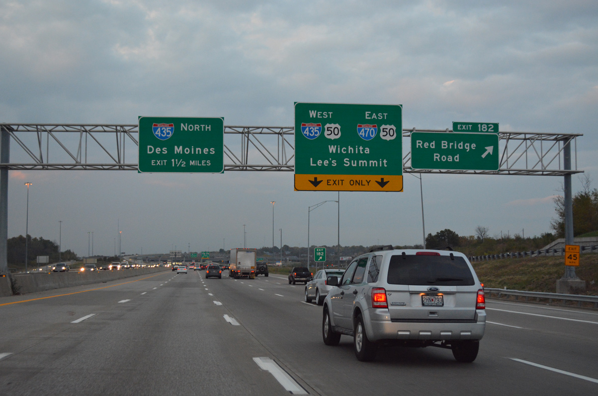
I-49/U.S. 71 cross the Kansas City line beyond the forthcoming overpasses for Blue Ridge Boulevard and the KCS Railroad. Back to back ramps follow for Red Bridge Road (Exit 182) and the Three Trails Crossing Memorial Highway interchange with I-435, I-470 and U.S. 50. 05/07/22
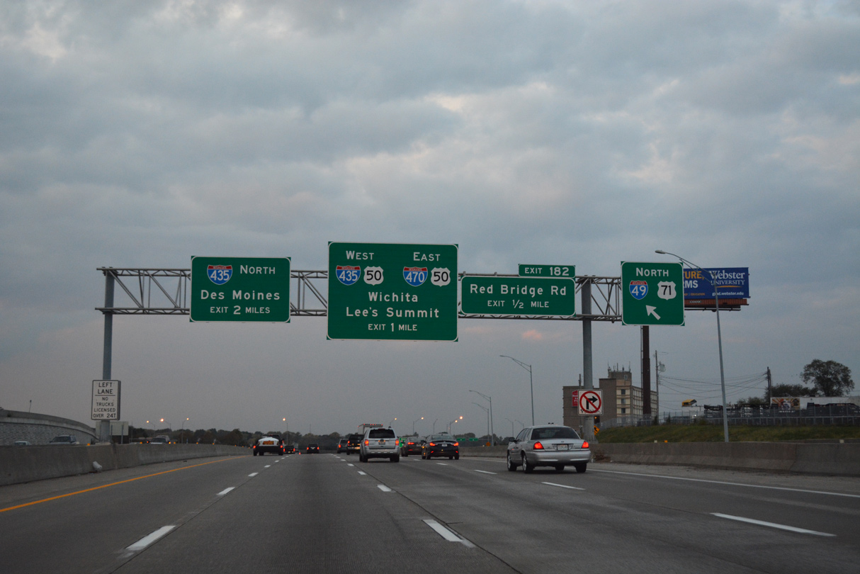
Traffic joins I-49/U.S. 71 north from Blue Ridge Boulevard ahead of the diamond interchange (Exit 182) with Red Bridge Road at the Hickman Mills community of south Kansas City. Two lanes eventually part ways with the freeway north for a distributor roadway to I-470/U.S. 50. This sign bridge was removed by 2021. 11/02/16
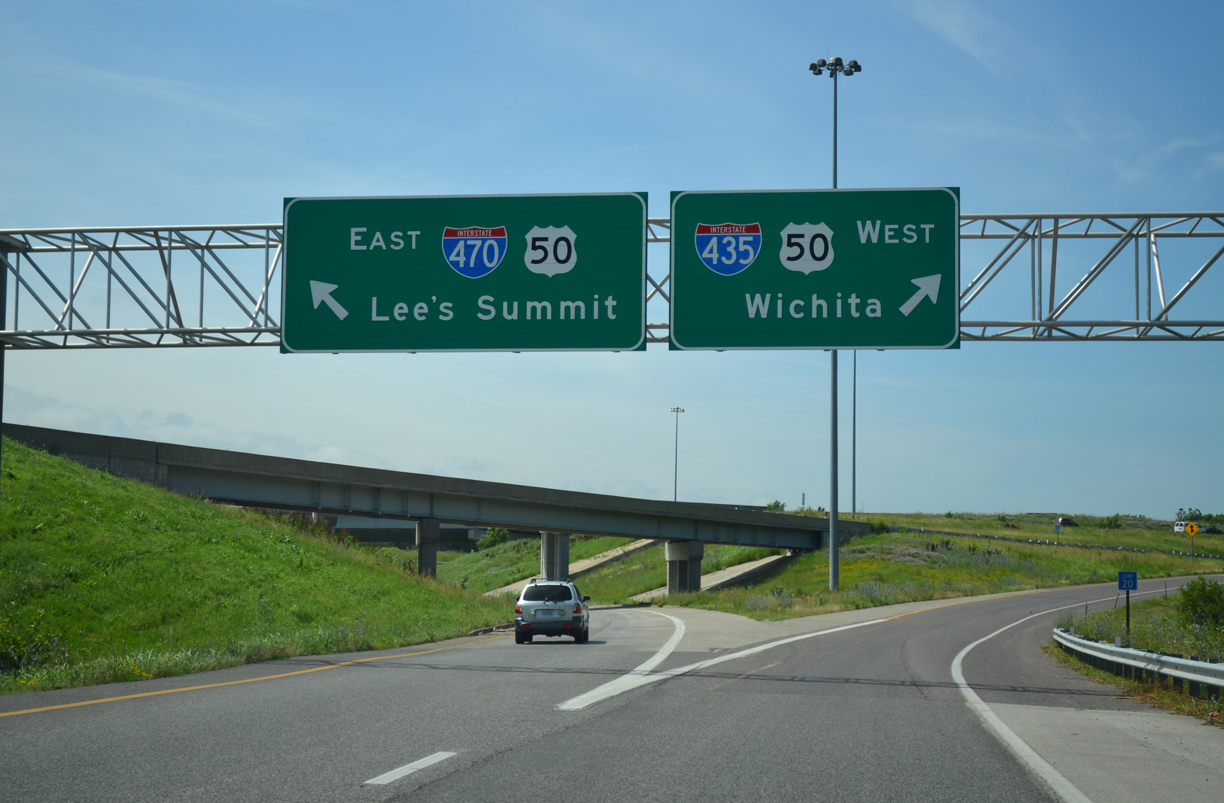
Interstate 470 branches east from the Kansas City beltway (I-435) with U.S. 50 to Longview in Kansas City, and Lee’s Summit. I-470 turns north beyond the split with U.S. 50 to overlap with Route 291 to Independence. 11/02/16
The Three Trails Crossing Memorial interchange upgrade separated traffic to I-470 east and I-435 west onto a distributor roadway. Motorists headed west to Overland Park and Lenexa, Kansas initially join I-470 before it converges with I-435 by the Oakwood area. 05/07/22
![]()
![]() East at
East at ![]()
![]()
![]()

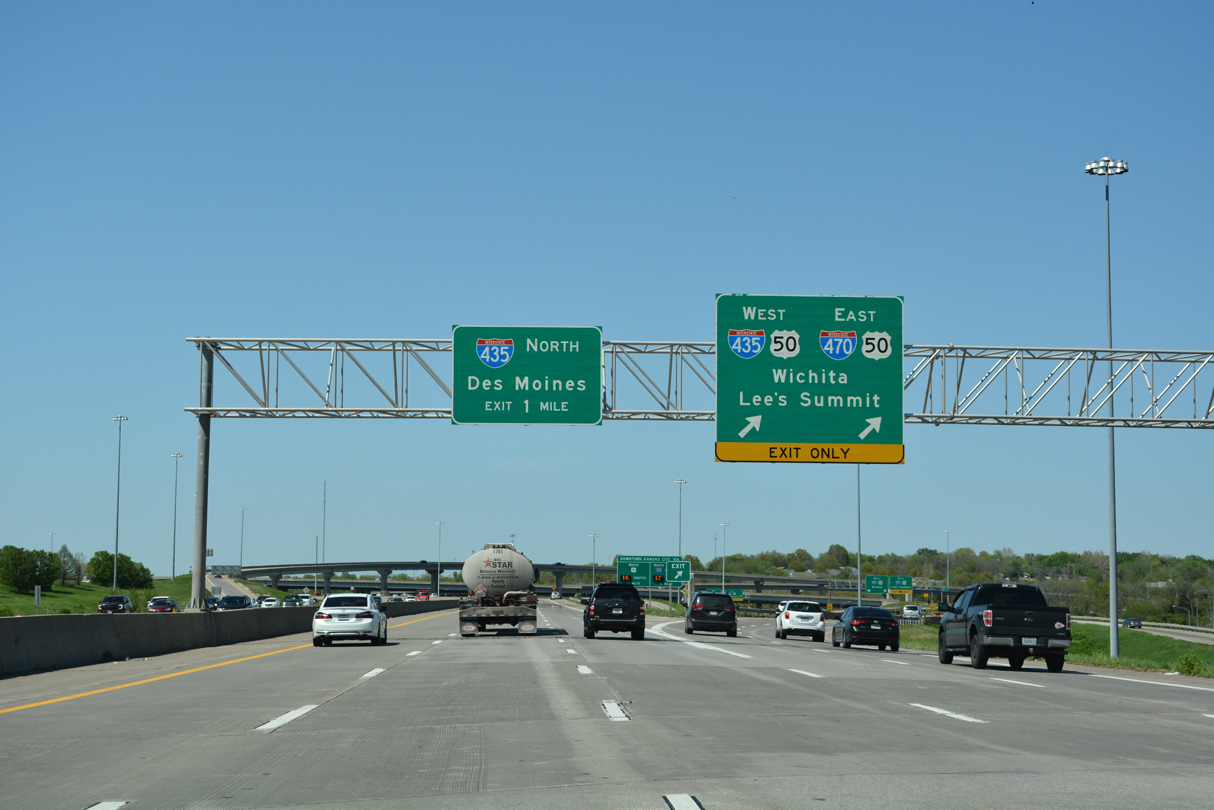
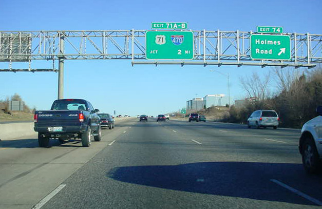
I-435/U.S. 50 travel east with four lanes through the six-ramp parclo interchange (Exit 74) with Holmes Road to cross the Blue River and reach the Three Trails Crossing Memorial Highway junction in 2.5 miles. 11/03/16
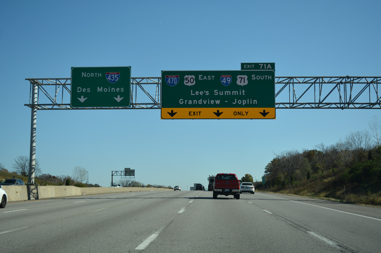
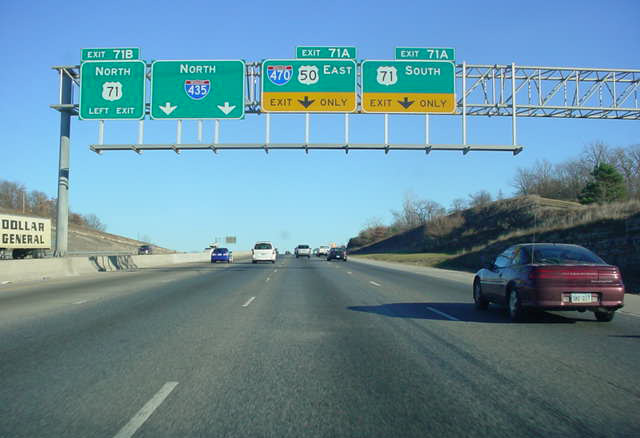
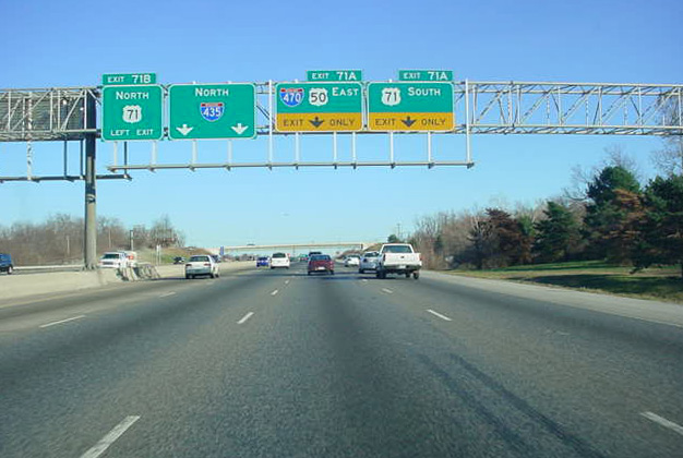
An auxiliary lane accompanies I-435 east to the eastbound beginning of Interstate 470. I-470/U.S. 50 curve southeast from Exit 71 A alongside the beginning of Interstate 49 to provide part of the connection with the freeway south to Hickman Mills, Grandview and Belton. 11/03/16
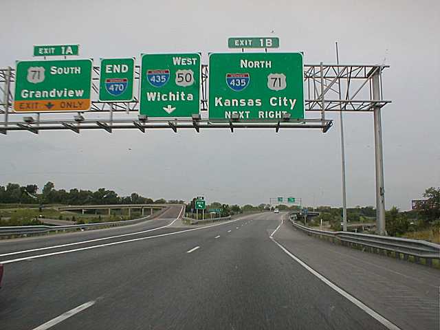
I-435 eastbound expands to six lanes ahead of Left Exit 71 B for U.S. 71 (Bruce R. Watkins Drive) north to Blue Hills and Ivanhoe in Kansas City. Four lanes eventually depart for I-470/U.S. 50 east to Lee’s Summit and I-49/U.S. 71 south to Joplin. 11/03/16
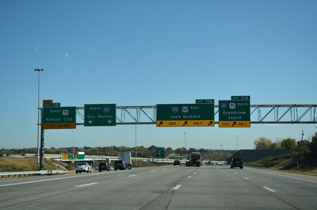
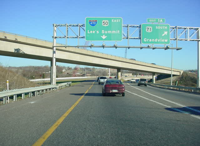
Traffic partitions as Interstate 435 and U.S. 50 east enter a directional T interchange with U.S. 71 (Bruce R. Watkins Drive). I-470/U.S. 50 east overlap for 6.64 miles to Lee’s Summit, where the US highway turns southeast along a freeway to Lake Lotawana. 11/03/16
![]() South at
South at ![]()
![]()
![]()
![]()
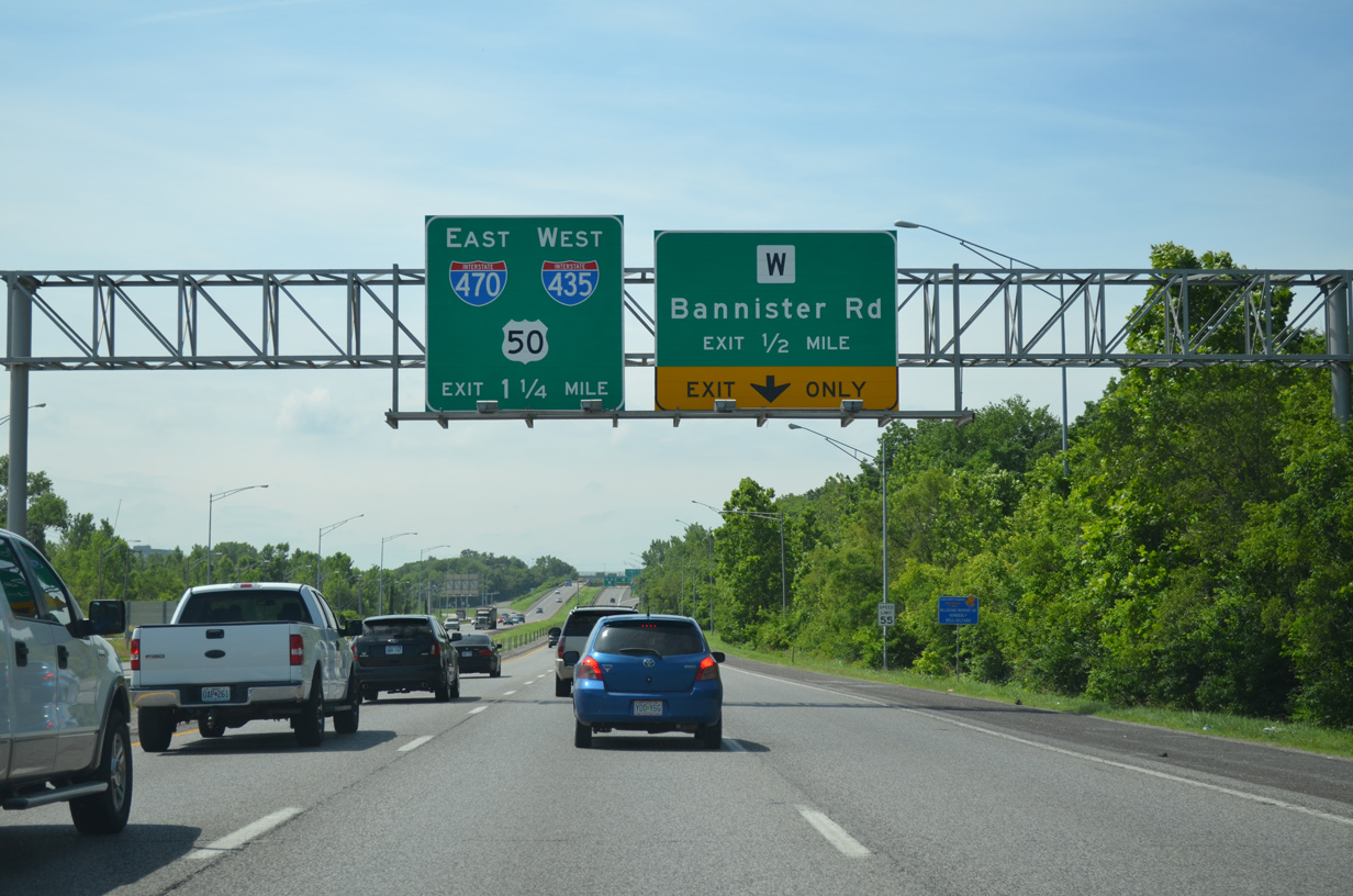
U.S. 71 (Bruce R. Watkins Drive) advances south to the Bannister Road exit for the Hidden Valley community and the ramps for I-435/U.S. 50 east and I-470/U.S. 50 west. 06/19/15
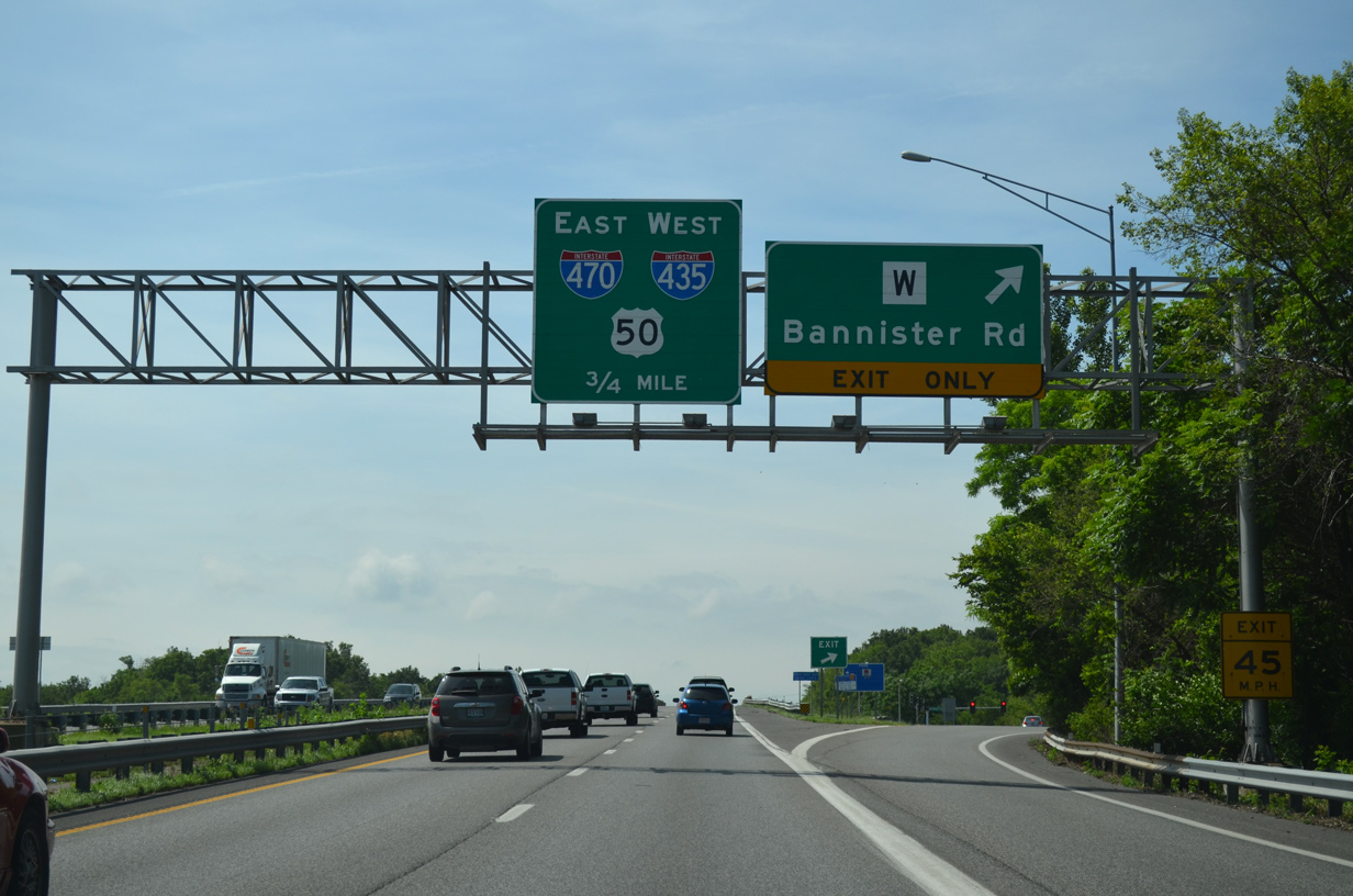
An unnumbered exit departs for Highway W (Bannister Road) as U.S. 71 continues south with two through lanes to the Three Trails Crossing Memorial Highway. Advance signs omit control cities, a facet of the previous sign design. 06/19/15
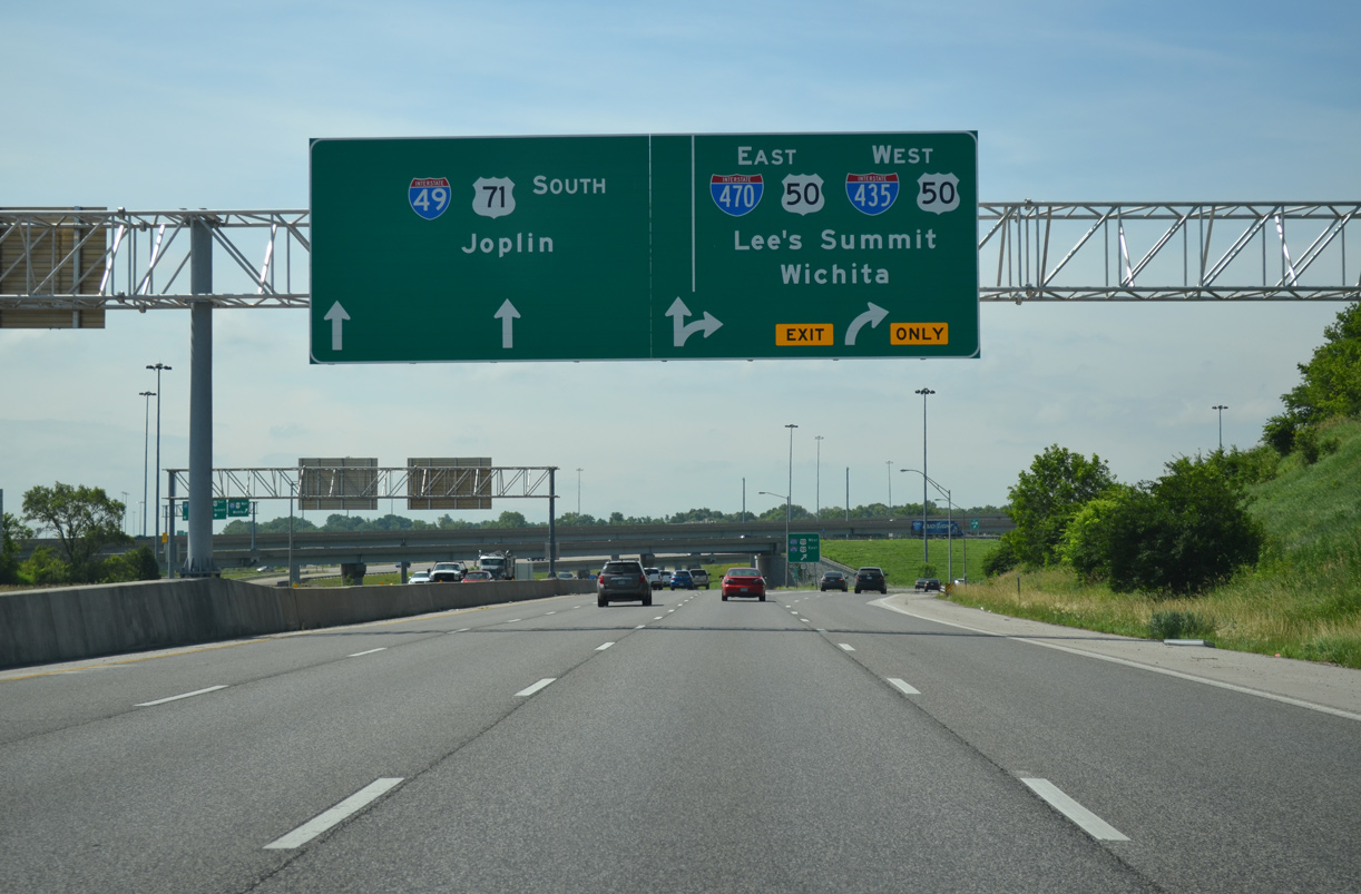
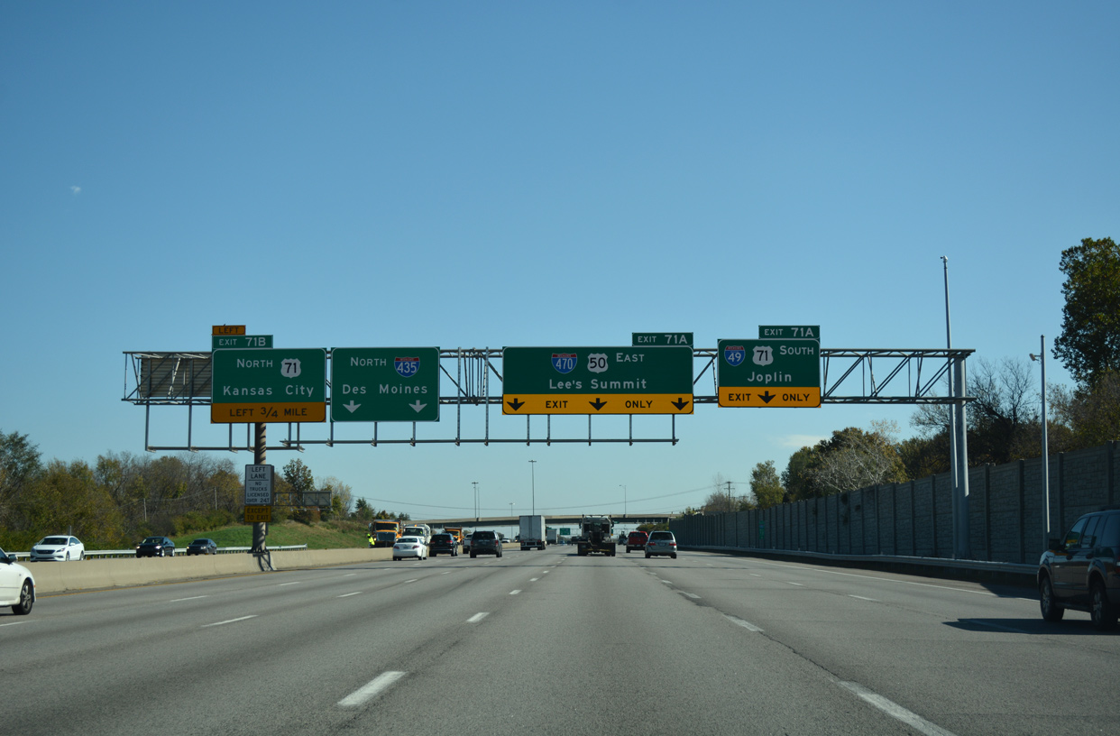
U.S. 71 expands to three through lanes as Interstate 49 begins. The two routes overlap southward 138 miles to I-44. Forthcoming grade level ramps connect with I-435/U.S. 50 west to the Johnson County, Kansas suburbs and I-470/U.S. 50 east toward Sedalia. 06/19/15
The ramps for I-435 west and I-470 east combine with ramps from I-435 south before joining their respective freeway mainlines. Lee’s Summit is an eight mile drive to the east. Wichita, Kansas lies 185 miles to the southwest via the Kansas Turnpike. 06/19/15
![]() South at
South at ![]()
![]()
![]()
![]()


A collector distributor roadway separates from I-435 south at Exit 71 for both I-49/U.S. 71 south to Joplin and I-470/U.S. 50 east to Lee’s Summit. 10/07/21
West End Throwback
An end sign was posted for Interstate 470 west at the original separation of traffic for U.S. 71 south (Exit 1 A) and I-435 north / U.S. 71 north (Exit 1 B). Exit 1 was reassigned to the left side ramp for I-49/U.S. 71 south to Joplin. Photo by Ben Prusia (2002).
The rebuild of the Grandview Triangle Interchange expanded the freeway mainline along U.S. 71 to eight overall lanes and reconfigured the interchanges with Blue Ridge Boulevard, Longview Road and Red Bridge Road to better separate ingress and egress traffic. This view looks at the northbound freeway prior to roadwork. Photo by Eric Stuve (11/30/02).
U.S. 71 continued north from Red Bridge Road with just three lanes to the off-ramp for I-435 west, I-470 east and U.S. 50. This stretch is five lanes wide now. Photo by Eric Stuve (11/30/02).
Northbound travelers reached the original Grandview Triangle Interchange with the Kansas City beltway and I-470 loop to Lee’s Summit. This interchange was notorious for congestion due to left side ramps and weaving traffic. Photo by Eric Stuve (11/30/02).
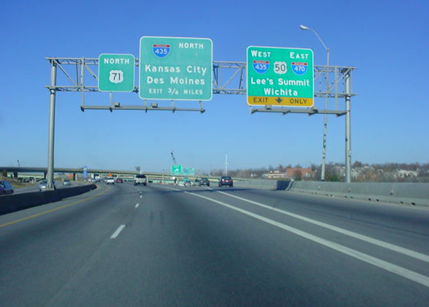
The first sign for the eastbound I-435 split with I-470/U.S. 50 appeared at Exit 74 for Holmes Road and the Linden Hills and Indian Heights communities. Signs were changed here, but the beltway otherwise remains the same today. Photo by Eric Stuve (11/30/02).
Advancing toward the Grandview Triangle Interchange along I-435/U.S. 50 east. This stretch was expanded to six eastbound lanes. Photo by Eric Stuve (11/30/02).
Nondescript signs directed motorists to U.S. 71 north (Exit 71 B), I-470/U.S. 50 east and U.S. 71 south (collectively Exit 71 A) at the Grandview Triangle Interchange. Replacements added control cities by 2007 as the interchange upgrade progressed. Photo by Eric Stuve (11/30/02).
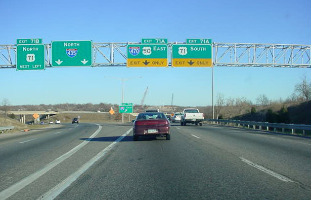
Interstate 435 turned northward from the Grandview Triangle as two lanes departed for I-470/U.S. 50 east. Exit 71 A was reconfigured as I-470 east shifted to a roadway running along the outside of the Three Trails Crossing Memorial Highway interchange to a new high speed flyover above I-49/U.S. 71. Photo by Eric Stuve (11/30/02).
The former configuration of I-470/U.S. 50 east at U.S. 71 south (old Exit 1 A). Three ramps now serve the freeway east to Lee’s Summit while two turn south for both I-49/U.S. 71 south and the exit for Red Bridge Road. Photo by Eric Stuve (11/30/02).
Button copy overheads posted along I-435/U.S. 50 east from when the beltway was just six lanes wide between the Blue River and the Grandview Triangle Interchange. Photo by Michael Summa (1984).
Sources:
- Interstate system route numbering web site
http://www.nwindianahwys.homestead.com/INTER_MAIN.HTML, Stephen Summers. - “I-470 interchange in Lee’s Summit is done.” The Kansas City Star, June 30, 2010.
- “Ceremony to open new interchange at I-470 and Strother Road in Lee’s Summit.” The Kansas City Star, August 19, 2010.
Page updated May 31, 2022.