Interstate 894 – Wisconsin
Overview
Interstate 894 provides a bypass to the southwest of Milwaukee while acting as a commuter route to several major suburbs. I-894 runs concurrent with I-41/43 on the south leg of the Bypass. That portion is known as the Airport Freeway. Cosigned with I-41 and U.S. 45, the western leg of I-894 follows the Zoo Freeway.
Major interchanges in the Milwaukee area are formally named. Those along I-894 include the Zoo Interchange with I-41-U.S. 45 and I-94, named for adjacent Milwaukee County Zoo; the Hale Interchange with I-43 leading southwest from Hale Corners; and the Mitchell Interchange with I-94, derived from nearby General Mitchell International Airport (MKE).
Zoo Interchange Project
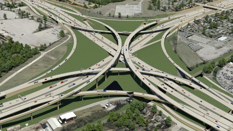
Northeasterly rendering of the final Zoo Interchange design
Starting in 2012, an overhaul at the Zoo Interchange reconfigured the exchange to eliminate left exits in all directions. The centerpiece of the largest transportation project in Wisconsin state history was the construction of a four-level systems interchange at I-41, I-94 and I-894. The $1.7 billion project also rebuilt I-94 west to S 108th Street (Exit 304), I-94 east to S 84th Street (Exit 306), I-41 north to Watertown Plank Road (Exit 40) and I-41/894 south to Greenfield Avenue (Exit 1 D). The associated roadways leading to and from the Zoo Interchange were upgraded to remove weaving traffic patterns.
Photos from the Zoo Interchange Project (I-41/I-94/I-894). The $1.7 billion project to reconstruct Wisconsin's busiest interchange just reached its halfway point.
Posted by AARoads on Tuesday, July 12, 2016
The last of the ramps at the Zoo Interchange opened to traffic in the week following a ribbon cutting ceremony celebrating completion of the Core project on August 27, 2018. Costing $232.6 million, the North Leg of the Zoo Interchange Project reconstructs 1.7 miles of Interstate 41 between N Swan Boulevard and Burleigh Street. The expansion work runs through 2023.5
Route Information
- East End – Milwaukee, WI
North End – Milwaukee, WI
- Mileage – 4.70 (9.92)1
Cities – Milwaukee, West Allis, Greenfield
- Junctions –

Source: December 31, 2021 Interstate Route Log and Finders List
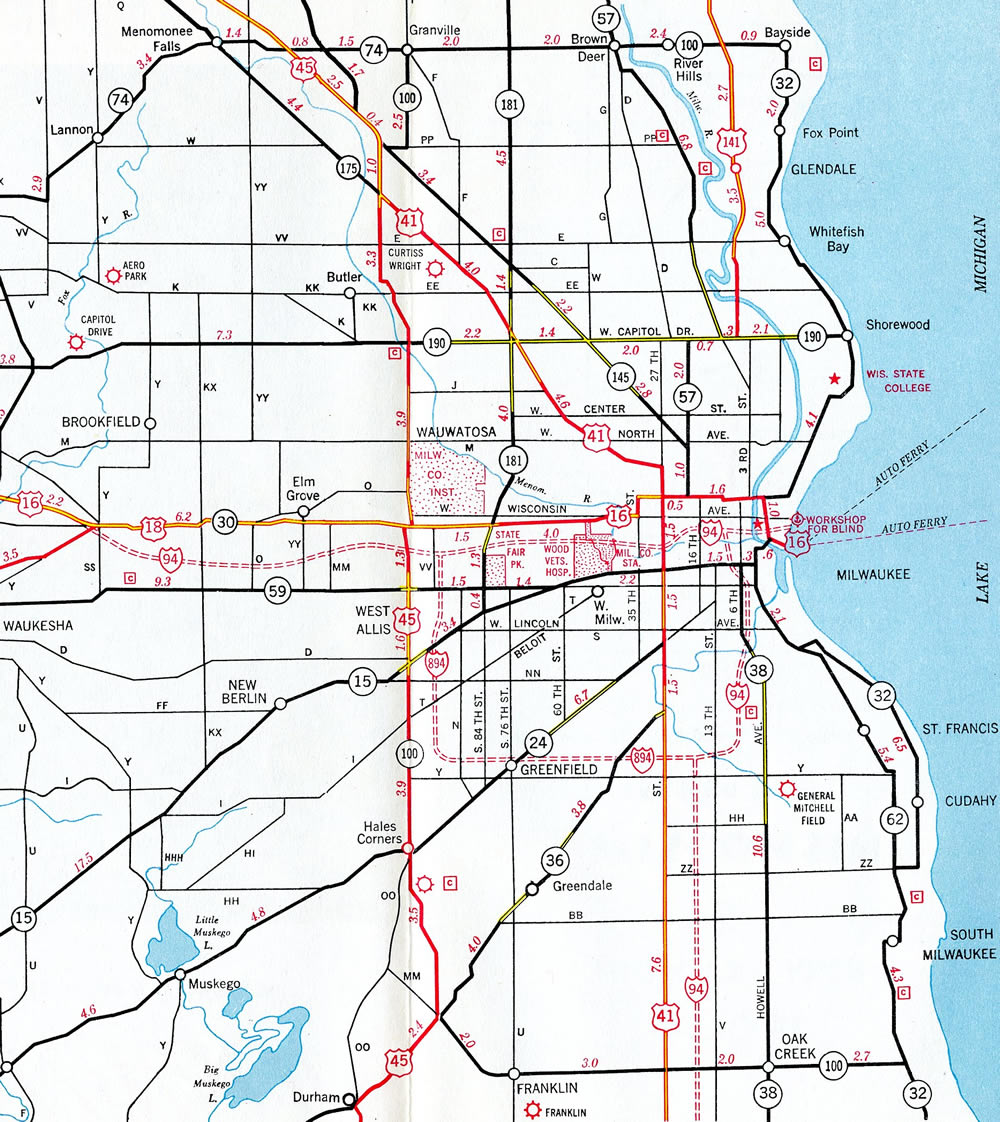
Interstate 894 proposed as a bypass of Milwaukee – 1961 Wisconsin Official Highway Map
The U.S. 45 (I-41 now) portion of the Zoo Freeway north of I-94 was not shown on the 1961 Official Highway Map. The freeway was built northward to North Avenue in conjunction with the initial stretch of I-894 south by 1963.
Original plans took the Stadium Freeway south from National Avenue to Interstate 894 (Airport Freeway). The directional T interchange with I-894 was partially completed and a portion of it later repurposed as bus ramps to the Loomis Road Park & Ride lot. Those ramps were permanently closed in 2011.
The Hale Interchange Maintenance Project involved work on bridges and ramps between November 2014 and Summer 2015. Work included replacement of bridge expansion joints and bridge polymer overlays.4
 History
The Zoo Freeway opened to traffic between County Trunk Highway T (Beloit Road) and Interstate 94 in 1963. The remainder of the freeway south to the Hale Interchange (I-43 / old Wis 15) and east to the Mitchell Interchange (I-94) followed in 1966. Interstate 43 was extended southwest via the freeway along Wis 15 toward Beloit officially on November 24, 1987, with signage erected the following year.1
Escalating construction costs in 2003 associated with the massive rebuild of the Marquette Interchange in Downtown Milwaukee, where I-43, I-94 and I-794 converge, included several cost cutting ideas touted by then major John Norquist. A scaled down interchange revamp developed by city engineers would save $361 million by only moving one of the left exit ramps at the busy Downtown exchange. Coupled with that was a renumbering plan proposed by the mayor that might offset traffic through the junction. The plan included rerouting I-94 over all of Interstate 894, extending I-794 west from the Marquette Interchange to the Zoo Interchange over former I-94, and leaving the North-South Freeway as simply I-43.2 This proposed renumbering was never implemented, and the Marquette Interchange was ultimately rebuilt between 2005 and December 2008.
Major construction redesigned the Mitchell Interchange over the course of four years as part of a $300 million project. The work eliminated left exit ramps along Interstate 94 while reconfiguring the adjacent interchange with S 27th Street (Exit 9) to offset weaving traffic patterns along I-43/894. Project elements included 51 bridges, three tunnels and more than 17 sound walls. A ribbon cutting ceremony marked the end of construction on November 9, 2012, with work completed a month and a half ahead of schedule.3
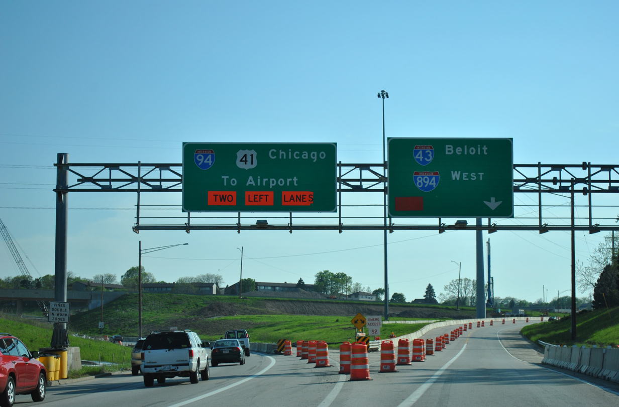
Interstate 41 was approved by the American Association of State Highway and Transportation Officials (AASHTO) on November 15, 2012. Signs for the route were erected starting in May 2015. The designation replaced all of U.S. 41 between Rosecrans, Illinois and Green Bay, Wisconsin. I-41 overlays all of I-894, but there are no plans to decommission the 894 designation due to its role as a through route bypass for I-94. The three way overlap between I-41, I-43 and I-894 along the Airport Freeway results in a “wrong way” overlap where I-41 north travels alongside I-43 south and vice versa.
East End  / Mitchell Interchange – Milwaukee, Wisconsin
![]() South
South ![]() North
North ![]() East at
East at ![]()

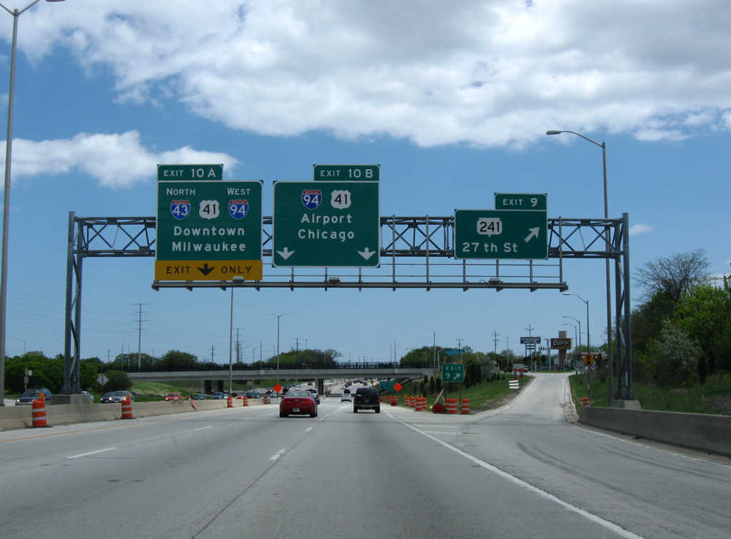
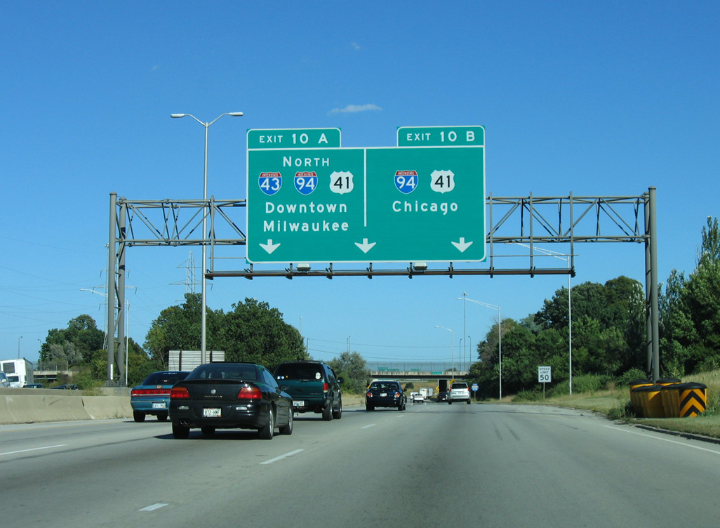
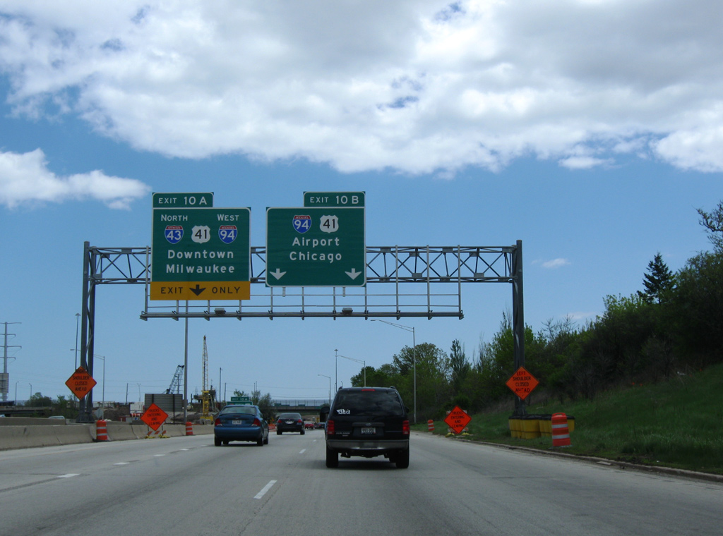
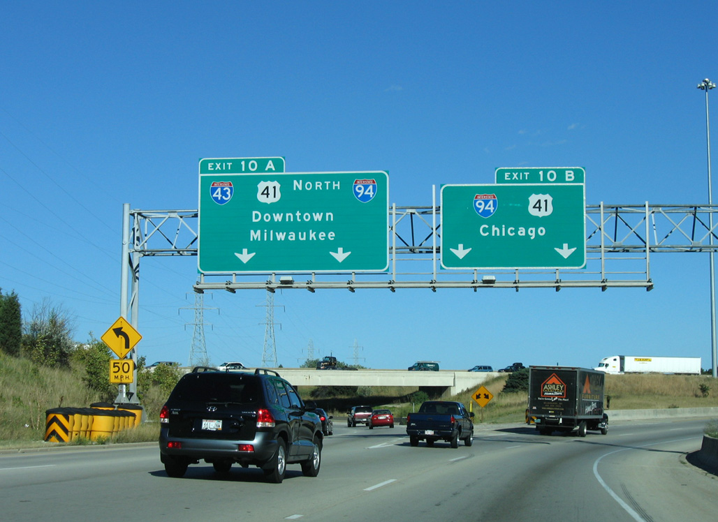
Passing over S 5th Street, the first sign for the upcoming Mitchell Interchange (Exits 10A/B) with Interstate 94 appears along I-41/43/894 eastbound. Photo by Peter Johnson (05/12/20).

Continuing east from the parclo interchange with Wis 36 (Loomis Road), I-41/43/894 pass through the partially built interchange for the Stadium Freeway on the one mile approach to Interstate 94. Photo by Peter Johnson (07/05/16).

The six-ramp parclo interchange (Exit 9) with Wis 241 (27th Street) was redesigned as part of the Mitchell Interchange project. The adjacent entrance ramp joins the northbound ramp taking I-43 onto I-94 west while the mainline defaults I-41 south onto I-94 east to the left. Photo by Peter Johnson (05/12/20).

Four lanes of Interstate 894 pass below Wis 241 (27th Street) and associated ramps with Exit 9. Interstate 41 turns south with three lanes to combine with I-94 en route to Rosecrans, Illinois, just south of the Wisconsin state line. Photo by Peter Johnson (05/12/20).
Signs for Interstate 41 began to appear throughout Wisconsin in May 2015. The route wholly replaced U.S. 41, including the lengthy overlap with I-94 leading south to the Tri State Tollway in northern Illinois. This was done for continuity purposes. Photo by Peter Johnson (05/12/20).
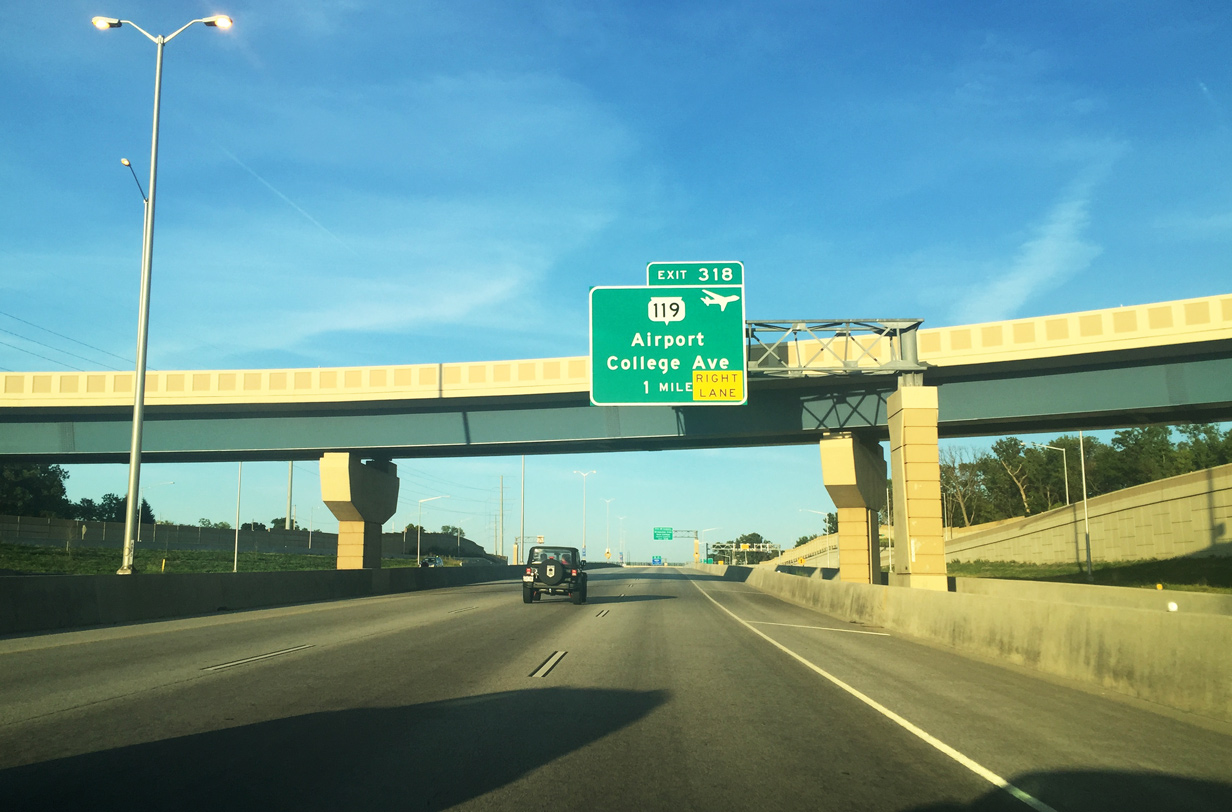
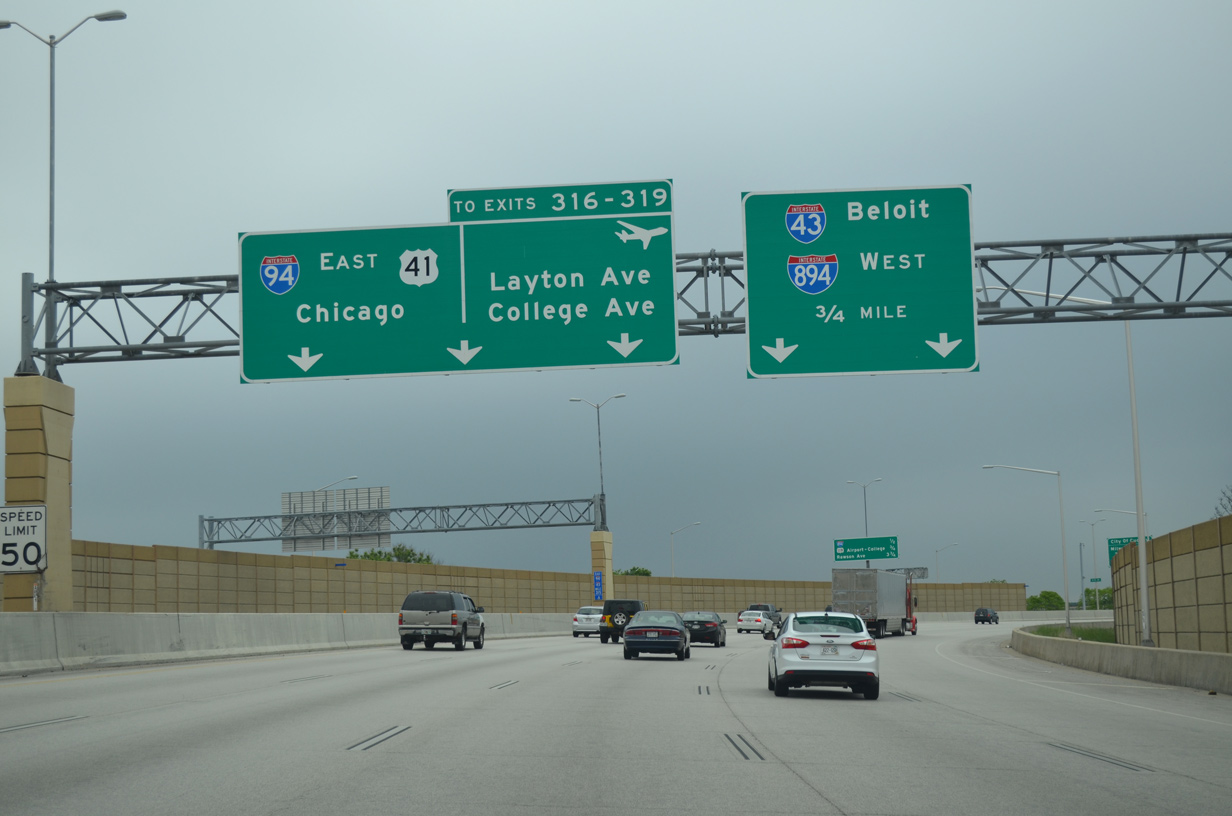
A ramp connecting Wis 241 (27th Street) to I-894 west passes overhead as the mainline advances one mile to Wis 119 east (Exit 318) and College Avenue (Exit 319). Wis 119 is a short freeway joining I-41/94 with General Mitchell International Airport (MKE) while College Avenue runs east to Wis 794 (Pennsylvania Avenue) and west to Wis 36 (Loomis Road) near Glendale. Photo by Peter Johnson (07/05/16).
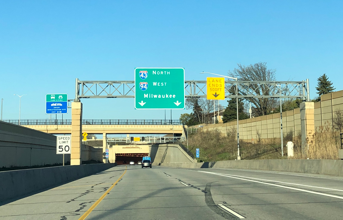
A sweeping two-lane ramp takes Interstate 43 north onto I-94 west for a six mile concurrency to the Marquette Interchange in Downtown Milwaukee. I-43 travels north from Milwaukee to Port Washington, Sheboygan, Manitowoc and ultimately Green Bay. Photo by Peter Johnson (05/12/20).

The continuation of I-43 north onto Interstate 94 west utilizes one of the two Mitchell Interchange tunnels. This ramp replaced a left side merge with I-94 east. Photo by Peter Johnson (05/12/20).
![]() North
North ![]() West at
West at ![]()
![]()

The first sign for the Mitchell Interchange and split of I-41/94 appears within the diamond interchange (Exit 320) at Rawson Avenue. 06/13/15

I-41 north / I-94 west pass through the trumpet interchange (Exit 318) with the Airport Spur (Wis 119) with four overall lanes. Two lanes separate in 0.75 miles for the Milwaukee Bypass (I-894). 06/13/15

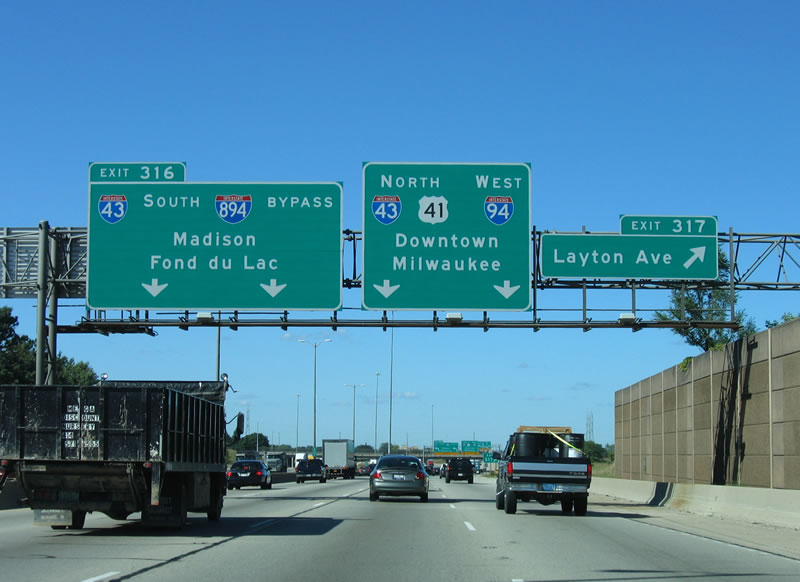
A collector distributor roadway separates I-41 north from I-94 west at Exit 317. The c/d roadway serves Layton Avenue in addition to I-43 south / I-894 west at the Mitchell Interchange. 06/13/15

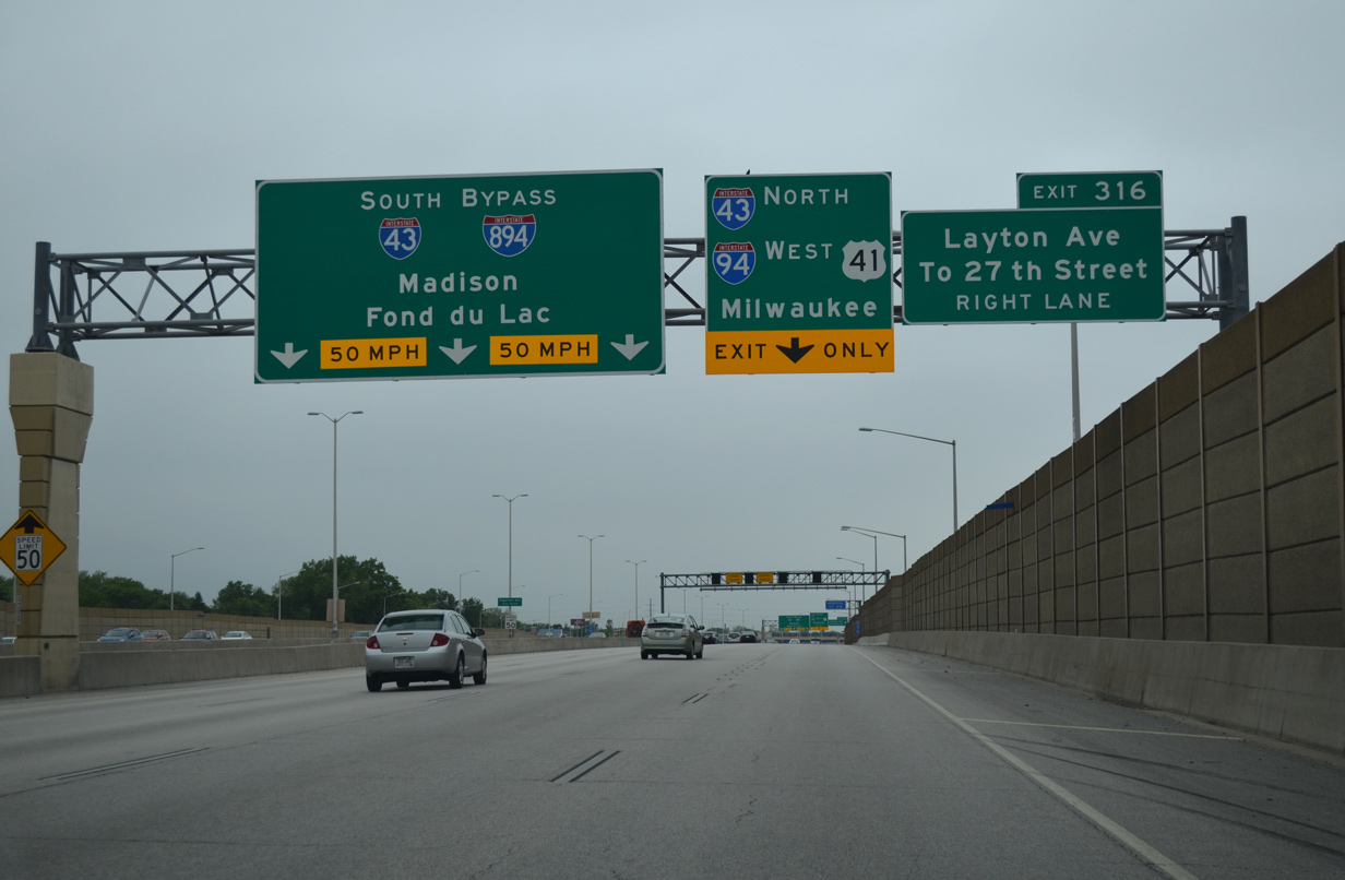
Long distance travelers bound for I-94 west to Madison are directed onto Interstate 894 west to bypass Milwaukee. Fond du Lac was also included for then U.S. 41 north. The control city is more relevant as Interstate 41 overlaps with all of I-894. 06/13/15
The Exit 316 c/d roadway accommodates four overall lanes as it combines with the entrance ramp from Wis 119 (Airport Spur). 06/13/15

The cloverleaf interchange with Layton Avenue was reconfigured into a diamond as part of the Mitchell Interchange project. Another change involved the relocation of the 27th Street off-ramp, which is not accessible for motorists taking I-41 north from I-94 west. Instead they are directed onto Exit 316 for Layton Avenue west to make the connection. 06/13/15
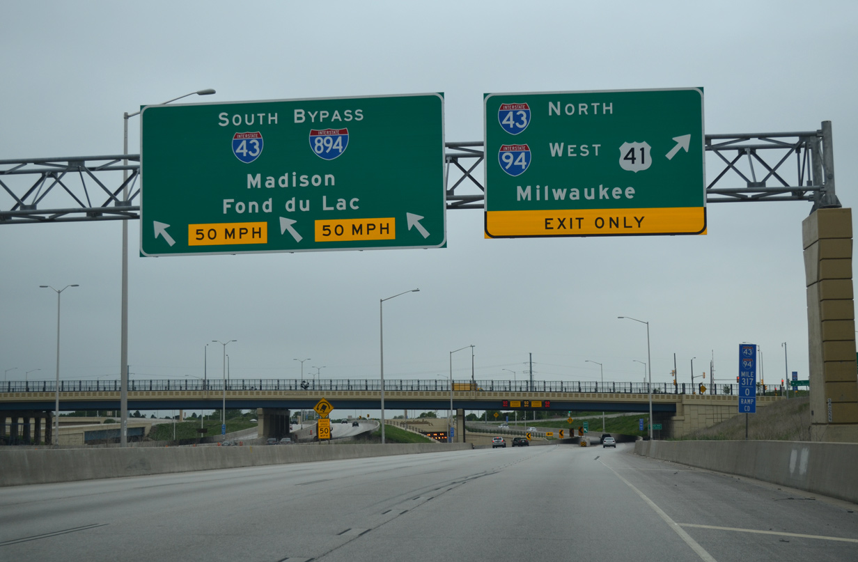
Interstate 41 turns west along a three-lane off-ramp to combine with I-43/894 west along the Airport Freeway. Two lanes continue north from the c/d roadway onto I-43/94 north to Downtown Milwaukee. 06/13/15

A tunnel takes Interstate 41 north below the I-94 mainline but above the I-43 northbound ramp to I-94 west. I-41/43 overlap 4.7 miles west to the Hale Interchange. 06/13/15
![]() South
South ![]() East at
East at ![]()
![]()

The first sign for the Mitchell Interchange and split of Interstate 43 south from I-94 east stands within the parclo interchange (Exit 314B) at Howard Avenue. 06/13/15

I-43/94 curve westward over S 6th Street on the one mile approach to succeeding ramp departures at the Mitchell Interchange. 06/13/15
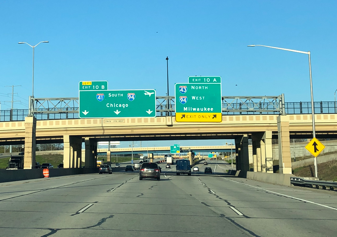
Two lanes part ways with Interstate 94 east for the continuation of I-43 south onto I-41/894 west. I-41 south joins I-94 east for 32 miles to the Illinois state line. 06/13/15

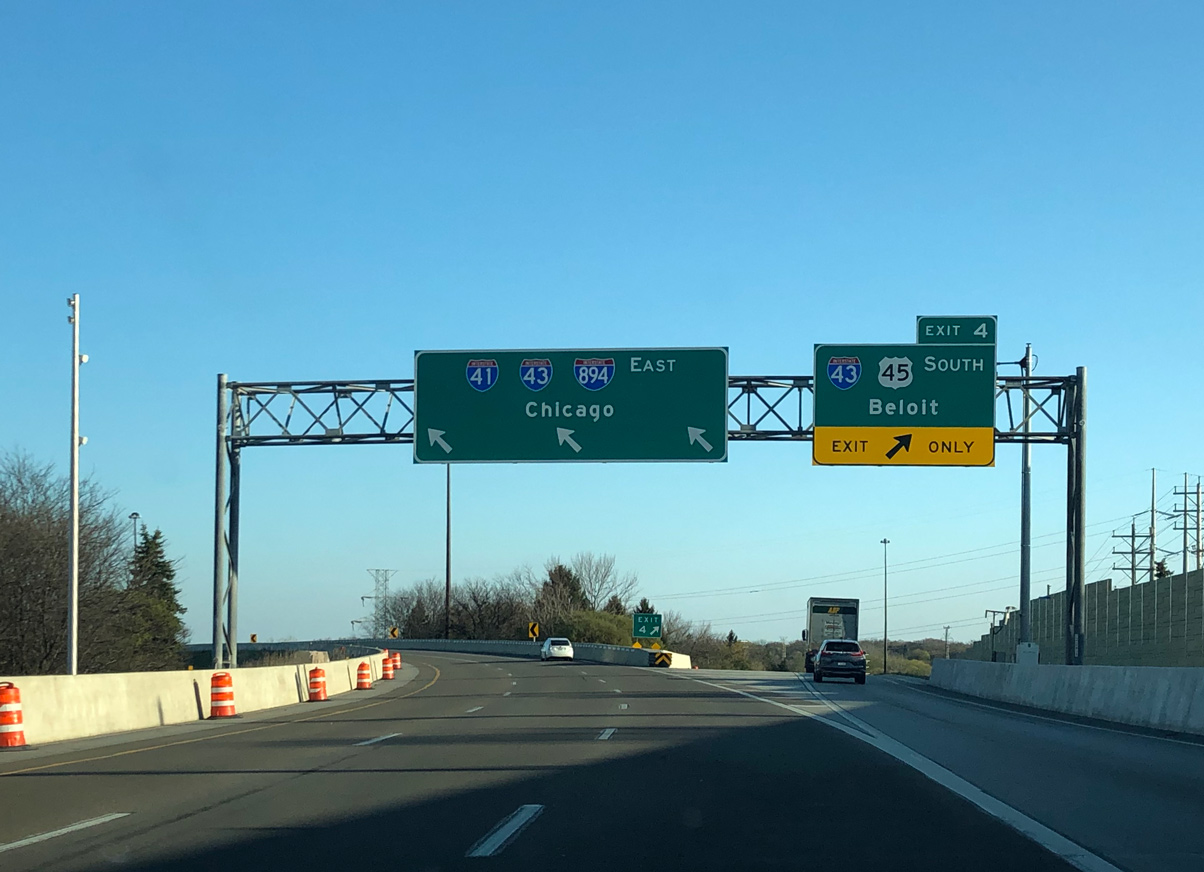
A viaduct takes I-43/94 across S 13th Street, a culverted creek and an adjacent railroad line. The unnumbered ramp for I-41/43/894 departs from the elevated roadway for Greenfield, West Allis and Beloit. 06/13/15

Interstate 43 south combines with I-41 north / I-894 west to the Hale Interchange while a two-lane c/d roadway branches away from the I-94 mainline for Layton Avenue, Wis 119 (Airport Spur) and College Avenue. 06/13/15
 East End Throwback
![]() North
North ![]() East at
East at ![]()
![]()

The initial sign for the Mitchell Interchange previously appeared within the scuttled Stadium Interchange along I-43 north / I-894 east. The departure point of Exits 10A/B was moved further west to the Wis 241 (27th Street) overpass during 2009-12 construction. 09/02/05
Originally two lanes took I-43 north onto I-94/U.S. 41 north to Downtown Milwaukee while two lanes carried motorists onto I-94/U.S. 41 south toward Chicago, Illinois.
This scene changed dramatically with expansion of the Airport Freeway to eight overall lanes and the revision of Exit 9 into a directional interchange. 09/02/05
The diagrammatic sign posted at Exit 9 was replaced by separate panels for Exits 10A/B. 05/09/10
The roadways of I-43/894 separated ahead of the S 20th Street overpass for the directional T interchange with I-94/U.S. 41. 09/02/05
Additional sign changes were made during early stages of the Mitchell Interchange construction for I-43 north / I-894 east ahead of I-94/U.S. 41. 05/09/10

Like Interstate 794, I-894 was also signed with an end shield. Four sets of roadways pass under 20th Street in this scene now. 09/02/05
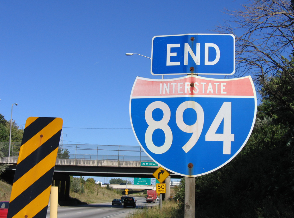
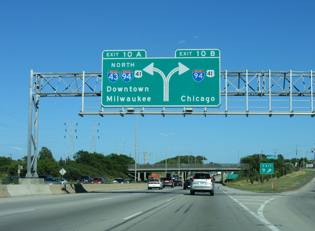
Interstate 894 conclude at the separation of Exits 10A/B for I-43/94 north to Downtown and I-94 east to Oak Creek, Caledonia and Chicago. U.S. 41 previously overlapped with I-94 northward to Exit 308, but was relocated to overlap with I-894 following the signing of Interstate 41 in 2015. 09/02/05
![]()
![]() North at
North at ![]()
![]()

The left exit ramp for I-43 south / I-894 west departed from I-94 west / U.S. 41 north two miles beyond the diamond interchange (Exit 319) with College Avenue. 09/02/05

I-94/U.S. 41 north progressed beyond the trumpet interchange with the Airport Spur (Wis 119) one mile to the Mitchell Interchange. C/d roadways run north from Wis 119 to the I-94 viaduct above S 13th Street now. 09/02/05

Two lanes were allocated for both the continuation of the North-South Freeway and for the Airport Freeway west. Today two remain for I-94 west while three depart for I-41/43/894 west. 09/02/05
The original Layton Avenue interchange included a single lane c/d roadway servicing dual ramps to the arterial. Movements between Layton Avenue and the adjacent Mitchell Interchange were combined into a single system of c/d roadways. 09/02/05

Geared to helping through traffic avoid Downtown Milwaukee, control cities for I-43/894 west at Exit 316 referenced Madison for I-94 west and Fond du Lac, located at the southern end of Lake Winnebago, for U.S. 41/45 north. 09/02/05

Speed limits reduced to 50 miles per hour as I-94/U.S. 41 north entered the three wye interchange with I-43/894. Painted chevrons lined the two left lanes for Exit 316 to Greenfield and West Allis while the former c/d roadway for Exit 317 returned at a ramp meter to the right. 09/02/05
![]()
![]() South
South ![]() East at
East at ![]()

I-43/94 originally carried just six lanes on the curve preceding the Mitchell Interchange. Five southbound lanes travel here now. Photo by Chris Lokken and Mike Saldivar (08/13/06).

Passing over 15th Street, I-43/94 split with two lanes remaining south along the North South Freeway and two joining the Airport Freeway west. Photo by Chris Lokken and Mike Saldivar (08/13/06).
Entering the Mitchell Interchange midway during construction to modernize the three wye exchange. 05/30/11
North End – Milwaukee, Wisconsin
![]()
![]() North
North ![]() West at
West at ![]()
I-41 north / I-894 west reach the Zoo Interchange with Interstate 94 just 0.75 miles north of the Greenfield Avenue (Wis 59) exit. Photo by Peter Johnson (05/12/20).

The flyover (Exit 1B) for I-94 west to Brookfield, New Berlin and Waukesha opened in late 2015. Photo by Peter Johnson (05/12/20).

Interstate 894 ends as I-41/U.S. 45 continue beyond Exit 1A for I-94 east toward Menomonee Falls, Germantown, West Bend and Fond du Lac. Photo by Peter Johnson (05/12/20).

I-41 and U.S. 45 intermingle to Oshkosh, where U.S. 45 branches westward toward Michigan while I-41 remains eastward to Appleton and Green Bay. Photo by Peter Johnson (05/12/20).
![]() East at
East at ![]()
![]()
![]()

Two miles west of the Zoo Interchange along Interstate 94 (East West Freeway) after the Elm Grove Road overpass. Photo by Peter Johnson (05/12/20).
Wis 100 connects I-94 with the adjacent Milwaukee County Zoo at Exit 304. The State Trunk Highway constitutes an arterial beltway encircling Milwaukee on a 270 degree loop. It merges with the Zoo Freeway on the northwest side, entering Waukesha County at Menomonee Falls. Photo by Peter Johnson (05/12/20).

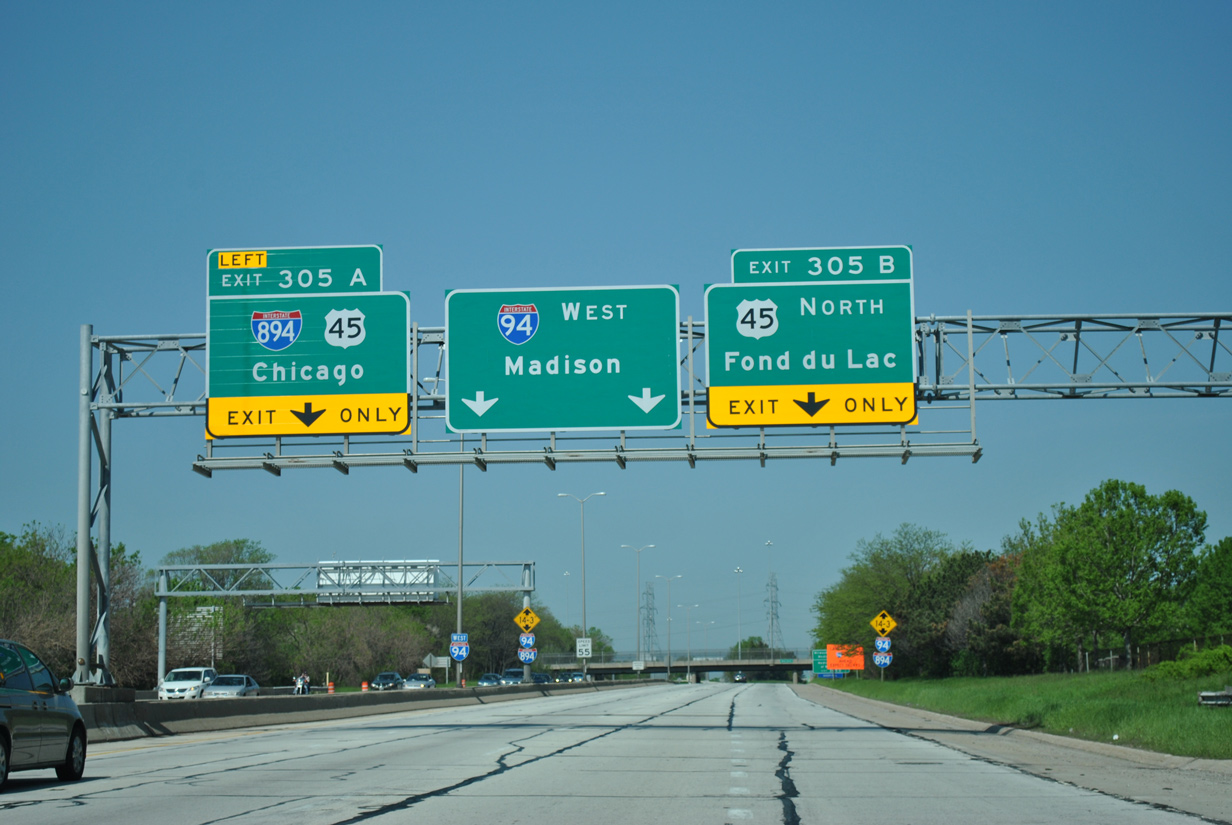
Exit 305A joins I-94 east with I-41-894/U.S. 45 south to West Allis, Greenfield and Hales Corners. U.S. 45 south splits with I-894 in four miles at the Hale Interchange. There I-43 merges with I-41/894 east along the Airport Freeway. Photo by Peter Johnson (05/12/20).

Two lanes separate from I-94 east beyond the off-ramp to Wis 100 for I-41/U.S. 45 south and I-894 east to General Mitchell International Airport (MKE) and Chicago, Illinois and I-41/U.S. 45 north to Wauwatosa, northwest Milwaukee, Menomonee Falls and Germantown. Photo by Peter Johnson (05/12/20).

Interstate 41 runs north from Milwaukee to Fond Du Lac, Oshkosh, Appleton and Green Bay. U.S. 45 overlaps with I-41 for 21 miles before separating to the east toward West Bend. Photo by Peter Johnson (05/12/20).
![]()
![]() South at
South at ![]()
![]()

Exit 40 with Watertown Plank Road was greatly expanded to include directional and loop ramps to I-41/U.S. 45 by late 2014. The freeway proceeds south from there directly to the Zoo Interchange with I-94 and I-894 east. Photo by Peter Johnson (05/12/20).

Construction associated with the Zoo Interchange project straightened out the I-41/U.S. 45 approach to Exits 38B/A with Interstate 94 (East West Freeway). Photo by Peter Johnson (05/12/20).
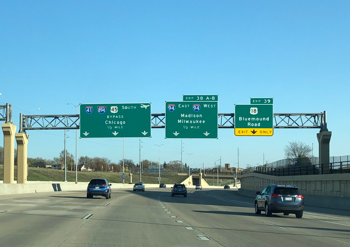
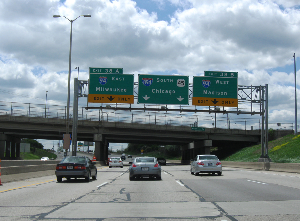
Left Exit 38A for Interstate 94 east to Downtown Milwaukee was replaced by a flyover ramp from the right. A new diamond interchange and overpass for U.S. 18 (Bluemound Road) at Exit 39 was also constructed. Photo by Peter Johnson (05/12/20).

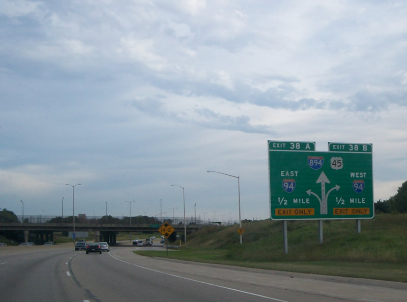
Traffic to both Interstate 94 eastbound for Miller Park and Downtown Milwaukee and west towards Waukesha and Madison departs from I-41 south in unison at Exits 38A/B. Photo by Peter Johnson (05/12/20).

Interstate 894 begins as Exit 38 separates for I-94. I-41/U.S. 45 remain south along the Zoo Freeway to the Hale Interchange with Interstate 43 (Rock Freeway). Photo by Peter Johnson (05/12/20).
North End Throwback
![]() West
West ![]() North at
North at ![]()

Expansion of the Zoo Freeway leading toward I-94 added two lanes per direction for ten total. Associated work converted Exit 1D with Wis 59 from a parclo to a diamond interchange. 06/13/15

Left Exit 1B for Interstate 94 westbound at the Zoo Interchange closed permanently in early 2015. 06/13/15

I-94/894 kink eastward to pass over Schlinger Avenue ahead of Interstate 94. All traffic now departs in unison to the right for I-94 west to Madison and east to Downtown Milwaukee. 06/13/15
![]() West at
West at ![]()
![]()
![]()

Two miles ahead of the Zoo Interchange with I-41 and I-894 east on Interstate 94 west at the split diamond interchange (Exit 307A) with 68th and 70th Streets. 05/30/11

This diagrammatic sign outlined the back to back ramps (Exits 305B/A) with the Zoo Freeway along I-94 west. Located at Exit 306 for Wis 181, this assembly was removed during the Zoo Interchange road work by 2015. 05/30/11
The next sign bridge on westbound Interstate 94 further delineated the lane assignments for the three routes. This stretch of freeway expands to five westbound lanes with an addition of a single lane distributor roadway from Wis 181. 05/30/11

I-41 south combines with I-894 east to the Hale Interchange, where I-43 north joins along the Airport Freeway leading east back into Milwaukee. Signs were updated in Summer 2015 to reflect the changeover of U.S. 41 to I-41 between Pleasant Prairie at the Illinois state line, and the north end of I-43 at Green Bay. 05/30/11
Left Exit 304A to I-894 east / U.S. 45 south closed permanently in 2015. This ramp was replaced with a flyover departing from the right side of eastbound I-94 opened by late 2017. 06/13/15
![]() East at
East at ![]()
![]()
![]()

These style of signs, which were erected by 2004, were posted on every major freeway-to-freeway interchange in the Milwaukee area. Photo by Chris Lokken and Mike Saldivar (08/13/06).

This diagrammatic sign appeared along Interstate 94 eastbound at the gore point for Exit 304 to Wis 100. 05/30/11


Separate ramps departed for I-894 east and U.S. 45 south from the right and to U.S. 45 north from the left at the original Zoo Interchange. 09/02/05, 05/30/11

The former left exit ramp for U.S. 45 north to Fond du Lac. Beyond the split with U.S. 41, U.S. 45 also serves Fond Du Lac and Oshkosh, but on a more local level. Photo by Chris Lokken and Mike Saldivar (08/13/06).
![]() South at
South at ![]()
![]()

Traveling through the original diamond interchange with Watertown Plank Road on U.S. 45 south, one mile ahead of the Zoo Interchange. Construction finished in late 2014 rebuilt this exchange. Photo by Chris Lokken and Mike Saldivar (08/13/06).
This diagrammatic sign was posted just north of the Wisconsin Avenue overpass along U.S. 45 southbound. Ramps once joined both Wisconsin Avenue and parallel U.S. 18 (Bluemound Road) here. Photo by Chris Lokken and Mike Saldivar (08/13/06).
A pair of lane drops occurred just south of the original U.S. 18 (Bluemound Road) overpasses along U.S. 45 south at the Zoo Interchange. 05/09/10

Entering the Zoo Interchange south of the new diamond interchange and overpass for U.S. 18 (Bluemound Road). 06/13/15

U.S. 45 south at Exit 38B to I-94 west prior to reconstruction of the Zoo Interchange. Photo by Chris Lokken and Mike Saldivar (08/13/06).
Sources
- Wisconsin Highways: Highways 400 through 894 (Chris Bessert).
- “Norquist freeway plan diverts traffic.” Milwaukee Journal Sentinel, January 23, 2003.
- “Ribbon cutting held for completed Mitchell Interchange project.” Fox6 (Milwaukee), November 9, 2012.
- “Short-term closure: Hale Interchange ramp to WIS 100 to close Monday, July 6th.” Fox6 (Milwaukee), July 2, 2015.
- “Scott Walker declares Zoo Interchange is done, even as years of work remain.” Milwaukee Journal Sentinel (WI), August 28, 2018.
Page updated June 22, 2022.