
Kansas

Sitemap to all pages covering the state of Kansas. Contributions and photography for the Kansas guides from Alex Nitzman, Andy Field, Brent Ivy and Justin Cozart.
Route Categories
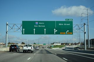
Interstates
9 routes, 2,875 photos
U.S. Highways
11 routes, 1,363 photos
State Highways
11 routes, 783 photos
Other Roads
2 routes, 57 photos
Population
| State Population | |||||
|---|---|---|---|---|---|
| 2,937,880 | |||||
| Metropolitan Populations | |||||
| Kansas City, MO-KS | 2,192,035 | Wichita | 647,610 | ||
| Topeka | 233,152 | Lawrence | 118,053 | ||
| Manhattan | 134,046 | Hutchinson | 61,898 | ||
| Salina | 60,038 | Garden City | 42,453 | ||
| Top County Populations | |||||
| Johnson | 609,863 | Sedgwick | 523,824 | ||
| Shawnee | 178,909 | Wyandotte | 169,245 | ||
| Douglas | 118,785 | Leavenworth | 81,881 | ||
| Riley | 71,959 | Butler | 67,380 | ||
| Top City Populations | |||||
| Wichita | 391,731 | Overland Park | 197,381 | ||
| Kansas City | 152,727 | Olathe | 141,665 | ||
| Topeka | 124,558 | Lawrence | 98,448 | ||
| Shawnee | 66,298 | Lenexa | 56,156 | ||
| Sources: 2020 U.S. Census Data (metro populations and counties), 2020 U.S. Census Estimate (cities) | |||||
About Kansas
- Capital:
 Topeka
 - Nickname: Sunflower State
- State Flower: Sunflower
- State Bird: Western Meadowlark
- State Tree: Flowering Cottonwood
- Total Interstate Mileage: 874.34
- Land Area: 81,759 square miles
- Highest Point: Mount Sunflower 4,039 feet
- Lowest Point: Verdigris River in Montgomery County near Coffeyville, 679 feet
- Number of Counties: 73
- Statehood: 34th state; admitted January 29, 1861
Last updated: Wednesday December 29, 2021