
New Jersey Road & Highway Photo Guides
Sitemap to road and highway photo guides covering the state of New Jersey.
Route Categories
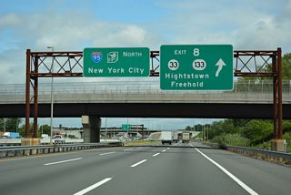
Interstates
11 routes, 2,173 photos
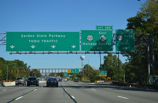
Toll Roads
2 routes, 741 photos
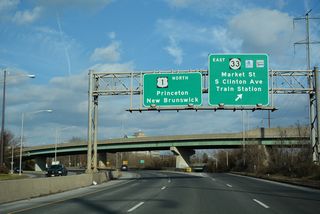
U.S. Highways
7 routes, 425 photos

State Routes
22 routes, 509 photos

Other Roads
1 routes, 10 photos
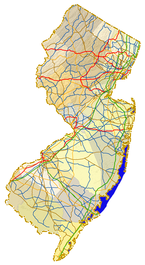
Photo Coverage of Roads and Highways in New Jersey
AARoads documents highways and roads across New Jersey with route-by-route photo guides organized by direction of travel. Coverage includes Interstate Highways, Toll Roads, U.S. Routes and New Jersey State Routes.
Photo guides focus on highway signage, interchanges, route markers, city limit signs, county lines, and notable points of interest along each route. Coverage includes the New Jersey Turnpike, Garden State Parkway and major toll bridges, with photo guides emphasizing closely placed interchanges along North Jersey and Camden area urban freeways.
New and updated photos for New Jersey routes are added periodically and cataloged on the updates page.
City Guides
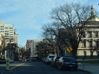
Trenton
5 PhotosPhotographic Contributors
Page and photo contributions by Alex Nitzman, Andy Field, Carter Buchanan, Justin Cozart, Ian Ligget and Matt Guerrino.
About New Jersey
- Capital:
 Trenton
 - Nickname: Garden State
- The six defined regions of New Jersey:
- Skylands
- Gateway
- Shore
- Delaware River
- Greater Atlantic City
- Southern Shore
- State Flower: Purple Violet
- State Bird: Eastern Goldfinch
- State Insect: Honeybee
- State Tree: Northern Red Oak
- Total Interstate Mileage: 431.36
- Land Area: 7,354.22 square miles
- Highest Point: High Point Monument 1,803 feet
- Lowest Point: sea level
- Number of Counties: 21
- Statehood: 3rd state; admitted Dec 18th, 1787.
Last updated: Saturday May 30, 2026