
New York Road & Highway Photo Guides

Sitemap to all road and highway photo guides covering the state of New York.
Route Categories
Interstates
29 routes, 3,761 photos
U.S. Highways
6 routes, 130 photos
State Routes
29 routes, 674 photos
Other Roads
7 routes, 324 photos
Photo Coverage of Roads and Highways in New York
AARoads documents highways and roads across New York with route-by-route photo guides organized by direction of travel. Coverage includes Interstate Highways, U.S. Routes, New York State Routes, Parkways and select named highways.
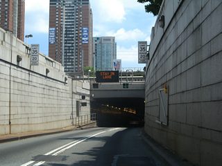
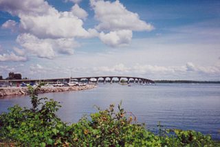
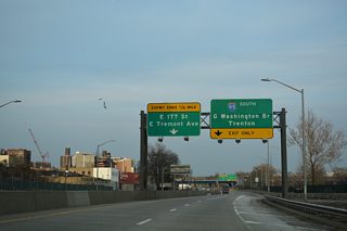
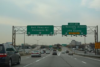
Photo guides focus on highway signage, interchanges, route markers, city limit signs, county lines, and notable points of interest along each route. Coverage includes parkways and limited-access expressways with extensive exit signage. Photo guides also highlight major river crossings and associated approach signage.
New and updated photos for New York routes are added periodically and cataloged on the updates page.
Area Guides
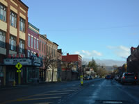
Dansville
12 PhotosPhotographic Contributors
Photography by Alex Nitzman, Andy Field, Brent Ivy, Carter Buchanan, Ian Ligget and Justin Cozart.
About New York
- Capital:
 Albany
 - Nickname: The Empire State
- State Flower: Rose
- State Bird: Eastern Bluebird
- State Tree: Sugar Maple
- Total Interstate Mileage: 1,730.34
- Land Area: 47,126 square miles
- Highest Point: Mount Marcy in Essex County: 5,344 feet
- Lowest Point: Sea level
- Number of Counties: 62
- Statehood: 11th State, July 26, 1788
Last updated: Monday March 30, 2026