
Cheyenne, WY
Overview
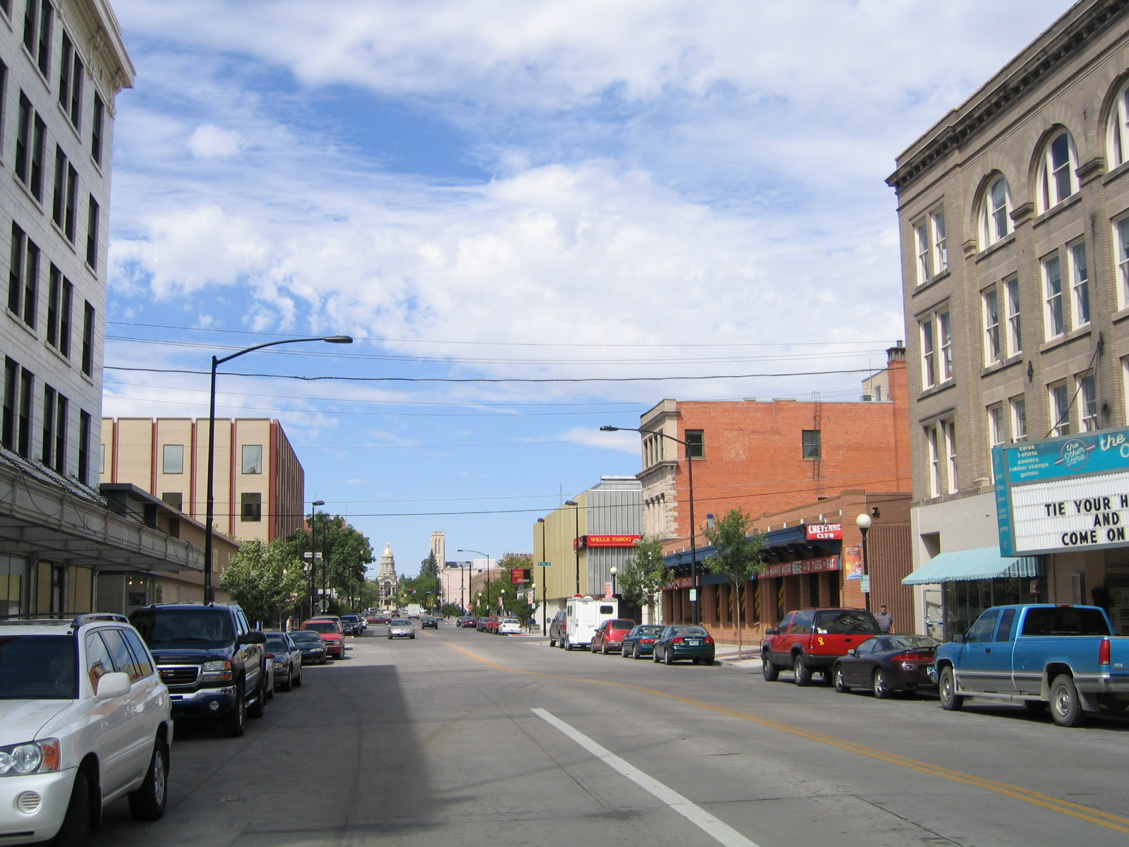
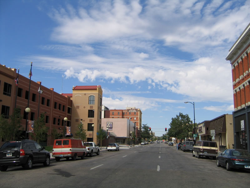
Home to 59,466 people as of the 2010 Census, the city of Cheyenne ("Magic City of the Plains") sits on the semi-arid high plains east of the Rocky Mountains at an elevation of 6,062 feet above sea level. The site where Cheyenne now rests was founded in June 1867 along Crow Creek where the railroad was planned to cross. Cheyenne is not only the state capital of Wyoming and the state's largest city, but it is also home to a large military installation, F.E. Warren Air Force Base as well as the Wyoming National Guard. Fort David A. Russell, which predated the modern air force base, established the long standing military presence here. Cheyenne, which means "alien" or "people of foreign language," was named after the large Indian nation found in the Central U.S. Great Plains region. The Wyoming capitol building was constructed between 1886 and 1890, which is when Wyoming itself achieved statehood.
Resource-based energy development is found all over Wyoming, and Cheyenne is no exception: It has a growing wind power industry in the area. Cheyenne also has a strong transportation basis; the Union Pacific Railroad passes through town only ten blocks south of the state capitol, and a large oil refinery is located near Nationway east of downtown. The north-south Burlington Northern and Santa Fe Railroad also passes through the area; it travels north toward the Powder River Basin (Wright and Gillette) and its rich coal producing mines. Two major freeways and their companion U.S. routes, Interstate 25 (U.S. 87) and Interstate 80 (U.S. 30), directly serve Cheyenne, while a spur route (Interstate 180) enters the downtown area from the south via the U.S. 85/Central Avenue corridor. U.S. 85 travels somewhat southeast toward Greeley, Colorado, and northeast toward Torrington, Lusk, Newcastle, and the Black Hills region. Cheyenne is considered to be the northernmost city along the fast-growing, multi-million population Front Range, which is generally accepted to extend south to Pueblo, Colorado.
Routes
 Interstate 25
Generally following the route of U.S. 87, Interstate 25 serves the metropolitan area of Cheyenne heading north to Chugwater, Wheatland, Douglas, Glenrock, Casper, Kaycee and ultimately Buffalo, where it meets I-90. A connection via Wyoming Highway 59 links Cheyenne with Gillette and northeastern Wyoming. Southward into the Centennial State, I-25 travels to the Colorado Front Range region, which includes Fort Collins, Denver, Colorado Springs and Pueblo.
Interstate 25 generally stays west of Downtown Cheyenne, but Central Avenue serves as the principal business route into the city from the north. Central Avenue is signed as both Business Loop I-25 and U.S. 87 Business.
 Interstate 80
Interstate 80 is a major east-west transcontinental Interstate highway. Starting in San Francisco, California, I-80 travels east across 11 states to Fort Lee, New Jersey, concluding near the foot of the George Washington Bridge leading into New York City, New York. The second-longest Interstate highway, I-80 generally follows historic U.S. 40 across California, Nevada, and Utah, and it joins the U.S. 30 and Lincoln Highway corridor in Wyoming. The link between U.S. 40 in Utah and U.S. 30 in Wyoming is made by I-80 replacing old U.S. 189, and even older U.S. 530, and Historic U.S. 30S through a portion of northern Utah and southwestern Wyoming.
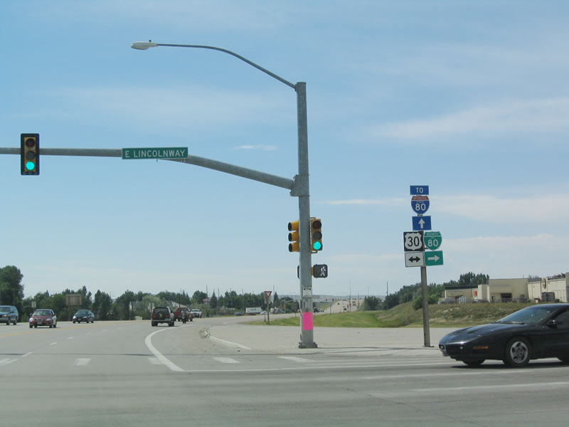
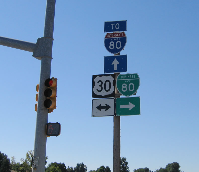
I-80 travels alongside the Union Pacific Railroad for much of its route in Wyoming, connecting cities that owe their heritage not only to the Lincoln Highway but also to the transcontinental railroad that carries goods across the Continental Divide. Reaching Cheyenne, Interstate 80 and U.S. 30 divide, with I-80 acting as a freeway bypass (marginal) to the south of the city center and U.S. 30 following the railroad directly into the city center along Lincolnway. U.S. 30 is cosigned as Business Loop I-80 along Lincolnway.
 Interstate 180
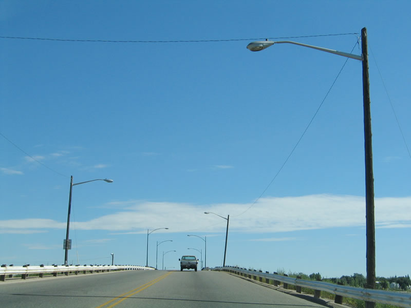
One spur Interstate route serves Cheyenne: Interstate 180 connects I-80 with Downtown Cheyenne via U.S. 85 (Central Avenue). I-180 is unique among the Interstate Highway System for having no freeway segment; instead, it is an expressway configuration with a series of traffic signals along Central Avenue between I-80 and U.S. 30/Business Loop I-80 (Lincolnway). The connection with I-80 is not even a high-speed exchange; it is a regular diamond interchange.
Central Avenue carries four signed routes along this stretch: Interstate 180, U.S. 85, Business Loop I-25, and U.S. 87 Business. This is the only known roadway signed with an Interstate, Off-Interstate Business Loop, U.S. route, and Business U.S. route. The reason this route is an Interstate is because the improved expressway was constructed using Interstate funds, including the large viaduct that carries the route over the Union Pacific Railroad yard.
 U.S. 30
U.S. 30 follows Business Loop I-80/Lincolnway through Downtown Cheyenne, connecting with Interstate 80 at either end. This major, transcontinental U.S. route extends from Astoria, Oregon east to Atlantic City, New Jersey. Within Wyoming, U.S. 30 enters the state from Idaho, connecting with Kemmerer before joining with Interstate 80 at Exit 66. U.S. 30 and I-80 overlap from that point east to Green River and Rock Springs, and then they cross the Red Desert to link with Wamsutter and Rawlins. At Walcott Junction, U.S. 30 separates from I-80 to serve Medicine Bow, while Interstate 80 stays closer to Elk Mountain. The routes combine again at Laramie, and they travel through Telephone Canyon and over Sherman Hill to descend into Cheyenne. At the West Lincolnway interchange, the routes again divide, with I-80 bypassing the city center to the south and U.S. 30 passing directly through the city via Lincolnway. U.S. 30 and Business Loop I-80 pass Little America, then parallel the Union Pacific Railroad into the central business district. They converge back together east of town, and overlap until the Nebraska state line. U.S. 30 and Interstate 80 have separate alignments from there east across Nebraska, but they closely parallel each another toward Sidney, Ogallala, North Platte, Kearney and Grand Island.
 Former U.S. 30 Alternate
Former U.S. 30 Alternate appears to have been signed along Nationway (now a city street) in the 1970s and possibly into the 1980s until Interstate 80 was completed on its current alignment. Nationway is a four-lane expressway, and it may have served as an interim highway east of Downtown Cheyenne until Interstate 80 was completed; this likely helped to keep traffic off Lincolnway while the permanent freeway was under development.
 U.S. 85
U.S. 85 enters the state of Wyoming just south of the Cheyenne metropolitan area; it starts as Greeley Highway and becomes Central Avenue. It approaches Cheyenne from the south, becoming part of Business Loop I-25 and U.S. 87 Business, then adding Interstate 180 north into the city center. After meeting Lincolnway (U.S. 30 and Business Loop I-80), U.S. 85 then continues along the Central Avenue and Warren Avenue couplet through Downtown and past the state capitol complex to eventually join Interstate 25.
North beyond Cheyenne, U.S. 85 eventually branches northeast from Interstate 25 and U.S. 87 to serve cities such as Torrington, Lusk and Newcastle before entering South Dakota in the Black Hills region. The separation from I-25/U.S. 87 north of Cheyenne is the final time U.S. 85 connects to those routes along the course northward from El Paso, Texas.
 U.S. 87
U.S. 87 also serves Cheyenne, but it stays on Interstate 25 for the entire route through Cheyenne and Laramie County. U.S. 87 generally stays on the I-25 freeway from Cheyenne north to Buffalo, with one exception between Glenrock and Casper where U.S. 20-26-87 travel on a separate alignment away from the Interstate. North from there, U.S. 87 overlaps with or closely follows Interstate 90 to the Montana state line.
Most instances of Business Loop I-25 in Wyoming are also signed as U.S. 87 Business, and two extant segments separate from either I-25 or Interstate 90, between Glenrock and Casper and again from near Story to Sheridan. U.S. 87 Business is concurrent with Business Loop I-25 along Central Avenue and Warren Avenue in Cheyenne.
 Wyoming 210 - Happy Jack Road
This east-west state highway originates at Interstate 80 and U.S. 30 at the Summit Rest Area (Sherman Hill, at the top of Telephone Canyon, Exit 323). It works its way east through the Pole Mountain Unit of Medicine Bow-Routt National Forest in Albany County, then crosses into Laramie County and connects to Curt Gowdy State Park (Granite Springs and Crystal Reservoirs). Wyoming 210 gradually descends from there to meet Interstate 25 at the Missile Drive interchange (Exit 10D).
 Wyoming 211 - Horse Creek Road
This north-south state highway originates at Wyoming 219/Yellowstone Road north of Cheyenne's city limits and travels west to intersect Interstate 25 and U.S. 87 (Exit 16). Wyoming 211 then travels northwest along Horse Creek Road to serve rural areas along Horse Creek and the Burlington Northern and Santa Fe Railroad. It serves the small communities of Federal, Horse Creek, and Iron Mountain. A portion of the route is unpaved from near the Laramie-Platte County line and a point just west of Chugwater, where Wyoming 211 merges back with Interstate 25 and U.S. 87.
 Wyoming 212 - College Drive, Four Mile Road
This partial beltway extends from Interstate 25 Exit 7 as College Drive, also carrying Business Loop I-25 and Business U.S. 87 for the first mile or so. Wyoming 212 transfers the business routes onto U.S. 85/Greeley Highway (Central Avenue), then continues east until Laramie County Community College, where it curves north to meet Interstate 80 at Exit 364. Wyoming 212 briefly gains Business Loop I-80, which transfers onto Lincolnway (U.S. 30) less than a mile north of the freeway interchange. From there, Wyoming 212 proceeds north along College Drive past Dell Range Boulevard, then eventually curves west at a point north of Summit Drive and east of Ridge Road. Wyoming 219 changes into Four Mile Road, which travels west to Wyoming 219/Yellowstone Road (Old U.S. 85-87) and ultimately the Interstate 25 East Service Road (Hynds Boulevard), where it ends just north of the Vandehei Interchange (Exit 13).
 Wyoming 219 - Yellowstone Road
This north-south road begins at Business Loop I-25, U.S. 85, and Business U.S. 87/Central Avenue near the Cheyenne Airport and travels north to meet U.S. 85 near Interstate 25 Exit 17.
 Wyoming 221 - Fox Farm Road
This east-west state road connected Business Loop I-25, U.S. 85, and Business U.S. 87/Central Avenue just south of the Interstate 80 interchange with Wyoming 212/College Drive. The state highway was decommissioned in 2009, and Fox Farm Road is now maintained locally. As of 2014, the majority of the former state route is located outside of the city of Cheyenne, so it is likely maintained by Laramie County.
 Wyoming 222 - Round Top Road
This north-south state highway travels from Wyoming 225/Otto Road (Historic U.S. 30/Lincoln Highway) southwest of Cheyenne and travels north past Interstate 80 Exit 357 (near the Wal-Mart distribution center) to Wyoming 210/Happy Jack Road. While state maintenance ends at the Wyoming 210 intersection, Round Top Road proceeds north alongside the western edge of F.E. Warren Air Force Base, connecting to the High Plains Arboretum (former Cheyenne Horticultural Field Research Station). North of the horticultural facility (access via Hildreth Road), the roadway changes to gravel, but it does connect as a locally maintained road to Wyoming 211/Horse Creek Road.
 Wyoming 223 - Terry Ranch Road
This very short, east-west state highway connects Interstate 25 with U.S. 85/Greeley Highway south of downtown. The state highway begins at Interstate 25 and U.S. 87 Exit 2, and it travels northwest to meet U.S. 95. Before it was rerouted onto Interstate 25, Wyoming 223 was the old alignment of U.S. 87 and used to be part of the main route from Fort Collins to Cheyenne. Wyoming 223 is named for Terry Ranch, which is famous for its bison herds often visible from Interstate 25 and/or Wyoming 223.
 Wyoming 224 - Central Avenue and Wyoming Department of Transportation Headquarters Driveway
This very short state highway serves as the entrance to the Wyoming Department of transportation headquarters located off Interstate 25 at the Central Avenue interchange (Exit 12). The state highway is not signed, but it appears to extend from the interchange west to the marked driveway into the headquarters, then proceeds south into the complex.
 Wyoming 225 - Otto Road
This east-west state highway is old U.S. 30/Lincoln Highway between Interstate 80 Exit 348 and Exit 358. It provides local ranch and industrial access.
 Wyoming 226 - Missile Drive
This former east-west state highway used to connect Interstate 25 Exit 10D with Business Loop I-80 and U.S. 30/Lincolnway west of Cheyenne. Missile Drive is now maintained by the city of Cheyenne and is the de facto connection between Happy Jack Road and the central business district of Cheyenne. It also links the city with the main entrance to F.E. Warren Air Force Base to the west.
 Other State Highways
Other state highways that serve Laramie County include Wyoming 213 (Burns Road from Interstate 80 Exit 386 north to Wyoming 216/Albin Road via Burns), Wyoming 214 (Carpenter Road from Chalk Bluffs Road in Carpenter north to Interstate 80 Exit 386), Wyoming 215 (Pine Bluffs-Albin Road from Business Loop I-80 and U.S. 30 in Pine Bluffs north to Wyoming 216 in Albin), and Wyoming 216 (Albin Road from U.S. 85 east to the Nebraska State line near Albin). Two decommissioned state routes in Laramie County were Wyoming 217, which is now Laramie County Route 140, which traveled south from Interstate 80 Exit 377 south to the point where the former state route turned from paved to gravel; and Wyoming 218, which is now Harriman Road (Laramie County Route 102), which traveled south from Interstate 80 Exit 342 southwest toward Harriman near the Colorado State Line. Both of these routes provide local and ranch access; they were returned to local maintenance in 2009.
City Streets and Roads
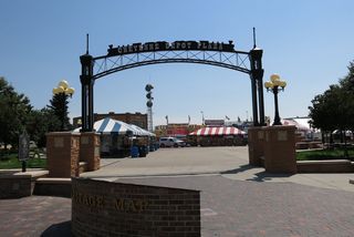
Cheyenne Railroad Depot (21 photos)
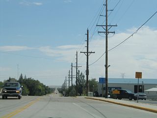
Fox Farm Road (Former Wyoming 221) (7 photos)
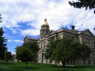
Wyoming State Capitol (6 photos)

Other Roads (12 photos)
Other Roads
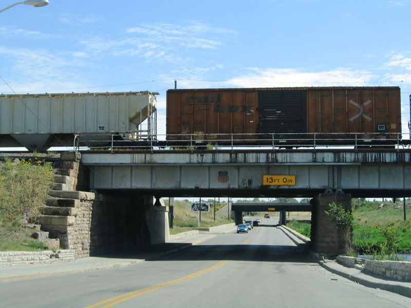
South of Lincolnway, Ames Avenue passes under a pair of viaducts to avoid the Union Pacific Railroad. 09/06/05
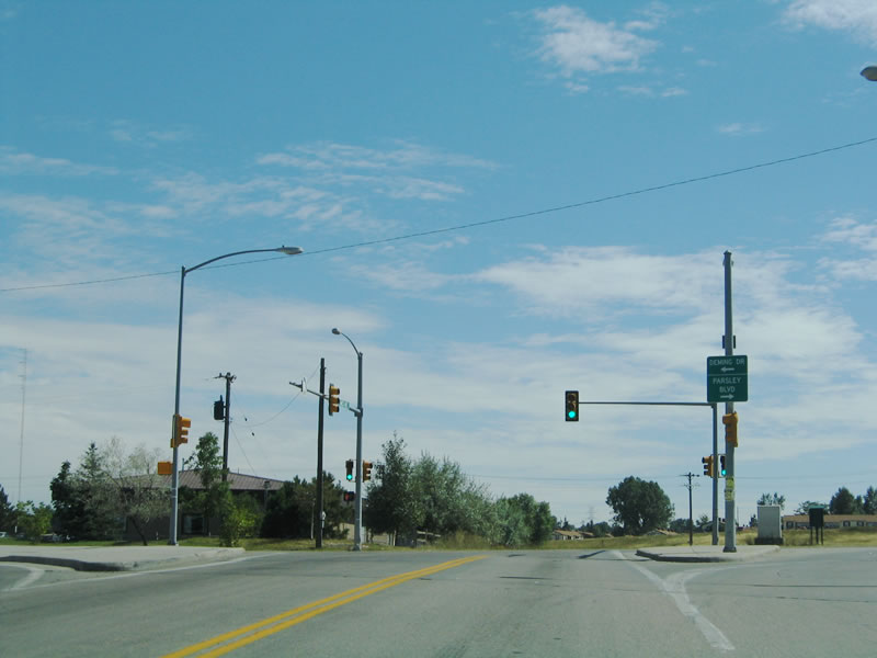
Once south of the viaduct, Ames Avenue meets Deming Drive. Follow Deming Drive southeast to the residential neighborhoods served by Ninth Street, Fifth Street, and First Street. 09/06/05
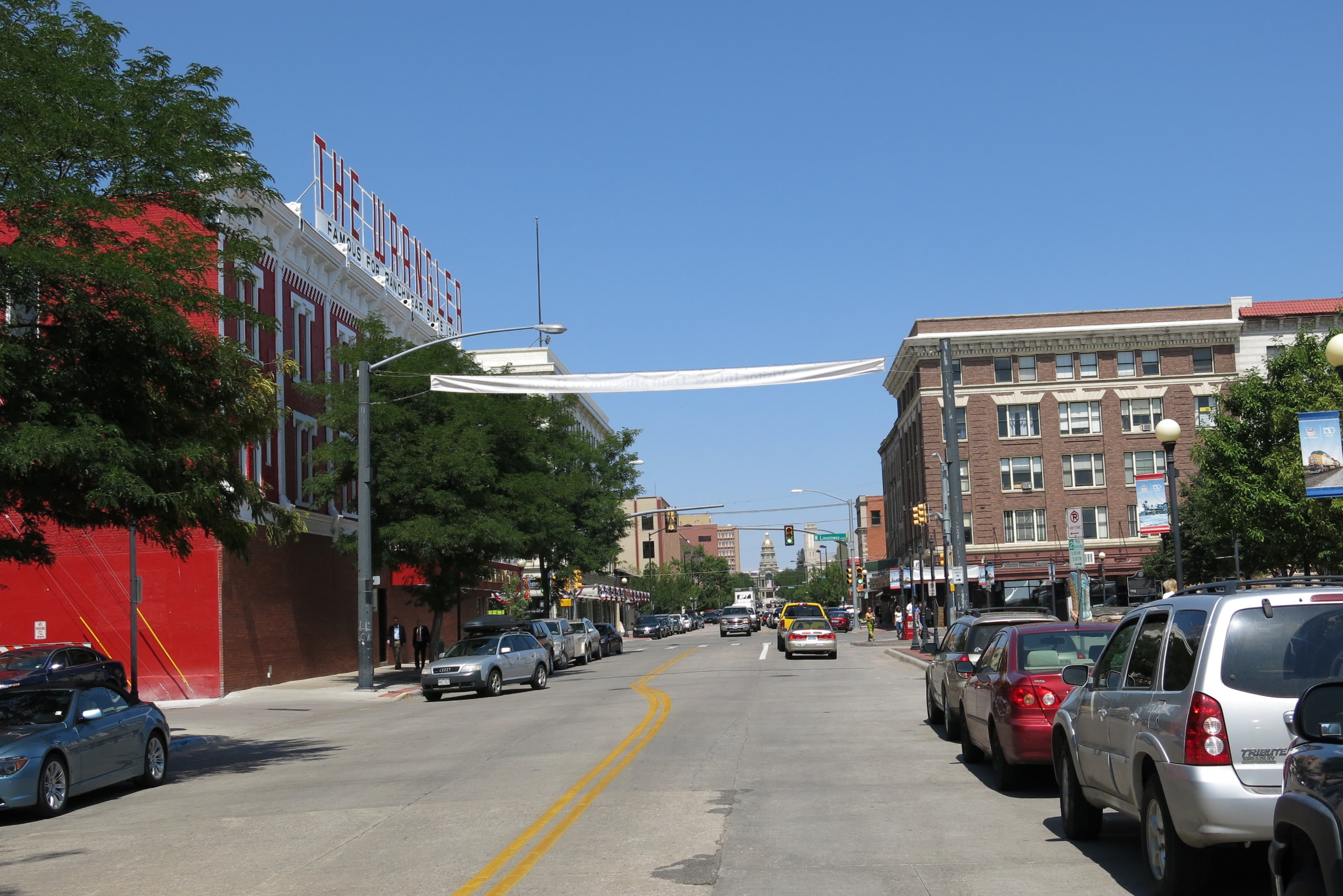
Looking North along Capitol Avenue near the Cheyenne Railroad Depot toward the Wyoming State Capitol. 08/15/13
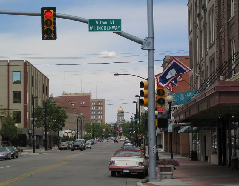
Capitol Avenue travels nine blocks between 15th Street and 24th Street one block west of Central Avenue (southbound Business Loop I-25, U.S. 85, and Business U.S. 87). At the intersection of Capitol Avenue and 24th Street is the Wyoming state capital building. The state capitol occupies four blocks, and Capitol Avenue resumes in a northwesterly direction at 26th Street. Here, northbound Capitol Avenue reaches Lincolnway (Business Loop I-80 and U.S. 30 or 16th Street). 09/06/05
Continuing north from Lincolnway, the state capitol is visible at the north end of Capitol Avenue. 09/06/05

Now at the north end of Capitol Avenue at 24th Street, this is the view looking south toward downtown Cheyenne. 09/06/05
Logan Avenue originates at Fifth Street, travels north over the Norris Viaduct (over the Union Pacific Railroad) and then angles northwest toward Pershing Boulevard. The Norris Viaduct was constructed in 1952 and was slated for replacement on an altered alignment along Alexander Avenue¹. The new viaduct four lane roadway facilities traffic flow with 5th Street and Nationway/8th Street. Logan Avenue forms the eastern boundary of the original city of Cheyenne as conceived by General Dodge, so the roads traveling west of Logan Avenue travel southwest to northeast. 09/06/05
Upon reaching the base of the Norris Viaduct, Logan Avenue reaches Nationway, a major east-west arterial that skirts the northern edge of the city's lone oil refinery. Nationway starts at Lincolnway (Business Loop I-80 and U.S. 30) and travels southeast to 8th Street, then follows 8th Street east to Windmill Road, then travels northeast to meet Ridge Road, where it changes into 12th Street. The 1975 American Automobile Association map of Colorado and Wyoming's inset of Cheyenne showed Nationway as Alternate U.S. 30, perhaps as an interim route for through traffic while the modern Interstate 80 alignment was being built to the south. However, this designation does not appear in most other maps of this period. 09/06/05
Logan Avenue travels in a north and northwesterly direction toward Lincolnway (Business Loop I-80 and U.S. 30). 09/06/05
Pioneer Avenue travels north from Lincolnway (Business Loop I-80 and U.S. 30), passing through downtown Cheyenne on a one-way street alignment. 09/06/05
Wyoming 212 forms a three-sided beltway around the northern, eastern, and southern edges of the Cheyenne urban area. On the eastern edge, Wyoming 212 follows College Drive. For a short distance between U.S. 30 (Lincolnway) and Interstate 80, Wyoming 212 is cosigned with Business Loop I-80. Here, southbound Wyoming 212/College Drive meets the intersection with U.S. 30 and Business Loop I-80/Lincolnway east of Cheyenne. 09/06/05
A close-up of the trailblazer shields at the Lincolnway intersection on southbound Wyoming 212/College Drive. Ahead, Business loop I-80 and Wyoming 212 share pavement until the two routes meet Interstate 80. 09/06/05