
Regional Navigation

Business Loops from Interstate 8

Business Loop I-8 in El Centro follows Imperial Avenue, Adams Avenue, and Fourth Street. The segments along Adams Avenue and Fourth Street are state-maintained and are part of California State Route 86. The Imperial Avenue segment travels north-south and is maintained by the city of El Centro. 04/20/13
Five business loops serve Interstate 8 as it crosses the southern tier of California through San Diego and Imperial Counties. The loops generally follow Old U.S. 80 and/or serve the central business district of the following areas:
- San Diego/La Mesa: Washington Street, Normal Street, El Cajon Boulevard
- El Cajon: El Cajon Boulevard, Main Street, Highway 8 Business
- Alpine: Alpine Boulevard, Willows Road
- El Centro: Imperial Avenue, Adams Avenue, Fourth Street (partial overlap with California 86 and Imperial County Route S-80)
- Winterhaven/Yuma: Winterhaven Drive (partial overlap with Imperial County Route S-24)
While each of these business routes were designated along with Interstate 8 in the 1960s and 1970s, they are generally not very well-signed. In fact, the San Diego/La Mesa loop has gradually seen its route markers disappear from the route through the 1990s and 2000s. La Mesa's section was free of route markers by 1995, and many business route markers in San Diego's sections of Washington Avenue, Normal Avenue, and El Cajon Boulevard (notably through the North Park, University Heights, and College Area districts) were removed by 2005. Historic U.S. 80 route markers sprang up to replace the business route shields starting in late 2006. However, some Business Loop I-8 shields remain on El Cajon Boulevard, especially in City Heights. The western end of the loop historically is at California 163; however, signs for Business Route 8 on California 163 northbound and southbound were removed in the early 2000s.
El Cajon's loop is sporadically signed. Historic U.S. 80 signs also appear occasionally along the loop. The eastern end of this loop is ambiguous. Possible endpoints include (1) the on-ramp from Main Street to Interstate 8 east; (2) the Greenfield Drive interchange with Interstate 8; or (3) Lake Jennings Park Road interchange. Part of the ambiguity is caused by the County of San Diego labeling the county-maintained extension of El Cajon's Main Street as "Highway 8 Business." While the street blade signs clearly label this road as "Highway 8 Business," there are no green shields for Business Loop I-8 between Greenfield Drive and Lake Jennings Park Road.
While "Route 8 Business" is signed in both directions of Interstate 8 on the approach to the Alpine Boulevard and Tavern Road interchanges, there are no green business loop shields anywhere along the route. This has been the case since at least 1999. Historic U.S. 80 route markers are in place along Alpine Boulevard, however.
The best-signed Business Loop I-8 in California is in El Centro, where the route is clearly labeled on Imperial Avenue (a city street) and also marked on its shared alignment with State Route 86 (Adams Avenue and Fourth Street). The loop in Winterhaven is poorly signed along Winterhaven Drive. Despite local maintenance, the continuation of Business Loop I-8 south into Yuma, Arizona along 4th Avenue and 32nd Street is well marked.
Business Loop I-8 Guides
- San Diego and La Mesa
- El Cajon
- Alpine
- El Centro
- see below
- Winterhaven
Business Loop 8 - El Centro
| Business Loop I-8 east | |
|---|---|
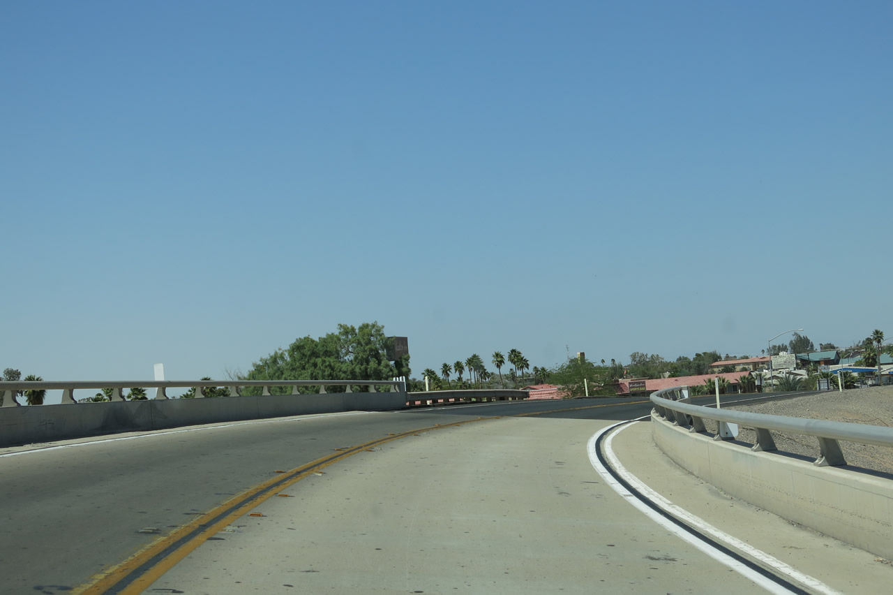 |
Business Loop I-8 begins at Exit 114, a trumpet interchange that connects to northbound Imperial Avenue. The interchange is slated for eventual reconstruction as more traditional design to allow for an extension of Imperial Avenue south of the freeway. Photo taken 04/20/13. |
 |
Eastbound Business Loop I-8 and northbound Imperial Avenue descend from the trumpet interchange and proceed into El Centro. Photo taken 04/20/13. |
 |
Business Loop I-8 transitions from Interstate 8 west (Exit 114) to Imperial Avenue north in the city of El Centro, the seat of Imperial County. El Centro had a population of 42,598 as of the 2010 Census, sits at an elevation of -39 feet below sea level, and was incorporated on April 16, 1908. Photo taken 05/07/06. |
 |
The first signalized intersection along Business Loop I-8 east and Imperial Avenue north is with Ocotillo Drive. El Centro sits at the historic crossroads of U.S. 80 and U.S. 99, with U.S. 80 traveling east-west between Yuma and San Diego and U.S. 99 traveling north-south from Indio to Calexico. Today, the crossroads are marked by Interstate 8 and California 86/111, respectively. Photo taken 04/20/13. |
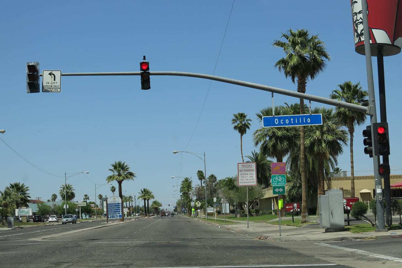 |
Northbound Business Loop I-8 (Imperial Avenue) approaches Ocotillo Drive at this traffic signal just north of the Interstate 8 trumpet interchange in El Centro. Business Loop I-8 will travel due north along Imperial Avenue between Interstate 8 and Adams Avenue, then turn east on Adams Avenue and south on Fourth Street to return to Interstate 8 at Exit 115. Photo taken 04/20/13. |
 |
In the median of Imperial Avenue is this welcome to El Centro sign, which advises traffic en route to various civic facilities (City Hall, Police Department, Fire Department, Imperial County Courthouse, etc.) and California 86 north to follow Imperial Avenue north. On the east side of Imperial Avenue is the El Centro Regional Medical Center (hospital). Photo taken 05/07/06. |
 |
Palms line the median of Business Loop I-8 (Imperial Avenue) next to the medical center between Ocotillo Drive and Ross Avenue. Photo taken 04/20/13. |
 |
Northbound Imperial Avenue meets Ross Avenue at this traffic signal. Photo taken 04/20/13. |
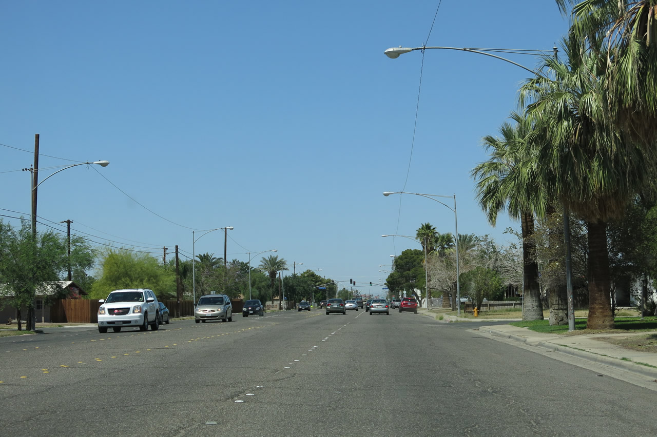 |
Raised pavement markers (Botts Dots) delineate the four-lane Imperial Avenue just north of Ross Avenue. Photo taken 04/20/13. |
 |
 |
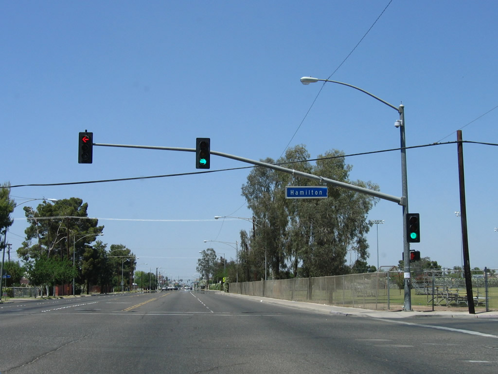
The first northbound Business Loop I-8 reassurance shield is posted along Imperial Avenue just prior to the Hamilton Avenue intersection. The years were not kind to this sign between 2006 and 2013: The sign in 2013 was barely legible. Photos taken 05/07/06 and 04/20/13. |
 |
Northbound Imperial Avenue meets Hamilton Avenue. Ahead on the east side of Imperial Avenue are Wilson Jr. High School and Central Union High School. Photo taken 05/07/06. |
 |
Imperial Avenue passes by Central Union High School. Photo taken 04/20/13. |
 |
Residential areas lie on either side of Imperial Avenue near the schools. Photo taken 04/20/13. |
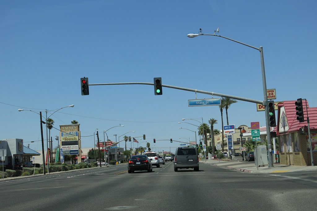 |
A commercial strip begins along Business Loop I-8 (Imperial Avenue) north of State Street. Photo taken 04/20/13. |
 |
 |
This business loop route marker is posted along northbound Imperial Avenue between State Street and Main Street. Like its partner further south, the years of desert sun has faded this business loop route marker substantially over the course of seven years. Photos taken 05/07/06 and 04/20/13. |
 |
Business Loop I-8 east and Imperial Avenue north meet Main Street at this traffic signal. Historic U.S. 80 used to follow Main Street through El Centro until it was rerouted onto Adams Avenue (along what is now Imperial County Route S-80). Photo taken 05/07/06. |
 |
Continuing north, Imperial Avenue continues through more commercial areas before approaching the next major intersection, this time with Imperial County Route S-80 (Adams Avenue). Photo taken 04/20/13. |
 |
At the Adams Avenue intersection, Business Loop I-8 will turn from northbound Imperial Avenue onto eastbound Adams Avenue. It will share pavement with Imperial County Route S-80 and California 86. To the west, Adams Avenue carries Imperial County Route S-80 west toward Seeley (this is also Historic U.S. 80). To the north (ahead), California 86 and Historic U.S. 99 proceed north toward the cities of Imperial and Brawley. Photo taken 04/20/13. |
 |
Northbound Imperial Avenue meets Adams Avenue at this traffic signal. Turn left here for Imperial County Route S-80 (Adams Avenue) and Historic U.S. 80 (Evan Hewes Highway) west to Seeley and Plaster City. Turn right for Business Loop I-8 east, California 86 south, Imperial County Route S-80 east, Historic U.S. 80 east, and Historic U.S. 99 south along Adams Avenue. Ahead, Imperial Avenue transitions directly onto California 86 and Historic U.S. 99 north to Imperial and Brawley. Photo taken 04/20/13. |
| Business Loop I-8 west and Imperial Avenue south | |
|---|---|
 |
Leaving the intersection with Imperial County Route S-80 (Adams Avenue), Business Loop I-8 proceeds south on Imperial Avenue toward its junction with Interstate 8. Photo taken 04/20/13. |

Page Updated May 21, 2013.
|
About Contact Glossary |
In The News Testimonials Interstate Guide |
Social Media:
 |
|
© 2000-23 AARoads.com | All Rights Reserved | Privacy Policy / Terms of Use
|
||