

Business Loop I-80 & U.S. 50 west
| Business Loop I-80 (Interstate 305)-U.S. 50 west & California 99 north | ||
|---|---|---|
 |
Immediately after Business Loop I-80, U.S. 50, and California 99 merge together after the WX-29/30 Interchange, signage immediately appears for the next exit, which is Exit 5, 16th Street north and 15th Street south (this couplet used to be assigned as California 160, but the state relinquished the former state highway to the city of Sacramento). Use 16th Street north to L Street west to the California State Capitol building; J Street west to the Sacramento Convention Center; H Street west to Governor's Mansion State Historic Park; and I Street west to the Sacramento City Hall. At this point, Business Loop I-80 and U.S. 50 join the Camellia City (WX) Viaduct for the journey past downtown Sacramento. A project to improve the viaduct and extend its service life completed construction in 2014. The viaduct continues all the way to the Sacramento River bridge. Photo taken 08/02/11. | |
 |
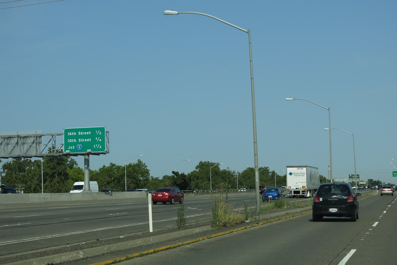 |
This mileage sign along Business Loop I-80 and U.S. 50 west and California 99 north provides the distance to the next three exits: Exit 5, 16th Street north and 15th Street south (former California 160); Exit 4B, Tenth Street; and Exit 4A, Interstate 5 (West Side Freeway) south to Los Angeles and north to Redding (to California 99 and California 70 north to Yuba City-Marysville and Chico). The 2011 picture shows this sign from the U.S. 50 mainline, while the 2013 picture shows this sign from the business loop freeway mainline. Photos taken 08/02/11 and 07/02/13. |
 |
The "mainline" of westbound Business Loop I-80 and Interstate 305 merges onto U.S. 50 west from the right. With a signing project announced in September 2015, Business 80 will be deemphasized in favor of U.S. 50 along the WX Freeway and east-west leg of the Capital City Freeway. Photo taken 07/02/13. | |
 |
 |
 |
The right lane of Business Loop I-80 (Capital City Freeway) and U.S. 50 west becomes exit only for Exit 5, 16th Street north and 15th Street south. California 160 was decommissioned between Interstate 5 Exit 512 and the American River bridge northeast of downtown Sacramento on October 19, 2001.1 The 2003 picture shows the original guide sign with the state route shield on it; the 2005 picture shows the 160 shield covered by a green overlay panel. Photos taken 08/02/11, 04/03/05, and 08/23/03. |
 |
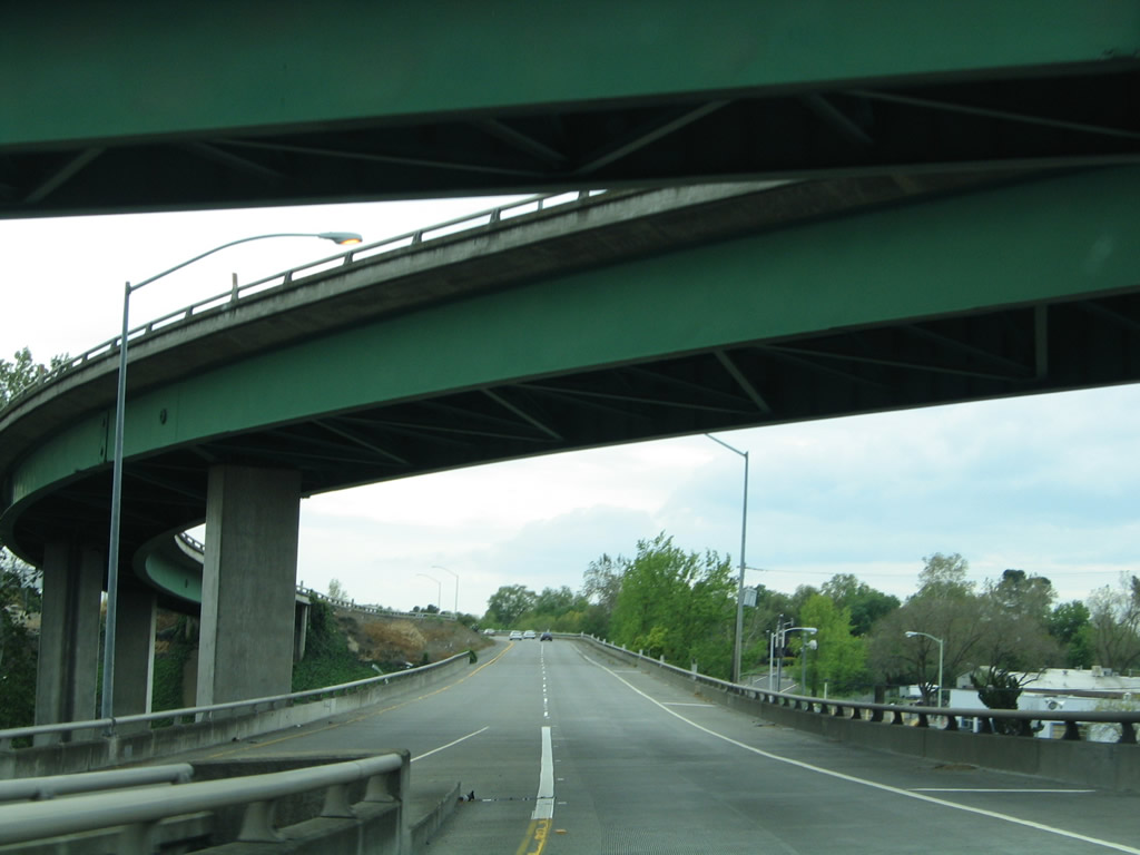
Through traffic is advised to remain on westbound Business Loop I-80 as it approaches the former California 160 interchange. You have to love a sign that advises motorists to use the "four left lanes." That gives you a pretty fair idea of how many lanes are on this freeway! While most business loops in California are regular arterial streets with businesses along its route, Business Loop I-80 in Sacramento is a massively wide, very busy "business loop freeway." Photo taken 08/02/11. | |
 |
 |
Westbound Business Loop I-80 and U.S. 50 (Interstate 305) and northbound California 99 meet Exit 5, 16th Street (former California 160). California 160 used to follow a couplet through Sacramento, 16th Street for northbound and 15th Street for southbound. This exit also leads to southbound Sacramento County J-8 (Franklin Boulevard) via Broadway, which is lost in the maze of ramps here. Photos taken 08/02/11 and 08/23/03. |
 |
Immediately thereafter, westbound Business Loop I-80 (Capital City Freeway) and U.S. 50 meet Exit 4B, Tenth Street. Use Tenth Street north into downtown Sacramento, with access to the state capitol and civic center. Take Tenth Street north to the state capitol complex and Capitol Mall (California 275) between N Street and L Street. The next interchange (and final city of Sacramento interchange) along Business 80 west is Exit 4A, Interstate 5. Photo taken 08/02/11. | |
 |
To Sacramento International Airport, use Interstate 5 north. The airport sits about nine miles north of here; take Interstate 5 north to Exit 528, just after the California 99 split. Photo taken 08/02/11. | |
 |
 |
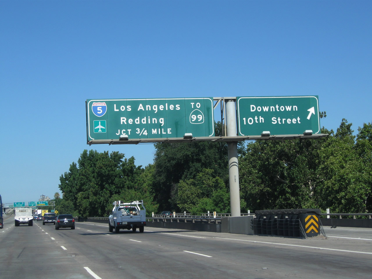
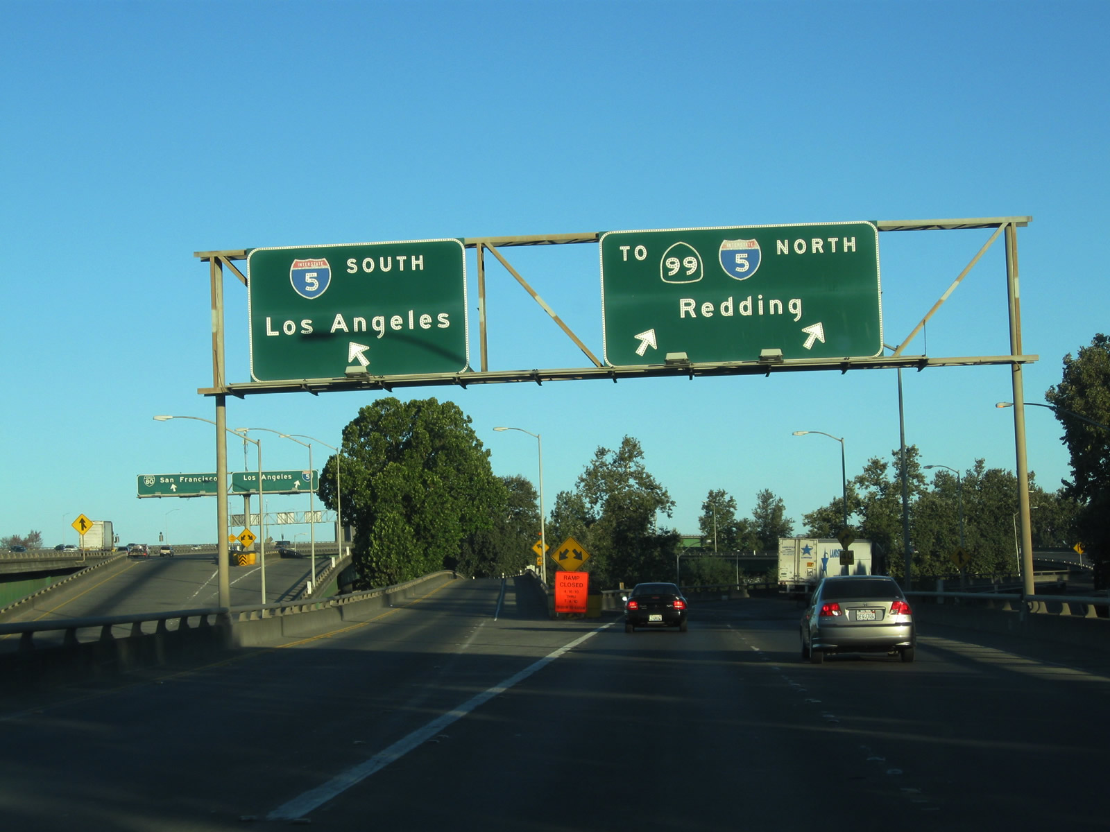
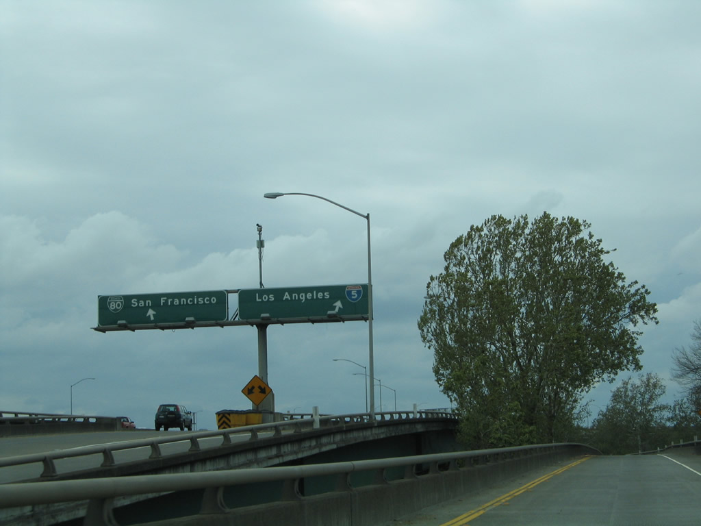
The next exit after the downtown exit is Interstate 5 (West Side Freeway) north to Redding and Portland and south to Los Angeles and San Diego. Interstate 5 is the major north-south corridor of the state, providing the only freeway connection to the Pacific Northwest and the most direct (and boring) route to Southern California by avoiding most Central Valley cities along the western edge of the valley parallel to the Diablo and Coast Ranges. California 99 leaves the Capital City Freeway to run along side I-5 north as a hidden route. Photos taken 08/02/11 and 04/03/05. |
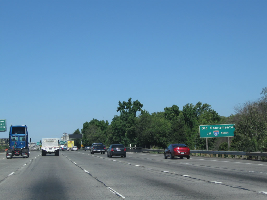 |
To Old Sacramento State Historic Park, use Interstate 5 north. Follow the signs to the park ... take Interstate 5 north to Exit 519B, J Street to Downtown Sacramento. The park is located on the strip of land between the freeway and the Sacramento River riverfront. Photo taken 08/02/11. |
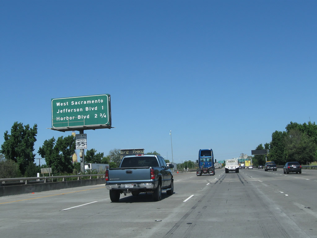 |
This mileage sign is found along westbound Business 80 and U.S. 50 (Capital City Freeway) prior to Exit 4A, Interstate 5. Although the Interstate 5 exit is not listed on this sign (but you can see the overhead signs for it in the distance), the West Sacramento (California 84 (Jefferson Boulevard) and Tower Bridge Gateway) interchange (Exit 3) and the penultimate interchange with Harbor Boulevard (Exit 1B). Photo taken 08/02/11. |
 |
Westbound Business Loop I-80 (Capital City Freeway), Interstate 305, U.S. 50, and California 99 meet Exit 4A, Interstate 5. Follow Interstate 5 north to California 99 (and California 70) en route to Marysville and Yuba City. Interstate 5 south leads to Los Angeles and San Diego. Business Loop I-80 and U.S. 50 continue west along the Capital City Freeway over the Sacramento River and into Yolo County, leaving Sacramento County. Photo taken 08/02/11. |
 |
After the ramp splits between south and north Interstate 5, the left lane connects to Interstate 5 south to Los Angeles, and the right two lanes transition onto northbound Interstate 5 and California 99. It is implied that California 16, which is split into two segments east and northwest of Sacramento, would continue via Interstate 5 north. Photo taken 09/04/10. |
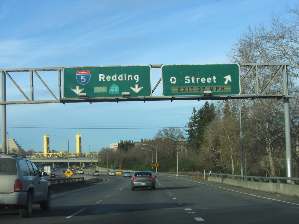 |
Now on the ramp from Business 80 west to Interstate 5 and California 99 north, there is an exit to Q Street east into downtown Sacramento, with access to the California State Capitol. Photo taken 01/16/06. |
 |
Meanwhile, a single lane connects from Business 80 west to Interstate 5 south. Visible from the transition ramp is signage for the on-ramp from Fifth Street, which links to both Business 80 west and Interstate 5 south. Photo taken 04/03/05. |
 |
The ramps from Business 80 and Fifth Street merge together before the ramp links to Interstate 5 south. Photo taken 04/03/05. |
| Business Loop I-80 (Interstate 305) & U.S. 50 west | |
|---|---|
 |
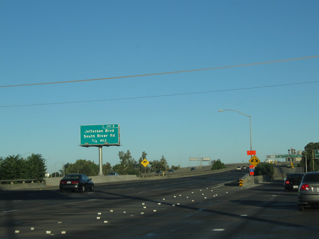 |
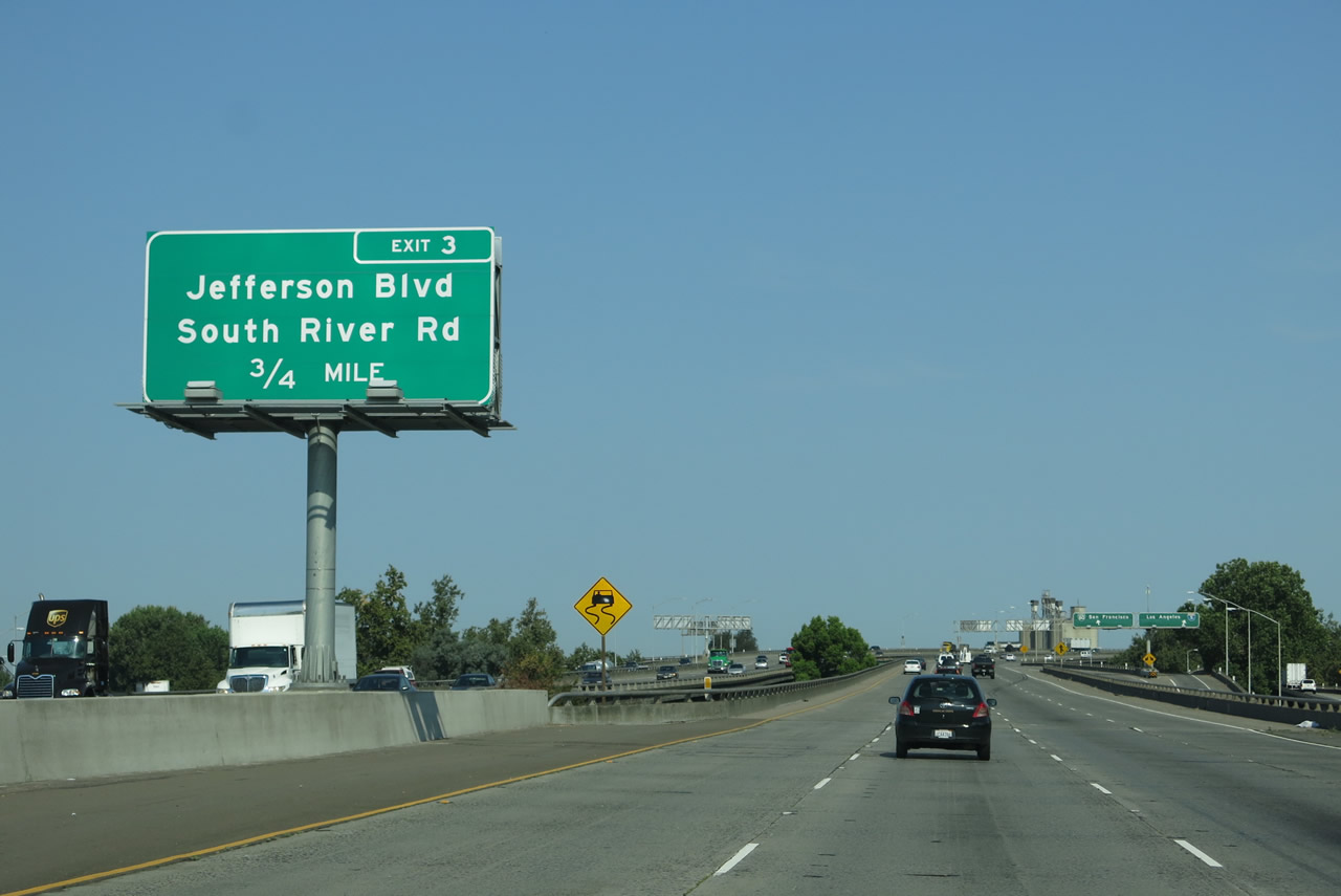
The next exit along Business Loop I-80 (Capital City Freeway), Interstate 305, and U.S. 50 west is Exit 3, Jefferson Boulevard (California 84) to Tower Bridge Gateway (former California 275) and South River Road. Photos taken 08/02/11 and 09/04/10. |
 |
 |
Continuing west along Business Loop I-80 (Capital City Freeway) and U.S. 50, signs for the off-ramp to Interstate 5 and the on-ramp from Fifth Street come into view on the right side of the freeway. Photos taken 08/02/11. |
 |
 |
Business Loop I-80 leaves the WX Viaduct and approaches the Pioneer Bridge. Photos taken 07/02/13. |
 |
Nearing the apex of the Pioneer Bridge, the right lane of Business 80 west becomes exit only for Exit 3, Jefferson Boulevard (California 84) to Tower Bridge Gateway (to California 275/Tower Bridge). Jefferson Boulevard is a north-south route that follows the west bank of the Sacramento River through the Delta region. California 84 is not signed in Yolo County but is signed in Solano County. It does not connect to California 84 in the San Francisco Bay Area due to a route gap in Contra Costa County. Taking Jefferson Boulevard northbound leads to an on-ramp for Tower Gateway east to California 275/Tower Bridge east into downtown Sacramento and Capitol Mall. Photo taken 08/02/11. | |
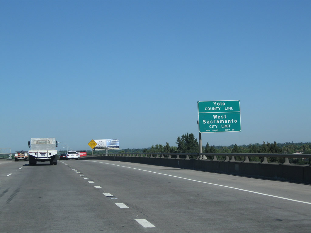 |
At the top of the Pioneer Bridge over the Sacramento River, Business Loop I-80 (Capital City Freeway), Interstate 305, and U.S. 50 leave Sacramento County and enters Yolo County. At this point, the freeway also leaves the city of Sacramento and enters the city of West Sacramento. As of the 2000 Census, West Sacramento had a population of 31,615 people. Photo taken 08/02/11. | |
 |
 |
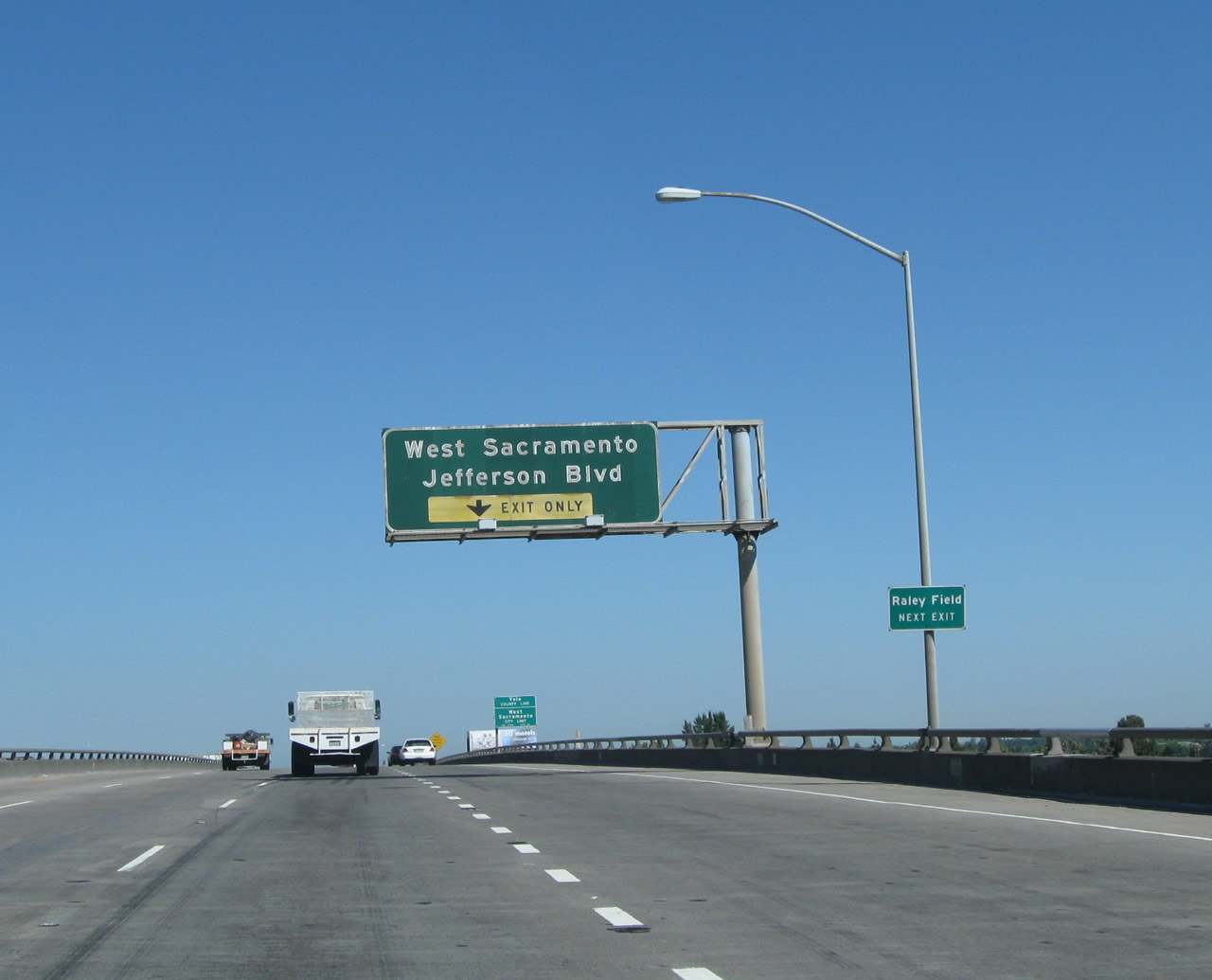
Westbound Business Loop I-80 & U.S. 50 (Capital City Freeway) meets Exit 3, California 84 (Jefferson Boulevard) and Tower Bridge Gateway in West Sacramento. Note that since the WX-29/30th interchange, not a single sign along westbound indicates that this is still U.S. 50. These signs were replaced in August 2013. Photos taken 08/27/13 by Dominic Ielati and 07/02/13. |
 |
 |
Business Loop I-80 continues west on an elevated viaduct as it passes over Jefferson Boulevard in West Sacramento. Photos taken 07/02/13 and 08/02/11. |
 |
This overpass carries traffic from Business Loop I-80 (Capital City Freeway) east to the Tower Bridge Gateway east. After this bridge passes overhead, traffic from the westbound Tower Bridge Gateway will merge onto Business 80 and U.S. 50 west. Photo taken 08/02/11. | |
 |
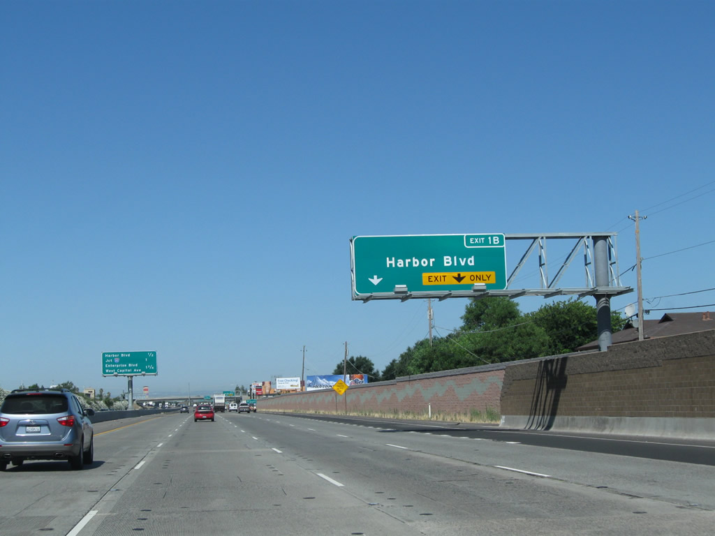
The next exit on westbound Business Loop I-80 (Capital City Freeway), U.S. 50, and Interstate 305 is Exit 1B, Harbor Boulevard (1.25 miles). This is the last exit along westbound before reaching the western end of the business loop at Interstate 80. Photo taken 08/02/11. | |
 |
Harbor Boulevard leads north from this interchange to meet California 84 just south of Interstate 80, then follows the west bank of the Sacramento River en route to Woodland. Heading south, Harbor Boulevard leads to Industrial Boulevard. Use Harbor Boulevard south to the Port of West Sacramento. Photo taken 08/02/11. | |
 |
The right two lanes of westbound Business Loop I-80 (Capital City Freeway), U.S. 50, and Interstate 305 will connect to Exit 1B, Harbor Boulevard and Evergreen Avenue. Photo taken 08/02/11. | |
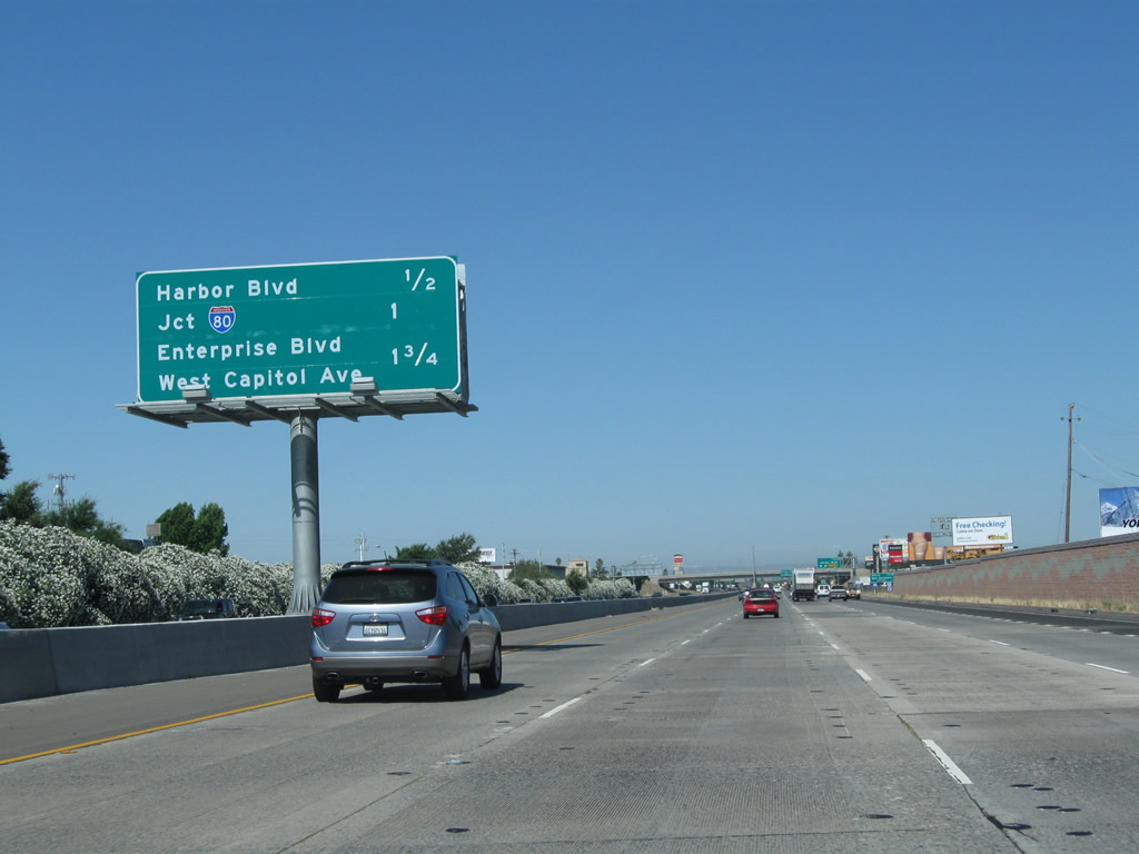 |
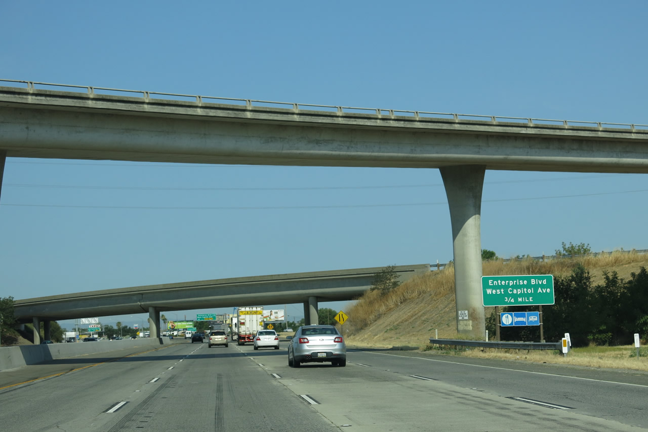
This interchange sequence sign along Business Loop I-80 (Capital City Freeway), U.S. 50, and Interstate 305 west provides the distance to the next three interchanges: Exit 1B, Harbor Boulevard and Evergreen Avenue; Exit 1A, Interstate 80 east to Reno and west to San Francisco; and Exit 81, Enterprise Boulevard and West Capitol Avenue (former U.S. 40-99W). Photo taken 08/02/11. | |
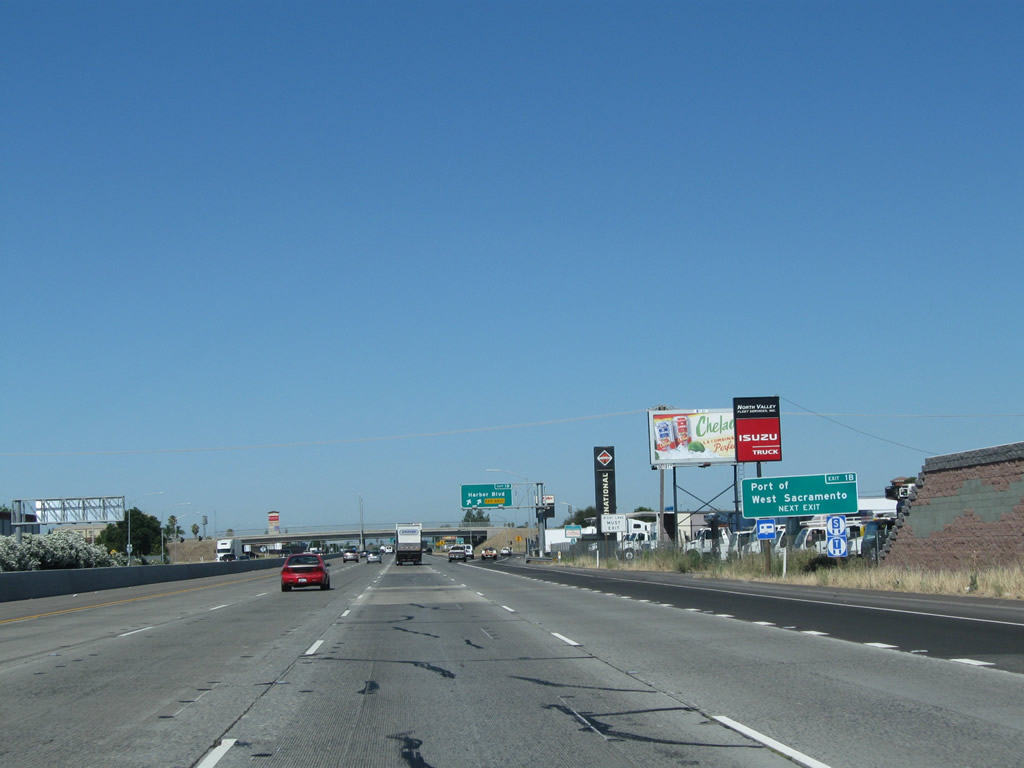 |
Use Harbor Boulevard south to the Port of West Sacramento. Photo taken 08/02/11. | |
 |
 |
U.S. 50 west meets Exit 1B, Harbor Boulevard and Evergreen Avenue. When this interchange was reconfigured in 2010, the off-ramp was relocated (note the change in placement of signs). Photos taken 08/02/11 and 08/23/03. |
 |
Exit 1B to Harbor Boulevard is signed with an exit number at the gore point. Photo taken 08/02/11. | |
 |
The final interchange along U.S. 50 (Capital City Freeway) is Exit 1A, Interstate 80 east to Reno. This interchange will mark the western terminus of all three routes. Photo taken 08/02/11. |
 |
A final green Business Loop I-80 reassurance marker is posted after the on-ramp from Harbor Boulevard. No signs are posted for either U.S. 50 or Interstate 305. Photo taken 08/02/11. |
 |
The right two lanes of the Capital City Freeway will connect to Exit 1A, Interstate 80 east to Reno. The left four lanes will directly connect to Interstate 80 west to San Francisco. Photo taken 08/02/11. |
 |
Exit 1A departs from the west end of U.S. 50 for Interstate 80 east to Reno. This interchange is also the former end of old Interstate 880 (until that designation was removed from the Sacramento north beltline in 1980). Photo taken 08/02/11. |
 |
A two-lane exit carries traffic from Business 80 west to Interstate 80 east. Photo taken 08/02/11. |
 |
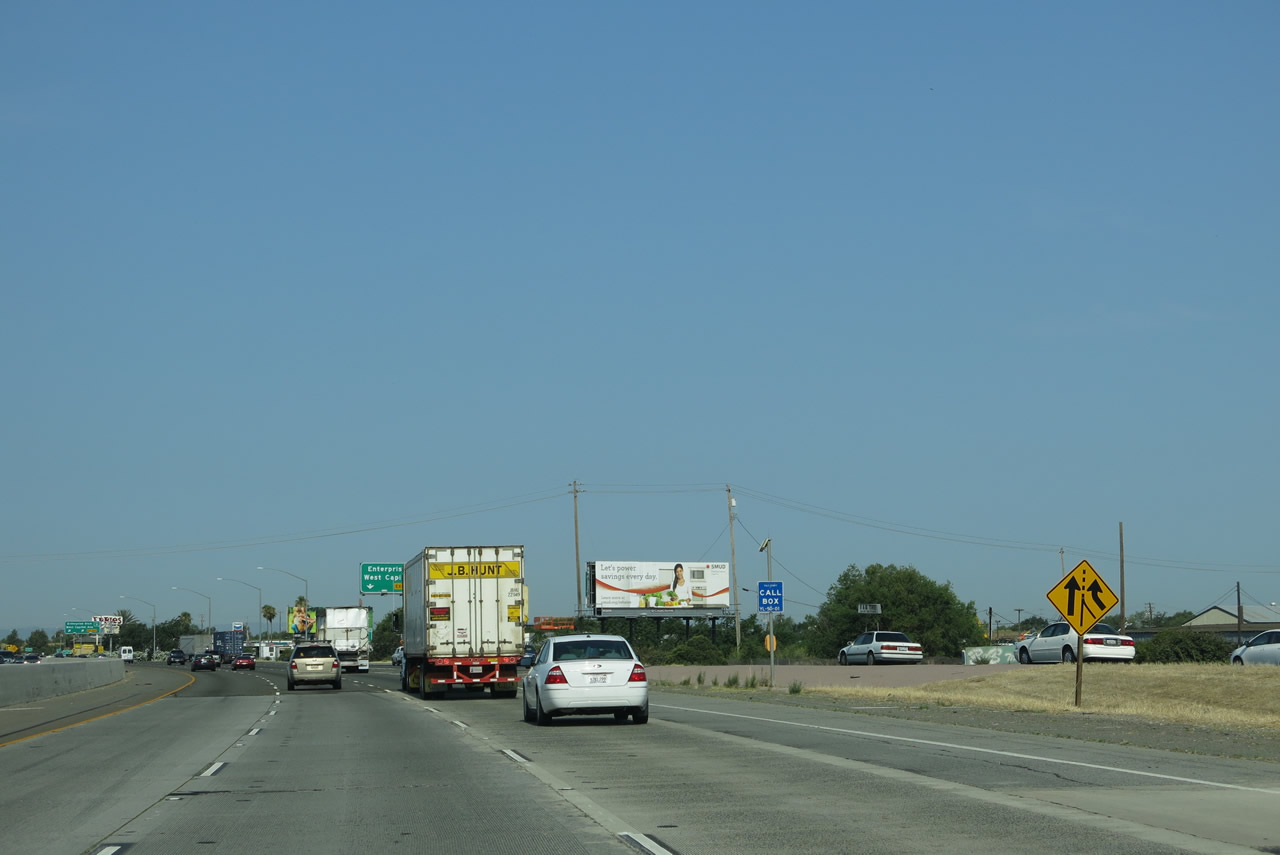
After merging with Interstate 80, the next exit will be Exit 81, Enterprise Boulevard and West Capitol Avenue (Historic U.S. 40 and U.S. 99W). Photo taken 07/02/13. |
 |
For a time after the Capital City Freeway was opened to traffic, West Capitol Avenue was known as U.S. 40 Business, and it then became Business Spur I-80. Both business designations were eliminated by the time what is now the Capital City Freeway was designated as Business Loop I-80 in 1980. Photo taken 07/02/13. |
 |
Traffic from Interstate 80 merges with U.S. 50 from the right. Note the call box, which identifies the Capital City Freeway as Route 50. This is the correct state legal definition of this section of freeway, since the 305 designation has never been legislatively approved by the state and the business route designation is not recognized as a legislative route number. Photo taken 08/02/11. |
Sources:
- City ponders slowing down Highway 160, Sacramento Business Journal, by Mike McCarthy, Sunday, November 11, 2001 - Excerpt: "On Oct. 19 the state Department of Transportation turned over ownership of the stretch of highway to the city. For the state, it meant getting rid of a secondary route that it didn't want to maintain. But to businesses along those 9 miles and the local officials who represent them, it was like waving a magic wand. With the state gone, the city is looking into ways it can change 160 from a fast semi-highway into a slower, prettier, more profitable city street."

Page Updated October 7, 2015.
|
About Contact Glossary |
In The News Testimonials Interstate Guide |
Social Media:
 |
|
© 2000-23 AARoads.com | All Rights Reserved | Privacy Policy / Terms of Use
|
||