

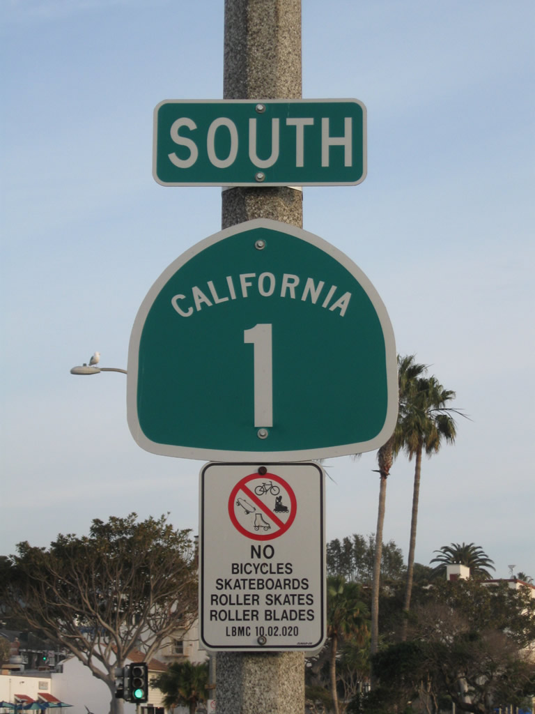
California 1 South - Orange County
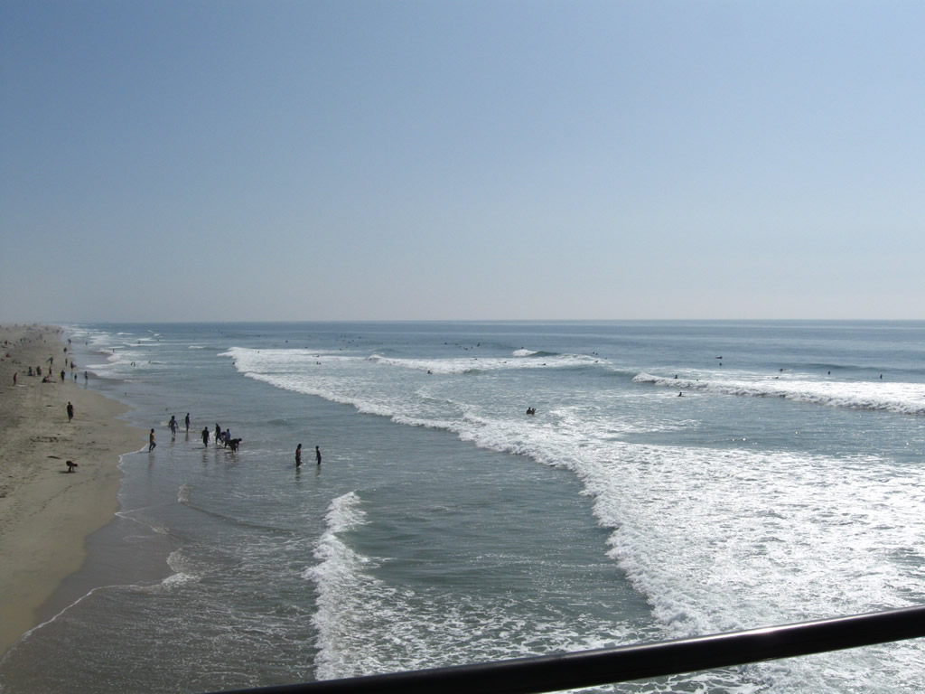
The beach is the reason for the incredible beauty and allure of the Pacific Coast Highway. This view looks southeast along the coastline from the Huntington Beach Pier. California 1 (Pacific Coast Highway) parallels the coastline throughout Orange County. Photo taken 10/24/09.
| California 1 (Pacific Coast Highway) south | |
|---|---|
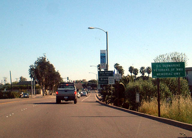 |
Southbound California 1 (PCH) leaves Los Angeles and enters Orange County. The first city along southbound in Orange County is Seal Beach. Photo taken 03/30/03. |
 |
This view of California 1 (PCH) south is found in the vicinity of Seal Beach. Photo taken 03/30/03. |
 |
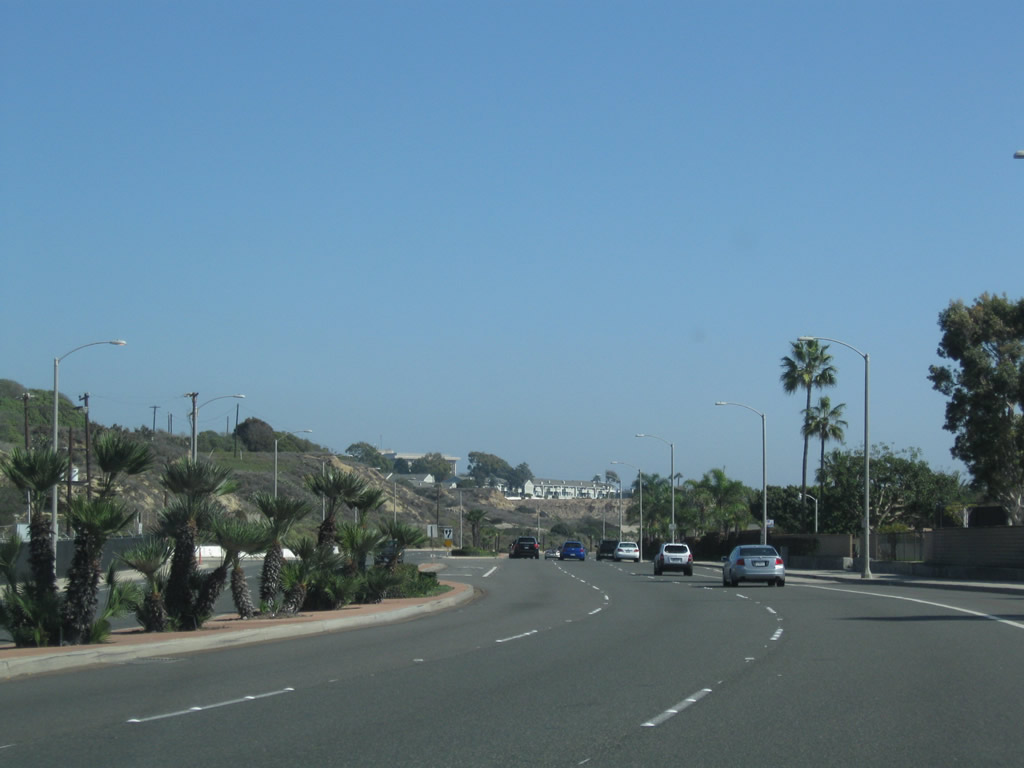
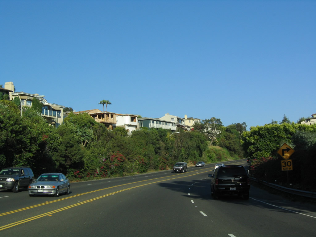
Bolsa Chica State Beach and Bolsa Chica Wetlands are adjacent to each other between Seal Beach and Huntington Beach along California 1 (PCH). Around this point, California 1 enters the city of Huntington Beach, "Surf City USA." Incorporated on February 17, 1909, Huntington Beach had a population of 202,566 as of the 2010 Census. With wide, sandy beaches and a vibrant downtown area adjacent to a fishing pier, Huntington Beach attracts beachgoers and tourists from all over Southern California.. Photo taken 03/30/03. |
 |
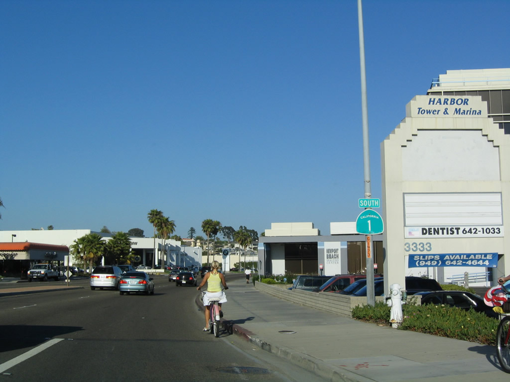
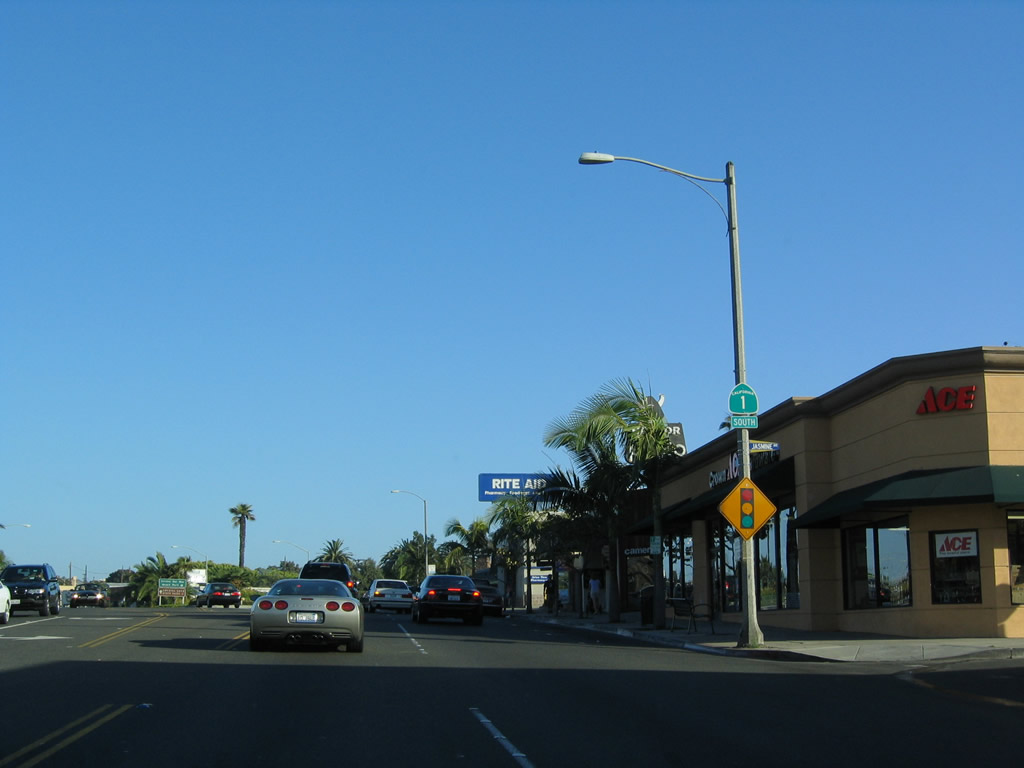
This view looks from the Main Street intersection in downtown Huntington Beach toward California 1 (Pacific Coast Highway) south. Photo taken 10/24/09. |
 |
A California 1 south reassurance shield is posted along southbound Pacific Coast Highway after the Main Street intersection in Huntington Beach. Photo taken 10/24/09. |
 |
Southbound California 1 (Pacific Coast Highway) approaches Huntington Street in Huntington Beach. Photo taken 10/24/09. |
 |
A pedestrian arch bridge allows pedestrians to cross over the Pacific Coast Highway safely; some pedestrians are beach-goers from the nearby Hyatt Regency Hotel. Photo taken 10/24/09. |
 |
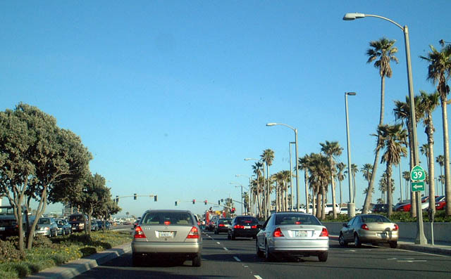 |
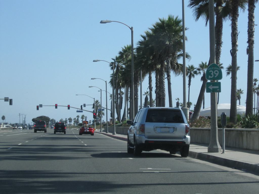
Southbound California 1 (Pacific Coast Highway) approaches California 39 (Beach Boulevard) north. California 39 travels north from here via Beach Boulevard to Westminster (Interstate 405), Garden Grove (California 22), Buena Park (California 91 and Interstate 5), and La Habra. There is a gap in California 39 between La Habra and West Covina; the state highway resumes its northward course along Azusa Boulevard and San Gabriel Canyon Road into the Angeles National Forest. Photos taken 10/24/09 and 03/30/03. |
 |
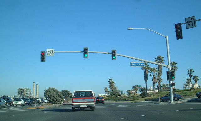 |
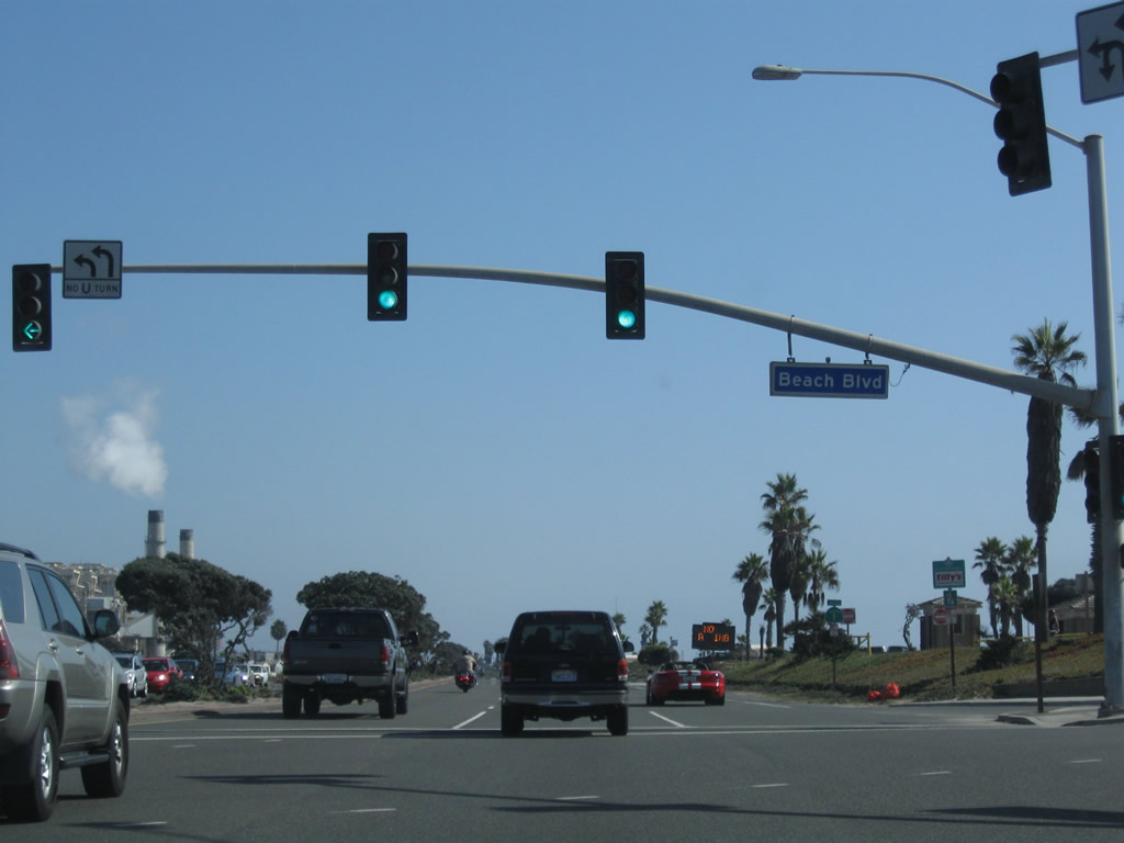
California 1 (PCH) meets California 39 (Beach Boulevard) at this traffic signal in Huntington Beach. While California 1 heads in a southeasterly direction parallel to the coast, California 39 heads due north from this intersection. Photos taken 10/24/09 and 03/30/03. |
 |
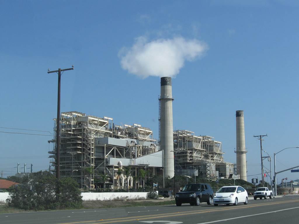 |
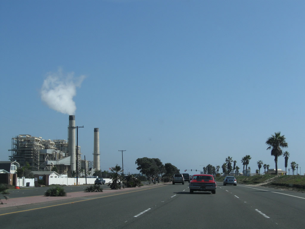
he Huntington Beach Generating Station (HBGS) dominates the view along the Pacific Coast Highway as we approach downtown Huntington Beach. This power plant, which was operated by Southern California Edison until electricity was deregulated, is now operated by AES. Powered by natural gas, the power plant uses steam turbines to generate electricity. The next two intersections are with Newland Street and Magnolia Street. Photos taken 10/24/09. |
 |
Following Magnolia Street, the next intersection along California 1 south is with Brookhurst Street. Use Brookhurst Street north to Fountain Valley and Interstate 405 Exit 14. Photo taken 10/24/09. |
 |
Southbound California 1 (Pacific Coast Highway) crosses over the Santa Ana River. The river serves as the boundary between Huntington Beach and Newport Beach. Photo taken 10/24/09. |
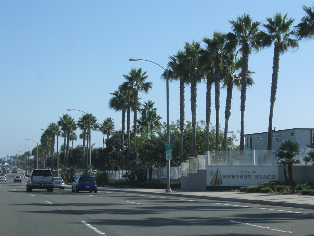 |
California 1 (Pacific Coast Highway) leaves Huntington Beach and enters the city of Newport Beach (population 70,032 as of 2000 Census and incorporated September 1, 1906). Photo taken 10/24/09. |
 |
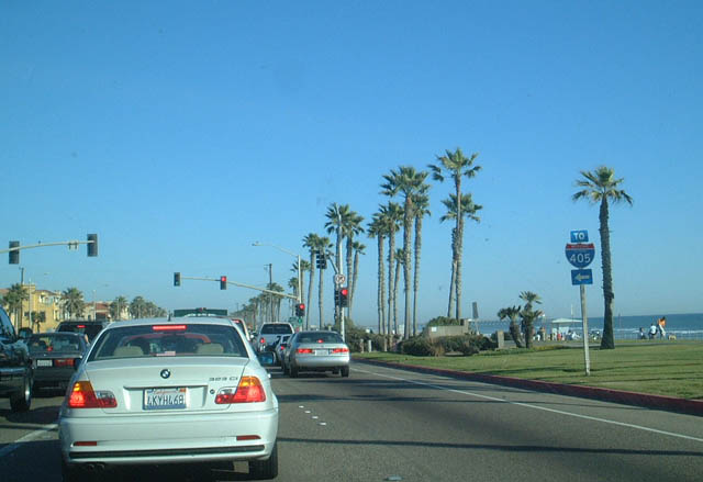
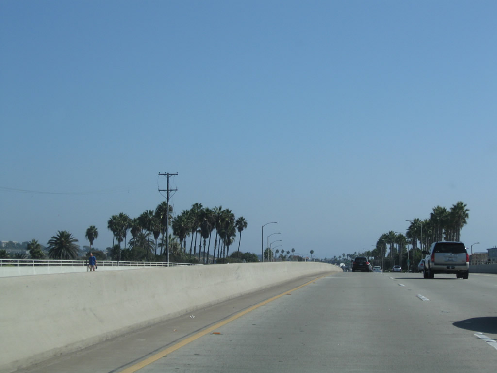
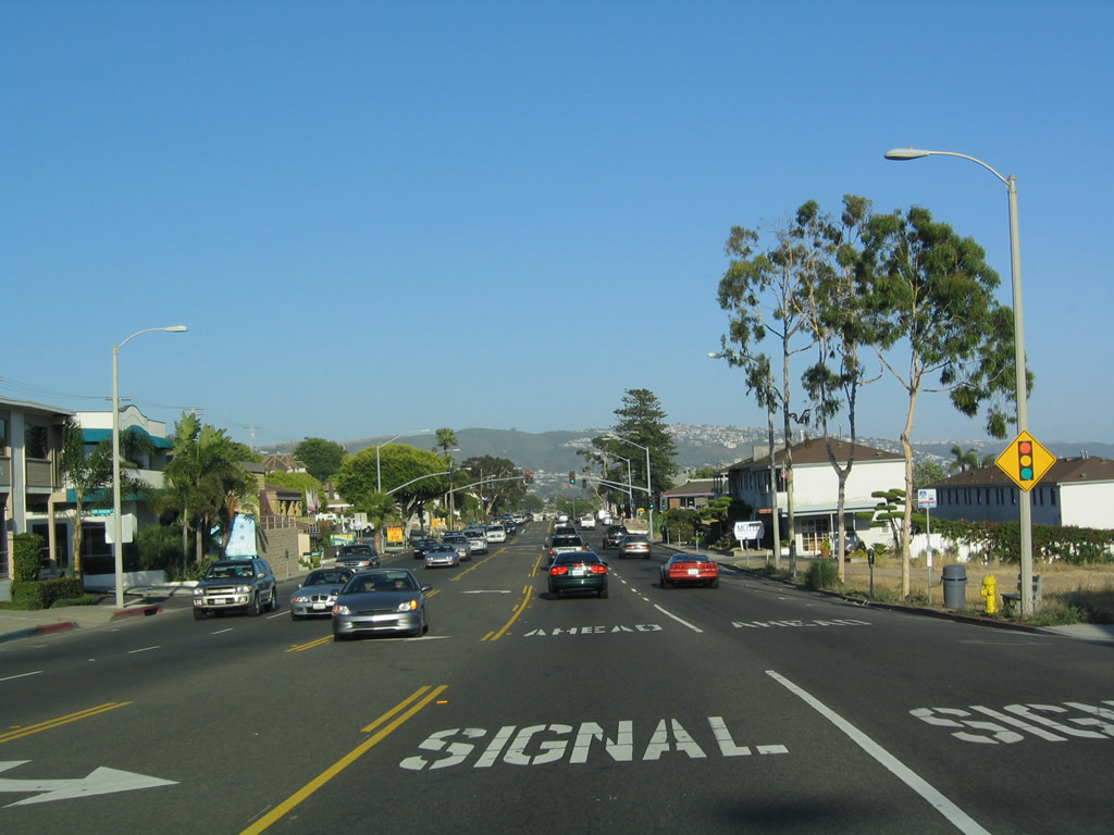
Continuing southeast through western Newport Beach, California 1 (Pacific Coast Highway) carries three southbound lanes. Photo taken 10/24/09. |
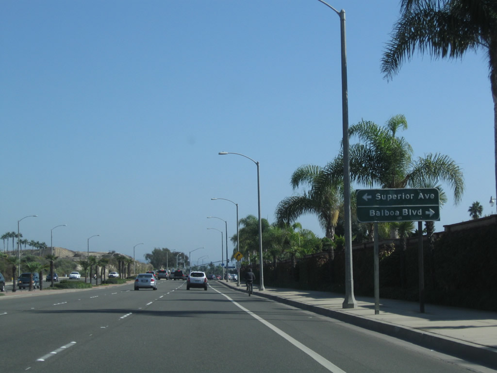 |
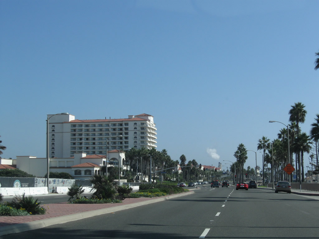
Southbound California 1 (Pacific Coast Highway) approaches a major intersection with Superior Avenue north to Costa Mesa and Balboa Boulevard south to the Balboa Peninsula. Photo taken 10/24/09. |
 |
An alternate route to California 55 north is via Superior Avenue north. Photo taken 10/24/09. |
 |
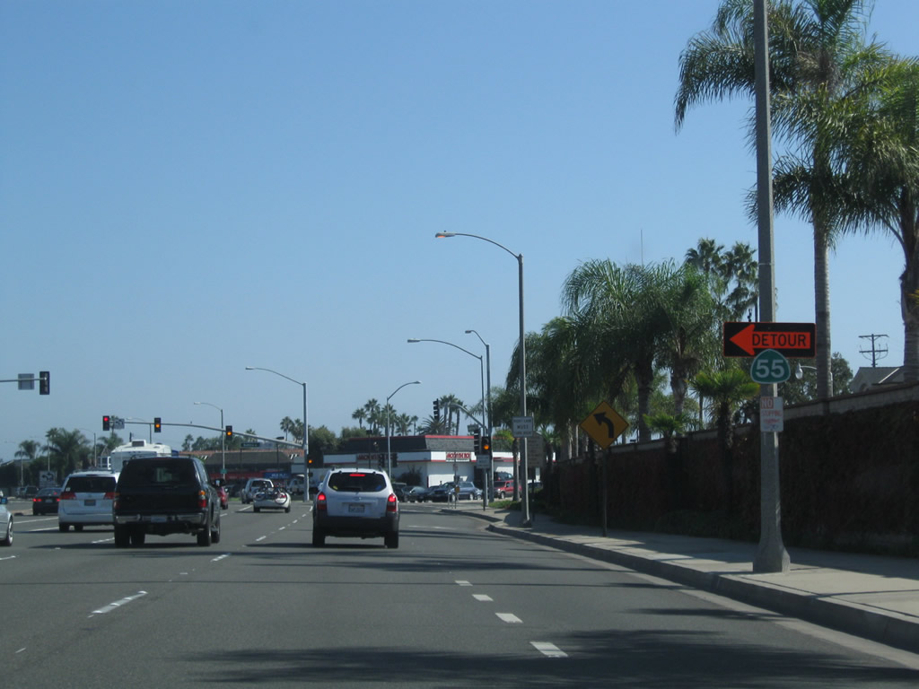
After the Superior Avenue-Balboa Boulevard intersection, the next interchange along California 1 (Pacific Coast Highway) south is the junction with California 55 (Newport Boulevard). The first ramp connects to Newport Boulevard south to Balboa Peninsula, while the second ramp (loop ramp) links to California 55 (Newport Boulevard) north to Costa Mesa. Photo taken 10/24/09. |
 |
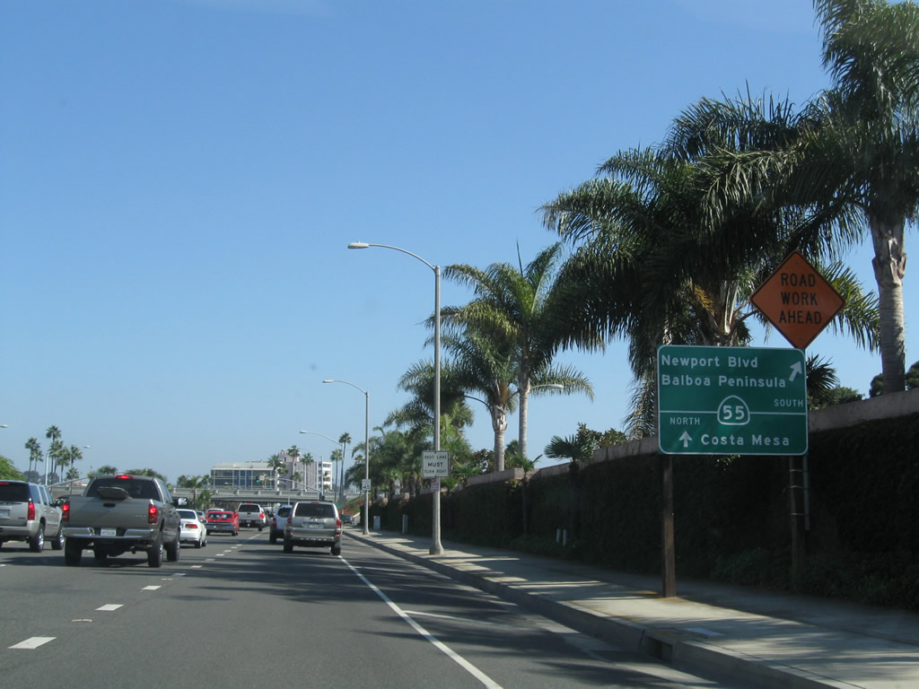
Southbound California 1 (PCH) meets Newport Boulevard south to Balboa Peninsula. The sign seems to indicate that California 55 continues south via this exit, but in reality, the southern terminus of California 55 is at California 1. Both Newport Boulevard and Balboa Boulevard are good routes from California 1 south to reach Balboa Peninsula, the beach, and the passenger ferry to Catalina Island. Photo taken 10/24/09. |
 |
Leaving the California 55 interchange, this California 1 south reassurance shield is posted along the Coast Highway in Newport Beach. Photo taken 05/30/04. |
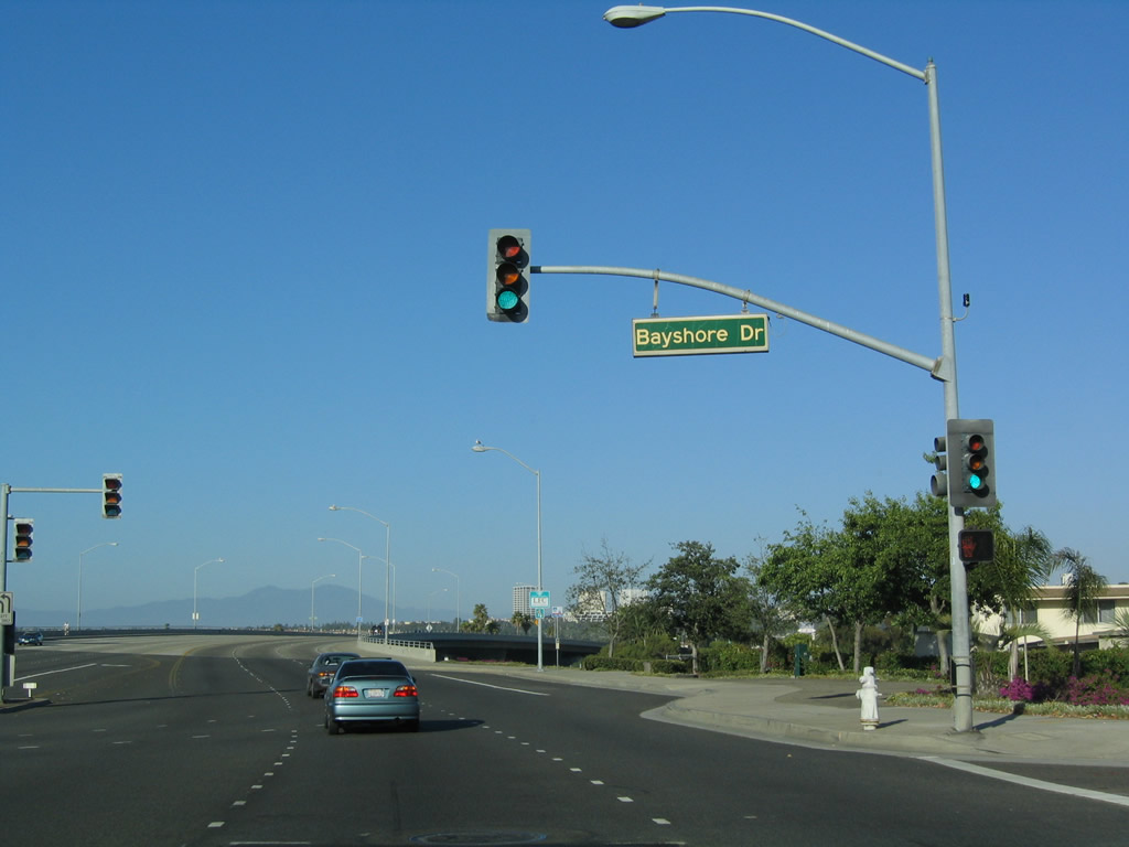 |
Southbound California 1 meets this signalized intersection, which connects to Dover Drive north to Costa Mesa and Bayshore Drive south into a gated community in Newport Beach. Ahead, California 1 will travel east over Lower Newport Bay. Photo taken 05/30/04. |
 |
As California 1 crosses Lower Newport Bay, Fashion Island and Newport Center come into view in the distance ahead. To the south is a view of the Balboa Peninsual. The next traffic signal is with Bayside Drive. Photo taken 05/30/04. |
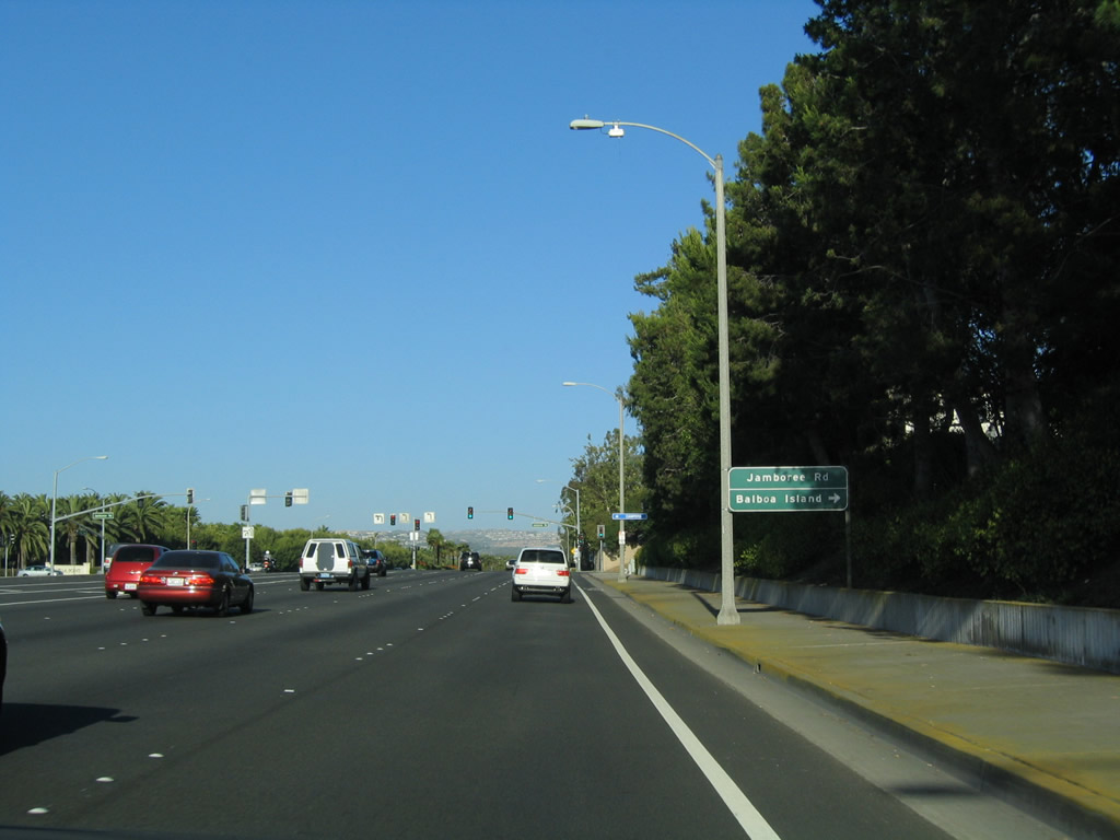 |
Southbound California 1 approaches its intersection with Jamboree Road, which travels north through Newport Beach into Irvine and south onto Balboa Island (located in Newport Bay, it is not to be confused with nearby Balboa Peninsula). A ferry links Balboa Island with Balboa Peninsula. Photo taken 05/30/04. |
 |
Passing by beautiful landscaped medians, southbound California 1 approaches its intersection with Irvine Terrace. Turn left here for Newport Beach Country Club. Photo taken 05/30/04. |
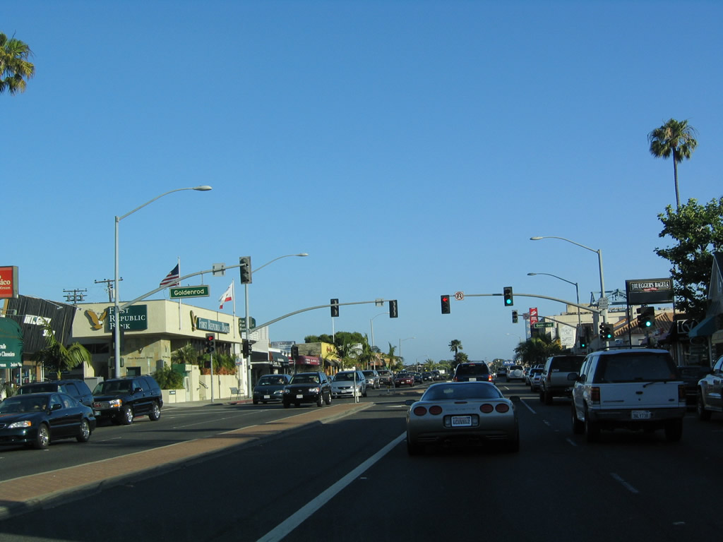 |
After the major intersections with Newport Center north to Fashion Island and MacArthur Boulevard (former California 73) north to Irvine, southbound California 1 approaches Goldenrod Avenue in the Corona del Mar neighborhood of the city of Newport Beach. Photo taken 05/30/04. |
 |
This California 1 south reassurance shield is posted after the Goldenrod Avenue intersection. Photo taken 05/30/04. |
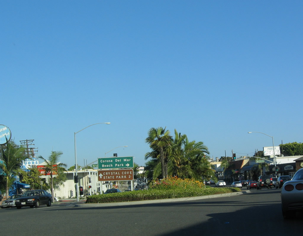 |
Southbound California 1 approaches its signalized intersection with Marguerite Avenue. Marguerite Avenue leads northeast to San Joaquin Hills Road and southwest to Corona del Mar State Beach. Coast Highway continues southeast to Crystal Cove State Park. Photo taken 05/30/04. |
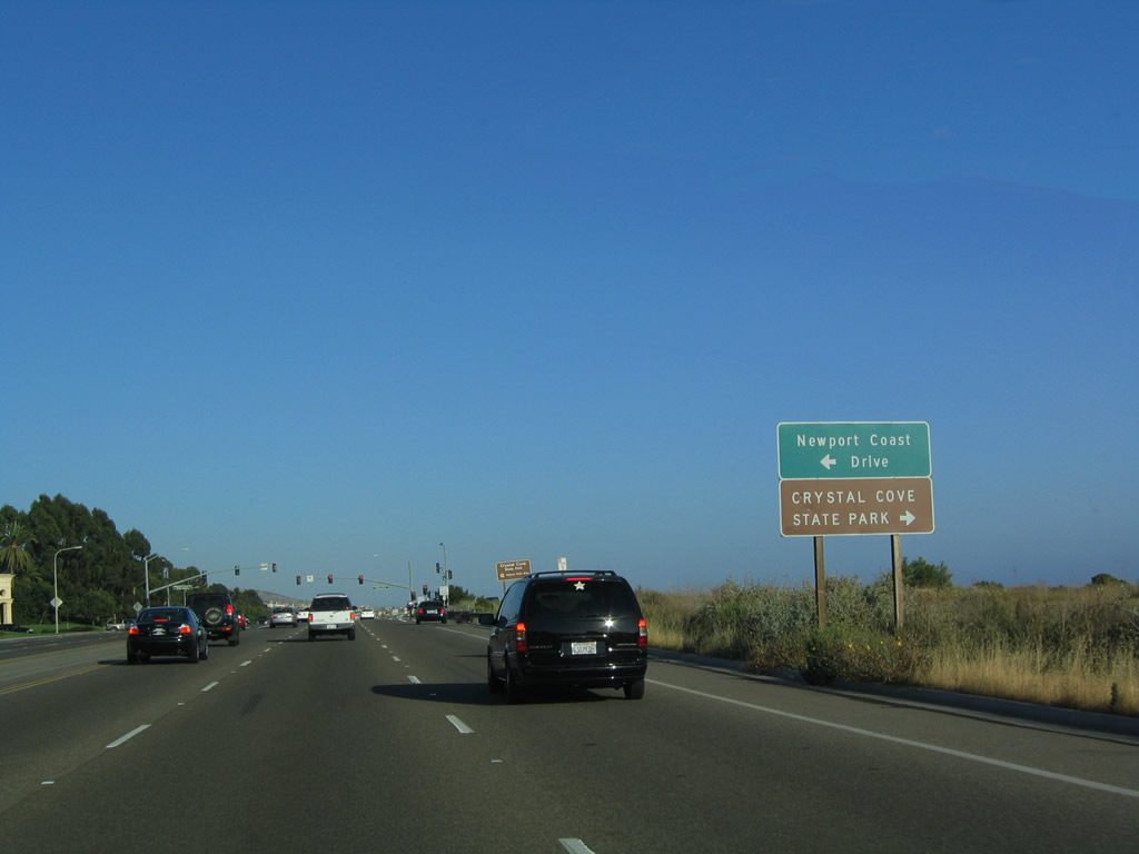 |
Leaving the urbanized area of Corona del Mar, southbound California 1 enters Crystal Cove State Park and approaches its intersection with Newport Coast Drive. Photo taken 05/30/04. |
 |
Coast Highway separates urbanized development to the north and east from the coastal bluffs and beach to the south and west. California 1 continues to cut in a southeastern direction through the park, which not only includes the beach but also includes a vast wilderness area that features several campgrounds. Photo taken 05/30/04. |
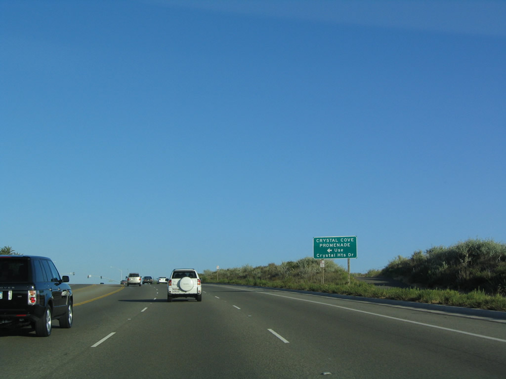 |
Crystal Heights Drive links leads California 1 south with the Cyrstal Cove Promenade. Photo taken 05/30/04. |
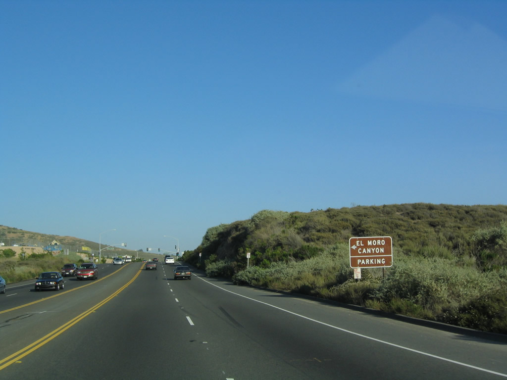 |
Southbound California 1 approaches El Moro Canyon Road, which offers access to El Moro Canyon within the state park. Photo taken 05/30/04. |
 |
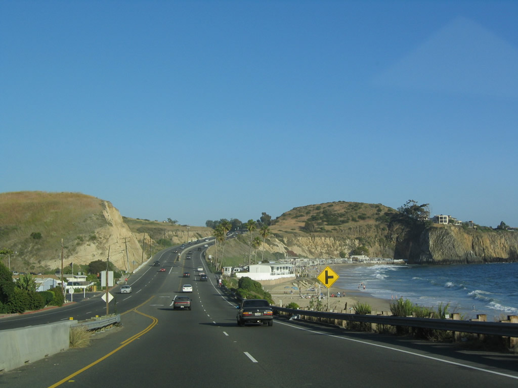 |
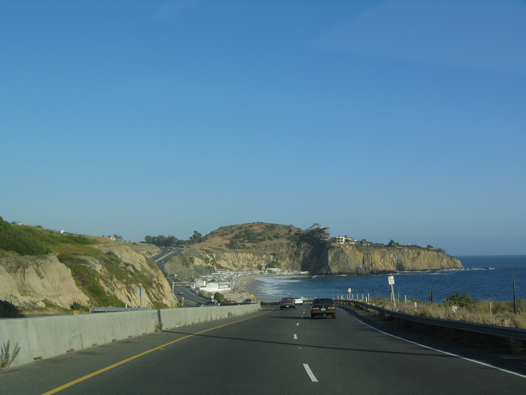
Toward the southern end of Crystal Cove State Park, California 1 sees some relatively undeveloped coastline before the highway approaches the southern edge of Newport Beach and northern edge of Laguna Beach and Emerald Bay. Photos taken 05/30/04. |
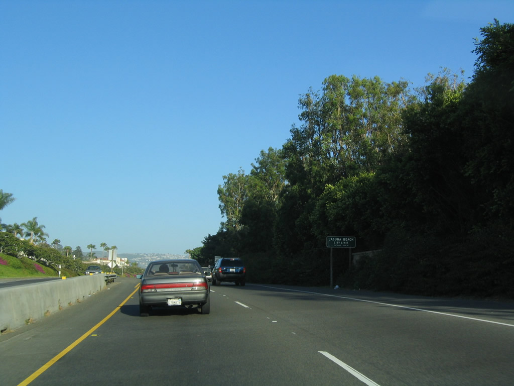 |
California 1 (Pacific Coast Highway) leaves Newport Beach and enters the city of Laguna Beach. The city was home to 23,727 as of the 2000 Census; it incorporated on June 29, 1927. Laguna Beach is well know for the arts, including its well-known Pageant of the Masters and a variety of art galleries. And of course, the city is known for its beaches. Photo taken 05/30/04. |
 |
The highway narrows to two lanes in each direction as it passes near Emerald Bay. Photo taken 05/30/04. |
 |
Nearing the intersection with San Joaquin Street, southbound California 1 straightens out as it proceeds southeast toward downtown Laguna Beach. Photo taken 05/30/04. |
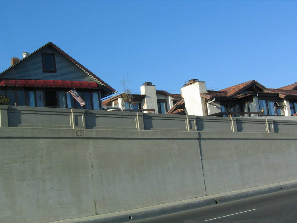 |
This retaining wall was put in place in 1932. Photo taken 05/30/04. |
 |
 |
Entering Downtown Laguna Beach, southbound California 1 (Pacific Coast Highway) approaches the turnoff to California 133 (Broadway / Laguna Canyon Road) north to Irvine. Comparing the 2004 and 2010 pictures, note that the California 133 shield was moved from its original position up to the traffic signal pole. Photos taken 05/30/04 and 01/31/10. |
 |
 |
Southbound California 1 (Pacific Coast Highway) meets California 133 (Broadway / Laguna Canyon Road) at this traffic signal. California 1 proceeds southeast through downtown Laguna Beach toward Dana Point, while California 133 turns north to pass through Laguna Canyon to connect to California 73 (San Joaquin Hills Transportation Corridor) and Interstate 5 and Interstate 405 near the El Toro Y interchange. A close look at the California 133 trailblazer shows a slightly different-than-usual font for the word "CALIFORNIA." This intersection marks the southern terminus of California 133, which assumes expressway characteristics north of the California 73 interchange. California 133 ends at California 241 as part of the Orange County Toll Road system. Photos taken 01/31/10. |
 |
 |
A California 1 south reassurance shield is posted shortly after the California 133 / Broadway intersection. This sign is posted next to Main Beach in the heart of Laguna Beach. Photos taken 01/31/10. |

Page Updated September 24, 2010.
|
About Contact Glossary |
In The News Testimonials Interstate Guide |
Social Media:
 |
|
© 2000-23 AARoads.com | All Rights Reserved | Privacy Policy / Terms of Use
|
||