
California 14 North - California 138 to Rosamond
| California 14 north and California 138 west | |
|---|---|
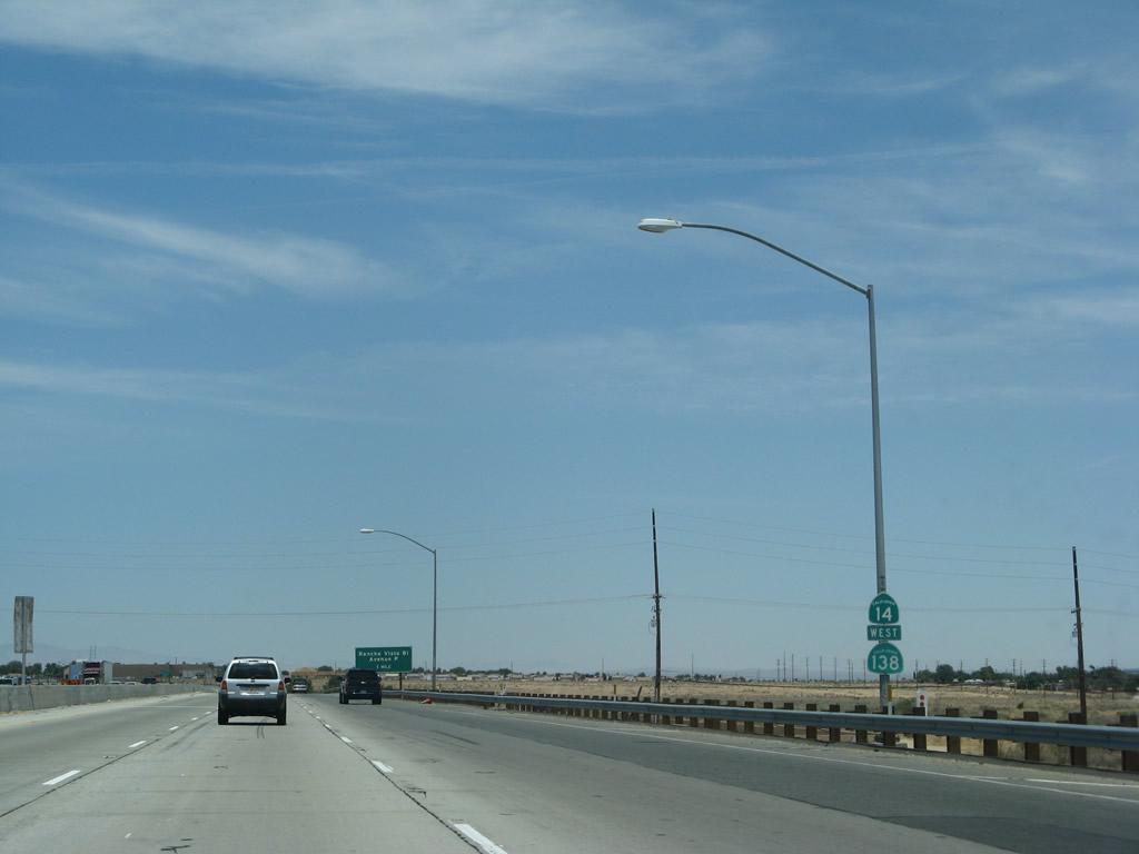 |
Generally, California 14 and California 138 are well-signed on their joined segment, which lasts from Exit 35 north to Exit 49. This particular assembly is located after Exit 36 and prior to Exit 37, Avenue P. Photo taken 07/04/07. |
 |
The next exit along California 14 (Antelope Valley Freeway) north and California 138 west is Exit 37, Avenue P and Rancho Vista Road. This is one of the first reflective signs installed along this stretch of California 14 and was placed prior to the exit numbering directive of 2002. Photo taken 07/04/07. |
 |
In Palmdale and Lancaster, the major east-west arterial roadways descend alphabetically from Avenue S to Avenue A north to the Los Angeles-Kern County line. The next exit (Avenue P) implies that we are 16 miles south of the county line (as P is the 16th letter in the alphabet). Photo taken 07/04/07. |
 |
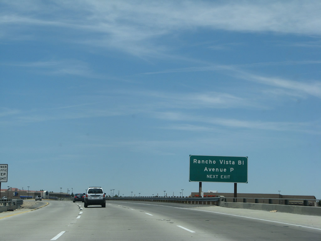
Northbound California 14 (Antelope Valley Freeway) and westbound California 138 at Exit 37, Avenue P/Rancho Vista Road. Notably, there are no mileage signs for specific exits along this stretch of California 14. Most of this freeway through Palmdale and Lancaster opened in stages between 1964 through 1974. Photo taken 07/04/07. |
 |
California 14 and California 138 crosses over Avenue P and Rancho Vista Road. Photo taken 07/04/07. |
 |
Another California 14 north and California 138 west reassurance shield is posted after the on-ramp from Exit 37, Avenue P. Photo taken 07/04/07. |
 |
The next exit along northbound California 14 (Antelope Valley Freeway) and westbound California 138 is Exit 39, Avenue N (0.75 mile). The freeway heads due north through the Antelope Valley, generally below grade, thus obscuring views of the surrounding development. Much of the area was developed and allows people to commute from the cheaper housing here to jobs in the greater Los Angeles area to the south. Photo taken 07/04/07. |
 |
Avenue N is another of the lettered series of east-west streets continue within the Palmdale-Lancaster metropolitan area. Photo taken 07/04/07. |
 |
Northbound California 14 (Antelope Valley Freeway) and westbound California 138 reaches Exit 37, Avenue N. Photo taken 08/16/03. |
 |
The next exit along California 14 (Antelope Valley Freeway) north and California 138 west is Exit 43, Avenue M (0.75 mile). This sign is mounted on the Avenue N overpass. Photo taken 07/04/07. |
 |
Another set of reassurance shields is posted after the Avenue N interchange. Photo taken 07/04/07. |
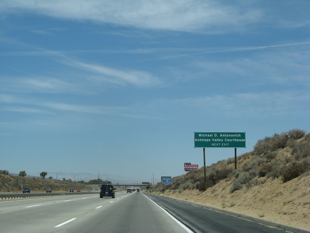 |
The Antelope Valley court house is located east of the freeway along Avenue N. Photo taken 07/04/07. |
 |
The next seven exits along northbound California 14 (Antelope Valley Freeway) and westbound California 138 serve the city of Lancaster: Exit 40, Avenue M; Exit 41, Avenue L; Exit 42, Avenue K; Exit 43, Los Angeles County N-5/Avneue J; Exit 44, Avneue I; Exit 45, Avenue H; and Exit 46, Avenue G. Photo taken 07/04/07. |
 |
Northbound California 14 (Antelope Valley Freeway) and westbound California 138 meet Exit 40, Avenue M. Photo taken 07/04/07. |
 |
At the Avenue M overpass, northbound California 14 (Antelope Valley Freeway) and westbound California 138 leave Palmdale and enter Lancaster. The city of Lancaster incorporated in 1977 and home to 118,718 people as of the 2000 Census. Like the nearby city of Palmdale, Lancaster experienced explosive growth during the 1970s and 1980s. Photo taken 07/04/07. |
 |
The next exit along California 14-138 north is Exit 41, Avenue L (one-quarter mile). Photo taken 07/04/07. |
 |
Northbound California 14 (Antelope Valley Freeway) and westbound California 138 reaches Exit 41, Avenue L. Photo taken 07/04/07. |
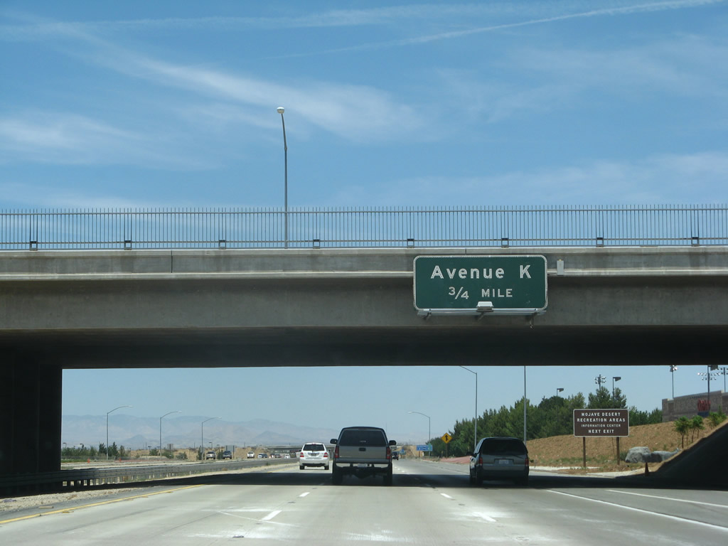 |
The next exit along northbound California 14 (Antelope Valley Freeway) and westbound California 138 is Exit 42, Avenue K (0.75 mile). The pattern of one lettered street per mile continues; this sign is mounted on the Avenue L overpass. It is three-quarters of a mile from the overpass to the exit gore and one mile between overpasses for lettered streets. Photo taken 07/04/07. |
 |
A motorist services sign advises that food, gas, and lodging are available at Exit 42. Photo taken 07/04/07. |
 |
Use Exit 42 to Antelope Valley College and a California State University-Bakersfield campus. Photo taken 07/04/07. |
 |
Northbound California 14 (Antelope Valley Freeway) and westbound California 138 meet Exit 42, Avenue K. Photo taken 07/04/07. |
 |
A California 14 north and California 138 west reassurance shield assembly is posted after the on-ramp from Avenue K. Photo taken 07/04/07. |
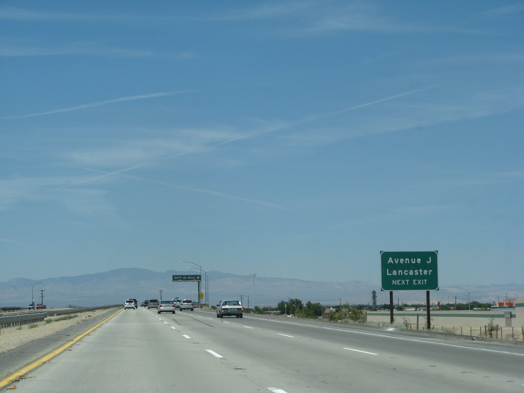 |
The next exit along California 14 north and California 138 west is Exit 43, Avenue J to 20th Street West (north/south). From this interchange, Los Angeles County N-5 travels east along Avenue J to Saddleback Butte County Park near the communities of Wilsona Gardens and Lake Los Angeles. This interchange marks the western end of County Route N-5. Photo taken 07/04/07. |
 |
Northbound California 14 north and westbound California 138 reaches Exit 43, Los Angeles County N-5/Avenue J east to 20th Street West, Lancaster, and Saddleback Butte County Park. To the west, Avenue J leads past a state prison en route to the unincorporated community of Del Sur. Photo taken 07/04/07. |
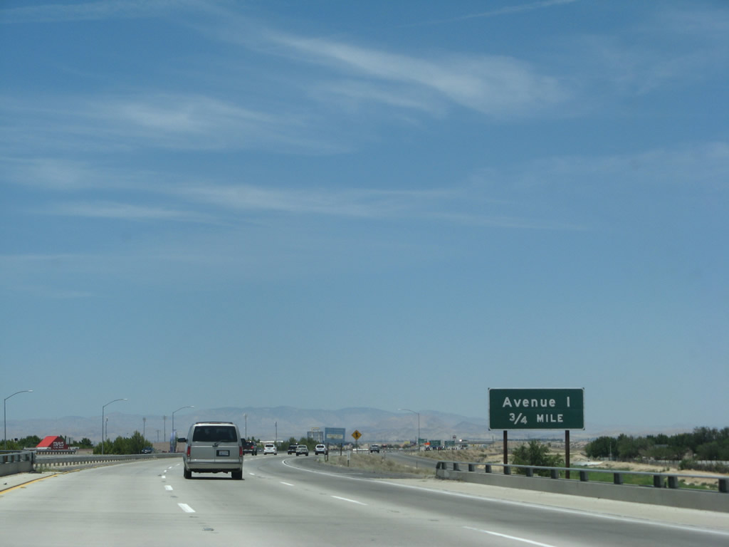 |
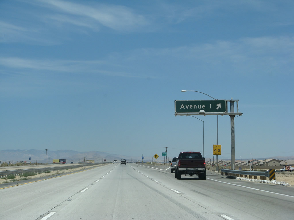
Traveling above grade for a change, northbound California 14 (Antelope Valley Freeway) and Westbound California 138 curve a bit to the northwest to avoid downtown Lancaster. Avenue I, which is Exit 44, leads into downtown Lancaster. Photo taken 07/04/07. |
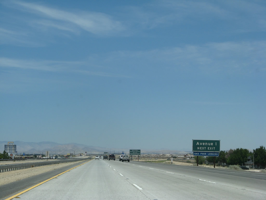 |
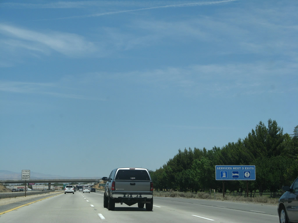
All motorist services are available at Exit 44, Avenue I. Photo taken 07/04/07. |
 |
Northbound California 14 (Antelope Valley Freeway) and westbound California 138 meet Exit 44, Avenue I to downtown Lancaster. The downtown area is situated between Avenue I and Avenue J along Sierra Highway (old U.S. 6). After Avenue I, the freeway loses a lane, dropping from six to four lanes overall. For those traveling north to Reno, we won't see six lanes again until entering the Carson City-Reno urban area. Photo taken 07/04/07. |
 |
A California 14 north and California 138 west reassurance shield assembly is posted after Exit 44, Avenue I. Photo taken 07/04/07. |
 |
This mileage sign along California 14 north and California 138 west provides the distance to Rosamond and Edwards Air Force Base (11 miles) and Mojave (25 miles). Photo taken 07/04/07. |
 |
The next exit along California 14 north and California 138 west is Exit 45, Avenue H (next right). Photo taken 07/04/07. |
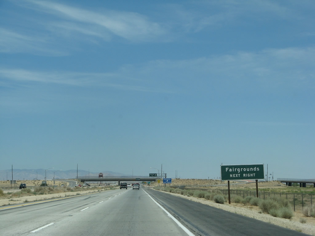 |
The Antelope Valley Fairgrounds are at the next exit. Photo taken 07/04/07. |
 |
Northbound California 14 and westbound California 138 meet Exit 45, Avenue H. Photo taken 07/04/07. |
 |
The next exit along California 14 (Antelope Valley Freeway) north and California 138 west is Exit 46, Avenue G (0.75 mile). Photo taken 07/04/07. |
 |
A California 14 north and California 138 west reassurance shield assembly is posted after the on-ramp from Exit 45. Photo taken 07/04/07. |
 |
Use Avenue G west to General William J. Fox Airport and Apollo County Park. This is the last interchange to serve the city of Lancaster. Photo taken 07/04/07. |
 |
Northbound California 14 (Antelope Valley Freeway) and westbound California 138 meet Exit 46, Avenue G. Both the airport and the park are located west of the freeway. Photo taken 07/04/07. |
 |
The next exit along California 14 (Antelope Valley Freeway) north and California 138 west is Exit 47, Avenue F, three-quarters of a mile. This is the last of the exits spaced every mile since the Avenue N interchange. Photo taken 07/04/07. |
 |
A California 14 north and California 138 west reassurance shield assembly is posted after the on-ramp from Exit 46. Photo taken 07/04/07. |
 |
A second California 14 reassurance shield is posted on this green sign just north of the Avenue G interchange. Photo taken 07/04/07. |
 |
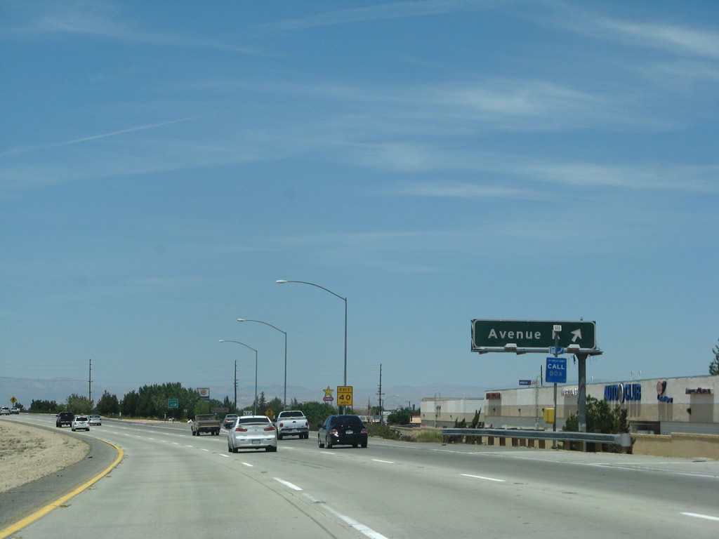
The next exit along California 14-138/Antelope Valley Freeway north is Exit 47, Avenue F. Photo taken 07/04/07. |
 |
 |
Northbound California 14 (Antelope Valley Freeway) and westbound California 138 meet Exit 47, Avenue F. Note the use of two separate signs to indicate this exit. Marc Reitzell indicates that the 2003 sign (now gone) for Avenue F is actually a "fold-out" sign. It is opened when the space shuttle comes to Edwards Air Force Base, which doesn't happen much anymore. When opened, that sign used to say something like, "Space Shuttle Viewing Site." Avenue F runs along the south boundary of Edwards Air Force Base to 120th Street East. Those interested in seeing the shuttle could then go through the south base gate on 120th Street East. You can also short cut to California 58 through the east side of Edwards by going this way to 120th Street East and then take Avenue B to Mercury Boulevard to Rich Road. Rich Road arrives in Boron (along the U.S. 466 corridor) eventually. Photo taken 08/16/03. |
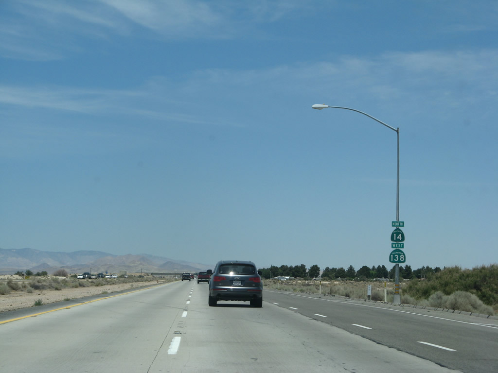 |
A final California 14 north and California 138 west reassurance shield assembly is posted after the on-ramp from Exit 47. Photo taken 07/04/07. |
 |
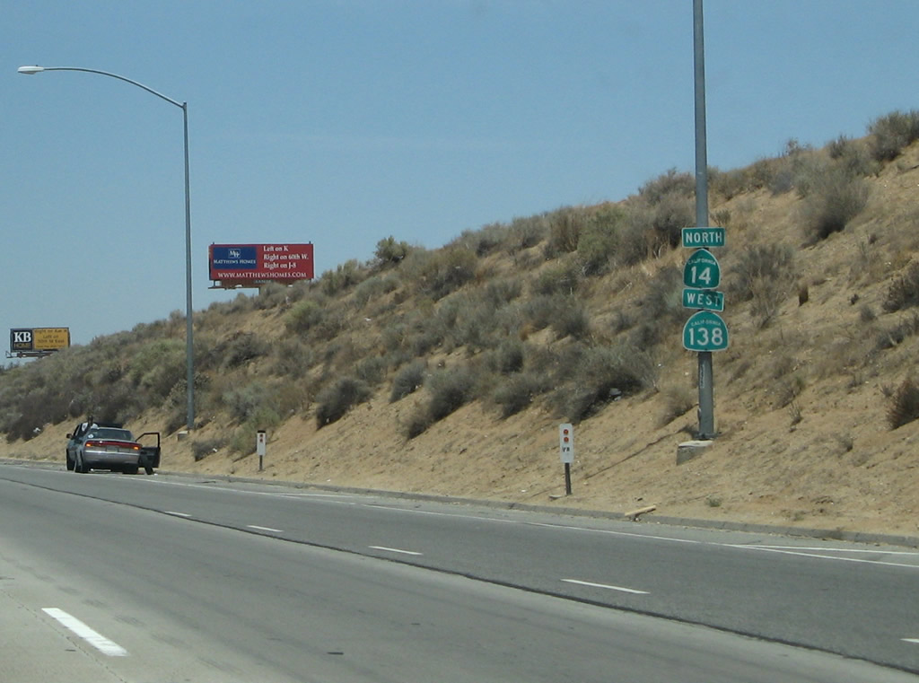
The next exit along California 14 (Antelope Valley Freeway) north is Exit 49, California 138/Avenue D west to Gorman. California 138 is slated for a freeway realignment that would move the route to a more direct diagonal route from Palmdale to Gorman and thus avoid the shared route with California 14. Such a new route is years away, if it ever occurs. Since California 138 is planned to be realigned, this interchange is proposed for the eventual California 48 connection. California 48 is a proposed east-west freeway that would provide a link across the northern tier of the Antelope Valley between future California 138 and a proposed north-south freeway called California 122 that would extend from California 138 east of Palmdale north to California 58 near Boron, east of Edwards Air Force Base. All these freeways are long-range proposals that are not imminently going to be constructed, and no official route has been defined yet. Photo taken 07/04/07. |
 |
Had the once-proposed Metropolitan Bypass been constructed, it would have followed California 138 and intersected the California 14 freeway near here, perhaps as part of the unconstructed California 48 freeway. Currently there are no further plans to construct California 138 as a freeway, but talk of such a corridor may still be resurrected at a future time depending on need for a bypass of Los Angeles as well as the growth and development of Antelope Valley. Photo taken 07/04/07. |
 |
Northbound California 14 (Antelope Valley Freeway) reaches Exit 49, California 138/Avenue D west to Gorman. Only four more miles of Los Angeles County remain after this interchange along northbound California 14 (Antelope Valley Freeway). Photo taken 07/04/07. |
| California 14 - Antelope Valley Freeway - north | |
|---|---|
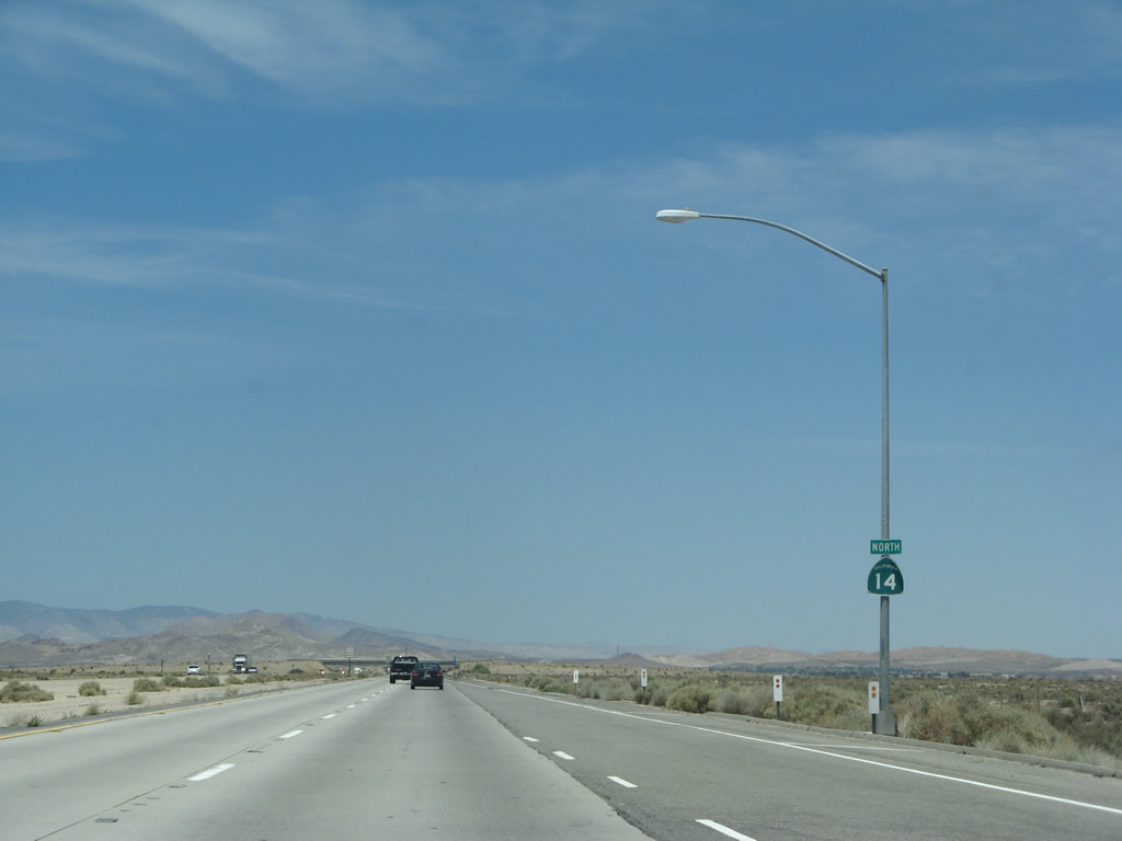 |
A standalone California 14 north reassurance shield is posted shortly thereafter. Photo taken 07/04/07. |
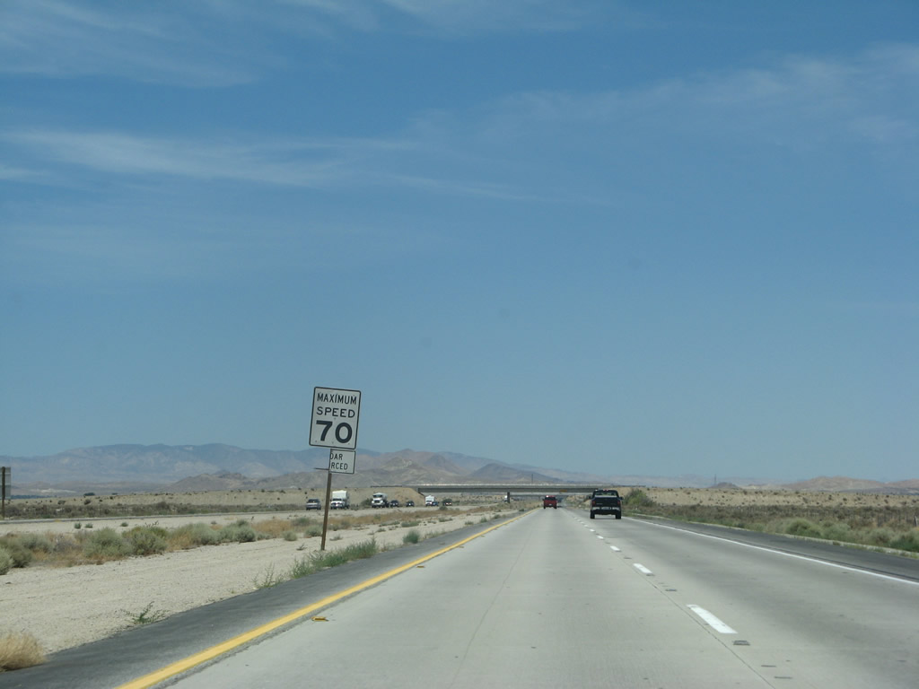 |
The speed limit increases to 70 miles per hour for the remainder of the freeway route north through Rosamond into the southern outskirts of Mojave. Photo taken 07/04/07. |
 |
The next exit along California 14 (Antelope Valley Freeway) north is Exit 52, Avenue A (one mile). Photo taken 07/04/07. |
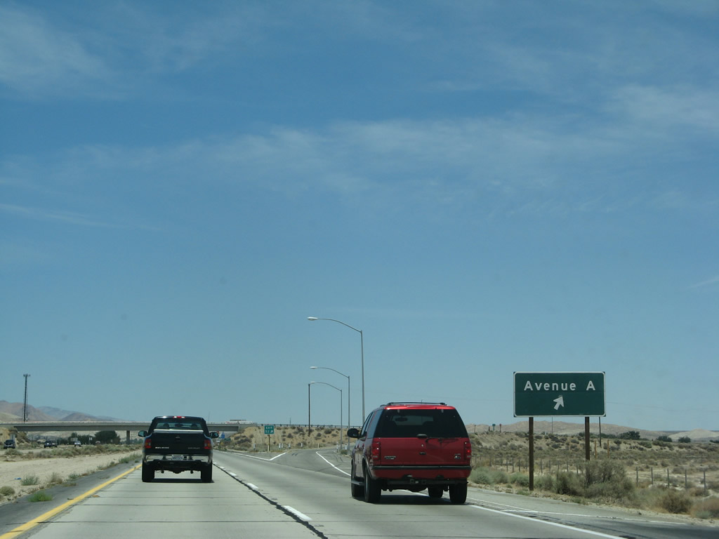 |
Northbound California 14 (Antelope Valley Freeway) reaches Exit 52, Avenue A. In the Los Angeles County grid pattern for Antelope Valley, Avenue A is the most northerly east-west road, and it forms the LA-Kern county line. The freeway now departs Los Angeles County and enters Kern County. Photo taken 07/04/07. |
 |
California 14 passes under the Avenue A overpass and enters Kern County. Photo taken 07/04/07. |

Page Updated September 16, 2009.
|
About Contact Glossary |
In The News Testimonials Interstate Guide |
Social Media:
 |
|
© 2000-23 AARoads.com | All Rights Reserved | Privacy Policy / Terms of Use
|
||