| California 14 - Antelope Valley Freeway south |
|
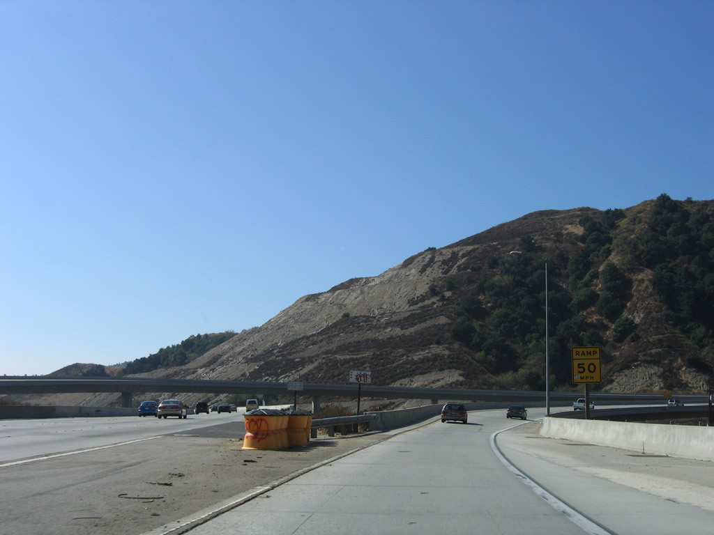
This view looks west along California 14; the total number of lanes drops from 3+1 to 2+1. Photo taken 07/19/09. |
|
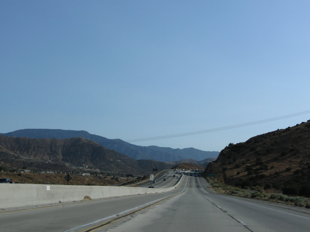
The next exit along California 14 (Antelope Valley Freeway) is Exit 27, Sierra Highway and Soledad Canyon Road. Photo taken 07/19/09. |
|
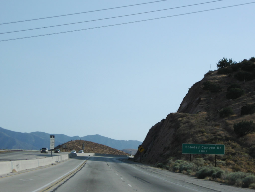
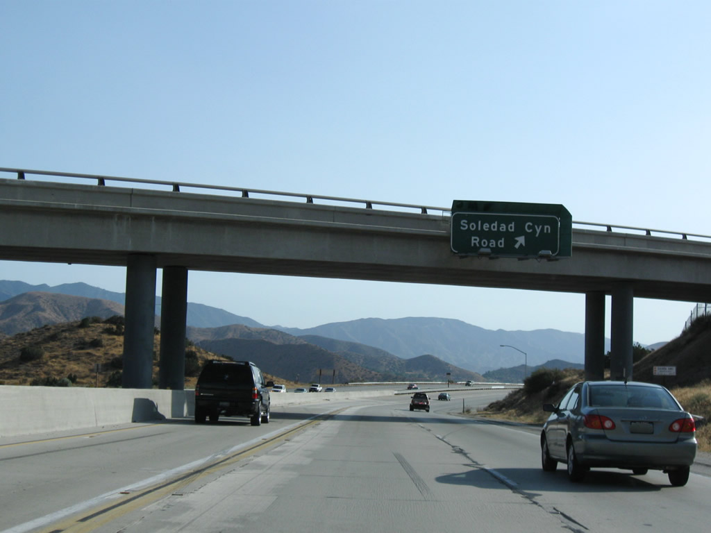
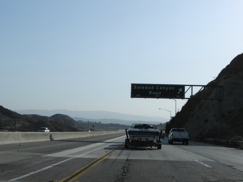
Southbound California 14 (Antelope Valley Freeway) reaches Exit 27, Sierra Highway (old U.S. 6) and Soledad Canyon Road. Photo taken 07/19/09. |
|
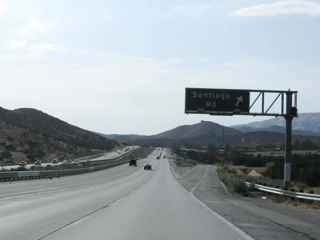
Shortly thereafter, southbound California 14 (Antelope Valley Freeway) reaches Exit 26, Santiago Road. Photo taken 07/19/09. |
|
Two miles further west, southbound California 14 (Antelope Valley Freeway) meets Exit 24, Crown Valley Road. Use Crown Valley Road south to Acton, which is located along Soledad Canyon Road. Photo taken 07/19/09. |
|
Southbound California 14 (Antelope Valley Freeway) next reaches Exit 22, Sierra Highway (old U.S. 6) west, Ward Road, Escondido Canyon Road, and Red Rover Mine Road. Photo taken 07/19/09. |
|
A ghost ramp that appears not to be in use is visible along southbound California 14 (Antelope Valley Freeway) between Exit 22 and Exit 19. Photo taken 07/19/09. |
|
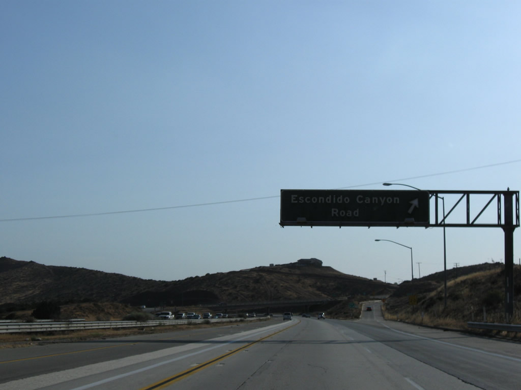
The next exit along southbound California 14 (Antelope Valley Freeway) is Exit 19, Escondido Canyon Road (one mile). Photo taken 07/19/09. |
|
Escondido Canyon Road loops south of California 14 between Exits 22 and 19. "Escondido" is Spanish for "hidden." Photo taken 07/19/09. |
|
Southbound California 14 (Antelope Valley Freeway) reaches Exit 19, Escondido Canyon Road. At elevation 3,258 feet, California 14 crosses Escondido Summit. Photo taken 07/19/09. |
|
Southbound California 14 (Antelope Valley Freeway) descends from Escondido Summit. Photo taken 07/19/09. |
|
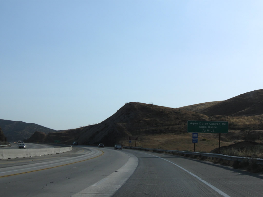
Southbound California 14 (Antelope Valley Freeway) approaches its next exit, which is Exit 15, Agua Dulce Canyon Road (one mile). Photo taken 07/19/09. |
|
Use Agua Dulce Canyon Road north to the unincorporated community of Agua Dulce, which sits on Sierra Highway (old U.S. 6). Photo taken 07/19/09. |
|
Exit 15 serves Agua Dulce Canyon. Photo taken 07/19/09. |
|
Southbound California 14 (Antelope Valley Freeway) reaches Exit 15, Agua Dulce Canyon Road to Agua Dulce. Photo taken 07/19/09. |
|
Continuing southwest, California 14 sees more elevation drops as it proceeds toward Santa Clarita. Photo taken 07/19/09. |
|
The next exit along California 14 south is Exit 11, Soledad Canyon Road to Soledad Canyon (one mile). Photo taken 07/19/09. |
|
Southbound California 14 meets Exit 11, Soledad Canyon Road. Photo taken 07/19/09. |
|
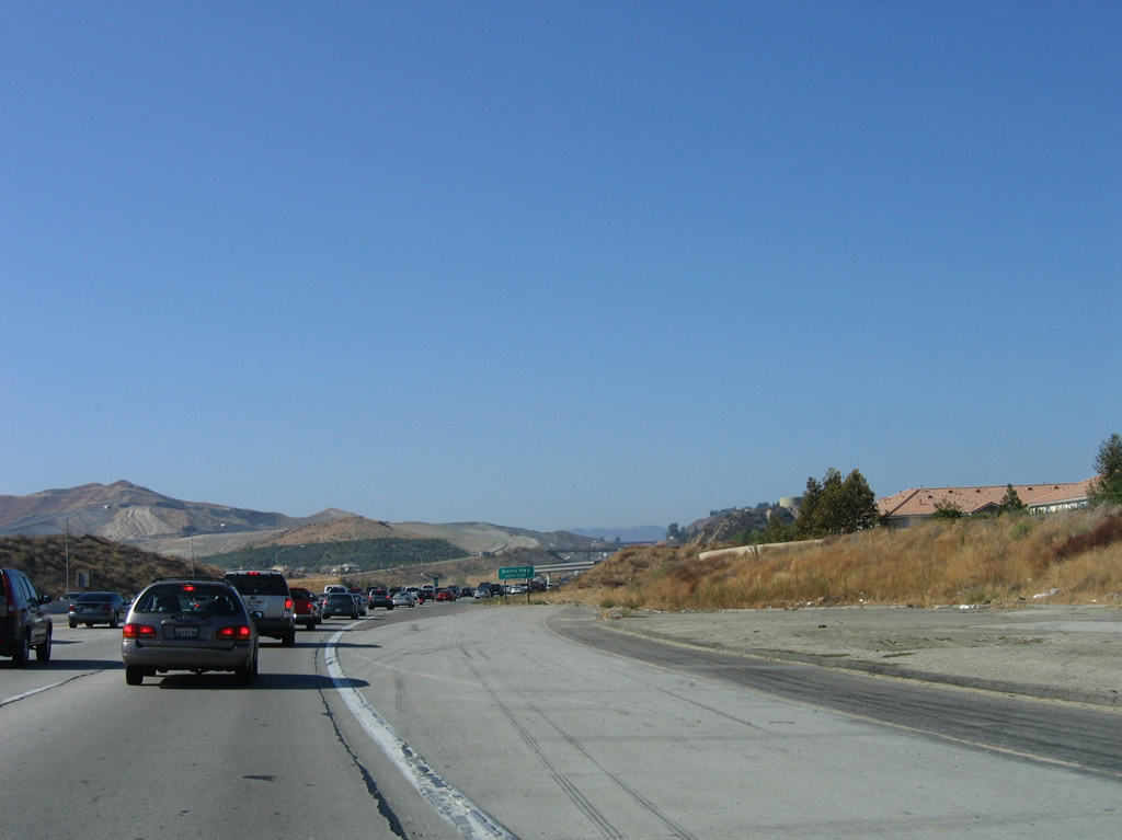
The next exit along California 14 south is Exit 9, Sand Canyon Road. California 14 enters the outskirts of the city of Santa Clarita, which has grown substantially through the 1980s, 1990s, and 2000s as it has annexed nearby lands to create more suburban living. With the creation of new housing tracts in formerly rural areas, large tract home developments and commercial areas have grown along with traffic congestion. Santa Clarita incorporated on December 15, 1987, as a consolidation of the previously unincorporated communities of Canyon Country, Newhall, Saugus, and Valencia. New communities are commonly seen along the California 14 corridor as the land becomes more highly coveted for residential development. Photo taken 07/19/09. |
|
This California 14 south reassurance shield is posted after the Sand Canyon Road interchange (Exit 9). Photo taken 10/07/06. |
|
A short distance later is this entrance to the high-occupancy vehicle lane. Photo taken 10/07/06. |
|
1.75 miles further south, SR 14 meets Via Princessa and Sierra Highway (old U.S. 6) at Exit 6. Photo taken 10/07/06. |
|
This mileage sign provides the distance to the next two exits along California 14 south: Exit 6, Via Princessa and Sierra Highway (old U.S. 6) and Exit 5, Golden Valley Road. Photo taken 10/07/06. |
|
A concrete lane appears to depart from the main lanes of the California 14. This ramp was constructed as part of the planned California 126 freeway that was to cross Santa Clarita in the 1970s. However, the crosstown freeway proposal was canceled, and by 2002, California 126 was retracted from Santa Clarita east of Interstate 5. The original California 126 interchange with California 14 was located at the San Fernando Road interchange, but that route is now a locally maintained road. Photo taken 10/07/06. |
|
Old U.S. 6 follows Sierra Highway as it parallels California 14 from Lancaster-Palmdale southwest to Santa Clarita. The former U.S. highway is a good alternative to California 14 when the freeway has congestion and traffic. Photo taken 10/07/06. |
|
Southbound California 14 (Antelope Valley Freeway) reaches Exit 6, Via Princessa and Sierra Highway (old U.S. 6). Photo taken 10/07/06. |
|
An exit number is posted at the gore point for Exit 6. Photo taken 10/07/06. |
|
|
|
Looking northwest from the Sierra Highway and Via Princessa interchange is this view of a flyover ramp that was built as part of the California 126 freeway project. The ramp was designed to carry traffic from northbound California 14 freeway to the westbound California 126 freeway. Photos taken 10/07/06. |
|
This mileage sign provides the distance to the next two exits along California 14 south: Exit 5, Golden Valley Road; Exit 3, Placerita Canyon Road; and Exit 2, San Fernando Road to Newhall Avenue. Photo taken 10/07/06. |
|
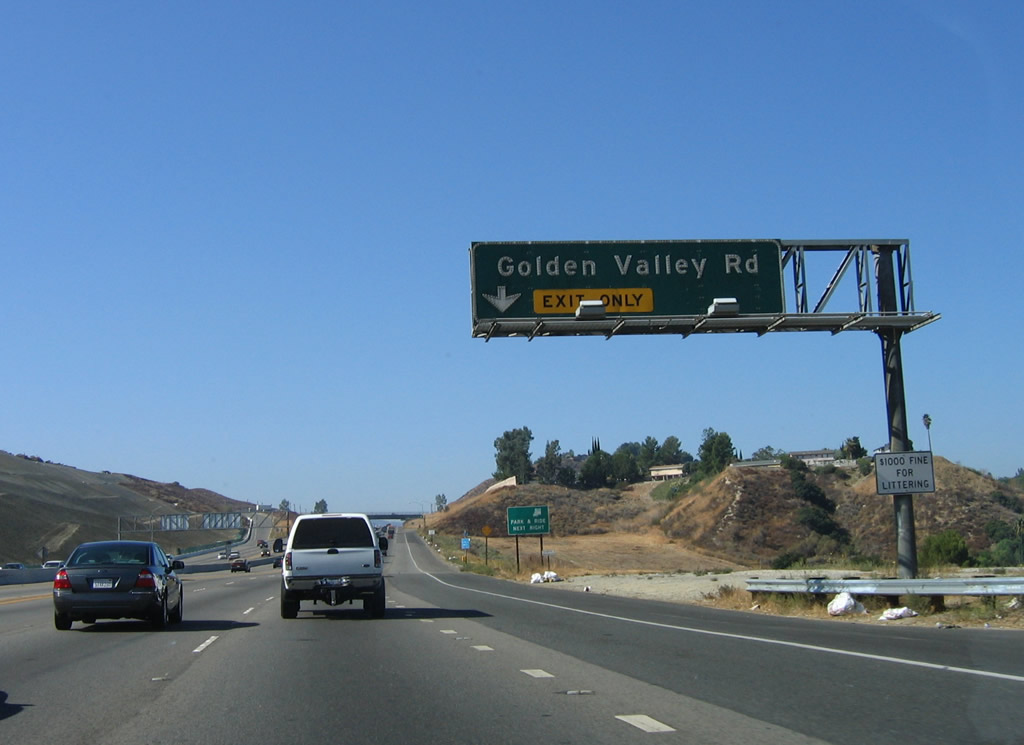
The right lane of California 14 (Antelope Valley Freeway) south becomes exit only for Exit 5, Golden Valley Road. Photo taken 10/07/06. |
|
Southbound California 14 (Antelope Valley Freeway) reaches Exit 5, Golden Valley Road. Photo taken 10/07/06. |
|
A California 14 south reassurance shield is posted after the on-ramp from Exit 5, Golden Valley Road in Santa Clarita. Photo taken 10/07/06. |
|
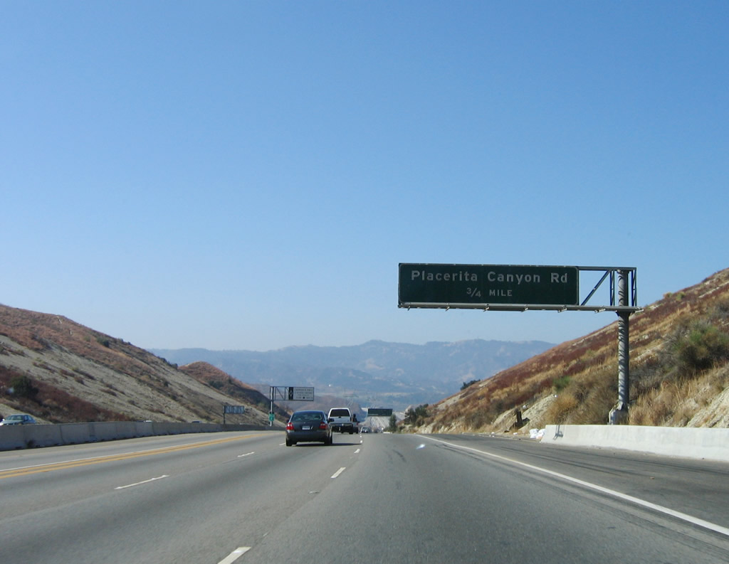
The next exit along California 14 south is Exit 3, Placerita Canyon Road (0.75 mile). This is another in a series of older, porcelain-enamel overhead signs that date prior to 1972. Photo taken 10/07/06. |
|
|
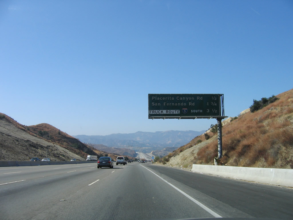
This mileage sign provides the distance to the final five exits along California 14 south: Exit 3, Placerita Canyon Road; Exit 2, Newhall Avenue (former California 126 / San Fernando Road); and Exits 1C-B-A, Interstate 5 (Golden State Freeway), including the truck bypass lanes. Photos taken 12/20/09 and 10/07/06. |
|
Use Exit 3, Placerita Canyon Road east to Placerita Canyon Park (regional open space park). Photo taken 10/07/06. |
|
|
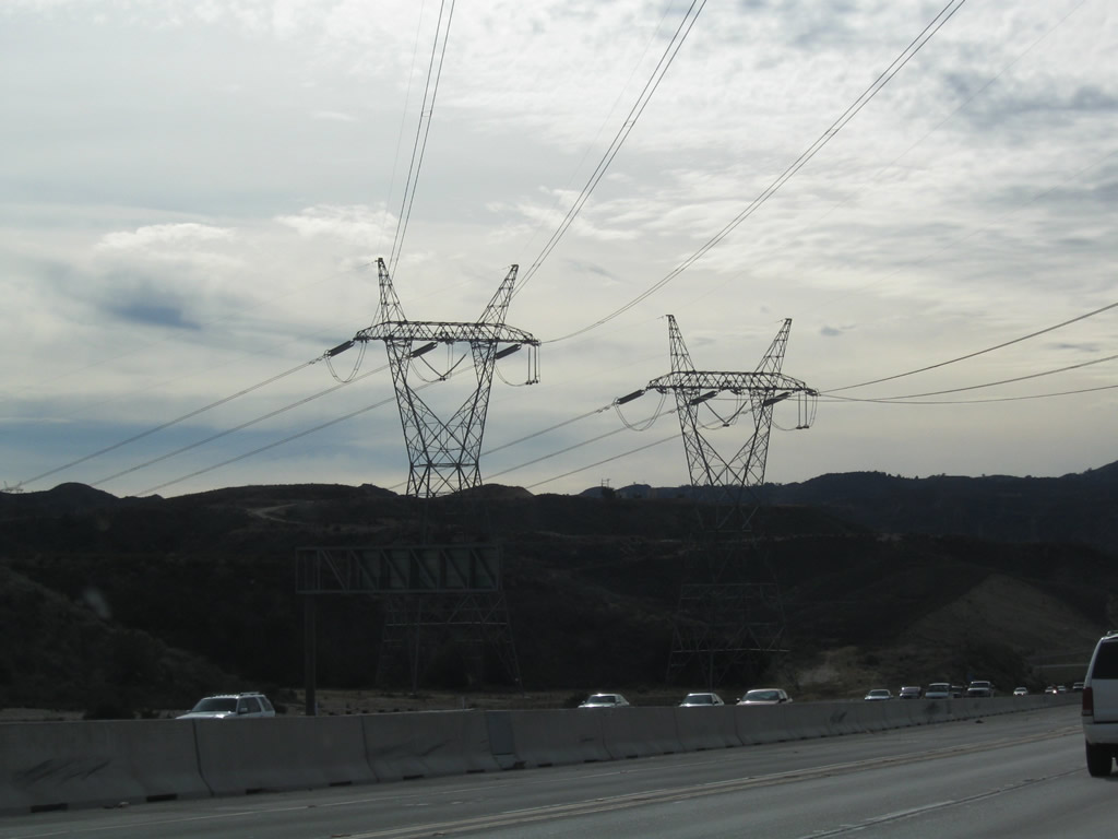
A pair of 500kV power transmission lines (owned by the Los Angeles Department of Water and Power) cross over California 14 at this point. Photos taken 12/20/09 and 10/07/06. |
|
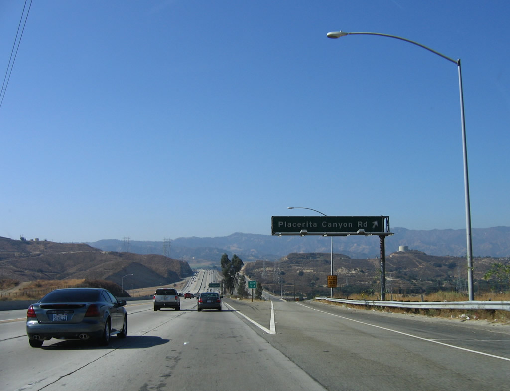
Southbound California 14 (Antelope Valley Freeway) reaches Exit 3, Placerita Canyon Road. Photo taken 10/07/06. |
|
|
The next exit along California 14 (Antelope Valley Freeway) south is Exit 2, Newhall Avenue (former California 126 / San Fernando Road) north to Newhall Avenue and Sierra Highway. A California 126 shield was scraped off the original overhead sign; an exit number sign was posted when San Fernando Road was renamed as Newhall Avenue in 2008. Photos taken 12/20/09 and 10/07/06. |
|
A California 14 south reassurance shield is posted after the on-ramp from Placerita Canyon Road. Another set of major power transmission lines crosses over California 14, including the Pacific Intertie (Path 65), which carries electricity generated along the Columbia River in Oregon south to the greater Los Angeles area. Photo taken 10/07/06. |
|
|
This mileage sign provides the distance to the final four exits along California 14 south: Exit 2, Newhall Avenue; Exit 1C, Truck Bypass to Interstate 5 south and The Old Road; and Exits 1B-A, Interstate 5 (Golden State Freeway) north to Sacramento and south to Los Angeles. Photos taken 12/20/09 and 10/07/06. |
|
|
Southbound California 14 (Antelope Valley Freeway) reaches Exit 2, Newhall Avenue (former California 126 / San Fernando Road). Use San Fernando Road north to Sierra Highway (California 14U). From that intersection, U.S. 99 proceeds north along San Fernando Road into Santa Clarita and south along with Sierra Highway (old U.S. 6) toward Los Angeles (Sylmar). Photos taken 07/19/09 and 10/07/06. | d
|
Turn right on San Fernando Road (former U.S. 99) to Santa Clarita, which includes Newhall and Valencia. Turn left to a parking area for open space access. Photo taken 10/07/06. |
|
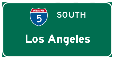
The final three exits along California 14 (Antelope Valley Freeway) south are Exit 1C, Truck Bypass for Interstate 5 (Golden State Freeway) south to Los Angeles, with a connection to The Old Road; Exit 1B, Interstate 5 (Golden State Freeway) north to Sacramento; and Exit 1A, Interstate 5 (Golden State Freeway) south to Los Angeles, Santa Ana, and San Diego. Photo taken 07/19/09. |
|
Use Exit 1C, Truck Bypass for the connection to The Old Road, which parallels Interstate 5 from the California 14 interchange northwest toward Magic Mountain. Photo taken 10/07/06. |
|
|
The next two exits along California 14 (Antelope Valley Freeway) south are Exit 1C, Truck Bypass for Interstate 5 (Golden State Freeway) south to Los Angeles, with a connection to The Old Road and Exit 1B, Interstate 5 (Golden State Freeway) north to Sacramento. Photos taken 12/20/09 and 10/07/06. |
|
Southbound California 14 (Antelope Valley Freeway) splits. The right two lanes depart here for Exit 1C, Truck Bypass for Interstate 5 (Golden State Freeway) south to Los Angeles, with a connection to The Old Road. The middle lane connects to Exit 1B, Interstate 5 (Golden State Freeway) north to Sacramento, while the left three lanes will connect to Exit 1A, Interstate 5 (Golden State Freeway) south to Los Angeles, Santa Ana, and San Diego. A construction project will add High Occupancy Vehicle (HOV) lane connectors between California 14 and Interstate 5. Photo taken 10/07/06. |
|
As the truck lanes depart to the right, this sign indicates that the Interstate 5 and California 14 interchange is known as the Los Angeles Police Officer Clarence Wayne Dean Memorial (Newhall Pass) Interchange. Officer Dean was killed when the ramp (connecting California 14 south to Interstate 5 south) he was riding on his motorcycle collapsed underneath him during the January 17, 1994, Northridge Earthquake (6.6 quake). That temblor caused the ramp to collapse to the ground, and the police officer was forced off the ramp to the distant ground below. Photo taken 10/07/06. |
|
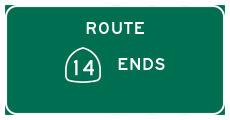
California 14 (Antelope Valley Freeway) ends at the point where the right lane departs for Exit 1B, Interstate 5 (Golden State Freeway) north to Sacramento and the left lanes merge onto Exit 1A, Interstate 5 (Golden State Freeway) south to Los Angeles, Santa Ana, and San Diego. Photo taken 10/07/06. |
|
This view shows the split between Exits 1B and 1A. There is no end shield for California 14. Photo taken 10/07/06. |
|
Now on the Exit 1B transition ramp, this view shows the link from California 14 south to Interstate 5 north. The Interstate 5 Truck Bypass can be seen from below the flyover ramp. Photo taken 10/07/06. |
|
The transition ramp from California 14 south to Interstate 5 north merges together at this point. Photo taken 10/07/06. |
Page Updated July 7, 2010.