

California 60 East - California 57 north to Interstate 15
| California 60 east | ||
|---|---|---|
 |
After the split from California 57 north, eastbound California 60 (Pomona Freeway) reaches Exit 26, Diamond Bar Boulevard. This interchange is the last one to serve the city of Diamond Bar before California 60 proceeds into Pomona. Photo taken 07/15/06. | |
 |
This mileage sign provides the distance for the next four exits on California 60 (Pomona Freeway) east: Exit 28, Phillips Ranch Road; Exits 29A-B, California 71 and Garey Avenue; and Exit 30, Reservoir Street. Photo taken 02/26/11. | |
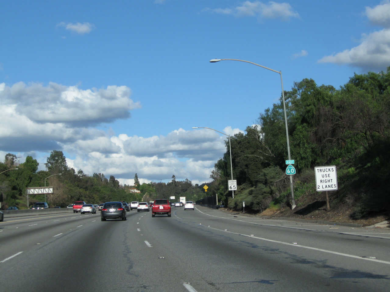 |
This California 60 east reassurance shield is posted after the on-ramp from Diamond Bar Boulevard. The freeway now travels uphill between Exits 26 and 28. Photo taken 02/26/11. | |
 |
The next exit on California 60 (Pomona Freeway) east is Exit 28, Phillips Ranch Road. Photo taken 02/26/11. | |
 |
 |
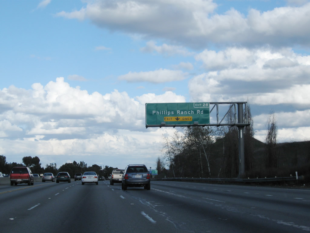
The right lane of California 60 (Pomona Freeway) east becomes exit only for Exit 28, Phillips Ranch Road. An exit number was added here between 2006 and 2011. Photos taken 02/26/11 and 07/15/06. |
 |
Nearing the top of the grade, California 60 (Pomona Freeway) enters the city of Pomona. Home to 149,473 people as of the 2000 Census, Pomona was incorporated on January 6, 1888. Photo taken 07/15/06. | |
 |
 |
Eastbound California 60 (Pomona Freeway) reaches Exit 28, Phillips Ranch Road; this is the first exit to serve the city of Pomona. Photos taken 02/26/11 and 07/15/06. |
 |
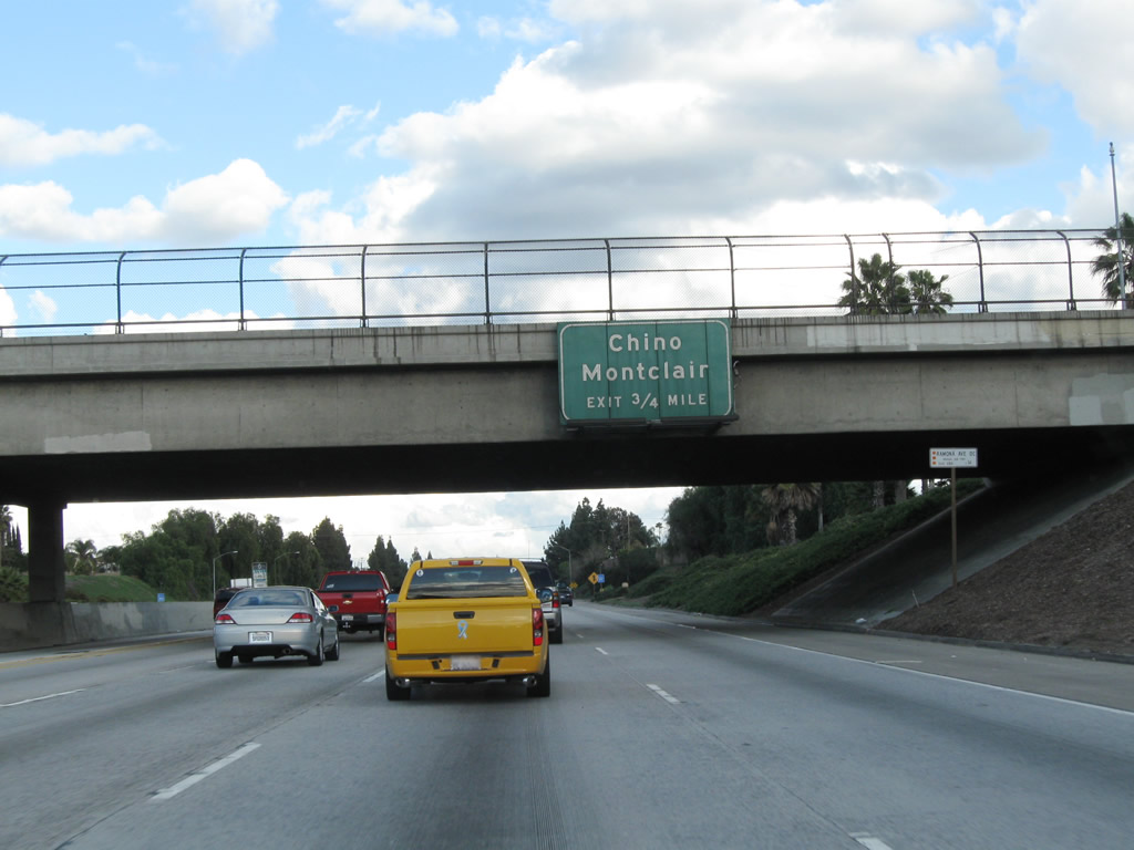
The next interchange on California 60 (Pomona Freeway) east is Exit 29, California 71 (Chino Hills Freeway). Use California 71 north to Business Loop I-10 (Holt Avenue) east to Pomona. Even though California 71 is called the Chino Hills Freeway, it is not a freeway through Pomona (between California 60 and Interstate 10) yet. An interchange at Mission Boulevard was slated for completion in 2010. However, the long-range Metro transportation planning document suggesting that funding may not be available for the completion of the California 71 freeway gap until 2029 due to limited funding availability. It has an expressway section through Pomona, but the rest of the route southeast to California 91 (Riverside Freeway) near Corona is up to freeway standards. Use California 71 north to Business Loop I-10 (Holt Avenue) (former U.S. 70-99) east into downtown Pomona. Photo taken 07/15/06. | |
 |
This mileage sign provides the distance for the next three exits on California 60 (Pomona Freeway) east: Exit 29A, California 71 (Chino Hills Freeway) south; Exit 29B, Garey Avenue; and Exit 30, Reservoir Street. Photo taken 07/15/06. | |
 |
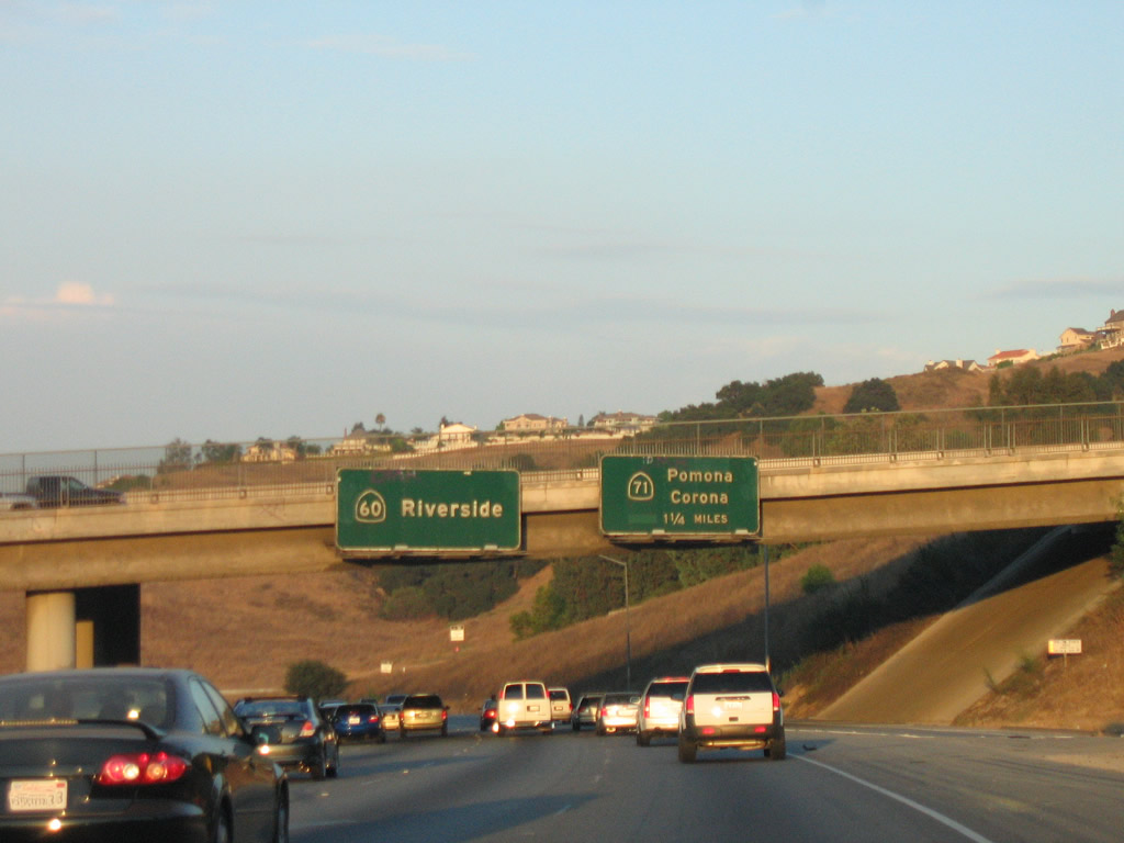
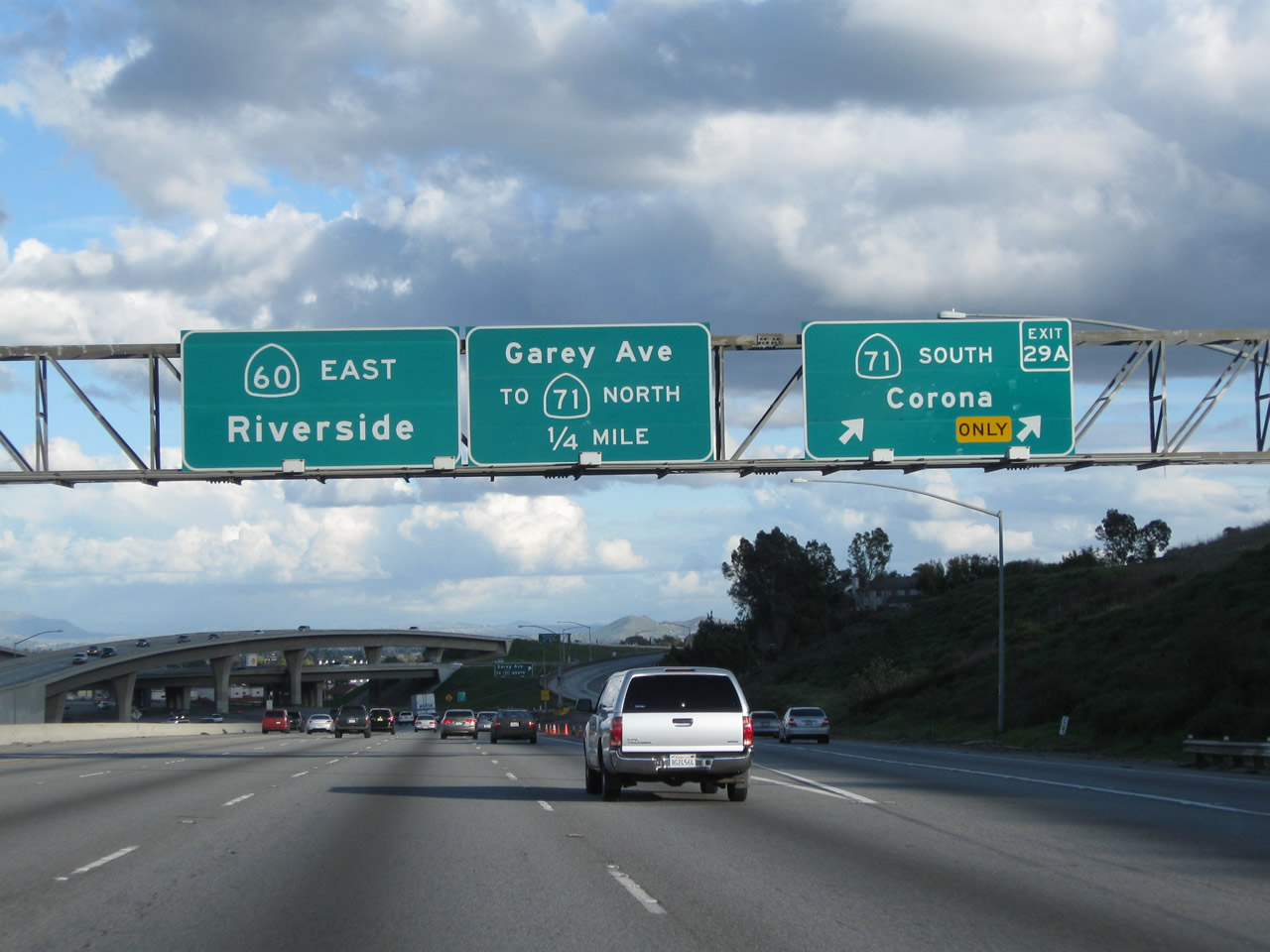
The right two lanes of California 60 (Pomona Freeway) east will connect to Exit 29A, California 71 (Chino Hills Freeway) south. To California 71 north, use Garey Avenue north. Photo taken 07/15/06. | |
 |
 |
Eastbound California 60 (Pomona Freeway) reaches Exit 29A, California 71 (Chino Hills Freeway) south to Corona. The second exit is Exit 29B, Garey Avenue to California 71 north. The control city for California 60 east changes from Pomona to Riverside. From here east to the eastern terminus in Beaumont, California 60 generally follows the path of Historic U.S. 60. Photo taken 02/26/11 and 07/15/06. |
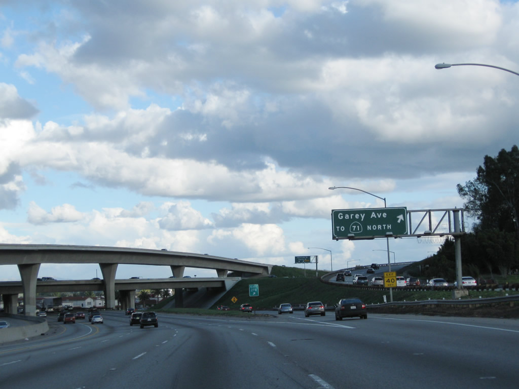 |
Immediately thereafter, eastbound California 60 (Pomona Freeway) meets Exit 29B, Garey Avenue to California 71 north. Photo taken 02/26/11. |
 |
California 60 (Pomona Freeway) passes through the California 71 interchange. Photo taken 02/26/11. |
 |
The final exit from California 60 (Pomona Freeway) east in Los Angeles County (city of Pomona) is Exit 30, Reservoir Street. Photo taken 02/26/11. |
 |
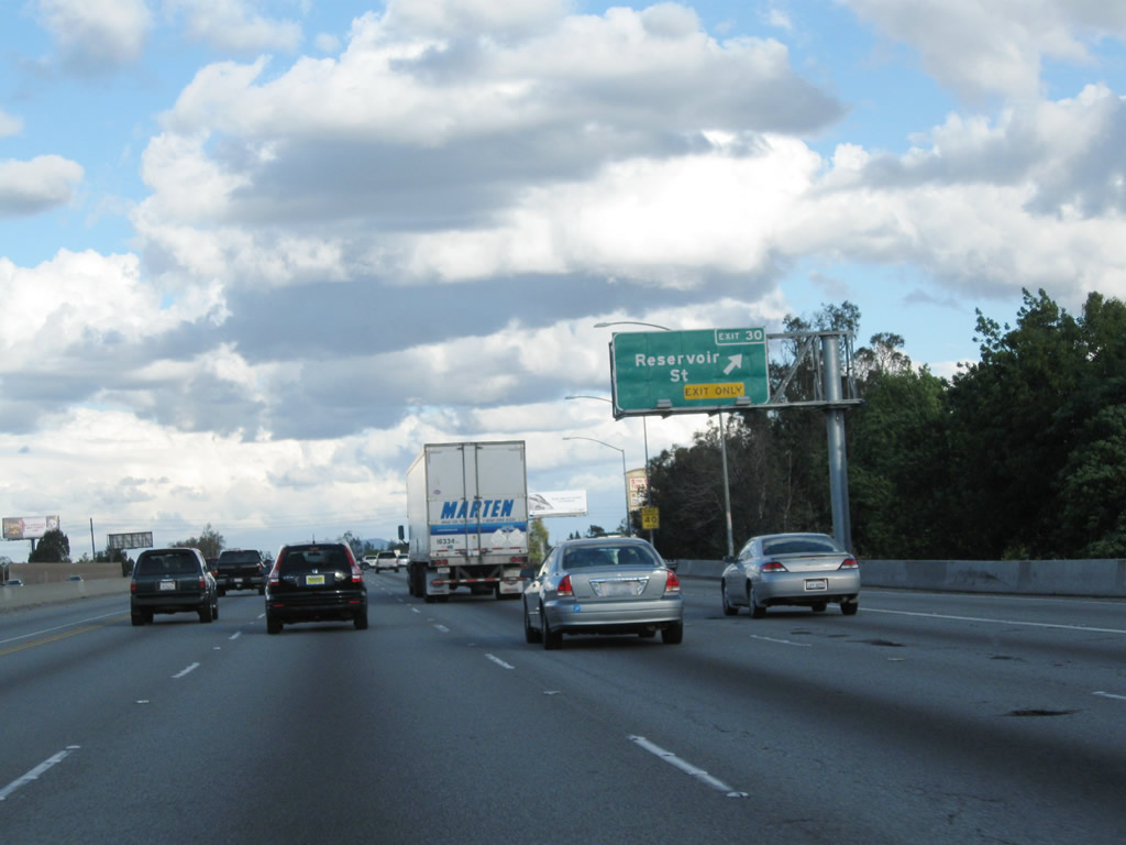
The right lane of California 60 (Pomona Freeway) east becomes exit only for Exit 30, Reservoir Street. Photo taken 02/26/11. |
 |
Eastbound California 60 (Pomona Freeway) reaches Exit 30, Reservoir Street. Photo taken 02/26/11. |
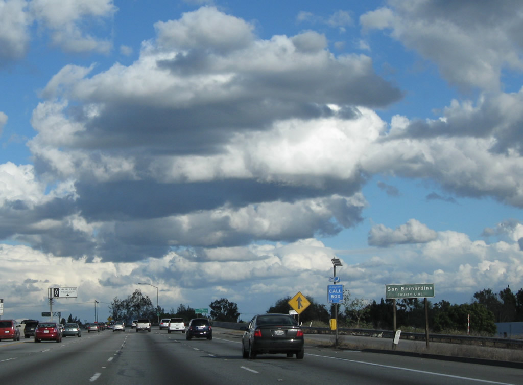 |
At the Reservoir Street interchange, California 60 (Pomona Freeway) leaves Los Angeles County and the city of Pomona and enters San Bernardino County and the city of Chino. San Bernardino County, which contains more land area than nine U.S. states (20,105 square miles), includes vast tracts of the Mojave Desert including all the Interstate 15 corridor north of Ontario until reaching the Nevada state line. Part of the "Inland Empire," the county had a population of 1,709,434 as of the 2000 Census and saw significant population gains through the 2000s due to vast increases in housing stock. Photo taken 02/26/11. |
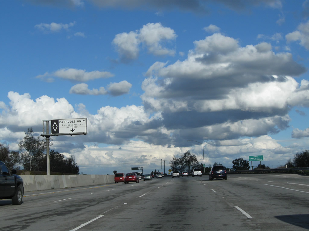 |
The carpool lane, which was added to the Los Angeles County portion of California 60 between 2007 and 2010, continues into San Bernardino County. Photo taken 02/26/11. |
 |
The next exit along California 60 (Pomona Freeway) east is Exit 32, Ramona Avenue. Photo taken 02/26/11. |
 |
The next three exits along California 60 east serve the city of Chino: Exit 32, Ramona Avenue; Exit 33, Central Avenue; and Exit 34, Mountain Avenue. Chino had a population of 67,168 as of the 2000 Census and incorporated on February 28, 1910. Photo taken 02/26/11. |
 |
California 60 (Pomona Freeway) east approaches Exit 32, Ramona Avenue to Chino. Photo taken 02/26/11. |
 |
Eastbound California 60 (Pomona Freeway) meets Exit 32, Ramona Avenue. Photo taken 02/26/11. |
 |
The next exit along California 60 (Pomona Freeway) east is Exit 33, Central Avenue. This sign is posted on the Ramona Avenue overpass. Photo taken 02/26/11. |
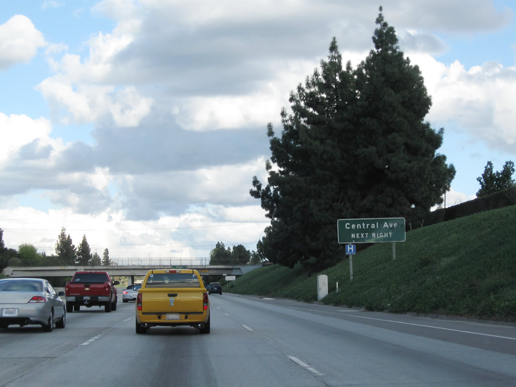 |
Central Avenue is a major north-south arterial that travels north to Montclair and a connection to Interstate 10 Exit 49. To the south, Central Avenue serves downtown Chino and ultimately connects with California 71 Exit 7. Photo taken 02/26/11. |
 |
This advance sign for Exit 33 (Central Avenue) advises that it connects to Montclair and Chino. Photo taken 02/26/11. |
 |
Eastbound California 60 (Pomona Freeway) meets Exit 33, Central Avenue. Photo taken 02/26/11. |
 |
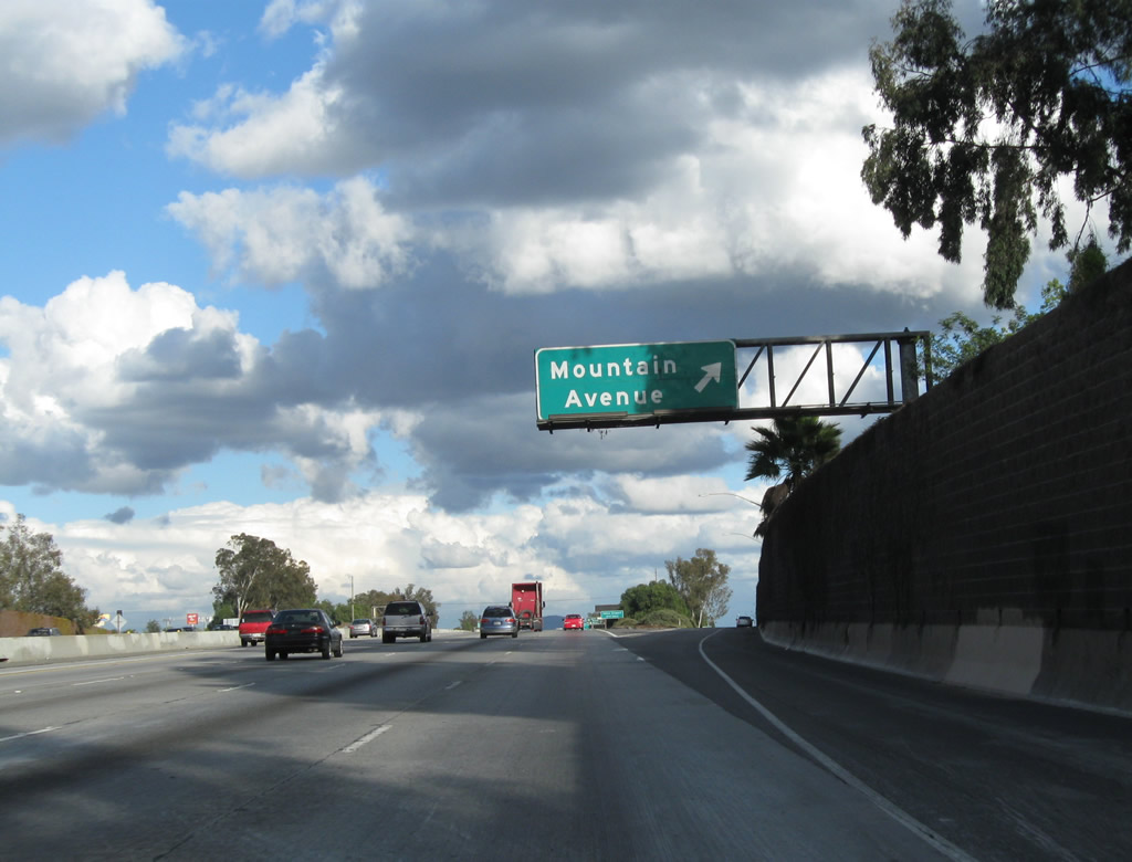
Passing under Central Avenue, the next exit along California 60 (Pomona Freeway) east is Exit 34, Mountain Avenue. In addition, an advance sign is posted here to advise travelers en route to LA/Ontario International Airport to use Exit 38, Archibald Avenue for long-term remote parking (four miles). An exit number would be appropriate on the newer sign. Additionally, this is an odd sign pairing, since they vary in height (which is uncommon for most California guide sign assemblies). Photo taken 02/26/11. |
 |
The next exit along California 60 (Pomona Freeway) east is Exit 34, Mountain Avenue. This sign is posted on the Benson Avenue overpass. Photo taken 02/26/11. |
 |
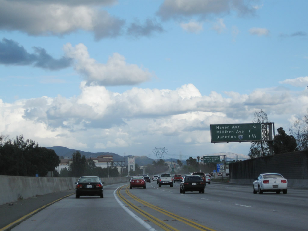
The next seven exits along California 60 (Pomona Freeway) east all serve the city of Ontario: Exit 34, Mountain Avenue; Exit 35, California 83 (Euclid Avenue); Exit 36, Grove Avenue; Exit 37, Vineyard Avenue; Exit 38, Archibald Avenue to LA/Ontario International Airport Remote Parking; Exit 39, Haven Avenue to LA/Ontario International Airport terminal; and Exit 40, Milliken Avenue and Hamner Avenue. Photo taken 02/26/11. |
 |
Eastbound California 60 (Pomona Freeway) reaches Exit 34, Mountain Avenue. Photo taken 02/26/11. |
 |
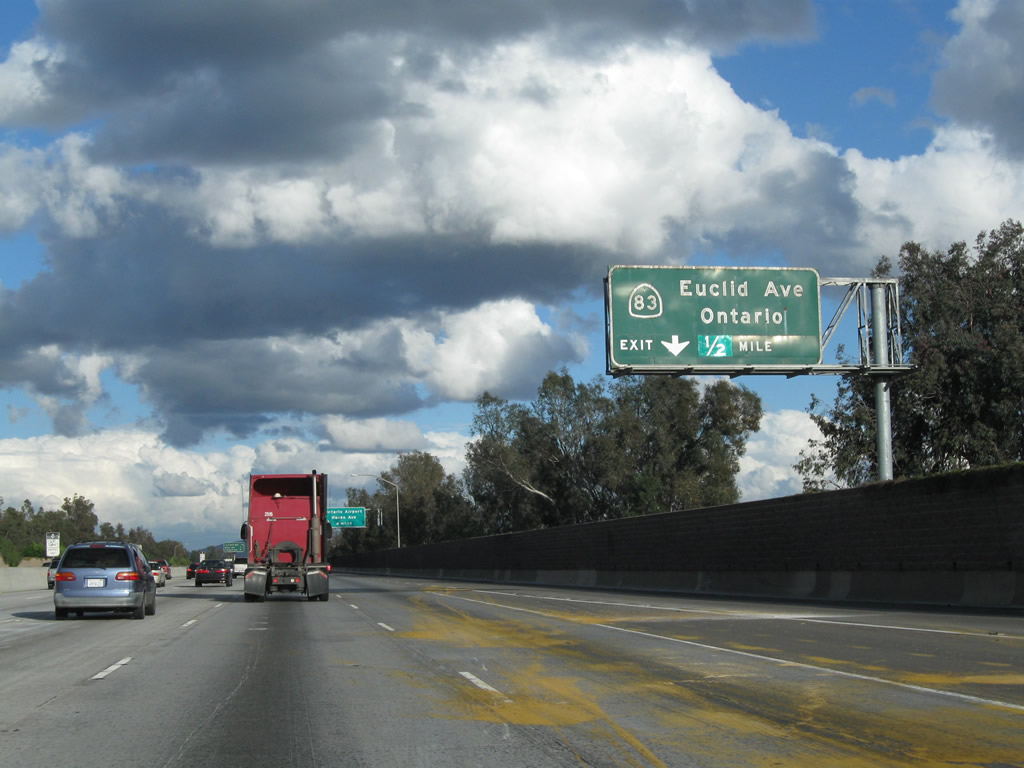
The next exit along California 60 (Pomona Freeway) east is Exit 35, California 83 (Euclid Avenue). Use California 83 (Euclid Avenue) south to Chino Airport (formerly Cal Aero Field), a general aviation airport. Photo taken 02/26/11. |
 |
California 83 follows Euclid Avenue from its inception on California 71 north through Ontario and Upland to its end at the point where Euclid Avenue meets 19th Street (former California 30), just shy of the Euclid Avenue bridge over California 210 freeway. The Euclid Avenue corridor is somewhat unique in that much of the route through Ontario and Upland has an extra wide median owing to its prior role for passenger transit via mule carts (a commemorative plaque is located at Euclid Avenue and C Street in Ontario). Photo taken 02/26/11. |
 |
Use Exit 39, Haven Avenue from California 60 (Pomona Freeway) east to LA/Ontario International Airport (ONT). Motorists may also use Exit 36, Grove Avenue, but signs on the freeway advise the best route is via Exit 39. Photo taken 02/26/11. |
 |
This mileage sign provides the distance to the next three exits along California 60 (Pomona Freeway) east: Exit 35, California 83 (Euclid Avenue); Exit 36, Grove Avenue; and Exit 37, Vineyard Avenue. Photo taken 02/26/11. |
 |
Eastbound California 60 (Pomona Freeway) reaches Exit 35, California 83 (Euclid Avenue). California 83 travels north to downtown Ontario and Upland. To the south, California 83 passes Chino Airport and extends through agricultural and rural areas before merging with California 71 northwest of Corona. Photo taken 02/26/11. |
 |
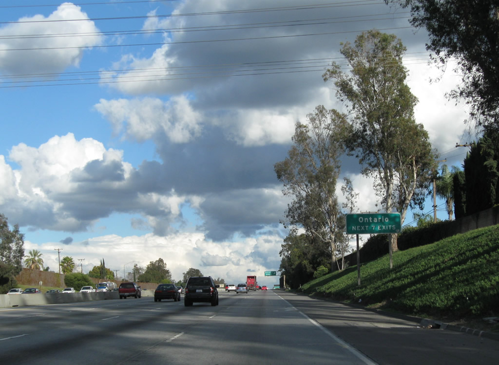
California 60 leaves Chino and enters the city of Ontario. As of the 2000 Census, Ontario had a population of 170,373. The city incorporated on December 10, 1891. Photo taken 02/26/11. |
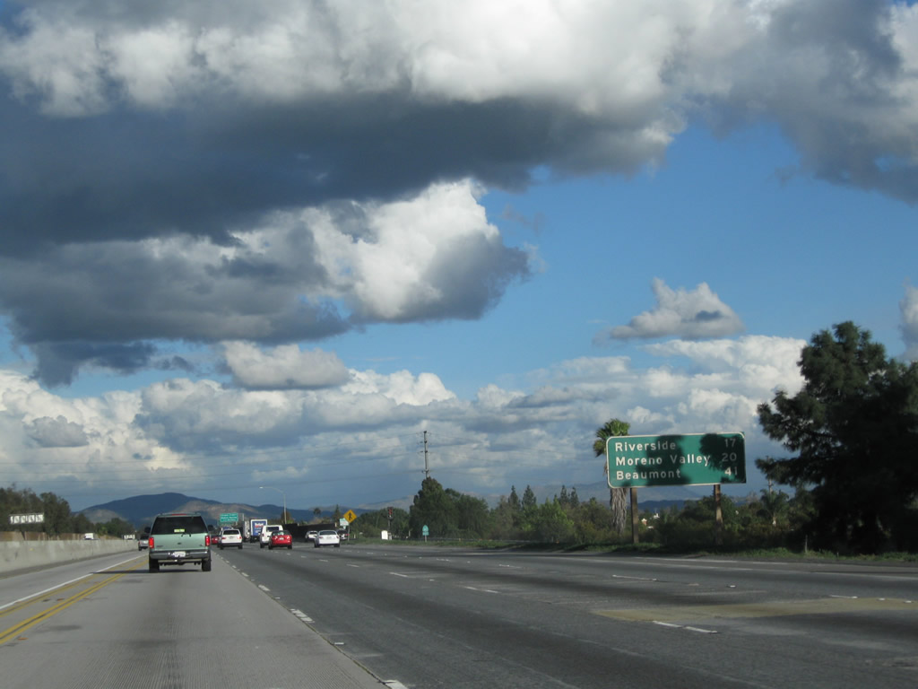 |
This mileage sign along California 60 east provides the distance to Riverside (17 miles), Moreno Valley (20 miles), and Beaumont (41 miles). Photo taken 02/26/11. |
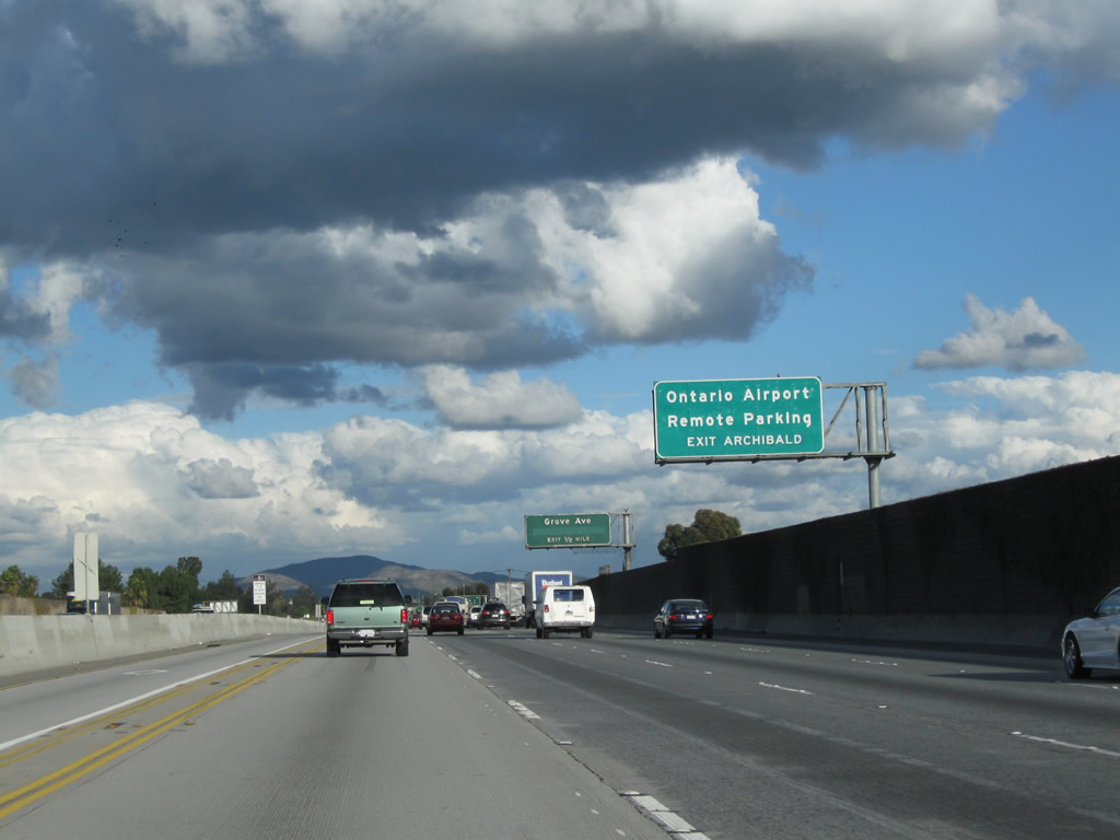 |
Another reminder is posted for motorists en route to LA/Ontario International Airport: Use Exit 38, Archibald Avenue north to Remote Parking or Exit 39, Haven Avenue north to the airport terminal. Photo taken 02/26/11. |
 |
The next exit along California 60 east is Exit 36, Grove Avenue. Photo taken 02/26/11. |
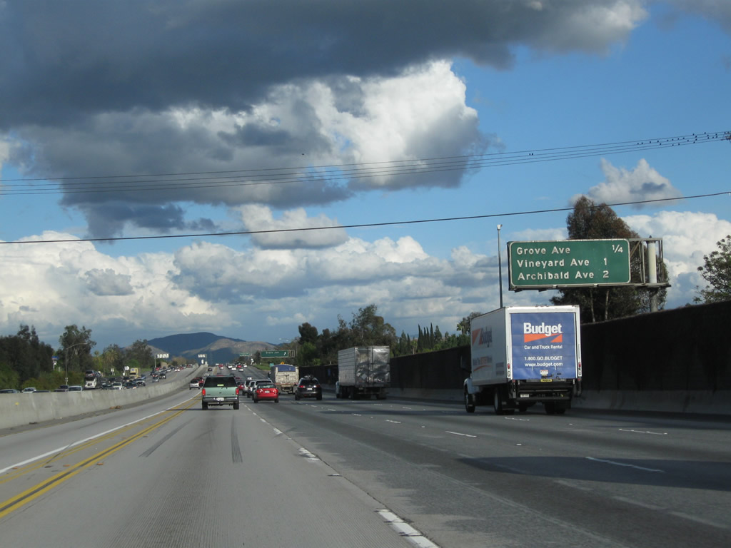 |
The next three exits from California 60 (Pomona Freeway) are: Exit 36, Grove Avenue; Exit 37, Vineyard Avenue; and Exit 38, Archibald Avenue. Photo taken 02/26/11. |
 |
Eastbound California 60 (Pomona Freeway) reaches Exit 36, Grove Avenue. Photo taken 02/26/11. |
 |
The next exit from California 60 (Pomona Freeway) is Exit 37, Vineyard Avenue (0.75 mile). Photo taken 02/26/11. |
 |
An upcoming mileage sign provides the distance to the next three exits from California 60 (Pomona Freeway) east: Exit 37, Vineyard Avenue; Exit 38, Archibald Avenue to LA/Ontario International Airport Remote Parking; and Exit 39, Haven Avenue to LA/Ontario International Airport terminal. Photo taken 02/26/11. |
 |
Eastbound California 60 (Pomona Freeway) reaches Exit 37, Vineyard Avenue. The next two exits will serve LA/Ontario International Airport: Exit 38, Archibald Avenue to Remote Parking; and Exit 39, Haven Avenue to the terminals. Photo taken 02/26/11. |
 |
The next exit along California 60 (Pomona Freeway) east is Exit 38, Archibald Avenue (0.75 mile). Photo taken 02/26/11. |
 |
An upcoming mileage sign provides the distance to the next three exits from California 60 (Pomona Freeway) east: Exit 38, Archibald Avenue to LA/Ontario International Airport Remote Parking; Exit 39, Haven Avenue to LA/Ontario International Airport terminal; and Exit 40, Milliken Avenue north and Hamner Avenue south (former California 31). Photo taken 02/26/11. |
 |
Eastbound California 60 (Pomona Freeway) reaches Exit 38, Archibald Avenue to LA/Ontario International Airport Remote Parking. Photo taken 02/26/11. |
 |
An upcoming mileage sign provides the distance to the next three exits from California 60 (Pomona Freeway) east: Exit 39, Haven Avenue to LA/Ontario International Airport terminal; Exit 40, Milliken Avenue north and Hamner Avenue south (former California 31); and Exit 41, Interstate 15. Photo taken 02/26/11. |
 |
Use Haven Avenue north to LA/Ontario International Airport. Photo taken 02/26/11. |
 |
Eastbound California 60 (Pomona Freeway) reaches Exit 39, Haven Avenue to LA/Ontario International Airport. A single-circuit, 500kV Southern California Edison power line crosses over California 60 at this point. Photo taken 02/26/11. |
 |
The next two exits along California 60 (Pomona Freeway) east are Exit 40, former California 31/Hamner Avenue south and Former California 31/Milliken Avenue north followed by Exit 41, Interstate 15 north to Barstow and Las Vegas and south to San Diego. Around this point, California 60 leaves San Bernardino County and enters Riverside County. Photo taken 02/26/11. |
 |
This mileage sign provides the distance to the next three exits along California 60 (Pomona Freeway) east: Exit 40, former California 31/Hamner Avenue south and Former California 31/Milliken Avenue north; Exit 41, Interstate 15 north to Barstow and Las Vegas and south to San Diego; and Exit 42, Van Buren Boulevard and Etiwanda Avenue. Photo taken 02/26/11. |
 |
Prior to the completion of Interstate 15 in the 1980s, California 31 was the north-south state route connecting Corona with Ontario via Hamner Avenue and Milliken Avenue. California 31 was decommissioned in favor of Interstate 15 once the freeway was built; a portion of Hamner Avenue through Norco is currently designated as Business Loop I-15 but is not state-maintained. Photo taken 02/26/11. |
 |
Eastbound California 60 (Pomona Freeway) meets Exit 40, former California 31/Hamner Avenue south and Former California 31/Milliken Avenue north. The following off-ramp will be Exit 41, Interstate 15 north to Barstow and Las Vegas and south to San Diego. Photo taken 02/26/11. |
 |
A double-circuit, 500kV Southern California Edison power line crosses over California 60. Photo taken 02/26/11. |
 |
Immediately thereafter, eastbound California 60 (Pomona Freeway) reaches Exit 41, Interstate 15 north to Barstow and Las Vegas and south to San Diego. A major north-south corridor leading from Southern California to Las Vegas, Salt Lake City, Pocatello, Butte, and Great Falls, Interstate 15 carries a great deal of traffic into the Rocky Mountain States of Utah, Idaho, and Montana with connections to Interstate 40 east to Albuquerque, Interstate 70 east to Denver, and Interstate 80 east to Cheyenne. Photo taken 02/26/11. |
 |
Passing through the Interstate 15 stack interchange, the next exit along California 60 (Pomona Freeway) east is Exit 42, Van Buren Boulevard and Etiwanda Avenue. Photo taken 02/26/11. |
 |
This mileage sign along California 60 (Pomona Freeway) east provides the distance to Riverside (12 miles), Beaumont (34 miles), and Indio (84 miles via Interstate 10 east). Photo taken 02/26/11. |
 |
An interchange sequence sign provides the distance to the next two exits from California 60 (Pomona Freeway) east: Exit 42, Van Buren Boulevard and Etiwanda Avenue and Exit 43, Country Village Road to California 60 Business (Mission Boulevard) east. Photo taken 02/26/11. |
 |
Eastbound California 60 (Pomona Freeway) reaches Exit 42, Van Buren Boulevard and Etiwanda Avenue after the stack interchange with Interstate 15. Photo taken 09/28/08. |
 border="0">
Page Updated April 17, 2011.
|
About Contact Glossary |
In The News Testimonials Interstate Guide |
Social Media:
 |
|
© 2000-23 AARoads.com | All Rights Reserved | Privacy Policy / Terms of Use
|
||